May 1, 2012 - Final Certification Order - Wagners
May 1, 2012 - Final Certification Order - Wagners
May 1, 2012 - Final Certification Order - Wagners

You also want an ePaper? Increase the reach of your titles
YUMPU automatically turns print PDFs into web optimized ePapers that Google loves.
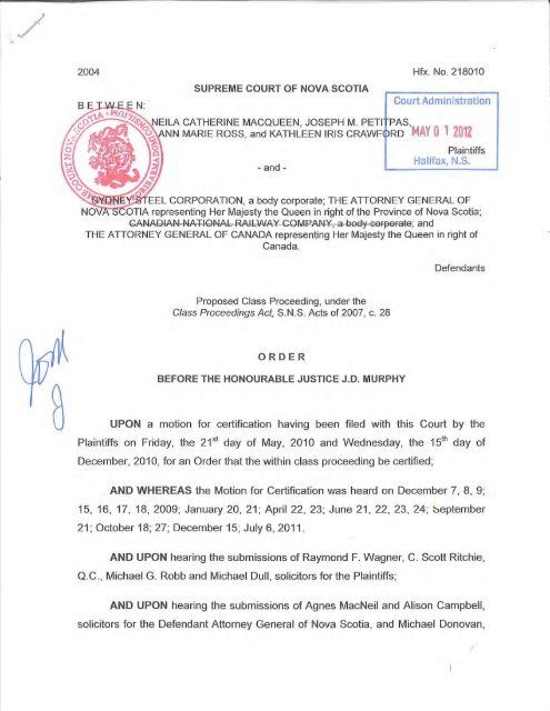
2004 Hfx. No. 218010<br />
SUPREME COURT OF NOVA SCOTIA<br />
Court Administration<br />
ElLA CATHERINE MACQUEEN, JOSEPH M. PETI PAS,<br />
N MARIE ROSS, and KATHLEEN IRIS CRAWF< DRD MAY 0 1 <strong>2012</strong><br />
- and -<br />
Plaintiffs<br />
Halifax, N.S.<br />
L CORPORATION, a body corporate; THE ATTORNEY GENERAL OF<br />
OTIA representing Her Majesty the Queen in right of the Province of Nova Scotia;<br />
CANADI:\N NATIONAL RAILWAY COMPANY, a body corporate; and<br />
THE ATTORNEY GENERAL OF CANADA representing Her Majesty the Queen in right of<br />
Canada.<br />
Defendants<br />
Proposed Class Proceeding, under the<br />
Class Proceedings Act, S.N.S. Acts of 2007, c. 28<br />
ORDER<br />
BEFORE THE HONOURABLE JUSTICE J.D. MURPHY<br />
UPON a motion for certification having been filed with this Court by the<br />
Plaintiffs on Friday, the 21 st day of <strong>May</strong>, 2010 and Wednesday, the 15th day of<br />
December, 2010, for an <strong>Order</strong> that the within class proceeding be certified;<br />
AND WHEREAS the Motion for <strong>Certification</strong> was heard on December 7, 8, 9;<br />
15, 16, 17, 18, 2009; January 20, 21; April 22, 23; June 21, 22, 23, 24; ~eptember<br />
21 ; October 18; 27; December 15; July 6, 2011.<br />
AND UPON hearing the submissions of Raymond F. Wagner, C. Scott Ritchie,<br />
Q.C. , Michael G. Robb and Michael Dull, solicitors for the Plaintiffs;<br />
AND UPON hearing the submissions of Agnes MacNeil and Alison Campbell,<br />
solicitors for the Defendant Attorney General of Nova Scotia, and Michael Donovan,
Q.C., Angela Green, Melissa Chan and Paul Evraire, Q.C., solicitors for the<br />
Defendant Attorney General of Canada;<br />
AND UPON REVIEW of the materials filed herein;<br />
AND UPON hearing the evidence of the affiants cross examined before the<br />
Court;<br />
IT IS HEREBY ORDERED that:<br />
1. For the purposes of this <strong>Order</strong> the definitions found at paragraph 1 of the<br />
Consolidated Statement of Claim Amended March 11, 2010, apply.<br />
2. This action be and is hereby certified as a class proceeding, pursuant to s.7 of<br />
the Class Proceedings Act, S.N.S. 2007, c. 28.<br />
3. The Class Boundary is defined as set out in Schedules A and B to this <strong>Order</strong>;<br />
4. The Classes are defined as:<br />
(a)<br />
(b)<br />
The Property Owner Class: Persons other than the defendants and<br />
their parent companies, affiliates or subsidiaries who are the beneficial<br />
owners of real property within the Class Boundaries as of the date that<br />
notice of the order Certifying this proceeding as a class proceeding is<br />
given.<br />
The Residential Class: Living Persons who have lived within the Class<br />
Boundaries for a minimum of seven (7) continuous years from January<br />
5, 1968 to the date of this <strong>Order</strong> certifying the proceeding.<br />
5. Neila Catherine MacQueen, Ann Marie Ross, and Kathleen Iris Crawford are<br />
hereby appointed as the representative plaintiffs of the Property Owner Class.<br />
6. Neila Catherine MacQueen, Ann Marie Ross, Kathleen Iris Crawford and<br />
Joseph Petitpas are hereby appointed as the representative plaintiffs for the<br />
Residential Class.
7. The claims asserted on behalf of the Classes are:<br />
(a)<br />
(b)<br />
(c)<br />
(d)<br />
(e)<br />
(f)<br />
(g)<br />
Breach of fiduciary duty (for both the Property Owner Class and the<br />
Residential Class);<br />
Negligence (for the Property Owner Class);<br />
Trespass (for the Property Owner Class);<br />
Battery (for the Residential Class);<br />
Negligent Battery (for the Residential Class);<br />
Nuisance (for both the Property Owner Class and the Residential<br />
Class); and<br />
Strict liability (for both the Property Owner Class and the Residential<br />
Class).<br />
8. The relief sought for the Residential Class is:<br />
(a)<br />
(b)<br />
(c)<br />
damages for nuisance, battery or negligent battery for exposure to the<br />
contaminants produced by the defendants;<br />
the funding of a "Medical Monitoring Program", supervised by the Court,<br />
for the purpose of educating and informing the public and medical<br />
community; and<br />
punitive and exemplary damages.<br />
9. The relief sought for the Property Owner Class is:<br />
(a)<br />
(b)<br />
general and special damages for the cost of remediation of their<br />
property to an acceptable level, or for the cost of replacing property<br />
where it cannot be remediated;<br />
a declaration that the Defendants have caused the contamination of the<br />
Property Owner Class Members' real property by the Contaminants to<br />
levels beyond legally permissible, in breach of their common law and<br />
equitable duties to Property Owner Class Members; and
(c)<br />
punitive and exemplary damages.<br />
10. The common issues are:<br />
(a)<br />
(b)<br />
(c)<br />
(d)<br />
(e)<br />
(f)<br />
(g)<br />
(h)<br />
(i)<br />
did the Defendants cause or permit the emission or escape of the<br />
Contaminants onto the properties and persons living within the Class<br />
Boundaries during the Class Period<br />
if the answer to (a) is yes, do the Contaminants emitted pose a risk to<br />
the use, and enjoyment of properties contaminated by them<br />
are the defendants or any of them strictly liable to Class Members for<br />
damages in tort pursuant to the principle in Rylands v. Fletcher for the<br />
emission or escape of the Contaminants from the properties of the<br />
defendants<br />
did the Defendants know, should they have known, or were they<br />
reckless or wilfully blind when they were causing or permitting the<br />
emission or escape of the Contaminants that they created a risk to the<br />
use and enjoyment of properties contaminated by them If so, when<br />
did they have or should they have had such knowledge<br />
did the discharge of the Contaminants onto the properties and persons,<br />
and the presence of the Contaminants on the lands and in the homes of<br />
persons living within the Class Boundaries during the Class Period<br />
constitute a nuisance<br />
did the Defendants owe the Class Members a duty of care to take steps<br />
to contain, reduce, minimize or eliminate the emission or escape of the<br />
Contaminants<br />
did the Defendants breach the duty of care owed to Class Members by<br />
failing to take available steps to contain, reduce, minimize or eliminate<br />
the emission or escape of Contaminants including but not limited to the<br />
implementation of emissions controls, the introduction of cleaner<br />
processes, and the use of cleaner raw materials<br />
did the Defendants or any of them intentionally cause the Contaminants<br />
to come into contact with Class Members so as to constitute a battery<br />
at law<br />
did the Defendants or any of them carelessly emit or permit the escape<br />
of the Contaminants when they knew or ought to have known that they<br />
would come into contact with the Class Members so as to constitute a<br />
negligent battery at law
(j)<br />
(k)<br />
does the deposition of the Contaminants by the defendants on the<br />
properties within the Class Boundaries constitute a trespass at law<br />
did Canada and/or Nova Scotia either or both defendants owe the<br />
Class Members a fiduciary duty to act in the best interests of Class<br />
Members in dealing with the dissemination of information concerning<br />
the existence of contamination within the Class Boundaries and the<br />
remediation of the contamination within the Class Boundaries If so,<br />
did they breach that duty by:<br />
(i)<br />
(ii)<br />
(iii)<br />
(iv)<br />
concealing the known nature and effects of the Contaminants;<br />
concealing the health risks associated with exposure to the<br />
Contaminants from the Plaintiffs and Class Members by, among<br />
other things, advising them that the Contaminants did not<br />
represent a risk to property and persons;<br />
continuing to spread the Contaminants within the Class<br />
Boundaries in spite of that knowledge; and<br />
declining to remediate the contamination now present on the<br />
lands in the within the Class Boundaries<br />
(l)<br />
(m)<br />
(n)<br />
(o)<br />
(p)<br />
is the definitive epidemiological study, proposed by the plaintiffs, an<br />
appropriate remedy<br />
are the Defendants required to ameliorate the ongoing exposure of<br />
Property Owner Class Members to Contaminants they emitted or<br />
permitted to escape onto the properties of Class Members within the<br />
Class Boundaries either by remediating those properties, or where not<br />
possible to effectively do so, by bearing the cost of relocating such<br />
Class Members to reasonably equivalent property that does not present<br />
such a risk<br />
are the defendants liable to compensate members of the Residential<br />
Class for their exposure to the Contaminants on the basis of location<br />
and duration of residence<br />
are the Defendants jointly and severally liable for the remedies set out<br />
in issues (n) and (o) or otherwise for the conduct set out in the<br />
Statement of Claim<br />
is this an appropriate case for assessing some or all damages in the<br />
aggregate, pursuant to ss. 32-33 of the Class Proceedings Act, S.N.S.<br />
2007, c. 28
(q)<br />
should one or both of Canada and Nova Scotia be liable to pay punitive<br />
damages in the aggregate and, if so, what is an appropriate amount of<br />
such aggregate damages<br />
11. The Plaintiffs are to amend their Litigation Plan to address the need for expert<br />
evidence to establish that a substance is harmful before its emission is deemed to<br />
cause damage and warrant remedy. Subject to this amendment, the Litigation Plan<br />
as before the Court is hereby approved.<br />
12. The form of the notice of certification of this action (the “Notice”) is as agreed<br />
to by the parties and attached hereto as Schedule “C”.<br />
13. The Notice shall be:<br />
(a)<br />
(b)<br />
(c)<br />
(d)<br />
(e)<br />
(f)<br />
(g)<br />
(h)<br />
(i)<br />
posted during regular business hours and available for public viewing at<br />
Melnick Hall, 88 Laurier Street Sydney Nova Scotia;<br />
posted by Class Counsel on its websites;<br />
appended to a press release circulated by wire service;<br />
delivered door-to-door to residential properties within the Class<br />
Boundaries;<br />
provided by Class Counsel to any person who requests it;<br />
published on three consecutive days in the Cape Breton Post;<br />
published once in The Chronicle Herald;<br />
published once in the national edition of The Globe and Mail; and<br />
available orally by recorded message at Class Counsel’s toll-free line.<br />
14. The defendants shall bear half the costs of the dissemination of the Notice.<br />
15. The Notice Program shall be implemented on a date to be fixed by the Court<br />
upon the approval of the Notice.
16. A Class Member may only opt out of this class action, by submitting a written<br />
election to opt-out containing the person's name, address, and a statement of<br />
intention to opt out of the Class(es) postmarked, faxed or emailed by the date<br />
specified in the Notice (which date shall be 90 days after the date of publication of<br />
the Notice), to <strong>Wagners</strong> Law Firm by mail to P.O. Box 756 Central RPO, 3d Floor,<br />
Pontiac House Historic Properties, 1869 Upper Water Street, Halifax, N.S. B3J 1 S9,<br />
fax# (902) 422-1233, or by email to mike@wagnerslawfirm.com.<br />
17. Within thirty (30) days after the expiration of the opt-out period, <strong>Wagners</strong> Law<br />
Firm shall report to the Court and the parties by affidavit and advise as to the names<br />
and addresses of those persons, if any, who have opted out of this class action.<br />
18. The costs of this motion shall be fixed by separate order of this Court following<br />
written submissions to be provided to the Court.<br />
<strong>May</strong> ( , <strong>2012</strong>.<br />
Consented to as to form:<br />
Prothonotary<br />
NANCY ROBERTS<br />
Deputy Prgthonotary<br />
Raymond . Wagner<br />
<strong>Wagners</strong><br />
1869 Upp r Water Street<br />
Suite PH 01, Historic Properties<br />
Halifax, N B3J 1 S9<br />
Solicitor for the Plaintiffs<br />
NANCY ROBERTS<br />
Deputy Prothonotary
Ang Ia- reen<br />
Department of Justice (Can)<br />
5251 Duke Street, Suite 1400<br />
Halifax, NS B3J 1 P3<br />
Solicitor for the Defendant,<br />
The Attorney General of Canada<br />
s MacNeil<br />
Department of Justice ~NS)<br />
5151 Terminal Road, 4 h Floor<br />
Halifax, NS B3J 2L6<br />
Solicitor for the Defendant,<br />
The Attorney General of Nova Scotia
SCHEDULE “A”<br />
Sydney Class Action<br />
Class Boundaries Definition<br />
Northern Zone<br />
COMMENCING at a point at Sydney Harbour at the high water mark where it intersects the<br />
North Western corner of the property known as PID 15522659 (Civic 1861 Highway 28).<br />
THEN travelling in an Easterly direction along the Northern property line of PID 15522659<br />
(Civic 1861 Highway 28) to where it intersects with the centre line of Highway 28.<br />
THEN travelling in a South Easterly direction along the centre line of Highway 28 direction to<br />
where it intersects with the prolongation of the Northern property line of the property known as<br />
PID 15626534 (Civic 1696 Victoria Road).<br />
THEN travelling in an Easterly direction along the Northern property line of the property known<br />
as PID 15626534 (Civic 1696 Victoria Road), then in a Southerly direction along the Eastern<br />
property line of the property known as PID 15626534 (Civic 1696 Victoria Road) and then in a<br />
Westerly direction along the Southern property line of the property known as PID 15626534<br />
(Civic 1696 Victoria Road) to where it intersects with the North Western corner of the property<br />
line of the property known as PID 15626559 (No Civic).<br />
THEN travelling in a Southerly direction along the Western property line of the property known<br />
as PID 15626559 (No Civic) to the South Eastern corner of the property line of the property<br />
known as PID 15626542 (Civic 50 Grants Lane), then in a Westerly direction along the<br />
Southern property line of the property known as PID 15626542 (Civic 50 Grants Lane) to the<br />
South Western corner of the property line of the property known as PID 15626542 (Civic 50<br />
Grants Lane).<br />
THEN travelling in a South Easterly direction along the Western property line of the property<br />
known as PID 15626559 (No Civic) to where it intersects with the prolongation of the Northern<br />
property line of the property known as PID 15155146 (No Civic).<br />
THEN travelling in a Westerly direction along the prolongation of the Northern property line of<br />
the property known as PID 15155146 (No Civic) to the North Eastern corner of the property<br />
line of the property known as PID 15155146 (No Civic).<br />
THEN travelling in a Southerly direction along the Eastern property line of the properties<br />
known as PID 15155146 (No Civic), PID 15155153 (No Civic), PID 15155161 (No Civic), PID<br />
15155179 (No Civic), PID 15155187 (No Civic), PID 15155195 (No Civic), PID 15155203 (No<br />
Civic), PID 15154990 (No Civic), PID 15155005 (No Civic), PID 15155013 (No Civic), PID<br />
15155021 (No Civic), PID 15155039 (No Civic), PID 15155047 (No Civic), PID 15155054 (No<br />
1
Civic), PID 15154958 (No Civic), PID 15154909 (Civic 78 Dalton Lane) and PID 15154909<br />
(Civic 80 Dalton Lane) to where it intersects with the centre line of Dalton Lane.<br />
THEN travelling in an Easterly direction along the centre line of Dalton Lane to where it<br />
intersects with the prolongation of the Northern property line of the property known as PID<br />
15630890 (Civic 48 Dalton Lane).<br />
THEN travelling in an Easterly direction along the Northern property line of the property known<br />
as PID 15630890 (Civic 48 Dalton Lane) to the North Eastern corner of the property line of the<br />
property known as PID 15630890 (Civic 48 Dalton Lane).<br />
THEN travelling in a Southerly direction along the Eastern property line of the properties<br />
known as PID 15630890 (Civic 48 Dalton Lane), PID 15154701 (Civic 32 Dalton Lane), PID<br />
15154693 (Civic 28 Dalton Lane) to the South Eastern corner of the property line of the<br />
property known as PID 15154693 (Civic 28 Dalton Lane).<br />
THEN travelling in a Westerly direction along the Southern property line of the property known<br />
as PID 15154693 (Civic 28 Dalton Lane) to the South Western corner of the property line of<br />
the property known as PID 15154693 (Civic 28 Dalton Lane).<br />
THEN travelling in a Southerly direction along the prolongation of the Western property line of<br />
the property known as PID 15154693 (Civic 28 Dalton Lane) to where it intersects with the<br />
South Western corner of the property known as PID 15154719 (No Civic).<br />
THEN travelling in an Easterly direction along the Southern property line of the property known<br />
as PID 15154719 (No Civic) to where it intersects with the centre line of Gill Street.<br />
THEN travelling in a Southerly direction along the centre line of Gill Street to where it intersects<br />
with the centre line of East Broadway.<br />
THEN travelling in an Easterly direction along the centre line of East Broadway to where it<br />
intersects with the prolongation of the Eastern property line of the property known as PID<br />
15153059 (Civic 254 East Broadway).<br />
THEN travelling in a Westerly direction along the Southern property line of the property known<br />
as PID 15153059 (Civic 254 East Broadway) to where it intersects with the North Western<br />
corner of the property line of the property known as PID 15507064 (No Civic).<br />
THEN travelling in a Southerly direction along the Western property line of the property known<br />
as PID 15507064 (No Civic) and then in an Easterly direction along the Southern property line<br />
of the property known as PID 15507064 (No Civic), to where the prolongation of the line<br />
intersects with the centre line of Gibbons Street.<br />
THEN travelling in a Southerly direction along the centre line of Gibbons Street to where it<br />
intersects with the centre line of Columbus Avenue.<br />
2
THEN travelling in an Easterly direction along the centre line of Columbus Avenue to where it<br />
intersects with the prolongation of the Western property line of the property known as PID<br />
15149313 (Civic 173 Columbus Avenue).<br />
THEN travelling in a Northerly direction along the Western property line of the property known<br />
as PID 15149313 (Civic 173 Columbus Avenue), then in an Easterly direction along the<br />
Northern property lines of the properties known as PID 15149313 (Civic 173 Columbus<br />
Avenue), PID 15149321 (No Civic) and PID 15149305 (Civic 201 Columbus Avenue) and then<br />
in a Southerly direction along the Eastern property line of the property known as PID 15149305<br />
(Civic 201 Columbus Avenue) to where the prolongation of the line intersects with the centre<br />
line of Columbus Avenue.<br />
THEN travelling in an Easterly direction along the centre line of Columbus Avenue & Linview<br />
Drive to where it intersects with the prolongation of the Eastern property line of the property<br />
known as PID 15154321 (Civic 20 Linview Drive).<br />
THEN travelling in a Southerly direction along the Eastern property line of the property known<br />
as PID 15154321 (Civic 20 Linview Drive), then in a Southerly direction in a straight line along<br />
the prolongation of the line through the properties known as PID 15154198 (412 & 414 Lingan<br />
Road) and PID 15154172 (No Civic) to where it intersects with the Northern property line of the<br />
property known as PID 15153968 (No Civic).<br />
THEN travelling in an Easterly direction along the Northern property line of the property known<br />
as PID 15153968 (No Civic).<br />
THEN travelling in a Southerly direction along the Western property line of the properties<br />
known as PID 15153968 (No Civic), PID 15153976 (No Civic), PID 15153984 (No Civic) & PID<br />
15153992 (No Civic) to the South Eastern corner of the property line of the property known as<br />
PID 15153992 (No Civic).<br />
THEN travelling in a Southerly direction along the prolongation of the Eastern property line of<br />
the property known as PID 15153992 (No Civic) to where it intersects with the centre line of<br />
Gatacre Street.<br />
THEN travelling in a South Easterly direction along the centre line of Gatacre Street to where it<br />
intersects with the prolongation of the Northern property line of the property known as PID<br />
15143902 (Civic 7 & 9 MacDonald Crescent).<br />
THEN travelling in a North Easterly direction along the Northern property line of the properties<br />
known as PID 15143902 (Civic 7 & 9 MacDonald Crescent), PID 15143894 (Civic 13 & 15<br />
MacDonald Crescent), PID 15143886 (Civic 19 & 21 MacDonald Crescent) and PID 15143878<br />
(Civic 25 & 27 MacDonald Crescent) to the North Eastern corner of the property known as PID<br />
15143878 (Civic 25 & 27 MacDonald Crescent).<br />
3
THEN travelling in a South Easterly direction along the Eastern property line of the properties<br />
known as PID 15143878 (Civic 25 & 27 MacDonald Crescent), PID 15143860 (Civic 37 & 39<br />
MacDonald Crescent), PID 15143852 (Civic 45 MacDonald Crescent), PID 15143845 (Civic 49<br />
MacDonald Crescent), PID 15143837 (Civic 53 MacDonald Crescent) and PID 15143829<br />
(Civic 111 MacDonald Court) to the South Eastern corner of the property line of the property<br />
known as PID 15143829 (Civic 111 MacDonald Court).<br />
THEN travelling in a North Easterly direction along the Northern property line of the property<br />
known as PID 15697600 (Civic 115 MacDonald Court) to the North Eastern corner of the<br />
property line of the property known as PID 15697600 (Civic 115 MacDonald Court).<br />
THEN travelling in a South Easterly direction along the Eastern property line of the property<br />
known as PID 15697600 (Civic 115 MacDonald Court) to the South Eastern corner of the<br />
property line of the property known as PID 15697600 (Civic 115 MacDonald Court).<br />
THEN travelling in a Westerly direction along the Southern property line of the property known<br />
as PID 15697600 (Civic 115 MacDonald Court) to the North Eastern corner of the property line<br />
of the property known as PID 15143795 (Civic 119 MacDonald Court).<br />
THEN travelling in a Southerly direction along the Eastern property line of the properties<br />
known as PID 15143795 (Civic 119 MacDonald Court), PID 15143787 (Civic 123 MacDonald<br />
Court), PID 15143779 (Civic 127 MacDonald Court), PID 15143761 (Civic 131 MacDonald<br />
Court), PID 15143753 (Civic 135 MacDonald Court) and PID 15143746 (Civic 145 MacDonald<br />
Court) to the South Eastern corner of the property line of the property known as PID 15143746<br />
(Civic 145 MacDonald Court).<br />
THEN travelling in a Westerly direction along the Southern property line of the property known<br />
as PID 15143746 (Civic 145 MacDonald Court) to the North Eastern corner of the property line<br />
of the property known as PID 15143563 (Civic 71 Gunn Street).<br />
THEN travelling in a South Easterly direction along the Eastern property line of the property<br />
known as PID 15143563 (Civic 71 Gunn Street) to the prolongation of the Eastern property line<br />
of the property known as PID 15143563 (Civic 71 Gunn Street) where it intersects the centre<br />
line of Gunn Street.<br />
THEN travelling in a North Easterly direction along the centre line of Gunn Street to where it<br />
intersects with the prolongation of the Eastern property line of the property known as PID<br />
15144801(Civic 172 Gunn Street).<br />
THEN travelling in a South Easterly direction along the Eastern property line of the property<br />
known as PID 15144801(Civic 172 Gunn Street) to the South Eastern corner of the property<br />
line of the property known as PID 15144801(Civic 172 Gunn Street).<br />
4
THEN travelling in a Westerly direction along the Southern property line of the property known<br />
as PID 15144801(Civic 172 Gunn Street) to where it intersects with the Eastern property line of<br />
the property known as PID 15143027 (Civic 75 & 77 Caroll Crescent).<br />
THEN travelling in a South Easterly direction along the Eastern property line of the properties<br />
known as PID 15143027 (Civic 75 & 77 Caroll Crescent), PID 15143480 (Civic 81 Caroll<br />
Crescent), PID 15143498 (Civic 83 Caroll Crescent), PID 15143506 (Civic 87 Caroll Crescent),<br />
PID 15143514 (Civic 91 Caroll Crescent), PID 15624398 (No Civic), PID 15143282 (Civic 95<br />
Caroll Crescent), PID 15143290 (Civic 99 Caroll Crescent) and PID 15143308 (Civic 103<br />
Caroll Crescent) crossing Austin Place and continuing in a South Easterly direction along the<br />
Eastern property line of the properties known as PID 15143365 (Civic 107 Caroll Crescent),<br />
PID 15143373 (Civic 111 Caroll Crescent), PID 15143381 (Civic 115 Caroll Crescent) and PID<br />
15143399 (Civic 119 Caroll Crescent) to the South Eastern corner of the property line of the<br />
property known as PID 15143415 (Civic 123 Caroll Crescent).<br />
THEN travelling in a Westerly direction along the Southern property line of the property known<br />
as PID 15143415 (Civic 123 Caroll Crescent) to the North Eastern corner of the property line of<br />
the property known as PID 15143423 (Civic 199 Maloney Street).<br />
THEN travelling in a South Easterly direction along the Eastern property line of the property<br />
known as PID 15143423 (Civic 199 Maloney Street) to where the prolongation of the line to<br />
where it intersects with the centre line of Maloney Street.<br />
THEN travelling in a North Easterly direction along the centre line of Maloney Street to where it<br />
intersects with the prolongation of the Eastern property line of the property known as PID<br />
15356298 (Civic 220 Maloney Street).<br />
THEN travelling in a South Easterly direction along the Eastern property line of the property<br />
known as PID 15356298 (Civic 220 Maloney Street) to the South Eastern corner of the<br />
property line of the property known as PID 15356298 (Civic 220 Maloney Street).<br />
THEN travelling in a Westerly direction along the Southern property line of the properties<br />
known as PID 15356298 (Civic 220 Maloney Street), PID 15186786 (Civic 214 Maloney<br />
Street), PID 15141104 (Civic 210 Maloney Street), PID 15626286 (Civic 192 Maloney Street),<br />
PID 15141088 (Civic 186 Maloney Street), PID 15134638 (No Civic), PID 15141062 (Civic 180<br />
Maloney Street), PID 15141054 (Civic 178 Maloney Street), PID 15141047 (Civic 176 Maloney<br />
Street), PID 15141039 (No Civic), PID 15141021 (Civic 168 Maloney Street), PID 15141013<br />
(Civic 164 Maloney Street), PID 15141005 (Civic 162 Maloney Street), PID 15140999 (Civic<br />
158 Maloney Street), PID 15140973 (No Civic), PID 15547227 (No Civic), PID 15140965 (Civic<br />
152 Maloney Street) and PID 15140957 (Civic 148 Maloney Street) to the North Western<br />
corner of the property line of the property known as PID 15140981 (No Civic).<br />
THEN travelling in a South Easterly direction along the Western property line of the properties<br />
known as PID 15140981 (No Civic), PID 15140980 (No Civic), PID 15547367 (No Civic), PID<br />
15547201 (No Civic) and PID 15140049 (No Civic) to where the prolongation of the Western<br />
5
property line of the property known as PID 15140049 (No Civic) intersects with the centre line<br />
of Frederick Street.<br />
THEN travelling in a Westerly direction along the centre line of Frederick Street to where it<br />
intersects with the centre line of Lingan Road.<br />
THEN travelling in a Southerly direction along the centre line of Lingan Road to where it<br />
intersects with the centre line of Sydney Port Access Road.<br />
THEN travelling in a Westerly direction along the centre line of Sydney Port Access Road to<br />
where it intersects with the centre line of Victoria Road.<br />
THEN travelling in a Northerly direction along the centre line of Victoria Road to where it<br />
intersects with the prolongation of the Southern property line of the property known as PID<br />
15146251 (Civic 11 and 15 Railroad Street).<br />
THEN travelling in a Westerly direction along the Southern property line of the properties<br />
known as PID 15146251 (Civic 11 and 15 Railroad Street), PID 15146269 (Civic 17 and 19<br />
Railroad Street), PID 15146277 (Civic 21 and 23 Railroad Street), PID 15146285 (Civic 25 and<br />
27 Railroad Street), PID 15146293 (Civic 29 Railroad Street), PID 15146301 (Civic 31 Railroad<br />
Street), PID 15146319 (Civic 35 Railroad Street), PID 15146327 (Civic 39 Railroad Street),<br />
PID 15146335 (Civic 41 Railroad Street), PID 15146343 (Civic 43 Railroad Street) and PID<br />
15146350 (Civic 45 Railroad Street) to the South Western corner of the property line of the<br />
property known as PID 15146350 (Civic 45 Railroad Street).<br />
THEN travelling in a Northerly direction along the Western property line of the property known<br />
as PID 15146350 (Civic 45 Railroad Street) to where the prolongation of the line intersects with<br />
the centre line of Railroad Street.<br />
THEN travelling in a North Westerly direction along the centre line of Railroad Street to where<br />
it intersects with the prolongation of the Southern property line of the property known as PID<br />
15138977 (No Civic).<br />
THEN travelling in a Westerly direction along the Southern property line of the properties<br />
known as PID 15138977 (No Civic), PID 15138969 (Civic 30 Henry Street) and PID 15138951<br />
(Civic 26 Henry Street) to the South Western corner of the property line of the property known<br />
as PID 15138951 (Civic 26 Henry Street).<br />
THEN travelling in a Northerly direction along the Western property line of the property known<br />
as PID 15138951 (Civic 26 Henry Street) to the North Eastern corner of the property line of the<br />
property known as PID 15625478 (No Civic).<br />
THEN travelling in a Westerly direction along the Northern property line of the property known<br />
as PID 15625478 (No Civic) to the North Western corner of the property line of the property<br />
known as PID 15625478 (No Civic).<br />
6
THEN travelling in a Northerly direction along the Eastern property line of the property known<br />
as PID 15625429 (No Civic) to the North Eastern corner of the property line of the property<br />
known as PID 15625429 (No Civic).<br />
THEN travelling in a North Westerly direction along the Western property line of the properties<br />
known as PID 15137797 (No Civic) and PID 15696586 (Civic 1 Henry Street) to the North<br />
Western corner of the property line of the property known as PID 15137797 (No Civic).<br />
THEN travelling in a Northerly direction along the Eastern property line of the property known<br />
as PID 15625346 (No Civic) to the South Eastern corner of the property line of the property<br />
known as PID 15625353 (No Civic).<br />
THEN travelling in a North Westerly direction along the Eastern property line of the property<br />
known as PID 15625353 (No Civic) to the Northern corner of the property known as PID<br />
15625353 (No Civic).<br />
THEN travelling in a Northerly direction along the Eastern property line of the properties known<br />
as PID 15625338 (No Civic) and PID 15625320 (No Civic) to the Southern property line of the<br />
property known as PID 15160849 (Civic 102 Matilda Street).<br />
THEN travelling in a Westerly direction along the Southern property line of the properties<br />
known as PID 15160849 (Civic 102 Matilda Street) and PID 15625387 (No Civic) to the South<br />
Western corner of the property line of the property known as PID 15625387 (No Civic).<br />
THEN travelling in a North Westerly direction along the Eastern property line of the property<br />
known as PID 15625320 (No Civic) to the South Eastern corner of the property line of the<br />
property known as PID 15160328 (No Civic).<br />
THEN travelling in a Westerly direction along the Northern property line of the property known<br />
as PID 15625320 (No Civic) to the South Western corner of the property line of the property<br />
known as PID 15160278 (Civic 54 & 56 Dominion Street).<br />
THEN travelling in a Northerly direction along the Western property line of the property known<br />
as PID 15160278 (Civic 54 & 56 Dominion Street) to the South Eastern corner of the property<br />
line of the property known as PID 15160260 (No Civic).<br />
THEN travelling in a Westerly direction along the Southern property line of the property known<br />
as PID 15160260 (No Civic) to the South Western corner of the property line of the property<br />
known as PID 15160260 (No Civic).<br />
THEN travelling in a Northerly direction along the Western property line of the property known<br />
as PID 15160260 (No Civic) to where the prolongation of the line intersects with the centre line<br />
of Dominion Street.<br />
THEN travelling in an Easterly direction along the centre line of Dominion Street to where it<br />
intersects with the centre line of St. Anns Street.<br />
7
THEN travelling in a Northerly direction along the centre line of St. Anns Street to where it<br />
intersects with the prolongation of the Northern property line of the property known as PID<br />
15157761 (No Civic).<br />
THEN travelling in a Westerly direction along the Northern property line of the property known<br />
as PID 15157761 (No Civic) to where the prolongation of the line intersects with the centre line<br />
of Shore Road.<br />
THEN travelling in a Northerly direction along the centre line of Shore Road to where it<br />
intersects with the centre line of Argosy Street.<br />
THEN travelling in a Westerly direction along the prolongation of the centre line of Argosy<br />
Street to the high water mark of Sydney River.<br />
THEN travelling along the high water mark of Sydney River and Sydney Harbour until the point<br />
of beginning.<br />
8
MacLeod St<br />
New Waterford Hwy<br />
Egan Ave<br />
Barrington St<br />
North Zone<br />
Birchwood Lane<br />
Grant St<br />
Grants Lane<br />
MacLeods Hill<br />
µ1:3,200<br />
0 100<br />
200 400 600<br />
Meters<br />
Borden St<br />
Playground<br />
Brookdale St<br />
Starr Crt<br />
Tartan Dr<br />
Borden St<br />
Oakville Dr<br />
Young St<br />
East Broadway<br />
Eastmount Rd<br />
Dalton Lane<br />
Gill St<br />
Argosy St<br />
Manse St<br />
Argosy St<br />
Campbell Lane<br />
Rileys Lane<br />
Broadway<br />
Mercer St<br />
Bradbury Lane<br />
Borden St<br />
Rear Seaview St<br />
Mclean St<br />
Seaview St<br />
Manse Pl<br />
Bison Dr<br />
MacLeod St<br />
Borden St<br />
Taylor St<br />
Mackillop St<br />
Catherine St<br />
Gibbons St<br />
St Anns St<br />
Connaught St<br />
Payne St<br />
Shore Rd<br />
Sports Field<br />
Dominion St<br />
Matilda St<br />
St Albans Ave<br />
Columbus Ave<br />
Linview Dr<br />
<strong>May</strong> Terr<br />
Griffin St<br />
Peter Pan Daycare<br />
Playground<br />
Neville St<br />
James St<br />
April Terr<br />
March Terr<br />
McCuishs Lane<br />
St Lawrence St<br />
French St Exten<br />
James St<br />
Carlin St<br />
Church St<br />
Brooks St<br />
Church St<br />
Brow St<br />
Harbourside<br />
Elementary<br />
Sports Field<br />
Furnace St<br />
Jameson St<br />
Lingan Rd<br />
Cameron St<br />
Neville<br />
Park<br />
Whitney Pier<br />
Jr High<br />
Sports Field<br />
Whitney Pier<br />
Youth Club<br />
MacDonald Cres<br />
MacDonald Crt<br />
Lxs Lane<br />
Roberts St<br />
North St<br />
Buller St<br />
West St<br />
East St<br />
Franklin St<br />
French St<br />
Breton St<br />
Harvard St<br />
Wesley St<br />
South St<br />
Gunn St<br />
Shendale Dr<br />
Kitchener St<br />
Gatacre St<br />
Bryan St<br />
Middle St<br />
Ferris St<br />
Swan St<br />
Bay St<br />
Elmwood Ave<br />
Meadow St<br />
Caroll Cres<br />
Victoria Rd<br />
Webster St<br />
Bay St<br />
Fisher St<br />
Bay St<br />
Playground<br />
Bay St<br />
The North Rd<br />
Henry St<br />
Mt Pleasant St<br />
Maloney St<br />
Fisher St<br />
Summitt St<br />
Mt Pleasant St<br />
Muggah St<br />
Unknown9 Rd<br />
Railroad St<br />
Fitzgerald Pl<br />
Stable Dr<br />
Ironside Dr<br />
Hankard St<br />
Sports<br />
Field<br />
William St<br />
Legend<br />
Railroad<br />
Streets<br />
Building Use<br />
Accessory<br />
The South Rd<br />
Laurier St<br />
Tupper St<br />
Frederick St<br />
North Zone Boundary<br />
Property Boundaries<br />
Recreational Use<br />
Park<br />
Commercial<br />
Industrial<br />
Institutional<br />
Mixed Use<br />
Playground<br />
Currys Lane<br />
Sydney Port Access Rd<br />
Playground<br />
Recreation<br />
Sports Field<br />
Residential<br />
Vacant<br />
FS Connector<br />
Ferry St<br />
Wabana Crt
SCHEDULE “B”<br />
Sydney Class Action<br />
Class Boundaries Definition<br />
Southern Zone<br />
COMMENCING at a point at Sydney Harbour at the high water mark where it intersects the<br />
prolongation of the centre line of Desbarres Street.<br />
THEN travelling in an Easterly direction along the centre line of Desbarres Street to where it<br />
intersects with the centre line of George Street.<br />
THEN travelling in a North Westerly direction along the centre line of George Street to where it<br />
intersects with the prolongation of the Northern property line of the property known as PID<br />
15516412 (No Civic).<br />
THEN travelling in an Easterly direction along the Northern property line of the properties<br />
known as PID 15516412 (No Civic), PID 15055502 (Civic 11 Louisa Street), PID 15055510<br />
(Civic 15 Louisa Street), PID 15055528 (Civic 19 Louisa Street), PID 15055536 (Civic 21<br />
Louisa Street), PID 15055544 (Civic 27 Louisa Street), PID 15055551 (Civic 33 Louisa Street),<br />
PID 15055569 (Civic 37 Louisa Street), PID 15055577 (Civic 41 Louisa Street) and PID<br />
15671258 (Civic 45 and 47 Louisa Street) to the North Eastern corner of the property line of<br />
the property known as PID 15671258 (Civic 45 and 47 Louisa Street).<br />
THEN travelling in a South Easterly direction along the Eastern property line of the property<br />
known as PID 15671258 (Civic 45 and 47 Louisa Street) to the South Eastern corner of the<br />
property line of the property known as PID 15671258 (Civic 45 and 47 Louisa Street).<br />
THEN travelling in a Westerly direction along the Southern the property line of the property<br />
known as PID 15671258 (Civic 45 and 47 Louisa Street) to where it intersects with the<br />
geographical end of Louisa Street.<br />
THEN travelling in a South Easterly direction along the geographical end of Louisa Street to<br />
where it intersects with the North Eastern corner of the property known as PID 15055601<br />
(Civic 50 Louisa Street).<br />
THEN travelling in a South Easterly direction along the Eastern property line of the properties<br />
known as PID 15055601 (Civic 50 Louisa Street), PID 15636426 (Civic 24 Cross Street), PID<br />
15055635 (Civic 26 Cross Street), PID 15055643 (Civic 28 Cross Street), PID 15055650 (Civic<br />
30 Cross Street), PID 15516446 (Civic 36 Cross Street), PID 15055658 (Civic 38 Cross<br />
Street), PID 15055684 (Civic 35 Cossitt Street), PID 15577711 (No Civic) and PID 15056047<br />
(Civic 44 Cossitt Street).<br />
1
THEN travelling in a South Easterly direction along the Eastern property line of the property<br />
known as PID 15056047 (Civic 44 Cossitt Street) to where the prolongation of said line<br />
intersects with the prolongation of the centre line of Desbarres Street.<br />
THEN travelling in a Westerly direction along the prolongation of the centre line of Desbarres<br />
Street to where it intersects with the prolongation of the Eastern property line of the property<br />
known as PID 15056260 (Civic 3 Fairview Street).<br />
THEN travelling in a South Easterly direction along the Eastern property line of the properties<br />
known as PID 15056260 (Civic 3 Fairview Street), PID 15056278 (Civic 5 Fairview Street), PID<br />
15056286 (Civic 7 Fairview Street), PID 15056294 (Civic 9 Fairview Street), PID 15617194<br />
(No Civic), PID 15796162 (No Civic), PID 15056302 (Civic 27 Fairview Street), PID 15056310<br />
(No Civic), PID 15056328 (Civic 31 Fairview Street), PID 15056336 (Civic 37 Fairview Street),<br />
PID 15056286 (Civic 41 Fairview Street), PID 15056286 (Civic 45 Fairview Street), PID<br />
15056369 (Civic 47 Fairview Street) and PID 15056377 (Civic 49 Fairview Street) to the South<br />
Eastern corner of the property line of the property known as PID 15056377 (Civic 49 Fairview<br />
Street).<br />
THEN travelling in a South Easterly direction along the prolongation of the Eastern property<br />
line of the property known as PID 15056377 (Civic 49 Fairview Street) to where it intersects<br />
with the centre line of Amelia Street.<br />
THEN travelling in a South Westerly direction along the centre line of Amelia Street to where it<br />
intersects with the prolongation of the Eastern property line of the property known as PID<br />
15056674 (Civic 51 Fairview Street).<br />
THEN travelling in a South Easterly direction along the Eastern property line of the properties<br />
known as PID 15056674 (Civic 51 Fairview Street), PID 15056682 (Civic 53 Fairview Street),<br />
PID 15056690 (Civic 55 Fairview Street) and PID 15056708 (No Civic) to the South Eastern<br />
corner of the property line of the property known as PID 15056708 (No Civic) to where the<br />
prolongation of the Eastern property line of the property known as PID 15056708 (No Civic) it<br />
intersects with the centre line of York Street.<br />
THEN travelling in a North Easterly direction along the centre line of York Street to where it<br />
intersects with the centre line of Walker Street.<br />
THEN travelling in a South Easterly direction along the centre line of Walker Street to where it<br />
intersects with the centre line of Ferry Street.<br />
THEN travelling in a South Westerly direction along the centre line of Ferry Street to where it<br />
intersects with the centre line of Intercolonial Street.<br />
THEN travelling in a South Easterly direction along the centre line of Intercolonial Street to<br />
where it intersects with the centre line of Dodds Street.<br />
2
THEN travelling in a South Easterly direction along the centre line of Dodds Street to where it<br />
intersects with the centre line of Prince Street.<br />
THEN travelling in an Easterly direction along the centre line of Prince Street to where it<br />
intersects with the prolongation of the Eastern property line of the property known as PID<br />
15642028 (Civic 214 Prince Street).<br />
THEN travelling in a Southerly direction along the Eastern property line of the property known<br />
as PID 15642028 (Civic 214 Prince Street) to where it intersects with the centre line of<br />
Townsend Street.<br />
THEN travelling in an Easterly direction along the centre line of Townsend Street to where it<br />
intersects with the prolongation of the Western property line of the property known as PID<br />
15086838 (Civic 259 Townsend Street).<br />
THEN travelling in a Northerly direction along the Western property line, then in an Easterly<br />
direction along the Northern property line and then in a Southerly direction along the Eastern<br />
property line of the property known as PID 15086838 (Civic 259 Townsend Street) to where it<br />
intersects with the North Western corner of the property line of the property known as PID<br />
15629447 (Civic 263, 265, 269 & 273 Townsend Street).<br />
THEN travelling in an Easterly direction along the Northern property line of the properties<br />
known as PID 15629447 (Civic 263, 265, 269 & 273 Townsend Street), PID 15086754 (No<br />
Civic), PID 15086747 (Civic 279 Townsend Street), PID 15086739 (Civic 281 Townsend<br />
Street), PID 15086721 (Civic 285 Townsend Street), PID 15086713 (No Civic), PID 15086705<br />
(Civic 293 Townsend Street), PID 15086697 (No Civic), PID 15086689 (No Civic), PID<br />
15086671 (No Civic) and PID 15086663 (Civic 311 Townsend Street) to the South Western<br />
corner of the property line of the property known as PID 15658008 (No Civic).<br />
THEN travelling in a North Easterly direction along the Western property line of the properties<br />
known as PID 15658008 (No Civic), PID 15086655 (Civic 128 Inglis Street), PID 15009467 (No<br />
Civic) and PID 15086630 (Civic 118 Inglis Street), to the Southern property line of the property<br />
known as PID 15086580 (Civic 450 Styles Lane).<br />
THEN travelling in a Westerly direction along the Southern property line of the properties<br />
known as PID 15086580 (Civic 40 Styles Lane), PID 15086572 (Civic 34 Styles Lane), PID<br />
15086564 (Civic 30 Styles Lane), PID 15086549 (No Civic), PID 15086531 (Civic 22 & 24<br />
Styles Lane), PID 15086523 (No Civic), PID 15086515 (No Civic), PID 15086507 (No Civic),<br />
PID 15060908 (Civic 297 Townsend Street) and PID 15060635 (No Civic) to the South<br />
Western corner of the property line of the property known as PID 15060635 (No Civic).<br />
THEN travelling in a North Westerly direction along the Western property line of the property<br />
known as PID 15060635 (No Civic) to where it intersects with the prolongation of the centre<br />
line of Styles Lane.<br />
3
THEN travelling in an Easterly direction along the centre line of Styles Lane to where it<br />
intersects with the intersection of Inglis Street and High Street.<br />
THEN travelling in a South Easterly direction along the centre line of High Street to where it<br />
intersects with the prolongation of the South Western corner of the property line of the property<br />
known as PID 15086119 (7 High Street).<br />
THEN travelling in a North Easterly direction along the Eastern property line of the property<br />
known as PID 15086119 (7 High Street) to where the prolongation of said intersects with the<br />
centre line of Terrace Street.<br />
THEN travelling in a North Westerly direction along the centre line of Terrace Street to where it<br />
intersects with the Southern property line of the property known as PID 15086002 (Civic 55<br />
Inglis Street).<br />
THEN travelling in a North Easterly direction along the Southern property line of the properties<br />
known as PID 15086002 (Civic 55 Inglis Street), PID 15107519 (No Civic) and PID 15605652<br />
(Civic 420 Prince Street) to where the prolongation of the Eastern property line of the property<br />
known as PID 15605652 (Civic 420 Prince Street) intersects with the centre line of Prince<br />
Street.<br />
THEN travelling in a Westerly direction along the centre line of Prince Street to where it<br />
intersects with the centre line of Disco Street.<br />
THEN travelling in a North Easterly direction along the centre line of Disco Street to where it<br />
intersects with the centre line of Massey Drive.<br />
THEN travelling in a Northerly direction along the centre line of Massey Drive to where it<br />
intersects with the centre line of Cape Breton Street.<br />
THEN travelling in a North Easterly direction along the centre line of Cape Breton Street to<br />
where it intersects with the centre line of Victoria Road.<br />
THEN travelling in a South Easterly direction along the centre line of Victoria Road to where it<br />
intersects with the prolongation of the Northern property line of the property known as PID<br />
15129208 (Civic 228 Victoria Road).<br />
THEN travelling in a North Easterly direction along the Northern property line of the property<br />
known as PID 15129208 (Civic 228 Victoria Road) to the Western property line of the property<br />
known as PID 15699689 (No Civic).<br />
THEN travelling in a South Easterly direction along the Western property line of the properties<br />
known as PID 15699689 (No Civic) and PID 15517980 (No Civic) to the South Western corner<br />
of the property line of the property known as PID 15517980 (No Civic).<br />
4
THEN travelling in an Easterly direction along the Southern property line of the property known<br />
as PID 15517980 (No Civic) to where it intersects with the prolongation of the Eastern property<br />
line of the property known as PID 15124597 (No Civic).<br />
THEN travelling in a Southerly direction along the Eastern property line of the properties<br />
known as PID 15124597 (No Civic), PID 15009442 (No Civic), PID 15009434 (No Civic) and<br />
PID 15124605 (Civic 215 Vulcan Avenue) to the South Eastern corner of the property line of<br />
the property known as PID 15124605 (Civic 215 Vulcan Avenue).<br />
THEN travelling in a Southerly direction from the South Eastern corner of the property line of<br />
the property known as PID 15124605 (Civic 215 Vulcan Avenue) to where it intersects with the<br />
centre line of Vulcan Avenue.<br />
THEN travelling in a Westerly direction along the centre line of Vulcan Avenue to where it<br />
intersects with the centre line of Forrest Street.<br />
THEN travelling in a South Easterly direction along the centre line of Forrest Street to where it<br />
intersects with the centre line of Welton Street.<br />
THEN travelling in a South Westerly direction along the centre line of Welton Street to where it<br />
intersects with the centre line of St. Peter’s Road.<br />
THEN travelling in a South Westerly direction along the centre line of St. Peter’s Road to<br />
where it intersects with the centre line of Lisgard Street.<br />
THEN travelling in a South Easterly direction along the centre line of Lisgard Street to where it<br />
intersects with the centre line of Royal Avenue.<br />
THEN travelling in a South Westerly direction along the centre line of Royal Avenue to where it<br />
intersects with the centre line of Cottage Road.<br />
THEN travelling in a Westerly direction along the centre line of Cottage Road to where it<br />
intersects with the centre line of George Street.<br />
THEN travelling in a North Westerly direction along the centre line of George Street to where it<br />
intersects with the centre line of Argyle Street.<br />
THEN travelling in a Westerly direction along the centre line of Argyle Street to where it<br />
intersects with the prolongation of the high water mark of the body of water in Wentworth Park.<br />
THEN travelling in a Westerly direction along the centre line of the high water mark of the body<br />
of water in Wentworth Park to the high water mark of Sydney Harbour until the point of<br />
beginning.<br />
THEN travelling in a South Easterly direction along the centre line of Cottage Road to where it<br />
intersects with the centre line of Milton Street.<br />
5
THEN travelling in a South Westerly direction along the centre line of Milton Street to where it<br />
intersects with the centre line of Rockdale Avenue.<br />
THEN travelling in a South Easterly direction along the centre line of Rockdale Avenue to<br />
where it intersects with the centre line of Newbury Street.<br />
THEN travelling in a South Westerly direction along the centre line of Newbury Street to where<br />
it intersects with the centre line of George Street.<br />
THEN travelling in a South Easterly direction along the centre line of George Street to where it<br />
intersects with the centre line of Hillside Street.<br />
THEN travelling in a Southerly direction along the centre line of Hillside Street to where it<br />
intersects with the prolongation of the Southern property line of the property known as PID<br />
15149297 (Civic 96 Hillside Street).<br />
THEN travelling in a Westerly direction along the Southern property line of the property known<br />
as PID 15149297 (Civic 96 Hillside Street) to the South Western corner of the property line of<br />
the property known as PID 15149297 (Civic 96 Hillside Street).<br />
THEN travelling in a South Westerly direction along the Western property line of the property<br />
known as PID 15103641 (Civic 297 Rotary Drive) to where the prolongation of said line<br />
intersects with the centre line of Rotary Drive.<br />
THEN travelling in a North Westerly direction along the centre line of Rotary Drive to where it<br />
intersects with the prolongation of the centre line of Shandwick Street.<br />
THEN travelling in a Westerly and Northerly direction along the prolongation of the centre line<br />
of Shandwick Street to where it intersects with the prolongation of the Southern property line of<br />
the property known as PID 15085111 (Civic 142 Shandwick Street).<br />
THEN travelling in a Northerly direction along the Southern property line of the property known<br />
as PID 15085111 (Civic 142 Shandwick Street) and then the Western property line of the<br />
property known as PID 15085111 (Civic 142 Shandwick Street) to where it intersects with the<br />
Southern property line of the property known as PID 15085095 (Civic 130 Shandwick Street).<br />
THEN travelling in a Westerly direction along the Southern property line of the property known<br />
as PID 15085095 (Civic 130 Shandwick Street) and then the Western property line of the<br />
property known as PID 15085095 (Civic 130 Shandwick Street) to the North Western corner of<br />
the property line of the property known as PID 15085095 (Civic 130 Shandwick Street).<br />
THEN travelling in a Northerly direction along the Western property line of the properties<br />
known as PID 15084254 (No Civic), PID 15690688 (No Civic), PID 15690670 (No Civic), PID<br />
15084239 (Civic 105 Cromarty Street), PID 15084221 (Civic 101 Cromarty Street) and PID<br />
15084213 (Civic 93 Cromarty Street) to the North Western corner of the property line of the<br />
property known as PID 15084213 (Civic 93 Cromarty Street).<br />
6
THEN travelling in a North Westerly direction along the prolongation of the Northern property<br />
line of the property known as PID 15084213 (Civic 93 Cromarty Street) to where it meets the<br />
prolongation of the Northern property line of the property known as PID 15070014 (No Civic)<br />
which point is located at the high water mark in the centre of the body of water.<br />
THEN travelling in a South Westerly direction along the prolongation of the Northern property<br />
line of the property known as PID 15070014 (No Civic), then along the Western property line of<br />
the properties known as PID 15070014 (No Civic), PID 15082357 (Civic 105 & 109 Alexandra<br />
Street), PID 15825490 (Civic 135 Alexandra Street) and PID 15825508 (No Civic) to the South<br />
Western corner of the property line of the property known as PID 15825508 (No Civic).<br />
THEN travelling in a Southerly direction along the prolongation of the Western property line of<br />
the property known as PID 15825508 (No Civic) to where it intersects with the centre line of<br />
Xavier Drive.<br />
THEN travelling in a South Easterly direction along the centre line of Xavier Drive to where it<br />
intersects with the Western property line of the property known as PID 15793383 (No Civic).<br />
THEN travelling in a South Westerly direction along the Western property line of the property<br />
known as PID 15793383 (No Civic) to where the prolongation of said line intersects with the<br />
centre line of St. Anthony Drive.<br />
THEN travelling in a South Easterly direction along the prolongation of the centre line of St.<br />
Anthony Drive to where it intersects with the Western property line of the property known as<br />
PID 15079791 (No Civic).<br />
THEN travelling in a South Westerly direction along the Western property line of the property<br />
known as PID 15079791 (No Civic) to where it intersects with the centre line of Membertou<br />
Street.<br />
THEN travelling in a North Westerly the centre line of Membertou Street to where it intersects<br />
with the centre line of Alexandra Street.<br />
THEN travelling in a South Westerly direction along the centre line of Alexandra Street to<br />
where it intersects with the centre line of Buckingham Drive.<br />
THEN travelling in a North Westerly direction along the centre line of Buckingham Drive to<br />
where it intersects with the prolongation of the Southern property line of the property known as<br />
PID 15074677 (Civic 343 Newlands Avenue).<br />
THEN travelling in a North Westerly direction along the Southern property line of the properties<br />
known as PID 15074677 (Civic 343 Newlands Avenue) and PID 15074511 (Civic 55 Holyrood<br />
Drive) to where it intersects with the prolongation of the Southern property line of the property<br />
known as PID 15074412 (Civic 56 Holyrood Drive).<br />
7
THEN travelling in a North Westerly direction along the Southern property line of the property<br />
known as PID 15074412 (Civic 56 Holyrood Drive), then along the Western property line of the<br />
property known as PID 15074412 (Civic 56 Holyrood Drive) to where it intersects with the<br />
Southern property line of the property known as PID 15074230 (Civic 54 & 56 Elmbank<br />
Avenue).<br />
THEN travelling in a North Westerly direction along the prolongation of the Southern property<br />
line of the property known as PID 15074230 (Civic 54 & 56 Elmbank Avenue) to where the<br />
prolongation of said line intersects with the centre line of Elmer Street.<br />
THEN travelling in a North Westerly direction along the centre line of Elmer Street to where the<br />
prolongation of said line intersects with the centre line of Kings Road.<br />
THEN travelling in a North Easterly direction along the centre line of Kings Road until it<br />
intersects with the prolongation of the centre line of Kinsmen Drive.<br />
THEN travelling along the centre line of Kinsmen Drive in a North Westerly direction to the high<br />
water mark of Sydney River.<br />
THEN travelling along the high water mark of Sydney River and Sydney Harbour until the point<br />
of beginning.<br />
8
Wabana Crt<br />
Ferry St<br />
Louisa St<br />
Teak St<br />
Victoria Rd<br />
Ortona Dr<br />
Pleasant St<br />
Cross St<br />
Cossitt St<br />
Stable Dr<br />
Garrison Rd<br />
Forrest St<br />
Desbarres St<br />
Ash St<br />
Birch St<br />
George St<br />
Ortona Dr<br />
Fairview St<br />
Desbarres St<br />
York St<br />
Armstrong Crt<br />
Walker St<br />
Cape Breton St<br />
Inverness St<br />
Richmond St<br />
Beech St<br />
Vulcan Ave<br />
Campbell St<br />
Havelock St<br />
Massey Dr<br />
Spruce St<br />
Willow St<br />
Raoul Lane<br />
Inglis St<br />
Amelia St<br />
York St<br />
Harrington Pl<br />
Ferry St<br />
Dolbin St<br />
Intercolonial St<br />
Gorman St<br />
David Joseph<br />
Memorial Park<br />
Sports Field<br />
Welton St<br />
Dufferin St<br />
Margaret St<br />
York St<br />
Nepean St<br />
College Pl<br />
Beech St<br />
Lorne St<br />
Glebe St<br />
Dorchester St<br />
Dodd St<br />
Terminal Rd<br />
Disco St<br />
Duke St<br />
State St<br />
Mechanic St<br />
Norwood Ave<br />
Willow St<br />
Nepean St<br />
Ritchie St<br />
Mcleods Lane<br />
Whitney Ave<br />
Park<br />
Spruce St<br />
Gray St<br />
Kane St<br />
Sutherland St<br />
Cornishtown Rd<br />
DesBarres Park<br />
Charlotte St<br />
Mclean Crt<br />
Forbes Crt<br />
Kendall St<br />
Johnston St<br />
Pitt St<br />
Sheriff Ave<br />
Stornaway St<br />
Chestnut Dr<br />
Davenport Rd<br />
Whitney Ave<br />
St Peters Rd<br />
Hinesdale Dr<br />
Upper Prince St<br />
Prince St<br />
Mitchell St<br />
Liberty St<br />
Inglis St<br />
Townsend St<br />
Sydney<br />
Academy<br />
Basketball<br />
Court<br />
Park<br />
Lisgard St<br />
Lynne Dr<br />
Dixon Ave<br />
Rosewood Dr<br />
Wentworth St<br />
Styles Lane<br />
Terrace St<br />
Ashby<br />
Elementary<br />
Playground<br />
Ashby Rd<br />
Dixon Ave<br />
Esplanade<br />
Wentworth St<br />
Sydney Boardwalk<br />
Playground<br />
Bentinck St<br />
Byng Ave<br />
Crescent St<br />
Falmouth St<br />
Wentworth Park<br />
Crescent St<br />
Douglas St<br />
Byng Ave<br />
Hugh St<br />
Brookland St<br />
Glenwood St<br />
Argyle St<br />
Morrison St<br />
Trinity Ave<br />
Lorway Ave<br />
Chappells Crt<br />
Mackenzie St<br />
Center St<br />
Essex St<br />
Dillon St<br />
Center St<br />
Park St<br />
Inglis St<br />
Whitney Ave<br />
Rigby Rd<br />
Union St<br />
High St<br />
Center St<br />
Howe Crt<br />
St Peters Rd<br />
Royal Ave<br />
Hillview St<br />
Howe St<br />
Hospital St<br />
Garden St<br />
Cabot St<br />
Columbia St<br />
Cartier St<br />
Atlantic St<br />
Ainsley St<br />
Juniper St<br />
Legend<br />
Herbert St<br />
Tulip Terr<br />
Lily Terr<br />
Iris Terrace<br />
Cornwallis St<br />
Holly St<br />
Cherry St<br />
Mcconnell Dr<br />
Lois Pl<br />
Birch Hill Dr<br />
Cusack Dr<br />
Railroad<br />
Building Use<br />
Streets<br />
Accessory<br />
South Zone Boundary Commercial<br />
Property Boundaries<br />
Recreational Use<br />
Park<br />
Playground<br />
Sports Field<br />
Industrial<br />
Eugene Pl<br />
Institutional<br />
Mixed Use<br />
Recreation<br />
Residential<br />
Bristol Dr<br />
Acadia Dr<br />
Date: 12/20/2011<br />
Kings Rd<br />
Richardson Ave<br />
Queen St<br />
Admiralty Crt<br />
Cottage Rd<br />
Beacon St<br />
Woodill St<br />
Cottagedale Cres<br />
Vacant<br />
µ1:3,250<br />
0 100<br />
200 400 600<br />
Meters<br />
South Zone
SCHEDULE “C”<br />
Authorized by the Supreme Court of Nova Scotia<br />
— NOTICE OF CERTIFICATION OF THE SYDNEY ENVIRONMENTAL CLASS ACTION —<br />
THE CLASS ACTION<br />
On March 24, 2004, Neila Catherine MacQueen, Ann Marie Ross,<br />
Kathleen Iris Crawford and Joseph Petitpas (the “Plaintiffs”)<br />
commenced a class action in the Supreme Court of Nova Scotia,<br />
against, the Sydney Steel Corporation, the Attorney General of Nova<br />
Scotia, and the Attorney General of Canada (the “Defendants”), who<br />
at various times, operated the Steel Works in Sydney, Nova Scotia.<br />
The action relates to the emission of certain contaminants into the<br />
neighbourhoods of Sydney in the course of the operation of the Steel<br />
Works.<br />
Read this notice carefully as it may affect your rights.<br />
PARTICIPATION IN THE CLASS ACTION<br />
Members of the Property Owner and Residential Classes who want to<br />
participate in the class action are automatically included and need not<br />
do anything at this time.<br />
Each Class Member will be bound by the terms of any judgment or<br />
settlement and will not be allowed to prosecute an independent action.<br />
If the class action is successful, he or she may be entitled to share in<br />
the amount of any award or remedy recovered. If unsuccessful,<br />
claims of all Class Members will be barred.<br />
Classes<br />
This notice is directed to the members of the Property Owner and<br />
Residential Classes, defined as follows:<br />
(a) The Property Owner Class: Persons other than the Defendants<br />
and their parent companies, affiliates or subsidiaries who are the<br />
beneficial owners of property within the Class Boundaries as of [the<br />
date of the certification Notice]; and<br />
(b) The Residential Class: Living Persons who have lived within the<br />
Class Boundaries for a minimum of seven (7) continuous years<br />
between 1968 and [the date of the certification Notice].<br />
The action seeks, among other things, a declaration that the<br />
Defendants have caused contamination of the Property Owner Class<br />
members’ real property, in breach of their legal obligations. The<br />
action also seeks funding of a “medical monitoring” program,<br />
supervised by the Court, for the purpose of educating and informing<br />
the public and medical community and compensation for exposure.<br />
Class Boundaries<br />
The Class Boundaries generally comprise areas within Whitney Pier;<br />
North End, and Ashby. Please take notice that not all areas within<br />
these three (3) communities are included. For more information please<br />
visit class counsels’ websites or Melnick Hall, 88 Laurier Street,<br />
Sydney, Nova Scotia.<br />
THE CERTIFICATION ORDER<br />
You must opt out if you do not want to participate in the class<br />
action. Class Members who do not want to participate in the class<br />
action must opt out. If you want to opt out of the class action, you<br />
must send a written, signed election, including your name, address,<br />
telephone number to: WAGNERS. No Class Member will be<br />
permitted to opt out of the class action unless the election to opt<br />
out is received by WAGNERS before [DATE].<br />
ADDITIONAL INFORMATION<br />
This Notice was approved by order of the Supreme Court of Nova<br />
Scotia. The court offices will by unable to answer any questions about<br />
the matters in this Notice. The certification order, Class Boundaries<br />
map and other information are available at<br />
www.sydneyclassaction.ca and www.wagners.co and<br />
www.classaction.ca. Questions for Class Counsel should be<br />
directed by email or telephone to:<br />
WAGNERS<br />
Raymond F. Wagner or Tel: 1.800.465.8794 (toll free)<br />
Michael Dull Fax: 902.422.1233<br />
Email: seriousinjury@wagners.co<br />
SISKINDS LLP<br />
Michael G. Robb or Tel: 1.800.461.6166 (toll free)<br />
Sabrina Lombardi Fax: 519.672.6065<br />
Email: sabrina.lombardi@siskinds.com<br />
On [certification <strong>Order</strong> date], the action was certified as a class<br />
proceeding by order of the Supreme Court of Nova Scotia. The order<br />
appointed Neila Catherine MacQueen, Ann Marie Ross and Kathleen<br />
Iris Crawford as the representative plaintiffs for the Property Owner<br />
Class and Neila Catherine MacQueen, Ann Marie Ross, Kathleen Iris<br />
Crawford and Joseph Petitpas as the representatives for the<br />
Residential Class.<br />
1759293.1