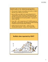
ACID SULFATE SOILS - Sawgal.umd.edu - University of Maryland
ACID SULFATE SOILS - Sawgal.umd.edu - University of Maryland
ACID SULFATE SOILS - Sawgal.umd.edu - University of Maryland

You also want an ePaper? Increase the reach of your titles
YUMPU automatically turns print PDFs into web optimized ePapers that Google loves.
eaction. This material is considered to qualify as a sulfidic material by Soil<br />
Taxonomy.<br />
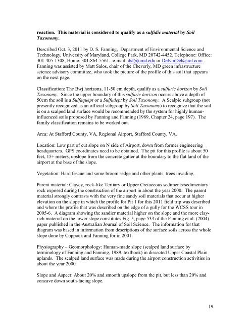
Described Oct. 3, 2011 by D. S. Fanning, Department <strong>of</strong> Environmental Science and<br />
Technology, <strong>University</strong> <strong>of</strong> <strong>Maryland</strong>, College Park, MD 20742-4452. Telephone: Office:<br />
301-405-1308, Home: 301:864-5561. e-mail: dsf@<strong>umd</strong>.<strong>edu</strong> or DelvinDel@aol.com .<br />
Fanning was assisted by Matt Salos, chair <strong>of</strong> the Cheverly, MD green infrastructure<br />
science advisory committee, who took the picture <strong>of</strong> the pr<strong>of</strong>ile <strong>of</strong> this soil that appears<br />
on the next page.<br />
Classification: The Bwj horizons, 11-50 cm depth, qualify as a sulfuric horizon by Soil<br />
Taxonomy. Since the upper boundary <strong>of</strong> this sulfuric horizon occurs above a depth <strong>of</strong><br />
50cm the soil is a Sulfaquept or a Sulfudept by Soil Taxonomy. A Scalpic subgroup (not<br />
presently recognized as an <strong>of</strong>ficial subgroup by Soil Taxonomy) to recognize that the soil<br />
is on a scalped land surface would be recommended by the system for highly humaninfluenced<br />
soils proposed by Fanning and Fanning (1989, Chapter 24, page 197). The<br />
family classification remains to be worked out.<br />
Area: At Stafford County, VA, Regional Airport, Stafford County, VA.<br />
Location: Low part <strong>of</strong> cut slope on N side <strong>of</strong> Airport, down from former engineering<br />
headquarters. GPS coordinates need to be obtained. The pit for this pr<strong>of</strong>ile is about 50<br />
feet, 15+ meters, upslope from the concrete gutter at the boundary to the flat land <strong>of</strong> the<br />
airport at the base <strong>of</strong> the slope.<br />
Vegetation: Hard fescue and some broom sedge and other plants, trees invading.<br />
Parent material: Clayey, rock-like Tertiary or Upper Cretaceous sediments/sedimentary<br />
rock exposed during the construction <strong>of</strong> the airport in about the year 2000. The parent<br />
material strongly contrasts with the very fine sandy soil materials that occur at higher<br />
elevation on the slope in which the pr<strong>of</strong>ile for Pit 1 for this 2011 field trip was described<br />
and where the pr<strong>of</strong>ile that was described on the edge <strong>of</strong> a gully for the WCSS tour in<br />
2005-6. A diagram showing the sandier material higher on the slope and the more clayrich<br />
material on the lower slope constitutes Fig. 5, page 533 <strong>of</strong> the Fanning et al. (2004)<br />
paper published in the Australian Journal <strong>of</strong> Soil Science. The information for that<br />
diagram was based in information from descriptions <strong>of</strong> the surface soils across the whole<br />
slope done by Coppock and Fanning for in 2001.<br />
Physiography – Geomorphology: Human-made slope (scalped land surface by<br />
terminology <strong>of</strong> Fanning and Fanning, 1989, textbook) in dissected Upper Coastal Plain<br />
uplands. The scalped land surface was made during the airport construction activities in<br />
about the year 2000.<br />
Slope and Aspect: About 20% and smooth upslope from the pit, but less than 20% and<br />
concave down south-facing slope.<br />
19