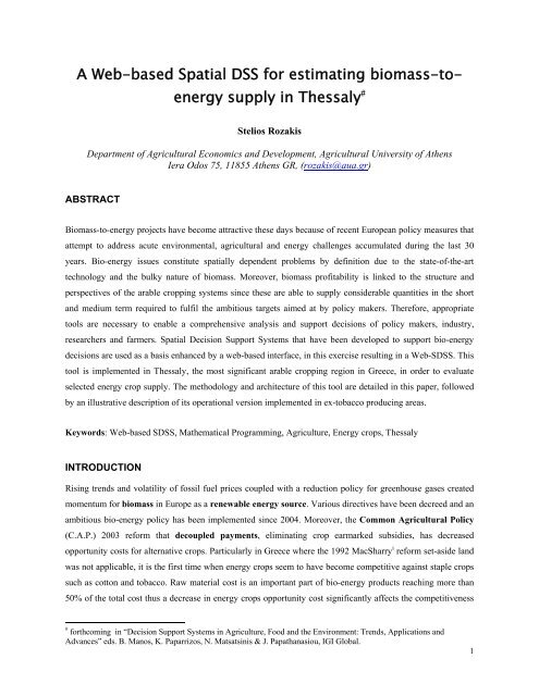
A Web-based Spatial DSS for estimating biomass-to- energy supply ...
A Web-based Spatial DSS for estimating biomass-to- energy supply ...
A Web-based Spatial DSS for estimating biomass-to- energy supply ...

Create successful ePaper yourself
Turn your PDF publications into a flip-book with our unique Google optimized e-Paper software.
A <strong>Web</strong>-<strong>based</strong> <strong>Spatial</strong> <strong>DSS</strong> <strong>for</strong> <strong>estimating</strong> <strong>biomass</strong>-<strong>to</strong><strong>energy</strong><br />
<strong>supply</strong> in Thessaly #<br />
Stelios Rozakis<br />
Department of Agricultural Economics and Development, Agricultural University of Athens<br />
Iera Odos 75, 11855 Athens GR, (rozakis@aua.gr)<br />
ABSTRACT<br />
Biomass-<strong>to</strong>-<strong>energy</strong> projects have become attractive these days because of recent European policy measures that<br />
attempt <strong>to</strong> address acute environmental, agricultural and <strong>energy</strong> challenges accumulated during the last 30<br />
years. Bio-<strong>energy</strong> issues constitute spatially dependent problems by definition due <strong>to</strong> the state-of-the-art<br />
technology and the bulky nature of <strong>biomass</strong>. Moreover, <strong>biomass</strong> profitability is linked <strong>to</strong> the structure and<br />
perspectives of the arable cropping systems since these are able <strong>to</strong> <strong>supply</strong> considerable quantities in the short<br />
and medium term required <strong>to</strong> fulfil the ambitious targets aimed at by policy makers. There<strong>for</strong>e, appropriate<br />
<strong>to</strong>ols are necessary <strong>to</strong> enable a comprehensive analysis and support decisions of policy makers, industry,<br />
researchers and farmers. <strong>Spatial</strong> Decision Support Systems that have been developed <strong>to</strong> support bio-<strong>energy</strong><br />
decisions are used as a basis enhanced by a web-<strong>based</strong> interface, in this exercise resulting in a <strong>Web</strong>-S<strong>DSS</strong>. This<br />
<strong>to</strong>ol is implemented in Thessaly, the most significant arable cropping region in Greece, in order <strong>to</strong> evaluate<br />
selected <strong>energy</strong> crop <strong>supply</strong>. The methodology and architecture of this <strong>to</strong>ol are detailed in this paper, followed<br />
by an illustrative description of its operational version implemented in ex-<strong>to</strong>bacco producing areas.<br />
Keywords: <strong>Web</strong>-<strong>based</strong> S<strong>DSS</strong>, Mathematical Programming, Agriculture, Energy crops, Thessaly<br />
INTRODUCTION<br />
Rising trends and volatility of fossil fuel prices coupled with a reduction policy <strong>for</strong> greenhouse gases created<br />
momentum <strong>for</strong> <strong>biomass</strong> in Europe as a renewable <strong>energy</strong> source. Various directives have been decreed and an<br />
ambitious bio-<strong>energy</strong> policy has been implemented since 2004. Moreover, the Common Agricultural Policy<br />
(C.A.P.) 2003 re<strong>for</strong>m that decoupled payments, eliminating crop earmarked subsidies, has decreased<br />
opportunity costs <strong>for</strong> alternative crops. Particularly in Greece where the 1992 MacSharry i re<strong>for</strong>m set-aside land<br />
was not applicable, it is the first time when <strong>energy</strong> crops seem <strong>to</strong> have become competitive against staple crops<br />
such as cot<strong>to</strong>n and <strong>to</strong>bacco. Raw material cost is an important part of bio-<strong>energy</strong> products reaching more than<br />
50% of the <strong>to</strong>tal cost thus a decrease in <strong>energy</strong> crops opportunity cost significantly affects the competitiveness<br />
# <strong>for</strong>thcoming in “Decision Support Systems in Agriculture, Food and the Environment: Trends, Applications and<br />
Advances” eds. B. Manos, K. Paparrizos, N. Matsatsinis & J. Papathanasiou, IGI Global.<br />
1
of bio-<strong>energy</strong>. This hypothesis is confirmed in Thessaly by Lychnaras and Rozakis (2006) who have estimated<br />
regional <strong>supply</strong> of <strong>biomass</strong> <strong>for</strong> perennial plantations using analytical techniques such as mathematical<br />
programming (MP) and farm statistics (European Farm Accounting Data Network). Lacking spatial<br />
in<strong>for</strong>mation, their results had limited value <strong>for</strong> decision makers regarding site-dependent bio-<strong>energy</strong> projects.<br />
As a matter of fact, with the exception of sunflower <strong>for</strong> biodiesel comprising a few hundred contracts, no bio<strong>energy</strong><br />
chain is operating in Thessaly. There<strong>for</strong>e, it is very important <strong>for</strong> potential inves<strong>to</strong>rs <strong>to</strong> have available<br />
in<strong>for</strong>mation on raw materials cost.<br />
For this purpose, a S<strong>DSS</strong> decision-making <strong>to</strong>ol that contains optimisation models fed by technical, economic,<br />
and car<strong>to</strong>graphic in<strong>for</strong>mation has been built <strong>to</strong> provide stakeholders with region specific <strong>biomass</strong>-<strong>to</strong>-<strong>energy</strong><br />
<strong>supply</strong> in<strong>for</strong>mation. Energy <strong>to</strong> <strong>biomass</strong> raw material cost is provided in <strong>supply</strong> curve <strong>for</strong>m incorporating<br />
physical land suitability <strong>for</strong> crops (survey and spatial in<strong>for</strong>mation), farm structure (survey) and policy scenarios<br />
(new CAP specification in the model). There<strong>for</strong>e, it is suitable <strong>for</strong> assisting in the evaluation of <strong>biomass</strong>-<strong>to</strong><strong>energy</strong><br />
penetration in<strong>to</strong> existing agricultural systems. Optimisation software (GAMS) is embedded in a GIS<br />
environment allowing <strong>for</strong> an interactive process in real time. A web-<strong>based</strong> interface built in open source<br />
software makes the S<strong>DSS</strong> <strong>to</strong>ol available <strong>for</strong> collaborative decision-making.<br />
A case-study explores potential <strong>supply</strong> of selected <strong>energy</strong> crops by arable farms in the Karditsa area, exploiting<br />
survey and spatial data. Numerous farms, geographically dispersed, decide maximizing gross margin, whether<br />
or not <strong>to</strong> introduce <strong>energy</strong> crops, namely sunflower, cynara and sorghum in their crop mix using crop suitability<br />
maps. Mathematical programming models of 70 representative farms are articulated and parametric<br />
optimization is used <strong>to</strong> generate <strong>supply</strong> curves <strong>for</strong> the <strong>energy</strong> crops at the regional level. The <strong>to</strong>ol operates on<br />
the Internet ii where the user can have full access <strong>to</strong> the data-set, enter selected parameters in<strong>to</strong> the model, and<br />
enables spatial visualisation and exploration of the results, enhancing interactivity in the decision process. The<br />
architecture and the task organisation among optimisation, simulation and software are illustrated in this paper<br />
and preliminary results are discussed.<br />
FROM CLASSIC GIS TO WEB-S<strong>DSS</strong>: OVERVIEW AND APPLICATIONS RELATED TO<br />
AGRICULTURE<br />
Evolution and state-of-the-art<br />
Geographic In<strong>for</strong>mation Systems (GIS) have been applied <strong>to</strong> map <strong>biomass</strong> potential in <strong>for</strong>estry, industrial,<br />
agricultural or lives<strong>to</strong>ck residues and also have been used extensively since the eighties in numerous bio-<strong>energy</strong><br />
studies. For example, a system model <strong>for</strong> <strong>estimating</strong> short rotation woody <strong>biomass</strong> production, harvesting and<br />
transport costs was developed and applied <strong>to</strong> a Hawaiian island, with GIS interfaced with the model <strong>to</strong> present<br />
results in car<strong>to</strong>graphic <strong>for</strong>m (Liu, 1992). More ambitious works have attempted <strong>to</strong> assist bio-<strong>energy</strong> policy at<br />
the national level by providing policy makers with quantitative economic and environmental in<strong>for</strong>mation on the<br />
potential <strong>supply</strong> of <strong>energy</strong> crops in the UK (Cole et al., 1996), and the US (Graham et al., 2000).<br />
2
While GIS can capture geographic variation which affects <strong>biomass</strong> cost and <strong>supply</strong>, they are effectively limited<br />
<strong>to</strong> deterministic analyses in spatial search. They can become a valuable <strong>to</strong>ol when complemented by<br />
optimisation models or by Decision Support Systems (<strong>DSS</strong>), as they can exploit spatial data and also efficiently<br />
avail the model output. Limitations of decision models lying in their inability <strong>to</strong> exploit spatial data can be<br />
overcome when articulated in a GIS environment. The graphical representation of results can contribute by<br />
visualising the work of the decision maker and thus facilitate dialogue and debate. The integration of spatial<br />
and analytical models has brought about a new type of <strong>DSS</strong> known as <strong>Spatial</strong> <strong>DSS</strong> (S<strong>DSS</strong>). S<strong>DSS</strong> as defined<br />
by Sugumaran & Sugumaran (2005) are “flexibly integrated systems built on a GIS plat<strong>for</strong>m <strong>to</strong> deal with<br />
spatial data and manipulations, along with an analysis module ... they support ‘what if’ analysis ... and help the<br />
user in understanding the results”. Although highly appealing, S<strong>DSS</strong> <strong>based</strong> on traditional GIS require<br />
sophisticated hardware and capital intensive resources, and these limitations hindered their adoption. With the<br />
development of the internet, <strong>Web</strong>-<strong>based</strong> S<strong>DSS</strong> have been developed, adding Internet interface programs <strong>to</strong> the<br />
computational models and geographic databases of the S<strong>DSS</strong>, in order <strong>to</strong> provide geographic in<strong>for</strong>mation and<br />
decision support through the <strong>Web</strong>.<br />
<strong>Web</strong>-S<strong>DSS</strong> may apply either client-side or server-side processing. The <strong>for</strong>mer approach identifies <strong>to</strong> a “thick”<br />
client in which GIS is downloaded on the end user computer and only the geographic data are retrieved through<br />
the web. It is certainly less resource-demanding than stand-alone S<strong>DSS</strong> <strong>based</strong> on traditional GIS, while offering<br />
standard menus and control but<strong>to</strong>ns, and allows the developer diffusing applications while maintaining control<br />
over the data. On the other hand, under the server-side processing approach the end user operates their machine<br />
as a simple browser, having access <strong>to</strong> decision models and data provided by the remote server, then proceeds <strong>to</strong><br />
tasks such as map display, queries <strong>to</strong> spatial or non-spatial databases, model execution and development of<br />
reports.<br />
The progress in <strong>Web</strong>-<strong>based</strong> decision support technologies has been recently described by Bhargava et al.<br />
(2007) in a special issue of the Decision Support Systems journal, and distinguishes between model-driven and<br />
data-driven <strong>DSS</strong> <strong>to</strong> provide an impressive list of systems <strong>for</strong> decision support using the web as a medium<br />
(stand-alone commercial applications) or as a computer (web-<strong>DSS</strong> or web-S<strong>DSS</strong>). Most applications concern<br />
business decision support, some deal with environmental issues involving also multi-criteria models iii , but only<br />
a few are related <strong>to</strong> agriculture. A <strong>to</strong>ol <strong>for</strong> Decision Analysis specialises in cow culling choices via the Internet<br />
(thin client or server <strong>based</strong>) and a region specific (Iowa, US) S<strong>DSS</strong> called Agri-FACT, assisting the farmer <strong>to</strong><br />
decide among cropping systems using agronomic research, are briefly presented below. Another two related<br />
applications are not further analysed: The first supports decision on the distribution of area of two agricultural<br />
zones among production technologies taking in<strong>to</strong> account environmental considerations is developed by Lo<strong>to</strong>v<br />
(1998). It is a stylized model illustrated by a car<strong>to</strong>graphic picture –thus, there is no GIS behind it- aiming at<br />
diffusing The concept of decision maps. The decision process consists in graphically displaying trade-offs in<br />
cases of three or more objectives by exploiting altitudinal map techniques. The second one concerns a model-<br />
3
driven <strong>DSS</strong> developed by Grazing Systems Ltd. classified by Bhargava et al. (2007) in the optimization <strong>to</strong>ols<br />
category, that offers decision support services in the agricultural sec<strong>to</strong>r, is not currently available in the web.<br />
An interactive Decision Support System currently available on the web provides recommended culling<br />
decisions generated by a model (Cow Culling <strong>DSS</strong>, 2009). The model considers biological fac<strong>to</strong>rs, market<br />
fac<strong>to</strong>rs, costs of production, management alternatives, joint consideration of biological and market fac<strong>to</strong>rs, the<br />
value of pregnancy testing and management of herd composition. It can be used as an extension instrument<br />
whose purpose is <strong>to</strong> provide ranchers with pertinent in<strong>for</strong>mation on cow culling decisions.<br />
Agri-FACTs is a web <strong>based</strong> GIS application that was developed as a coarse level decision support <strong>for</strong> farmers<br />
within the central Great Plains region in the U.S. <strong>to</strong> analyze alternative cropping systems <strong>for</strong> their farms<br />
(Vernon, 1999). It integrates agro-ecozone modeling with cropping systems research and is made available <strong>to</strong><br />
the farmer with ArcView IMS and an easy <strong>to</strong> use graphical user interface, so identifies <strong>to</strong> “thick” client<br />
approach. Agro-ecological fac<strong>to</strong>rs such as soil quality and weather related risks affect the suitability of a<br />
particular field <strong>for</strong> alternative cropping practices. This type of research in<strong>for</strong>mation is typically unavailable <strong>to</strong> a<br />
farmer, but may greatly assist them in decision making regarding implementing alternative cropping systems<br />
on their farms.<br />
DECISION SUPPORT RELATED TO BIO-ENERGY<br />
Technical choices and past work<br />
Concerning the estimation of <strong>biomass</strong> <strong>supply</strong>, this represents a much more complex and burdensome problem<br />
than the ones mentioned in the previous paragraphs, necessitating sec<strong>to</strong>r model aggregating numerous<br />
decentralised decision-making units (farms) and drilling in<strong>for</strong>mation from detailed land suitability maps of a<br />
large region. Furthermore, <strong>biomass</strong> trans<strong>for</strong>mation <strong>to</strong> <strong>energy</strong> may be included in the analysis when the system<br />
assists in decision regarding location and size of bio-<strong>energy</strong> generating plants. It is a typical multi-criteria<br />
multi-stakeholder problem. Coupling GIS software <strong>to</strong> the multi-farm models iv is undertaken, thus constructing<br />
a <strong>Spatial</strong> DDS. Attempting <strong>to</strong> classify GIS – optimisation models Laaribi (2000) points out three modes of<br />
physical integration:<br />
a. First integration level: GIS and optimisation software are independent; optimisation analysis assisted<br />
by GIS but it is non-interactive and inconvenient in use.<br />
b. Second integration level: GIS and optimisation software is still independent but only one interface is<br />
used, that of GIS software. Interactivity is enhanced but it is limited <strong>to</strong> pre-designed capacities (data<br />
export import concerns only certain categories, parameters <strong>to</strong> determine are predefined by the<br />
designer).<br />
c. Complete integration: unique software able <strong>to</strong> per<strong>for</strong>m not only spatial analysis and database<br />
management but also optimisation and optimisation analysis.<br />
4
According <strong>to</strong> the above distinction the <strong>to</strong>ol described in this paper identifies <strong>to</strong> the second integration level<br />
where a unique interface accommodates all operations.<br />
survey data<br />
GIS query<br />
car<strong>to</strong>graphic<br />
layout<br />
Biomass <strong>supply</strong><br />
curves<br />
Farm models<br />
<strong>Spatial</strong>-car<strong>to</strong>graphic data<br />
Figure 1. GIS – optimisation models integration and data flows<br />
Relevant work undertaken by teams coordinated by the author started a decade ago in the context of the<br />
European research projects (Saez et al., 2004) within the framework of ALTENER programme (EU program <strong>to</strong><br />
fund research and pilot applications of Renewable Energy Sources) evolving from a static S<strong>DSS</strong> on bio-<strong>energy</strong><br />
multi-criteria decision-making (Rozakis et al., 2001), via a thick client ARC-IMS web-S<strong>DSS</strong> (Rozakis et al.,<br />
2002) <strong>to</strong> the web-S<strong>DSS</strong> using open GIS implemented <strong>for</strong> a site-selection bio-electricity problem in Farsala,<br />
Thessaly (Bore<strong>to</strong>s & Rozakis, 2006) and the thin client current system. Thus, the thin client server-sided<br />
approach used by the current application is considered more appropriate <strong>to</strong> bio-<strong>energy</strong> related decision support<br />
systems, better responding <strong>to</strong> challenges pointed out in <strong>Web</strong>-S<strong>DSS</strong> literature. These can be grouped in<br />
technical, economic and social & behavioural, more concretely concerning system per<strong>for</strong>mance, technical<br />
integration, interoperability, security and privacy as well as quality of service.<br />
SDDS Architecture and interface design<br />
The basic series of steps of the proposed <strong>Web</strong> GIS/<strong>DSS</strong> is as follows:<br />
• the user creates an input <strong>for</strong>m and submits it <strong>to</strong> the web server<br />
• the <strong>Web</strong> server passes the arguments <strong>to</strong> an external program or script that executes the <strong>DSS</strong> model.<br />
• The external process runs the <strong>DSS</strong> and passes the results and control <strong>to</strong> the Map server.<br />
• The Map server modifies spatial attributes and features <strong>based</strong> on the model’s results, and runs any<br />
additional spatial analysis requested.<br />
• The Map server creates the necessary map and translates it <strong>to</strong> a bitmapped file, usually a GIF or a JPEG<br />
file and passes it back <strong>to</strong> the web server.<br />
• The <strong>Web</strong> server returns the image and results back <strong>to</strong> the user’s browser using HTML.<br />
Thus the logic of the <strong>to</strong>ol is: <strong>to</strong> use the car<strong>to</strong>graphic and statistical in<strong>for</strong>mation then exploit economic data and<br />
crop productivity maps maximising farm gross margins <strong>to</strong> estimate <strong>biomass</strong> <strong>supply</strong>. The interface that<br />
5
illustrates spatial features of the optimal solution is presented in figure 2, with the optimisation model<br />
command menu in the left and the GIS explorer of available layers and query tables in the right.<br />
Operations available in the screen are:<br />
Scenario selection and model command section: The user can build the scenario <strong>to</strong> be tested selecting values of<br />
input parameters of the mathematical programming model and execute it. Then an optimal solution can be<br />
visualized in tabular, graphical <strong>for</strong>ms. Results with a spatial dimension are incorporated in the spatial database.<br />
Map visualization screen: In the middle of the screen selected layers and maps of the region can be retrieved.<br />
Geographical In<strong>for</strong>mation Access section: The user may explore the map layers and per<strong>for</strong>m spatial and<br />
attribute queries. Basic functionalities of GIS are made available in this section, in order <strong>to</strong> facilitate<br />
exploration of the region of interest and visualization of optimization model spatial output.<br />
Figure 2. <strong>Spatial</strong> Decision Support System host page, Karditsa prefecture in Thessaly.<br />
Basic technical specifications draw from Bore<strong>to</strong>s and Rozakis (2006) v . The results of the client approach<br />
followed are impressive. User interface response is very fast, or at least indicative of a typical “web<br />
6
experience”. While the interface is not as rich, (nor as confusing), as the thick client interface, the most<br />
common operations are available, including zoom and pan features as well as parametric queries. Additionally,<br />
when input data is submitted <strong>for</strong> running a model, a very clear indication is given <strong>to</strong> the user as <strong>to</strong> processing<br />
times expected, as well as the model’s progress. When bugs were reported, most were easily reproduced and<br />
corrected on the server side. Since a scripting approach was used <strong>for</strong> the logic, changes were made “on the fly”,<br />
on a running, production system (Ousterhout,1997).<br />
While the current bio-<strong>energy</strong> project thin-client approach produced acceptable results, and fulfilled its scope,<br />
several desirable features were identified and have been improved in the current version:<br />
• The current geographic data sets are Arc-View shapefiles, which by nature, contains a DBF <strong>for</strong><br />
attribute s<strong>to</strong>rage. DBF is difficult <strong>to</strong> manage in a multi-user environment as is the case on the Internet.<br />
It would be more appropriate <strong>to</strong> s<strong>to</strong>re features and attribute data in a spatially enabled database, such as<br />
ESRI SDE (SDE), or Postgre (PG-SQL), resulting in simplified user session management and<br />
cus<strong>to</strong>mized “data views”.<br />
• Economic and sec<strong>to</strong>r models are resource intensive, and as such tend <strong>to</strong> load the single server machine<br />
which was used <strong>for</strong> all web requests, model and geo-spatial processing. A layered, “Service Oriented”<br />
approach, can now be implemented on multiple machines <strong>to</strong> re-gain acceptable per<strong>for</strong>mance under<br />
load. Cross-plat<strong>for</strong>m distributed computing can be realized, <strong>based</strong> on XML/RPC, a remote procedure<br />
pro<strong>to</strong>col using XML <strong>for</strong> the encoding and HTTP as the transport (XML/RPC).<br />
OPTIMISATION MODULE: DESCRIPTION AND METHODOLOGY<br />
Modelling regional agriculture: a bot<strong>to</strong>m-up approach<br />
Past experience shows that the raw material cost, defined at the farm level, <strong>for</strong>ms a significant part of the biofuel<br />
cost. Due <strong>to</strong> an important spatial dispersion of bio-fuel raw material in many productive units (farms) and<br />
competition between agricultural activities <strong>for</strong> the use of production fac<strong>to</strong>rs (land in particular), strongly<br />
dependent on the CAP, the cost estimates of these raw materials raise specific problems (Sourie, 2002).<br />
Although it is important that this cost be estimated correctly, three key difficulties are faced:<br />
• scattering of the resource.<br />
• competition existing between agricultural activities and non-food crops at the farm level.<br />
• dependence of raw material costs on agricultural policy measures.<br />
The microeconomic concepts of <strong>supply</strong> curve and opportunity cost make possible a solution <strong>to</strong> these<br />
difficulties. These concepts could be elaborated in a satisfac<strong>to</strong>ry way by using mathematical programming<br />
models, called <strong>supply</strong> models, <strong>based</strong> on a representation of farming systems, thus sec<strong>to</strong>r models.<br />
7
Mathematical modelling provides a <strong>to</strong>ol <strong>to</strong> evaluate simultaneous policy interventions in a system, such as<br />
arable agriculture, taking in<strong>to</strong> account interrelationships such as resource and agronomic constraints, as well as<br />
synergies and competition among activities. Optimisation models maximising consumer and producer surplus<br />
selecting among feasible activity plans have been extensively used in agricultural sec<strong>to</strong>r modelling (Hazell and<br />
Nor<strong>to</strong>n, 1986). They allow <strong>for</strong> a techno-economic representation of the sec<strong>to</strong>r containing a priori in<strong>for</strong>mation<br />
on technology, fixed production fac<strong>to</strong>rs, resource and agronomic constraints, production quotas and set aside<br />
regulations, along with explicit expression of physical linkages between activities. The choice of mathematical<br />
programming methods is motivated by the importance of technical possibilities of substitution between<br />
activities and the importance of CAP measures <strong>for</strong> the different activity levels in the cropping plan.<br />
Assuming rational economic behaviour, optimisation results in efficient allocation of production. When the<br />
base year optimal crop mix approaches the actual one, then the model can be expected <strong>to</strong> <strong>for</strong>ecast future<br />
changes given specific policy parameters and <strong>to</strong> reveal impacts of different agricultural policy scenarios on<br />
production volume, resource allocation and farm income, eventually evaluating policy efficiency. Moreover,<br />
optimisation analysis is theoretically appealing as it generates shadow prices <strong>for</strong> explicit capacity, policy<br />
constraints providing valuable in<strong>for</strong>mation <strong>to</strong> policy makers, as well as demand constraints whose dual values<br />
are used <strong>to</strong> determine <strong>supply</strong> response curves.<br />
However, in most cases, it is difficult <strong>to</strong> replicate actual base year data, due <strong>to</strong> disadvantages inherent <strong>to</strong> the LP.<br />
Those usually mentioned in the literature as cited by Leh<strong>to</strong>nen (2001) are : a) normative optimisation behaviour<br />
due <strong>to</strong> strict neoclassical assumptions, b) aggregation problems, c) ad hoc calibration and validation procedure,<br />
d) discontinuous response <strong>to</strong> changing endogenous conditions, and e) tendency <strong>to</strong> strong specialisation. In order<br />
<strong>to</strong> mitigate the above deficiencies, the sec<strong>to</strong>r <strong>supply</strong> model developed in this exercise is sufficiently detailed <strong>to</strong><br />
reflect the diversity of arable agriculture in the region of interest, articulating numerous farm sub-models in a<br />
block angular <strong>for</strong>m, having neither the same productivity nor the same economic efficiency, so that the<br />
production costs are variable in space.<br />
Thus, it is possible <strong>to</strong> correctly estimate <strong>biomass</strong> production costs by taking in<strong>to</strong> account heterogeneity and<br />
finally <strong>to</strong> aggregate them in order <strong>to</strong> obtain raw material <strong>supply</strong> <strong>for</strong> industry. Different values of the parameters<br />
in the model (<strong>for</strong> example, the rate of obliga<strong>to</strong>ry set-aside or of the quantity of bio-fuel <strong>to</strong> be produced) give<br />
rise <strong>to</strong> a new <strong>supply</strong> curve. Thus, <strong>for</strong> each non-food or <strong>energy</strong> crop, there exists a family of <strong>supply</strong> curves.<br />
Model specification<br />
An individual farm (f) is supposed <strong>to</strong> choose a cropping plan (x f ) and input use among technically feasible<br />
activity plans<br />
appears as:<br />
f f f<br />
A x ≤ b so as <strong>to</strong> maximise gross margin gm f . The optimisation problem <strong>for</strong> the farmer f<br />
8
f f<br />
f f f<br />
f<br />
f<br />
f<br />
( x , θ , κ ) ≡ g ( θ , κ ) x ≡ ∑( pc<br />
+ sc<br />
) yc<br />
+ subc<br />
− vc<br />
)<br />
f<br />
⎧max<br />
gm<br />
⎪<br />
x f<br />
c<br />
⎪<br />
f f f f f<br />
m×<br />
n<br />
⎨s.<br />
t.__<br />
A ( θ , κ ) x ≤ b ( θ , κ )___<br />
A∈R<br />
_( I)<br />
⎪ f<br />
n<br />
⎪<br />
x ≥ 0 ______________________ x ∈R __( II)<br />
⎪<br />
⎩<br />
The sec<strong>to</strong>r model contains f farm problems such as the one specified above. The basic farm problem is linear<br />
with respect <strong>to</strong> x f , the primal n × 1-vec<strong>to</strong>r of the n cropping activities. The m × n-matrix A f and the m × 1-<br />
vec<strong>to</strong>r b f represent respectively the technical coefficients and the capacities of the m constraints on production.<br />
The vec<strong>to</strong>r of parameters θ f characterizes the f th representative farm (y f c yields <strong>for</strong> crop c, v f f<br />
c variable costs, p c<br />
prices dependent on quality, s c subsidies linked <strong>to</strong> crop quantity). κ stands <strong>for</strong> the vec<strong>to</strong>r of general economic<br />
parameters (p prices not dependent on farm, sub c subsidies specific <strong>to</strong> crop cultivated area). The constraints can<br />
be distinguished in resource, agronomic, demand and policy ones. The model enables a comparative static<br />
analysis, but does not allow <strong>for</strong> farm expansion, as it takes as given land resource endowments and land rent of<br />
the base year. Different sets of parameters are applied <strong>to</strong> denote the CAP 2000 and the current CAP.<br />
x<br />
f<br />
c<br />
(1)<br />
The model specified above is a linear version of an Non-linear Programming (NLP) arable sec<strong>to</strong>r model<br />
previously applied <strong>to</strong> the cot<strong>to</strong>n sec<strong>to</strong>r response <strong>to</strong> policy changes (Rozakis et al., 2008). Alternative variants of<br />
mathematical programming the agricultural sec<strong>to</strong>r may use multi-criteria methods (Amador et al., 1998),<br />
Positive Mathematical Programming (Howitt, 1995), risk modelling (Hardaker et al., 2003) or interval linear<br />
programming. (Kazakci et al., 2007). It should be noticed that an important advantage of the server-<strong>based</strong><br />
<strong>Web</strong>-S<strong>DSS</strong> is that the optimization basic LP model can be improved, or even replaced by models following<br />
alternative methodologies without involving the end user of the <strong>to</strong>ol.<br />
CASE-STUDY IN THESSALY, GREECE<br />
<strong>Spatial</strong> and non-spatial in<strong>for</strong>mation<br />
The purpose of the project being <strong>to</strong> evaluate the feasibility of ex-<strong>to</strong>bacco growing farms <strong>to</strong> switch <strong>to</strong> <strong>energy</strong><br />
crop cultivation (Pilotec, 2009), car<strong>to</strong>graphic work focuses on eleven municipalities of the Karditsa<br />
prefecture concentrating the bulk of <strong>to</strong>bacco production. Pilot cultivations of different <strong>energy</strong> crops are<br />
installed in the area (project team, Arable Agriculture lab, Dept of Agronomy, University of Thessaly) in order<br />
<strong>to</strong> estimate yields and production costs in average parcel scale and operate in local conditions. Pilot plantations<br />
comprise sunflower, cynara cardunculus, fiber and sweet sorghum. The area of interest on the relief of the<br />
region appears in map 1 below:<br />
9
Figure 3. Tobacco growing municipalities in Karditsa relief.<br />
The web application’s map is composed of the following feature layers appearing in figure 2:<br />
• Polygon layers of the administrative units of Municipalities (“Dimoi”) and municipal tracks (“DD”)<br />
and of the residential areas (“settlements”).<br />
• Point layer of the parcel centroids of the farms that participated in the project survey (“sample_farms”),<br />
provisioned by the Greek Payment and Control Agency For Guidance And Guarantee Community Aids<br />
(OPEKEPE)<br />
• Polygon layer of land units partitioned on the calculated <strong>energy</strong> crops’ yield per hectare. This layer was<br />
constructed only <strong>for</strong> ex-<strong>to</strong>bacco cultivated areas, as identified by satellite images and on-site survey.<br />
The calculation of the yields was <strong>based</strong> on the construction of probability digital map <strong>for</strong> each fac<strong>to</strong>r,<br />
including altitude, slope, PH, drainage and others (Perakis et al., 2009). The above fac<strong>to</strong>rs are included<br />
on the attribute table of the layer.<br />
Figure 4. Detail of the final land unit map layer.<br />
Using the query menu of the <strong>to</strong>ol one can explore the attributes of the land units in relation <strong>to</strong> farms, <strong>for</strong><br />
instance <strong>to</strong> obtain in<strong>for</strong>mation on <strong>energy</strong> crop potential yield in each farm of the sample. For example, when<br />
10
selecting a farm parcel and activating the command “single join <strong>to</strong> other layer”, the <strong>to</strong>ol displays <strong>to</strong> the user the<br />
main features of the parcel and also which land unit this parcel belongs <strong>to</strong> and its principal characteristics.<br />
Table 1: layer exploration through spatial query results<br />
Layer: land_units<br />
OBJECTID CYNARA (t/ha) Land type CULTIVATION SLOPE CATEGORY DETAILS<br />
1029 28 Irrigated land yes 0% - 3%<br />
Details<br />
Parcel ID 545 in Layer: sample_farms<br />
Surface (ha) crop ID coordinates parcel_code Prefect_Code<br />
3 Cot<strong>to</strong>n 545 314760 4356390 4 41<br />
The decision concerning the introduction of the <strong>energy</strong> crop in the rotation is made <strong>for</strong> each individual farm<br />
after taking in<strong>to</strong> account the opportunity cost <strong>for</strong> each parcel. Using parametric optimisation one can estimate<br />
the opportunity cost derived by the dual value of the constraint imposed on the farmer <strong>to</strong> cultivate a certain area<br />
of the <strong>energy</strong> crop in question. Supply of <strong>energy</strong> <strong>biomass</strong> by area or group of farms is derived by aggregating<br />
individual farm <strong>supply</strong> curves.<br />
The user can select which farm or group of farms <strong>to</strong> include in the analysis and which <strong>energy</strong> crop among those<br />
cultivated in pilot plants they wish <strong>to</strong> introduce in the cropping plan (rotation). Then they should fix a price at<br />
the farm level (“crisp value” in left side section in Figure 2) in order <strong>to</strong> observe the farmer’s response with<br />
regard <strong>to</strong> the cultivation and <strong>supply</strong> of <strong>biomass</strong>-<strong>to</strong>-<strong>energy</strong>. This response will be the outcome of the farm model<br />
at the optimum since each farm model maximizes farm profit subject <strong>to</strong> relevant constraints.<br />
In<strong>for</strong>mation on <strong>energy</strong> crop cultivation and yield is drilled from the pilot project results s<strong>to</strong>red in a database<br />
embedded in the land suitability maps of the region. The current interface can test the farmers’ response on<br />
only one <strong>energy</strong> crop at a time.<br />
Alternatively the user can propose a price range triggering a loop of parametric optimization of the model,<br />
which determines quantity supplied at the optimal crop mix given farm-specific agronomic, economic and<br />
current policy parameters. In this case the result identifies <strong>to</strong> the well-known concept of <strong>supply</strong> curves that can<br />
be farm or cluster specific, or regional <strong>biomass</strong> <strong>supply</strong> if all farms are selected.<br />
Once the input interface is filled (upper left section in Figure 5), optimization software is called <strong>to</strong> solve the<br />
model from the “run model” but<strong>to</strong>n. Results are given in four output files available <strong>to</strong> the remote user as<br />
appearing in the lower left section in figure 5.<br />
11
Figure 5. Farm geographical selection, farm model run, exploration of optimal solution<br />
GAMS output file<br />
This is a standard GAMS output text file returned by the software including the algebraic model code in GAMS<br />
language, the input data that the model developer had selected <strong>to</strong> display <strong>to</strong> the remote user making the model<br />
transparent, and visualizes the full extent model <strong>for</strong>m as appears below :<br />
LP_Cynara.lst<br />
GAMS Rev 229 LNX-LX3 22.9.2 x86/Linux<br />
03/29/09 18:42:58 Page 28<br />
G e n e r a l A l g e b r a i c M o d e l i n g S y s t e m<br />
Equation Listing SOLVE LP_Karditsa Using LP From line 561<br />
---- eq_crop =E= Defining the vec<strong>to</strong>r of eligible activities<br />
eq_crop(1,Alfalfa).. - lg_x(1,Alfalfa) - nlg_x(1,Alfalfa) + x(1,Alfalfa) =E= 0 ;<br />
(LHS = 0)<br />
eq_crop(1,Cot<strong>to</strong>n).. - lg_x(1,Cot<strong>to</strong>n) - nlg_x(1,Cot<strong>to</strong>n) + x(1,Cot<strong>to</strong>n) =E= 0 ; (LHS<br />
= 0)<br />
eq_crop(1,D_Wheat).. - lg_x(1,D_Wheat) - nlg_x(1,D_Wheat) + x(1,D_Wheat) =E= 0 ;<br />
(LHS = 0)<br />
Figure 6. An excerpt of the GAMS output file (modelname.lst)<br />
Furthermore it includes the full report of bugs and problems, if any, encountered during the solution process,<br />
consequently, in<strong>for</strong>ms the user on the solution status, and finally renders the full list of the results of the primal<br />
and dual models.<br />
12
Cropping plan at the optimal solution<br />
Table 2 shows the cropping plan displaying the optimal crop mix at different price levels of the <strong>energy</strong> crop.<br />
All crop cultivated surfaces in the farm or group of farms are calculated, including the <strong>energy</strong> crop. In this way<br />
the user can observe the evolution of conventional crop cultivating areas <strong>for</strong> increasing prices of the <strong>energy</strong><br />
crop. In table 1 the farm in question cultivates durum wheat and alfalfa on 86 and 75 ha respectively. Maize,<br />
cot<strong>to</strong>n, <strong>to</strong>ma<strong>to</strong>es and white beans are grown in the region but not in the particular farm (farm no1). When the<br />
price of cynara becomes 4.6 cents/kg, durum wheat is replaced by cynara, whereas when the cynara price<br />
raises <strong>to</strong> 8.2 c/kg part of the alfalfa is also replaced by cynara.<br />
Table 2. Parametric optimization results : cropping plan versus <strong>energy</strong> crop price<br />
scenario Alfalfa Cot<strong>to</strong>n D_Wheat Maize Toma<strong>to</strong>es White_Be Cynara<br />
scenario 1 cynara price = 0.01 euro/kg<br />
farm 1 75.1515 0 86.8482 0 0 0 0<br />
scenario 2 cynara price = 0.028 euro/kg<br />
farm 1 75.1515 0 86.8484 0 0 0 0<br />
scenario 3 cynara price = 0.046 euro/kg<br />
farm 1 75.1515 0 0 0 0 0 86.8484<br />
scenario 4 cynara price = 0.064 euro/kg<br />
farm 1 75.1515 0 0 0 0 0 86.8484<br />
scenario 5 cynara price = 0.082 euro/kg<br />
farm 1 28.7539 0 0 0 0 0 133.246<br />
Supply curve – <strong>energy</strong> crop quantity vs. price graphical display<br />
The columns denoting <strong>energy</strong> crop “price” and “quantity” at the optimum resulting from the parametric<br />
optimization are retrieved from the previous table <strong>to</strong> present a two-dimensional graphical visualization of the<br />
cynara <strong>supply</strong> curve. The user can have a clear idea on the capacity of the examined farms <strong>to</strong> provide <strong>biomass</strong><br />
and the price-quantity elasticity over the range of proposed prices. In figure 6 one can observe the individual<br />
farm <strong>supply</strong> curve. Quantity-price relationships of all crops cultivated by the farm can be visualized<br />
simultaneously in order <strong>to</strong> give the evolution of the entire farm crop mix, if the output “cropping plan” text file<br />
is processed in a commercial spreadsheet.<br />
13
Figure 7. Cynara <strong>supply</strong> curve of the sample farm 1 in Karditsa region<br />
The <strong>supply</strong> curve in the single farm graph (figure 7) presents abrupt changes due <strong>to</strong> the penny-switching nature<br />
of the LP model whereas it becomes smooth when a large number of farms supplies <strong>biomass</strong> as in figure 8.<br />
The estimated <strong>supply</strong> curve is much more useful when it is derived from a fair number of farms aggregating<br />
individual curves. Furthermore if supplied quantity is projected in the region of interest <strong>based</strong> on representative<br />
weights the resulting <strong>supply</strong> curve may be valuable <strong>for</strong> inves<strong>to</strong>rs and the industry or cooperatives present in the<br />
<strong>biomass</strong> trans<strong>for</strong>mation <strong>to</strong> <strong>energy</strong> activities, who would be willing <strong>to</strong> pay <strong>to</strong> acquire such pieces of in<strong>for</strong>mation.<br />
Figure 8. Cynara <strong>supply</strong> curve of survey farms in Karditsa region<br />
14
It has <strong>to</strong> be noted that in the context of S<strong>DSS</strong> every point of the <strong>supply</strong> curve can be visualized in the map<br />
corresponding <strong>to</strong> a geographical snapshot of the focus area using Attribute queries from the interface (right side<br />
section in Figure 2). Once the model determines the optimal solution, the Land Unit attribute table is updated<br />
retrieving in<strong>for</strong>mation from the model results regarding the <strong>energy</strong> crop produced quantities. Then the user<br />
could select Land Units that produce a positive quantity of the <strong>energy</strong> crop, obtaining in<strong>for</strong>mation not only of<br />
the quantity produced at a given price level but also of the localization of this production in the region of study.<br />
CONCLUSIONS<br />
Decision-making in bio-<strong>energy</strong> is currently in high demand, especially in Greece, where the bio-fuel issue has<br />
been highlighted recently due <strong>to</strong> European strategy and promotion policies. Neither the government nor the<br />
industry and farmers were adequately prepared: the <strong>for</strong>mer imposed costly measures including tax exemptions<br />
and production quotas, the latter became involved in a risky business. Farmers and their cooperatives are in<br />
urgent need of alternative crops since the subsidies have been decoupled from production, thus causing them <strong>to</strong><br />
behave differently from the past when policy makers indirectly dictated activity choices and production levels.<br />
At the same time, research on bio-<strong>energy</strong> related fields and decision support systems being available and<br />
funding <strong>to</strong> ex-<strong>to</strong>bacco producers notwithstanding, a web-<strong>based</strong> S<strong>DSS</strong> has been proposed focusing on providing<br />
valid and documented estimations of <strong>biomass</strong> <strong>supply</strong>. In this paper, the above mentioned system is described,<br />
classified as thin-client processing, aiming at reaching potential bio-<strong>energy</strong> community stakeholders in Greece<br />
thus enhancing the dialogue and discussion on bio-fuel feasibility on sound bases.<br />
Existing spatially dependent knowledge and agronomic in<strong>for</strong>mation has been exploited and agricultural<br />
economics advances can be incorporated since optimisation models used are distinct within the <strong>DSS</strong>. At its<br />
present <strong>for</strong>m the <strong>to</strong>ol allows <strong>for</strong> geographic exploration and analysis of the farm sample, using sophisticated<br />
optimisation models and combining all of them so as <strong>to</strong> estimate <strong>biomass</strong> <strong>supply</strong>. Scenario building is<br />
incorporated in such a way as <strong>to</strong> facilitate sensitivity analysis concerning spatial and economic dimensions of<br />
the problem. Ensuring minimum per<strong>for</strong>mance and interoperability the <strong>to</strong>ol has enhanced interdisciplinary team<br />
collaboration. End users comprise also agronomists and economists working in the field in the region of study<br />
and elsewhere, raising a large number of questions and revealing numerous deficiencies and rigidities<br />
especially related <strong>to</strong> transparency <strong>to</strong>wards the background databases (geographic in<strong>for</strong>mation and farm<br />
structure and operations) and the explanation of results. The more profane users are exposed <strong>to</strong> economic<br />
concepts such as the ubiqui<strong>to</strong>us “<strong>supply</strong> curve”, the more they scrutinize background in<strong>for</strong>mation and<br />
underlying assumptions. The web-<strong>based</strong> <strong>to</strong>ol has proven an ideal context <strong>for</strong> this interaction obliging the<br />
development team <strong>to</strong> carry out constant improvement in order <strong>to</strong> keep up with the challenging bio-<strong>energy</strong> issue.<br />
15
ACKNOWLEDGMENTS<br />
This work has been undertaken in the project PILOTEC (Set up of innovative PILOT projects <strong>to</strong> assist ex<strong>to</strong>bacco<br />
producers <strong>to</strong> sustainably cultivate Energy Crops) financed by the Greek “Payment and Control Agency<br />
<strong>for</strong> Guidance and Guarantee Community Aids” in the context of the Tobacco Fund (Action 10,<br />
Com(EC)2182/02). The author owes special thanks <strong>to</strong> Nicolas Bore<strong>to</strong>s <strong>for</strong> the development of the <strong>DSS</strong> in the<br />
web, <strong>to</strong> Dimitrios Kremmydas <strong>for</strong> maintaining the web site, <strong>to</strong> John Stedman <strong>for</strong> proofreading the paper and <strong>to</strong><br />
anonymous referees <strong>for</strong> their remarks in an earlier version.<br />
REFERENCES<br />
Amador F., J.M.Sumpsi, and C.Romero (1999). A non-interactive methodology <strong>to</strong> assess farmers’ utility<br />
functions: An application <strong>to</strong> large farms in Andalusia. European Review of Agricultural Economics 25, 92-<br />
109<br />
Bureau J C and Alan Matthews, 2005. EU Agricultural Policy: What Developing Countries Need <strong>to</strong> Know, IIIS<br />
Discussion Paper No. 91, Institute <strong>for</strong> International Integration Studies, Trinity College Dublin.<br />
Bhargava H. K., D. J. Power, D. Sun (2007). Progress in <strong>Web</strong>-<strong>based</strong> decision support technologies, Decision<br />
Support Systems, 43, 1083– 1095<br />
Bore<strong>to</strong>s N., and S. Rozakis (2006, April). Enhancing optimization capacities of GIS: an S<strong>DSS</strong> <strong>for</strong> bio-<strong>energy</strong><br />
project evaluation operating in the Internet, Paper presented at the 64 th meeting <strong>for</strong> the European Working<br />
Group “Multi-criteria Aid <strong>for</strong> Decisions”, Larissa, Greece.<br />
Cole N., S.P. Dagnall, J. Hill, C. Jenner, D.Pegg, K. M. Rush<strong>to</strong>n, and E. Toplis (1996). Resource mapping and<br />
analysis of potential sites <strong>for</strong> short rotation coppice in the UK – assessing the opportunities of <strong>biomass</strong>-<strong>to</strong><strong>energy</strong><br />
technologies, in Chartier et al. (Eds.) 9 th Biomass <strong>for</strong> Energy European Conference Proceedings (pp.<br />
1811-1816), Ox<strong>for</strong>d Elsevier.<br />
Cow Culling Decision Support System (2009). Agricultural and Resource Economics Department, University<br />
of Arizona, from http://ag.arizona.edu/AREC/cull/culling.html (last download: 28/4/2009).<br />
Graham R., B.C. English, C.E. Noon (2000). A GIS-<strong>based</strong> modeling system <strong>for</strong> evaluating the cost of delivered<br />
<strong>energy</strong> feeds<strong>to</strong>ck, Biomass & Bio-<strong>energy</strong>, 18(4), 309-329.<br />
Hardaker J.B., R.B.M. Huirne, and J.R. Anderson (1997). Coping with Risk in Agriculture. London, UK: CAB<br />
International.<br />
Hazell P. and R.D. Nor<strong>to</strong>n (1986). Mathematical programming <strong>for</strong> economic analysis in agriculture. New<br />
York: Macmillan Co.<br />
Howitt, R.E. (1995). Positive Mathematical Programming. American Journal of Agricultural Economics, 77,<br />
329-342.<br />
16
Kazakçi, A., S. Rozakis, D. Vanderpooten (2007). Energy crop <strong>supply</strong> in France: A min-max regret approach,<br />
Journal of the Operations Research Society, 58(11): 1470-1479<br />
Kings<strong>to</strong>n R., S. Carver, A. Evans, and I. Tur<strong>to</strong>n (2000). <strong>Web</strong>-<strong>based</strong> public participation geographical<br />
in<strong>for</strong>mation systems: an aid <strong>to</strong> local environmental decision-making. Computers, Environment and Urban<br />
Systems, 24, 109-125<br />
Laaribi A. (2000). S.I.G. et analyse multicritère. Paris : Hèrmes Science Publications.<br />
Leh<strong>to</strong>nen, H. (2001), Principles, structure and application of dynamic regional sec<strong>to</strong>r model of Finnish<br />
agriculture, PH. D. Thesis, Agrifood Research Finland Economic Research (MTTL), Publications 98.<br />
Liu, W., V.D. Philips, D. Singh (1992). A spatial model <strong>for</strong> the economic evaluation of <strong>biomass</strong> production<br />
systems, Biomass & Bio-<strong>energy</strong>, 3 (5), 345-356.<br />
Lo<strong>to</strong>v A.V. (1998). Computer-<strong>based</strong> support <strong>for</strong> planning and negotiation on environmental rehabilitation of<br />
water resource systems. In Res<strong>to</strong>ration of Degraded Rivers: Challenges,Issues and Experience, ed. D.P.Loucks.<br />
Netherlands: Kluwer Academic Publishers. URL:http://www.ccas.ru/mmes/mmeda/resource/program/main.htm<br />
(last download: 02/10/2009).<br />
Lychnaras V. and S. Rozakis (2006). Economic Analysis of Perennial Energy Crop Production in Greece under<br />
the light of the new CAP, New MEDIT, 3(6), 29-37.<br />
Ousterhout J. (1997), 97 Ousterhout, Proceedings of the Fifth Annual Tcl/Tk Workshop<br />
Perakis K., I. Faraslis, S. Rozakis and D. Stathakis, 2009. Probability satellite imagery <strong>based</strong> maps <strong>for</strong><br />
substituting <strong>to</strong>bacco with <strong>energy</strong> plants,, 29 th Symposium of the European Association of Remote Sensing<br />
Labora<strong>to</strong>ries, 15-18 June, MAI of Chania.<br />
Pilotec project: Pilot plantations <strong>for</strong> <strong>energy</strong> crop cultivation in selected ex-<strong>to</strong>bacco growing zones in Greece,<br />
retrieved Oc<strong>to</strong>ber 2, 2009, from http://aoa<strong>to</strong>ols.aua.gr/pilotec<br />
Rosenthal R. (2006). GAMS: A User’s Guide, GAMS Development Co. Washing<strong>to</strong>n, DC, USA.<br />
Rozakis S., P.G.Solda<strong>to</strong>s, L.Kallivroussis, I.Nikolaou (2001). Multiple Criteria Decision Making on bio-<strong>energy</strong><br />
projects assisted by GIS: The case of Farsala, J. of Geograph. In<strong>for</strong>mation and Decision Analysis, 5(1), 49-64<br />
Rozakis S., S.Casalegno and J-M Gilliot (2002). Multicriteria decision-making on bio-<strong>energy</strong> projects<br />
assisted by G.I.S.: current applications and perspectives, in Options Méditerannéenes, Rozakis & Sourie<br />
(eds.), Special Issue ‘Comprehensive economic and spatial bio-<strong>energy</strong> modeling’, Series A (48): 105-122<br />
Rozakis S., K. Tsiboukas and M. Korasidis (2008). CAP Re<strong>for</strong>m Impacts To Greek Cot<strong>to</strong>n Farmers: A<br />
Mathematical Programming Approach, Journal of Agricultural and Food Economics, 3(1-2), 85-106<br />
Saez, R. et al. (2004). Global Analysis of Energy Crops in a <strong>Spatial</strong> Dimension, Madrid: Coleccion<br />
Documen<strong>to</strong>s CIEMAT.<br />
17
Sourie J-C. (2002). Energy crop <strong>supply</strong> in France, in Options Méditerannéenes, in S. Rozakis & J-C. Sourie<br />
(eds.), Special Issue 'Comprehensive modeling of bio-<strong>energy</strong> systems', Series A (48): 3-8.<br />
Sugumaran V. and R. Sugumaran (2005). <strong>Web</strong>-<strong>based</strong> <strong>Spatial</strong> Decision Support Systems (<strong>Web</strong>S<strong>DSS</strong>):<br />
Evolution, Architecture, and Challenges, Third Annual SIG<strong>DSS</strong> Pre-ICIS Workshop: Designing Complex<br />
Decision Support: Discovery and Presentation of In<strong>for</strong>mation and Knowledge, Las Vegas, Nevada.<br />
Vernon L. T., Aiken, R.M., Waltman, W. (1999). Agri-FACTs: Agricultural Farm Analysis and Comparison<br />
Tool, URL: http://www.esri.com/library/userconf/proc99/proceed/papers/pap385/p385.htm<br />
XML/RPC, Remote Procedure Calling pro<strong>to</strong>col. URL: http://www.xmlrpc.com/spec<br />
i The basic instruments of the CAP remained largely un<strong>to</strong>uched during the first thirty years of its existence (1961-1992).<br />
The first major re<strong>for</strong>m <strong>to</strong> the CAP occurred as a result of the MacSharry (EU Commissioner <strong>for</strong> Agriculture) propositions<br />
in 1992 and implemented in 1994. For the first time, MacSharry succeeded in reducing the level of support prices <strong>for</strong> a<br />
number of major commodities. The reason <strong>for</strong> his success was that he compensated farmers <strong>for</strong> the resulting loss of<br />
income by increasing direct payments. This has been the model <strong>for</strong> all subsequent CAP re<strong>for</strong>ms (Bureau and Matthews,<br />
2005).<br />
ii The project site contains detailed in<strong>for</strong>mation on project scope, project results, deliverables and publications. The <strong>to</strong>ol<br />
operates online in http://aoa<strong>to</strong>ols.aua.gr/pilotec/webgis.php.<br />
iii An excellent example that enhances public participation in local environmental decision making in the UK is analyzed in<br />
Kings<strong>to</strong>n et al. (2000).<br />
iv The models are written and executed in GAMS a software extensively applied by the academic community regularly<br />
maintained and updated with powerful optimisation solvers appropriate <strong>to</strong> LP, NLP and MINLP problems (Rosenthal,<br />
2006).<br />
v Initial ef<strong>for</strong>ts adopted fairly “thick” client approach was implemented as follows:<br />
• connect <strong>to</strong> the central <strong>to</strong>ol web site<br />
• download a Java runtime (SUN Microsystems, 96) <strong>for</strong> their specific plat<strong>for</strong>m if not already installed<br />
• download application specific applet containing application logic and mapping functionality<br />
Issues encountered with the thick-client approach included:<br />
• Substantial download times <strong>for</strong> both Java runtime (50 Mb) and the application applet (30Mb)<br />
• Installation failures/version conflicts<br />
• Unacceptable response time of the interface (client-side processing)<br />
• Complexity of interface<br />
• Minimal event notification (in<strong>for</strong>m user that the system is processing)<br />
• Browser incompatibilities<br />
• Non reproducible bug reports (most processing was on the client side)<br />
As a result of the above, a second approach was undertaken and implemented, <strong>based</strong> around “thin-client” technology.<br />
Working requirements were:<br />
• User base only requires an HTML4.0 compliant Browser (Internet connected PCs generally have a suitable<br />
browser installed)<br />
• No DHTML (different browsers (may) respond differently)<br />
• No Javascript (as above)<br />
• Server-side processing (scalability, reproducible bugs)<br />
The modelling routines, as in the first phase, were programmed in GAMS, and were called via CGI scripts written in TCL.<br />
18