Example Flood Risk Report
Example Flood Risk Report
Example Flood Risk Report

Create successful ePaper yourself
Turn your PDF publications into a flip-book with our unique Google optimized e-Paper software.
2. <strong>Risk</strong> Analysis<br />
2.1 Overview<br />
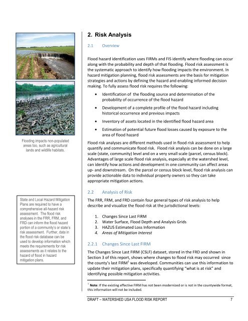
<strong>Flood</strong>ing impacts non-populated<br />
areas too, such as agricultural<br />
lands and wildlife habitats.<br />
.<br />
State and Local Hazard Mitigation<br />
Plans are required to have a<br />
comprehensive all-hazard risk<br />
assessment. The flood risk<br />
analyses in the FRR, FRM, and<br />
FRD can inform the flood hazard<br />
portion of a community’s or state’s<br />
risk assessment. Further, data in<br />
the flood risk database can be<br />
used to develop information which<br />
meets the requirements for risk<br />
assessments as it relates to the<br />
hazard of flood in hazard<br />
mitigation plans.<br />
<strong>Flood</strong> hazard identification uses FIRMs and FIS identify where flooding can occur<br />
along with the probability and depth of that flooding. <strong>Flood</strong> risk assessment is<br />
the systematic approach to identify how flooding impacts the environment. In<br />
hazard mitigation planning, flood risk assessments are the basis for mitigation<br />
strategies and actions by defining the hazard and enabling informed decision<br />
making. To fully assess flood risk requires the following:<br />
Identification of the flooding source and determination of the<br />
probability of occurrence of the flood hazard<br />
Development of a complete profile of the flood hazard including<br />
historical occurrence and previous impacts<br />
Inventory of assets located in the identified flood hazard area<br />
Estimation of potential future flood losses caused by exposure to the<br />
area of flood hazard<br />
<strong>Flood</strong> risk analyses are different methods used in flood risk assessment to help<br />
quantify and communicate flood risk. <strong>Flood</strong> risk analysis can be done on a large<br />
scale (state, community) level and on a very small scale (parcel, census block).<br />
Advantages of large scale flood risk analysis, especially at the watershed level,<br />
can identify how actions and development in one community can affect areas<br />
up- and downstream. On the parcel or census block level, flood risk analysis can<br />
provide actionable data to individual property owners so they can take<br />
appropriate mitigation actions.<br />
2.2 Analysis of <strong>Risk</strong><br />
The FRR, FRM, and FRD contain four general types of risk analysis to help<br />
describe and visualize the flood risk at the jurisdictional levels:<br />
1. Changes Since Last FIRM<br />
2. Water Surface, <strong>Flood</strong> Depth and Analysis Grids<br />
3. HAZUS Estimated Loss Information<br />
4. Areas of Mitigation Interest<br />
2.2.1 Changes Since Last FIRM<br />
The Changes Since Last FIRM (CSLF) dataset, stored in the FRD and shown in<br />
Section 3 of this report, shows where changes to flood risk may occurred since<br />
the county’s last FIRM 1 was developed. Communities can use this information to<br />
update their mitigation plans, specifically quantifying “what is at risk” and<br />
identifying possible mitigation activities.<br />
1 Note: If the existing effective FIRM has not been modernized or is not in the countywide format,<br />
this information will not be included.<br />
DRAFT – WATERSHED USA FLOOD RISK REPORT 7