spring 04 / 17:1 - Grand Canyon River Guides
spring 04 / 17:1 - Grand Canyon River Guides
spring 04 / 17:1 - Grand Canyon River Guides

Create successful ePaper yourself
Turn your PDF publications into a flip-book with our unique Google optimized e-Paper software.
the journal of <strong>Grand</strong> <strong>Canyon</strong> <strong>River</strong> <strong>Guides</strong>, Inc volume <strong>17</strong> number 1 <strong>spring</strong> 20<strong>04</strong><br />
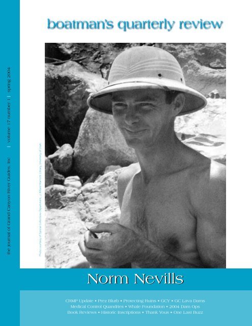
Photo courtesy of Special Collections Department, J. Willard Marriott Library, University of Utah.<br />
Norm Nevills<br />
CRMP Update • Prez Blurb • Protecting Ruins • GCY • GC Lava Dams<br />
Medical Control Quandries • Whale Foundation • 20<strong>04</strong> Dam Ops<br />
Book Reviews • Historic Inscriptions • Thank Yous • One Last Buzz
oatman’s quarterly review<br />
…is published more or less quarterly<br />
by and for <strong>Grand</strong> <strong>Canyon</strong> <strong>River</strong> <strong>Guides</strong>.<br />
<strong>Grand</strong> <strong>Canyon</strong> <strong>River</strong> <strong>Guides</strong><br />
is a nonprofit organization dedicated to<br />
Protecting <strong>Grand</strong> <strong>Canyon</strong><br />
Setting the highest standards for the river profession<br />
Celebrating the unique spirit of the river community<br />
Providing the best possible river experience<br />
General Meetings are held each Spring and Fall. Our<br />
Board of Directors Meetings are generally held the first<br />
Wednesday of each month. All innocent bystanders are<br />
urged to attend. Call for details.<br />
Staff<br />
Executive Director<br />
Board of Directors<br />
President<br />
Vice President<br />
Treasurer<br />
Directors<br />
Gcrg’s amwg<br />
Representative<br />
Gcrg’s twg<br />
Representative<br />
Bqr Editors<br />
Lynn Hamilton<br />
John O’Brien<br />
Drifter Smith<br />
Lynn Hamilton<br />
OC Dale<br />
Bob Dye<br />
Jocelyn Gibbon<br />
Matt Kaplinski<br />
Jeri Ledbetter<br />
Jayne Lee<br />
Andre Potochnik<br />
Matt Kaplinski<br />
Katherine Spillman<br />
Mary Williams<br />
Our editorial policy, such as it is: provide an open forum.<br />
We need articles, poetry, stories, drawings, photos, opinions,<br />
suggestions, gripes, comics, etc. Opinions expressed<br />
are not necessarily those of <strong>Grand</strong> <strong>Canyon</strong> <strong>River</strong><br />
<strong>Guides</strong>, Inc.<br />
Written submissions should be less than 1500 words<br />
and, if possible, be sent on a computer disk, pc or mac<br />
format; Microsoft Word files are best but we can translate<br />
most programs. Include postpaid return envelope if<br />
you want your disk or submission returned.<br />
Deadlines for submissions are the 1st of February,<br />
May, August and November. Thanks.<br />
Our office location: 515 West Birch, Flagstaff, az 86001<br />
Office Hours: 10:30–4:30 Monday through Friday<br />
CRMP Update<br />
The National Park Service (nps) is planning to<br />
release the Draft Environmental Impact Statement<br />
(eis) for the Colorado <strong>River</strong> Management<br />
Plan (crmp) for public review and comment in May<br />
20<strong>04</strong>. The nps will seek public comment on the Draft<br />
eis once a notice of availability has been posted in the<br />
Federal Register. A schedule of public meetings will be<br />
announced following release of the draft.<br />
The Draft eis will analyze a full range of reasonable<br />
alternatives as well as a draft preferred alternative for<br />
managing recreational use on the Colorado <strong>River</strong> from<br />
Lees Ferry to Lake Mead.<br />
Issues being addressed in the planning effort include,<br />
but are not limited to:<br />
• the range of services and opportunities provided<br />
to the public,<br />
• appropriate levels of visitor use consistent with<br />
natural and cultural resource protection and<br />
preservation mandates,<br />
• allocation of use between commercial and noncommercial<br />
groups,<br />
• level of motorized versus non-motorized raft use,<br />
• non-commercial river permit system, and<br />
• continued use of helicopters to transport river passengers<br />
from the Colorado <strong>River</strong> near Whitmore Wash.<br />
Public and stakeholder involvement has been and<br />
continues to be very important in this planning process.<br />
Information relating to the release of the Draft eis and<br />
how the public can be fully involved in the process will<br />
be provided in a variety of ways including postings on<br />
the park’s website at www.nps.gov/grca/crmp.<br />
The nps is committed to completing a final National<br />
Environmental Policy Act (nepa) compliance document<br />
by December 31, 20<strong>04</strong>. We appreciate your interest in<br />
<strong>Grand</strong> <strong>Canyon</strong> National Park and look forward to your<br />
continued participation in the revision of the crmp.<br />
Rick Ernenwein<br />
crmp Planning Team Leader<br />
Phone 928/773-1075<br />
Fax 928/773-8523<br />
E-mail gcrg@infomagic.net<br />
Website www.gcrg.org<br />
page 2<br />
grand canyon river guides
Prez Blurb<br />
The biggest news this winter is the following,<br />
“The National Park Service (nps) is planning to<br />
release the Draft Environmental Impact Statement<br />
(eis) for the Colorado <strong>River</strong> Management Plan<br />
(crmp) for public review and comment in May 20<strong>04</strong>.” I<br />
wrote in my previous column, “Hopefully by the time<br />
you read this, the Colorado <strong>River</strong> Management Plan<br />
will be out in draft form…”. Well, it won’t be.<br />
In fact, if the Park releases its draft when they say<br />
they will, it will be the worst time possible for river<br />
guides to read the draft eis, formulate a reasoned<br />
opinion, and make constructive comments. In May,<br />
most of us will be packing for a trip, or packing for the<br />
season to move closer to Flagstaff or Kanab, or already<br />
down river on our first or second or third trip of the<br />
season.<br />
Our crmp mail may arrive at our winter home, our<br />
summer home, or at the outfitters. Then if it catches<br />
up to us, we can read it on our trips, after the fourteen<br />
hour day, write up our comments, find a stamp and an<br />
envelope, and mail them from Phantom Ranch,<br />
<strong>Grand</strong> <strong>Canyon</strong> Caverns, or Meadview.<br />
Hopefully that fits in with the 30 or 45 or 60 day<br />
review period that the nps will schedule. Sixty days<br />
may seem like a long time to review a document, if<br />
you are sitting in an office, waiting for it to arrive. But<br />
if you are working a full season in the canyon, maybe<br />
taking only single trip off to go to a wedding, 60 days<br />
will come and go in a flash.<br />
It is going to be hard for the gcrg Board to come<br />
up with a position on the draft eis, because we will all<br />
be on the water, on different trips, trying to touch base<br />
with each other, coming off on different days, going<br />
back on this week or next. We will be formally<br />
requesting that <strong>Grand</strong> <strong>Canyon</strong> National Park (gcnp)<br />
develop a very abbreviated executive summary of the<br />
Draft eis, listing what would change between the<br />
current system and the proposed alternative. We are<br />
hoping that this would be easy for guides to take with<br />
them on the river and short enough to attempt to<br />
read. Gcrg will be doing whatever we can to get<br />
information out to members in time for them to<br />
comment on the Draft eis. If you have any ideas about<br />
the Draft eis, or anything else going on, please contact<br />
us at gcrg@infomagic.net or po Box 1934, Flagstaff, az<br />
86002.<br />
I think the next most important issue that gcrg<br />
has been discussing this winter is the increasing level<br />
of wilderness medical certifications that are being<br />
required. Most of us now have quite a bit of training<br />
that has become mandatory. Much of which, we have<br />
been told not to use unless: 1) we are in a wilderness<br />
setting, 2) we have medical protocols in writing, at the<br />
company we work for, and 3) our company has<br />
“medical control”. Gcrg has asked gcnp to be very<br />
specific about what they want us to be doing for<br />
people in a wilderness setting. The letter we sent to<br />
the park is in this issue.<br />
On a lighter note, I was lucky enough to attend the<br />
Second Annual (I hope) “Whale Foundation Wing-<br />
Ding” in Flagstaff on the last weekend in January. A<br />
lot of <strong>Canyon</strong>-related art and gear was auctioned off,<br />
much good food consumed, and many old friends met<br />
and enjoyed. I hope a lot of money was raised.<br />
Looking around at the Wing-Ding, I was reminded of<br />
Bill Beer’s comment at a gts a few years ago, “You’ve<br />
got a tremendous organization with a tremendous<br />
group of people.” I saw a number of folks there doing<br />
great things, accomplishing plenty, and not worrying<br />
who got the credit. That sounds like a good river trip<br />
to me. And it was a celebration—a chance to get<br />
together and laugh, and tell an old story, or hear a new<br />
one, and maybe summon up the courage, or the good<br />
sense, to let your friends know how important they are<br />
to you. If you’re lucky, you don’t need a celebration to<br />
do any of those things, because your friends are close<br />
by, and close. Just hanging out at the Wing-Ding, I’m<br />
reminded how lucky we are in the river community;<br />
we have more friends than we know sometimes. It’s<br />
amazing how fast a river season will go by, and how<br />
good it is to see friends year around.<br />
Speaking of celebrations, the gts will be coming<br />
up soon, and we are hoping for a great turnout, for the<br />
land session and for the river session. We’ll be meeting<br />
Friday, March 26 at the Old Marble <strong>Canyon</strong> Lodge for<br />
the annual gcrg meeting. We’ll move from there to<br />
the Hatch warehouse for dinner and a party. The gts<br />
will be at the Hatch warehouse, Saturday and Sunday,<br />
March 27th and 28th, starting at 8 a.m., coffee and<br />
breakfast earlier. Please come if you can; I know it<br />
often conflicts with work, school, skiing, jury duty and<br />
everything else in life. The gts is always the best place<br />
I know to learn something about the <strong>Canyon</strong>, meet an<br />
old friend, make a new one, and celebrate our community.<br />
I hope to see you there.<br />
John O’<br />
boatman’s quarterly review page 3
Protecting the <strong>Canyon</strong>’s Ruins<br />
One of the most interdisciplinary research<br />
ventures sponsored by gcmrc launched from<br />
Lees Ferry on May 4, 2003. The research group<br />
of geologists and archeologists—including representatives<br />
from the US Geological Survey, UC Santa Cruz,<br />
<strong>Grand</strong> <strong>Canyon</strong> National Park, the Hopi Tribe, the<br />
Hualapai Tribe, and Western Area Power Administration—set<br />
off to see the effect of Glen <strong>Canyon</strong> Dam on<br />
the sand that has been<br />
preserving Native American<br />
archeological sites. After<br />
examining the arroyos that<br />
are formed by water running<br />
down the canyon walls and<br />
seeing the archeological sites<br />
exposed in the arroyos, there<br />
are two questions on<br />
everyone’s minds. If Glen<br />
<strong>Canyon</strong> Dam didn’t exist or<br />
was operated to allow more<br />
sand to be retained in the<br />
system, would more sand be<br />
blown in from the bars along<br />
the river to fill in the arroyos<br />
If there were more windblown<br />
sand, would it be<br />
slowing or preventing erosion<br />
of the ruins<br />
At the time the dam was<br />
built, environmental concerns focused on the area that<br />
was to be submerged beneath Lake Powell, upstream<br />
from the dam. Later, the Environmental Impact Statement<br />
(March 1995) for Glen <strong>Canyon</strong> Dam operations<br />
identified water, sediment, fish, vegetation, wildlife and<br />
habitat, endangered species, and cultural resources as<br />
some of the issues to be analyzed in detail, and studies<br />
have documented a number of impacts to the Colorado<br />
<strong>River</strong> downstream from the dam, below the high water<br />
line. There has been relatively little research on impacts<br />
above the old high-water zone. The archeologists and<br />
geologists on this trip are concerned that the dam may<br />
also effect that environment. The river corridor contains<br />
nearly 500 places of past human activity. The <strong>Grand</strong><br />
<strong>Canyon</strong> Protection Act of 1992 mandates that Glen<br />
<strong>Canyon</strong> Dam be operated to protect downstream natural<br />
and cultural resources. If the dam operations have<br />
directly contributed to the erosion of cultural sites in<br />
the canyon, dam operations may need to change or<br />
other measures taken to ensure preservation of those<br />
resources.<br />
Jan Balsom, National Park Service Cultural<br />
Resources manager, explains to the assembled group of<br />
Photograph of malachite pendant found at eroding<br />
archaeological site.<br />
scientists that 10,000 years of human history may be<br />
buried in the sands of the <strong>Grand</strong> <strong>Canyon</strong>. “With active<br />
arroyo cutting of archeological sites, many sites have<br />
recently been exposed, creating a huge problem for<br />
preservationists.” Can the creation of arroyos be slowed<br />
and the archeological sites preserved What the Park<br />
Service wants, Balsom makes clear, is a “system-wide”<br />
strategy that will relieve her staff from trying to repair<br />
every exposed site individually.<br />
For the two-week trip,<br />
the archeologists pick more<br />
than 30 representative sites to<br />
visit, revealing a range of<br />
problems.<br />
One stop is a site that<br />
National Park Service archaeologists<br />
have monitored over<br />
the past 20 years, and they<br />
have reported that each time<br />
they return, more artifacts are<br />
exposed. The archeologists<br />
have identified the site as<br />
being occupied approximately<br />
900 years ago. It is impossible<br />
to walk without stepping on<br />
pottery. There are several<br />
identified ceramics, including<br />
Tsegi Orange Ware distinguished<br />
by its bright red color<br />
with black lines and flecks of white. There is a type of<br />
burned clay used in house construction known as daub.<br />
For a brief instant, the geologists forget about sedimentary<br />
structures, becoming amateur archaeologists,<br />
looking for artifacts and evidence of the past.<br />
Each day, rising with the sun, the scientists trek<br />
across beaches, past blooming milkweed and blossoming<br />
cactus. They hike along sandy paths, walk over river<br />
terraces and onto rocky ledges overlooking the river. At<br />
one site, Balsom shows the top of an arroyo cutting into<br />
the posts and roof beams of a 1000-year-old structure.<br />
She explains that a structure even older is revealed<br />
below. At site after site, the scientists see fire-cracked<br />
rock, fire pits used to roast agave, ceramics, and carved<br />
and worked stone known as lithics. At one site where<br />
there is no visitor traffic, whole terraces are filled with<br />
archeological sites, and potsherds are scattered across the<br />
landscape. At other sites the archeologists show off<br />
check dams built by the Zuni Conservation Program.<br />
Some look like random scatterings of driftwood, others<br />
look like piles of rocks, all are placed to stop erosion,<br />
trap wind-blown sand, and prevent exposure of nearby<br />
artifacts and structures.<br />
page 4<br />
grand canyon river guides
David Rubin, a u.s.g.s. sedimentologist, directs the<br />
geologic research. The question for the geologists is<br />
whether the sand up on the plateaus, at the edges of the<br />
beaches, and atop the sand dunes is fluvial or eolian<br />
(whether the sand was deposited by water or wind).<br />
With shovels, trowels, Brunton compasses, and a<br />
Chinese calligraphy brush, the geologists march up and<br />
down the beaches, looking at the sedimentary structures<br />
in the cutbanks. At one site not far from the water’s<br />
edge, Rubin sees ripples migrating right to left and<br />
upward, and identifies them as fluvial climbing ripples.<br />
At another site, the geologists agree that the sand is<br />
probably fluvial, either from a 300,000 cfs flood of the<br />
Colorado <strong>River</strong>, or from flooding of a nearby side creek.<br />
At the next site, closer to the river, and lower on the<br />
plateau, all agree that the 10 foot wall of mud, pebbles,<br />
and rocks is from the side creek.<br />
But many sites show evidence of eolian sand deposition.<br />
Wind-blown sand is found on the beach near the<br />
water’s edge, and up in canyons, far from the river. At<br />
one newly exposed site, Rubin considers that “if the<br />
sand bars were bigger, less vegetated, and less frequently<br />
submerged, more sand would blow up the canyon and up<br />
to the area of this site.” The geologists look at another<br />
site and consider the incredible amount of sand and<br />
wind it would take to provide protection to the area,<br />
noting that the sand would need to travel quite a<br />
distance from the river, blowing over boulders, reaching<br />
well above water level. But Balsom recalls seeing sand<br />
dunes form up on the ledges of the Redwall Limestone,<br />
well above river level. Other researchers recall times in<br />
the canyon when the wind is blowing so hard the sky is<br />
sand-colored, when the wind blew sand into their eyes<br />
while they rafted down the middle of the river. The<br />
geologists note that the cactus and bushes in the area all<br />
appear on mounds that are being undercut, a sign that<br />
there used to be a lot more sand in the area. Their<br />
examination completed, they agree that with the 40-50<br />
mile wind gusts common in the <strong>spring</strong>, and with more<br />
sand in the system, it might be possible for eolian sand<br />
to reach up to the sites that are now being exposed.<br />
Another site has extensive pottery scatter and is<br />
believed to have been occupied during much of the time<br />
from 900-1640 ad. Seven cultural features had been<br />
identified at the site. Four have already disappeared,<br />
victims of erosion. The scientists all agree that the site is<br />
a good place for an excavation to integrate the sciences<br />
of archaeology and geomorphology.<br />
The preliminary investigation completed, several<br />
of the geologists think that reduced wind-blown sediment<br />
might be a significant factor causing erosion of the<br />
archeological sites. To determine whether the dam is, in<br />
fact, depleting the sand source, the geologists outline<br />
the investigation. Geologic maps and air photos will be<br />
used to determine a site’s position in the larger land-<br />
Please Don’t Mind the Equipment<br />
In November 2003, instrument stations were set<br />
up by the US Geological Survey and National<br />
Park Service to monitor eolian (wind-blown) sediment<br />
transport at several locations along the river<br />
corridor. By gathering data at a few carefullyselected<br />
sites, we hope to predict how changes in<br />
dam management might affect areas where<br />
archaeological sites are threatened by erosion.<br />
Would deposition of new sand at low elevation<br />
from a beach/habitat building flow (bhbf) result<br />
in more eolian deposition at higher elevation,<br />
helping to preserve archaeological features<br />
To help answer questions like this, we have set<br />
up temporary instrument stations that are maintained<br />
regularly by science trips. This equipment,<br />
which will be removed after the 20<strong>04</strong> season, has<br />
been placed in areas that are not campsites or<br />
frequent stops for river trips. We have camouflaged<br />
instruments as much as possible, while realizing<br />
that it is not possible to hide them<br />
completely. All equipment will be removed at the<br />
completion of this study without leaving any<br />
impact on the sites. If you come across any of<br />
these instruments while on a river trip, please<br />
ensure that your group respects them—they are<br />
used to help us understand how to preserve and<br />
manage valuable cultural resources.<br />
If you have any questions please contact Dr.<br />
Amy Draut, usgs, Santa Cruz, ca 95060, 831-<br />
427-4733, adraut@usgs.gov.<br />
Dr. Amy Draut<br />
scape. Anemometers will be placed to record winds and<br />
sand traps will be set to measure transport of windblown<br />
sand. Historical photos and statistics from<br />
completed surveys will be used to compare bar size and<br />
vegetation over time. Amy Draut will conduct this<br />
research for her post-doctoral fellowship funded by<br />
gcmrc.<br />
The investigation is wide-ranging. On a small beach,<br />
the grasses have grown into a 10-foot-tall, nearly impenetrable<br />
barrier, covering all but a narrow15 foot strip of<br />
sand at the water’s edge. The role that these new plants<br />
play in the preservation or erosion of archeological sites<br />
is unknown. If the vegetation were removed (or at least<br />
reduced) and the sand bar made bigger, would more sand<br />
be blown up to the archeological sites above the high<br />
water line of the river Or would the beaches and<br />
boatman’s quarterly review page 5
arroyo banks erode further without the vegetative<br />
protection, further reducing the sand available to<br />
protect the archeological sites Until now, the geologists<br />
have considered the role of the vegetation only<br />
when lamenting the loss of good camping beaches and<br />
when cataloging the changes that have occurred since<br />
erection of the dam. The analysis changes if the vegetation<br />
is either protecting or harming the archeological<br />
sites.<br />
On the river, the water is incredibly clear. In the<br />
shallow places, individual rocks on the bottom of the<br />
Colorado are visible. The sparkling water confirms<br />
that the canyon is depleted in sand and mud. A little<br />
later, the water clouds slightly, confirming that sand is<br />
being taken off the already depleted beaches. Does this<br />
sand get washed completely out of the canyon, or does<br />
it end up on downstream beaches, where it might blow<br />
onto archeological sites<br />
With so many archeological sites at stake, the<br />
study’s conclusion is being excitedly anticipated.<br />
Michelle Rubin<br />
Farewell<br />
John b. (Jack) Rigg, 77, passed away December 31,<br />
2003. Jack was born in Omaha, Nebraska and grew<br />
up in <strong>Grand</strong> Junction, Colorado, where he met his<br />
childhood sweetheart, Shirley, and married her in 1946.<br />
Jack had an<br />
adventurer’s spirit<br />
and independence.<br />
Frank Wright and<br />
Jim Rigg (Jack’s<br />
brother) were<br />
encouraged to take<br />
over the Nevills<br />
Expedition river<br />
running business<br />
after the untimely<br />
and tragic accident<br />
that took the lives<br />
of Norm and Doris<br />
in September of<br />
1949. They did so after considerable discussions and soul<br />
searching. At the same time, Jack Rigg took over the<br />
lodge at Mexican Hat. When Jim and Frank split their<br />
operation, Frank took the cataract boats and Jim took<br />
the power boats. The operation then became “Mexican<br />
Hat Power Boat Expeditions.” Jack was on the initial<br />
Power Boat run in 1952 and also on the 1955 run. In<br />
1955 Jim, Jack and Bob Rigg also ran three Chris Crafts<br />
through the <strong>Canyon</strong> in the very high water of that<br />
year—three brothers and three boats. According to<br />
Dock Marston, Jack was the 151st person to run the<br />
Colorado <strong>River</strong> in <strong>Grand</strong> <strong>Canyon</strong>.<br />
Jack was active in the mining industry throughout<br />
his career. As an executive in the U.S. Department of<br />
the Interior, Jack served under three U.S. Presidents,<br />
with responsibility for numerous agencies, including the<br />
Minerals Management Service.<br />
Farewell beloved husband, father, and grandfather.<br />
Nancy Rigg<br />
Announcements<br />
FOR SALE<br />
16-foot whitewater aluminum dory with custom wood<br />
trim and paint. Comes with Baker trailer, excellent<br />
condition. $6,500. Contact Jack Irby (970) 259-1132<br />
or irbyjack@frontier.net<br />
page 6<br />
grand canyon river guides
What’s New at <strong>Grand</strong> <strong>Canyon</strong> Youth<br />
The 20<strong>04</strong> season is looking to be a full and<br />
fantastic one for <strong>Grand</strong> <strong>Canyon</strong> Youth (gcy).<br />
Currently, we have the potential to serve over<br />
200 youth with five San Juan trips, three <strong>Grand</strong><br />
<strong>Canyon</strong> trips, and four Lower <strong>Grand</strong> <strong>Canyon</strong> trips.<br />
Gcy is collaborating with the Youth Volunteer Corps<br />
in two school clubs at Flagstaff High School and<br />
Northland Preparatory Academy. So far, this partnership<br />
has provided several wonderful community<br />
service opportunities for youth in Flagstaff, as well as<br />
spread the word about <strong>Grand</strong> <strong>Canyon</strong> Youth<br />
throughout the community. If you know any middle or<br />
high school youth who would benefit from a <strong>Grand</strong><br />
<strong>Canyon</strong> Youth experience, have them contact the<br />
office for trip dates and other information. <strong>Grand</strong><br />
<strong>Canyon</strong> Youth is still in<br />
need of financial<br />
support and volunteers<br />
to run these valuable<br />
programs.<br />
<strong>Guides</strong> Needed at gcy<br />
for the 20<strong>04</strong> Season<br />
<strong>Grand</strong> <strong>Canyon</strong> Youth is<br />
looking for licensed<br />
<strong>Grand</strong> <strong>Canyon</strong> guides<br />
interested in youth<br />
river trips to take part<br />
in our exciting four-day<br />
Lower <strong>Grand</strong> <strong>Canyon</strong><br />
programs, (Diamond<br />
Creek to South Cove). This is a great way to kick-off<br />
your season and support gcy!<br />
Trip Dates are: March 18–21, April 9–12, April<br />
13–16, and April 29–May 2.<br />
We will be able to pay our guides a per diem this<br />
year for their help. Even if you are not available for<br />
trips this season, you can be put on the list to be<br />
contacted with future trip information. Please contact<br />
Emma at the <strong>Grand</strong> <strong>Canyon</strong> Youth office either by<br />
phone (928) 773-7921, email info@gcyouth.org, or<br />
snail mail PO Box 23376 Flagstaff, az 86002. Get<br />
involved doing trips with youth. It’s an experience you<br />
won’t soon forget.<br />
Adopt-A-Youth Program<br />
office (515 West Birch), and will be available at this<br />
<strong>spring</strong>’s gts, or we can send them directly to you.<br />
“Gcy Guide Kits” include twenty brochures, an information<br />
sheet about gcy, and a great gcy sticker for<br />
you to display in the location of your choice. Thank<br />
you to all the guides who have helped to spread the<br />
valuable message about <strong>Grand</strong> <strong>Canyon</strong> Youth the past<br />
six years. We couldn’t have done it without you.<br />
4th Annual Art Auction<br />
and <strong>River</strong> Runners Film Festival<br />
The 4th Annual Art Auction and <strong>River</strong> Runners<br />
Film Festival is April 4, 20<strong>04</strong> 4–9pm at the Orpheum<br />
Theater in downtown Flagstaff, 15 W. Aspen St.<br />
Flagstaff, az 86001.<br />
This years Art<br />
Auction and <strong>River</strong><br />
Runners Film Festival<br />
is sure to be a great<br />
time. Come early to<br />
enjoy delicious food,<br />
delightful music,<br />
mingling with friends<br />
and to take part in the<br />
silent auction. There<br />
will also be a raffle<br />
with fabulous prizes.<br />
Then, grab your<br />
popcorn and sit-back<br />
to enjoy several river<br />
related films. Mark<br />
your calendars, tell your friends, and look forward to<br />
sharing a night of fun. All the proceeds from this<br />
event go towards getting youth on the river and<br />
involved in education and community service. Besides,<br />
it’s a great way to get the river season off to a roaring<br />
start.<br />
In order for this event to be a success, contributions<br />
of artwork, financial sponsorship, and time are<br />
gratefully welcomed and needed at this time. Contact<br />
Marieke Taney, the most excellent gcy Art Auction<br />
Coordinator, at rmtalces@hotmail.com or Emma<br />
Wharton at the gcy office. We hope to see you there!<br />
Emma Wharton<br />
Our Adopt-A-Youth program is supported mainly by<br />
guides sharing the mission of <strong>Grand</strong> <strong>Canyon</strong> Youth<br />
with interested passengers on commercial trips. “Gcy<br />
Guide Kits” are available for guides to pick-up at our<br />
boatman’s quarterly review page 7
A Fresh Look at Western <strong>Grand</strong> <strong>Canyon</strong> Lava<br />
Dams: Dating the Rocks<br />
At one point or another, anyone who has<br />
worked in <strong>Grand</strong> <strong>Canyon</strong> has had these questions<br />
posed to them: “How old is <strong>Grand</strong><br />
<strong>Canyon</strong> How long did it take to form” The answers to<br />
these questions<br />
are often full of<br />
ages produced by<br />
the geoscientists<br />
who have studied<br />
rocks and<br />
minerals of the<br />
<strong>Canyon</strong> for<br />
decades. For over<br />
thirty years, geologists<br />
have used<br />
the position and<br />
age of lava flows<br />
in western <strong>Grand</strong><br />
<strong>Canyon</strong>,<br />
Toroweap Dam in<br />
particular, to<br />
constrain the<br />
timing of incision<br />
of the Colorado<br />
<strong>River</strong> through<br />
the <strong>Grand</strong><br />
<strong>Canyon</strong> (McKee<br />
et al., 1968).<br />
Before our<br />
work in western<br />
<strong>Grand</strong> <strong>Canyon</strong><br />
began in the mid-1990s, nearly all the age constraints<br />
on lava flows relied on a technique called potassiumargon<br />
dating, also known as K-Ar ages. K-Ar ages rely<br />
on the radioactive decay of potassium to argon gas.<br />
Radioactive potassium is a small part of all the potassium<br />
that make up minerals within western <strong>Grand</strong> <strong>Canyon</strong><br />
lavas. Over time, as the potassium decays to argon, the<br />
gas accumulates and is stored within the minerals.<br />
Because the decay rate of potassium is well known,<br />
geochronologists use the amounts of potassium and<br />
argon present in rocks today to determine the age of the<br />
rock. This technique was used by geochronologists to<br />
study the ages of lava flows in western <strong>Grand</strong> <strong>Canyon</strong><br />
during the 1960s and 1970s (Damon et al., 1967;<br />
Dalrymple and Hamblin, 1998).<br />
In using K-Ar dating, geochronologists assumed that<br />
the lava had no argon gas in it as it erupted out of the<br />
earth’s interior and flowed out onto the Uinkaret<br />
Plateau. As soon as the lava cooled and formed rock, the<br />
potassium in it started to turn into argon. The scientists<br />
soon noted, however, that there appeared to be “extra”<br />
argon gas in the lava, most likely brought up from the<br />
earth’s interior trapped in microscopic “bubbles” in<br />
minerals brought<br />
up with the lava.<br />
Because the lava<br />
was bringing up<br />
and storing extra<br />
argon before it<br />
cooled into rock,<br />
measurements<br />
made by scientists<br />
made it<br />
appear that the<br />
lava had been<br />
rock for a much<br />
longer period of<br />
time than actually<br />
had transpired.<br />
K-Ar ages<br />
of western <strong>Grand</strong><br />
<strong>Canyon</strong> lava<br />
flows range from<br />
10,000 years<br />
(Vulcan’s<br />
Throne) to 1.8<br />
million years<br />
(Prospect Dam).<br />
Argon-argon<br />
dating, a newer<br />
technique also known as 40Ar/39Ar dating, is very<br />
similar to K-Ar dating, but 40Ar/39Ar dating is more<br />
accurate and can account for most—but not always all—<br />
of this extra gas brought up from the earth’s interior.<br />
New 40Ar/39Ar studies of western <strong>Grand</strong> <strong>Canyon</strong> lavas<br />
(Pederson et al., 2002; Luchitta et al., 2000; McIntosh et<br />
al., 2002) show the oldest lava flow, the Black Ledge<br />
flow, is approximately 600,000 to 650,000 years old. The<br />
youngest flow (Esplanade Dam) dated with Ar/Ar or K-<br />
Ar techniques is 110,000 years old (Dalrymple and<br />
Hamblin, 1998).<br />
In 1995, we began in earnest to re-evaluate the ages<br />
of the lava flows and dams in western <strong>Grand</strong> <strong>Canyon</strong><br />
using a new technique called cosmogenic dating. This<br />
allowed us to investigate the accuracy of the K-Ar ages<br />
that have been reported in <strong>Grand</strong> <strong>Canyon</strong> studies since<br />
the 1960s. In a nutshell, cosmogenic dating is like dating<br />
the suntan of a rock, or dating how long the surface of a<br />
rock has been exposed to cosmic rays coming in through<br />
Figure 1—Photograph of Toroweap Dam, a lava flow overlying ancient river<br />
gravels approximately 100 feet above the present-day river level. The photographer<br />
(Dominic Oldershaw) is standing on river left at river mile <strong>17</strong>9 on the<br />
Prospect debris fan, looking across the river.<br />
page 8<br />
grand canyon river guides
the earth’s atmosphere from outer space. These cosmic<br />
rays are simply high-energy protons that have enough<br />
energy to move through the earth’s magnetic field and<br />
into the earth’s atmosphere. These protons cause a<br />
cascading shower of nuclear interactions in both the<br />
atmosphere and in the surface of rocks on the ground.<br />
The longer a rock has been exposed to these cosmic<br />
rays, the older the cosmogenic age of the rock. In the<br />
case of western <strong>Grand</strong> <strong>Canyon</strong>, the olivine crystals<br />
within basalt are dense enough to trap helium gas that is<br />
spalled off oxygen, magnesium, aluminum, and silicon—<br />
just about all the elements that make up olivine—and<br />
the buildup of that helium (3He) indicates that amount<br />
of time that the rocks have been “sunbathing.”<br />
Which of these three age-dating techniques you use<br />
can radically change the interpretation of the age of<br />
western <strong>Grand</strong> <strong>Canyon</strong>. The Toroweap Dam (Figure 1)<br />
is a lava flow exposed on river right just upstream from<br />
Lava Falls Rapid<br />
(rm <strong>17</strong>9). This<br />
structure has a<br />
K-Ar age of 1.2<br />
million years<br />
(McKee et al.,<br />
1968) and is<br />
widely cited<br />
within the<br />
scientific literature<br />
dealing<br />
with the age of<br />
<strong>Grand</strong> <strong>Canyon</strong>.<br />
This lava flow<br />
has been incised<br />
and eroded by<br />
the Colorado<br />
<strong>River</strong>, exposing<br />
the base and<br />
interior of the<br />
lava flow where<br />
it overlies an<br />
ancient<br />
reworked debrisflow<br />
and old<br />
Colorado <strong>River</strong><br />
gravel deposits. The base of the lava flow, thus, the top<br />
of the gravels, is about 100 feet above present-day river<br />
level, and for several decades, geologists have used the<br />
position and age of this dam to say that, after initial<br />
incision of the <strong>Grand</strong> <strong>Canyon</strong> began, the river downcut<br />
to within 100 feet of its current level by 1.2 million<br />
years ago (Hamblin, 1994).<br />
The active Toroweap fault runs north-south across<br />
the river, offsetting by different amounts lava flows, river<br />
gravel, and hillslope deposits of different ages, including<br />
the Toroweap and Prospect Dams (Figures 1 and 2<br />
respectively). These offsets occur over time during largescale<br />
earthquakes (magnitude seven or higher on the<br />
Richter scale). The last earthquake strong enough to<br />
rupture the earth’s surface along this fault occurred about<br />
3,000 years ago (Jackson, 1990; Webb et al., 1999), and<br />
it has been inferred that this fault has been moving for<br />
the past million years or so (Jackson, 1990; Huntoon,<br />
1977; McKee et al., 1968). Both the Toroweap and<br />
Prospect lava dams have approximately 145 feet of<br />
displacement along the fault, but interestingly enough,<br />
the flows have K-Ar ages that differ by 600,000 years.<br />
Our research, which uses cosmogenic 3He dating rather<br />
than K-Ar dating of rocks, shows that the Toroweap<br />
fault has been moving at the same rate for at least the<br />
past 400,000 years (Fenton et al., 2001), and because the<br />
offsets in the Toroweap and Prospect lava dams were<br />
essentially the same, that the ages of the lava flows<br />
should be the same as well.<br />
Cosmogenic<br />
ages of lava flows<br />
on the Uinkaret<br />
Plateau range in<br />
age from 1,000<br />
to 400,000 years<br />
and for the most<br />
part, agree with<br />
Ar/Ar ages of the<br />
same flows. In<br />
some cases, the<br />
K-Ar ages agree<br />
with the cosmogenic<br />
ages, as<br />
well, however,<br />
the K-Ar ages<br />
are usually two<br />
to three times<br />
older than ages<br />
provided by the<br />
other methods.<br />
In cosmogenic<br />
dating, we<br />
assumed little to<br />
no erosion of the<br />
surfaces we<br />
dated, but we did notice that the older lava flows, particularly<br />
the Prospect Dam, had cosmogenic ages that were<br />
younger than 40Ar/39Ar ages of the same flow (Fenton<br />
et al., 20<strong>04</strong>). The Prospect Dam has a cosmogenic age of<br />
approximately 395,000 years, one K-Ar and several<br />
40Ar/39Ar ages of approximately 500,000 years, and one<br />
K-Ar age of 1.8 million years. The 500,000 year-old age<br />
is likely most accurate, whereas the 1.8 million year age<br />
is likely affected by extra argon gas, and the 395,000<br />
year age affected by erosion of the rock’s surface. So, as<br />
you can see, all of these dating techniques have their<br />
Figure 2—Photograph of Prospect Valley and the Prospect Dam taken from near<br />
Toroweap Overlook on the north rim, just above Lava Falls Rapid. Toroweap fault<br />
runs down the axis of Prospect Valley (essentially out of the page).<br />
boatman’s quarterly review page 9
own sources of error. Because the offsets in the flows on<br />
either side of the canyon are about the same, this<br />
strongly suggests that the Prospect Dam and Toroweap<br />
lava flows should also be about the same age. We draw<br />
this conclusion despite the uncertainties in the age<br />
dating.<br />
The take-home message from all of this is that every<br />
age reported in scientific literature, as well as every<br />
dating technique used to produce these ages, have their<br />
own uncertainties and sources of error. No age is, in fact,<br />
“set in stone,” but by using a variety of dating techniques<br />
to date the same lava flows or deposits, geologists<br />
produce ages that begin to converge on a “true age” of<br />
the lava flows or deposits. So, when people ask you “how<br />
old is the <strong>Grand</strong> <strong>Canyon</strong>” or “how long did it take to<br />
form”, gently explain to them that science has helped<br />
constrain the age of the big ditch to five to six million<br />
years old, depending upon whether you believe in<br />
creation science or not, but that the really interesting<br />
thing is that the age of the canyon beneath Toroweap<br />
Point is much younger than previously believed. Our<br />
work, combined with other researchers, suggests that this<br />
part of the canyon formed less than a million years ago<br />
and the river at Lava Falls arrived within 100 feet of its<br />
current depth about 500,000 years ago. By anyone’s idea<br />
of speed, that’s fast downcutting.<br />
Kaufmann, D., O’Brien, G., Mead, J.I., Bright, J., and<br />
Umhoefer, P., 2002. Late Quaternary <strong>spring</strong>-fed deposits in<br />
the eastern <strong>Grand</strong> <strong>Canyon</strong> and their implications for deep<br />
lava-dammed lakes, Quaternary Research, v. 58, p. 329-340.<br />
Lucchitta, I., G.H. Curtis, M.E. Davis, S.W. Davis, and B.<br />
Turrin, Cyclic aggradation and downcutting, fluvial<br />
response to volcanic activity, and calibration of soilcarbonate<br />
stages in the western <strong>Grand</strong> <strong>Canyon</strong>, Arizona,<br />
Quaternary Research, v. 53, 23-33, 2000.<br />
McIntosh, W.C., Peters, L., Karlstrom, K.E., and Pederson, J.L.,<br />
2002. New 40Ar-39Ar dates on basalts in <strong>Grand</strong> <strong>Canyon</strong>:<br />
Constraints on rates of Quaternary river incision and slip on<br />
the Toroweap fault and implications for lava dams: Geological<br />
Society of America Abstracts with. Programs, Rocky<br />
Mountain Section.<br />
McKee, E.D. and Hamblin, W.K., and Damon, P.E., 1968. K-<br />
Ar age of lava dams in <strong>Grand</strong> <strong>Canyon</strong>. Geol. Soc. Amer.<br />
Bull. 79: 133-136.<br />
Pederson, J., Karlstrom, K., Sharp, W., and McIntosh, W.,<br />
2002. Differential incision of the <strong>Grand</strong> <strong>Canyon</strong> related to<br />
Quaternary faulting – Constraints from U-series and Ar/Ar<br />
dating. Geology, v. 30, p. 739-742.<br />
Webb, R.H., Melis, T.S., Griffiths, P.G., Elliott, J.G., Cerling,<br />
T.E., Poreda, R.J., Wise, T.W., and Pizzuto, J., 1999, Lava<br />
Falls Rapid in <strong>Grand</strong> <strong>Canyon</strong>: Effects of Late Holocene<br />
debris flows on the Colorado <strong>River</strong>. U. S. Geol. Surv. Prof.<br />
Paper 1591, 90 pp. + map.<br />
Cassie Fenton & Bob Webb<br />
References:<br />
Dalrymple, G.B., and Hamblin, W.K., 1998. K-Ar ages of Pleistocene<br />
lava dams in the <strong>Grand</strong> <strong>Canyon</strong> in Arizona.<br />
Proceedings of the National Academy of Sciences, v. 95, p.<br />
9,744-9,749.<br />
Damon, P.E., Laughlin, A.W., and Percious, J.K., 1967. The<br />
problem of excess Argon-40 in volcanic rocks, in Proc.<br />
Symp. Rad. Dating and Methods of Low-Level Counting,<br />
Monaco 2-10 March, 1967: International Atomic Energy<br />
Agency: 24 p.<br />
Fenton, C.R., Poreda, R.J., Nash, B.P., Webb, R.H., and<br />
Cerling, T.E., Geochemical discrimination of five Pleistocene<br />
lava-dam outburst-flood deposits, western <strong>Grand</strong><br />
<strong>Canyon</strong>, AZ, Journal of Geology, v. 112, p. 91-110.<br />
Fenton, C.R., Webb, R.H., Pearthree, P.A., Cerling, T.E., and<br />
Poreda, R.J., 2001. Displacement rates on the Toroweap and<br />
Hurricane faults: Implications for Quaternary downcutting<br />
in <strong>Grand</strong> <strong>Canyon</strong>. Geology 29: 1,035-1,038.<br />
Hamblin, W.K., 1994, Late Cenozoic lava dams in the western<br />
<strong>Grand</strong> <strong>Canyon</strong>, 135 pp., Geological Society of America<br />
Memoir 183, 139 pp.<br />
Huntoon, P.W., 1977, Holocene faulting in the western <strong>Grand</strong><br />
<strong>Canyon</strong>, Arizona, Geological Society of America Bulletin,<br />
v. 88, p. 1619–1622.<br />
Jackson, G.W., 1990, Tectonic geomorphology of the Toroweap<br />
fault, western <strong>Grand</strong> <strong>Canyon</strong>, Arizona: Implications for<br />
transgression of faulting on the Colorado Plateau. Arizona<br />
Geological Survey Open-File Report 90-4, p. 1–66.<br />
page 10<br />
grand canyon river guides
No Shit, There I Was…<br />
No shit, there I was…in tranquil repose, my<br />
nylon shorts around my knees, contemplating<br />
another fine <strong>Canyon</strong> morning from my perch<br />
atop The Unit. Another gorgeous September day, about<br />
one week into a vegetation monitoring trip. The Little<br />
Colorado <strong>River</strong> was a short distance downstream; most<br />
of the grueling, scratchy, mucky marsh transects were<br />
behind us. Easier botanizing and the fun big water lay<br />
ahead of us. Life was fine.<br />
I watched idly as a canyon wren flitted down out of<br />
the foliage and landed near the 20mm ammo can lid<br />
that was propped against a tamarisk about thirty feet<br />
away, marking the turnoff to the Unit. He (or she—<br />
can’t really tell with wrens) hopped around, behind,<br />
under, and finally on top of the lid, bobbing and flicking<br />
his tail, thoroughly investigating this odd foreign object<br />
that had mysteriously appeared within his territory.<br />
This was a bonus to an already fine morning—who<br />
among <strong>Canyon</strong> junkies doesn’t love a canyon wren<br />
That mellifluous, descending warble, pure and beautiful<br />
in the deep silence of a slot canyon; their energetic and<br />
boundless curiosity. Once, on a previous trip, I watched<br />
a wren descend upon an unoccupied boat on the beach<br />
and check out the boat and its contents for a good ten<br />
minutes. After that, he hopped over to a life jacket<br />
clipped to the bowline and inspected it inside and out,<br />
hopping into the neck hole and peering out from an arm<br />
hole. Curiosity and a high comfort level with manmade<br />
objects and nearby human activity seem to be characteristic<br />
of wrens in general; in the Southeast, Carolina<br />
wrens routinely nest in people’s yards and porches, occupying<br />
flowerpots, kayaks, and other suitable domiciles<br />
conveniently provided by humans. One pair raised a<br />
brood on our back porch in my husband’s backpack.<br />
So I watched quietly to see if this wren would move<br />
closer to inspect the yellow seat cushion I’d dropped on<br />
the ground halfway between the ammo can lid and the<br />
Unit. Sure enough, once the ammo can lid was satisfactorily<br />
inspected, he flew over to the seat cushion,<br />
perched on it and gave it the once-over. From there he<br />
followed the logical progression, landing on the ammo<br />
can immediately next to the throne, inches from my<br />
elbow. I was practically holding my breath as he scrutinized<br />
the toilet paper, the bleach bottle, and other<br />
appurtenances of the Unit. He then looked up at me, I<br />
looked at him, and he hopped onto my shorts between<br />
my knees. He inspected my shorts, peered briefly into<br />
the black void below me (whoa, little buddy, don’t go<br />
there), then from his perch on the crotch of my shorts,<br />
turned and calmly looked me up and down. When I<br />
finally had to take a breath, the slight movement startled<br />
him and he flew off into the tammies.<br />
Judging by the length of his inspections, I am apparently<br />
slightly more interesting than a seat cushion but<br />
less fascinating than a roll of toilet paper. Be that as it<br />
may, I now know something I’d never have known<br />
without this up-close encounter: the tiny light-colored<br />
specks in a canyon wren’s plumage, which appear<br />
whitish or beige and are depicted that way in bird books,<br />
are actually a beautiful blue, like mountain bluebirds,<br />
like little chips of the <strong>Canyon</strong> sky.<br />
Patricia Corry<br />
boatman’s quarterly review page 11
Medical Control Quandries<br />
The following is a copy of a letter sent to Superintendent<br />
Joe Alston from the gcrg Board of Directors<br />
on January 31, 20<strong>04</strong> regarding medical control.<br />
The <strong>Grand</strong> <strong>Canyon</strong> <strong>River</strong> <strong>Guides</strong> board received, and<br />
has discussed at length, your December 5, 2003 response<br />
to our letter dated January 27, 2003. There were several<br />
questions regarding first aid certification requirements<br />
that remain unanswered, although we have been<br />
discussing this with <strong>Grand</strong> <strong>Canyon</strong> National Park<br />
(gcnp) for four years. As the National Park Service<br />
(nps) moves toward requiring that guides be certified as<br />
Wilderness First Responders (wfr), these concerns must<br />
be answered, and quickly.<br />
The commercial season is approaching and guides<br />
who have been forced to learn advanced wilderness<br />
medical protocols still have not been told why this<br />
training is deemed necessary, nor which protocols are<br />
appropriate for them to follow. We ask you to please<br />
respond to these questions promptly and thoroughly, in<br />
writing, before the beginning of the 20<strong>04</strong> river season.<br />
We also request that a gcnp representative attend the<br />
<strong>Guides</strong> Training Seminar, and be prepared to respond to<br />
these questions:<br />
1) Which of the protocols (list attached) are approved<br />
by the nps<br />
When a minimum of Advanced First Aid was the nps<br />
requirement, although many guides had higher levels of<br />
training, the expectation of standard of care was unambiguous.<br />
<strong>Guides</strong> were expected to provide advanced first<br />
aid. Changing the minimum requirement in the<br />
Commercial Operating Requirements to wfr raises the<br />
implied standard of care beyond that which we can<br />
legally provide. The advanced protocols taught in wfr<br />
courses require medical control, which most outfitters<br />
have been unwilling or unable to acquire. Our question<br />
has been, and remains, without medical control, which<br />
of these protocols are appropriate for guides to use<br />
In your letter, you stated that “If you do not have<br />
medical control you may not perform invasive procedures,<br />
such as administering of medications and reducing<br />
fractures.”<br />
You must understand that this vague statement only<br />
complicates the matter. Pulling traction on an open<br />
femur fracture, for example, drastically reduces pain,<br />
bleeding, and tissue damage. Advil is a medication used<br />
to reduce pain and swelling. Electrolytes are used for<br />
heat and dehydration emergencies. Your letter ruled out<br />
these protocols, as well as many others.<br />
First aid courses do not distinguish procedures on the<br />
basis of “invasive” vs. “non-invasive.” Cleaning a wound<br />
would doubtless be considered invasive and, according<br />
to wfr protocols requires medical control. Are you<br />
saying we should not clean wounds<br />
Protocols vary widely depending on the company<br />
teaching the course, and by the individual instructor,<br />
because there is no standard for wfr. Attached is a list<br />
of wilderness protocols that could be considered “invasive.”<br />
Because the nps is requiring this level of training,<br />
you should review this list, correct it as necessary, and<br />
clearly state which protocols are appropriate for guides<br />
to use in gcnp, and which are not.<br />
2) Why require this level of training for every guide<br />
when the bulk of the course teaches protocols that,<br />
without medical control, we should not use<br />
If the nps is unwilling to approve or disapprove of protocols,<br />
or believes that none of them are appropriate, then<br />
why should guides be compelled to be trained in them<br />
According to one instructor, “these protocols are what<br />
make wfr a wfr. Without them, they would be first<br />
responders.”<br />
3) At the meeting between board members and nps<br />
personnel last January, Sherrie Collins, Deputy Chief<br />
Ranger, told us that “wfr is the national standard.”<br />
How, specifically, did she reach that conclusion<br />
To which “industry” was Ranger Collins referring The<br />
job of a guide, after all, is not providing Emergency<br />
Medical Service (ems); it is preventing illness and injury.<br />
A guide who is honing his first aid skills in <strong>Grand</strong><br />
<strong>Canyon</strong> isn’t doing his job very well. But regarding river<br />
guiding, the industry standard clearly is not wfr. In<br />
California, Oregon, Idaho, Utah, North Carolina, South<br />
Carolina, Tennessee, and Montana, land management<br />
agencies require basic or advanced first aid.<br />
Each wfr course is different; protocols vary, and<br />
course lengths range from 60 to 100 hours over six to<br />
eleven days, because there is no standard, nor is there an<br />
overseeing organization that defines what a wfr certification<br />
means. Because of this, providers of the training<br />
often won’t recognize each other’s courses when it’s time<br />
to recertify.<br />
Is wfr recognized by the state of Arizona We are<br />
investigating this now, because it is not recognized by<br />
the state of Utah, nor by the state of New Mexico. In<br />
both these states, someone certified in wfr who follows<br />
wfr protocols, is considered to be practicing medicine<br />
without a license. Is the same true in Arizona<br />
page 12<br />
grand canyon river guides
Please understand, we agree that wilderness medical<br />
training is valuable. Many guides voluntarily took these<br />
courses long before they were required to, and they will<br />
continue to do so. But the level of training required of<br />
guides implies a standard of care. Yet there is no standard<br />
for wfr, and guides cannot legally follow the protocols.<br />
This sets us up for a very scary lose-lose situation.<br />
When a trip participant is injured or becomes ill,<br />
guides are expected to decide quickly, in the heat of the<br />
moment, what action to take. Because we have asked<br />
these questions, verbally and in writing, for over four<br />
years, we reasonably expect the nps to deliver a clear<br />
response by the weekend of March 27, this year.<br />
Until these concerns are addressed, it is unreasonable<br />
for the nps to raise the minimum first aid certification<br />
required by the Commercial Operating<br />
Requirements beyond the level of Advanced First Aid.<br />
GTS 20<strong>04</strong><br />
Time is simply speeding by. The <strong>Guides</strong> Training<br />
Seminar (gts) is just around the corner and we<br />
couldn’t be more excited about the speaker line up<br />
for the gts land session! We’ve got topics ranging from<br />
geology to astronomy, old boats and old boaters to old<br />
hikers, resource issues to dam releases, Paiute perspectives<br />
to Havasupai concerns, the Whale Foundation Health Fair<br />
to financial planning strategies. And that’s doesn’t even<br />
cover everything! We just want to give you a little inkling<br />
of how the weekend is shaping up to really whet your<br />
appetite (for knowledge, that is). The gts weekend is not<br />
to be missed! Send in your $30 registration fee before<br />
March 1st or pay $35 after that (unless you’re sponsored<br />
that is, in which case your outfitter will pick up the tab).<br />
The gts river trip is rapidly filling. The trip is going to<br />
be simply amazing! If you’ve never gone before, sign up<br />
now! If you’ve gone in the past, but it’s been a while,<br />
consider going again! We’ve got great speakers on both<br />
halves and it will be a fabulous cooperative experience<br />
with guides from different companies learning from one<br />
another, newer guides learning from more experienced<br />
guides, interpretive training in human history, vegetation<br />
restoration topics, geology, astronomy, tribal perspectives,<br />
hydrology, ranger issues and more. Remember that the gts<br />
river trip counts towards not one, but two trips towards<br />
trip leader status. Send in your gts postcard now! If you<br />
don’t have one, call the gcrg office at (928) 773-1075 and<br />
we’ll send you one.<br />
Just as a reminder, here’s the schedule once again.<br />
Mark your calendars in permanent ink because you know<br />
you gotta go!<br />
Food Handler’s Class<br />
Date: Friday, March 26th, 20<strong>04</strong>. 10 a.m.—2 p.m.<br />
Place: Old Marble <strong>Canyon</strong> Lodge (Marble <strong>Canyon</strong>,<br />
az).<br />
Contact: Marlene Gaither, Coconino County Environmental<br />
Health at (928) 226-2769 or email her<br />
at mgaither@co.coconino.az.us to sign up.<br />
Gcrg Spring Meeting<br />
Date: Friday, March 26, 20<strong>04</strong> (starts at 3 p.m.)<br />
Place: Old Marble <strong>Canyon</strong> Lodge (Marble <strong>Canyon</strong>,<br />
az).<br />
Discussion of: gcrg board nominations, crmp,<br />
conservation issues, etc…<br />
Dinner and party follow at Hatchland afterwards.<br />
Come and offer your ideas!<br />
Gts Land Session<br />
Dates: March 27–28, 20<strong>04</strong> (8 a.m. to whenever).<br />
Place: Hatch <strong>River</strong> Expeditions warehouse, Marble<br />
<strong>Canyon</strong>, az.<br />
Lodging: On your own (camping, or staying at one of<br />
the local lodges).<br />
Cost: $35 (covers food for the weekend) or $30 if you<br />
sign up by March 1.<br />
Note: If you’re sponsored by an outfitter, please sign<br />
up and we’ll bill them later.<br />
Bring: a camp chair, a mug, dress warmly and in<br />
layers and plan on staying for the weekend!<br />
Gts <strong>River</strong> Session<br />
Upper Half Dates: March 30–April 5, 20<strong>04</strong> (Lees<br />
Ferry to Phantom Ranch)<br />
Cost for Upper Half: $165<br />
Lower Half Dates: April 5–15, 20<strong>04</strong> (Phantom<br />
Ranch to Lake Mead)<br />
Cost for Lower Half: $185<br />
Note: If you’re sponsored by an outfitter, please sign<br />
up and we’ll bill them later. Requirement: The<br />
river session is open to guides/trainees with work<br />
for the 20<strong>04</strong> river season.<br />
Lynn Hamilton<br />
Executive Director gcrg<br />
boatman’s quarterly review page 13
Back of the Boat—<br />
The Whale Foundation News Bulletin<br />
A Whale of a Year<br />
During 2003 medical physicians saw seven<br />
guides and donated $830 in services. Mental<br />
health professionals including counselors,<br />
psychologists and a psychiatrist saw fifty guides and<br />
donated 294 hours of service including Liaison<br />
Training worth approximately $10,400. Twenty-six of<br />
the counseling hours were billed at fifty percent. The<br />
Whale Foundation was able to pay some of the guide<br />
counseling in full.<br />
If you need help in any way, please call our confidential<br />
hotline toll free at 1-866-773-0773. We also<br />
have a plethora of information at www.whalefoundation.org.<br />
If we can be of assistance in anyway or if you<br />
have suggestions or comments, get in touch. We would<br />
love to hear from you.<br />
The Kenton Grua Memorial Scholarship,<br />
Making a Difference<br />
Following is a letter from a first year recipient of the<br />
Kenton Grua Memorial Scholarship:<br />
It’s hard to believe that eighteen years have passed since<br />
I first began working as a guide in the <strong>Grand</strong> <strong>Canyon</strong>.<br />
Looking back, I can’t imagine a better way to have invested<br />
those years. At the time, a college education was the<br />
furthest thought from my mind. I was young and single,<br />
and freedom from responsibility was my battle cry. Along<br />
the way, I met my wife-to-be, also a <strong>Grand</strong> <strong>Canyon</strong><br />
guide, and together we spent our summers rafting, and our<br />
winters working in the warm waters of the Caribbean Sea.<br />
I was living the dream.<br />
Two years ago, quite unexpectedly, I began thinking<br />
about a college education. As I closed in on forty years of<br />
age, I realized I wouldn’t be able to keep up with the physical<br />
demands of guiding forever. Beverly, my wife, and I<br />
entertained the thought of starting our own dive shop along<br />
the coastal shores of Mexico’s Yucatan Peninsula. The<br />
more I thought of the investment in not only our time, but<br />
also all of our savings, I began to have cold feet. It wasn’t<br />
that I doubted our abilities to be successful in this endeavor,<br />
as it was my fears of natural disasters wiping us out. One<br />
hurricane, with a silly name like Egbert, could easily turn<br />
our dive shop into an artificial reef. I needed something to<br />
fall back on.<br />
The drastic shortage of nurses, not only in the United<br />
States, but the world, was splashed all over the media a<br />
few years back. I began speaking to nurses on my trips<br />
through the canyon about their jobs. The more nurses I<br />
spoke to, the more I realized this was the direction I was<br />
heading. I’ve been an emt; on and off, for the past ten<br />
years, and always have enjoyed the work. Nursing would<br />
give me the opportunity to enter a dynamic field in an area<br />
of study, which I already knew I enjoyed.<br />
Once I made the decision to begin school, it seemed<br />
everything just fell into place. The interest rates on home<br />
loans were at an all time low—possibly the lowest I would<br />
ever see in my lifetime—so we bought a home in St.<br />
George, Utah, where High Desert Adventures, the<br />
company we were working for, was based. St. George,<br />
also, is the home of Dixie State College, an institution with<br />
a respected nursing program. I applied for grants, which I<br />
didn’t receive, but refused to be swayed from my decision.<br />
Instead of incurring any more debt, we dipped into our<br />
savings and paid for my first semester. The following<br />
summer, Meg Viera spoke to me about a scholarship<br />
program, managed by the Whale Foundation, in memory<br />
of Kenton Grua. I applied, and was pleasantly surprised to<br />
learn I was one of three guides awarded a scholarship. The<br />
funds greatly helped to offset the financial burdens a college<br />
education can be. In addition to the Kenton Grua Memorial<br />
Scholarship, this semester I was also awarded an academic<br />
scholarship from Dixie State.<br />
In summary, change is not only a positive experience,<br />
but also an inevitable one. Twenty years ago, I couldn’t<br />
imagine working anywhere but the <strong>Grand</strong> <strong>Canyon</strong>, nor<br />
would I have guessed I would be a freshman at the age of<br />
38. My advice to anyone entertaining the thoughts of a<br />
career change, at any point in their lives, would be to plow<br />
on full steam ahead. Assistance, in many forms, is available<br />
to make the transition easier. I give my profound<br />
thanks to the board of directors of the Whale Foundation<br />
for their generosity, and their desires to make a difference<br />
in the lives of others.<br />
Mike Caifa<br />
The Kenton Grua Memorial Scholarship application is<br />
available on the Whale Foundation website at<br />
www.whalefoundation.org. It’s not too early to be<br />
preparing your application for the 20<strong>04</strong>–2005 scholarships.<br />
The deadline is June 1, 20<strong>04</strong>. During 2003 the<br />
Whale Foundation awarded three $1,000 scholarships<br />
to <strong>Grand</strong> <strong>Canyon</strong> river guides. We are proud of recipients<br />
like Mike Caifa and look forward to seeing more<br />
guides go back to school and receive assistance from<br />
the Whale Foundation.<br />
page 14<br />
grand canyon river guides
The First Annual Whale Foundation Health Fair<br />
As a reminder, the 20<strong>04</strong> Spring gts will feature the firstever<br />
Whale Foundation’s Health Fair. This inaugural event<br />
is aimed at promoting healthier lives and lifestyles for the<br />
guiding community. It’s open to all guides, and it’s free!<br />
On Saturday, March 27th, there will be two designated<br />
time slots for Health Fair participation. The first will<br />
follow the last of the morning presentations, beginning<br />
around 12 noon or so, and continue for one to one and a<br />
half hours during the lunch break. Health-fair stations will<br />
be set up within the Hatch warehouse where participants<br />
may access to a variety of volunteers from the medical<br />
community (doctors, nurses, physical therapists, etc.) who<br />
will be providing a range of free basic screenings and information<br />
on a variety of medical problems including: high<br />
blood pressure, glaucoma, skin cancer, low back pain, and<br />
repetitive motion injuries. In addition, vouchers to obtain<br />
free or discounted medical tests will also be given and will<br />
include: cholesterol (for heart disease-risk screening),<br />
blood glucose (for diabetes screening), psa’s (for males at<br />
higher risk for prostate cancer) and mammograms (for<br />
women at higher risk for breast cancer). If you miss the<br />
first session, no worries! The scenario will be repeated in<br />
the late afternoon, around 5 p.m., following the last of the<br />
afternoon presentations, and continuing for about one<br />
hour around dinner. Then on Sunday, the 28th, the<br />
Whale Foundation is also sponsoring a presentation on<br />
financial planning as part of its effort to help guides attain<br />
financial as well as physical health.<br />
More good news is that nothing is required of participants<br />
for the Health Fair other than showing up. That’s<br />
right—no prerequisite fasting, embarrassing exposures or<br />
body orifice probing. So relax, enjoy the weekend! And<br />
remember it’s free! We hope to see you there!<br />
WingDing Success<br />
The second annual Whale Foundation WingDing was<br />
held on Saturday, January 31, 20<strong>04</strong> at the Coconino<br />
Center for the Arts. At this year’s WingDing, over 350<br />
people attended for food, drinks, music, live and silent<br />
auctions—and just to have a great time. The Whale<br />
Foundation cannot begin to thank all of the individuals<br />
that made this event happen. For fear of leaving<br />
someone out, we wish to just extend our heartfelt thanks<br />
to everyone that made this event so successful. Donations<br />
came pouring in for sponsorships, auction items,<br />
entertainment, food, signage, etc. The generosity we<br />
received was unbelievable!<br />
When we first began talking about the WingDing, we<br />
wanted to create a party where the river community<br />
could get together to not only celebrate our old friend<br />
Whale, but also catch up with one another at a relaxing,<br />
fun event. We believe we accomplished what we set out<br />
to create. Whale was there in spirit—everyone who<br />
attended can attest to that. Many in attendance ran into<br />
friends they hadn’t seen in years. This was exciting to<br />
experience. The success of our event will allow us to<br />
further extend the programs the Whale Foundation<br />
offers to the guiding community.<br />
Once again, we wish to thank everyone who donated<br />
and/or attended the second annual Whale Foundation<br />
WingDing. If you weren’t there this year—we missed<br />
you and we hope to see you all again in 2005! Thanks<br />
again.<br />
Meg Viera<br />
Shana Coupland Mental Health Memorial Fund<br />
A new fund has been set up with donations earmarked for<br />
mental health services in memory of Shana Coupland.<br />
This fund was established by a supporter of the Whale<br />
Foundation who wanted to help others with donations<br />
given in remembrance of a young and vital woman who<br />
lost her life to suicide as a result of depression.<br />
GCE Signs On<br />
<strong>Grand</strong> <strong>Canyon</strong> Expeditions has announced that it will<br />
pay for mental health services provided by the Whale<br />
Foundation. Welcome aboard, gce.<br />
2005 Calendars<br />
The Whale Foundation 2005 calendar is out and filled<br />
with the artistic talents of 12 contributors from our river<br />
community. The calendars are $12 and can be purchased<br />
through the Whale Foundation at other locations to be<br />
announced.<br />
WingDing snapshots continued on pages 46 & 47.<br />
Photos by Dan Dierker<br />
boatman’s quarterly review page 15
20<strong>04</strong> Dam Operations;<br />
Some Questions and Answers<br />
Italicized excerpts are from: Glen <strong>Canyon</strong> Dam -<br />
Lake Powell Operations & Experimental Flows, Bureau of<br />
Reclamation monthly update, Feb. 4, 20<strong>04</strong>, Tom Ryan<br />
Experimental Flows<br />
—Daily high fluctuating releases from Glen <strong>Canyon</strong> Dam,<br />
as part of the Glen <strong>Canyon</strong> Dam experimental flows, are<br />
being implemented from January through March 20<strong>04</strong>…<br />
between a high of 20,000 cubic feet per second (cfs) to a<br />
low of 5,000 cfs.<br />
—Beginning February 4, 20<strong>04</strong> the high fluctuating release<br />
pattern is being adjusted [2 more hours/day of the 20k cfs<br />
high release Mondays-Saturdays, and only 8k cfs release on<br />
Sundays].<br />
—Scientists have recognized that the humpback chub population<br />
has been in general decline since highly fluctuating flows<br />
were curtailed in November of 1991. Those flows helped<br />
keep the non-native fish, especially the rainbow and brown<br />
trout, in check.<br />
—The Finding of No Significant Impact on the experimental<br />
flows can be found at http://www.uc.usbr.gov/amp/flow_<br />
fonsi.pdf.<br />
Why is the Bureau of Reclamation releasing experimental<br />
flows from the dam<br />
Scientists determined that Record of Decision flows<br />
from the dam were failing to conserve sediment and<br />
endangered native fish in <strong>Grand</strong> <strong>Canyon</strong>. So, they<br />
designed dam release experiments that may stem the loss<br />
of those critical resources. They are also conducting<br />
mechanical removal of non-native fish from the river<br />
near the mouth of the lcr and in the mouth of Bright<br />
Angel Creek to reduce competitive pressures on the<br />
chub.<br />
Why the high daily fluctuations from January through<br />
March<br />
These are called trout suppression flows. This is the<br />
second year of a two year test to see if large daily fluctuations<br />
can ‘knock back’ the yearly trout spawn, assuming<br />
the trout are responsible for eating and competing with<br />
the endangered humpback chub. It’s also hypothesized<br />
that this will improve the Lees Ferry trout fishery by<br />
fostering the growth of larger trout.<br />
Why are the trout suppression flows being changed<br />
midway through the experiment<br />
Western Area Power Administration miscalculated the<br />
hydropower costs. They originally thought this would be<br />
an economic boon, but found they had to buy energy on<br />
the ‘spot market’ for the first two hours of each day at<br />
exorbitant rates to satisfy their long-term peaking power<br />
contracts. This caused a reduction in revenue from the<br />
dam’s generators.<br />
How do we know that high daily fluctuations in dam<br />
releases helped keep the trout in check<br />
We don’t understand the cause(s) of chub decline.<br />
Cause-effect relationships are complex and probably<br />
multiple. Other possible causes include: changes in the<br />
Little Colorado <strong>River</strong> flows due to changes in watershed<br />
management, climatic variation, increased handling of<br />
native fish by scientists, and changes to the aquatic food<br />
base.<br />
Dam Releases for 20<strong>04</strong><br />
Monthly release volumes in February, and March 20<strong>04</strong> are<br />
scheduled to be 744,000 and 807,000 acre-feet, respectively,<br />
which averages out to about 13,000 cfs per day. In April,<br />
high fluctuating releases will end. Releases in April, 20<strong>04</strong><br />
will likely be 600,000 acre-feet which averages out to about<br />
10,000 cfs.<br />
What will dam releases be during the river running<br />
season April-October, 20<strong>04</strong><br />
Dam releases will likely be similar to last year. A<br />
minimum of 8.23 million acre feet of water must pass<br />
through the dam annually and it is apportioned as 12<br />
monthly volumes. Larger daily fluctuations occur with<br />
higher monthly volumes, smaller daily fluctuations with<br />
lower monthly volumes. An average daily flow of 10,000<br />
cfs means that daily fluctuations will range from about<br />
7,500 to 12,500 cfs each day (April-May). Average daily<br />
flows will likely increase to 13,000 cfs (June-August)<br />
then decrease to 8,000 cfs (Sept.-Dec.).<br />
Current Basin Conditions<br />
—As of February 4, 20<strong>04</strong>, snowpack in the Colorado <strong>River</strong><br />
Basin is 96 percent of average. Because of the extended<br />
drought, the snowpack lies atop a mantle of very dry soil.<br />
This scenario is not favorable for this <strong>spring</strong>’s runoff, as<br />
much of the melting snow will be absorbed by the soil. The<br />
page 16<br />
grand canyon river guides
National Weather Service’s February inflow forecast is<br />
calling for 6.5 million acre-feet of unregulated inflow to<br />
Lake Powell in April through July. This is only 82 percent<br />
of average.<br />
—The Colorado <strong>River</strong> Basin is now in its 5th year of<br />
drought. Inflow volumes have been below average for 4<br />
consecutive years. Unregulated inflow in water year 2003<br />
was only 53 percent of average. Unregulated inflow in<br />
2000, 2001 and 2002 was 62, 59, and 25 percent of<br />
average, respectively. Inflow in 2002 was the lowest ever<br />
observed since the completion of Glen <strong>Canyon</strong> Dam in<br />
1963.<br />
—Low inflows have reduced water storage in Lake Powell.<br />
On December 5, 2003, the elevation of Lake Powell<br />
dropped below 3600 feet. The last time the water surface<br />
elevation was this low was in 1973. The current elevation<br />
(as of February 3, 20<strong>04</strong>) of Lake Powell is 3,591 feet<br />
(109 feet from full pool). Current storage is 11.0 million<br />
acre-feet (45 percent of capacity).<br />
What is meant by the term ‘unregulated inflow to<br />
Lake Powell’<br />
This is the amount of water that would enter Lake<br />
Powell if there were no dams or diversions upstream.<br />
So, it’s approximate, not actual.<br />
How much longer will this drought continue<br />
It’s anybody’s guess, but it’s shaping up to be worse<br />
than the 1930s dust bowl drought. Climatic studies of<br />
the Colorado Plateau suggest that it may continue, on<br />
and off, over the next couple of decades.<br />
Where Are<br />
the Amphibians<br />
The Usgs Southwest Biological Science<br />
Center is conducting an amphibian survey in<br />
the Glen <strong>Canyon</strong>/<strong>Grand</strong> <strong>Canyon</strong> area and we<br />
need your help. <strong>River</strong> runners and hikers in <strong>Grand</strong><br />
<strong>Canyon</strong> at some point find themselves in amphibian<br />
habitat, that is, along the main river channel, hiking up<br />
one of the sidestream tributaries, or possibly at a <strong>spring</strong><br />
area high up on the Tonto platform. During your<br />
sojourns, you may come across a frog or a toad, and we<br />
are very interested in your observations. Information<br />
from you will help address the question, “Where are the<br />
amphibians in Glen and <strong>Grand</strong> <strong>Canyon</strong>s”<br />
Information we need includes location of the<br />
sighting, date, species, and life stage (egg, tadpole,<br />
adult). Please include descriptive notes as well, particularly<br />
how you identified the species. If you can, take a<br />
photograph. We are particularly interested in the<br />
northern leopard frog, Rana pipiens, which has become<br />
very rare in the Glen <strong>Canyon</strong> / <strong>Grand</strong> <strong>Canyon</strong> area, but<br />
we welcome any and all amphibian observations. Send<br />
your information to:<br />
Lisa Gelczis<br />
Usgs Colorado Plateau Field Station<br />
928-556-7197<br />
lisa.gelczis@nau.edu<br />
Andre Potochnik<br />
Northern Leopard Frog (Rana pipiens): note smooth skin,<br />
green or brown coloration overall, prominent dark spots,<br />
large eyes, pointed snout; active, strong jumper—much<br />
quicker and more active than any of the toads;<br />
most likely to be seen in water or in dense vegetation<br />
immediately adjacent to stream.<br />
boatman’s quarterly review page <strong>17</strong>
Book Reviews<br />
“Hijacking A <strong>River</strong>: A Political History of the<br />
Colorado <strong>River</strong> in the <strong>Grand</strong> <strong>Canyon</strong>” by Jeff<br />
Ingram, 2003, Vishnu Temple Press, Flagstaff, 479<br />
pages, paperback, $<strong>17</strong>.95<br />
I’ll confess at the outset that when I agreed to<br />
read and review this book, I didn’t think that I would<br />
enjoy it or have much good to say about it. It was, as<br />
I expected, limited in a number of ways, but in spite of<br />
it’s flaws I think Hijacking A <strong>River</strong> deserves a larger audience<br />
than it is likely to find.<br />
During the period from 1966 to 1969, as interest in<br />
<strong>Grand</strong> <strong>Canyon</strong> boating was taking off (no doubt in part<br />
due to the post-Glen <strong>Canyon</strong> dam river environment),<br />
author Jeff Ingram was intimately involved in the<br />
controversies over the management of the river. As he<br />
states in his introduction, “As the author of this book, I<br />
have a definite point of view, shaped over almost twenty<br />
years in the 1960s and ’70s fighting to protect the <strong>Grand</strong><br />
<strong>Canyon</strong> and to enhance peoples ability to enjoy it in<br />
ways that do not damage the place and allow us to enjoy<br />
it on its terms. The fighting was necessary, is still necessary,<br />
will continue to be necessary, because others see<br />
the <strong>Canyon</strong> very differently.”<br />
Ingram is an unapologetic opponent of motorized<br />
boating in <strong>Grand</strong> <strong>Canyon</strong>, an advocate of designating<br />
the river as a non-motorized “Wilderness,” as well as a<br />
severe critic of the National Park Service and the<br />
companies that run commercial trips on the Colorado<br />
<strong>River</strong>. And in the mid to late 1960s, he was on the staff<br />
of the Sierra Club, their Southwestern Representative,<br />
opposing the construction of more dams and fighting for<br />
his vision of good management for the Colorado <strong>River</strong>,<br />
in opposition to the rapidly expanding interest in<br />
commercial boating.<br />
Consequently, this “history” is told from a very<br />
personal point of view. Ingram does not like commercial<br />
operators, and makes no bones about it. They are deliberately<br />
trivialized as “comm ops”, just as some folks have<br />
dismissed Sierra Club conservationists with the term<br />
“tree huggers.” Nor does he have anything good to say<br />
about motorized boating in the <strong>Grand</strong> <strong>Canyon</strong>—he<br />
doesn’t like motors, and thinks they have no place in<br />
the “wilderness”—which is what he believes the <strong>Grand</strong><br />
<strong>Canyon</strong> would, and should, be, if it were not for the<br />
pernicious influence of commercial outfitters and their<br />
cronies in the National Park Service.<br />
Like most true believers, Ingram never bothers to<br />
consider the possibility that people holding different<br />
points of view might have as much reason for their opinions<br />
as he has for his own. Consequently, rather than<br />
engaging anyone with different views on managing the<br />
river, he dismisses them—and their opinions—as obviously<br />
wrong, if not downright evil. This “holier than<br />
thou” attitude was, no doubt, at least part of the reason<br />
that the Sierra Club’s—and Ingram’s—plan for<br />
managing the river went nowhere. He’s definitely<br />
preaching to the choir here.<br />
Most of Hijacking a <strong>River</strong> details events and controversies<br />
of the late 1960s and 1970s. The interesting<br />
decade of the 1980s—when Ingram was no longer an<br />
active player—is quickly skipped over. There’s nothing<br />
about the floods of ’83 and ’84, while Glen <strong>Canyon</strong><br />
Environmental Studies is mentioned twice, both times<br />
in a single paragraph. <strong>Grand</strong> <strong>Canyon</strong> <strong>River</strong> <strong>Guides</strong>, and<br />
the successful three year campaign that led to the<br />
passage of the <strong>Grand</strong> <strong>Canyon</strong> Protection Act, isn’t<br />
mentioned at all. While Ingram obviously sympathizes<br />
with private (i.e. “non-commercial”) boaters—and does<br />
mention their lawsuit which restarted the Colorado<br />
<strong>River</strong> Manangement Plan (crmp) process—it’s easy to<br />
get the impression that his knowledge of private boaters<br />
is limited, at best.<br />
In spite of these shortcomings and others—a jarring<br />
style of writing stands out—there’s a lot of interesting<br />
material here. The early history of commercial <strong>Grand</strong><br />
<strong>Canyon</strong> boating, and its spectacular growth during the<br />
late ’60s and early ’70s, was before the time of most<br />
current guides. The current controversies over allocation,<br />
wilderness, motors, and the relative importance of<br />
preservation versus recreation, to mention a few, have a<br />
long history that predates the involvement of most of<br />
the folks now embroiled in these issues. Arguments<br />
about the importance, accuracy, and relevance of<br />
research in managing the canyon go back a long time.<br />
There’s an entertaining account of how human waste<br />
was ignored, until that became impossible, then<br />
containerized in privies made of 55 gallon drums buried<br />
in sandbars near popular camps (until they became unapproachable),<br />
then voluntarily carried out (by a few<br />
companies) before the nps finally recognized (a decade<br />
after the Sierra Club) the necessity of hauling all waste<br />
out of the canyon. This brought back fragrant memories<br />
of my early trips. A similar toe-dragging, head-in-the<br />
sand attitude was adopted in regard to epidemics of<br />
communicable disease on river trips, following the<br />
shigella incidents in ’72 and ’79. However, Ingram is<br />
clearly impatient with both outfitters and the National<br />
Park Service, who were—to be honest about this—struggling<br />
to invent and manage something entirely new (for<br />
themselves, their customers, and future visitors). Characterizing<br />
them as greedy (outfitters) and incompetent<br />
page 18<br />
grand canyon river guides
(nps) seems to me to greatly oversimplify the situation,<br />
and demonizes everyone who did not hold the Sierra<br />
Club party line.<br />
Between the covers of Hijacking a <strong>River</strong> you’ll find<br />
the names of some familiar characters—perhaps a third<br />
of the outfitters from the early days are still active—but,<br />
like me, you may not recognize all of them from<br />
Ingram’s descriptions. Ingram has clearly bought into the<br />
idea that motorized boating dominates the <strong>Grand</strong><br />
<strong>Canyon</strong> because, way back when commercial boating<br />
got started, the outfitters were obsessed with the<br />
economic efficiency of large groups, quick trips, and<br />
large passenger to crew ratios. I think he’s all to eager to<br />
ignore the obvious, that then—as now—it’s easier to sell<br />
a one week vacation trip than it is to sell one that is two<br />
or three times as long, and more expensive besides. Most<br />
people take their vacations a week at a time.<br />
Ingram and his sympathizers obviously subscribe to<br />
the notion that a long, slow, non-motorized trip is the<br />
best way to see the canyon, but they go a bit further and<br />
argue that if you aren’t willing to do it their way, well,<br />
you should just stay home and make more room for<br />
people like them. I’m inclined to think—and the history<br />
of the past couple decades seems to demonstrate—that<br />
millions of other Americans simply don’t agree.<br />
In summary: this book has some rough edges and a<br />
very one-sided point of view. But it’s still very interesting,<br />
and—considering the on-going controversy over<br />
the Colorado <strong>River</strong> Management Plan—it tells an old<br />
story, but one that is still relevant. Others really do “see<br />
the <strong>Canyon</strong> very differently.” Ingram has written from a<br />
front-row seat perspective, and documents his side of the<br />
story with hundreds of references to documents, papers,<br />
testimony, meetings, newspaper articles, etc. You probably<br />
won’t agree with much of what he has to say, or<br />
how he says it. But like it or not, it may be too important<br />
to ignore. In the controversy to come over the<br />
Draft crmp, some folks will be using Hijacking a <strong>River</strong> as<br />
their bible, history book, and call to arms: those who<br />
disagree should at least know where they are coming<br />
from.<br />
Drifter Smith<br />
“The Books of the Colorado <strong>River</strong> & the <strong>Grand</strong><br />
<strong>Canyon</strong> A Selective Bibliography” by Francis P.<br />
Farquhar, Edited and Endnotes by Daniel F.<br />
Cassidy, Expanded Index by Richard D. Quartaroli,<br />
2003, Fretwater Press, Flagstaff.<br />
“The Books of the <strong>Grand</strong> <strong>Canyon</strong>, the Colorado<br />
<strong>River</strong>, the Green <strong>River</strong> & the Colorado Plateau<br />
1953–2003 A Selective Bibliography” by Mike S.<br />
Ford, 2003, Fretwater Press, Flagstaff<br />
<strong>Grand</strong> <strong>Canyon</strong> bibliomaniacs need no introduction<br />
to “Farquhar”—as this rare and long<br />
out of print classic is known. Farquhar’s little<br />
book is the standard reference to the most collectable,<br />
and readable, literature of the Colorado <strong>River</strong>. In it he<br />
lists, and briefly describes, his favorite 125 works on<br />
the <strong>Canyon</strong> and the <strong>River</strong>, from the earliest accounts<br />
up until 1953, when it was first published. In it you’ll<br />
find your old favorites by Powell, Dutton, Dellenbaugh,<br />
and Kolb, and dozens of other classics, with a<br />
brief description of each, and notes on various versions<br />
and editions (updated by Dan Cassidy), with an<br />
expanded index (courtesy of Richard Quartaroli).<br />
Brad Dimmock has performed a great service for<br />
folks interested in the <strong>Grand</strong> <strong>Canyon</strong> and Colorado<br />
<strong>River</strong>, by making these volumes available in attractive<br />
matching editions. Farquhar has been long out of<br />
print, and is itself on the order of a rare collectable. In<br />
honor of the 50th anniversary re-issuing of Farquhar’s<br />
classic, Mike Ford has prepared a companion volume<br />
listing his picks for the best of the last fifty years, an<br />
additional 225 titles. It would be a very empty ammo<br />
box that doesn’t have at least a couple of Mike’s<br />
favorites, and a very good library that had them all.<br />
The literature of the <strong>Grand</strong> <strong>Canyon</strong> continues to<br />
grow at an exponential rate, and just trying to keep up<br />
with new books as they are published would probably<br />
be more than a full-time occupation, if not an impossibility.<br />
If you want to include the classics of the past as<br />
well as new releases in your reading, you’ll appreciate<br />
the value of these two little gems, which will give you<br />
lots of ideas about how to round out your acquaintance<br />
with the best of <strong>Grand</strong> <strong>Canyon</strong> literature.<br />
This is not to say that either Farquhar or Ford has<br />
absolutely the last word on what’s worth reading: any<br />
well-read person interested in the <strong>Grand</strong> <strong>Canyon</strong> and<br />
the Colorado <strong>River</strong> would come up with a slightly<br />
different list. However, there would certainly be a very<br />
large amount of overlap. Even the best libraries, which<br />
might have many of these titles, won’t have them all<br />
shelved in the same place for your convenience.<br />
Browsing Farquhar’s and Ford’s selective bibliographies<br />
can save you some time while looking for a good book<br />
to read next, and is interesting in its own right.<br />
Drifter Smith<br />
boatman’s quarterly review page 19
Super Guide Map<br />
The <strong>Grand</strong> <strong>Canyon</strong> Super Guide Map is more<br />
than just a map. It is like having a park ranger in<br />
your back pocket. It is double-sided, water resistant,<br />
and tear resistant. The front side covers the 280<br />
mile span between Lake Powell and Lake Mead and is<br />
packed full of geologic diagrams and essays. The<br />
back side zooms in on the <strong>Canyon</strong>’s central corridor,<br />
and is full of facts, figures, and historical anecdotes.<br />
The <strong>Grand</strong> <strong>Canyon</strong> Super Guide Map labels every<br />
major temple, butte, side canyon, point of interest,<br />
rapid and trail within <strong>Grand</strong> <strong>Canyon</strong>’s limits.<br />
For those who have wanted more information in a<br />
map, Bronze Black—designer, photographer, geologist,<br />
and <strong>Grand</strong> <strong>Canyon</strong> river guide—has created this<br />
comprehensive, user-friendly, guide-map to the <strong>Grand</strong><br />
<strong>Canyon</strong>.<br />
The maps are available<br />
March 20<strong>04</strong> for $9.95 (isbn:<br />
0-9740027-1-2), If you are<br />
interested, please contact<br />
Bronze Black, Dragon Creek<br />
Publishing, llc, p.o. Box<br />
546, Flagstaff, az 86002-<br />
0546, gc@superguidemaps<br />
.com, (928) 525-0359.<br />
Book Announcement<br />
Anew book regarding the Colorado Plateau has<br />
reached the shelves: Cataract <strong>Canyon</strong>: A<br />
Human and Environmental<br />
History by Robert H. Webb, Jayne<br />
Belnap, John H. Weisheit.<br />
This ambitious book will enthrall<br />
armchair naturalists and river runners<br />
alike, offering a stunning tour through<br />
the natural, environmental, and human<br />
history of Cataract <strong>Canyon</strong>. Setting the<br />
stage with preliminary chapters on<br />
geology and hydrology, prehistory and<br />
geography, biology, and river-running<br />
history the authors take the reader on a<br />
“downriver journey,” narrating an<br />
exploration of the river that is breathtaking<br />
in scope.<br />
Robert H. Webb is a research advisor with the us<br />
Geological Survey in Tucson, Arizona. Jayne Belnap is<br />
a biologist with the us Geological<br />
Survey in Moab, Utah. John Weishiet<br />
is a senior river guide and cofounder of<br />
Colorado Plateau <strong>River</strong> <strong>Guides</strong> which<br />
publishes the journal The Confluence.<br />
The book (480 pp., 7 x 10; 125 illustrations,<br />
two maps) will be available in<br />
April 20<strong>04</strong>. A cloth bound version is<br />
$60 (isbn 0-87480-781-60) and a paper<br />
back version is $26.95 (isbn 0-87480-<br />
782-4).<br />
page 20<br />
grand canyon river guides
Historic Inscriptions At Lees Ferry<br />
Lees Ferry has truly been the crossroads of the<br />
canyon country when taking into account both<br />
river travel up and down the Colorado and overland<br />
travel between Utah and Arizona. It is located at<br />
the mouth of the Paria <strong>River</strong> where, for a ways, the<br />
confining walls break down and lower between the foot<br />
of Glen <strong>Canyon</strong> upstream and Marble Gorge downstream.<br />
This has long made it the primary crossing place<br />
of the Colorado <strong>River</strong> between what is now Moab,<br />
known is the old Lees Ferry fort. Situated facing towards<br />
the river, it is only a few paces north of today’s parking<br />
lot and concrete boat-launch ramp. The one-story, stone<br />
building was constructed in the summer of 1874 by the<br />
Mormon Church to serve as a combination trading store<br />
and fortification for dealings with the Navajo Indians<br />
across the Colorado to the south.<br />
On the face of the large stone lintel above the<br />
eastern door, a discerning eye can make out the weathered<br />
remnant of at least two words, painted on with<br />
what was probably axle grease. The first four letters can<br />
be made out to be “Andr—,” but the remainder is no<br />
longer readable. The possibility exists that it may be the<br />
name “Andrew Gibbons,” one of the leaders of the<br />
fifteen-man Mormon building crew. Also dating to the<br />
construction period is the name “E.W. Stevens,” incised<br />
into one of the building stones on the back of the<br />
trading store-fort. Immediately underneath are the<br />
letters “Jul.” A long one, or a short two days’ journey to<br />
the west, the same name, E.W. Stevens, but this time<br />
Lees Backbone and Echo Cliffs<br />
Utah, some 279 miles above, and what was Pearce Ferry,<br />
almost the same exact distance below. Indeed, the late<br />
P.T. Reilly was able to author a tome of 542 pages<br />
concerning just the Lees Ferry area.<br />
Though utilized by Native Americans for over a<br />
millennium, whites, with our Euro-centric concept of<br />
history, first came to what would one day be called Lees<br />
Ferry in <strong>17</strong>76. Today, nearly two-and-a-half centuries<br />
later, it remains the embarkation point for thousands of<br />
whitewater river-runners heading downstream on the<br />
Colorado through the <strong>Grand</strong> <strong>Canyon</strong>, while Highway 89<br />
crosses not far to the south. It should not be surprising,<br />
therefore, that at least some of the myriad travelers that<br />
have gone through Lees Ferry over the years have left a<br />
record of their passing in the form of names and dates<br />
on the surrounding rocks.<br />
These inscriptions have been both carved and<br />
painted on the cliffsides, rock boulders, and even into<br />
the stone walls of one of the 19th century buildings still<br />
standing at the site. Some of these signatures are easily<br />
seen and are well known to modern tourists and visitors.<br />
Others are familiar to backpackers and hikers who range<br />
away from today’s boat-launching area. However, there<br />
are some that are only seen by ardent searchers and<br />
enthusiasts.<br />
Of the five separate localities in the Lees Ferry area<br />
where these historic inscriptions can be found, the best<br />
E.W. Stevens inscription, Lees Ferrey trading post<br />
with a complete date of “Jul The 3, 1874,” is carved at<br />
House Rock Spring.<br />
Four other inscriptions carved into the fort walls date<br />
from an 1891 prospecting-river trip. Initiated by Denver<br />
capitalist James S. Best, the plan was to descend the<br />
Green and Colorado <strong>River</strong>s from the railroad town of<br />
Greenriver, Utah, to a silver vein located in the depths<br />
of the <strong>Grand</strong> <strong>Canyon</strong> below Lees Ferry. They would also<br />
prospect for other possible mineral resources as they<br />
boated down the rivers. They reached Lees Ferry on<br />
August 14, and it was soon decided to end the river<br />
portion of their expedition here and continue on to<br />
Bright Angel <strong>Canyon</strong> (near the mouth of which was the<br />
reported silver prospect) over land with packhorses.<br />
While Best and one other member of the expedition<br />
traveled out to Kanab, Utah, to secure horses, the rest<br />
boatman’s quarterly review page 21
of the group stayed in the “old John D. Lee fort,” and<br />
spent the next few days cleaning out the building and<br />
generally tidying up their camp. Names incised into two<br />
adjacent stones of the structure, to the left of the<br />
western door, are those of expedition members “E.<br />
Kane” and “McCormick.” Elmer Kane’s is dated “Aug.<br />
20. 91,” while James A. McCormick’s is “Aug. 18–91.”<br />
As events unfolded, Best was called back to Denver<br />
to meet with the mining company board, and as a result<br />
the men languished at Lees Ferry for over two months.<br />
Member Luther H. Jewel left “LH Jewel Sept 20–91”<br />
incised into the back wall of the fort on the left, close to<br />
E.W. Steven’s inscription. Undoubtedly, it was also<br />
sometime during this two-month waiting period that<br />
John Hislop carved “J. Hislop” to the right of the eastern<br />
front door.<br />
With the eventual return of Best, the party finally<br />
departed Lees Ferry on October <strong>17</strong>. The silver prospect<br />
turned out to be a bust, and by the end of the month the<br />
expedition subsequently broke up. One other inscription,<br />
lightly scratched into the back wall of the Lees<br />
Ferry fort, near that of Jewel’s, reads, “JRB 91+Nov.”<br />
None of the members of the expedition had these<br />
initials, the closest being James S. Best himself. Though<br />
the date would be in agreement with when any of the<br />
members of the now-dissolved prospecting party might<br />
have returned to Lees Ferry, this inscription probably<br />
does not relate to the Best expedition.<br />
In 1871, John Doyle Lee was sent by the Latter-day<br />
Saint church president, Brigham Young, to the mouth of<br />
the Paria <strong>River</strong> to establish a crossing place on the<br />
Colorado <strong>River</strong> for future Mormon settlement into the<br />
Little Colorado <strong>River</strong> region of northern Arizona. Lee<br />
and his family arrived on or close to New Year’s, 1872.<br />
Later that fall the first ferryboat was constructed for use<br />
by the colonizing expeditions of the coming year. The<br />
point chosen for the ferry crossing was about half-a-mile<br />
upstream from Lees farm and residence. Here, at the foot<br />
of Glen <strong>Canyon</strong>, various ferryboats would transport<br />
hundreds of travelers back and forth across the Colorado<br />
from 1873 until 1928.<br />
About halfway up to the ferry crossing, carved into a<br />
low rock wall immediately adjacent to the river, is the<br />
following inscription: “G.M. Wright Nov. <strong>17</strong>, 1892.”<br />
Perhaps inspired in part by the newspaper publicity<br />
surrounding the Best expedition the year before,<br />
prospector George M. Wright had been hired by a<br />
mining company in Salt Lake City to follow in Best’s<br />
“footsteps” down the Green and Colorado <strong>River</strong>s,<br />
searching for possible mineral locations. As did Best,<br />
Wright ended his river voyage at Lees Ferry, reaching<br />
that point on November <strong>17</strong>. The inscription probably<br />
marks his landing and/or camping place. He subsequently<br />
remained in the Lees Ferry area for the next<br />
couple of years prospecting, before finally drifting farther<br />
south in Arizona to new mining opportunities.<br />
On the opposite, or south side of the ferry crossing,<br />
a rough wagon road had been constructed which<br />
followed back downstream for a short ways before<br />
angling up the steep ascent of Lees Backbone. On some<br />
rocky outcroppings to the left of this road can still be<br />
seen several names left by travelers. One, painted on<br />
with what was probably axle grease, reads, “E.A. Burk<br />
Nov 21 —.” Unfortunately, the year date has been<br />
nearly weathered away, but appears to be “89.” Luckily,<br />
this same person left another inscription some forty<br />
miles to the west along the Mormon Wagon road at<br />
House Rock Spring. This carving provides much more<br />
information: “Edgar A. Burk Of Farmington Cut This<br />
In Sep 22 1880 Going To Arizona A.D.” The<br />
November 21 date at Lees Ferry indicates, obviously, a<br />
different trip.<br />
Very close to the Burk inscription is one reading,<br />
“Val. Wightman May 10 95.” Wightman also left his<br />
name and the date incised at Willow Springs, farther<br />
south on the Mormon wagon road, but three days<br />
earlier, on March 7. This would, of course, indicate that<br />
he was traveling from Arizona north to Utah.<br />
From the south bank of the Lees Ferry crossing, the<br />
Mormon wagon road soon began its way upward along<br />
the steeply sloping incline of the large rock ledge<br />
named, facetiously, by early travelers “Lees Backbone.”<br />
Part way up the mile-long climb a lengthy inscription<br />
can be found deeply carved into a boulder: “Dec 4 1878.<br />
This Rock Sentinel To Passing Of First Mesa Company<br />
Under The Command Of Hyrum Smith Phelps.” Phelps,<br />
from Bear Lake County, Idaho, piloted a group of 83<br />
individuals from that region, and also from Salt Lake<br />
Hyrum Smith Phelps inscription at Lees Backbone<br />
County, Utah, to reinforce the relative few Mormon<br />
settlers who had come “over the rim” of the Colorado<br />
Plateau to the valley of the Salt <strong>River</strong> in central Arizona<br />
the preceding <strong>spring</strong>.<br />
Farther south, shortly before the old route descends<br />
to the comparatively flat level of the Marble Platform,<br />
page 22<br />
grand canyon river guides
another early traveler left his name and the fate incised<br />
near the bottom of a roadside boulder: “Isaac Miller 24<br />
Jul 1885.”<br />
From the beginning, early travelers complained about<br />
the rugged, jolting, slow route up and over Lees Backbone.<br />
As a result, beginning in 1878, a lower ferry<br />
crossing was established below the mouth of the Paria<br />
<strong>River</strong>, thus avoiding the obstacle of the “backbone” and<br />
attaining the level of the Marble Platform via a comparatively<br />
short dugway constructed up from the south side<br />
of the Colorado. However, the high <strong>spring</strong> floods made a<br />
crossing here extremely difficult and dangerous, and<br />
therefore this lower ferry crossing was only utilized<br />
between August and May. By 1897 it was abandoned<br />
altogether.<br />
Old names and dates can still be seen on both banks<br />
of this lower crossing site. Those on the north side,<br />
painted in axle grease on exposed rock ledges, have<br />
almost entirely weathered away. The only one still readable<br />
today is the initials “J.C.K.,” with a date of “Mar 21<br />
88.”<br />
Close to the south side landing of the ferry, in a more<br />
sheltered overhang of the cliff, a dozen names, also<br />
painted in axle grease, remain to be seen. The oldest is<br />
probably that of “H. Cluff.” Below the name, and more<br />
weathered, can be read, “Oct 14.” The year date,<br />
however, below the month and day, can no longer be<br />
made out. The extended Cluff family first settled on<br />
Silver Creek, one of the headwaters of the Little<br />
Colorado <strong>River</strong> in east-central Arizona, in 1877. Various<br />
members of the family left several inscriptions at different<br />
places along the old Mormon road between Utah and<br />
Arizona, with dates ranging from 1876 to 1893.<br />
Other travelers’ names still readable under the rock<br />
overhang at the south bank ferry landing include, “J.A.<br />
Teeples Sept. 10th. 92,” “I.T. Kempton Oct. 92,” “Annie<br />
Hunt 1892,” “C.H. Mar. 29/95,” and “Alice” and “Jack<br />
Rowe Nov 13/96.”<br />
Before there was a wagon road linking the established<br />
Mormon towns of southern Utah with the fledgling<br />
settlements in northern Arizona, trails came to the<br />
Colorado <strong>River</strong> at the mouth of the Paria. Prior to 1874<br />
this point was little used as a stream crossing; the depth<br />
of the river was simply too great. The main crossing<br />
point before that time was some forty miles upstream, at<br />
what was variously known as the Crossing of the<br />
Fathers, or simply as the Ute Ford. As the latter name<br />
indicates, for most months of the year, the Colorado<br />
here was shallow enough to be used as an actual ford;<br />
boats or ferries were not necessary.<br />
Native American foot trails, and later used by horses,<br />
reached this river ford from the Lees Ferry area only<br />
after climbing the thousand-foot face of the Paria<br />
Plateau to the north. The trail followed up the Paria<br />
<strong>River</strong> about three miles, before abruptly ascending the<br />
north side of the canyon via some cascading sand<br />
dunes and scalable rock ledges. Known simply as the<br />
Sand Trail, or later as the Dominguez Pass Trail, it<br />
remained the principal foot and horseback egress to<br />
the north from the Lees Ferry area until 1910.<br />
At the bottom of the Paria canyon, very close to<br />
where the Sand Trail begins its climb upwards, a large<br />
talus boulder sits a few feet off of the path. Carved into<br />
two of its sides are the initials “P.W.J.” and “F.T.J.,”<br />
with the year date “1896.” Price William and Frank<br />
Tilton Johnson were two of the sons of Warren M.<br />
Johnson, who operated Lees Ferry for the Mormon<br />
Church from 1875 until November 1896. Very likely<br />
the initials and date mark the Johnson boys’ memorial<br />
and good-by to the place where they were born and to<br />
the only home they had ever known.<br />
One last inscription site is found in the Lees Ferry<br />
area. It is intriguing in the fact that, while it does date<br />
back into the 19th century, it is not as “old” as it<br />
seems. About three miles straight west from Lees Ferry,<br />
at the foot of the Vermilion Cliffs, is what is shown on<br />
today’s maps as Fisher Spring. Beneath the green<br />
cottonwoods a weathered slab of rock bears the names<br />
“C.E. Holladay 1857,” and immediately below, “C.A.<br />
Huntington.”<br />
This inscription would be important as far as Lees<br />
Ferry regional history is concerned, for it would<br />
predate the earliest known Anglo-American visit there<br />
by one year; Jacob Hamblin’s first missionary and<br />
exploratory expedition to the Hopi pueblos in 1858.<br />
However, written records and oral testimony show that<br />
C.E. “Gene” Holladay and Clark A. “Al” Huntington,<br />
two Mormon prospectors, did not actually come to<br />
Lees Ferry until 1889. For the next few years they<br />
made Lees Ferry their “base” for making short<br />
prospecting trips into the surrounding region. Very<br />
probably it was during this period that one, or both, of<br />
the men carved their names at Fisher Spring, said to be<br />
one of their favorite camping places. Why they put the<br />
1857 date is not known; perhaps just a “joke” on their<br />
part.<br />
All of these inscriptions are important historical<br />
records of Lees Ferry’s past. Many of them, especially<br />
those “painted” onto the rock, are succumbing naturally<br />
to time and the elements. Modern-day visitors do<br />
not need to hasten the process by touching them or<br />
“adding to” them. Remember the old adages you have<br />
heard since you were a child: “Look, but do not<br />
touch,” and “Take pictures, but leave only footprints.”<br />
Jim Knipmeyer<br />
boatman’s quarterly review page 23
Sincerest Thank You’s …<br />
We are thrilled, honored and quite tickled<br />
pink to be able to announce that our yearend<br />
fundraising drive raised over $11,000 for<br />
<strong>Grand</strong> <strong>Canyon</strong> <strong>River</strong> <strong>Guides</strong> and our many important<br />
programs! It is extremely gratifying and even humbling<br />
to know that our members are such steadfast supporters<br />
of our efforts. The list below reflects all year-end contributors<br />
as well as those unsolicited donations received<br />
within the last two months. We wish we had space to<br />
list everyone who has donated to gcrg over the year.<br />
Each and every one of you has our sincerest appreciation!<br />
We also apologize for anyone we may have missed<br />
in this listing, so please let us know.<br />
Mr. & Mrs. Philip R. Albright<br />
Steve Anderson<br />
Bruce Andrews<br />
Betsey Arnett<br />
Steve Asadorian<br />
David Ash<br />
Will Barrett<br />
Bobbie Becker<br />
Sandy Bernstein<br />
Bill Bishop<br />
John Blaustein<br />
Guy Blynn<br />
Carl Boyer<br />
Joe Brazie<br />
Harriet Burgess<br />
George & Jean Campbell<br />
Jim Case<br />
Matthew Claman<br />
Gerri Clark<br />
Marion & Charles Classen<br />
David Clayton & Gayle Dekellis<br />
Jake Coggin<br />
Pat Connell<br />
Jim Cuthbertson & Cindy Magill<br />
Bob Dye<br />
Michael Ehlers<br />
Leslie Englehart<br />
Pat & Roger Essick<br />
Michael Fabry<br />
Stephen Fickett<br />
Richard Forkey<br />
Kent Frost<br />
Carlos Gallinger<br />
Hank Gentry<br />
Ardian Gill<br />
Phillip Gormley<br />
John Gray<br />
Jerry Handy<br />
Irv Hassenfeld<br />
Joanna Hawley-Jones<br />
Ingolf Hermann<br />
Chuck Higgins<br />
Denise Hudson<br />
Peter Huntoon<br />
Steve Jellinek<br />
Ed Jodice<br />
Dr. Robin Johnson<br />
Lois Jotter Cutter<br />
Jane & Robert Katz Foundation<br />
Donnel Kelly<br />
Joyce Knutson<br />
Irene Kosinski (in memory of Chet Kosinski)<br />
Susan Kovarik<br />
Blair Kuropatkin<br />
Gary Ladd<br />
Ronald Larsen<br />
Kiyomi Masatani & Gary Yamahara<br />
Scott Mascher<br />
Allyson Mathis<br />
Pamela Mathues<br />
Ken McCormick<br />
McJunkin Corporation<br />
Tom Moody<br />
Betsy Newcomer<br />
Joanne Nissen (in honor of Ann & Tony Anderson)<br />
Jerry & Judy Overfelt<br />
Wayne Peterson<br />
Rudi Petschek<br />
Kevin Qualls<br />
Richard Quartaroli<br />
Bruce Quayle<br />
Ann Raffel<br />
Marji Robinson<br />
Randy Rohrer<br />
Jack Schmidt<br />
Mark Schneggenburger<br />
Harry Schoening<br />
Jack Schuster<br />
Arthur Smith<br />
Phil Smith<br />
Newell Squires<br />
Walt & Nancy Taylor<br />
Suzu Tokunaga<br />
Bill Trevithick<br />
Claudia Turner<br />
Richard Turner<br />
Bill Vandergraff<br />
Ellen Voorhees<br />
Dick Warner<br />
Michael Wehrle<br />
page 24<br />
grand canyon river guides
Greg Woodall<br />
Tim Yanacheck<br />
Gcrg would also like to thank our wonderful funders<br />
who have awarded us grants over the last six months<br />
(since our July 1 fiscal year commenced). Their significant<br />
funding support has bolstered many of our<br />
programs:<br />
Ceres Foundation—general support<br />
Chehalis Fund of the Tides Foundation—for the<br />
boatman’s quarterly review *<br />
<strong>Grand</strong> <strong>Canyon</strong> Conservation Fund—<strong>Guides</strong> Training<br />
Seminar, Adopt-a-Beach Program, Adaptive Management<br />
Program activities, and <strong>Grand</strong> <strong>Canyon</strong> Plant<br />
Field Guide<br />
Flagstaff Cultural Partners—<strong>Grand</strong> <strong>Canyon</strong> Plant Field<br />
Guide<br />
<strong>Grand</strong> <strong>Canyon</strong> Monitoring & Research Center—<br />
Adopt-a-Beach program<br />
Norcross Wildlife Foundation—oral history project<br />
Walton Family Foundation—for the boatman’s quarterly<br />
review<br />
*on the recommendation of Mr. Drummond Pike<br />
All in all, we thank every one of our members and all<br />
of our funders for standing behind us and believing in<br />
our organization and our goals. You buoy us up and<br />
make us strong.<br />
Lynn Hamilton<br />
Executive Director gcrg<br />
… But Could You Please<br />
Help Some More<br />
Iknow it may seem strange to thank our contributors<br />
and then ask for more help in the same breath<br />
(or at least the same page), but that’s pretty much par<br />
for the course. Gcrg could always use more of your help<br />
in a variety of ways. Here are just a few suggestions:<br />
1. The 2003 tax year may have just ended, but the 20<strong>04</strong><br />
tax year has begun so if you didn’t have a chance to<br />
send us a contribution last year, why not send it now<br />
Our funding for the bqr looks to be nowhere near as<br />
significant as it was last year, so we count on you to<br />
take up the slack! Please help us out, won’t you<br />
These tax-deductible contributions help us enormously,<br />
while they help you on your taxes. It’s an<br />
eminently worthy cause, so do it today! Large or<br />
small, it all helps and we’re grateful for every penny.<br />
2. I know it’s not something any of us likes to think<br />
about, but please consider naming <strong>Grand</strong> <strong>Canyon</strong><br />
<strong>River</strong> <strong>Guides</strong> as a beneficiary in your will. The<br />
Colorado <strong>River</strong> and the <strong>Grand</strong> <strong>Canyon</strong> have most<br />
likely figured quite significantly in your life. A bequest<br />
to gcrg helps to protect those precious resources in<br />
perpetuity. It’s a wonderfully touching way to keep on<br />
giving to the place that has given you so much.<br />
3. Come and volunteer in the gcrg office. If you know<br />
your abc’s, we can use you! We’ve had wonderful<br />
volunteers lately including Liz Sharp, Ellen Rocher<br />
and Bob Melville. You guys rock! Our stacks of filing<br />
are always threatening to topple, so even an hour of<br />
your time will help!<br />
4. Pay your dues on time. Don’t let them lapse and loose<br />
the chance to read the bqr! Your membership dues<br />
keep us strong.<br />
And, I know I’ve said it before, but this is your organization.<br />
We wouldn’t be here without the support and<br />
vitality of our membership. We thank each and every<br />
one of you for all you do for the <strong>Canyon</strong> and the river,<br />
in ways large and small. It’s a deep love that we all share<br />
in our hearts. Please consider our suggestions above, and<br />
help us as you are able. Thanks so very much.<br />
Lynn Hamilton<br />
Executive Director gcrg<br />
boatman’s quarterly review page 25
Norm Nevills<br />
In 1936, an ex-Californian named Norman Nevills<br />
put together a guided trip down southeastern Utah’s<br />
San Juan <strong>River</strong> for three men who wanted to see and<br />
photograph Rainbow Natural Bridge. Two years later he<br />
conducted the first fare paying passengers down the<br />
Colorado <strong>River</strong> through <strong>Grand</strong> <strong>Canyon</strong>. The trip, which<br />
produced considerable national publicity, made commercially<br />
led river expeditions a brand new “trophy vacation”<br />
choice, and positioned thirty-year old Norman<br />
Nevills as the man to lead them.<br />
At the time of his death in 1949 he had, for about<br />
ten years, been known as “The World’s No. 1 Fast-Water<br />
Man” and, although it was magazine and newspaper<br />
writers who invented the title, Norm worked very hard<br />
to earn and maintain it, and basked in it as an unparalleled<br />
stock in trade. As early as 1936 he had begun to<br />
think of professional river running as a career, and in the<br />
ensuing years could get fairly distraught about anything<br />
he felt could tarnish his reputation for safe adventure.<br />
Besides being preoccupied with passenger safety, especially<br />
on-river, he worked very hard to make every trip a<br />
mixture of adventure, exploration, games, tall tales, and<br />
stunts.<br />
For newspapers and magazines he was a well<strong>spring</strong> of<br />
publicity ideas that generally were intended to focus on<br />
the adventures rather than the man. But most writers<br />
approached the stories from the hero angle, which he<br />
didn’t mind at all because publicity for Norm Nevills<br />
was publicity for Nevills Expeditions.<br />
Before he had established a reputation of his own,<br />
Norm did his best to give himself a relevant boatingflavored<br />
heritage, drawing on lore about his father and<br />
grandfather. After going on the 1942 San Juan and<br />
<strong>Grand</strong> <strong>Canyon</strong> expeditions and interviewing Norm for a<br />
magazine story, author Neill C. Wilson wrote, of Norm’s<br />
grandfather, that Captain William Alexander Nevills<br />
once owned a vessel on the Great Lakes. Of Norm’s<br />
father, William Eugene Nevills, Wilson wrote that he<br />
had been in Alaska around 1900, where he had learned<br />
about driftboat design and the Canadian-Alaskan<br />
method of “backing down” through fast water, and had<br />
built a boat and run the White Horse and Miles <strong>Canyon</strong><br />
Rapids. Although these snippets had gotten a bit<br />
garbled, each of them had some basis in a family background<br />
more colorful than Norm may have known.<br />
During his rise to fame, Norm developed some<br />
detractors, not especially for his achievements, but for<br />
such things as being a showoff, or exaggerating, or<br />
renaming landmarks and side canyons more colorfully.<br />
His harshest critic was Otis Marston, who became a<br />
preeminent river historian.<br />
Marston and Nevills met in 1942. Advertising man /<br />
free lance writer Neill Wilson had been one of Norm’s<br />
San Juan passengers in May and, seeing the story potential,<br />
had signed up for the July 15, 1942 <strong>Grand</strong> <strong>Canyon</strong><br />
Expedition. Wilson suggested that he and Marston both<br />
bring their teen-age sons along. The expedition—six<br />
passengers in all—probably wouldn’t have materialized<br />
in that war year except for Wilson’s signups, and his<br />
account of the 1942 expedition was one of the <strong>spring</strong>board<br />
stories that helped launch Norm’s career and reputation.<br />
The other two passengers Ed Olson and Ed<br />
Hudson, would also be heard from again: a few years<br />
later Ed Olsen produced the award winning documentary<br />
film Danger <strong>River</strong>, and about the same time Ed<br />
Hudson, with his Esmeralda I and Esmeralda II, introduced<br />
the running of hard hulled motorboats through<br />
<strong>Grand</strong> <strong>Canyon</strong>.<br />
On the 1942 expedition, Norm let Marston row President<br />
Harding and Mile 205 rapids as well as a few other<br />
middle-sized ones, and Marston, like countless others<br />
who have been baited that way, was hooked. In 1944 he<br />
went on the Nevills June 6–12 San Juan trip and was<br />
allowed to share the rowing with some other passengers<br />
Norm was eying as potential boatmen. In July 1945<br />
Marston graduated to the big water when he rowed one<br />
of the cataract boats on a Nevills Expedition for the<br />
Marston family down the Colorado from Moab <strong>spring</strong><br />
through Cataract and Glen canyons to Lees Ferry. In<br />
1946 Marston recruited the passengers for Nevills Expeditions<br />
down the Snake and Salmon rivers in Idaho, and<br />
was rewarded by being chosen as one of the boatmen. In<br />
1947 he rowed the cataract boat Joan on the upper<br />
Green <strong>River</strong> and in <strong>Grand</strong> <strong>Canyon</strong>. He rowed the<br />
cataract boat Joan on the upper Green <strong>River</strong> in 1947,<br />
and through <strong>Grand</strong> <strong>Canyon</strong> in 1947 and 1948.<br />
From 1942 through the end of 1948 the two men<br />
corresponded frequently. Their relationship was a mix of<br />
common interests and symbiosis. Marston, who retired<br />
from E.F. Hutton in 1947, had discovered, in river<br />
running, an exciting new interest. Norm, whose expeditions<br />
and other work kept him in remote country a good<br />
deal of the time, had discovered an enthusiastic, perspicacious,<br />
well-heeled and well-located promoter. Marston<br />
showed river films and gave travelogue talks frequently<br />
in the Bay Area and, as time went on, in other parts of<br />
the country. Norm wrote newsy letters to Marston, gave<br />
him historical information, and put him in the limelight<br />
as a whitewater boatman and budding historian.<br />
Sometime between the 1945 and 1946 expeditions<br />
Norm decided that the trips would be more fun if<br />
everyone had a nickname and suggested that Marston,<br />
who had grown chin whiskers, resembled a college<br />
professor, and should be called “Doctor.” By late 1945<br />
page 26<br />
grand canyon river guides
Norm’s letters opened with “Dear Doctor” which he<br />
later shortened to “Doc.” Marston signed his letters,<br />
“Cheerio —Doctor” and opened them with “Dear<br />
Admiral,” later “Dear Commodore” and eventually<br />
“Commodore Salute.” Norm was apparently flattered<br />
and when he responded to Marston’s letters he signed<br />
them as he was addressed: in the beginning as “Admiral”<br />
and later as “Commodore.”<br />
The two men were from totally opposite worlds.<br />
Marston was affluent, urbane, erudite, an ex-Navy<br />
officer, swimming coach, and stockbroker. Norm was<br />
provincial, horny-handed, rapid-fire, cocky, a working<br />
man. Marston lived in the university atmosphere of<br />
Berkeley; Norm had spent most of his first twenty years<br />
as an only child in a one-parent household and then was<br />
transplanted to a poverty pocket in the Utah desert<br />
where the outside world seldom seen or heard from, was<br />
of secondary interest.<br />
Although Marston described differences between<br />
river people as “feudin,” he and Norm didn’t really feud,<br />
they just toyed with each other pretty hard. Norm once<br />
mentioned having a letter from the renowned Buzz<br />
Holmstrom, in which Holmstrom gave some opinions<br />
about running rivers in high water, and Doc wanted the<br />
letter for his historical collection. Norm kept finding<br />
reasons he couldn’t look for the letter right at the<br />
moment. Then, when Norm wanted to borrow Doc’s<br />
movie film for a showing, Doc “forgot” to send it to<br />
Norm in time.<br />
One of their early clashes was in 1945, over determining<br />
the height and span of a natural bridge in a tributary<br />
of the Escalante <strong>River</strong> ,which resulted in Norm<br />
getting embarrassed by his not knowing trigonometry.<br />
In the summer of 1947, between their runs of the<br />
upper Green and the <strong>Grand</strong> <strong>Canyon</strong>, Norm, Marston,<br />
and Rosalind Johnson had a three-way tiff at Mexican<br />
Hat. Ros, who was the seventh or eighth woman to go<br />
through <strong>Grand</strong> <strong>Canyon</strong> and now considered herself a<br />
seasoned river passenger, decided to go down to the San<br />
Juan behind the Nevills house and float through Gyp<br />
Creek Rapid on an air mattress. Joan Nevills wanted to<br />
do it too, and Norm was all for it, but Ros, understandably<br />
not wanting to be responsible for someone else’s<br />
eleven year old, wouldn’t take her along. Norm considered<br />
Ros’ refusal tantamount to giving his daughter<br />
orders. Norm and Ros had a spat over it and when it was<br />
over, Marston rebuked Norm, and that strained the relationship.<br />
In February 1948, after watching Marston’s film at<br />
the Mesa College auditorium in <strong>Grand</strong> Junction,<br />
Colorado, Norm told Ros he didn’t think much of it and<br />
suggested Danger <strong>River</strong> as a “real film.” Ros, now miffed<br />
at Norm, undoubtedly relayed this to Marston, whose<br />
letter to Norm a couple of weeks later seemed intended<br />
to create, via Doris, an issue between Norm and his<br />
publisher friend Randall Henderson. The letter<br />
suggested that Norm “tell Doris that Ros…considers you<br />
have a right to sue Randall for those pictures of her.”<br />
Later that same year during the July <strong>Grand</strong> <strong>Canyon</strong><br />
expedition, Frank Masland, skeptical of some of Norm’s<br />
campfire tales, questioned Marston, the budding historian,<br />
as to their accuracy. Marston obliged by correcting<br />
Norm in the presence of his passengers. During the same<br />
expedition Marston hiked up Lava <strong>Canyon</strong> for several<br />
hours to explore, and stayed so long that, by the time he<br />
returned, the others had camped and prepared dinner,<br />
and they had to hurriedly gulp it down and reload the<br />
boats and run against the edge of darkness to the place<br />
Norm had intended to camp to light the signal fire that<br />
would be seen from Desert View.<br />
That December, Marston narrated a silent film<br />
presentation for a large audience at the Pasadena<br />
Community Playhouse in which, as part of his presentation,<br />
he lauded Norm Nevills. Then about a month later<br />
he learned that he was not being offered a rowing job in<br />
1949. After that, Marston had nothing good to say about<br />
Norm. He changed the spelling of his nickname to<br />
“Dock” and began claiming “his” rowing job was given<br />
to P.T. Reilly—who counterclaimed that it was actually<br />
given to Jim Rigg, because Jim was hired after P.T.<br />
Despite having changed his nickname to “Dock”<br />
(and later, in correspondence with P.T. Reilly) to<br />
“Parson,” Marston continually assailed Norm for name<br />
changing and, ten years after the Nevills’ death, still<br />
refused to refer to the canyon that Norman called<br />
Mystery <strong>Canyon</strong> as anything except “the canyon at Mile<br />
73.6”—and eventually had its name officially changed to<br />
Anasazi <strong>Canyon</strong>. As a final riposte, Marston penned a<br />
note on the file copy of one of his “Dear Admiral” /<br />
“Commodore” letters to Norm declaring that he had<br />
given Norm those nautical titles in derision.<br />
Although Marston chose to bundle Norm’s traits<br />
together under the charge “legend builder,” a fuller and<br />
fairer appraisal would have been: “what a character!”<br />
Whatever else Norm Nevills was, he was fearless, fun<br />
loving, self-confident, highly energized, physically<br />
oriented, strong, agile, literate and expressive. He was<br />
happy with himself.<br />
He stood five feet seven inches tall and weighed 140<br />
pounds. Although he couldn’t bend the heavy oars like<br />
bigger men could, he had an extra measure of energy,<br />
and wide shoulders, strong arms, and calloused hands<br />
from life and labor at Mexican Hat. He was handy at<br />
most trades. He was keen at reading water, and lightning<br />
quick to react. In his thousands of miles of river running,<br />
there’s no indication he ever capsized a boat.<br />
As the only child of a doting mother and often<br />
absent fortune-seeking father, Norman had grown up as<br />
something of a showoff. He had little or no fear of<br />
height and one of the things he liked to do was climb.<br />
boatman’s quarterly review page 27
At age seventeen, he and his mother visited his father at<br />
the Mexican Hat oil camp and on a day when Billy<br />
Nevills had company from up-country, Norm climbed up<br />
on the drilling rig’s “walking beam” and did his version<br />
of a Navajo dance. “ Norman, get down from there,”<br />
yelled Billy Nevills, “you got less sense than your god<br />
damned old mother!”<br />
That was a bit unfair: Norm didn’t lack sense—he<br />
just had a high tolerance for fear, and could transcend it<br />
when the reward was great enough. His friend Hilda<br />
Oliver recalled that “he used to stand on his head and<br />
hands on the rail of the river bridge and do crazy things<br />
on the cables and scare poor Moe and me half to death.”<br />
That stunt worked well on the river trips years later:<br />
when the Colorado was carrying a lot of debris, Norm<br />
would often row up to a big floating log and headstand<br />
on it while the cameras clicked. At Rainbow Bridge he<br />
often climbed onto the top of the great stone arch, and<br />
sometimes slept there. In September 1939 he climbed to<br />
the top of Mexican Hat Rock, on a complicated pole<br />
and rope rigging that was cantilevered out beyond the<br />
brim of the 65-foot “inverted sombrero”—and persuaded<br />
Doris and a budding young archaeobotanist named Hugh<br />
Cutler to accompany him.<br />
Sometimes Norm overstated things, like the height<br />
of the waves and the speed of the water. He did this to<br />
keep passengers and boatmen on edge about the next<br />
rapid, with exclamations like: “…Good God, that looks<br />
terrible! I don’t know how we’ll ever get through!,” and<br />
then afterwards, “well, that one wasn’t too bad this<br />
time—but the next one is really tough.” Even his<br />
daughter Sandra at age six observed “My daddy zadjerates.”<br />
Norm just didn’t worry about objectivity; he left<br />
that to the historians. He worked at keeping people<br />
interested and excited about their trip.<br />
With his boatmen, he was direct and could be<br />
peremptory. As an expedition leader he sometimes<br />
annoyed his boatmen by barking orders, or scolding<br />
them in the presence of passengers, and it probably<br />
sounded even more imperious because of his precise and<br />
explosive manner of speaking. As Frank Wright<br />
described it, Norm “spoke and enunciated too perfectly.<br />
I think he may have had to overcome a speech defect.”<br />
That was a pretty good guess: during Norm’s childhood,<br />
roller skating while blowing a tin whistle, he had fallen<br />
and jammed the whistle down his throat, tearing his<br />
larynx, and after that had to form words strongly and<br />
carefully.<br />
Norm’s accomplishments were possible partly because<br />
he was in the right place at the right time, but also<br />
because of the way he was—his “nayt-chur,” as his mother<br />
put it—and also the forces that influenced his childhood,<br />
adolescence, marriage, and family life. One of those was<br />
his pugnacious, flamboyant grandfather, William<br />
Alexander Nevills, whom it’s clear Norm had been told<br />
some interesting things about, but probably never met.<br />
William Alexander Nevills was a Canadian farm boy<br />
who left home around 1860 to work on (but not “own”)<br />
a Great Lakes steamer between Buffalo, New York and<br />
Chicago, Illinois. He married a neighbor girl, and had<br />
several children in addition to Norman’s father, William<br />
Eugene (“Billy”) Nevills. Around 1872 he sold his<br />
interest in the family farm and, leaving his wife and<br />
children in Canada, went to California, where by the<br />
mid-1890s he had become a gold mining magnate<br />
addressed, like many intimidating men of that era, as<br />
“Captain.” At the pinnacle of his life Captain Nevills<br />
had taken some six million dollars worth of gold from<br />
the ground and owned several mines, two hotels, two<br />
vineyards, and parts of a stagecoach line and a railroad.<br />
Fifteen years later he died virtually penniless and was<br />
buried in an unmarked grave.<br />
In 1889 Billy Nevills followed his father to the<br />
American West and began staking claims for him. In<br />
1893 and 1894 he was superintendent of two mines near<br />
his father’s workings, and he made a couple of attempts<br />
to obtain mines of his own on a “working partner” basis<br />
with other prospectors, but wasn’t successful. By 1897 he<br />
and his father had a serious falling-out that resulted in<br />
Billy being written out of Captain Nevills’ will, and it<br />
appears that the two had very little communication for<br />
the remaining years of the Captain’s life.<br />
From 1897 to 1902 Billy had a San Francisco address,<br />
and for a time he was a partner in a shipping company.<br />
In “about 1900” according to Norm, Billy went to “The<br />
Yukon to look into the big gold strike,” which had<br />
begun three years before. By 1903 he had gravitated<br />
toward the Cherokee placer near Oroville, California<br />
and met Mary Davies, whose father, a miner, had<br />
emigrated from Wales.<br />
Billy and Mary (who went by “Mae” until her granddaughters<br />
changed it to “Moe”), were married in late<br />
1903 or early 19<strong>04</strong> when he was 38 and she was 28, but<br />
Billy immediately went prospecting again for about three<br />
years, and Norman wasn’t born until April 1908, when<br />
Billy had settled down in Chico, California and was<br />
working as a machine hand. At the time of Norman’s<br />
birth, his mother was seriously ill with peritonitis, and<br />
was being tended by a San Francisco doctor named<br />
Landon Ellis, who would later figure in the family’s<br />
destiny. The pregnancy and birth were further complicated<br />
by the fact Mae was also having to care for one of<br />
her sisters who was terminally ill with tuberculosis.<br />
Dr. Ellis urged Mae to give Norman away, but she<br />
refused, insisting that she was going to get well and live<br />
to raise her son. Two weeks after he was born, young<br />
Norman was sent to St. Helena in Napa County, with a<br />
nurse. Six weeks later they returned to the family apartment<br />
in Chico, but Mae was still seriously ill and after a<br />
week she had to take Norman to her mother’s home.<br />
page 28<br />
grand canyon river guides
Through all this Norman<br />
became undernourished and<br />
very small and thin. When<br />
Mae had regained enough<br />
strength in her mother’s<br />
home, she took Norman to<br />
Oroville, where Billy had<br />
found another job. After six<br />
or eight months at Oroville<br />
the family returned to Chico<br />
for a while, then a few<br />
months later, in 1910, they<br />
went north to Edgewood,<br />
near the Oregon border, and<br />
soon after that to the mining<br />
town of Weed. Because of the<br />
deep rift between Billy and<br />
his father, it was not until<br />
after the captain died in San<br />
Francisco in 1912 that Billy,<br />
Mae and Norman moved<br />
down to Oakland, where Billy<br />
worked alternately as a<br />
promoter, carpenter and<br />
contractor.<br />
In 1920 Doctor Ellis asked<br />
Billy to go to Goodridge,<br />
Utah (later renamed Mexican<br />
Hat) to help his brother A.C.<br />
Ellis Jr. hold the family’s<br />
claim in the San Juan oil<br />
patch against claim-jumpers until the assessment work<br />
could be completed. He remained in Utah working for<br />
Ellis (who also used the sobriquet “Colonel” in front of<br />
his name) and then about 1927 split off from Colonel<br />
Ellis and began drilling his own wells. Occasionally he<br />
returned to Oakland to see his family, stopping en route<br />
to visit a friend named John Oliver, who had moved<br />
down from the settlement of Bluff to open a store near<br />
the oil camp.<br />
In Oakland, Norman graduated from Claremont<br />
Grammar School in 1921 and University High School<br />
in 1925. That summer he and his mother went to Utah<br />
to visit Billy, and then returned to California where<br />
Norm took two semesters at College Of The Pacific in<br />
nearby Stockton, and the faculty noticed he was more<br />
interested in the dramatics courses than in geology.<br />
Billy, who believed in the school of hard knocks,<br />
thought college a waste of time, and complained to his<br />
friend John Oliver that Mae was “making an educated<br />
fool” out of their son. Sitting in class wasn’t Norm’s<br />
thing either, and after the <strong>spring</strong> semester he was back<br />
around Chico briefly, and then back to Oakland where,<br />
in 1927 and 1928, he worked as a clerk, probably at the<br />
Southern Pacific Company, a railway and shipping firm<br />
Norman Nevills and his father, W.E. Nevills,<br />
at the Mexican Hat oil field, circa 1930.<br />
Photo courtesy of Special Collections Department,<br />
J. Willard Marriott Library, University of Utah.<br />
with a ticket office not far<br />
from the Nevills home, and a<br />
terminal at the Oakland pier.<br />
At about this time he<br />
informed his parents that he<br />
was going to work his way<br />
around the world on a<br />
freighter, but Billy, now<br />
working mostly alone,<br />
persuaded him to come to<br />
Utah first, make some money,<br />
“and then make the voyage<br />
first-class,” and Norman and<br />
his mother joined Billy there<br />
late in 1928.<br />
Billy’s 1927 well had<br />
produced enough crude oil<br />
that he was able to build a<br />
topping plant and pull off<br />
kerosene and gasoline for sale<br />
to the few outsiders who<br />
happened through. By June<br />
1929 he and Norman were<br />
making plans to build a<br />
diesel-powered generating<br />
plant and sell electricity to<br />
the drillers and settlers, but<br />
soon after that the well<br />
stopped pumping oil and<br />
started producing brackish<br />
water—“went to water” in<br />
drillers’ lingo. In the early 1930s Billy drilled three more<br />
wells, but they were puny producers.<br />
With no reason to live at the oil camp, they moved<br />
to flatter ground a mile south where the road turns west<br />
toward the river bridge, and acquired a trading post<br />
where Mae dealt in Navajo rugs and jewelry, clothing,<br />
groceries, and gasoline—which, ironically, she had to<br />
buy from Conoco and have hauled in from the outside<br />
world. A few outsiders drove through, but most of her<br />
trade was with Navajos from the northern part of Monument<br />
Valley, many of whom affectionately called her shima<br />
(“my mother”). Billy, with help from Norman and<br />
some Navajo stonemasons, began building the Nevills<br />
Mexican Hat Lodge just across the road. The lodge,<br />
judging from its guest register, was finished enough to<br />
begin receiving guests by mid-August 1933.<br />
Norman Nevills’s star began to rise in 1929 when a<br />
young General Electric engineer named Thorn Mayes,<br />
who was being transferred to California from Schenectady,<br />
New York, tried a shortcut and found himself in<br />
Mexican Hat and met Billy and Mae Nevills. In 1930<br />
the Mayes’s returned to Mexican Hat for an end-of-year<br />
vacation and met Norman himself. Thorn had became<br />
enthralled with nearby Monument Valley, and begun<br />
boatman’s quarterly review page 29
progressively creating a map of the area by adding the<br />
names of the monuments and details such as elevations,<br />
roads, <strong>spring</strong>s, trails, and Navajo hogans to a mosaic of<br />
Fairchild Aerial Surveys photos.<br />
In June 1933 the Rainbow Bridge Monument Valley<br />
Expedition (rbmv) came into the area. The rbmv Expedition<br />
was an interagency sponsored survey put together<br />
and directed by Ansel F. Hall. The Monument Valley<br />
area had been proposed as a unit of the national park<br />
system and Hall, the Park Service Director for Education,<br />
foresaw the need for authentic research-based<br />
information on the topography, scenic features, geology,<br />
archeology, ethnology and plant and animal life, so that<br />
the merits and boundaries of the designation could be<br />
decided. Initially it looked as if the Expedition would<br />
headquarter at Mexican Hat, and an airstrip was graded<br />
there for them, but they eventually decided on Kayenta,<br />
Arizona, which had the advantages of a government<br />
hospital and the accomodations and Navajo connections<br />
of the legendary Indian Trader, John Wetherill. From<br />
Kayenta and several field camps the rbmv Expedition<br />
worked the area for six summers. Thorn Mayes was put<br />
in charge of the seventeen-man mapping team and he<br />
hired Norman as a member of that team.<br />
Because the San Juan <strong>River</strong> was the most expedient<br />
way to traverse the rough terrain north and east of<br />
Navajo Mountain, the Survey had brought several small<br />
boats. These craft, known as Wilson Fold-Flat boats,<br />
were ten feet long and made mostly of plywood joined<br />
by canvas hinges. They were pointed at the bow and<br />
square at the transom, which could be removed,<br />
allowing the sides and bottom to fold into a flat, easily<br />
transportable package. The Wilson boats were used<br />
about a dozen times to travel reaches of river that<br />
connected the mouths of certain tributary canyons, the<br />
first being in August 1933 when John Wetherill led<br />
them on a 200 mile reconnaissance down the San Juan<br />
and Glen <strong>Canyon</strong> to Lees Ferry.<br />
Just a month before that, Norm and three fellow<br />
rbmv Expedition workers had gone up to Monticello,<br />
Utah for a couple of days off. Norm, while looking for an<br />
acquaintance named Donald May, whose father then ran<br />
the county newspaper, San Juan Record, encountered<br />
Doris Drown, a very attractive 19 year old from Oregon,<br />
who happened to be there with her mother and her stepfather<br />
Charles Albert (“Bert”) Dingledine, traveling<br />
circulation boosters who had come to help the San Juan<br />
Record increase its readership. Donald and Doris, who<br />
were then dating, suggested they line up Donald’s sister<br />
and two other girls for Norm and his friends, and drive<br />
over to nearby Dove Creek, Colorado, for a Saturday<br />
night dance.<br />
Norm had been smitten by the girl from Oregon and<br />
two weeks later he and two of the same boys made a<br />
second trip to Monticello, and with Doris again as<br />
Donald’s date, and Norm and his fellow expedition<br />
workers fixed up with local girls, went to another dance,<br />
this one at the hamlet of Lockerby, Colorado. This time,<br />
Doris recalled, “…for some reason or other Norm and I<br />
weren’t interested in our dates—we were busy getting<br />
really acquainted.”<br />
“The next time Norm came up,” she continued, “we<br />
went on a picnic up the mountain. It was quite cold.<br />
Norm threw one of his beautiful and highly prized<br />
Navajo blankets across my shoulders, saying ‘and now<br />
you’re my squaw’; I knew these words, lightly spoken,<br />
had much meaning.”<br />
On, July 26th, Norm brought his mother and introduced<br />
Doris to her. Then—perhaps sending Mae shopping—he<br />
took Doris to see a cliff dwelling west of town,<br />
and there he proposed marriage to her. She quickly<br />
accepted, but just as quickly told him she couldn’t marry<br />
him then, because she and her parents were leaving the<br />
very next morning for their new assignment in<br />
Nebraska.<br />
While Doris was in Nebraska she and Norm corresponded<br />
and made wedding plans. By now Norm knew<br />
that his mother wasn’t especially interested in having<br />
him get married, so he and Doris figured out a “reverse<br />
elopement” involving Norm’s friend Hilda, who was the<br />
telephone operator at Bluff. One day in mid-October,<br />
Doris phoned Hilda to say that she was leaving for<br />
Green <strong>River</strong>, Utah and Norm should meet her there at<br />
the railroad station. Hilda then wrote a confidential<br />
message and had it carried down to Norm. On receiving<br />
it, he contrived a reason to drive up to Green <strong>River</strong>,<br />
where he and Doris were married by a Protestant<br />
minister on October 18, 1933. Before that day they had<br />
seen each other only four times, but they loved each<br />
other then, and for all of their sixteen years together,<br />
and neither of their lives would have been very full<br />
without the other. They were often described as kindred<br />
spirits.<br />
Doris, the only child of Clarence Drown, a<br />
handyman who later became an engineer, and Edith<br />
Thompson, a stenographer, was born in Portland Oregon<br />
in March 1914, after her parents had been married for<br />
seven years. Clarence and Edith were divorced when<br />
Doris was three years old and for several years she was<br />
raised by her aunt and great aunt.<br />
About 1920 Edith married Charles Albert “Bert”<br />
Dingledine, who then listed himself as “circulation<br />
manager” for the Pendleton, Oregon Tribune. This<br />
was—or led to—a profession as a circulation booster for<br />
ailing newspapers because a few years later Mr. Dingledine’s<br />
work was taking him on a chain of temporary jobs<br />
from town to town in Oregon, Washington and California,<br />
and Edith and Doris were traveling with him.<br />
Doris’ diary and letters describe almost constant<br />
movement during her grade school and high school<br />
page 30<br />
grand canyon river guides
years. By 1928, she and her mother and stepfather were<br />
in Spokane, where they stayed long enough for Doris to<br />
receive, on January 24, 1929, her 8th grade diploma<br />
from Spokane Public Schools. Immediately after that the<br />
family drove to San Diego, where Mr. Dingledine had a<br />
six week job with the San Diego Progress. Doris loved<br />
San Diego, but by March <strong>17</strong> the family was on their way<br />
back north. Her stepfather’s next job took them to the<br />
hamlet of North Powder in northeastern Oregon, where<br />
Doris entered high school and attended for a few weeks.<br />
In 1930 they were in Olympia, Washington and in 1932<br />
in east central Oregon, where the job lasted long enough<br />
for Doris to graduate from Mount Vernon High School<br />
in the <strong>spring</strong> of 1933. Shortly after that Mr. Dingledine<br />
was hired to come to Southeastern Utah to help the San<br />
Juan Record.<br />
A few weeks before the wedding, Norm had been<br />
given one of rbmv’s boats that had been damaged in the<br />
August run down the San Juan. He fixed it up, and he<br />
and fellow rbmv mapper Bill Wood ran it four miles<br />
from Mexican Hat Rock, down though Gypsum Creek<br />
Rapid to the Goodridge bridge.<br />
Newly married, Norm wanted to give his bride a<br />
honeymoon trip down the San Juan, but decided that<br />
before taking them into the canyon beyond the bridge<br />
landing he’d better try it himself. In November he<br />
guided John “Jack” Frost, head of the Farmington New<br />
Mexico office of the u.s. Geological Survey, overland to<br />
plug an abandoned oil well at the point where Slickhorn<br />
Gulch joins the San Juan <strong>River</strong>. It was probably then<br />
that Norm pitched the idea of Frost running the river<br />
with him.<br />
“If it gets low enough to wade, I might go,” Frost<br />
replied. About a month later it was, and they did.<br />
By then they had decided to include Doris, and<br />
considering the ten-foot Fold-Flat a bit light and tippy<br />
and too small to carry three people plus gear for a trip of<br />
several days, Norm built a slightly longer boat resembling<br />
some that Billy Nevills could have seen on the Yukon<br />
<strong>River</strong>. Jack Frost described it as being made of scrap<br />
lumber, with a beam of about three feet at the chine and<br />
four feet at the gunwales, formed of inch-thick boards six<br />
or eight inches wide, nailed edge to edge over two by<br />
four ribs spaced eighteen inches apart. The cracks<br />
between the planks were caulked by pounding strips of<br />
worn out shirts and underwear into them.<br />
Norm and Doris Nevills and Jack Frost shoved off<br />
from the beach near Mexican Hat Rock on a December<br />
day in 1933. They intended to go downstream seventy<br />
miles to Copper <strong>Canyon</strong>, where an old prospecting road,<br />
a relic of the 1892–1893 gold rush, was supposed to<br />
reach the river. The San Juan was running a bit less<br />
than 600 cubic feet per second (cfs) and Frosts “water<br />
shallow enough to wade” proved to be a bad idea: they<br />
frequently scraped over rocks, which raked out enough<br />
of the underwear caulking that the cracks began leaking<br />
badly, putting the boat in danger of foundering. Twentyone<br />
miles downstream, not far beyond the last of the<br />
San Juan’s entrenched meanders known as the “Great<br />
Goosenecks,” they dragged the boat onto the right bank,<br />
climbed up an old miner’s route called the Honaker<br />
Trail, which was the only way out of the 1500-foot deep<br />
gorge for many miles either upstream or down, and<br />
walked overland back to Mexican Hat.<br />
They were not discouraged though, and during the<br />
winter Nevills and Frost exchanged letters making plans<br />
for another run. This time both wives would go along.<br />
The plan was for them all to leave Mexican Hat in<br />
another boat, recover the December boat at Honaker<br />
Trail, and go on to Copper <strong>Canyon</strong> with both boats.<br />
Norm was to build the other boat ahead of time but<br />
didn’t quite get to it, so he and Jack Frost hurriedly built<br />
one from inch by twelve inch boards after the Frosts<br />
arrived. John Taylor, who ran the trading post at Oljeto,<br />
had a Ford Model T truck that had been equipped with<br />
one of the new Ruckstell axles and could be geared<br />
down for hills and sand pits; they figured he’d come<br />
down Copper <strong>Canyon</strong> to its mouth and get them.<br />
On the afternoon of March 9th Norm, Doris, Mae<br />
and Billy launched the new, hurriedly-built boat at the<br />
Mexican Hat bridge, and ran it to the Honaker Trail<br />
where they made camp with the Frosts, who had hiked<br />
down to meet them at that point. Retrieving the boat<br />
that had been left there four months earlier, they<br />
replaced the caulking and nailed strips of tin, cut from<br />
coffee cans, over the seams and then put it into the river<br />
to soak; to swell the planking. The next afternoon Billy<br />
and Mae hiked up the Honaker Trail and the other four<br />
set out downstream. As Frost (who eventually started<br />
running his own San Juan trips) told it later, both men<br />
had been handling the boats in the conventional way,<br />
pulling downstream, until he got turned backwards by<br />
one of the rapids and discovered that floating stern-first<br />
was better because he could see where he was going.<br />
Norm, he said, resisted the idea initially, but then began<br />
trying it.<br />
Their second night’s camp was at the mouth of Slickhorn<br />
Gulch. On the third day they came into the section<br />
called Paiute Farms, where the river widened and they<br />
had to push and drag the boats through shallow water the<br />
rest of the day and camp after dark in a rainstorm. The<br />
fourth day they again fought the braided shallows until<br />
late afternoon, arriving at the mouth of Copper <strong>Canyon</strong><br />
to discover that, although the truck had gotten most of<br />
the way down the floor of Copper <strong>Canyon</strong>, it wasn’t able<br />
to get to them: the old prospecting road, instead of<br />
coming to the mouth of the canyon, forked three miles<br />
from the river where one of its branches headed downstream<br />
to Zahn’s old mining camp and the other<br />
upstream to Spencer’s. To reach the truck they had to<br />
boatman’s quarterly review page 31
hike in darkness for two and a half hours, carrying everything<br />
they wanted to keep. When the truck got them to<br />
Oljeto at one a.m. they were offered beds but they were<br />
so grimy and tired that they declined, and slept soundly<br />
on the trading post’s cement floor.<br />
By 1935 Norm was being moved inexorably toward<br />
his river man destiny. That year he ran a few trips on the<br />
San Juan near Mexican Hat and experimented with boat<br />
design. In June Emery Kolb, well-known for his filmmaking<br />
run through <strong>Grand</strong> <strong>Canyon</strong> in 1911 and another<br />
trip in 1923, came through Mexican Hat and stayed at<br />
the Nevills Lodge. Norm then had another boat of some<br />
kind, probably a close copy of the ones left at Copper<br />
<strong>Canyon</strong> the previous year. Kolb looked at it and said<br />
charitably that it was “of logical design.”<br />
About this time Norm received a letter from Ernest<br />
“Husky” Hunt, a teacher at Stanford University. The<br />
two had met while Hunt was doing summer archeological<br />
work with rbmv Expeditions. Having learned of<br />
Rainbow Natural Bridge, Hunt was interested in seeing<br />
and photographing it. Rainbow was fairly well known by<br />
then because John Wetherill had, for many years, been<br />
leading horseback groups to it from Kayenta, a grueling<br />
three or four day ride through the labyrinth of sandstone<br />
canyons that are the north shoulder of Navajo Mountain.<br />
Hunt wanted to get to the “stone rainbow” by<br />
hiking up to it from the river. His inquiry developed into<br />
a 1936 expedition down the San Juan and Colorado<br />
rivers to Lees Ferry for himself and two acquaintances,<br />
Charles Elkus of San Francisco, and J.C. Irwin from<br />
Stanford University. The agreement was that Norm<br />
would provide the guide service and the boat, and the<br />
passengers would supply the food and pay for a truck and<br />
driver to pick them all up 191 miles down river at Lees<br />
Ferry and return them to Mexican Hat.<br />
They launched at Mexican Hat just after noon on<br />
March 24th on 2,000 cfs of water and had rain, snow<br />
and wind the first night and most of the next day,<br />
forcing Norm at one point to land because of blinding<br />
snow. One night ice froze in the boat. Norm, in the<br />
hyperbole that’s expected of river guides, said they didn’t<br />
get sick because it was so cold all the germs had frozen.<br />
The fourth day they made lunch at the mouth of<br />
Copper <strong>Canyon</strong>, the farthest Norm had been down the<br />
San Juan. Beyond there it was all new canyon for him,<br />
but his journal indicates that he knew where he was at<br />
all times, so it's likely that he had some notes from John<br />
Wetherill and was using the “Birdseye maps” which had<br />
been drawn from the 1921 survey done by the u.s.<br />
Geological Survey in cooperation with the Southern<br />
California Edison Company. These 21 x 27 inch sheets<br />
were especially useful because they showed, at a scale of<br />
one inch per mile, the course of the river, the milepoints,<br />
the locations (and names, if any) of the side<br />
canyons and the rapids—along with a profile of each<br />
rapid’s head-to-foot steepness.<br />
There were known to be three significant rapids<br />
between Copper <strong>Canyon</strong> and the San Juan’s confluence<br />
with the Colorado: Paiute Rapid at Mile 21 (from the<br />
confluence); Syncline Rapid at Mile 15, and then, just<br />
above Mile 11, the one called Thirteen-and-a-Half-Foot<br />
Rapid for its steep drop from top to botttom.<br />
Paiute Rapid was, except for times of extremely high<br />
water, split by a island formed by a mound of boulders,<br />
but at the flow level the Nevills group were experiencing,<br />
there was no right-hand channel; the “island”<br />
had become part of the right bank, and all the water ran<br />
down the left through 75 yards of boulder-studded shallows<br />
before narrowing into deeper water. In the time<br />
since they left Mexican Hat the flow had decreased<br />
to1500 cfs and Norm had his passengers walk around<br />
Paiute rapid—to lighten the boat for maneuvering<br />
through the rocks and to lessen the damage if rocks were<br />
hit—and reboard the boat below the shallows.<br />
Syncline, a narrow straight rapid squeezed between a<br />
rocky debris fan and the canyon wall, was fairly easy, but<br />
“Thirteen-Foot”—as boatmen later abbreviated it – was,<br />
at most levels of flow, another rock-studded rapid, wide<br />
at the top and shallow most of the way down and then<br />
funneling the whole river back to the lower right where<br />
the deeper water piled into a big chunk of sandstone<br />
imbedded in the right bank that threw it sharply left<br />
toward a clutch of mid-stream boulders. No matter<br />
where a boatman entered Thirteen-Foot at the top it<br />
would push him back to the hazardous bottleneck at the<br />
bottom. The miners and surveyors who had been down<br />
the river called Thirteen-Foot unrunable, but Norm<br />
studied it and worked out his moves and noted in his log<br />
that he ran it with one passenger, Charles Elkus, riding.<br />
On the 30th, now having reached the Colorado they<br />
stopped at Aztec Creek and hiked the six miles up<br />
Forbidden and Bridge canyons to photograph Rainbow<br />
Bridge, then went back to the boat and continued down<br />
Glen <strong>Canyon</strong>. It was slow going because the Colorado<br />
was only flowing about 7500 cubic feet per second, and<br />
on top of that the <strong>spring</strong> winds came up ( blowing<br />
upstream, as winds on the river invariably do), slowing<br />
them even more. On the 31st they bucked the wind for<br />
almost twelve hours with Norm, a chain-smoker who<br />
rolled his own cigarettes, noting that “all members of<br />
(the) party have run out of tobacco.” When they<br />
reached Lees Ferry in midmorning of April 1, the truck<br />
and driver from Kayenta, who had been waiting for<br />
them for about twenty-four hours, drove them back to<br />
Mexican Hat, and on April 2 the three Californians<br />
stayed overnight at the Nevills Lodge.<br />
The boat Norm used for that expedition appears to<br />
have been one he nicknamed “Horse Trough.” Frank<br />
Dodge, who had been a boatman for several survey expeditions<br />
and was then doing odd jobs at Lees Ferry,<br />
page 32<br />
grand canyon river guides
The Nevills 1936 boat, which Norm said he made with lumber from a<br />
Navajo horse-watering trough. The spare oar was a metal highway<br />
sign bolted to a wooden pump rod.<br />
Photo courtesy of Special Collections Department,<br />
J. Willard Marriott Library, University of Utah.<br />
reportedly looked at Norm’s crude boat and later, out of<br />
Norm’s hearing, suggested that it wasn’t worth hauling<br />
home. But to Norm it was; the boat had gotten them<br />
down the river, and he had an inkling he might need to<br />
use it again. By the time his first daughter Joan was born<br />
six months later, he had designed a letterhead<br />
bannering:<br />
NEVILLS EXPEDITION<br />
OCTOBER 1936<br />
To Collect Scientific Data<br />
Colored Movies<br />
DESCENDING THE<br />
San Juan <strong>Canyon</strong> Glen <strong>Canyon</strong> Marble <strong>Canyon</strong><br />
<strong>Grand</strong> <strong>Canyon</strong> Black <strong>Canyon</strong><br />
541 MILES BY BOAT<br />
TO BOULDER DAM<br />
It didn’t materialize that year, but it soon would, as<br />
serendipitous events continued steering Norm ever more<br />
toward his destiny. The March 1936 expedition had<br />
gotten him all the way down the San Juan and 68 miles<br />
of Glen <strong>Canyon</strong> to Lees Ferry. Husky Hunt’s colored<br />
motion pictures were being shown frequently, bringing<br />
in inquiries from prospective new passengers. In June Ed<br />
Holt, one of the members of Clyde Eddy’s 1927 “college<br />
boy/pet bear” expedition through <strong>Grand</strong> <strong>Canyon</strong>,<br />
stopped in Mexican Hat and registered at the Nevills<br />
Lodge. On the 6th of September Norm launched a<br />
seven day trip from Mexican Hat to Lees Ferry for two<br />
couples from Iowa, undoubtedly using Horse Trough.<br />
In August the following year Elzada Clover, a<br />
University of Michigan botanist, stayed at Nevills Lodge<br />
and talked with Norm about her interest in canyon flora.<br />
On November 25 Haldane “Buzz” Holmstrom<br />
completed a successful solo trip that began on<br />
the upper Green and came down the Colorado<br />
through <strong>Grand</strong> <strong>Canyon</strong>. In late December of<br />
1937 Ed Holt was back at the lodge and, hearing<br />
about Norm’s occasional San Juan trips, taunted<br />
him with “why don’t you run a real river sometime”<br />
“I’ll be running it next year,” Norm retorted.<br />
Norm rounded up all the books, maps, journals,<br />
and living river runners he could find and<br />
gave himself a cram course on the boats and<br />
experiences of earlier expeditions and the places<br />
they’d had trouble. He melded all of this and the<br />
chance meeting of Elzada Clover into a 1938<br />
botanical expedition with “University of<br />
Michigan” credentials and some financial support<br />
in the form of fares. That expedition launched at<br />
Green <strong>River</strong> City, Utah and ran almost 700 miles<br />
downstream. It, in turn, produced attendant<br />
publicity that launched Nevills Expeditions as an<br />
enterprise, and adventure river running as a<br />
thinkable vacation option.<br />
The first Nevills cataract boats were built virtually on<br />
the eve of the 1938 trip. They didn’t resemble Yukon<br />
stampeders’ boats as much as they did a longer and wider<br />
version of the rbmv Expedition Fold Flats, merged with<br />
the concepts evolved between the 1890s and 1907 by<br />
the trapper Nathaniel Galloway and adopted by the<br />
Birdseye Survey and more recently Buzz Holmstrom.<br />
Nevills’ boats adopted the concepts of decking them<br />
over forward and aft of the oarsman’s cockpit, building<br />
in watertight compartments for flotation and storage,<br />
and adding splashboards to knock the waves away from<br />
the cockpit. Norm called his boats “cataract boats”; they<br />
were meant primarily to get down a rapids-filled river,<br />
and secondarily to carry passengers.<br />
For hull material he turned to a new product called<br />
“Super-Harbord,” a laminated marine-grade plywood. It<br />
was normally produced in four-foot by eight-foot sheets<br />
but he persuaded the manufacturer to make him a few<br />
oversized sheets, each of them sixteen-feet long and fivefeet<br />
wide. From three of these sheets—one for the<br />
bottom, another for the two sides, and a third for the<br />
bulkheads and decking—Norm could build a cataract<br />
boat. With money borrowed from Don Harris, the<br />
government river gauger at Mexican Hat, he ordered<br />
material for three boats.<br />
The launch date was initially set for June 15—which<br />
proved to be a little too early to complete the boat<br />
building, but kept them from being in the middle of<br />
Cataract <strong>Canyon</strong> at a worse time than they were. With<br />
slightly more than a month to go, the Super-Harbord<br />
was finally shipped, and when the train arrived at Green<br />
<strong>River</strong> Utah, the nearest train stop, Norm was there to<br />
boatman’s quarterly review page 33
Norman Nevills (left) and Don Harris building the first cataract boats<br />
at Mexican Hat, Utah, June 1938.<br />
Photo courtesy of Special Collections Department,<br />
J. Willard Marriott Library, University of Utah.<br />
unload it. Construction began on May 12th with a dayby-day<br />
log of the progress kept. The work was done by<br />
Norman and Don Harris, helped initially by Philander<br />
Hatch and toward the end by Riddel Barton. To get<br />
better coverage, and probably to save precious time, the<br />
priming (raw linseed oil, applied hot) and inside<br />
painting of the sides and bottoms was done during the<br />
framing rather than after the boats were decked over and<br />
finished. In late May it was clear more time was needed,<br />
and the launch date was moved back five days.<br />
By June 14, all three boats were nearly completed,<br />
with just a few already-cut parts such as hatch covers<br />
and splash boards yet to be finished and attached. The<br />
special ocean longboat oars arrived and were shortened<br />
for river use. Norm named the boats Wen for his father’s<br />
initials, Botany as a nod to the theme of the expedition,<br />
and Mexican Hat for his tiny home town, and he<br />
painted them with colors Conoco had intended to be<br />
used on his mother's trading post.<br />
The six weeks long 1938 expedition, although<br />
successful, was not smooth, mainly because the launch<br />
date was ill-timed and they were short on whitewater<br />
boating experience. Norm, with a few hundred hours on<br />
the San Juan and Glen <strong>Canyon</strong>, had the most depth and<br />
breadth, but none on a river of this volume and velocity.<br />
Nor had his second and third boatmen been chosen for<br />
their boating skills. Don Harris had helped build the<br />
boats between gauging chores, and could get vacation<br />
time with pay in June, just before a job transfer to Idaho.<br />
Wilbur "Bill" Gibson was a commercial artist - photographer<br />
from San Francisco who had stayed at the Nevills<br />
Lodge in June 1937; he was chosen because, in addition<br />
to running a boat, he was expected to help document<br />
and illustrate the adventure. Even if any of the earlier<br />
river men who were still<br />
around in 1938 would have<br />
agreed to be his boatmen,<br />
Norm probably wouldn't<br />
have asked them. He wanted<br />
very much to put his own<br />
stamp on this adventure,<br />
from which he intended to<br />
build a career for himself.<br />
They shoved off from<br />
Green <strong>River</strong> on June 20,<br />
expecting to land at Lees<br />
Ferry on the Fourth of July.<br />
The passengers were the<br />
University of Michigan’s<br />
Elzada Clover, age 40, her<br />
teaching assistant Lois Jotter,<br />
age 25, and Eugene<br />
Atkinson, a zoology grad<br />
student, age 25. While planning<br />
for the trip Lois had<br />
personally visited Colonel Birdseye at the Geological<br />
Survey in Washington D.C. and been able to obtain a<br />
copy of the 1923 Plan and Profile of Cataract <strong>Canyon</strong>,<br />
which was out of print and not generally available. It<br />
was to prove invaluable to Norm.<br />
Despite the rushed beginning—Norm had no<br />
sunglasses and had to borrow his mother’s, nor any boots<br />
for lining and portaging along shore and had to borrow a<br />
pair of Elzada’s—once on the water, it went smoothly<br />
enough for a few days. Their first 120 miles were on<br />
placid reaches of the Green known as Labyrinth and<br />
Stillwater canyons. They took turns rowing, to augment<br />
the slow current. Norm sat on the decks and finished<br />
bolting down the hatch covers that had been pre-built at<br />
Mexican Hat and attaching lever-like ice box door<br />
latches to hold them closed. Gene Atkinson had<br />
brought both a shotgun and a revolver and the punctuation<br />
for the first few days other than mosquitoes and a<br />
rainstorm, consisted mostly of Gene and Bill shooting a<br />
goose, a duck, and a deer. When he woke up the third<br />
morning Norm noted that the overnight drop in the<br />
level of the Green was two and a half inches across a<br />
250 foot wide section. This seemed like good news.<br />
Although it made for even slower going through the<br />
Stillwater section, it should mean lower water in<br />
Cataract <strong>Canyon</strong>.<br />
In mid-afternoon of their fourth day, when they came<br />
to the point where the Colorado <strong>River</strong> joins the Green,<br />
they had no way of knowing that although the Green<br />
had peaked and was now subsiding, the Colorado had<br />
not. United States Geological Survey gauging records<br />
show that the peak runoff down the Colorado arrived at<br />
the confluence of the rivers at virtually the same time<br />
the Nevills Expedition did. The combined flow of the<br />
page 34<br />
grand canyon river guides
ivers was about to send more than 61,000 cfs through<br />
Cataract <strong>Canyon</strong>, a stage of water that linked most of<br />
the rapids together into a chain of brawling whitewater<br />
more than thirty miles long.<br />
Rapids are often located, discussed, and sometimes<br />
named by the mile point they are nearest. In Cataract<br />
<strong>Canyon</strong> those milepoints are counted by their distance<br />
upstream from a point near Lees Ferry, the last rapid in<br />
Cataract <strong>Canyon</strong> being at Mile 182.8 and the first being<br />
34 miles farther upstream at 216.5. But some of<br />
Cataract’s rapids are so close together (in some places<br />
several in the same river mile) that to cite them by mile<br />
point would be<br />
confusing and<br />
dangerous. Therefore,<br />
boatmen try<br />
to designate the<br />
rapids by<br />
counting: Rapid<br />
#1; #2; #3. The<br />
count can change<br />
when a lower flow<br />
lets a long rapid<br />
reduce itself into<br />
several shorter<br />
ones—or even<br />
more dangerous,<br />
when high flow<br />
ties several short<br />
rapids together<br />
into a longer one.<br />
From the<br />
confluence of the<br />
rivers the Nevills<br />
Expedition floated<br />
down four more<br />
miles on flat water. About five o’clock they landed at a<br />
curve on the right bank just above Rapid #1. Norm<br />
intended to proceed cautiously; he was determined,<br />
perhaps because of Ed Holt’s taunting, to run more (line<br />
fewer) rapids than the Eddy expedition had. He planned<br />
to stay above the rapid overnight and run it the next<br />
morning, but he wanted to have the boatmen walk a<br />
half-mile down along shore for a first look before setting<br />
up camp.<br />
At 5:30 p.m. they were standing at the foot of Rapid<br />
#1 when Bill Gibson looked upstream and exclaimed<br />
“My God, there’s the Mexican Hat!” As they watched,<br />
the boat went by empty, riding twelve to fifteen-foot<br />
waves, and disappeared downstream. Apparently it had<br />
been carelessly tied—or maybe not tied at all in the rush<br />
for a first look—and the swelling river swinging against<br />
the outside of the curve where they had beached had<br />
simply lifted the Mexican Hat off the sand and snatched<br />
it, instantly changing a cautious approach into a wild<br />
Norm with his parents on the eve of the 1938 expedition.<br />
Photo courtesy of Special Collections Department,<br />
J. Willard Marriott Library, University of Utah.<br />
melee that split the party and the boats just at the end<br />
of the day and kept them scattered until the next<br />
morning.<br />
When the Mexican Hat swept away unmanned, Norm<br />
sent Don sprinting back upstream to get the Wen so they<br />
could chase the runaway boat.<br />
While Don was headed upstream, the others raced<br />
downstream over a half-mile of rocky shore to where<br />
they thought the Mexican Hat might have been swept<br />
into a large eddy and held. But it wasn’t there. Norm<br />
then sent Gene and Bill running upstream, instructing<br />
them to bring Botany down through Rapid #1, but to<br />
have Elzada walk<br />
down.<br />
The next<br />
thing Norm saw<br />
was the Wen<br />
sailing by with<br />
Don straining at<br />
the oars below<br />
Rapid #1, but<br />
unable to pull the<br />
boat to shore and<br />
Lois was aboard.<br />
As they disappeared<br />
down river<br />
he ran upstream<br />
and, to his relief,<br />
found the Botany<br />
now tied in an<br />
eddy some<br />
distance below<br />
the foot of Rapid<br />
#1, with Elzada,<br />
Gene and Bill<br />
waiting nearby.<br />
Dusk was turning to darkness and there seem to be<br />
nothing more they could do until morning. They opened<br />
some cans of pork and beans, peas, and roast beef and<br />
were just starting to eat with sticks of wood since the<br />
utensils were in one of the runaway boats, when they<br />
heard a shout from the left bank of the river and realized<br />
it was Don. Loading Elzada, Gene and Bill onto the<br />
Botany, Norm rowed them across in near darkness. Now<br />
able to be heard above the roar of the river, Don told<br />
them he had finally landed on the left at the head of<br />
Rapid #7, and had made his way back up along the bank<br />
to this point. He ate some canned peaches and then he<br />
and Gene started working their way down the left shore,<br />
intending to get back to Lois.<br />
It was a long restless night for all. Early the next<br />
morning Norm took the Botany and started downstream<br />
with Elzada and Bill aboard. Ten minutes later he came<br />
upon the others at the head of Rapid #8—Don and Gene<br />
only recently having reached there because darkness had<br />
boatman’s quarterly review page 35
forced them to sleep in the rocks until daylight, some<br />
distance short of where Don had left Lois the previous<br />
evening.<br />
No one had been injured and none of the cataract<br />
boats had been lost and the only damage was a broken<br />
oar. It took until almost noon to dry everything and<br />
reorganize logistically and emotionally. Then they<br />
floated two and a half miles and camped at the head of<br />
Mile Long Rapid, about a quarter of the way through<br />
Cataract. Then next day, Mile Rapid (now called Mile<br />
Long)—so lengthy and canyon-locked that it couldn’t<br />
be inspected from shore—gave them a big exciting ride.<br />
Norm was elated: “No portages and we’re two rapids<br />
ahead of Eddy,” he wrote.<br />
The elation was short-lived. They ended that day just<br />
above the steepest section of Cataract where, in one<br />
mile, the river drops 35 feet through four big rapids. (In<br />
later years, this piece of Cataract became known as “Big<br />
Drops” and its most formidable part as “Satan’s Gut”).<br />
The next two days were spent lining and portaging most<br />
of this four-part show-stopper, the time being taken<br />
mostly by a grueling portage of boats and cargo up,<br />
across, and back down a talus slope to avoid the unrunable<br />
pileup of waves and holes that at this stage of water<br />
Norm numbered “#24.” The two days frazzled them. In<br />
his June 26th entry he wrote, “We haven’t enough<br />
manpower for this trip and I know Don and Bill would<br />
like to quit at Lees Ferry. I would too, as we haven’t<br />
enough personnel for hard portages. Maybe we’ll feel<br />
better at Lees Ferry.”<br />
By the end of their seventh day in Cataract they had<br />
made twenty of its 34 miles. Having gotten most of the<br />
way through the steep rapid-fire section they had relaxed<br />
a little. Norm, in the lead, was planning to camp at the<br />
mouth of Gypsum Creek but as he neared it he decided<br />
to go on to Clearwater <strong>Canyon</strong>. Then at the mouth of<br />
Gypsum the river ahead of him simply dropped out of<br />
sight. He tried to land, but the current was too swift and<br />
he only had time to shout “this is the biggest drop of the<br />
trip” a warning that only Elzada heard, as the other<br />
boats were some distance back. Caught by the current,<br />
he dodged a dangerous mushroom wave and found a<br />
course along the left wall for a hundred yards and then<br />
looked back just in time to see Botany shoot up on the<br />
mushroom and capsize end-over-end, spilling Bill and<br />
Gene into the river.<br />
Gene in his life jacket washed on through the rapid<br />
and down to the Wen, climbing aboard with Norm and<br />
Elzada. As the Botany floated down beside them Elzada<br />
grabbed its bow line; Norm then tried to use the Wen to<br />
tow the Botany to shore but with an extra passenger and<br />
the capsized boat pulling at the end of Elzada’s tether<br />
like a two ton kite it was too much. Linked together, the<br />
boats washed through the next rapid and came out of it<br />
five or six feet from shore. Norm grabbed the Wen’s<br />
bowline and jumped for it, but the beach had an steep<br />
dropoff and he went over his head and as he scrambled<br />
for shallow water the rope slipped out of his hands and<br />
both boats swept away, leaving him stranded there.<br />
Luckily, the Mexican Hat was still behind the other<br />
boats. Don dropped over the brink, saw the mushroom<br />
wave and missed it, ran the rapid, caught up with Bill<br />
who was trying to swim to shore, and took him aboard.<br />
They then saw Norm, stranded on shore and waving for<br />
a ride. Don picked him up at the foot of the next rapid.<br />
Norm was shaken by the episode, and having two<br />
boats washed down the river with two people aboard<br />
who couldn’t handle them. Faced with the possibility<br />
that he might have to get four people on through<br />
Cataract in just the Mexican Hat, he insisted on lining it<br />
through Clearwater Rapid. Then, when he found the<br />
others and the Wen and the Botany beached a half mile<br />
below Clearwater, he was chagrined that he had lost his<br />
composure and lined a little five foot drop.<br />
Elzada and Gene had gotten somewhat bunged up<br />
salvaging the Botany. Bill had been pulled out of the<br />
river too tired to have saved himself, and Norm was<br />
emotionally drained. They camped below Clearwater<br />
and planned to go on at noon the next day, but later<br />
decided to spend the rest of the day and night—their<br />
eighth—at the Clearwater camp, too. They finished<br />
drying their clothing, overhauled Bill’s motion picture<br />
camera, which had ridden several miles in the capsized<br />
Botany, napped, and played a few hands of Hearts.<br />
Norm, sure he was going to lose Don and Bill at Lees<br />
Ferry, pondered where to find replacement boatmen for<br />
the <strong>Grand</strong> <strong>Canyon</strong> leg of the expedition.<br />
The night of July 1 they camped at the head of Dark<br />
<strong>Canyon</strong> Rapid, having taken thirteen days to make just<br />
over a 150 miles. They lined the rapid the next morning<br />
and were on quiet water at the head of Glen <strong>Canyon</strong>.<br />
But even though Glen, like Labyrinth and Stillwater,<br />
ran slow and had no significant rapids, they were still<br />
more than a 180 miles from Lees Ferry, and wouldn’t<br />
make it by the Fourth of July. On July 2nd they camped<br />
fourteen miles below Dark <strong>Canyon</strong> at the mouth of the<br />
“Dirty Devil” (Fremont <strong>River</strong>). The next day they<br />
stopped at Hite to ask which side canyons had drinkable<br />
water—and to wrangle a dinner invitation at Arth<br />
Chaffin’s ranch—and then spent the ensuing week<br />
floating down Glen <strong>Canyon</strong>, looking for “Indian ruins”<br />
and taking time to visit Rainbow Bridge.<br />
Down through Glen <strong>Canyon</strong>, without danger to bind<br />
them together, all the resentments of ten tough days in<br />
Cataract began festering. The group split unofficially,<br />
with the Botany and Mexican Hat sometimes drifting<br />
ahead, sometimes falling behind. On the Wen, Norm<br />
and Elzada, the members with career motives, continued<br />
their ongoing conversation about ideas for the books and<br />
lectures the expedition could yield. The others, whose<br />
page 36<br />
grand canyon river guides
easons for participating were various and less substantive,<br />
traveled together and talked about how they had<br />
gotten cold, tired, and scared. They were sick from<br />
drinking river water. They discussed that one or two of<br />
them could have drowned; that the linings and portages<br />
were grueling and exhausting; that Norm was too<br />
cautious; that Norm wasn’t cautious enough; that he<br />
didn’t seem to care about anything but expedition<br />
publicity.<br />
The second and third boats in effect became the<br />
Botany-Mexican Hat and it sometimes passed, sometimes<br />
lagged behind the Wen. This annoyed Norm, who<br />
believed the leader’s boat was to go first and the others<br />
were to maintain interval and position behind it, and he<br />
finally pressed his point by letting them miss the<br />
Rainbow Bridge landing at Forbidden <strong>Canyon</strong> so that<br />
they both floated on through the little rapid at its mouth<br />
and had to carry their gear back upstream through the<br />
bushes and boulders to the place he had pulled in for<br />
that night's camp.<br />
They landed at Lees Ferry on July 8th and that night<br />
Norm, accompanied by Don, Gene and Elzada, caught a<br />
series of truck and car rides home to see his family, and<br />
to find boatmen for the next leg of the expedition.<br />
It was 4:30 a.m. when they reached Mexican Hat but<br />
earlier—about midnight—at Tuba City Norm unexpectedly<br />
met Lorin Bell, age 24, who was related to the<br />
trading post family, the Kerleys, and he recruited Lorin<br />
as a boatman. Then the next day at Mexican Hat he<br />
encountered Del Reed, age 44, a prospector the Nevills<br />
knew, and he talked Del into filling the other boatman<br />
slot.<br />
Two days later Norm and Elzada drove to <strong>Grand</strong><br />
<strong>Canyon</strong> to get Emery Kolb’s advice about some of the<br />
rapids and drinking water sources, to see if he could<br />
borrow a short-wave radio from Emery, and to make<br />
arrangements for getting resupplied by pack mule at<br />
Bright Angel beach. They ended up staying at the south<br />
rim overnight and most of the next day, and then drove<br />
to Lees Ferry.<br />
On the 13th, with Lorin and Del replacing Don and<br />
Gene, the expedition shoved off from Lees Ferry,<br />
expecting easier going because in <strong>Grand</strong> <strong>Canyon</strong> the<br />
river drops an average of seven and a half feet per mile,<br />
compared with Cataract’s drop of 35 feet per mile. They<br />
were also relieved that the flow had now subsided to<br />
25,000 cfs. This being “Mile 0,” the point from which<br />
river miles were measured both upstream and down, the<br />
mile numbers would be increasing as they went.<br />
Bill Gibson had decided to continue with the expedition,<br />
and a Pathe News cameraman who had laid over<br />
from the July 8th arrival was going to ride the first eight<br />
miles, photograph the boats in Badger Creek Rapid, and<br />
then climb out of the canyon. So was Ed Kerley from<br />
Tuba City.<br />
With Don having left, Bill was now the next-most<br />
experienced. Norm gave Bill the Botany and assigned<br />
Del to break in by riding as Bill’s passenger. Lorin was<br />
assigned to the bow seat of Wen where he could look<br />
over Norm’s shoulder and get acquainted with the sternfirst<br />
rowing technique.<br />
When they reached Badger Creek, Norm, probably<br />
still taking the measure of his new boatmen, found the<br />
rapid too formidable, with “a tongue that washes out<br />
before it gets started, making it most doubtful of<br />
avoiding one or the other of the holes at the head.” He<br />
had the boats lined down to a pool past the head of the<br />
rapid, then he himself rowed each of them from there<br />
down to the beach, providing the cameraman an opportunity<br />
to film him giving rides in turn to Ed Kerley, and<br />
Lorin. On the last run he took the cameraman as<br />
passenger for some on-river footage and got knocked off<br />
his seat into the cameraman’s lap, but in his journal he<br />
converted the untoward moment into an achievement,<br />
describing it as “a perfect back-flip” and noting “this<br />
type of rapid water is more the type I like” .<br />
Soap Creek Rapid at Mile 12 had traditionally been<br />
lined. Norm found it to be “wild looking,” but had Lorin<br />
run it in the Mexican Hat. Del was not given a chance at<br />
the oars until Houserock Rapid at Mile <strong>17</strong> and as the<br />
expedition continued Norm began hoping that Ed<br />
Kerley would hike back in at Bright Angel to run a boat.<br />
Except for Badger they didn’t line any rapids above<br />
Bright Angel, although at several of them Norm ran all<br />
of the boats through. At Bright Angel beach he encountered<br />
a man from the “forest service” (probably the<br />
National Park Service) who was willing to pay for the<br />
privilege of going along to help with the portages.<br />
On July 19th just after daylight they (except for Del,<br />
who stayed with the boats) hiked up the Bright Angel<br />
Trail to the south rim. When they presented themselves<br />
at the Kolb Studio, which was perched on the canyon’s<br />
rim at the head of the trail, Emery invited them to stay<br />
for lunch, and to attend the next showing of his river<br />
movie and address his audience. That evening Norm<br />
had dinner with the Kolbs and invited Emery to be his<br />
guest on the remaining leg of the expedition.<br />
During the three days they laid over, park visitors<br />
talked about them and pointed them out to each other,<br />
the Associated Press issued daily dispatches, and they<br />
were asked to participate with park superintendent<br />
Tillotson in a fifteen minute nationwide radio spot by<br />
the National Broadcasting Company. Norm was very<br />
pleased by all this.<br />
Late in the afternoon of July 22 they hiked back<br />
down to the river, Emery Kolb with them, and cooked<br />
dinner at the river gauger’s cabin.<br />
Ed Kerley didn’t rejoin the expedition as Norm had<br />
hoped he would, and the “man from the Forest Service”<br />
either could not be found, or was not re-invited. When<br />
boatman’s quarterly review page 37
they left Bright Angel on the morning of July 22nd,<br />
Norm had Lorin run the Mexican Hat and Del run<br />
Botany. Bill, in effect reassigned to photography, rode in<br />
Del’s boat. The river was down to <strong>17</strong>, 500 cfs.<br />
They had wild runs through Horn Creek at Mile<br />
90.4, where Loren broke an oarlock, and Granite Falls,<br />
Mile 93.5, where Norm slipped off to the right and got<br />
turned end-for-end between the wave train and the cliff<br />
before being flushed out the bottom on the wrong side of<br />
the river. Hermit Falls, Mile 94.9, had an explosion<br />
wave near the bottom that Norm thought would flip one<br />
or more of the boats, so he had the boatmen line it. At<br />
the bottom of the linedown he sent the other boats off<br />
first so that Emery, riding in the Wen, could photograph<br />
them with Hermit’s explosion wave in the background.<br />
At Serpentine, a sharp “c” shaped rapid at Mile 106,<br />
Norm and Del pulled in at the top to look it over, but<br />
Lorin missed the landing and dropped into a huge hole<br />
and tailwaves Norm described as, “the biggest we’ve seen<br />
since the big ones in Cataract.” Seeing Lorin in trouble<br />
he pulled back out into the current and ran it, with Del<br />
following. At the bottom they discovered Lorin had torn<br />
an abdominal muscle in trying to pull away from the<br />
hole, and was in great pain and unable to row enough to<br />
maneuver. Norm gave the Botany back to Bill and had<br />
Lorin ride as passenger. He gave Lorin a jigger of<br />
whiskey to ease the pain and they ran another two miles<br />
and quit for the day at Bass Camp.<br />
On the 24th they stopped at Elves’ Chasm, a<br />
concealed grotto thirty yards off the river where a little<br />
<strong>spring</strong>-fed stream splashed down into a pool through a<br />
cluster of large boulders. In a dry alcove above the grotto<br />
they found names and early 1900s dates that had been<br />
written on the wall with charred firewood: N. Galloway<br />
’97; Frank Dodge ’23; Clyde Eddy ’27. To those Norm<br />
added Nevills Expedition ’38. They were now only<br />
fifteen miles from Dubendorff Rapid and seeing Eddy’s<br />
name at Elves’ only reminded Norm of his self-imposed<br />
contest to line fewer rapids than Eddy had.<br />
The Dubendorff of his mind’s eye was a bugaboo.<br />
Eddy had lined it, but during the lining one of his boats<br />
had gotten loose, washed downstream, and lodged in the<br />
rocks of the “s” shaped rapid. Held by the current and<br />
filled by the river it became immovable and after three<br />
days of trying to recover it Eddy gave up and abandoned<br />
it. Norm—with Loren still “knocked out” as he put it—<br />
didn’t want to risk running Dubendorff and capsizing a<br />
boat, but he was also still trying to do fewer linings than<br />
Eddy: “we’ve already run three rapids in the canyon from<br />
Lees Ferry that Eddy lined,” he wrote in his journal.<br />
Emery had rigged ropes to snub his tripod to the Wen<br />
so that in calmer water he could attach his motion<br />
picture camera and stand on the stern deck taking<br />
pictures. Down through the mild rapids of Stephen’s<br />
Aisle Emery took pictures and as time went on he occasionally<br />
skipped the picture-taking and used the ropes to<br />
ride the rapids standing up. Norm, recognizing a good<br />
stunt, tried it too, and called it “great sport.”<br />
When Norm stood at the head of the real Dubendorff<br />
the next afternoon, it was less a dilemma than he<br />
had been imagining The only danger he saw was one<br />
hole on the right, partway down. “One look decided me<br />
to run it,” he wrote in his journal. With Emery as<br />
passenger he backed down to the hole, skirted it, then<br />
when clear, invoked Emery’s stunt, jumping out on the<br />
stern deck and riding the curved tail of the rapid<br />
standing up. Lorin was back at the oars by now and the<br />
other two boats ran Dubendorff, adopting the route, but<br />
not the stunt. Their passengers walked along shore and<br />
reboarded below.<br />
Emery’s personal rapid was the one at Mile 150. It<br />
was named “Upset Rapid” because he, head boatman for<br />
the Birdseye Survey, had upset there in 1923. Wide at<br />
the top, Upset narrowed quickly and at this stage fed<br />
most of the river back into a sharp rocky hole across<br />
most of the rapid near the bottom. Emery, after riding<br />
through with Norm advised Norm to run the other boats<br />
and Norm headed back upstream intending to do that,<br />
but before he could get there Del, and then Lorin, came<br />
through. “Both boys fumbled their course but made it<br />
thru,” he noted, but because Emery had wanted him to<br />
run all boats (probably for pictures) he chewed Del and<br />
Lorin out for not waiting for orders. He clearly admired<br />
Emery. “Emery is so like dad,” he noted after Upset,<br />
“afraid of nothing.”<br />
On the 27th they reached Lava Falls. The others<br />
wanted to run it, and Norm did too, but felt the chances<br />
of capsizing were too strong. On another trip—he<br />
promised his journal—he would run every rapid on the<br />
river. They lined along the left side of Lava Falls and<br />
camped just below it on the rocky bench where travertine-flavored<br />
water nourishes a patch of cat tails and<br />
joint grass—the place Kolb had camped in 1923.<br />
The next day Norm had Del drop back to third position<br />
and brought Lorin up to run in second position—<br />
not a promotion, but a way of bracketing him so he’d<br />
stay in sight. He had lagged far behind the previous day<br />
and then, catching up, had almost passed the others,<br />
who were out of sight in a cove at the head of the rapid.<br />
Had he not seen them just in time he would have gone<br />
into Lava Falls without knowing it. During the day<br />
below Lava the talk again turned to an expedition that<br />
would start in June 1939 from Green <strong>River</strong> Wyoming.<br />
Most everyone said they’d like to go.<br />
In camp at Mile 205 Elzada worked back and forth<br />
between her plant presses and hot towels for Norm’s<br />
“trick knee” which he’d disjointed while lining Lava.<br />
They again discussed their book.<br />
On the morning of the 29th, while they were still at<br />
the 205 camp, a small plane appeared overhead, circled<br />
page 38<br />
grand canyon river guides
them several times, and then flew off to the southwest.<br />
Norm had set an August 1st date for arrival at Boulder<br />
Beach and the press and the politicians at that end were<br />
checking to see if he was getting close.<br />
Before they left camp Emery taught them an initiation<br />
ceremony that made them all “river rats.” Then<br />
they ran eighteen miles, taking a long lunch with a<br />
three hour nap, and camped just above the mouth of<br />
Diamond Creek. Norm was now estimating they might<br />
reach Boulder beach, near the dam, on the 31st, which<br />
would be too early for the ceremonies.<br />
On the 30th, after running Diamond Creek Rapid’s<br />
half-mile of fast water and a dozen more miles punctuated<br />
by “some wicked twisting drops” they passed Separation<br />
<strong>Canyon</strong>, which would become the nominal head<br />
of Lake Mead. The lake was then in its final stage of<br />
filling behind the new Hoover Dam and had not quite<br />
covered the infamous Separation Rapid. They ran the<br />
mild remnant of the rapid, and a fraction of a mile<br />
beyond that noted that the river slowed noticeably from<br />
what they had become so accustomed to. They slowly<br />
gained three more miles and camped that night on<br />
reddish-brown water that was moving less than one mile<br />
per hour.<br />
A hundred miles of Lake Mead now lay between<br />
them and Boulder beach. Somewhere along the way a<br />
motor boat was supposed to meet them and take the<br />
cataract boats in tow, but the meeting point was uncertain.<br />
On July 31st they rowed down lake all day. Norm<br />
was a bit out of sorts; his knee still hurt, he hated the<br />
dead water, and the air temperature went above 130<br />
degrees. Resting often because of the heat, they made<br />
seventeen miles and stopped at a canyon they later<br />
figured out was the one called Quartermaster. Six miles<br />
above Quartermaster the water turned lake-blue, having<br />
finally lost its ability to carry silt.<br />
Starting to explore, Norm nearly stepped on a<br />
rattlesnake, one of the few things he feared. Lorin then<br />
caught and consigned it to an empty bacon can with a<br />
perforated lid, but the exploratory trip up the brushy<br />
canyon was then called off and they slept fitfully that<br />
night worrying that the snake might escape, and that<br />
the brushy landing might be concealing others.<br />
In the morning, just as they were leaving Quartermaster<br />
<strong>Canyon</strong>, another plane flew over them and then<br />
away. They pushed off, rowed five miles in four hours—<br />
stopping once to release and photograph the captured<br />
rattlesnake—and pulled the boats into a cove for shade<br />
and an early lunch.<br />
They were beginning to make sandwiches when they<br />
heard an engine out on the lake and they ran out along<br />
shore to make sure they would be seen. The sound was<br />
that of a small motorboat, with Buzz Holmstrom at the<br />
wheel. With him were the superintendent of Lake Mead<br />
National Recreation Area, and Emery Kolb’s son in law,<br />
who was Chief Ranger at <strong>Grand</strong> <strong>Canyon</strong>. Holmstrom, by<br />
then working for the tour company on Lake Mead, had<br />
been waiting down lake. When the plane reported that<br />
the expedition had reached clear water, Buzz motored up<br />
to meet them. The sighting of the boats from this plane<br />
had also triggered newspaper headlines that would be in<br />
print by the time the expedition reached Boulder.<br />
With the three cataract boats tied one behind the<br />
other by their long bow lines, Buzz Holmstrom began<br />
towing them. Nine miles farther on they stopped at<br />
Emery Falls, and hiked to explore some sloth caves. Just<br />
as they returned, a larger boat arrived, carrying a Nevada<br />
congressman, the owner of the tour company, newspaper<br />
reporters, cameramen, and Bill Gibson’s wife and<br />
parents. The big boat, with expedition members and the<br />
reception committee aboard, took over the three-boat<br />
tow. As they broke out of <strong>Grand</strong> Wash Cliffs into Pearce<br />
Ferry Basin an amphibious plane also owned by the tour<br />
company intercepted them and Bill Belknap, a young<br />
photographer destined to become a noted river runner<br />
and historian, took photos of them and then flew off.<br />
Next, an hour or so from Boulder beach they were met<br />
by another motorboat with Doris Nevills aboard. She<br />
brought news of a telegram from Harbor Plywood<br />
Corporation offering to buy all three of the news-making<br />
boats. Harbor would use the boats for publicity about<br />
their “Super-Harbord’s” indestructibility.<br />
Doris had arrived suffering with a painful finger<br />
infection called a “felon,” and on reaching the landing<br />
Norm, without stopping to harvest any more publicity,<br />
immediately drove her to a Boulder City doctor, who<br />
sent them to Las Vegas that night for surgery. Doris was<br />
confined to a Las Vegas hospital for several days; Norm<br />
shuttled back and forth between his wife and various<br />
ceremonies and events, and more “book talk,” then on<br />
August 7th they started back to Mexican Hat. Norm<br />
invited Elzada to join a San Juan trip he would be<br />
leading in about three weeks and Lorin invited her to<br />
stay at the Kerley Trading Post in Tuba City until that<br />
time, so she rode partway back with them. En route they<br />
stopped at the south rim, and stayed for Emery Kolb’s<br />
next day movies and the opportunity to again address his<br />
audiences.<br />
The Harbor Plywood offer was tempting—both the<br />
money for the boats and the publicity Harbor would<br />
generate for Nevills Expeditions. But the Mexican Hat<br />
had already been promised to Don Harris in return for<br />
buying some of the lumber and helping build the boats.<br />
And Norm undoubtedly wanted to keep one of the<br />
boats, maybe for sentimental reasons, but probably now<br />
as a pattern for the next ones. In the end he answered<br />
all three callings: he left the Botany and Mexican Hat at<br />
the beach for their new owners and he and Doris trailered<br />
the Wen back to Mexican Hat.<br />
In late August, using the Wen and three borrowed<br />
boatman’s quarterly review page 39
foldboats, Norm, Lorin and Jack Frost took Jack’s son,<br />
Kent Frost from Monticello, Elzada, Lorin, and four<br />
paying passengers on a seven day trip down the San Juan<br />
and Colorado to Lees Ferry.<br />
A few weeks later he could not resist driving to<br />
Green <strong>River</strong> Utah to meet a party of three French<br />
kayakers—one a woman—who had started 500 miles<br />
farther upstream, at Green <strong>River</strong> Wyoming, and were<br />
making their way down the river. Norm, then planning<br />
to run “the whole river” took them to dinner at the<br />
Midland Hotel and picked their brains about the rapids<br />
of the upper Green.<br />
Although Norm and Elzada did stay in touch after<br />
that (as late as 1944 she was sending Norm copies of her<br />
published botanical papers) the book didn’t materialize—Norm<br />
and Elzada were too far apart on the theme<br />
and focus of it. The “next year” expedition didn’t materialize<br />
either—probably for lack of boats and lack of<br />
money to build them.<br />
His 1938 expedition brought him a flurry of publicity<br />
and enough inquiries that in 1939 he was able to run<br />
several San Juan trips. One of his 1939 passengers was<br />
Ernie Pyle, a newspaper reporter who later became a<br />
well-known war<br />
correspondent.<br />
Pyle, who was<br />
working for the<br />
Albuquerque<br />
Tribune on a<br />
series of columns<br />
about people and<br />
places in the<br />
Four Corners,<br />
came to Mexican<br />
Hat to meet and<br />
interview Norm.<br />
It was July and<br />
the river was low,<br />
so Norm took<br />
Pyle and his<br />
editor, E.H.<br />
Schaeffer, on a<br />
twenty mile trip<br />
down to Mexican<br />
Hat, starting<br />
from the mouth of Comb Wash, in what Pyle described<br />
as a fifteen foot plywood foldboat that Norm quipped<br />
“can’t leak, but sure is doing a good job of going through<br />
the motions, isn’t it.” He captured the writer’s fancy and<br />
after the trip, Pyle wrote a lively article that was widely<br />
printed in syndicated newspapers.<br />
With 1939’s proceeds and a winter mortgage on the<br />
Wen from his bank in Moab, Norm built two new<br />
cataract boats, one a replacement named Mexican Hat II,<br />
and the other Joan, named for his three-year old<br />
daughter. He used them and his flagship Wen in 1940,<br />
for a 1,100 mile expedition beginning at Green <strong>River</strong><br />
Wyoming and ending at Lake Mead.<br />
That enabled him to build, for 1941, two new boats<br />
for bread-and-butter trips to Rainbow Bridge. These first<br />
“semi-cataract boats,” San Juan and Rainbow Trail, more<br />
resembled Horse Trough than they did the cataract boats<br />
he had built three years earlier. In 1941 he made his<br />
eighth through fifteenth visits to Rainbow Bridge,<br />
keeping count in the guest register, and was accepted for<br />
membership in the New York City-based Explorer’s<br />
Club, an exclusive organization of adventurous achievers<br />
for which nomination by existing members was a prerequisite.<br />
Herbert Gregory, the noted canyon country geologist,<br />
and Ansel Hall, the general director of the Rainbow<br />
Bridge Monument Valley Survey, endorsed his nomination.<br />
When World War II began, Norm was making a little<br />
extra money as hydrogeologic field assistant for the u.s.<br />
Geological Survey at Mexican Hat. He expected to be<br />
drafted into the army and had several tentative induction<br />
dates, but each got changed through the shifting<br />
criteria of the Selective Service System and his double<br />
immunity of<br />
being a river<br />
gauger and also<br />
still drilling for<br />
oil—a precious<br />
wartime<br />
commodity. In<br />
1942 he was able<br />
to run an alreadyplanned<br />
expedition<br />
through<br />
<strong>Grand</strong> <strong>Canyon</strong>, as<br />
well as some San<br />
Juan trips. In<br />
1943 the Survey<br />
advanced him to<br />
Engineering Aid<br />
at a salary of<br />
$1800 per year.<br />
He had no known<br />
1943 expeditions<br />
but at least three<br />
San Juan trips in 1944, and in July 1945, with Otis<br />
Marston as a boatman, he conducted an eighteen day<br />
expedition for Marston’s family from Moab, Utah, down<br />
through Cataract and Glen canyons to Lees Ferry.<br />
In 1946 he ran Salmon and Snake <strong>River</strong> (Idaho)<br />
expeditions; in 1947 another Green <strong>River</strong> Wyoming to<br />
Lake Mead expedition; in 1948 he led his traditional<br />
San Juan and <strong>Grand</strong> <strong>Canyon</strong> expeditions, and in 1949<br />
the upper Green from Green <strong>River</strong> to Jensen in<br />
June–July, followed by his <strong>Grand</strong> <strong>Canyon</strong> expedition.<br />
Norm's “San Juan” (above) and its sister ship “Rainbow Trail,” both built in the<br />
<strong>spring</strong> of 1941, bore a distinct resemblance to his "Horse Trough.”<br />
Photo courtesy of Special Collections Department,<br />
J. Willard Marriott Library, University of Utah.<br />
page 40<br />
grand canyon river guides
He might have gone on to try the Brahmaputra or<br />
Indus or one of the other unrunable rivers of the world<br />
that he liked to mention,<br />
and he might have<br />
survived them or not. He<br />
might have fought the<br />
damming of the San Juan<br />
and Glen <strong>Canyon</strong> and he<br />
might have succeeded<br />
where others failed. Or,<br />
he might have been in<br />
the vanguard of the postexpedition/post-dam<br />
phase of river running,<br />
for which he was<br />
unknowingly positioned.<br />
In late 1948 one of that<br />
summer’s San Juan<br />
passengers, a Sierra Club<br />
member, proposed organizing<br />
such a trip for 75<br />
of its members . The<br />
project would undoubtedly<br />
have materialized, as<br />
Norm’s erstwhile<br />
passenger-boatman<br />
Francis Farquhar had just<br />
been elected president of<br />
the club. Norm planned<br />
to run that trip in June<br />
1950, using outboard<br />
motors and a fleet of<br />
sixteen inflatable boats<br />
that he had ordered in<br />
the summer of 1949.<br />
The story ended<br />
otherwise because Norm<br />
fell in love with flying. For years—maybe from the<br />
summer of 1933 when rbmv Expeditions’ hired biplane<br />
was flitting around getting Thorn Mayes’s aerial<br />
photos—Norm had wanted an airplane. It would be a<br />
quicker way to get his mail from the Bluff post office, 22<br />
bone-rattling miles away, and he could think of many<br />
other advantages. As early as August 1944 he began<br />
taking flight instruction on his supply trips to <strong>Grand</strong><br />
Junction and in 1946 he ordered a plane. On November<br />
27, he hitch-hiked to <strong>Grand</strong> Junction and flew home<br />
nc48871, a Piper J3 “Cub” that he named Cherry,<br />
(which was his pet name for Doris). Like all Cubs it was<br />
yellow, with two “bucket seats,” one behind the other.<br />
The 65 horsepower engine had no starter; it had to be<br />
“propped” by hand. The fuel tanks were in the wing<br />
roots above the pilot’s shoulders. The fuel level was indicated<br />
by small glass “sight tubes” mounted on the<br />
bottom of each tank and sticking down outside the<br />
By the mid-1940s, the Nevills San Juan boats had abandoned the<br />
horse trough design and were following the lines of the cataract<br />
boats—five feet wide at the gunwales with about ten inches of<br />
rake at bow and stern. These refinements allowed the boats to<br />
carry more passengers and made them much more maneuverable.<br />
Photo courtesy of Special Collections Department,<br />
J. Willard Marriott Library, University of Utah.<br />
pilots’ side windows—if there was gas in the tubes, there<br />
was gas in the tanks. Thorn Mayes once noticed that<br />
when Norm banked the<br />
plane sharply, the tube<br />
on the higher wing<br />
didn’t stay full. “That’s<br />
okay, said Norm “she<br />
flies a long time after<br />
she’s empty.”<br />
Before buying the<br />
Cub he had already<br />
smoothed the old rbmv<br />
Expeditions landing<br />
strip at Mexican Hat<br />
and talked the operator<br />
of a county road grader<br />
into blading the strip at<br />
the west edge of Bluff.<br />
The day he brought the<br />
plane home, the two<br />
and a half hour flight<br />
from <strong>Grand</strong> Junction<br />
took nearly half as long<br />
as the 240 mile drive,<br />
but flying over “his”<br />
country thrilled him<br />
immensely. That afternoon,<br />
after hurriedly<br />
doing his river gauging<br />
chores, he took Doris<br />
for a short local ride,<br />
then loaded “Soldier<br />
and HeeHee” (Joan and<br />
Sandra) into the back<br />
seat and flew to Bluff.<br />
Up there he gave a<br />
quick plane ride or two<br />
to interested locals, got the mail and a few loaves of<br />
bread, and flew back to The Hat.<br />
That evening he wrote his mother, who was<br />
wintering in California, telling her about the day, and<br />
urging that when she returned to Utah she take the<br />
train as far as Green <strong>River</strong> and let him fly her the rest of<br />
the way to Mexican Hat. “We can make it in an hour<br />
and forty-five minutes”…(instead of) “six hours by car,”<br />
he coaxed. He knew Mae didn’t like airliners and he<br />
assured her that “this Cub isn’t like those big transports.”<br />
A month later he wrote her a “Happy New Year” letter<br />
to thank her for Christmas gifts and say that he and<br />
Doris had taken in $15,630 that year, counting his usgs<br />
pay, and expected to make $27,000 in 1947. “ In another<br />
few years,” he said, “I will quit the river and relax in an<br />
airplane.”<br />
Going to Bluff for the mail gave him a reason to fly<br />
several days a week. His friend Hilda Oliver had married<br />
boatman’s quarterly review page 41
and was living at the west edge of Bluff near the airstrip;<br />
he’d either buzz her house and she’d pick him up and<br />
drive him to the post office, or sometimes he’d walk in<br />
and she’d always know when he was coming, because<br />
he’d be whistling cheerfully as he came up the lane.<br />
By the first week of January 1947 he had already<br />
logged a hundred hours of flying time. The airplane, like<br />
the cataract boat, had become an extension of Norm.<br />
He loved what a plane could do, where it could put him.<br />
“Norm flew me<br />
from Bluff to<br />
Mexican Hat one<br />
time” remembered<br />
Frank<br />
Wright’s brother<br />
Earl, “and we was<br />
never more than<br />
twenty feet<br />
above the ground<br />
except when he<br />
crossed over a<br />
canyon.”<br />
By March he<br />
wanted a more<br />
powerful plane<br />
and, after the<br />
river season was<br />
under way, he<br />
traded the Cub<br />
toward a Piper<br />
Super Cruiser to<br />
be delivered in<br />
late summer. The<br />
Super Cruiser had almost twice the horsepower of the<br />
Cub, a controllable-pitch propeller, two-way radio, and a<br />
two-passenger back seat. He named it Cherry II. At<br />
Doris’s insistence they had aviation coverage added to<br />
their life insurance policies.<br />
By then the uranium boom was in its fledgling stage.<br />
There were many exposures of potentially uraniumbearing<br />
strata not far from Mexican Hat, and Norm,<br />
who had become famous but never made any real<br />
money, thought maybe uranium could be his bonanza.<br />
He teamed up with Jim Rigg, owner of Pioneer Aviation,<br />
Don Wegner and Sid McCullough (also aviation<br />
people), and a Mormon prospector named Shumway<br />
who had a geiger counter. The others provided some<br />
gasoline money and periodic maintenance on the Super<br />
Cruiser. Norm would fly Shumway to a likely exposure,<br />
make a short-field landing wherever he could; and the<br />
two would check the area. If the instrument detected<br />
radioactivity they’d stake a claim around the hot spot.<br />
When they were finished they’d move enough rocks and<br />
shrubs to make a “strip” the Super Cruiser could take off<br />
from.<br />
Norm and Doris in 1948 with their Piper PA22, "Cherry II"<br />
Photo courtesy of Special Collections Department,<br />
J. Willard Marriott Library, University of Utah.<br />
In July 1948 it was arranged that Jim Rigg’s shop<br />
would do some periodic maintenance on Cherry II while<br />
Norm was on the <strong>Grand</strong> <strong>Canyon</strong> expedition. Jim<br />
hitched a ride to Mexican Hat in a customer’s five-place<br />
Stinson to pick up Norm’s Super Cruiser and Norm<br />
instantly decided that they should fly both planes to<br />
Lees Ferry; there Norm would join his river passengers,<br />
and from there Jim would take Cherry II back to <strong>Grand</strong><br />
Junction. The Stinson beat Cherry II to Lees Ferry by<br />
quite a margin.<br />
Norm saw immediately<br />
that he<br />
wanted a Stinson:<br />
“ Lord! Salt Lake<br />
in under two<br />
hours, bring back<br />
1,000 pounds,” he<br />
wrote his mother.<br />
By now he was<br />
moving toward a<br />
new venture—<br />
Nevills Aviation.<br />
For ten years he<br />
and Nevills Expeditions<br />
had been<br />
the centerpiece of<br />
several films and<br />
scores of newspaper<br />
and magazine<br />
stories that<br />
he and his wife<br />
and his mother<br />
had proudly<br />
collected and arranged in a thick deck of scrapbooks and<br />
albums. He had been accepted into the New York<br />
Explorers’ Club, photographed for the Library Of<br />
Congress, and was featured in Fox Movietone’s film,<br />
Danger <strong>River</strong>, which was named Best Documentary of<br />
The Year in 1947. He was, in fact, the world’s foremost<br />
whitewater boatman. But, as he told family friend Frank<br />
Masland after the 1948 <strong>Grand</strong> <strong>Canyon</strong> expedition, “This<br />
whitewater boating is a young man’s game.”<br />
His boats were aging, too. The Wen was twelve inclusive<br />
years old and the Joan eleven, very respectable ages<br />
for wooden boats whose lives consisted of rotation<br />
between running rapids-filled rivers and lying on<br />
sawhorses in waves of desert heat and desert cold. He<br />
was thinking he might build one more fleet of boats, use<br />
them four more years, and retire in 1951.<br />
He and Doris applied for a loan, probably to build<br />
the nicer house she had long wanted. A few years earlier<br />
they had pursued the romantic notion of obtaining a<br />
homesite from the Navajos on Monument Pass, with a<br />
view of the much-photographed Monument Valley.<br />
When that was unsuccessful they had decided to settle<br />
page 42<br />
grand canyon river guides
for building at Mexican Hat, on the ridge above the<br />
river and the boat beach, where they could at least see<br />
some of the surrounding country and the landmark<br />
called Alhambra off to the southwest.<br />
By the time the 1949 expedition was set, Norm had<br />
decided to use the boats one more time. Then, returning<br />
from that expedition, he left the Wen at <strong>Grand</strong> <strong>Canyon</strong><br />
(donated to the National Park Service) and a few weeks<br />
later wrote to Governor J. Bracken Lee offering the Joan<br />
to the State of Utah for exhibit in the Capitol rotunda<br />
“like Campbell’s racer”—the car that had set a land<br />
speed record on the Bonneville salt flats. He had, in a<br />
way, “burned his boats,” as deliberately as Odysseus did<br />
after the Trojan War.<br />
In September 1948, having home-schooled Joan until<br />
then, Norm and Doris had enrolled her in Wasatch<br />
Academy. Wasatch was a<br />
six-year boarding school<br />
at Mount Pleasant Utah<br />
that was attended mostly<br />
by children of ranchers,<br />
National Park Service<br />
employees, and others<br />
who lived in places too<br />
sparsely settled to have<br />
schools. Periodically the<br />
rest of the family would<br />
fly to Mount Pleasant to<br />
visit her on weekends or<br />
their way to Salt Lake on<br />
business.<br />
On Sunday September<br />
18, 1949. Norm, Doris and<br />
eight-year old Sandra left<br />
Mt. Pleasant airport in<br />
late afternoon to fly back<br />
to Mexican Hat. Sandra<br />
remembers that on the<br />
return flight the plane’s<br />
engine was running a bit<br />
roughly. When they<br />
landed at Mexican Hat<br />
they found that an ore<br />
truck driver returning to<br />
Monument Valley for<br />
another load had left a message that Doris’s uncle had<br />
died in California the previous day. Doris wanted to<br />
attend the services and the only way she could be there<br />
on time was for Norm to fly her to <strong>Grand</strong> Junction, put<br />
her on a commercial airliner, and send a telegram<br />
informing the relatives she was on her way. Norm was<br />
comfortable with night flying and wanted to go yet that<br />
night but Doris, concerned about the roughness in the<br />
engine, insisted on waiting until daylight.<br />
The next morning they were up and out early. A little<br />
Norm, ending a <strong>Grand</strong> <strong>Canyon</strong> expedition, swims eagerly to<br />
Doris, aboard the launch that will tow the cataract boats<br />
down Lake Mead to Boulder Beach.<br />
Photo courtesy of Cline Library, Special Collections and Archives, Northern<br />
Arizona University.<br />
after 7:00 a.m.. Norm taxied out from the hangar and<br />
took off to the south, which he customarily did because it<br />
was downhill and also headed them back toward their<br />
house to wave goodbye to those staying home.<br />
He had the plane off the ground well before the end<br />
of the strip. Then, while he was still climbing for enough<br />
altitude to circle the house, the engine coughed and quit.<br />
He turned back toward the airstrip, saw he wasn’t quite<br />
high enough to clear the rocky wall of Sand Draw and<br />
tried to turn right to land in the wash bed, but ran out of<br />
altitude and flying speed before he could complete the<br />
turn. The plane crashed into the sandstone headwall just<br />
below the rim and instantly caught fire. Norm and Doris,<br />
unconscious from the impact, had no chance to get out.<br />
It was said that for a long time after that, whenever a<br />
plane happened to land at the Nevills strip, their dog<br />
“Nig” would race frantically<br />
up there yelping<br />
excitedly, and then, after<br />
a while, come walking<br />
slowly and silently home.<br />
In the words of Hilda<br />
Oliver Perkins, who had<br />
known them both from<br />
1933, Norm “was<br />
completely fearless. He<br />
was always laughing and<br />
happy and I don’t think<br />
I ever saw him when he<br />
wasn’t excited about<br />
doing something. Doris<br />
was the same, always<br />
smiling and happy. Life<br />
was a challenge and an<br />
adventure to both of<br />
them. I’m sure they went<br />
over in the way they<br />
would have preferred—<br />
together.”<br />
In 1949 Norm Nevills<br />
doubted that anyone<br />
would ever equal his<br />
seven expeditions<br />
through <strong>Grand</strong> <strong>Canyon</strong>.<br />
But he had set the stage<br />
better than he knew, by handing his successors a wellfinished<br />
combination of expedition boat design and boathandling<br />
technique just as whitewater boating was<br />
catching the public fancy.<br />
Gaylord Staveley<br />
Note: This article is an excerpt from portions of Gaylord’s<br />
upcoming book about river running, From Nevills to Nowdays.<br />
boatman’s quarterly review page 43
One Last Buzz<br />
As many of you know already, in August<br />
1998, a memorial plaque honoring Buzz<br />
Holmstrom was placed at Sturdivant Park in<br />
Coquille, Oregon, Holmstrom’s hometown. At the<br />
time one memorial, even for a man like Holmstrom,<br />
seemed quite enough. Now we have gone and done<br />
the unthinkable; Buzz would never forgive us.<br />
On Friday morning, June 14, 2002, a second plaque<br />
honoring Buzz was placed at Rondowa, the confluence<br />
of the Wallowa and <strong>Grand</strong>e Ronde <strong>River</strong>s in eastern<br />
Oregon, where he died more than fifty years ago.<br />
Kevin Hoskins, (b.l.m. river-ranger and navigator<br />
of bureaucratic waterways,) Mike Miller, (master of<br />
stone, heavy equipment, and the open road) and<br />
myself (ex-suntanned-idiot boatman and eternal<br />
rowmantic) secured the plaque to the abutment (river<br />
left) of the trestle bridge spanning the <strong>Grand</strong>e Ronde<br />
<strong>River</strong> without mishap, for the most part.<br />
We raised our bottles of Guinness and toasted Buzz,<br />
the plaque, the <strong>River</strong>, the beautiful day, our mothers;<br />
you see what I mean…<br />
There are a couple of ways to reach Rondowa. You<br />
can, of course, do a river trip on the <strong>Grand</strong>e Ronde<br />
which can last from three to five very slow days. It’s a<br />
wonderful piece of water, especially from May until<br />
early July. Put-in on the Wallowa <strong>River</strong> at Minam on<br />
Highway 82. Before you depart, stop in and say hello<br />
to the owner of the Minam Store, an original eastern<br />
Oregon curmudgeon of legendary stature. He might<br />
even talk you out of buying his warm beer or using his<br />
shuttle service or even going down the river.<br />
Anyway, it’s a leisurely ten mile float to the confluence<br />
where the <strong>Grand</strong>e Ronde <strong>River</strong> intervenes. And<br />
though carrying less volume than the Wallowa <strong>River</strong>,<br />
the <strong>Grand</strong>e Ronde is longer and therefore trumps the<br />
clearer, fresher Wallowa. Rondowa—the last of the<br />
Wallowa, literally and syllabically. Row across the<br />
confluence and pull your boat up on the cobble stone<br />
beach. Most confluences have an air of mystery and<br />
wonderment about them. Rondowa is no exception.<br />
You can also reach the plaque by walking a couple<br />
of miles along the railroad tracks from Palmers Junction,<br />
a peculiar place where the road ends. It is a<br />
pleasant stroll out to Rondowa with the <strong>Grand</strong>e<br />
Ronde <strong>River</strong> rollicking along beside you. Takes about<br />
forty-five minutes unless you lollygag (an activity I<br />
highly recommend) along the way. To find Palmer’s<br />
Junction, however, you should stop in Elgin, Oregon<br />
(please check your map carefully) first and ask for<br />
directions. Likely as not, you’ll get a long gaze and a<br />
bit of head scratching, followed by a lengthy explanation<br />
with some world-class hand waving and finger<br />
pointing. Once you have the directions, you should<br />
probably stop again and ask another friendly soul to<br />
verify the first set of directions. If you are still feeling,<br />
uhhmm, directionless, try again. The drive to Palmer’s<br />
Junction takes an hour or more. It is beautiful, especially<br />
in fall.<br />
For moral and financial support, we offer thanks to<br />
the Holmstrom family, Richard from Pennsylvania,<br />
and Brad of Fretwater Press.<br />
As Buzz said after his amazing river journey and we<br />
heartily agree, “Everything O.K.” (But please, no more<br />
damn plaques.)<br />
Vince Welch<br />
page 44<br />
grand canyon river guides
Wilderness First Aid Courses 20<strong>04</strong>:<br />
Sponsored by GCRG & Desert Mountain Medicine (DMM)<br />
Wilderness First Responder—March 18–26, 20<strong>04</strong> (nine day course)<br />
Prerequisite: None<br />
Location: Flagstaff, az (exact location to be determined)<br />
Lodging & Meals: On your own<br />
Certification: three-year wfr certification and two-year cpr certification<br />
Cost: $435<br />
Wilderness Review (Recert) Course —March 29–31 (two and a half days) and April 2–4 (two and a half days)<br />
(Please note the April 2–4 course is currently FULL!)<br />
Prerequisite: Dmm will accept anyone who has had and kept current a wfr certification (80 hour course) through<br />
Wilderness Medical Associates, wmi, solo, nols, dmm and other Wilderness medicine providers.<br />
Location: Flagstaff, az (exact location to be determined)<br />
Lodging & Meals: On your own<br />
Certification: Renews your certification for three years plus two-year cpr cert.<br />
Cost: $185<br />
Also, Desert Mountain Medicine will be offering a Bridge Course directly (not through gcrg) on February 25–29th in<br />
Flagstaff. This course would upgrade you from a Wilderness Advanced First Aid (wafa) to a Wilderness First<br />
Responder (wfr). This may be the last Bridge course that they offer, so if you need it, better sign up! You can register<br />
by calling Shoshanna Jensen of Desert Mountain Medicine at (928) 213-1243.<br />
Class size is strictly limited for the gcrg/dmm Review & wfr classes. Send your $50 non-refundable deposit with<br />
the application below to us at PO Box 1934, Flagstaff, az 86002 to hold a space. Checks can be made payable to gcrg.<br />
If you work for an outfitter who pays one hundred percent of course costs, just send in the registration form by itself<br />
and we’ll take care of the rest. The courses are already filling, so act now! Gcrg reserves the right to cancel any classes<br />
due to insufficient enrollment. Call the gcrg office at (928) 773-1075 with any questions.<br />
First Aid Course Registration<br />
Circle one: Review Course Wilderness First Responder<br />
Name ______________________________________________________________________________<br />
Address_____________________________________________________________________________<br />
City _______________________________________________State ___________Zip______________<br />
Phone (important!)_______________________________Email _______________________________<br />
Outfitter_________________________________________________<br />
Type of current 1st aid _____________________________________<br />
boatman’s quarterly review page 45
Businesses Offering Support<br />
Thanks to the businesses that like to show their support for gcrg by offering varying discounts to members.<br />
<strong>Canyon</strong> Supply—Boating gear 928/779-0624<br />
The Summit—Boating equipment 928/774-0724<br />
Chums—Chums 800/323-3707<br />
Mountain Sports 928/779-5156<br />
Aspen Sports—Outdoor gear 928/779-1935<br />
Teva 928/779-5938<br />
Sunrise Leather—Birkenstock sandals 800/999-2575<br />
<strong>River</strong> Rat Raft and Bike—Bikes and boats 916/966-6777<br />
Professional <strong>River</strong> Outfitters—Equip. rentals 928/779-1512<br />
<strong>Canyon</strong> R.E.O.—<strong>River</strong> equipment rental 928/774-3377<br />
Winter Sun—Indian art & herbal medicine 928/774-2884<br />
Mountain Angels Trading Co.—<strong>River</strong> jewelry 800/808-9787<br />
Terri Merz, MFT—Counselling 702/892-0511<br />
Dr. Jim Marzolf, DDS—Dentist 928/779-2393<br />
Snook’s Chiropractic 928/779-4344<br />
Fran Sarena, NCMT—Body work 928/773-1072<br />
Five Quail Books—<strong>Canyon</strong> and <strong>River</strong> books 928/776-9955<br />
<strong>Canyon</strong> Books—<strong>Canyon</strong> and <strong>River</strong> books 928/779-0105<br />
<strong>River</strong> Gardens Rare Books—First editions 435/648-2688<br />
Patrick Conley—Realtor 928/779-4596<br />
Design and Sales Publishing Company 520/774-2147<br />
<strong>River</strong> Art & Mud Gallery—<strong>River</strong> folk art 435/648-2688<br />
Fretwater Press—Holmstrom and Hyde books 928/774-8853<br />
Marble <strong>Canyon</strong> Lodge 928/355-2225<br />
Cliff Dwellers Lodge, AZ 928/355-2228<br />
Trebon & Fine—Attorneys at law 928/779-<strong>17</strong>13<br />
Laughing Bird Adventures—Sea kayak tours 503/621-1167<br />
North Star Adventures—Alaska & Baja trips 800/258-8434<br />
Chimneys Southwest—Chimney sweeping 801/644-5705<br />
Rescue Specialists—Rescue & 1st Aid 509/548-7875<br />
Wilderness Medical Associates 888/945-3633<br />
Rubicon Adventures—Mobile cpr & 1st Aid 707/887-2452<br />
Vertical Relief Climbing Center 928/556-9909<br />
Randy Rohrig—Rocky Point Casitas rentals 928/522-9064<br />
Dr. Mark Falcon—Chiropractor 928/779-2742<br />
Willow Creek Books—Coffee & Outdoor gear 435/644-8884<br />
KC Publications—Books on National Parks 800/626-9673<br />
Roberta Motter, CPA 928/774-8078<br />
Flagstaff Native Plant & Seed—928/773-9406<br />
High Desert Boatworks—Dories & Repairs 970/259-5595<br />
Hell’s Backbone Grill—Restaurant & catering 435/335-7464<br />
Boulder Mountain Lodge 800/556-3446<br />
Marble <strong>Canyon</strong> Metal Works 928/355-2253<br />
Cañonita Dories—Dory kits, hulls, oars, etc. 970/259-0809<br />
Tele Choice—Phone rates 877/548-3413<br />
Kristen Tinning, NCMT—Rolfing & massage 928/525-3958<br />
Inner Gorge Trail <strong>Guides</strong>—Backpacking 877/787-4453<br />
Sam Walton—Rare Earth Images, screen savers 928/214-0687<br />
Plateau Restoration/Conservation Adventures 435/259-7733<br />
EPF Classic & European Motorcycles 928/778-7910<br />
Asolo Productions—Film and Video Productions 801/705-7033<br />
Funhog Press—AZ Hiking <strong>Guides</strong> 928/779-9788<br />
Man of Rubber, Inc. 800/437-9224<br />
Capitol Hill Neighborhood Acupuncture 206/323-3277<br />
CC Lockwood—Photography books 225/769-4766<br />
<strong>Canyon</strong> Arts—<strong>Canyon</strong> art by David Haskell 928/567-9873<br />
WingDing<br />
continued. . .<br />
page 46<br />
grand canyon river guides
WingDing<br />
continued. . .<br />
Care To Join Us<br />
If you’re not a member yet and would like to be, or if your membership has lapsed, get with the program! Your<br />
membership dues help fund many of the worthwhile projects we are pursuing. And you get this fine journal to<br />
boot. Do it today. We are a 501(c)(3) tax deductible non-profit organization, so send lots of money!<br />
General Member<br />
Must love the <strong>Grand</strong> <strong>Canyon</strong><br />
Been on a trip______________________________<br />
With whom________________________________<br />
Guide Member<br />
Must have worked in the <strong>River</strong> Industry<br />
Company__________________________________<br />
Year Began_________________________________<br />
Number of trips_____________________________<br />
Name______________________________________<br />
Address____________________________________<br />
City_____________________ State___ Zip_______<br />
Phone_____________________________________<br />
$30 1-year membership<br />
$125 5-year membership<br />
$277 Life membership (A buck a mile)<br />
$500 Benefactor*<br />
$1000 Patron (A grand, get it)*<br />
*benefactors and patrons get a life membership, a silver<br />
split twig figurine pendant, and our undying gratitude.<br />
$100 Adopt your very own Beach:_________________<br />
$______donation, for all the stuff you do.<br />
$24 Henley long sleeved shirt Size____Color____<br />
$16 Short sleeved T-shirt Size____Color____<br />
$18 Long sleeved T-shirt Size____Color____<br />
$12 Baseball Cap<br />
$10 Kent Frost Poster (Dugald Bremner photo)<br />
$13 Paul Winter CD<br />
$<strong>17</strong> Lava Falls / Upset posters (circle one or both)<br />
Total enclosed _________________<br />
boatman’s quarterly review page 47
What Do You Do In The Winter<br />
Thanks to all you poets, photographers, writers, artists, and to all of you who send us stuff. Don’t ever stop.<br />
Special thanks to the Ruth H. Brown Foundation, Chehalis Fund of the Tides Foundation,<br />
Norcross Wildlife Foundation, The Louise H. and David S. Ingalls Foundation, the Walton Family Foundation and<br />
innumerable gcrg members for their generous and much appreciated support of this publication.<br />
Box 1934<br />
Flagstaff, AZ 86002<br />
ADDRESS SERVICE REQUESTED<br />
NON-PROFIT<br />
ORGANIZATION<br />
U.S. POSTAGE<br />
PAID<br />
FLAGSTAFF, AZ<br />
PERMIT NO. 10