Recommendations - City of West Torrens - SA.Gov.au
Recommendations - City of West Torrens - SA.Gov.au
Recommendations - City of West Torrens - SA.Gov.au

You also want an ePaper? Increase the reach of your titles
YUMPU automatically turns print PDFs into web optimized ePapers that Google loves.
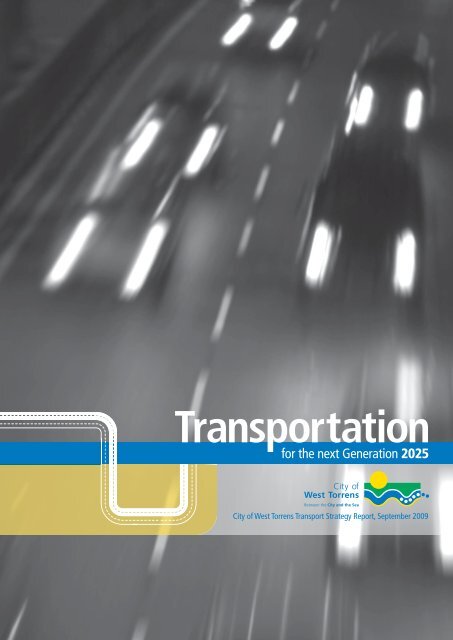
Transportation<br />
for the next Generation 2025<br />
<strong>City</strong> <strong>of</strong> <strong>West</strong> <strong>Torrens</strong> Transport Strategy Report, September 2009
<strong>City</strong> <strong>of</strong> <strong>West</strong> <strong>Torrens</strong><br />
165 Sir Donald Bradman<br />
Drive, Hilton <strong>SA</strong> 5033<br />
Telephone: (08) 8416 6333<br />
Facsimile: (08) 8443 5709<br />
Email: csu@wtcc.sa.gov.<strong>au</strong><br />
Website www.wtcc.sa.gov.<strong>au</strong><br />
Project staff<br />
Authors<br />
Angelo Catinari<br />
Manager <strong>City</strong> Assets<br />
Frank Siow<br />
Traffic Consultant<br />
Publisher<br />
Boylen Media<br />
Level 3, 47 South Tce,<br />
Adelaide, <strong>SA</strong>, 5000<br />
Telephone: 8233 9433<br />
Facsimile: 8212 6484<br />
Website: www.boylen.com.<strong>au</strong><br />
2 <strong>City</strong> <strong>of</strong> <strong>West</strong> <strong>Torrens</strong> | Transportation for the Next Generation
‘ This strategy will<br />
guide us on how we<br />
can best meet our<br />
city’s needs during<br />
the next 20 years.’<br />
- Hon John Trainer, Mayor <strong>City</strong> <strong>of</strong> <strong>West</strong> <strong>Torrens</strong>
Contents<br />
Executive Summary 7<br />
Part 1 Overview 11<br />
1.0 Future Vision 13<br />
2.0 The Transport Study 15<br />
3.0 The <strong>City</strong> Pr<strong>of</strong>i le 17<br />
4.0 Transport Mode and Employment 19<br />
5.0 Other Policy Framework 21<br />
5.1 Federal Framework 22<br />
5.1.1 Local <strong>Gov</strong>ernment Roads<br />
and Transport Strategy 2006-2016 ALGA 22<br />
5.2 State Framework 22<br />
5.2.1 Draft Planning Strategy for Metropolitan Adelaide 22<br />
5.2.2 Infrastructure Plan For South Australia 22<br />
5.2.3 Adelaide Airport Limited Master Plan 22<br />
5.2.4 Metropolitan Local <strong>Gov</strong>ernment<br />
Transport Strategy August 2005 22<br />
5.3 Council Framework 23<br />
5.3.1 <strong>City</strong> Of <strong>West</strong> <strong>Torrens</strong> Community<br />
Plan 2004 - 2009 23<br />
5.3.2 <strong>City</strong> Of <strong>West</strong> <strong>Torrens</strong> Section 30<br />
Development Plan Review 24<br />
5.3.3 <strong>City</strong> Of <strong>West</strong> <strong>Torrens</strong> Asset Management Policy 24<br />
6.0 State Of The DTEI Transport Network 25<br />
6.1 National Transport Network And The Adelaide<br />
Urban<br />
Corridors Strategy 26<br />
6.2 <strong>City</strong> <strong>West</strong> Bypass 28<br />
6.3 Bakewell Bridge Replacement 28<br />
6.4 South Road Underpass 28<br />
6.5 Other DTEI Projects 29<br />
6.6 Adelaide Airport Master Plan 29<br />
7.0 Key Issues For The DTEI Transport Network 35<br />
8.0 Freight 38<br />
9.0 Pedestrians And Bicycles 44<br />
9.1 Pedestrians 45<br />
9.2 Bicycles 45<br />
10.0 Public Transport 47<br />
11.0 Travel Demand Management 51<br />
4 <strong>City</strong> <strong>of</strong> <strong>West</strong> <strong>Torrens</strong> | Transportation for the Next Generation
12.0 Local Road Network 55<br />
12.1 Road Hierarchy 56<br />
12.2 Local Network Issues 57<br />
12.3 Crash Data 60<br />
12.4 Monitoring Of Data 61<br />
Part 2 Traffic Management 65<br />
1.0 Introduction 67<br />
2.0 Objectives And Setting Criteria 69<br />
2.1 The Need For And The Process For<br />
A LATM Study 70<br />
2.2 The Need For A Warrant-Based Priority<br />
System For LATM Studies 70<br />
2.3 How To Address Traffi c Issues Raised 81<br />
2.4 Setting A Criteria To Help Address<br />
Traffi c Issues 81<br />
3.0 LATM Experience 84<br />
4.0 Guidelines On Use Of Traffi c<br />
Control Devices 86<br />
5.0 Templates For Addressing<br />
Traffi c Issues 92<br />
Part 3 Parking Management 990<br />
1.0 Introduction 101<br />
2.0 Objectives And Setting Criteria 103<br />
3.0 Guidelines For Parking Management 106<br />
4.0 Overview Of Current Parking Issues 108<br />
5.0 Overview Of Future Parking<br />
Characteristics 111<br />
6.0 Overview Of Possible Parking Actions 114<br />
6.1 Use Of Relevant Standards 115<br />
6.2 Development Plan 115<br />
6.3 Key Parking Reviews 115<br />
7.0 Other Possible Parking Considerations 118<br />
7.1 Parking Meters 119<br />
7.2 Adelaide Airport Developments 119<br />
7.3 Private Parking Areas Act 119<br />
7.4 Off-Street Car Park Consolidation 119<br />
8.0 How Parking Controls Are Implemented 121<br />
8.1 Current Practice – Single Street Issue 122<br />
8.2 Strategic Level Consideration 122<br />
List Of References 125<br />
Transportation for the Next Generation | <strong>City</strong> <strong>of</strong> <strong>West</strong> <strong>Torrens</strong> 5
Executive Summary
‘ The Transport Strategy<br />
considers the future<br />
traffic and parking<br />
demands in the arterial<br />
and local road networks<br />
over the next 20 years.’<br />
- General Manager, Urban Services, <strong>City</strong> <strong>of</strong> <strong>West</strong> <strong>Torrens</strong>
Executive Summary<br />
The <strong>City</strong> <strong>of</strong> <strong>West</strong> <strong>Torrens</strong> is<br />
experiencing significant growth in<br />
traffic through a combination <strong>of</strong> new<br />
developments, its location in close<br />
proximity to the CBD, its proximity<br />
to the coast and major transport<br />
hubs. Increasing congestion in the<br />
arterial road network, due to capacity<br />
constraints at critical intersections<br />
and increasing use <strong>of</strong> local streets<br />
by through traffic to bypass these<br />
congested roads, require strategies to<br />
be put in place to address these issues.<br />
Increasing urban consolidation through<br />
in-fill developments, regeneration<br />
<strong>of</strong> existing large industrial areas and<br />
current/future significant developments<br />
at the Adelaide Airport have also<br />
contributed to concerns about parking<br />
availability issues on the road network.<br />
The Transport Strategy considers the<br />
future traffic and parking demands on<br />
the arterial and local road networks<br />
over the next 20 years and importantly,<br />
it identifies strategies that the <strong>City</strong><br />
could implement to maintain good<br />
accessibility, provide a safe road<br />
network, maintain a high level <strong>of</strong><br />
amenity for residents and a high level<br />
<strong>of</strong> parking opportunity throughout the<br />
<strong>City</strong>.<br />
The Transport Strategy provides<br />
strategies in a number <strong>of</strong> key areas:<br />
• DTEI Road Network<br />
• Managing freight impacts<br />
• Pedestrian and Cycling Plans<br />
• Public Transport<br />
• Travel Demand Management<br />
• Local Road Network<br />
• Crash identification and action<br />
• Monitoring <strong>of</strong> traffic patterns<br />
• Traffic management<br />
• Parking management<br />
The Transport Strategy is being<br />
developed in conjunction with the<br />
<strong>City</strong>’s Section 30 Development Plan<br />
Review. The inclusion <strong>of</strong> relevant<br />
and appropriate policies in the<br />
Development Plan will help achieve<br />
some <strong>of</strong> the outcomes sought by the<br />
Transport Strategy.<br />
<strong>City</strong> <strong>of</strong> <strong>West</strong> <strong>Torrens</strong> | Executive Summary 9
Part One<br />
Overview
1.0<br />
Future Vision
1.0<br />
Future Vision<br />
The vision for the <strong>City</strong> <strong>of</strong> <strong>West</strong> <strong>Torrens</strong> is:<br />
‘ <strong>West</strong> <strong>Torrens</strong> –<br />
Committed to being<br />
the best place to live,<br />
work and enjoy life.’<br />
14<br />
Part 1 - Overview | Future Vision
2.0<br />
The Transport Study
2.0<br />
The Transport Study<br />
The <strong>City</strong> <strong>of</strong> <strong>West</strong> <strong>Torrens</strong> is a diverse<br />
Council located between the Central<br />
Business District (CBD) <strong>of</strong> Adelaide<br />
and the coast. Its proximity to the CBD<br />
and the coast results in a range <strong>of</strong><br />
transport opportunities, in particular<br />
for commuting and recreation. This<br />
proximity to the CBD also means that<br />
the Council road network is subject<br />
to intrusion <strong>of</strong> through traffic and the<br />
significant merging <strong>of</strong> traffic flows<br />
from the south, north and west on the<br />
approaches to the CBD.<br />
In addition to these road network<br />
issues, increasing developments and<br />
rejuvenation <strong>of</strong> existing residential and<br />
non-residential zones in the <strong>City</strong> have<br />
further added to the transport demands.<br />
One <strong>of</strong> the largest landowners in the<br />
<strong>City</strong> is Adelaide Airport. It occupies<br />
approximately 20% <strong>of</strong> the total land<br />
area in the <strong>City</strong>, but importantly, the<br />
significant developments that have<br />
occurred and continuing to occur within<br />
the Airport boundaries feed significant<br />
new volumes <strong>of</strong> traffic to the abutting<br />
road system.<br />
‘ The study reviews the<br />
transport needs in the<br />
<strong>City</strong>, to develop<br />
strategies to assist the<br />
<strong>City</strong> in managing traffic<br />
movements and parking<br />
needs, to plan and<br />
implement transport<br />
strategies to meet the<br />
<strong>City</strong>’s needs over the<br />
next 20 years.’<br />
The objectives <strong>of</strong> the Transport<br />
Study are:<br />
• Review the existing transport<br />
conditions in the <strong>City</strong>, including<br />
traffic demands, parking demands<br />
and pedestrian/cycling demands.<br />
• Review the future transport demands<br />
having regard to changes within the<br />
<strong>City</strong> from development opportunities,<br />
land use changes and other external<br />
transport demands that may have<br />
an influence in the <strong>City</strong>.<br />
• Develop a road hierarchy that is<br />
appropriate to meet the needs <strong>of</strong><br />
the <strong>City</strong>, having regard to the needs<br />
<strong>of</strong> residents, businesses<br />
and industries.<br />
• Review the process <strong>of</strong> traffic<br />
management and develop an<br />
appropriate strategy to guide<br />
the <strong>City</strong> in addressing concerns<br />
regarding traffic flows, intrusion <strong>of</strong><br />
through traffic, speeds and use <strong>of</strong><br />
traffic control devices.<br />
• Review the process <strong>of</strong> parking<br />
management and develop an<br />
appropriate strategy to guide<br />
the <strong>City</strong> in addressing the<br />
issues <strong>of</strong> parking supply and<br />
demand, having regard to the<br />
needs <strong>of</strong> residents, businesses<br />
and industries, the use <strong>of</strong><br />
kerb space and the increasing<br />
parking demands generated by<br />
developments throughout the <strong>City</strong>.<br />
The primary objective <strong>of</strong> this report<br />
is to develop a series <strong>of</strong> polices that<br />
would guide the Administration on<br />
the implementation <strong>of</strong> traffic and<br />
parking actions.<br />
16<br />
Part 1 - Overview | The Transport Study
3.0<br />
The <strong>City</strong> Pr<strong>of</strong>ile
3.0<br />
The <strong>City</strong> Pr<strong>of</strong>ile<br />
The <strong>City</strong> <strong>of</strong> <strong>West</strong> <strong>Torrens</strong> is located<br />
immediately west <strong>of</strong> the Central<br />
Business District (CBD). It is bounded by<br />
the River <strong>Torrens</strong>, <strong>City</strong> <strong>of</strong> Charles Sturt<br />
to the north and Cities <strong>of</strong> Holdfast Bay,<br />
Marion and Unley along its southern<br />
boundary. The eastern boundary is the<br />
western edge <strong>of</strong> the <strong>City</strong> <strong>of</strong> Adelaide<br />
Parklands. The western boundary<br />
includes a strip <strong>of</strong> coastal land which<br />
abuts the Gulf <strong>of</strong> St Vincent.<br />
The <strong>City</strong> covers an area <strong>of</strong> 36 square<br />
kilometres. It has a population <strong>of</strong><br />
50,416 (Census 2001). It is envisaged<br />
that the Census data will be updated<br />
in later versions <strong>of</strong> the report.<br />
For more detailed analysis <strong>of</strong> the<br />
demographics <strong>of</strong> the <strong>City</strong> <strong>of</strong> <strong>West</strong><br />
<strong>Torrens</strong>, refer to The future <strong>of</strong> <strong>West</strong><br />
<strong>Torrens</strong> Section 30 Development Plan<br />
Review Issues Paper.<br />
Figure 1 shows the location map <strong>of</strong> the <strong>City</strong>.<br />
The major land uses as a percentage<br />
<strong>of</strong> the total land area in the <strong>City</strong> are as<br />
follows:<br />
• Residential - 40%<br />
• Commercial/Industrial - 22.5%<br />
• Adelaide Airport – 20%<br />
• Other uses – 17.5%<br />
‘ Overall there has been a<br />
general trend <strong>of</strong> increasing<br />
dwelling approvals. This<br />
highlights the potential<br />
for a significant increase in<br />
housing stock through in-fill<br />
development.’<br />
The primary shopping centres are<br />
located in Kurralta Park, <strong>Torrens</strong>ville<br />
and Hilton. Commercial developments<br />
are generally located along the main<br />
arterial roads.<br />
The areas experiencing greatest<br />
changes are the Adelaide Airport, the<br />
industrial zones in particular around<br />
Thebarton and Mile End, and in-fill<br />
residential developments.<br />
The <strong>West</strong> <strong>Torrens</strong> Community Pr<strong>of</strong>ile<br />
identifies that overall there has<br />
been a general trend <strong>of</strong> increasing<br />
dwelling approvals rising from 214<br />
in 1998-99 to 291 in 2004-2005.<br />
Approximately 64% <strong>of</strong> the <strong>City</strong>’s<br />
housing stock is detached dwellings on<br />
individual allotments. This highlights<br />
the potential for a significant<br />
increase in housing stock through<br />
in-fill development, such as detached<br />
dwellings being replaced by two and<br />
sometimes three new dwellings.<br />
Source <strong>of</strong> the above Information:<br />
The future <strong>of</strong> <strong>West</strong> <strong>Torrens</strong> Section 30<br />
Development Plan Review Issues Paper.<br />
Figure 1<br />
18<br />
Part 1 - Overview | The <strong>City</strong> Pr<strong>of</strong>ile
4.0<br />
Transport Mode and Employment
4.0<br />
Transport Mode and Employment<br />
In Adelaide, public transport carries<br />
an estimated 10% <strong>of</strong> passenger travel<br />
during peak hours and only 5% <strong>of</strong> all<br />
weekday travel (peak and <strong>of</strong>f-peak). South<br />
Australia’s Strategic Plan identifies a target<br />
to double the use <strong>of</strong> public transport to<br />
10% <strong>of</strong> weekday travel by 2018*.<br />
Within metropolitan Adelaide,<br />
approximately 3.5 million trips are<br />
made each day <strong>of</strong> which 2.7 million<br />
are made by car, 160,000 by public<br />
transport and the remainder by<br />
walking, cycling or other means. Travel<br />
on weekends has been rising with an<br />
average <strong>of</strong> 3.4 million trips*.<br />
*Source <strong>of</strong> information: Adelaide Urban<br />
Corridors Strategy 2006 DTRS and DTEI.<br />
‘ In the <strong>City</strong> <strong>of</strong> <strong>West</strong> <strong>Torrens</strong>,<br />
67 per cent <strong>of</strong> people use a<br />
car to travel to work, 8.1 per<br />
cent use public transport and<br />
4.7 per cent walk or cycle.’<br />
The ABS Census 2001 data shows that<br />
in the <strong>City</strong> <strong>of</strong> <strong>West</strong> <strong>Torrens</strong>, 67% <strong>of</strong><br />
people use a car as their only means<br />
<strong>of</strong> travel to work, 8.1% use public<br />
transport and 4.7% walk or cycle.<br />
The journey to work data for 2001 for<br />
the <strong>City</strong> <strong>of</strong> <strong>West</strong> <strong>Torrens</strong> shows that<br />
24.4% <strong>of</strong> the employed residents <strong>of</strong> the<br />
<strong>City</strong> worked within the Council area.<br />
Of those residents who worked outside<br />
<strong>of</strong> the Council area, the two major areas<br />
are within the <strong>City</strong> <strong>of</strong> Adelaide (24.7%<br />
<strong>of</strong> the employed residents) and within<br />
the <strong>City</strong> <strong>of</strong> Charles Sturt (11.1%).<br />
Table 1 summarises the<br />
employment destinations for<br />
residents <strong>of</strong> the <strong>City</strong>.<br />
Top 10<br />
Percentage LGA Percentage<br />
Adelaide 24.7<br />
<strong>West</strong> <strong>Torrens</strong> 24.4<br />
Charles Sturt 11.1<br />
Port Adelaide Enfield 7.1<br />
Marion 5.0<br />
Unley 3.8<br />
Holdfast Bay 3.1<br />
Norwood Payneham 3.0<br />
St Peters<br />
Mitcham 2.6<br />
Burnside 1.9<br />
Source: ABS Census 2001<br />
Of the workforce within the <strong>City</strong> who<br />
reside outside <strong>of</strong> the <strong>City</strong>, the majority<br />
live within the <strong>City</strong> <strong>of</strong> Onkaparinga<br />
(13.3%), followed by the Cities <strong>of</strong><br />
Marion and Charles Sturt (10.0%).<br />
Table 2 shows the residence<br />
<strong>of</strong> the <strong>City</strong>’s workforce.<br />
Top 10<br />
Percentage LGA Percentage<br />
<strong>West</strong> <strong>Torrens</strong> 14.9<br />
Onkaparinga 13.3<br />
Marion 10.0<br />
Charles Sturt 10.0<br />
Port Adelaide Enfield 6.9<br />
Salisbury 6.5<br />
Tea Tree Gully 6.2<br />
Mitcham 5.8<br />
Holdfast Bay 4.0<br />
Unley 3.6<br />
Source: ABS Census 2001<br />
The Census data shows an influx<br />
<strong>of</strong> approximately 29,000 workers<br />
to the <strong>City</strong> from other LGAs, compared<br />
to approximately 16,000 residents<br />
<strong>of</strong> the <strong>City</strong> who leave the area to<br />
work elsewhere.<br />
Note: The above information is based on<br />
the Census 2001 data. This information<br />
would be updated in later stages <strong>of</strong> this<br />
report following an analysis <strong>of</strong> Census<br />
2006, recently made available by the<br />
Australian Bure<strong>au</strong> <strong>of</strong> Statistics.<br />
20<br />
Part 1 - Overview | Transport Mode and Employment
5.0<br />
Other Policy Framework
‘ Transport is critically<br />
important to the social,<br />
cultural and economic<br />
success <strong>of</strong> every Australian<br />
community.’<br />
There are a number <strong>of</strong> strategic plans<br />
and polices developed by the State<br />
<strong>Gov</strong>ernment with reference to the<br />
transport issues.<br />
Some <strong>of</strong> the key points <strong>of</strong> these<br />
strategies are summarised below.<br />
5.1 Federal Framework<br />
5.1.1 Local <strong>Gov</strong>ernment Roads and<br />
Transport Strategy 2006-2016 ALGA<br />
The Strategy acknowledges that<br />
transport is critically important to the<br />
social, cultural and economic success<br />
<strong>of</strong> every Australian community. The<br />
Strategy calls for forging transport<br />
partnerships between Federal and<br />
Local <strong>Gov</strong>ernments to deliver efficient,<br />
effective and equitable transport<br />
services and infrastructure, through<br />
the following key areas:<br />
• local road funding and management<br />
• urban transport solutions<br />
• mobility and access for regional<br />
Australians<br />
• freight management<br />
• long-term sustainability <strong>of</strong> local<br />
government.<br />
5.2 State Framework<br />
5.2.1 Draft Planning Strategy<br />
for Metropolitan Adelaide<br />
Growing Prosperity<br />
Land use and transport integration –<br />
character <strong>of</strong> transport routes;<br />
22<br />
Part 1 - Overview | Other Policy Framework<br />
access to public transport; equitable<br />
access to employment opportunities,<br />
service and facilities; a sustainable<br />
transport system that is integrated,<br />
coordinated, affordable, efficient and<br />
safe; importance <strong>of</strong> airports.<br />
Employment and business<br />
focus areas – planned employment<br />
areas across a range <strong>of</strong> industries<br />
with supporting infrastructure;<br />
export growth an important driver <strong>of</strong><br />
economic prosperity; access routes;<br />
opportunities for education and<br />
training; benefit<br />
<strong>of</strong> cluster.<br />
Industry – focus on export growth;<br />
ensure the appropriate supply <strong>of</strong><br />
serviced industrial land; industry<br />
clusters to warrant improved physical<br />
infrastructure and facilitate move<br />
towards more sustainable production<br />
processes; minimise interface issues.<br />
Commercial uses – preferably located<br />
within designated activity centres;<br />
functional and attractive commercial<br />
uses; safe traffic access.<br />
Tourism facilities – enhance tourism<br />
appeal; enhance connections between<br />
tourism assets, ready access for all; key<br />
gateway points eg Adelaide Airport<br />
and passenger routes; preserve history<br />
and heritage.<br />
Energy efficiency – energy-efficient<br />
design and layout <strong>of</strong> land and<br />
buildings; reducing the amount <strong>of</strong><br />
energy used for transport, eg promote<br />
walking and cycling.<br />
Building communities<br />
Activity centres – contain retail<br />
and commercial uses traditionally<br />
found in centres as well as a diverse<br />
range <strong>of</strong> other uses, including<br />
community facilities, <strong>of</strong>fices and<br />
residential development; play a key<br />
role in providing goods and services,<br />
employment and a cultural focus for<br />
the community; encouraging a mix <strong>of</strong><br />
uses; encouraging walking, cycling and<br />
the use <strong>of</strong> public transport; creating<br />
attractive, functional and vibrant<br />
activity centres.<br />
5.2.2 Strategic Infrastructure Plan<br />
for South Australia<br />
Invest in transport infrastructure<br />
• Develop and deepen Outer<br />
Harbour and substantially improve<br />
infrastructure at the port <strong>of</strong> Adelaide.<br />
• Improve the north-south transport<br />
corridor.<br />
• Develop and maintain regional<br />
freight networks.<br />
• Increase use <strong>of</strong> public transport.<br />
• Other major infrastructure works<br />
announced by the <strong>Gov</strong>ernment<br />
include the creation <strong>of</strong> a non-stop<br />
north-south corridor between the<br />
Southern Expressway and the Port<br />
River Expressway, public transport<br />
upgrades and the extension <strong>of</strong> the<br />
tram service from North Terrace<br />
to the Entertainment Centre and<br />
beyond.<br />
5.2.3 Adelaide Airport Limited<br />
Master Plan<br />
See Section 6.6<br />
5.2.4 Metropolitan Local<br />
<strong>Gov</strong>ernment Transport Strategy<br />
August 2005<br />
The Metropolitan Local <strong>Gov</strong>ernment<br />
Group (MLGG) provides a forum for<br />
metropolitan councils to develop<br />
decisions and progress actions through
5.0<br />
Other Policy Framework<br />
the Local <strong>Gov</strong>ernment Association on<br />
public policy matters <strong>of</strong> importance to<br />
them. All 18 metropolitan councils are<br />
members <strong>of</strong> the MLGG.<br />
‘ Whilst much <strong>of</strong> the strategic<br />
transport planning focus<br />
has been directed towards<br />
road networks, a new<br />
balance in the strategic<br />
transport focus must extend<br />
well beyond the road<br />
system alone.’<br />
– MLGTS study<br />
The Metropolitan Transport<br />
Strategy was developed in 2005.<br />
The Strategy is an area plan for the<br />
Metropolitan Local <strong>Gov</strong>ernment<br />
area with a particular focus on<br />
the local road network under the<br />
control <strong>of</strong> local councils and takes<br />
into account all modes <strong>of</strong> public and<br />
private transport.<br />
Some <strong>of</strong> the issues covered in the<br />
Strategy include:<br />
• role for local government<br />
• transport principles, strategic<br />
directions and policy options<br />
• integrate transport and land use and<br />
increase choices<br />
• good urban design and transport<br />
• integrated corridor planning<br />
• Travel Demand Management and<br />
Travel Behaviour Change<br />
• TravelSmart<br />
• review <strong>of</strong> road network classification<br />
framework<br />
• strategic directions for the Adelaide<br />
road network<br />
• future road network and<br />
performance<br />
• industry and freight transport<br />
• safety<br />
• public transport<br />
• bicycles.<br />
The Strategy details a whole range <strong>of</strong><br />
issues related to transport, including a<br />
comprehensive range <strong>of</strong> integrated<br />
transport planning options.<br />
“ Whilst much <strong>of</strong> the strategic<br />
transport planning focus has been<br />
directed towards road networks,<br />
a new balance in the strategic<br />
transport focus must extend well<br />
beyond the road system alone. The<br />
transport system as a whole must<br />
be safe and secure, economically<br />
efficient, environmentally sustainable,<br />
responsive to community needs, and<br />
socially equitable.”<br />
MLGTS study August 2005<br />
Integrated transport planning is largely<br />
about four things:<br />
• changing the focus from vehiclemovement<br />
to moving people and<br />
goods with more choice <strong>of</strong><br />
transport mode<br />
• taking full account <strong>of</strong> social,<br />
environmental and economic<br />
costs and benefits in planning and<br />
decision-making<br />
• making best use <strong>of</strong> finite resources<br />
for transport<br />
• creating environments where<br />
transport supports broader<br />
socio-economic goals, but does<br />
not dominate cities, town centres<br />
and suburbs.<br />
Source: <strong>City</strong> <strong>of</strong> Unley Integrated<br />
Transport Plan<br />
The new integrated transport<br />
planning approach from the MLGTS is<br />
summarised below:<br />
• commuting alternatives<br />
• work alternatives<br />
• parking management alternatives<br />
• support programs.<br />
5.3 Council Framework<br />
5.3.1 <strong>City</strong> <strong>of</strong> <strong>West</strong> <strong>Torrens</strong><br />
Community Plan 2004 - 2009<br />
Development Plan – Ensure Council’s<br />
planning and development policies<br />
are relevant and up-to-date via<br />
regular reviews and amendments as<br />
appropriate.<br />
Source: MLGTS study area<br />
Part 1 - Overview | Other Policy Framework 23
5.0<br />
Other Policy Framework<br />
Road Network – Council will<br />
implement a Pavement Management<br />
System as part <strong>of</strong> Council’s Corporate<br />
Asset Management System and<br />
develop an integrated 5-10 year<br />
Capital Works Program.<br />
Traffic Management – Council will<br />
develop an integrated city-wide traffic<br />
management plan that takes into<br />
account matters including, but not<br />
limited to, traffic management in and<br />
around the Airport.<br />
5.3.2 <strong>City</strong> <strong>of</strong> <strong>West</strong> <strong>Torrens</strong> Section<br />
30 Development Plan Review<br />
The September 2006 Issues Paper<br />
identifies future strategies that could<br />
be considered in relation to traffic and<br />
access issues.<br />
• Prepare a strategic traffic<br />
management framework for the <strong>City</strong><br />
which provides guidance on priority<br />
areas for traffic management.<br />
• Identify the critical routes and<br />
nodes within the <strong>City</strong>, and fund and<br />
implement measures to support the<br />
travel demands evident.<br />
• Identify, fund and implement<br />
innovative travel demand management<br />
approaches, such as transit lanes.<br />
• Identify, fund and implement<br />
infrastructure measures that will<br />
improve public transport usage.<br />
• Develop and implement a strategic<br />
framework for traffic management<br />
and the upgrading <strong>of</strong> main roads<br />
(DTEI responsibility), based on<br />
prioritising the areas requiring action.<br />
• Seek external funding opportunities<br />
to implement its action programs.<br />
• Seek protection for existing areas<br />
abutting the Airport, which may be<br />
impacted by new developments,<br />
24<br />
Part 1 - Overview | Other Policy Framework<br />
through traffic management<br />
measures and buffer protection.<br />
Policy options identified include:<br />
• Investigate transit-oriented<br />
development and activity centres.<br />
• Promote the construction <strong>of</strong><br />
pedestrian networks and cycle ways.<br />
• Review Commercial (Arterial)<br />
Zones in relation to appropriate land<br />
uses.<br />
• Protect residential areas from<br />
through traffic.<br />
• Address impacts arising from future<br />
Adelaide Airport development.<br />
• Review standards relating to bicycle<br />
and car parking.<br />
5.3.3 <strong>City</strong> <strong>of</strong> <strong>West</strong> <strong>Torrens</strong> Asset<br />
Management Policy<br />
In November 2006, the <strong>City</strong> <strong>of</strong> <strong>West</strong><br />
<strong>Torrens</strong> adopted an Asset Management<br />
Policy to guide how existing assets are<br />
managed, new assets acquired and an<br />
overall program for maintenance <strong>of</strong><br />
these assets.<br />
The assets include approximately 500<br />
kilometres <strong>of</strong> footpaths, 24 kilometres<br />
<strong>of</strong> shared use paths, approximately<br />
290 kilometres <strong>of</strong> local roads and 85<br />
kilometres <strong>of</strong> State <strong>Gov</strong>ernment kerb<br />
and gutter.<br />
The policy will enable the <strong>City</strong> to:<br />
• Identify fit for purpose levels <strong>of</strong><br />
service for each road asset.<br />
• Deliver desired levels <strong>of</strong><br />
service for users <strong>of</strong> Council’s<br />
road assets.<br />
• Introduce reasonable maintenance<br />
standards.<br />
• Reduce the life cycle costs <strong>of</strong><br />
maintaining its road assets.<br />
• Provide users with best utilisation<br />
opportunities.<br />
• Ensure that the current road asset<br />
holdings can be sustained in the<br />
future.<br />
• Justify acquisition <strong>of</strong> new road assets<br />
to stakeholders.<br />
• Reduce risks <strong>of</strong> road asset failures.
6.0<br />
State <strong>of</strong> the Department for Transport, Energy<br />
and Infrastructure (DTEI) Transport Network
Major routes traversing the <strong>City</strong> include<br />
South Road, Marion Road, Tapleys Hill<br />
Road, Anzac Highway, Henley Beach<br />
Road, Sir Donald Bradman Drive,<br />
Richmond Road and Cross Road. These<br />
roads are under the care and control <strong>of</strong><br />
the Department for Transport, Energy<br />
and Infrastructure (DTEI).<br />
The information on current congestion<br />
levels in this network is sourced from<br />
the Adelaide Urban Corridors Strategy<br />
report 2006 (DTRS and DTEI), DTEI<br />
major road projects and Adelaide<br />
Airport Limited (AAL) Access Study<br />
reports. Important parts <strong>of</strong> these<br />
reports are reproduced in this section.<br />
Level <strong>of</strong> Service (LOS) is an indicator <strong>of</strong><br />
road network performance based upon<br />
traffic congestion criteria outlined in<br />
the Austroads Capacity Guide to Traffic<br />
Engineering Practice - Roadway Capacity.<br />
LOS ranges from (A) – free flow<br />
conditions to (F) where traffic demand<br />
exceeds the capacity <strong>of</strong> the road and<br />
serious congestion results.<br />
DTEI’s general description <strong>of</strong> levels <strong>of</strong><br />
service in relation to volume/capacity<br />
ratio is as follows.<br />
LOS Degree <strong>of</strong> saturation<br />
A-B 0 to 0.5<br />
C 0.5 to 0.7<br />
D 0.7 to 0.85<br />
E 0.85 to 1.0<br />
F Over 1.0<br />
The degree <strong>of</strong> saturation is used to<br />
identify intersection performances in<br />
the following sections <strong>of</strong> the report.<br />
FIGURE 2 shows the key intersections<br />
and road corridors discussed in this<br />
section <strong>of</strong> the report.<br />
26<br />
Figure 2<br />
Part 1 - Overview | State <strong>of</strong> the DTEI Transport Network<br />
‘ The number <strong>of</strong> trips made<br />
during non-peak times is<br />
growing faster than peak<br />
travel and traffic congestion<br />
is becoming more common<br />
outside <strong>of</strong> the traditional<br />
peak periods across the<br />
entire road network.’<br />
6.1 National Transport<br />
Network and the Adelaide<br />
Urban Corridors Strategy<br />
National Transport Network is a major<br />
Australian <strong>Gov</strong>ernment initiative<br />
designed to improve planning, decisionmaking<br />
and funding for the national<br />
land transport infrastructure. A key<br />
component <strong>of</strong> the National Transport<br />
Network process is the development<br />
<strong>of</strong> a strategy for each corridor <strong>of</strong> the<br />
National Transport Network.<br />
The Adelaide Urban Corridors Strategy<br />
is based on the National Transport<br />
Network objectives:<br />
• Increase its infrastructure capacity and<br />
efficiency.<br />
• Improve its safety and security.<br />
• Improve transport productivity on<br />
its nationally strategic and exportoriented<br />
freight corridors.<br />
• Improve the reliability <strong>of</strong> travel on<br />
interstate and inter-regional corridors.<br />
• Are consistent with viable,<br />
long-term economic and social<br />
outcomes, and with obligation to<br />
current and future generations to<br />
sustain the environment.<br />
The Adelaide Urban Corridors routes in<br />
the <strong>City</strong> include:<br />
• South Road, between Grand Junction<br />
Road and Sir Donald Bradman Drive<br />
- part <strong>of</strong> National Transport Network<br />
corridor.<br />
• Sir Donald Bradman Drive, between<br />
South Road and Sir Richard Williams<br />
Avenue (Adelaide Airport entrance)<br />
- part <strong>of</strong> National Transport Network<br />
corridor.<br />
• South Road, between Sir Donald<br />
Bradman Drive and the Southern<br />
Expressway.
6.0<br />
State <strong>of</strong> the DTEI Transport Network<br />
Congestion levels on the Adelaide<br />
Urban Corridors<br />
Regular travel to or from work and<br />
school has increased in line with<br />
population growth. Other travel, such<br />
as for shopping, social and recreation<br />
purposes, has increased at a faster<br />
rate. As a result, the number <strong>of</strong><br />
trips made during non-peak times is<br />
growing faster than peak travel and<br />
traffic congestion is becoming more<br />
common outside <strong>of</strong> the traditional<br />
peak periods across the entire road<br />
network.<br />
• Population growth in Adelaide –<br />
from 1.2 million to 1.4 million.<br />
• Employment – changing nature<br />
<strong>of</strong> work.<br />
• Socio-economic impacts – decline <strong>of</strong><br />
the workforce.<br />
• Housing and built environment –<br />
smaller households.<br />
• Environmental impacts – concerns<br />
about environmental impacts <strong>of</strong><br />
transport activity.<br />
• Transport preferences –<br />
weekend trips rising, public<br />
transport usage to increase.<br />
• Industry – majority <strong>of</strong> new<br />
investment to be in the<br />
north and north-west <strong>of</strong><br />
Adelaide.<br />
• Freight – amount <strong>of</strong> freight<br />
Australia-wide is expected<br />
to double over the next<br />
20 years.<br />
The Adelaide Urban Corridors study<br />
has identified that for the worst peak<br />
hour (typical morning) volumes, the<br />
performance <strong>of</strong> 4 key intersections<br />
in the <strong>City</strong> <strong>of</strong> <strong>West</strong> <strong>Torrens</strong>, ie Sir<br />
Donald Bradman Drive/Marion Road,<br />
South Road/Sir Donald Bradman Drive,<br />
South Road/Henley Beach Road and<br />
South Road/Anzac Highway, are at or<br />
approaching capacity levels. See Fig. 3<br />
The study has found that the urban<br />
congestion in Adelaide has increased<br />
at a greater rate than travel demand<br />
over the last 10 years. Given that travel<br />
demand is predicted to increase by<br />
15% between 2001 and 2025, the<br />
scale <strong>of</strong> the congestion problem is<br />
expected to compound.<br />
‘ Travel demand is predicted<br />
to increase by 15 per cent<br />
between 2001 and 2025.’<br />
Foreseeable changes to 2025 in the<br />
Adelaide Urban Corridors Strategy<br />
The key drivers <strong>of</strong> future transport<br />
demand identified in the Adelaide<br />
Urban Corridors study include:<br />
Figure 3 Source: National Transport Network<br />
Part 1 - Overview | State <strong>of</strong> the DTEI Transport Network 27
• Planning policy – better land use<br />
and transport planning to reduce<br />
travel demands.<br />
The projects identified by <strong>Gov</strong>ernment<br />
to address some <strong>of</strong> the above issues<br />
include:<br />
• South Road Underpass.<br />
• Bakewell Bridge replacement.<br />
• 600m tunnel on South Road under<br />
Port Road, Grange Road and rail line.<br />
• Widening <strong>of</strong> South Road, between<br />
Port Road and <strong>Torrens</strong> Road.<br />
• TravelSmart and Green Travel Plans.<br />
• Expansion <strong>of</strong> walking and cycling<br />
facilities.<br />
Priorities <strong>of</strong> the Adelaide Urban<br />
Corridors Strategy<br />
The National Transport Network<br />
priorities applicable to the <strong>City</strong> <strong>of</strong> <strong>West</strong><br />
<strong>Torrens</strong> are:<br />
• Short term priorities (to 2015).<br />
• Make better use <strong>of</strong> existing road<br />
and rail infrastructure through a<br />
combination <strong>of</strong> targeted infrastructure<br />
enhancements (grade separation<br />
and road widening), improved traffic<br />
control, extended clearways and<br />
Intelligent Transport Systems.<br />
• Implement the long term<br />
development strategy for South<br />
Road given that it will fundamentally<br />
shape the traffic patterns and dictate<br />
investment patterns in central<br />
Adelaide.<br />
• Improve the efficiency <strong>of</strong> Sir Donald<br />
Bradman Drive in providing access to<br />
Adelaide Airport by way <strong>of</strong> targeted<br />
investment at key intersections.<br />
• Develop and implement a freight<br />
network strategy for the efficient<br />
movement <strong>of</strong> freight by road and rail.<br />
• Manage demand for travel by private<br />
car by a range <strong>of</strong> travel demand<br />
measures such as involving public<br />
transport, land use planning and<br />
parking controls.<br />
Long-term priorities (2015-2025)<br />
• Implement the South Road<br />
development strategy.<br />
28<br />
• Improve transport connections to<br />
intermodal terminals.<br />
• Upgrade alternative road transport<br />
routes.<br />
• Effectively integrate land use and<br />
transport planning.<br />
<strong>Recommendations</strong><br />
• Seek DTEI and State <strong>Gov</strong>ernment<br />
to implement upgrades <strong>of</strong><br />
critical intersection nodes in the<br />
DTEI transport network to ease<br />
congestion in the western region.<br />
• Support the State <strong>Gov</strong>ernment’s<br />
South Road development strategy.<br />
• Seek DTEI and State <strong>Gov</strong>ernment to<br />
upgrade alternative road transport<br />
routes to ease pressure and provide<br />
performance benefits for the<br />
National Transport Network, such<br />
as the upgrade <strong>of</strong> the Marion Road-<br />
Holbrooks Road alternative to South<br />
Road.<br />
• Support statewide measures that<br />
would impact on car use such as<br />
alternative modes <strong>of</strong> transport and<br />
increased use <strong>of</strong> public transport.<br />
• Amend land use planning policies,<br />
where appropriate, to manage travel<br />
demand through the Section 30<br />
Review Process and Plan Amendment<br />
review Process with Development<br />
Plan Amendment process.<br />
6.2 <strong>City</strong> <strong>West</strong> Bypass<br />
This project has recently been completed<br />
and links Port Road with South Road. It<br />
forms part <strong>of</strong> the extension <strong>of</strong> the inner<br />
ring route around the CBD.<br />
See fig 4<br />
Part 1 - Overview | State <strong>of</strong> the DTEI Transport Network<br />
The Home Maker centre adjacent<br />
to the <strong>City</strong> <strong>West</strong> Bypass is one <strong>of</strong> the<br />
largest bulky goods developments in<br />
the <strong>City</strong>. Increasing developments for<br />
large retail/showroom uses are also<br />
occurring in the area south <strong>of</strong> the<br />
Figure 4 <strong>City</strong> Ring Route<br />
Source: DTEI<br />
Home Maker centre. The <strong>City</strong> <strong>West</strong><br />
Bypass provides good access to this<br />
major retail area <strong>of</strong> the <strong>City</strong>.<br />
The Adelaide Urban Corridors Strategy has<br />
identified that the at-grade intersection <strong>of</strong><br />
South Road/<strong>City</strong> <strong>West</strong> bypass is currently<br />
at or approaching capacity levels.<br />
6.3 Bakewell Bridge replacement<br />
The road underpass on Henley Beach<br />
Road has on-road bicycle lanes included<br />
on both sides. Two bridges span the<br />
underpass, one <strong>of</strong> which will carry<br />
traffic along James Congdon Drive and<br />
East Terrace and the other bridge is for<br />
the railway line. The underpass was<br />
opened in January 2008.<br />
Immediately downstream <strong>of</strong> the<br />
underpass is the at-grade intersection<br />
<strong>of</strong> South Road/Henley Beach Road. The<br />
Adelaide Urban Corridors Strategy has<br />
identified that this intersection is currently<br />
at or approaching capacity levels.<br />
6.4 South Road underpass<br />
South Road is a key road in the<br />
metropolitan network and a key part <strong>of</strong><br />
the Outer DTEI <strong>City</strong> Ring Route network.
6.0<br />
State <strong>of</strong> the DTEI Transport Network<br />
The South Road underpass would<br />
provide improved traffic flows at one<br />
<strong>of</strong> the key intersections in Adelaide.<br />
The South Road underpass project is<br />
expected to be completed in 2009.<br />
Capacity calculations provided by<br />
Adelaide Connect (Project manager<br />
for the underpass) show the following<br />
degree <strong>of</strong> saturation <strong>of</strong><br />
the intersection:<br />
2006 AM peak performance<br />
(existing) 1.05*<br />
2008 AM peak performance<br />
(on opening) 0.75<br />
2026 AM peak performance<br />
(forecast) 0.98*<br />
*>0.85 denotes at or approaching<br />
capacity levels<br />
2006 PM peak performance<br />
(existing) 0.98*<br />
2008 PM peak performance<br />
(on opening) 0.57<br />
2026 PM peak performance<br />
(forecast) 0.77<br />
*>0.85 denotes at or approaching<br />
capacity levels<br />
The improvements to intersection<br />
performance at one <strong>of</strong> the critical<br />
intersections in the <strong>City</strong> will be<br />
significant, as a result <strong>of</strong> the<br />
underpass. As a result <strong>of</strong> the<br />
underpass. North and south <strong>of</strong> this<br />
intersection on South Road, the<br />
Adelaide Urban Corridors Strategy<br />
identified that the current at-grade<br />
intersections are operating at below<br />
the 0.85 levels.<br />
6.5 Other DTEI projects<br />
Marion Road – Holbrooks Road<br />
The link between Marion Road and<br />
Holbrooks Road will assist in improving<br />
the north-south traffic flows through<br />
the <strong>City</strong>. It is also an alternative<br />
transport route to South Road.<br />
However, it is understood that this DTEI<br />
project is <strong>of</strong> a lower priority due to the<br />
South Road project commitments.<br />
The key intersections that would<br />
benefit from this upgrade would<br />
be Henley Beach Road/Marion<br />
Road and Marion Road/Sir Donald<br />
Bradman Drive.<br />
Upgrade <strong>of</strong> tram crossings<br />
Recent changes to the tram signal<br />
operation in Morphett Road, south<br />
<strong>of</strong> Anzac Highway, have appeared<br />
to exacerbate congestion on<br />
the approaches to the adjacent<br />
intersection <strong>of</strong> Anzac Highway/<br />
Morphett Road.<br />
The issue <strong>of</strong> the tram crossing and<br />
delays to adjacent intersections is<br />
also applicable to Anzac Highway/<br />
Marion Road.<br />
Grade separation <strong>of</strong> the tram crossing<br />
at South Road is currently in progress.<br />
This would significantly improve traffic<br />
flows at the South Road corridor. The<br />
tram overpass project is expected to be<br />
completed in 2010.<br />
‘ Some <strong>of</strong> the developments<br />
around Adelaide Airport<br />
would generate significant<br />
amounts <strong>of</strong> new traffic to<br />
the main roads.’<br />
<strong>Recommendations</strong><br />
• Seek DTEI and State <strong>Gov</strong>ernment to<br />
upgrade alternative road transport<br />
routes to ease pressure and provide<br />
performance benefits for the<br />
National Transport Network, such as<br />
the upgrade <strong>of</strong> the Marion Road-<br />
Holbrooks Road alternative to South<br />
Road.<br />
• Support the upgrade <strong>of</strong> the tram<br />
crossing at South Road by the State<br />
<strong>Gov</strong>ernment.<br />
6.6 Adelaide Airport 2004<br />
Master Plan<br />
The Master Plan forecasts the<br />
passenger growth at the Adelaide<br />
Airport.<br />
Average growth p.a. Forecast<br />
International passengers 4.5%<br />
Domestic 3.5%<br />
Regional 3.8%<br />
Recent information by AAL shows that<br />
for 2006, the passenger growth rates<br />
were well in excess <strong>of</strong> the forecast.<br />
Total passengers Forecast<br />
2008 5.33 million<br />
2010 5.65 million<br />
2015 6.63 million<br />
2020 7.68 million<br />
2025 8.87 million<br />
Recent information by AAL shows<br />
that for 2005/06, the passenger<br />
number was 5.8 million and well<br />
ahead <strong>of</strong> forecast.<br />
In a recent announcement by AAL,<br />
further expansion <strong>of</strong> the terminal<br />
is being planned in view <strong>of</strong> the<br />
better than expected increase in<br />
air travel demand and the entry <strong>of</strong><br />
new airlines to South Australia.<br />
An assessment by Council <strong>of</strong> the key<br />
right turn movement from the Airport<br />
to the <strong>City</strong> <strong>of</strong> Adelaide direction<br />
showed that the afternoon peak hour<br />
Part 1 - Overview | State <strong>of</strong> the DTEI Transport Network 29
6.0<br />
State <strong>of</strong> the DTEI Transport Network<br />
traffic flow in 2006 was already close<br />
to the 2016 forecast in the Master Plan.<br />
An approximate breakdown <strong>of</strong> current<br />
trips to the Airport is as follows:<br />
Taxis 25%*<br />
Passenger vehicles 73%<br />
Commercial vehicles 2%**<br />
* source: Adelaide Airport Access Study<br />
Stages One, Two and Three<br />
** source: DTEI Nov 2006 data<br />
A further breakdown <strong>of</strong> the trips at the<br />
terminal is as follows:<br />
Terminal related 85%<br />
Commercial vehicles 2%<br />
Other land uses 13%<br />
The traffic volumes on the main<br />
transport routes would increase with<br />
the growth in passenger numbers.<br />
In addition, the Master Plan envisages<br />
significant development opportunities<br />
around the Airport. Some <strong>of</strong> the<br />
developments would generate<br />
significant amounts <strong>of</strong> new traffic to<br />
the main roads in the area including:<br />
Additional peak traffic<br />
(vehicles per hour)<br />
Burbridge Business Park<br />
Airport East/Morphett<br />
precinct<br />
Tapleys precincts<br />
30<br />
1900 vph<br />
850 vph<br />
2600 vph<br />
General descriptions <strong>of</strong> the use <strong>of</strong><br />
these precincts are as follows.<br />
Runways - predominantly a precinct<br />
for aircraft operations including<br />
aircraft landing, take <strong>of</strong>f and taxiing;<br />
infrastructure for navigation, radar and<br />
communications; air traffic control,<br />
aviation rescue services, fire fighting<br />
Part 1 - Overview | State <strong>of</strong> the DTEI Transport Network<br />
and meteorological services.<br />
Terminal – an area for the safe,<br />
efficient and economic handling <strong>of</strong><br />
aircraft, passengers and freight; in<br />
addition to retailing, business and<br />
hospitality activities that support the<br />
operation <strong>of</strong> the airport.<br />
Morphett – a mix <strong>of</strong> industrial,<br />
recreational and aviation related<br />
support industries.<br />
Burbridge – an area accommodating<br />
business, education, technology and<br />
research facilities in an <strong>of</strong>fice park-like<br />
setting; also allowing warehousing and<br />
storage activities.<br />
Tapleys – large scale retailing facilities<br />
including bulky goods, Brand Outlet<br />
Centre and associated smaller shops<br />
and support retailing.<br />
Airport East – an area for future<br />
aircraft maintenance facilities, aircraft<br />
hangars and ancillary aviation support<br />
services; also industrial, warehouse and<br />
distribution land uses.<br />
Recreation – a precinct comprising<br />
aged persons accommodation, open<br />
space and recreation.<br />
Some <strong>of</strong> the large scale developments<br />
that have taken place and those that<br />
are currently being planned for the<br />
near future are described below.<br />
‘ A number <strong>of</strong> options were<br />
discussed ... they included<br />
widening Sir Donald<br />
Bradman Drive to three lanes<br />
in the westbound direction.’<br />
These developments have and would<br />
significantly add to the traffic volumes<br />
on the main transport routes. FIGURE<br />
Figure 5 Adelaide Airport Policy Areas<br />
Source: AAL Master Plan<br />
5 identifies the Airport Master plan<br />
and the various policy areas for<br />
future developments.<br />
The information on intersection<br />
performances in this section is based<br />
on the AAL Access Study reports. The<br />
capacity analysis <strong>of</strong> the key intersections<br />
are summarised below. The capacity<br />
analysis is based on the existing<br />
layout <strong>of</strong> the affected intersection,<br />
the additional <strong>of</strong> new traffic from<br />
the Airport development and the<br />
progressive upgrade <strong>of</strong> each <strong>of</strong> the<br />
intersection (options) until Year 2021.<br />
New terminal and IKEA<br />
The IKEA store at the corner <strong>of</strong> Sir<br />
Donald Bradman Drive/Airport Road<br />
provides approximately 24,000m2 <strong>of</strong><br />
retail floor area and over 900 car parks.<br />
The Airport Terminal and internal road<br />
upgrades have resulted in changes to<br />
the road patterns within the Airport.<br />
A number <strong>of</strong> options were discussed in<br />
the AAL Access Study report to cater for<br />
the increased traffic volumes generated<br />
by the Airport site. They include<br />
widening <strong>of</strong> Sir Donald Bradman Drive<br />
to 3 lanes in the westbound direction,<br />
signal phasing alteration to a diamond<br />
overlap and a right turn overpass from<br />
Sir Richard Williams Avenue into Sir<br />
Donald Bradman Drive.
‘ The information<br />
on intersection<br />
performances in<br />
this section is based<br />
on the AAL Access<br />
Study reports.’
Sir Donald Bradman Drive/Airport Road/Sir Richard Williams Avenue<br />
Intersection performance – degree <strong>of</strong> saturation<br />
Weekday capacity analysis Year AM peak PM peak<br />
Existing layout Present 0.737 0.927<br />
3 westbound lanes provided Present 0.792 0.875<br />
3 westbound lanes provided 2011 0.909 0.936<br />
3 lanes both directions & phase change 2016 0.920 0.897<br />
Add 2 more right turn lanes 2021 0.902 0.920<br />
Sir Donald Bradman Dr overpass option 2021 0.918 0.825<br />
Right turn overpass option from Airport 2021 0.868 0.947<br />
IKEA/Sir Donald Bradman Drive<br />
Intersection performance – degree <strong>of</strong> saturation<br />
Weekday capacity analysis Year PM peak<br />
Existing layout Present 0.676<br />
Extend northbound lane 2011 0.825<br />
3 lanes both directions 2021 0.932<br />
*>0.85 denotes at or approaching capacity levels<br />
Adelaide Airport Tapleys North and South Precincts<br />
The development <strong>of</strong> the Tapleys North and South Precincts includes the retail hub <strong>of</strong> Harbour Town and further<br />
developments <strong>of</strong> other retail and fast food outlets. Traffic patterns have changed along Tapleys Hill Road, in particular<br />
with the signalisation <strong>of</strong> <strong>West</strong> Beach Road/Tapleys Hill Road.<br />
Tapleys Hill Road/<strong>West</strong> Beach Road<br />
Intersection performance – degree <strong>of</strong> saturation<br />
Weekday capacity analysis Year AM peak PM peak<br />
Existing layout Present 0.896 0.738<br />
Extend northbound lane 2011 0.859 0.845<br />
3 lanes both directions 2021 0.843 0.874<br />
*>0.85 denotes at or approaching capacity levels<br />
‘ Adelaide Airport’s Master Plan envisages a link between Morphett Road with Richmond Road.’<br />
Adelaide Airport Tapleys <strong>West</strong> Precinct<br />
AAL has advised <strong>of</strong> the future potential to develop this precinct into a recreational type use.<br />
Adelaide Airport Burbridge Precinct<br />
Development <strong>of</strong> the Burbridge Business Park precinct has commenced with warehouse/<strong>of</strong>fice type uses along the Sir<br />
Donald Bradman Drive frontage. The Business Park, when completed, would cater for over 100,000m2 <strong>of</strong> floor area for<br />
such uses. Traffic signals have been installed at the main access point to the Business Park on Sir Donald Bradman Drive.<br />
An additional left in left out access point has also been provided to service the site.<br />
32<br />
Part 1 - Overview | State <strong>of</strong> the DTEI Transport Network
6.0<br />
State <strong>of</strong> the DTEI Transport Network<br />
As a result <strong>of</strong> the above development, DTEI has reduced the previous speed limit <strong>of</strong> 70 kph to 60 kph. In addition, DTEI has<br />
advised that there is a proposal to implement on-road bicycle lanes along Sir Donald Bradman Drive, between Tapleys Hill<br />
Road and the IKEA traffic signals, in response to AAL developments along this road.<br />
Burbridge Business Park/Sir Donald Bradman Drive<br />
Intersection performance – degree <strong>of</strong> saturation<br />
Weekday capacity analysis Year AM peak PM peak<br />
Existing layout Present 0.498 0.706<br />
Existing layout 2011 0.578 0.838<br />
3 westbound lanes 2021 0.676 0.889<br />
*>0.85 denotes at or approaching capacity levels<br />
Adelaide Airport East Precinct<br />
The Airport East precinct has been earmarked for large scale developments <strong>of</strong> <strong>of</strong>fice/warehouse type uses. The Airport East<br />
precinct is the area abutting Transport Avenue, Morley Street and Richmond Road. The types <strong>of</strong> land uses envisaged would<br />
generate significant volumes <strong>of</strong> large vehicles, including semi trailers and potentially B Doubles.<br />
AAL is currently reviewing access options for the development <strong>of</strong> the Airport East and Morphett precincts.<br />
Marion Road/Richmond Road<br />
Intersection performance – degree <strong>of</strong> saturation<br />
Weekday capacity analysis Year PM peak<br />
Existing layout Present NA<br />
Existing layout 2011 1.083<br />
Upgraded layout – existing traffic 2011 0.890<br />
Upgraded layout + AAL new traffic 2011 0.913<br />
Further upgrade + AAL new traffic 2021 0.910<br />
*>0.85 denotes at or approaching capacity levels<br />
The Master Plan also envisages the linking <strong>of</strong> Morphett Road with Richmond Road.<br />
A road link between Richmond Road and the terminal, via Export Park, if feasible, would enable alternative access to the<br />
Airport from the south <strong>of</strong> Adelaide.<br />
Marion Road/Mooringe Avenue<br />
Intersection performance – degree <strong>of</strong> saturation<br />
Weekday capacity analysis Year AM peak PM peak<br />
Existing layout Present 0.857 0.760<br />
Upgrade extra lane + AAL new traffic Present 0.836 0.891<br />
*>0.85 denotes at or approaching capacity levels<br />
Adelaide Airport Morphett Precinct<br />
The Morphett Precinct has been earmarked for a recreation type development. This precinct extends a significant distance<br />
from the Tapleys Hill Road direction east towards the Airport East Precinct.<br />
AAL is currently undertaking consultation on its 2009 Master Plan for Adelaide Airport.<br />
Part 1 - Overview | State <strong>of</strong> the DTEI Transport Network 33
<strong>Recommendations</strong><br />
• Seek DTEI and State <strong>Gov</strong>ernment to implement upgrades <strong>of</strong> critical intersection<br />
nodes in the DTEI transport network to ease congestion in the western region.<br />
• Support the State <strong>Gov</strong>ernment’s South Road development strategy.<br />
• Seek DTEI and State <strong>Gov</strong>ernment to upgrade alternative road transport routes<br />
to ease pressure and provide performance benefits for the National Transport<br />
Network, such as the upgrade <strong>of</strong> the Marion Road-Holbrooks Road alternative<br />
to South Road.<br />
• Support statewide measures that would impact on car use such as alternative<br />
modes <strong>of</strong> transport and increased use <strong>of</strong> public transport.<br />
• Amend land use planning policies, where appropriate, to manage travel demand<br />
through the Section 30 Review Process and Plan Amendment Review Process<br />
with Development Plan Amendment process.<br />
• Support the upgrade <strong>of</strong> the tram crossing at South Road by the State<br />
<strong>Gov</strong>ernment.<br />
• Seek DTEI and State <strong>Gov</strong>ernment to undertake a comprehensive transport<br />
assessment <strong>of</strong> the road network within the western region <strong>of</strong> Council, taking<br />
into account the impacts from future Airport developments and the better than<br />
expected growth in passenger forecast compared to the original Master Plan.<br />
• Seek DTEI and State <strong>Gov</strong>ernment to review Tapleys Hill Road in view <strong>of</strong> the<br />
capacity issues that would arise from continuing development at the Airport’s<br />
Tapleys North and South Precincts.
7.0<br />
Key Issues for the DTEI Transport Network
7.0<br />
Key Issues for the DTEI Transport Network<br />
‘ Traffic congestion<br />
would remain to be <strong>of</strong><br />
issues <strong>of</strong> concern well<br />
into the future.’<br />
There are a number <strong>of</strong> factors that<br />
would influence the conditions <strong>of</strong> the<br />
main road network within the <strong>City</strong> <strong>of</strong><br />
<strong>West</strong> <strong>Torrens</strong>. They include:<br />
• Growth in travel demands from<br />
population increases including work<br />
trips, school trips and social trips,<br />
and freight demands.<br />
• Growth and investment in industries.<br />
• Developments within the <strong>City</strong> and<br />
from in-fill housing.<br />
• Developments at the Adelaide<br />
Airport.<br />
The information on capacity levels<br />
show that many <strong>of</strong> the major<br />
intersections within the <strong>City</strong> are<br />
operating at or approaching<br />
capacity. Even with major upgrades<br />
implemented, by 2021 and 2026,<br />
the forecast performance <strong>of</strong> major<br />
intersections would again be at or<br />
approaching capacity.<br />
The Adelaide Urban Corridors Strategy<br />
has identified that road congestion is<br />
the predominant issue for metropolitan<br />
Adelaide’s arterial road network. It<br />
noted that while a grid pattern <strong>of</strong><br />
arterial roads has served Adelaide well<br />
in providing local access and connectivity,<br />
the quantity <strong>of</strong> signalised intersections<br />
within the grid is undermining the<br />
performance <strong>of</strong> the system.<br />
This indicates that traffic congestion<br />
would remain to be <strong>of</strong> issues <strong>of</strong><br />
concern well into the future.<br />
The <strong>City</strong> <strong>of</strong> <strong>West</strong> <strong>Torrens</strong> supports<br />
the key strategies for the National<br />
Transport Network’s Adelaide<br />
Urban Corridors.<br />
The assessment highlights the need<br />
for short-term and long-term actions<br />
for the main road network, some <strong>of</strong><br />
which have been identified in previous<br />
studies by DTEI, by the National<br />
Transport Network study and based<br />
on the traffic demand foreseen by the<br />
<strong>City</strong>, including:<br />
• Continue to implement the South<br />
Road development strategy.<br />
• Upgrade alternative road transport<br />
routes to ease pressure and provide<br />
performance benefits for the<br />
National Transport Network. The<br />
upgrade <strong>of</strong> the Marion Road-<br />
Holbrooks Road alternative to South<br />
Road warrant urgent consideration.<br />
• Review <strong>of</strong> Tapleys Hill Road in view <strong>of</strong><br />
the capacity issues that would arise<br />
from continuing development at the<br />
Airport’s Tapleys North and South<br />
Precincts.<br />
• Measures that would impact on car<br />
use such as alternative modes <strong>of</strong><br />
transport and increased use <strong>of</strong><br />
public transport.<br />
• Land use planning policies to<br />
manage travel demand.<br />
The capacity constraints on the DTEI’s<br />
main road network would have<br />
implications on the Council’s local road<br />
network. This is already evident from<br />
the issues <strong>of</strong> through traffic on many<br />
local streets in the <strong>City</strong>.<br />
‘ Many <strong>of</strong> the major<br />
intersections within the<br />
city are operating at, or<br />
approaching, capacity.’<br />
36<br />
Part 1 - Overview | Key Issues for the DTEI Transport Network
<strong>Recommendations</strong><br />
• Seek DTEI and State <strong>Gov</strong>ernment to undertake a comprehensive transport<br />
assessment <strong>of</strong> the road network within the western region <strong>of</strong> Council, taking<br />
into account the impacts from future Airport developments.<br />
• Seek DTEI and State <strong>Gov</strong>ernment to implement upgrades <strong>of</strong> critical intersection<br />
nodes in the DTEI transport network to ease congestion in the western region.<br />
• Support the State <strong>Gov</strong>ernment’s South Road development strategy.<br />
• Support the upgrade <strong>of</strong> the tram crossing at South Road by the State<br />
<strong>Gov</strong>ernment.<br />
• Seek DTEI and State <strong>Gov</strong>ernment to upgrade alternative road transport routes<br />
to ease pressure and provide performance benefits for the National Transport<br />
Network, such as the upgrade <strong>of</strong> the Marion Road-Holbrooks Road alternative<br />
to South Road.<br />
• Seek DTEI and State <strong>Gov</strong>ernment to review Tapleys Hill Road in view <strong>of</strong> the<br />
capacity issues that would arise from continuing development at the Airport’s<br />
Tapleys North and South Precincts.<br />
• Support statewide measures that would impact on car use such as alternative<br />
modes <strong>of</strong> transport and increased use <strong>of</strong> public transport.<br />
• Amend land use planning policies, where appropriate, to manage travel demand<br />
through the Section 30 Review Process and Development Plan Amendment process.
8.0<br />
Freight
8.0<br />
Freight<br />
‘ Communities are<br />
increasingly aware <strong>of</strong><br />
the potential impacts <strong>of</strong><br />
freight operations, freight<br />
terminals, freight corridor<br />
traffic and inter-modal<br />
facilities. This reflects<br />
increased community<br />
involvement in issues<br />
concerning quality <strong>of</strong><br />
life, health, environment,<br />
amenity and safety.’<br />
MLGTS study August 2005<br />
Communities are increasingly aware<br />
<strong>of</strong> the potential impacts <strong>of</strong> freight<br />
operations, freight terminals, freight<br />
corridor traffic and inter-modal<br />
facilities. This reflects increased<br />
community involvement in issues<br />
concerning quality <strong>of</strong> life, health,<br />
environment, amenity and safety.<br />
As a consequence, the State<br />
<strong>Gov</strong>ernment’s approach to freight<br />
transport planning seeks to:<br />
• continue industrial development in<br />
designated regions close to major<br />
freight routes<br />
• discourage industrial development<br />
in residential areas and areas away<br />
from freight routes<br />
• encourage industry to relocate to<br />
industrial precincts to reduce land<br />
use conflicts<br />
• continue the partnership with local<br />
government and the freight transport<br />
industry to achieve an acceptable<br />
balance between community<br />
concerns and industry needs<br />
• develop a heavy vehicle restricted<br />
access plan to protect areas against<br />
truck access<br />
• upgrade arterial roads in major<br />
freight corridors to attract trucks from<br />
less suitable roads by developing<br />
inner and outer ring-roads, and<br />
upgrading roads to facilitate north<br />
south freight movement.<br />
Source: MLGTS study area<br />
Freight movements comprise the<br />
following:<br />
• Freight servicing local industries in<br />
the <strong>City</strong>.<br />
• Freight movements on a regional<br />
basis utilising some <strong>of</strong> the main<br />
roads in the <strong>City</strong>.<br />
• B Double access routes.<br />
• Controlled access buses.<br />
• Over-dimensional vehicles.<br />
The key freight routes comprise the<br />
DTEI main road network and local<br />
roads that service large industry zones<br />
with the <strong>City</strong>, including:<br />
• Ashwin Parade<br />
• Ashley Street (Ashwin Parade to<br />
Holbrooks Road)<br />
• Phillips Street<br />
• <strong>West</strong> Thebarton Road<br />
• Grove Avenue<br />
• Galway Avenue<br />
• Mooringe Avenue<br />
• James Melrose Road<br />
• Morphett Road<br />
• London Road<br />
• Manchester Street<br />
• Scotland Road<br />
•Richmond Road<br />
In addition to the above freightgenerating<br />
land uses, the Adelaide<br />
Airport is also a major freight<br />
generating site, particularly with the<br />
Burbidge Business Park development,<br />
which would house large industries,<br />
and the terminal itself with major<br />
fuel deliveries.<br />
Regulatory Overview<br />
The South Australian Road Traffic<br />
Act and Regulations recognise<br />
the significant differences across<br />
the road network in standard and<br />
use. It therefore accommodates<br />
the operational requirements <strong>of</strong> the<br />
various vehicle types and supports the<br />
role <strong>of</strong> <strong>Gov</strong>ernment in providing the<br />
most appropriate road system possible<br />
within its existing and long-term<br />
financial strategies.<br />
Heavy vehicle operations are divided<br />
into three categories. These are:<br />
• General Access<br />
• Restricted Access by Gazette Notice<br />
• Restricted Access by Permit<br />
General Access<br />
Heavy vehicles in this category are<br />
permitted access to all roads in South<br />
Australia subject to any local road or<br />
bridge restriction.<br />
Maximum limits for General Access are:<br />
Gross Mass<br />
Width<br />
Height<br />
Length<br />
42.5 tonne<br />
2.5 metre<br />
wz 4.3 metre<br />
19.0 metre<br />
The common six-axle articulated<br />
vehicle (semi-trailer) equates to the<br />
above limits.<br />
Council’s Previous B Double<br />
Working Party <strong>Recommendations</strong><br />
Following a detailed assessment <strong>of</strong><br />
potential B Double routes in the <strong>City</strong><br />
by a Working Party <strong>of</strong> Council, which<br />
also included representatives <strong>of</strong> DTEI<br />
Part 1 - Overview | Freight 39
and the South Australia Police, 6 Council<br />
roads were nominated and approved for<br />
DTEI for B Double gazettal:<br />
• Ashwin Parade<br />
• Richmond Road<br />
• London Road<br />
• Scotland Road (part)<br />
• Manchester Road (part)<br />
• Smith Street (part)<br />
The above roads have been<br />
incorporated for a number <strong>of</strong> years<br />
by DTEI into the gazetted B Double<br />
network which does note require<br />
permits to operate on by B Doubles<br />
(refer to FIGURE 6).<br />
The <strong>City</strong> has also approved B Double<br />
access on a number <strong>of</strong> other local roads<br />
by annual permit. Each application for<br />
B Double access is assessed on merit<br />
before approval is given.<br />
DTEI’s Heavy Vehicle Access<br />
Framework<br />
The source <strong>of</strong> the following<br />
information on restricted access<br />
vehicles is from the report, Heavy<br />
Vehicle Access Framework (HVAF)<br />
Version 1 report July 2006 by DTEI.<br />
The HVAF has been developed to<br />
provide industry with the necessary<br />
guidelines for sustainable long-term<br />
planning and transport operations. The<br />
HVAF provides the policy and direction<br />
for meeting the main objectives <strong>of</strong><br />
South Australia’s Strategic Plan for<br />
heavy vehicle operation.<br />
Restricted Access by Gazette Notice<br />
Restricted Access Vehicles (RAVs) can<br />
only operate on approved routes due<br />
to their large size and mass.<br />
It is recognised that transport efficiency<br />
40<br />
Part 1 - Overview | Freight<br />
can be improved by the use <strong>of</strong> larger<br />
vehicles with greater carrying capacity.<br />
South Australia has adopted the<br />
Restricted Access Vehicle concept<br />
within State legislation to make the<br />
most efficient use <strong>of</strong> the existing road<br />
network infrastructure.<br />
As some RAV types, such as Road<br />
Trains and B-Doubles, are built to a<br />
common design and configuration,<br />
their construction specifications<br />
and general rules <strong>of</strong> operation are<br />
specified in the Road Traffic Act and<br />
related Regulations.<br />
Due to their size and mass, these<br />
RAVs are only permitted to travel on<br />
routes approved as safe and suitable in<br />
accordance with nationally consistent<br />
road assessment standards.<br />
Controlled Access Buses for<br />
carrying passengers are also included<br />
in this category.<br />
RAVs can only operate legally in South<br />
Australia in accordance with specified<br />
conditions and on approved routes<br />
either by Gazette Notice or Permit.<br />
Another category <strong>of</strong> RAV is Special<br />
Purpose Vehicles (SPVs). These vehicles<br />
are designed and built to undertake<br />
specific tasks and functions generally<br />
as machines on wheels not as freight<br />
carrying vehicles. Typical SPVs are<br />
front-end loaders, fork-lifts, mobile<br />
cranes and grain-harvesting machines.<br />
Due to their unique design, SPVs,<br />
in many cases, do not comply with<br />
vehicle standards or the general access<br />
width, height, length or axle mass<br />
limits. Consequently, they operate<br />
under strict conditions such as daylight<br />
travel only and no travel during peak<br />
periods in urban areas.<br />
In recent times, the <strong>Gov</strong>ernment has<br />
also allowed by regulation the use <strong>of</strong><br />
14.4m long buses on the main road<br />
network. The current regulation for<br />
rigid vehicles specifies a maximum<br />
length <strong>of</strong> 12.5m for such a vehicle.<br />
However, in view <strong>of</strong> disabled access<br />
requirements, many passenger buses<br />
now have to increase in length from<br />
12.5m to 14.4m to accommodate<br />
the disabled access requirements. As<br />
a consequence, the <strong>Gov</strong>ernment has<br />
had to gazette the use <strong>of</strong> 14.4m buses<br />
as a matter <strong>of</strong> urgency.<br />
At this stage, the <strong>City</strong> has not<br />
<strong>au</strong>thorised the use <strong>of</strong> 14.4m<br />
buses on local roads controlled by<br />
the Council and which form part <strong>of</strong><br />
a regular bus route. This is due to<br />
concern about existing traffic control<br />
devices and local intersections not<br />
being able to accommodate the<br />
longer-length buses and the changes<br />
that may be required for bus stops<br />
and bus bay locations. A few specific<br />
routes (to bus company depots) have<br />
been supported and approved by the<br />
<strong>City</strong> and these were based on merit<br />
and detailed assessment by DTEI,<br />
which demonstrated that the local<br />
roads used for access did not<br />
require alterations.<br />
Strategic Approach to classify<br />
freight networks<br />
A detailed response from the <strong>City</strong><br />
<strong>of</strong> <strong>West</strong> <strong>Torrens</strong> on the HVAF report<br />
was prepared in September 2005.<br />
This Council Agenda report and<br />
the minutes adopted have been
8.0<br />
Freight<br />
reproduced in this section <strong>of</strong><br />
the report.<br />
The strategic approach classifies the<br />
road freight network into 3 categories:<br />
Key Freight Routes (primarily arterial<br />
roads and national highways), Local<br />
Freight Routes (eg Ashwin Parade) and<br />
Commodity Freight Routes (usually<br />
seasonal transport eg wine and grain,<br />
which is not relevant for the <strong>City</strong> <strong>of</strong><br />
<strong>West</strong> <strong>Torrens</strong>).<br />
The HVAF also refers to Higher<br />
Mass Limits, which are vehicles that<br />
could exceed the general mass limit,<br />
provided these vehicles are fitted with<br />
road friendly suspension. However, the<br />
current <strong>au</strong>thorised routes for Higher<br />
Mass Limits vehicles do not include any<br />
Council-controlled roads and Council<br />
has no plans to <strong>au</strong>thorise such routes.<br />
‘ The concept <strong>of</strong> a user-pay<br />
system for upgrade <strong>of</strong><br />
routes to accommodate<br />
certain types <strong>of</strong> freight<br />
vehicles is supported.’<br />
The HVAF refers to a new Performance<br />
Based Standards (PBS) system for<br />
assessing freight networks. However, as<br />
the PBS system is still being developed<br />
by the National Transport Commission,<br />
details <strong>of</strong> this system and its<br />
implications are sketchy at this stage.<br />
The PBS system is supposed to be a<br />
more innovative approach to improve<br />
transport efficiency and productivity.<br />
The HVAF states that “it is not<br />
uncommon for private industry to<br />
contribute towards the funding and<br />
development <strong>of</strong> specific roads where<br />
there is an economic benefit”. An<br />
example in the <strong>City</strong> <strong>of</strong> <strong>West</strong> <strong>Torrens</strong><br />
was Cochrane Transport contributing<br />
towards the widening <strong>of</strong> the Ashwin<br />
Parade/Jervois Street intersection.<br />
This principle, ie a user-pay system,<br />
is supported, although the longterm<br />
maintenance cost is not usually<br />
factored in by Council at present.<br />
The HVAF refers to voluntary<br />
compliance, pro-active approach to<br />
compliance and on-road enforcement<br />
to ensure compliance with the laws,<br />
rules and regulations. In the <strong>City</strong><br />
<strong>of</strong> <strong>West</strong> <strong>Torrens</strong> experience, police<br />
enforcement is regularly sought to<br />
address this problem. The voluntary<br />
and pro-active approach is therefore<br />
considered to be <strong>of</strong> limited value.<br />
Restricted Access by Permit<br />
Permits are also issued by DTEI for<br />
transport operators using local Council<br />
roads, subject to approval from the Local<br />
<strong>Gov</strong>ernment Authority. These permits<br />
are usually <strong>of</strong> a yearly renewal basis.<br />
A number <strong>of</strong> these permits have been<br />
approved by the <strong>City</strong> <strong>of</strong> <strong>West</strong> <strong>Torrens</strong><br />
over the past few years.<br />
Refer to Figure 6 and 7.<br />
The following resolutions were<br />
previously adopted by the <strong>City</strong> <strong>of</strong> <strong>West</strong><br />
<strong>Torrens</strong> in response to the HVAF:<br />
• There have been previous errors<br />
noted in the current B Double map<br />
for Manchester Street and London<br />
Road. Both roads have a bridge load<br />
limit located near the South Road<br />
end. The DTEI map does not clearly<br />
identify this constraint. The map<br />
should be corrected accordingly.<br />
• Currently, for B Double access for<br />
roads that are not gazetted in the<br />
DTEI map, specific approval has to<br />
be obtained from Council. Before<br />
any permits are issued to the<br />
transport operator by DTEI Permits<br />
Section, a concurrence letter has<br />
to be obtained from Council, with<br />
specified conditions for the B Double<br />
access. There have been instances<br />
where DTEI has issued more permits<br />
than what Council had agreed to.<br />
This non-compliance with Council’s<br />
requirement should be addressed<br />
Figure 6<br />
Figure 7<br />
Part 1 - Overview | Freight 41
8.0<br />
Freight<br />
by implementing a better checklist<br />
process. In addition, the HVAF refers<br />
to the Minister for Transport having<br />
the <strong>au</strong>thority to approve routes for the<br />
operation <strong>of</strong> Restricted Access Vehicles<br />
(B Doubles and road trains). However,<br />
it does not make reference to the<br />
requirement for Council concurrence<br />
for B Doubles to use roads that are<br />
controlled by Council and which do not<br />
form part <strong>of</strong> the gazetted route. The<br />
requirement for Council concurrence<br />
should be retained and a separate<br />
procedure for application <strong>of</strong> the yearly<br />
permits should be documented in the<br />
HVAF report.<br />
• Council should be consulted with<br />
respect to the future designation <strong>of</strong><br />
freight routes, whether under the<br />
current system or the future PBS<br />
system. While Council has in the past<br />
<strong>au</strong>thorised 6 specific routes to be<br />
included in the gazette for B Double<br />
access, ie London Road, Manchester<br />
Street and Scotland Road (between<br />
Railway Terrace and the bridges),<br />
Ashwin Parade, Smith Street (between<br />
Port Road and Cawthorne Street)<br />
and Richmond Road, Council may in<br />
the future request these routes to be<br />
deleted from the B Double network.<br />
Therefore, while these routes have<br />
been included in the gazetted B Double<br />
network, it does not necessarily follow<br />
that Council would agree for these<br />
routes to be classified in a different<br />
manner under the new PBS system.<br />
• Council does not support Higher<br />
Mass Limits in the <strong>City</strong> <strong>of</strong> <strong>West</strong><br />
<strong>Torrens</strong>, therefore proposals for<br />
such freight movements on Councilcontrolled<br />
roads would not be<br />
considered by Council.<br />
• Within the arterial road network<br />
in the <strong>City</strong> <strong>of</strong> <strong>West</strong> <strong>Torrens</strong>,<br />
Railway Terrace has very poor<br />
verge conditions. There are also<br />
constraints at the various junctions<br />
where B Double turns are permitted<br />
under the current gazette. In the<br />
maps contained in the HVAF report,<br />
Railway Terrace is designated as a<br />
“Regional Freight Route”, as part<br />
<strong>of</strong> the gazetted B Double network<br />
and also as a “Higher Mass Limits”<br />
route. The current verge and<br />
junction conditions do not appear<br />
to be conducive to its designation as<br />
the nominated freight routes.<br />
• Council would also wish to provide<br />
input into the proposed designation<br />
<strong>of</strong> James Congdon Drive for freight<br />
access. The current B Double map<br />
shows the section <strong>of</strong> James Congdon<br />
Drive, between Sir Donald Bradman<br />
Drive and Railway Terrace as part<br />
<strong>of</strong> the gazetted B Double route.<br />
Currently, north <strong>of</strong> Railway Terrace,<br />
James Congdon Drive is not a<br />
gazetted B Double route but it is<br />
designated as a Higher Mass Limits<br />
route. Council should be consulted if<br />
it is proposed that the freight route<br />
designation is to be amended for this<br />
section <strong>of</strong> James Congdon Drive.<br />
• The issue <strong>of</strong> B Doubles illegally<br />
using roads within the <strong>City</strong> <strong>of</strong> <strong>West</strong><br />
<strong>Torrens</strong> is <strong>of</strong> concern. There have<br />
been many instances <strong>of</strong> this illegal<br />
use, as reported by residents. While<br />
the HVAF report refers to voluntary<br />
and pro-active approach to the<br />
enforcement issue, Council’s view is<br />
that there should be an enforcement<br />
regime in place that would firstly<br />
increase the penalty for illegal access,<br />
secondly ensure that documentation<br />
for approved B Double vehicles<br />
should be carried at all times on the<br />
vehicle, and thirdly to simplify the<br />
enforcement process in terms <strong>of</strong><br />
reporting <strong>of</strong>fences. This issue does<br />
not appear to have been adequately<br />
addressed in the HVAF report.<br />
• The concept <strong>of</strong> a user-pay system for<br />
upgrade <strong>of</strong> routes to accommodate<br />
certain types <strong>of</strong> freight vehicles,<br />
as suggested in the HVAF report,<br />
is supported. In many instances,<br />
allowing B Double access on a council<br />
road is to the economic benefit <strong>of</strong> the<br />
particular industry or activity. While<br />
Council has in the past required the<br />
upgrade <strong>of</strong> junctions <strong>of</strong> intersections<br />
to be paid for by the Applicant<br />
for B Double access, the issue <strong>of</strong><br />
the long-term maintenance cost<br />
to the Council from allowing such<br />
vehicles to use the road has not been<br />
factored into the “cost” to Council.<br />
As many other councils would have<br />
experienced this same issue, the<br />
HVAF report should include a “cost<br />
matrix” structure that could be used<br />
by metropolitan councils and which<br />
would more easily allow such costs<br />
to be identified and passed on to the<br />
Applicants seeking B Double access.<br />
• Given the impacts that freight access<br />
would have for other road users and<br />
residents <strong>of</strong> the <strong>City</strong> <strong>of</strong> <strong>West</strong> <strong>Torrens</strong>,<br />
Council would expect that it will be<br />
consulted regarding the adoption <strong>of</strong><br />
any new PBS system or even where<br />
freight routes are proposed to be<br />
amended within the <strong>City</strong>.<br />
42<br />
Part 1 - Overview | Freight
<strong>Recommendations</strong><br />
• Support the designation <strong>of</strong> freight routes in a strategic<br />
manner as proposed by DTEI.<br />
• Work with DTEI to address the issues and concerns raised<br />
by the <strong>City</strong> <strong>of</strong> <strong>West</strong> <strong>Torrens</strong> on freight access.<br />
• Work with industries in the <strong>City</strong> <strong>of</strong> <strong>West</strong> <strong>Torrens</strong> to facilitate<br />
freight access and to minimise the impacts <strong>of</strong> freight on<br />
residential areas.<br />
• Assess the appropriateness <strong>of</strong> allowing 14.4m long buses<br />
onto the local road network.
9.0<br />
Pedestrians and Bicycles
9.0<br />
Pedestrians and Bicycles<br />
9.1 Pedestrians<br />
“With respect to the planning and<br />
delivery <strong>of</strong> pedestrian facilities, Local<br />
<strong>Gov</strong>ernment has a major (perhaps<br />
the most significant) role to play with<br />
regard to all levels <strong>of</strong> government.<br />
Land use planning, land use density,<br />
land use mixing, management <strong>of</strong><br />
limited street space, pedestrian links<br />
and nodes, landscaping, personal<br />
safety and the general quality <strong>of</strong> the<br />
urban environment are all key aspects<br />
<strong>of</strong> a local area that is (or is not) a highquality<br />
pedestrian environment.”<br />
MLGTS study August 2005<br />
Many <strong>of</strong> the current planning and<br />
transport strategies advocate the<br />
reduction in dependence on vehicle<br />
usage, for example the Draft Planning<br />
Strategy for Metropolitan Adelaide.<br />
In 2002, the <strong>City</strong> <strong>of</strong> <strong>West</strong> <strong>Torrens</strong><br />
demonstrated a commitment to<br />
reducing greenhouse gas emissions<br />
by signing up to participate in the<br />
Cities for Climate Protection program.<br />
Promotion and encouragement <strong>of</strong><br />
walking and cycling would be part<br />
<strong>of</strong> such a process and this mode <strong>of</strong><br />
transport would make a positive<br />
contribution towards reducing<br />
greenhouse gas emissions.<br />
DTEI has established the Office <strong>of</strong><br />
Walking and Cycling to promote,<br />
encourage and facilitate walking and<br />
cycling programs in South Australia.<br />
One <strong>of</strong> the encouragement measures<br />
for walking is the provision <strong>of</strong> good<br />
quality and convenient footpaths<br />
throughout the <strong>City</strong>, linking to main<br />
pedestrian generators, public transport<br />
routes etc. Other facility provision<br />
includes bus shelters, real-time bus<br />
information at bus stops etc.<br />
The <strong>City</strong> <strong>of</strong> <strong>West</strong> <strong>Torrens</strong> has compiled<br />
an asset database including the<br />
location and condition <strong>of</strong> all footpaths<br />
in the <strong>City</strong>. The GIS database <strong>of</strong> this<br />
network would allow the assessment,<br />
construction and upgrade <strong>of</strong> footpaths<br />
to occur in a programmed manner.<br />
In 2006, an Asset Management Policy<br />
was adopted by the <strong>City</strong> with the<br />
objective <strong>of</strong> managing, maintaining and<br />
disposing <strong>of</strong> assets. The subsequent<br />
development <strong>of</strong> asset management<br />
plans would enable assets to be<br />
efficiently and effectively managed.<br />
The <strong>City</strong>’s footpath plan has been<br />
developed based on the following key<br />
objectives:<br />
• To proactively reduce trip steps by<br />
prioritising a patching program<br />
based on a risk pr<strong>of</strong>ile.<br />
• To responsibly renew existing<br />
footpaths commencing with<br />
replacing bitumen footpaths with<br />
concrete or block pavers.<br />
• To ensure that all developed road<br />
reserves have a paved or concrete<br />
footpath on one side <strong>of</strong> the road.<br />
One <strong>of</strong> the key pedestrian facilities in<br />
the <strong>City</strong> is the 3 major shared use paths:<br />
• River <strong>Torrens</strong> Linear Park<br />
• <strong>West</strong>side Bikeway<br />
• Reece Jennings Bikeway<br />
Additions to this major network<br />
include the Sturt Creek shared use<br />
path, the tram line linear park and<br />
the new shared use path alongside<br />
the Airport boundary on Sir Donald<br />
Bradman Drive.<br />
Together, these shared use paths<br />
provide a significant recreational<br />
network for the community.<br />
Significant upgrade works <strong>of</strong> these<br />
shared use paths have occurred over<br />
many years and would continue to occur<br />
in future years to enhance this asset.<br />
‘ Promotion and<br />
encouragement <strong>of</strong> walking<br />
and cycling would be part<br />
<strong>of</strong> Council’s commitment<br />
to reducing greenhouse<br />
gas emissions.’<br />
<strong>Recommendations</strong><br />
• Implement the footpath plan to<br />
guide the installation <strong>of</strong> pedestrian<br />
facilities, including footpaths, shared<br />
use paths and support facilities.<br />
• Extend and maintain the condition <strong>of</strong><br />
the current major shared use paths in<br />
the <strong>City</strong>.<br />
9.2 Bicycles<br />
In March 2007, the report on the<br />
review <strong>of</strong> the <strong>City</strong> <strong>of</strong> <strong>West</strong> <strong>Torrens</strong><br />
Strategic Bicycle Plan was adopted by<br />
Council. This Bicycle Plan is an integral<br />
part <strong>of</strong> this Transport Study and is part<br />
<strong>of</strong> this report under separate cover.<br />
Implementation <strong>of</strong> relevant strategies and<br />
works are recommended in this report.<br />
<strong>Recommendations</strong><br />
• Adopt the proposed measures in the<br />
Strategic Bicycle Plan Review report.<br />
Part 1 - Overview | Pedestrians and Bicycles 45
<strong>Recommendations</strong><br />
• Implement the footpath plan to guide the installation <strong>of</strong><br />
pedestrian facilities, including footpaths, shared use paths<br />
and support facilities.<br />
• Extend and maintain the condition <strong>of</strong> the current major<br />
shared use paths in the <strong>City</strong>.<br />
• Adopt the proposed measures in the Strategic Bicycle Plan<br />
Review report.
10.0<br />
Public Transport
Being located in close proximity<br />
to the <strong>City</strong> <strong>of</strong> Adelaide, there are<br />
many convenient public transport<br />
routes between the <strong>City</strong> <strong>of</strong> <strong>West</strong><br />
<strong>Torrens</strong> and the <strong>City</strong> <strong>of</strong> Adelaide and<br />
the beachside suburbs.<br />
In Adelaide, public transport carries<br />
an estimated 10% <strong>of</strong> passenger travel<br />
during peak hours and only 5% <strong>of</strong><br />
all weekday travel (peak and <strong>of</strong>fpeak).<br />
South Australia’s Strategic Plan<br />
identifies a target to double the use <strong>of</strong><br />
public transport to 10% <strong>of</strong> weekday<br />
travel by 2018*.<br />
* Source <strong>of</strong> information: Adelaide Urban<br />
Corridors Strategy 2006 DTRS and DTEI.<br />
The ABS Census 2001 data shows that<br />
in the <strong>City</strong> <strong>of</strong> <strong>West</strong> <strong>Torrens</strong>, 8.1% use<br />
public transport.<br />
Figure 8 shows the public transport<br />
routes located within the <strong>City</strong>.<br />
On the main east-west routes, there<br />
are Go Zones for peak hour travel<br />
along Henley Beach Road, Sir Donald<br />
Bradman Drive and Anzac Highway.<br />
The Adelaide-Glenelg tram also<br />
provides a convenient public transport<br />
service between the <strong>City</strong> <strong>of</strong> Adelaide<br />
and the beachside suburb <strong>of</strong> Glenelg.<br />
In recent years, the public transport<br />
routes have extended into the<br />
Adelaide Airport.<br />
Public Transport Routes<br />
The above map shows that the <strong>City</strong> <strong>of</strong><br />
<strong>West</strong> <strong>Torrens</strong> is well served by public<br />
transport.<br />
Travel Demand Management measures<br />
to encourage more public transport<br />
usage includes transit lanes, real<br />
time bus information, Go Zones and<br />
improvements to intersection operations.<br />
The role <strong>of</strong> the <strong>City</strong> includes providing<br />
supporting infrastructure to assist in<br />
increasing usage <strong>of</strong> public transport,<br />
for example, by providing a good<br />
network <strong>of</strong> footpaths (compliant with<br />
DDA requirements), a convenient<br />
network <strong>of</strong> bus stops and bus shelters.<br />
Increasing the public transport usage is<br />
consistent with the Infrastructure Plan<br />
for South Australia and the need to<br />
reduce greenhouse gas emissions by<br />
reducing car usage.<br />
Where public transport routes utilise<br />
local streets, a number <strong>of</strong> issues have<br />
arisen in recent years, in particular the<br />
need to design traffic control devices<br />
to accommodate the infrequent<br />
articulated bus and the increasing<br />
use <strong>of</strong> 14.4m long controlled access<br />
rigid buses.<br />
The design <strong>of</strong> traffic control devices<br />
on local streets which form part <strong>of</strong><br />
a regular bus route need to have<br />
regard to the type <strong>of</strong> buses that would<br />
traverse the device. The frequent<br />
constrained width <strong>of</strong> local intersections<br />
means that articulated buses are <strong>of</strong>ten<br />
not possible to be accommodated. If<br />
mounting <strong>of</strong> the central island were<br />
possible, the design <strong>of</strong> a roundabout<br />
would be much easier. However,<br />
DTEI has, in the past, not accepted<br />
such an approach.<br />
Figure 8<br />
Public transport routes: source DTEI<br />
48<br />
Part 1 - Overview | Public Transport<br />
The increasing use <strong>of</strong> the 14.4m<br />
long controlled access bus means<br />
that it would become even more<br />
difficult to accommodate such a bus<br />
in the design <strong>of</strong> roundabouts, given<br />
the longer wheel base and turning<br />
space requirements. For existing<br />
roundabouts, it would be likely that
10.0<br />
Public Transport<br />
many <strong>of</strong> these devices would not be<br />
able to accommodate this type <strong>of</strong> bus<br />
and therefore would require alteration<br />
in order to do so. Currently, the <strong>City</strong> <strong>of</strong><br />
<strong>West</strong> <strong>Torrens</strong> has not agreed to allow<br />
controlled access buses on the local<br />
street network.<br />
‘ The design <strong>of</strong> traffic<br />
control devices on local<br />
streets which form part <strong>of</strong><br />
a regular bus route need to<br />
have regard to the type <strong>of</strong><br />
buses that would traverse<br />
the device.’<br />
Community Bus Service<br />
The <strong>City</strong> also operates a community<br />
transport service using a 28-seater<br />
bus, 11-seater bus and 10-seater bus.<br />
The community bus service is accessed<br />
by approximately 21,000 passengers<br />
per annum and is a very important<br />
community facility.<br />
A range <strong>of</strong> transport options are<br />
provided including transport from<br />
residents homes to various programs,<br />
door-to-door service to a number<br />
<strong>of</strong> local shopping centre, outings<br />
and charters.<br />
Supporting facilities<br />
Encouraging the use <strong>of</strong> public<br />
transport would be enhanced by<br />
provision <strong>of</strong> supporting facilities such<br />
as bus shelters and conveniently<br />
located footpaths. There is also an<br />
obligation to ensure that disabled<br />
access requirements are compliant by<br />
2010, including safe crossings points,<br />
tactile surface indicators etc.<br />
Assessment <strong>of</strong> the supporting facilities<br />
would include compiling a network<br />
<strong>of</strong> current bus stops, bus stops<br />
with shelters, criteria to determine<br />
priority for bus shelter installation<br />
etc. This assessment would be<br />
greatly supported by more detailed<br />
information on bus patronage at<br />
various bus routes or bus stops by OPT.<br />
In addition to encouraging the use <strong>of</strong><br />
public transport as a “green” form <strong>of</strong><br />
transport, public transport also meets<br />
the needs for social access.<br />
The Asset Management Policy (see<br />
Section 8.1), in particular the footpath<br />
plan, would consider these issues on a<br />
strategic level.<br />
Recommendation<br />
• Support Travel Demand<br />
Management (TDM) measures<br />
in relation to public transport to<br />
increase the usage.<br />
• Provide supporting facilities such<br />
as bus shelters and footpaths as<br />
measures to encourage greater use<br />
<strong>of</strong> public transport.<br />
• Continue with discussions with DTEI<br />
on the design vehicle for use for<br />
traffic control devices on<br />
local streets.<br />
• Maintain the community transport<br />
service for residents in the <strong>City</strong>.<br />
Part 1 - Overview | Public Transport 49
<strong>Recommendations</strong><br />
• Support Travel Demand<br />
Management (TDM) measures in relation to public<br />
transport to increase the usage.<br />
• Provide supporting facilities such as bus shelters and<br />
footpaths as measures to encourage greater use <strong>of</strong> public<br />
transport.<br />
• Continue with discussions with DTEI on the design vehicle<br />
for use for traffic control devices on<br />
local streets.<br />
• Maintain the community transport service for residents in<br />
the <strong>City</strong>.
11.0<br />
Travel Demand Management
Travel Demand Management (TDM) is<br />
aimed at modifying travel behaviour to<br />
reduce or redistribute travel demand.<br />
TDM aims to improve the utilisation<br />
<strong>of</strong> existing resources by encouraging<br />
more efficient use <strong>of</strong> existing transport<br />
infrastructure and services. One<br />
<strong>of</strong> the most significant aspects <strong>of</strong><br />
travel behaviour to be targeted in<br />
TDM strategies is the continuing<br />
dependence on private vehicles for<br />
personal travel and the associated<br />
low average vehicle occupancies,<br />
particularly during peak times.<br />
TDM initiatives include reducing singleoccupant<br />
car use and encouraging<br />
more sustainable transport choices to<br />
meet personal travel needs.<br />
Transport 2007 An Action Plan for<br />
South East Queensland identifies that<br />
TDM initiatives can be categorised into<br />
two broad categories:<br />
S<strong>of</strong>t measures:<br />
• education and awareness campaigns<br />
• workplace travel plans<br />
• teleworking opportunities<br />
• flexible working hours to facilitate<br />
peak spreading<br />
• car pooling<br />
• destination travel plans (non<br />
workplace travel)<br />
• school programs<br />
• household travel (eg travel blending)<br />
• Intelligent Transport Systems.<br />
In recent years there has been a rapid<br />
expansion in the development and<br />
application <strong>of</strong> technology to transport.<br />
Intelligent Transport Systems (ITS)<br />
can reduce travel demands and make<br />
more efficient use <strong>of</strong> existing system<br />
52<br />
Part 1 - Overview | Travel Demand Management<br />
capacity. ITS provide people with better<br />
travel information to enable them<br />
to make informed decisions on their<br />
travel behaviour and patterns.<br />
ITS includes:<br />
• providing real-time information for<br />
travellers<br />
• improving traffic management systems<br />
• using advanced in-vehicle<br />
technologies<br />
• improving systems to detect and<br />
respond to emergencies and major<br />
traffic incidents.<br />
Hard measures:<br />
• parking supply measures (restrict or<br />
control supply)<br />
• parking pricing.<br />
Many <strong>of</strong> the above initiatives are also<br />
identified for South Australia.<br />
‘ TravelSmart aims to achieve<br />
change in personal travel<br />
behaviour, from single-car<br />
occupant to sustainable<br />
modes <strong>of</strong> travel (public<br />
transport, walking and<br />
cycling), smarter car use<br />
(car pooling) and in some<br />
cases travel substitution<br />
(teleworking).’<br />
TravelSmart<br />
The TravelSmart program helps people<br />
to explore and assess their transport<br />
options. The program aims to achieve<br />
a sustainable change in personal travel<br />
behaviour from single-car occupant<br />
to sustainable modes <strong>of</strong> travel (public<br />
transport, walking and cycling), smarter<br />
car use (car pooling) and in some cases,<br />
travel substitution (teleworking).<br />
TravelSmart employs intensive,<br />
customised marketing campaigns<br />
conducted within local communities,<br />
schools, universities and workplaces,<br />
to ensure that people who might<br />
be swayed by the benefits <strong>of</strong> using<br />
alternative modes have full information<br />
about the choices available to them.<br />
DTEI has a TravelSmart Coordinator<br />
who provides advice and assistance to<br />
organisations wishing to participate in<br />
TravelSmart programs, some <strong>of</strong> which<br />
are briefly described below.<br />
Walking School Bus Program<br />
A 12-month trial for 10 schools in<br />
South Australia has recently been<br />
completed.<br />
The TravelSmart Coordinator <strong>of</strong><br />
DTEI works with schools and<br />
parents to establish Walking Bus<br />
Programs, including providing<br />
advice on registration, publicity and<br />
volunteer training (parents). As part<br />
<strong>of</strong> identifying appropriate routes <strong>of</strong><br />
travel, DTEI and Council would be<br />
involved in carrying an <strong>au</strong>dit <strong>of</strong> these<br />
routes and implement improvements<br />
along the routes such as trimming<br />
overhanging vegetation, installing<br />
pedestrian ramps and providing<br />
crossing facilities over busy roads.<br />
DTEI has advised that it would provide<br />
insurance cover for the volunteers <strong>of</strong><br />
the program.<br />
Council is currently seeking expressions<br />
<strong>of</strong> interest from local schools to carry<br />
out a Walking School Bus program in<br />
the <strong>City</strong>.
11.0<br />
Travel Demand Management<br />
‘ Bike Ed encourages cycling<br />
to school to reduce car trips.’<br />
Bike Ed Program<br />
Bike Ed has been provided to many<br />
primary schools in South Australia over<br />
the years. It educates primary schoolaged<br />
children on cycling safety issues<br />
and instructs children on riding skills<br />
in a practical manner which would<br />
benefit them and encourage cycling to<br />
school to reduce car trips. In the <strong>City</strong><br />
<strong>of</strong> <strong>West</strong> <strong>Torrens</strong>, most <strong>of</strong> the primary<br />
schools have in the past been provided<br />
with this program. The program is fully<br />
funded by DTEI.<br />
departments and private<br />
businesses to encourage<br />
alternative modes <strong>of</strong> travel (such<br />
as walking and cycling) to reduce<br />
greenhouse emissions and to<br />
encourage sustainable travel.<br />
DTEI could |assist Council in<br />
establishing such a program if<br />
Council and local businesses<br />
are interested.<br />
Recommendation<br />
• Support the statewide initiatives on<br />
travel demand management.<br />
• Seek DTEI and other funding to<br />
participate in TravelSmart and<br />
Travel Demand Management<br />
initiatives, in partnership with other<br />
stakeholders.<br />
• Trial the Walking School Bus program<br />
in the <strong>City</strong>.<br />
Safe Routes to School Program<br />
The Safe Routes to School Program<br />
is also a school safety program which<br />
involves schools, parents, DTEI<br />
and Council working together to<br />
develop appropriate routes for<br />
children to travel to and from<br />
school, including cyclists. The DTEI<br />
website indicates that as many as 24<br />
councils and 98 schools are currently<br />
participating in this program. The <strong>City</strong><br />
<strong>of</strong> <strong>West</strong> <strong>Torrens</strong> have participated in<br />
this program.<br />
Cycling School Bus Program<br />
DTEI plans to trial a “Cycle Train”<br />
program in two years time. The Cycling<br />
Train would have similar benefits to<br />
the Walking School Bus Program,<br />
particularly to address childhood<br />
obesity issues, to<br />
reduce the reliance on the motor<br />
vehicle etc.<br />
Workplace Travel Program<br />
DTEI works with government<br />
Part 1 - Overview | Travel Demand Management 53
<strong>Recommendations</strong><br />
• Support the statewide initiatives on travel demand<br />
management.<br />
• Seek DTEI and other funding to participate in TravelSmart<br />
and Travel Demand Management initiatives, in partnership<br />
with other stakeholders.<br />
• Trial the Walking School Bus program in the <strong>City</strong>.
12.0<br />
Local Road Network
12.1 Road Hierarchy<br />
There are a number <strong>of</strong> ways that a<br />
road can be classified. The classical<br />
model uses descriptions such as<br />
freeways, arterials, distributors,<br />
collectors and local streets.<br />
The <strong>City</strong> <strong>of</strong> <strong>West</strong> <strong>Torrens</strong> has<br />
previously adopted the following<br />
classification <strong>of</strong> roads.<br />
Urban Local Road - Local streets -<br />
provide essentially local access or<br />
access to properties. Generally<br />
resident access tend to dominate the<br />
characteristics <strong>of</strong> these streets with<br />
lower speed and traffic volume being<br />
the desirable aim.<br />
Urban Local Road - Local<br />
collector roads - these are higher<br />
order streets which “collect” traffic<br />
from local streets and distribute the<br />
traffic to other higher order streets<br />
such as arterial roads. By their nature<br />
and function, they are expected to<br />
carry higher volumes <strong>of</strong> traffic and<br />
speeds tend to be higher. They also<br />
frequently form part <strong>of</strong> a public<br />
transport route. The desirable aim is to<br />
limit traffic volume and speed, while<br />
still being able to provide relatively<br />
unhindered access. Some through<br />
traffic usage can be expected.<br />
The following local roads are proposed<br />
as local collector roads:<br />
• Coral Sea Road (Fulham)<br />
• Fulham Park Drive (Lockleys)<br />
56<br />
Part 1 - Overview | Local Road Network<br />
• Rutland Avenue (Lockleys)<br />
• White Avenue (Lockleys)<br />
• Lipsett Terrace (Brooklyn Park)<br />
• Pine Avenue (Novar Gardens)<br />
• Bonython Avenue (Novar Gardens)<br />
• Whelan Avenue (Camden Park)<br />
• Streeters Road (North Plympton)<br />
• Harvey Avenue (North Plympton)<br />
• Tennyson Street (Kurralta Park)<br />
• Barwell Avenue (Marleston)<br />
• Davenport Terrace (Hilton)<br />
• Ashley Street (South Road to East<br />
Terrace) (Thebarton)<br />
• Parker Street (Thebarton)<br />
• Albert Street (Thebarton)<br />
• Holland Street (Thebarton)<br />
• Croydon Road (Keswick)<br />
• Victoria Street (Mile End)<br />
• Claremont Street (Mile End)<br />
Figure 9 identifies the above Local<br />
Collector Roads.<br />
‘ The <strong>City</strong> <strong>of</strong> <strong>West</strong> <strong>Torrens</strong><br />
has been very proactive in<br />
previous years addressing<br />
crash issues. Many Black<br />
Spot locations have already<br />
been investigated and/or<br />
addressed.’<br />
Urban Local Road - Major collector<br />
roads - these are higher order streets<br />
which generally serves a sub-arterial<br />
function, carrying higher volumes<br />
than a local collector road but lesser<br />
traffic volumes than an arterial road.<br />
They generally provide convenient<br />
and more direct connection between<br />
arterial roads, area generally without<br />
traffic control devices and carry more<br />
significant volumes <strong>of</strong> commercial<br />
traffic and through traffic.<br />
The following local roads are proposed<br />
as major collector roads:<br />
• <strong>West</strong> Beach Road (<strong>West</strong> Beach)<br />
• Military Road (<strong>West</strong> Beach)<br />
• Africaine Road (Glenelg North)<br />
• Warren Avenue (Tapleys Hill Road to<br />
James Melrose Road) (Novar Gardens)<br />
• James Melrose Road (Novar Gardens)<br />
• Morphett Road (Camden Park)<br />
• Mooringe Avenue (Camden Park)<br />
• Stonehouse Avenue (Camden Park)<br />
• Beckman Street (Plympton)<br />
• Gray Street (Kurralta Park)<br />
• Daly Street (Kurralta Park)<br />
• Galway Avenue (Marleston)<br />
• Grove Avenue (Marleston)<br />
• Brooker Terrace (Richmond)<br />
• Bagot Avenue (Cowandilla)<br />
• Hounslow Avenue (Cowandilla)<br />
• May Terrace (Lockleys)<br />
• Pierson Street (Lockleys)<br />
• Garden Terrace (Underdale)<br />
• Ashley Street (Holbrooks Road to<br />
Hardys Road) (Underdale)<br />
• Hardys Road (<strong>Torrens</strong>ville)<br />
• Ashwin Parade (<strong>Torrens</strong>ville)<br />
• <strong>West</strong> Thebarton Road (Thebarton)<br />
• Phillips Street (Thebarton)<br />
• George Street (Thebarton)<br />
• Deacon Avenue (Mile End South)<br />
• Everard Avenue (Keswick)<br />
• Richmond Road (<strong>West</strong> Richmond)<br />
NOTE: Parts <strong>of</strong> <strong>West</strong> Beach Road<br />
and Military Road are in the <strong>City</strong> <strong>of</strong><br />
Charles Sturt. Further discussions<br />
between councils will be undertaken<br />
to determine the acceptability <strong>of</strong> the<br />
road hierarchy and functional hierarchy<br />
definitions in this strategy.<br />
FIGURE 9 identifies the above major<br />
collector roads.<br />
Urban Local Road - Arterial roads -<br />
these are roads performing a regional<br />
type function, carry significant volumes<br />
<strong>of</strong> traffic and commercial vehicles.
12.0<br />
Local Road Network<br />
Movement function predominate<br />
for such roads, with clearways<br />
sometimes provided to satisfy capacity<br />
requirements.<br />
In recent years, functional classification<br />
<strong>of</strong> roads have been used. For example,<br />
DTEI’s functional classification<br />
describes the predominant use <strong>of</strong> a<br />
particular road:<br />
• strategic routes (all modes)<br />
• freight routes<br />
• car (commuter) access routes<br />
• tourist routes<br />
• passenger transport routes<br />
• pedestrian zones<br />
• cycling routes<br />
The issue <strong>of</strong> road classification was<br />
considered in the Metropolitan Local<br />
<strong>Gov</strong>ernment Transport Strategy.<br />
The Strategy notes that it would<br />
be desirable to have a uniform system<br />
in the metropolitan area and this<br />
is supported.<br />
Without being overly prescriptive,<br />
it is desirable to have a uniform<br />
system for classifying roads throughout<br />
the metropolitan region.<br />
Accordingly, the following threetiered<br />
classification model is <strong>of</strong>fered<br />
for consideration:<br />
• road hierarchy (i.e. to determine<br />
road responsibility)<br />
• road functionality (i.e. to identify<br />
how a road should operate)<br />
• road land use relationship.<br />
The value <strong>of</strong> this approach is that the<br />
transport and access/land use role <strong>of</strong><br />
each road can be better described,<br />
which can lead to development <strong>of</strong><br />
clearer road performance criteria.<br />
The interrelationship between the<br />
road environment and adjacent land<br />
uses can also be better understood,<br />
along with the compromises that<br />
are <strong>of</strong>ten needed in managing the<br />
available road space.<br />
MLGTS study August 2005<br />
The <strong>SA</strong> Grants Commission has also<br />
used the functionality <strong>of</strong> a road (a<br />
three-tier classification <strong>of</strong> freight,<br />
tourism and social) as part <strong>of</strong> its Special<br />
Local Roads funding considerations.<br />
The MLGTS has proposed the following<br />
functional hierarchy description:<br />
Freight route - Facilitates industry<br />
development by linking key industries<br />
to major transport routes and<br />
contributes to efficient movement <strong>of</strong><br />
large volumes <strong>of</strong> heavy freight vehicles.<br />
Primary Freight Routes link strategically<br />
important economic regions within and<br />
external to the State. Secondary Freight<br />
Routes link urban and regional freight<br />
generators and providing connections<br />
to primary freight routes –<br />
See Figure 10.<br />
Social access routes - Provides for<br />
community development and equitable<br />
access to community facilities whilst<br />
minimising the impact <strong>of</strong> heavy<br />
vehicles on the community. Routes that<br />
provide a high level <strong>of</strong> connectivity<br />
between areas (through routes),<br />
including those that supplement the<br />
arterial road network, or that provide<br />
immediate access to community spaces<br />
or recognised shopping precincts.<br />
See Figure 11.<br />
Tourist routes - provides access to<br />
tourism sites and locations and enables<br />
people to view scenic attractions in<br />
a safe and enjoyable manner. Tourist<br />
routes can be described as either being<br />
part <strong>of</strong> the attraction (i.e. destination)<br />
or part <strong>of</strong> the route to/from the<br />
destination or attraction.<br />
See Figure 12.<br />
Passenger public transport routes<br />
• routes that support the use <strong>of</strong><br />
passenger transport including<br />
strategic bus routes as well as routes<br />
that provide access to associated<br />
facilities (e.g. park-n-ride areas) –<br />
See FIGURE 8 in Section 9.0.<br />
Bicycle routes - key cycling routes –<br />
see bicycle routes in Strategic Bicycle<br />
Plan report<br />
Pedestrian routes - key pedestrian<br />
routes – to be prepared under Pedestrian<br />
Footpath Plan (See Section 8.0).<br />
The functional road hierarchy is shown<br />
in FIGURES 10 to 12.<br />
Recommendation<br />
• Adopt the proposed classical and<br />
functional road hierarchy classification<br />
<strong>of</strong> roads as shown in Figures 9 to 12.<br />
12.2 Local Network Issues<br />
A number <strong>of</strong> improvements have<br />
previously been identified for some <strong>of</strong><br />
the “collector roads”. For example, in<br />
a recent detailed traffic investigation<br />
for the Garden Terrace area in<br />
Underdale, upgrades to the Holbrooks<br />
Road junction and Garden Terrace/<br />
White Avenue junction were identified<br />
for future implementation.<br />
Table 3 provides a list <strong>of</strong> local<br />
intersections with arterial roads that<br />
have been considered in past traffic<br />
reviews or are know “problem” sites.<br />
Part 1 - Overview | Local Road Network 57
Figure 9<br />
Classical Road Hierarchy<br />
Figure 10<br />
Freight routes<br />
Figure 11<br />
Social Access routes<br />
Figure 12<br />
Tourist routes<br />
58<br />
Part 1 - Overview | Local Road Network
12.0<br />
Local Road Network<br />
Table 3 – Improvement options for collector roads<br />
Road Issue Possible future action<br />
Ashley St-<br />
Hardys Rd-<br />
Ashwin Pde<br />
Congestion with only one exit lane<br />
present.<br />
Consider improvement in Ashley St at<br />
Holbrooks Road to create two exit lanes.<br />
Barwell Ave-<br />
Everard Ave<br />
Bonython Avenue<br />
Barwell Ave, between Grove Ave and<br />
Moss Ave, is used by commercial traffic<br />
and the carriageway is very narrow.<br />
A local collector road with a relatively<br />
long uncontrolled section.<br />
Consider widening the narrow section <strong>of</strong><br />
Barwell Ave or implement parking controls<br />
when traffic flows warrant improvements.<br />
Recently completed roundabout.<br />
Garden Tce-<br />
Pierson St<br />
Gray St-Daly-<br />
Ave-Grove Ave-<br />
Brooker Tce-<br />
Bagot Ave<br />
Difficulty for bus turns at White Ave/<br />
Garden Tce and minor widening <strong>of</strong><br />
Pierson Street to create two exit lanes.<br />
Through traffic issues along this northsouth<br />
route.<br />
Review junction and priority improvements at<br />
White Ave and Garden Terrace.<br />
Review junction improvements in Pierson<br />
Street at Holbrooks Rd.<br />
Review the traffic movements in the area<br />
following completion <strong>of</strong> the South Road<br />
Underpass Project.<br />
James Melrose Road Appropriateness for B Double access. Review B Double access as part <strong>of</strong> AAL<br />
development.<br />
Mooringe Avenue<br />
Morphett Road<br />
Streeters Rd-<br />
Harvey Ave<br />
Tennyson Street<br />
B Double access not possible to Marion<br />
Road at present due to intersection<br />
constraints.<br />
The role <strong>of</strong> Morphett Rd has expanded<br />
to provide a regional-type route. Further<br />
AAL developments would significantly<br />
increase traffic volumes and commercial<br />
vehicle usage.<br />
Improve access for the Local collector<br />
roads.<br />
The South Rd underpass, when<br />
completed, would have a significant<br />
impact on access from South Rd.<br />
Review Marion Rd signals for B-double access.<br />
Consider upgrade <strong>of</strong> Marion Rd intersection.<br />
Review B-double access.<br />
Upgrade road to connect to Richmond Road<br />
as part <strong>of</strong> the AAL Master.<br />
Transfer Morphett Road to DTEI as part <strong>of</strong> the<br />
DTEI transport network.<br />
Consider minor widening for left and right<br />
turn exit lanes at Streeters Rd/Mooringe Ave<br />
and Harvey Ave/Marion Rd.<br />
Review the traffic movements in the area<br />
following completion <strong>of</strong> the South Road<br />
Underpass Project.<br />
Part 1 - Overview | Local Road Network 59
A number <strong>of</strong> known congestion issues for some <strong>of</strong> the “collector roads” at the main road intersections are summarised in<br />
Table 4.<br />
Table 4 – Congestion issues and improvement options<br />
Main Road Location Issue Possible future action<br />
Ashley Street/<br />
Holbrooks Road<br />
Bagot Avenue/<br />
Henley Beach Road<br />
Brooker Tce/<br />
Sir Donald<br />
Bradman Dr<br />
Garden Terrace/<br />
Holbrooks Road<br />
Mooringe Avenue/<br />
Marion Road<br />
Significant queuing in Ashley St during<br />
peak hours.<br />
Potential queuing during peak hours.<br />
Significant queuing in Brooker Tce<br />
during peak hours due to commuter and<br />
shopping traffic.<br />
Monitor queuing in Garden Tce during<br />
school dismissal and peak hours.<br />
Significant queuing in Mooringe Avenue<br />
during peak hours.<br />
Consider widening for additional exit lane in<br />
Ashley St in conjunction with signal phasing<br />
review.<br />
Monitor queuing in Bagot Ave during peak<br />
hours.<br />
Review signal phasing and lane arrangement.<br />
Review improvement at Holbrooks Rd.<br />
Review phasing <strong>of</strong> signals for improvements.<br />
Review improvement at the Marion Road<br />
intersection.<br />
Morphett Road Immanuel College issue. Monitor pedestrian and traffic access issue.<br />
Pierson Street/<br />
Signals installed recently.<br />
Monitor the effect <strong>of</strong> the traffic signals in the<br />
Rowells Road<br />
local street network.<br />
<strong>West</strong> Beach Rd/<br />
Tapleys Hill Rd<br />
Rutland Ave –<br />
Strathmore Ave<br />
Signals installed recently as part <strong>of</strong><br />
Harbour town development.<br />
LATM and traffic diversion issue under<br />
investigation currently.<br />
Monitor the effect <strong>of</strong> the traffic signals on the<br />
local street network.<br />
Monitor the effect <strong>of</strong> further traffic<br />
management on traffic flows on the local<br />
street network.<br />
Monitor the effect <strong>of</strong> further AAL<br />
development on the local street network.<br />
May Terrace Potential effect <strong>of</strong> AAL developments. Monitor the effect <strong>of</strong> further AAL<br />
development on the local street network.<br />
Recommendation<br />
Undertake a review <strong>of</strong> the proposed<br />
actions listed in TABLE 3 and 4. Seek<br />
future budgets to implement the<br />
improvements measures arising from<br />
the review.<br />
12.3 Crash data<br />
DTEI has provided the <strong>City</strong> with a<br />
crash database and details <strong>of</strong> locations<br />
where the types and numbers <strong>of</strong><br />
60<br />
Part 1 - Overview | Local Road Network<br />
crashes have satisfied the Black Spot<br />
Funding criteria (Federal and State<br />
Black Spot Program).<br />
The <strong>City</strong> <strong>of</strong> <strong>West</strong> <strong>Torrens</strong> has been<br />
very pro-active in previous years in<br />
addressing the crash issues. Many <strong>of</strong><br />
the locations identified as potential<br />
Black Spot sites have already been<br />
investigated and/or addressed by the<br />
<strong>City</strong> in previous years.<br />
The improvements under these<br />
programs include:<br />
• James Melrose Road<br />
– Federal program<br />
• Mooringe Avenue – Federal program<br />
• Mooringe Avenue/James Melrose<br />
Road – Federal program<br />
• George Street/Dew Street<br />
– State program<br />
• George Street/Albert Street<br />
– State program<br />
• Davenport Terrace – State program
12.0<br />
Local Road Network<br />
• Marleston Avenue/Farnham Road<br />
– State program<br />
• Kinkaid Avenue/Deeds Road – State<br />
program<br />
• <strong>West</strong>side Bikeway – State program<br />
Fatal crashes, when reported, are also<br />
investigated and reports prepared for<br />
Council consideration.<br />
It is recommended that the DTEI crash<br />
database be reviewed on an annual<br />
basis and that funding be sought to<br />
implement improvement works where<br />
the criteria for funding has been met.<br />
The complete DTEI data for 2001<br />
to 2005, in detailed form, has been<br />
collated and summarised into a format<br />
where screening by main roads, Council<br />
roads, road name and suburbs is now<br />
possible. This database would be used<br />
as part <strong>of</strong> the Assessment Procedure<br />
outlined in PART 2 when assessing<br />
concerns raised about traffic issues.<br />
An example <strong>of</strong> the crash database for<br />
a mid-block crash along a local street is<br />
given below. See table below.<br />
Community Road Safety Group<br />
The continuation <strong>of</strong> the work<br />
<strong>of</strong> the Community Road Safety Group<br />
is supported.<br />
The establishment <strong>of</strong> a Community<br />
Road Safety Group within the <strong>City</strong> <strong>of</strong><br />
<strong>West</strong> <strong>Torrens</strong> has allowed the “bigpicture”<br />
road safety issues to be<br />
discussed and considered specifically<br />
within the area. One <strong>of</strong> the major<br />
projects undertaken by the Group and<br />
funded by Council, DTEI and other<br />
stakeholders, was the mock crash<br />
staged at Thebarton Oval in 2006.<br />
Many other road safety initiatives<br />
have been considered and reviewed<br />
by the Group.<br />
‘ The establishment <strong>of</strong><br />
a community road safety<br />
group has allowed the<br />
big picture road safety<br />
issues to be discussed<br />
and considered.’<br />
Recommendation<br />
• Review the DTEI crash database on<br />
an annual basis and seek funding<br />
from the Federal and State Black<br />
Spot program to address critical<br />
crash sites.<br />
• Investigate fatal crash locations as<br />
they arise to consider improvement<br />
works, where appropriate.<br />
• Support the activities <strong>of</strong> the<br />
Community Road Safety Group on<br />
road safety initiatives in the <strong>City</strong>.<br />
12.4 Monitoring <strong>of</strong> data<br />
Traffic data forms the basis <strong>of</strong> most<br />
analysis undertaken in Traffic Engineering.<br />
The commonly used data includes:<br />
• daily and peak hour traffic flows<br />
• number <strong>of</strong> commercial vehicles<br />
• types <strong>of</strong> commercial vehicles (based<br />
on axle lengths and number <strong>of</strong> axles)<br />
• traffic speeds (mean speeds and 85th<br />
percentile speeds).<br />
• In roads under the care and control<br />
<strong>of</strong> Council, Council is responsible<br />
for the collection <strong>of</strong> such data. The<br />
data covers all <strong>of</strong> the local streets<br />
and collector street network. Where<br />
roads are under the care and control<br />
<strong>of</strong> DTEI, data can be obtained from<br />
the Department. These are usually<br />
turning counts at major intersections<br />
undertaken over an 11-hour period.<br />
Collection <strong>of</strong> traffic data is<br />
an important aspect <strong>of</strong> traffic<br />
management work. It allows traffic<br />
conditions to be identified for<br />
particular streets and, where available,<br />
it allows comparisons to be made with<br />
previous data so that an assessment <strong>of</strong><br />
“traffic growth” can be made.<br />
Table showing the crash details<br />
Road Road1 Road2 Date_time Crash Type Direction Damage<br />
Bickford St Weaver Ave Chambers Ave<br />
14/10/2001 Hit Parked Vehicle Unknown 2000<br />
18:20<br />
Bickford St Weaver Ave Chambers Ave<br />
14/10/2001 Hit Parked Vehicle Unknown 2000<br />
18:20<br />
Bignell St Sanders St Chambers Ave<br />
20/01/2001 Hit Parked Vehicle South 2000<br />
14:45<br />
Bignell St Sanders St Chambers Ave<br />
20/01/2001 Hit Parked Vehicle <strong>West</strong> 2000<br />
14:45<br />
Part 1 - Overview | Local Road Network 61
12.0<br />
Local Road Network<br />
The data also forms the basis <strong>of</strong> “before” and “after” comparisons <strong>of</strong> traffic schemes and major road projects such as the<br />
Bakewell Bridge Underpass and South Road Underpass. The responsibility for traffic data collection is summarised below.<br />
Data Responsible What the data is used for<br />
Traffic volumes -<br />
non arterial roads<br />
Council Collected as part <strong>of</strong> count programme. Provide information on daily and peak hour<br />
traffic flows and used for traffic assessment <strong>of</strong> problems requested by the public.<br />
Also enables Council to assess traffic growth in Council roads.<br />
Traffic volumes -<br />
arterial roads<br />
Commercial vehicles<br />
- non arterial roads<br />
Commercial vehicles<br />
- arterial roads<br />
DTEI<br />
Council<br />
DTEI<br />
Collected from 11-hour manual counts by DTEI staff. These counts are then factored<br />
up to provide the Annual Average Daily Traffic (AADT) from which analysis <strong>of</strong> traffic<br />
growths are undertaken for the metropolitan area. Peak hour flows counted also<br />
form the basis for intersection improvements, capacity analysis, performance <strong>of</strong><br />
intersections, signal phasing assessment and projections for future growth.<br />
Collected as part <strong>of</strong> count programme. These counts are used to quantify<br />
commercial vehicles in Council roads so that amelioration measures could be<br />
implemented to minimise these problems.<br />
From 11-hour manual counts. A summary <strong>of</strong> commercial vehicle volumes is provided<br />
which could then be used to assess future growths.<br />
Traffic speeds Council Collected as part <strong>of</strong> count programme. Speeding is one <strong>of</strong> the most commonly cited problems<br />
by the community. Use <strong>of</strong> the 85th percentile speed forms the basis <strong>of</strong> quantification <strong>of</strong> the<br />
speeding problem.<br />
“ Collection <strong>of</strong> traffic data<br />
allows traffic conditions<br />
to be identified and, where<br />
previous data is available,<br />
it allows comparisons<br />
to be made. This gives<br />
Council an assessment<br />
<strong>of</strong> ‘traffic growth’.”<br />
62<br />
Part 1 - Overview | Local Road Network<br />
There is an extensive database <strong>of</strong><br />
traffic information collected over<br />
many years. Currently this data is<br />
being incorporated into the Asset<br />
Management database and is available<br />
to view via the GIS plan.<br />
A regular program <strong>of</strong> traffic<br />
counting has been undertaken within<br />
the <strong>City</strong> for many years. Despite this<br />
extensive program, there are many<br />
streets in the <strong>City</strong> where traffic data is<br />
not available, due primarily to the large<br />
number <strong>of</strong> streets which the <strong>City</strong> is<br />
responsible for.<br />
As traffic counts are not normally<br />
undertaken during school holiday<br />
and Christmas/New Year holiday<br />
periods, there is generally a window<br />
<strong>of</strong> approximately 40 weeks available<br />
for traffic counting. Traffic counts are<br />
usually undertaken over a full<br />
week period.<br />
Given that there are approximately 10<br />
traffic counters available, allowing for<br />
time to program, set-up, download<br />
and assess each <strong>of</strong> the count data,<br />
realistically a program <strong>of</strong> 200 to 300<br />
sites per annum could be achieved<br />
using current resources.<br />
Recommendation<br />
• Maintain the current traffic count<br />
program in the <strong>City</strong>.<br />
• Seek regular DTEI updates on new<br />
count information for the main road<br />
network.<br />
• Complete the input the traffic<br />
count information into the Asset<br />
Management database and GIS plan.
<strong>Recommendations</strong><br />
• Adopt the proposed classical and functional road hierarchy<br />
classification <strong>of</strong> roads as shown in FIGURES 9 to 12.<br />
• Undertake a review <strong>of</strong> the proposed actions listed in<br />
TABLE 3 and 4. Seek future budgets to implement the<br />
improvements measures arising from the review.<br />
• Review the DTEI crash database on an annual basis and<br />
seek funding from the Federal and State Black Spot<br />
program to address critical crash sites.<br />
• Investigate fatal crash locations as they arise to consider<br />
improvement works, where appropriate.<br />
• Support the activities <strong>of</strong> the Community Road Safety Group<br />
on road safety initiatives in the <strong>City</strong>.<br />
• Maintain the current traffic count program in the <strong>City</strong>.<br />
• Seek regular DTEI updates on new count information for<br />
the main road network.<br />
• Complete the input the traffic count information into the<br />
Asset Management database and GIS plan.
Part Two<br />
Traffic Management
1.0<br />
Introduction
1.0<br />
Introduction<br />
‘ As traffic flows increase<br />
on the road network in<br />
the inner suburbs close<br />
to the <strong>City</strong> <strong>of</strong> Adelaide,<br />
congestion delays result in<br />
more drivers using the local<br />
roads to bypass congested<br />
intersections.’<br />
Traffic management may be<br />
defined as the application <strong>of</strong> specific<br />
traffic control practices to achieve<br />
specified objectives.<br />
Local Area Traffic Management (LATM)<br />
is concerned with the planning and<br />
management <strong>of</strong> the usage <strong>of</strong> road<br />
space within a local traffic area. LATM<br />
involves the use <strong>of</strong> physical devices,<br />
streetscaping treatments and other<br />
measures (including regulations and<br />
other non-physical measures) to<br />
influence vehicle operation, in order to<br />
create safer and more pleasant streets<br />
in local areas.<br />
Source: Austroads<br />
Traffic calming is another term<br />
that is commonly used. Traffic<br />
calming generally embraces physical,<br />
educational and management<br />
approaches to reducing the impacts<br />
<strong>of</strong> vehicles on urban areas. LATM is<br />
therefore only one <strong>of</strong> the possible<br />
applications <strong>of</strong> traffic calming.<br />
Traffic that does not have an origin or<br />
destination within a local area should,<br />
ideally, use the main road network, not<br />
local roads.<br />
However, as the traffic flows increase on<br />
the road network in the inner suburbs<br />
close to the <strong>City</strong> <strong>of</strong> Adelaide, congestion<br />
delays result in more drivers using<br />
the local roads to bypass congested<br />
intersections. As mid-block road capacities<br />
reach saturation levels, local roads provide<br />
more convenient alternatives to the main<br />
road network. The issue <strong>of</strong> through traffic<br />
is more evident in suburbs closer to the<br />
<strong>City</strong> <strong>of</strong> Adelaide.<br />
Other critical intersections in the<br />
outer areas also experience through<br />
traffic diversion, due to “localised”<br />
congestion.<br />
These are two <strong>of</strong> the main sources <strong>of</strong><br />
residents’ concerns regarding traffic<br />
flows raised in the <strong>City</strong>.<br />
Another common concern <strong>of</strong> residents<br />
is excessive speed and poor driver<br />
behaviour (burn-outs etc). In less<br />
frequent instances, resident concerns<br />
about the high level <strong>of</strong> commercial<br />
traffic have also been raised in the past.<br />
These issues are commonly addressed<br />
on a reactive basis, based on<br />
complaints received. However, in<br />
recent years, a pro-active approach to<br />
traffic management has increasingly<br />
been used.<br />
Where single issues are concerned,<br />
these complaints are investigated,<br />
assessed and recommendations<br />
developed for implementation.<br />
Where area-wide issues are identified,<br />
it is commonly addressed via a LATM<br />
study involving a precinct-based<br />
approach. Issues are then investigated,<br />
assessed and recommendations<br />
developed for implementation on an<br />
area-wide basis.<br />
Being located in an area which<br />
includes the inner suburbs <strong>of</strong> Adelaide,<br />
the <strong>City</strong> <strong>of</strong> <strong>West</strong> <strong>Torrens</strong> has had to<br />
deal with a variety <strong>of</strong> these traffic<br />
issues for many years.<br />
68<br />
Part 2 - Traffic Management | Introduction
2.0<br />
Objectives and Setting Criteria
Setting objectives for LATM allows a<br />
scheme to be assessed, implemented<br />
and measured against the desired<br />
outcomes.<br />
A possible approach to setting<br />
objectives is as follows:<br />
Primary objectives:<br />
• improve the safety <strong>of</strong> the street<br />
network<br />
• reduce the environmental impact <strong>of</strong><br />
traffic.<br />
Specific objectives:<br />
• reduce speed<br />
• reduce volumes<br />
• reduce through traffic<br />
• reduce heavy vehicles.<br />
Secondary objectives:<br />
• maintain access through the <strong>City</strong> for<br />
residents<br />
• avoid transferring traffic from one<br />
street to another.<br />
In practice, the above approach has<br />
been used by the <strong>City</strong> <strong>of</strong> <strong>West</strong> <strong>Torrens</strong><br />
over many years <strong>of</strong> LATM studies and<br />
traffic management.<br />
Recommendation<br />
• Adopt the above objectives for<br />
LATM studies.<br />
2.1 The need for and the<br />
process for a LATM study<br />
The need usually arises from:<br />
• resident concerns about traffic<br />
conditions in an area<br />
• known through traffic issues and<br />
increasing impact on the local area<br />
• need to reduce traffic-related<br />
problems on an area-wide basis<br />
• traffic concerns arising from major<br />
new developments or new road<br />
projects in or abutting the area<br />
• proactive approach to road safety in<br />
the local area.<br />
While a LATM is intended to provide<br />
positive traffic outcomes to a local<br />
area, there are negative effects that<br />
would result, including:<br />
• increased travel time for drivers<br />
• increase in noise adjacent to devices<br />
• impact on on-street parking<br />
• impact on cyclists and pedestrians<br />
• restricted access to properties<br />
• effect on emergency service vehicles<br />
• transfer <strong>of</strong> traffic from one street<br />
to another<br />
• enforcement issues and difficulties<br />
• costs to Council.<br />
A LATM study area is usually bounded<br />
by arterial roads, other physical<br />
barriers such as creeks, railways or<br />
reserves, and in the case <strong>of</strong> the <strong>City</strong><br />
<strong>of</strong> <strong>West</strong> <strong>Torrens</strong>, the Adelaide Airport<br />
boundaries.<br />
The process involved in a LATM study<br />
is generally as follows:<br />
• prepare LATM study<br />
• define the objectives<br />
• develop options and plan for the<br />
LATM<br />
• design the approved LATM scheme<br />
• implement the LATM scheme<br />
• monitor and review.<br />
The <strong>City</strong> <strong>of</strong> <strong>West</strong> <strong>Torrens</strong> has undertaken<br />
many such LATM studies in past years.<br />
The above summary provides the<br />
background and the methodology<br />
previously used in the <strong>City</strong> and such<br />
a process is recommended to be<br />
retained.<br />
2.2 The need for a warrantbased<br />
priority system for LATM<br />
studies<br />
The Austroads Guide to Traffic<br />
Engineering Practice Part 10 lists three<br />
possible warrant system to determine<br />
priority for LATM decision making, ie:<br />
• “Qualifying conditions” to merit<br />
closer examination.<br />
• Warrants expressed as acceptable<br />
thresholds <strong>of</strong> stated criteria.<br />
• Warrants, usually expressed as<br />
points, to provide a basis for<br />
priority ranking.<br />
The simplest approaches to indicators<br />
<strong>of</strong> the need for action comes in the<br />
form <strong>of</strong> a “checklist” or sieve <strong>of</strong><br />
conditions, some <strong>of</strong> which may be<br />
qualitative, that must apply in order for<br />
a street to qualify for closer inspection.<br />
This approach is compatible with a<br />
one-<strong>of</strong>f, street-bystreet approach to<br />
traffic calming but is also useable in<br />
area-wide LATM.<br />
Source: Austroads<br />
This has been the approach <strong>of</strong> the <strong>City</strong><br />
<strong>of</strong> <strong>West</strong> <strong>Torrens</strong> for many years. The<br />
“sieving” <strong>of</strong> conditions include:<br />
• assessment <strong>of</strong> the current street<br />
conditions<br />
• review <strong>of</strong> the traffic volumes, speeds<br />
and commercial traffic<br />
• review <strong>of</strong> through traffic usage<br />
• analysis <strong>of</strong> the crash data<br />
• adjacent land uses<br />
• road hierarchy.<br />
70<br />
Part 2 - Traffic Management | Objectives and Setting Criteria
2.0<br />
Objectives and Setting Criteria<br />
An example <strong>of</strong> a priority rating system to determine which LATM area to investigate is shown on page 69.<br />
Points per 500m <strong>of</strong> street or road<br />
Traffic Parameter Value Local Street Collector Street1 Distributor Road1<br />
Traffic Speed >55 1 0 0<br />
85th Percentile Speed >60 3 1 0<br />
>65 5 3 2<br />
>70 8 6 6<br />
>75 11 9 9<br />
Traffic Volume >1000 2 1 0<br />
24 hour Volume >1500 3 2 0<br />
>2000 4 3 0<br />
>3000 7 5 2<br />
>5000 10 8 4<br />
6000+ 13+3 per 100 11+3 per 100 7+3 per 100<br />
Traffic Volume >150 1 0 0<br />
Highest Hourly Volume >200 2 1 0<br />
(HHV) >300 3 2 1<br />
>400 4 3 2<br />
>600 6 5 4<br />
700+ 8+2 per 100 8+2 per 100 8+2 per 100<br />
Through Traffic >10% 1 0 0<br />
Peak hour volume - >20% 2 1 0<br />
% <strong>of</strong> 24 hour volume >30%3 2 1<br />
>50% 5 4 2<br />
Crash Data (5year period) Points 6 5 5<br />
Per fatal crash per 4 4 4<br />
Per serious injury crash crash 2 2 2<br />
Per other injury crash<br />
Noise >58 dBAL18h 5 5 3<br />
>63 dBAL18h 10 10 7<br />
>68 dBAL18h 15 15 12<br />
Heavy Vehicles Points per% 2 2 2<br />
<strong>of</strong> total traffic<br />
Activity Generators Low 1 1 1<br />
Medium 3 3 3<br />
High 5 5 5<br />
Primary School 10 15 20<br />
High School 10 15 15<br />
Source: Austroads<br />
The above rating system can be briefly<br />
described as follows.<br />
For the same street category<br />
(example local streets) higher points<br />
are awarded for streets which have<br />
higher speeds, volumes, crashes and<br />
commercial traffic. It also takes into<br />
account land uses with higher points<br />
awarded to say schools which are<br />
located in the street. A higher overall<br />
score would then give a higher priority<br />
to the street.<br />
Across the 3 road categories,<br />
the points awarded have regard to the<br />
impact on the street. For<br />
example, higher speeds would have<br />
a greater impact on a local street<br />
compared to a collector or distributor<br />
road. Similarly, higher volumes would<br />
have a greater impact on a local street<br />
compared to collector street.<br />
Part 2 - Traffic Management | Objectives and Setting Criteria 71
The city <strong>of</strong> <strong>West</strong> <strong>Torrens</strong> will assess and<br />
develop an appropriate rating system<br />
for use in traffic management as part<br />
<strong>of</strong> this transport strategy.<br />
Before developing a priority rating system<br />
for LATM in the <strong>City</strong> <strong>of</strong> <strong>West</strong> <strong>Torrens</strong>, it is<br />
worth reviewing the specific nature <strong>of</strong> the<br />
<strong>City</strong>’s road network and the LATM work<br />
that has been completed in the past.<br />
There are major boundaries that<br />
affect the flow <strong>of</strong> traffic in the <strong>City</strong>. The<br />
Adelaide Airport forms a very large land<br />
use in the <strong>City</strong> which breaks up the<br />
continuity <strong>of</strong> the road system. Along<br />
the northern boundary <strong>of</strong> the <strong>City</strong> is the<br />
River <strong>Torrens</strong> Linear Park which again<br />
limits the number <strong>of</strong> road connections<br />
into the <strong>City</strong> <strong>of</strong> Charles Sturt.<br />
On the southern boundary is the<br />
Adelaide-Glenelg tram line, which<br />
limits the number <strong>of</strong> road connections<br />
into the Cities <strong>of</strong> Marion and Unley.<br />
To the west is the beach.<br />
Based on these conditions, there are<br />
many local areas that are “protected”<br />
from the intrusion <strong>of</strong> through traffic.<br />
Notable examples include:<br />
• Lockleys area north <strong>of</strong> Henley Beach<br />
• Road and west <strong>of</strong> Rowells Road<br />
• <strong>West</strong> Richmond area north <strong>of</strong><br />
Richmond Road and east <strong>of</strong> the Airport<br />
• <strong>West</strong> Beach area<br />
• Fulham area<br />
• Glandore area<br />
In addition, the former Town<br />
<strong>of</strong> Thebarton completed LATM<br />
plans for most <strong>of</strong> its areas prior to<br />
amalgamation, with many traffic<br />
control devices implemented such as<br />
slow points, pavement thresholds,<br />
humps and roundabouts.<br />
The <strong>City</strong> <strong>of</strong> <strong>West</strong> <strong>Torrens</strong> has also<br />
implemented many LATM plans<br />
over the years including in Lockleys,<br />
Richmond, <strong>Torrens</strong>ville, Brooklyn Park<br />
and Underdale.<br />
Figure 13 shows the LATM precincts for<br />
the <strong>City</strong>.<br />
Known traffic issues based on previous<br />
investigations for the various areas are<br />
summarised as follows.<br />
72<br />
Part 2 - Traffic Management | Objectives and Setting Criteria
2.0<br />
Objectives and Setting Criteria<br />
Precinct 1 (Part Fulham)<br />
Background Located in “outer” area <strong>of</strong> the <strong>City</strong>.<br />
Land use Predominantly residential.<br />
Some commercial/retail along the<br />
arterial roads.<br />
Road network Relatively isolated from excessive traffic<br />
movements.<br />
Through traffic usage not evident.<br />
Traffic issues None apparent.<br />
Traffic options None apparent.<br />
Precinct 2 (Part Fulham)<br />
Background Located in “outer” area <strong>of</strong> the <strong>City</strong>.<br />
Land use Predominantly residential.<br />
Some commercial/retail along the<br />
arterial roads.<br />
Road network Through traffic usage not evident.<br />
Coral Sea Road is relatively long with no<br />
traffic controls.<br />
Traffic issues Speeding issue in Coral Sea Road.<br />
Traffic options Remember 50 km/hr advisory signs<br />
previously installed in Coral Sea Road.<br />
Seek police enforcement against<br />
speeding.<br />
Precinct 3 (<strong>West</strong> Beach)<br />
Background Located in “outer” area <strong>of</strong> the <strong>City</strong>.<br />
Land use Predominantly residential.<br />
<strong>West</strong> Beach Primary School.<br />
Harbour town in close proximity.<br />
Road network Through traffic usage not evident.<br />
<strong>West</strong> Beach Road is a major road in<br />
the precinct.<br />
Traffic issues Speeding issue in <strong>West</strong> Beach Road.<br />
Previous concerns about poor driver<br />
behaviour in the area.<br />
Traffic options Remember 50 km/hr advisory signs<br />
previously installed in the area.<br />
Seek police enforcement against<br />
speeding and poor driver behaviour.<br />
Precinct 4 (Fulham)<br />
Background Isolated from excessive traffic<br />
movements by the River <strong>Torrens</strong>.<br />
Land use Predominantly residential.<br />
Road network Through traffic usage not evident.<br />
Traffic issues MacKirdy Street/Henley Beach Road<br />
intersection upgrade to protect existing<br />
trees in Henley Beach Road.<br />
Traffic options None apparent.<br />
Precinct 5 (Fulham)<br />
Background Small residential area bounded by the<br />
River <strong>Torrens</strong> and main roads.<br />
Land use Predominantly residential.<br />
Hotel/retail land uses along the main<br />
road boundaries.<br />
Road network Limited access to the main roads from<br />
the residential area.<br />
Traffic issues Some short-cut traffic use Chippendale<br />
Avenue.<br />
Traffic options Investigations into the through traffic<br />
issue in Chippendale Avenue were<br />
completed recently with turn controls<br />
implemented at the main roads.<br />
Monitoring <strong>of</strong> the traffic management<br />
measures is to be undertaken.<br />
Precinct 6 (Lockleys)<br />
Background Isolated from excessive traffic<br />
movements by the River <strong>Torrens</strong>.<br />
Land use Predominantly residential.<br />
Commercial/retail land uses along the<br />
main roads.<br />
St Francis Primary School.<br />
Road network No direct connection north to the <strong>City</strong> <strong>of</strong><br />
Charles Sturt except via Rowells Road.<br />
Traffic issues Previous traffic study completed around<br />
the Fulham Park Drive area and around<br />
the school.<br />
Previous concerns about poor driver<br />
behaviour in the area.<br />
Traffic options Previous recommendation for minor<br />
works implemented.<br />
Previous recommendation for police<br />
enforcement against poor driver behaviour<br />
and speeding has been acted upon.<br />
Part 2 - Traffic Management | Objectives and Setting Criteria 73
Precinct 7 (Lockleys)<br />
Background The area was the subject <strong>of</strong> a detailed<br />
LATM study over the past few years.<br />
Land use Predominantly residential.<br />
Lockleys Oval.<br />
Road network Rutland Avenue is the main collector<br />
road in the area.<br />
Traffic issues Previous LATM investigations resulted in<br />
installation <strong>of</strong> speed cushions in Rutland<br />
Avenue.<br />
Continuing investigation occurring into<br />
traffic diversion to Strathmore Avenue<br />
and Southerly Avenue.<br />
Traffic options Recent Council recommendation to<br />
install turn prohibitions to address traffic<br />
diversion issue has been implemented.<br />
Monitoring <strong>of</strong> traffic impact <strong>of</strong> the turn<br />
prohibitions is to occur.<br />
Precinct 8 (Lockleys and Underdale)<br />
Background The area was the subject <strong>of</strong> a detailed<br />
LATM traffic study in previous years.<br />
The area was the subject <strong>of</strong> a detailed<br />
traffic investigation for Garden Terrace/<br />
Pierson Street in recent years.<br />
Land use Predominantly residential.<br />
EDS located in Pierson Street.<br />
Lockleys North Primary School and<br />
Underdale High School.<br />
Road network The previous LATM study resulted in<br />
angled slow points and driveway links<br />
installed in a number <strong>of</strong> streets, such as<br />
White Avenue and Autumn Avenue.<br />
Garden Terrace and Pierson Street are<br />
main collector roads in the area.<br />
DTEI recently installed traffic signals at<br />
Pierson Street/Rowells Road.<br />
Traffic issues Excessive traffic movements in the<br />
collector roads.<br />
Speeding and poor driver behaviour.<br />
Traffic options No further action on traffic control<br />
devices in the recent traffic study for<br />
Garden Terrace/Pierson Street.<br />
Minor improvements to intersections<br />
adopted by Council in the recent traffic<br />
study for Garden Terrace/Pierson Street<br />
which are currently being assessed.<br />
Precinct 9 (Underdale and <strong>Torrens</strong>ville)<br />
Background The area was the subject <strong>of</strong> a detailed<br />
LATM traffic study by the previous<br />
Thebarton Council resulting in many<br />
traffic control devices being installed.<br />
Major reconstruction <strong>of</strong> Ashwin Parade<br />
was undertaken in recent years.<br />
The area was the subject <strong>of</strong> detailed<br />
traffic investigations for a number<br />
<strong>of</strong> streets and intersections in recent<br />
years arising from road safety concerns<br />
including Golden Glow Avenue and<br />
Wilford Avenue.<br />
Land use Mix <strong>of</strong> residential and industry land uses<br />
at the northern section.<br />
The District Centre zone is located on<br />
the southern section along Henley<br />
Beach Road.<br />
<strong>Torrens</strong>ville Primary School and<br />
Thebarton College.<br />
Thebarton Oval.<br />
Road network The previous Thebarton Council installed<br />
road closures in Ashley Street, many<br />
roundabouts at local intersections and<br />
angled slow points in Hardys Road.<br />
Other more recent investigations<br />
resulted in turn prohibition in Wilford<br />
Avenue and driveway links in Sheriff<br />
Street and Norman Street.<br />
Ashwin Parade and Ashley Street (Hardys<br />
Road to Holbrooks Road) are main eastwest<br />
collector roads in the area.<br />
Hardys Road is the main north-south<br />
collector road in the area.<br />
Many <strong>of</strong> the streets in the area provide<br />
good east-west and north-south<br />
connectivity and therefore are subject to<br />
through traffic movements.<br />
Traffic issues Speeding and poor driver behaviour.<br />
Excessive traffic volumes.<br />
Traffic options A major review <strong>of</strong> the traffic conditions<br />
would appear to be warranted, given<br />
the long period since an area-wide<br />
assessment was completed for the area.<br />
74<br />
Part 2 - Traffic Management | Objectives and Setting Criteria
2.0<br />
Objectives and Setting Criteria<br />
Precinct 10 (Thebarton)<br />
Background The area was the subject <strong>of</strong> a detailed<br />
LATM traffic study by the previous<br />
Thebarton Council which resulted<br />
in many traffic control devices being<br />
installed.<br />
Land use Mix <strong>of</strong> residential, commercial and<br />
industry land uses.<br />
Biotechnology industries located in the<br />
Murray Street precinct.<br />
Road network The previous Thebarton Council installed<br />
many traffic control devices in the area,<br />
including roundabouts and single lane<br />
slow points.<br />
<strong>West</strong> Thebarton Road-Phillips Street and<br />
George Street are the main east-west<br />
collector roads in the area.<br />
Parker Street, Albert Street and Holland<br />
Street are the main north-south collector<br />
roads in the area.<br />
Major roadworks including the Bakewell<br />
underpass and upgrade <strong>of</strong> East Terrace<br />
have recently been completed.<br />
Traffic issues Incidences <strong>of</strong> speeding and poor driver<br />
behaviour.<br />
Traffic options No further action at this stage.<br />
Monitor the traffic conditions in the<br />
area after the completion <strong>of</strong> the major<br />
roadworks.<br />
Precinct 11 (Brooklyn Park)<br />
Background The May Terrace area was the subject <strong>of</strong> a<br />
recent detailed traffic investigations.<br />
Previous investigations include Lipsett<br />
Terrace and Marshall Terrace in conjunction<br />
with the St John Bosco School.<br />
Recent investigations also included the<br />
potential impact <strong>of</strong> the IKEA traffic signals<br />
on the side streets such as Kopurlo<br />
Avenue and Tristania Avenue.<br />
Land use Predominantly residential.<br />
Commercial land uses along the main roads.<br />
Lockleys Primary School and St John<br />
Bosco School.<br />
Major Adelaide Airport developments in<br />
the vicinity <strong>of</strong> the area.<br />
Road network Lipsett Terrace provides the more direct<br />
east-west route in the area.<br />
May Terrace is the major north-south<br />
collector road.<br />
Traffic issues Incidences <strong>of</strong> speeding and poor driver<br />
behaviour.<br />
Concerns about short-cut traffic in some<br />
streets.<br />
Impact <strong>of</strong> Adelaide Airport developments<br />
in the area.<br />
Traffic options Recent investigations <strong>of</strong> May Terrace and<br />
surrounding streets were completed and<br />
endorsed by Council.<br />
Monitor the traffic conditions in the area<br />
as the Adelaide Airport developments<br />
progress.<br />
Precinct 12<br />
(Brooklyn, Cowandilla, Mile End and Hilton)<br />
Background The area was the subject <strong>of</strong> a detailed<br />
LATM traffic study by the previous<br />
Thebarton Council which resulted<br />
in many traffic control devices being<br />
installed.<br />
The area was also the subject <strong>of</strong> a<br />
recent LATM study which resulted in<br />
speed cushions being installed in Bagot<br />
Avenue.<br />
Land use Predominantly residential.<br />
Commercial and retail land uses along<br />
the main roads.<br />
The District Centre zone is located on<br />
the northern section along Henley<br />
Beach Road.<br />
Road network Bagot Avenue and Hounslow Avenue<br />
provide the collector road function in the<br />
area.<br />
Traffic issues Incidences <strong>of</strong> speeding and poor driver<br />
behaviour.<br />
Concerns about short-cut traffic in some<br />
streets.<br />
Concerns about excessive traffic<br />
movements.<br />
Traffic options No further action at the present time,<br />
given the recent Council decision on<br />
traffic management in the area.<br />
Part 2 - Traffic Management | Objectives and Setting Criteria 75
Precinct 13 (Mile End)<br />
Background The area was the subject <strong>of</strong> a detailed<br />
LATM traffic study by the previous<br />
Thebarton Council which resulted<br />
in many traffic control devices being<br />
installed.<br />
Major roadworks completed in the area<br />
include the Bakewell Underpass project<br />
and upgrade <strong>of</strong> East Terrace (Inner Ring<br />
Route).<br />
Land use Predominantly residential.<br />
Commercial and retail land uses along<br />
the main roads.<br />
Road network Victoria Street provides the north-south<br />
collector road in the area.<br />
Traffic issues Incidences <strong>of</strong> speeding and poor driver<br />
behaviour.<br />
Traffic options No further action at this stage.<br />
Monitor the traffic conditions in the<br />
area after the completion <strong>of</strong> the major<br />
roadworks.<br />
Precinct 14 (Brooklyn Park)<br />
Background Relatively “enclosed” area bounded by<br />
main roads, Adelaide Airport and the<br />
Keswick drain.<br />
Land use Predominantly residential.<br />
Commercial land uses along the main<br />
roads.<br />
Road network Local streets in the area.<br />
Left turn prohibition implemented in<br />
previous years in Press Road to reduce<br />
short-cut traffic.<br />
Traffic issues Some complaints about short-cut traffic.<br />
Traffic options No further action at this stage.<br />
Monitor the traffic conditions in the area<br />
as the Adelaide Airport developments<br />
progress.<br />
Precinct 15 (<strong>West</strong> Richmond)<br />
Background Relatively “enclosed” area bounded by<br />
Marion Road, Adelaide Airport and the<br />
Keswick drain.<br />
Previous LATM study resulted in road<br />
closures being implemented on the<br />
southern boundaries with Richmond<br />
Road to separate the residential land<br />
uses from the industry zone.<br />
Land use Predominantly residential.<br />
Commercial land uses along the main<br />
roads.<br />
Road network Local streets in the area.<br />
Traffic issues None apparent.<br />
Traffic options No further action at this stage.<br />
Monitor the traffic conditions in the area<br />
as the Adelaide Airport developments<br />
progress.<br />
Precinct 16 (Cowandilla, Hilton and Richmond)<br />
Background Previous LATM study resulted in<br />
roundabouts being installed along<br />
Brooker Terrace.<br />
Other traffic investigations resulted in a<br />
median island being installed in Kingston<br />
Avenue and line marking in Davenport<br />
Terrace.<br />
Land use Predominantly residential.<br />
Commercial land uses along the main<br />
roads.<br />
Road network Brooker Terrace is the major collector<br />
road in the area.<br />
Traffic issues Incidences <strong>of</strong> speeding and poor driver<br />
behaviour.<br />
Concerns about short-cut traffic near<br />
congested main road intersections, eg<br />
Lucas Street.<br />
Traffic options No further action at this stage.<br />
Carry out an area-wide monitoring <strong>of</strong><br />
traffic movements to assess current<br />
conditions in the area and to determine if<br />
a LATM study is warranted.<br />
Precinct 17 (Netley and North Plympton)<br />
Background Previous LATM study resulted in<br />
roundabouts being installed along<br />
Harvey Avenue, Streeters Road.<br />
Other traffic investigations resulted in<br />
left turn prohibitions being implemented<br />
in side streets <strong>of</strong>f Mooringe Avenue and<br />
turn prohibitions at Kinkaid Avenue.<br />
Land use Predominantly residential.<br />
Industry zone in the Richmond Road<br />
precinct (separated from the residential<br />
area to the south by a road closure.<br />
Commercial land uses along the main roads.<br />
Further development from the Adelaide<br />
Airport Morphett East precinct.<br />
Road network Harvey Avenue and Streeters Road are<br />
the collector roads in the area.<br />
Traffic issues Incidences <strong>of</strong> speeding and poor driver<br />
behaviour.<br />
Concerns about safety at a number <strong>of</strong><br />
local intersections.<br />
76<br />
Part 2 - Traffic Management | Objectives and Setting Criteria
2.0<br />
Objectives and Setting Criteria<br />
Traffic options No further action at this stage.<br />
Monitor the traffic conditions in the area<br />
as the Adelaide Airport developments<br />
progress.<br />
Precinct 18 (Plympton)<br />
Background Previous LATM study resulted in<br />
roundabouts being installed along<br />
Birdwood Terrace.<br />
Land use Predominantly residential.<br />
Road network Local streets in the area.<br />
Traffic issues Incidences <strong>of</strong> speeding and poor driver<br />
behaviour.<br />
Concerns about short-cut traffic<br />
to Marion Road using many <strong>of</strong> the local<br />
streets.<br />
Traffic options No further action at this stage.<br />
Carry out an area-wide monitoring <strong>of</strong><br />
traffic movements to assess current<br />
conditions in the area and to determine if a<br />
LATM study is warranted.<br />
Precinct 19 (Plympton and Kurralta Park)<br />
Background A recent LATM study resulted in left turn<br />
prohibitions being implemented in some<br />
<strong>of</strong> the side streets <strong>of</strong>f Anzac Highway to<br />
reduce short-cut traffic in Gray Street.<br />
Major roadworks have commenced on<br />
the South Road underpass project.<br />
Land use Predominantly residential.<br />
Plympton Primary School.<br />
Road network Gray Street-Daly Street form<br />
the north-south collector route<br />
in the area.<br />
Galway Avenue-Tennyson Avenue and<br />
Barwell Avenue form the east-west<br />
collector route in the area.<br />
Traffic issues Incidences <strong>of</strong> speeding and poor driver<br />
behaviour.<br />
Concerns about short-cut traffic and<br />
excessive traffic volumes in Gray Street<br />
and Daly Street.<br />
The South Road underpass project<br />
would have major implications on<br />
traffic flows in the area during and after<br />
construction.<br />
Traffic options No further action at this stage.<br />
Monitor the traffic conditions in the<br />
area after the completion <strong>of</strong> the major<br />
roadworks.<br />
Precinct 20 (Ashford and Keswick)<br />
Background A major parking study was recently<br />
completed in the area with review <strong>of</strong><br />
some <strong>of</strong> the traffic issues.<br />
Major roadworks have commenced on<br />
the South Road underpass project.<br />
Land use Mix <strong>of</strong> residential, commercial and retail<br />
land uses.<br />
Ashford Hospital and other medical<br />
related land uses.<br />
Richmond Primary School.<br />
Road network Everard Avenue and Croydon Road are<br />
the collector roads in the area.<br />
Many <strong>of</strong> the other streets provide good<br />
connectivity to the main roads.<br />
Traffic issues Incidences <strong>of</strong> speeding and poor driver<br />
behaviour.<br />
The South Road underpass project<br />
would have major implications on<br />
traffic flows in the area during and after<br />
construction.<br />
Traffic options No further action at this stage.<br />
Monitor the traffic conditions in the<br />
area after the completion <strong>of</strong> the major<br />
roadworks.<br />
Precinct 21 (Novar Gardens)<br />
Background Recent traffic investigations resulted<br />
in a new roundabout at Pine Avenue/<br />
Wongala Avenue to address speeding<br />
issues in the street.<br />
Two existing roundabouts in Pine Avenue<br />
have also been upgraded recently to<br />
current day standards.<br />
Land use Predominantly residential.<br />
Immanuel College.<br />
Road network Pine Avenue and Bonython Avenue are<br />
collector roads in the area.<br />
Morphett Road is a major collector<br />
road in the area and has recently been<br />
upgraded.<br />
Traffic issues Incidences <strong>of</strong> speeding and poor driver<br />
behaviour.<br />
Immanuel College issues with traffic<br />
flows and pedestrian safety.<br />
Traffic options No further action at this stage.<br />
Monitor the traffic conditions in the area<br />
after the completion <strong>of</strong> the roundabouts<br />
and recent safety improvement measures<br />
around Immanuel College.<br />
Part 2 - Traffic Management | Objectives and Setting Criteria 77
Precinct 22 (Camden Park and Plympton)<br />
Background Previous traffic investigations resulted<br />
in roundabouts being implemented in<br />
Whelan Avenue.<br />
Recent traffic investigations resulted in<br />
an area-wide load limit scheme being<br />
implemented in the Camden Park area to<br />
reduce commercial traffic intrusion into<br />
the residential area.<br />
Land use Predominantly residential.<br />
A significant industry land use adjacent<br />
to Mooringe Avenue.<br />
William Light School.<br />
Road network Mooringe Avenue and Stonehouse<br />
Avenue are major collector roads in the<br />
area.<br />
Whelan Avenue is a minor collector road<br />
in the area.<br />
Traffic issues Incidences <strong>of</strong> speeding and poor driver<br />
behaviour, particularly in Creslin Terrace<br />
and Birkalla Terrace.<br />
Immanuel College issues with traffic<br />
flows and pedestrian safety.<br />
Traffic options No further action at this stage.<br />
Seek police enforcement against<br />
speeding and poor driver behaviour.<br />
Precinct 23 (Glandore)<br />
Background Relatively “enclosed” area bounded by<br />
the main roads and the tram line.<br />
Major roadworks have commenced on<br />
the South Road underpass project.<br />
Land use Predominantly residential.<br />
Commercial land uses along the main<br />
roads.<br />
Road network Local streets in the area.<br />
The South Road underpass project would<br />
have major implications on traffic flows<br />
in the area during and after construction.<br />
Traffic issues None apparent.<br />
Traffic options No further action at this stage.<br />
Monitor the traffic conditions in the<br />
area after the completion <strong>of</strong> the major<br />
roadworks.<br />
Precinct 24 (Plympton)<br />
Background Relatively “enclosed” area bounded by<br />
the main roads and the tram line.<br />
Land use Predominantly residential.<br />
Commercial land uses along the main<br />
roads.<br />
Road network Local streets in the area.<br />
Traffic issues Previous complaints about short-cut<br />
traffic using Clayton Avenue and<br />
surrounding streets was investigated and<br />
not found to be significant.<br />
Traffic options No further action at this stage.<br />
No major previous investigations<br />
in the area.<br />
Precinct A (Glenelg North)<br />
Background Only a few streets in this precinct.<br />
Land use Recreational land use.<br />
Boat ramp at Barcoo Road<br />
Road network Military Road and Africaine Road are<br />
major collector roads in the area.<br />
Traffic issues Concerns about speeding and poor<br />
driver behaviour addressed by police<br />
enforcement and use <strong>of</strong> Remember 50<br />
km/hr signs.<br />
Traffic options No further action at this stage.<br />
Low priority for a LATM type study.<br />
Precinct B (Glenelg North and Novar Gardens)<br />
Background Only a few streets in this precinct.<br />
Land use Predominantly residential.<br />
Further development from the Adelaide<br />
Airport Morphett precinct.<br />
Road network Warren Avenue and James<br />
Melrose Road are major collector roads<br />
in the area.<br />
Upgrade <strong>of</strong> James Melrose Road has<br />
recently been completed.<br />
Traffic issues Concerns about speeding and poor<br />
driver behaviour in James Melrose Road<br />
is addressed by police enforcement and<br />
use <strong>of</strong> Remember 50 km/hr signs.<br />
Traffic options No further action at this stage.<br />
Low priority for a LATM type study.<br />
Monitor the traffic conditions in the area<br />
as the Adelaide Airport developments<br />
progress.<br />
78<br />
Part 2 - Traffic Management | Objectives and Setting Criteria
2.0<br />
Objectives and Setting Criteria<br />
Precinct C (North Plympton)<br />
Background Major industry precinct.<br />
Land use Predominantly industry.<br />
Further development from the Adelaide<br />
Airport Morphett precinct.<br />
Road network Mooringe Avenue and Morphett Road<br />
are major collector roads in the area.<br />
Previous black spot funding has enabled<br />
the upgrade <strong>of</strong> James Melrose Road/<br />
Morphett Road, Mooringe Avenue and<br />
Deeds Road/Kinkaid Avenue.<br />
B Double permitted to use James<br />
Melrose Road and part Mooringe<br />
Avenue and part Morphett Road.<br />
Traffic issues Future access for B Doubles to the<br />
industry zone.<br />
Traffic options Low priority for a LATM type study.<br />
Monitor the traffic conditions in the area<br />
as the Adelaide Airport developments<br />
progress and review B Double access<br />
as part <strong>of</strong> the Adelaide Airport<br />
development issue.<br />
Precinct D (Marleston)<br />
Background Large industry zone in the area.<br />
Land use Mix <strong>of</strong> residential, industry and<br />
commercial land uses.<br />
Further development from the Adelaide<br />
Airport Morphett precinct could impact<br />
on this area.<br />
Road network Galway Avenue and Grove Avenue are<br />
major collector roads in the area.<br />
Barwell Avenue is a local collector road<br />
in an east-west direction.<br />
Grove Avenue has been upgraded<br />
recently and can facilitate B Double<br />
access.<br />
Traffic issues Previous complaints about traffic issues<br />
not apparent.<br />
Traffic options Low priority for a LATM type study.<br />
Monitor the traffic conditions in the area<br />
as the Adelaide Airport developments<br />
progress.<br />
Precinct E (Mile End South)<br />
Background Major industry precinct.<br />
Land use Predominantly industry.<br />
Major new bulky goods development<br />
Road network London Road is a major collector road in<br />
the area.<br />
Railway Terrace is a DTEI arterial road.<br />
Many <strong>of</strong> the other streets in the area<br />
provide commercial vehicle access<br />
including B Double access.<br />
Traffic issues Commercial vehicle access.<br />
Traffic options Low priority for a LATM type study.<br />
Request DTEI to upgrade Railway Terrace.<br />
Monitor the traffic conditions in the area<br />
as major developments are completed in<br />
the area.<br />
Part 2 - Traffic Management | Objectives and Setting Criteria 79
‘ Setting objectives for<br />
LATM allows a scheme<br />
to be assessed,<br />
implemented and<br />
measured against the<br />
desired outcomes.’<br />
Part 2 - Traffic Management | Objectives and Setting Criteria
2.0<br />
Objectives and Setting Criteria<br />
Recommendation<br />
• Compile and consolidate all<br />
previous LATM studies and traffic<br />
investigations into a single database<br />
as a resource document for future<br />
traffic investigations.<br />
• Establish a priority rating system for<br />
determining where LATMs should be<br />
undertaken.<br />
2.3 How to address traffic<br />
issues raised<br />
Many <strong>of</strong> the continuing complaints<br />
and resident concerns relate to<br />
single-street issues. Experience in the<br />
<strong>City</strong> have shown that despite the<br />
implementation <strong>of</strong> a LATM plan, such<br />
concerns would continue to occur.<br />
To assist in addressing the single-street<br />
issue, a “template” has been prepared<br />
in Section 5.0 to provide a step-bystep<br />
methodology in investigating and<br />
responding to these concerns.<br />
2.4 Setting a criteria to help<br />
address traffic issues<br />
Traffic Management is not an exact<br />
science. In assessing traffic issues,<br />
consideration is normally given to<br />
traffic conditions (traffic volumes,<br />
speeds, commercial vehicles and<br />
crash statistics), resident concerns and<br />
external impacts.<br />
What is an acceptable speed<br />
The 85th percentile speed is the<br />
commonly used criteria in road design<br />
and in assessing speeding problems.<br />
It is the speed in which 85% <strong>of</strong> all<br />
traffic in that street is would travel at<br />
or below.<br />
Since the introduction <strong>of</strong> the 50 kph<br />
statewide speed limit in March 2003,<br />
it would appear that 85th percentile<br />
speeds have decreased in local<br />
streets. Information from other<br />
councils also indicates that such a<br />
reduction had occurred in many areas<br />
in metropolitan Adelaide.<br />
Isolated incidence <strong>of</strong> speeding is<br />
commonly cited by residents to be <strong>of</strong><br />
concern. Such speeding commonly<br />
occurs outside <strong>of</strong> peak hours,<br />
particularly in early morning and<br />
late night periods. Finding measures<br />
to address such site specific and<br />
infrequent occurring incidences are<br />
very difficult and police enforcement<br />
is usually an appropriate way <strong>of</strong><br />
addressing the issue.<br />
The setting <strong>of</strong> one “speed criteria” to<br />
be applied over the whole council area<br />
(for established streets) is difficult and<br />
is not recommended.<br />
In practice, 85th percentile speeds <strong>of</strong><br />
up to 55 kph would be considered as<br />
being “reasonable”.<br />
Where speeds are significantly greater<br />
than this, it would trigger a process<br />
to identify measures to address the<br />
speed issue. In many instances, police<br />
enforcement would be the commonly<br />
adopted course <strong>of</strong> action. In other<br />
instances, use <strong>of</strong> signs or line marking<br />
to influence driver behaviour would<br />
be used, for example reducing the<br />
perception <strong>of</strong> a wide street by line<br />
marking to reduce speeds. If additional<br />
and more aggressive measures are<br />
warranted, then traffic control devices<br />
would be considered, such as road<br />
humps, roundabouts or slow points.<br />
What is an acceptable traffic<br />
volume<br />
PART 1 Section 10 <strong>of</strong> this report<br />
recommends a road hierarchy for the<br />
<strong>City</strong> <strong>of</strong> <strong>West</strong> <strong>Torrens</strong>.<br />
Based on road hierarchy, the<br />
following range <strong>of</strong> daily traffic<br />
volumes are normally adopted based<br />
on road classification.<br />
Local street<br />
Minor collector<br />
Major collector<br />
up to 2,000 vpd<br />
up to 3,000 vpd<br />
3,000-6,000 vpd<br />
The above levels should not be<br />
considered as rigid standards. For<br />
example, major collector roads such<br />
as Beckman Street, Ashwin Parade,<br />
Morphett Road and Mooringe Avenue<br />
carry over 10,000 vehicles per day. Under<br />
the classical road hierarchy system for<br />
the Council’s road network, they would<br />
be classed as major collector roads. If<br />
they are DTEI roads, they would probably<br />
be classified as sub-arterial roads.<br />
However, as a guide, the criteria<br />
below provide a checklist for assessing<br />
traffic issues.<br />
‘ Speeding commonly occurs<br />
outside <strong>of</strong> peak hours,<br />
particularly in early morning<br />
and late night periods.’<br />
Part 2 - Traffic Management | Objectives and Setting Criteria 81
2.0<br />
Objectives and Setting Criteria<br />
Table 5 – Traffic criteria<br />
Local Street Local Collector Major Collector<br />
Daily volumes
<strong>Recommendations</strong><br />
• Adopt the objectives in Section 2.0 for LATM studies.<br />
• Compile and consolidate all previous LATM studies and<br />
traffic investigations into a single database as a resource<br />
document for future traffic investigations.<br />
• Establish a priority rating system for determining where<br />
LATMs should be undertaken.
3.0<br />
LATM Experience
3.0<br />
LATM Experience<br />
The <strong>City</strong> <strong>of</strong> <strong>West</strong> <strong>Torrens</strong> have a<br />
wealth <strong>of</strong> experience in the<br />
undertaking and successful<br />
implementation <strong>of</strong> LATM plans. It is<br />
not proposed to elaborate on this<br />
experience other than to refer to<br />
many <strong>of</strong> the previous LATM reports that<br />
have been adopted by the Council.<br />
As discussed in Section 2.0, major traffic<br />
investigations including LATM studies<br />
have already occurred in most <strong>of</strong> the<br />
areas within the <strong>City</strong> <strong>of</strong> <strong>West</strong> <strong>Torrens</strong>.<br />
One <strong>of</strong> the recommendations <strong>of</strong> this<br />
strategy is the development <strong>of</strong> a<br />
priority rating system for determining<br />
future LATM studies. This would then<br />
allow LATM studies to be undertaken<br />
on a strategic manner.<br />
Previous LATM Richmond Area – roundabout control<br />
Previous LATM Underdale Area – angled slow points<br />
Part 2 - Traffic Management | LATM Experience 85
4.0<br />
Guidelines on use <strong>of</strong> Traffic Control Devices
4.0<br />
Guidelines on use <strong>of</strong> Traffic Control Devices<br />
The Code <strong>of</strong> Technical Requirements<br />
for the legal use <strong>of</strong> traffic control<br />
devices govern the use <strong>of</strong> traffic<br />
control devices in South Australia.<br />
The Code lists the traffic control<br />
devices that are permitted for use,<br />
including:<br />
• Channelisation measures (traffic<br />
islands, medians and kerb<br />
extensions).<br />
• Roundabouts.<br />
• Pavement markings and signs.<br />
• Koala crossings and EMU crossings.<br />
• WOMBAT crossings.<br />
• Distinctive pavements.<br />
• Perimeter thresholds.<br />
• Road humps (Watts pr<strong>of</strong>ile humps<br />
and flat top humps).<br />
• Speed cushions.<br />
• Road closures.<br />
• Slow points.<br />
• Driveway links.<br />
• Centre blisters.<br />
General approval has been given to<br />
Council to install many <strong>of</strong> the above<br />
traffic control devices.<br />
A number <strong>of</strong> excluded devices that still<br />
require DTEI approval include:<br />
• Centre blisters.<br />
• Mini roundabouts.<br />
• Shared zones.<br />
• Speed cushions.<br />
• T-junction rearrangements.<br />
• Any other traffic control device not<br />
contained or referred to in the Code.<br />
The Austroads Guide to Traffic<br />
Engineering Practice Part 10 provides<br />
a very detailed description <strong>of</strong> traffic<br />
control devices used in Australia. It also<br />
lists the advantages and disadvantages<br />
<strong>of</strong> each device and the impact on<br />
reducing volumes, speeds etc.<br />
Measure<br />
Vertical<br />
Deflection<br />
Devices<br />
Horizontal<br />
Deflection<br />
Devices<br />
Raised Tables<br />
Wombat<br />
Crossings<br />
Description<br />
A flat-topped raised section <strong>of</strong> roadway ramped<br />
up from the normal level <strong>of</strong> the street and<br />
Reduce<br />
Speeds<br />
Reduce<br />
Traffic<br />
Volume<br />
Increase<br />
Pedestrian<br />
Safety<br />
-<br />
Reduce<br />
Crash<br />
Risk<br />
<br />
located mid-block<br />
<br />
A flat-topped raised area similar to a raised<br />
table but with the top surface marked as a<br />
designated pedestrian crossing to give priority<br />
to pedestrians.<br />
Road Humps A curved, raised area <strong>of</strong> a street similar tick In<br />
dimension to raised tables eg. “Watts” and<br />
sinusoidal pr<strong>of</strong>ile<br />
Road Cushions Form <strong>of</strong> road lump that allows non-car traffic<br />
(cyclists/buses/emergency vehicles) to pass<br />
Raised<br />
- <br />
unimpeded<br />
<br />
<br />
A raised flat section <strong>of</strong> roadway extending<br />
across the apron <strong>of</strong> an intersection ramped up<br />
from the normal level <strong>of</strong> the street.<br />
Lane<br />
Methods to narrow the width <strong>of</strong> the street to<br />
narrowings/ reduce speed and reduce pedestrian crossing<br />
Kerb extensions distances<br />
Slow points -<br />
One-lane and<br />
Two-lane<br />
A series <strong>of</strong> kerb extensions on alternating sides<br />
<strong>of</strong> a street that narrow and deflect the trafficable<br />
roadway. Can be angled Or <strong>of</strong>fset and can<br />
include a central Median island or linemarking<br />
- <br />
<br />
<br />
-<br />
-<br />
<br />
<br />
-<br />
- -<br />
Part 2 - Traffic Management | Guidelines on use <strong>of</strong> Traffic Control Devices<br />
87
Measure<br />
Horizontal<br />
Deflection<br />
Devices<br />
Diversion<br />
Devices<br />
Signage,<br />
Linemarking<br />
And Other<br />
Treatments<br />
Blister Islands<br />
Driveway links<br />
Mid-block<br />
Median<br />
Treatments<br />
Roundabouts<br />
Full road<br />
closure<br />
Half road<br />
Closure<br />
Diagonal road<br />
Closure<br />
Modified ‘T’<br />
Intersection<br />
Left-in/<br />
Left-out islands<br />
Speed<br />
limit signs<br />
Prohibited<br />
Traffic<br />
Movement<br />
Signs<br />
Description<br />
A wide oval concrete island positioned at the<br />
centreline (median) <strong>of</strong> a street that narrows the<br />
lanes, diverts the angle<br />
<strong>of</strong> traffic flow, and can be used to provide<br />
pedestrians with a refuge.<br />
An extended form <strong>of</strong> slow point<br />
stretching for two or more property frontages<br />
that provides a greater visual and physical<br />
impact on the street.<br />
A flush or raised island placed along the<br />
centreline <strong>of</strong> the street that narrows the<br />
carriageway and can provide pedestrians<br />
With a safe place to take refuge<br />
Small to large circular central island at intersections<br />
Reduce<br />
Speeds<br />
Reduce<br />
Traffic<br />
Volume<br />
Increase<br />
Pedestrian<br />
Safety<br />
<br />
Reduce<br />
Crash<br />
Risk<br />
-<br />
<br />
- <br />
-<br />
that simplifies the allocation <strong>of</strong> priority. <br />
Closing <strong>of</strong>f streets to through vehicle traffic at -<br />
intersections or mid-block<br />
<br />
Methods to restrict access to/from a local area -<br />
and limit traffic flow at intersections<br />
<br />
-<br />
<br />
A kerb extension or vertical barrier extending<br />
diagonally across an intersection, effectively<br />
obstructing (prohibiting) traffic flow in a<br />
Particular direction(s).<br />
A three-way intersection treatment using raised<br />
medians, signage and other delineation to<br />
modify the priority and to slow and physically<br />
direct traffic through an intersection.<br />
A partial road closure that obstructs right turns,<br />
and through movements to and<br />
from the intersection.<br />
<br />
-<br />
<br />
Signs displaying reduced speed limits.<br />
May be implemented on an area-wide basis.<br />
- <br />
Signs indicating that particular traffic<br />
movements are not permitted to be<br />
undertaken. Signs are used to prevent<br />
undesirable traffic movements into And out <strong>of</strong><br />
residential streets<br />
-<br />
<br />
-<br />
<br />
88<br />
Part 2 - Traffic Management | Guidelines on use <strong>of</strong> Traffic Control Devices
4.0<br />
Guidelines on use <strong>of</strong> Traffic Control Devices<br />
Measure<br />
Signage,<br />
Linemarking<br />
And Other<br />
Treatments<br />
Combination<br />
Devices<br />
One-way signs<br />
Stop signs<br />
Give way signs<br />
Pedestrian<br />
Crossings<br />
Perimeter<br />
Threshold<br />
Treatments<br />
Tactile<br />
Surface<br />
Treatments<br />
Bicycle lanes/<br />
By-passes/<br />
advisory<br />
Treatments<br />
and other<br />
facilities<br />
Bus-only links/<br />
Bus-modified<br />
Traffic control<br />
Devices/Bus<br />
by-passes <strong>of</strong><br />
treatments<br />
Shared zones<br />
Integrated<br />
road<br />
Treatments<br />
Description<br />
Signs indicating that traffic is allowed to travel<br />
only in the direction as indicated by the arrow<br />
on the sign.<br />
Sign informing road users to stop<br />
at an intersection. Typically used<br />
Reduce<br />
Speeds<br />
Reduce<br />
Traffic<br />
Volume<br />
-<br />
Increase<br />
Pedestrian<br />
Safety<br />
<br />
Reduce<br />
Crash<br />
Risk<br />
in pairs to assign priority.<br />
<br />
Sign that assigns priority at intersections.<br />
<br />
A marked crossing that designates<br />
pedestrian priority<br />
- <br />
A coloured and/or textural pavement surface<br />
-<br />
that contrasts with the adjacent street alerting<br />
<br />
drivers they are entering a local traffic area<br />
<br />
Low bumps, buttons, bars, grooves or strips<br />
closely spaced across or immediately adjacent<br />
to a street or path that draws attention to a<br />
feature or hazard and can have a vibratory and/<br />
or <strong>au</strong>dible effect.<br />
On-road facilities specifically for<br />
bicycles that can be used to narrow increase<br />
safety for bicycle users<br />
Treatments designed to facilitate and provide<br />
priority to bus services.<br />
Very low-speed streets with vehicles,<br />
pedestrians and other road users sharing the<br />
<br />
- - -<br />
- - -<br />
-<br />
<br />
<br />
- -<br />
<br />
same space.<br />
<br />
A combination <strong>of</strong> devices including the use <strong>of</strong><br />
serpentine or meandering pavements, driveway<br />
links, the narrowing <strong>of</strong> pavement area, <strong>of</strong>fset<br />
vehicle path or parking facilities on<br />
wide, low volume access streets<br />
-<br />
Source: Austroads<br />
Part 2 - Traffic Management | Guidelines on use <strong>of</strong> Traffic Control Devices 89
4.0<br />
Guidelines on use <strong>of</strong> Traffic Control Devices<br />
The document Towards Traffic Calming Federal Office <strong>of</strong> Road Safety also provides a comprehensive database<br />
<strong>of</strong> traffic control devices used throughout Australia.<br />
The use <strong>of</strong> traffic control devices need to have regard to the road classification. TABLE 7 below provides a guide on the use<br />
<strong>of</strong> some <strong>of</strong> the commonly used devices, depending on the road category.<br />
Table 7 – Guide on the use <strong>of</strong> traffic control devices<br />
Device Local Street Local Collector Major Collector<br />
Channelisation<br />
<br />
Roundabouts<br />
Perimeter thresholds<br />
Road humps<br />
Speed cushions<br />
Road closures<br />
Slow points<br />
Driveway links<br />
<br />
<br />
<br />
<br />
<br />
<br />
<br />
Recommendation<br />
• Adopt the guide in TABLE 7 when considering the use <strong>of</strong> traffic control devices for the relevant road classification.<br />
90<br />
Part 2 - Traffic Management | Guidelines on use <strong>of</strong> Traffic Control Devices
<strong>Recommendations</strong><br />
• Adopt the guide in TABLE 7 when considering the use <strong>of</strong><br />
traffic control devices for the relevant road classification.
5.0<br />
Templates for Addressing Traffic Issues
5.0<br />
Templates for Addressing Traffic Issues<br />
The following templates have<br />
been prepared to assist in<br />
the review <strong>of</strong> traffic concerns.<br />
The templates document the<br />
process from receipt <strong>of</strong> the<br />
complaint to completion <strong>of</strong><br />
investigations and implementation<br />
<strong>of</strong> the measures.<br />
Three templates are proposed,<br />
two <strong>of</strong> which deal with the traffic<br />
concerns outlined in previous<br />
sections <strong>of</strong> this report.<br />
The third template deals with the<br />
assessments <strong>of</strong> traffic impacts <strong>of</strong><br />
developments (lodged under the<br />
Development Act).<br />
Template 1 is used for responding to<br />
traffic concerns raised by residents.<br />
Template 2 is used for responding to<br />
LATM type investigations.<br />
Template 3 is used for responding to traffic<br />
concerns arising from developments.<br />
The above templates would provide<br />
the Administration with a common and<br />
simplified methodology in responding<br />
and reporting on traffic concerns.<br />
Recommendation<br />
• Adopt the above templates for the<br />
assessment <strong>of</strong> traffic issues.<br />
• Template 1 – Single street issue<br />
Template 2 – LATM type issue<br />
Template 3 – Development<br />
assessment procedure<br />
Part 2 - Traffic Management | Templates for Addressing Traffic Issues 93
Template 1<br />
Single Street Issue<br />
Complaint<br />
Received<br />
Assess Site<br />
Collect Data<br />
Assess Data<br />
Assess Criteria<br />
Meet Criteria<br />
Not Meet<br />
Criteria<br />
No Action<br />
Assess Options<br />
Signs Line Marking Enforce/others<br />
No<br />
Council Report Minor Works Reply Resident<br />
Yes<br />
Council Decision<br />
Implement<br />
Reply Resident<br />
Future Budget<br />
No<br />
Implement<br />
Yes<br />
Allocate Budget<br />
94<br />
Part 2 - Traffic Management | Templates for Addressing Traffic Issues
5.0<br />
Templates for Addressing Traffic Issues<br />
Template 2<br />
LATM Type Issue<br />
Complaint Received<br />
Isolated Issue<br />
Yes<br />
Use Template 1<br />
Assess Area<br />
Assess Data<br />
Meet Criteria<br />
Not Meet Criteria<br />
No Action<br />
Council Report<br />
Proceed LATM<br />
Yes<br />
Form Working Party<br />
No<br />
No Action<br />
Develop Options<br />
Refer Options<br />
in Part 2 Report<br />
Council Report<br />
Consult Stakeholders<br />
Review/Amend Plan<br />
Council Decision<br />
Yes<br />
Traffic Impact Statement<br />
No<br />
No Action<br />
Seek Necessary Approvals<br />
Future Budget<br />
Requirements<br />
Implementation Strategy<br />
Part 2 - Traffic Management | Templates for Addressing Traffic Issues 95
5.0<br />
Templates for Addressing Traffic Issues<br />
Template 3<br />
Development Assessment Procedure<br />
Development<br />
Lodged<br />
Assess Site<br />
Check Compliance<br />
• Road Layout<br />
• Road Hierarchy<br />
• Parking Control<br />
• Lighting<br />
• Vegetation<br />
• Fences<br />
• Sight Distance<br />
• Traffic Conditions<br />
• Signage<br />
• Line Marking<br />
Car Park AS 2890.1<br />
Servicing AS 2890.2<br />
Traffic Generation<br />
RTA NSW LUTG <strong>SA</strong><br />
Parking Generation<br />
Dev Plan<br />
Planning Bulletin<br />
RTA NSW<br />
Comply<br />
Yes<br />
DA Report<br />
No<br />
Seek Changes<br />
Review Changes<br />
Add Conditions<br />
DA Report<br />
96<br />
Part 2 - Traffic Management | Templates for Addressing Traffic Issues
<strong>Recommendations</strong><br />
• Adopt the above templates for the assessment<br />
<strong>of</strong> traffic issues.
Part Three<br />
Parking Management
1.0<br />
Introduction
1.0<br />
Introduction<br />
Parking management is about making<br />
efficient use <strong>of</strong> parking resources.<br />
Parking resources include on-street<br />
parking (utilising the road network)<br />
and <strong>of</strong>f-street parking.<br />
Parking demand is generated by a variety<br />
<strong>of</strong> land uses such as commercial and<br />
retail lands uses, schools, recreational<br />
and residential land uses. Each <strong>of</strong> these<br />
land uses have their own distinctive<br />
parking characteristics, whether by time<br />
<strong>of</strong> day or day <strong>of</strong> the week.<br />
The <strong>City</strong> <strong>of</strong> <strong>West</strong> <strong>Torrens</strong> is located in<br />
an urban area with a varied mix <strong>of</strong> land<br />
uses and increasingly higher urban<br />
residential densities. The road network<br />
is generally fixed by site constraints<br />
such as road reserve widths. As a<br />
consequence, the amount <strong>of</strong> kerbside<br />
parking is limited.<br />
The regeneration <strong>of</strong> many areas<br />
within the <strong>City</strong> and increasing new<br />
developments have resulted in<br />
increasing parking demand, that, if<br />
not met by <strong>of</strong>f-street parking, would<br />
overflow onto the on-street parking in<br />
the road network.<br />
This is one <strong>of</strong> the primary parking<br />
issues faced by the <strong>City</strong>.<br />
‘ The regeneration <strong>of</strong> many<br />
areas within the city, and<br />
increasing new developments,<br />
have resulted in increasing<br />
parking demand.’<br />
102<br />
Part 3 - Parking Management | Introduction
2.0<br />
Objectives and Setting Criteria
2.0<br />
Objectives and Setting Criteria<br />
Setting objectives for parking<br />
management allows the efficient<br />
management <strong>of</strong> this limited resource<br />
on a strategic level.<br />
A possible approach to setting<br />
objectives is as follows:<br />
Primary Objectives:<br />
• Provide adequate parking for the<br />
various land uses in the <strong>City</strong>.<br />
• Improve the efficiency <strong>of</strong> parking<br />
through effective management <strong>of</strong><br />
parking spaces.<br />
• Ensure that new developments<br />
provide adequate parking for the<br />
land uses proposed.<br />
Secondary Objectives:<br />
• Adopt a consistent approach to the<br />
setting <strong>of</strong> parking controls.<br />
• Avoid transferring the<br />
parking problem from one street<br />
to another.<br />
Recommendation<br />
• Adopt the above Objectives for<br />
parking management.<br />
104<br />
Part 3 - Parking Management | Objectives and Setting Criteria
<strong>Recommendations</strong><br />
• Adopt the Objectives in Section 2.0 for<br />
parking management.
3.0<br />
Guidelines for Parking Management
3.0<br />
Guidelines for Parking Management<br />
Parking design is governed by a number<br />
<strong>of</strong> standards which allows consistency<br />
to be achieved Australia-wide.<br />
National Standards<br />
The design and management <strong>of</strong> onstreet<br />
parking spaces is governed by<br />
Australian Standard 22890.5 Part<br />
5 On-Street Parking Facilities. This<br />
standard sets dimensions for various<br />
forms <strong>of</strong> on-street parking including<br />
angled parking and parallel parking.<br />
Design Standard, Guide to Traffic<br />
Engineering Practice Part 11<br />
Parking provides guidelines on onstreet<br />
and <strong>of</strong>f-street parking. The<br />
standard sets dimensions for the<br />
various parking layouts in on-street<br />
and <strong>of</strong>f-street car parks and also provides<br />
guidelines on methods to survey parking<br />
usage, setting parking policies and<br />
management <strong>of</strong> parking controls.<br />
Australian Standard 1742.11 lists<br />
the complete range <strong>of</strong> parking control<br />
signage and pavement markings in the<br />
area <strong>of</strong> parking management.<br />
Design standard, Australian/New<br />
Zealand 2890.1 Part 1 Off-Street<br />
Parking Facilities provides guidelines<br />
on the design <strong>of</strong> <strong>of</strong>f-street car parks.<br />
This standard is used in particular<br />
for assessing car parks proposed in<br />
development applications.<br />
Design standard, Australian<br />
Standard 2890.2 Part 2 Off-Street<br />
Commercial Vehicle Facilities<br />
provides guidelines<br />
on the design <strong>of</strong> servicing and<br />
loading areas <strong>of</strong> land uses. This<br />
standard is used particularly for<br />
assessing servicing requirements<br />
<strong>of</strong> loading areas proposed in<br />
development applications.<br />
Australian Road Rules lists the legal<br />
requirements on traffic and parking<br />
matters. It clearly sets out the parking<br />
requirements for all situations in onstreet<br />
areas.<br />
State Standards<br />
The Code <strong>of</strong> Technical Requirements<br />
for the Legal Use <strong>of</strong> Traffic Control<br />
Devices governs the use <strong>of</strong> parking<br />
controls in South Australia. Through<br />
Ministerial delegation, some <strong>of</strong> the<br />
parking controls can be installed<br />
by Council without DTEI or<br />
Ministerial approval.<br />
Council Practices<br />
The Development Plan sets parking<br />
requirements for various forms <strong>of</strong> land<br />
uses for new developments.<br />
The <strong>City</strong> also has a number <strong>of</strong> policies<br />
in relation to parking management.<br />
Part 3 - Parking Management | Guidelines for Parking Management 107
4.0<br />
Overview <strong>of</strong> Current Parking Issues
4.0<br />
Overview <strong>of</strong> Current Parking Issues<br />
A brief summary <strong>of</strong> the known parking<br />
issues in the <strong>City</strong> <strong>of</strong> <strong>West</strong> <strong>Torrens</strong> is<br />
listed below.<br />
Event-generated Parking Problems<br />
Thebarton Oval<br />
Background:<br />
• <strong>SA</strong>NFL matches<br />
• restricted width streets<br />
• driver resistance to pay for <strong>of</strong>f-street<br />
parking.<br />
Land use:<br />
• predominantly residential<br />
• Kings Reserve<br />
• Thebarton Aquatic Centre.<br />
Issues:<br />
• within 10 metres <strong>of</strong> intersections<br />
• obstructing / within 1 metre <strong>of</strong> fire<br />
plugs<br />
• obstructing residential driveways<br />
• parking in areas prohibited when<br />
oval in use.<br />
Richmond Oval<br />
Background:<br />
• <strong>SA</strong>NFL matches<br />
• restricted width streets<br />
• limited availability <strong>of</strong> <strong>of</strong>f-street<br />
parking.<br />
Land use:<br />
• predominantly residential.<br />
Issues:<br />
• parking in areas prohibited when<br />
oval in use<br />
• within 10 metres <strong>of</strong> intersections<br />
• obstructing residential driveways.<br />
• Star Theatre, Hilton<br />
Background:<br />
• restricted width streets<br />
• no available <strong>of</strong>f-street parking.<br />
Land use:<br />
• commercial on Sir Donald Bradman<br />
Drive<br />
• predominantly residential.<br />
Issues:<br />
• obstructing residential driveways<br />
• within 10 metres <strong>of</strong> intersections<br />
• parking in prohibited areas.<br />
Thebarton Theatre, <strong>Torrens</strong>ville<br />
Background:<br />
• night activity<br />
• limited availability <strong>of</strong> <strong>of</strong>f-street parking<br />
• parking prohibited on arterial roads<br />
adjacent to the theatre.<br />
Land use:<br />
• commercial on Henley Beach Road<br />
and South Road<br />
• predominantly residential.<br />
Issues:<br />
• obstructing residential driveways<br />
• within 10 metres <strong>of</strong> intersections<br />
• parking in prohibited areas<br />
• obstructing / within 1 metre <strong>of</strong><br />
fire plugs.<br />
Morphettville Racecourse<br />
Background:<br />
• major race meetings only<br />
• restricted width streets<br />
• driver resistance to pay for<br />
<strong>of</strong>f-street parking.<br />
Land use:<br />
• predominantly residential.<br />
Issues:<br />
• obstructing residential driveways<br />
• within 10 metres <strong>of</strong> intersections<br />
• parking in prohibited areas<br />
• parking on footpath, verge, nature strip.<br />
Bonython Park<br />
Background:<br />
• major events (Skyshow, Schutzenfest,<br />
circuses etc)<br />
• weekend and night activities<br />
• variable availability <strong>of</strong> <strong>of</strong>f-street<br />
parking (weather dependant)<br />
• driver resistance to pay for<br />
<strong>of</strong>f-street parking<br />
• parking prohibited on arterial road<br />
adjoining the park lands<br />
• restricted width streets.<br />
Land use:<br />
• commercial land uses on Port Road<br />
• predominantly commercial, some<br />
residential in adjoining streets.<br />
Issues:<br />
• parking in bicycle lane on Port Road<br />
• parking in other prohibited areas<br />
• within 10 metres <strong>of</strong> intersections<br />
• parking on footpath, verge, nature strip<br />
• obstructing residential driveways<br />
• obstructing business driveways and<br />
car parks.<br />
Business/commercial generated<br />
intrusion into residential areas<br />
Ashford<br />
Background:<br />
• adjacent to Ashford Hospital<br />
• driver resistance to pay for <strong>of</strong>f-street<br />
parking<br />
• restricted width streets.<br />
Part 3 - Parking Management | Overview <strong>of</strong> Current Parking Issues 109
4.0<br />
Overview <strong>of</strong> Current Parking Issues<br />
Land use:<br />
• mixed commercial and residential in<br />
adjoining streets.<br />
Issues:<br />
• parking in prohibited areas<br />
• within 10 metres <strong>of</strong> intersections<br />
• obstructing residential driveways<br />
• parking in excess <strong>of</strong> time limits.<br />
Lockleys EDS<br />
Background:<br />
• adjacent to EDS Centre<br />
• <strong>of</strong>f-street parking demand exceeds<br />
availability<br />
• driver resistance to pay for <strong>of</strong>f-street<br />
parking permits.<br />
Land use:<br />
• predominantly residential<br />
• Lockleys North Primary School.<br />
Issues:<br />
• parking in prohibited areas<br />
• within 10 metres <strong>of</strong> intersections<br />
• parking in excess <strong>of</strong> time limits<br />
• obstructing residential driveways.<br />
Mile End<br />
Background:<br />
• streets adjacent/adjoining retail and<br />
commercial areas (Henley Beach<br />
Road, Sir Donald Bradman Drive,<br />
South Road)<br />
• limited availability <strong>of</strong> <strong>of</strong>f-street parking<br />
• commuter parking.<br />
Land use:<br />
• predominantly residential<br />
• Telstra, St George College, BEA<br />
Motors<br />
• churches, medical centres.<br />
Issues:<br />
• parking in prohibited areas<br />
• parking in excess <strong>of</strong> time limits<br />
• obstructing residential driveways<br />
• within 10 metres <strong>of</strong> intersections.<br />
<strong>Torrens</strong>ville<br />
Background:<br />
• streets adjacent/adjoining<br />
commercial areas (Henley Beach<br />
Road, Ashwin Parade, Ashley Street,<br />
Stephens Avenue)<br />
• limited availability <strong>of</strong> <strong>of</strong>f-street<br />
parking.<br />
Land use:<br />
• mixed commercial and residential in<br />
some streets<br />
• predominantly residential<br />
• Thebarton Senior College, Thebarton<br />
Aquatic Centre.<br />
Issues:<br />
• parking in prohibited areas<br />
• parking in excess <strong>of</strong> time limits<br />
• within 10 metres <strong>of</strong> intersections<br />
• obstructing residential driveways.<br />
Hilton, Keswick, Thebarton<br />
Background:<br />
• streets adjacent/adjoining retail and<br />
commercial areas<br />
• established older areas with<br />
insufficient <strong>of</strong>f-street staff and<br />
customer parking.<br />
Land use:<br />
• predominantly residential<br />
• mixed commercial and residential in<br />
some streets.<br />
Issues:<br />
• parking in prohibited areas<br />
• parking in excess <strong>of</strong> time limits<br />
• obstructing residential driveways<br />
• within 10 metres <strong>of</strong> intersections.<br />
110<br />
Part 3 - Parking Management | Overview <strong>of</strong> Current Parking Issues
5.0<br />
Overview <strong>of</strong> Future Parking Characteristics
‘ Increasingly, higher density<br />
housing is becoming the<br />
norm in residential areas.<br />
As a consequence, parking<br />
demand may flow onto the<br />
road system, resulting in<br />
increasing competition for<br />
limited road space.’<br />
The land use changes in the <strong>City</strong> is a<br />
significant source <strong>of</strong> increasing parking<br />
demands.<br />
the same allotment. As a consequence,<br />
the parking demand generated by the<br />
same allotment would be more than<br />
doubled. If adequate <strong>of</strong>f-street parking<br />
is not provided, the parking demand<br />
would flow onto the road system<br />
resulting in increasing competition for<br />
the limited road space.<br />
The standard 2-vehicle household<br />
also appears to be changing. As adult<br />
children remain longer in the household,<br />
parking demand also increases per<br />
household if the adult children own cars.<br />
expected to generate a parent pick up<br />
demand <strong>of</strong> 1 space per 6 students, ie<br />
100 spaces.<br />
Such a high parking demand <strong>of</strong> very<br />
short duration is difficult to manage,<br />
particularly with limited road space for<br />
on-street parking. In most instances,<br />
this short term parking demand is<br />
accommodated by the road system.<br />
The <strong>City</strong> has to, therefore, design<br />
parking controls, manage and enforce<br />
these controls to maximise the parking<br />
availability for the school.<br />
For land uses that have been in<br />
existence for many years, for example<br />
in the District Centre in <strong>Torrens</strong>ville,<br />
the provision <strong>of</strong> <strong>of</strong>f-street parking<br />
has in many instances not been<br />
a requirement in the past. As a<br />
consequence, the increase in business<br />
associated with these premises has<br />
resulted in increasing parking demands<br />
on the road network.<br />
An example is an existing rest<strong>au</strong>rant<br />
with no <strong>of</strong>f-street parking. If there is<br />
no change <strong>of</strong> use proposed, the <strong>City</strong><br />
has no enforcement power to require<br />
an existing rest<strong>au</strong>rant to provide<br />
<strong>of</strong>f-street parking. Therefore, as the<br />
rest<strong>au</strong>rant becomes popular, customer<br />
parking generated would have to rely<br />
solely on on-street parking.<br />
Other “trends” are summarised below.<br />
Residential land uses<br />
Increasingly, higher density is becoming<br />
the “norm” in residential areas. Where<br />
previously only one property was<br />
located in a relatively large allotment,<br />
sub-division or development results in<br />
two or sometimes three dwellings on<br />
112<br />
Retail land uses<br />
With the extension <strong>of</strong> trading hours<br />
for retail and 7-day trading now<br />
permitted, the peak parking <strong>of</strong> these<br />
users have reduced. In the past, most<br />
councils apply a parking rate <strong>of</strong> 7<br />
spaces per 100m2 to retail floor space.<br />
In recent years, this has reduced to 5.5<br />
spaces per 100m2.<br />
In the case <strong>of</strong> the <strong>Torrens</strong>ville District<br />
Centre, many <strong>of</strong> the shops and<br />
supermarkets have not provided<br />
adequate <strong>of</strong>f-street parking and<br />
therefore on-street parking is very<br />
high in the side streets adjacent to<br />
this centre. As a result, residents are<br />
affected.<br />
Monitoring <strong>of</strong> the parking conditions<br />
in these situations would assist in<br />
quantifying the increase in parking<br />
demand associated with retail land<br />
uses.<br />
Schools<br />
School parking is characterised by very<br />
high peaks during the starting and<br />
dismissal periods. As a rule <strong>of</strong> thumb, a<br />
600-student primary school would be<br />
Part 3 - Parking Management | Overview <strong>of</strong> Future Parking Characteristics<br />
Many private schools have provision<br />
for <strong>of</strong>f-street parking for staff and<br />
student parking, bus parking and also<br />
some parent parking.<br />
For public schools, it has been the<br />
policy <strong>of</strong> the State <strong>Gov</strong>ernment to<br />
not provide <strong>of</strong>f-street parking for<br />
parents, due to liability concerns. As a<br />
consequence, total reliance on onstreet<br />
parking is necessary.<br />
Any proposed expansion <strong>of</strong> existing<br />
schools should therefore be assessed<br />
very carefully to ensure that adequate<br />
parking is provided <strong>of</strong>f-street, or that the<br />
impact <strong>of</strong> on-street parking is not overly<br />
detrimental on adjacent land uses.<br />
Other specific land uses<br />
There are a number <strong>of</strong> “non-standard”<br />
land uses that are large parking<br />
generators. Examples include hospitals<br />
and call centres.<br />
For instance, Ashford Hospital<br />
generates high staff parking demands,<br />
particularly during shift overlaps.<br />
As many staff do not wish to pay<br />
for parking in the <strong>of</strong>f-street car park
5.0<br />
Overview <strong>of</strong> Future Parking Characteristics<br />
nearby, the parking demand flows onto<br />
the road network, with consequent<br />
impact on adjacent land uses.<br />
While new developments are reviewed<br />
comprehensively with respect to parking<br />
adequacy, the above land uses are<br />
existing land uses where it would not<br />
be possible to force additional <strong>of</strong>f-street<br />
parking on these land uses. Therefore,<br />
increasing parking demands, for example<br />
with the employment <strong>of</strong> additional staff,<br />
would exacerbate the on-street parking<br />
situation in these areas.<br />
Impact <strong>of</strong> Airport developments<br />
The largest developments in the<br />
<strong>City</strong> are occurring within the Airport<br />
precinct. As State Planning regulations<br />
do not apply for the Airport precinct,<br />
there are significant concerns about<br />
the impact <strong>of</strong> parking from the<br />
proposed developments. Intrusion into<br />
the residential areas would result in<br />
increased complaints from residents.<br />
While the <strong>City</strong> is able to provide<br />
comments on the adequacy <strong>of</strong> parking<br />
for various proposed developments<br />
within the Airport precinct, continuing<br />
monitoring <strong>of</strong> the parking impacts <strong>of</strong><br />
the precinct is necessary and parking<br />
control action may need to be taken<br />
to protect residential amenity in these<br />
critical areas.<br />
Summary<br />
Future parking requirements can be<br />
set through the Development Plan for<br />
the <strong>City</strong> <strong>of</strong> <strong>West</strong> <strong>Torrens</strong>. The current<br />
review, The future <strong>of</strong> <strong>West</strong> <strong>Torrens</strong><br />
Section 30 Development Plan Review<br />
Issues Paper, would include a review<br />
<strong>of</strong> the appropriateness <strong>of</strong> the previous<br />
parking requirement rates.<br />
Part 3 - Parking Management | Overview <strong>of</strong> Future Parking Characteristics<br />
113
6.0<br />
Overview <strong>of</strong> Possible Parking Actions
6.0<br />
Overview <strong>of</strong> Possible Parking Actions<br />
6.1 Use <strong>of</strong> relevant standards<br />
The standards listed in Section 3.0<br />
should be used to assess parking issues<br />
in on-street and <strong>of</strong>f-street parking<br />
areas. In addition, the following design<br />
guidelines should also be used for<br />
assessing new developments:<br />
• Guide to Traffic Generating<br />
Developments Road Traffic Authority<br />
New South Wales<br />
• Planning Bulletin – parking for<br />
selected land uses (<strong>SA</strong>)<br />
• Land use Parking Generation<br />
Guidelines (<strong>SA</strong>).<br />
Recommendation<br />
• Ensure that the relevant parking<br />
standards are used in the design and<br />
assessment <strong>of</strong> parking matters.<br />
6.2 Development Plan<br />
A review <strong>of</strong> the Development Plan is<br />
currently in progress. This review would<br />
also look at the appropriateness <strong>of</strong><br />
the previous parking rates for various<br />
land uses. Parking rates should reflect<br />
the future trends in parking and the<br />
changing nature <strong>of</strong> various land uses.<br />
Recommendation<br />
• Review and update the parking<br />
rates in the Development Plan for<br />
assessing new developments.<br />
• Ensure that the Development Plan<br />
requirements and other relevant<br />
standards are used to determine<br />
parking provision for new<br />
developments.<br />
6.3 Key parking reviews<br />
There have been few area-wide<br />
parking reviews undertaken in the<br />
<strong>City</strong>, the exception being the Ashford<br />
Parking Study completed in 2006.<br />
An area-wide study would allow parking<br />
management strategies on an area-wide<br />
basis to be developed. Such an approach<br />
would consider the spread <strong>of</strong> the<br />
existing parking demands, the parking<br />
characteristics <strong>of</strong> the users and the<br />
impacts on surrounding land uses. From<br />
this assessment, strategies on parking<br />
controls, such as what time limit controls<br />
to use, can then be formulated. The<br />
implication <strong>of</strong> making parking control<br />
changes in one street and the impact on<br />
another street can be forecast.<br />
Five key areas identified for such a<br />
review as follows:<br />
Key Area 1 - District Centre<br />
<strong>Torrens</strong>ville<br />
This is a major District Centre in the<br />
<strong>City</strong> with a variety <strong>of</strong> land uses such<br />
as rest<strong>au</strong>rants, shops, supermarket,<br />
<strong>of</strong>fices and residential properties.<br />
Many <strong>of</strong> the streets are currently time<br />
limited. However, there has not been<br />
a major review undertaken <strong>of</strong> the<br />
usage <strong>of</strong> on-street parking,<br />
how long customers stay and also<br />
the occupancy <strong>of</strong> the many <strong>of</strong>f-street<br />
car parks.<br />
This major review would allow<br />
the <strong>City</strong> to amend and develop<br />
an improved parking management<br />
strategy for all users on a<br />
strategic level.<br />
Key Area 2 - Kurralta Park Centre<br />
Future expansion <strong>of</strong> the centre could<br />
result in increased parking in the<br />
adjacent residential streets. In the past,<br />
there have been concerns about truck<br />
servicing the centre parking in the<br />
nearby streets.<br />
Part 3 - Parking Management | Overview <strong>of</strong> Possible Parking Actions 115
6.0<br />
Overview <strong>of</strong> Possible Parking Issues<br />
An area-wide review would allow<br />
the parking demand and parking<br />
characteristic to be quantified.<br />
Measures to manage the parking<br />
on-street can then be developed on a<br />
strategic level.<br />
Key Area 3 - Schools<br />
The high parking demands generated<br />
by schools should be reviewed to<br />
determine if improvements could<br />
be made to facilitate the shortterm<br />
parking demands. The review<br />
for schools should also include an<br />
assessment <strong>of</strong> <strong>of</strong>f-street parking<br />
opportunities. Even if it is a public<br />
school, <strong>of</strong>f-street parking opportunities<br />
should be reviewed and recommended<br />
to State <strong>Gov</strong>ernment for action if the<br />
measure would improve parking and<br />
safety for schools.<br />
A detailed review <strong>of</strong> parking for all<br />
schools is recommended.<br />
Key Area 4 - EDS Lockleys<br />
Parking issues associated with<br />
the above land use are continuing to<br />
be experienced in the surrounding area.<br />
Intrusion <strong>of</strong> staff parking in streets quite<br />
remote from EDS, such as Autumn<br />
Avenue, is increasingly occurring. While<br />
in the past the <strong>City</strong> has taken action to<br />
implement parking controls to manage<br />
this issue on a street by street basis,<br />
an area-wide review <strong>of</strong> the parking<br />
conditions in the area around EDS<br />
would be beneficial, given that it has<br />
been many years since such an areawide<br />
review was undertaken.<br />
The findings from a major review<br />
<strong>of</strong> this nature would allow the <strong>City</strong><br />
to develop parking management<br />
measures on a strategic level.<br />
Ashford Hospital<br />
A detailed area-wide review<br />
was completed in 2006 and<br />
recommendations adopted for<br />
implementation.<br />
Key Area 5 – Review <strong>of</strong><br />
narrow streets<br />
Parking controls on narrow streets<br />
should be reviewed with respect<br />
to compliance with the Australia<br />
Road Rules and to facilitate access<br />
to properties. Under the Road Rules,<br />
a 3.0m wide lane must be available<br />
for traffic access. Streets which are<br />
generally narrower than 7.6m would not<br />
accommodate parking on both sides.<br />
A review <strong>of</strong> these narrow streets<br />
should be undertaken in a structured<br />
manner and options considered on<br />
how to best manage the on-street<br />
parking whilst minimising the impact<br />
on affected land uses.<br />
The suggested parking management<br />
for narrow streets is as follows.<br />
Recommendation<br />
Instigate area-wide parking reviews for<br />
the key areas identified in this report<br />
to formulate parking measures on a<br />
strategic level.<br />
Street width Option<br />
Consideration<br />
< 6.0m Prohibit parking on one side Assess<br />
- if parking is required.<br />
- Identify the side with the least impact.<br />
< 6.0m Prohibit parking on both sides Assess<br />
- if accessibility is an issue.<br />
- compliance with ARR<br />
< 7.6m Prohibit parking on one side Assess<br />
- Level <strong>of</strong> parking demand*.<br />
- Effect <strong>of</strong> traffic flow. - Identify the side with the least impact.<br />
Prohibit parking on both sides Assess:<br />
- Effect on traffic flow, traffic volume, safety, vehicle composition.<br />
* I f the parking demand is high, the likelihood <strong>of</strong> parking on both sides would be higher, resulting in more instances <strong>of</strong> non-compliance<br />
with ARR. Criteria: peak occupancy >50% <strong>of</strong> street parking capacity (based on parking survey during a busy period).<br />
116<br />
Part 3 - Parking Management | Overview <strong>of</strong> Possible Parking Actions
<strong>Recommendations</strong><br />
• Ensure that the relevant parking standards are used in the<br />
design and assessment <strong>of</strong> parking matters.<br />
• Review and update the parking rates in the Development<br />
Plan for assessing new developments.<br />
• Ensure that the Development Plan requirements and other<br />
relevant standards are used to determine parking provision<br />
for new developments.<br />
• Instigate area-wide parking reviews for the key areas<br />
identified in this report to formulate parking measures on a<br />
strategic level.
7.0<br />
Other Possible Parking Considerations
7.0<br />
Other Possible Parking Considerations<br />
7.1 Parking meters<br />
The concept <strong>of</strong> paid parking (parking<br />
meters) was previously considered in<br />
the Ashford Hospital area but was not<br />
found to be cost-effective or feasible.<br />
It may be that as parking demands<br />
increase to a level where more<br />
significant control <strong>of</strong> parking is<br />
necessary, the use <strong>of</strong> meter parking<br />
may help alleviate parking conditions<br />
in a particular area. However, it is not<br />
apparent that there are any critical<br />
areas where such a measure would be<br />
appropriate at the present time.<br />
However, the option <strong>of</strong> meter parking<br />
should not be discounted as a future<br />
possible parking measure.<br />
7.2 Adelaide Airport<br />
developments<br />
Monitoring <strong>of</strong> the potential impacts<br />
<strong>of</strong> parking overflow from the Airport<br />
development should be undertaken.<br />
Critical areas include Brooklyn Park<br />
opposite IKEA, Lockleys (Rutland<br />
Avenue area) opposite the Burbridge<br />
Business Park and <strong>West</strong> Beach opposite<br />
the Harbour Town development.<br />
Enforcement <strong>of</strong> the parking controls<br />
within the Airport precinct is currently<br />
being undertaken by staff <strong>of</strong> AAL, by<br />
delegation from the <strong>City</strong>.<br />
Recommendation<br />
• Monitor the parking impact <strong>of</strong><br />
Airport developments on the<br />
surrounding areas and take necessary<br />
action to minimise the impacts<br />
where appropriate.<br />
7.3 Private Parking Areas Act<br />
The <strong>City</strong> currently has a number <strong>of</strong><br />
Private Parking Areas Act agreements<br />
with private owners, including:<br />
• <strong>Torrens</strong>ville Plaza shopping centre –<br />
Henley Beach Road Mile End.<br />
• Designer Direct – Port Road<br />
Thebarton.<br />
• Police Credit Union car park –<br />
Hampton Road Keswick.<br />
• Australian National Building car park<br />
– Richmond Road Keswick.<br />
• Wheatsheaf Hotel – George Street<br />
Thebarton<br />
• Centrelink – Henley Beach Road<br />
<strong>Torrens</strong>ville.<br />
• Ashford Hospital – Reid Street,<br />
vacant land and car parks Ashford.<br />
• The enforcement <strong>of</strong> these private<br />
parking areas would assist in making<br />
these car parks more efficient by<br />
turning over parking. Some <strong>of</strong> the<br />
above agreements involve small car<br />
parks while the <strong>Torrens</strong>ville<br />
Plaza shopping centre would be<br />
relatively large.<br />
A criteria should be developed<br />
to assist in establishing the types <strong>of</strong><br />
private parking areas that the <strong>City</strong><br />
could undertake the enforcement<br />
function. The criteria may need to<br />
give consideration to the minimum<br />
size <strong>of</strong> the private car park involved,<br />
the parking conditions relevant to<br />
the particular area and the impact on<br />
administration/enforcement resources.<br />
Recommendation<br />
• Develop a criteria and procedure<br />
for enforcement <strong>of</strong> private<br />
parking areas.<br />
7.4 Off-street car park<br />
consolidation<br />
The <strong>City</strong> has previously assisted in<br />
identifying consolidation opportunities<br />
for private <strong>of</strong>f-street car parks.<br />
Examples include the Henley Beach<br />
precinct in <strong>Torrens</strong>ville and the private<br />
car parks for the furniture showrooms<br />
along Anzac Highway in Keswick.<br />
Limited success resulted from these<br />
projects.<br />
However, the consolidation <strong>of</strong> these<br />
private small car parks into a larger<br />
entity would have significant benefits<br />
in “strip shopping” situations where<br />
on-street parking is limited. The joining<br />
up <strong>of</strong> the small car parks would result<br />
in more efficient use <strong>of</strong> parking spaces,<br />
more effective and efficient access<br />
arrangements and increased parking<br />
spaces where mixed land uses are present.<br />
Areas which warrant further<br />
consideration for car park<br />
consolidation opportunities include:<br />
• Anzac Highway (continuing from the<br />
previous project in Keswick).<br />
• Henley Beach Road <strong>Torrens</strong>ville<br />
(reactivate this project).<br />
• Henley Beach Road in general (where<br />
strip shopping is present).<br />
• Marion Road (<strong>West</strong> Richmond and<br />
Richmond area where strip shopping<br />
is present and where DTEI has<br />
recently implemented peak period<br />
bicycle lanes).<br />
Recommendation<br />
• Facilitate and develop strategies to<br />
consolidate <strong>of</strong>f-street parks in key<br />
areas identified in this report.<br />
Part 3 - Parking Management | Other Possible Parking Considerations 119
<strong>Recommendations</strong><br />
• Monitor the parking impact <strong>of</strong> Airport developments<br />
on the surrounding areas and take necessary action to<br />
minimise the impacts where appropriate.<br />
• Develop a criteria and procedure for enforcement <strong>of</strong> private<br />
parking areas.<br />
• Facilitate and develop strategies to consolidate <strong>of</strong>f-street<br />
parks in key areas identified in this report.
8.0<br />
How Parking Controls are Implemented
8.0<br />
How Parking Controls are Implemented<br />
8.1 Current Practice – single<br />
street issue<br />
The process used in determining and<br />
implementing parking controls would<br />
look comprehensively at the underlying<br />
parking issue before parking controls<br />
are considered.<br />
The process seeks to ensure that any<br />
parking control proposals implemented<br />
are able to address the targeted issue,<br />
complies with the relevant regulations<br />
and are able to be effectively enforced.<br />
Factors used to determine types <strong>of</strong><br />
parking control installed:<br />
• identify the problem requiring<br />
attention (traffic hazard, traffic<br />
flow restriction, restricted access to<br />
premises, lack <strong>of</strong> available on-street<br />
parking, no valid problem, etc)<br />
• determine the c<strong>au</strong>se <strong>of</strong> the problem<br />
(limited visibility, limited road width,<br />
road design/layout, unrestricted<br />
parking, etc)<br />
• identify the source/generator <strong>of</strong><br />
the problem (commuter, business,<br />
resident, visitor, event, etc)<br />
• determine the timing and duration<br />
<strong>of</strong> the problem (business hours, peak<br />
periods, all hours, week end, day,<br />
night, short term, long term, etc);<br />
• classify the problem – is it a<br />
safety issue, an access issue or a<br />
convenience issue<br />
• will parking controls alone remedy<br />
the problem or are traffic or other<br />
controls required<br />
Based on the above, determine if<br />
parking can then legally/safely/<br />
conveniently be continued in the<br />
location:<br />
• if no, prohibit stopping and/or<br />
parking<br />
122<br />
• if yes, control/limit the time / days /<br />
duration <strong>of</strong> parking and/or limit the<br />
type / class <strong>of</strong> vehicles which may be<br />
parked.<br />
The type <strong>of</strong> control chosen is based on<br />
compliance with Australian Standards,<br />
Road Traffic Act, Australian Road<br />
Rules, Code <strong>of</strong> Technical Requirements<br />
for the Legal Use <strong>of</strong> Traffic Control<br />
Devices and consultation with affected<br />
parties and subject to:<br />
• will the control effectively remedy<br />
the problem<br />
• is it appropriate to the circumstances<br />
(not unduly or unnecessarily<br />
restrictive)<br />
• is the control able to be effectively<br />
policed<br />
Recommendation<br />
• Maintain the current approach to<br />
determine requests for parking<br />
controls in the <strong>City</strong>.<br />
8.2 Strategic level consideration<br />
Four key areas (see Section 6.3) have<br />
been recommended for area-wide<br />
reviews and development <strong>of</strong> strategies.<br />
An additional key area which has been<br />
completed recently is the Ashford<br />
Parking Study.<br />
Once the area-wide strategies have<br />
been adopted, any future single street<br />
parking assessment (the process<br />
documented in Section 8.1) would<br />
need to have further regard to the<br />
strategic level strategies for these key<br />
areas, if the street is located within<br />
these key areas. This would ensure that<br />
consideration <strong>of</strong> parking controls for<br />
a street is consistent with the strategy<br />
for the overall area.<br />
Part 3 - Parking Management | How Parking Controls are Implemented<br />
An example would be, if removal <strong>of</strong><br />
time limit controls in a particular street<br />
length appears feasible based on a<br />
“localised” assessment, it may not<br />
be appropriate from a strategic level<br />
if there is a large parking generator<br />
present in the area that in turn may<br />
create staff parking problems in<br />
the particular street if the time limit<br />
controls were to be removed.<br />
Recommendation<br />
• Where requests are received for<br />
parking controls located within the<br />
key areas identified in Section 6.3,<br />
the requests should be assessed<br />
against those on a strategic level for<br />
those key areas.
<strong>Recommendations</strong><br />
• Maintain the current approach to determine requests for<br />
parking controls in the <strong>City</strong>.<br />
• Where requests are received for parking controls located<br />
within the key areas identified in Section 6.3, the requests<br />
should be assessed against those on a strategic level for<br />
those key areas.
List <strong>of</strong> References
List <strong>of</strong> References<br />
Australian Bure<strong>au</strong> <strong>of</strong> Statistics Census data 2001<br />
Queensland <strong>Gov</strong>ernment – Transport 2007 An Action Plan for South East Queensland.<br />
Department <strong>of</strong> Transport and Regional Services (Australian <strong>Gov</strong>ernment) and Department for Transport, Energy and<br />
Infrastructure (South Australian <strong>Gov</strong>ernment) – National Transport Network Adelaide Urban Corridors Strategy 2006.<br />
<strong>Gov</strong>ernment <strong>of</strong> South Australia – Draft Planning Strategy for Metropolitan Adelaide 2005.<br />
<strong>Gov</strong>ernment <strong>of</strong> South Australia – Strategic Infrastructure Plan for South Australia 2005.<br />
Australian Local <strong>Gov</strong>ernment Association – Local <strong>Gov</strong>ernment Roads and Transport Strategy 2006-2016.<br />
Department for Transport, Energy and Infrastructure – Heavy Vehicle Access Framework 2006.<br />
Adelaide Airport Limited – Adelaide Airport Master Plan.<br />
Adelaide Airport Ltd and Department for Transport Energy and Infrastructure – Adelaide Airport Access Study Stages One,<br />
Two and Three: Murray F Young & Associates.<br />
Local <strong>Gov</strong>ernment Association <strong>of</strong> South Australia – Metropolitan Local <strong>Gov</strong>ernment Transport Strategy 2005: ARRB Group<br />
and Tonkin Consulting.<br />
<strong>City</strong> <strong>of</strong> <strong>West</strong> <strong>Torrens</strong> – <strong>City</strong> <strong>of</strong> <strong>West</strong> <strong>Torrens</strong> Community Plan 2004-2009.<br />
<strong>City</strong> <strong>of</strong> <strong>West</strong> <strong>Torrens</strong> – <strong>City</strong> <strong>of</strong> <strong>West</strong> <strong>Torrens</strong> Section 30 Development Plan Review 2006.<br />
<strong>City</strong> <strong>of</strong> <strong>West</strong> <strong>Torrens</strong> – <strong>City</strong> <strong>of</strong> <strong>West</strong> <strong>Torrens</strong> Asset Management Policy 2006.<br />
<strong>City</strong> <strong>of</strong> <strong>West</strong> <strong>Torrens</strong> | List <strong>of</strong> References 127