

Download 2008 Aug Newsletter - South African Geophysical ...
Download 2008 Aug Newsletter - South African Geophysical ...
Download 2008 Aug Newsletter - South African Geophysical ...

Create successful ePaper yourself
Turn your PDF publications into a flip-book with our unique Google optimized e-Paper software.
www.sagaonline.co.za<br />
FOUNDED IN 1977<br />
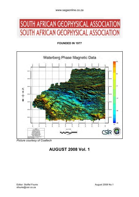
Picture courtesy of Coaltech<br />
AUGUST <strong>2008</strong> Vol. 1<br />
Editor: Stoffel Fourie<br />
sfourie@csir.co.za<br />
<strong>Aug</strong>ust <strong>2008</strong> No.1
www.sagaonline.co.za<br />
SAGA<br />
NEWSLETTER<br />
<strong>Aug</strong>ust <strong>2008</strong><br />
In this issue...<br />
* President's report for <strong>2008</strong>-2009 * <strong>Geophysical</strong> Dictionary<br />
* Get to know our new SAGA President. * New Equipment for the Physical Property<br />
Laboratory at the CGS.<br />
* Past president’s Report 2007-<strong>2008</strong> * Hired, fired, and retired.<br />
* Note from the editor * The DGS of Botswana<br />
* Special honour for Manfred hauger * A true physics story.<br />
* SAGA’s Armageddon * Shallow high resolution seismic surveys:<br />
Resolution and frequency content is everything –<br />
A simple tool to help with survey planning: C.J.S.<br />
Fourie and C.L. van Dam.<br />
<strong>2008</strong>-2009 Council Members<br />
President Mr. S.J. du Plessis CSIR sduplessis1@csir.co.za<br />
Vice-President Mr. A. Wolmarans De Beers Anton.wolmarans@debeersgroup.com<br />
Past-President Ms. P. Du Pisani Anglo American pdupisani@angloamerican.co.za<br />
Treasurer Mr. G. Campbell Gap Geophysics gapgeo@icon.co.za<br />
Editor Dr. S. Fourie CSIR sfourie@csir.co.za<br />
Members Mr.T. Odgers Red Dog S.S. reddog@geoafrica.co.za<br />
Mr. A.R. Vorster De Beers anre.vorster@debeersgroup.com<br />
Ms. S. J. Webb Wits. Geophysics webbs@geosciences.wits.ac.za<br />
Mr. K. Trofimczyk Anglo American ktrofimczyk@angloamerican.co.za<br />
Dr. D. Vogt CSIR dvogt@csir.co.za<br />
Dr. Lindsay Linzer<br />
Lindsay.Linzer@gmail.com<br />
Western Cape Branch Committee<br />
Chairman Mr. W. de Meyer<br />
Vice chairman Solomon Lephoto PetroSA solomon.lephoto@petrosa.co.za<br />
Sec/ Treas Vincent Mashaba PetroSA Vincent.mashaba@petrosa.co.za<br />
Members Tobias Tonsing Tullowoil Tobias.tonsing@tullowoil.com<br />
George Smith UCT George.Smith@uct.ac.za<br />
Buhle Hlatshwayo Tullowoil Buhle.hlatshwayo@tullowoil.com<br />
Heinz Pferdekamper Tullowoil heinz.pferdekamper@tullowoil.com<br />
Geoffrey Jackson Tullowoil Geoffrey.jackson@tullowoil.com<br />
Lihle Madyibi UCT Lihle.madyibi@uct.ac.za<br />
SAGA ADMIN<br />
Jann Otto<br />
RCA Conference Organisers<br />
P O Box 72147 Parkview 2122<br />
011 728 8173 fax 011 728 1675<br />
events@rca.co.za www.rca.co.za<br />
Editor: Stoffel Fourie<br />
sfourie@csir.co.za<br />
<strong>Aug</strong>ust <strong>2008</strong> No.1
www.sagaonline.co.za<br />
FEES<br />
Anyone wishing to join SAGA can please contact Jann Otto (ADMIN) for<br />
assistance:<br />
Members R250.00<br />
Associate/affiliate members R250.00<br />
Student members R60.00<br />
Sustaining/institutional members R2500.00/US$775.00<br />
Overseas members<br />
US$37.50<br />
SADC Countries R250.00<br />
ADVERTISEMENTS<br />
Anyone wishing to advertise in the SAGA newsletter must please contact the<br />
Editor (Stoffel Fourie at sfourie@csir.co.za). Rates (per issue) are as shown below;<br />
½ page ad. b/w R100/$50 Full page b/w R200/$100<br />
Full colour full page (min. 2 issues) R625/$625<br />
Brochure insert (
www.sagaonline.co.za<br />
SAGA President <strong>2008</strong>-9: Report<br />
Your newly elected SAGA President is Stefaans du Plessis, Research Group Leader<br />
at the CSIR Applied Geoscience research group.<br />
Stefaans in Peru, Consulting to a mining company (December 2007)<br />
The SAGA AGM held in May <strong>2008</strong> was a very enjoyable affair at a function held at<br />
the old Johannian club in Houghton, Johannesburg. It was a very cosy venue with<br />
fires to neutralise the effect of the cold winter evening. The evening was attended by<br />
around 40 people. Petro du Pisani, the SAGA President for 2007-8 presented her<br />
report on the activities during her term. Her report is elsewhere in this newsletter. The<br />
SAGA year 2007-8 under Petro’s competent leadership and enthusiasm was a busy<br />
year for SAGA, with two visiting SEG distinguished lecturers, monthly talks, three<br />
courses (Uranium, MT and Geophysics in Exploration), as well as the highly<br />
successful SAGA2009 Biennial Conference at the Wild Coast Sun. On behalf of me,<br />
as new SAGA President and the SAGA committee, and SAGA members, we would<br />
like to sincerely thank you for your efforts in making 2007- 8 a most successful year<br />
for SAGA. Well done and congratulations on a significant achievement. It certainly<br />
was a lot of fun as well!<br />
The SAGA treasurer, Geoff Campbell arrived just in time for delivering his usual<br />
eloquent, clear and concise and entertaining report. SAGA is happy to report that the<br />
finances look solid at the moment.<br />
In order to strengthen our relationship with the Geological Society of <strong>South</strong> Africa<br />
(GSSA), we invited a number of GSSA representatives to the SAGA AGM. From the<br />
Egoli Branch of the GSSA, we had Dr George Henry (Chairman Egoli Branch of the<br />
GSSA) and Erika Barton (who sends out the SAGA talk announcements to Egoli<br />
Branch members) as well as a Vice President of the GSSA, Dr Pamela Naidoo,<br />
representing the GSSA, attending the SAGA AGM. During 2007, we had an informal<br />
arrangement whereby Egoli Branch GSSA talks announcements were sent to SAGA<br />
members and SAGA talks announcements in return to Egoli Branch GSSA members.<br />
Editor: Stoffel Fourie<br />
sfourie@csir.co.za<br />
<strong>Aug</strong>ust <strong>2008</strong> No.1
www.sagaonline.co.za<br />
The highlight of the evening was an excellent talk by Dr Ludwig Combrinck from the<br />
Hartebeeshoek Radio Astronomy Observatory (HARTRAO) facility on current and<br />
future exploration of the moon. Terry Odgers was very surprised to hear that the<br />
moon is drifting away from the earth at about 4 cm per year – admittedly, I also did<br />
not know that… Apparently there’s also a lot of Helium on the surface of the moon –<br />
waiting to be exploited!<br />
During 2007, RCA, Robbie Cameron’s events company and Jann Otto took over the<br />
SAGA Secretary role, building on the highly successful and mutually beneficial<br />
relationship SAGA has developed with RCA, whilst organising the SAGA conference.<br />
We have made great progress towards organising SAGA2009, and look forward to<br />
working together during the term <strong>2008</strong>-9. Thank you to Robbie and Jann and the<br />
other RCA staff members for their enthusiasm and most professional service.<br />
A special thank you is required for Stoffel Fourie who has volunteered to do the<br />
SAGA newsletter. Stoffel got stuck in immediately and this is his first effort - I hope<br />
you enjoy reading the newsletter. Thank you Stoffel, for your enthusiasm and rapid<br />
delivery of the newsletter after taking over the task.<br />
Since the AGM we had the following monthly talks:<br />
July <strong>2008</strong>: Dr. Stoffel Fourie talked on his PhD topic “In-Situ Subsurface Density<br />
Estimations Using a Seismic Technique”<br />
<strong>Aug</strong>ust <strong>2008</strong>: Professor Gordon Cooper talked about potential field filters<br />
Activities planned:<br />
September <strong>2008</strong>: Talk by Stefaans du Plessis, “Recent Dighem dyke detection<br />
survey results from a Total Coal colliery”.<br />
October <strong>2008</strong>: Wireline logging course presented by Marcus Chatfield<br />
November <strong>2008</strong>: Hoping to host an SEG distinguished lecturer<br />
Please approach the committee if you have done something interesting that you<br />
would like to present at a SAGA monthly meeting, or if you know someone who has<br />
something to present.<br />
SAGA 2009 Biennial conference in Swaziland “From ancient rocks to modern<br />
techniques”.<br />
The main event in 2009 to look forward to is the SAGA2009 biennial conference to<br />
be hosted 13-18 September 2009 in Swaziland. Swaziland is home to the oldest<br />
dated rocks in Africa “The ancient gneiss complex”. The nearby Barberton Mountain<br />
land is one of the best exposed greenstone belts in the world. Swaziland is also close<br />
to the famous and large Kruger Park game reserve, borders Mozambique that is an<br />
excellent diving and fishing and beach holiday destination. Swaziland bosts a couple<br />
of game reserves, all within 40 minutes drive of the Royal Swazi Spa hotel, located<br />
outside Mbabane (the capital of Swaziland). Swaziland and the Milwane game<br />
Editor: Stoffel Fourie<br />
sfourie@csir.co.za<br />
<strong>Aug</strong>ust <strong>2008</strong> No.1
www.sagaonline.co.za<br />
reserve (10 minutes drive from the Royal Swazi Spa) is a top birding destination, and<br />
early morning birding trips will be organised. At Hlane game reserve (about a 40<br />
minute drive from the Royal Swazi Sun), you can walk with rhinos.<br />
We are very happy to report that the sponsors and exhibitors have already started to<br />
stake their claims and have committed themselves to supporting SAGA2009. Thank<br />
you to Keith Fisk (Getech), CGG Veritas (Michele Denis), Robert Wilson and Laurent<br />
Ameglio (Terraquest), for sponsoring big events at 2009 such as the The Gala Dinner<br />
with a Difference ‘House on fire’, the Shebeen evening (SAGA2007 it was the ‘pirate<br />
party’), and the opening of the trade show ice breaker cocktail event. Simon Bate<br />
(Aegis) is sponsoring the Golf day, Ria Tinnion (Geosoft) the ‘pub in the hub’. We<br />
highly appreciate your support. Every day more sponsors are coming to the party.<br />
Other sponsorship options are available as well www.sagaonline.co.za<br />
It is also fantastic that Maarten de Wit is again bringing Inkaba yeAfrica to SAGA,<br />
and Inkaba yeAfrica will run parallel technical sessions at SAGA.<br />
We are also indebted to Professor Alan Jones (DIAS), bringing SAMTEX to<br />
SAGA2009.<br />
Africa Array will again be a major participant at SAGA2009 and for that we thank<br />
Professor Dirks, Ray Durrheim, Sue Webb and all the Africa Array students.<br />
We look forward to welcoming you all at SAGA2009.<br />
We also plan lots of field trips: Komati valley, home of the Komati-ites, spinnifex<br />
textures etc; Sheba (mine) Top quad bike trip; Possibly Sheba mine (underground<br />
Editor: Stoffel Fourie<br />
sfourie@csir.co.za<br />
<strong>Aug</strong>ust <strong>2008</strong> No.1
www.sagaonline.co.za<br />
visit) and Lily mine as well as possibly visits to mining activities in Swaziland in<br />
conjunction with the Egoli Branch of the GSSA.<br />
In addtition to this, a number of workshops and courses will be on offer. We also<br />
hope to have more than one SEG distinguished lecturer at the SAGA2009<br />
conference.<br />
The SAGA2009 conference committee:<br />
Conference Chair: Stefaans du Plessis<br />
Technical Chair: Dr. Declan Vogt<br />
Workshops and Courses and social events: Petro du Pisani<br />
Gholf and field trips: Kazek Trofimczyk<br />
Website: Terry Odgers<br />
Special sessions: Ray van Rensburg<br />
Student affairs and SEG: Sue Webb<br />
Professional Events Company: RCA, Jann Otto, Robbie Cameron and team<br />
Sponsored by GETECH<br />
Editor: Stoffel Fourie<br />
sfourie@csir.co.za<br />
<strong>Aug</strong>ust <strong>2008</strong> No.1
www.sagaonline.co.za<br />
Editor: Stoffel Fourie<br />
sfourie@csir.co.za<br />
<strong>Aug</strong>ust <strong>2008</strong> No.1
www.sagaonline.co.za<br />
Get to know our new SAGA President: - Stefaans du Plessis<br />
Stefaans completed his B.Sc. degree in geology and physics at the University of<br />
Potchefstroom (now Northwest University) in 1988, and went on to study for B.Sc.<br />
Honours in Exploration Geophysics at the University of Pretoria in 1989. He joined<br />
Anglovaal (later Avmin) in 1990 and worked on both mine and exploration projects in<br />
southern Africa. He was part of the exploration team that discovered the massive<br />
sulphide deposit that became the Nkomati nickel mine, and also pioneered the use of<br />
the airborne Dighem technique used to detect non-magnetic dykes in coal fields, and<br />
in collaboration with John Bishop, successfully used down hole magnetometric<br />
resistivity (DHMMR) at Nkomati to detect massive sulphides – the first time the<br />
technique was used on excellent conductors – DHMMR was developed to detect<br />
weak conductors. He interpreted 30,000 line km of SYSMIN programme Airborne EM<br />
data over the eastern extension (under surface cover) Matchless Amfibolite belt, as<br />
well as interpreting the ground EM surveys on identified targets from this airborne EM<br />
survey. Stefaans then transferred to Avgold as Chief Geophysicist from 1998 to<br />
1999, working on projects in both East and West Africa. He did private consulting and<br />
lecturing for a brief spell in 2000-2001, and then joined Anglo American as a<br />
Divisional Geophysicist, responsible for consultations, oversight and assurance, and<br />
group support for the company's subsidiaries. He was involved in the interpretation of<br />
the high resolution Midas aeromagnetic surveys flown over all of Anglo Platinum<br />
mines on the Bushveld Complex. Stefaans also spent time in Morocco interpreting<br />
EM surveys, and was responsible for a successful Coaltech 2020 aeromagnetic<br />
project whereby all the industry airborne magnetic data was sourced and collated into<br />
Editor: Stoffel Fourie<br />
sfourie@csir.co.za<br />
<strong>Aug</strong>ust <strong>2008</strong> No.1
www.sagaonline.co.za<br />
a map. A dyke lineament map for the Witbank and Highveld coalfields was also<br />
produced.<br />
In February 2006 Stefaans left industry to become the Research Group Leader<br />
(RGL) in the Applied Geoscience (AG) Research Group of the Mining Competence<br />
Area - Natural Resources and the Environment of the Council for Scientific and<br />
Industrial Research (CSIR). He gained managerial experience by overseeing the AG<br />
research projects involving both geophysical and geological inputs, as well as<br />
conducting several consulting projects. He initiated and managed the flagship "Glass<br />
Rock" Parliamentary Grant Project, now into its third year. He also oversaw the<br />
commercial borehole radar surveys that are now a widely used technique. He has<br />
also been acting Mining Competence Area Manager when the need arose.<br />
Stefaans joined <strong>African</strong> Nickel, a junior exploration company, as Consulting<br />
Geophysicist in September <strong>2008</strong>, thereby starting another chapter in the adventure<br />
called life.<br />
Stefaans has been an active member of SAGA since around 1990, presenting at<br />
many of the conferences, and was chairman of the committee that put together the<br />
very successful and enjoyable conference "Making Waves" at the Wild Coast Sun in<br />
October 2007. During 2007 he was Vice President of SAGA. He has also volunteered<br />
to chair the team organising the next SAGA conference in 2009 to be held in<br />
Swaziland. This conference is going to be even better than the Wild Coast<br />
conference and it is a must to attend!<br />
SAGA Past President’s report 2007/8, Petro du Pisani, Anglo American<br />
Dear SAGA members<br />
The 2007/8 SAGA year has flown past. It has been a full and eventful year,<br />
which has confirmed that SAGA is an active and enthusiastic association within<br />
the <strong>South</strong>ern <strong>African</strong> geoscientific community.<br />
The highlight of the year was the 2007 SAGA Biennial Technical Meeting and<br />
exhibition which took place at the Wild Coast Sun in October 2007.<br />
Editor: Stoffel Fourie<br />
sfourie@csir.co.za<br />
<strong>Aug</strong>ust <strong>2008</strong> No.1
www.sagaonline.co.za<br />
2007 Conference<br />
The theme of the conference was “Making Waves” which referred as much to<br />
geophysical waves as to the contribution that our members make through out<br />
Industry, Research and Academia. The conference committee was led by<br />
Stefaans du Plessis, who did an excellent job of coordinating the effort and<br />
keeping everybody calm. Conference organizers RCA were contracted to organize<br />
the conference and their friendly and efficient manner ensured that the<br />
conference ran smoothly with no major hiccups.<br />
Prior to the conference various courses and workshops were presented over two<br />
days, such as Inkaba ye Africa, SAMTEX, In-mine Geophysics workshop, Geosoft<br />
and Intrepid courses. A field trip from Durban to the Wild Coast Sun was led by<br />
Dr. Geoff Grantham.<br />
The conference was attended by a record number of delegates and exhibitors<br />
setting the bar high for the next conference to be held in Swaziland in 2009.<br />
Without various sponsors (listed on our website) the conference would not have<br />
been possible and they are sincerely thanked for their contributions. The<br />
standard of technical presentation and content was raised in 2007 by a peer<br />
review process of papers, coordinated by Lindsay Linzer, the Technical Chair for<br />
the conference. The Best paper awards went to:<br />
Fugro Best Paper: Frikkie de Beer (Necsa)<br />
Fugro 2 nd paper: Declan Vogt (CSIR)<br />
Fugro 3 rd paper: Susan Webb (Wits)<br />
Fugro 4 th paper: Andreas Chwala (IPHT-Jena)<br />
Best Student paper: Stephanie Scheiber (Wits)<br />
Best Mining paper: Anton Wolmarans (De Beers)<br />
Best poster: Fatheela Kaldine (Anglo American)<br />
Best student poster: Marion Miensopust (DIAS)<br />
The full conference proceedings have been given an ISBN number and are<br />
available at the National Library.<br />
As usual the comprehensive technical programme was complimented by a busy<br />
social programme which included a golf day, Icebreaker, Beach party and Gala<br />
dinner. Two awards were presented at the French-themed gala dinner, namely:<br />
The geophysical enterprise award to Ray van Rensburg, and<br />
The meritorious geophysical service award to Reynie Meyer.<br />
The conference was huge success technically, socially and financially. Planning<br />
for an even bigger and better conference in 2009 is already underway. Members<br />
are encouraged to start conceptualizing their brilliantly scientific and thought<br />
provoking papers for submission early in 2009.<br />
Administration<br />
In 2007, after doing an excellent job of organizing SAGA’s administrative affairs<br />
for 2 years, Gorete de Oliveira handed over the reigns to Jann Otto from RCA.<br />
RCA have been running the administrative function for SAGA, attending<br />
Editor: Stoffel Fourie<br />
sfourie@csir.co.za<br />
<strong>Aug</strong>ust <strong>2008</strong> No.1
www.sagaonline.co.za<br />
meetings, taking minutes and making sure members pay their dues. The Council<br />
thanks both Gorete and RCA for their contribution in 2007/8.<br />
Monthly meetings and talks<br />
A number of successful talks were hosted in the 2007/8 year. Talks were given<br />
by:<br />
Vic Simmonds (Crimesight)<br />
Allan Place (MDA Geospatial Services)<br />
Kazek Trofimczyk (Anglo American)<br />
Ken Witherley (Condor Consulting)<br />
Wayne Pettit (BHP Billiton)<br />
SAGA was also privileged to host a SEG distinguished lecturer in May <strong>2008</strong>. Tad<br />
Ulrych entertained a packed CSIR auditorium with his talk:<br />
“The role of amplitude and phase processing and inversion.”<br />
Courses and workshops<br />
SAGA ran two highly successful courses in the previous term, namely:<br />
Magnetotellurics for Natural Resources by Dr. Alan Jones in March <strong>2008</strong>, and<br />
Geophysics in Exploration (in conjunction with GSSA) in April <strong>2008</strong>.<br />
AGM<br />
The new SAGA council was elected at the AGM held on 6 June <strong>2008</strong> at the<br />
Johannian club in Johannesburg.<br />
Stefaans du Plessis (President)<br />
Anton Wolmarans (Vice-President)<br />
Geoff Campbell (Treasurer)<br />
Stoffel Fourie (<strong>Newsletter</strong> Editor)<br />
Terry Odgers<br />
Declan Vogt<br />
Anre Vorster<br />
Kazek Trofimczyk<br />
Lindsay Linzer<br />
Petro du Pisani (Past president)<br />
Sue Webb (Student affairs & SEG liaison)<br />
New members elected to the council included Anton Wolmarans and Stoffel<br />
Fourie (who will be the new <strong>Newsletter</strong> Editor). Standing down from the Council<br />
were Magdel Combrinck and Dave Hatch. Thanks to Magdel and Dave for their<br />
outstanding contribution during the many years they both served on the Council.<br />
Manfred Hauger was awarded a SAGA meritorious award at the AGM for is long<br />
term to contribution to <strong>South</strong> <strong>African</strong> geophysics.<br />
President’s comment<br />
2007/8 has been an excellent year of collaboration, with SAGA making their<br />
voices heard at the First SEG General Assembly of all associated Geophysics<br />
Societies In January <strong>2008</strong>. This resulted in a distinguished lecturer gracing our<br />
shores and will hopefully lead to many learning experiences in the future.<br />
Editor: Stoffel Fourie<br />
sfourie@csir.co.za<br />
<strong>Aug</strong>ust <strong>2008</strong> No.1
www.sagaonline.co.za<br />
Furthermore SAGA collaborated with the Geological Society to present a highly<br />
successful introductory Geophysics course. Efforts have been made in 2007/8 to<br />
include and communicate with our Western Cape branch members and I hope<br />
that these ties can be strengthened through continued dialogue and cooperation.<br />
The geoscientific community faces many exciting opportunities and challenges<br />
over the next year, including booming commodity prices combined with the<br />
challenge of rising skills shortages. SAGA will continue to serve is members to<br />
best its best abilities in these interesting times.<br />
None of the achievements SAGA can celebrate for the 2007/8 term would have<br />
been possible without the fantastic support provided by the SAGA Council, RCA<br />
and to you the SAGA members. Thank you all!<br />
Best regards<br />
Petro du Pisani<br />
SAGA President 2007/8<br />
Note from the Editor……<br />
It is a while since the last SAGA <strong>Newsletter</strong> was released. We hope that with this<br />
edition of the SAGA <strong>Newsletter</strong> we will spark a new interest within the SAGA<br />
members to contribute actively towards the newsletter. Please also contribute<br />
towards the dictionary. As usual, we will give news about the hired, fired and<br />
married…. of our community, but we would also like to get contributions from our<br />
neighbours and abroad; for an added international flavour.<br />
In this edition we will remind you of our next SAGA Conference in 2009 and we<br />
honour some of our geophysicists that made a large contribution to our community<br />
during the last 50 years. We would also like publish papers of our members and<br />
students. If we get enough support we would like to compile a volume of papers at<br />
the end of the year of the papers published in the SAGA newsletter.<br />
In the next issue…….We will report on more of our distinguished members that<br />
contributed to our community. We will continue with the dictionary and publish a<br />
paper by Ian Saunders on the national seismology network.<br />
SAGA also plans to bid for the International EM Conference to be held in <strong>South</strong><br />
Africa in 2012. The bid committee is currently Geoff Cambell of GAP Geophysics,<br />
Valeriya Zadorozhnaya of the CGS and Stoffel Fourie of the CSIR. Help was<br />
pledged from Alan Jones, Edgar Stettler and Mark Hamilton.<br />
Enjoy it…. Stoffel<br />
Editor: Stoffel Fourie<br />
sfourie@csir.co.za<br />
<strong>Aug</strong>ust <strong>2008</strong> No.1
www.sagaonline.co.za<br />
A Special Honour: - Meritorious Service Award to: Manfred Hauger –<br />
SAGA recognise his long term contributions of 50 years to the <strong>South</strong> <strong>African</strong><br />
geophysical community.<br />
Manfred Hauger was born on 25<br />
September 1930 at Grootfontein in <strong>South</strong><br />
West Africa. He started primary school in<br />
1937 at Otavi. He started secondary<br />
school in 1944 in Windhoek. He attended<br />
the HPS German school. He started a<br />
B.Sc with Geology at the University of<br />
Pretoria in 1952, with Simon Zacht and<br />
Prof. Lombaard. He could not finish his<br />
studies due to finances. The funding he<br />
should have received from family in East<br />
Germany could not reach him due to the<br />
Berlin Wall.<br />
Manfred started to work in February 1953<br />
as a technician at the Geological Survey<br />
of <strong>South</strong> Africa. He started field work in<br />
April 1953 near Hammanskraal. They<br />
stayed in a field camp with tents. They<br />
did the siting of boreholes for<br />
groundwater near Hammanskraal, using<br />
the Gane-Enslin Resistivity equipment.<br />
The PARI instrument (Phase Amplitude<br />
Ratio Instrument) was also used. It was a<br />
Tube driven Electromagnetic system. It<br />
used a round Tx loop with a 1.5kw 220V<br />
generator. This system was very<br />
sensitive to vertical structures and thus<br />
good for groundwater. Manfred had and<br />
still has an extensive knowledge of tubes,<br />
and was able to fix the PARI system.<br />
He also did groundwater exploration for<br />
the Department of Agriculture on the<br />
Springbok Plane. The purpose was to<br />
find boreholes that can deliver more than<br />
10 000 Gallons per hour to irrigate<br />
tobacco fields. They suspected this will<br />
destroy the aquifer, which happened 9<br />
years later.<br />
He developed the first water level<br />
instrument in <strong>South</strong> Africa to replace the<br />
old wet measuring tape system. It used<br />
a voltmeter and was more accurate.<br />
Multiple copies of this system were built<br />
by the Geological Survey.<br />
In 1954 he did the first geophysical<br />
surveys that started the Rooiberg Tin<br />
mine. He could map the faults and<br />
dykes. A survey near Messina was done<br />
to detect the shallow dipping Copper<br />
beds in the area.<br />
He did a self potential survey near<br />
Barberton in 1955. This started the<br />
beginning of Barbrook Goldmine. To be<br />
more mobile Manfred got himself a<br />
caravan. He did water divining for all the<br />
railway stations between Warrenton and<br />
Kimberley. Water was needed for the<br />
small communities that serviced the<br />
stations, but more so for the steam<br />
engines.<br />
In 1955, Bellsbank, close to Barkley West<br />
opened for diamond prospectors and<br />
diggers. He was commissioned to detect<br />
the Kimberlite Dykes and Fishers. The<br />
large contrast in resistivity between the<br />
Kimberlites and the Dolomites produced<br />
very good results. The thickness varied<br />
between 10cm to 10m. It is a very dry<br />
and arid place with dry boreholes.<br />
Editor: Stoffel Fourie<br />
sfourie@csir.co.za<br />
<strong>Aug</strong>ust <strong>2008</strong> No.1
www.sagaonline.co.za<br />
When deeper digging started there was<br />
so much water that it could not be<br />
pumped to continue mining. Mining had<br />
to stop at the water table.<br />
During the mining process a digger found<br />
a piece of meteorite. Manfred organised<br />
via the Commissioner of Mines that it<br />
was placed in a Museum.<br />
In 1956 the Goldmine Industry started to<br />
experience more problems with<br />
groundwater. Manfred started a<br />
weekly/monthly borehole measurement<br />
program where the water levels were<br />
measured in deep exploration holes.<br />
Borehole elevations were measured with<br />
Barometers. These results showed that<br />
the area can be divided into separate<br />
compartments.<br />
In 1957 Manfed and Dr. Kleywegt started<br />
to explore for the Dolerite and Syenite<br />
dykes in the Wits. All dyke positions were<br />
measured with a “vlaktafel” and Alidade<br />
and a map was made. This started the<br />
pumping of the Wits to save the Gold<br />
Mining industry. As the water table<br />
dropped due to pumping, fountains dried<br />
up like Gemsbokfontein, Venterspos,<br />
Bank and Oberholzer. Sinkholes started<br />
to appear.<br />
By 1961 it was not clear what would be<br />
the best way to detect the areas of<br />
possible sinkhole formation. A test<br />
gravity survey was started and the results<br />
indicated that a gravity survey was the<br />
best way to detect possible weak zones.<br />
He did some heat flow experiments by<br />
measuring temperatures in shallow<br />
boreholes, 24 hours after they were<br />
drilled. They were in a profile across the<br />
Venterspos Dyke. The dyke gave a very<br />
good magnetic and electromagnetic<br />
response. The temperature readings<br />
corresponded very well with the<br />
geophysical results, confirming that more<br />
heat flow form igneous structures.<br />
The <strong>South</strong> <strong>African</strong> Railways asked for a<br />
survey in De Aar to find water for their<br />
large steam train fleet. They used water<br />
from the Brakriver at Karoluspoort. He<br />
used resistivity and a seismograph that<br />
was developed by the CSIR to detect the<br />
size and depth of the aquifer. It was the<br />
first time that a hammer seismic<br />
instrument was used on such a survey.<br />
The results were proved by <strong>Aug</strong>er holes.<br />
Pump tests were done. A tracer<br />
Flourosine was used for the first time to<br />
try and detect the groundwater flow,<br />
which didn’t give good results. It was<br />
later established that the organic material<br />
and the plant roots absorbed all the<br />
tracer molecules. Draining tests were<br />
done to pump water into dams. Only<br />
dams with plants at the bottom drained,<br />
the rest was only normal evaporation.<br />
In 1962 his involvement with the seismic<br />
method started. Manfred did the survey<br />
for a pipeline between Kouga Dam and<br />
Port Elisabeth and a seismic refraction<br />
survey for a bridge near Despatch. He<br />
became more involved with the seismic<br />
team, especially when instruments broke<br />
– Radio tubes. Manfred finished off the<br />
survey between Glencorner, Gamtoos<br />
and Hanky.<br />
Manfred started the seismic survey near<br />
Dannhauser and Dundee for Coal<br />
reserves. The camp was later moved to<br />
Laingsburg. He did seismics from<br />
Laingsburg to Barrydale and from<br />
Laingsburg to Sutherland. Later, a profile<br />
was done from Koringplaas to<br />
Sutherland.<br />
In 1963 he took part in seismic profiles<br />
between Jamestown and Stutterheim and<br />
near Middelburg.<br />
In 1964 he converted a seismic refraction<br />
system to be more portable. He did<br />
surveys with this instrument at Milnerton<br />
and Cape Town.<br />
Editor: Stoffel Fourie<br />
sfourie@csir.co.za<br />
<strong>Aug</strong>ust <strong>2008</strong> No.1
www.sagaonline.co.za<br />
He also did the surveys for the<br />
Theewaterskloof Dam in Riviersonderend<br />
and the tunnel through the Fransch Hoek<br />
mountains into the Berg River.<br />
He did surveys between 1966 and 1970,<br />
across the PE Cretaceous basin, starting<br />
at Kinkelbos. He did a seismic profile at<br />
Colchester where the CSIR did some<br />
deep resistivity work, to compare results.<br />
A borehole position was established, and<br />
it was the only borehole in the PE<br />
Cretaceous Basin that produced a little<br />
bit of oil. The next surveys on the basin<br />
were then done at Oudtshoorn.<br />
By 1971 Manfred did a seismic refraction<br />
survey at Melkbos Strand for the<br />
Koeberg Nuclear power station. The<br />
government also drilled about 500<br />
boreholes near Beaufort West for<br />
Uranium exploration. Manfred did the<br />
radiometric logging of the holes.<br />
Manfred did the geophysical surveys for<br />
the Sterkfontein Dam and the Kilburn<br />
Pumpstation. Manfred did the Seismic<br />
Refraction Survey for the pipe line form<br />
the Grootvlei Dam near Standerton to<br />
Secunda, also in 1971.<br />
Between 1972 and 1975, Manfred took<br />
over the Paleomagnetic Laboratory from<br />
Dr. Henthorn. He had to do instrument<br />
support. He immediately improved the<br />
design of the Helmholtz cage that is to be<br />
used during AF-Demagnetisation.<br />
Manfred designed and build the neutron<br />
gamma system for a borehole probe. He<br />
measured all the boreholes drilled for<br />
coal in the Secunda area with this probe.<br />
From 1976 to 1980, Manfred build a<br />
prototype DC equipment (ERMA) to find<br />
clay deposits in the west rand. The same<br />
receiver can also record EM signals.<br />
In 1985, together with Dr. Edgar Stettler,<br />
he started with the development of MT<br />
equipment. He did MT-profiles from<br />
Sishen to keimoes and from Darling to<br />
Moreesburg and also stations in Kokstad<br />
and Chinoyi in Zimbabwe.<br />
He developed software for the<br />
Paleomagnetic Laboratory to control the<br />
data acquisitioning and processing.<br />
In 1989 Manfred was involved with the<br />
testing of the new Pulse EKKO GPR<br />
system, with Cristo Craill and Stoffel<br />
Fourie.<br />
He started with work on the site for the<br />
Mohale Dam and at the hot water springs<br />
near Tsipise.<br />
He did the geophysical investigation at<br />
Vaalputs for the nuclear waste site, and<br />
developed a drilling system with a small<br />
diamond drill to take paleomagnetic<br />
samples.<br />
Several MT-Surveys followed, and he<br />
retired from the Geological Survey in<br />
1994.<br />
He was contracted to stay on at the<br />
Council for Geoscience. He started then<br />
on the development of the Microlight<br />
Airborne system, together with John<br />
Kulper.<br />
He also started with the development of<br />
the RIPS system. In 2005 his contract<br />
with the CGS was not renewed. Manfred<br />
still do development work for<br />
improvements on the RIPS system and<br />
to debug new palaeomagnetic<br />
equipment. He is also developing an<br />
EKS system at the moment. He is still a<br />
member SAAG and the PSA.<br />
Editor: Stoffel Fourie<br />
sfourie@csir.co.za<br />
<strong>Aug</strong>ust <strong>2008</strong> No.1
www.sagaonline.co.za<br />
SAGA’s Armageddon (July <strong>2008</strong>): - Look what you have<br />
missed.<br />
Near-Earth Asteroids<br />
Potentially Hazardous Asteroids (PHAs) are space rocks larger than approximately<br />
100m that can come closer to Earth than 0.05 AU. None of the known PHAs is on a<br />
collision course with our planet, although astronomers are finding new ones all the<br />
time.<br />
On July 24, <strong>2008</strong>, there were 962 potentially hazardous asteroids.<br />
July <strong>2008</strong> Earth-asteroid encounters:<br />
Asteroid Date(UT) Miss Distance Magnitude. Size<br />
2003 YE45 July 13 16.5 LD 15 1.4 km<br />
<strong>2008</strong> BT18 July 14 5.9 LD 13 1.0 km<br />
2003 LC5 July 15 62 LD 16 1.4 km<br />
<strong>2008</strong> NP3 July 17 6.8 LD 18 85 m<br />
Notes: LD means "Lunar Distance." 1 LD = 384,401 km, the distance between Earth and the Moon. 1<br />
LD also equals 0.00256 AU. MAG is the visual magnitude of the asteroid on the date of closest<br />
approach.<br />
Reference: www.spaceweather.com<br />
SAGA’s <strong>Geophysical</strong> Dictionary<br />
A<br />
Acceleration<br />
The rate at which an object's velocity changes with time.<br />
Accelerometer<br />
An instrument that measures acceleration.<br />
Airborne Gravity<br />
Airborne gravity is the measurement of the gravity field from the air, using an<br />
aeroplane, airship or satellite.<br />
Altitude Correction<br />
An altitude correction is made to correct or compensate for the height or elevation<br />
above a certain reference level. In the earth sciences it is usually above sea level.<br />
Altitude corrections are usually made in barometric, gravity, magnetic, seismic, radio<br />
nuclide and satellite applications.<br />
Please contribute. Ed.<br />
Editor: Stoffel Fourie<br />
sfourie@csir.co.za<br />
<strong>Aug</strong>ust <strong>2008</strong> No.1
www.sagaonline.co.za<br />
REPLACEMENT EQUIPMENT<br />
FOR THE PHYSICAL<br />
PROPERTIES LABORATORY<br />
The function of the Physical Properties<br />
Laboratory of the Council for Geoscience is<br />
to facilitate research on the rock magnetic,<br />
palaeomagnetic and physical properties of<br />
rock samples.<br />
During 2007 the Physical Properties<br />
Laboratory has acquired several new<br />
instruments for the study of rock magnetic<br />
and palaeomagnetic properties. These<br />
instruments include:<br />
• The JR-6A dual speed spinner<br />
magnetometer from AGICO for<br />
measurement of remnant magnetization of<br />
rocks using classical (i.e. non-quantum,<br />
non-cryogenic) operating principles.<br />
Kappa Bridge<br />
• The CS-3 furnace apparatus which is<br />
attached to the MFK1-FA model and<br />
measures the high temperature variations<br />
of magnetic susceptibility which enables the<br />
determination of Curie transition<br />
temperatures. The Curie temperature can<br />
be used as a diagnostic tool to identify<br />
magnetic mineralogy. This is a tool has until<br />
now not been available at the Council for<br />
Geoscience.<br />
• The MMTD80 thermal demagnetizer from<br />
Magnetic Measurements Ltd (UK) which<br />
has the capacity to demagnetize 80<br />
samples simultaneously. The necessary<br />
attachments for the MMTD80 to enable<br />
Thellier-Thellier experiments have also<br />
been acquired.<br />
Spinner Magnetometer<br />
• The MFK1-FA multi-function kappa bridge<br />
from AGICO for the measuring anisotropy<br />
of magnetic susceptibility (AMS) of rocks<br />
as well as in-phase and out-of –phase bulk<br />
magnetic susceptibility in weak variable<br />
fields and at 3 different operating<br />
frequencies. This instrument can even<br />
measure the anisotropies of diamagnetic<br />
and near-zero susceptibility samples.<br />
Thermal Demagnetiser<br />
For more information contact:<br />
Leonie Maré, Geophysics Unit<br />
+27 (0)12 841 1416<br />
leoniem@gescience.org.za<br />
Editor: Stoffel Fourie<br />
sfourie@csir.co.za<br />
<strong>Aug</strong>ust <strong>2008</strong> No.1
www.sagaonline.co.za<br />
Hired, Fired and Retired…… Lief en Leed.<br />
From the Council for geoscience: - by Janine Cole.<br />
Quite a few new people have joined the Geophysics Unit at the Council for<br />
Geoscience over the past year. Peter Nyabeze and Emmanuel Chirenje, both<br />
originally from Zimbabwe, joined last year. Earlier this year Dr. Abera Tessema came<br />
to the Unit from the University of Venda. He specializes in potential fields. Melvin<br />
Sethobya and Lebogang Ledwaba are both young scientists who finished their<br />
studies and started to work at the CGS. Melvin is busy with a BTech at TUT, while<br />
Lebogang finished his BSc(Hons) at Wits. Marinda Havenga became mother for the<br />
second time in the beginning of this year. Henk Coetzee from the Environmental<br />
Geosciences Unit obtained a PhD from Wits University recently.<br />
Congratulations Henk!.....from SAGA( ed.)<br />
From the CSIR Applied Geoscience: - by Stefaans du<br />
plessis.<br />
Phetla Sefara (TUT) has joined the CSIR borehole radar team as an intern Borehole<br />
Radar Interpreter.<br />
Partene Pemengoye (TUT) (depending a student work permit application) will also<br />
soon join the CSIR borehole radar team as a Borehole radar interpreter.<br />
Stoffel Fourie has graduated with his PhD qualification at the University of Pretoria:<br />
Well done and congratulations Stoffel!<br />
Pieter Ewald Share is a CSIR bursary student and has spent 3 months on the<br />
SAMTEX field work programme, gaining valuable experience. Pieter Share will also<br />
be going to Ireland to DIAS to pursue his MSc studies (registered at Wits under Sue<br />
Webb) and hopefully continue on to complete a PhD as well.<br />
Ilze Janse van Vuuren (Tukkies geophysics student) is working part time for the CSIR<br />
and will be doing her honours in geophysics at Wits during 2009.<br />
Editor: Stoffel Fourie<br />
sfourie@csir.co.za<br />
<strong>Aug</strong>ust <strong>2008</strong> No.1
www.sagaonline.co.za<br />
The Department of Geological Survey<br />
Botswana (DGS): - by Hudson Ngwisanyi.<br />
MISSION<br />
The Department of Geological Survey (DGS) exists to advance knowledge on the<br />
earth resources of Botswana and to advice government and public on their<br />
sustainable utilization to the benefit of all. This is done by acquiring, archiving,<br />
interpreting and disseminating geo-science information on Botswana in order to<br />
facilitate:<br />
1. The speedy discovery and development of mineral and water resources for<br />
sustained economic growth, heath and safety, and<br />
2. Sustainable land resources utilization and the use of best practices for<br />
environmental upkeep and protection.<br />
Institutional Framework<br />
The DGS was established in 1948, primarily to address water supply challenges. It<br />
later grew from a focus on water only to include minerals and coal. This has been the<br />
focus since, with a lesser emphasis on coal.<br />
At present there are six primary operational divisions driving the mandate of the<br />
department. These are Regional Geological Mapping, Economic Geology,<br />
Hydrogeology, Geophysics, Environmental and Engineering Geology, and National<br />
Geoscience Information Centre. These are supported by the Chemistry and Mineral<br />
Dressing laboratories, Cartography and Drilling Sections.<br />
The DGS is directly responsible for gathering, assessing and disseminating data<br />
related to rocks, soils and minerals. To fulfil this responsibility, the DGS administers<br />
the concession of mineral prospecting rights to companies and individuals. It also<br />
undertakes regional geological, geophysical and geochemical mapping, and mineral<br />
potential studies.<br />
In the water sector the DGS undertakes regional groundwater investigations,<br />
assessment of groundwater, do recharge studies, monitoring of water levels and<br />
chemical changes within aquifers. Such information is used by the agricultural sector<br />
as well as the water authorities.<br />
The environmental and engineering geology sections are fairly new. It was<br />
established to address the numerous requests on environmental and geotechnical<br />
issues in Botswana.<br />
Notable Achievements<br />
Provision of geological maps at various scales to exploration companies has led to<br />
discoveries of economic mineral deposits including vast quantities of coal. Figure 1<br />
shows the level of exploration activity in Botswana as evidenced by the number of<br />
exploration licenses granted for diamonds.<br />
Editor: Stoffel Fourie<br />
sfourie@csir.co.za<br />
<strong>Aug</strong>ust <strong>2008</strong> No.1
www.sagaonline.co.za<br />
Figure 1: Mineral Concessions Map of July <strong>2008</strong><br />
In 2002 the DGS initiated a project called “Coalbed Methane and Karoo Basin<br />
Stratigraphic Project” whose objective was to establish a database on stratigraphy<br />
and develop a correlation system that characterizes the coal-bearing sedimentary<br />
rock sequence of the Kalahari Karoo Basin of Botswana. Two deep boreholes were<br />
drilled and one of them indicated the existence of coal bed methane. This was<br />
enough to encourage private sector exploration for CBM and the result is a number<br />
of mineral concessions granted for coal and CBM exploration.<br />
Identification of groundwater resources for human, livestock and mining continued.<br />
High resolution aeromagnetic data covering the entire country have been collected<br />
(figure 2). About 80% of Botswana is now covered with airborne magnetics at 200-<br />
250 metre lion spacing and 80 metres flying height. Indeed the data has been used<br />
by the private sector and this has led to the discovery of kimberlite pipes and<br />
generated several mineral exploration targets.<br />
Industrial mineral evaluation has been undertaken resulting in the establishment of<br />
some brick manufacturing factories.<br />
Editor: Stoffel Fourie<br />
sfourie@csir.co.za<br />
<strong>Aug</strong>ust <strong>2008</strong> No.1
www.sagaonline.co.za<br />
Figure 2: Aeromagnetic Anomaly Map of Botswana<br />
Current and Future Activities<br />
The Molopo farms complex project was started in 2001 with the overall aim of<br />
evaluating the Mineral Potential of the complex for PGM’s. A significant portion of the<br />
world’s reserves for platinum group minerals is hosted within the Bushveld complex<br />
in <strong>South</strong> Africa of which the Molopo farms complex is believed to be its offshoot.<br />
Interpretation of high resolution aeromagnetic data has led to a better understanding<br />
of the geology of the area. Soil geochemical sampling has been done over the area.<br />
Currently the department is doing follow-up geophysical and geochemical surveys<br />
over anomalous areas.<br />
The DGS will embark on projects to identify, assess and facilitate exploitation of<br />
industrial minerals and other commodities. This will benefit the local construction<br />
industry as well as communities and individuals. Because these projects are aimed at<br />
the small investors they will be carried through to the techno-economical evaluation<br />
stage and initiation of small scale mining so as to minimize risks for the miners<br />
(especially citizens).<br />
Regional geophysical surveys will be conducted over mafic, ultramafic and granitic<br />
complexes to assess their mineral potential. This will comprise a high resolution<br />
aeromagnetic survey over the Nossop-Ncojane block and the rest of the country,<br />
geochemical surveys over selected areas, airborne electromagnetic survey, deep<br />
seismic and subsequent drilling over selected targets. This will contribute to the<br />
search and discovery of mineral resources and provide baseline data. Hence the goal<br />
Editor: Stoffel Fourie<br />
sfourie@csir.co.za<br />
<strong>Aug</strong>ust <strong>2008</strong> No.1
www.sagaonline.co.za<br />
is to attract exploration companies to explore for minerals in this hitherto unexplored<br />
area.<br />
Assessment of kimberlite/ diamond exploration techniques will also be undertaken.<br />
This project is aimed at generating targets for kimberlite diamond exploration through<br />
systematic evaluation of exploration techniques, understanding of the source of<br />
indicator minerals of kimberlites in various provinces in Botswana (e.g Orapa and<br />
Kweneng areas) as well as structural implications to the emplacement of kimberlites.<br />
This will foster diamond exploration and enhance diamond discovery which<br />
subsequently will lead to sustainability in diamond aggregation and cutting in<br />
Botswana.<br />
Challenges<br />
The DGS has faced an unprecedented rate of staff turnover in the past 5 years as<br />
employees have left for better remuneration in the private sector. This has led to<br />
diminished organisational effectiveness and project implementation capacity. The<br />
department lacks some critical skills especially in seismology and geochemistry.<br />
A true physics story<br />
The following concerns a question in a physics degree exam at the University of<br />
Copenhagen: - "Describe how to determine the height of a skyscraper with a<br />
barometer."<br />
One student replied:<br />
"You tie a long piece of string to the neck of the barometer, then lower the barometer<br />
from the roof of the skyscraper to the ground. The length of the string plus the length<br />
of the barometer will equal the height of the building."<br />
This highly original answer so incensed the examiner that the student was failed<br />
immediately. He appealed on the grounds that his answer was indisputably correct,<br />
and the university appointed an independent arbiter to decide the case. The arbiter<br />
judged that the answer was indeed correct, but did not display any noticeable<br />
knowledge of physics.<br />
To resolve the problem it was decided to call the student in and allow him six minutes<br />
in which to provide a verbal answer which showed at least a minimal familiarity with<br />
the basic principles of physics.<br />
For five minutes the student sat in silence, forehead creased in thought. The arbiter<br />
reminded him that time was running out, to which the student replied that he had<br />
several extremely relevant answers, but couldn't make up his mind which to use. On<br />
being advised to hurry up the student replied as follows:<br />
Editor: Stoffel Fourie<br />
sfourie@csir.co.za<br />
<strong>Aug</strong>ust <strong>2008</strong> No.1
www.sagaonline.co.za<br />
"Firstly, you could take the barometer up to the roof of the skyscraper, drop it over<br />
the edge, and measure the time it takes to reach the ground. The height of the<br />
building can then be worked out from the formula H= 0.5g x t 2 . But bad luck on the<br />
barometer.<br />
"Or if the sun is shining you could measure the height of the barometer, then set it<br />
on end and measure the length of its shadow. Then you measure the length of the<br />
skyscraper's shadow, and thereafter it is a simple matter of proportional arithmetic to<br />
work out the height of the skyscraper."<br />
But if you wanted to be highly scientific about it, you could tie a short piece of string<br />
to the barometer and swing it like a pendulum, first at ground level and then on the<br />
roof of the skyscraper. The height is worked out by the difference in the gravitational<br />
restoring force T = 2 *π*√ (l / g)."<br />
"Or if the skyscraper has an outside emergency staircase, it would be easier to walk<br />
up it and mark off the height of the skyscraper in barometer lengths, then add them<br />
up”.<br />
"If you merely wanted to be boring and orthodox about it, of course, you could use<br />
the barometer to measure the air pressure on the roof of the skyscraper and on the<br />
ground, and convert the difference in millibars into feet to give the height of the<br />
building."<br />
But since we are constantly being exhorted to exercise independence of mind and<br />
apply scientific methods, undoubtedly the best way would be to knock on the janitor's<br />
door and say to him 'If you would like a nice new barometer, I will give you this one if<br />
you tell me the height of this skyscraper'."<br />
The student was Niels Bohr, the only Dane to win the Nobel prize for Physics.<br />
Editor: Stoffel Fourie<br />
sfourie@csir.co.za<br />
<strong>Aug</strong>ust <strong>2008</strong> No.1
www.sagaonline.co.za<br />
Shallow high resolution seismic surveys: Resolution and<br />
frequency content is everything – A simple tool to help with survey<br />
planning.<br />
C.J.S. Fourie, Geophysicist: Applied Geoscience, CSIR, <strong>South</strong> Africa<br />
Telephone: +12-841-3395, Fax: +86-602-9765, E-mail: sfourie@csir.co.za,<br />
Address: Post Box 395, Pretoria, 0001, <strong>South</strong> Africa<br />
C.L. van Dam, Geophysicist, 63 Van Riebeeck Avenue, Lyttleton, <strong>South</strong> Africa<br />
Telephone: +12-664-3430, E-mail: chris.vd@cybersmart.co.za.<br />
ABSTRACT<br />
All electromagnetic geophysical methods, but the frequency domain methods<br />
in particular, depend on the skindepth as a guide to the depth of investigation or<br />
penetration from the surface. By definition the skindepth is the distance where the<br />
initial amplitude of the electromagnetic wave attenuated by 1/e or 67%. This measure<br />
is influenced by the physical properties of the subsurface and uses the resistivity, the<br />
angular frequency (ω) of the electromagnetic field and the magnetic permeability (µ).<br />
By using more than one frequency, different depths of penetration are achieved,<br />
which allows one to obtain information from the consecutive different layers of<br />
geology. The same is true of seismic waves which also attenuate with distance and<br />
time. The attenuation also depends on the properties of the subsurface, of which the<br />
frequency (f), velocity (v) and the Q-factor are the most important. Similar to the<br />
electromagnetic method, depth of penetration can be manipulated in a way by<br />
controlling the frequency of the input wave. This information can be used in<br />
conjunction with this spreadsheet to aid the geophysicist in designing shallow high<br />
resolution seismic surveys to achieve maximum resolution and penetration. This<br />
Excel spreadsheet is available free from the authors.<br />
INTRODUCTION<br />
Electromagnetic systems and the frequency domain electromagnetic (FDEM)<br />
systems in particular, utilise more than one frequency to obtain information from the<br />
subsurface at different depths (e.g. Apex Max-Min system). These frequency domain<br />
electromagnetic systems utilise an entity called the skin depth (Sheriff, 1991, Telford,<br />
1986). The definition of the skin depth is the effective depth of penetration of an<br />
electromagnetic plane wave up to the point where it is attenuated to 1/e of its original<br />
amplitude. The electromagnetic skin depth is given by equation 1.<br />
δ =<br />
2σ<br />
µω<br />
(1)<br />
Editor: Stoffel Fourie<br />
sfourie@csir.co.za<br />
<strong>Aug</strong>ust <strong>2008</strong> No.1
www.sagaonline.co.za<br />
Where<br />
σ = resistivity<br />
µ = permeability<br />
ω = 2Πf = angular frequency.<br />
The skin depth is largely controlled by the frequency used. As a rule, lower<br />
frequencies, allow for deeper depths of investigation. The conductivity also plays an<br />
important role. Lower conductivities (higher resistivities) result in deeper depths of<br />
investigation. High conductivities have a shielding effect on the electromagnetic<br />
waves.<br />
This approach is also employed by using certain seismic or sound waves<br />
(Nasseri-Moghaddam et.al, 2005). They used the frequency dependency of the<br />
surface waves to determine the depth of shallow voids. The penetration of the<br />
surface seismic waves of P-waves and S-waves, the so-called Rayleigh and Love<br />
waves definitely have these properties (Thorne and Wallace, 1995, Yilmaz 1989).<br />
All seismic waves undergo attenuation. The loss of amplitude is exponential<br />
of a seismic wave through an imperfect medium (Waters, 1981). This means that the<br />
ratio in which the amplitude decays is a constant, which is called the logarithmic<br />
decrement (δ). The specific logarithmic decrement is called the Q-factor. Together<br />
with the velocity (v) and the frequency (f) one can calculate an attenuation constant<br />
(α) for each situation.<br />
Shallow high resolution seismic surveys are routinely used in near surface for<br />
mineral exploration and in environmental surveys to detect small structures and<br />
lithologies for pollution detection purposes. In this paper a very simple spreadsheet<br />
is introduced to aid in the planning and design of shallow high resolution seismic<br />
surveys, when all of the important parameters are taken into account.<br />
ATTENUATION OF SEISMIC WAVES<br />
Seismic waves undergo attenuation, even when the waves have very small<br />
amplitudes. This happens because the subsurface medium is not perfectly elastic<br />
and because the earth is strong but not critically damped (Fourie, 2005, Fourie et al,<br />
2004). The deviations from Hooke’s law are usually small and the approximations of<br />
the elastic wave theory are sufficient (Fourie, 2005 and Waters, 1981).<br />
Friction arising from the sliding of grains or crystals against each other is<br />
widely acknowledged as the most probable mechanism of energy loss, and the term<br />
“solid friction” is frequently used (Waters, 1981).<br />
The symbol Q is used to indicate the rock quality for seismic wave propagation,<br />
analogue to the electrical circuit situation. For the “solid friction” model the<br />
attenuation coefficient (α) is dependant on the following properties of the seismic<br />
wave:<br />
• Frequency (f)<br />
• Velocity (v)<br />
Editor: Stoffel Fourie<br />
sfourie@csir.co.za<br />
<strong>Aug</strong>ust <strong>2008</strong> No.1
www.sagaonline.co.za<br />
• Quality factor (Q) and<br />
• Logarithmic decrement (δ), where δ = Π/Q<br />
The attenuation constant can thus be expressed as the following (Waters, 1981):<br />
α =<br />
Πf<br />
Qv<br />
(2)<br />
The attenuation is exponential. To calculate the distance that the wave must<br />
travel in a specific environment before it is reduced to a certain amplitude is given by<br />
(Waters, 1981):<br />
e<br />
−αx<br />
=<br />
A<br />
R<br />
(3)<br />
Where<br />
α = attenuation constant<br />
x = distance travelled by the wave<br />
A R = Resultant amplitude<br />
These relationships in equations 2 and 3 were used to develop a simple<br />
spreadsheet to aid the scientist with seismic survey design.<br />
SPREADSHEET DESCRIPTION<br />
During any reflection seismic survey some survey planning has to be done to<br />
ensure the success of the survey. Usually the size and the depth of the target have<br />
the most influence on the planning. This will determine the frequencies to be used.<br />
The attenuation also depends on the Q-factor of the different lithologies of the<br />
subsurface.<br />
Q-factor information of rocks is very incomplete. As a rule of thumb, the Q-<br />
factor for rock is usually estimated as being 1% to 3% of the velocity (Sheriff, 1991).<br />
Our experience is that it could be a low as 0.5% to 0.25% if the weathered layer with<br />
the unconsolidated material is investigated.<br />
During the data acquisitioning process of any normal seismic survey, there is<br />
an offset between the source and the receiver (Figure 1). The maximum allowed<br />
angle is 45 degrees; otherwise more surface waves will be generated with little<br />
penetration, which is energy insufficient. This angle at 45 degrees is maximum ray<br />
path that should be used for a survey. Depending on the physical properties of the<br />
subsurface and the acquisition parameters such as the frequency, velocity and the<br />
Q-factor, a maximum target depth can be estimated using the spreadsheet. The aim<br />
of all processing is to obtain a zero offset or stack section (Figure 2). The<br />
spreadsheet allows for this option.<br />
Editor: Stoffel Fourie<br />
sfourie@csir.co.za<br />
<strong>Aug</strong>ust <strong>2008</strong> No.1
www.sagaonline.co.za<br />
Figure 1: Schematic diagram of the seismic data acquisitioning process.<br />
Although the spreadsheet can be adapted and customised, it currently allows for<br />
different options. These include:<br />
• The maximum two-way ray path distance at 45 0 .<br />
• The two-way ray path distance at zero offset.<br />
• The one way ray path distance at zero offset<br />
Amplification and attenuation in electronics, acoustics, seismic instrumentation<br />
and other fields are often described by means of a logarithmic rather than linear<br />
scale, because the range of values of interest is very large. The notion of decibels<br />
was first used in comparing signals of sound, and in this case the desired<br />
comparison is between intensities of sound. Thus if two signals have intensities I 1<br />
and I 2 respectively then the intensities are compared using the formula 10 log(I 1 /I 2 ).<br />
Now the intensity of a sinusoidal signal having fixed amplitude and frequency is<br />
proportional to the square of its amplitude.<br />
Let A 1 and A 2 be the amplitudes of two sinusoidal signals and I 1 and I 2 their<br />
intensities.<br />
Then I 1 ∝ A 1 2 and I 2 ∝ A 2 2 implies I1 = kA 1 2 and I 2 = kA 2 2 for some constant k.<br />
(Revise proportion.)<br />
Then 10 log (I 1 /I 2 )<br />
= 10 log (kA 1 2 /(kA 2 2 ))<br />
= 10 log (A 1 2 /A 2 2 )<br />
= 10 log (A 1 /A 2 ) 2 ,<br />
= 10 [2log (A 1 /A 2 )], (from log a b = b log a)<br />
= 20log (A 1 /A 2 ).<br />
In this way the expression 20log (A 1 /A 2 ) has come into use where amplitudes of<br />
voltage or current are under consideration.<br />
Editor: Stoffel Fourie<br />
sfourie@csir.co.za<br />
<strong>Aug</strong>ust <strong>2008</strong> No.1
www.sagaonline.co.za<br />
Figure 2: Schematic of the Zero Offset principal.<br />
This spreadsheet thus allows the user to calculate the loss of amplitude in<br />
decibels (dB). This is important because it gives an indication of the amplification<br />
properties a seismograph must have to record the data within acceptable noise levels<br />
(Figure 3). It is often referred to as the gain.<br />
Figure 3: Spreadsheet operations to calculate amplitude, energy and gain losses for different<br />
parameters.<br />
Editor: Stoffel Fourie<br />
sfourie@csir.co.za<br />
<strong>Aug</strong>ust <strong>2008</strong> No.1
www.sagaonline.co.za<br />
SPREADSHEET OPERATION<br />
Using the spreadsheet is quite easy. It calculates penetration depths for five<br />
(5) different frequency options (Figure 4). On the left side is the amplitude ratio and<br />
on the right side is the gain in Decibels (dB) and the remaining energy of the wave.<br />
At the bottom of the table the operator can change the wave velocity (v), the<br />
frequency and the Q-factor. It is thus possible to compare penetration depths for the<br />
same frequencies using different parameters, or to make comparisons between<br />
different frequencies and keeping the other parameters constant.<br />
Figure 4: Penetration depths as calculated by the spreadsheet.<br />
Five different curves are displayed where the percentage of energy against<br />
the penetration depths are displayed. The operator can also calculate the<br />
penetration depths by adjusting the wave paths. For a maximum two-way path<br />
distance of 45 0 the factor is 2.38. A zero offset two-way path is calculated with a<br />
factor 2 and a one way path distance is calculated at a factor 1.<br />
DISCUSSION<br />
The development of this spreadsheet was done primarily to aid the<br />
geophysicist with the design of shallow high resolution seismic reflection surveys<br />
where resolution of small faults and structures are important. Attenuation of seismic<br />
Editor: Stoffel Fourie<br />
sfourie@csir.co.za<br />
<strong>Aug</strong>ust <strong>2008</strong> No.1
www.sagaonline.co.za<br />
waves is influenced a lot by the physical properties of rocks, which have a large<br />
influence on the wave velocity and the Q-factor. By varying these parameters the<br />
effects of the changes are immediately apparent on the graphs.<br />
Simple aid and prediction tools to help the geophysicist in designing surveys<br />
are not so easy to find. It is proposed that this simple spreadsheet discussed in this<br />
paper can meet this requirement in one aspect of small seismic surveys, by giving the<br />
geophysicist the possibility to quickly vary input parameters, which will aid and guide<br />
him to better predict survey specifications. This spreadsheet is available free from<br />
the authors.<br />
REFERENCES<br />
Fourie, C.J.S., Cole, .P and Van Rooy, L., <strong>2008</strong>, Three-dimensional in-situ small<br />
movement elasticity modulus estimations using a seismic technique: Africa<br />
Geoscience Review, Vol.15, No.1, pp.1-10.<br />
Fourie, C.J.S., 2005, Three-dimensional in-situ subsurface density estimations using<br />
a seismic technique: Africa Geoscience Review, Vol.12, No.1&2, 2005.<br />
Fourie, C.J.S. and Cole, P. 2004, Development of an In-situ Density <strong>Geophysical</strong><br />
method using a Seismic Technique: Report 2004-0095, Council for Geoscience,<br />
Pretoria, <strong>South</strong> Africa.<br />
Fourie, C.J.S. and Cole, P. 2004; Three – dimensional In-situ subsurface Density<br />
estimations using a Seismic Technique: Geoscience Africa, 2004, Abstracts.<br />
(Johannesburg, <strong>South</strong> Africa).<br />
Griffiths, D.H. and King, R.F. 1969; Applied Geophysics for Engineers and<br />
Geologists: Second Edition, Pergamon Press.<br />
Kearey, Phillip and Brooks, Michael, 1991, An introduction to <strong>Geophysical</strong><br />
Exploration: Second Edition, Blackwell Scientific Publications.<br />
Kibble, T.W.B. 1985, Classical Mechanics: Third Edition, Longman Scientific &<br />
Technical Press, London.<br />
Nasseri-Moghaddam, A. et. al, 2005, A New Quantitave Procedure to Determine<br />
the Location and Embedment Depth of a Void Using Surface Waves: Journal of<br />
Environmental & Engineering Geophysics, Vol.10, Issue 1, March 2005.<br />
Sears, Zemansky and Young, 1987, University Physics: (Seventh Edition).<br />
Massachusetts, Addison-Wesley Publishing Company.<br />
Sheriff, R.E., 1991, Encyclopaedic Dictionary of Exploration Geophysics: Third<br />
Edition, Society of Exploration Geophysicists, Tulsa OK, U.S.A.<br />
Telford, W.M., 1986, Applied Geophysics: Cambridge University Press.<br />
Thorne, L., and Wallace, T. C. 1995, Modern Global Seismology: San Diego,<br />
Academic Press.<br />
Waters, K.H., 1981, Reflection Seismology, A tool for energy resource exploration:<br />
Second edition, John Wiley & Sons, New York.<br />
Yilmaz, O. 1989, Seismic Data Processing: Society of Exploration Geophysicists,<br />
U.S.A.<br />
Editor: Stoffel Fourie<br />
sfourie@csir.co.za<br />
<strong>Aug</strong>ust <strong>2008</strong> No.1