Pre-Clearing Ecological Survey Report - QCLNG Camps 1, 2 ... - QGC
Pre-Clearing Ecological Survey Report - QCLNG Camps 1, 2 ... - QGC
Pre-Clearing Ecological Survey Report - QCLNG Camps 1, 2 ... - QGC

Create successful ePaper yourself
Turn your PDF publications into a flip-book with our unique Google optimized e-Paper software.
<strong>QCLNG</strong> Project<br />
t<br />
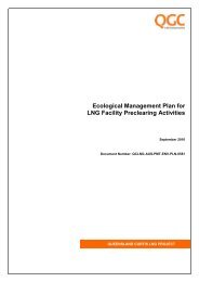
<strong>Pre</strong>-clearing <strong>Ecological</strong> <strong>Survey</strong> <strong>Report</strong><br />
<strong>QCLNG</strong> <strong>Camps</strong> 1, 2 and<br />
Aldoga Laydown<br />
<strong>QGC</strong>020-ENV-RPT-00133<br />
Rev 1<br />
Produced for: <strong>QGC</strong>
Release authorisation<br />
Originator<br />
Chris Cantwell<br />
Reviewed<br />
Berlinda Ezzy<br />
Approved<br />
Steve Fox<br />
Client<br />
<strong>QGC</strong><br />
Revision record<br />
1 05-5-11 Incorporating client<br />
comments<br />
CC BE SF<br />
0 29-4-11 Final issued to client CC BE SF<br />
A 28-4-11 Draft issued to client CC BE SF<br />
Rev Date Status Originator Reviewed Approved<br />
Page 2 of 21
Table of contents<br />
1 Introduction and Purpose ......................................................................................................... 4<br />
2 Definitions and Abbreviations .................................................................................................. 5<br />
3 Methodology ............................................................................................................................... 5<br />
4 <strong>Survey</strong> Results ........................................................................................................................... 7<br />
4.1 Camp Site Descriptions ....................................................................................................... 7<br />
4.1.1 Proposed Camp 1 ........................................................................................................... 7<br />
4.1.2 Proposed Camp 2 ......................................................................................................... 11<br />
4.1.3 Proposed Aldoga Laydown ........................................................................................... 16<br />
4.2 Threatened <strong>Ecological</strong> Communities ................................................................................ 20<br />
4.3 Regional Ecosystems ........................................................................................................ 20<br />
4.4 EVNT Flora Species .......................................................................................................... 20<br />
4.5 Other <strong>Ecological</strong> Features ................................................................................................. 20<br />
5 Conclusion ................................................................................................................................ 21<br />
6 References ................................................................................................................................ 21<br />
Appendix 1 - Personnel CV .............................................................................................................. 22<br />
Page 3 of 21
<strong>QCLNG</strong> Project<br />
<strong>Pre</strong>-clearingg <strong>Ecological</strong> <strong>Survey</strong> <strong>Report</strong><br />
<strong>QCLNG</strong>G Camp Sites s 1, 2 and Aldoga Laydown<br />
1<br />
Introduction and Purpose<br />
5.<br />
Before the clearance of native vegetation in the pipeline p ROWW the proponent must:<br />
a. undertake pre-clearance surveys for the presence of listed threatened species,<br />
their habitat and listed ecological communities; and<br />
b. alternatively, where recent surveys have already a beenn undertaken and those<br />
surveys meet the Department’s<br />
requirementss for surveyss for the relevant Matters<br />
of National Environmental Significance (MNES), the proponent may elect to<br />
develop management plans based on those surveys in accordance with the<br />
requirements of Condition 8.<br />
6.<br />
<strong>Pre</strong>-clearance surveys must:<br />
<strong>QGC</strong><br />
(a BG-Group Company) is in the approval phase of the <strong>QCLNG</strong> Project with both<br />
Commonwealth<br />
and State Government approvals obtained in October 2010. . The Project comprisess<br />
threee main elements:<br />
The Coal Seam Gas (CSG) Fields;<br />
Gas<br />
Collection Header (GCH) and Export Pipeline (EP); and<br />
LNG<br />
facility on Curtis Island. .<br />
The CSG Fields<br />
and GCH occur in the Southern Brigalow Belt Bioregion B of Queensland<br />
between the<br />
towns of Tipton and Taroom. The LNG Plant is located on Curtis Island on the Central Queensland<br />
Coast immediately north of the city of Gladstone. The EP links these two areas. The pipeline runs<br />
north-east from the western<br />
end of Barakula State<br />
Forest (north of Miles) ) through to<br />
the Central<br />
Queensland Coast.<br />
The construction of the Project will include unavoidable impacts on remnant native<br />
vegetation<br />
protected under<br />
the State Vegetation Management<br />
Act 1999 ( VM Act) andd Threatened <strong>Ecological</strong><br />
Communities (TECs) under the Commonwealth Environment<br />
Protection<br />
and Biodiversity<br />
Conservation Act 1999 (EPBC Act). Impacts to flora and fauna species listedd as threatened under the<br />
State Nature Conservation Act 1992 (NCC Act) and/or the EPBC Act A may also occur.<br />
Ancillary to the construction of the EP, camp sites are required too accommodate staff and provide for<br />
laydown areas for piping and associated infrastructure. This report describes the results of pre-<br />
clearance surveys conducted on three (3) sites, including Camp 1 (KP 65) and Camp 2 (KP 5) along<br />
the EP, and the Aldoga Laydown Area which is located near Gladstone.<br />
Conditions 5 to<br />
13 of the<br />
Commonwealth Department of Sustainability, Environment, Water,<br />
Population and Communities (DSEWPC) approval for the Pipeline component of the Project have<br />
been<br />
considered. This report specificallyy addresses Conditions 5 to 7 relatingg to the requirements for<br />
pre-clearance surveys, as follows:<br />
a. for each<br />
listed species, be undertaken in accordance withh the Department’s<br />
survey guidelines in effect at the time of the survey. s This information can be<br />
obtained<br />
from http://www.environment.gov.au/epbc/guidelines-<br />
by the Department in<br />
writing;<br />
policies. html#threatened;<br />
b. be undertaken by a suitably qualified ecologist approved<br />
c. document the survey methodology, results and significant findings in relation to<br />
MNES; and<br />
d. apply best practice site assessment and ecological survey methods<br />
appropriate<br />
for each<br />
listed threatened species, migratory species, their habitat and listed<br />
ecological communities.<br />
Page 4 of 21
<strong>QCLNG</strong> Project<br />
<strong>Pre</strong>-clearingg <strong>Ecological</strong> <strong>Survey</strong> <strong>Report</strong><br />
<strong>QCLNG</strong>G Camp Sites s 1, 2 and Aldoga Laydown<br />
7.<br />
<strong>Pre</strong>-clearance survey reports (which documentt the methods used and<br />
the resultss<br />
obtained) must be published by the proponent and provided to the Department at the<br />
time of publication.<br />
2<br />
Definitions and Abbreviations<br />
Table 1 provides<br />
an explanation of termss and acronyms used within the document.<br />
Table 1. Explanation of Terms and Abbreviations<br />
used in thee document<br />
Term<br />
CSG<br />
DERM<br />
DSEWPC<br />
EP<br />
EPBC Act<br />
ERE<br />
EVNT<br />
GCH<br />
HERBRECS<br />
KP<br />
LCRE<br />
NC<br />
Act<br />
OCRE<br />
RE<br />
ROW<br />
SEVT<br />
TEC<br />
VM<br />
Act<br />
Wildlife<br />
Online<br />
Definition<br />
Coal Seam Gas<br />
Department of Environment and Resource Management<br />
Department of Sustainability, Environment, Water, Populationn and Communities<br />
Export Pipeline<br />
Environmentt Protection and Biodiversity Conservation Act 1999<br />
Endangered Regional Ecosystem as defined under the Vegetation Management<br />
Act 1999<br />
Endangered, Vulnerable or Near Threatened floraa and fauna species under the<br />
NC Act and including Extinct, Extinctt in the Wild, Critically Endangered,<br />
Endangered, Vulnerable and Conservation Dependent under r the EPBC Act<br />
Gas Collection Header<br />
A database of all plant specimen records held by the Queensland Herbarium<br />
Kilometre Point along thee pipeline ROW<br />
Least Concern Regional Ecosystem as defined under the Vegetation<br />
Management Act 1999<br />
Nature Conservation Actt 1992<br />
Of Concern Regional Ecosystem as defined under the Vegetation Management<br />
Act 1999<br />
Regional Ecosystem as defined under the Vegetation Management Act 1999<br />
Right of Way<br />
– the pipeline corridor/easement<br />
Semi-evergreen Vine Thicket<br />
Threatened <strong>Ecological</strong> Communities<br />
Vegetation Management<br />
t Act 1999<br />
Database of recorded wildlife sightings and listings of plants, , fungi, protists,<br />
mammals, birds, reptiles, amphibians, freshwaterr fish, marinee cartilaginous fish<br />
and butterflies in Queensland maintained by DERM<br />
3<br />
Methodology<br />
<strong>Pre</strong>-clearancthreee proposed sites. The purpose of the pre-clearance surveyy was to identify and document the<br />
ecological values contained within the site. <strong>Ecological</strong> values that were targeted during<br />
the survey<br />
included:<br />
surveys weree conducted by Unidel ecologists commissioned<br />
by <strong>QGC</strong> att each of the<br />
<br />
<br />
<br />
presence and extentt of Threatened <strong>Ecological</strong> Communities (TECs) under the EPBC Act;<br />
presence and extentt of Regionall Ecosystems(REs) mapped under the VM Act;<br />
presence of Endangered, Vulnerable and Near Threatened (EVNT) flora speciess listed under<br />
the EPBC Act and/or the NC Act; and<br />
Page 5 of 21
<strong>QCLNG</strong> Project<br />
<strong>Pre</strong>-clearingg <strong>Ecological</strong> <strong>Survey</strong> <strong>Report</strong><br />
<strong>QCLNG</strong>G Camp Sites s 1, 2 and Aldoga Laydown<br />
other ecological and environmental features incidentally observed o including:<br />
o<br />
o<br />
o<br />
o<br />
o<br />
o<br />
o<br />
Regionally significant flora;<br />
Hollow-bearing trees;<br />
Brachychiton<br />
species (bottle trees and kurrajongs);<br />
Grass trees and fig trees;<br />
Rocky and gravel outcrops;<br />
Adjoining wetlands; and<br />
Fauna breeding sites.<br />
Prior to the surveys being conducted inn the field the ecologistss undertook desktop assessments to<br />
identify any remnant vegetation or significant flora/fauna speciess that may occur on or near the site.<br />
The desktop assessment included revieww of:<br />
<br />
<br />
<br />
<br />
<br />
<br />
<br />
REs and<br />
High Value<br />
Regrowth vegetation mapping by DERM;<br />
Regional Vegetation Management Codes for<br />
Threshold REs; R<br />
EPBC Act list of threatened floraa or fauna;<br />
EVNTs under the NC<br />
Act;<br />
Wildlife Online (wildlife.online@derm.qld.gov.au);<br />
Essential Habitat; and<br />
MNES search.<br />
The pre-clearance surveys were undertaken on the following dates:<br />
Camp 1 – 4 th November 2010;<br />
Camp 2 – 28 th September 2010; and<br />
Aldoga Laydown – 27 th April 2011.<br />
The entire areaa of the proposed campp sites/laydown area and adjacent areas on each subject<br />
property were surveyed. All three sites comprised rural paddockss that were highly modified from their<br />
original condition. A walkthrough surveyy was conducted using random meander technique (Cropperr<br />
1993), which involved traversing the study area in no set pattern, but roughly back and<br />
forth, whilst<br />
searching for species of interest identified in desktop searches. Where environmental<br />
values weree<br />
encountered, their position was recorded on a hand-held GPSS device and if they occurred as a<br />
population they were counted. Photographs were also taken to record thee condition of ecological<br />
values that weree encountered at each camp site. A summary off the findingss during the survey weree<br />
then<br />
recorded on<br />
a Project Environmenta<br />
al Clearance form.<br />
Plant specimenss observed were identified in the field using appropriate field guides and taxonomic<br />
keys. Specimens that could not be identified in the field were collected for more detailed examinationn<br />
and identificationn in the office. Where necessary, confirmation of plant identifications was<br />
sought from<br />
the Queensland Herbarium. Nomenclature for scientific and common names followed that of Bostock<br />
and Holland (2007).<br />
Incidental observations of EVNT faunaa species, regionally significant flora, hollow-bearing trees,<br />
Brachychiton species, grass trees, fig trees, rocky and gravel outcrops, adjoining wetlands and faunaa<br />
breeding sites were recordedd on a handheld GPS device.<br />
Page 6 of 21
<strong>QCLNG</strong> Project<br />
<strong>Pre</strong>-clearingg <strong>Ecological</strong> <strong>Survey</strong> <strong>Report</strong><br />
<strong>QCLNG</strong>G Camp Sites s 1, 2 and Aldoga Laydown<br />
The surveys were undertaken by Unidel field ecologists Steve Cupitt (Camp 2) and Wayne Harris<br />
(Aldoga Laydown) and <strong>QGC</strong><br />
Environment Officer Ben Salleras (Camp(<br />
1). CVs for Stevee and Wayne<br />
are provided in Appendix 1. The preparation for pre-clearance<br />
surveys, survey methodologies and<br />
write<br />
ups were undertaken with the supervision of Steve Fox, General G Manager of Environment at<br />
Unidel. Steve Fox and Wayne Harris have been approved as suitable by DSEWPC in i writing for<br />
undertaking pre-clearanchighly disturbed, Ben Salleras was considered suitable to undertake the environmental survey of<br />
the site. Steve Fox has reviewed Ben Salleras’ survey results andd supports the findings.<br />
surveys on 28 October 2010. Due to t Camp 1 being completely cleared<br />
and<br />
Subsequent to the initial surveys, a request from <strong>QGC</strong> was forwarded to DSEWPC (21 March 2011)<br />
to approve additional Unidel ecologists for pre-clearance surveys, including Steve Cupitt who<br />
undertook the surveys for Camp 2. This approval was granted byy DSEWPC on 21 April 2011.<br />
4<br />
<strong>Survey</strong> Results<br />
This<br />
section describes the results r of thee pre-clearance surveys undertaken<br />
Aldoga Laydown<br />
for:<br />
on <strong>Camps</strong> 1, 2 and the<br />
<br />
<br />
<br />
<br />
TECs under the EPBC Act;<br />
REs;<br />
EVNT flora species; and<br />
Other notable ecological andd environmental features.<br />
4.1<br />
Camp Site Descriptions<br />
4.1.11 Proposed Camp 1<br />
Proposed Camp<br />
1 is located<br />
on Hubbards Road, Crossroads on Lot 2RP108045, near KP65 of the<br />
Export Pipeline (see Figure 1).<br />
The site is currently used for f pasture, grazed by cattle, and iss entirely clear of native<br />
vegetation.<br />
Directly south of<br />
the proposed camp location are areas of Endangered RE 11.4.12 and Of Concernn<br />
RE 11.3.4/11.3.2/11.3.25, associated with Wambo Creek (see Figures F 1, 3 and 4). These REs are<br />
environmentally<br />
sensitive areas requiringg a 200m buffer. The proposed camp has been designed to<br />
incorporate this buffer (refer to points A6-A10 on Figure 2).<br />
No declared weed species were identified on the site. The weed risk of the site was rated r as low.<br />
The terrain is generally flat, with a minimal slope towards the north, and soils were non-sodicsandy<br />
loams. Wambo Creek flows approximately 250m – 300m south of the proposed site. There was no<br />
erosion observed on the site.<br />
Two<br />
dams and a pond presently exist onn the property, and the design of the proposed camp has<br />
avoided these features (see Figure 2).<br />
Page 7 of 21
<strong>QCLNG</strong> Project<br />
<strong>Pre</strong>-clearing <strong>Ecological</strong> <strong>Survey</strong> <strong>Report</strong><br />
<strong>QCLNG</strong> Camp Sites 1, 2 and Aldoga Laydown<br />
Figure 1 – Proposed Camp 1 Location<br />
Page 8 of 21
<strong>QCLNG</strong> Project<br />
<strong>Pre</strong>-clearing <strong>Ecological</strong> <strong>Survey</strong> <strong>Report</strong><br />
<strong>QCLNG</strong><br />
Camp Sites 1, 2 and Aldoga<br />
Laydown<br />
Figure 2 – Proposed Camp 1 Detail<br />
Page 9 of 21
<strong>QCLNG</strong> Project<br />
<strong>Pre</strong>-clearingg <strong>Ecological</strong> <strong>Survey</strong> <strong>Report</strong><br />
<strong>Camps</strong> s 1, 2 and Aldoga Laydown<br />
Figure 3 – Northern Edge of Endangered RE 11.4. .12 (facing east) e<br />
Figure 4 – Northern Edge of Of Concern RE 11.3.4/11.3.2/11.3.25 (facing west)<br />
Page 10 of 21
<strong>QCLNG</strong> Project<br />
<strong>Pre</strong>-clearingg <strong>Ecological</strong> <strong>Survey</strong> <strong>Report</strong><br />
<strong>Camps</strong> s 1, 2 and Aldoga Laydown<br />
4.1.2<br />
Proposed Camp 2<br />
Proposed Camp<br />
2 is located<br />
on Upper Downfall Creek Road, Guluguba on<br />
on the EP (see Figure 5).<br />
Lot 23 FT272, near KP5<br />
The site has been used for grazing and cropping in the past, and is predominantly clear of vegetation.<br />
Apart from a bottle tree (Brachychiton rupestris) on the westernn end of the southern boundary (seee<br />
Figure 7) and approximately four mature Eucalyptus at the far south-eastern corner off the site, no<br />
living<br />
mature or habitat trees remain on the site or in surrounding areas (see Figure 8) ). One deadd<br />
habitat tree was observed on<br />
the site. Scattered limebush (Citruss glauca) andd some regrowth Acacia,<br />
Eucalyptus and Atalayahemi glauca occur on the site. The design of the camp avoids<br />
these trees<br />
(seee Figure 6), however if the t dead habitat tree must be removed for health and safety reasons, a<br />
fauna spotter will be required. Similarly, thin bands of mixed vegetation line both sides of the Stiller’s<br />
property driveway, and mustt be protectedd through barricading.<br />
Two<br />
weed species were recorded on the site and surrounds; Opuntia O spp. (high risk) and Verbena<br />
spp.<br />
(low risk). The Opuntia spp. (see Figure 9) will require removal and immediate treatment to stop<br />
spread by vehicle tyres. The<br />
property has a mild slope towards the north and north-east, sodic soilss<br />
weree present. There was a moderate level of erosion, particularly at contour outlets and sloping<br />
drainage lines. Downfall Creek (stream order 3) runs along the north of the property, within 320m of<br />
the proposed camp site. A minor unnamed drainage<br />
channel borders the site from the south-eastern<br />
corner, and travels along the eastern and northernn boundaries of the site. Stringent erosion and<br />
sediment control measures will be required within and bordering the site, including sediment basins at<br />
site outfalls in proximity to Downfall Creek.<br />
Page 11 of 21
<strong>QCLNG</strong> Project<br />
<strong>Pre</strong>-clearing <strong>Ecological</strong> <strong>Survey</strong> <strong>Report</strong><br />
<strong>Camps</strong> 1, 2 and Aldoga Laydown<br />
Figure 5 – Proposed Camp 2Location<br />
Page 12 of 21
<strong>QCLNG</strong> Project<br />
<strong>Pre</strong>-clearing <strong>Ecological</strong> <strong>Survey</strong> <strong>Report</strong><br />
<strong>Camps</strong> 1, 2 and Aldoga Laydown<br />
Figure 6 – Proposed Camp 2 Detail<br />
Page 13 of 21
<strong>QCLNG</strong> Project<br />
<strong>Pre</strong>-clearingg <strong>Ecological</strong> <strong>Survey</strong> <strong>Report</strong><br />
<strong>Camps</strong> s 1, 2 and Aldoga Laydown<br />
Figure 7 – Bottle Tree at Southern Boundary<br />
Figure 8 – Proposed Site (facing north-east from proposed access point)<br />
Page 14 of 21
<strong>QCLNG</strong> Project<br />
<strong>Pre</strong>-clearingg <strong>Ecological</strong> <strong>Survey</strong> <strong>Report</strong><br />
<strong>Camps</strong> s 1, 2 and Aldoga Laydown<br />
Figure 9 – Opuntia spp. at southern boundary to be removedd<br />
Page 15 of 21
<strong>QCLNG</strong> Project<br />
<strong>Pre</strong>-clearingg <strong>Ecological</strong> <strong>Survey</strong> <strong>Report</strong><br />
<strong>Camps</strong> s 1, 2 and Aldoga Laydown<br />
4.1.3<br />
Proposed Aldoga Laydown<br />
The proposed Aldoga Laydown site (see Figure 10) is locatedd off Gladstone Mt Larcom Road in<br />
Aldoga. The proposed laydown site is located to the south-east of o Aldoga <strong>Pre</strong>cinct 1, and<br />
is Lot 1 of a<br />
five-lot setout plan (see Figure 11) on the property Lot 12 SP162130.<br />
The site has been fully cleared and leveled, presumably for future industrial uses (seee Figure 12) .<br />
Vegetation on the site consists of grasses and occasional low shrubs. Dominant grasses on the site<br />
are Heteropogon<br />
contortus and Chrysopogon fallax (see Figure 13). The dominant shrub species on<br />
the site is the introduced pasture shrub Stylosanthes scabra. There is minimal native regrowth<br />
vegetation (Corymbia tesselaris) on the site and in the surrounding area.<br />
No declared or significant weeds were identified on the site during the field survey, and no REs weree<br />
mapped or observed on the site.<br />
There are no watercourses in proximity to the<br />
environmental factors.<br />
proposed laydown l site, and no<br />
constraining<br />
Page 16 of 21
<strong>QCLNG</strong> Project<br />
<strong>Pre</strong>-clearing <strong>Ecological</strong> <strong>Survey</strong> <strong>Report</strong><br />
<strong>Camps</strong> 1, 2 and Aldoga Laydown<br />
Figure 10 – Proposed Aldoga Laydown Layout Plan<br />
Page 17 of 21
<strong>QCLNG</strong> Project<br />
<strong>Pre</strong>-clearing <strong>Ecological</strong> <strong>Survey</strong> <strong>Report</strong><br />
<strong>Camps</strong> 1, 2 and Aldoga Laydown<br />
Figure 11 – Proposed Aldoga Laydown – <strong>Pre</strong>liminary Lease Lot Setout Plan<br />
Page 18 of 21
<strong>QCLNG</strong> Project<br />
<strong>Pre</strong>-clearingg <strong>Ecological</strong> <strong>Survey</strong> <strong>Report</strong><br />
<strong>Camps</strong> s 1, 2 and Aldoga Laydown<br />
Figure 12 – Aldoga Laydown<br />
Figure 13 – Dominant Grasses on the Aldoga Laydown Site<br />
Page 19 of 21
<strong>QCLNG</strong> Project<br />
<strong>Pre</strong>-clearingg <strong>Ecological</strong> <strong>Survey</strong> <strong>Report</strong><br />
<strong>Camps</strong> s 1, 2 and Aldoga Laydown<br />
4.2<br />
Threatened <strong>Ecological</strong> Communities<br />
There are a number of TECs protected by the EPBC Act mapped in thee vicinity of<br />
associated construction camps. These include:<br />
the EP and<br />
Brigalow (Acaciaa harpophylladominant and co-dominant);<br />
White Box-Yellow Box-Blakely's Red Gum Grassy Woodland and Derived Native<br />
Grassland;<br />
Natural Grasslands on basalt and fine-textured alluvial plains of northern New South<br />
Wales and southern Queensland;<br />
Semi-evergreen<br />
Vine Thickets of the Brigalow Belt (North andd South) and Nandewar<br />
Bioregions; and<br />
Weeping Myall Woodlands.<br />
None of these TECs occur at proposed Camp sites 1 or 2, or the proposed Aldoga Laydown.<br />
4.3<br />
Regional Ecosystems<br />
No Endangered REs, Of Concern REss or Least Concern REss were mapped or observed on the<br />
proposed sites for <strong>Camps</strong> 1, 2 or the Aldoga Laydown. Proposed Camp 1 is located north of<br />
Endangered and<br />
Of Concern REs (see Figures 3 and 4), and Camp 2 is located south of an<br />
Endangered RE; however appropriate buffer zones have been incorporated<br />
into camp layout design<br />
to avoid any impacts on these REs.<br />
4.4<br />
EVNT Flora Species<br />
All three proposed locations were heavilyy cleared rural sites that have been highly modified from their<br />
original condition. No EVNT flora speciess were found<br />
at any of the sites.<br />
4.5<br />
Other <strong>Ecological</strong> Features<br />
Other ecological features encountered<br />
in or near the proposedd sites included a mature bottle treee<br />
(seee Figure 7) and a dead habitat tree att proposed Camp 2.<br />
Page 20 of 21
<strong>QCLNG</strong> Project<br />
<strong>Pre</strong>-clearingg <strong>Ecological</strong> <strong>Survey</strong> <strong>Report</strong><br />
<strong>Camps</strong> s 1, 2 and Aldoga Laydown<br />
5<br />
Conclusion<br />
No TECs were identified at the proposedd sites for <strong>Camps</strong> 1, 2 or the Aldoga Laydown.<br />
No remnant vegetation or EVNT flora species were encountered<br />
at any of thee proposed camp<br />
sites, though Endangered and Of Concern REs exist<br />
in proximityy to Camp sites 1 and 2. This<br />
vegetation will not be affected by the proposed uses, as appropriate buffers have been<br />
incorporated into<br />
camp site design.<br />
Other ecological features identified on the sites, such as drainage areas and mature trees t<br />
weree of a minor nature and have been avoided wherever possiblee in the design.<br />
6<br />
References<br />
Bostock, P.D. and Holland, A.E. (eds) (2007). Census of the Queensland Flora 2007.<br />
Queensland Herbarium, Environmental Protection Agency, Brisbane.<br />
Cropper, S. (1993). Management of Endangered Plants. CSIRO East Melbourne.<br />
Page 21 of 21
<strong>QCLNG</strong> Project<br />
<strong>Pre</strong>-clearingg <strong>Ecological</strong> <strong>Survey</strong> <strong>Report</strong><br />
<strong>Camps</strong> s 1, 2 and Aldoga Laydown<br />
Appendix 1 - Personnel CV
Steve Cupitt<br />
PRINCIPAL ECOLOGIST<br />
Profile<br />
Steve is an ecologist with over 12 years experience in vegetation management and<br />
assessment. During this time, he has worked with over 1,000 landholders in the field, been<br />
manager of the Greening Australia Rural program, Dalby Community Nursery, Environmental<br />
Services Unit and weed control teams. He has consulted for a number of organisations on<br />
wetlands and riparian management and worked closely with State and Commonwealth<br />
Departments on a number of programs, including managing the State Governments<br />
Vegetation Incentives Program.<br />
Qualifications<br />
Associate Degree of Applied Science (Distinction)<br />
Cert 4 Assessment and Workplace Training<br />
RAQ31698 Cert 3 Agriculture (production Horticulture)<br />
Career Summary<br />
2009 – <strong>Pre</strong>sent Senior Ecologist, Unidel<br />
2002 – 2009 Manager West Region, Greening Australia Queensland<br />
Areas of expertise<br />
• Regional Ecosystem Assessment and Identification<br />
• Wetland Management and Assessment<br />
• Riparian Zone Management<br />
• Property Vegetation Management Planning<br />
• Environmental and Habitat Assessments<br />
• Extension / Education to the Rural Community<br />
Industry experience<br />
Offsets<br />
Eastern Star Gas: Steve was involved in the delivery of environmental offsets including<br />
landholder engagement, ground-truthing and preparation of offset agreements.<br />
Queensland Curtis LNG Project, Queensland Gas Company ($8 billion): World first coal<br />
seam gas to LNG project including a 10 000+ well gas field in the Surat Basin, a 400km gas<br />
pipeline to Gladstone and LNG plant on Curtis Island. The project requires extensive offsets<br />
under State and Federal government legislation. Steve was involved in assessment of the
project’s offset requirements, preparation of offset budgets and a landscape scale<br />
assessment to determine the feasibility of securing offsets as well as the early identification of<br />
priority offset sites associated with the Curtis Island Export Facility. Steve has also managed<br />
the landholder engagement process and undertaken extensive liaison with rural landholders<br />
for the provision of offsets.<br />
Wiggins Island Coal Terminal, Wiggins Island Coal Export Terminal Pty Ltd: Steve was<br />
involved in the identification of vegetation offsets for the project, landholder engagement and<br />
field assessments.<br />
Newstead Pipeline Offsets Strategy, APA Wallumbilla: Steve was responsible for assessing<br />
the project’s offset requirements, preparing offset cost estimates and a landscape scale<br />
assessment to determine the feasibility of securing offsets.<br />
Vegetation Management<br />
Steve has significant experience in preparing vegetation management plans and providing<br />
advice on regional ecosystems and on farm conservation programs. Examples of projects<br />
that Steve has been involved in are listed below:<br />
• Origin Energy: Re-vegetation and tree planting project in Spring Gully<br />
• Arrow Energy: Weed control and Weed Identification Consultancy<br />
• Santos: Consulting on Regional Ecosystems<br />
• Braemar Power and <strong>QGC</strong>: Weed Control on 200km Gas pipeline and Braemar Power<br />
Station<br />
• Greening Australia Rural Nursery: Managed the weed control team and<br />
Environmental Services Unit<br />
• Condamine Alliance: Consultant for wetland and riparian management<br />
• Greening Australia: Manager of West Region<br />
• Commonwealth Government: Regional Support Contract<br />
• Greening Australia: State Coordinator Devolved Grants<br />
On Farm Conservation<br />
• Greening Australia: State Manager of Government Vegetation Incentives Program<br />
• Greening Australia: Field Officer with the On Farm Conservation Program<br />
• Greening Australia: Regional Coordinator of the On Farm Conservation Program
Wayne Harris<br />
PRINCIPAL ECOLOGIST<br />
Profile<br />
Wayne has more than 20 years experience in biological sciences particularly in plant<br />
systematics and plant identification, environmental assessment and vegetation mapping. He<br />
has worked in Queensland, Western Australian and Victoria on consultancy assignments for<br />
industry and government. Wayne’s consultancy work has included route selection,<br />
environmental surveying, vegetation mapping, and monitoring.<br />
Wayne has been involved in developing strategies and guidelines for sustainable<br />
development and the protection, enhancement and rehabilitation of species and regional<br />
ecosystems.<br />
Qualifications<br />
Doctor of Philosophy (Plant Systematic)<br />
Master of Science<br />
Bachelor of Science<br />
Career Summary<br />
2009 – <strong>Pre</strong>sent Principal Ecologist, Unidel<br />
1998 – <strong>Pre</strong>sent Research Associate, Queensland Herbarium.<br />
1998 – 2008 Consultant for biodiversity assessments of major development<br />
projects<br />
Botanical surveys and services of local shire councils and<br />
environmental groups.<br />
1995 – 1998 Ph.D. in Systemic Botany, University of Queensland<br />
Industry experience<br />
Oil and Gas<br />
Queensland Curtis LNG Project, <strong>QGC</strong> ($6 Billion+): World first coal seam gas to LNG project<br />
including a 10,000+ well gas field in the Surat Basin, a 400km gas pipeline to Gladstone and<br />
LNG plant on Curtis Island.<br />
Ruby Braemar Pipeline (ERM Power): The project involved the construction of an 80 km long<br />
gas pipeline near Braemar State Forest in Queensland.<br />
Liquid Niugini Gas. Pipeline route and LNG site selection and botanical surveys.
Rail<br />
‘Missing Link’ railway corridor Environmental Impact Assessment for Queensland Rail.<br />
Mining<br />
China First Project, Waratah Coal ($2 Billion+): The project involved the establishment of a<br />
new coal mine, railway and port facilities to export high volatile, low sulphur, steaming coal to<br />
international markets. It included a new coal terminal within the Abbot Point State<br />
Development Area (APSDA) and the Port of Abbot Point, a new mine near Alpha in central<br />
Queensland and a new heavy haul standard gauge rail system linking the mine and coal<br />
terminal.<br />
Coal slurry pipeline for Tarong Power.<br />
In the early part of his career Wayne was employed as a geologist and became Exploration<br />
Manager (Eastern Australia) for the Petroleum Division of Western Mining Corporation.<br />
Defence<br />
Shoalwater Bay Defence property for Department of Defence.<br />
HMAS Cerberus Defence property for Department of Defence.<br />
Kikori River (Papua New Guinea) catchment biodiversity study, for the World Wildlife Fund for<br />
Nature.<br />
Scientific Biological <strong>Survey</strong>s<br />
Invited on two occasions to participate on botanical surveys of the Pilbara region, Western<br />
Australia for the WA government.<br />
<strong>Survey</strong> of Mussau Island (PNG) for the National Capital Botanic Gardens, Port Moresby.<br />
Expedition to the Torricelli Mountains, PNG for an orchid survey on behalf of the National<br />
Capital Botanic Gardens, Port Moresby.<br />
Areas of expertise<br />
• Land access management<br />
• Botanical survey<br />
• Plant classification and identification<br />
• Orchids<br />
• Vegetation Mapping