
Create successful ePaper yourself
Turn your PDF publications into a flip-book with our unique Google optimized e-Paper software.
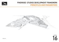
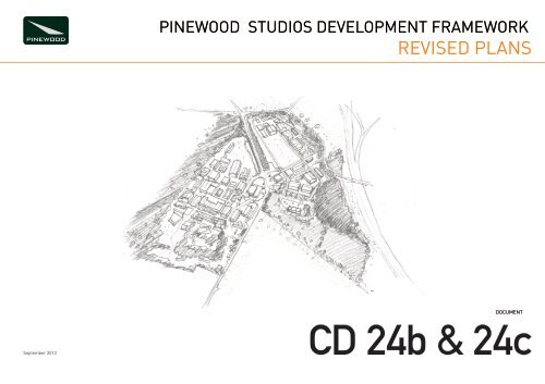
PINEWOOD STUDIOS DEVELOPMENT FRAMEWORK<br />
<strong>REVISED</strong> <strong>PLANS</strong><br />
September 2013<br />
DOCUMENT<br />
CD 24b & 24c
A1<br />
A B C D E F G H I J K L M N<br />
Lodge<br />
1<br />
2<br />
Langley Woodhouse<br />
3<br />
4<br />
St Benedict<br />
Tennis<br />
Court<br />
Presbytery<br />
The Bridgettine<br />
Convent<br />
Astraea<br />
Larkswood<br />
Pine Cottage<br />
Parkspring<br />
Lodge<br />
Pantiles<br />
The Firs<br />
Woodcroft<br />
Posts<br />
Wood<br />
Cottage<br />
Dick<br />
Turpins<br />
Cottage<br />
Springfield Cottages<br />
Hollydene<br />
LB<br />
70.4m<br />
70.1m<br />
Mast<br />
Hill View<br />
Home Farm<br />
Gantry<br />
Cherry<br />
Orchard<br />
Farm<br />
Cherry Orchard<br />
Farm Bungalow<br />
Pond<br />
Gantry<br />
Blanchard's Farm<br />
55.6m<br />
Belle<br />
Farm<br />
Lodge<br />
Belle Farm<br />
Cottage<br />
Nursery<br />
57.3m<br />
The Oaks<br />
Long Coppice<br />
Pond<br />
Pond<br />
N<br />
Sevenhills Farm<br />
Weir<br />
Planning Application Boundary<br />
PROPOSED ROUTES AND<br />
LIMITS OF DEVIATION<br />
Primary Roads<br />
Secondary Roads<br />
NOTE - Cycle paths are included within<br />
the Roads and Development Cells shown.<br />
Controlled Permissive<br />
Pedestrian Access (+/- 10 m)<br />
Footpaths (+/- 10m)<br />
Black Park link path<br />
Edge of secure private land (+/- 10m)<br />
Location of Proposed New Access from<br />
<strong>Pinewood</strong> Road.<br />
- Refer to P-A-003 Rev D<br />
Location of Proposed Access from<br />
Sevenhills Road to be used as both an<br />
Emergency Access and a Secondary<br />
Controlled Vehicular Access - Refer to<br />
P-A-004 Rev E<br />
Limits of Deviation<br />
Road Edge +/- 2 mts.<br />
Road Edge + 5 mts/ - 10 mts.<br />
Road Edge +/- 10 mts<br />
NOTE - preservation of hedgerows and<br />
trees supercedes any inference of<br />
encroachment by a limit of deviation<br />
G:\Jobs\224788-10 PSB - ARAS\4-03 Drawings\4-03-01-02 Arch\Planning\P-P-005.dwg 10 Sep 2013 14:27:50 id: 8E3E25EB-3E97-490C-A687-66B1F346368D Amparo.Galvan<br />
Dromenagh<br />
5<br />
Farm<br />
Strawberry Wood<br />
Pond<br />
Dromenagh<br />
Farm House<br />
6<br />
- 19/ 12/<br />
12<br />
Issued for Outline Planning Approval<br />
Pond<br />
Issue<br />
Date<br />
7<br />
Black Park<br />
Ponds<br />
Knoll House<br />
Heathwood<br />
Arup Associates<br />
Pond<br />
Bratton<br />
Cattle Grid<br />
<strong>Pinewood</strong><br />
Mews<br />
13 Fitzroy Street London W1T 4BQ United Kingdom<br />
t +44 20 7755 2525<br />
www.arupassociates.com<br />
Key Plan<br />
8<br />
TCB<br />
Issues<br />
Baney<br />
9<br />
LB<br />
Chardan<br />
House<br />
Albury<br />
House<br />
Laurel Court<br />
Client<br />
<strong>Pinewood</strong> <strong>Studios</strong> Ltd.<br />
Job Title<br />
<strong>Pinewood</strong> <strong>Studios</strong><br />
Development Framework<br />
Spring<br />
10<br />
60.6m<br />
Drawing Title<br />
Site Access and Circulation<br />
Pond<br />
Park Lodge Farm<br />
Gamekeepers<br />
Cottage<br />
Issues<br />
FB<br />
49.1m<br />
Scale at A1<br />
1:2500<br />
Discipline<br />
Masterplanning<br />
11<br />
0<br />
10m<br />
50m<br />
100m<br />
250m<br />
Iver Heath<br />
Brackenwood<br />
Pond<br />
LB<br />
Mapping reproduced by permission of Ordnance Survey on<br />
behalf of HMSO. © Crown copyright and database right 2012.<br />
All rights reserved.<br />
Ordnance Survey Licence number 100018033<br />
Stag and<br />
Job No<br />
224788-00<br />
Drawing No<br />
P-P-005<br />
Drawing Status<br />
PLANNING<br />
Issue<br />
0i<br />
Hounds<br />
Dellfield Farm<br />
Do not scale<br />
(PH)<br />
© Arup Associates
Notes:<br />
ACCESS TO BE CONSTRUCTED OF<br />
TARMACADAM OR SIMILAR LOCAL<br />
AUTHORITY APPROVED MATERIAL (tbc).<br />
KEY:<br />
EXTENT OF WORKS<br />
EXISTING PUBLIC<br />
HIGHWAY BOUNDARY<br />
EXISTING ACCESS<br />
TO BE WIDENED.<br />
2 No. TREES TO<br />
BE REMOVED<br />
R8.00<br />
REV. DETAILS DRAWN CHECKED DATE<br />
CLIENT:<br />
R14.00<br />
PROJECT:<br />
6.0m<br />
DRAWING TITLE:<br />
EXISTING GATE TO<br />
BE REMOVED AND<br />
REPLACED WITH<br />
BARRIER.<br />
SCALES:<br />
DRAWN:<br />
CHECKED:<br />
DATE:<br />
DRAWING NUMBER:<br />
P-A-004<br />
REVISION:<br />
E
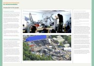
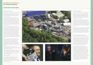
2 <strong>Pinewood</strong> <strong>Studios</strong> Development Framework | DEVELOPMENT FRAMEWORK DOCUMENT<br />
PINEWOOD STUDIOS<br />
DEVELOPMENT FRAMEWORK<br />
SEPTEMBER 2013