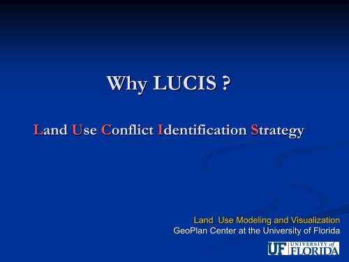
Why LUCIS? - Lake-Sumter Metropolitan Planning Organization
Why LUCIS? - Lake-Sumter Metropolitan Planning Organization
Why LUCIS? - Lake-Sumter Metropolitan Planning Organization

Create successful ePaper yourself
Turn your PDF publications into a flip-book with our unique Google optimized e-Paper software.
<strong>Why</strong> <strong>LUCIS</strong> ?<br />
Land<br />
Use<br />
Conflict<br />
Identification<br />
Strategy<br />
Land Use Modeling and Visualization<br />
GeoPlan Center at the University of Florida
<strong>LUCIS</strong><br />
Land<br />
Use<br />
Conflict<br />
Identification<br />
Strategy<br />
is a<br />
“What if?” land use scenario model developed by professors<br />
and researchers at the University of Florida GeoPlan<br />
Center<br />
Goal-driven GIS model that produces a spatial<br />
representation of probable patterns of future land use
How does the <strong>LUCIS</strong> model work?<br />
<strong>LUCIS</strong> analyzes historical development patterns and their<br />
relationship to show how suitable specific land areas are for<br />
certain uses.<br />
• Agricultural, Conservation, and Urban<br />
• <strong>LUCIS</strong> identifies sensitive environmental factors that would be<br />
impacted by urban development, and conversely areas that are<br />
positive factors for conservation uses (i.e. wetlands, floodplains,<br />
endangered species or habitat, biodiversity).<br />
• <strong>LUCIS</strong> also identifies suitable and/or unsuitable lands for specific<br />
types of urban development potential or agricultural productivity<br />
(i.e. crops, timber production, or residential and commercial<br />
suitability).
<strong>LUCIS</strong> Modeling Process<br />
1. Determine Land Use Suitability<br />
How appropriate are certain locations for future development, future<br />
agricultural use, or future conservation opportunities given existing physical,<br />
access or location characteristics and economic value?<br />
2. Categorize Land Use Preference<br />
There are numerous factors to consider when determining if land is suitable<br />
for a particular use (e.g. Agriculture, Conservation, or Urban). When all of<br />
these factors are considered together, then <strong>LUCIS</strong> assists in determining<br />
ermining<br />
which lands are preferred for those uses?<br />
3. Determine Land Use Conflict<br />
The intrinsic value of lands dictate the appropriateness of future use, but are<br />
there areas that can naturally support more than one type of use? ? Therefore,<br />
to what degree is one future use preferred over another?
<strong>LUCIS</strong> Alternative Futures<br />
Depend Upon<br />
What Type of Future We Are Trying to<br />
Achieve?<br />
Continued Trend, Urban Centers, Increased Green Areas<br />
How Local or Regional Policy Changes Guide<br />
Future Development?<br />
Increased Redevelopment, Implementation of Mass Transit<br />
Options<br />
What might be the Impact of Future Growth on<br />
Transportation, Sensitive Natural Areas, and the<br />
Economy?
Conceptual GIS Suitability Modeling<br />
Goals & Objectives<br />
(Criteria)<br />
Final<br />
Suitability<br />
Expert Input<br />
Community Input
Preference is Organized to Identify<br />
Conflict
The computer model detects conflict, based on which lands are most<br />
appropriate (based on their) characteristics for:<br />
1) urban use,<br />
2) conservation lands,<br />
3) agricultural lands ,<br />
4) minor conflict, and<br />
5) major conflict<br />
Preferred urban<br />
Major conflict<br />
Minor<br />
conflict<br />
Conservation preferred<br />
Agriculture preferred
<strong>LUCIS</strong> Conflict Analysis<br />
• The collapsed preference scores are organized to spatially<br />
identify land use conflict<br />
Value: 1 2 3<br />
Agriculture<br />
Conservation<br />
Urban
An Example of Future Growth<br />
Potential in <strong>Lake</strong> and <strong>Sumter</strong><br />
Counties
Allocation Summary<br />
Employment – <strong>Lake</strong> County<br />
2005 2015<br />
2020<br />
2025<br />
2030<br />
2035<br />
Total New<br />
(new)<br />
(new)<br />
(new)<br />
(new)<br />
(new)<br />
Service<br />
TREND<br />
COMPOSITE<br />
57,493<br />
57,493<br />
21, 362<br />
20,796<br />
9,194<br />
9,544<br />
7,501<br />
7,894<br />
7,143<br />
7,143<br />
7,640<br />
7,652<br />
52,840 (Total<br />
Empl.: 110,333)<br />
53,029 (Total<br />
Empl: 110,552)<br />
Comm<br />
TREND<br />
COMPOSITE<br />
24,283<br />
24,283<br />
10,379<br />
9,838<br />
2,597<br />
3,134<br />
2,198<br />
2,161<br />
1,687<br />
1,817<br />
2,249<br />
2,130<br />
19,110 (Total<br />
Empl: 43,393)<br />
19,080 (Total<br />
empl: 43,363)<br />
Industrial<br />
TREND<br />
COMPOSITE<br />
19,808<br />
19,808<br />
5,241<br />
5,248<br />
1,893<br />
1,894<br />
1,572<br />
1,544<br />
1,685<br />
1,736<br />
2,170<br />
2,132<br />
12,561 (Total<br />
Empl: 32,369)<br />
12,554 (Total<br />
Empl: 32,362)
Allocation Summary<br />
Employment – <strong>Sumter</strong> County<br />
2005 2015<br />
2020<br />
2025<br />
2030<br />
2035<br />
Total New<br />
(new)<br />
(new)<br />
(new)<br />
(new)<br />
(new)<br />
Service<br />
TREND<br />
COMPOSITE<br />
8,523<br />
8,523<br />
3,465<br />
3,396<br />
1,451<br />
1,487<br />
1,135<br />
1,195<br />
1,105<br />
1,068<br />
1,110<br />
1,316<br />
8,266 (Total<br />
Empl.: 16,789)<br />
8,462 (Total<br />
Empl.: 16,985)<br />
Comm<br />
TREND<br />
COMPOSITE<br />
3,256<br />
3,256<br />
2,500<br />
2,427<br />
710<br />
713<br />
484<br />
505<br />
440<br />
428<br />
454<br />
450<br />
4,588 (Total<br />
Empl: 7,844)<br />
4,523 (Total<br />
Empl.: 7,779)<br />
Industrial<br />
TREND<br />
COMPOSITE<br />
3,504<br />
3,504<br />
1,536<br />
1,638<br />
562<br />
520<br />
368<br />
386<br />
423<br />
396<br />
501<br />
530<br />
3,390 (Total<br />
Empl: 6,894)<br />
3,470 (Total<br />
Empl.: 6,974)
Overview<br />
LAKE COUNTY<br />
2005 Population: 263,642<br />
Projected 2035 Population: 504,500<br />
SUMTER COUNTY<br />
2005 Population: 66,447<br />
Projected 2035 Population: 188,500
<strong>LUCIS</strong> Conflict
Commercial Retail Multi-family Single Family<br />
3131
<strong>LUCIS</strong> Mixed Use<br />
Conflict
Existing Urban
2015 Development (Composite)
2020 Development (Composite)
2025 Development (Composite)
2030 Development (Composite)
2035 Development (Composite)
<strong>LUCIS</strong> – Redevelopment and<br />
Densification<br />
The Land<br />
Use<br />
Conflict<br />
Identification<br />
Strategy<br />
also provides<br />
for the identification of areas in existing regional cities<br />
that, through redevelopment, i.e. mixed use<br />
development, new retail and commercial opportunities,<br />
and higher density multi-family residential development<br />
might increase the regional density and thereby<br />
decrease open space development in low density<br />
sprawl.
Redevelopment<br />
Area
Residential
Commercial
Service
Industrial
Retail, Commercial,<br />
Industrial, and Residential
Downtown Eustis<br />
Before<br />
Eustis Downtown<br />
Downtown Eustis<br />
After<br />
Eustis Downtown
Downtown Eustis Land Use Plan
Downtown Eustis Site Plan
Integration of BRT into Downtown<br />
Landscape
Integration of BRT into Downtown<br />
Landscape
Some Final Remarks<br />
<strong>LUCIS</strong> is a method/model for identifying land use opportunities<br />
and conflict?<br />
<strong>LUCIS</strong> helps in the understanding/allocation of employment<br />
and population? However, the allocation of population and<br />
employment is more often than not policy oriented, which can<br />
be either development based or conservation based?<br />
<strong>LUCIS</strong> is a tool not the final answer – if the land use policy is<br />
toward low density development (sometimes called sprawl) then<br />
<strong>LUCIS</strong> shows where the conflict will occur --- often indicating<br />
that the areas of high agricultural and conservation preference<br />
will be developed.
Question