Full version, low resolution, 7.5MB - InterRidge
Full version, low resolution, 7.5MB - InterRidge
Full version, low resolution, 7.5MB - InterRidge

You also want an ePaper? Increase the reach of your titles
YUMPU automatically turns print PDFs into web optimized ePapers that Google loves.
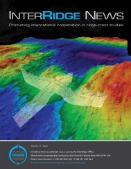
International Research<br />
identified, the three features shown in Figure 2b have steep slopes<br />
of between 20° and 25° facing away from the axis and slightly<br />
domed, gently dipping surfaces facing west towards the axis.<br />
The occurrence of OCCs east of the MAR at the 13°N region<br />
indicates that core complex formation is not limited to the western<br />
side of the axis and may have been occurring on both sides of the<br />
spreading center simultaneously. The identification of core<br />
complexes as far as 220 km from the MAR on both sides of the axis<br />
suggests that detachment faulting has been occurring at this section<br />
of the MAR axis for the past ~20 Myrs.<br />
Intra-transform spreading center, 7º40’N<br />
Segmented transform systems consist of several faults offset by<br />
short axial rifts referred to as intra-transform spreading centers<br />
(ITSCs) [Menard and Atwater, 1969; Searle, 1983; Pockalny et al.,<br />
1997], where active seafloor spreading and crustal accretion are<br />
occurring [Fornari et al., 1989; Hekinian et al., 1992; Perfit et al.,<br />
1996]. Intra-transform spreading centers are believed to result from<br />
plate motion changes over the last few million years that has caused<br />
extension within the transform. The spreading centers may have<br />
begun as 'leaky' transforms and later evolved into organized<br />
spreading centers with continued extension [Pockalny et al., 1997].<br />
We mapped the western portion of the spreading center which joins<br />
two transform valleys within the Doldrums FZ near 7.3°N, 34.7°W<br />
(Figure 3). The axial valley is oriented NW-SE, and is about 30 km<br />
in length. Hummocky terrain on the valley floor forms an axial<br />
volcanic ridge with high backscatter as seen in the sidescan data<br />
derived from the EM122 and suggests recent volcanic activity in this<br />
short spreading segment. The northern intersection of the axis and<br />
transform fault contains a nodal basin about 5000 m in depth, which<br />
curves to the west. The southern nodal basin, which is only partially<br />
imaged, reaches depths of 5600 m. The western rift mountain at<br />
7.3°N rises to a height of ~2.5 km above the axial valley floor, and<br />
has a NW-SE trending crest. Teleseismic earthquakes in this ridge<br />
segment (Figure 3) are mostly located off-axis although a small<br />
number of events are located in the axial valley itself. Since<br />
teleseismic earthquakes error locations are large, we will have to wait<br />
for the hydrophone-recorded seismicity to know if these<br />
earthquakes are associated with movement on the transform faults<br />
or some other process at the spreading center.<br />
Mid-Atlantic Ridge, 5ºN<br />
Data were acquired over the ridge axis in the region of 5°N,<br />
approximately 90 km of which is shown in Figure 4. High<br />
backscatter, hummocky terrain and circular features are indicative<br />
of widespread present day volcanism in the axial valley. Between<br />
5.2 and 5.4°N, the center of the axial valley is dominated by a ~35<br />
km-long ridge, which rises to a height of ~200 m above the valley<br />
floor. The symmetrical shape of its flanks and the hummocky<br />
texture suggest the ridge is volcanic in origin, although the sidescan<br />
data are inconclusive since the ridge is directly beneath the ship<br />
centerbeam. To the west of the axial valley, we have noted two<br />
features, ~10 km in length, which may indicate active detachment<br />
faulting. They show a curved geometry in plan view, and their<br />
smooth backscatter signature suggests they are not hummocky and<br />
thus, not volcanic in origin.<br />
Next steps<br />
In the next stage of this project we will recover the hydrophone<br />
moorings in 2014 after two years of data acquisition. The data will<br />
be analyzed to identify earthquake locations, and used to interpret<br />
the seismicity at the ridge axis and fracture zones in the context of<br />
what we know about the geologic structures. The hydrophone data<br />
will be made available soon after completion of the cruise. The<br />
earthquake locations will also be made available once they are<br />
obtained.<br />
During the recovery cruise, additional multibeam data will be<br />
collected to add to the existing bathymetry database; these will be<br />
made available through the National Geophysical Data Center<br />
(http://www.ngdc.noaa.gov/mgg/bathymetry/multibeam.html).<br />
We are now in the process of obtaining all existing bathymetry data<br />
to generate a map of the equatorial Atlantic region as a resource for<br />
the entire community.<br />
Acknowledgements<br />
The hydrophone project is supported by the U.S. National Science<br />
Foundation OCE 1062238 (D. Smith, R. Dziak PIs). <strong>InterRidge</strong><br />
Cruise Bursaries enabled CP, RPT and AZ to participate in cruise<br />
AT21-03. We gratefully acknowledge the excellent co-operation of<br />
the Captain, crew and scientists aboard R/V Atlantis during Cruise<br />
AT21-03.<br />
References<br />
Blackman, D. K., J. R. Cann, B. Janssen, and D.K. Smith. Origin of<br />
extensional core complexes: Evidence from the Mid-Atlantic Ridge<br />
at Atlantis Fracture Zone. J. Geophys. Res., 103, 21315-21333, 1998.<br />
Buck, W. Roger. Flexural Rotation of Normal Faults. Tectonics, 7,<br />
959-973, 1988.<br />
Cann, J. R., D. K. Blackman, D. K. Smith, E. McAllister, B. Janssen,<br />
S. Mello, E. Avgerinos, A. R. Pascoe and J. Escartín. Corrugated slip<br />
surfaces formed at North Atlantic ridge-transform intersections.<br />
Nature, 385, 329-332,1997.<br />
Escartin, J., D.K. Smith, J. Cann, H. Schouten, C. H. Langmuir and<br />
S. Escrig. Central role of detachment faults in accretion of s<strong>low</strong>spreading<br />
oceanic lithosphere. Nature, 455,790-794, 2008.<br />
Hekinian, R., D. Bideau, M. Cannat, J. Francheteau and R. Hebert.<br />
Volcanic activity and crust-mantle exposure in the ultrafast Garrett<br />
transform fault near 13°28’S in the Pacific. Earth Planet. Sci. Lett.,<br />
108, 259-275,1992.<br />
Macleod, C. J., R. C. Searle, B. J. Murton, J. F. Casey, C. Mal<strong>low</strong>s, S.<br />
C. Unsworth, K. L. Achenbach and M. Harris. Life cycle of oceanic<br />
core complexes. Earth Planet. Sci. Lett., 287, 333-344, 2009.<br />
INTERRIDGE NEWS 26 VOL.21, 2012