Stewardship Plan - the Town of Dennis
Stewardship Plan - the Town of Dennis
Stewardship Plan - the Town of Dennis

You also want an ePaper? Increase the reach of your titles
YUMPU automatically turns print PDFs into web optimized ePapers that Google loves.
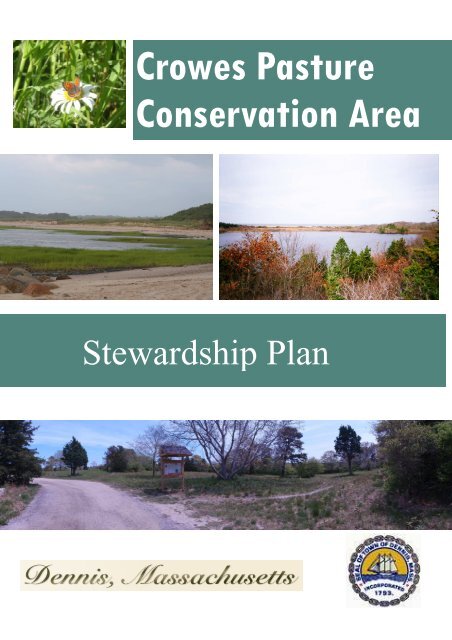
Crowes Pasture<br />
Conservation Area<br />
Steward Program<br />
<strong>Stewardship</strong> <strong>Plan</strong>
Crowes Pasture Conservation Area<br />
<strong>Stewardship</strong> <strong>Plan</strong><br />
2012<br />
<strong>Dennis</strong> Department <strong>of</strong> Natural Resources<br />
Karen M. Johnson, Director<br />
Brian F. Everett, Land Management Specialist<br />
With support from <strong>the</strong> following agencies:
Vision Statement<br />
IT IS THE VISION OF THE TOWN OF DENNIS CONSERVATION COMMISSION TO<br />
CONSERVE, PROTECT AND RESTORE ALL THE NATURAL RESOURCES FOUND AT<br />
CROWES PASTURE CONSERVATION AREA SO THAT THEY ARE PRODUCTIVE,<br />
FUNCTIONAL AND VIABLE. CROWE’S PASTURE WILL CONTINUE TO SERVE AS A<br />
HAVEN TO WILDLIFE. CROWE’S PASTURE CONSERVATION AREA WILL CONTINUE TO<br />
SUPPORT A WIDE VARIETY OF PUBLIC USES INCLUDING HIKING, HUNTING,<br />
AQUACULTURE, PEDESTRIAN AND ORV BEACH ACCESS, HORSEBACK RIDING, AND<br />
BIRDWATCHING. WITHIN FIVE (5) YEARS CROWES PASTURE CONSERVATION AREA<br />
WILL PROVIDE AN EXCEPTIONAL RESOURCE-BASED EXPERIENCE FOR VISITORS<br />
THROUGH THE DESIGNATION OF A LOOP TRAIL SYSTEM, INSTALLATION OF<br />
EDUCATIONAL SIGNAGE, AND CONSTRUCTION OF PUBLIC USE FACILITIES WHICH<br />
ARE ENVIRONMENTALLY COMPATIBLE.
TABLE OF CONTENTS<br />
I. Executive Summary 1<br />
II. Introduction 3<br />
III. Location and Site Description 4<br />
A. Location 4<br />
B. Acreage and Acquisition 4<br />
IV. Natural Resources Description 6<br />
A. Aquatic Resources 6<br />
a. Barrier Beach 6<br />
b. Kettle Ponds 6<br />
c. Wetlands and Vernal Pools 7<br />
B. Biological Resources 7<br />
a. Geology 7<br />
b. Natural <strong>Plan</strong>t Communities 12<br />
c. Wildlife 16<br />
d. Listed Species 17<br />
C. Cultural Resources 18<br />
a. Archaeological 18<br />
b. Land Use History 19<br />
c. Public Interest 19<br />
V. Management Factors 21<br />
A. Natural Trends and Disturbances 21<br />
B. Legal Obligations and Constraints 22<br />
a. Permitting 22<br />
b. Conservation Restrictions 23<br />
c. Department Operations 24<br />
C. Public Access 24<br />
a. Inventory <strong>of</strong> Trails 24<br />
b. Signage 25<br />
c. Parking Areas 26<br />
d. Accessibility 27<br />
D. Recreation 27<br />
a. Nature Study 28<br />
b. Bird Watching 28<br />
c. Hiking/Walking 28<br />
d. Dog Walking 29<br />
e. Horseback Riding 29<br />
f. Hunting 29<br />
g. Shellfishing/Fishing 30<br />
h. ORV and Pedestrian Beach Use 30<br />
E. Forest Management 30<br />
F. Erosion 31<br />
VI. Management Action <strong>Plan</strong> 33<br />
A. Goals and Strategies 33<br />
B. Operations and <strong>Plan</strong>ned Improvements 33<br />
C. Estimated Timelines & Financial Considerations 35<br />
VII. Literature Cited 36
IX. Appendices 37<br />
A. DCT Conservation Restrictions<br />
B. Bird List<br />
C. <strong>Town</strong> <strong>of</strong> <strong>Dennis</strong> Rules and Regulations for Off Road Vehicles<br />
D. Crowes Pasture Conservation Area Maps<br />
1. Location Map<br />
2. Soils Map<br />
3. Natural Communities<br />
4. Listed Species<br />
5. Trailways<br />
6. Parking Areas<br />
7. Hunting<br />
8. Commercial Aquaculture<br />
9. ORV Trailways<br />
10. Shoreline Change<br />
E. Certificate <strong>of</strong> Compliance (Wetland Permits)<br />
F. Aquaculture Approvals (DCS, DMF)<br />
G. Coles Pond Overlook Disabled Access Design
I. Executive Summary<br />
Crowes Pasture Conservation Area consists <strong>of</strong> seven parcels purchased over several years<br />
through <strong>the</strong> receipt <strong>of</strong> a National Coastal Wetland Grant from <strong>the</strong> U.S. Fish and Wildlife<br />
Service (obtained via <strong>the</strong> Massachusetts Department <strong>of</strong> Conservation and Recreation),<br />
Massachusetts Self-Help monies, and <strong>the</strong> purchase <strong>of</strong> perpetual conservation restrictions by<br />
<strong>the</strong> <strong>Dennis</strong> Conservation Trust. In addition, private funding and in-kind services were<br />
contributed by Save <strong>the</strong> Crowe (a grassroots organization), <strong>the</strong> Association for Preservation <strong>of</strong><br />
Cape Cod, <strong>the</strong> Orenda Wildlife Land Trust, and The Compact <strong>of</strong> Cape Cod Conservation<br />
Trusts.<br />
The Crowes Pasture/Quivet Creek area, which includes properties preserved within <strong>the</strong> <strong>Town</strong><br />
<strong>of</strong> Brewster, encompasses approximately 570 acres <strong>of</strong> contiguous lands. Over 300 acres <strong>of</strong><br />
<strong>the</strong>se lands have been classified as nationally declining wetland types. This area is identified<br />
as a coastal barrier by <strong>the</strong> federal Coastal Barrier Resources System and is part <strong>of</strong> <strong>the</strong><br />
sou<strong>the</strong>rn lobe <strong>of</strong> <strong>the</strong> Massachusetts Bay system and <strong>the</strong> National Estuary Program as<br />
designated by <strong>the</strong> U.S. Environmental Protection Agency. The U.S. Fish and Wildlife Service’s<br />
Gulf <strong>of</strong> Maine Program identifies this area as having significant habitat for a number <strong>of</strong> species<br />
<strong>of</strong> federal concern.<br />
Management <strong>Plan</strong>s have been developed for individual parcels as each piece was acquired. In<br />
1998 a Management <strong>Plan</strong> was developed for ORV use on <strong>the</strong> barrier beach habitats. In 2003,<br />
approximately 250 acres <strong>of</strong> <strong>the</strong> Crowes Pasture area was approved as a District <strong>of</strong> Critical<br />
<strong>Plan</strong>ning Concern (DCPC). In 2004 <strong>the</strong> Sears Property and Coles Pond Management <strong>Plan</strong>s<br />
were finalized. Subsequently, a Baseline Documentation Report was completed for <strong>the</strong><br />
Department <strong>of</strong> Conservation and Recreation on 138 acres <strong>of</strong> <strong>the</strong> property.<br />
There are significant water resource areas within <strong>the</strong> Crowes Pasture Conservation Area,<br />
including both coastal and freshwater resources. Quivet Creek is located along <strong>the</strong><br />
sou<strong>the</strong>asterly border. This creek system includes a large marsh area and a herring run to its<br />
headwaters at Bound Brook Pond. Water quality in Quivet Creek is excellent. Freshwater<br />
resources include Coles Pond and Little Coles Pond. These ponds represent ten (10) acres <strong>of</strong><br />
kettlehole ponds which support rare plant habitat. The ponds are solely dependent on<br />
groundwater.<br />
An ongoing restoration project to restore <strong>the</strong> open field/meadow habitat will continue but<br />
management activities must be scheduled to avoid conflicts with hunters, hikers and bird<br />
monitoring. Likewise, ORV beach use and dog walking must be balanced with piping plover<br />
nesting activities. Input from <strong>the</strong> Crowes Pasture user survey and <strong>the</strong> Crowes Pasture Users<br />
Group will be utilized to develop management guidelines.<br />
This land stewardship plan will help guide <strong>the</strong> current use and future development <strong>of</strong> public<br />
use facilities to balance <strong>the</strong> needs <strong>of</strong> <strong>the</strong> public while protecting <strong>the</strong> existing resources. Existing<br />
uses will be maintained and management needs for each use will be defined.<br />
The goal <strong>of</strong> <strong>the</strong> land stewardship plan is to identify <strong>the</strong> Crowes Pasture resources and to<br />
develop ways to protect and restore those resources while insuring this Conservation Area will<br />
be developed in accordance with <strong>the</strong> conservation restrictions. A management plan which
identifies specific management units has been established. Each unit has goals which are<br />
dependent upon its needs, strategies for accomplishing <strong>the</strong>se goals, a timetable for <strong>the</strong><br />
completion <strong>of</strong> <strong>the</strong> goals, and standards to measure <strong>the</strong> accomplishment <strong>of</strong> <strong>the</strong> goals.<br />
Continued public support will be required to balance all <strong>the</strong> uses at Crowes Pasture<br />
Conservation Area.
II.<br />
Introduction<br />
Prior to purchase by <strong>the</strong> <strong>Town</strong> <strong>of</strong> <strong>Dennis</strong>, Crowes Pasture Conservation Area (CPCA) was<br />
comprised <strong>of</strong> several separately owned parcels <strong>of</strong> property. Management plans were<br />
developed for each parcel as <strong>the</strong>y were acquired, with specific attention paid to <strong>the</strong> critical<br />
habitats present. With <strong>the</strong> consolidation <strong>of</strong> <strong>the</strong>se multiple parcels, management plans and<br />
public use facilities can now be developed which extend throughout <strong>the</strong> conservation area and<br />
showcase all <strong>the</strong> characteristics which make this area an important coastal resource.<br />
The use <strong>of</strong> state and federal funding for <strong>the</strong> purchase <strong>of</strong> <strong>the</strong>se properties requires that access<br />
be provided to everyone, not just residents from <strong>the</strong> <strong>Town</strong> <strong>of</strong> <strong>Dennis</strong>. However, this<br />
requirement does not prevent <strong>the</strong> management entity from enacting limitations <strong>of</strong> <strong>the</strong> type,<br />
volume and timing <strong>of</strong> access and use. Crowe’s Pasture Conservation Area (CPCA) is<br />
designated for passive recreational use, and <strong>the</strong> public utilizes <strong>the</strong> area for a variety <strong>of</strong> uses,<br />
including but not limited to, hiking, dog walking, ORV and pedestrian beach use, hunting and<br />
birdwatching. While generally compatible, <strong>the</strong> continuation <strong>of</strong> <strong>the</strong>se multiple uses requires <strong>the</strong><br />
implementation <strong>of</strong> a variety <strong>of</strong> management practices in order to effectively sustain <strong>the</strong>se uses<br />
for <strong>the</strong> future.<br />
Several separate studies have been conducted at CPCA for <strong>the</strong> purposes <strong>of</strong> identifying<br />
sensitive resources within <strong>the</strong> multiple parcels. Information from <strong>the</strong>se studies has been<br />
utilized and consolidated within this document.<br />
The goal <strong>of</strong> <strong>the</strong> land stewardship plan is to identify <strong>the</strong> CPCA resources and to develop ways<br />
to protect and restore those resources while insuring this Conservation Area will be developed<br />
in accordance with <strong>the</strong> conservation restrictions. A Crowe’s Pasture Users Group was created<br />
to assist <strong>the</strong> <strong>Town</strong> <strong>of</strong> <strong>Dennis</strong> Natural Resources Department, <strong>the</strong> <strong>Dennis</strong> Conservation Trust<br />
and <strong>the</strong> <strong>Dennis</strong> Conservation Commission achieve this goal.<br />
Information received from <strong>the</strong> users group was utilized to develop management priorities for<br />
<strong>the</strong> CPCA. Technical information was ga<strong>the</strong>red from state and federal regulatory agencies to<br />
support <strong>the</strong> management plans and priorities. Permitting information was obtained from<br />
Conservation Commission’s technical consultant and conservation restriction information came<br />
from <strong>the</strong> <strong>Dennis</strong> Conservation Trust and The Compact staff.<br />
This <strong>Stewardship</strong> <strong>Plan</strong> should be viewed as a living document which will require updates every<br />
five (5) years at a minimum. Implementation timeframes are estimates and will depend on <strong>the</strong><br />
level <strong>of</strong> available staffing and financial support.
III.<br />
Location and Site Description<br />
A. Location<br />
Crowes Pasture Conservation Area (41°45’20” N, 70°0 7’53” W) is located in East <strong>Dennis</strong>, and<br />
can be accessed by South Street Extension (also known as Crowes Pasture Road. It is<br />
bordered by Cape Cod Bay to <strong>the</strong> north, Quivet Creek to <strong>the</strong> south and east, and private<br />
property to <strong>the</strong> west. Quivet Creek also serves as <strong>the</strong> border for <strong>the</strong> <strong>Town</strong>s <strong>of</strong> <strong>Dennis</strong> and<br />
Brewster.<br />
Crowes Pasture Location Map<br />
B. Acreage and Acquisition<br />
John Crowe, after whom <strong>the</strong> Pasture is named, was originally deeded 100 acres <strong>of</strong> uplands<br />
and 20 acres <strong>of</strong> meadow in 1648. This meadow was used by <strong>the</strong> residents <strong>of</strong> Quivet neck to<br />
graze <strong>the</strong>ir cattle and livestock. Starting with just 71 acres, <strong>the</strong> <strong>Town</strong> <strong>of</strong> <strong>Dennis</strong> purchased<br />
Crowes Pasture in 1972 with assistance from <strong>the</strong> Massachusetts Self Help Program. Soon<br />
after acquisition, <strong>the</strong> <strong>Dennis</strong> Conservation Commission established regulations for its use in<br />
early 1973. In 1996, The Massachusetts Division <strong>of</strong> Fish and Wildlife established <strong>the</strong><br />
“Biodiversity Initiative,” with <strong>the</strong> following goals:
1. to promote and implement a land stewardship program that maintains and<br />
restores <strong>the</strong> native diversity <strong>of</strong> flora and fauna through active land management<br />
and restoration based upon sound ecological science<br />
2. to develop a program to serve as a model <strong>of</strong> land management where traditional<br />
values, such as hunting, recreational, and forestry resources, are managed to<br />
enhance or restore native plants, animals and natural communities.” (MADFW)<br />
The Massachusetts Upland Program was pursued by <strong>the</strong> <strong>Town</strong> <strong>of</strong> <strong>Dennis</strong> with <strong>the</strong> goal <strong>of</strong> a<br />
successful reclamation <strong>of</strong> <strong>the</strong> abandoned meadows at Crowes Pasture in 1998. The relative<br />
large size and complexity <strong>of</strong> <strong>the</strong> conservation area was considered a high priority for<br />
remediation and protection, and in <strong>the</strong> fall <strong>of</strong> 1999, maintenance activities began to reclaim <strong>the</strong><br />
grasslands.<br />
The former Mullin property (33.49 acres) was purchased by <strong>the</strong> <strong>Town</strong> <strong>of</strong> <strong>Dennis</strong> in July 2003.<br />
Originally owned by a conglomerate <strong>of</strong> landowners, <strong>the</strong> land was slated for development as a<br />
residential neighborhood to be located at <strong>the</strong> entrance <strong>of</strong> <strong>the</strong> conservation area.<br />
The most recent and last land acquisition, <strong>the</strong> Sears property, was purchased in October 2004<br />
with a $500,000 grant from <strong>the</strong> Massachusetts Self-Help Program and $1.3 million from <strong>the</strong><br />
<strong>Town</strong> <strong>of</strong> <strong>Dennis</strong> Land Bank. Under direct control <strong>of</strong> <strong>the</strong> <strong>Dennis</strong> Conservation Commission, <strong>the</strong><br />
28.05 acre property connects <strong>the</strong> 56 protected acres on <strong>the</strong> west side <strong>of</strong> Crowes pasture<br />
conservation area to <strong>the</strong> 116 protected acres on <strong>the</strong> eastern side, bordering Quivett Creek/<br />
<strong>Town</strong> Of Brewster.
IV.<br />
Natural Resources Description<br />
A. Aquatic Resources<br />
Barrier Beach<br />
A barrier beach is typically a narrow strip <strong>of</strong> beach and dunes which is separated from <strong>the</strong><br />
mainland by a narrow body <strong>of</strong> fresh, brackish or saline water or a marsh system. All dunes<br />
extending from <strong>the</strong> beach to <strong>the</strong> marsh, bay or river are considered part <strong>of</strong> <strong>the</strong> barrier beach. A<br />
barrier beach may be joined to <strong>the</strong> mainland at one or both ends. Barrier beaches play<br />
important roles to serve as storm buffers and as habitat for a variety <strong>of</strong> species, many <strong>of</strong> which<br />
are listed as threatened or endangered. Barrier beaches are very dynamic and <strong>of</strong>ten change.<br />
Typically <strong>the</strong> beach is less steep and wider during <strong>the</strong> summer months, becoming narrower<br />
and steeped in <strong>the</strong> winter. Over time barrier beaches migrate landward. The ability <strong>of</strong> <strong>the</strong><br />
dunes and beach to respond to storm winds and waves is important to maintain. Left<br />
unaltered, <strong>the</strong>se beaches rebuild <strong>the</strong>mselves while maintaining landward salt marsh systems.<br />
The CPCA contains a dynamic barrier beach which provides an important habitat to numerous<br />
plant and animal species. Each spring, <strong>the</strong> Piping Plovers arrive and establish nests on <strong>the</strong><br />
beach. The <strong>Dennis</strong> Department <strong>of</strong> Natural Resources (DNR) annually hires a shorebird<br />
monitor who documents nesting activities and breeding success. On <strong>the</strong> north side <strong>of</strong> <strong>the</strong><br />
barrier beach is <strong>the</strong> main travel corridor for ORV’s. ORV’s can also utilize <strong>the</strong> front beach on<br />
<strong>the</strong> west side to access <strong>the</strong> expansive tidal flats. ORV use is closely regulated in order to<br />
prevent damage to <strong>the</strong> barrier beach and associated dunes and tidal areas.<br />
Behind <strong>the</strong> barrier beach is Quivet Creek and associated salt marsh habitats. This tidal creek<br />
connects Cape Cod Bay to Bound Brook and is a productive anadromous fish passage. The<br />
herring run at Bound Brook is cleaned annually to maintain fish passage. The American<br />
Osprey, a recent species removed from <strong>the</strong> states threatened status list, also calls Quivet<br />
Creek its home. Each summer, Ospreys can be observed nesting and foraging over <strong>the</strong> creek.<br />
In addition to providing important wildlife habitat, <strong>the</strong> salt marsh serves as a protective<br />
measure in <strong>the</strong> event <strong>of</strong> storm surge or storm damage.<br />
Kettle Ponds<br />
When <strong>the</strong> glaciers retreated from Cape Cod, large chunks <strong>of</strong> ice were left behind. As <strong>the</strong>se ice<br />
chunks melted, <strong>the</strong> landscape above <strong>the</strong>m collapsed leaving large water-filled depressions<br />
called “kettle holes’. Kettle holes extend into <strong>the</strong> groundwater table and typically lack a surface<br />
water inlet or outlet. The water surface <strong>of</strong> <strong>the</strong>se ponds typically fluctuates up and down in<br />
response to <strong>the</strong> seasonal rise and fall in <strong>the</strong> aquifer. Monitoring long term fluctuations in pond<br />
elevations provides data for use in determining <strong>the</strong> susceptibility <strong>of</strong> endangered shoreline plant<br />
species, evaluating groundwater flow direction and reviewing potential impacts from<br />
surrounding land uses.<br />
Cole’s Pond and Little Cole’s Pond are situated in <strong>the</strong> northwestern portion <strong>of</strong> <strong>the</strong> CPCA.<br />
Access to <strong>the</strong>se ponds is restricted. As a result <strong>of</strong> this limited access, use by <strong>the</strong> public is<br />
limited with distant parking areas and long walks to <strong>the</strong> ponds. Rare plant species can be<br />
found along <strong>the</strong> 2800 linear feet <strong>of</strong> shoreline. Limiting access while allowing passive<br />
recreational opportunities assists in <strong>the</strong> protection <strong>of</strong> <strong>the</strong>se species. The Plymouth gentian, a<br />
state Species <strong>of</strong> Special Concern can be found in <strong>the</strong> late summer around <strong>the</strong> shore <strong>of</strong> Coles<br />
Pond when <strong>the</strong> shoreline is exposed due to lower water levels. Black willow (Salix nigra) is
occasionally found on <strong>the</strong> boundaries with water willow <strong>the</strong> only species that occurs in <strong>the</strong><br />
deeper water around <strong>the</strong> pond margins. DCT and DNR staff will conduct a baseline survey <strong>of</strong><br />
Cole’s pond as time allows in <strong>the</strong> future.<br />
Wetlands and Vernal Pools<br />
Vernal Pools are unique wildlife habitats known for <strong>the</strong> amphibians and invertebrate animals<br />
that use <strong>the</strong>m to breed. These pools typically fill with water in <strong>the</strong> fall or winter season due to<br />
rainwater and rising groundwater, and remain saturated through <strong>the</strong> spring and early summer.<br />
Vernal pools typically dry out at <strong>the</strong> end <strong>of</strong> summer each year. This drying out period is<br />
important for <strong>the</strong> purpose <strong>of</strong> limiting fish populations which prey on <strong>the</strong> amphibian and<br />
invertebrate species that rely on <strong>the</strong>se habitats for breeding success.<br />
Some vernal pools are protected by <strong>the</strong> Massachusetts Wetland Protection Act regulations.<br />
The Massachusetts Natural Heritage Endangered Species Program (NHESP) serves to<br />
<strong>of</strong>ficially “certify” vernal pools that are documented by citizens, researchers and o<strong>the</strong>r parties.<br />
Located primarily behind <strong>the</strong> barrier beach surrounded by upland forest, <strong>the</strong> CPCA wetlands<br />
serve as important breeding habitat for a variety <strong>of</strong> amphibian species that call <strong>the</strong> CPCA<br />
home. Although six areas in <strong>the</strong> CPCA have been previously identified and mapped as<br />
potential vernal pools by <strong>the</strong> MA Division <strong>of</strong> Fisheries and Wildlife, <strong>the</strong>ir Rapid Ecological<br />
Assessment Team found that most areas in <strong>the</strong> CPCA did not fit <strong>the</strong> definition <strong>of</strong> a classic<br />
vernal pool. Based on <strong>the</strong>ir survey, only one <strong>of</strong> <strong>the</strong> potential vernal pools (PVP) as well as two<br />
areas not mapped by <strong>the</strong> Division, are considered as likely vernal pools. O<strong>the</strong>r areas <strong>of</strong> <strong>the</strong> site<br />
(shrub swamps, shallow emergent marsh, kettlehole level bog) might contain depressions that<br />
meet <strong>the</strong> technical definition <strong>of</strong> vernal pool habitat. Those areas that were considered likely<br />
vernal pools had clearly defined basin depressions and were not permanently flooded. Surveys<br />
were not conducted during <strong>the</strong> breeding season for typical vernal pool breeding amphibians.<br />
These seasonally wet areas will continue to be monitored for <strong>the</strong> presence <strong>of</strong> Vernal Pool<br />
Species. Potential species could include Fowlers Toad, Spadefoot Toad, or even a Spotted<br />
Salamander, all <strong>of</strong> which have threatened status within <strong>the</strong> State. The remoteness <strong>of</strong> <strong>the</strong><br />
vernal pools limits impacts by vehicle and human traffic, to <strong>the</strong> advantage <strong>of</strong> <strong>the</strong> species found<br />
in <strong>the</strong> area.<br />
Monitoring <strong>the</strong>se areas will be a priority in <strong>the</strong> springtime, with <strong>the</strong> goal <strong>of</strong> identifying organisms<br />
to promote biodiversity in <strong>the</strong> conservation area.<br />
B. Biological Resources<br />
Geology<br />
Soils information for Crowes Pasture was updated in September 2002 as part <strong>of</strong> <strong>the</strong><br />
Environmental Review Team Study completed by The Pilgrim Resource Conservation and<br />
Development (RC&D) Area Council. The completed study provided information on soil<br />
mapping, soil descriptions, and soil limitations for development and wildlife habitat. The site<br />
specific information collected by <strong>the</strong> ERT provides more detailed information than that provided<br />
in <strong>the</strong> 1993 Soil Survey <strong>of</strong> Barnstable County which ga<strong>the</strong>red soils data with mapping<br />
limitations measuring 5-8 acres in size.
As summarized in <strong>the</strong> ERT Study, surficial deposits in Sou<strong>the</strong>astern Massachusetts are mainly<br />
glacial and post-glacial deposits. The USGS mapping for <strong>the</strong> area identified <strong>the</strong> surficial glacial<br />
geologic deposits in <strong>the</strong> Quivet Neck/Crowe’s Pasture area as Ice-Contact Deltaic-Lake<br />
Deposits which include: sand, gravel, clayey silt and minor amounts <strong>of</strong> glacial till which were<br />
deposited during an early stage <strong>of</strong> Glacial Lake Cape Cod. Glacial Lake deposits are fine<br />
textured silts and clays once deposited in open lakes which have since drained or filled with<br />
sediment. Those post-glacial deposits mapped in <strong>the</strong> Quivet Neck/Crowes Pasture area<br />
include Dune and Beach deposits (wind deposited sand), Marsh/Swamp and Cranberry Bogs<br />
(organic deposits).<br />
The 1993 Barnstable County Soils Survey identified four (4) major soils types within <strong>the</strong> Quivet<br />
Neck/Crowes Pasture area:<br />
Crowes Pasture contains <strong>the</strong> following soil units:<br />
1. Plymouth soils (excessively drained)<br />
2. Belgrade soils (moderately well drained)<br />
3. Hooksan soils (coastal and beaches)<br />
4. Freetown and Ipswich soils (poorly drained organics)<br />
1 - Water - Fresh water, generally more than 3 feet deep, includes some areas <strong>of</strong><br />
emergent vegetation.<br />
14A – Scitico silt loam, 0 to 3% slopes - Poorly drained soils formed in silty and<br />
clayey glacial lake floor deposits. Scitico soils are hydric associated with wetland areas.<br />
225B – Belgrade silt loam, 3 to 8 % slopes - Moderately well drained soils formed in<br />
silty glacial lake floor deposits. Belgrade soils have seasonal high water tables 1.5 to<br />
3.5’ below <strong>the</strong> surface and very slow permeability in <strong>the</strong> substratum.<br />
226B, 226C,226D – Hinesburg fine sandy loam, 3-8% slopes (B), 8-15%<br />
slopes (C), and 15-25% slopes (D) - Well drained soils formed in sandy eolian<br />
underlain by silty glacial lacustrine deposits. Major limitations relate to slow permeability<br />
<strong>of</strong> <strong>the</strong> silty substratum.<br />
256A – Deerfield loamy sand, 0 to 3% slopes - Moderately well drained soils formed<br />
in sandy glacial outwash deposits. Deerfield soils have an apparent seasonal high water<br />
table 1.5 to 3’ below <strong>the</strong> surface. These soils are associated with aquifer recharge<br />
areas.<br />
258B – Amostown sandy loam 3 – 8% slopes - Moderately well drained soils formed<br />
in sandy eolian material underlain by silty glacial lacustrine deposits. Amostown soils<br />
have a seasonal high water table 1.5 – 3’ below <strong>the</strong> surface. Major limitations are<br />
related to <strong>the</strong> seasonal high water table and <strong>the</strong> slowly permeable substratum.<br />
435B, 435C, 435D – Plymouth loamy coarse sand 3-8% slopes (B), 8-15% slopes<br />
(C), and 15-25% slopes (D) - Excessively well drained soils formed in sandy glacial till.<br />
Plymouth soils are associated with aquifer recharge areas.
436B,436C – Plymouth loamy coarse sand, very stony, 3-8% slopes (B), 8-15%<br />
slopes (C) - Excessively well drained soils formed in sandy glacial till. Plymouth soils<br />
are associated with aquifer recharge areas.<br />
52A – Freetown muck, 0-1% slopes - Very poorly drained soils formed in more than<br />
51” <strong>of</strong> highly decomposed organic material. Freetown soils have a seasonal high water<br />
table +2’ above <strong>the</strong> surface to 1’ below <strong>the</strong> surface. Freetown soils are hydric soils<br />
associated with wetlands.<br />
613C – Hooksan-Duneland complex, hilly - Very deep, hilly and steep excessively<br />
drained Hookan soil and areas <strong>of</strong> Dune land. This soils unit is mapped in areas <strong>of</strong><br />
recent coastal eolian deposits adjacent to beaches and coastal ponds.<br />
614B – Hooksan, wet substratum 2-8% slopes - Moderately well drained soils formed<br />
in recent deposits <strong>of</strong> eolian sand. This map unit is a variant <strong>of</strong> <strong>the</strong> excessively drained<br />
Hooksan series, with a seasonal high water table 1.5 to 4’ below <strong>the</strong> surface.<br />
66A – Ipswich-Pawcatuck-Matunuck complex, 0-1% slopes - Very deep, level, very<br />
poorly drained soils in tidal marshes that are subject to daily inundation by salt water.<br />
They are adjacent to shore areas and brackish ponds<br />
66X – Pawcatuck, overblown phase - Very poorly drained Pawcatuck soils with a 20-<br />
30” deposit <strong>of</strong> recent eolian sand deposited over Pawcatuck soils.<br />
701 – Cranberry bed, abandoned, mineral substratum - Very poorly drained mineral<br />
soils which were formerly used for cranberry bed production but have been abandoned<br />
for more than 5 years and have reverted back to wetland vegetation. The map unit<br />
consists <strong>of</strong> hydric soils associated with wetlands.<br />
704 – Cranberry bed, abandoned, organic substratum - Very poorly drained organic<br />
soils which were formerly used for cranberry bed production but have been abandoned<br />
for more than 5 years and have reverted back to wetland vegetation. The map unit<br />
consists <strong>of</strong> hydric soils associated with wetlands.<br />
Map 2 in D identifies soil types within <strong>the</strong> Crowes Pasture area.
Soils Map<br />
(http://www.pilgrimrcd.org/100902FNL<strong>Dennis</strong>ERT.pdf)<br />
Soils mapping is useful for <strong>the</strong> determination <strong>of</strong> potential land improvements and wildlife<br />
habitat management. All soils within <strong>the</strong> Crowes Pasture area are highly erodible when not<br />
stabilized by natural vegetation. Areas where slopes greater than 8% are present typically<br />
experience accelerated erosion. These soils are found around Cole’s Pond and within <strong>the</strong><br />
coastal beach and dune areas. Therefore disturbances should be minimized in <strong>the</strong>se areas.<br />
Soils are typically rated for <strong>the</strong>ir potential wildlife habitat value based on <strong>the</strong>ir suitability for<br />
establishing, improving or maintaining habitat through vegetation propagation and<br />
management. Ratings are good, fair, poor and very poor.<br />
Good indicates <strong>the</strong> kind <strong>of</strong> habitat is easily established, improved or maintained. Few or no<br />
limitations affect management. Fair indicates <strong>the</strong> kind <strong>of</strong> habitat can be established, improved<br />
or maintained in most places. Moderately intensive management is required. Poor indicates<br />
that limitations are severe for <strong>the</strong> kind <strong>of</strong> habitat. Habitat can be created, improved or<br />
maintained in most places but management is difficult and intensive. Very poor indicates that<br />
restrictions for <strong>the</strong> kind <strong>of</strong> habitat are very severe and that unsatisfactory results can be<br />
expected. Creating, improving or maintaining habitat is impractical or impossible. Table 1<br />
provides a breakdown for <strong>the</strong> Crowes Pasture area.
Table 1. Soils and Wildlife Habitat<br />
Map Unit<br />
Grain<br />
&<br />
Seed<br />
Grasses<br />
&<br />
Legumes<br />
Wild<br />
Herbs<br />
Hardwood<br />
Trees<br />
Coniferous<br />
<strong>Plan</strong>ts<br />
Wetlands<br />
<strong>Plan</strong>ts<br />
Shallow<br />
Wetland<br />
<strong>Plan</strong>ts<br />
Openland<br />
Wildlife<br />
Woodland<br />
Wildlife<br />
14A POOR FAIR FAIR FAIR FAIR GOOD FAIR FAIR FAIR FAIR<br />
225B FAIR GOOD GOOD GOOD GOOD<br />
VERY<br />
POOR<br />
226B POOR FAIR GOOD GOOD GOOD POOR<br />
226C POOR FAIR GOOD GOOD GOOD<br />
226D POOR FAIR GOOD GOOD GOOD<br />
VERY<br />
POOR<br />
VERY<br />
POOR<br />
VERY<br />
POOR GOOD GOOD<br />
VERY<br />
POOR FAIR GOOD<br />
VERY<br />
POOR FAIR GOOD<br />
VERY<br />
POOR FAIR GOOD<br />
Wetland<br />
Wildlife<br />
VERY<br />
POOR<br />
VERY<br />
POOR<br />
VERY<br />
POOR<br />
VERY<br />
POOR<br />
256A POOR FAIR FAIR POOR POOR POOR POOR GOOD GOOD POOR<br />
258B FAIR GOOD GOOD GOOD GOOD POOR POOR GOOD GOOD POOR<br />
435B<br />
VERY<br />
POOR POOR POOR<br />
VERY<br />
POOR<br />
VERY<br />
POOR<br />
VERY<br />
POOR<br />
VERY<br />
POOR<br />
POOR<br />
VERY<br />
POOR<br />
VERY<br />
POOR<br />
435C<br />
VERY<br />
POOR POOR POOR<br />
VERY<br />
POOR<br />
VERY<br />
POOR<br />
VERY<br />
POOR<br />
VERY<br />
POOR<br />
POOR<br />
VERY<br />
POOR<br />
VERY<br />
POOR<br />
435D<br />
436B<br />
52A<br />
704<br />
701<br />
VERY<br />
POOR POOR POOR<br />
VERY<br />
POOR POOR POOR<br />
VERY<br />
POOR<br />
VERY<br />
POOR<br />
VERY<br />
POOR<br />
VERY<br />
POOR<br />
VERY<br />
POOR<br />
VERY<br />
POOR<br />
VERY<br />
POOR<br />
VERY<br />
POOR<br />
POOR<br />
POOR<br />
VERY<br />
POOR<br />
VERY<br />
POOR<br />
VERY<br />
POOR<br />
VERY<br />
POOR<br />
VERY<br />
POOR POOR POOR POOR POOR GOOD GOOD POOR POOR GOOD<br />
VERY<br />
POOR POOR POOR POOR POOR GOOD GOOD POOR POOR GOOD<br />
VERY<br />
POOR POOR POOR POOR POOR GOOD GOOD POOR POOR GOOD<br />
613C<br />
VERY<br />
POOR<br />
VERY<br />
POOR POOR POOR POOR<br />
VERY<br />
POOR<br />
VERY<br />
POOR<br />
VERY<br />
POOR<br />
POOR<br />
VERY<br />
POOR<br />
614<br />
VERY<br />
POOR<br />
VERY<br />
POOR POOR POOR POOR<br />
VERY<br />
POOR<br />
VERY<br />
POOR<br />
VERY<br />
POOR<br />
POOR<br />
VERY<br />
POOR<br />
66A<br />
VERY<br />
POOR<br />
VERY<br />
POOR<br />
VERY<br />
POOR<br />
VERY<br />
POOR<br />
VERY<br />
POOR GOOD GOOD<br />
VERY<br />
POOR<br />
VERY<br />
POOR<br />
GOOD<br />
66X<br />
VERY<br />
POOR<br />
VERY<br />
POOR<br />
VERY<br />
POOR<br />
VERY<br />
POOR<br />
VERY<br />
POOR GOOD GOOD<br />
VERY<br />
POOR<br />
VERY<br />
POOR<br />
GOOD
Natural <strong>Plan</strong>t Communities<br />
Natural Communities within much <strong>of</strong> <strong>the</strong> CPCA were mapped in 2002 as part <strong>of</strong> <strong>the</strong><br />
Environmental Review Team Study completed by The Pilgrim Resource Conservation and<br />
Development (RC&D) Area Council. Mapping was completed according to <strong>the</strong> Natural Heritage<br />
Endangered Species Program (NHESP) Classification <strong>of</strong> Natural Communities in<br />
Massachusetts. Habitat delineations were based on aerial photography interpretation, soils<br />
and vernal pool data layers, wetland<br />
conservancy maps and ground truthing. Although<br />
potential vernal pools exist within <strong>the</strong> Crowes<br />
Pasture property, none have been certified to<br />
date. A survey <strong>of</strong> <strong>the</strong>se potential vernal pools will<br />
be conducted by <strong>Dennis</strong> Natural Resources in<br />
<strong>the</strong> spring <strong>of</strong> 2012.<br />
Wild Cranberry is found throughout <strong>the</strong> conservation area.<br />
Historically, <strong>the</strong> <strong>Town</strong> <strong>of</strong> <strong>Dennis</strong> is known to have <strong>the</strong> first<br />
human farmed crop <strong>of</strong> cranberries in <strong>the</strong> U.S.<br />
Coastal Forest Woodland (CFW) – Coastal<br />
forests within Crowes Pasture can be found<br />
bordering <strong>the</strong> Quivet Creek salt marsh along <strong>the</strong><br />
eastern border <strong>of</strong> <strong>the</strong> property, bordering <strong>the</strong><br />
nor<strong>the</strong>rn edge <strong>of</strong> <strong>the</strong> main pasture area.<br />
The most common canopy trees growing within<br />
<strong>the</strong>se areas at Crowes Pasture are scarlet oak<br />
(Quercus coccinea), white oak (Quercus alba), and post oak (Quercus stellata). O<strong>the</strong>r canopy<br />
species include black cherry (Prunus serotina), tupelo (Nyssa sylvatica), pitch pine (Pinus<br />
rigida) and red cedar (Juniperus virginiana). Shrub species found within <strong>the</strong> coastal forest<br />
woodlands include arrowwood (Viburnum recognitum), shadbush (Amelanchier sp.), bayberry<br />
(Myrica pensylvanica), Morrow’s honeysuckle (Lonicera morrowii) and occasionally<br />
huckleberry (Gaylussacia sp.). Where high soil moisture is found, sweet pepperbush (Clethra<br />
alnifolia) is very common. The herbaceous layer in <strong>the</strong>se areas is generally sparse but typically<br />
contains poison ivy (Toxicodendron radicans), Virginia creeper (Par<strong>the</strong>nocissus quinquefolia)<br />
and greenbrier (Smilax rotundifolia and Smilax glauca). Also identified were two separate<br />
coastal forest woodland dominated by sassafras (Sassafras albidum) and tupelo (Nyssa<br />
sylvatica).<br />
Cultural grassland (CG) – One large area <strong>of</strong> cultural grassland is located within Crowes<br />
Pasture, know as <strong>the</strong> pasture, and represents an area maintained by mowing and prescribed<br />
burning. The cultural grassland area is characterized by a variety <strong>of</strong> grasses including Velvet<br />
grass (Holcus lanatus), Wavy hairgrass (Deschampsia flexuosa), Orchardgrass (Dactylus<br />
glomerata), Sweet Vernal Grass (Anthoxanthum odoratum), Bentgrass (Agrostis spp.), Panic<br />
grasses (Panicum spp.), and many herbaceous plants including Rough Goldenrod (Solidago<br />
rugosa), Blackberry (Rubus spp.), Virginia creeper, Strawberry (Fragaria virginiana),<br />
Hawkweeds (Hypochoeris radicata, Hieracium florentinum), Yarrow (Achillea millefolium),<br />
Spurge (Euphorbia spp.), and Oxeye daisy (Chrysan<strong>the</strong>mum leucan<strong>the</strong>mum). Large oaks,<br />
pitch pines and cedars can be found widely scattered throughout this area.
Maritime Beach Strand (MBS) – Open beaches within Crowes Pasture include sandy areas<br />
near <strong>the</strong> mouth <strong>of</strong> Quivet Creek, <strong>the</strong> frontal sandy beach, and eroding headlands. Glacial<br />
erratic can be found on <strong>the</strong> frontal beach. Most <strong>of</strong> <strong>the</strong> beach lacks vegetation although dusty<br />
Miller (Artemesia stellariana), seabeach sandwort (Honkenya peploides), seabeach orache<br />
(Atriplex pantandra), and seaside<br />
goldenrod (Solidago sempervirens)<br />
can be found at <strong>the</strong> base <strong>of</strong> <strong>the</strong> bluffs.<br />
Glacial Erratic at Crowes Pasture beach west access<br />
Maritime Dune (MD, MD-I) – Two<br />
maritime dune categories were<br />
identified at Crowes Pasture; coastal<br />
and interior. The coastal maritime<br />
dune occurs between <strong>the</strong> beach and<br />
on <strong>the</strong> sandy uplands <strong>of</strong> <strong>the</strong> peninsula<br />
extending between <strong>the</strong> salt marsh and<br />
<strong>the</strong> mouth <strong>of</strong> Quivet Creek. A heavily<br />
used <strong>of</strong>f road vehicle (ORV) trail<br />
extends through this area. The coastal<br />
maritime dune is characterized by<br />
sand blowouts with sparse vegetation.<br />
The most common species found in this area is beach grass (Ammophila breviligulata) with<br />
beach pea (Lathyrus japonicas), pinweed (Lechea spp.) and beach plum found occasionally.<br />
Poison ivy and poverty grass (Danthonia spicata) are also present. Several areas support<br />
extensive lichen communities.<br />
Located between two wetland areas and bordering <strong>the</strong> east side <strong>of</strong> Safari Road, <strong>the</strong> interior<br />
maritime dune community occurs behind a narrow strand <strong>of</strong> maritime forest dominated by post<br />
oak, black oak and beach plum (Prunus maritima) and bayberry. Extensive open sands and<br />
rich lichen communities are present throughout <strong>the</strong> interior dune area. In this area beach plum,<br />
pitch pines and oaks, broad patches <strong>of</strong> golden hea<strong>the</strong>r (Hudsonia ericoides), sickle-leaved<br />
aster (Chrysopsis falcata), and bearberry (Arctostaphylos uva-ursi) can also be found. Isolated<br />
clumps <strong>of</strong> beach grass and aster (Aster rigida) are also present. Bayberry is common along <strong>the</strong><br />
edges, as is red cedar and black cherry.<br />
Maritime Shrubland (MS) – This habitat type can be found on <strong>the</strong> northwestern side <strong>of</strong> <strong>the</strong><br />
property and along <strong>the</strong> roadside edges. It is a thicket dominated by a mix <strong>of</strong> arrowwood,<br />
bayberry, black cherry, shadbush, and Morrow’s honeysuckle. O<strong>the</strong>r common species include<br />
beach plum, high-bush blueberry (Vaccinium corymbosum), tupelo, pitch pine, and stunted<br />
oaks (scrub, post, scarlet, black). It appears from historic aerial photographs (1971) that this is<br />
a successional plant community following historic clearing for pasture. Stonewalls run through<br />
this community type. Poison ivy and Virginia creeper are common.<br />
Pitch Pine – Oak/Red Cedar Forest (PPO) – Located west <strong>of</strong> <strong>the</strong> pasture area, this habitat is<br />
dominated by pitch pine, with oaks (white, scarlet and black) also common. In portions which<br />
were historically pastureland, red cedar is frequently found. The understory is almost an<br />
impenetrable thicket <strong>of</strong> greenbrier in many areas. The herbaceous layer is sparse with grasses<br />
(Deschampsia flexuosa, Festuca filiformis) frequently observed. O<strong>the</strong>r species include<br />
arrowwood, highbush blueberry (Vaccinium corymbosum), Virginia creeper, Poison ivy,<br />
bayberry, honeysuckle (Lonicera morrowii/bella and japonica), scrub oak (Quercus ilicifolia),
and black cherry. Also present is chokeberry (Aronia sp.), little blue stem (Andropogon<br />
scorparia), Yarrow, winged sumac (Rhus copallina), bearberry, Sweet Goldenrod (Solidago<br />
odora) and dewberry (Rubus spp.)<br />
Kettlehole Level Bog (KLB, KLB/SS) –<br />
Two significant areas <strong>of</strong> kettlehole level bog occur within <strong>the</strong> study area: one occurs around<br />
Coles Pond, <strong>the</strong> o<strong>the</strong>r in a small kettlehole depression closer to Quivet Creek. A third<br />
kettlehole bog area was historically cultivated for cranberries, but has now grown up into a<br />
shrub swamp (KLB/SS), and is dominated by swamp azalea (Rhododendron viscosum), Sweet<br />
Pepperbush, Highbush Blueberry, red maple (Acer rubrum) and catbriar (Smilax sp.). <strong>the</strong><br />
kettlehole level bogs are underlain by a thin layer <strong>of</strong> muck over sand, and are dominated by<br />
large cranberry (Vaccinium macrocarpon), candlewick rush, water willow, marsh fern and<br />
marsh St. Johnswort. The perimeters are dominated by swamp azalea, sweet pepperbush,<br />
high bush blueberry, chokeberries (Aronia melanocarpa and A. arbutifolia) and scattered red<br />
maples. Within <strong>the</strong> bogs, Scirpus americanus, Scirpus cyperinus, Juncus canadensis,<br />
cottongrass(Eriophorum virginicum), swamp candles, cattails and poison ivy are also common<br />
growing in and around <strong>the</strong> Sphagnum moss. Spartina pectinata is also present in <strong>the</strong>se<br />
habitats near Coles Pond.<br />
Shrub Swamp (SS) –<br />
Several shrub swamps are scattered throughout Crowes Pasture. These areas were likely<br />
historical kettleholes which intercepted <strong>the</strong> groundwater and over <strong>the</strong> years have developed<br />
into shrub swamps. Many are inaccessible. Common species in this habitat include<br />
arrowwood, sweet pepperbush, swamp azalea, inkberry (Ilex glabra), and tupelo. Water willow<br />
can be found is areas where open water is present. Fetterbush (Leucothoe racemosa),<br />
buttonbush, Bebb’s willow (Salix bebbiana) and Dwarf huckleberry (Gaylussacia dumosa) can<br />
also be found. Open areas <strong>of</strong> Sphagnum moss are also common.<br />
Intertidal Salt Marsh (SM) –<br />
Extensive areas <strong>of</strong> salt marsh dominate <strong>the</strong> eastern side <strong>of</strong> Crowes Pasture extending along<br />
Quivet Creek. The area between <strong>the</strong> low and mean high tide is dominated by saltwater<br />
cordgrass (Spartina alterniflora) with <strong>the</strong> zone between mean high tide and spring high tide<br />
(<strong>the</strong> high marsh) dominated by salt marsh hay (Spartina patens), spike grass (Distichlis<br />
spicata) and black grass (Juncus gerardii) located fur<strong>the</strong>r landward. O<strong>the</strong>r species found along<br />
<strong>the</strong> upper edges include sea lavender (Limonium carolinianum), seaside goldenrod, largeflowered<br />
saltmarsh aster (Aster tenuifolius), saltmarsh germander (Teucrium canadense),<br />
saltmarsh wheatgrass (Agropyron pungens), and three-square (Scirpus pungens). Fur<strong>the</strong>r<br />
upslope in <strong>the</strong> freshest areas switch grass (Panicum virgatum), marsh bentgrass (Agrostis<br />
stolonifera), saltmarsh elder (Iva frutescens), Scirpus robustus, Scirpus americanus, and<br />
groundsel tree (Baccharis halimifolia) are present. Scatterd in low, poorly drained salty areas<br />
are glassworts (Salicornia spp.), saltwort (Salsola kali), and Triglochin maritima.<br />
In <strong>the</strong> upland areas along <strong>the</strong> edges <strong>of</strong> <strong>the</strong> saltmarsh are beach grass, stiff aster, red cedar,<br />
bristly locust (Robinia hispida), rugosa rose (Rosa rugosa), sassafras, black cherry, winged<br />
sumac, bittersweet, shadbush, and o<strong>the</strong>r species.<br />
Wet Meadow (WM) –
Within <strong>the</strong> pasture, several areas <strong>of</strong> wet meadow exist. These are open, seasonally flooded<br />
kettlehole depressions. A drainage ditch connects three <strong>of</strong> <strong>the</strong> wetlands. These areas are<br />
dominated by wool grass (Scirpus cyperinus), Marsh fern (Thelypteris palustris), Marsh St.<br />
Johnswort (Triadenum virginicum), Candlewick Rush (Juncus effuses), Swamp Candles<br />
(Lysimachia terrestris) and Scirpus americanus. Water willow (Decodon verticillata),<br />
buttonbush (Cephalanthus occidentalis), steeplebush (Spiraea tomentosa), inkberry, sensitive<br />
fern (Onoclea sensibilis), Marsh bedstraw (Galium palustre), water horehound (Lycopus sp.)<br />
and grapes (Vitis sp.) are common.<br />
Several species <strong>of</strong> sedges and spikerushes (Eleocharis spp.) are also present. Reed Canary<br />
Grass (Phalaris arundinacea), blue joint grass (Calamagrostis Canadensis) and rice cut grass<br />
(Leersia oryzoides) are also present. Sphagnum moss and cranberries can also be found.<br />
Estuarine Intertidal Brackish Marsh (BTM) –<br />
The area between <strong>the</strong> low and mean high tide is dominated by saltwater cordgrass (Spartina<br />
alterniflora), while <strong>the</strong> zone between <strong>the</strong> mean high tide and spring high tide (<strong>the</strong> high marsh)<br />
is dominated by broad patches <strong>of</strong> salt marsh hay (Spartina patens), spike grass (Distichlis<br />
spicata) and toward <strong>the</strong> upland edge black grass (Juncus gerardii). O<strong>the</strong>r species found near<br />
<strong>the</strong> upper edges include sea lavender (Limonium carolinianum), seaside goldenrod, largeflowered<br />
saltmarsh aster (Aster tenuifolius), saltmarsh germander (Teucrium canadense),<br />
saltmarsh wheatgrass (Agropyron pungens), and three-square (Scirpus pungens). Near <strong>the</strong><br />
freshest edges, switch grass (Panicum virgatum), marsh bentgrass (Agrostis stolonifera),<br />
saltmarsh elder (Iva frutescens), Scirpus robustus, Scirpus americanus and groundsel tree<br />
(Baccharis halimifolia).Scattered in low, poorly drained salty areas are glassworts (Salicornia<br />
spp.), saltwort (Salsolakali) and Triglochin maritima.<br />
Open Water (OW) – Cole’s Pond and one small kettlehole pond surrounded by shrub swamp<br />
represent <strong>the</strong> two areas within Crowes Pasture with year round open water. Plymouth gentian<br />
(Sabatia kennedyana), a state listed species <strong>of</strong> concern, border <strong>the</strong> eastern side <strong>of</strong> Cole’s<br />
Pond along <strong>the</strong> muddy shoreline. O<strong>the</strong>r potential state-listed species that may occur here<br />
include Comet Darner (Anax longipes), New England Bluet (Enallagma laterale) and Pine<br />
Barrens Bluet (E. recurvatum).<br />
Coles Pond, as seen from <strong>the</strong> overlook
Natural communities<br />
Map 3 in Appendix D identifies habitat communities within <strong>the</strong> Crowes Pasture area.<br />
Wildlife<br />
Due to <strong>the</strong> variety and diversity <strong>of</strong> <strong>the</strong> twelve natural communities found at CPCA, our<br />
discussion <strong>of</strong> <strong>the</strong> biodiversity <strong>of</strong> organisms present will be divided into three major habitats:<br />
Marine/Coastal, Pine/Oak Woodlands, and Grassland.<br />
Marine/Coastal: Within <strong>the</strong> marine habitat, in which <strong>the</strong> estuaries, high and low marsh, creeks<br />
and tidal flats encompass <strong>the</strong> estuarine ecosystem, rare and common species thrive. From<br />
large species such as Grey Seals and Diamondback Terrapin turtles to smaller species<br />
including Plovers, shellfish, and insects, foraging habitat is critical and influenced through<br />
human and natural actions. The wrack line, which typically denotes <strong>the</strong> high tide mark on <strong>the</strong><br />
beach, contains valuable food resources such as invertebrates and algae for shorebirds.<br />
Pine/Oak Woodlands: Commonly observed in <strong>the</strong> woodlands are white tailed deer, rabbits,<br />
squirrels, skunks, raccoons, moles, mice and various amphibians. Bird species include<br />
sparrows and warblers, American Robins, Raptors, Titmice, Grey Catbirds, BlueJays,<br />
Bobwhite quail, Ovenbirds, even an occasional Wild turkey. The lack <strong>of</strong> habitat fragmentation<br />
provides a contiguous tract <strong>of</strong> cover and shelter for <strong>the</strong> species in <strong>the</strong> woodlands. Because <strong>of</strong><br />
<strong>the</strong> dense cover, hunting is very difficult within <strong>the</strong> woodlands. “Game Trails” can be found<br />
criss-crossing <strong>the</strong> conservation area, <strong>of</strong>ten under thick pockets <strong>of</strong> briar and vines. The<br />
relatively undisturbed nature <strong>of</strong> <strong>the</strong> woodlands lacks large amounts <strong>of</strong> non-native invasive plant<br />
species, allowing unrestricted animal movement.
Grassland: Locally on Cape Cod, <strong>the</strong> increased development <strong>of</strong> land has resulted in a huge<br />
decline in grassland ecosystems. As a result <strong>of</strong> this decline in habitat, combined with <strong>the</strong><br />
remaining poor quality habitat, species populations that utilize grasslands have also declined.<br />
Native grasses attract insects that small mammals and birds depend upon as a food source. If<br />
grasslands are not maintained annually, <strong>the</strong> grasses are out competed by tree and shrub<br />
growth, resulting in early successional woodlands. By introducing prescribed fire into this<br />
habitat, woody growth is periodically stopped and grasses thrive.<br />
Cape Cod Bird Club members surveyed <strong>the</strong> area in 2002-2004 to determine what species <strong>of</strong><br />
birds, butterflies and dragonflies were utilizing <strong>the</strong> area. An extensive list <strong>of</strong> <strong>the</strong>se species was<br />
compiled. It was recognized that Crowes Pasture was wintering habitat for 20-30 Eastern<br />
Bluebirds; from this, <strong>the</strong> idea <strong>of</strong> establishing a nestbox trail was born. Six boxes were installed<br />
in <strong>the</strong> spring <strong>of</strong> 2004 and o<strong>the</strong>rs added in 2006 and 2008. Currently <strong>the</strong>re are 12 (2011). The<br />
Club organizes a team <strong>of</strong> trained monitors who visit <strong>the</strong> boxes at least once per week during<br />
<strong>the</strong> nesting season from April through mid-August. Field notes are compiled for each visit and<br />
entered into <strong>the</strong> Cornell NestWatch website where <strong>the</strong> results are available to researchers<br />
studying cavity-nesting species <strong>of</strong> birds. Results <strong>of</strong> <strong>the</strong> nestbox survey are also posted on <strong>the</strong><br />
Cape Cod Bird Club’s website. During <strong>the</strong> nestbox monitoring season at least 40 species <strong>of</strong><br />
birds are seen nesting or foraging in Crowes Pasture, <strong>the</strong> surrounding woodlands, and salt<br />
marshes. Many more utilize it during yearly migration and for winter habitat.<br />
In addition to bluebirds, sparrows, swallows, wrens, and warblers have all been observed in<br />
<strong>the</strong> grassland area. White tailed deer can also be seen foraging on <strong>the</strong> grasses and berries.<br />
Listed Species<br />
The adaptive habitat management <strong>of</strong> species and ecosystems undertaken by <strong>Dennis</strong> Natural<br />
Resources has enabled a popular recreational destination to also be enjoyed and inhabited by<br />
locally rare animal species. Limiting non-climate related stressors to species promotes<br />
populations <strong>of</strong> rare species to continue to return year after year. Piping Plovers have<br />
specifically become a high priority for <strong>the</strong> Natural Resources Department, employing seasonal<br />
plover monitors each summer. Their duties include installing fencing, predator exclosures, and<br />
observation and recording <strong>of</strong> breeding trends and behavior. This enables <strong>the</strong> department to<br />
implement management actions that promote plover breeding or to discontinue actions that<br />
have a mitigating effect to <strong>the</strong> bird’s population. Below is a table <strong>of</strong> recorded rare species<br />
found at CPCA to date. When rare species are observed, Natural Resources staff reports <strong>the</strong><br />
findings to <strong>the</strong> Massachusetts Natural Heritage and Endangered Species Program.
Table 2. Listed Species<br />
Federally and State listed species found at Crowes Pasture<br />
SPECIES<br />
Massachusetts<br />
State Status<br />
Federal Status<br />
Roseate Tern Endangered Endangered<br />
Piping Plover Threatened Threatened<br />
Common Tern Special Concern None<br />
Least Tern Special Concern None<br />
Arctic Tern Special Concern None<br />
Coastal Heathland Cutworm Special Concern<br />
None<br />
Straight-Lined Mallow Moth Special Concern<br />
None<br />
Plymouth Gentian Special Concern None<br />
Eastern Box Turtle Special Concern None<br />
Map 4 in Appendix D identifies areas mapped as Estimated Habitat by NHESP within <strong>the</strong><br />
Crowes Pasture area.<br />
C. Cultural Resources<br />
Archaeological<br />
The Archaeological reconnaissance effort put forth by <strong>the</strong> Public Archaeology Library and <strong>the</strong><br />
report submitted in 2003, documents numerous critical resources within <strong>the</strong> CPCA area. PAL<br />
recovered evidence and artifacts that confirm long term land use <strong>of</strong> <strong>the</strong> area dating from <strong>the</strong><br />
Middle Archaic period through late Woodland periods (7,500 to 450 years ago.) This evidence<br />
suggests that <strong>the</strong> Quivet Creek area was a bountiful resource for many years, serving <strong>the</strong><br />
needs <strong>of</strong> both Native Americans and <strong>the</strong> settlers alike. Locations surveyed to <strong>the</strong> north and<br />
east <strong>of</strong> <strong>the</strong> present day cemetery <strong>of</strong>f <strong>of</strong> South Street have indicated possible Indian burial<br />
grounds, marked with various rocks on <strong>the</strong> surface in <strong>the</strong> shapes <strong>of</strong> squares (10’x10’ area).<br />
The shoreline <strong>of</strong> Cole’s Pond was identified as ano<strong>the</strong>r potential historic site, but <strong>the</strong> dense<br />
brush and overgrown vegetation severely limit access to <strong>the</strong>se areas.
Land Use History<br />
Some <strong>of</strong> <strong>the</strong> earliest land use <strong>of</strong> <strong>the</strong> Quivet Creek area was during <strong>the</strong> 1700’s by Captain John<br />
Sears. Due to <strong>the</strong> Revolutionary War in 1776, early colonists struggled because <strong>of</strong> <strong>the</strong> ban on<br />
imports by <strong>the</strong> British Navy. Salt, essential for preserving food and tanning animal furs, was<br />
one commodity that was high in demand, but low in supply due to <strong>the</strong> ban. Captain Sears<br />
began <strong>the</strong> most important land use venture at <strong>the</strong> time with <strong>the</strong> creation <strong>of</strong> a solar powered sea<br />
water evaporation process. Although his business started slowly, (only eight bushels <strong>of</strong> salt<br />
were produced <strong>the</strong> first year) Sears improved his processes, obtained a patent for his works<br />
from <strong>the</strong> U.S. Government, and was remembered as a pioneer in <strong>the</strong> community. As a result <strong>of</strong><br />
this industrial endeavor, most <strong>of</strong> <strong>the</strong> Quivet Creek/Crowes Pasture area was cleared <strong>of</strong> its<br />
woodlands to supply ship building and home building demand. With <strong>the</strong> forest cleared, <strong>the</strong><br />
Pasture was established and <strong>the</strong> residents <strong>of</strong> Quivet Creek brought <strong>the</strong>ir animals to graze. By<br />
<strong>the</strong> 1880’s, historical maps show <strong>the</strong> industry had subsided and most <strong>of</strong> <strong>the</strong> salt works were<br />
retired. Pictured below are some <strong>of</strong> <strong>the</strong> windmills that were built to assist in <strong>the</strong> pumping <strong>of</strong> sea<br />
water into <strong>the</strong> evaporation vats, and <strong>the</strong> monument to Captain John Sears.<br />
Drift whale processing was also an essential commercial activity for <strong>the</strong> settlers <strong>of</strong> Quivet<br />
Creek. Historical resources indicate that this area located on Cape Cod Bay was an area<br />
common to whale standings and settlers exploited <strong>the</strong>se opportunities to harvest and collect<br />
blubber for various uses.<br />
Public Interest<br />
The purchase <strong>of</strong> Crowes Pasture was supported by <strong>the</strong> residents <strong>of</strong> <strong>Dennis</strong> with additional<br />
financial support provided through State and federal agencies. In addition, <strong>the</strong> <strong>Dennis</strong><br />
Conservation Trust actively pursued land purchases contiguous to <strong>the</strong> <strong>Town</strong> purchases. The<br />
CPCA is used for a variety <strong>of</strong> activities and appeals to a wide range <strong>of</strong> users. As a result, <strong>the</strong><br />
CPCA represents a unique destination within <strong>the</strong> <strong>Town</strong> <strong>of</strong> <strong>Dennis</strong>. With <strong>the</strong> increase in use,<br />
negative effects can occur to <strong>the</strong> natural resources over time. Balancing <strong>of</strong> <strong>the</strong> needs <strong>of</strong><br />
multiple users is critical to preserve <strong>the</strong> outdoor experience and protect <strong>the</strong> natural resources.<br />
Proposed activities or changes within Crowes Pasture Conservation Area should be pursued<br />
thoughtfully, and input from <strong>the</strong> various stakeholders is critical for <strong>the</strong> development <strong>of</strong> a plan.<br />
To that end, a Crowes Pasture Users Group was established in November 2010. This group<br />
included representatives from stakeholders including staff from <strong>the</strong> <strong>Dennis</strong> Department <strong>of</strong><br />
Natural Resources, <strong>Dennis</strong> Conservation Commission, The Compact <strong>of</strong> Cape Cod, <strong>Dennis</strong><br />
Conservation Trust and <strong>the</strong> Mass Audubon Society. In addition, members <strong>of</strong> <strong>the</strong> public<br />
representing birdwatchers, ORV users, hunters, aquaculturists, and hikers were included in <strong>the</strong>
group. Representatives from <strong>the</strong> Users Group obtained input from <strong>the</strong>ir respective groups and<br />
provided recommendations to <strong>the</strong> entire Users Group. In addition, a use survey was distributed<br />
by <strong>the</strong> DNR staff, data were compiled and <strong>the</strong> results were shared with <strong>the</strong> Users Group.<br />
Based on <strong>the</strong> input, members <strong>of</strong> <strong>the</strong> Users Group inspected portions <strong>of</strong> <strong>the</strong> CPCA and<br />
identified areas appropriate for <strong>the</strong> installation <strong>of</strong> new trails, benches and information kiosks.<br />
The Users Group represents <strong>the</strong> communication network between <strong>the</strong> DNR, Conservation<br />
Commission, <strong>Dennis</strong> Conservation Trust and <strong>the</strong> recreational users <strong>of</strong> <strong>the</strong> CPCA. This group<br />
will be consulted periodically to provide input regarding new management techniques.<br />
Presentations describing <strong>the</strong> conservation efforts <strong>of</strong> Crowes Pasture and <strong>the</strong> activities <strong>of</strong> <strong>the</strong><br />
<strong>Dennis</strong> Department <strong>of</strong> Natural Resources are <strong>of</strong>ten <strong>the</strong> most effective method <strong>of</strong> raising<br />
community and stakeholder awareness. This plan will continue to undergo public review<br />
through meetings with <strong>the</strong> Conservation Commission and Board <strong>of</strong> Selectmen. Pubic input will<br />
be sought as management activities are enacted and new techniques are proposed. Updates<br />
and activities at Crowes Pasture will continually be updated and revised on <strong>the</strong> <strong>Town</strong> <strong>of</strong> <strong>Dennis</strong><br />
website. The site can be accessed at:<br />
http://www.town.dennis.ma.us/Pages/<strong>Dennis</strong>MA_NaturalResources/index
V. Management Factors<br />
A. Natural Trends and Disturbances<br />
Undeveloped land is subject to seasonal changes and natural trends which occur over time.<br />
Crowes Pasture Beach, a dynamic barrier beach can be expected to change slope and width<br />
with <strong>the</strong> seasons as sand is eroded and deposited. Over time barrier beaches migrate<br />
landward and it is important to maintain <strong>the</strong> ability <strong>of</strong> <strong>the</strong> dunes and beach to respond to storm<br />
winds and waves. Implementation <strong>of</strong> a long term monitoring program to periodically assess <strong>the</strong><br />
beach and dune pr<strong>of</strong>iles can identify potential problem areas. Once identified, ongoing uses <strong>of</strong><br />
<strong>the</strong> barrier beach need to be reviewed to identify <strong>the</strong> underlying causes <strong>of</strong> problems.<br />
The kettle ponds represent a unique and fragile natural habitat in <strong>the</strong> CPCA. The water surface<br />
<strong>of</strong> <strong>the</strong>se ponds typically fluctuates up and down in response to <strong>the</strong> seasonal rise and fall in <strong>the</strong><br />
aquifer. Water elevations within <strong>the</strong>se ponds have a direct correlation with <strong>the</strong> success <strong>of</strong><br />
endangered plant species inhabiting <strong>the</strong> pond edges. Implementation <strong>of</strong> a monitoring program<br />
to record long term fluctuations in water elevations can help identify potential problems.<br />
Natural grassland habitats must be maintained in order to halt natural succession towards<br />
hardwood forest. If not maintained, grasses are out competed and early successional<br />
woodlands take over, <strong>the</strong>reby limiting <strong>the</strong> diversity <strong>of</strong> habitat and prohibiting use <strong>of</strong> <strong>the</strong> area by<br />
a large variety <strong>of</strong> animal species. When invasives are allowed to out compete <strong>the</strong> native<br />
vegetation, <strong>the</strong> biodiversity suffers due to a lack <strong>of</strong> proper food available to foragers.<br />
Successful grasslands management requires a number <strong>of</strong> tools: prescribed burning, grassland<br />
mowing, invasive species removal, and education. Prescribed burning refreshes grasslands,<br />
producing a healthier habitat with more food and cover.<br />
Within <strong>the</strong> pitch pine oak forest, which makes up <strong>the</strong> largest natural community in <strong>the</strong><br />
conservation area, trails must be maintained for <strong>the</strong> accessibility <strong>of</strong> hikers and walkers. Most<br />
maintenance activities are conducted with hand tools to minimize impacts that heavy<br />
machinery could incur. Trail maintenance will be done on a continual basis as trails expand<br />
and future ones are planned.
View <strong>of</strong> <strong>the</strong> grasslands, looking east. Without proper maintenance, this area would be overwhelmed<br />
with early successional trees such as oaks, cherries, and pines.<br />
During <strong>the</strong> summer, when Crowes is at its peak usage, it is imperative that <strong>the</strong> roads and<br />
parking lots are maintained and accessible or parking could become chaotic. When <strong>the</strong><br />
grasses are high and unkempt, <strong>the</strong> parking spaces appear uninviting and <strong>the</strong> visitors <strong>of</strong>ten look<br />
elsewhere. Encroachment from trees and shrubs into <strong>the</strong> road ways are also maintenance<br />
issues with which <strong>Town</strong> <strong>of</strong> <strong>Dennis</strong> must contend. On <strong>the</strong> more narrow roads such as <strong>the</strong> tidal<br />
flat access road, passing vehicles can easily be scratched by overhanging limbs drawing<br />
criticism from <strong>the</strong> various stakeholders.<br />
B. Legal Obligations, Operations and Constraints<br />
Permitting<br />
With <strong>the</strong> presence <strong>of</strong> Piping Plovers and o<strong>the</strong>r federally listed species in <strong>the</strong> CPCA, <strong>the</strong><br />
conservation area falls under strict federal management guidelines to protect <strong>the</strong>se species<br />
and future ones (<strong>the</strong> U.S. Fish and Wildlife Service categorizes species as Endangered,<br />
Threatened, or Special Concern as a priority ranking system for protection). The Endangered<br />
Species Act (ESA) specifically outlines what activities can and cannot occur in <strong>the</strong> area. A<br />
“take” as explained in Section 10 <strong>of</strong> <strong>the</strong> ESA describes any activity or action that might harm,<br />
distress, or negatively impact a federally listed species or its habitat as strictly forbidden.<br />
Permits can be applied for through <strong>the</strong> USFWS that potentially limit minor “takes” as long as<br />
mitigation measures are taken. The USFWS also assists in management decisions and<br />
approaches to species management.
In addition <strong>the</strong> MA. Natural Heritage and Endangered Species Program (NHESP) reviews<br />
potential projects in conjunction with MA. Endangered Species Act (MESA).<br />
Certain state regulatory processes may be applicable to specific projects within CPCA.<br />
• Due to <strong>the</strong> proximity to <strong>the</strong> ocean, <strong>the</strong> Office <strong>of</strong> Costal Zone Management should<br />
be advised if any action is proposed below <strong>the</strong> Mean High Water (MHW) mark on<br />
<strong>the</strong> beach. This includes activities pertaining to <strong>the</strong> commercial aquaculture farm<br />
that is located <strong>of</strong>fshore.<br />
• Due to <strong>the</strong> priority habitat designation, coordination with MA Fish and Wildlife<br />
may be necessary under Massachusetts Environmental Policy Act to review and<br />
assess proposed changes to CPCA<br />
Quoting <strong>the</strong> <strong>Dennis</strong> Conservation Trust,<br />
“This project (<strong>the</strong> acquisition <strong>of</strong> Crowes Pasture) illustrated that <strong>the</strong> Trust can assist as a<br />
non-pr<strong>of</strong>it partner working with <strong>the</strong> <strong>Town</strong> and o<strong>the</strong>rs, and is an example <strong>of</strong> how we must<br />
work in <strong>the</strong> 21st century: united in our goal <strong>of</strong> preserving <strong>the</strong> best <strong>of</strong> what’s left, and<br />
confident in our ability to do what’s right.”<br />
This partnership between <strong>the</strong> <strong>Town</strong> and <strong>the</strong> DCT has proven its value for land conservation not<br />
only at Crowes Pasture, but also for a number <strong>of</strong> parcels throughout <strong>the</strong> <strong>Town</strong>. New projects<br />
will be coordinated between <strong>the</strong> <strong>Town</strong> and DCT to insure compatible goals are being met.<br />
Maintenance will be conducted by <strong>Town</strong> <strong>of</strong> <strong>Dennis</strong> Department <strong>of</strong> Natural Resources and<br />
Department <strong>of</strong> Public Works. The <strong>Dennis</strong> Conservation Trust, <strong>Dennis</strong> Natural Resources, and<br />
Conservation Commission all partner toge<strong>the</strong>r to monitor and improve upon <strong>the</strong> land wherever<br />
possible.<br />
Conservation Restrictions<br />
The Crowes Pasture Conservation Area consists <strong>of</strong> several parcels <strong>of</strong> land purchased by <strong>the</strong><br />
<strong>Town</strong> <strong>of</strong> <strong>Dennis</strong> using Land Bank funds supplemented by funding from <strong>the</strong> US Fish & Wildlife<br />
Service (National Coastal Wetland Grant), <strong>the</strong> Commonwealth <strong>of</strong> Massachusetts Department<br />
<strong>of</strong> Conservation and Recreation (DCR) and <strong>the</strong> Self Help Program, and <strong>the</strong> <strong>Dennis</strong><br />
Conservation Trust. The <strong>Dennis</strong> Conservation Trust (grantee) holds restrictions on specific<br />
parcels and requires an annual inspection to ensure <strong>the</strong>re are no negative impacts occurring<br />
on <strong>the</strong> land. Management <strong>Plan</strong>s are required under <strong>the</strong> provisions <strong>of</strong> <strong>the</strong> Massachusetts Self<br />
Help Program Project Agreement for <strong>Dennis</strong> Self Help #37 and Self Help policies and<br />
regulations 301 CMR 5.00.<br />
This <strong>Stewardship</strong> <strong>Plan</strong> is intended to comply with <strong>the</strong> goals and objectives <strong>of</strong> <strong>the</strong> <strong>Town</strong> <strong>of</strong><br />
<strong>Dennis</strong> Open Space and Recreational <strong>Plan</strong>, The Division <strong>of</strong> Conservation Services’ “Land Use<br />
and Management <strong>Plan</strong> Guidelines” as well as to be consistent with <strong>the</strong> provisions <strong>of</strong> <strong>the</strong><br />
Conservation Restrictions protecting <strong>the</strong>se properties.<br />
Under Massachusetts statute, lands managed by <strong>the</strong> Conservation Commission under M.G.L.<br />
c.40, s. 8c are to be used for conservation and passive recreational purposes. This
<strong>Stewardship</strong> <strong>Plan</strong> is intended to reserve <strong>the</strong> Crowes Pasture Conservation Area for public<br />
enjoyment at a level <strong>of</strong> use appropriate to sustain <strong>the</strong> significant natural resources identified on<br />
<strong>the</strong> properties. These properties were acquired for conservation, open space and passive<br />
recreational uses. They are protected from conversion to o<strong>the</strong>r uses by a combination <strong>of</strong><br />
conservation restriction, statutory provisions (MGL c. 40, s. 8c and <strong>the</strong> Land Bank Act) and <strong>the</strong><br />
Constitution <strong>of</strong> <strong>the</strong> Commonwealth. Conversion to uses o<strong>the</strong>r than conservation and passive<br />
recreation would require: a) a majority vote <strong>of</strong> <strong>the</strong> Conservation Commission that <strong>the</strong><br />
properties are no longer needed for conservation; b) a two-thirds vote <strong>of</strong> <strong>Dennis</strong> <strong>Town</strong><br />
Meeting; c) review under <strong>the</strong> MA Environmental Policy Act and approval by <strong>the</strong> Secretary <strong>of</strong><br />
Environmental Affairs; d) release <strong>of</strong> <strong>the</strong> <strong>Town</strong> from <strong>the</strong> provisions <strong>of</strong> <strong>the</strong> conservation<br />
restriction held by <strong>the</strong> MA Department <strong>of</strong> Conservation and Recreation and <strong>the</strong> <strong>Dennis</strong><br />
Conservation Trust; and e) a two-thirds call vote <strong>of</strong> <strong>the</strong> Massachusetts General Court (State<br />
Legislature) and signature by <strong>the</strong> Governor. In addition, <strong>the</strong> state Self Help project agreement<br />
would require <strong>the</strong> <strong>Town</strong> to identify and devote ano<strong>the</strong>r parcel <strong>of</strong> equivalent value and utility for<br />
conservation in exchange for release <strong>of</strong> any <strong>of</strong> <strong>the</strong>se properties.<br />
The recorded Conservation Restrictions for <strong>the</strong> Crowes Pasture Conservation Area properties<br />
identify those activities prohibited in <strong>the</strong> area. In addition, <strong>the</strong>se documents detail those<br />
activities which may be permitted with approval from <strong>the</strong> appropriate Grantee. Copies <strong>of</strong> <strong>the</strong><br />
Conservation Restrictions documents can be found in Appendix A.<br />
Department Operations<br />
<strong>Dennis</strong> Natural Resources employs full time Natural Resource Officers (NRO’s) as well as<br />
seasonal NROs from May-September. These Officers perform a multitude <strong>of</strong> tasks and<br />
activities to ensure public safety and responsible resource management. The Natural<br />
Resources Department coordinates with <strong>the</strong> Conservation Commission to identify CPCA<br />
needs.<br />
C. Public Access<br />
Inventory <strong>of</strong> Trails<br />
Currently, <strong>the</strong> trails at CPCA are limited and a continuous loop trail system is not present. The<br />
first parking area provides access to <strong>the</strong> main walking trail. This trail is moderately easy for<br />
walking but difficulty can occur at <strong>the</strong> beginning where it crosses <strong>the</strong> abandoned cranberry<br />
bog. The trail forks and provides <strong>the</strong> opportunity for walkers to end at <strong>the</strong> roadway or to<br />
continue nor<strong>the</strong>rly to <strong>the</strong> pasture. Two o<strong>the</strong>r short trails, one within <strong>the</strong> pasture and <strong>the</strong> o<strong>the</strong>r<br />
providing access to <strong>the</strong> Coles Pond Overlook provide easy walking.<br />
Survey participants and members <strong>of</strong> <strong>the</strong> Users Group expressed an interest in providing<br />
additional trails and longer trail options with resting areas. Of importance is limiting use <strong>of</strong> <strong>the</strong><br />
roadway by walkers and avoiding conflicts between walkers and vehicles using <strong>the</strong> main<br />
roadway. Development <strong>of</strong> a looped trail network achieves this goal. Members <strong>of</strong> <strong>the</strong> Users<br />
Group visited <strong>the</strong> CPCA twice to identify potential new trail layouts. Care was taken to locate<br />
trails in areas where hunting trails previously existed and/or to border <strong>the</strong> roadway so as to<br />
avoid habitat fragmentation. In addition, a portion <strong>of</strong> <strong>the</strong> trail network should be reworked to<br />
provide accessibility for disabled persons. The Coles Pond Overlook trail is proposed to be<br />
upgraded to allow such access.
The resulting proposed trail network provides an overlook along Quivett Creek and creates a<br />
loop trail system. Walkers can enjoy short or long distance hikes and <strong>the</strong> network avoids<br />
walking along <strong>the</strong> roadway and limits road crossings to two locations. Trails cross a variety <strong>of</strong><br />
habitats and can be accessed year round.<br />
Map 5 in Appendix D identifies existing and proposed trails.<br />
Signage<br />
A large sign identifying Crowes Pasture as a Cooperative Conservation Project is located to<br />
<strong>the</strong> left <strong>of</strong> <strong>the</strong> entrance point to <strong>the</strong> property (see photo). As required by <strong>the</strong> MA Department <strong>of</strong><br />
Conservation and Recreation, <strong>the</strong> sign identifies all parties involved with <strong>the</strong> funding and<br />
purchase <strong>of</strong> <strong>the</strong>se conservation lands. To <strong>the</strong> right <strong>of</strong> <strong>the</strong> entrance, a cedar kiosk has been<br />
erected which is used to display information related to hunting seasons, conservation area and<br />
ORV regulations and general information. Smaller signs indicating speed limits, dog leashing,<br />
etc. are also located here.<br />
Entrance Sign<br />
Kiosk<br />
Parking areas are designated throughout <strong>the</strong> conservation lands with signage kept to a<br />
minimum in order to maintain <strong>the</strong> natural setting. In recent years additional No Parking signs<br />
have been installed in an effort to reduce unauthorized parking in vegetated areas. Additional<br />
signs designating walking trails and ORV regulations are placed where appropriate throughout<br />
<strong>the</strong> conservation lands. Additional signage is installed during <strong>the</strong> summer months when use is<br />
heavy, with many signs removed after Labor Day.<br />
Designated Parking/No Parking Signage
ORV Regulations<br />
Walking Trails<br />
As <strong>the</strong> existing trail system is expanded, new signs will be added to clearly mark trailheads and<br />
<strong>the</strong> associated parking areas. Kiosks will be relocated to maximize viewing by <strong>the</strong> public and<br />
information displays updated periodically to provide <strong>the</strong> most current information to users.<br />
Installation <strong>of</strong> a large interpretive sign in <strong>the</strong> pasture area and at <strong>the</strong> Coles Pond Overlook will<br />
be beneficial for educational purposes and to alert users during hunting season.<br />
Parking Areas<br />
Parking areas at Crowes Pasture are small and scattered throughout <strong>the</strong> conservation lands.<br />
Parking areas are located near <strong>the</strong> entrance to <strong>the</strong> property and along <strong>the</strong> two main access<br />
roadways. Parking areas immediately adjacent to <strong>the</strong> beach trailheads are ill defined and<br />
generally constitute individual spaces under <strong>the</strong> trees. These spaces are intensively used and<br />
could be improved by installing “parking bumpers” or redesigned to consolidate parking areas<br />
in a manner that does not create congestion or restricts <strong>the</strong> passage <strong>of</strong> emergency vehicles.<br />
Survey results indicate that <strong>the</strong> majority <strong>of</strong> users would favor additional parking but do not want<br />
to be assessed a cost for <strong>the</strong> construction <strong>of</strong> a large parking area.<br />
In April 2010, <strong>the</strong> Commission determined that Crowes Pasture Conservation Area parking<br />
should be a maximum <strong>of</strong> 69 spaces. In 2011 Natural Resources staff revisited <strong>the</strong> parking<br />
areas to fur<strong>the</strong>r define <strong>the</strong>se spaces. Two spaces within <strong>the</strong> pasture area were closed and<br />
replaced with two spaces designated within an old, disturbed roadway area. This maintained<br />
<strong>the</strong> previously existing total <strong>of</strong> parking spaces. Throughout <strong>the</strong> 2011 summer season, Natural<br />
Resource Officers maintained available parking at 66 spaces.<br />
With <strong>the</strong> expansion <strong>of</strong> <strong>the</strong> trail system, additional parking is needed to provide trailhead<br />
access. The creation <strong>of</strong> new spaces is not feasible but spaces do exist in proximity to trail<br />
crossings. These spaces are rarely used by beachgoers due to <strong>the</strong>ir distance from <strong>the</strong> beach<br />
access points. Four (4) Trailhead Parking Areas will be designated containing a total <strong>of</strong> four (4)<br />
spaces, shown as P-2, P-3, P4 and P-6 on Map 6. Signage will be installed specifically<br />
identifying <strong>the</strong>se areas for Trailhead Parking. Large rocks will be installed to limit parking to<br />
one (1) vehicle in location. Parking restrictions will be enforced by <strong>the</strong> Natural Resource<br />
Officers.
The remaining parking areas, P1-P13 will incorporate <strong>the</strong> remaining spaces which is consistent<br />
with those area utilized throughout 2010 and 2011. Parking Areas and number <strong>of</strong> spaces in<br />
each lot are designated with signage. Pull <strong>of</strong>f areas along <strong>the</strong> roadways are not considered<br />
safe for vehicle parking and vehicles parked outside designated parking areas are given<br />
citations and required to relocate <strong>the</strong>ir vehicles. Large rocks will be installed to prohibit parking<br />
in disturbed areas.<br />
Parking<br />
Areas<br />
ORV use <strong>of</strong> <strong>the</strong> Crowes Pasture beach is heavy from Memorial Day weekend through Labor<br />
Day weekend. Due to <strong>the</strong> high numbers <strong>of</strong> vehicles using <strong>the</strong> area, parking becomes<br />
problematic and unauthorized parking occurs within vegetated areas. Efforts have been made<br />
in <strong>the</strong> past to close <strong>of</strong>f areas where vegetation removal and soil erosion has occurred. Those<br />
areas have been replaced with more stabilized parking which represents less impact to <strong>the</strong><br />
resources. The installation <strong>of</strong> additional signs is not proposed because too many signs disrupt<br />
<strong>the</strong> natural setting. Consistent enforcement and <strong>the</strong> levy <strong>of</strong> fines for parking violations will<br />
continue and is anticipated to minimize encroachment into natural areas. Parking impacts are<br />
assessed annually and activities adjusted accordingly. Any proposed reduction in parking<br />
spaces will require a public hearing.<br />
Map 6 in Appendix D identifies parking areas at Crowes Pasture.<br />
Accessibility<br />
Access to Crowes Pasture can be accomplished by car, bicycle, horseback and on foot. The<br />
main roadway extends from <strong>the</strong> property entrance approximately 1.5 miles down to <strong>the</strong> beach<br />
access. Access onto <strong>the</strong> beach is limited to 4 x 4 vehicles which have a current <strong>Town</strong> <strong>of</strong><br />
<strong>Dennis</strong> ORV sticker. The road undergoes minimal maintenance, assisting with efforts to restrict<br />
traffic loads and to maintain slow speeds. Passage by low clearance vehicles can be difficult at<br />
times. However, <strong>the</strong> slow speeds allow vehicle passengers to view <strong>the</strong> surroundings and <strong>of</strong>ten<br />
observe wildlife using <strong>the</strong> area. There are several parking areas located immediately adjacent<br />
to <strong>the</strong> roadway. Survey participants were not in favor <strong>of</strong> upgrading <strong>the</strong> roadway and preferred<br />
to maintain lower traffic levels and slower speeds. DNR staff monitors roadways to identify<br />
obstructions and improvements.<br />
There is currently one main trail system located within Crowes Pasture. Proposed expansion <strong>of</strong><br />
this system will provide more walking opportunities <strong>of</strong> varying distances. With <strong>the</strong> exception <strong>of</strong><br />
<strong>the</strong> Coles Pond Overlook Trail, walking trails are maintained for hiking and are not constructed<br />
to be passable by motorized vehicles. This trail is a historic driveway that is wide and provides<br />
a firm, even surface for walking. Vehicle access is prohibited by a locked cable. The cable can
e lifted to allow wheelchair access. The installation <strong>of</strong> an improved gate system will provide<br />
pedestrian and equestrian access as well as wheelchair access while prohibiting motor<br />
vehicles. Wheelchair access will require stabilization <strong>of</strong> <strong>the</strong> trail and will promote more<br />
pedestrian traffic to <strong>the</strong> Coles Pond Overlook. In addition to <strong>the</strong> installation <strong>of</strong> gate,<br />
identification <strong>of</strong> <strong>the</strong> nearby trailhead parking area will assist in improving accessibility to <strong>the</strong><br />
area.<br />
D. Recreation<br />
The multi-use nature <strong>of</strong> <strong>the</strong> conservation area creates an inviting and popular destination for<br />
residents and non residents <strong>of</strong> <strong>Dennis</strong>. Visitors can engage in a variety <strong>of</strong> recreational activities<br />
on a year–round basis. Crowes Pasture is unique in that it provides beach access without <strong>the</strong><br />
assessment <strong>of</strong> a parking fee. Additionally, Off-Road Vehicle use is allowed by permit.<br />
Providing a variety <strong>of</strong> recreational uses creates inherent conflicts and it is important that <strong>the</strong><br />
needs <strong>of</strong> all users be balanced.<br />
Recreational opportunities at Crowes pasture include:<br />
• Nature Study<br />
• Bird Watching<br />
• Hiking/ walking<br />
• Dog walking<br />
• Horseback Riding<br />
• Hunting<br />
• Shellfishing and Fishing<br />
• ORV and pedestrian beach use<br />
• Photography<br />
Nature Study<br />
The many undisturbed habitats at Crowes Pasture provide opportunities for observing wildlife<br />
as well as investigating <strong>the</strong> plant life in <strong>the</strong> area. Installation <strong>of</strong> additional seating areas will<br />
allow hikers to rest and quietly observe <strong>the</strong>ir surroundings. Scheduling <strong>of</strong> informational nature<br />
walks in cooperation with <strong>the</strong> Audubon Society, DCT and o<strong>the</strong>rs will provide <strong>the</strong> opportunity to<br />
educate <strong>the</strong> public on <strong>the</strong> habitat values <strong>of</strong> <strong>the</strong> CPCA.<br />
Bird Watching<br />
Many birdwatchers visit Crowes Pasture. The grassland and <strong>the</strong> salt marsh provide good<br />
opportunities for birdwatching. Cape Cod Bird Club began a relationship with <strong>the</strong> <strong>Dennis</strong>
Natural Resources Department in 2003 as members who were <strong>Dennis</strong> <strong>Town</strong> residents became<br />
involved in public outreach about Crowes Pasture and its purchase. Cape Cod Bird Club<br />
members surveyed <strong>the</strong> area in 2002-2004 to determine what species <strong>of</strong> birds, butterflies and<br />
dragonflies were utilizing <strong>the</strong> area. An extensive list <strong>of</strong> <strong>the</strong>se species was compiled.<br />
It was recognized that Crowes Pasture was wintering habitat for 20-30 Eastern Bluebirds; from<br />
this, <strong>the</strong> idea <strong>of</strong> establishing a nestbox trail was born. Six boxes were installed in <strong>the</strong> spring <strong>of</strong><br />
2004 and o<strong>the</strong>rs added in 2006 and 2008. Currently <strong>the</strong>re are 12 (2011). The Club organizes<br />
a team <strong>of</strong> trained monitors who visit <strong>the</strong> boxes at least once per week during <strong>the</strong> nesting<br />
season from April through mid-August. Field notes are compiled for each visit and entered into<br />
<strong>the</strong> Cornell NestWatch website where <strong>the</strong> results are available to researchers studying cavitynesting<br />
species <strong>of</strong> birds. Results <strong>of</strong> <strong>the</strong> nestbox survey are also posted on <strong>the</strong> Cape Cod Bird<br />
Club’s website. During <strong>the</strong> nestbox monitoring season at least 40 species <strong>of</strong> birds are seen<br />
nesting or foraging in Crowes Pasture, <strong>the</strong> surrounding woodlands, and salt marshes. Many<br />
more utilize it during yearly migration and for winter habitat.<br />
The monitors also observe <strong>the</strong> Osprey nesting activity in Quivet Creek and report <strong>the</strong> results to<br />
Mass Audubon Society as part <strong>of</strong> <strong>the</strong>ir Osprey research.<br />
The Cape Cod Bird Club has also led public bird walks at <strong>the</strong> site which is listed in <strong>the</strong> book<br />
Birding Cape Cod. The book is jointly published by <strong>the</strong> Cape Cod Bird Club and<br />
Massachusetts Audubon Society.<br />
A list <strong>of</strong> birds observed at Crowes Pasture is included in Appendix B.<br />
Hiking/ walking<br />
Existing trails are limited but provide access to a variety <strong>of</strong> habitat within <strong>the</strong> CPCA. Expansion<br />
<strong>of</strong> <strong>the</strong> trail system will provide long and short routes which appeal to a variety <strong>of</strong> users. New<br />
trails will be supported by trail signage and interpretative signage providing background and<br />
education about <strong>the</strong> area. Expanded trails will limit pedestrian use <strong>of</strong> <strong>the</strong> roadway and help<br />
avoid vehicle/pedestrian conflicts.<br />
Although Crowes Pasture peak visitor season is typically summer, outdoor<br />
enthusiasts can find opportunities year-round, like <strong>the</strong>se cross country skiers.
Dog walking<br />
Many visitors, in addition to <strong>the</strong> neighborhood homeowners, enjoy walking <strong>the</strong>ir dogs at<br />
Crowes Pasture. Dogs are allowed within <strong>the</strong> upland areas <strong>of</strong> <strong>the</strong> CPCA at all times <strong>of</strong> <strong>the</strong><br />
year. Dogs are allowed on <strong>the</strong> beach but must be on leash from April 1 through Labor Day due<br />
to Piping Plover breeding activities. When active plover nests are present on <strong>the</strong> beach, dogs<br />
are prohibited until plover chicks fledge. Responsible dog walking (cleaning up after ones pet<br />
and using a leash) is encouraged and citations are issued when <strong>the</strong>re are violations.<br />
Horseback Riding<br />
Horseback riding is allowed in <strong>the</strong> CPCA. Currently this use is limited. As use increases,<br />
monitoring will be undertaken to determine potential impacts from waste products. In order to<br />
limit hiking trail erosion ,horseback riding is primarily limited to <strong>the</strong> roadway and <strong>the</strong> Coles<br />
Pond Overlook trail.<br />
Hunting<br />
Active hunting occurs at Crowes Pasture and <strong>the</strong> area is posted at <strong>the</strong> start <strong>of</strong> <strong>the</strong> season.<br />
During pheasant season (usually <strong>the</strong> Fall) <strong>the</strong> area is stocked by <strong>the</strong> State. Rabbit, deer, and<br />
quail hunting are also permitted according to state regulations. O<strong>the</strong>r hunting regulations<br />
include requiring 500’ safety zones around nearby residences and wearing “Hunter Orange”<br />
colored clothing while engaging in hunting. No hunting is allowed in <strong>the</strong>se 500’ buffer zones.<br />
Signs have been installed identifying this zone on <strong>the</strong> property and when applicable, hunting<br />
dates are posted in <strong>the</strong> kiosks for visitor safety. Because <strong>the</strong> Conservation Area is stocked<br />
with pheasant it is designated as a Wildlife Management Area (WMA) by <strong>the</strong> state and limits<br />
hunting hours from sunrise to sunset here as opposed to ½ hour prior sunrise and ½ hour after<br />
sunset in non WMA’s<br />
Map 7 in Appendix D illustrates <strong>the</strong> Hunter Safety Zone limits.<br />
Shellfishing and Fishing<br />
The CPCA shorefront is used extensively for shellfishing. Nearshore areas are commonly used<br />
by license holders to dig s<strong>of</strong>t shell clams. Additionally, <strong>the</strong> tidal flats are used by commercial<br />
aquaculturists to grow and harvest oysters for sale. Copies <strong>of</strong> State agency approvals for<br />
commercial aquaculture are included in Appendix F.<br />
The commercial aquaculture grants at Crowes Pasture consist <strong>of</strong> 32 separate 1 acre tracts.<br />
The majority <strong>of</strong> grants are tended by<br />
individuals utilizing one vehicle, although some<br />
employ two (2) or more vehicles. The<br />
westernmost grants are accessed at low tide<br />
via <strong>the</strong> beach area known as Little Beach. The<br />
remaining grants are accessed at low tide by<br />
traveling along <strong>the</strong> inner dune trail and<br />
accessing across <strong>the</strong> flats at a posted corridor<br />
near Quivett Creek.<br />
Pedestrian beach goers and ORV users are<br />
prohibited from accessing <strong>the</strong> commercial<br />
Commercial Shellfisherman sorting oysters on a foggy day at
grant areas. Operations <strong>of</strong> <strong>the</strong> grants are monitored by <strong>the</strong> <strong>Dennis</strong> Shellfish Constable and<br />
personnel from <strong>the</strong> MA Division <strong>of</strong> Marine Fisheries.<br />
Map 8 in Appendix D identifies <strong>the</strong> commercial aquaculture area and access.<br />
ORV and pedestrian beach use<br />
The sale <strong>of</strong> ORV stickers represents a significant revenue source which <strong>the</strong> <strong>Town</strong> <strong>of</strong> <strong>Dennis</strong><br />
desires to maintain. The existing permit approvals which allow for ORV use, limit <strong>the</strong> number <strong>of</strong><br />
vehicles which can be accommodated at this beach and sets out specific parameters which <strong>the</strong><br />
<strong>Town</strong> must follow in order to protect Piping Plover and Tern habitat, nests and individual birds.<br />
ORV use is monitored in coordination with monitoring <strong>of</strong> <strong>the</strong> beach width and pr<strong>of</strong>ile to insure<br />
that adequate travel corridors and parking areas exist to accommodate <strong>the</strong> maximum number<br />
<strong>of</strong> vehicles allowable. The Certificate <strong>of</strong> Compliance and Management <strong>Plan</strong> under which this<br />
ORV use is regulated can be found in Appendix E.<br />
ORV regulations are periodically reviewed and updated, and are supplemented with vehicle<br />
management policies which reflect changing conditions on <strong>the</strong> barrier beach. ORV Regulations<br />
are included as Appendix C.<br />
Map 9 in Appendix D delineates <strong>the</strong> ORV Trailways.<br />
E. Forest Management<br />
The diversity <strong>of</strong> habitats found in Crowes Pasture make this a truly unique conservation area.<br />
The forest area size is estimated to be near 90 acres, according to <strong>the</strong> Mass Environmental<br />
Review team which surveyed <strong>the</strong> land. Located within <strong>the</strong> forested area, both Cole’s Pond and<br />
Little Cole’s Pond make up <strong>the</strong> only freshwater bodies <strong>of</strong> water in <strong>the</strong> Conservation Area, but<br />
as previously mentioned, access is severely limited. Wetlands Regulations established by <strong>the</strong><br />
state and <strong>the</strong> <strong>Town</strong> <strong>of</strong> <strong>Dennis</strong> protect <strong>the</strong>se bodies <strong>of</strong> water, and <strong>the</strong> adjoining buffer zones as<br />
well.<br />
Species management within <strong>the</strong> forested areas will be done in accordance with <strong>the</strong><br />
recommendations from <strong>the</strong> States’ Natural Heritage & Endangered Species Program.<br />
Specifically, this includes:<br />
1. Limiting vehicle traffic to existing vehicle corridors and designated parking<br />
areas;<br />
2. Limiting disturbance <strong>of</strong> fallen logs, snags, and o<strong>the</strong>r uncut trees;<br />
3. Limiting soil disturbance throughout <strong>the</strong> forested areas <strong>of</strong> <strong>the</strong> Conservation Area;<br />
and<br />
4. Preventing <strong>the</strong> establishment <strong>of</strong> exotic and invasive species.<br />
These conservation practices minimize mortality in species that prefer forested areas. Species<br />
such as <strong>the</strong> New England Cottontail and <strong>the</strong> Eastern Box Turtle are being studied intensively<br />
due to <strong>the</strong>ir decline in population and habitat loss. Because <strong>of</strong> a lack <strong>of</strong> habitat alteration and
prohibiting harvesting in <strong>the</strong> forest, <strong>the</strong> populations <strong>of</strong> <strong>the</strong>se species should be maintainable as<br />
long as <strong>the</strong>ir habitats are managed appropriately.<br />
Wildland Fire Fighters conduct a prescribed burn on a grassland property. Fire is one <strong>of</strong> <strong>the</strong> most preferred<br />
management tools in <strong>the</strong> maintenance <strong>of</strong> grasslands, such as <strong>the</strong> one found at Crowes Pasture.<br />
F. Erosion<br />
Research from NOAA’s Office <strong>of</strong> Ocean and Coastal Resource Management has found that<br />
<strong>the</strong> coastline <strong>of</strong> Crowes Pasture has eroded at a rate <strong>of</strong> 0.49 and 5.87 feet per year. Severe<br />
storms can lead to costly repairs and great amount <strong>of</strong> time by staff making <strong>the</strong> Conservation<br />
Area safe and accessible. The ecological function <strong>of</strong> this costal habitat is threatened by intense<br />
storms, sea-level rise and man made construction (jetties/seawalls). Sand dunes are described<br />
by MA Fish & Game as a “globally rare natural community,” and justifiably, require constant<br />
monitoring for any change. By restricting pedestrian and vehicle access in <strong>the</strong> dunes through<br />
signage and roping, detrimental effects to <strong>the</strong> dunes are minimized. DNR Officers impose<br />
closures on <strong>the</strong> beach when <strong>the</strong> high tide is forecasted to impede or disrupt travel on <strong>the</strong><br />
beach front. This ensures <strong>the</strong> safety <strong>of</strong> <strong>the</strong> ORV users and lessens <strong>the</strong> environmental impacts.<br />
Because <strong>of</strong> <strong>the</strong> threat <strong>of</strong> erosion <strong>of</strong>ficers also restrict movement in, on, or across dunes<br />
through roping and signage.<br />
Map 10 in Appendix D includes a map <strong>of</strong> shoreline change from 1868 to 2011.
VI.<br />
Management Action <strong>Plan</strong><br />
A. Goals and Strategies<br />
To ensure <strong>the</strong> ecosystems maintain <strong>the</strong>ir integrity and <strong>the</strong> interests <strong>of</strong> <strong>the</strong> visitors to <strong>the</strong><br />
conservation area are protected, <strong>the</strong> <strong>Dennis</strong> Natural Resources Department dedicates<br />
valuable time and resources. Staffing and patrols <strong>of</strong> Crowes Pasture increase in correlation to<br />
<strong>the</strong> warmer months <strong>of</strong> <strong>the</strong> year when <strong>the</strong> beach becomes more inviting. The Department<br />
employs full-time <strong>of</strong>ficers year round, and hires additional full-time seasonal employees. All<br />
staff are trained in first aid/CPR, handling <strong>of</strong> injured wildlife, mammalian strandings,<br />
enforcement <strong>of</strong> applicable regulations, land maintenance, and species identification<br />
(bird/plant/mammal).<br />
The Department <strong>of</strong> Natural Resources and <strong>the</strong> Conservation Commission have developed a<br />
strategy to maintain and balance a variety <strong>of</strong> passive recreational uses at Crowes Pasture. To<br />
do this, access points are inspected no less than twice a year to determine maintenance<br />
needs. Trails are routinely patrolled and hand maintenance done as needed. Signage is<br />
repaired and located appropriately, with signs kept to a minimum in order to maintain <strong>the</strong><br />
natural setting.<br />
Cooperation with o<strong>the</strong>r agencies and non-pr<strong>of</strong>it groups is encouraged for <strong>the</strong> purpose <strong>of</strong><br />
providing educational events for <strong>the</strong> general public. The <strong>Plan</strong> is revisited every five (5) years or<br />
more frequently to determine whe<strong>the</strong>r ongoing efforts have been successful.<br />
B. Operations & <strong>Plan</strong>ned Improvements<br />
Accessibility<br />
Expansion <strong>of</strong> <strong>the</strong> existing trail network will be undertaken to provide opportunities for different<br />
users. This will entail clearing and designation <strong>of</strong> a new loop system with corresponding<br />
installation <strong>of</strong> additional trail signage and vegetation markers which identify plant species along<br />
<strong>the</strong> pathways. Improvements to <strong>the</strong> Coles Pond Overlook Trail will be undertaken which<br />
include <strong>the</strong> installation <strong>of</strong> a specially designed gate to allow pedestrian, wheelchair and<br />
equestrian access while prohibiting vehicle access. The corresponding trail surface will be<br />
leveled and hardened to accommodate wheelchair access to an area with a view <strong>of</strong> Coles<br />
Pond. A typical design detail is included in Appendix G.<br />
The main access road and parking areas will be assessed in <strong>the</strong> spring and fall each year, or<br />
more <strong>of</strong>ten if necessary, to determine <strong>the</strong> extent <strong>of</strong> maintenance needed. Improvements will be<br />
kept to a minimum in order to preserve <strong>the</strong> natural values <strong>of</strong> <strong>the</strong> area and maintain slow<br />
speeds which reduce wildlife mortality. Any improvements within 100’ <strong>of</strong> wetlands and/or<br />
coastal resources will be reviewed with <strong>the</strong> Conservation Commission, <strong>the</strong> <strong>Dennis</strong><br />
Conservation Trust and o<strong>the</strong>r interested parties. If a need for additional parking areas is<br />
identified, locations will be coordinated with members <strong>of</strong> <strong>the</strong> Users Group, <strong>the</strong> Conservation<br />
Commission, <strong>the</strong> <strong>Dennis</strong> Conservation Trust and o<strong>the</strong>r interested parties.<br />
Unauthorized access into <strong>the</strong> CPCA, including unpermitted vehicles accessing <strong>the</strong> beach, will<br />
continue to be regulated as directed by <strong>the</strong> Conservation Commission.
Education/Information<br />
The installation <strong>of</strong> signs within <strong>the</strong> CPCA has been limited in order to maintain <strong>the</strong> natural<br />
setting. However, interpretive, educational and informative signs can benefit <strong>the</strong> public. A large<br />
interpretive sign will be installed adjacent to <strong>the</strong> parking area overlooking <strong>the</strong> grassland. This<br />
sign will provide background on <strong>the</strong> acquisition <strong>of</strong> <strong>the</strong> CPCA and <strong>the</strong> importance <strong>of</strong> maintaining<br />
a variety <strong>of</strong> habitats in this area. In addition, <strong>the</strong> exiting informational kiosk will be relocated<br />
adjacent to <strong>the</strong> parking area in order to provide visitors better access for viewing.<br />
A second large interpretive sign will be installed at <strong>the</strong> Coles Pond Overlook. This sign will<br />
include a discussion <strong>of</strong> <strong>the</strong> formation <strong>of</strong> Kettle Ponds and <strong>the</strong>ir importance in <strong>the</strong> Cape Cod<br />
landscape. This vista allows visitors to see Coles Pond and Cape Cod Bay in a pristine<br />
environment unlike any o<strong>the</strong>r in <strong>the</strong> conservation area.<br />
Trailhead parking areas will be assessed and identified for visitors.<br />
Land Management<br />
Trails will be inspected monthly and vegetation trimmed back as needed to provide passage.<br />
The entire trail network will be assessed no less than twice annually (spring and fall) to<br />
determine <strong>the</strong> condition <strong>of</strong> <strong>the</strong> trails, sign installation and maintenance needs.<br />
Climbing vines and o<strong>the</strong>r invasive species will be controlled, where possible, through hand<br />
removal and point treatment with approved herbicides.<br />
The grassland will be managed through a program <strong>of</strong> controlled burning and periodic mowing.<br />
A Prescribed Fire Burn <strong>Plan</strong> will be completed in 2013 which establishes individual burn units<br />
and a rotation for burning activities. For optimal results, burns will be conducted in <strong>the</strong> early<br />
spring to not interfere with nesting birds and prior to emergent vegetation growth. When<br />
complete, <strong>the</strong> Prescribed Burn <strong>Plan</strong> will be incorporated into this <strong>Stewardship</strong> <strong>Plan</strong>. The<br />
grassland will continue to be mowed annually. Mowing will occur between Dec 1 and Feb. 15.<br />
Tasks Weekly Monthly Annually Bi-annually Every 3-5<br />
Years<br />
Trail upgrades x x x<br />
Signs<br />
x<br />
Gate x x<br />
Controlled Burn<br />
x<br />
Access<br />
x x x<br />
maintenance<br />
Rare Species<br />
x<br />
x<br />
Surveys<br />
Operational<br />
x<br />
x<br />
Reviews<br />
Recreational<br />
Shellfish<br />
Oct.1-<br />
June 1
Grassland<br />
Mowing<br />
Dec. 1 –<br />
Feb. 15<br />
C. Estimated Timelines & Financial Considerations<br />
The overall goal <strong>of</strong> this plan is to implement measures which protect <strong>the</strong> natural resources in<br />
<strong>the</strong> Crowes Pasture Conservation Area (CPCA) while maintaining recreational uses. Balancing<br />
<strong>of</strong> natural resources management needs with recreational use needs will be a challenge.<br />
Implementation <strong>of</strong> management techniques must be cost effective and scheduled to maximize<br />
effectiveness. The installation <strong>of</strong> interpretive signs is costly but serves as an important tool to<br />
educate <strong>the</strong> recreational users <strong>of</strong> <strong>the</strong> area.<br />
Large scale, costly improvements will require a review by <strong>the</strong> Capital Outlay Committee and<br />
<strong>the</strong> Board <strong>of</strong> Selectmen. Design <strong>of</strong> such projects will include coordination with <strong>the</strong><br />
Conservation Commission and <strong>the</strong> public. Funding for small projects such as parking signs will<br />
come from <strong>the</strong> Department <strong>of</strong> Natural Resources operating budget.<br />
Activity Number Estimated Unit Cost Estimated Total Cost<br />
Kiosk 2 1,000 2,000<br />
Interpretive Sign 2 2,000 4,000<br />
Information signs 4 250 1,000<br />
Trail upgrades 2 500 1,000<br />
Gates 1 2,000 2,000<br />
Road, parking maintenance 1 2,000 2,000**<br />
Burn <strong>Plan</strong> 1 3,000 3,000<br />
Burning 1 5,000 5,000*<br />
* assumes one event over a period <strong>of</strong> 3 years<br />
** assumes one event over a period <strong>of</strong> 2 years
VII.<br />
Literature Cited<br />
1. Guidelines for Barrier Beach Management in Massachusetts A Report <strong>of</strong> <strong>the</strong> Massachusetts Barrier<br />
Beach Task Force, February 1994, 265 pgs<br />
2. Guidelines for Managing Recreational Use <strong>of</strong> Beaches to protect Piping Plovers, Terns, and <strong>the</strong>ir<br />
habitats in Massachusetts Div Of Fisheries and Wildlife, Natural Heritage and Endangered Species<br />
Program, April 1993, 14 pgs<br />
3. Guidelines For Managing Recreational Activities in Piping Plover Breeding Habitat on <strong>the</strong> U.S.<br />
Atlantic Coast To Avoid Take under Section 9 <strong>of</strong> The Endangered Species U.S. Fish And Wildlife,<br />
April 1994, 21 pages<br />
4. Massachusetts Forestry Conservation Management Practices for Eastern Box Turtles<br />
Massachusetts Div. <strong>of</strong> Fisheries and Wildlife, Natural Heritage and Endangered Species Program, 2007,<br />
19 pgs<br />
5. Environmental Impact Report for Prescription Burning <strong>of</strong> <strong>the</strong> Impact Area at Camp Edwards, MA,<br />
Massachusetts Army National Guard Drake, N. E. R., W. A.Patterson III, and E. Babij, 1988.. 140 pp.<br />
6. Camp Edwards Training Site: Intergrated Natural Resources Management <strong>Plan</strong><br />
M. Larese-Cavanaugh, J.P.Kelly, M.A. Ciaranca, and D. Cray. 2001. 424 pages<br />
7. A Landowner’s Guide to New England Cottontail Habitat Management, Arbuthnot, M. 2008.<br />
Environmental Defense Fund. 36 pp.<br />
8. Farewell to Camp Mullin Yankee Magazine, April 1989, 6 pgs<br />
9. Our Irreplaceable Heritage: Protecting Biodiversity in Massachusetts. Barbour, H., T. Simmons, P.<br />
Swain, and H. Woolsey. 1999.<br />
10. <strong>Town</strong> <strong>of</strong> <strong>Dennis</strong> By-laws, Enacted<br />
11. Quivet Neck/Crowes Pasture <strong>Dennis</strong>, Massachusetts. Environmental Review Team (ERT) Study<br />
The Pilgrim Resource Conservation and Development (RC&D) Area Council, Inc. September 2002. 41pgs.