Download Newsletter number 39 ( PDF - 980 KB ) - Australian Alps ...
Download Newsletter number 39 ( PDF - 980 KB ) - Australian Alps ...
Download Newsletter number 39 ( PDF - 980 KB ) - Australian Alps ...

You also want an ePaper? Increase the reach of your titles
YUMPU automatically turns print PDFs into web optimized ePapers that Google loves.
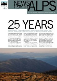
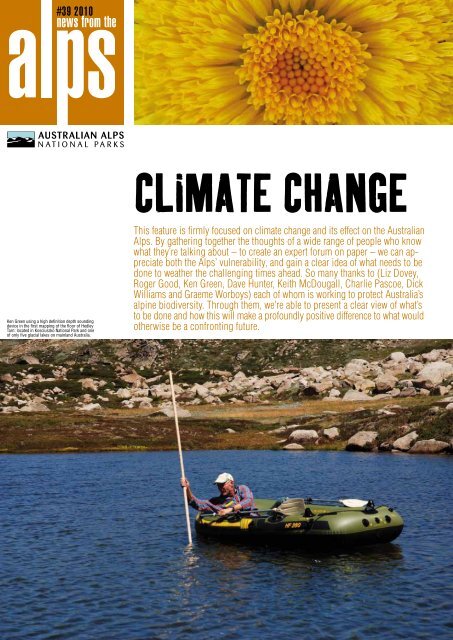
#<strong>39</strong> 2010<br />
news from the<br />
Ken Green using a high definition depth sounding<br />
device in the first mapping of the floor of Hedley<br />
Tarn: located in Kosciuszko National Park and one<br />
of only five glacial lakes on mainland Australia.<br />
CLIMATE CHANGE<br />
This feature is firmly focused on climate change and its effect on the <strong>Australian</strong><br />
<strong>Alps</strong>. By gathering together the thoughts of a wide range of people who know<br />
what they’re talking about – to create an expert forum on paper – we can appreciate<br />
both the <strong>Alps</strong>’ vulnerability, and gain a clear idea of what needs to be<br />
done to weather the challenging times ahead. So many thanks to (Liz Dovey,<br />
Roger Good, Ken Green, Dave Hunter, Keith McDougall, Charlie Pascoe, Dick<br />
Williams and Graeme Worboys) each of whom is working to protect Australia’s<br />
alpine biodiversity. Through them, we’re able to present a clear view of what’s<br />
to be done and how this will make a profoundly positive difference to what would<br />
otherwise be a confronting future.
WELCOME<br />
...to 2010, declared by the United<br />
Nations as the International Year<br />
of Biodiversity. This is a pointed<br />
reminder that we humans are an<br />
integral part of Nature and that the<br />
quality of our existence is dependent<br />
on biodiversity - on other living<br />
things, inhabiting an astonishing<br />
<strong>number</strong> of landscapes, around the<br />
world.<br />
Which is why our special<br />
feature takes climate change as its<br />
theme, and looks at its potential<br />
effect on the biodiversity of the<br />
landscape we know as the <strong>Australian</strong><br />
<strong>Alps</strong>. This exceptional story<br />
exists thanks to the generosity of<br />
eight passionate, articulate and well<br />
informed experts. What they have to<br />
say is often confronting, but equally<br />
inspiring.<br />
To balance this big picture<br />
offering, we’ve other news of what’s<br />
been taking place in the <strong>Alps</strong>.<br />
Indigenous archaeological treasure<br />
revealed post fire and flood;<br />
encouraging news from the dreaded<br />
Hawkweed battlefronts; what it’s like<br />
to live and work in Canada on an<br />
exchange program; borrowing post<br />
fire response protocols from the<br />
world’s experts; and much more.<br />
As always, news from the alps<br />
is a chunky read which reflects the<br />
passion, commitment and skill of<br />
the <strong>Alps</strong> community.<br />
Take care, until next time.<br />
Rod Atkins<br />
program manager & editor<br />
Published by <strong>Australian</strong> <strong>Alps</strong> national<br />
parks, Program Manager and Editor:<br />
Rod Atkins. For editorial contributions,<br />
or mailing list updates contact Rod,<br />
500 Cotter Road Weston ACT 2611.<br />
T: 02 6205 2487. M: 0429 618 308.<br />
email Rodney.Atkins@act.gov.au<br />
For more information about the <strong>Alps</strong>,<br />
including information about the<br />
Parks, other publications and news,<br />
visit the <strong>Australian</strong> <strong>Alps</strong> Web Page,<br />
www.australianalps.environment.gov.au<br />
www.australianalps.environment.<br />
Design and artwork by Tom Sapontsis.<br />
Editorial support by Elizabeth DeFriest<br />
03 9534 7970.<br />
Printed on ISO 14001 Environmental<br />
Accredited paper.<br />
A big thankyou to those who have<br />
made time to be interviewed; and to<br />
the photographers for their images.<br />
Without this support, news from the<br />
alps would not be possible.<br />
Let’s start with an overview...<br />
Two people, well positioned to describe the scenario facing the<br />
<strong>Alps</strong>, are Liz Dovey (<strong>Australian</strong> Government Department of Climate<br />
Change) and Graeme Worboys, (IUCN World Commission on Protected<br />
Areas, [Mountains Biome and Connectivity Conservation]).<br />
Both know that this topic is both a confronting mix and a complex<br />
beast to grasp. Yet both Liz and Graeme have the knack of telling<br />
a strangely invigorating tale – invigorating in the sense that the<br />
moment has arrived when something must be done, and that the<br />
doing needs to be along fresh lines.<br />
Graeme begins with no pulled punches. “Change is inevitable.<br />
A lot of it will be unexpected, and according to the latest forecasts<br />
for very high carbon dioxide concentration levels, the rate of<br />
change will really surprise us. During the typical 30 year career of<br />
a park manager, he or she will witness quite a difference between<br />
year one and year 30.” Graeme’s comments are based in part on<br />
the recently published Australia’s Biodiversity and Climate Change:<br />
A strategic assessment of the vulnerability of Australia’s biodiversity<br />
to climate change (August 2009).* “Within it, there’s a map<br />
that identifies major changes in just 90 years. In 2100 it shows the<br />
great deserts of Central Australia extending as far east as Albury,<br />
Australia’s largest inland city, and almost all of the really productive<br />
woodland and agriculture country west of the Great Divide<br />
drying up. This is a wake-up call for all of our decision makers<br />
because so many people will be affected, and while it is a modeled<br />
scenario and it may not actually happen, it is one possible terrible<br />
future.”<br />
For the <strong>Alps</strong>, this same scenario shows an equally dramatic<br />
change. “In terms of the future habitats of eastern Australia - it<br />
shows a contraction of the Eucalypt forests southwards and this<br />
will also mean rising tree lines in the mountains and changes to<br />
the types of forests on the slopes. Many alpine plants and animals<br />
will lose habitat suitable for their existence, and managers<br />
will need to think about which species will need to be kept alive<br />
outside of parks such as in zoos.”<br />
Graeme stresses that, “The scenario I describe is based on<br />
good science by Will Steffan of the <strong>Australian</strong> National University<br />
(and others) and is one of the recognised forecasting models<br />
available.” And in a measured understatement, “If our politicians<br />
fail to curb the carbon dioxide pollution of our atmosphere, and<br />
if the scenario is indicative of what we can expect, then we really<br />
do need to stop and take a good look at how we adapt to these<br />
changes now.”<br />
Like many other experts, Liz Dovey agrees with Graeme.<br />
“We know that even if we were able to turn off the CO2 emissions<br />
tomorrow, the response in terms of atmospheric concentrations of<br />
CO2, temperature and sea level rise would be slow – 200 years or<br />
more before levels returned to those of the recent past. As a result,<br />
we will be planning for and managing a future of radical change,<br />
and we need to be getting on with it.”<br />
If anyone needs more motivation, Liz has a list of facts designed<br />
to spark effective action. Such as the graphed waves of CO2<br />
produced by Antarctic ice core data, which spike abruptly to a current<br />
day high after 600,000 years of natural rhythm at lower levels;<br />
the Bureau of Meteorology’s announcement that we’re having the<br />
hottest decade ever recorded; evidence of more frequent extremes<br />
of storms, heat waves and fire; or the graph that lays out a fist-full<br />
of possible climate change futures envisaged in 2001 only to show<br />
the actual rates of CO2 concentrations, temperature and sea level<br />
have risen above the worst case, or runaway, scenario.<br />
We have<br />
caused this<br />
climate<br />
change so<br />
we need to<br />
intervene.<br />
Against this sobering evidence, Liz points out, “While we are<br />
moving into the unknown, this doesn’t mean there is nothing we<br />
can do about it. Obviously business as usual just isn’t going to<br />
work. However the tools we’ve used in the past are still important<br />
and we can build on our strengths.”<br />
Among the strengths we can build on is the collaborative<br />
culture which has been nurtured across the <strong>Alps</strong>. For some time<br />
now we’ve been working together - agency staff, researchers, local<br />
communities, government, and many others - to protect the <strong>Alps</strong><br />
and build this landscape’s resilience to well known threats: fire,<br />
pest species, less water and reduced habitat. While climate change<br />
will affect the <strong>Alps</strong> in unexpected ways, it’s also certain that it will<br />
exacerbate these existing threats and this is why we need to build<br />
on what we already have in place - with some significant changes.<br />
No longer will we be effective in building the <strong>Alps</strong>’ resilience<br />
simply by preserving all species in their current locations, but<br />
rather we need to make space and opportunities for them to self-adapt,<br />
re-organise, move. And we need to continue our efforts to remove<br />
the pest plant and animal species from the picture as this is a stress<br />
and a threat that we can control and minimise (unlike increased fire<br />
or reduced rainfall). We need to press on with connectivity conservation,<br />
again in the interests of space and adaptive movement, and we<br />
should also be poring over maps to help us spot potential refugia<br />
to focus our efforts on – sweet spots where Mother Nature, even<br />
under the influence of climate change, is more likely to be kind to<br />
biodiversity under threat.<br />
And then we get into a more detailed ‘to do’ list: like ecoengineering<br />
(for example, shading bogs to protect them from UV<br />
radiation) or preserving genetic stock (the Ark approach for reintroduction<br />
in the future), and many more. Much of this is already<br />
part of our management approach. However we’re now being strongly<br />
advised, in this uncertain future, to use these tools very differently,<br />
and the new methods hang on a very cozy relationship between the<br />
scientists and the land managers.<br />
Graeme explains. “Suddenly we need all this extra information<br />
about the changes that are happening, and to achieve this we need<br />
a better arrangement for scientists and managers to work together.<br />
The managers need quality information, updated constantly about<br />
what is actually happening so that they can be better informed as<br />
they manage the <strong>Alps</strong>. And the scientists need better collaborative<br />
support and improved long term working and financial arrangements<br />
to be able to do this.”<br />
Both Graeme and Liz appreciate that the biggest shift lies in<br />
how this new relationship operates. As Graeme points out, “We<br />
need to know how well the actions against threats are being carried<br />
out; we need research to give us an improved understanding on<br />
how effective a pest or weed control program is.”<br />
As Liz points out, “We have caused this climate change so<br />
we need to intervene. However to be effective we need to be well<br />
informed. We need to manage adaptively - have a go, test our<br />
theory, monitor its outcomes and then feed that information back to<br />
the start of the decision making loop.” Adaptive management will<br />
be the master methodology, the means by which we chart our path<br />
through the unknown which lies ahead.<br />
This is probably a good moment to take a look at how well<br />
the <strong>Australian</strong> <strong>Alps</strong> are bearing up, through the eyes of a range of<br />
experts in specific fields. Obviously this is just a sample of what’s<br />
happening in many corners across the alpine landscape...<br />
*For more information visit http://www.csiro.au/resources/<br />
Australia-Biodiversity-and-Climate-Change.html<br />
Liz Dovey and Graeme Worboys.<br />
2<br />
3<br />
3
4<br />
the snow man<br />
It would be difficult to pigeonhole cold<br />
climate ecologist Ken Green, who keeps<br />
himself in the field as much as possible,<br />
occupied in the study of a range of<br />
subjects falling under the general headings<br />
of fauna, flora and hydrology. But<br />
before you think the scope of this must<br />
be impossibly broad, there is one word<br />
that zips it all snuggly together – snow.<br />
With a career that includes working in<br />
the Antarctic, the sub-Antarctic and<br />
alpine Australia (which Ken claims,<br />
possibly truthfully, reduces the <strong>number</strong><br />
of trees he needs to identify), he is well<br />
positioned to report on the changes<br />
taking place, something he obviously<br />
feels is essential.<br />
“In the 1990s I’d put in for some<br />
funding to research climate change and<br />
was told by a senior parks manager that<br />
I’d been unsuccessful because climate<br />
change wasn’t considered to be a management<br />
issue.”<br />
Things have changed since then,<br />
but there is still scope to close the gap<br />
between the realms of research and<br />
management. “Managers must react to<br />
what’s happening often operating within<br />
a three year political cycle. Researchers<br />
have the luxury of being able to sit<br />
back and think about whether the ‘now’<br />
issues – managing the horses or the<br />
dogs – are in fact the big threats for the<br />
future.”<br />
Often big threats reveal themselves<br />
through research – sometimes unexpectedly.<br />
Take the case of the marsupial<br />
lawns in Tasmania, stretches of wallabygrazed<br />
grasses found where winter<br />
snow doesn’t linger so that wallabies<br />
can graze for longer in alpine areas.<br />
“Tall herb fields were found growing<br />
on inaccessible islands in a river near<br />
marsupial lawns. The explanation from<br />
Tasmanian researchers is that the wallabies<br />
which occupy Tasmania’s high<br />
country were being excluded, much in<br />
the same way mainland snow patches<br />
protect the herb fields from grazing and<br />
being overtaken by other colonising<br />
plant species.” Through some thoughtful<br />
observation, Ken has gained a whiff<br />
of the future above the tree line on the<br />
mainland. Information like this, placed<br />
in the hands of managers, feeds into the<br />
decision process for managing the future<br />
<strong>Alps</strong>: if there is less snow to protect<br />
the herb fields, do managers need to<br />
substitute artificial barriers?<br />
Other signs of change are dotted<br />
through Ken’s records, many linked to<br />
30 years’ worth of snow melt data. There<br />
is a general trend showing the snow<br />
melting earlier. Not surprisingly, other<br />
events, like the coming out of hibernation<br />
of the mountain pygmy possums<br />
or the flowering of plants is also taking<br />
place earlier each year. “I don’t know<br />
why, but the Bogong moths which travel<br />
from the plains, are taking longer to<br />
reach the <strong>Alps</strong>. Thirty years ago they arrived<br />
sixty days before snow melt, now<br />
they reach the mountains thirty days<br />
before.”<br />
At present, this doesn’t seem to<br />
pose a major problem for the possum<br />
which makes use of the moth as a key<br />
food source. But if the trend continues,<br />
this possum species probably won’t.<br />
“Snow melt isn’t a very productive<br />
time of year - there aren’t many beetles<br />
or grubs around. If the moths haven’t<br />
arrived, given these possums aren’t<br />
diggers, it would be difficult for them to<br />
survive.”<br />
Obviously information is the key,<br />
which is why people like Ken Green take<br />
great care to maximise the opportunities<br />
to gather it, like bringing the <strong>Australian</strong><br />
<strong>Alps</strong> into the GLORIA (Global, Observation<br />
Research Initiative in Alpine<br />
Environments) project. Sites across<br />
the mountains of the world are being<br />
used to gather information – from the<br />
Southern Andes (Chile) to Zackenberg<br />
(Greenland); the Polar Urals (Russia)<br />
to our own Kosciuszko National<br />
Park. “Vegetation is being monitored<br />
throughout the alpine world to provide<br />
information for a uniform comparison.<br />
The sites at Kossy are set at five<br />
altitudes, with four plots at each site<br />
located at true north, south, east and<br />
west with measurements taken according<br />
to set protocols.”<br />
Making information like this available<br />
to those that could use it best is<br />
the challenge. Ken puts out a monthly<br />
report on whatever he’s involved in and<br />
from the feedback, it’s being read. Or<br />
there’s The Alpine Ark, which Ken put<br />
together following his part in the first of<br />
the <strong>Alps</strong> Liaison Committee organised<br />
Science Management Forums (see<br />
page 11). “It was a broad resource for<br />
managers; picking out where I saw the<br />
likely challenges, and offering some<br />
suggestions towards solutions.” This<br />
is adaptive management in action. It’s<br />
not new, but it could probably be used<br />
more, where good science gets the<br />
information to the park managers.<br />
fire & climate change<br />
There’s no question in Dick Williams’<br />
mind of the clear connection between<br />
climate change and fire. As Senior<br />
Principal Scientist with CSIRO Sustainable<br />
Ecosystems, Dick has a very<br />
well-informed overview. You can sense<br />
the wheels in motion as he considers<br />
the right point to jump off from, into a<br />
topic that is very complex. “Someone<br />
once said fire management is not rocket<br />
science, it’s much, much harder than<br />
that - and they’re right.”<br />
In Dick’s view, there are some<br />
things worth knowing if your responsibility<br />
is to manage a landscape in which<br />
fire is an expected visitor. Firstly, there<br />
is the concept of the fire regime – the<br />
pattern of recurrence of fire across the<br />
landscape – and how components of<br />
this regime, especially fire intensity, frequency,<br />
the intervals between fires, may<br />
vary. “Regimes rule,” says Dick. Secondly<br />
there is the link between climate<br />
change, and weather - temperature,<br />
rainfall, humidity, and wind factors that<br />
drive fire behaviour, and hence regimes.<br />
Changes to weather in turn affect how<br />
hot or how frequently fires may burn.<br />
“Fire weather is measured using the Fire<br />
Danger Index, and a one degree rise in<br />
mean annual temperature by 2020 could<br />
increase the risk of severe (and higher)<br />
fire days (when the FDI is more than 50)<br />
in some parts of south eastern Australia<br />
by 65%.” (FDIs were revised in 2009 as<br />
a result of the fire events in Victoria that<br />
year – previously an FDI above 50 was<br />
‘extreme’ – ed.)<br />
To this point Dick has been talking<br />
about what he calls the highly likely<br />
aspects of climate change and fire,<br />
but there are also those that are highly<br />
uncertain. Such as: an increase in CO2<br />
and its effects on vegetation productivity;<br />
or drought’s effects on vegetation;<br />
and of course humans who will always<br />
be a potential source of deliberate or<br />
accidental ignition. Combine the certain<br />
with the uncertain and you have a<br />
potential change to fire regimes, which<br />
may mean more frequent fire. However<br />
he is quick to explain that this doesn’t<br />
necessarily mean it’s all over for alpine<br />
biodiversity.<br />
“The good news is that for millions<br />
of years our flora and fauna have been<br />
coping with the occasional big hot fire,<br />
and variation in intervals between fires.<br />
What we need to better understand is<br />
the patterns of reoccurrence and the<br />
effects of these as they shift due to<br />
climate change.”<br />
Biogeographical data is a key<br />
part of the jigsaw. The more we know<br />
about species in the landscape – their<br />
strengths and weaknesses – the better<br />
we can manage the alpine landscape<br />
and fire. We need to know about parts<br />
of the landscape where species might<br />
flounder between fire events, much as<br />
we come up gasping for air between the<br />
dumpers on a big day at the beach. Or<br />
as Dick puts it somewhat colourfully, “If<br />
the plants and animals don’t get their<br />
bed & breakfast sorted between fires,<br />
they’re buggered.”<br />
Where such ‘hot spots’ are identified,<br />
management may involve action<br />
and intervention. Areas of less concern<br />
– those under the threshold of potential<br />
harm – might be left alone to recover<br />
naturally.<br />
Gathering these sorts of data on<br />
species distribution and their ‘likes<br />
and dislikes’ about fire regimes is an<br />
effective investment, both in practical<br />
and cost terms. Every manager needs a<br />
map marked with the areas of potential<br />
concern so that he or she can make the<br />
decision where to devote the resources<br />
– people, equipment, materials and the<br />
funds - post fire.<br />
Assuming data collection is given a<br />
priority, the most important tool we have<br />
to deal with the uncertain behaviour<br />
of fire under the influence of climate<br />
change is our ability to learn and adapt<br />
- literally. We need to make decisions<br />
based on the information to hand, and<br />
we need to record what happens next.<br />
It’s this information, that follows a<br />
decision, which must be fed back into<br />
the loop to inform the next decision<br />
making moment – and there will always<br />
be plenty of those. “The most important<br />
thing is for scientists and managers to<br />
communicate to each other what they<br />
have found out about the way a place<br />
works. There’s a lot to be learned from<br />
a good yarn that starts out I reckon...”<br />
This is adaptive management and it is<br />
the Holy Grail.<br />
giving the weeds a leg up<br />
Talking to Keith McDougall, botanist with<br />
the Department of Environment, Climate<br />
Change and Water, you’re momentarily<br />
comforted as he describes times past<br />
where there’s been very little snow fall.<br />
Using dendrochronology, where tree ring<br />
formation provides information about<br />
past conditions, Keith appreciates that,<br />
“Alpine flora and fauna have had to deal<br />
with this before”...but here comes the<br />
sting, “...albeit without the current additional<br />
pressures”.<br />
Two of the most powerful of these pressures<br />
are weeds, and people. Weeds<br />
threaten mountain biodiversity by altering<br />
the plant communities found there, and<br />
the activities of people help the weeds<br />
get a leg up the mountain. But on a more<br />
positive note, this is being matched:<br />
through co-ordinated research to find out<br />
as much as possible about how weeds<br />
are behaving in mountain areas, both<br />
here and around the world; by gaining a<br />
better understanding of the importance<br />
of natural and man-made filters to limit<br />
weed establishment at higher altitudes;<br />
and by appreciating how effective preemptive<br />
intervention is, in other words,<br />
implementing a weed management<br />
program along the lines of ‘a stitch in<br />
time saves nine’.<br />
Keith is Co-chair of the Mountain<br />
Invasion Research Network (MIREN),<br />
where weed research is being carried<br />
out in nine core mountain regions. “A<br />
global survey – looking at different places<br />
including the <strong>Australian</strong> <strong>Alps</strong> - is the<br />
only way to see what’s going on, to detect<br />
the patterns. Each location may have its<br />
own interesting story, but you don’t know<br />
what factors are affecting the results.”<br />
Hence the need for MIREN’s standardised<br />
comparative experiments from mountain<br />
regions covering the major climatic zones<br />
including both island and continental<br />
systems.<br />
“These surveys show that at higher<br />
altitudes there are fewer weeds while<br />
at low altitudes there are more weeds.<br />
Temperature is one contributing factor.<br />
Disturbance is another.”<br />
However disturbance takes place, it<br />
opens up the ground, allowing greater<br />
opportunities for establishment – through<br />
activities such as revegetation, alpine<br />
exotic gardens, roads and ski slope<br />
maintenance. If this is teamed with unwittingly<br />
transporting weeds to these open,<br />
disturbed areas, then the result is more<br />
weeds at higher altitudes.<br />
This scenario describes just how the<br />
lowland plant filter is being bypassed.<br />
This filter has, until recently, effectively<br />
screened the weeds, preventing them<br />
from establishing themselves at high<br />
altitudes. By a process of natural selection,<br />
the lower areas might be smothered<br />
in introduced nasties, but temperature<br />
prevents them from settling happily too<br />
far up the slope. However, if temperatures<br />
rise, the slopes will begin to be less<br />
hostile from the weeds’ viewpoint and<br />
colonisation is more likely.<br />
“Things that have managed to get<br />
part way up the mountain will be able to<br />
get further. To manage this, we need to<br />
think in terms of less disturbance equals<br />
less movement. Prevention is the most<br />
cost-effective management tool we have<br />
available, and for this to be carried out<br />
we also need to have a knowledge of how<br />
weeds behave.<br />
“We know things are going to get<br />
warmer so if we look down the mountain<br />
and identify those weeds which are a real<br />
problem in disturbed areas lower down,<br />
we may predict which will be a future<br />
problem in mountains.” This simple step<br />
provides the targets for management<br />
concern. Best of all, the MIREN data has<br />
produced a soon to be published list** of<br />
the worst of the worst, “so if you already<br />
have those species or have them lurking<br />
in the lowlands, it’s a flag to be aware.”<br />
It’s then a case of physical control mixed<br />
with public education and protocols to<br />
prevent further infestation.<br />
**visit www.miren.ethz.ch/ where the list<br />
will be posted in spring 2010.<br />
5
factoring in the pest animals<br />
Talking about climate change and vertebrate<br />
pests – horses, deer, pigs, goats,<br />
wild dogs, foxes, cats, hares, rabbits,<br />
rats, mice and trout – Charlie Pascoe<br />
sums up the situation simply. “We’re<br />
currently just managing the major<br />
threats that pest animals pose to the<br />
highest priority assets (eg threatened<br />
species and communities, wetlands and<br />
waterways); and we’ve limited resources<br />
to look at what impacts climate change<br />
may be having, either already or in the<br />
future.”<br />
Charlie’s role as Natural Values<br />
Program Manager for Parks Victoria’s<br />
Alpine District, requires him to juggle<br />
resources based on a combination<br />
of risk assessment and professional<br />
judgment. Charlie’s background as a<br />
fauna ecologist - with a special interest<br />
in mammals, particularly pest species<br />
- means he is very aware of what<br />
he currently lacks. “Not only do we<br />
not know what the actual responses to<br />
climate change may be for these pest<br />
species, but, for some of them, we lack<br />
even baseline data on their current<br />
distribution, abundance and impacts on<br />
which to build.”<br />
In other words, there is a sense<br />
of what is likely to happen, based on<br />
knowledge of each species’ ecology,<br />
what has been learnt elsewhere and, anecdotally,<br />
what’s already been observed<br />
in the field. But where quantitative data<br />
is lacking, it is not possible to accurately<br />
forecast the impacts that these<br />
pests will have under a climate change<br />
scenario.<br />
“We do know that when there is<br />
less snow (both extent and duration<br />
of cover), more habitat is available for<br />
species, such as feral horses, whose<br />
movement and feeding is restricted<br />
by deep snow. Other species will be<br />
affected by increased temperatures and<br />
reduced rainfall in summer. Brown and<br />
rainbow trout, for example, are likely<br />
to find that habitat is more restricted in<br />
some streams, due to increased water<br />
temperatures and reduced flows in<br />
summer.”<br />
More information is needed on<br />
deer and Parks Victoria, with help from<br />
the <strong>Australian</strong> Deer Association, has<br />
implemented a program to monitor<br />
changes in the abundance of sambar<br />
and fallow deer at high elevations on<br />
Mt Buffalo and the Bogong High Plains.<br />
“At this point we have three years’ data<br />
but it could take another five years, or<br />
more, before we can detect any patterns<br />
of change. Even then it is uncertain<br />
whether we would be able to attribute<br />
those patterns to climate change.”<br />
In Charlie’s view, pest animal<br />
management should be focused on<br />
managing the impacts of each pest species,<br />
rather than simply on the <strong>number</strong>s<br />
of animals. “Impacts can include<br />
browsing, grazing, trampling, pugging<br />
of wetlands and stream margins, and<br />
predation of native animals. Our working<br />
hypothesis is that under warmer<br />
climatic conditions some pests will be<br />
able to spend longer periods and/or<br />
maintain higher population densities at<br />
high elevations – and the impacts on<br />
alpine and sub-alpine environments<br />
will therefore likely be greater. Lower<br />
winter mortality and increased breeding<br />
success of these pest species is likely<br />
to exacerbate the problems.”<br />
So to form the future plans of<br />
action, Charlie Pascoe’s wish list is<br />
obvious – baseline studies on each of<br />
the pests, where current data is lacking,<br />
followed by monitoring and, where appropriate,<br />
experimental studies to better<br />
define the pressures on the alpine landscape.<br />
At this point, Charlie and anyone<br />
like him whose responsibility is to best<br />
manage these places, could take the<br />
data, act upon it and pop any feedback<br />
into a cycle of adaptive management.<br />
It’s clear that Charlie would like to take<br />
some of the unknowns out of this ideal<br />
approach by having all the necessary<br />
resources and support.<br />
UV & alpine flora<br />
Roger Good may describe himself as<br />
retired, but his current <strong>Alps</strong> project is<br />
an interesting one. For someone who<br />
has “always had an interest in external<br />
pressures on the alpine environment,<br />
particularly plants”, Roger is looking<br />
at alpine flowering plants, seed set and<br />
seed viability under a climate change<br />
regime, a project with the <strong>Australian</strong><br />
National Botanic Gardens, <strong>Australian</strong><br />
National University and Kosciuszko<br />
National Park.<br />
Roger – whose connection with the<br />
<strong>Alps</strong> began in the mid sixties and has<br />
included a career devoted to mountain<br />
soil conservation, ecosystem restoration<br />
and plant ecology – is concerned<br />
not with climate change directly, but<br />
with the easily quantifiable components<br />
that make up our weather. It’s the impact<br />
of temperature, rain & snowfall and UV<br />
radiation on plants and plant communities<br />
that interests him.<br />
Take for example an increase in<br />
UV radiation and its effect on the alpine<br />
bogs and fens. “An increase in temperature<br />
is associated with an increase<br />
in cloud free days which in turn leads<br />
to higher levels of solar radiation. We<br />
also know that the optimum growth of<br />
sphagnum is when it has about 70 percent<br />
shade, which is supplied naturally<br />
by tall grasses and shrubs.” Put the two<br />
together – increased total UV radiation<br />
and less natural shade as a result of fire<br />
and past grazing, and it’s not surprising<br />
that these communities are being<br />
stressed.<br />
“Over the past five to six years<br />
we’ve recorded temperatures about one<br />
degree higher at Charlotte Pass, but we<br />
won’t know what that means until we’re<br />
able to extend these studies out a lot<br />
longer.” However, in the short term, a<br />
response to an increase in temperature<br />
and UV regardless of a long-term trend,<br />
is predicted. Which is why shade cloth<br />
was used in a <strong>number</strong> of significant<br />
bogs in the <strong>Australian</strong> Capital Territory<br />
(ACT) and Kosciuszko National Park<br />
after the 2003 fires. The results justified<br />
the effort. Not only did the Sphagnum<br />
respond but so did other plant species<br />
which subsequently have helped shade<br />
the bog ecosystem.<br />
Work on the bogs and fens – in the<br />
ACT, New South Wales and Victoria -<br />
has been coordinated by the <strong>Alps</strong> mire<br />
restoration and research group, funded<br />
at both State and Federal levels. “We<br />
established permanent monitoring plots<br />
The effects of increased UV on the bogs is indirectly<br />
putting pressure on the already threatened corroboree frog.<br />
in 2004 in a <strong>number</strong> of restored bogs<br />
which were monitored every six months<br />
during the first two years and are now studied<br />
yearly.” This information contributes<br />
to the adaptive management program<br />
for the bogs which play a key role in<br />
alpine hydrology - the filtering of runoff<br />
and the regulation of flows both in the<br />
mountains and down onto the plains.<br />
What then of the concept of plants<br />
climbing like an army up the hill, triggered<br />
by climate change? Roger points<br />
out that, “The elevation range of the<br />
<strong>Australian</strong> <strong>Alps</strong> is not great by world<br />
standards, and most of the tall alpine<br />
herb fields already occur over the several<br />
hundred metres below Kosciuszko’s<br />
summit. The change we may see in<br />
time would therefore be in patterns of<br />
plant species distribution within these<br />
broader plant communities. Some of<br />
the species growing at the top of Mt<br />
Kosciuszko, Feathertop and Bogong may<br />
be lost in those specific areas, but continue<br />
to exist in refugia – sites with less<br />
exposure to wind and UV radiation.”<br />
frogs<br />
Perhaps the best way to appreciate the<br />
power of climate change is to take a<br />
close-up look. From a distance, a shift in<br />
temperature, snow or rainfall may seem<br />
innocuous, but by zooming in on one<br />
species, climate change’s negative leverage<br />
is revealed. Dave Hunter, Threatened<br />
Species Officer at the Department of<br />
Environment Climate Change and Water,<br />
is one of the best people to describe the<br />
situation currently being ‘enjoyed’ by both<br />
the southern and northern corroboree<br />
frog (Pseudophryne corroboree and P.<br />
pengilleyi). He’s studied them for 15 years<br />
(gaining his Masters and a PhD along the<br />
way), spending a great deal of time up in<br />
the alpine bogs: “It gets you out there - I<br />
love it.”<br />
What his and others’ research has<br />
shown, is that corroboree frog <strong>number</strong>s<br />
are in decline. “There are now only 38<br />
southern males remaining in the wild,<br />
and without intervention this species will<br />
be extinct within the next five years.” Not<br />
that Dave utters these words with a catch<br />
in his throat because he believes the<br />
intervention which is currently in place,<br />
based on a captive-bred population, is<br />
likely to save the species, but from what?<br />
As it turns out, two main factors, in a<br />
nasty combination, only one of them<br />
being climate change.<br />
“The immediate impact of climate<br />
change seems to be an increased drying<br />
of the overall bog environment where<br />
some of the large pools are starting to<br />
grow over. Corroboree frogs need these<br />
ephemeral pools; the tadpoles rely on<br />
them not to dry out too early, up until<br />
November.”<br />
The other major issue is the chytrid<br />
fungus (Batrachochytrium dendrobatridis).<br />
“Corroboree frogs are relatively<br />
long-lived, up to ten years having reached<br />
sexual maturity at four or five years. This<br />
means that despite the drying of the<br />
pools, there is still likely to be some time<br />
during an adult frog’s lifespan when it will<br />
successfully produce offspring.” However<br />
the presence of this introduced fungus<br />
means the adults are now vulnerable, and<br />
in the case of the corroboree frogs, yet<br />
to develop a resistance to the fungus as<br />
other native frog species have done over<br />
the past decades.<br />
But there is hope, summed up by<br />
Dave Hunter when he says, “I feel like we<br />
are close to cracking the breeding.” There<br />
may only be 38 male frogs in the wild, but<br />
there are 3,000 frogs in captivity, spread<br />
between Australia’s expert amphibian<br />
research facilities. This is where frogs are<br />
bred in captivity so that <strong>number</strong>s can be<br />
released into the wild bogs where they<br />
will hopefully develop a natural resistance<br />
to the fungus. “Though at this stage<br />
there is a big hole in the captive breeding<br />
program – getting the frogs to breed reliably<br />
in captivity. We need more funding<br />
to support research into our husbandry<br />
techniques. If we can’t breed enough<br />
frogs in captivity, the release program to<br />
build resistance to the fungus won’t be<br />
self-sustaining and viable even in the<br />
short term.”<br />
To tackle climate change’s contribution,<br />
the drying of the bogs, two options<br />
emerge. Environmental engineering<br />
which will slow the flow of water through<br />
the bogs and maintain water in the pools<br />
longer, and further research which may<br />
also identify areas that will maintain suitable<br />
habitat even under a climate change<br />
scenario – refugia for these frogs.<br />
These 350 litre artificial pools, buried in the moss, provide both<br />
a fungus free environment and enough water for the metamorphosing<br />
coroboree frogs; pictured here with Dave Hunter.<br />
The degree of change is going to surprise people making it essential that<br />
all stakeholders are kept up-to-date, fully aware of what’s happening and<br />
what people are actually doing: the parks manager’s role must include an<br />
increasing amount of communication and community relations.”Graeme Worboys<br />
6 7
Left to right), Neil Dudley and Alex Beben (Archaeological consultants) with Lee and Shannon Hood (Gunai Kurnai representatives) inspecting and recording artefacts found.<br />
As the saying goes, “good comes from bad”. In some ways this was the case of the 2006-07 fires that<br />
swept through a million hectares of the Victorian <strong>Alps</strong>. If those fires weren’t devastating enough, the<br />
major flood event which followed in the Wellington River Catchment area, took with it a long list of visitor<br />
facilities, millions of cubic metres of silt, access roads and walking tracks.<br />
FIRE, FLOOD, THEN TREASURE<br />
So far, none of this could be considered good news, but these<br />
two natural events did lead to a revelation. During the early<br />
days of the rehabilitation and recovery works that took place<br />
immediately afterwards, a wonderful discovery was made.<br />
Mike Dower, Ranger in Charge of the Alpine National Park’s<br />
Wonnangatta and Moroka units explains...<br />
“With the vegetation removed, artefacts which had been<br />
lying hidden over a period of thousands of years of Aboriginal<br />
occupation were uncovered. Here was physical evidence,<br />
rich archaeological deposits in-situ, marking the places<br />
where the First Peoples sat collecting and crafting stone<br />
tools. Its richness is amazing”.<br />
At this point, pressing on with the planned works would<br />
have been foolish given its threat to all these newly discovered<br />
Aboriginal cultural objects. Parks Victoria immediately<br />
paused all planning for proposed works, appointed specialist<br />
archaeological contractors and approached the Traditional<br />
Owners – the Gunai-Kurnai Peoples – to put forward<br />
representatives.<br />
Under the Aboriginal State Heritage Act (2006), the<br />
process to draw up a cultural heritage management plan was<br />
begun. The Traditional Owners’ representatives, Parks Victoria<br />
staff and archaeologists; together worked in the field for<br />
three weeks late last year, producing a detailed field survey of<br />
the areas affected by the fire and floods.<br />
The result is a detailed record of all the sites together<br />
with strong recommendations for a cultural heritage management<br />
plan for the area – how best to protect what chance has<br />
uncovered.<br />
The connections made during the survey, between Parks<br />
staff and the First Peoples representatives, are now helping to<br />
steer the process – informing how best to proceed with the<br />
completion of works affected by the floods, especially the 15<br />
camp sites along the Wellington River. There’s now a path<br />
forward.<br />
“Once the plan is complete, we’ll be able to finish our<br />
building and recovery works, making adjustments to protect<br />
these re-discovered rich cultural assets”.<br />
RATs, BAERs, BRRATs & BAATs<br />
Risk assessment consultant<br />
Don Dobson with Margaret Kitchin<br />
at Terrace Mountain, looking down<br />
towards township of Kelowna.<br />
You’d think that there wouldn’t be much opportunity, when you’re in the thick of fire suppression, to come<br />
up with new ideas. But even in these moments, some people have been wondering if there were ways<br />
to improve the method: to better manage the landscape both during and immediately after fire.<br />
Andrew Marshall (Director, Business Strategy, Parks Victoria)<br />
is one of these people. He shares the view that we should be<br />
integrating - into the existing fire response method - more<br />
steps which focus on people and their property, cultural values<br />
and the landscape’s natural values. As well as this, he sees<br />
the need to protect all of this both during the fire – from the<br />
incident control centre – and then immediately after.<br />
Margaret Kitchin (Senior Forest Ecologist with ACT<br />
Parks Conservation and Lands) also shares this view. When<br />
the expert US Burned Area Emergency Response (BAER)<br />
team were deployed to work on the Victorian fires in February<br />
2009, both Andrew and Margaret were given the opportunity<br />
to watch and learn. Says Andrew, “These people were<br />
extraordinarily expert, very skilled, working together as a tight<br />
team with a very clear mission. In 14 days they had produced<br />
a report containing all the necessary information in an easy to<br />
extract format. It was an epiphany.”<br />
Andrew and Margaret have since been sent to British<br />
Columbia to observe the methods of a Canadian equivalent<br />
– the Rapid Assessment Team (RATs) – in action during the<br />
fires late last year. Says Margaret, “After the Terrace Mountain<br />
fire at Kelowna, we followed a drainage line to assess the<br />
depth of pine needle ash as potential run-off, in places over<br />
a foot deep, descending 100 metres or more to where there<br />
were houses. Our work produced a recommendation based<br />
on the likely impact a debris flow might have on these assets.<br />
It’s an excellent model.”<br />
Between the amply manned US model with teams of up to<br />
13, and the leaner three member Canadian teams, Andrew and<br />
Margaret have armed themselves with sufficient inspiration<br />
to help set up <strong>Australian</strong> versions. In Victoria, the Bushfire<br />
RRATs (Rapid Risk Assessment Team) have been ready to<br />
run for the first time over this fire season, and the combined<br />
New South Wales, ACT model - burnt area assessment teams,<br />
BAATs - are in the formation stage.<br />
These <strong>Australian</strong> models are designed to be straightforward.<br />
They may be small, but they have a range of expert<br />
support called in as needed. The team is deployed towards<br />
the end of a fire, and, using information collected by the<br />
incident team and remote sensing from satellites and aerial<br />
photography, they look at how the landscape will behave after<br />
being burnt and what impact that could have on key values.<br />
This investigation is from the ground up, and, using local<br />
knowledge and expert judgement, works through all the issues<br />
to calculate the risks and how to reduce them. The post fire<br />
risk assessment report is delivered within days and it aims to<br />
give everyone a clear view of the risks, options and cost.<br />
Within a longer time frame, the lessons learned across<br />
the <strong>Alps</strong> will be shared to refine the methodology of fire rapid<br />
risk assessment and response, conceivably adapting the<br />
methodology to deal with major storm events.<br />
For further information contact either Margaret Kitchin (Margaret.kitchin@act.gov.au<br />
or Amarshal@parks.vic.gov.au<br />
8 9
50<br />
YEARS<br />
AGO...<br />
Above: Tinderries South Peak (1974).<br />
R: Stone arrangements on Mt Morgan<br />
(1966).<br />
Hindsight is easily mastered, though it’s often painful, given its frequent association with the phrase if only<br />
we’d... What’s truly difficult to master is foresight, but back in the sixties, that’s exactly what a small group<br />
of concerned Canberra citizens had, and did<br />
Their vision was to set aside a tract of land in the Mount<br />
Kelly - Mount Gudgenby area of the ACT both to conserve its<br />
natural values, but equally importantly, to act as a refuge from<br />
urbanisation.<br />
Most of the proposed area was timbered Crown Lease<br />
Land, but there were complications: many of the low-land<br />
valleys were still being run as rural enterprises; NASA would<br />
eventually operate two tracking stations within the region; and<br />
the Commonwealth Government retained control of the Cotter<br />
River catchment – the source of Canberra’s water. Undeterred,<br />
these Canberrans formed the National Parks Association of<br />
the ACT (NPAACT) with the aim of establishing a National<br />
Park for the National Capital.<br />
And they succeeded. Some 24 years and much lobbying<br />
later, Namadgi National Park was gazetted over an area that<br />
far exceeded NPAACT’s original goal. In the years since, the<br />
Association has continued its involvement in the affairs of<br />
Namadgi: contributing to policy development, coordinating<br />
work parties and conducting regular walks within the Park.<br />
This year the NPAACT is celebrating its 50th year with<br />
a series of events including an official function at the same<br />
venue and date of the Association’s first in1960, a member’s<br />
picnic, a symposium and a series of photographic exhibitions.<br />
For more information visit the NPA website:<br />
www.npaact.org.au/splash.php<br />
Dick Williams nails the value of the Science Management<br />
Forums by describing them as “friendly,<br />
engaged and informed debate”. And in his view,<br />
nothing captures being part of the wisdom and<br />
experience that typically gets thrown around over<br />
the three days.<br />
3 DAYS @ FALLS CREEK<br />
Ben Derrick from the Falls Creek<br />
Resort Management Board takes<br />
the group through the work<br />
that’s been achieved within the<br />
resort on wetland stabilisation and<br />
restoration.<br />
Clearly, this is one management resource you should make<br />
time for if you’re keen to do some out & out thinking with<br />
people who know what they’re talking about. And he’d know,<br />
given Dick has been to a few and facilitated the most recent<br />
forum on bogs. Like those held previously on visitor experience,<br />
climate change and fire, this one “was explicitly set up to involve<br />
as many people, over as wide a spectrum as possible.”<br />
Forum co-organiser, Tamara Boyd, Program Leader<br />
of Ecological Water at Parks Victoria and Convenor of the<br />
<strong>Australian</strong> <strong>Alps</strong> Water & Catchments Reference Group, was<br />
the ideal choice to help organise this particular forum.<br />
“Creating the agenda took many months because we<br />
wanted to include a good mix of experts with a diversity of<br />
opinion. By bringing together people with disparate views,<br />
our aim was to ensure that everyone was welcomed into an<br />
environment that was accepting. Regardless of debate or<br />
disagreement, everyone shared the same aim - the best possible<br />
management of our alpine wetlands.”<br />
Tamara is quick to credit the facilitator with achieving<br />
much of this. “Dick was ideal because he sits outside the<br />
agencies yet has standing within them; he was able to keep<br />
things moving along with an objective, unbiased viewpoint.”<br />
Through a series of informed talks each followed by<br />
debate, the power of the forum emerged, and as Tamara<br />
witnessed, “There’s a heck of a lot of science going on and<br />
forums like these allow managers to identify what’s out there<br />
and how it can best be used.” Speakers from universities,<br />
agencies and departments included: Fiona Coates, Roger<br />
Good, Sam Grover, Geoff Hope, Dave Hunter, Keith McDougall,<br />
Phil Suter, Ewen Sylvester, Ian Thomas, Arn Tolsma,<br />
Henrik Wahren, Neville Walsh, Andrew Western, Dave Whitfield,<br />
Dick Williams, Graeme Worboys and Tony Varcoe.<br />
While it’s dangerous to pick anything out under the heading,<br />
‘highlights’, a few aspects are worth flagging: that science<br />
can help managers set management priorities to help spread<br />
limited resources more effectively; proportionally, bogs don’t<br />
cover large areas, however they are crucial and therefore<br />
warrant scientific study to make informed decisions about<br />
their management; both intervention and doing nothing are<br />
management options but good science is needed to inform<br />
the process to decide which way to go.<br />
“Whatever the decision”, says Dick, “there must, should,<br />
ought to be a process designed to evaluate its effectiveness<br />
so that we can all learn.”<br />
Look for the outcomes of the forum on the <strong>Alps</strong> website soon<br />
– www.australianalps.environment.gov.au<br />
PEOPLE SNAPSHOT<br />
It’s funny how people with connections to the <strong>Alps</strong> often find<br />
their way back later on in their lives and careers...<br />
Kathryn Smith, a project officer with the Commonwealth<br />
Government’s National Reserve System Section, spends most<br />
of her day working on NSW and NT land acquisition and<br />
covenanting projects, designed to expand Australia’s network<br />
of protected areas. Her background is a mix of social sciences<br />
and logistics experience gained through the Army Reserve.<br />
Kathryn is also a mountains person. “We’ve family going<br />
back to the early 1900s, stockmen at Currango in Kosciuszko<br />
National Park, and a heap of relatives that have lived at Adelong,<br />
Tumbarumba and Tumut. My mother grew up in Tumut<br />
and when I was at boarding school (my parents were in Papua<br />
New Guinea), we’d spend some of our summer holidays<br />
with my grandma who still lives there. We’d also go into the<br />
Victorian <strong>Alps</strong>, to Dinner Plain and Mt Hotham to ski with our<br />
parents or go bushwalking in summer.”<br />
So when Kathryn was offered the role of secretary to the<br />
<strong>Australian</strong> <strong>Alps</strong> Liaison Committee (AALC), organising the<br />
who, where and paperwork related to its meetings, straight<br />
away she was interested.<br />
Now a part of these meetings, she sees something worth<br />
noting. “It’s a committee of people who know a great deal and<br />
who have a real interest, and that’s very comforting. There’s a<br />
genuine dedication towards the issues to be solved.”<br />
10 11
For thousands of years, the First Peoples travelled seasonally into the <strong>Australian</strong> <strong>Alps</strong> to take part in gatherings<br />
for festival, dance, marriage and trade. After colonisation, this practiced ceased – until five years ago when the<br />
Traditional Owners of the <strong>Australian</strong> <strong>Alps</strong> came together again, “to speak with one voice over Country”. Uncle<br />
Ernie, a member of the Taungurung clan in central Victoria explains what’s been achieved since that moment<br />
which marked a new beginning.<br />
“That first modern gathering allowed the joining of mens’ and<br />
womens’ business, together expressing the First Peoples’<br />
hopes, dreams, vision and aspirations for the future.”<br />
One of the aspirations realised is that reference groups<br />
from all three states came together under the banner of the<br />
<strong>Australian</strong> <strong>Alps</strong> Traditional Owners Reference Group, “and<br />
this enabled the various government agencies to connect with<br />
these First Peoples, to work together for the <strong>Australian</strong> <strong>Alps</strong>”.<br />
Three main areas of activity were identified and in the five<br />
years since then, much has been done. Traditional Owners are<br />
employed within the agencies in a range of roles; Traditional<br />
Owners are involved in interpretive signage and materials<br />
allowing their stories to be told directly; and in terms of<br />
participating in management, Traditional Owners have been<br />
working together with the agencies on the development of<br />
management plans in the <strong>Australian</strong> <strong>Alps</strong>.<br />
A second gathering is now due, and will take place in<br />
late April and early May in Jindabyne. “We’re bringing people<br />
together again to see what has been achieved and to gain a<br />
recommendation as to where we go from here, of what we’re<br />
putting in place for future generations.”<br />
THE 2ND GATHERING IS DUE<br />
THE ROGAINERS<br />
Who would have thought that a new sport, created<br />
back in the 1970s by three Melbourne siblings,<br />
would leap from an orienteering base to become<br />
internationally known, with events held in at least 25<br />
countries and a world championship every two years.<br />
With backpacks, map and compass this rogaining team of four heads out.<br />
Put in its simplest form, rogainers gather in teams of two<br />
to five and are given a map with checkpoints with varying<br />
scoring value positioned in the landscape. The idea is to plot<br />
a course to maximise the team’s score during the 24 hour<br />
competition. Equipped with a map and compass, the clothes<br />
on their back and the food and safety equipment they carry,<br />
the teams head on out to face the many and varied challenges.<br />
This year the ACT Rogaining Association hosted the<br />
2010 <strong>Australian</strong> Championship event where participants<br />
found their way through a section of the northern Kosciuszko<br />
National Park. Association member, Jonathan Miller explains<br />
“while rogaining can be described as a non-mechanical form<br />
of recreation combining cross-country running with navigation,<br />
I’ve also seen people head out with a child in their pack<br />
to have a picnic and then head back within six hours”. Clearly<br />
rogaining is a wonderfully variable sport. Other non-championship<br />
events are held over shorter time duration (5-12<br />
hours) in a range of terrain, including urban and mountain<br />
bike variations.<br />
It’s also a great example of an appropriate balance between<br />
people and landscape. “In Europe there may be up to1000<br />
participants for major events, but a limit has been deliberately<br />
set on 550 for these championships.” As well as limiting the<br />
<strong>number</strong> of participants, each team took a different route to<br />
reduce their potential impact. Even the checkpoints were positioned<br />
in consultation with Parks staff to avoid disturbance<br />
to sensitive cultural sites or vegetation communities.<br />
To find out more about rogaining visit http://act.rogaine.<br />
asn.au/arc2010 or contact Jonathan Miller jonathanmiller@<br />
grapevine.com.au or 02 6161 5131 (ah).<br />
HAWKWEED<br />
the enemy<br />
“It only takes one seed to lodge in a<br />
remote nook within the park where no<br />
one will see it and within a handful of<br />
years a small population grows and<br />
then there are literally thousands and<br />
thousands of seeds being dispersed<br />
by the wind... It and other hawkweeds<br />
have devastated parts of New Zealand<br />
where they cover more than 6 million<br />
hectares. In Australia it has frightening<br />
potential to change the whole appearance<br />
of the <strong>Alps</strong>, smothering native<br />
vegetation and impacting on wildlife<br />
reliant on a native understorey. “<br />
DECCW botanist, Dr Keith McDougall<br />
The good fight against the dreaded Hieracium or hawkweed – to stop it growing, flowering and setting<br />
seed in the <strong>Alps</strong> – continues thanks to the efforts of various departments, agencies and volunteers.<br />
A critical part of this involves seasonal survey work when the<br />
hawkweed is flowering and its orange or yellow flowers are more<br />
easily spotted and sprayed. This work is being co-ordinated<br />
by Gen Wright (Flora Ecologist with the Parks and Wildlife<br />
Group of the NSW Dept. of Environment, Climate Change and Water)<br />
and Elaine Thomas (Parks Victoria Ranger at Mt Beauty).<br />
Gen is currently writing up the results of the New South<br />
Wales and ACT surveys. “We did find a <strong>number</strong> of small satellite<br />
sites of hawkweed outside the known main infestations,<br />
but what we didn’t find were any new large infestations. This<br />
is a positive given the result follows a reasonable amount of<br />
survey work. But we can never be sure.”<br />
Another positive was the failure – after two separate<br />
investigations a month apart – to locate any of the Mouse-ear<br />
Hawkweed (Hieracium pilosella) known to have been growing<br />
in Nursery Swamp in Namadgi National Park in 1992.<br />
In Victoria, Elaine is analysing the survey data collected<br />
by volunteers from universities, conservation groups and<br />
walking clubs, contractors, and two Department of Primary<br />
Industry survey teams. Of the results which are slightly different<br />
to those of New South Wales, Elaine says “We did find<br />
new hawkweed infestations within our control boundaries, but<br />
nothing outside.”<br />
However surveys carried out next season will be critical,<br />
and if no new infestations are located then, everyone will<br />
have a better idea of what’s being faced. Not that anyone will<br />
ever be completely confident when it comes to this particular<br />
weed, as during these most recent surveys one small infestation<br />
was discovered in a location which goes against the<br />
pattern of what’s been expected or observed.<br />
Much of the survey work has been supported using a<br />
predictive model produced by Nick Williams at the University<br />
of Melbourne’s Department of Land and Environment. “We’re<br />
providing information gained through these surveys to refine<br />
the model so that we can spend less time locating new sites.”<br />
Both Gen and Elaine have agreed that the previous<br />
belief that Hieracium seed viability was short lived – only a<br />
year – may need further investigation as new rosettes of<br />
the weed are appearing within treated sites. It’s a blow, but<br />
it’s also good to see this crucial information being fed back<br />
into the adaptive management loop. And there’s more. Says<br />
Elaine, “I like to describe this weed as being like an athlete<br />
on performance enhancing drugs who finds clever ways to<br />
avoid detection.” It turns out that Hawkweed produces stolons<br />
– above ground runners – which flower in places well hidden<br />
and a short distance from the parent plant. What should<br />
be a simple case of spray ‘n go is now a hunt where clever<br />
observation may mean the difference between success or the<br />
unspeakable.<br />
The verdict is that hawkweed is currently believed to be<br />
contained, but anyone involved with the program is loath to<br />
be smug about it.<br />
12 13<br />
*<br />
Volunteer weed spotter Evelyn Portek marks a new Hawkweed site for treatment and future monitoring.
If you haven’t already heard about the exchange program between Parks Victoria and Parks Canada, make<br />
a point to find out more. For over five years now, the program has made it possible for staff to be part of<br />
the other park’s service for a year. Chris Smith and Dannica Shaw are currently taking part. News for the alps<br />
caught up with each of them at a point half way through their Canadian experience...<br />
OFF TO CANADA<br />
Clockwise from left:<br />
Leach Lake, with Mt Fryatt and Mt<br />
Geraldine in the background, where<br />
Dannica is working.<br />
Chris Smith with the big red water<br />
wheel – a working reconstruction<br />
which is part of the St Maurice Forge<br />
National Historic Site.<br />
Impossibly beautiful accommodation,<br />
Chris’s home away from home on the<br />
Beveridge Lockstation with an original<br />
and still operational crab winch in the<br />
foreground.<br />
Dannica at Geraldine Lake, Jasper NP.<br />
Chris Smith is a heritage planner, supporting the work of<br />
regional staff from Parks Victoria’s Melbourne office and member<br />
of the <strong>Alps</strong> Cultural Heritage Reference Group. He is also<br />
the first heritage person (to his knowledge) to take part in the<br />
program, “to work on a World Heritage site like the recently<br />
listed Rideau Canal in Ottawa; to work on a project within a<br />
cultural landscape” has been a dream come true for Chris.”<br />
It has taken a few months to settle in, “but then you<br />
begin to understand the detail and see where you can make a<br />
contribution.”<br />
Chris is part of the team producing a strategy to manage<br />
the canal landscape. In this case the strategy can’t simply be<br />
created and imposed by Parks Canada partly because their<br />
jurisdiction is only to the high water mark. Instead it’s essential<br />
to engage, consult and work with the 13 municipalities,<br />
the eight provincial departments, the many interest groups and<br />
30,000 adjoining landowners. Clearly this is a complex process.<br />
“Suddenly I could see an opportunity to help, to make<br />
use of the fact that as an outsider, I could offer something<br />
closer to an objective view.” In other words, Chris was able<br />
to gather information to process and re-present in more<br />
accessible formats such as tables or charts – without cultural<br />
prejudice. Ultimately the 25 member steering committee,<br />
along with its break-out advisory groups, will produce the<br />
necessary UNESCO strategy.<br />
Chris’s Canadian exchange has been one of immersion<br />
in the canal setting, no pun intended. “Following the 1812<br />
war between Britain and the United States, Britain was aware<br />
that their key access to the Great Lakes – the St Lawrence<br />
River – would always be vulnerable. So they built the Rideau<br />
Canal, for military purposes, through wilderness three years<br />
before Melbourne was settled. It was a massive undertaking,<br />
cutting 19 kilometres of canal through limestone to join the<br />
series of existing rivers and lakes to create a 202 kilometrelong<br />
waterway. It was the first canal in the world to be built for<br />
steamships, and as a result had no tow paths, and given there<br />
were few roads in the area at the time, there were very few<br />
bridges. Parks Canada manages nine historic canals, however<br />
the Rideau is probably the most beautiful given it wasn’t built<br />
for industry but through wilderness.”<br />
Chris has been based at the Parks Canada office at<br />
Smiths Falls, and he and his partner Charla (who is currently<br />
on long service leave) are accommodated in the lockmaster’s<br />
house at the nearby Beveridges Lock Station (1883).<br />
“If you have the opportunity to apply for the exchange<br />
program, my advice is to do it. It broadens your outlook,<br />
offers different life experiences and ways to do things, and it<br />
gives you confidence in your own abilities. Being away, you<br />
also appreciate the things we do well.”<br />
For Dannica Shaw, Ranger in the King Howqua<br />
Unit (Alpine National Park) ) and member of the <strong>Alps</strong> Water<br />
and Catchments Reference Group, applying to work with a<br />
wilderness team out of Jasper National Park in Alberta was<br />
a focused and determined move. And no surprise given her<br />
long term passion for mountain landscapes.<br />
“I grew up in a 4WD camping family with a genuine love<br />
of wild places, camping each year at Wonnangatta. So I’m<br />
really passionate about mountains and I wanted to learn about<br />
the role mountains play in other places around the world.<br />
Looking at the Canadian Rocky Mountains makes you see<br />
those at home afresh: interestingly, having been away from<br />
<strong>Australian</strong> mountains, I now feel more connected to them, but<br />
that may be due to the scale of the landscape in Jasper, the<br />
fact that I’m new to it, or perhaps it’s the bears.”<br />
Jasper is the largest of the Canadian Rocky Mountain<br />
Parks, just north of Banff and part of the Yellowstone to<br />
Yukon wilderness landscape. Dannica has been working with<br />
the back country unit (the <strong>Australian</strong> equivalent would be a<br />
wilderness unit). At Jasper, getting around means mostly on<br />
foot or on horseback as there are few 4WD tracks. Distances<br />
are significant given the park covers 10,878 square kilometres.<br />
Ninety five per cent of this is wilderness and Dannica<br />
has been working with the one unit primarily responsible for<br />
maintaining its integrity.<br />
“I was put through a week-long horse course: learning<br />
how to shoe (using dead horse feet – you work fast while<br />
they’re still frozen); swimming with horses so that you can<br />
cross rivers in flood; bare back riding; and learning how to<br />
pack a packsaddle on a horse to carry heavy loads and avoid<br />
sores forming. I also walk the tracks to reach remote areas<br />
and along the way I check permits, coach visitors in environmentally<br />
sustainable practices and I report in on the condition<br />
of the track after each trip.<br />
“Jasper is a town within the Jasper National Park and<br />
because many people in Jasper depend on the park, the<br />
population is very environmentally aware. The animals in and<br />
around the town are also very accustomed to people - when<br />
I saw my first Elk walking along the road I knew I was so far<br />
from Australia. My little cabin is 20 km out of Jasper and in<br />
the first month I’d see a black bear a week, which I find really<br />
confronting. In most of Australia we’re the primary predator<br />
and you can outrun the snakes and spiders.”<br />
Interestingly, bears are indirectly playing a key role in<br />
maintaining spotless campsites following a spate of maulings<br />
in the 1<strong>980</strong>s. The public education program which followed<br />
coached park visitors how best to co-exist. “People learned<br />
they had to be part of responsible environmental management<br />
to be able to enjoy these places safely.”<br />
Dannica’s involvement in the warden (ranger) centennial<br />
celebrations will probably be the highlight of her stay. “I had<br />
the wonderful opportunity to be part of a four day ride over<br />
90 kms with 25 others, and when we rode into Banff there<br />
was a parade with people lining the street to cheer. It showed<br />
how proud, passionate and respectful Canadians are about<br />
the work of the wardens. It’s beautiful to see that people who<br />
protect the environment are so respected.”<br />
14<br />
15 15
Left: National Parks & Wildlife<br />
Service (NSW) postcards bearing<br />
this image, carried the caption:<br />
“Audley has always been the hub of<br />
the National Park. Hire boats were<br />
available from 1893, and introduced<br />
freshwater fish were ‘acclimatised’<br />
in the waters above the dam for the<br />
benefit of anglers”. 1899.<br />
Right: Kookaburra Flat, Royal<br />
National Park.<br />
Below: South West Arm, Royal<br />
National Park.<br />
One word in the last issue of news from the alps – “Yellowstone” – have spurred Geoff Mosley* to set<br />
the record straight about the world’s first national park...<br />
FIRST NATIONAL PARK?<br />
<strong>Australian</strong>s should be really proud, not that our Royal<br />
National Park was the world’s second national park (as stated<br />
in the last news from the alps) but because it was in fact the<br />
very first protected area anywhere in the world to be officially<br />
named as a national park. This moment in history is significant<br />
and it’s linked to some unfinished business in our own<br />
alpine backyard.<br />
The gazettal of what was initially named ‘The National<br />
Park’ (the name was changed to ‘Royal National Park’ in 1954)<br />
took place on 26th April, 1879. It recorded that 18,000 acres<br />
had been dedicated for “the purpose of a national park”. In<br />
1880, the park was increased in size to 35,000 acres and later<br />
to 36,320 acres in 1887.<br />
This initial gazettal - a move which had been anticipated<br />
for some time - was welcomed with pride, and the press<br />
reports of the time make interesting reading. A report in The<br />
Sydney Morning Herald of 29th March, 1879 headed<br />
‘A National Park’ said “a better name could not be given”.<br />
On the 2nd of April the same paper said that the area “for<br />
extent and beauty will hardly find its parallel within the same<br />
distance of any metropolis in the world”. While proximity to<br />
Sydney and to a proposed new railway was clearly important,<br />
the new park was seen as having a wider significance, affording<br />
as the newspaper said, “to the people of the whole colony (a)<br />
means of sport and recreation not to be surpassed anywhere<br />
in the world”.<br />
As for Yellowstone, it was named The Yellowstone Public<br />
Park and was established on United States Federal land by<br />
means of the Yellowstone Act of 1st March, 1872. Its purpose<br />
was stated as being a “public park or pleasuring ground for<br />
the enjoyment of the people”. Although very much larger than<br />
Australia’s The National Park, both shared public recreation<br />
and reservation as their main focus and both were linked to<br />
the building of a nearby railway.<br />
Not that a debate exists as those closest to the history<br />
of Yellowstone National Park know that Royal was first. In<br />
fact, when Yellowstone celebrated its centenary in 1972 the<br />
Yellowstone Library and Museum Association produced a<br />
commemorative book for the occasion entitled Yellowstone<br />
a centenary of the wilderness idea. In the book, authors Ann<br />
and Myron Sutton state: “but the first time the words “national<br />
park” were used in the body of a public act was in the<br />
establishment of Royal National Park near Sydney, Australia<br />
in 1879. It was then simply called “the National Park” (the<br />
first legislative reference to Yellowstone as a national park<br />
occurred in 1883 in a bill relating to appropriations)”.<br />
Of course the naming of national parks and the process<br />
of reserving which follows has played a major role within the<br />
<strong>Australian</strong> <strong>Alps</strong>, beginning with the reservation of the 45,344<br />
hectare Snowy Mountains National Chase in 1906. At the<br />
time this was the largest protected area in Australia. However<br />
the putting together of the present chain of alpine parks and<br />
reserves remains unfinished business.<br />
Unfortunately, there is still a gap of about 60 to 80<br />
kilometres between the western end of the Alpine National<br />
Park and the Baw Baw National Park. This area was a part<br />
of the original proposal for a greater alpine national park<br />
in Victoria with the support of the <strong>Australian</strong> Academy of<br />
Science, the <strong>Australian</strong> Conservation Foundation and the<br />
Victorian National Parks Association. The <strong>Australian</strong> <strong>Alps</strong><br />
Walking Track joins these current two national parks, travers-<br />
ing the neglected stretch in between which includes three<br />
proposed natural feature and scenic reserves, including<br />
one at Mt Skene, whose reservation was recommended<br />
by the Land Conservation Council in 1979. Now that the<br />
Victorian Government has moved to extend and connect<br />
the Errinundra, Snowy River and Alpine National Parks in<br />
the east (legislation passed in late 2009 and proclamations<br />
due in the first part of 2010) it is hoped it will turn<br />
its attention to this long overdue national park extension<br />
in the west. A map of the proposal can be found at www.<br />
colongwilderness.org.au (go to Campaigns/Issues, The<br />
<strong>Alps</strong> South East Forests World Heritage Campaign and<br />
The western link to Baw Baw National Park).<br />
*Dr Geoff Mosley has had a lifelong association with<br />
the <strong>Alps</strong> thorough years of research and conservation<br />
advocacy in national parks and wilderness areas.<br />
16 17
FERAL HORSES<br />
Above: An aerial survey of feral horses in Kosciuszko National Park.<br />
Below: The damage they do – here cut up bogs, Cooleman Plain Kosciuszko National Park.<br />
Mention horses and the mountains, and depending<br />
on your age, most people will have a mental picture<br />
of flying manes fleshed out by the writings of Banjo<br />
Patterson (The Man from Snowy River) or Elyne<br />
Mitchell (The Silver Brumby). What they won’t have<br />
is the flip-side view, the much less romantic dayto-day<br />
perspective that faces park managers.<br />
As woven as they are into our <strong>Australian</strong> alpine psyche, these<br />
horses are outsiders, introduced, heavy hoofed and therefore<br />
worthy of the title feral. Their negative impacts on fragile<br />
landscapes – the bogs, the stream banks – is sadly, obvious.<br />
Worse still, aerial surveys carried out in 2001, 2003<br />
and most recently in April 2009 show that their <strong>number</strong>s are<br />
increasing at such a rate that a new effective and acceptable<br />
approach needs to be developed, now. To do this, more information<br />
is needed and the <strong>Australian</strong> <strong>Alps</strong> Liaison Committee<br />
together with the University of Canberra, are seeking a grant<br />
from the <strong>Australian</strong> Research Council.<br />
For more information about feral horses, their <strong>number</strong>s, impact<br />
and methods of control, visit http://www.australianalps.<br />
environment.gov.au/ to get your <strong>PDF</strong> copy of, Feral Horse<br />
Management, Fact Sheet.<br />
WORKS AROUND THE ALPS PROGRAM UPDATE<br />
Work proceeds on a <strong>number</strong> of projects – outlined below – approved for implementation in the 2009-10<br />
financial year.<br />
Program Promotion and Information<br />
Latest newsletter. Issue #<strong>39</strong>, this is it. If you’ve an idea for a story in a future issue (we’ll do all the hard work with your tip off), let Rod<br />
Atkins know (contact details see page two). The deadline for issue 40 is the end of April 2010.<br />
Brochure reprints. The key <strong>Alps</strong> brochures will be re-printed and distributed in June 2010.<br />
Scanning and Digitising <strong>Alps</strong> publications/reports. This important project continues and we hope that before the end of 2009-10<br />
many of these documents will be available on the web.<br />
Presentations and Workshops by Dr Harry Biggs (South African National Parks). Dr Biggs will be doing a range of presentations<br />
in June 2010 on adaptive management and the concept of thresholds of potential concern.<br />
Cultural Heritage<br />
<strong>Australian</strong> <strong>Alps</strong> Traditional Owners Reference Group. Very successful meetings of the Group were held in August and November<br />
2009. The next meeting will be in April 2010 just before the First Peoples’ Gathering.<br />
<strong>Australian</strong> <strong>Alps</strong> First People’s Gathering. This significant event will be held in Jindabyne at the end of April 2010. A First Peoples’<br />
Gathering was held five years ago at Dinner Plain in Victoria.<br />
Historic Cultural Heritage Workshop. This very popular workshop, run every few years, was held in March 2010 and enabled<br />
participants to get an appreciation of the principles and practice of historic cultural heritage conservation.<br />
Stakeholder Engagement and Communication<br />
<strong>Alps</strong> Frontline Workshop. This favourite will be the second in twelve months and will be in Victoria to spread the message around<br />
(the last one was in the ACT). Participants will leave the workshop armed with the information they need to assist visitors to the <strong>Australian</strong><br />
<strong>Alps</strong> region.<br />
Development of the <strong>Alps</strong> Intranet. Work is underway on this project that will enable <strong>Alps</strong> agency staff to find information easily<br />
about various projects that are going on around the <strong>Alps</strong>. The plan is for it to be in operation by the end of 2009 -10.<br />
Development of the <strong>Alps</strong> Image Database. A deal has been struck with the <strong>Australian</strong> Government Department of the Environment,<br />
Water, Heritage and the Arts to develop a new component of their on-line database for images of the <strong>Alps</strong>. See http://www.environment.<br />
gov.au/about/media/imagedb/index.html to see how the database works. <strong>Alps</strong> images will be uploaded as time permits.<br />
Visitor Experiences and Marketing<br />
Scoping Market Research on Visitor Experiences and Expectations. It’s been ten years since the last market research was undertaken<br />
about visitor attitudes to the <strong>Alps</strong>. This no cost project is scoping what may be required to undertake another round of research<br />
to help <strong>Australian</strong> <strong>Alps</strong> managers better understand visitor’s needs.<br />
<strong>Australian</strong> <strong>Alps</strong> Walking Track Stakeholder Meeting. This biennial meeting brings together representatives of bushwalkers,<br />
national parks associations, and tourism interests to help agency staff shape the next two year strategy and operational plan.<br />
Water and Catchments<br />
State of the Catchment Report. The <strong>Australian</strong> Government has provided funds for this project and Graeme Worboys, Roger Good<br />
and Andy Spate have been contracted to prepare the report and work has been progressing. Advance drafts of the report will be reviewed<br />
in April.<br />
IUCN Science Management Forum. A very successful science management forum on the topic of alpine and sub-alpine wetlands<br />
was held at Falls Creek in October 2009. Outcomes available soon.<br />
Natural Resource Management<br />
Hawkweeds Survey. This work was carried out over the Christmas – new year period with findings showing new incursions in some<br />
places and the elimination of the weeds at other sites. Report available soon.<br />
Feral Horse Impacts Study. An <strong>Australian</strong> Research Council grant application was submitted with the University of Canberra seeking<br />
funds for this work. Grant application outcome expected in May 2010.<br />
Wild Dog Tracking Fact Sheet. Now available on the <strong>Alps</strong> website.<br />
Fire Ecology Monitoring Plots Data Analysis. The analysis of this data is underway following collation and processing last year.<br />
The <strong>Alps</strong>-wide data will inform future management and research on fire effects.<br />
Climate Change<br />
Podocarpus Dendrochronology Study. This interesting project is analysing the growth rings of mountain plum pine (Podocarpus<br />
lawrencii) to help determine snow depths in the <strong>Alps</strong> going back up to 500 years. Analysis is underway with a report expected before the<br />
end of 2009 -10.<br />
Climate Change in the <strong>Alps</strong> Fact Sheet. This fact sheet summarising the potential impacts of climate change on the <strong>Alps</strong> is underway.<br />
Look for it on the <strong>Alps</strong> website soon.<br />
18 19
DIARY<br />
26-28 March 2010<br />
Howman’s Gap, Victoria<br />
Historic Cultural Heritage<br />
Workshop<br />
28-29 March 2010<br />
Howman’s Gap, Victoria<br />
AAWT Stakeholder<br />
meeting<br />
TBA May 2010<br />
Canberra, ACT<br />
<strong>Alps</strong> Heads of Agencies<br />
meeting<br />
NO PULLED PUNCHES<br />
What’s more effective – applying conservation management to bite-sized pockets of land or interconnected landscapes?<br />
(Here’s a hint, think big and you’ve hit on the right answer.)<br />
The Linking Landscapes Summit held late last year at Kingscliff, New South Wales, did more than bring together the<br />
serious players in every conceivable sector with direct links to the <strong>Australian</strong> Landscape. It looked at our land-use, and asked<br />
questions about the future through a very chunky list of topics – among them, climate change, urbanisation, fragmentation,<br />
species crisis, tree change, stewardship payments, private protected areas, biobanking, Indigenous involvement, bioagriculture,<br />
and carbon markets.<br />
Local and international speakers spoke: of working cooperation and partnerships across both the landscape and land tenures;<br />
of building on sustainability, conservation and climate change resilience. With this Summit, a national dialogue has been kickstarted,<br />
aimed at shaping the future by making the vision of an interconnected natural landscape across Australia a reality.<br />
To re-visit what took place, go to www.linkinglandscapes.net.au/ where you can access the papers presented as well as<br />
the Kingscliff Communiqué which conveys the urgency for action to Australia’s governments at all levels.<br />
PRETTY PLAIN WELCOMES AGAIN<br />
29-30 April 2010<br />
Jindabyne, NSW<br />
<strong>Australian</strong> <strong>Alps</strong><br />
Traditional Owners’<br />
Reference Group<br />
Meeting<br />
30 April-2 May 2010<br />
Jindabyne, NSW<br />
<strong>Australian</strong> <strong>Alps</strong> First<br />
Peoples’ Gathering<br />
27-28 May 2010<br />
Rawson, Victoria<br />
<strong>Alps</strong> Frontline<br />
Workshop<br />
4 June 2010<br />
Canberra, ACT<br />
Presentations by Dr<br />
Harry Biggs (South<br />
African National Parks)<br />
Adaptive Management<br />
8-9 June 2010 Beechworth,<br />
Victoria<br />
<strong>Australian</strong> <strong>Alps</strong> Science<br />
Management Workshop<br />
– Researchers and<br />
Managers –<br />
Managing together<br />
9-10 June 2010<br />
Beechworth, Victoria<br />
<strong>Alps</strong> Operational Group<br />
meeting<br />
10-11 June 2010<br />
Beechworth, Victoria<br />
<strong>Australian</strong> <strong>Alps</strong> Liaison<br />
Committee Meeting<br />
If you happened to be on Durgals Fire Track on March 13th, you’d probably have wondered at the 100 or so other people<br />
there who were also there, unless like them, you were heading towards the Stromlo Trail and then the one hour walk into<br />
Pretty Plain Hut.<br />
Seventy of those were volunteers who’d worked at both Khancoban and up at the Pretty Plain Hut site itself, rebuilding<br />
the 13 x 7 metre log cabin after the original was destroyed in the 2003 fires. Others had connections to the original hut:<br />
descendants of those who’d had stock leases in the mountains and more recently, bushwalkers.<br />
All were gathered for the official opening where billy tea was shared and speeches heard from both the parks managers<br />
and members of the wonderfully supportive Victorian High Country and Kosciusko Huts Associations. One person in particular,<br />
travelling some distance to be there, proved that the value of this new hut is more than the 100 logs and a further 100 slabs<br />
that make up its fabric. It’s the associations with people’s lives that were being equally celebrated that day, like those of Captain<br />
Colin Chisholm who held the original lease and had the first hut built in 1953, represented by his nephew Bruce Chisholm.<br />
On a practical note, the rebuilding of this hut simplified logistics by organising construction off the mountain, before<br />
disassembly and reconstruction up on site. In this way, more people were able to be a part of the process, skills were shared<br />
and the pool of huts-related knowledge has grown – a working example of cultural heritage being nurtured and sustained.<br />
people working<br />
together for the<br />
<strong>Australian</strong> <strong>Alps</strong><br />
The statements made in “news from the alps” are those of the various individuals and do not necessarily reflect the views of the <strong>Australian</strong>, New South Wales,<br />
Victorian or ACT Governments or their agencies.