Volume 19 • Number 3 • 2003 - the Marine Advanced Technology ...
Volume 19 • Number 3 • 2003 - the Marine Advanced Technology ...
Volume 19 • Number 3 • 2003 - the Marine Advanced Technology ...
You also want an ePaper? Increase the reach of your titles
YUMPU automatically turns print PDFs into web optimized ePapers that Google loves.
THE JOURNAL OF MARINE EDUCATION<br />
<strong>Volume</strong> <strong>19</strong> <strong>•</strong> <strong>Number</strong> 3 <strong>•</strong> <strong>2003</strong><br />
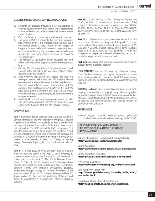
COURSE INSTRUCTOR’S SUPPLEMENTAL GUIDE<br />
1. Students will progress through <strong>the</strong> lessons toge<strong>the</strong>r in<br />
order to advance into <strong>the</strong> next lesson. O<strong>the</strong>r assignments<br />
can be worked on as students finish <strong>the</strong>ir current lesson<br />
ahead of o<strong>the</strong>rs.<br />
2. Part I can be worked on independently or with a partner.<br />
3. The video in Part II is shown to <strong>the</strong> class after everyone<br />
has completed Part I. It is interesting and valuable, but if<br />
you cannot obtain a copy, lecture on <strong>the</strong> subject of<br />
longitude or have students do a research exercise (books<br />
or on-line) addressing <strong>the</strong> questions. Alternatively, you<br />
can skip this part, but you’ll need to adjust <strong>the</strong> Captain’s<br />
Test accordingly.<br />
4. The instructor will go over <strong>the</strong> use of navigation tools and<br />
charts prior to students beginning Part III. Here teamwork<br />
is good.<br />
5. Part IV: The Captains Test will be pre-announced and<br />
given to all <strong>the</strong> students at <strong>the</strong> same time. Retakes will be<br />
determined by <strong>the</strong> situation.<br />
6. After everyone has successfully passed <strong>the</strong> test, <strong>the</strong><br />
“Voyages” activity will follow and all students should<br />
complete <strong>the</strong> activity at <strong>the</strong> same time. We have listed our<br />
final and most difficult voyage; however, <strong>the</strong> students<br />
complete four additional voyages. After all <strong>the</strong> students<br />
have completed <strong>the</strong> activity <strong>the</strong> best <strong>the</strong>y can, we review<br />
<strong>the</strong> activity by going over <strong>the</strong> expected, and usually some<br />
unexpected results.<br />
7. Students will receive four separate grades on <strong>the</strong> module:<br />
The introductory navigation research and tasks, <strong>the</strong> video<br />
answers, <strong>the</strong> Captains Test, and <strong>the</strong> “Voyages” activity.<br />
ANSWER KEY<br />
Part I: 1. grid lines that go east and west; 2. parallel lines to <strong>the</strong><br />
equator running east and west through <strong>the</strong> two poles (Note: on<br />
a globe <strong>the</strong> lines will not be completely parallel); 3. parallel lines<br />
running north and south around <strong>the</strong> Earth; 4. <strong>the</strong> measurement<br />
units around a circle, 360° around <strong>the</strong> Earth; 5. degrees; 6. It<br />
takes <strong>the</strong> Earth one hour to travel around 15° longitude; 7. land<br />
and ocean features as well as lines of latitude and longitude are<br />
distorted; 8. a nautical or marine map showing information for<br />
people in water vessels; 9. 360°; 10. 0°longitude running<br />
through Greenwich, England; 11. 1 knot = 1 nautical mile per<br />
hour<br />
Part II: 1. triangle piece of wood and rope used to measure<br />
knots to check <strong>the</strong> speed of <strong>the</strong> boat; 2. dead reckoning; 3.<br />
currents, crosswinds; 4. latitude; 5. sun, horizon; 6. <strong>the</strong>y hit land,<br />
crashed into rocks, and sank; 7. 1714; 8. John Harrison; 9. back<br />
home, on ship; 10. 15°; 11. to make a clock that could keep<br />
accurate time under <strong>the</strong> harsh conditions at sea; 12. humidity,<br />
different latitude and longitude, atmospheric pressure,<br />
temperature changes, rocking; 13. he used <strong>the</strong> motion of <strong>the</strong><br />
stars; 14. friction; 15. wood; 16. o<strong>the</strong>r people taking his ideas; 17.<br />
it was smaller; 18. <strong>the</strong>y used <strong>the</strong> positioning of <strong>the</strong> sun and<br />
moon; <strong>19</strong>. it was tested on a voyage from Portland, England, to<br />
Barbados<br />
Part III: 25.2°N, 77.4°W; 23.7°N, 74.8°W; 18.4°N, 66.2°W;<br />
20.4°N, 86.9°W; 12.2°N, 69.9°W; 1. N indicates north of <strong>the</strong><br />
equator; 2. W indicates west of <strong>the</strong> prime meridian; 33.8°N,<br />
78.9°W; 32.3°N, 64.6°W; 12.1°N, 61.5°W; 24.6°N, 81.8°W;<br />
<strong>19</strong>.1°N, 81.2°W; 18.5°N, 64.5°W; 13.3°N, 59.6°W; 33-25-<strong>19</strong>°N,<br />
65-80-67°W<br />
Part IV: 1. 1/360 of a circle, or a measure of <strong>the</strong> fractions of a<br />
circle, or lines of latitude and longitude; 2. longitude; 3. to chart<br />
or read a degree heading or direction; 4. lines of longitude; 5. 0°;<br />
6. Cancer; 7. 66-90°S, or South Pole; 8. 4.5"; 9. 180°; 10. Prime<br />
Meridian; 11. B; 12. C; 13. GPS; 14. D; 15. knots; 16. North Pole<br />
or airplane; 17. degree; 18. International Date Line; <strong>19</strong>. 15°; 20.<br />
determine longitude or fix accuracy of clocks<br />
Part V: Nassau/about 15.5 days; have some kind of “treasure”<br />
available for <strong>the</strong> successful captains!<br />
RICK VALLIERE teaches at Conway High School in Conway,<br />
South Carolina. He enjoys teaching his marine science classes<br />
a lot, but you can also find him out on <strong>the</strong> Gulf Stream learning<br />
marine science and navigation firsthand in a quest for big and<br />
tasty fish.<br />
SHARON GILMAN tries to maintain her status as a cardcarrying<br />
(or ra<strong>the</strong>r diploma carrying) biological oceanographer<br />
by teaching marine science classes every once in a while, but<br />
her career interest has wandered into <strong>the</strong> realm of <strong>the</strong> science<br />
of teaching and learning science. She teaches Biology at<br />
Coastal Carolina University.<br />
REFERENCES<br />
National Research Council: National Science Education<br />
Standards. National Academy Press, Washington, D.C., <strong>19</strong>96.<br />
FOR INFORMATION AND ACTIVITIES<br />
RELATED TO THIS ARTICLE THE BRIDGE<br />
RECOMMENDS:<br />
Institute of Navigation: Navigation Education Materials<br />
http://www.ion.org/satdiv/education.cfm<br />
<strong>Marine</strong> Navigation<br />
http://www.mi.mun.ca/mi-net/marinavi/marinavi.htm<br />
<strong>Marine</strong> Navigation Calculator<br />
http://pollux.nss.nima.mil/calc/calc_options.html<br />
How to Use a Compass<br />
http://www.learn-orienteering.org/old/exercise1.html<br />
Land Navigation Lesson Plan<br />
http://www.geocities.com/Yosemite/Falls/9200/<br />
lessonplan.html<br />
Navigational Charts-Office of Coast Survey<br />
http://nauticalcharts.noaa.gov/staff/charts.htm<br />
31


