Tanzania Case Study - Natural Capital Project
Tanzania Case Study - Natural Capital Project
Tanzania Case Study - Natural Capital Project

Create successful ePaper yourself
Turn your PDF publications into a flip-book with our unique Google optimized e-Paper software.
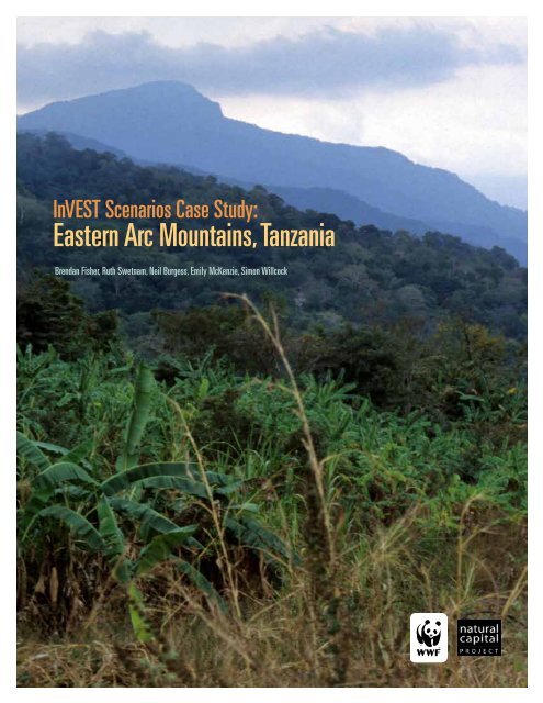
InVEST Scenarios <strong>Case</strong> <strong>Study</strong>:<br />
Eastern Arc Mountains, <strong>Tanzania</strong><br />
Brendan Fisher, Ruth Swetnam, Neil Burgess, Emily McKenzie, Simon Willcock
excerpted from<br />
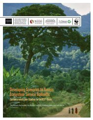
Developing Scenarios to Assess Ecosystem Service Tradeoffs<br />
This case study highlights a real-world example of using<br />
InVEST scenarios to inform decisions about land use. In this<br />
example, scenarios were developed, ecosystem service impacts<br />
were assessed, and the results were used to make sound policy<br />
decisions. The case study offers background on the policy<br />
context and goals, and then delves deeply into the experience<br />
with scenarios and draws out lessons.<br />
Background<br />
One of the richest areas in the world for biological diversity is the Eastern Arc<br />
Mountains, which harbor around 100 vertebrate species and at least 550 plant<br />
species found nowhere else. However, arguments based on biodiversity alone<br />
have failed to halt the conversion of Eastern Arc forests to farmland: Less than<br />
30 percent of the original forest now remains, almost all within protected areas<br />
of various kinds.<br />
The mountains provide benefits to people too—water regulation for farming<br />
purposes, water flow for hydroelectric power generation, and water for domestic<br />
and industrial use by almost 4 million users in Dar es Salaam. Other services<br />
derived from the forest include fuelwood, food, medicine, timber and building<br />
poles for nearby villagers, and carbon storage and sequestration for the global<br />
community. In 2007, a 5-year research program called Valuing the Arc was<br />
established to research the value of these ecosystem services, and thereby<br />
strengthen the case for conservation of the Eastern Arc Mountains. This major<br />
endeavor involved over 30 researchers in <strong>Tanzania</strong>, the UK and the U.S., and<br />
aimed to demonstrate the true contribution of ecosystems in the Eastern Arc<br />
Mountains to the <strong>Tanzania</strong>n economy and society, and integrate these values<br />
into important decisions and support novel policy solutions.<br />
While this research was under way, <strong>Tanzania</strong> was selected as a pilot country<br />
under the UN-REDD (Reducing Emissions from Deforestation and forest<br />
Degradation) pilot program and the bilateral Norwegian government support for<br />
REDD readiness work, and the <strong>Tanzania</strong>n government was therefore involved in<br />
a variety of activities to prepare for REDD. These included building capacity and<br />
developing a national strategy for REDD, in the expectation that REDD would<br />
be included in the UN Framework Convention on Climate Change.<br />
<strong>Tanzania</strong> also experimented with equitable payments for watershed services<br />
(PWS) with pilot feasibility studies in the Pangani and Rufiji water basins, and<br />
one operational project in the Uluguru Mountains that was established by WWF<br />
and CARE. The Eastern Arc Mountains provide drinking water for at least 60<br />
percent of the urban population of <strong>Tanzania</strong>. The mountains are also the source<br />
for more than 90 percent of the nation’s hydroelectricity generation capacity<br />
(which constitutes half of total power production) (Burgess et al. 2007).<br />
InVEST Scenarios <strong>Case</strong> <strong>Study</strong>: Eastern Arc Mountains, <strong>Tanzania</strong> | 1
Within the Uluguru mountain block, poor farming practices and conversion of<br />
forest to farmland were leading to heavy sediment loading and turbidity of feeder<br />
streams leading into the main river, affecting water treatment costs of industries<br />
and utilities downstream (Zahabu, Malimbwi, and Ngaga 2005). The PWS project<br />
aimed to create incentives to conserve and improve the reliable flow and quality of<br />
water downstream, and at the same time improve the quality of life of rural poor<br />
communities. As Valuing the Arc conducted their research, there was interest in<br />
scaling up PWS schemes to additional water catchments.<br />
Across developed and developing countries, governments are striving to improve<br />
the integration of policies across ministries and departments. Such is the case<br />
in <strong>Tanzania</strong>. The Valuing the Arc research program used the ecosystem service<br />
framework to show how different sectors affect—and depend on—the achievement<br />
of goals in other sectors. For example, the delivery of freshwater depends on the<br />
regulation capacity of upland forests and woodlands. Therefore an integrated<br />
approach to policy and project implementation is required, involving both forestry<br />
and water sectors.<br />
What policy questions did the analysis set out to address?<br />
The mapping of ecosystem services in the Eastern Arc Mountains was designed<br />
to meet both research and policy goals. In terms of research, the program aimed<br />
to develop cutting-edge ecosystem service analytical methods and develop new<br />
insights on the contribution of ecosystem services to a range of beneficiaries—<br />
from the global community to poor, local, rural communities. At the broadest<br />
policy scale, the program aimed to demonstrate to policy makers in <strong>Tanzania</strong><br />
the value of ecosystem services and thereby strengthen support for conservation<br />
where the benefits outweighed the costs.<br />
More specifically, the project aimed to provide information needed for scaling up<br />
market mechanisms to maintain ecosystem services, answering policy questions<br />
such as: “Where are REDD pilots most likely to be economically viable compared<br />
with other land-use choices?” and “Where does conservation make the most sense<br />
in terms of the net social benefits and costs across a range of services and land<br />
uses?” Valuing the Arc also aimed to demonstrate the practicality of mapping<br />
ecosystem services in a region with moderate data availability and with emerging<br />
capacity for GIS-based mapping and modeling approaches.<br />
What scenarios were selected?<br />
Scenarios were developed to shed light on how land-use change due to<br />
socioeconomic factors affected ecosystem service delivery. These socioeconomic<br />
factors were pinned to the level of success of the implementation of various<br />
national policies or changes in such policies.<br />
The scenario development process created a framework for exploring how driving<br />
factors—such as policy shifts and their attendant socioeconomic effects (e.g.,<br />
population growth)—might change in the future. The <strong>Tanzania</strong> study team built<br />
scenarios that represented possible futures that were grounded in policy and<br />
practical realities in <strong>Tanzania</strong> and looked plausible to stakeholders.<br />
InVEST Scenarios <strong>Case</strong> <strong>Study</strong>: Eastern Arc Mountains, <strong>Tanzania</strong> | 2
The study team assessed ecosystem services under three scenarios:<br />
• Matazamio Mazuri (Hopeful Expectations): This scenario reflects an optimistic<br />
vision of the future, where <strong>Tanzania</strong> meets all its stated policy goals to alleviate<br />
poverty and manage natural resources sustainably. REDD policies and<br />
payments for watershed services are successfully implemented. The population<br />
continues to grow, but more slowly, and exogenous economic pressures<br />
continue.<br />
• Kama Kawaida (Business as Usual): This scenario represents stakeholders’<br />
expectations of the future in <strong>Tanzania</strong> if current policy and practice continue.<br />
REDD is not implemented at any meaningful scale. There is a growing<br />
population and ongoing resource exploitation, leading to environmental<br />
degradation and declining family income.<br />
• Sideswipe Scenario: The team also developed a scenario sideswipe that explored<br />
the possibility of an agricultural land grab, following a recent trend in Africa. In<br />
this scenario the area of agricultural land expands dramatically. This scenario<br />
was developed outside of the participatory process, but in response to priority<br />
“what if...?” questions presented by decision makers.<br />
How were scenarios developed?<br />
Valuing the Arc researchers broke new ground by developing a process to move<br />
from narrative scenario storylines to quantitative, spatially explicit scenario maps<br />
that described the direction and magnitude of land-cover change (Swetnam et al.<br />
2011). The entire process involved extensive stakeholder input and participation<br />
through a policy review, interviews, and workshops (Fisher 2008).<br />
Scenario development was led and facilitated by a social science team with some<br />
expertise in scenario development. First, current sectoral and national policies<br />
and strategies were reviewed, such as the agriculture strategy, tourism strategy,<br />
the Mkukuta Poverty Reduction Strategy Papers, and the <strong>Tanzania</strong> Vision 2025.<br />
This review highlighted the sectors, interventions and policy goals that are<br />
likely to interact directly with ecosystem services in the Eastern Arc Mountains.<br />
Relevant sectors included agriculture, water, livestock, tourism, health, forestry,<br />
transport and energy.<br />
Semi-structured interviews were conducted with government, academic and<br />
NGO representatives. The first round of interviews helped researchers gain an<br />
understanding of current trends, key policies and interventions, and perceptions<br />
of the major impediments to, and environmental impacts of, growth in different<br />
sectors. The interviews also helped to draw together a commonly shared vision for<br />
<strong>Tanzania</strong>’s future.<br />
A participatory workshop was then held to develop a first draft of the scenarios.<br />
Participants came from government ministries, universities and NGOs.<br />
Stakeholders gave their perspectives on the state, trends, opportunities and<br />
challenges facing relevant sectors. They also shared insights on the drivers of<br />
change in <strong>Tanzania</strong>, clarifying important linkages among development, the state<br />
of the Eastern Arc Mountains, and the ecosystem services they provide.<br />
The workshop included exercises to elucidate the impacts of, and interactions<br />
among, sectors, policies and ecosystem services. Stakeholders situated each sector<br />
along axes of economic importance and environmental impact, and assessed<br />
InVEST Scenarios <strong>Case</strong> <strong>Study</strong>: Eastern Arc Mountains, <strong>Tanzania</strong> | 3
how this might change over the next 25 years under a business-as-usual and an<br />
ecologically optimistic trajectory. Participants were also asked to list policies,<br />
interventions, opportunities and threats that might drive these trajectories.<br />
For example, the forestry sector was assessed as currently having little negative<br />
impact on the environment and as being of limited economic importance. Under<br />
a business-as-usual trajectory, the group listed informal logging activities and<br />
low monitoring capacity as threats to forestry. Under an optimistic trajectory,<br />
the group saw the growth of a regulated carbon market and adequate funding for<br />
PWS schemes as opportunities to improve both the biophysical state of the forests<br />
and their economic importance.<br />
On the basis of information and stakeholder input gleaned from the policy review,<br />
interviews and the first workshop, qualitative narrative scenario storylines were<br />
developed. These scenarios were then sent back to workshop participants for<br />
review and comment. A second round of interviews were undertaken to test<br />
the plausibility and utility of the draft scenarios. One of the original storylines<br />
(representing a situation of low economic growth and high environmental<br />
sustainability) was subsequently rejected, as it was not deemed to be relevant,<br />
realistic or useful by many stakeholders.<br />
A second workshop was held a year after the first, to revise and build consensus<br />
on the final scenarios. A major part of this workshop involved translating the<br />
qualitative narrative storylines into quantitative changes in different landcover<br />
classes expected under each scenario. Stakeholders ranked the impacts of<br />
particular drivers on land-cover inputs needed for the ecosystem service models.<br />
The direction and magnitude of the land-cover impacts were ranked.<br />
For example, the group assessed how population is likely to affect forest cover,<br />
and how markets for biofuels are likely to affect agricultural lands. To simplify<br />
the process, the 30 land-cover classes were combined into six categories. Two<br />
separate groups undertook the process, and there was minimal disagreement<br />
across them. The interactions were then checked for consistency.<br />
The participants then considered how these trends could impact land cover across<br />
the region and helped to construct simple diagrams which captured the current<br />
and future state of land cover and contained information on the flows between<br />
classes (see Figure 1, p. 5).<br />
How were scenarios translated into land-cover maps?<br />
Once the team had quantitative impacts on land cover for each scenario, the next<br />
step was to determine where these changes might happen across the landscape<br />
(Swetnam et al. 2011). The research team—with stakeholder input from the<br />
second workshop—constructed rules for each land-cover group to govern where<br />
changes could occur. These included both biophysical rules, based on factors such<br />
as soil type or climate variables, and socioeconomic rules, based on factors such<br />
as the administrative region or population level.<br />
The workshop facilitator questioned the participants to make general rules<br />
more specific and quantitative. For example, participants clarified that land was<br />
targeted for agricultural expansion based on climate suitability and the proximity<br />
of transport infrastructure. Expert knowledge, existing data and literature reviews<br />
were used to define a specific, quantitative rule: agricultural land increases where<br />
InVEST Scenarios <strong>Case</strong> <strong>Study</strong>: Eastern Arc Mountains, <strong>Tanzania</strong> | 4
Figure 1 Interactions among sectors and land-cover change under an optimistic<br />
scenario in <strong>Tanzania</strong><br />
Expected land cover transitions under the Matazamio Mazuri scenario, with the top line of boxes showing the distribution of the<br />
main land-cover groups in 2000 and the bottom the estimated situation in 2025. Bold arrows between classes show those components<br />
which have remained unchanged; dashed arrows indicate fluxes between classes. Figure 2 in Swetnam et al. (2011) Journal<br />
of Environmental Management.<br />
rainfall is at least 800 mm yr and closest to current transportation routes. This<br />
process was repeated to move from qualitative to quantitatively expressed rules.<br />
Each time, participants started with a broad qualitative statement. Participants<br />
then developed more specific quantitative rules, facilitated by questions from the<br />
modelers who needed to implement the rule. In many cases, participants could<br />
not provide exact values but instead gave general guidance that could be checked<br />
in the published literature later—e.g., the minimum rainfall value for sorghum/<br />
maize/wheat.<br />
Each land-cover group had its own associated set of rules. These were then coded<br />
into the Geographic Information System (GIS) by combining different digital<br />
datasets. The final map for each land-cover group only contained those areas<br />
which met all the conditions specified in the rules (these were termed “spatial<br />
masks,” and there was one for each land-cover group). Agricultural expansion<br />
was deemed to be the most important driver of land-cover change in the region<br />
and as a consequence it attracted the most attention. The rules for agriculture<br />
are summarized in Table 1 (p. 6).<br />
InVEST Scenarios <strong>Case</strong> <strong>Study</strong>: Eastern Arc Mountains, <strong>Tanzania</strong> | 5
Table 1 Rules determining the location of agricultural expansion<br />
Qualitative rules<br />
Agriculture can expand where the<br />
climate is suitable<br />
Agriculture can expand where the<br />
soils are good<br />
Agriculture will expand where the<br />
land is already near a road and near<br />
existing areas of agriculture<br />
Agriculture will expand mainly in<br />
the miombo and coastal habitats;<br />
it will not expand into existing<br />
plantation forest<br />
Quantitative rules<br />
800mm ≥ Annual Rainfall ≤ 1800mm AND<br />
155mm ≥ Dry Season Rainfall ≤ 740mm<br />
Soil type must equal type “a, b or c”<br />
(where these are <strong>Tanzania</strong>n soil types)<br />
Distance to road ≤ 20km AND Distance<br />
to existing agriculture ≤ 20km<br />
Land-cover type ≠ urban, plantation forest<br />
or swamp<br />
A second stage of refinement was then undertaken. The spatial masks were<br />
graded, with each cell assigned a weight based on accessibility to the main<br />
market of Dar es Salaam; accessibility to the nearest navigable road;<br />
accessibility to existing agriculture; and climatic suitability for the land-cover<br />
class under consideration. Cells with a high weighting were targeted first for<br />
land-cover change.<br />
How did the scenarios shape the final results for policy makers?<br />
One outcome of the scenario development was their use as an input for the carbon<br />
modeling within the InVEST tool. Researchers compared the total loss of carbon<br />
under each scenario, and mapped where carbon gain and loss occurred across<br />
the landscape. Using a modest estimate of carbon value (≈ $15 per Mg CO2),<br />
indicative changes in the value of carbon stored and sequestered were calculated<br />
under each scenario.<br />
To explore tradeoffs, similar analyses were undertaken using both InVEST and<br />
more sophisticated process models for other ecosystem services. Ecosystem<br />
services included biodiversity, water yield, firewood, building materials (thatch),<br />
food (fruit, tubers, honey, bushmeat), and provision of wood for charcoal.<br />
All the terrestrial ecosystem service models used land cover as a major input,<br />
so it is through changes in land cover that the scenarios propagated change.<br />
The scenarios showed policy makers what might happen to <strong>Tanzania</strong>n forests<br />
in the future, and the implications for multiple ecosystem services. The<br />
difference in the future carbon storage in the Kama Kawaida scenario compared<br />
to the Matazamio Mazuri scenario showed the additional carbon “saved.”<br />
This identified areas that could be candidates for payment under REDD+<br />
and voluntary carbon projects.<br />
Key assumption<br />
• The scenarios assumed a mid-range climate for <strong>Tanzania</strong>. The modelers<br />
assumed that over the timescale of the scenarios (to 2025), climate would be<br />
a less significant driver of land-use change than would socioeconomic forces.<br />
InVEST Scenarios <strong>Case</strong> <strong>Study</strong>: Eastern Arc Mountains, <strong>Tanzania</strong> | 6
Figure 2 Changes in the spatial distribution of carbon storage under scenarios in <strong>Tanzania</strong><br />
The four focal mountain blocks of the northeastern Eastern Arc Mountains, showing changes in the spatial distribution of carbon<br />
storage by block and overall changes in carbon storage (tonnes). Figure 5 in Swetnam et al. (2011) Journal of Environmental<br />
Management.<br />
Strengths<br />
• The project used a participatory process that channeled local expert input into<br />
the entire process of developing qualitative scenarios, estimating quantitative<br />
impacts on land cover for those scenarios, and determining where on the<br />
landscape those impacts would occur.<br />
• The final scenarios were selected on the basis of relevance and utility for<br />
<strong>Tanzania</strong>n stakeholders. The scenario process was flexible and iterative, with<br />
continued evolution in which scenarios to include, based on feedback from<br />
stakeholders. Those scenarios that did not resonate were rejected.<br />
• Scenarios were used as a way to engage policy makers. In presenting the carbon<br />
results to policy makers at the Copenhagen Climate Summit, the scenarios<br />
generated significant interest.<br />
• The scenarios were based on a comprehensive and integrated set of drivers<br />
and interactions, using workshop exercises, but did not require quantitative<br />
scenario modeling.<br />
• The comprehensive approach for developing these scenarios enabled learning<br />
elsewhere. For example, a simpler version of the approach was developed for a<br />
project in the Virungas landscape covering Rwanda, Uganda and Democratic<br />
Republic of Congo.<br />
InVEST Scenarios <strong>Case</strong> <strong>Study</strong>: Eastern Arc Mountains, <strong>Tanzania</strong> | 7
Challenges and areas for future improvement<br />
• The scenarios were highly detailed and parameterized, because they considered<br />
a large number of interactions among drivers, sectors, policies and land-cover<br />
impacts. This may have made them too complex to be transparent to policy<br />
makers.<br />
• The scenarios captured changes in the quantity of each land cover under each<br />
scenario, but not changes to the condition of land cover.<br />
• The process required considerable time, capacity and expertise. The total staff<br />
time was approximately one year, devoted full-time. This was split between<br />
two staff members, who ran the interviews and workshops, and undertook the<br />
modeling. Developing the qualitative scenarios required an understanding of<br />
macroeconomics and policy, along with facilitation, data collection, literature<br />
review and interview skills. Translating the scenarios into land-cover maps<br />
demanded a high level of GIS, data management and spatial modeling skills.<br />
Funding was needed to cover the costs of workshops.<br />
• Many people seized on the scenario maps as definitive results, and focused on<br />
the details of a relatively small area they knew well. Researchers emphasized<br />
that the scenarios were depictions of uncertain futures at broad scales—more<br />
important in terms of relative gains and losses—and should be interpreted as<br />
such.<br />
• The study team initially intended to use downscaled global scenarios based<br />
on the Special Report on Emissions Scenarios published by the IPCC, and on<br />
the global scenarios developed to assess future trends in ecosystem services<br />
published by the Millennium Ecosystem Assessment. However, <strong>Tanzania</strong>n<br />
stakeholders felt these scenarios, and the drivers and policy levers embodied<br />
within them, were not relevant to <strong>Tanzania</strong>. The scenarios were reframed to<br />
fit their interests and needs. The new scenarios were not downscaled global<br />
scenarios, but based on local information on <strong>Tanzania</strong>n drivers and policy.<br />
• Data availability was a challenge, with few digital data sources of sufficient<br />
quality and scale, and many inconsistencies across sources. The biggest<br />
challenges related to information on soils and agricultural capacity. Key<br />
datasets, such as settlement and road data, had to be created from disparate<br />
sources or digitized afresh. Interviews, grey literature, peer-reviewed literature,<br />
and government policies were cross-checked to obtain reliable estimates of key<br />
statistics.<br />
• It did not prove feasible to integrate climate change and socioeconomic<br />
scenarios in the same modeling approach. As they interact, this presented a<br />
complicated modeling and conceptual challenge.<br />
<strong>Case</strong> <strong>Study</strong> References<br />
Burgess, N. D., T. M. Butynski, N. J. Cordeiro, N. H. Doggart, J. Fjeldså, K. M. Howell, F. B.<br />
Kilahama, S. P. Loader, J. C. Lovett, B. Mbilinyi, M. Menegon, D. C. Moyer, E. Nashanda, A.<br />
Perkin, F. Rovero, W. T. Stanley, and S. N. Stuart. 2007. “The biological importance of the<br />
Eastern Arc Mountains of <strong>Tanzania</strong> and Kenya.” Biological Conservation no. 134 (2):209–231.<br />
Fisher, Brendan. 2008. Developing scenarios for Valuing the Arc. In Valuing the Arc Workshop<br />
Report. Dar es Salaam, <strong>Tanzania</strong>.<br />
Swetnam, R., B. Fisher, B.P. Mbilinyi, P.K.T. Munishi, S. Willcokc, T. Ricketts, S. Mwakalila,<br />
A. Balmford, N.D. Burgess, A.R. Marshall, and S.L. Lewis. 2011. “Mapping socio-economic<br />
InVEST Scenarios <strong>Case</strong> <strong>Study</strong>: Eastern Arc Mountains, <strong>Tanzania</strong> | 8
scenarios of land cover change: A GIS method to enable ecosystem service modelling.” Journal<br />
of Environmental Management no. 92:563–574.<br />
Zahabu, E., R.E. Malimbwi, and Y.M. Ngaga. 2005. Payments for environmental services as<br />
incentive opportunities for catchment forest reserves management in <strong>Tanzania</strong>. In Paper<br />
presented to the <strong>Tanzania</strong> Association of Foresters Meeting, held at Karimjee Hall, November<br />
2005. Dar es Salaam: www.communitycarbonforestry.org<br />
Valuing the Arc: www.valuingthearc.org<br />
REDD in <strong>Tanzania</strong>: www.reddtz.org<br />
snapshoT | <strong>Tanzania</strong><br />
Policy Context<br />
Policy level<br />
Local, sub-national (Eastern <strong>Tanzania</strong>) and national<br />
Policy questions<br />
• advocate conservation by demonstrating nature’s value<br />
• explain why REDD and PWS policies are needed<br />
• suggest where REDD and PWS pilots could be feasible and outline different<br />
costs of these approaches<br />
Ecosystem services included<br />
Carbon storage and sequestration, biodiversity, water yield, firewood, building<br />
materials (poles and thatch), food (fruit, tubers, honey, bushmeat), provision of<br />
wood for charcoal production<br />
Scenario Product and Process<br />
Scenario format<br />
Qualitative narrative storylines and quantitative impacts on land cover for each<br />
scenario<br />
Number of scenarios<br />
2<br />
Time frame for scenarios<br />
<strong>Study</strong> undertaken in 2010; scenarios envisioned for 2025<br />
Time frame for ES assessments<br />
Carbon assessed for 2025<br />
Spatial extent of scenarios<br />
Eastern <strong>Tanzania</strong> (340,000 km 2 )<br />
Spatial extent of policy recommendations<br />
Eastern Arc Mountains (35,000 km 2 )<br />
Stakeholder participation in scenarios<br />
Medium/High<br />
Consideration of exogenous drivers<br />
High<br />
Consideration of endogenous drivers<br />
High<br />
Capacity and time required<br />
High<br />
InVEST Scenarios <strong>Case</strong> <strong>Study</strong>: Eastern Arc Mountains, <strong>Tanzania</strong> | 9
THIS CASE STUDY WAS<br />
DEVELOPED THROUGH<br />
THE NATURAL CAPITAL<br />
PROJECT, WHICH IS A<br />
PARTNERSHIP AMONG<br />
Developing Scenarios to Assess Ecosystem Service Tradeoffs: Guidance<br />
and <strong>Case</strong> Studies for InVEST Users is a resource for practitioners who want to<br />
assess the provision of ecosystem services under alternative future scenarios.<br />
The guide draws on case experiences where InVEST was used to compare<br />
ecosystem service tradeoffs under different scenarios. It can help InVEST users<br />
choose appropriate types of scenarios and methods, engage stakeholders, and<br />
create scenario maps. The guide highlights key issues and questions for reflection,<br />
along with tools, case studies, references and resources for those who want to<br />
learn more.<br />
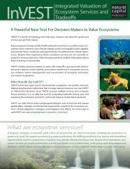
InVEST is a suite of ecosystem service models, developed by the <strong>Natural</strong><br />
<strong>Capital</strong> <strong>Project</strong>, for mapping, quantifying and valuing ecosystem services<br />
under different scenarios. InVEST helps decision makers incorporate ecosystem<br />
services into policy and planning at different scales in terrestrial, freshwater<br />
and marine environments.<br />
Further materials are available on the scenarios page at naturalcapitalproject.org<br />
© 2012 WWF. All rights reserved by World Wildlife Fund, Inc. 07-12