West Gippsland Region - Waterwatch Victoria
West Gippsland Region - Waterwatch Victoria
West Gippsland Region - Waterwatch Victoria

You also want an ePaper? Increase the reach of your titles
YUMPU automatically turns print PDFs into web optimized ePapers that Google loves.
<strong>West</strong> <strong>Gippsland</strong><br />
2007/08<br />
Monitoring Information<br />
10 groups, 86 participants, 96 sites<br />
Education Participation<br />
2,600 participants<br />
Coordinators (FTE) 3.5<br />
Program Budget $453,300<br />
• <strong>Waterwatch</strong> Coordinators<br />
Tammy Logan Tanya Cowell Marni Speed Jill Vella Bryce Morden Karen Borton Dale Wilson Catherine Timms<br />
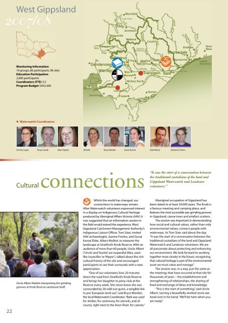
Cultural connections<br />
“It was the start of a conversation between<br />
the traditional custodians of the land and<br />
<strong>Gippsland</strong> <strong>Waterwatch</strong> and Landcare<br />
volunteers.”<br />
22<br />
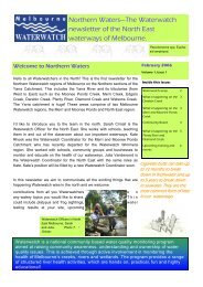
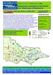
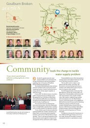
Uncle Albert Mullett interpreting the grinding<br />
grooves at Knob Reserve sandstone bluff.<br />
Whilst the world has changed, our<br />
connections to waterways remain.<br />
After <strong>Waterwatch</strong> volunteers expressed interest<br />
in a display on Indigenous Cultural Heritage<br />
produced by Aboriginal Affairs <strong>Victoria</strong> (AAV) it<br />
was suggested that an information session in<br />
the field would extend the experience. <strong>West</strong><br />
<strong>Gippsland</strong> Catchment Management Authority’s<br />
Indigenous Liaison Officer, Tom Sizer, invited<br />
AAV archaeologist, Joanne Freslov, and Gunai<br />
Karnai Elder, Albert Mullett, to interpret the<br />
landscape at Stratford’s Knob Reserve. With an<br />
audience of more than 60 people, Uncle Albert<br />
(‘Uncle’ and ‘Auntie’ are respectful titles, used<br />
like ‘councillor’ or ‘Mayor’), talked about the rich<br />
cultural history of the site and encouraged<br />
participants to see their surrounds with a new<br />
appreciation.<br />
“One of our volunteers lives 20 minutes<br />
down the road from Stratford’s Knob Reserve<br />
and brings her daughter to pony club at the<br />
Reserve every week. She never knew she was<br />
surrounded by 30-odd scar gums, a tangible link<br />
to pre-European land use,” said Bryce Morden,<br />
the local <strong>Waterwatch</strong> Coordinator. “Bark was used<br />
for shelter, for ceremony, for utensils, and of<br />
course, right next to the Avon River, for canoes.”<br />
Aboriginal occupation of <strong>Gippsland</strong> has<br />
been dated to at least 30,000 years. The Knob is<br />
a famous meeting and camping place, and<br />
features the most accessible axe-grinding grooves<br />
in <strong>Gippsland</strong>, canoe trees and artefact scatters.<br />
The session was important in demonstrating<br />
how social and cultural values, rather than only<br />
environmental values, connect people with<br />
waterways. As Tom Sizer said about the day,<br />
“It was the start of a conversation between the<br />
traditional custodians of the land and <strong>Gippsland</strong><br />
<strong>Waterwatch</strong> and Landcare volunteers. We are<br />
all passionate about protecting and enhancing<br />
our environment. We look forward to working<br />
together more closely in the future, recognising<br />
that cultural heritage is part of the environmental<br />
asset we must value and manage.”<br />
The session was, in a way, just the same as<br />
the meetings that have occurred at that site for<br />
thousands of years – the establishment and<br />
strengthening of relationships, the sharing of<br />
food and exchange of ideas and knowledge.<br />
“This is the start of something,” said Uncle<br />
Albert, turning a beautifully worked stone axe<br />
head over in his hand, “We’ll be here when you<br />
are ready.”
Monitoring to plan<br />
Changing land use can put new and<br />
different pressures on waterways.<br />
Stakeholders need to be informed and involved<br />
in suggesting ways to alleviate those pressures.<br />
A year ago, Warragul District Landcare<br />
Group became concerned about the growing<br />
pressure on the network of creeks that run<br />
through the township of Warragul. Known<br />
collectively as Hazel Creek, it is a complex<br />
system of tributaries high up in the upper<br />
catchment of the Moe River that ultimately run<br />
to the sea through Lakes Entrance.<br />
Warragul’s stormwater drainage relies on<br />
Hazel Creek and with increasing urbanisation<br />
around the perimeters of the town, Landcare<br />
was concerned about how the creek system<br />
would handle the effects of new development.<br />
The group began monitoring at five sites<br />
and, by setting up a roster between the 12<br />
monitors, they aim to monitor after rain events.<br />
Assisting their monitoring efforts, the Warragul<br />
Gazette has agreed to publish monthly reports<br />
on the results to help raise community awareness.<br />
The Brooker Park Wetland, situated in the<br />
centre of Warragul, is the key site in the group’s<br />
monitoring program. The data collected<br />
establishes a baseline and shows the effectiveness<br />
of the wetland as a filter and sediment trap and<br />
its role in pollution and flood mitigation.<br />
The group’s data will ultimately inform a<br />
management plan for Hazel Creek, developed<br />
by the <strong>West</strong> <strong>Gippsland</strong> Catchment Management<br />
Authority and Baw Baw Shire Council.<br />
Monitoring results from the groups five sites,<br />
together with other <strong>Waterwatch</strong> data collected<br />
since the early 1990s, will provide valuable<br />
information about where interventions are<br />
needed in order to maintain and hopefully<br />
improve the health of the Creek.<br />
As Liz Clay, a member of the Landcare group<br />
describes, “The wetlands at Brooker Park have<br />
become iconic. By establishing baseline data<br />
our monitoring not only validates the function<br />
of Brooker Park but hopefully will encourage<br />
the development of a system of wetlands.”<br />
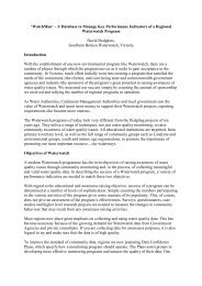
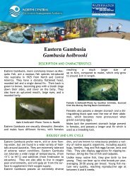
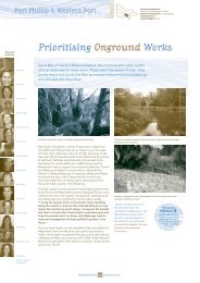
A monitoring site on Hazel Creek near the Princes<br />
Highway in Warragul. (Photo: Monica Green)<br />
“The group’s data will ultimately inform a<br />
management plan for Hazel Creek.”<br />
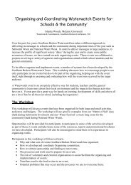
The classroom in a canoe<br />
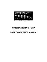
Year 9 students from Neerim District Secondary<br />
College, monitoring at the water’s edge.<br />
“It is a whole different thing once they’re<br />
on the river. It’s all in context, they can see<br />
what’s around them and they can<br />
understand”<br />
The classroom is not necessarily the<br />
best place to learn a lesson and canny<br />
teachers are changing this tradition to better<br />
engage students.<br />
A few years ago, Neerim District Secondary<br />
College teacher, Liz Keily, participated in a<br />
<strong>Waterwatch</strong> community canoe tour. The tour<br />
sparked an idea for teaching her Year 9 students<br />
an Integrated Studies Unit, based on<br />
environmental studies. Liz thought that by<br />
giving academic issues context, students<br />
would be more interested and engaged and<br />
could better apply what they were learning. So<br />
she literally took the classroom into a canoe!<br />
Every fortnight her students spend a day<br />
paddling different sections of the LaTrobe and<br />
Thomson Rivers. On each trip they undertake a<br />
number of water quality monitoring tests,<br />
habitat and macroinvertebrate assessments<br />
and have representatives from different<br />
organisations talk to them about why the rivers<br />
are important.<br />
Liz said, “You can get people from different<br />
industries to come and talk to the students in<br />
the classroom but it is a whole different thing<br />
once they’re on the river. It’s all in context, they<br />
can see what’s around them and they can<br />
understand.”<br />
Students paddle at the top end of the Lake<br />
Wellington catchment where the river winds<br />
through towering mountain ash forests, down<br />
to low lying irrigated land where agriculture<br />
and the power industry rely on the waterways<br />
for very different needs.<br />
The students have presentations from a<br />
range of stakeholders including farmers,<br />
Landcare, the power industry and the Historical<br />
Society of Walhalla, all who give a different<br />
perspective on the river.<br />
Liz summarizes the experience, “By paddling,<br />
we build up the real story about the river.<br />
<strong>Waterwatch</strong> provides another picture in that<br />
story.”<br />
Partners and Sponsors of the <strong>West</strong> <strong>Gippsland</strong> <strong>Waterwatch</strong> Program Natural Heritage Trust, <strong>West</strong> <strong>Gippsland</strong> Catchment Management Authority, <strong>Gippsland</strong> Water,<br />
South <strong>Gippsland</strong> Water, Southern Rural Water, HVP Plantations, ESSO/BHP Billiton Australia, TRU Energy, Loy Yang Power, SGS Environmental Services.<br />
23