RECEIVED DEC 1 2 mz - Douglas County
RECEIVED DEC 1 2 mz - Douglas County
RECEIVED DEC 1 2 mz - Douglas County

Create successful ePaper yourself
Turn your PDF publications into a flip-book with our unique Google optimized e-Paper software.
.I J<br />
... <strong>RECEIVED</strong><br />
<strong>DEC</strong> 1 2 <strong>mz</strong><br />
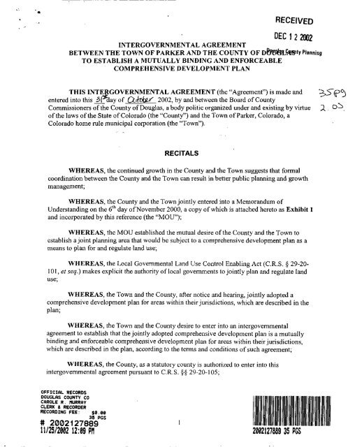
INTERGOVERNMENTAL AGREEMENT<br />
BETWEEN THE TOWN OF PARKER AND THE COUNTY OF D&!&lLhWtY Planning<br />
TO ESTABLISH A MUTUALLY BINDING AND ENFORCEABLE<br />
COMPREHENSIVE DEVELOPMENT PLAN<br />
THIS INTE GOVERNMENTAL AGREEMENT (the “Agreement”) is made and<br />
entered into this - 31 z day of 2002, by and between the Board of <strong>County</strong><br />
Commissioners of the <strong>County</strong> of <strong>Douglas</strong>, a body politic organized under and existing by virtue<br />
of the laws of the State of Colorado (the “<strong>County</strong>”) and the Town of Parker, Colorado, a<br />
Colorado home rule municipal corporation (the “Town”).<br />
RECITALS<br />
WHEREAS, the continued growth in the <strong>County</strong> and the Town suggests that formal<br />
coordination between the <strong>County</strong> and the Town can result in better public planning and growth<br />
management;<br />
WHEREAS, the <strong>County</strong> and the Town jointly entered into a Memorandum of<br />
Understanding on the 6‘h day of November 2000, a copy of which is attached hereto as Exhibit 1<br />
and incorporated by this reference (the “MOU”);<br />
WHEREAS, the MOU established the mutual desire of the <strong>County</strong> and the Town to<br />
establish a joint planning area that would be subject to a comprehensive development plan as a<br />
means to plan for and regulate land use;<br />
WHEREAS, the Local Governmental Land Use Control Enabling Act (C.R.S. 9 29-20-<br />
101, et seq.) makes explicit the authority of local governments to jointly plan and regulate land<br />
use;<br />
WHEREAS, the Town and the <strong>County</strong>, after notice and hearing, jointly adopted a<br />
comprehensive development plan for areas within their jurisdictions, which are described in the<br />
plan;<br />
WHEREAS, the Town and the <strong>County</strong> desire to enter into an intergovernmental<br />
agreement to establish that the jointly adopted comprehensive development plan is a mutually<br />
binding and enforceable comprehensive development plan for areas within their jurisdictions,<br />
which are described in the plan, according to the terms and conditions of such agreement;<br />
WHEREAS, the <strong>County</strong>, as a statutory county is authorized to enter into this<br />
intergovemmental agreement pursuant to C.R.S. $5 29-20-105;<br />
OFFICIRL RECORDS<br />
DOUGLQS COUNTY CO<br />
CRROLE R. PIURRW<br />
CLERK & RECORDER<br />
RECORDING FEE: $0.00<br />
3s PGS<br />
# 2002127889<br />
11125121102 1209 PI1<br />
1<br />
+9-p3<br />
2 , 05,
WHEREAS, the Town, as a home rule municipality is authorized to enter into this<br />
intergovernmental agreement pursuant to Colo. Const. Art. XX, Colo. Const. Art. XIV, Section<br />
18, as well as C.R.S. §§ 29-1-203 and the Local Government Land Use Control Act, Sections 29-<br />
20-101 through 107, C.R.S., as amended; and<br />
WHEREAS, the <strong>County</strong> and the Town desire to enter into this intergovernmental<br />
agreement to make the comprehensive development plan mutually binding and enforceable.<br />
AGREEMENT<br />
NOW, THEREFORE, the <strong>County</strong> and the Town agree to enter into this<br />
Intergovernmental Agreement (“Agreement”) to provide as follows:<br />
1. Comprehensive Development Plan. The <strong>County</strong> and Town jointly adopt the<br />
Comprehensive Development Plan, which is attached hereto as Exhibit 2 and<br />
incorporated by this reference (the “Comprehensive Development Plan”). The <strong>County</strong><br />
and the Town acknowledge that the Comprehensive Development Plan is mutually<br />
binding and enforceable for areas within their jurisdiction as described in the plan to the<br />
fullest extent allowed by C.R.S. § 29-20-105(1) and (2).<br />
2. Effective Date and Term. This Agreement shall be effective after: (1) it has been<br />
executed by the <strong>County</strong> and the Town; and (2) the <strong>County</strong> has adopted conforming<br />
amendments to the <strong>Douglas</strong> <strong>County</strong> Zoning Resolution. <strong>Douglas</strong> <strong>County</strong> shall attempt to<br />
complete said amendment by January 31, 2003. This Agreement shall remain in full force<br />
and effect for the five-year period commencing on its effective date. Thereafter, this<br />
Agreement shall automatically remain in full force and effect for successive five-year<br />
terms through the year 2022, unless sooner terminated. This Agreement may be<br />
terminated at the end of a five-year term by a party giving written notice to the other<br />
party at least 180 days prior to the expiration of the five-year term. This Agreement may<br />
also be terminated at any time by mutual agreement of the parties. The term of the<br />
Comprehensive Development Plan shall run concurrently with the term of this<br />
Agreement.<br />
3. Remedies. The parties hereto agree and acknowledge that each party may exercise all<br />
rights and remedies in law or in equity, by decree of specific performance or damages, or<br />
such other legal or equitable relief as may be available including, but not limited to, those<br />
remedies described in Section 29-20-105(2)(g), C.R.S.<br />
4. General Provisions.<br />
A. Notices. All notices, demands, requests or other communications required under this<br />
Agreement shall be in writing and shall be hand delivered to the individual or to a<br />
member of the firm or to an officer of the corporation from whom it is intended, or<br />
sent by registered or certified mail, return receipt requested, postage prepaid, to the<br />
2
following addresses or to such other addresses as any party may from time to time<br />
designate by notice given pursuant to this paragraph.<br />
<strong>County</strong> of <strong>Douglas</strong>:<br />
Doug DeBord, <strong>County</strong> Administrator<br />
<strong>Douglas</strong> <strong>County</strong><br />
100 Third Street<br />
Castle Rock, Colorado 80104<br />
Facsimile: 303-688-1293<br />
With a copy to:<br />
J. Mark Hannen, <strong>County</strong> Attorney<br />
<strong>Douglas</strong> <strong>County</strong><br />
100 Third Street<br />
Castle Rock, Colorado 80104<br />
Facsimile: 303-688-6596<br />
Peter Italiano, Director Community Development<br />
<strong>Douglas</strong> <strong>County</strong><br />
100 Third Street<br />
Castle Rock, Colorado 80104<br />
Facsimile: 303-660-9550<br />
Town of Parker:<br />
Aden Hogan, Town Administrator<br />
Town of Parker<br />
20120 E. Mainstreet<br />
Parker, Colorado 80138<br />
Facsimile: 303-840-9792<br />
With a copy to:<br />
James. S. Maloney, Esq.<br />
Town of Parker<br />
20120 E. Mainstreet<br />
Parker, Colorado 80138<br />
Facsimile: 303-840-9792<br />
Garner Stoll, Planning Director<br />
Town of Parker<br />
20120 E. Mainstreet<br />
Parker, Colorado 80138<br />
Facsimile: 303-841-3223<br />
3
In the event facsimile transmission or other electronic means of notice is provided,<br />
the notice shall be deemed to be delivered upon its transmission and receipt of<br />
confirmation of its receipt at the business location of the receiving party, provided the<br />
notice is also immediately sent by mail as provided above.<br />
B. No Vested Rights. This Agreement shall not grant any status or right to any third<br />
party, specifically any owner of any property, to make any claim as a third party<br />
beneficiary, or for deprivation of any right, violation of any vesting or rights, or<br />
inverse or other condemnation. This Agreement is for the benefit of the parties only<br />
to resolve issues between the parties.<br />
C. Interpretation of Agreement. Because this Agreement is the result of mutual<br />
negotiation and drafting, in the event this Agreement is deemed to be ambiguous or<br />
vague, the parties agree with the rule of construction that “ambiguities shall be<br />
construed against the drafter” shall not apply.<br />
D. Choice of Law. This Agreement shall be interpreted and construed in accordance with<br />
the laws of the State of Colorado.<br />
E. Invalidity of Terms. If any term, claim, clause or provision of this Agreement shall be<br />
judged to be invalid, the validity and effect of any other term, claim, clause or<br />
provision shall not be affected; and such invalid term, claim, clause or provision shall<br />
be deemed from this Agreement in a manner to give effect to the remaining terms,<br />
claims, clauses or provisions.<br />
F. Counterparts. This Agreement may be executed in any number of counterparts, each<br />
of which shall be considered an original for all purposes, and all of which when taken<br />
together shall constitute one and the same Agreement.<br />
G. Authority. Each of the undersigned represents as to itself that each has the authority<br />
to execute this Agreement.<br />
H. Forum Selection. Any action brought to enforce the terms and provisions of this<br />
Agreement or alleging a breach hereof shall be brought only in the District Court in<br />
<strong>Douglas</strong> <strong>County</strong>, Colorado.<br />
I. Consents/Approvals. Wherever this Agreement calls for the consent or approval of<br />
any party hereto, with respect to which consent or approval under this Agreement is<br />
not self-executing, in order to be effective, such consent or approval shall be in the<br />
form of a Resolution duly enacted by the Town Council and Board of <strong>County</strong><br />
Commissioners.<br />
J. Recordation of Agreement. The parties shall record this Agreement in the real estate<br />
records of <strong>Douglas</strong> <strong>County</strong>, <strong>Douglas</strong> <strong>County</strong>, Colorado.<br />
4
K. Entire Ameement. This Agreement constitutes the entire understanding, contract, and<br />
agreement between the parties as to the subject matters herein set forth, and this<br />
Agreement only supersedes prior written or oral understandings, agreements, and<br />
commitments, formal or informal, relative thereto between all the parties hereto. No<br />
change, modification, alteration, or amendment to this Agreement shall be binding<br />
upon the parties except as specifically expressed in writing, making reference to this<br />
Agreement and signed by all of the parties hereto agreeing to be bound thereby.<br />
IN WITNESS WHEREOF, this Intergovemmental Agreement is executed by the Town<br />
of Parker and the Board of <strong>County</strong> Commissioners of <strong>Douglas</strong> <strong>County</strong> as of the date first above<br />
APPROVED AS<br />
TOWN OF PARKER. COLORADO<br />
V BOARD OF COUNTY COMMISSIONERS<br />
OF THE COUNTY OF DOUGLAS,<br />
APPROVED AS TO FORM:<br />
J Ld -!--I- /''/J?/OZ<br />
J. Mark kannen, <strong>County</strong> Attomey<br />
5
EXHIBIT 1<br />
MEMORANDUM OF UNDERSTANDING<br />
6
EXHIBIT 2<br />
COMPREHENSIVE DEVELOPMENT PLAN<br />
7
COMPREHENSIVE DEVELOPMENT PLAN<br />
THIS COMPREHENSIVE DEVELOPMENT PLAN (the “Plan”) is made and entered<br />
into this 31 &day of 02bkEf 2002, by and between the Board of <strong>County</strong><br />
Commissioners of the <strong>County</strong> of <strong>Douglas</strong>, a body politic organized under and existing by virtue<br />
of the laws of the State of Colorado (the “<strong>County</strong>”) and the Town of Parker, Colorado, a<br />
Colorado home rule municipal corporation (the “Town”).<br />
RECITALS<br />
WHEREAS, the continued growth in the <strong>County</strong> and the Town suggests that formal<br />
coordination between the <strong>County</strong> and the Town Can result in better public planning and growth<br />
management;<br />
WHEREAS, the Local Governmental Land Use Control Enabling Act (the “Act”)<br />
(C.R.S. $5 29-20-101 et seq.) makes explicit the authority of local govemments to jointly plan<br />
and regulate land use;<br />
WHEREAS, the Act states that “local govemments may provide through<br />
intergovemmenlal agreements for the joint adoption by the goveming bodies, after notice and<br />
hearing, of mutually binding and enforceable comprehensive development plans for areas within<br />
their jurisdiction”; and<br />
WHEREAS, the <strong>County</strong> and the Town desire to enter into a mutually binding<br />
comprehensive development plan as a means to plan for and regulate land use within a joint<br />
planning area, as identified in such plan.<br />
PLAN<br />
NOW, THEREFORE, the <strong>County</strong> and the Town jointly approve and adopt this<br />
Comprehensive Development Plan (“Plan”) to provide as follows:<br />
1.0 Planning Area Definitions<br />
I. I Town Urban Service Area. Represents the boundary of the Town’s potential<br />
future annexation area to the year 2022. The level to which this area may or may<br />
not be developed shall depend on a number of factors, including, but not limited<br />
to, natural features, utility services, and compliance with applicable Town<br />
regulations and master plans. This boundary represents the Town’s potential<br />
annexation perimeter and will include areas dedicated for open space as well as<br />
urban level development. The Town Urban Service Area is depicted on the<br />
attached map (Attachment A).<br />
8
1.2 Community Separation Buffer. Represents a buffer around the Town’s Urban<br />
Service Area that provides a transitional “edge” between the Town and other<br />
incorporated and unincorporated communities. While this area is not needed to<br />
accommodate the Town’s growth to the year 2022, land use and development<br />
changes within this area will have a direct impact on the Town. The Community<br />
Separation Buffer is depicted on the attached map (Attachment A).<br />
1.3 Permitted Uses. The Comprehensive Development Plan shall supersede the<br />
<strong>County</strong> Zoning Resolution for the real property contained within the Community<br />
Separation Buffer Area and the Town Urban Service Area to the extent provided<br />
in the Plan. The only uses permitted by right within the Community Separation<br />
Buffer Area and the Town Urban Service Area are those permitted uses described<br />
in Attachment B (the “Permitted Uses and Special Uses Matrix”) and depicted in<br />
Attachment C (“Zoning Map”). The Permitted Uses shall not be changed,<br />
modified or expanded within the Community Separation Buffer Area during the<br />
term of this Plan, except (i) pursuant to paragraph 4.1, or (ii) as provided in<br />
paragraph 6.0 of the Plan. The Permitted Uses shall not be changed, modified or<br />
expanded within the Town Urban Service Area, except (i) pursuant to paragraph<br />
3.1.1 of the Plan; (ii) pursuant to a pre-annexation agreement with the Town<br />
pursuant to paragraph 3.1.2 of the Plan; or (iii) pursuant to paragraph 6.0 of the<br />
Plan.<br />
1.4 Special Uses. The only Special Uses allowed within the Community Separation<br />
Buffer Area and the Town Urban Service Area are those special uses described in<br />
Attachment B (“Permitted Uses and Special Uses Matrix”) that are determined to<br />
meet, after notice and hearing, the requirements contained in Attachment D. The<br />
Special Uses shall not be changed, modified or expanded within the Community<br />
Separation Buffer Area during the term of this Plan, except (i) pursuant to<br />
paragraph 4.1, or (ii) as provided in paragraph 6.0 of the Plan. The Special Uses<br />
shall not be changed, modified or expanded within the Town Urban Service Area,<br />
except (i) upon the annexation of real property located within the Town Urban<br />
Service Area, pursuant to paragraph 3.1.1 of the Plan; (ii) pursuant to a preannexation<br />
agreement with the Town pursuant to paragraph 3.1.2 of the Plan; or<br />
(iii) pursuant to paragraph 6.0 of the Plan.<br />
2.0 Petitions for Annexation within the Town’s Urban Service Area<br />
2.1 Commitment by Town to Actively Pursue Annexation of Enclaves and Roads.<br />
The Town will commit to actively pursue annexation of all enclaves. Enclaves are<br />
those unincorporated areas of land entirely contained within the outer boundaries<br />
of the Town. The businesses and land owners that are located on unincorporated<br />
enclaves identify with the Town of Parker, are a part of the community fabric of<br />
the Town, and contribute to the Town’s revenue. Annexation of these enclaves<br />
will benefit the land and business owners, the Town, as well as the <strong>County</strong> by<br />
consolidating the service area of the Town and <strong>County</strong>, bringing these properties<br />
under Town services.<br />
9
2.2 Standards for Review of Annexation Petitions. The Town, when reviewing<br />
proposed annexations within the Town’s Urban Service Area, shall apply the<br />
following Standards for Review.<br />
2.2.1 The property under consideration for annexation is within the Town’s<br />
Urban Service Area.<br />
2.2.2 The annexation complies with the Town’s Land Development Code and<br />
applicable design standards.<br />
2.2.3 The annexation request is consistent with the Town’s adopted plans<br />
including, but not limited to, the Master Plan, Parks and Open Space<br />
Master Plan and Open Space Master Plan, as amended.<br />
2.2.4 The site plan provides for the preservation of significant stands of<br />
vegetation; unique or distinctive topographic features including buttes and<br />
rock outcroppings; drainage riparian and wetland areas; significant<br />
wildlife habitats including breeding grounds, nesting areas, migration<br />
routes and wintering areas; scenic views; identified aquifer recharge areas<br />
and important historical or archaeological sites.<br />
2.2.5 The site plan incorporates elements that provide for logical connections to<br />
local trails in order to link neighborhoods and connections to regional<br />
trails and nearby destinations.<br />
2.2.6 The land can be used safely for the intended purpose without danger to the<br />
public health, safety or welfare or peril from fire, flood, geologic hazards<br />
or other natural hazards.<br />
2.2.7 The petition for annexation is in conformance with a fully executed<br />
preannexation agreement with the Town, if applicable.<br />
2.2.8 The area sought to be annexed meets the requirements of the Municipal<br />
Annexation Act of 1965, as amended.<br />
2.2.9 The petition for annexation satisfies the requirements of Article II, Section<br />
30 of the Constitution of Colorado.<br />
2.2.10 That upon the annexation ordinance becoming effective, all lands within<br />
the area sought to be annexed shall become subject to the ordinances,<br />
resolutions, rules and regulations of the Town, except for general property<br />
taxes which shall become effective on January 1 of the next succeeding<br />
year following passage of the annexation ordinance.<br />
10
2.2.11 Petitioners understand that the Town does not provide municipal water<br />
and sewer service, and connection to water and sewer requires inclusion<br />
into the Parker, Cottonwood, Stonegate, or Compark Water and Sanitation<br />
District.<br />
2.2.12 The petitioners agree that no vested rights to use or to develop the<br />
property in any particular way, as defined in Section 24-68-101 et seq.,<br />
C.R.S., have been acquired by petitioners from any government entity.<br />
Petitioners waive any vested land use rights attached to any or all of the<br />
property to be annexed.<br />
2.2.13 The petitioners acknowledge that upon annexation of the property to the<br />
Town, the property, the owners thereof, and uses thereon will be subject to<br />
all taxes and fees imposed by the Town. The petitioners further<br />
acknowledge that the property, the owners thereof, and the uses thereon<br />
are also bound by any voter authorization under Article X, §20 of the<br />
Colorado Constitution adopted prior to annexation of the property. The<br />
petitioners waive any claims they may have under Article X, §20 of the<br />
Colorado Constitution related to such taxes and fees.<br />
3.0 Land Use Applications Submitted to the <strong>County</strong> for Unincorporated Lands within<br />
the Town Urban Service Area<br />
3.1 Applications for Urban Level Development Other Than Region 2. Applications<br />
submitted to the <strong>County</strong> for rezoning to business, commercial, industrial, or<br />
residential development at a density greater than 1 dwelling unit/2.5 acres will be<br />
directed to the Town for annexation.<br />
3.1.1 If there is contiguity, the Town shall process a petition for annexation. The<br />
Town Council shall apply the Standards for Review, as outlined above in<br />
paragraph 2.2 of the Plan, when considering a petition for annexation.<br />
Final decision authority for said petitions shall be with the Town Council<br />
following a public hearing, in the manner provided by the Plan.<br />
3.1.2 If contiguity cannot be established, or if the Town adopts an ordinance<br />
establishing growth limitations, a pre-annexation agreement shall be<br />
executed between the property owner and the Town prior to the <strong>County</strong><br />
processing the application.<br />
3.1.2.1 If a pre-annexation agreement is executed, the <strong>County</strong> shall<br />
process the application.<br />
3.1.2.1.1 The Town Planning staff shall be available for a preapplication<br />
conference(s) with the <strong>County</strong> and<br />
applicant.<br />
11
3.1.2.1.2 The <strong>County</strong> shall forward the application to the Town<br />
for review and comment. The Town shall provide a<br />
referral response with comments based upon the<br />
Town’s Land Development Code and applicable<br />
design standards.<br />
3.1.2.1.3 The <strong>County</strong> shall actively consider the Town’s<br />
comments in its review of the application.<br />
3.1.2.1.3.1 If conformance with both the <strong>County</strong> and<br />
Town’s regulations cannot be achieved,<br />
the staff of both the <strong>County</strong> and the Town<br />
shall meet to resolve the issues and<br />
attempt to provide a joint recommendation<br />
on the application. If resolution is not<br />
achieved, the <strong>County</strong> shall process the<br />
application in conformance with both the<br />
<strong>County</strong> and Town’s regulations to the<br />
extent feasible.<br />
3.1.2.1.3.2 If additional interpretation is needed, the<br />
staff of both the <strong>County</strong> and the Town<br />
shall meet to resolve the issues and<br />
attempt to provide a joint recommendation<br />
on the application. If resolution is not<br />
achieved, the <strong>County</strong> shall process the<br />
application in conformance with the<br />
Town’s comments to the extent feasible.<br />
3.1.2.1.3.3 Final decision authority for said<br />
applications shall be with the Board of<br />
<strong>County</strong> Commissioners following a public<br />
hearing, in the manner provided by the<br />
Plan and the <strong>County</strong>’s Zoning Resolution.<br />
Where the Plan and the <strong>County</strong>’s Zoning<br />
Resolution conflict, the provisions of the<br />
Plan shall prevail.<br />
3.1.2.2 If a pre-annexation agreement is not executed, the property owner<br />
may:<br />
3.1.2.2.1 Request that the <strong>County</strong> process an application for<br />
development in compliance with the Plan for<br />
Permitted Uses and Special Uses; or<br />
12
3.1.2.2.2 Request an amendment to the Plan in compliance with<br />
the provisions outlined in paragraph 6.0 of the Plan.<br />
3.2 Applications for Development in Region 2. The <strong>County</strong>, as permitted by the<br />
<strong>County</strong> Zoning and Subdivision Resolutions, shall process all applications<br />
submitted to the <strong>County</strong> for urban-level development or for Permitted Uses and<br />
Special Uses as outlined in the Plan. As described herein, urban-level, Planned<br />
Development-zoned development is residential rezoning and subdivisions at a<br />
density greater than one (1) dwelling unit per two and one-half (2.5) acres; and all<br />
non-residential rezoning, subdivisions and site improvement plans.<br />
3.2.1 The <strong>County</strong> shall submit a notice to the Town through the standard<br />
referral process. The Town shall provide a referral response with<br />
comments based upon the Town’s Land Development Code and<br />
applicable design standards.<br />
3.2.2 The <strong>County</strong> shall encourage the property owner to annex into the Town.<br />
3.3 Applications for Development in Compliance with the Comprehensive<br />
Development Plan. The <strong>County</strong>, as permitted by the <strong>County</strong> Zoning and<br />
Subdivision Resolutions, shall process applications submitted to the <strong>County</strong> for<br />
development in compliance with the Plan, for Permitted Uses and Special Uses.<br />
Prior to processing the application, the <strong>County</strong> shall encourage the property<br />
owner to annex into the Town.<br />
3.3.1 The <strong>County</strong> shall submit a notice to the Town through the standard<br />
referral process. The Town’s referral comments will be based on the<br />
provisions of this Plan.<br />
4.0 Land Use Applications Submitted to the <strong>County</strong> within the Community Separation<br />
Buffer<br />
4.1 Regions. The <strong>County</strong> agrees to process all land use applications within the<br />
Community Separation Buffer in compliance with the Permitted Uses, Special<br />
Uses and as described below provided that the Permitted Uses and Special Uses<br />
may be modified and supplemented in Region E through the approval by the<br />
<strong>County</strong> of a Planned Development as described below in items 4.1.5 and 4.2.<br />
4.1.1 Region A: As defined by the <strong>Douglas</strong> <strong>County</strong> Comprehensive Master<br />
Plan, this region permits rural development that is of a low-intensity<br />
nature and may continue to build out in the established land pattern.<br />
Semi-rural development may be considered when available water supply<br />
and provision of schools, recreation, employment, and shopping are<br />
provided.<br />
13
4.1.2 Region B: Residential development in this region may continue to build<br />
out in the established land pattern. Redevelopment of this region may be<br />
supported when appropriate urban level services are provided.<br />
Redevelopment shall be defined as a density greater than one (1) dwelling<br />
unit per acre and/or commercial in nature. Redevelopment may be<br />
considered when all of the following principles/requirements are met:<br />
4.1.2.1 Site development shall be sensitive to the physical patterns of<br />
land and water that occur naturally on the site.<br />
4.1.2.2 Development shall be clustered to preserve the floodplain and<br />
natural features of Happy Canyon Gulch.<br />
4.1.2.3 Lincoln Avenue provides a sense of transition into the Town and<br />
acts as a “gateway” into the community. Development along this<br />
thoroughfare shall respect and incorporate design elements that<br />
enhance the concept of community gateway.<br />
4.1.2.4 Site design will provide for vehicular and pedestrian connectivity<br />
to all adjacent communities, to the extent feasible.<br />
4.1.2.5 Sufficient open space, parks and trails shall be provided to meet<br />
the needs of the development.<br />
4.1.3 Region C: As defined by the <strong>Douglas</strong> <strong>County</strong> Comprehensive Master<br />
Plan, this region permits rural development that is of a low-intensity<br />
nature (1 dwelling unit/35 acres). If a rural site plan is submitted in<br />
accordance with the <strong>County</strong> Zoning Resolution, the density may be<br />
increased not exceeding 1 dwelling unit/17.5 acres as an incentive to<br />
preserve open space and protect wildlife habitat. Semi-rural development<br />
in this region is not supported.<br />
4.1.4 Region D: This region permits uses associated with open space, passive<br />
and non-motorized recreation, agricultural and Parker Water and<br />
Sanitation uses. Such passive uses may include, but are not limited to,<br />
hiking, biking, equestrian activities, outdoor conservation activities and<br />
fishing. The <strong>County</strong> shall have the final determination for allowed<br />
activities.<br />
4.1.5 Region E: This region permits urban level, Planned Development-zoned<br />
development as identified and defined in the <strong>Douglas</strong> <strong>County</strong><br />
Comprehensive Master Plan and defined in the <strong>Douglas</strong> <strong>County</strong> Zoning<br />
Resolution. Through the <strong>County</strong>’s approval of a rezoning to Planned<br />
Development, the Permitted Uses and Special Uses may be modified and<br />
supplemented with additional uses that are consistent with urban level<br />
development. Development in this region shall comply with all of the<br />
14
4.2 Review Process.<br />
following principles/requirements:<br />
4.1.5.1 Site development shall be sensitive to the physical patterns of<br />
land and water that occur naturally on the site.<br />
4.1.5.2 Development should consider clustering to preserve areas of<br />
natural open space between developments and to promote<br />
separation of developments.<br />
4.1.5.3 Development shall implement site planning techniques to<br />
minimize visual impacts of development in highly scenic,<br />
topographically diverse terrain.<br />
4.1.5.4 Lincoln Avenue provides a sense of transition into the Town and<br />
acts as a “gateway” into the community. Development along this<br />
thoroughfare shall respect and incorporate design elements that<br />
enhance the concept of community gateway.<br />
4.1.5.5 Site development along the proposed extension of Chambers<br />
Road will be adequately setback to establish a greenbelt/trail<br />
system, effectively acting as a community separation buffer<br />
between the development and this vehicular thoroughfare.<br />
4.1.5.6 Site design will provide for vehicular and pedestrian connectivity<br />
to all adjacent communities, to the extent feasible.<br />
4.1.5.7 Site design will preserve sufficient open space to meet the needs<br />
of the development and provide community separation and should<br />
consider: environmental areas; riparian features; 100-year<br />
floodplain; significant natural land forms; significant natural<br />
vegetation areas; important wildlife habitat areas; geologic hazard<br />
areas; severe soil erosion areas; and cultural, historic and<br />
archaeological areas.<br />
4.2.1 The <strong>County</strong> shall submit a notice to the Town through the standard<br />
referral process for land use applications in Regions A, B (when<br />
redevelopment is not proposed), C and D.<br />
4.2.2 The <strong>County</strong> and the Town shall jointly review any redevelopment<br />
application submitted for Region B. Such review shall include jointly held<br />
meeting(s) at the staff level in order to develop comments on an<br />
application.<br />
15
4.2.3 Subject to 4.2.5 below, the <strong>County</strong> and the Town shall jointly review all<br />
urban level Planned Development rezoning applications submitted for<br />
Region E. Such review shall consist of jointly held meeting(s) at the staff<br />
level in order to develop comments on an application.<br />
4.2.4 The Town’s referral comments will focus on compliance with the<br />
provisions of this Plan, as outlined in paragraph 4.1 of the Plan.<br />
4.2.5 The <strong>County</strong> shall hold public hearings to the extent provided in the<br />
<strong>County</strong>’s zoning and subdivision resolutions, and make its final decision<br />
in accordance with the Plan and said resolutions.<br />
5.0 Land Use Applications Submitted to the Town within the Town Urban Service<br />
Area.<br />
5.1 Region 1: Site development shall comply with the following<br />
principles/requirements or with the Plan for Permitted Uses and Special Uses:<br />
5.1.1 Provide for a regional open space corridor that is continuous and sufficient<br />
in size to effectively act as a buffer between the Town’s Urban Service<br />
Area and the Community Separation Buffer. The corridor shall feature<br />
naturally undisturbed, passive open space to provide regional access and<br />
trail connections as well as a wildlife corridor through this area.<br />
5.1.2 Preserve significant natural features, critical stands of vegetation, riparian<br />
corridors/primary gulches, natural hazard areas, steep slopes, critical<br />
wildlife habitat, and sites of historic, cultural, or archaeological<br />
significance.<br />
5.1.3 Development shall implement site planning techniques to minimize visual<br />
impacts of development in highly scenic, topographically diverse terrain.<br />
5.1.4 Protect the rural roadside character of Crowfoot Valley Road by<br />
establishing an open space buffer zone along this corridor.<br />
5.1.5 Include a pedestrian circulation system designed to assure that pedestrians<br />
can walk safely and easily on the site, and between properties and activity<br />
areas/open space/activity centers/special features. Pedestrian circulation<br />
systems shall also be linked with regional connections to open space and<br />
trails.<br />
5.1.6 Provide sufficient passive open space corridors that are contiguous and<br />
integrated into local and regional greenway/trail systems.<br />
16
5.1.7 Development shall be clustered to preserve and protect significant open<br />
space in its natural state.<br />
5.1.8 Provide appropriately sized and located activity centers that offer a wide<br />
range of goods and services to the immediate market area, neighborhood<br />
and community.<br />
5.1.9 Vehicular circulation systems shall be designed with consideration to the<br />
topographic conditions of the land and provide for logical connections to<br />
public rights-of-way.<br />
5.1.10 Provide active recreational areas including, but not limited to, open space,<br />
parks and trails in suitable locations that meet the needs of the<br />
development and offer convenient access by residents.<br />
5.1.11 Proposed golf courses shall, at a minimum, be designed to include<br />
provisions to promote water conservation and wildlife habitat as provided<br />
by the Center for Resource Management’s published “Environmental<br />
Principles for Golf Courses in the United States” and National Audubon<br />
Society’s model for “green” golf course standards.<br />
5.1.12 Development on the south side of Crowfoot Valley Road shall apply the<br />
Transit Oriented Design principles to site development, providing<br />
sufficient open space opportunities from the remaining portions located<br />
east of the ridge bisecting the site from north to south.<br />
5.2 Development Adjacent to the Community Separation Buffer. When the Town<br />
evaluates applications for development adjacent to the Community Separation<br />
Buffer, consideration will be given to contributing to and expanding the buffer<br />
area along the fringe of the Urban Service Area.<br />
5.3 Review Process.<br />
5.3.1 The Town shall submit a notice to the <strong>County</strong> through the standard referral<br />
process for all land use applications, except for applications submitted for<br />
Region 1.<br />
5.3.2 Land use applications submitted for Region 1 shall be jointly reviewed by<br />
the Town and <strong>County</strong>. Such review shall include jointly held meeting(s) at<br />
the staff level in order to develop comments on an application.<br />
5.3.3 The <strong>County</strong>’s referral comments will be based on the provisions of this<br />
Plan, as outlined in paragraph 5.1 of the Plan.<br />
17
5.3.4 The Town shall hold public hearings to the extent provided in the Town’s<br />
zoning and subdivision regulations, and shall make its final decision in<br />
accordance with the Plan and said regulations.<br />
6.0 Amendments to the Comprehensive Development Plan<br />
6.1 The Town or the <strong>County</strong> may request an amendment to the Plan.<br />
6.2 A property owner may request an amendment to the Plan when:<br />
6.2.1 a petition for annexation of unincorporated land within the Urban Service<br />
Area is denied by the Town; or<br />
6.2.2 a pre-annexation agreement for unincorporated land within the Urban<br />
Service Area cannot be reached with the Town.<br />
6.3 Process for Amending the Plan<br />
6.3.1 Request for consideration must be submitted in writing to both the Town<br />
and the <strong>County</strong>.<br />
6.3.2 The amendment request will be heard by a jointly appointed Review<br />
Board.<br />
6.3.2.1 The Review Board will be representative of both the Town Council<br />
and Board of <strong>County</strong> Commissioners. Each respective body shall<br />
appoint two (2) members to sit on the Review Board.<br />
6.3.2.2 The recommendation of the Review Board shall be submitted to<br />
both the Town Council and Board of <strong>County</strong> Commissioners for<br />
final decision.<br />
6.3.3 The Town and <strong>County</strong> will each process the request through their<br />
respective adopted processes. An amendment to the Plan requires that both<br />
the Town and <strong>County</strong> approve the request.<br />
7.0 Effective Date and Term<br />
7.1 This Plan shall be effective after: (1) it has been executed by the <strong>County</strong> and the<br />
Town; and (2) the <strong>County</strong> has adopted conforming amendments to the <strong>Douglas</strong><br />
<strong>County</strong> Zoning Resolution. <strong>Douglas</strong> <strong>County</strong> shall attempt to complete said<br />
amendment by January 31, 2003. This Plan shall remain in full force and effect<br />
for the five-year period commencing on its effective date. Thereafter, this Plan<br />
shall automatically remain in full force and effect for successive five-year terms<br />
through the year 2022, unless sooner terminated. This Plan may be terminated at<br />
the end of a five-year term by a party giving written notice to the other party at<br />
18
IN WITNESS WHEREOF, this mutually binding Comprehensive Development Plan is<br />
approved and adopted by the Town of Parker and the Board of <strong>County</strong> Commissioners of<br />
<strong>Douglas</strong> <strong>County</strong> as of the date first above written.<br />
APPROVED AS TO FORM:<br />
1 L d-/Q/aP,oi<br />
J. Mark Hannen, <strong>County</strong> Attorney<br />
TOWN OF PAR<br />
BOARD OF COUNTY COMMISSIONERS<br />
RAD0<br />
19
ATTACHMENT A<br />
PLANNING AREA<br />
20
ATTACHMENT B<br />
PERMITTED USES AND SPECIAL USES MATRIX<br />
21
Zone District Abreviations<br />
Agricultural A-1<br />
Large Rural Residential LRR<br />
Rural Residential RR<br />
Estate Residential ER<br />
Suburban Residential SR<br />
Business B<br />
Commercial C<br />
Light Industrial LI<br />
General Industrial GI
LAND USE/ZONING DISTRICT A-1 LRR RR ER SR B C LI GI<br />
Agricultural Recreational Activities P P<br />
Airport USR<br />
Animals<br />
Horse/Cow/Mule/Llama P P A A<br />
Pig/Goat/Sheep/Miniature Horse P P A A<br />
Buffalo/Ostrich/Emu/Bees P P<br />
Chicken/Turkey/Duck P P A A<br />
Dog/Cat/Pot-bellied Pig P P A A A<br />
Wolf/Bear/Snake/Mtn. Lion USR USR<br />
Kennel<br />
Automobile Service/Repair P P<br />
Automobile Service Station with gas pumps P P P P<br />
Auto Wrecking Yard<br />
Bank/Financial Institution P P P P<br />
Bar/Lounge P P P P<br />
Batch Plant - asphalt/concrete P<br />
Bed and Breakfast USR USR USR USR<br />
Boarding House USR USR USR<br />
Building Materials - retail/wholesale P P P<br />
Campground USR USR<br />
Cemetery USR USR<br />
Chemical Storage/Transfer/Disposal (incl. hazardous ) USR<br />
Church - max. seating capacity 350 P P P P P P P P P<br />
Church - seating capacity greater than 350 USR USR USR USR USR P P P P<br />
Club/Private Recreation Use (Country Club ) USR USR<br />
College P P P P<br />
Construction Office - temporary P P P P P P P P<br />
Convention/Conference Center P P<br />
Cultural Facility USR USR P P<br />
Day-Care Center USR USR USR USR USR P P<br />
Day-Care Facility for employees' children P P A<br />
Day-Care Home - small A A A A A<br />
Day-Care Home - large USR USR USR USR USR<br />
P = Principal Use, A = Accessory Use, USR = Use by Special Review, blank space = Not Permitted
LAND USE/ZONING DISTRICT A-1 LRR RR ER SR B C LI GI<br />
Entertainment Event USR<br />
Equipment Rental P P<br />
Equipment Rental - small P P P<br />
Extended-Care Facility P P<br />
Farming/Ranching P P<br />
Feed Yard - commercial<br />
Fire Station - no training P P P P P P P P P<br />
Fire Station - w/training facilities P P P P<br />
Firing Range - indoor USR P P P P<br />
Firing Range - outdoor USR<br />
Floodplain Uses (storage lot/parking area ) USR USR USR USR<br />
Fur Farm USR<br />
Golf Course USR USR USR USR USR P P<br />
Greenhouse - 1 acre max. P P P P P<br />
Greenhouse - greater than 1 acre USR USR P P P<br />
Group Home USR USR USR USR USR<br />
Group Home for Registered Sex Offenders<br />
Guest House A A A<br />
Guest Ranch USR<br />
Hazardous Materials Storage/Transfer USR<br />
Heliport USR USR USR USR<br />
Home Occupation<br />
Class 1 A A A A A<br />
Class 2 A A A<br />
Exceeding Class 2 thresholds USR<br />
Horse Boarding USR USR<br />
Horse Rental Stable USR USR<br />
Hospital P P<br />
Hotel P P USR<br />
In-Home Elder Care A A A A A<br />
Jail/Correctional Facility USR<br />
Junk Yard<br />
Kennel - dog/cat<br />
P = Principal Use, A = Accessory Use, USR = Use by Special Review, blank space = Not Permitted
LAND USE/ZONING DISTRICT A-1 LRR RR ER SR B C LI GI<br />
Landfill - public/private USR<br />
Landing Field - private USR USR USR<br />
Library P P P P P P P P P<br />
Manufacturing Operations P P<br />
Mini Warehouse P P P<br />
Mining/Quarry USR<br />
Motel P P<br />
Motor Vehicle/Equipment Service/Repair P P P<br />
Nursing Home P P<br />
Office - General/Medical/Professional/Government P P P P<br />
Office - Temporary P P P P<br />
Oil/Gas Drilling<br />
Open Space/Trails P P P P P P P P P<br />
Park/Playground P P P P P P P P P<br />
Parking Lot - public/private P P P P<br />
Police Training Facility<br />
Poultry Farm - commercial<br />
Product Distribution/Storage (no hazardous materials ) P P<br />
Propane Distribution/Storage USR<br />
Quarry<br />
Raceway - motorized/nonmotorized<br />
Ranching P P<br />
Recreation Facility<br />
Community P<br />
Neighborhood P P P<br />
Indoor P P P P<br />
Outdoor P P P<br />
Recreational Use - private USR USR USR USR USR<br />
Recreational Vehicle Storage Lot P P<br />
Recycle/Trash Transfer Facility P<br />
Research and Development Facility P P<br />
Residence<br />
Caretaker P USR<br />
P = Principal Use, A = Accessory Use, USR = Use by Special Review, blank space = Not Permitted
LAND USE/ZONING DISTRICT A-1 LRR RR ER SR B C LI GI<br />
Caretaker - mobile home USR USR<br />
Employee/Management Housing USR USR A USR<br />
Mobile Home - permanent USR USR<br />
Multifamily USR USR USR<br />
Single-Family P P P P P<br />
Single-Family attached USR<br />
Temporary P P P P<br />
Resort Lodge/Cabin<br />
Restaurant/Fast Food (including drive-up facility ) P P P P<br />
Retail/Service Business - indoor P P<br />
Retail/Service Business - outdoor P<br />
Retirement Home P P<br />
Retreat - Religious USR<br />
Sales Office - temporary P P P<br />
Satellite Dish A A A A A A A A<br />
School - private/public (K-12) P P P P P P P P P<br />
Seasonal Use P P P P<br />
Septic Waste and Sludge - Land Application USR USR<br />
Sewage Treatment<br />
Sexually Oriented Business P<br />
Sheriff Station (no training/detention ) P P P P P P P P P<br />
Storage Area - commercial A P P<br />
Telecommunication Facilities<br />
PWC Antennas P P P P P P P P P<br />
PWC Towers P P P P P<br />
Satellite Earth Station (within height restrictions ) P P<br />
Satellite Earth Station (exceeding height restrictions )<br />
Telecommunication Facilities (within height restrictions ) P P<br />
Telecommunication Facilities (exceeding height restrictions )<br />
Telecommunication and PWC Facilities (exceeding height restrictions )<br />
Temporary Uses<br />
Theater - indoor P P<br />
Theater - outdoor P<br />
P = Principal Use, A = Accessory Use, USR = Use by Special Review, blank space = Not Permitted
LAND USE/ZONING DISTRICT A-1 LRR RR ER SR B C LI GI<br />
Training of Horses/Riders (max. of 14/week ) P P A A<br />
Tree Farming P P<br />
University P P P P<br />
Utility - major facility USR USR USR USR USR USR USR USR P<br />
Utility Service Facility P P P P P P P P P<br />
Veterinary Clinic/Hospital USR USR P P P P<br />
Warehouse P P<br />
Water Treatment/Storage<br />
Wholesale Business - sales/service P P<br />
Wind Energy Conversion System USR USR USR USR<br />
Youth-Oriented Agricultural Activities P P P P<br />
Zoo USR
ATTACHMENT C<br />
ZONING MAP<br />
22
ATTACHMENT D<br />
APPROVAL STANDARDS FOR SPECIAL USES<br />
A Special Use shall be approved only if the Board of <strong>County</strong> Commissioners finds that the<br />
proposed special use:<br />
� Complies with the minimum zoning requirements of the zoning district in which the<br />
special use is to be located, as set forth in the <strong>Douglas</strong> <strong>County</strong> Zoning Resolution in<br />
effect as of the date of this Plan;<br />
� Complies with the requirements of Section 21, Use By Special Review, as set forth in the<br />
<strong>Douglas</strong> <strong>County</strong> Zoning Resolution in effect as of the date of this Plan;<br />
� Complies with the <strong>Douglas</strong> <strong>County</strong> Subdivision Resolution, in effect as of the date of this<br />
Plan;<br />
� Will be in harmony and compatible with the character of the surrounding areas and<br />
neighborhood;<br />
� Will be consistent with the <strong>Douglas</strong> <strong>County</strong> Comprehensive Master Plan;<br />
� Will not result in an over-intensive use of land;<br />
� Will not have a material adverse effect on community capital improvement programs;<br />
� Will not require a level of community facilities and services greater than that which is<br />
available;<br />
� Will not cause significant air, water, or noise pollution;<br />
� Will be adequately landscaped, buffered, and screened;<br />
� Will have a sufficient water supply in terms of quantity, dependability and quality as<br />
determined in conformance with the standards set forth in Water Supply – Overlay<br />
District, as set forth in the <strong>Douglas</strong> <strong>County</strong> Zoning Resolution in effect as of the date of<br />
this Plan; and<br />
� Will not otherwise be detrimental to the health, safety, or welfare of the present or future<br />
inhabitants of <strong>Douglas</strong> <strong>County</strong>.<br />
23
![106 [7.3Mbs] - Douglas County](https://img.yumpu.com/5716620/1/190x245/106-73mbs-douglas-county.jpg?quality=85)