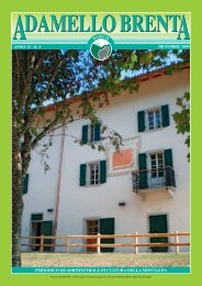
DAMELLO BRENT A A - Parco Naturale Adamello Brenta
DAMELLO BRENT A A - Parco Naturale Adamello Brenta
DAMELLO BRENT A A - Parco Naturale Adamello Brenta

You also want an ePaper? Increase the reach of your titles
YUMPU automatically turns print PDFs into web optimized ePapers that Google loves.
A <strong>DAMELLO</strong> <strong>BRENT</strong>A<br />
GeoPark<br />
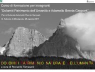
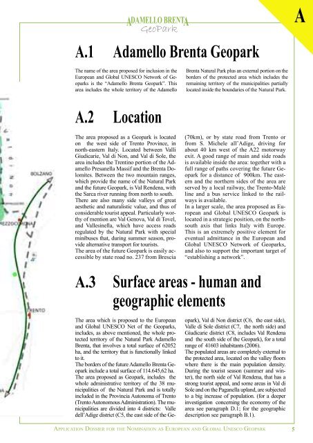
A.1 <strong>Adamello</strong> <strong>Brenta</strong> Geopark<br />
The name of the area proposed for inclusion in the<br />
European and Global UNESCO Network of Geoparks<br />
is the “<strong>Adamello</strong> <strong>Brenta</strong> Geopark”. This<br />
area includes the whole territory of the <strong>Adamello</strong><br />
A.2 Location<br />
The area proposed as a Geopark is located<br />
on the west side of Trento Province, in<br />
north-eastern Italy. Located between Valli<br />
Giudicarie, Val di Non, and Val di Sole, the<br />
area includes the Trentino portion of the <strong>Adamello</strong><br />
Presanella Massif and the <strong>Brenta</strong> Dolomites.<br />
Between the two mountain ranges,<br />
which provide the name of the Natural Park<br />
and the future Geopark, is Val Rendena, with<br />
the Sarca river running from north to south.<br />
There are also many side valleys of great<br />
aesthetic and naturalistic value, and thus of<br />
considerable tourist appeal. Particularly worthy<br />
of mention are Val Genova, Val di Tovel,<br />
and Vallesinella, which have access roads<br />
regulated by the Natural Park with special<br />
minibuses that, during summer season, provide<br />
alternative transport for tourists.<br />
The area of the future Geopark is easily accessible<br />
by state road no. 237 from Brescia<br />
The area which is proposed to the European<br />
and Global UNESCO Net of the Geoparks,<br />
includes, as above mentioned, the whole protected<br />
territory of the Natural Park <strong>Adamello</strong><br />
<strong>Brenta</strong>, that involves a total surface of 62052<br />
ha, and the territory that is functionally linked<br />
to it.<br />
The borders of the future <strong>Adamello</strong> <strong>Brenta</strong> Geopark<br />
include a total surface of 114.645,62 ha.<br />
The area proposed as Geopark, includes the<br />
whole administrative territory of the 38 municipalities<br />
of the Natural Park and is totally<br />
included in the Provincia Autonoma of Trento<br />
(Trento Autonomous Administration). The municipalities<br />
are divided into 4 districts: Valle<br />
dell’Adige district (C5, the east side of the Ge-<br />
<strong>Brenta</strong> Natural Park plus an external portion on the<br />
borders of the protected area which includes the<br />
remaining territory of the municipalities partially<br />
located inside the boundaries of the Natural Park.<br />
(70km), or by state road from Trento or<br />
from S. Michele all’Adige, driving for<br />
about 40 km west of the A22 motorway<br />
exit. A good range of main and side roads<br />
is available inside the area: together with a<br />
full range of paths covering the future Geopark<br />
for a distance of 900km. The eastern<br />
and the northern sides of the area are<br />
served by a local railway, the Trento-Malè<br />
line and a bus service linked to the railways<br />
is available.<br />
In a larger scale, the area proposed as European<br />
and Global UNESCO Geopark is<br />
located in a strategic position, on the northsouth<br />
axis that links Italy with Europe.<br />
This is an extremely positive element for<br />
eventual admittance in the European and<br />
Global UNESCO Network of Geoparks,<br />
and also to support the important target of<br />
“establishing a network”.<br />
A.3 Surface areas - human and<br />
geographic elements<br />
opark), Val di Non district (C6, the east side),<br />
Valle di Sole district (C7, the north side) and<br />
Giudicarie district (C8, includes Val Rendena<br />
and the south side of the Geopark), for a total<br />
range of 41603 inhabitants (2006).<br />
The populated areas are completely external to<br />
the protected area, located on the valley floors<br />
where there is the main population density.<br />
During the tourist season (summer and winter),<br />
the north side of Val Rendena, that has a<br />
strong tourist appeal, and some areas in Val di<br />
Sole and on the Paganella upland, are subjected<br />
to a big increase of population. (for a deeper<br />
investigation concerning the economy of the<br />
area see paragraph D.1; for the geographic<br />
description see paragraph B.1).<br />
APPLICATION DOSSIER FOR THE NOMINATION AS EUROPEAN AND GLOBAL UNESCO GEOPARK<br />
5<br />
A