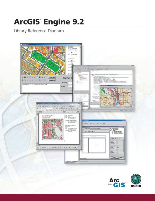
ArcGIS Engine 9.2 - Esri Portugal
ArcGIS Engine 9.2 - Esri Portugal
ArcGIS Engine 9.2 - Esri Portugal

Create successful ePaper yourself
Turn your PDF publications into a flip-book with our unique Google optimized e-Paper software.
®<br />
<strong>ArcGIS</strong><br />
<strong>Engine</strong> <strong>9.2</strong><br />
Library Reference Diagram
ESRI<br />
380 New York Street<br />
Redlands, California<br />
92373-8100 USA<br />
Phone: 909-793-2853<br />
Fax: 909-793-5953<br />
E-mail: info@esri.com<br />
ESRI Regional Offices<br />
Olympia<br />
360-754-4727<br />
St. Louis<br />
636-949-6620<br />
Minneapolis<br />
651-454-0600<br />
Philadelphia<br />
610-644-3374<br />
Boston<br />
978-777-4543<br />
For more than 35 years, ESRI has<br />
been helping people make better<br />
decisions through management<br />
and analysis of geographic<br />
information. A full-service GIS<br />
company, ESRI offers a framework<br />
for implementing GIS technology<br />
and business logic in any<br />
organization from personal GIS on<br />
the desktop to enterprise-wide GIS<br />
servers (including the Web) and<br />
mobile devices. ESRI GIS solutions<br />
are flexible and can be customized<br />
to meet the needs of our users.<br />
California<br />
909-793-2853<br />
ext. 1-1906<br />
Denver<br />
303-449-7779<br />
ESRI International Offices<br />
Australia<br />
www.esriaustralia.com.au<br />
San Antonio<br />
210-499-1044<br />
Hungary<br />
www.esrihu.hu<br />
Washington, D.C.<br />
703-506-9515<br />
Charlotte<br />
704-541-9810<br />
<strong>Portugal</strong><br />
www.esri-portugal.pt<br />
Belgium/Luxembourg<br />
www.esribelux.com<br />
India<br />
www.esriindia.com<br />
Romania<br />
www.esriro.ro<br />
For More Information<br />
Bulgaria<br />
www.esribulgaria.com<br />
Indonesia<br />
www.esrisa.com.my<br />
Singapore<br />
www.esrisa.com<br />
1-800-GIS-XPRT (1-800-447-9778)<br />
Canada<br />
www.esricanada.com<br />
Italy<br />
www.esriitalia.it<br />
Spain<br />
www.esri-es.com<br />
www.esri.com<br />
Locate an ESRI value-added reseller<br />
near you at<br />
www.esri.com/resellers<br />
Outside the United States,<br />
contact your local ESRI distributor.<br />
For the number of your distributor,<br />
call ESRI at 909-793-2853,<br />
ext. 1-1235, or visit our Web site at<br />
www.esri.com/distributors<br />
Chile<br />
www.esri-chile.com<br />
China (Beijing)<br />
www.esrichina-bj.cn<br />
China (Hong Kong)<br />
www.esrichina-hk.com<br />
Finland<br />
www.esri-finland.com<br />
France<br />
www.esrifrance.fr<br />
Germany/Switzerland<br />
www.esri-germany.de<br />
www.esri-suisse.ch<br />
Japan<br />
www.esrij.com<br />
Korea<br />
www.esrikr.co.kr<br />
Malaysia<br />
www.esrisa.com.my<br />
Netherlands<br />
www.esrinl.com<br />
Northeast Africa<br />
202-516-7485<br />
Poland<br />
www.esripolska.com.pl<br />
Sweden<br />
www.esri-sweden.com<br />
Thailand<br />
www.esrith.com<br />
United Kingdom<br />
www.esriuk.com<br />
Venezuela<br />
www.esriven.com<br />
No. GS-35F-5086H<br />
105810<br />
UBS10M5/07jm/dh<br />
Copyright © 2007 ESRI. All rights reserved. ESRI, the ESRI globe logo, <strong>ArcGIS</strong>, the <strong>ArcGIS</strong> logo, ArcObjects, ArcSDE, ArcView, ArcPad, ArcCatalog, @esri.com, and www.esri.com are trademarks, registered<br />
trademarks, or service marks of ESRI in the United States, the European Community, or certain other jurisdictions. Other companies and products mentioned herein may be trademarks or registered trademarks<br />
of their respective trademark owners.<br />
Printed in USA
that are used by the SpatialAnalyst<br />
and 3DAnalyst extensions.<br />
GeoAnalyst<br />
Analysis<br />
Location<br />
Contains the objects for displaying data. The<br />
PageLayout and Map objects are in this library<br />
along with map layers and renderers for all<br />
the supported data types.<br />
15<br />
GeoDatabase-<br />
Distributed<br />
13<br />
DataSources-<br />
Raster<br />
11<br />
DataSources-<br />
GDB<br />
Contains the objects<br />
required to support a<br />
distributed geodatabase.<br />
Contains the workspace<br />
factories and workspaces<br />
for file-basedraster data<br />
formats.<br />
Contains the workspace<br />
factories and workspaces<br />
for vector and raster data<br />
formats supported by the<br />
geodatabase that are<br />
stored within an RDBMS.<br />
Contains types for all the definitions relating<br />
to data access. Features, tables, networks,<br />
TINs are all defined in this library.<br />
Output<br />
Contains objects to aid in the<br />
creation, management, and use<br />
of terrain datasets and<br />
cadastral fabrics.<br />
<strong>ArcGIS</strong>®<br />
GeoDatabase-<br />
Extensions<br />
Objects used for accessing netCDF<br />
files and for creating rasters,<br />
features, or tables from netCDF<br />
variables in <strong>ArcGIS</strong>.<br />
6<br />
16<br />
14<br />
Data Sources-<br />
NetCDF<br />
The objects to work<br />
with animations in<br />
Scene and Globe<br />
controls.<br />
<strong>Engine</strong>: Create Custom GIS Desktop<br />
Contains the objects<br />
Applications<br />
Contains the objects for<br />
labeling features using<br />
the Maplex extension.<br />
Enables connections to<br />
ArcWeb SM Services.<br />
Contains objects for working with<br />
remote GIS services provided by<br />
either ArcIMS ® or <strong>ArcGIS</strong> Server.<br />
21<br />
Animation<br />
Maplex<br />
22<br />
ArcWeb<br />
GISClient<br />
Supports the creation and<br />
analysis of utility networks.<br />
Provides workspaces for working with<br />
OLEDB-based data sources.<br />
9<br />
8<br />
12<br />
DataSource-<br />
OleDB<br />
Carto<br />
17<br />
The workspace factories<br />
and workspaces for vector<br />
data formats supported<br />
by the GeoDatabase API.<br />
10<br />
DataSources-<br />
File<br />
7<br />
Geodatabase<br />
Contains the objects for displaying data. The<br />
PageLayout and map objects are in this library<br />
along with map layers and renderers for all<br />
the supported data types.<br />
13<br />
DataSources-<br />
Raster<br />
11<br />
DataSources-<br />
GDB<br />
required to support a<br />
distributed geodatabase.<br />
Contains the workspace<br />
factories and workspaces<br />
for file-based raster data<br />
formats.<br />
Contains the workspace<br />
factories and workspaces<br />
for vector and raster data<br />
formats supported by the<br />
geodatabase that are<br />
stored within an RDBMS.<br />
Contains types for all the definitions relating<br />
to data access. Features, tables, networks,<br />
and TINs are all defined in this library.<br />
Output<br />
Contains objects to aid in the<br />
creation, management, and use<br />
of terrain datasets and<br />
cadastral fabrics.<br />
15<br />
Geodatabase-<br />
Distributed<br />
16<br />
Geodatabase-<br />
Extensions<br />
14<br />
Data Sources-<br />
NetCDF<br />
Objects used for accessing netCDF<br />
files and for creating rasters,<br />
features, or tables from netCDF<br />
variables in <strong>ArcGIS</strong>.<br />
6<br />
Display<br />
4<br />
Contains the objects required to<br />
generateoutput to both printers<br />
<strong>ArcGIS</strong> and plotters orexporting <strong>Engine</strong><br />
to files.<br />
The core objects of the <strong>ArcGIS</strong> Schematics<br />
Contains the objects used Provides objects for working with 5<br />
extension, used to manage schematic data<br />
Contains components<br />
and processes. The Schematics extension to obtain a connection to network datasets. Server These objects<br />
supports <strong>ArcGIS</strong> the analysis, display, <strong>Engine</strong> and Library Reference that support drawing<br />
Diagram<br />
<strong>ArcGIS</strong> Server. allow you to perform network<br />
symbology to an<br />
Display<br />
manipulation of schematic data.<br />
analysis in your applications.<br />
output device.<br />
4<br />
Contains the objects required to<br />
generate output to both printers<br />
and plotters or exporting to files.<br />
egory<br />
d utility classes.<br />
ns controls for application<br />
ment including commands<br />
ls for use with the controls.<br />
e.<br />
e<br />
es<br />
a<br />
ckingnalyst<br />
s<br />
ta<br />
e<br />
.<br />
utput<br />
29<br />
19<br />
cation<br />
Contains objects to aid in the<br />
creation, management, and use<br />
of terrain datasets and<br />
cadastral fabrics.<br />
Objects used for accessing netCDF<br />
files and for creating ADF rasters,<br />
features, or tables from netCDF<br />
variables in <strong>ArcGIS</strong>.<br />
6<br />
jects required to<br />
to both printers<br />
porting to files.<br />
16<br />
GeoDatabase-<br />
Extensions<br />
14<br />
Data Sources-<br />
NetCDF<br />
3<br />
Contains the core geometry objects<br />
<strong>ArcGIS</strong> Geometry<br />
® <strong>Engine</strong> provides and a standard defines and framework implements for the spatial<br />
developers to build custom reference geographic objects for information coordinate systems.<br />
(GIS) and mapping applications. <strong>ArcGIS</strong> <strong>Engine</strong> is based<br />
on ArcObjects , the core set of components from which<br />
<strong>ArcGIS</strong> products are built. Applications<br />
.Net<br />
can be deployed<br />
within the <strong>ArcGIS</strong> <strong>Engine</strong> framework, or developers can<br />
embed GIS functionality in other custom or commercial<br />
applications.<br />
<strong>ArcGIS</strong> <strong>Engine</strong> offers<br />
• Rich spatial functionality<br />
• Cost-effective deployment requiring only an <strong>ArcGIS</strong><br />
<strong>Engine</strong> Runtime or <strong>ArcGIS</strong> Desktop license per computer<br />
• Developer controls available in ActiveX, .NET, and Java<br />
that simplify application development<br />
• A choice of standard developer languages including<br />
COM, .NET, Java, and C++<br />
• Extensive developer resources including object models,<br />
utilities, samples, and documentation<br />
<strong>ArcGIS</strong> <strong>Engine</strong> is available as part of the ESRI ® Developer<br />
Network (EDN SM ) annual subscription program.<br />
33<br />
Controls<br />
Extensions<br />
<strong>ArcGIS</strong> <strong>Engine</strong> Runtime extensions include Geodatabase Update, Spatial,<br />
3D, Network, Schematics, Tracking, Maplex , and Data Interoperability.<br />
They are integral factors in the development of a custom GIS application<br />
and are used to initialize <strong>ArcGIS</strong> <strong>Engine</strong> features. The application above<br />
displays <strong>ArcGIS</strong> <strong>Engine</strong> with the Spatial extension.<br />
Contains core spatial analysis operations<br />
that are used by the SpatialAnalyst<br />
and 3DAnalyst extensions.<br />
The objects to work<br />
with animations in<br />
Scene and Globe<br />
controls.<br />
Enables connections to<br />
ArcWeb SM Services.<br />
28<br />
GlobeCore<br />
Contains objects for working with<br />
remote GIS services provided by<br />
either ArcIMS ® or <strong>ArcGIS</strong> Server.<br />
Contains objects for<br />
performing analysis and<br />
supports the display<br />
of globe data.<br />
The core objects of the <strong>ArcGIS</strong> Schematics<br />
extension, used to manage schematic data<br />
and processes. The Schematics extension<br />
supports the analysis, display, and 28<br />
manipulation of schematic data.<br />
Contains objects for<br />
performing analysis and<br />
supports the display<br />
of globe data.<br />
28<br />
GlobeCore<br />
27<br />
3DAnalyst<br />
The objects to work<br />
with animations in<br />
Performs 3D analysis<br />
Scene and Globe<br />
of data and<br />
Controls.<br />
supports<br />
3D data display.<br />
27<br />
3DAnalyst<br />
25<br />
Schematic 9<br />
ArcWeb<br />
Contains the objects used<br />
to obtain a connection to<br />
<strong>ArcGIS</strong> Server.<br />
20<br />
GeoAnalyst<br />
Provides user interfaces to<br />
support objects contained in<br />
the SpatialAnalyst library.<br />
24<br />
Network-<br />
Analyst 12<br />
DataSource-<br />
OleDB<br />
23<br />
Geoprocessing<br />
8<br />
26<br />
GISClient Spatial-<br />
Analyst<br />
Server 18<br />
Network-<br />
Analysis<br />
Defines types used by user interface<br />
components in the <strong>ArcGIS</strong> system<br />
Analyst<br />
such as ICommand and ITool.<br />
Java Only<br />
Contains components that Contains expose components<br />
services used by the other that libraries support drawing<br />
composing <strong>ArcGIS</strong>.<br />
19<br />
symbology to an<br />
Location output device.<br />
System<br />
.NET Only<br />
2<br />
1<br />
11<br />
DataSources-<br />
GDB<br />
Bean.*<br />
Display<br />
33<br />
Controls<br />
Contains the workspace<br />
factories and workspaces<br />
for vector and raster data<br />
Contains types for all the definitions relating<br />
to data 2 access. Features, tables, networks,<br />
and TINs are all defined in this library.<br />
3<br />
Geometry<br />
Contains controls for application<br />
development including commands<br />
and tools for use with the controls.<br />
Contains the core geometry objects<br />
and defines and implements the spatial<br />
reference objects for coordinate systems.<br />
Animation<br />
Maplex<br />
Contains the objects for<br />
labeling features using<br />
the Maplex extension.<br />
GlobeCore<br />
25<br />
Schematic 27<br />
3DAnalyst<br />
Performs 3D analysis<br />
of data and supports<br />
3D data display.<br />
Contains core spatial analysis operations<br />
that are used by the SpatialAnalyst<br />
and 3DAnalyst extensions.<br />
22<br />
Maplex 20<br />
GeoAnalyst<br />
Contains objects for working with<br />
remote GIS Services provided by<br />
either ArcIMS ® or the <strong>ArcGIS</strong> Server.<br />
Spatial-<br />
Analyst<br />
24<br />
29<br />
Tracking-<br />
Analyst<br />
23<br />
Geoprocessing<br />
Network-<br />
Analyst<br />
21<br />
Animation<br />
25<br />
Schematic<br />
23<br />
Geoprocessing<br />
Contains the objects used to<br />
obtain a connection to the<br />
<strong>ArcGIS</strong> Server.<br />
Provides objects for working with<br />
network datasets. Contains These objects components that expose<br />
allow you to perform services network used by the other libraries<br />
analysis 26in your applications. composing <strong>ArcGIS</strong>.<br />
Provides user interfaces to<br />
support objects contained in<br />
the Spatial Analyst library.<br />
5 10<br />
Server DataSources- InterOp<br />
File<br />
Contains the objects for<br />
Provides workspaces for working with<br />
labeling 21 features using Supports the OleDB-based creation and data sources.<br />
13<br />
Contains the workspace<br />
the Maplex extension. analysis of utility networks.<br />
The 17 workspace Contains factories the objects DataSources-<br />
for displaying data. The<br />
factories and workspaces<br />
Carto<br />
and workspaces PageLayout for vector and map objects are in this library<br />
9<br />
Raster<br />
for file-basedraster data<br />
data formats along supported with map layers and renderers for all<br />
Enables connections to<br />
12<br />
formats.<br />
14<br />
ArcWeb<br />
Contains objects to aid in the<br />
by the Geodatabase the supported API.<br />
ArcWeb services.<br />
DataSource-<br />
data types.<br />
Data Sourcescreation,<br />
management, and use<br />
22<br />
OleDB<br />
11<br />
of terrain datasets and NetCDF<br />
Contains the workspace<br />
15 DataSourcesfactories<br />
and workspaces cadastral fabrics.<br />
Geodatabase- 10<br />
8<br />
GDBContains the objects for vector and raster data<br />
DataSources-<br />
required to support a<br />
Distributed<br />
formats supported by the<br />
GISClient<br />
File<br />
distributed geodatabase.<br />
that are Objects used for accessing netCDF<br />
16<br />
stored within an RDBMS. files and for creating rasters,<br />
Geodatabase-<br />
Provides workspaces for working with<br />
features, or tables from netCDF<br />
OLEDB-based data sources.<br />
13<br />
Extensions variables in <strong>ArcGIS</strong>.<br />
Contains the workspace<br />
The workspace<br />
29<br />
factories DataSources- 7 Contains types factories for all the and definitions workspaces relating<br />
Tracking- and workspaces for GeoDatabase<br />
vector Raster to data access. for Features, file-based tables, raster networks, data<br />
data formats supported<br />
Analyst<br />
TINs are all defined formats. in this library.<br />
14 6<br />
by the GeoDatabase API.<br />
26<br />
Spatial-<br />
Analyst<br />
20<br />
GeoAnalyst<br />
18<br />
Network-<br />
Analysis<br />
Implements the geoprocessing<br />
framework in addition to the base set<br />
of geoprocessing tools.<br />
Supports the creation and<br />
analysis of utility Contains networks. objects related to working<br />
Carto<br />
with location data, either route events<br />
or geocoding locations.<br />
Defined types used by user interface<br />
components in the <strong>ArcGIS</strong> system<br />
such as ICommand and ITool.<br />
5<br />
Network-<br />
Analysis<br />
18<br />
19<br />
Location<br />
Contains objects related to working<br />
with location data, either route events<br />
or geocoding locations. InterOp<br />
19<br />
Location<br />
Contains components<br />
that support drawing<br />
symbology to an<br />
output device.<br />
7<br />
Geodatabase<br />
SystemUI<br />
System<br />
17<br />
1<br />
Display<br />
Provides objects to display,<br />
analyze, and manipulate<br />
time series data.<br />
33<br />
Controls<br />
4<br />
ADF<br />
Provides objects to display,<br />
analyze, and manipulate<br />
Implements the time geoprocessing<br />
series data.<br />
framework in addition to the base set<br />
of geoprocessing tools.<br />
Bean<br />
Contains the objects for displaying data. The<br />
PageLayout and Map objects are in this library<br />
along with map layers and renderers for all<br />
the supported data types.<br />
15<br />
GeoDatabase-<br />
Distributed<br />
4<br />
Provides the .NET base<br />
classes, component category<br />
unique IDs (CATIDs), and utility classes.<br />
33<br />
Controls<br />
Contains the objects<br />
required to support a<br />
distributed geodatabase.<br />
formats supported by the<br />
Contains<br />
geodatabase that are Objects<br />
the objects<br />
used<br />
required<br />
for accessing<br />
to<br />
netCDF<br />
generateoutput to both printers<br />
stored within an RDBMS. files and for creating rasters,<br />
and plotters orexporting to files.<br />
features, or tables from netCDF<br />
variables in <strong>ArcGIS</strong>.<br />
3<br />
Geometry 6<br />
Output<br />
Contains the objects required to<br />
generate output to both printers<br />
and plotters or exporting to files.<br />
Contains controls for application<br />
development including commands<br />
and tools for use with the controls.<br />
These packages contain the Java<br />
visual beans, which allow very<br />
easy access and visualization of data.<br />
They are coarse-grained, heavyweight<br />
components.<br />
Data Output Sources-<br />
NetCDF<br />
Contains objects to aid in the<br />
creation, management, and use<br />
of terrain datasets and<br />
cadastral fabrics.<br />
29<br />
Tracking-<br />
SystemUI<br />
Analyst<br />
24<br />
Network-<br />
16<br />
GeoDatabase-<br />
Extensions<br />
Contains the core geometry objects<br />
and defines and implements the spatial<br />
reference objects for coordinate systems.<br />
Controls<br />
Controls can be embedded into an existing application to add additional<br />
mapping capability or used to create a new stand-alone application. This<br />
<strong>ArcGIS</strong> <strong>Engine</strong> application depicts MapControl, TOCControl (Table of<br />
Contents), ToolbarControl, and LicenseControl.<br />
Tools and Commands<br />
Tools and commands interact with the <strong>ArcGIS</strong> <strong>Engine</strong> controls to<br />
provide the framework for your GIS application. With<br />
<strong>ArcGIS</strong> <strong>Engine</strong>, you can use more than 150 custom commands<br />
and tools to carry out specific actions in your application.<br />
Contain<br />
perform<br />
support<br />
of globe<br />
Contains core spatial an<br />
that are used by the Sp<br />
and 3DAnalyst extensio<br />
The objects to work<br />
with animations in<br />
Scene and Globe<br />
controls.<br />
G<br />
3<br />
Performs 3D<br />
of data and s<br />
3D data disp<br />
Co<br />
lab<br />
th<br />
Enables co<br />
ArcWeb SM<br />
Contains objects fo<br />
remote GIS services<br />
either ArcIMS ® or A<br />
arto<br />
Contains the core geometry objects<br />
and defines and implements the spatial<br />
reference objects for coordinate systems.<br />
17<br />
21<br />
Animation<br />
Defines types used by user interface<br />
components in the <strong>ArcGIS</strong> system<br />
such as ICommand and ITool.<br />
17<br />
Carto SystemUI<br />
2<br />
Geometry<br />
3<br />
Contains the core geometry objects<br />
and defines and implements the spatial<br />
reference objects for coordinate systems.<br />
10<br />
Sources-<br />
File<br />
15<br />
GeoDatabase-<br />
Distributed<br />
13<br />
DataSources-<br />
Raster<br />
11<br />
DataSources-<br />
GDB<br />
16<br />
GeoDatabase-<br />
Extensions<br />
14<br />
Data Sources-<br />
NetCDF<br />
Maplex<br />
22<br />
ArcWeb<br />
GISClient<br />
Contains components that expose<br />
services used by the other libraries<br />
composing <strong>ArcGIS</strong>.<br />
9<br />
8<br />
12<br />
DataSources-<br />
OleDB<br />
System<br />
10<br />
DataSources-<br />
File<br />
1<br />
15<br />
GeoDatabase-<br />
Distributed<br />
13<br />
DataSources-<br />
Raster<br />
11<br />
DataSources-<br />
GDB<br />
16<br />
GeoDatabase-<br />
Extensions<br />
14<br />
Data Sources-<br />
NetCDF<br />
7<br />
Database<br />
Display<br />
4<br />
Output<br />
6<br />
7<br />
GeoDatabase<br />
www.esri.com/arcgisengine<br />
5<br />
Server<br />
4<br />
Display<br />
Output<br />
6<br />
Copyright © 2007 ESRI. All rights reserved. ESRI, the ESRI globe logo, the <strong>ArcGIS</strong> logo, <strong>ArcGIS</strong>, ArcWeb, Maplex, ArcIMS, ArcObjects, EDN, and www.esri.com are<br />
trademarks, registered trademarks, or service marks of ESRI in the United States, the European Community, or certain other jurisdictions. Other companies and products<br />
mentioned herein may be trademarks or registered trademarks of their respective trademark owners.<br />
2<br />
Geometry<br />
3<br />
SystemUI<br />
2<br />
Geometry<br />
3