Land Use and Traffic Congestion - SSTI
Land Use and Traffic Congestion - SSTI
Land Use and Traffic Congestion - SSTI

You also want an ePaper? Increase the reach of your titles
YUMPU automatically turns print PDFs into web optimized ePapers that Google loves.
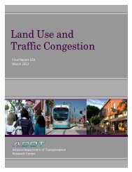
<strong>L<strong>and</strong></strong><strong>Use</strong><br />
<strong>and</strong><strong>Traffic</strong><strong>Congestion</strong><br />
<br />
FinalReport618<br />
March2012<br />
<br />
<br />
<br />
<br />
<br />
<br />
<br />
<br />
Preparedby:<br />
J.RichardKuzmyak<br />
TransportationConsultant,LLC<br />
SilverSpring,Maryl<strong>and</strong><br />
<br />
InAssociationwith:<br />
CaliperCorporation<br />
Newton,Massachusetts<br />
<br />
<strong>and</strong><br />
<br />
PolyTechCorporation<br />
Surprise,Arizona<br />
<br />
<br />
Preparedfor:<br />
ArizonaDepartmentofTransportation<br />
incooperationwith<br />
U.S.DepartmentofTransportation<br />
FederalHighwayAdministration<br />
140 of 226
EXECUTIVESUMMARY<br />
The purpose of this project was to analyze <strong>and</strong> interpret the relationship between higherdensity<br />
development <strong>and</strong> traffic congestion. Governments have expressed increased<br />
interest in the possible benefits of compact, mixed l<strong>and</strong> use—referred to in many circles<br />
as smart growth—to reduce auto dependency <strong>and</strong> use. If true, this finding could be of<br />
significance in planning solutions to a host of transportation system investment,<br />
performance, <strong>and</strong> impact issues.<br />
Before considering any type of formal policy position in relation to l<strong>and</strong> use, the Arizona<br />
Department of Transportation (ADOT) is exp<strong>and</strong>ing its underst<strong>and</strong>ing of the relationships<br />
between l<strong>and</strong> use development patterns <strong>and</strong> transportation. Among ADOT’s key<br />
questions are:<br />
Does higher-density development reduce auto use, to what extent, <strong>and</strong> in response<br />
to what factors?<br />
Does higher-density development also generate higher levels of traffic congestion<br />
simply due to the higher concentration of activity?<br />
Do Arizonans know about smart growth, <strong>and</strong> what are their perceptions of its<br />
impacts <strong>and</strong> desirability?<br />
The research study that is summarized in this report was commissioned to address these<br />
specific issues. It involved a national-scale review of research <strong>and</strong> evidence on<br />
transportation <strong>and</strong> l<strong>and</strong> use relationships; detailed local analysis of these relationships<br />
using data from metropolitan Phoenix; <strong>and</strong> a survey of officials in Arizona’s metropolitan<br />
areas about their perceptions of l<strong>and</strong> use/transportation, how higher-density development<br />
is viewed, <strong>and</strong> whether there would be receptiveness for compact, mixed-use approaches<br />
regionally <strong>and</strong> in their own area.<br />
The findings of this study confirm the benefits of better l<strong>and</strong> use. In its assessment of a<br />
prodigious volume of research on this topic, the project’s literature review was able to<br />
highlight the following findings:<br />
Density <strong>and</strong> Vehicle Miles Traveled Using residential density as a primary<br />
indicator of concentrated l<strong>and</strong> use, a variety of studies have shown that<br />
households in higher-density (i.e., more urban) settings tend to own fewer<br />
vehicles, drive less, walk <strong>and</strong> take transit more often, <strong>and</strong> generate one-half to<br />
one-third of the daily vehicle miles traveled (VMT) of their suburban<br />
counterparts.<br />
Beyond Density: Research has found that the effects of l<strong>and</strong> use on travel<br />
behavior are rooted in factors beyond simple density. Also important are related<br />
factors such as mix of uses, auto- vs. pedestrian-oriented design, <strong>and</strong> regional<br />
accessibility enhanced by multiple travel choices (especially transit). These<br />
characteristics of density, diversity, design, <strong>and</strong> destinations are commonly<br />
referred to as the 4Ds.<br />
Travel Purpose: Work travel, which is associated with peak period congestion,<br />
generally garners most of the attention in transportation planning <strong>and</strong> policy<br />
deliberations. Indeed, where compact l<strong>and</strong> use is focused around high-quality<br />
1<br />
141 of 226
egional transit—at both the origin <strong>and</strong> destination of a journey—commuters will<br />
use transit in large numbers because of its convenience. However, the travel<br />
market that may be most influenced by compact mixed-l<strong>and</strong> use is nonwork<br />
travel, which accounts for as much as 80 percent of routine household travel <strong>and</strong><br />
has been the fastest-growing segment since the 1980s. This relationship/trend can<br />
be directly linked to l<strong>and</strong> use, recognizing that in conventional suburban areas<br />
almost all household needs—shopping, transporting children, personal business,<br />
social, <strong>and</strong> recreation—require private vehicle travel. Areas where residents live<br />
in older, mixed-use communities with nearby services <strong>and</strong> restaurants show a<br />
much greater concentration of travel to local destinations—including walking,<br />
biking, or short car trips—despite a daily commute that may well be a long<br />
distance solo-driver trip.<br />
Market Forces: Critics of smart growth approaches to l<strong>and</strong> use maintain that it is<br />
a planner’s notion that does not reflect market realities. However, real estate<br />
industry experts assert that the reason more compact, mixed-use development has<br />
not occurred has to do with restrictive local zoning codes or traffic level of service<br />
st<strong>and</strong>ards, <strong>and</strong> not because of market dem<strong>and</strong>, which is gauged as twice as high as<br />
current build rates. This is borne out by visual preference surveys that show a<br />
general preference for older (pre-World War II) suburban development patterns,<br />
which are more compact <strong>and</strong> walkable, <strong>and</strong> foster more social interaction between<br />
residents.<br />
To ascertain the validity of these research findings in the Arizona environment,<br />
researchers performed a number of detailed studies using local data <strong>and</strong> both existing<br />
planning tools as well as some new ones developed specially for analysis of the role of<br />
l<strong>and</strong> use. These analyses were focused on the Phoenix metropolitan area <strong>and</strong> were<br />
performed using data, modeling tools, <strong>and</strong> staff support of the Maricopa Association of<br />
Governments (MAG).<br />
Conventional four-step transportation planning models are unable to account for<br />
important differences in l<strong>and</strong> use as represented by the 4Ds. The influence of l<strong>and</strong> use is<br />
most relevant at the level of the individual traveler <strong>and</strong> what they can walk to within ¼ to<br />
½ mile at either origin or destination. Four-step models operate at a traffic analysis zone<br />
(TAZ) level of aggregation, which is generally much too coarse for discerning l<strong>and</strong> use<br />
differences. For this reason, this genre of models also does not deal directly with<br />
nonmotorized trips such as biking or walking, which are a critical element in compact<br />
mixed use designs.<br />
Using data from MAG’s 2001 regional household travel survey supplemented with<br />
information from its travel model <strong>and</strong> geographic information systems (GIS) databases,<br />
researchers developed a set of regression models to quantify the relationships between<br />
travel behavior, traveler demographic characteristics, <strong>and</strong> measures of the 4Ds. These<br />
models show the effect of the 4Ds of l<strong>and</strong> use on both household vehicle ownership <strong>and</strong><br />
on household VMT. Residential density, l<strong>and</strong> use mix, walk opportunities, <strong>and</strong> regional<br />
transit accessibility to jobs were the variables used to represent the 4Ds. Negative signs<br />
on the coefficients for these variables indicate that as each of the l<strong>and</strong> use variables<br />
2<br />
142 of 226
increases, vehicle ownership <strong>and</strong> VMT rates decline proportionately. Vehicle ownership<br />
is an important determinant of travel in the VMT models, so when it is reduced in<br />
relation to better l<strong>and</strong> use, its effect is compounded by also acting to reduce VMT.<br />
The MAG region was divided into 17 jurisdictional areas <strong>and</strong> the household travel survey<br />
database used to explore differences in travel in relation to these key l<strong>and</strong> use factors.<br />
Higher-density <strong>and</strong> more mixed-use areas such as South Scottsdale, Tempe, <strong>and</strong> East<br />
Phoenix were found to behave significantly differently from lower- density/less mixeduse<br />
areas like Glendale, Gilbert, <strong>and</strong> North Scottsdale. Residential density for the more<br />
compact areas ranged from 6.14 to 6.94 households per acre vs. 2.86 to 3.61 households<br />
for the lower-density group. These higher-density areas also had better mix (0.53 vs. 0.30<br />
value on a 0 to 1.0 entropy index scale); more retail <strong>and</strong> service opportunities within<br />
walking distance (42.4 vs. 15.4); <strong>and</strong> considerably more jobs accessible by transit (59,000<br />
vs. 27,000). The implications of these differences may be seen in various travel measures,<br />
including:<br />
Vehicle Ownership: 1.55 vs. 1.92.<br />
Average Trip Lengths: 7.4 vs. 10.7 miles for home-based work trips; 2.7 vs. 4.3<br />
for home-based shopping trips; 4.4 vs. 5.2 for home-based other trips; <strong>and</strong> 4.6 vs.<br />
5.3 for nonhome-based trips.<br />
Per Capita VMT: 10.5 miles per day vs. 15.4 miles per day.<br />
The 4Ds models were subsequently used to investigate the potential impact of improved<br />
l<strong>and</strong> use characteristics in each of the 17 areas. To do this, average residential densities<br />
were raised to 10 households per acre (vs. on the order of two to four in most places),<br />
l<strong>and</strong> use mix was brought to the ideal entropy index value of 1.0, the number of walk<br />
opportunities was increased to 100 in all places, <strong>and</strong> regional transit accessibility was<br />
raised to somewhere between the current minimum <strong>and</strong> maximum for the respective area.<br />
This resulted in estimates of VMT reduction of 20 percent to 45 percent, with an average<br />
overall of 25 percent.<br />
Having reasonably demonstrated that areas in Phoenix with higher density generated less<br />
vehicle travel per capita than lower-density areas, the second hypothesis investigated was<br />
whether a higher concentration of activity would also lead to localized traffic congestion.<br />
A sample of four urban corridors was selected for detailed study—also in the Phoenix<br />
area—based on information from local <strong>and</strong> regional officials that these areas were<br />
perceived to have major traffic congestion issues: Scottsdale Road between Thomas Road<br />
<strong>and</strong> Chaparral Road in the older, southern part of Scottsdale; Central Avenue north of<br />
downtown Phoenix, between McDowell Road <strong>and</strong> Camelback Road; the Mill Avenue<br />
<strong>and</strong> Apache Boulevard corridor through Tempe; <strong>and</strong> West Bell Road in the northwest<br />
part of the region, connecting the central valley with the newer communities of Peoria,<br />
Glendale, <strong>and</strong> Surprise.<br />
The objective was to examine the interplay between the intense development patterns in<br />
these areas <strong>and</strong> the condition of traffic on the street <strong>and</strong> road network. Researchers<br />
performed the following assessments:<br />
3<br />
143 of 226
Density: Three of the areas—south Scottsdale, Central Avenue, <strong>and</strong> Tempe—<br />
exhibited some of the highest development densities in the region while Bell Road<br />
served an area of intense activity spread over a large area of moderate to low<br />
density.<br />
Composition: The Scottsdale, Central Avenue, <strong>and</strong> Tempe areas also had a high<br />
level of mix in their l<strong>and</strong> uses, while Bell Road was heavily residential. The<br />
overall jobs-to-housing ratio in the Bell Road area was only 0.49 compared to<br />
1.42 in Scottsdale, 2.30 in Tempe, <strong>and</strong> 5.60 in the Central Avenue corridor. Retail<br />
jobs per household (a measure of access to local services) was not quite as<br />
skewed, but Bell Road’s ratio of 0.31 was still only about half of the 0.56 to 0.65<br />
level found in the other three areas.<br />
Road Network: Each area is served by the one mile arterial “super grid,” with no<br />
area having a freeway closer than two miles from its center. However, a major<br />
distinction occurs in the secondary road system, with Central Avenue <strong>and</strong><br />
Scottsdale having a rich network of secondary streets on one-eighth mile spacing.<br />
Tempe’s secondary grid is not quite as fine but is still much better than the Bell<br />
Road corridor, which has little secondary road system beyond subdivision<br />
networks.<br />
Transit: Central Avenue <strong>and</strong> Tempe are well-served by the regional bus system<br />
<strong>and</strong> are also connected by the region’s inaugural light rail line (not operational at<br />
the time of the analysis). Scottsdale is moderately served by transit, while Bell<br />
Road has only park-<strong>and</strong>-ride bus service. Transit accounts for about 6 percent of<br />
all internal trips in Scottsdale, <strong>and</strong> between 3 percent <strong>and</strong> 6 percent of external<br />
trips. In the Central Avenue corridor, about 8 percent of internal trips <strong>and</strong> about 7<br />
percent of external trips are made by transit, while in Tempe about 3 percent of<br />
internal trips <strong>and</strong> 5 percent to 10 percent of external trips are by transit. In<br />
contrast, less than 1 percent of all trips in the Bell Road corridor involve transit.<br />
<strong>Traffic</strong> <strong>Congestion</strong>: Interestingly, traffic congestion levels were much lower in<br />
the Scottsdale Road <strong>and</strong> Central Avenue corridors than in the Bell Road corridor.<br />
Volume-to-capacity (V/C) ratios in both Scottsdale <strong>and</strong> Central Avenue were in<br />
the 0.8 to 0.9 range in the PM peak period compared to 1.6 to almost 2.0 along<br />
Bell Road. Tempe fell predictably in between given its less-articulated secondary<br />
road network, with V/C ratios in the neighborhood of 1.0. Tempe also employs<br />
traffic-calming strategies on its secondary road network to discourage cut-through<br />
traffic, which pushes traffic onto major arterials.<br />
Through <strong>Traffic</strong>: <strong>Traffic</strong> volumes in each of the four areas are affected by<br />
through travel (no trip end within the defined area). Central Avenue, Bell Road,<br />
<strong>and</strong> Apache Boulevard in Tempe all had rates of through travel that accounted for<br />
about half of peak period traffic volumes. Without this through traffic movement,<br />
Central Avenue <strong>and</strong> Tempe would be relatively uncongested, though Bell Road<br />
would still be congested from its internal volume. Scottsdale’s rate of through<br />
traffic on the measured links was much less—about 22 percent to 28 percent—<br />
probably due to the design of the local grid, which encourages through travelers to<br />
use peripheral streets.<br />
4<br />
144 of 226
These findings tended to corroborate responses elicited from participants in the project’s<br />
survey of officials. For this survey, which was conducted early in the project, researchers<br />
distributed 423 questionnaires <strong>and</strong> received 134 responses from a diverse list of elected<br />
officials, planning <strong>and</strong> zoning officials, transportation planners, <strong>and</strong> members of other<br />
relevant disciplines in the Phoenix, Tucson, <strong>and</strong> Flagstaff metropolitan areas. Some of the<br />
key discoveries in this investigation are given below:<br />
<strong>Traffic</strong> <strong>Congestion</strong> Concerns: While important, traffic congestion was rated as<br />
less a factor in project review than were issues of compatibility with adopted<br />
plans <strong>and</strong> impact on surrounding neighborhoods <strong>and</strong> businesses.<br />
Familiarity: Most officials were familiar with mixed-use concepts, had been<br />
involved in the review of these concepts, <strong>and</strong> had even encouraged submission of<br />
such projects.<br />
Transportation Impacts: The overwhelming majority of officials responding<br />
believed that compact, mixed-use development would increase transit use <strong>and</strong><br />
nonmotorized travel, though only about one-third felt unequivocally that it would<br />
lead to less traffic congestion. (Most were unsure.)<br />
Desirability: The great majority believed that the region would benefit from more<br />
mixed-use centers <strong>and</strong> corridors, focusing employment in centers <strong>and</strong> corridors,<br />
<strong>and</strong> building more mixed-use communities. About 80 percent believed that their<br />
own community would support compact, mixed-use development.<br />
Residential/retail <strong>and</strong> office/retail mixed use were the most highly rated<br />
combinations.<br />
These findings suggest an opportunity to advance the dialogue on <strong>and</strong> support for<br />
compact, mixed-use development in Arizona’s metropolitan areas. Among the initiatives<br />
that might be considered are the following:<br />
Education: There is a need to better inform the public, the business community,<br />
<strong>and</strong> officials about the nature <strong>and</strong> benefits of compact, mixed use. Themes<br />
developed in this project can serve as educational messages.<br />
Better Analysis Tools: Local planners <strong>and</strong> planning commissions are still using<br />
traditional traffic engineering approaches to assess the impact of development<br />
projects. By looking only at traffic congestion levels on adjacent links, ignoring<br />
through travel, <strong>and</strong> failing to account for the efficiencies of mixed-use<br />
development on lower vehicle trip rates <strong>and</strong> VMT, progressive projects are likely<br />
to be rejected or unreasonably downsized. The metropolitan planning<br />
organizations should take steps to add 4D enhancements to their existing tools.<br />
Visioning <strong>and</strong> Plan Overhauls: Existing long-range or comprehensive plans<br />
may be silent or devoid of a position on compact, mixed-use development.<br />
Regional or local targeted visioning exercises can raise visibility <strong>and</strong><br />
underst<strong>and</strong>ing of the issues, leading to greater acceptance <strong>and</strong> support in updated<br />
plans.<br />
Incentives: Adoption of compact, mixed-use development approaches can be<br />
encouraged in various ways. Grant monies <strong>and</strong>/or technical assistance can be<br />
offered to support studies or demonstration projects. Several states prioritize state<br />
program or grant funding based on demonstrated steps by a jurisdiction to<br />
embrace <strong>and</strong> incorporate key elements in their plans, codes, or procedures.<br />
5<br />
145 of 226
Supportive Infrastructure: A key incentive in its own right, local l<strong>and</strong> use<br />
choices can be influenced by the manner in which transportation resources are<br />
distributed. Priorities can be placed on investments that will most contribute to<br />
concentrated l<strong>and</strong> use policies such as transit investments, local street <strong>and</strong><br />
sidewalk infrastructure, or rehab/upgrade of facilities in older developed areas.<br />
6<br />
146 of 226