YARD2012_Upstate NY Mashbird Monitoring.pdf - New York-New ...
YARD2012_Upstate NY Mashbird Monitoring.pdf - New York-New ...
YARD2012_Upstate NY Mashbird Monitoring.pdf - New York-New ...

You also want an ePaper? Increase the reach of your titles
YUMPU automatically turns print PDFs into web optimized ePapers that Google loves.
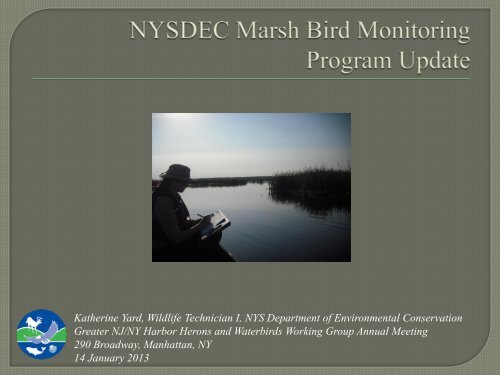
Katherine Yard, Wildlife Technician I, <strong>NY</strong>S Department of Environmental Conservation<br />
Greater NJ/<strong>NY</strong> Harbor Herons and Waterbirds Working Group Annual Meeting<br />
290 Broadway, Manhattan, <strong>NY</strong><br />
14 January 2013
Photo: Al AboutBirds.org<br />
Photo: Heidi Kennedy, <strong>NY</strong>SDEC<br />
Photo: USFWS<br />
Photo: The Nature Conservancy<br />
Photo: Matthew Walter / <strong>NY</strong>SDEC<br />
endangered<br />
threatened<br />
threatened<br />
threatened<br />
special concern
Photo: Matt King, <strong>NY</strong>SDEC<br />
Photo: USFWS<br />
Photo: audubon.org<br />
Photo: D. Menke, USFWS<br />
Photo: Gerrit Vyn, from<br />
Birds of North America<br />
closed season<br />
Photo: Rob Curtis,<br />
from audubon.org
Photo: Marie Read, from<br />
Birds of North America<br />
Photo: Isidor Jeklin/CLO, from<br />
Birds of North America<br />
SGCN<br />
Photo: G. Armistead, from<br />
Birds of North America<br />
threatened<br />
Photo: Marie Read, from<br />
Birds of North America<br />
endangered
Estimate temporal trends in marsh bird occupancy and<br />
abundance to inform management decisions regarding<br />
population health (T&E species).<br />
Determine change in annual occupancy and abundance to<br />
inform regulatory decisions for migratory game bird species.<br />
Document species-specific habitat associations at multiple<br />
scales.
Call-broadcast surveys<br />
• 2-3 survey replicates per point (May-Jun)<br />
• 5 minutes passive listening<br />
• 6 minutes call-broadcast (30-sec calls + 30-sec silence for each of 6 focal spp)<br />
• Record all primary and secondary focal species detected<br />
Rapid habitat assessment<br />
• Water depth, edge type, percent cover for habitat classes, vegetation height,<br />
vegetation density, invasives, etc.
Primary Sampling Unit (PSU) = 40km 2 hexagon<br />
Random two-stage<br />
cluster sample:<br />
• Primary Sampling Units<br />
• Secondary Sampling Units<br />
• Johnson et al. (2009) design<br />
Also <strong>NY</strong>S long-term<br />
monitoring points<br />
• Not random<br />
• Wetlands of interest to<br />
Regional offices<br />
Secondary Sampling Units (SSU)
General survey design in emergent marsh habitat is valuable<br />
for estimating abundance of common species (e.g., VIRA,<br />
SORA, AMBI).<br />
General survey design is not useful for estimating abundance<br />
of rare species (e.g., KIRA) and is unlikely to inform<br />
management decisions.<br />
Stratification within a general design would allow for tailoring<br />
monitoring to test ecological or management hypotheses.
700<br />
Random SSUs <strong>NY</strong>S Long-term # Surveys<br />
600<br />
500<br />
400<br />
300<br />
200<br />
100<br />
0<br />
2009 2010 2011 2012 Total<br />
Pilot study years<br />
More surveys in state-owned wetlands
¯<br />
6<br />
5<br />
9<br />
8<br />
7<br />
4<br />
Years Surveyed<br />
2009 PSU<br />
Long-term <strong>Monitoring</strong> Area<br />
2010-2012 PSU*<br />
PSU Grid<br />
3<br />
* PSU surveyed at least one year during 2010-2012<br />
Kilometers<br />
0 25 50 100<br />
2<br />
1
Relative abundance and distribution maps<br />
• Objectives #1 and #2
Relative Abundance<br />
1.0<br />
0.9<br />
0.8<br />
0.7<br />
0.6<br />
0.5<br />
0.4<br />
0.3<br />
0.2<br />
0.1<br />
0.0<br />
2009 2010 2011 2012<br />
*Different random sample<br />
<strong>NY</strong>SLT<br />
SSU<br />
¯<br />
2009-2012 Detections<br />
*Average # birds/point<br />
Virginia rail<br />
Kilometers<br />
0 25 50 100
Relative Abundance<br />
1.0<br />
0.9<br />
0.8<br />
0.7<br />
0.6<br />
0.5<br />
0.4<br />
0.3<br />
0.2<br />
0.1<br />
0.0<br />
<strong>NY</strong>SLT<br />
SSU<br />
2009 2010 2011 2012<br />
¯<br />
sora<br />
Kilometers<br />
0 25 50 100
Relative Abundance<br />
1.0<br />
0.9<br />
0.8<br />
0.7<br />
0.6<br />
0.5<br />
0.4<br />
0.3<br />
0.2<br />
0.1<br />
0.0<br />
<strong>NY</strong>SLT<br />
SSU<br />
2009 2010 2011 2012<br />
¯<br />
pied-billed grebe<br />
Kilometers<br />
0 25 50 100
Relative Abundance<br />
1.0<br />
0.9<br />
0.8<br />
0.7<br />
0.6<br />
0.5<br />
0.4<br />
0.3<br />
0.2<br />
0.1<br />
0.0<br />
<strong>NY</strong>SLT<br />
SSU<br />
2009 2010 2011 2012<br />
¯<br />
American bittern<br />
Kilometers<br />
0 25 50 100
Relative Abundance<br />
1.0<br />
0.9<br />
0.8<br />
0.7<br />
0.6<br />
0.5<br />
0.4<br />
0.3<br />
0.2<br />
0.1<br />
0.0<br />
<strong>NY</strong>SLT<br />
SSU<br />
2009 2010 2011 2012<br />
¯<br />
least bittern<br />
Kilometers<br />
0 25 50 100
Relative Abundance<br />
1.0<br />
0.9<br />
0.8<br />
0.7<br />
0.6<br />
0.5<br />
0.4<br />
0.3<br />
0.2<br />
0.1<br />
0.0<br />
<strong>NY</strong>SLT<br />
SSU<br />
2009 2010 2011 2012<br />
¯<br />
king rail<br />
Kilometers<br />
0 25 50 100
Site occupancy analysis:<br />
• Objectives #1 and #2<br />
• With long-term monitoring, can use occupancy as a “surrogate for population<br />
size or species abundance” to track population trends over time<br />
• More informative than Relative Abundance because accounts for detection<br />
probability
Site Occupancy (ψ)<br />
1.00<br />
0.80<br />
0.60<br />
Virginia rail [ψ(.)p(.)]<br />
ψ<br />
p<br />
*Basic singleseason<br />
model<br />
0.40<br />
0.20<br />
*Random SSUs<br />
only<br />
0.00<br />
2010 2011 2012
ψ<br />
ψ<br />
1.0<br />
0.8<br />
0.6<br />
0.4<br />
0.2<br />
0.0<br />
1.0<br />
0.8<br />
0.6<br />
0.4<br />
0.2<br />
0.0<br />
2011<br />
0 20 40 60 80 100<br />
Upland habitat (%)<br />
2011<br />
0 50 100 150 200<br />
Water depth (cm)<br />
In 2011, top-supported VIRA models<br />
included covariates UPLAND,<br />
DEPTH and SHRUB.<br />
Summed model weights indicated<br />
that UPLAND (w i = 0.758) and<br />
DEPTH (w i = 0.636) habitat<br />
covariates had greater importance to<br />
VIRA site occupancy than other<br />
covariates.<br />
VIRA site occupancy was negatively<br />
related to UPLAND (β = -1.131; SE<br />
= 0.464) and was positively related to<br />
DEPTH (β = 0.726; SE = 0.251).
Marsh Bird <strong>Monitoring</strong> Program included in DEC’s new 5-year<br />
(2012-2017) Federal Aid grant:<br />
• Continue monitoring at both random & long-term survey routes<br />
• Initiate king rail surveys at historic locations<br />
• Pilot managed wetlands study at WMAs with water control structures<br />
• Good possibility of hiring seasonal marsh bird technicians in 2013<br />
• Build long-term dataset for occupancy analysis to estimate population trends