FINAL Report - Hutchinson River Restoration Project
FINAL Report - Hutchinson River Restoration Project
FINAL Report - Hutchinson River Restoration Project

Create successful ePaper yourself
Turn your PDF publications into a flip-book with our unique Google optimized e-Paper software.
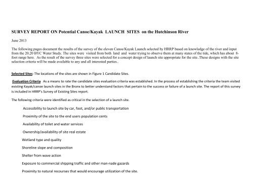
SURVEY REPORT ON Potential Canoe/Kayak LAUNCH SITES on the <strong>Hutchinson</strong> <strong>River</strong><br />
June 2013<br />
The following pages document the results of the survey of the eleven Canoe/Kayak Launch selected by HRRP based on knowledge of the river and input<br />
from the 20.20 BYC Water Study. The sites were visited from both land and water trying to observe them at many states of the tide, which has about 8-<br />
foot range here. As the result of the survey three sites were selected for a concept design of launch site appropriate for the site..These designs with the site<br />
selection criteria will be made available to any and all interested parties..<br />
Selected Sites: The locations of the sites are shown in Figure 1 Candidate Sites.<br />
Evaluation Criteria As a means to rate the candidate sites evaluation criteria was established. In the process of establishing the criteria the team visited<br />
existing Kayak/canoe launch sites in the Bronx to better understand factors that pertain to the success or failure of a launch site. The report of this survey<br />
is included in HRRP’s Survey of Existing Sites report.<br />
The following criteria were identified as critical in the selection of a launch site.<br />
Accessibility to launch site by car, foot, and/or public transportation<br />
Proximity of the site to the end users population cents<br />
Availability of toilet and water services<br />
Ownership/availability of site real estate<br />
Wetland type and quality<br />
Shoreline slope and composition<br />
Shelter from wave action<br />
Exposure to commercial shipping traffic and other man-nade gazards<br />
Proximity to natural recourses that would encourage utilization of the site.
Figure 1 Candidate Sites<br />
Candidate Sites<br />
The following pages give details of the surveys of the sites starting from the most northern site and proceeding south down the <strong>Hutchinson</strong> <strong>River</strong> to<br />
Eastchester Bay. It should be noted that there is a barge canal that hugs( 2 to 4 feet) the western shore of the river from just below the <strong>Hutchinson</strong><br />
Parkway Bridge to Mt. Vernon.
Site 4<br />
Site 4<br />
Site 4 was selected from the Google Satellite map images that showed some small boat activity in the inlet. Several attempts were made to verify boat<br />
activity and gain access to a possible launch point. Neither were accomplished. Access to that portion of Pelham Bay Park is restricted by a 6 ft fence<br />
with no entry points. Investigation of the area indicated that the dense underbrush and tree growth would make further consideration of this Site not<br />
worthwhile. Later attempts to enter the area by canoe revealed that use of the shore would be greatly limited by low tide mud.<br />
Status: Rejected, very difficult access with no public services in the area. Ownership unknown.
Site 9 Eastchester MTA Bus Depot<br />
This site was suggested by the 20/20 NYC Water Study<br />
SITE 9<br />
MTA Security prohibited access to the river and the taking pictures of the site. The satellite image shows the barge channell flowing past general area that<br />
would consider for a launch site which would make it unsafe for human powered boats.<br />
Status: Rejected.<br />
MTA/eps Security prohibited access to the area. The area is not compatible with public boating activities
Sites Co-op 5&9 Northeast Co Op City<br />
Site 5<br />
Site 9<br />
Site 5 Co-op City Little League area<br />
Site 9 Co Op City Bellemy Circle
Site 5 Co Op Little League Ball Park<br />
Site 9 Co Op Bellemy Circle
9<br />
Major concern with respect to consideration of these sites was the river channel runs very close to the shore in the areas of the sites. Any<br />
launching platform that was in the channel would be in jeopardy as would people using the site. A second consideration was opinion and<br />
cooperation of <strong>River</strong>bay, Co Op City Manager. Discussions with <strong>River</strong>bay and Co Op residents were initiated. HRRP Team surveyed Co-Op Sites 5 &9<br />
but because of fencing were unable to get access to the river shore line. Based on the initial survey it is evident that there is significant undeveloped area from<br />
the Little League Field (HRRP’s Site 5) to the CAC Contractor Area. <strong>River</strong>bay was contacted to determine their position with respect to availability of a site for a<br />
Conoe/Kayack Launch. Team met with a <strong>River</strong>bay Representative to review the Canoe/Kayack Study and determine their interest in participation. The <strong>River</strong>bay<br />
Rep was very positive with respect to launch site in the 5/9 area . She felt that development of the river property along Co OP Blvd would be beneficial to the
community and felt the management would support it. She agreed to meet the team on Thursday 3/8 at 2:3 to grant the team access to the river .<br />
The inspection of the river bank confirmed the concern that the bank along Co-op Blvd was to high and steep and any launch site would require a floating doch<br />
which most probably would interfere with barge traffic,<br />
Status Site rejected It was the opinion of the team that considering proximity of the canal, barge traffic and effect of the tide the site did not lend itself as a<br />
safe candidate.
Sites 1 & 2 Co Op City Einstein Loop (also referred to as Site 7 when combined as one site)<br />
Site 2<br />
Site 1<br />
Two additional candidate sites were identified in Co-op City on the west shore of the <strong>Hutchinson</strong> in the Einstein Loop neighborhood. Site 1 and 2 occurs<br />
along the western shoreline of the <strong>Hutchinson</strong> <strong>River</strong>, adjacent to recreation areas, northeast of the AmTrack bridge on the southeastern corner of Co-Op City<br />
and would front on Erskine Place. . The property is owned/controlled by the <strong>River</strong>bay Corporation.
Site 1<br />
Site 2
The proposed locations are within a landscaped to shrubby area and have a steep slope to the water and then a gentle grade at the shore line into the water but<br />
with a muddy bottom Away from the shoreline, the uplands are in a lawn/landscaped condition. Rye grass (Lolium sp.) dominates and is kept mowed. The<br />
uplands immediately adjacent to the shoreline are largely in shrubs and weeds. Plant species in the area are wormwood (Artesemia sp.) and Japanese knotweed<br />
(Polygonnum cuspidatum).<br />
Narrow, dirt pathways leads eastward from the more developed portions of the site (including parking and basketball courts) to the upper edge of a fill. Most of<br />
the upland is above elevation 12 feet and tapers at a slight grade to the fill edge at 10 to 11 feet. The shoreline then drops steeply to the high water. The water’s<br />
edge slope and toe of slope do not contain any wetland vegetation. The upland in this area is was the subject of deep filling for the residential purposes. The<br />
shoreline itself is a jumble of large slabs of concrete and stone rubble. It drops off at an angle exceeding 30 degrees. The condition at the toe of slope is a flat,<br />
very deep, muddy sediment, which is exposed some 30 to 40 feet offshore to the east at low tide. The muddy material in combination with the grade makes<br />
for very bad footing when launching or landing small craft. This is especially important at low tide. Floating docks will be needed for low water boat recovery.<br />
The shallow grade makes the location very unsuited to motorized craft. The site is 400 feet west of the barge channel. It is 30 feet north of a large storm water<br />
discharge pipe and headwall. The exposure to wind and waves at the site are from the east to southeast and is minimal with a 0.5 mile fetch. Wave action<br />
should never exceed 6 inches.<br />
Parking occurs 300 feet to the southwest at Erskine Place. A utility access roadway, walking/biking paths occurs on both the site’s interior. These paths (a mix<br />
of both formal and informal access ways) links the parking with the location proposed . A landscaped lawn occurs west of the existing foot paths that could be a<br />
parking area as the facility is constructed (i.e., in one phase).<br />
Site 1 offers shielded launch points with relatively small tidal effects. The area has direct access by existing road. Proximity to existing sporting area should<br />
be an asset in support to the launch site. Currently there is a proposal/plan to construct a Met North Rail Station in this area which would make the site<br />
more accessible and might be able to take advantage of facilities that are brought into the area by that construction<br />
.
Advantages for Site 1 and 2<br />
It is Co-Op City land.<br />
It can be controlled by an access-only gate.<br />
It will serve the large, concentrated population of Co-Op City.<br />
It fronts on exiting paths with a long potential frontage.<br />
It has room for additional parking.<br />
It is well away from the barge channel even at low tide.<br />
It has limited exposure.<br />
It has a nice view (especially to the east).<br />
Disadvantages for Site 1 and 2<br />
It has a steep slope at the waters’ edge.<br />
A lot of cut or fill will be required.<br />
It has a gentle slope at the beach but is a deep, muddy material.<br />
It will require floating docks for low tide recovery.<br />
As <strong>River</strong>bay is a private entity, legal liabilities may be a substantial.<br />
Recreational fishermen are frequently on site. Due to this, fishing<br />
gear (e.g. fishing hooks, lines and lost tackle) is likely to be lost at the<br />
shoreline and in the water on site. This poses a risk for<br />
injury-especially for barefoot individuals.<br />
Status A design concept was prepared for Site 1<br />
Site 1was selected for concept development primarily because it is situated in the most accessible area and offers the better launch area being located<br />
further from the traffic canal in a small protected bay.
Site 2A Pelham Bay Stable area<br />
SITE 2 A<br />
Status: Rejected. Inaccessible at low tide due to deep mud.
Site 2 Bus Stop Shore Rd and City Island Rd.<br />
Site<br />
2
Location<br />
Proposed Location 2 occurs along the northern shoreline of the <strong>River</strong>, east of the three bridges. It is on the southeastern corner of the intersection of Shore<br />
Road and City Island Road. The launch facility would “front” on City Island Road. A bus stop for MTA Route BX-29 occurs at the site, on the south side of City<br />
Island Road. The property is owned/controlled by the New York City Department of Parks (NYC Parks).<br />
The proposed location is wooded and has a gentle slope to the water and into the water.<br />
The uplands are largely wooded. The tree species in the area are black oak (Quercus velutina), black cherry (Prunus serotina), red maple (Acer rubrum), Norway<br />
maple (Acer platanoides), etc. The understory is shrubby with Japanese honeysuckle (Lonicera japonica) and multiflora rose (Rosa multiflora) dominating. Two,<br />
narrow, dirt pathways lead southward from City Island Road and the bus stop to the beach. Most of the upland is above elevation 10 feet and tapers at a slight<br />
grade to the high water line/wetland edge at approximately 5 to 6 feet.<br />
The upland in this area is only disturbed along the roadways and at the bus stop. No parking occurs until 1,300 feet to the east at the golf facility. A<br />
walking/biking path occurs on both the north and south side of City Island Road and links the two locations. A field occurs east of the existing foot paths that<br />
could be a future (Phase 2) parking area.
The beach is a sand and gravel mix with some larger rocks. A large outcrop of bedrock occurs 100 feet off shore to the southwest and the beach is 300 to 400<br />
feet north of the barge channel. The gentle slope is approximately 1%. The sandy material in combination with the grade makes for good footing when<br />
launching or landing small craft. This is especially important at low tide. The shallow grade and scattered rocks make the location very unsuited to motorized<br />
craft. The exposure to wind and waves at the site are from the southeast and is limited to a one to two mile fetch. Wave action should never exceed 12 inches.<br />
The beach, itself, does not contain any wetland vegetation. Intertidal Marsh (IM- per Title 6 NYCRR Part 661.4) flanks the 80 foot wide beach and can be readily<br />
avoided by any proposed facility and boaters. Shallow Marine (SM- per Title 6 NYCRR Part 661.4) occurs onshore. Littoral Zone (LZ- per Title 6 NYCRR Part<br />
661.4) occurs offshore of the beach itself.<br />
This site is currently used for HRRP Thomas Pell Cleanup launch.<br />
Site2 Advantages<br />
It is Parks land.<br />
It fronts on a good road with a long potential frontage (i.e., any entry<br />
can be set back from the intersection).<br />
It will serve a transient population but is close to the concentrated<br />
population of City Island.<br />
It has a lot of room (for future parking?).<br />
It has a gentle slope to the uplands (i.e., beyond vegetative clearing,<br />
very little cut or fill will be required).<br />
It has a gentle slope at the beach and is solid, sandy material.<br />
It is well away from the barge channel even at low tide.<br />
It has limited exposure.<br />
It has a nice view (especially to the east/southeast) and an interesting<br />
view (the draw bridges occur to the west).<br />
Site 2 Disadvantages<br />
It is on a busy road and need to be set back from the intersection.<br />
It is 1,300 feet from existing parking.<br />
The two items above necessitate a temporary drop and drive area.<br />
It is wooded and will require a portion of the woodlands to be cleared.<br />
Many recreational and water’s edge users are already present. While<br />
this is a good thing, any design must consider favoring the unmotorized,<br />
small boat user and avoiding packing the facility with other<br />
users.<br />
Recreational fishermen are frequently on site. Due to this, fishing gear<br />
(e.g. fishing hooks, lines and lost tackle) is likely to occur at the shoreline<br />
and in the water on site. This poses a risk for injury .<br />
Status A concept design was prepare for this site
Site 3R Mound<br />
Site 3R Pelham Bay Landfill (Northeast)<br />
Site 3 R<br />
Shore Road traffic makes access difficult. Steep slope to launch area and large rocks in the area would make both development and use of a site<br />
in this area very difficult.<br />
Status: Because of the safety concerns no further action planned.
Site 3a Pelham Bay Park Landfill<br />
Proposed Location 3a occurs along the northern shoreline of the Pelham Bay, southeast of the <strong>River</strong>. It is on the southwestern corner of the closed Pelham Bay<br />
landfill and on the waterfront of Pelham Bay Park. The property is owned/controlled by the New York City Department of Parks (NYC<br />
Existing Condition<br />
The proposed location is a shrubby area and has a gentle slope to the water and into the water. The uplands are largely in shrubs and weeds. Plant species in<br />
the area are wormwood (Artesemia sp.), Japanese knotweed (Polygonum cuspidatum), black cherry (Prunus serotina), Japanese honeysuckle (Lonicera japonica)<br />
and multiform rose (Rosa multiflora). Two, narrow, dirt pathways lead southeastward from the more developed portions of the park (including parking and<br />
ballfields) to the beach. Most of the upland is above elevation 10 feet and tapers at a slight grade to the high water line/wetland edge at approximately 5 to 6<br />
feet.<br />
No parking occurs until 1,750 feet to the southwest at the track facility. Walking/biking paths occurs on both the park’s interior and along the shoreline. These<br />
paths (a mix of both formal and informal access ways) links the parking with the beach location proposed as Site 3a. A field occurs west/northwest of the<br />
existing foot paths that could be a future (Phase 2) parking area.<br />
The beach is a sand and gravel mix with few larger rocks. A large stone wall, which acts as a breakwater jetty, occurs on the southern edge of the beach. It is 110<br />
feet long, 8 feet wide and 6 to 8 feet tall. The site is 1,800 to 2,000 feet west of the barge channel. The beach’s gentle slope is approximately 1%. The sandy
material in combination with the grade makes for good footing when launching or landing small craft. This is especially important at low tide. The shallow grade<br />
makes the location very unsuited to motorized craft. The exposure to wind and waves at the site are from the east to southeast and is limited to a 0.5 to two<br />
mile fetch. Wave action should never exceed 12 inches.<br />
The beach, itself, does not contain any wetland vegetation. Intertidal Marsh (IM- per Title 6 NYCRR Part 661.4) occurs south of the 60 foot wide beach and can<br />
be readily avoided by any proposed facility and boaters. Shallow Marine (SM- per Title 6 NYCRR Part 661.4) occurs onshore. Littoral Zone (LZ- per Title 6 NYCRR<br />
Part 661.4) occurs offshore of the beach itself.
3a’s Advantages<br />
It is Parks land.<br />
It fronts on exiting paths with a long potential frontage.<br />
It has a lot of room (for future parking?).<br />
It has a gentle slope to the uplands (i.e., beyond vegetative clearing,<br />
very little cut or fill will be required).<br />
It has a nice view (especially to the east/southeast)<br />
3a’s Disadvantages<br />
It is well removed from Site existing access for small boat users and<br />
parking.<br />
The site necessitates a temporary drop and drive area.<br />
It is vegetated and will require a portion of it to be cleared<br />
Conclusion Site 3a is a good candidate and a design concept was prepared prepared<br />
Site 1 Turtle Bay in Pelham Bay Park
Difficult access with a rocky shoreline, muddy at low tide makes this site a poor choice. Use of this area would also disturb a large amount of<br />
wild life.<br />
Status: No further action is planned.
Design Concepts<br />
Based on the surveys described three sites were identified as preferred and a launch site design concept was prepare for each.<br />
The HRRP did not rate these site and presented them at community meeting without comment .
Site 1/2 (7) Co-op City<br />
A area next to the basketball courts was selected as the optimum site for a launch area. The suggested design is shown in red on the following<br />
drawing/
Black/White image of red notes on previous image
Site 3a Pelham Bay Park South
Site 2 Bus Stop
Community Meeting<br />
The results of the survey and the resultant preliminary designs were presented at meeting, in Co-op City and City Island.