BROKEN ANVIL RANCH - Wyoming State Lands
BROKEN ANVIL RANCH - Wyoming State Lands
BROKEN ANVIL RANCH - Wyoming State Lands

You also want an ePaper? Increase the reach of your titles
YUMPU automatically turns print PDFs into web optimized ePapers that Google loves.
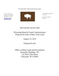
DETAILED ANALYSIS<br />
DETAILED ANAYLSIS<br />
LAND EXCHANGE PROPOSAL BETWEEN THE<br />
BOARD OF LAND COMMISSIONERS<br />
and<br />
<strong>BROKEN</strong> <strong>ANVIL</strong> <strong>RANCH</strong>, INC.<br />
FREMONT, COUNTY, WYOMING<br />
PROPOSAL:<br />
Broken Anvil Ranch, Inc. (Broken Anvil) has presented a land<br />
exchange proposal to the Office of <strong>State</strong> <strong>Lands</strong> and Investments<br />
(the Office) involving state trust lands within the ranch boundaries<br />
for a parcel of deeded land. Broken Anvil submitted a letter<br />
proposing the exchange on March 15, 2005. The letter and<br />
accompanying map are attached as Exhibit “A”.<br />
The Office recorded the proposal on the Category I<br />
Disposal/Acquisition Lists. After preliminary review, the Director<br />
determined that the parcels may be suitable for exchange, and<br />
moved the parcels to the Category II Disposal/Acquisition Lists in<br />
accordance with the rules of the Board of Land Commissioners<br />
(the Board).<br />
AUTHORITY:<br />
W.S. 36-1-107. Exchange of state-owned and privately owned<br />
lands.<br />
W.S. 36-1-110. Authority of the director to effect and complete<br />
land exchanges.<br />
W.S. 36-1-111. Orders, rules and regulations relative to exchange<br />
of lands<br />
Rules: Chapter 26, Section 5, Exchanges.<br />
Trust Land Management Objectives adopted by the Board August<br />
11, 2005.<br />
All documents relating to the Board’s authorization to exchange<br />
state land are attached as Exhibit “B”<br />
LEGAL<br />
DESRIPTION:<br />
STATE LAND<br />
160.00 ± Acres<br />
Township 31 North, Range 98 West, 6th P.M. Fremont County,<br />
<strong>Wyoming</strong><br />
Section 08: SW¼SW¼<br />
Section 17: W½NW¼<br />
Section 18: NE¼SE¼
DETAILED ANALYSIS<br />
PRIVATE LAND<br />
160.00 ± Acres<br />
Township 31 North, Range 98 West, 6th P.M. Fremont County,<br />
<strong>Wyoming</strong><br />
Section 19: SE¼NE¼: E½SE¼<br />
Section 20: SW¼SW¼<br />
SUBJECT PROPERTY DESCRIPTION:<br />
STATE LAND<br />
County/Location: The state land is located in Fremont County, <strong>Wyoming</strong> approximate 13<br />
miles southeast of Lander, <strong>Wyoming</strong> in Weiser Creek and West Fork of Cottonwood Creek<br />
drainage.<br />
Maps and Photographs: Topographical maps of the state land including illustrations of the<br />
land ownership status before and after the proposed exchange are attached as Exhibit “C”.<br />
Photographs of the state land are attached as Exhibit “D”.<br />
Size and Shape: The state land encompasses 160.00± acres. The state land in Sections 8<br />
and 17 is 120 acres, adjacent to Broken Anvil deeded land and arranged in a rectangle, ¼ mile<br />
wide and ¾ mile long. The state land in Section 18 is a 40 acre parcel, ¼ mile square which<br />
corners on the state land in Section 17.<br />
Topography: The state land is on a hill that lies between Weiser Creek and the West Fork of<br />
Cottonwood Creek. The state land’s terrain is rugged with slopes between 10 and 20 percent.<br />
Soils and Productivity: Soils in this area are a mixture of clay loam and sandy clay loam and<br />
are adequate and typical for the area.<br />
Vegetative Cover: The vegetative cover on the state land is a combination of sagebrush,<br />
rabbit brush and grasses. Scattered cottonwood trees and willows line the West Fork of<br />
Cottonwood Creek with a smattering of cedars on the ridges. Some of the grasses that are on<br />
the state land are western wheatgrass, Indian ricegrass, prairie junegrass, and green<br />
needlegrass.<br />
Access: The most practical vehicular access route to the subject state land is by a primitive<br />
road off of <strong>Wyoming</strong> Highway 28 through about 1½ miles of private land owned by Broken Anvil.<br />
An alternative route is a primitive road from the north off of US Highway 287 for approximately<br />
two miles across private land. Legal public access to the state land is only possible by foot or<br />
horseback. A person could park on Highway 28 and hike or ride in an easterly direction across<br />
nearly two miles of BLM land located to the west of the state land parcel.<br />
Utilities: A power line cuts through the SW¼SW¼ of Section 8.<br />
Fences: The subject state land is not fenced.
DETAILED ANALYSIS<br />
Water Rights: A review of the <strong>State</strong> of <strong>Wyoming</strong> <strong>State</strong> Engineer’s website did not show any<br />
water rights appurtenant to the subject state land.<br />
Water Influence: Both Weiser Creek and West Fork of Cottonwood Creek are intermittent<br />
streams as they flow through the state land. The creeks provide spring and early summer water<br />
but dry up during late summer and fall. Weiser Creek runs in a northeasterly direction while the<br />
West Fork of Cottonwood Creek runs in a northerly direction. The confluence of the West Fork of<br />
Cottonwood Creek and Weiser Creek is just east of the eastern border of the state land in<br />
Section 8. Weiser Creek enters the state land in the northwest corner of Section 17 and exits the<br />
state land on its eastern border in Section 8. The West Fork of Cottonwood Creek enters the<br />
state land through its southeast corner in Section 17 and exits the state land through the state<br />
land’s eastern border in the NW¼NW¼ of that section. Several unnamed draws flow toward both<br />
Weiser Creek and West Fork of Cottonwood Creek.<br />
Livestock Water: Weiser Creek and West Fork of Cottonwood Creek provide water for<br />
livestock and wildlife during the spring and early summer.<br />
Mineral Rights: The state owns all of the minerals. The subject state land’s minerals are not<br />
leased with the last lease on them being in the mid 1980’s.<br />
Building Improvements: There are no structural improvements on the property.<br />
Land Improvements: There are no land improvements to this property.<br />
Easements, Hazards, Detriments: There is an electrical line easement that runs west to<br />
east across the state land in Section 8. There does not appear to be any hazardous materials or<br />
environmental concerns present on the property. The land has not been developed for any use<br />
that would subject the land to hazardous materials, or which would create environmental<br />
concerns. The appraiser did not notice any hazardous materials on the property during his<br />
inspection.<br />
Annual Tax Load: The property is owned by the <strong>State</strong> of <strong>Wyoming</strong>; it is not assessed or<br />
taxed by Fremont County. If the land was taxed by Fremont County the taxes would be estimated<br />
at $130.00. In Fremont County, taxes on land used for agricultural purposes are based on<br />
agricultural production.<br />
Amenities: There are no outstanding amenities on the state land proposed in the exchange.<br />
There is a panoramic view of the surrounding country from the top of the ridge.<br />
Forest Products: There are no forest products on this parcel of state land.<br />
Broken Anvil Land<br />
County/Location: The Broken Anvil, Inc. property is located in Fremont County,<br />
approximately 15 miles southeast of Lander, <strong>Wyoming</strong> in the West Fork of Cottonwood Creek<br />
drainage.<br />
Maps and Photographs: Topographical maps of the Broken Anvil land including illustrations<br />
of the land ownership status before and after the proposed exchange are attached as Exhibit
DETAILED ANALYSIS<br />
“C”. Photographs of the Broken Anvil land are attached as Exhibit “E”.<br />
Size and Shape: The subject encompasses approximately 160 deeded acres. The land in<br />
Section 19 is ¾ mile long from north to south and a ¼ mile wide. The land in Section 20 is<br />
square, being ¼ mile on each side.<br />
Topography: The Broken Anvil property has two land classes: wet meadows and upland<br />
range. On the property are three knolls. One knoll is on the northern end of the property with the<br />
second being located approximately in the eastern center of the property and the third straddling<br />
the border between the SE¼SE¼ of Section 19 and the SW¼SW¼ of Section 20. The Hofftowe<br />
Meadows, as identified on topographical maps, is fed by springs on the subject property and off<br />
of the property. The meadow lies between the three knolls. The remaining acreage is rolling to<br />
steep upland range. The land slopes towards the West Fork of Cottonwood Creek.<br />
Soils and Productivity: Soils in this area are a mixture of clay loam and sandy clay loam.<br />
The soils are adequate and typical for the area.<br />
Vegetative Cover: The vegetative cover is a combination of sagebrush, native grasses and<br />
sedges. Cottonwood trees and willows are scattered along West Fork of Cottonwood Creek.<br />
Western wheatgrass, Indian ricegrass, prairie junegrass, and green needlegrass are some of the<br />
grasses that are on the upland range.<br />
Access: There are no roads on the property. The most direct access route to the Broken Anvil<br />
land is by foot or horseback across BLM land situated west of the parcel. From <strong>Wyoming</strong><br />
Highway 28, a person could hike or ride in an easterly direction for approximately one mile to the<br />
Broken Anvil land.<br />
Utilities: No utilities are extended to the property. The nearest power line is 1 mile to the north.<br />
Fences: There are wood and barb wire fences along its western and southern border.<br />
Water Rights: The Hofftowe Meadows have a water right on 17 acres. A review of the<br />
<strong>Wyoming</strong> <strong>State</strong> Engineer’s website shows that there is a water right for 17 acres on the<br />
SW¼SW¼ Section 20 and E½SE¼, SE¼NE¼ of Section 19 Township 31 North, Range 98 West<br />
with an 1886 appropriation date for .45 cubic feet per second of water out of Commissary<br />
Springs through Huftile ditch.<br />
Water Influence: There are several springs on this parcel of land providing water for wildlife<br />
and livestock.<br />
Mineral Rights: Broken Anvil reportedly owns the minerals underlying its land. The Office has<br />
not conducted mineral title research of the Broken Anvil property.<br />
Building Improvements: There are no structural improvements on the property.<br />
Land Improvements: Land improvements consist of fencing only. From a valuation<br />
perspective, the land improvements are included as part of the land value.<br />
Easements, Hazards, Detriments: No obvious easements were noted by the appraiser or<br />
the staff. There does not appear to be any hazardous materials or environmental concerns<br />
present on the property. The land has not been developed for any use that would subject the
DETAILED ANALYSIS<br />
land to hazardous material, or which would create environmental concerns. The appraiser did not<br />
notice any hazardous material on the property during his inspection.<br />
Annual Tax Load: The Broken Anvil property is taxed by Fremont County in the amount of<br />
$130.00. In Fremont County, taxes on land used for agriculture purposes are based on<br />
agricultural production.<br />
Amenities: There are no outstanding amenities on the Broken Anvil land in the proposed<br />
exchange. There is a panoramic view of the surrounding country from the top of the ridge.<br />
Forest Products: There are no forest products on the Broken Anvil property.<br />
COMMENTS FROM AGENCIES:<br />
In accordance with the Board’s rules the <strong>Wyoming</strong> Game and Fish Department (the Department)<br />
and the <strong>Wyoming</strong> Department of <strong>State</strong> Parks and Cultural Resources (<strong>State</strong> Parks) was notified<br />
of the proposed land exchange.<br />
Wildlife and Wildlife Habitat:<br />
The Department’s report indicates the state land and the Broken Anvil land proposed for<br />
exchange is within a crucial winter/yearlong range for mule deer. It also provides habitat for<br />
pronghorn, small game, upland game and non-game wildlife. The state land proposed for the<br />
exchange would possibly be developed in conjunction with the <strong>Wyoming</strong> Catholic College, which<br />
may have an affect of wildlife habitat. The comment letter from the Department is attached as<br />
Exhibit “F”.<br />
Recreation and Cultural Resources:<br />
<strong>State</strong> Parks reviewed the proposed exchange between the Board and Broken Anvil Ranch, Inc.<br />
and determined it would have no positive or negative effect on public recreation in Fremont<br />
County.<br />
The <strong>Wyoming</strong> <strong>State</strong> Historic Preservation Office (SHPO) has searched its records and found that<br />
there has not been a cultural resource survey in the area of the proposed exchange. SHPO<br />
recommends that a cultural resource survey of the lands involved in the proposed exchange be<br />
conducted. The comment letters from <strong>State</strong> Parks and SHPO are attached as Exhibit “G”.<br />
APPRAISED VALUE:<br />
The Office conducted an appraisal of both properties. The effective date of the appraisals was<br />
September 9, 2005. The appraiser determined that the highest and best use of each parcel is as<br />
add-on ranch property with recreational influences. The appraiser used the sales comparison<br />
approach to arrive at the market value of each of the subject properties. The comparable sales<br />
were all selected from Fremont County within a 20 mile radius of the subject property. The<br />
appraised value for the subject properties are summarized as follows:<br />
<strong>State</strong> Land: 160 Acres @ $887.50 per Acre = $142,000.00<br />
Broken Anvil Land: 160 Acres @ $968.75 per Acre = $155,000.00<br />
The appraiser determined that the two properties are very similar. The only exception identified<br />
by the appraiser, and the reason for the $13,000 difference in the appraised value, is that the<br />
Broken Anvil land has a water right and 17 acres of meadow.The appraisal reports for both
DETAILED ANALYSIS<br />
properties along with the accompanying comparable sales information, maps, photographs and<br />
related information are available in the Office for review.<br />
MANAGEMENT OF THE PARCELS CONSIDERED IN THE EXCHANGE:<br />
The detailed analysis provides a side by side comparison of the two parcels from a management<br />
perspective; each as a stand alone property and in conjunction with other state lands (if<br />
applicable).<br />
<strong>State</strong> Land:<br />
The state 160 acres is part of a state grazing lease with 280 acres. The entire lease has 68<br />
AUMs and based on the established AUM rate of $4.78 for 2006 the revenue from that lease is<br />
projected to be $325.04. The 160 acres provides 39 AUMs and is expected to contribute $186.42<br />
of the 2006 annual rental. It is used in conjunction with other private land and a BLM allotment.<br />
The state land is not leased out for mineral production and it has no timber. It is likely that if this<br />
parcel is retained by the state that the state would continue to utilize it under the grazing and<br />
agricultural lease.<br />
If Broken Anvil acquires the state land through this exchange, the indications are that the land<br />
will be included in the development plans for location of the <strong>Wyoming</strong> Catholic College. The<br />
grazing lease on the state lands that Broken Anvil would acquire through the exchange would be<br />
terminated. The Broken Anvil land that the state would acquire would be incorporated into Broken<br />
Anvil’s grazing lease.<br />
Broken Anvil Land:<br />
The Broken Anvil parcel is 160 acres used in conjunction with other private, state and federal<br />
land within a BLM allotment. Within the allotment are 310 acres of private land, 280 acres of<br />
state land and approximately 1,160 acres of federal land. The Bureau of Land Management<br />
estimates that there are 120 AUMs on the 310 acres of private land within the allotment. If the<br />
trade is consummated the acres of ownership within the allotment would not change. The overall<br />
AUMs would not be affected. The AUMs within the state grazing lease would increase due to the<br />
higher production on the meadow. The management of the state land for grazing would not<br />
change from the current scenario.<br />
The exchange would provide a slightly better land ownership configuration for the state because<br />
the Broken Anvil land is adjacent to a full section of state land to the south (Section 29, Township<br />
31 North, Range 98 West).<br />
ANTICIPATED INVESTMENT RETURN:<br />
The total return of any investment is comprised of two parts; (1) income generating potential; and<br />
(2) appreciation of the underlying asset.<br />
1. INCOME GENERATING POTENTIAL:<br />
Board of Land Commissioners Rules and Regulations Chapter 26 require the detailed analysis to<br />
include an estimate of the income generating potential of the parcel, individually and in<br />
combination with other trust lands.<br />
Broken Anvil Land:<br />
The Office has inspected the Broken Anvil property but has not conducted a range survey to<br />
establish its carrying capacity. The productivity of other state land in the area is rated much more<br />
conservatively than the Broken Anvil property, but those lands do not have meadows or the
DETAILED ANALYSIS<br />
amount of livestock water which is present on the Broken Anvil property.<br />
The uplands on the Broken Anvil property are similar to that of the surrounding state lands. It is<br />
estimated there is 143 acres of dry upland range on this 160 acre parcel with the remaining 17<br />
acres being classified as meadow. Conservatively, it is anticipated the Broken Anvil property<br />
would have a carrying capacity of 52 AUMs. Using the 2006 state rental rate of $4.78, the Broken<br />
Anvil parcel would generate an annual income of $248.56 in comparison to the $186.42 that the<br />
state would have earned on the 160 acres considered in the exchange proposal. The proposed<br />
exchange would result in an additional $62.14 in rental income to the state in 2006.<br />
If acquired through exchange, the Broken Anvil land wuld be incorporated into the existing lease<br />
held by Broken Anvil Ranch, Inc. The income from that lease will reflect the additional annual<br />
rental.<br />
Projected Income from Mineral Related Opportunities:<br />
The mineral rights on both properties are included in the exchange, however, the exchange will<br />
not increase or decrease the likelihood of mineral development on either property. The minerals<br />
are not leased on either property and income has not been projected in this analysis.<br />
Projected Income from Wildlife Oriented Opportunities:<br />
The exchange as proposed would not significantly alter the current wildlife habitat or wildlife<br />
oriented opportunities in Fremont County.<br />
Projected Income from Public Recreational Opportunities:<br />
The exchange as proposed would not significantly change public access or public recreational<br />
opportunities on state land in Fremont County.<br />
2. ANTICIPATED APPRECIATION OF PARCELS AS A REAL ESTATE ASSET:<br />
The appraisal of the Broken Anvil Ranch, Inc. property and the state land indicates that land of<br />
this type is appreciating in value at 3 percent per year. Appreciation in land value is a function of<br />
supply and demand and the local community’s economic condition. The appraisal indicates that<br />
the state land and the Broken Anvil land are appreciating at the same rate.<br />
CONCLUSION:<br />
The Office has completed the Detailed Analysis as required by the Board’s rules. The Detailed<br />
Analysis has determined that the proposed land exchange meets the following Trust Land<br />
Management Objectives:<br />
1. Better meet the beneficiaries’ short and/or long term objectives:<br />
a. Revenue – Improved income generating potential from grazing and agricultural<br />
leasing of $248.56 on the Broken Anvil property compared to $186.42 on the state<br />
land, assuming that the Broken Anvil land will be incorporated into an existing lease at<br />
the standard state AUM rate.<br />
b. Investment –<br />
i. Asset Value – The appraised value of the Broken Anvil property involved in the<br />
exchange results in a net value gain to the state land trust of $13,000.00<br />
ii. Appreciation potential – The Broken Anvil property should continue to increase<br />
in value at a minimum of 3 percent per year. Over a 10-year period the value of<br />
the Broken Anvil property could increase to $208,307.04. However, the state<br />
would only realize that increase if it exchanged or sold the Broken Anvil
DETAILED ANALYSIS<br />
property. In comparison the state land over the same 10-year period would<br />
increase in value to $190,836.13 at a 3 percent appreciation rate.<br />
2. Improve the manageability of the land asset:<br />
a. Consolidate ownership patterns – The addition of the 160 acres Broken Anvil property<br />
would connect an isolated 120 acres of state land with 640 acres of state land<br />
blocking nearly 920 acres.<br />
3. Meet a specific school and/or community need:<br />
a. Provide growth opportunity – The exchange would allow Broken Anvil to gift this<br />
portion of its ranch to the <strong>Wyoming</strong> Catholic College which is proposing to build its<br />
campus at this site. Construction and completion of the college would subsequently<br />
increase sales tax revenue as a result of faculty and student population expenditures<br />
in Fremont County.<br />
This Detailed Analysis is being distributed to the public in accordance with the rules. The detailed<br />
analysis is also available on the Office’s website. It is also available for public viewing at several<br />
locations in Fremont County.<br />
As required in the rules, one public hearing will be conducted in Fremont County. The date, time<br />
and location of the public hearings will be advertised in the Lander Journal, Riverton Ranger, and<br />
Casper Star Tribune.<br />
This Detailed Analysis includes the following documents and attachments as required by the<br />
rules:<br />
Detailed descriptions of the state land and the deeded land, including maps and<br />
photographs.<br />
A summary of the appraisal of the <strong>State</strong> land and the Broken Anvil Ranch, Inc. property.<br />
The Office has made the appraisal of both properties available for public review in the<br />
Cheyenne and Lander Offices.<br />
The determination by the <strong>Wyoming</strong> Game and Fish Department of the existence and<br />
importance of any wildlife habitat and wildlife-orientated recreational opportunities located<br />
on the parcels considered in the exchange proposal.<br />
The determination by the Department of <strong>State</strong> Parks and Cultural Resources of the<br />
existence and importance of any public recreational opportunities or cultural resources<br />
located on the parcels considered in the exchange proposal.<br />
Anticipated Investment Returns from Income Generation and Appreciation.<br />
LIST OF EXHIBITS
DETAILED ANALYSIS<br />
"A."<br />
"B"<br />
"C"<br />
"D"<br />
"E"<br />
"F"<br />
"G"<br />
Exchange Proposal from Broken Anvil<br />
Authorities of the Board to Sell Land<br />
Maps – Current Ownership and Proposed Ownership<br />
Photographs of the <strong>State</strong> Trust Land<br />
Photographs of the Broken Anvil Land<br />
<strong>Wyoming</strong> Game and Fish Department Report<br />
<strong>State</strong> Parks and Cultural Resources Department Reports