

CROFT AMBREY, AYMESTREY ... - English Heritage
CROFT AMBREY, AYMESTREY ... - English Heritage
CROFT AMBREY, AYMESTREY ... - English Heritage

Create successful ePaper yourself
Turn your PDF publications into a flip-book with our unique Google optimized e-Paper software.
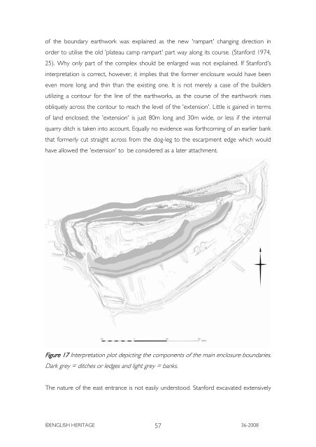
of the boundary earthwork was explained as the new 'rampart' changing direction in<br />
order to utilise the old 'plateau camp rampart' part way along its course. (Stanford 1974,<br />
25). Why only part of the complex should be enlarged was not explained. If Stanford's<br />
interpretation is correct, however, it implies that the former enclosure would have been<br />
even more long and thin than the existing one. It is not merely a case of the builders<br />
utilizing a contour for the line of the earthworks, as the course of the earthwork rises<br />
obliquely across the contour to reach the level of the 'extension'. Little is gained in terms<br />
of land enclosed; the 'extension' is just 80m long and 30m wide, or less if the internal<br />
quarry ditch is taken into account. Equally no evidence was forthcoming of an earlier bank<br />
that formerly cut straight across from the dog-leg to the escarpment edge which would<br />
have allowed the 'extension' to be considered as a later attachment.<br />
Figure 17 Interpretation plot depicting the components of the main enclosure boundaries.<br />
Dark grey = ditches or ledges and light grey = banks.<br />
The nature of the east entrance is not easily understood. Stanford excavated extensively<br />
©ENGLISH HERITAGE 57<br />
36-2008


