County Use of GIS Technology - St. Louis County
County Use of GIS Technology - St. Louis County
County Use of GIS Technology - St. Louis County

Create successful ePaper yourself
Turn your PDF publications into a flip-book with our unique Google optimized e-Paper software.
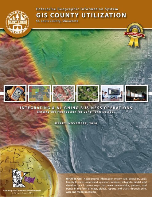
e nterprise Geographic Information System<br />
<strong>GIS</strong> <strong>County</strong> Utilization<br />
<strong>St</strong>. <strong>Louis</strong> <strong>County</strong>, Minnesota<br />
ST. LOUIS COUNTYMN<br />
Award Winning<br />
Integrating & Aligning Business Operations<br />
Setting the Foundation for Long-Term Success<br />
Draft: November, 2010<br />
Planning and Community Development<br />
© <strong>St</strong>. <strong>Louis</strong> <strong>County</strong>, MN<br />
What is <strong>GIS</strong>: A geographic information system (<strong>GIS</strong>) allows <strong>St</strong>. <strong>Louis</strong><br />
<strong>County</strong> to view, understand, question, interpret, integrate, model, and<br />
visualize data in many ways that reveal relationships, patterns, and<br />
trends in the form <strong>of</strong> maps, globes, reports, and charts through print,<br />
web, and mobile mediums.
about <strong>GIS</strong>: Many people have heard <strong>of</strong> Geographic Information<br />
System (<strong>GIS</strong>) but may not be aware <strong>of</strong> the broad impact and the<br />
critical function it plays in the daily lives and operations <strong>of</strong> many<br />
residents, businesses, and government. <strong>GIS</strong> was first developed<br />
in 1963 and is a sophisticated geospatial enabled desktop, web,<br />
and mobile technology. It can be used to manage assets and<br />
resources to assist business operations by providing the ability<br />
to query, analyze, model, capture, update, store, and map large<br />
quantities <strong>of</strong> geospatial and non-geospatial data.<br />
Most <strong>of</strong> the information and discussions about our world contain<br />
references to a location or area. This location-based reference<br />
is enhanced by <strong>GIS</strong> technology, which enables businesses<br />
and government to connect and utilize geospatial and nongeospatial<br />
data together to create powerful tools for users, or<br />
in our case, <strong>St</strong>. <strong>Louis</strong> <strong>County</strong>. At the county government level,<br />
it is estimated that a majority <strong>of</strong> government data is locationbased<br />
such as: land ownership, buildings, survey corners, roads,<br />
emergencies, accidents, fires, sales, and a host <strong>of</strong> other data.<br />
This location-based information, or geospatial data, has become<br />
essential infrastructure and core function <strong>of</strong> government<br />
operations to improve enterprise productivity and efficiency.<br />
Furthermore, <strong>GIS</strong> technology allows users to layer geospatial<br />
information and connect to non-geospatial information to<br />
create an enhanced geo-enabled system. These can be added<br />
on top <strong>of</strong> each other or organized in a way that best suits the<br />
user’s interests. The end-user controls the amount <strong>of</strong> information<br />
by stacking information in layers for further analysis <strong>of</strong> resources<br />
and assets or to mobilize resources for a given task. This can all be<br />
done from all from a desktop, web, and/or mobile application.<br />
<strong>GIS</strong> can be simple, complex or anything in-between. <strong>Use</strong>rs can<br />
make a simple map or perform in-depth analysis, modeling,<br />
transportation routing, reporting, charting, image analysis, GPS<br />
tracking, and so on. Its application is limited only by the user’s<br />
imagination.<br />
A Map is<br />
Data<br />
Location (<strong>GIS</strong>) Based <strong>County</strong> Issues<br />
Land Ownership<br />
Buildings<br />
Survey Corners<br />
Roads, Bridges<br />
911 Dispatch<br />
Lakes<br />
Addressing<br />
Parks, Trails<br />
Accidents & Incidences<br />
Hazards<br />
Rivers/<strong>St</strong>reams<br />
Zoning<br />
Schools<br />
Construction<br />
Hospitals<br />
Emergency Shelters<br />
Sales<br />
Building Ownership<br />
Utilities<br />
Physical Road Inventories<br />
Permits<br />
Waste Treatment<br />
Health Incidences<br />
Crime, Fires<br />
<strong>St</strong>. <strong>Louis</strong> <strong>County</strong>, Minnesota 2 <strong>County</strong> <strong>GIS</strong> <strong>Use</strong>
<strong>GIS</strong> General Benefits<br />
Enterprise<br />
Better Decisions- Informed<br />
<strong>GIS</strong> is a tool to query, analyze, locate, spot conditions,<br />
portray trends, identify patterns, and model scenarios to<br />
support the decision making process through increased<br />
quality and depth <strong>of</strong> information.<br />
Improved Productivity and Efficiency<br />
<strong>GIS</strong> has streamlined many common tasks <strong>of</strong> government<br />
and business operations. Ultimately, <strong>GIS</strong> and a parcel layer<br />
will increase efficiency and productivity. <strong>GIS</strong> has improved<br />
management <strong>of</strong> government and resources by creating<br />
a shared database. One department can benefit from the<br />
work <strong>of</strong> another. Essentially, data can be collected once<br />
and used many times by many departments.<br />
Improved Data Managementl<br />
A common by-product <strong>of</strong> <strong>GIS</strong> is that information is<br />
better managed and formatted to be user-friendly. It<br />
also provides the ability to link databases for a clearer<br />
understanding <strong>of</strong> a particular issue or project.<br />
Improved Access to Information<br />
The greatest number <strong>of</strong> requests for information on <strong>St</strong>.<br />
<strong>Louis</strong> <strong>County</strong>’s web site was for parcel information from<br />
real estate businesses (e.g. appraisers, realtors, title search<br />
companies, developers) and residents. <strong>GIS</strong> parcel layer<br />
provides opportunities to quickly and efficiently get<br />
information to various end-users.<br />
Improved Data Quality and <strong>St</strong>andards<br />
As <strong>GIS</strong> grows across the enterprise, increasingly <strong>GIS</strong> data<br />
quality and standards are enforced and many times<br />
required to be able to interface with spatial technology.<br />
Shared and Leveraged <strong>Technology</strong> Platform<br />
<strong>GIS</strong> ensures that a common set <strong>of</strong> technologies and tools<br />
is used and that duplication is minimized by leveraging a<br />
common technology platform.<br />
Common Operating Picture<br />
<strong>GIS</strong> provides a common way for <strong>County</strong> personnel to view<br />
and use <strong>GIS</strong> s<strong>of</strong>tware and data, thus reducing duplicate<br />
efforts and increasing and improving the way people see<br />
information through a common window.<br />
Locational Awareness<br />
<strong>GIS</strong> provides location based awareness that is critical in<br />
many aspects <strong>of</strong> <strong>County</strong> business operations.<br />
<strong>St</strong>. <strong>Louis</strong> <strong>County</strong>, Minnesota 3 <strong>County</strong> <strong>GIS</strong> <strong>Use</strong>
<strong>St</strong>. <strong>Louis</strong> CountY CONTEXT<br />
Comparison (for Context Purposes Only)<br />
Rhode Island<br />
Square Miles: 1,545<br />
(Land Area 1,045 and Water Area 500)<br />
Delaware<br />
Square Miles: 2,489<br />
(Land Area 1,954 and Water Area 536)<br />
Connecticut<br />
Square Miles: 5,543<br />
(Land Area 4,845 and Water Area 699)<br />
<strong>St</strong>. <strong>Louis</strong> <strong>County</strong> , Minnesota<br />
Square Miles: 6,860<br />
(Land Area 6,225 and Water Area 635)<br />
<strong>St</strong>. <strong>Louis</strong> <strong>County</strong> vs. <strong>St</strong>ates<br />
Comparison (for Context Purposes Only)<br />
To put <strong>St</strong>. <strong>Louis</strong> <strong>County</strong>’s size in perspective, it is relatively the<br />
same size as various states. This comparison only compares<br />
states to show our challenges which may require different<br />
approaches to our governance, data, transactional and<br />
processing, infrastructure and network, and applications and<br />
s<strong>of</strong>tware direction. The sheer size <strong>of</strong> the county requires the<br />
county to deliver services in a different manner. The following<br />
are topics the county must keep in mind as it develops the<br />
county enterprise <strong>GIS</strong> program:<br />
Perspective: Requires a state type view <strong>of</strong> our<br />
<strong>GIS</strong> program and operations. Any project and/or<br />
initiative is an enourmous undertaking and all-duediligents<br />
must be incorporated into procedures.<br />
Data: Any data development is a large undertaking and<br />
can be costly. Plan early and get it right the first time.<br />
Infrastructure & Network: Any deployment needs<br />
to take into account the intense network demands,<br />
cost, and maintenance across county.<br />
Applications & S<strong>of</strong>tware: Any applications<br />
deployment needs to take into account access and<br />
server application demands per infrastruture and<br />
network capacity.<br />
New Jersey<br />
Square Miles: 8,721<br />
(Land Area 7,417 and Water Area 1,304)<br />
Vermont<br />
Square Miles: 9,250<br />
(Land Area 8,885 and Water Area 365)<br />
New Hampshire<br />
Square Miles: 9,350<br />
(Land Area 8,868 and Water Area 382)<br />
massachusetts<br />
Square Miles: 10,555<br />
(Land Area 7,838 and Water Area 2,717)<br />
<strong>St</strong>. <strong>Louis</strong> <strong>County</strong>, Minnesota 4 <strong>County</strong> <strong>GIS</strong> <strong>Use</strong>
Version 1.2<br />
rev. 2-17<br />
<strong>GIS</strong> <strong>County</strong> <strong>Use</strong><br />
<strong>County</strong> <strong>Use</strong> <strong>of</strong> <strong>GIS</strong><br />
E911 & Public Safety: <strong>GIS</strong> technology<br />
and geospatial data is used in <strong>St</strong>. <strong>Louis</strong><br />
<strong>County</strong>’s E911 Computer Aided Dispatch<br />
(CAD) and 911 addressing by providing<br />
key data for 911 dispatchers to dispatch<br />
appropriate fire, police, ambulance, and<br />
first responders <strong>of</strong> nearly 180 emergency<br />
response agencies in <strong>St</strong>. <strong>Louis</strong> <strong>County</strong>.<br />
Land Records Management: A critical<br />
function <strong>of</strong> county government has been<br />
to track, record, and provide detailed<br />
information on land records at the parcel<br />
level. It provides tools to more efficiently<br />
conduct assessment, taxpayer services,<br />
and management <strong>of</strong> land records.<br />
Natural Resource Management: <strong>GIS</strong><br />
helps departments manage, track, and<br />
monitor forest health and growth, fire<br />
and disease assessment, sensitive wildlife<br />
identification, administation <strong>of</strong> tax forfeit<br />
lands, wetlands, floodplains, watersheds,<br />
and surveying, assessing, locating and<br />
appraising <strong>of</strong> tax forfeit property.<br />
Community & Economic Development:<br />
The county is increasingly turning to <strong>GIS</strong><br />
to promote community and economic<br />
development to strengthen the economic<br />
base <strong>of</strong> county communities by retaining<br />
and growing existing businesses and<br />
attracting new investment, and addressing<br />
community needs.<br />
Public Health: The county is increasingly<br />
using <strong>GIS</strong> technology in its Sub-Surface<br />
Treatment System (SSTS) management<br />
to enhance permitting, monitoring, and<br />
enforcement actions.<br />
Transportation: <strong>GIS</strong> has been used in<br />
planning and implementing infrastructure<br />
projects from roads and bridges to<br />
managing assets and planning for capital<br />
improvements. It is increasingly used to<br />
support surveying and field work.<br />
Planning: <strong>GIS</strong> assists departments<br />
conduct long-range planning by providing<br />
the ability to research, analyze, project,<br />
and map data. It also assists in parcel<br />
identication, permitting, zoning and<br />
land use administration, transportation<br />
networks, housing stock, residential, and<br />
more.<br />
Waste Management: Expanded usage<br />
<strong>of</strong> <strong>GIS</strong> involved with the overall high level<br />
management <strong>of</strong> waste management,<br />
canister sites, recycling, and hazardours<br />
waste.<br />
Emerging- <strong>County</strong> <strong>Use</strong> <strong>of</strong> <strong>GIS</strong><br />
Facility Management: <strong>GIS</strong> is beginning<br />
to be used as a tool to help plan and<br />
manage the delivery <strong>of</strong> health and human<br />
service programs and to make the most<br />
efficient use <strong>of</strong> available resources.<br />
Human Services: <strong>GIS</strong> is beginning to be<br />
used as a tool to help manage emerging<br />
plans, and general planning support for<br />
human service programs.<br />
<strong>St</strong>. <strong>Louis</strong> <strong>County</strong>, Minnesota 5 <strong>County</strong> <strong>GIS</strong> <strong>Use</strong>
911 Communications Dispatch<br />
•<br />
•<br />
•<br />
Assists in Determining Appropriate Response: Provides<br />
Dispatchers Enhanced Details about Situation and Landscape<br />
There are 180 different emergency response agencies, thus determining<br />
the situation can improve response and save potential resources. With<br />
<strong>GIS</strong>, dispatchers have the ability to further assess the situation (e.g. aerial<br />
photography, water, elevation/terrain, access, nearby trails, wetlands, and<br />
nearby property owners for assistance) so that emergency response can be<br />
better prepared and responded too.<br />
Improves Emergency Response, Dispatching, & Tracking- AVL<br />
Real-time mapping information on police/ambulance locations (Automatic<br />
Vehicle Location- AVL), its destination, possible routes <strong>of</strong> travel for the<br />
shortest time interval to site, and can identify the distance the emergency<br />
response is from the callers location and update the caller as the emergency<br />
vehicle approaches.<br />
Identifies Location <strong>of</strong> Calls or Property Owners<br />
Identifies Exact Location <strong>of</strong> Cellular Phone Callers<br />
There is an ability for the parcel layer and <strong>GIS</strong> to combine technology that<br />
will pinpoint the location <strong>of</strong> cell phone callers (lost/injured) in relationship<br />
to the overall landscape and situation (<strong>GIS</strong>/parcel layer). Through this call,<br />
a dispatcher can direct emergency response based upon landscape.<br />
Assists Dispatcher Determine Location <strong>of</strong> Calls with Little Information<br />
•<br />
•<br />
•<br />
There are calls that have no information attached, so dispatchers must<br />
determine location <strong>of</strong> calls or locate property. Callers may not know the<br />
exact locations, but do know the property owner <strong>of</strong> the land they are on.<br />
This can quickly help identify or pinpoint the perverbial “hunting shack” to<br />
assist in locating the “lost, missing, or late” hunter.<br />
Improves Identifying Owners at Site <strong>of</strong> Incident<br />
The <strong>GIS</strong> and Land Information Portal would be particularly useful for<br />
burglary & break-in situations by helping locate information.<br />
Limits Mobilizing Search and Rescue Situations & Potential Tragedy<br />
A dispatcher can locate a lost hunter/hiker/camper, watch progress through<br />
GPS, and direct them out to safety (around lakes, wetlands, through trails)<br />
or to nearby property owners for further assistance. This could limit<br />
mobilizing search and rescue operations and potential tragedy.<br />
Limits Mobilizing Search and Rescue Situations & Potential Tragedy<br />
Provides a method <strong>of</strong> notifications in situations requiring evacuations<br />
(e.g. clearing a particular area due to a gas line break, etc.) by identifying<br />
(flagged) vulnerable adults within area for further assistance.<br />
Improves Process to Assign Rural Addresses<br />
Assists in the process <strong>of</strong> assigning rural addresses to new structures both<br />
commercial and residential. Currently, addresses are stamped on a paper<br />
map and inserted into the 911 dispatch system.<br />
<strong>St</strong>. <strong>Louis</strong> <strong>County</strong>, Minnesota 6 <strong>County</strong> <strong>GIS</strong> <strong>Use</strong>
sheriff<br />
•<br />
•<br />
Improves Emergency Management<br />
1. Planning: Analyze and document potential emergencies or disasters,<br />
consequences or impacts upon life, property, environment, and assessing<br />
the hazards and risks.<br />
2. Mitigation: Activities that eliminate or reduce the probability <strong>of</strong> a<br />
disaster.<br />
3. Preparedness: Develop plans to save lives, minimize disaster damage,<br />
enhance disaster response operations, stockpiling vital supplies,<br />
preparing routes and response teams.<br />
4. Response: Emergency assistance for victims (e.g. search and rescue,<br />
shelter, medical care, food), stabilization <strong>of</strong> situation, reduce secondary<br />
damage (e.g. shutting <strong>of</strong>f contaminated water supply sources, securing<br />
and patrolling looting-prone areas).<br />
5. Recovery: Security, cleanup, recovery, temporary housing, and access<br />
to food/water.<br />
Improves Crime Analysis<br />
Crime statistics portrayed geographically have the power to solve crimes or<br />
assist in patrolling to enhance public safety. By using <strong>GIS</strong>, mapping crime by<br />
category, the Sheriff’s Office can determine crime intensity, solve potential<br />
crimes, determine “hot spots,” create strategies to be proactive, and spot<br />
trends. In some cases, <strong>GIS</strong> was used to solve drug cases by linking sales<br />
data <strong>of</strong> cough medicine or cold tablets and found that a “bench chemist”<br />
was producing drugs with certain ingredients in the area.<br />
•<br />
•<br />
•<br />
•<br />
•<br />
Enhances Planning Efforts for Raids, Seizures, and Monitoring<br />
<strong>GIS</strong> provides background data and layout for law enforcement raids,<br />
seizures, and monitoring. It can provide quicker research and identification<br />
by showing property boundary and ownership information, improved<br />
access to legal descriptions for search warrant applications, and identify<br />
property owners for burglarized cabins and property.<br />
Improves Court Room Evidence<br />
Mapping capabilities can show a jury the spatial location <strong>of</strong> evidence and<br />
victims which provide a more comprehensive assessment <strong>of</strong> the situation.<br />
Improves Public Safety Policy<br />
<strong>GIS</strong> makes it possible to track the effectiveness <strong>of</strong> law enforcement programs<br />
such as: comparing accident data to determine the effectiveness <strong>of</strong> programs,<br />
comparing service calls before and after setting up a neighborhood patrol<br />
program, balancing workloads by drawing up more equitable patrol areas,<br />
and evaluating the results <strong>of</strong> selective enforcement plans.<br />
Helpful in Search and Rescue Situations<br />
Search and rescue situations require background information to set up<br />
search parameters, area details, property ownership, elevation, terrain, and<br />
many other factors that can be useful in finding the missing person.<br />
Improves Property Owner Notification<br />
Assists in identifying and notifying property owners who have been<br />
burglarized, vandalized, or other forms <strong>of</strong> property destruction.<br />
<strong>St</strong>. <strong>Louis</strong> <strong>County</strong>, Minnesota 7 <strong>County</strong> <strong>GIS</strong> <strong>Use</strong>
Miles<br />
Prepared By: Planning Department<br />
Planning, Research, & <strong>GIS</strong> Division<br />
(218) 725-5000<br />
www.co.st-louis.mn.us<br />
Team Credits:<br />
Source:<br />
Map Created: May 29, 2007<br />
Location:<br />
Tracking #:<br />
Notes:<br />
Disclaimer<br />
This is a compilation <strong>of</strong> records as they appear<br />
in the Saint <strong>Louis</strong> <strong>County</strong> Offices affecting the<br />
area shown. This drawing is to be used only<br />
for reference purposes and the <strong>County</strong> is not<br />
responsible for any inaccuracies herein<br />
contained.<br />
Copyright Saint <strong>Louis</strong> <strong>County</strong><br />
© All Rights Reserved<br />
<strong>St</strong>. <strong>Louis</strong> <strong>County</strong> MN<br />
N<br />
0 0.01 0.02 0.04 0.06<br />
188.71<br />
188.71<br />
MAPLE GROVE<br />
208.71<br />
MAPLE GROVE<br />
290.71<br />
N 0-3-0 W<br />
991<br />
634.35<br />
621.75<br />
300<br />
150<br />
150<br />
300<br />
296.67<br />
299.53<br />
302.4<br />
S 89-2-28 E<br />
S 89-57-0 W<br />
N 89-21-42 W<br />
N 89-21-42 W<br />
623.4<br />
636.46<br />
521<br />
712.01<br />
777.94<br />
322.4<br />
322.4<br />
330.05<br />
304.95<br />
5<br />
20<br />
191.73<br />
N 89-57-0 E<br />
N 89-57-0 E<br />
N 89-2-28 W<br />
5<br />
216.21<br />
N 89-57-0 E<br />
216.21<br />
216.19<br />
51.49 144.73<br />
638.17<br />
3 2.4 3 2.4<br />
S 0-3-0 E<br />
991<br />
SAMS STREET<br />
625.17<br />
294.71<br />
19.59<br />
R=591.8<br />
19.58<br />
80.9<br />
R=565.2<br />
308.76 256<br />
S 0-3-0 E<br />
315<br />
R=525.8<br />
3 2.4<br />
106.25<br />
R=651.2<br />
322.4<br />
281.45<br />
14.45<br />
S 0-3-0 E<br />
334.92<br />
N 89-21-42 W<br />
133.07<br />
130.41<br />
353 MAPLE GROVE<br />
N 0-10-47 W<br />
RICHARD AVENUE<br />
215.6<br />
215.66<br />
N 89-57-0 E<br />
210.9<br />
60.01<br />
2 1.23<br />
109.41<br />
S 89-2-28 E 801.51<br />
S 0-9-10 E<br />
201<br />
639. 8<br />
215.9<br />
626. 8<br />
338.73<br />
187.37<br />
N 0-5-58 W<br />
N 0-5-58 W<br />
N 0-5-58 W<br />
83<br />
5<br />
1.27<br />
189.03<br />
S 89-54-2 W<br />
EVEE DRIVE<br />
201<br />
S 89-54-2 W<br />
131.95<br />
131.95<br />
322.4<br />
222<br />
233<br />
257.95<br />
N 89-2-28 W<br />
N 89-2-28 W<br />
N 89-21-42 W<br />
412.38<br />
3 2.4<br />
388<br />
257.95<br />
130<br />
130<br />
258<br />
N 0-5-58 W<br />
45<br />
83<br />
N 0-5-58 W<br />
N 0-5-58 W<br />
33.3<br />
147.13<br />
36<br />
36<br />
152.42<br />
320<br />
N 0-5-58 W<br />
626. 8 641.6<br />
3<br />
HAINES<br />
HAINES<br />
375<br />
S 0-5-58 W<br />
HAINES<br />
927.1<br />
MAPLE GROVE<br />
Auditor<br />
CITY OF HERMANTOWN<br />
MAPLE GROVE ACRES and REARRANGEMENT OF MAPLE GROVE ACRES<br />
LINDGREN<br />
LINDGREN<br />
Legend<br />
Subdivision<br />
Roads<br />
Unidentified Parcels<br />
Parcels<br />
ROW<br />
2006 Aerial Photo<br />
MAPLE GROVE<br />
ACRES<br />
HERMANTOWN<br />
REARRANGEMENT<br />
OF MAPLE<br />
GROVE ACRES<br />
N 45-25-47 E<br />
42.03<br />
•<br />
Improves Service and Efficiency<br />
Improves Response Time to Data Requests<br />
Every year, thousands <strong>of</strong> requests are received from residents, appraisers,<br />
lawyers, real estate pr<strong>of</strong>essionals, title companies, and others for parcel<br />
data on ownership, parcel location, acreage, last sale date, abstract/<br />
torrens, last date document recorded, original plats, maps, land<br />
delineation, and lot dimensions (hundreds per month). Difficulties arise<br />
when this data is stored in various departments, data platforms (Excel,<br />
Access, MCIS, etc), and maps (plat books, range book, Carson maps, halfsection<br />
maps, U.S.G.S., Certificate <strong>of</strong> Survey, Township maps, etc.), and<br />
cannot be easily accessed. The end result is slower service to customers<br />
due to inefficient and outdated technology systems.<br />
Enhances Tracking and Updating Information<br />
<strong>GIS</strong> can easily track and modify information as new and additional<br />
information is recorded and provided by the residents. This information<br />
could be easily and immediately accessed by all.<br />
Eliminates Antiquated Process for Public Notification (Generating<br />
Owner Labels):<br />
The Auditor’s Office assists cities in developing mailing labels for public<br />
notification for variances and other development activities in order to<br />
notify adjoining property owners within a certain buffer. This antiquated<br />
process takes up hours to days for each query request. <strong>GIS</strong> significantly<br />
reduces the time for this process or can be completed by requesting city.<br />
•<br />
•<br />
•<br />
Web Portal: Enhances Access 24/7<br />
To some degree, access is available through the current parcel<br />
information web site. However, many <strong>of</strong> the data requests are<br />
geographically based and are not easily accessible by the current setup.<br />
Through a geographically based parcel layer coverage, a business or<br />
resident can use the web site any time <strong>of</strong> the day to conduct research that<br />
otherwise would be handled by county staff on the phone or at the front<br />
counter. This will greatly enhance services for commerce and residents<br />
who request data.<br />
Assists in Election Process<br />
The parcel layer and <strong>GIS</strong> assists the planning efforts in redistricting,<br />
reprecincting, projected growth for each precinct, voter analysis, voter<br />
education, voter counts, voter turnout, precinct election support, determine<br />
optimal polling sites, improving voter registration process, election day<br />
support <strong>of</strong> volunteers, and others.<br />
Converts Cadastral (Parcel) Recording from Paper to Digital<br />
Converting parcel recording from drawing on paper to digital <strong>GIS</strong> form will<br />
improve all areas <strong>of</strong> the Auditor’s Office and the <strong>County</strong> from eliminating<br />
book deteriortation and replacement, improves drawing accuracy, and<br />
eliminates multiple documents - one edit used many times.<br />
<strong>St</strong>. <strong>Louis</strong> <strong>County</strong>, Minnesota 8 <strong>County</strong> <strong>GIS</strong> <strong>Use</strong>
!<br />
17'<br />
!<br />
! !<br />
22'<br />
29'<br />
7'<br />
2'<br />
12'<br />
6'<br />
22'<br />
8'<br />
8' 3' 10'<br />
3'<br />
10'<br />
4'<br />
1'<br />
20'<br />
10'<br />
7'<br />
19.7'<br />
2'<br />
12'<br />
4'<br />
13<br />
12'<br />
2'<br />
3'<br />
26'<br />
6'<br />
4'<br />
14.7'<br />
16'<br />
23'<br />
25'<br />
25'<br />
10'<br />
26'<br />
Public Records & Property Valuation: Assessor<br />
ALDER AVE<br />
3780 ALDER AVENUE<br />
5151 COUNTRY ROAD<br />
395-0064-00080<br />
395-0064-00110<br />
5141 COUNTRY ROAD<br />
COUNTRY RD<br />
395-0064-00100<br />
395-0062-00080<br />
s<br />
ndary Lines<br />
ns<br />
395-0064-00070<br />
UTM: 4813835,3341995<br />
395-0064-00100<br />
UTM: 4814124,3341971<br />
395-0062-00080<br />
UTM: 4814329,3341955<br />
RDS<br />
METRY<br />
395-0064-00070<br />
DEDICATED ROW<br />
DEDICATED ROW<br />
5160 COUNTRY ROAD<br />
395-0064-00010<br />
UTM: 4814212,3341911<br />
COUNTRY LN<br />
395-0064-00060<br />
5156 COUNTRY ROAD<br />
395-0066-00050<br />
5161 COUNTRY LANE<br />
395-0064-00010<br />
395-0062-00150<br />
395-0064-00090<br />
5173 COUNTRY LANE<br />
395-0064-00060<br />
UTM: 4813992,3341706<br />
395-0064-00020<br />
UTM: 4814062,3341705<br />
395-0064-00020<br />
N<br />
Development<br />
rch, & <strong>GIS</strong> Division<br />
n.us<br />
nt Projects\Addressing <strong>St</strong>andards<br />
Disclaimer<br />
This is a compilation <strong>of</strong> records as they<br />
appear in the <strong>St</strong>. <strong>Louis</strong> <strong>County</strong> Offices<br />
affecting the area shown. This drawing<br />
is to be used only for reference purposes<br />
and the <strong>County</strong> is not responsible for any<br />
inaccuracies herein contained.<br />
© Copyright <strong>St</strong>. <strong>Louis</strong> <strong>County</strong> All Rights Reserved<br />
Addressing: Residential <strong>St</strong>ructure & Driveway<br />
DK<br />
486'<br />
0 5 10 20 30 40 50 60 70 80 90 100 110<br />
Enterprise Data Development<br />
2.8'<br />
1/C<br />
15.8'<br />
2.8'<br />
1/C<br />
24'<br />
7.5'<br />
1/B<br />
354'<br />
Feet<br />
2/B<br />
1073'<br />
AG/F<br />
650'<br />
OP<br />
12'<br />
3' 7'<br />
2.8'<br />
1/C<br />
11.9'<br />
SOO<br />
40'<br />
1/C<br />
11.9'<br />
2.8'<br />
•<br />
•<br />
•<br />
Fair and Equitable Assessment<br />
A parcel map would help both county and local assessors to locate parcels<br />
from various points <strong>of</strong> view that affect value and classification. Such points<br />
<strong>of</strong> view include location with regard to access (roads, water, trails); location<br />
with regard to man-made features both good (parks, malls, hospitals,<br />
schools) and unpleasant (active gravel pits, junkyards); location with regard<br />
to natural features both good (lakes, rivers, panoramic views) and bad<br />
(erosion areas, low lands subject to seasonal flooding); location with regard<br />
to market trends (changes in demographics, investment opportunities); and<br />
location with regard to legal use (zoning laws, habitat restrictions).<br />
Improves Real Estate Record Analysis<br />
The Assessor’s Office receives innumerable amounts <strong>of</strong> data requests from<br />
real estate pr<strong>of</strong>essionals researching information on comparable sales,<br />
acreage, bath and bedroom counts, assessments, taxes, land values, price<br />
per acres, and a host <strong>of</strong> other facts. Such data requests have made the<br />
Assessor’s staff de facto research assistants. <strong>GIS</strong> will substantially reduce the<br />
number <strong>of</strong> these requests.<br />
Improves Assessment Tracking and Analysis<br />
Improves Sales Trend Trackings: <strong>GIS</strong> is being used more and more to<br />
display such sales trends as price paid per acre or front footage, depreciation<br />
<strong>of</strong> existing buildings as markets heat up or cool <strong>of</strong>f, effects <strong>of</strong> recent changes<br />
in legal use on a market, influx <strong>of</strong> out-<strong>of</strong>-county buyers, conversion <strong>of</strong> parcels<br />
from one use to another. Such displays can be used by assessors to write<br />
valuation schedules and by taxpayers to judge the reasonableness <strong>of</strong> their<br />
57<br />
•<br />
market values and the reasons behind increases/decreases.<br />
Provides Ability to Match Undocumented New Construction &<br />
<strong>St</strong>ructures to a Parcel: An appraiser who comes across undocumented<br />
structures, or first-time new construction, can use the <strong>GIS</strong> parcel layer to<br />
identify the parcel and its owner.<br />
2/B<br />
1199'<br />
DK<br />
264'<br />
Improves Auditing Assessment<br />
Enhances Administration Functions: <strong>GIS</strong> can be used to display such sales<br />
trends as price paid per acre or front footage, depreciation <strong>of</strong> existing sales.<br />
Provides Equalization Support: Parcel maps can display assessed values<br />
<strong>of</strong> parcels side-by-side throughout a neighborhood, township, or region.<br />
Assessors can compare, for instance, the consistency <strong>of</strong> their estimated<br />
market values on contiguous 40-acre parcels, or platted lots.<br />
Assists Board <strong>of</strong> Appeal and Equalization: <strong>GIS</strong> helps the Appeal Board<br />
members to “get their bearings” as taxpayers come in one at a time and<br />
appeal the value/class on a particular parcel. <strong>GIS</strong> maps would help the<br />
board make judgements with regard to locale, neighboring influences.<br />
• Improves Service and Efficiency<br />
Improves Response Time to Data Requests: <strong>GIS</strong> data is linked through<br />
a web portal to reduce information requests by phone calls, walk-in, and<br />
e-mail questions regarding basic assessment data. A web site using a<br />
parcel map allows the internet user to drill down to the parcel level to find<br />
such information and compare properties. This would significantly reduce<br />
employee time devoted to data gathering.<br />
<strong>St</strong>. <strong>Louis</strong> <strong>County</strong>, Minnesota 9 <strong>County</strong> <strong>GIS</strong> <strong>Use</strong>
Public Records & Property Valuation: Recorder<br />
MT IRON ECONOMIC<br />
DEVELOPMENT AUTH<br />
MT IRON ECONOMIC<br />
DEVELOPMENT<br />
AUTH<br />
MT IRON ECONOMIC<br />
DEVELOPMENT AUTH<br />
NORTHWARD<br />
PROPERTIES LLC<br />
NORTHWARD PROPERTIES LLC<br />
Private Individual<br />
(Nikolanci)<br />
CITY OF MT IRON<br />
MESSIAH LUTHERAN CHURCH MT IRON<br />
175-0070-01430<br />
175-0071-00870<br />
HRA OF<br />
MT IRON<br />
HOUSING &<br />
REDEVELOPMENTPrivate Individual<br />
AUTHORITY (Johnson)<br />
HOUSING &<br />
REDEVELOPMENT<br />
AUTHORITY<br />
Private Individual<br />
(Roskoski)<br />
175-0071-01550<br />
175-0071-01582<br />
•<br />
Improves Review Processes<br />
Currently, when examining documents, the Recorder’s Office in many<br />
instances must access maps and data in other departments to complete<br />
a review and determination <strong>of</strong> a document. This method slows down the<br />
process and ties up staff in several departments. For example: the Examiner<br />
<strong>of</strong> Titles and the Recorder’s staff must review maps from scattered sources<br />
when examining and reviewing documents. Often they must physically<br />
go to the Auditor’s Tax Department or call the <strong>County</strong> Surveyor’s <strong>of</strong>fice,<br />
causing additional staff workload in all departments. With <strong>GIS</strong>, Recorder’s<br />
staff can internally review documents, saving time for both departments.<br />
Prepared By:<br />
Team Credits:<br />
Planning & Development Disclaimer<br />
Planning, Research, & <strong>GIS</strong> Division This is a compilation <strong>of</strong> records as they appear in the Saint<br />
(218) 725-5000<br />
<strong>Louis</strong> <strong>County</strong> Offices affecting the area shown. This drawing<br />
www.co.st-louis.mn.us<br />
is to be used only for reference purposes and the <strong>County</strong> is not<br />
Planning, Land, PW, 911<br />
responsible for any inaccuracies herein contained.<br />
Source: <strong>St</strong>. <strong>Louis</strong> <strong>County</strong>, DNR<br />
Map Created: 3/24/2008<br />
© Copyright <strong>St</strong>. <strong>Louis</strong> <strong>County</strong> All Rights Reserved<br />
•<br />
N<br />
Assists Cleaning-Up Parcels with Clouded Property Titles<br />
Many developments are well down the road <strong>of</strong> securing private and public<br />
dollars, permits, and bids only to hit an obstacle <strong>of</strong> a clouded property title.<br />
Title problems can be expensive, cause delays, or kill a project. There are key<br />
parcels in Duluth and 0 other communities 0.05 0.1that remain undeveloped in part<br />
because clearing the title can be cumbersome, and the city or developer is<br />
Miles<br />
unwilling to take on the responsibility <strong>of</strong> clearing title.<br />
• Improves Service and Efficiency<br />
Quick Drill Down- Improves Ability to Review Documents<br />
Mountain Iron, MN<br />
Quickly/Easily:<br />
<strong>GIS</strong> will dramatically improve the ability <strong>of</strong> Recorder’s staff, businesses,<br />
• Assists in Certificate <strong>of</strong> Title Determination School District (ISD 703, 712) and residents surrounding to quickly area search, ownership<br />
locate, and review a wide range <strong>of</strong> legal<br />
A review <strong>of</strong> <strong>GIS</strong> will assist Recorder’s staff in assessing the need for a residue documents. Currently, there is no ability for searches by address, which<br />
certificate <strong>of</strong> title as part <strong>of</strong> a transaction.<br />
causes problems (additional research) <strong>of</strong> locating the correct documents<br />
filed on a particular property.<br />
• Enhances Business Interaction<br />
Improves Response Time to Data Requests: The Recorder’s Office receives<br />
Identifies Exact Location <strong>of</strong> Cellular Phone Callers<br />
innumerable phone calls, e-mails and written requests from people looking<br />
The Recorder’s Office records documents and creates certificates that<br />
for objective data such as lot size, recording data <strong>of</strong> documents, whether<br />
many businesses seek for its normal business transactions. These<br />
Torrens or Abstract, and the existence <strong>of</strong> liens or encumbrances. With <strong>GIS</strong>,<br />
businesses are title companies or attorneys doing title searches, abstracts,<br />
recorded documents and data can be quickly searched and located, thus<br />
owners and encumbrance reports, title insurance, and much more. With<br />
reducing the amount <strong>of</strong> time for each request.<br />
<strong>GIS</strong>, a business can quickly query and locate a person or property (by<br />
address, legal description or clicking on property– the latter <strong>of</strong> which • Web Portal: Enhances Access 24/7<br />
currently does not exist), and begin the review process. This improves the A web site using a parcel map that allows the internet user to drill down<br />
efficiency <strong>of</strong> the businesses and reduces the amount <strong>of</strong> time county staff<br />
to the parcel level to find such information would significantly reduce<br />
spends helping businesses locate a site.<br />
employee time devoted to such mundane data gathering.<br />
<strong>St</strong>. <strong>Louis</strong> <strong>County</strong>, Minnesota 10 <strong>County</strong> <strong>GIS</strong> <strong>Use</strong>
Comet Island<br />
Pine Island<br />
2<br />
RES-1<br />
RES-5 RES-8<br />
10 SENS-3 9<br />
8<br />
1<br />
RES-4<br />
8<br />
RES-8<br />
7<br />
5<br />
1<br />
RES-11<br />
3<br />
6<br />
2<br />
RES-9<br />
RES-1<br />
1<br />
RES-9<br />
LCO 6<br />
RES-9<br />
5<br />
2 1<br />
MUNS-5<br />
4<br />
RES-1<br />
5<br />
6<br />
RES-10<br />
413<br />
1<br />
5<br />
6<br />
7<br />
3<br />
9<br />
RES-9 RES-10<br />
RES-10<br />
RES-8<br />
3<br />
RES-10<br />
Crosby<br />
Rd N<br />
4<br />
FAM-3<br />
4 3 RES-3<br />
FAM-3<br />
RD<br />
LAKE<br />
FAM-3<br />
2<br />
2<br />
1<br />
HOODOO<br />
LAKE AVE<br />
AVE S<br />
1<br />
N<br />
5<br />
4<br />
RES-10<br />
1 2<br />
Spider Island<br />
3<br />
4<br />
2<br />
6<br />
8 RES-10<br />
RES-10<br />
126<br />
2ND ST N<br />
Matson Island<br />
RES-9<br />
RES-9<br />
-0<br />
7<br />
3<br />
1<br />
RES-3<br />
4 2 FAM-3 1<br />
3<br />
6<br />
10<br />
4<br />
697<br />
2ND ST N<br />
6 7<br />
4<br />
2<br />
5<br />
RES-10<br />
RES-10<br />
VERMILION<br />
RES-10<br />
2<br />
RES-10<br />
GD-69037800<br />
RES-10<br />
RES-10<br />
2<br />
RES-10<br />
4<br />
4<br />
3<br />
RES-9<br />
1<br />
1<br />
3<br />
RES-10<br />
RES-10<br />
RES-10<br />
2<br />
1<br />
RES-10 RES-10<br />
Ely Island<br />
RES-10<br />
6<br />
5<br />
Rasberry Island<br />
2<br />
3<br />
RES-10<br />
3 5<br />
4<br />
RES-10<br />
4<br />
RES-9<br />
RES-10<br />
RES-10<br />
8<br />
7 RES-10<br />
RES-10<br />
5<br />
3<br />
RES-10 3<br />
2<br />
6<br />
1<br />
RES-10<br />
5<br />
RES-10 RES-10<br />
1<br />
RES-10<br />
RES-11<br />
5<br />
Crosby Rd N<br />
RES-8<br />
4<br />
2<br />
8<br />
RES-10<br />
5<br />
3<br />
12<br />
11<br />
11<br />
RES-10<br />
RES-10<br />
2<br />
3<br />
4<br />
5<br />
MUNS-5<br />
Lands within 300 feet <strong>of</strong> rivers, shall<br />
have same dimensional standards as adjacent<br />
non-shoreland area. Except for <strong>St</strong>. <strong>Louis</strong>,<br />
Crosby Rd N<br />
1<br />
RES-8<br />
3<br />
6<br />
2<br />
9<br />
1<br />
RES-10<br />
RES-4<br />
RES-10<br />
5<br />
RES-11<br />
RES-10<br />
7<br />
-0<br />
-<br />
3<br />
RES-4<br />
MUNS-4<br />
8<br />
9<br />
RES-1<br />
MUNS-4<br />
JUCTION<br />
3<br />
2<br />
RES-9<br />
5 6 - VERMILION 4 SENS-1<br />
9<br />
RES-9<br />
RES-9<br />
RES-1 7 GD-69037800<br />
FAM-3<br />
RES-9<br />
RES-1<br />
RES-8<br />
3<br />
RES-9<br />
4<br />
SENS-1<br />
RES-10<br />
RES-7 4 3<br />
1<br />
2 1<br />
RES-10<br />
3 2 1<br />
4<br />
8<br />
5<br />
5<br />
BASS<br />
RES-10<br />
RD-69044600<br />
7<br />
9<br />
6<br />
6<br />
7<br />
6<br />
4<br />
7<br />
8 9<br />
RES-10<br />
4<br />
1<br />
RES-10 4<br />
<strong>St</strong>runtz Island<br />
11<br />
RES-10<br />
RES-1<br />
RES-4<br />
2 1<br />
RES-11<br />
2<br />
7<br />
RES-4<br />
1<br />
4<br />
RES-10<br />
RES-10<br />
5<br />
3<br />
RES-1<br />
MAIN<br />
RES-12<br />
FAM-3<br />
ST<br />
4<br />
FAM-3<br />
5<br />
RES-10<br />
9<br />
2<br />
LIU-10<br />
10<br />
1<br />
8<br />
RES-1<br />
2<br />
RES-3<br />
3<br />
FAM-3<br />
ST<br />
1<br />
10<br />
RES-9 RES-9<br />
1<br />
4 3<br />
RES-10<br />
RES-10<br />
7<br />
RES-1<br />
4<br />
MUNS-4<br />
Birch Island<br />
5<br />
2<br />
6<br />
RES-10<br />
3 2<br />
1<br />
RES-4<br />
1<br />
7<br />
RES-10<br />
1<br />
169<br />
3<br />
OLD<br />
9<br />
2<br />
RES-10<br />
Timber Island<br />
4 3 2 1 4 3 2<br />
8<br />
169<br />
4<br />
9<br />
8<br />
10<br />
RES-10 6 7 RES-10 5 4<br />
RES-10 6<br />
RES-10<br />
RES-10<br />
9<br />
8<br />
8<br />
RES-3<br />
FAM-2<br />
FAM-3<br />
FAM-2<br />
RES-8<br />
2<br />
RES-10<br />
5<br />
RES-4<br />
1<br />
RES-10<br />
7<br />
7<br />
FAM-2<br />
2<br />
RES-2<br />
1<br />
1<br />
11<br />
6<br />
3<br />
4<br />
4 3<br />
UNNAMED<br />
NE-69103800<br />
7<br />
5<br />
1<br />
5<br />
6<br />
4<br />
6<br />
RES-10<br />
2<br />
1<br />
2<br />
3<br />
3<br />
4<br />
4<br />
5<br />
3<br />
3<br />
6<br />
4<br />
3<br />
4<br />
2<br />
1<br />
4 3<br />
5<br />
5<br />
8<br />
1<br />
2<br />
SMU-10<br />
2<br />
7<br />
6<br />
7<br />
2<br />
1<br />
1<br />
8<br />
9<br />
FAM-1<br />
3<br />
1<br />
RES-5<br />
5 6<br />
2<br />
FOUR MILE<br />
2 NE-69028100<br />
4 3<br />
1<br />
5<br />
FIVE MILE<br />
NE-<br />
69028800<br />
4<br />
LAWLER<br />
NE-69027600<br />
FAM-1<br />
MUNS-4<br />
FAM-1<br />
RES-1<br />
FAM-1<br />
FAM-3<br />
FAM-1<br />
RES-5<br />
RES-5<br />
This zoning map was prepared on<br />
November 16, 1995. It is<br />
effective on January 29, 1996.<br />
For any subsequent changes contact the<br />
<strong>St</strong>. <strong>Louis</strong> <strong>County</strong> Planning & Zoning Department.<br />
4<br />
6<br />
3<br />
Omnimax/Duluth<br />
10 Movie Theater<br />
<strong>St</strong>. <strong>Louis</strong> <strong>County</strong> MN<br />
N<br />
Planning & Community Development<br />
6 ST W<br />
5 ST W<br />
4 ST W<br />
MESABA PL<br />
¬« 194<br />
Parking<br />
2 ST W<br />
<strong>St</strong>. <strong>Louis</strong><br />
<strong>County</strong><br />
Courthouse<br />
PRILEY DR<br />
<strong>St</strong>. <strong>Louis</strong><br />
<strong>County</strong> Motor<br />
Pool Garage<br />
N 4 AVE W<br />
Duluth<br />
City Hall<br />
Duluth News<br />
Tribune<br />
Parking<br />
Board<br />
<strong>of</strong> Trade<br />
Building<br />
Qwest<br />
Palladio<br />
Building<br />
Missabe<br />
Building<br />
N 3 AVE W<br />
AT&T<br />
Blustin Optical Center<br />
Salon<br />
Capelli<br />
ARDC<br />
YMCA<br />
Blustin Optical<br />
Center<br />
Providence<br />
Building<br />
SUPERIOR ST W<br />
Holiday Inn<br />
Parking<br />
Ramp<br />
Torrey<br />
Building<br />
Medical<br />
Arts<br />
Building<br />
Lonsdale<br />
Building<br />
Alworth<br />
Building<br />
North<br />
Shore<br />
Bank<br />
Holiday<br />
Center<br />
Wells<br />
Fargo<br />
Building<br />
N 2 AVE W<br />
Holiday<br />
Inn Hotel<br />
Minnesota<br />
Surplus<br />
S 3 AVE W<br />
North<br />
Shore<br />
Bank<br />
Maurices<br />
Inc<br />
S 2 AVE W<br />
Sellwood<br />
Building<br />
Ace<br />
Hardware<br />
Duluth Transit Authority<br />
US Bank<br />
Parking US Bank Parking Ramp<br />
DR<br />
LAKE PLACE<br />
SUTPHIN ST<br />
Green<br />
Mill<br />
Canal Park Lodge<br />
Hampton<br />
Inn<br />
The Inn on Lake<br />
Superior<br />
MESABA AVE<br />
CANAL PARK<br />
Skywalk<br />
Parking<br />
<strong>St</strong>ructures<br />
Depot Project Areas<br />
Site Plan<br />
Area Master Plan<br />
Area Master Plan Transition<br />
N 9<br />
AVE W<br />
N 8 AVE W<br />
N 7 AVE W<br />
N 7H<br />
AVE W<br />
UNKNOWN<br />
3 ST W<br />
1 ST W<br />
BIGOS-LENOX<br />
PLACE<br />
U.S.<br />
Federal<br />
Courthouse<br />
N 6 AVE W<br />
Incline <strong>St</strong>ation<br />
Bowling<br />
Center<br />
Parking<br />
Gateway<br />
Towers<br />
S 6 AVE W<br />
N 5 AVE W<br />
Radisson Hotel<br />
Duluth Harborview<br />
Parking<br />
Duluth Public<br />
Library<br />
Union<br />
Depot<br />
§¨¦ 35<br />
Ordean<br />
Building<br />
MICHIGAN ST W<br />
S<br />
<strong>St</strong>anley<br />
Center<br />
5 AVE W<br />
4th Ave Auto Park<br />
RAILROAD ST<br />
DECC<br />
Parking<br />
Ramp<br />
Duluth Entertainment<br />
Convention Center<br />
(DECC)<br />
Duluth Entertainment<br />
Convention<br />
Center (DECC)<br />
Subway/On<br />
The Canal<br />
Salon<br />
Duluth<br />
Pack<br />
BUCHANAN<br />
LAKE AVE S<br />
DR<br />
ST<br />
MORSE ST E<br />
Grandma's<br />
Saloon<br />
& Grill<br />
Comfort<br />
Suites<br />
Lake Superior<br />
Maritime<br />
Visitor Center<br />
S 4 AVE W<br />
Great Lakes<br />
Aquarium<br />
HARBOR DR<br />
Lake<br />
Superior<br />
S 8 AVE W<br />
XRAMP<br />
Lois<br />
Paulucci Music<br />
Pavilion<br />
8 ST S<br />
GLEN PL<br />
MINNESOTA AVE<br />
Prepared By: <strong>St</strong>. <strong>Louis</strong> <strong>County</strong><br />
Planning & Development Department<br />
(218) 725-5000<br />
www.co.st-louis.mn.us<br />
Team Credits: Planning, Property Management, Public Works, Land<br />
Source:<br />
Map Created:<br />
•<br />
•<br />
<strong>St</strong>. <strong>Louis</strong> <strong>County</strong><br />
4/28/2009<br />
36<br />
<strong>St</strong>. <strong>Louis</strong> <strong>County</strong> 31<br />
32<br />
33<br />
34<br />
35<br />
Proposed Zoning Map Breitung 62-15<br />
Disclaimer<br />
This is a compilation <strong>of</strong> records as they<br />
appear in the <strong>St</strong>. <strong>Louis</strong> <strong>County</strong> Offices<br />
affecting the area shown. This drawing<br />
is to be used only for reference purposes<br />
and the <strong>County</strong> is not responsible for any<br />
inaccuracies herein contained. 1 6<br />
© Copyright <strong>St</strong>. <strong>Louis</strong> <strong>County</strong><br />
All Rights Reserved<br />
Pike Bay<br />
")<br />
12<br />
24<br />
!(<br />
380-0010-06070<br />
5900<br />
5700<br />
5500 NICKERSON 5300 L 5100<br />
MONTGOMERY<br />
<strong>St</strong>reamlines the Land-<strong>Use</strong> Permitting Process<br />
5 4 3 2<br />
1 6<br />
River Classification & Setbacks<br />
2300<br />
2100<br />
1900<br />
13 18 17<br />
")")<br />
1100 1300 1500 1700<br />
")")<br />
19<br />
25 30<br />
36<br />
ECHO<br />
POINTRD<br />
7<br />
S WAMP<br />
31<br />
HOODOO POINT RD<br />
POINT RD<br />
Zone Districts<br />
Forest Agricultural Management<br />
£¤<br />
Fam-1, 2, 3<br />
Residential<br />
Res-1, 1a, 2, 3, 4, 5, 6, 7, 8, 9, 10, 11, 12<br />
Shoreland Mixed <strong>Use</strong><br />
Smu-1, 2, 3, 3a, 4, 4a, 5, 6, 7, 8, 9, 10, 11<br />
Multiple <strong>Use</strong> Non-Shoreland<br />
Muns-2, 3, 4, 5, 7<br />
Sensitive Areas<br />
Sens-1,2, 3, 5<br />
Industrial<br />
Ind-4<br />
Limited Industrial<br />
Liu-1, 4, 5, 10, 11<br />
Non-Shoreland Commercial<br />
Com-4, 6, 7, 11<br />
Lake Superior Overlay<br />
Lso-10<br />
Union Depot - Planimetrics & Skywalks<br />
5<br />
5<br />
4<br />
3<br />
2<br />
1<br />
6<br />
Historic <strong>St</strong>. <strong>Louis</strong> <strong>County</strong> Part Union <strong>of</strong>: Depot Grand - Site Lake Plan 51-16, & Area Section Master 31 Plan<br />
Bass Bay<br />
<strong>St</strong>. <strong>Louis</strong> <strong>County</strong>, MN<br />
8<br />
20<br />
29<br />
32<br />
!(!(<br />
McKINLEY<br />
380-0010-06055<br />
COLLELO ANTHONY<br />
9 10 11<br />
")<br />
PARK RD<br />
16<br />
21 22 23<br />
28<br />
<strong>St</strong>untz Bay<br />
15<br />
27<br />
33 34<br />
RD<br />
RES-10 RES-10<br />
9/16/2008<br />
representation in relation to lakes, rivers, roads, and other features.<br />
BAY RD<br />
STUNTZ<br />
Klimek Rd<br />
JASPER<br />
Nickerson Rd<br />
OLD HWY 1 69<br />
14<br />
26<br />
Armstrong Bay<br />
£¤ £¤<br />
Currently, land-use permitting requires residents to provide a lot description<br />
Tributaries<br />
100 ft.<br />
É É É É É É É Primitive<br />
300 ft.<br />
when applying for a permit, and to determine setback requirements<br />
! ! ! SLC Remote 200 ft.<br />
É É É É É É É Recreational 150 ft.<br />
for each proposal. Problems arise when residents have ! lengthy ! ! Rural / Agricultural legal 200 ft.<br />
É É É É É É É Urban<br />
100 ft.<br />
! ! ! Trout <strong>St</strong>reams 150 ft.<br />
descriptions with various dimensions and angles, making it difficult to<br />
É É É É É É É DNR Remote 200 ft.<br />
! ! ! DNR Forested 150 ft.<br />
determine lot dimensions over the phone or e-mail. By developing a<br />
digital parcel layer, staff can quickly identify parcels and their geographical<br />
Cloquet, Whiteface, and Vermilion rivers. <strong>St</strong>. <strong>Louis</strong> <strong>County</strong> Board Resolution No. 346 <strong>St</strong>. <strong>Louis</strong> <strong>County</strong> Board Resolution No. 961<br />
380-0010-06100<br />
Adopted May 6, 1997<br />
Adopted December 19, 1995.<br />
FINNISH<br />
WORKMEN SOC<br />
Enhances Economic Development<br />
<strong>St</strong>. <strong>Louis</strong> <strong>County</strong> has expanded its role in economic development over<br />
the past several years through the adoption <strong>of</strong> economic development<br />
strategies. However, its capacity to conduct pre-planning and research<br />
to bring development into reality is limited without a parcel layer map. A<br />
digital parcel layer will assist business research and assess potential sites for<br />
business and commerce. All entities are limited in assessing sites because<br />
<strong>of</strong> the research needed to determine ownership, routes <strong>of</strong> infrastructure to<br />
minimize impacts and cost, and many others.<br />
• Improves Long-Range Planning<br />
Every community in <strong>St</strong>. <strong>Louis</strong> <strong>County</strong> has a comprehensive plan that is<br />
administered by the county or local jurisdiction. These plans are based<br />
upon an array <strong>of</strong> information, trends, and input. <strong>GIS</strong> assists residents and<br />
government in making informed decisions based upon sound data, such<br />
as an existing land-use map, proposed zoning map, etc.<br />
35<br />
HWY<br />
36<br />
380-0010-06050<br />
12 SHELTON<br />
7<br />
LAWRENCE G<br />
13<br />
24<br />
25<br />
36<br />
MUD<br />
CREEK RD<br />
31<br />
18<br />
OLD HWY 169<br />
380-0010-06071<br />
19<br />
SHELTON<br />
WILLIAM J<br />
30<br />
31<br />
MUD<br />
CREEK<br />
RD<br />
32<br />
20<br />
8<br />
17<br />
29<br />
32<br />
N<br />
0 120 240 480 720 960<br />
4900<br />
4700<br />
4500<br />
• Planning Commission & BOA Decision Support<br />
1<br />
6<br />
5<br />
Road Functional Classifications<br />
& Road Setbacks<br />
Lake Classification<br />
& Shoreline Setbacks<br />
<strong>Louis</strong> Ct<br />
Klimek Rd<br />
380-0010-06069<br />
FLEISCHAUER<br />
RICHARD ETUX<br />
380-0010-06074<br />
LEE BRENT ETUX<br />
380-0010-06075<br />
MATTSON<br />
RICHARD A ETAL<br />
380-0010-06076<br />
PETERSON RICHARD<br />
B& GAIL M LVG TRST<br />
380-0010-06077<br />
OLSON ROLAND R<br />
380-0010-06063<br />
FLEISCHAUER<br />
RICHARD ETUX<br />
Legend<br />
Parcels<br />
The Planning and Community Development Department prepares a<br />
Principal and Minor Arterial 110 ft.<br />
Major Collectors general 85 ft. set <strong>of</strong> maps for the Board <strong>of</strong> Adjustment (BOA) and Planning<br />
Minor Collectors<br />
68 ft.<br />
Commission (PC). These maps identify the site with various backgrounds<br />
General Development - GD 75ft.<br />
Recreational Development - RD<br />
such<br />
100ft.<br />
as: zoning, wetlands, aerial photography, 0 35 70elevation, 140 210 280 etc. Currently,<br />
Natural Environment - NE 150 ft.<br />
Feet<br />
staff must draw in the legal representation <strong>of</strong> the parcel and then create<br />
Prepared By: Planning & Development<br />
Planning, Research, & <strong>GIS</strong> Division<br />
(218) 725-5000<br />
www.co.st-louis.mn.us<br />
´ the maps. A digital parcel layer will reduce the amount <strong>of</strong> time it takes to<br />
Team Credits: Planning, Land, Public Works, 911<br />
Source: <strong>St</strong>. <strong>Louis</strong> <strong>County</strong>, DNR<br />
1 Inch = 1 Mile<br />
Map Created: 6/15/2010<br />
generate 380-0010-06110 the maps since all parcels are stored electronically. This process is<br />
Disclaimer<br />
NICKERSON L MONTGOMERY<br />
This is a compilation <strong>of</strong> records as they<br />
appear in the Saint <strong>Louis</strong> <strong>County</strong> Offices<br />
affecting the area shown. This drawing<br />
done over a hundred times a year.<br />
is to be used only for reference purposes<br />
and the <strong>County</strong> is not responsible for any<br />
inaccuracies herein contained.<br />
Copyright <strong>St</strong>. <strong>Louis</strong> <strong>County</strong><br />
© All Rights Reserved<br />
• Improves Public Notification<br />
Public notification methods for conditional-use and variance requests are<br />
antiquated. Currently, when the Planning and Community Development<br />
Department receives a request for a conditional-use permit (e.g.<br />
commercial, sales, service) or variance, the department must notify<br />
adjoining landowners and landowners within a specified vicinity. For<br />
example, to do a plat notification (1/2 mile radius from project), staff must:<br />
1) highlight the area on paper copy from the plat book and identify 1/2 mile<br />
radius; 2) identify plats through the plat index book; 3) list plats, sections,<br />
etc., <strong>of</strong> area specified on paper; 4) identify homeowners from Minnesota<br />
Counties Information System (MCIS) and copy them to a document to<br />
generate labels. This process takes an enormous amount <strong>of</strong> staff time and<br />
is a process conducted several hundred times a year. A digital parcel layer<br />
and <strong>GIS</strong> technology will greatly reduce the amount <strong>of</strong> staff time it takes to<br />
determine and notify adjoining property owners.<br />
Feet<br />
<strong>St</strong>. <strong>Louis</strong> <strong>County</strong>, Minnesota 11 <strong>County</strong> <strong>GIS</strong> <strong>Use</strong>
JAY COOKE STATE PARK<br />
Fond du Lac Park<br />
35<br />
N.B. Merritt Memorial Park<br />
Magney Snively Natural Area<br />
35<br />
Spirit Mountain Recreation Area<br />
Spirit Mountain Rec Area<br />
Lake Superior Zoo<br />
Indian Point Campground<br />
Bayview Park<br />
35<br />
35<br />
35<br />
Brewer Park<br />
8 <strong>St</strong> W<br />
Grand Ave<br />
1 <strong>St</strong> W<br />
35<br />
N 40 Ave W<br />
S 40 Ave W<br />
35<br />
Wheeler Athletic Complex<br />
35<br />
Piedmont Ski parking<br />
N 27 Ave W<br />
1 0 <strong>St</strong> W<br />
Lincoln Park<br />
Superior <strong>St</strong> W<br />
N 24 Ave W<br />
53<br />
53<br />
3 <strong>St</strong> W<br />
535<br />
535<br />
535<br />
53<br />
Arlington Athletic Complex<br />
Lake Superior College<br />
Michigan <strong>St</strong> W<br />
Enger Park<br />
Ma l Dr<br />
Central Park<br />
Superior <strong>St</strong> W<br />
Railroad <strong>St</strong><br />
Park Point Recreation Area<br />
Skyharbor Airport<br />
Park Point Hiking Trail Park<br />
Duluth International Airport<br />
3 <strong>St</strong> W<br />
4 <strong>St</strong> W<br />
1 <strong>St</strong> W<br />
Duluth Public Library<br />
The Depot<br />
Aquarium DECC<br />
Minnesota Point Shoreline<br />
7 <strong>St</strong> W<br />
2 <strong>St</strong> W<br />
N 1 Ave E<br />
Lake Ave N<br />
Lake Ave S<br />
N 3 Ave E<br />
N 2 Ave E<br />
7 <strong>St</strong> E<br />
35<br />
N 6 Ave E<br />
3 <strong>St</strong> E<br />
N 7 Ave E<br />
13 <strong>St</strong> E<br />
9 <strong>St</strong> E<br />
N 10 Ave E<br />
Chester Bowl<br />
2 <strong>St</strong> E<br />
1 <strong>St</strong> E<br />
<strong>St</strong>. Scholastica<br />
Chester Park<br />
4 <strong>St</strong> E<br />
N 14 Ave E<br />
8 <strong>St</strong> E<br />
N 19 Ave E<br />
Superior <strong>St</strong> E<br />
London Rd<br />
Bagley Nature Area (UMD)<br />
N 21 Ave E<br />
UMD<br />
N 24 Ave E<br />
Hartley Park (approximate)<br />
8 <strong>St</strong> E<br />
S 26 Ave E<br />
Congdon Park<br />
N 34 Ave E<br />
Glensheen Mansion<br />
N 36 Ave E<br />
121<br />
ST10<br />
Sni v ely R d<br />
Hawk Ridge<br />
Lake Park Athletic Complex<br />
Jennette Pollay Park<br />
Amity Park<br />
Hawk's Ridge Observation Area<br />
Lester Park Golf Course<br />
Kitchi Gammi Park (Brighton Beach)<br />
Moose Hill Park<br />
Congdon Blvd<br />
land<br />
Public Lands<br />
City <strong>of</strong> Duluth<br />
ST<br />
ST 44<br />
43<br />
ST 56<br />
ST GV 48 9<br />
ST<br />
£¤ 35 53<br />
GV 4<br />
ST 34<br />
ST 6 £¤ 53<br />
ST 36<br />
ST 2<br />
ST<br />
£¤ 40<br />
2<br />
ST 17<br />
ST 56<br />
GV 13 ST 37<br />
ST 19 ST 48 GV 91<br />
ST<br />
ST ST 43<br />
45 11 ST<br />
GV 91<br />
ST 32<br />
ST<br />
ST 10<br />
54<br />
ST 73 ST 14 ST 89<br />
ST 90 ?A@ 194<br />
GV<br />
£¤ 9<br />
53<br />
GV ST 54<br />
91 GV 4<br />
£¤ 53<br />
?A@ 210 ST 3 ST 12<br />
£¤ 53 ?A@ ST 23<br />
33<br />
£¤ 2<br />
?A@ 61<br />
ST 33<br />
?A@ 23 ST 61<br />
?A@ 23 ?A@ 39<br />
Becks Rd<br />
Midway Rd<br />
Idaho <strong>St</strong><br />
Cloquet Rd N<br />
Old Hwy 61<br />
Thompson Hi l Rd<br />
Ida ho <strong>St</strong><br />
88 Ave W<br />
Mountain Dr<br />
Mo ris Thomas Rd<br />
<strong>St</strong>ark Rd<br />
Skyline Pkwy W<br />
Ugstad Rd N<br />
<strong>St</strong> <strong>Louis</strong> River Rd<br />
4 <strong>St</strong><br />
Boundary Ave S<br />
5 Ave N<br />
2 <strong>St</strong><br />
5 <strong>St</strong><br />
2 Ave N<br />
Boundary Ave N<br />
Vinland <strong>St</strong><br />
Maple Grove Rd<br />
Skyline P kwy W<br />
S 63 Ave W<br />
Raleigh <strong>St</strong><br />
Waseca <strong>St</strong><br />
N 63 Ave W<br />
Lesure <strong>St</strong><br />
Cody <strong>St</strong><br />
Getchell Rd<br />
Skyli n e Pkwy W<br />
N 59 Ave W<br />
Ramsey <strong>St</strong><br />
Bristol <strong>St</strong><br />
Morris Thomas Rd<br />
Highland <strong>St</strong><br />
N 57 Ave W<br />
Central Ave N<br />
Ugstad Rd<br />
Mike Colali lo Dr<br />
Haines Rd<br />
Hermantown Rd<br />
Haines Rd<br />
Carlton <strong>St</strong><br />
Lavaque Rd<br />
<strong>St</strong>ebner Rd<br />
Piedmont Ave<br />
Anderson Rd<br />
Skyline Pkwy W<br />
Decker Rd<br />
Piedmont Ave<br />
Garfield Ave<br />
Burning Tree Rd<br />
Lavaque By Pass<br />
Airport Rd<br />
Sundby Rd<br />
Air Base Rd<br />
Maple Grove Rd<br />
A rowhead Rd W<br />
Arlington Ave S<br />
N 10 Ave W<br />
Minnesota Ave<br />
Unknown<br />
Lake Ave S<br />
Airport Rd<br />
Arlington Ave N<br />
Pecan Ave<br />
Rice Lake Rd<br />
Skyline Pkwy E<br />
Rice Lake Rd<br />
Kenwood Ave<br />
Kent Rd<br />
Junction Ave<br />
Co lege <strong>St</strong> W<br />
S 21 Ave E<br />
Kirby Dr<br />
Kent Rd E<br />
Library Dr<br />
Clover <strong>St</strong><br />
<strong>St</strong> Marie <strong>St</strong> W<br />
Wa<br />
la c e Ave<br />
Maxwe l Ave<br />
Anoka <strong>St</strong> W<br />
Calvary Rd E<br />
Redwing <strong>St</strong> W<br />
Oxford <strong>St</strong> E<br />
Calvary Rd<br />
Livingston Ave<br />
N 40 Ave E<br />
Tischer Rd W<br />
Howard Gnesen Rd<br />
Woodland Ave<br />
N 43 Ave E<br />
N 45 Ave E<br />
N 47 Ave E<br />
Martin Rd<br />
Skyline Pkw y E<br />
Crosley Ave<br />
Glenwood <strong>St</strong><br />
N 52 Ave E<br />
Oakley <strong>St</strong><br />
N 60 Ave E<br />
Arnold Rd<br />
Schultz Rd<br />
Jean Duluth Rd<br />
Tischer Rd N<br />
Lismore Rd<br />
<strong>St</strong>rand Rd<br />
Zimmerman Rd<br />
Lester River Rd<br />
Tischer Rd N<br />
North Shore Dr<br />
Roberg Rd<br />
Mcquade Rd<br />
Lismore Rd<br />
Lakewood Rd<br />
Legend<br />
XC ski, hiking, and multipurpose trails<br />
City <strong>of</strong> Duluth Parks<br />
<strong>St</strong>ate <strong>of</strong> MN Owned/managed lands<br />
DNR owned land<br />
<strong>St</strong> <strong>of</strong> MN Tax Forfeit (C278 L35) <strong>County</strong> Managed<br />
City <strong>of</strong> Duluth<br />
Prepared by: Planning & Development<br />
Planning, Research, & <strong>GIS</strong> Division<br />
Duluth North Shore Sanitary District<br />
(218) 725-5000<br />
DEDA<br />
www.co.st-louis.mn.us<br />
Duluth Airport Authority<br />
Team Credits: Planning, Land, Public Works, 911<br />
Duluth Seaway Port Authority<br />
Source: <strong>St</strong>. <strong>Louis</strong> <strong>County</strong>, DNR<br />
Duluth Transit Authority<br />
Map Created: 4/15/2010<br />
Duluth HRA<br />
MN <strong>St</strong>ate Parks<br />
© Copyright <strong>St</strong>. <strong>Louis</strong> <strong>County</strong> All Rights Reserved<br />
DISCLAIMER<br />
This is a compilation <strong>of</strong> records as they appear in the<br />
<strong>St</strong>. <strong>Louis</strong> <strong>County</strong> Offices affecting the area shown. This<br />
drawing is to be used only for reference purposes and<br />
the <strong>County</strong> is not responsible for any inaccuracies<br />
herein contained.<br />
µ<br />
0 0.5 1 2 3 4<br />
Miles<br />
LDKey:26446 City <strong>of</strong> Duluth<br />
Tract# 3<br />
C22090176 Twp:50 Rng:14 Sec: 21<br />
Acres+/-0.47 CVT:10 Plat: 400<br />
Zoning:R2 Parcel(s):770<br />
Land $21,000.00<br />
Timber $0.00<br />
Improvements $0.00<br />
Certified Assessments $0.00<br />
Total $21,000.00<br />
Potential Future Assessments: $0.00<br />
City <strong>of</strong> Duluth Treasurer........ 218.730.5350<br />
City <strong>of</strong> Duluth City Hall.....… 218.730.5000<br />
City <strong>of</strong> Duluth Assessor......... 218.730.5190<br />
Legal Description:<br />
Lot 8 Block 5 NLY 1/2, CENTRAL ACRES 2ND<br />
DIVISION DULUTH<br />
Comments:<br />
Vacant wooded 132' x 156' lot overlooking Central Entrance with road frontage on Myrtle <strong>St</strong>reet. A<br />
dense mix <strong>of</strong> spruce, aspen, ash and alder cover this mostly steep property. All utilities are available<br />
to this parcel. This parcel is zoned R2, which requires 5,000 sq ft <strong>of</strong> lot area and 50' <strong>of</strong> frontage on a<br />
maintained city street to meet zoning requirements. Check with the City <strong>of</strong> Duluth Treasurer's <strong>of</strong>fice<br />
for any assessments. Subject to all existing easements <strong>of</strong> record and rights <strong>of</strong> way. Recording Fee<br />
$46.00.<br />
Driving Directions:<br />
From Central Entrance East in Duluth, turn north onto Myrtle Place for approximately one<br />
block. Follow Myrtle Place as it curves to the east (right) and turns into Myrtle <strong>St</strong>reet East.<br />
<strong>St</strong>ay on Myrtle <strong>St</strong>reet East and follow it for approximately 0.2 <strong>of</strong> a mile until reaching the<br />
subject which is located on the south (right) side.<br />
Parcel from February 11, 2010 auction Tract #2<br />
•<br />
•<br />
•<br />
Improves Forest Resource Management<br />
Currently, the Land Department maintains its own tax forfeit trust lands<br />
parcel layer which serves as a base for the forest cover type layer. The<br />
cover type layer is the principal layer the department uses for managing<br />
900,000 acres <strong>of</strong> tax forfeit trust lands. <strong>GIS</strong> has eliminated the need for<br />
the department to maintain its own parcel layer, and would help the<br />
department in its landscape level planning efforts in identifying adjacent<br />
owners whom the department can take into consideration in developing its<br />
long and short term plans.<br />
Assists in Suitability <strong>of</strong> Sale and Exchange<br />
One <strong>of</strong> the responsibilities <strong>of</strong> the Land Department is to classify the tax<br />
forfeit lands as to their suitability for management, sale, exchange or<br />
conveyance. Knowing the public and private ownership patterns adjacent<br />
to tax forfeit lands greatly assists in this classification.<br />
Improves Management <strong>of</strong> Urban Tax Forfeit Parcels<br />
Currently, urban tax forfeit parcels are indicated on paper maps or not at<br />
all. <strong>GIS</strong> assists in identifying areas where trash and trespass on tax forfeit<br />
parcels is a problem. Having a readily available map <strong>of</strong> the parcel locations<br />
would improve the efficiency <strong>of</strong> inventory and periodic inspection <strong>of</strong><br />
these parcels. Overlaying the parcels with topographic features, water<br />
features and aerial photos would assist with the classification <strong>of</strong> these<br />
parcels as to future disposition.<br />
•<br />
•<br />
Enhances the Tax Forfeit Land Sales Process<br />
<strong>GIS</strong> helps in the land appraisal process by enabling the appraiser to use the<br />
<strong>County</strong> Assessor’s data and other location data more efficiently. Adjacent<br />
and similar parcels could be easily brought up for display and analysis.<br />
Sale maps would be easier to prepare and automated processes could be<br />
set up to display these maps on the internet. Many <strong>of</strong> the processes the<br />
Land Department now has to manage its tax forfeit parcel database would<br />
be eliminated or simplified as these processes would become part <strong>of</strong> the<br />
county wide parcel layer database. Duplication <strong>of</strong> databases would be<br />
eliminated as a parcel layer would provide a link to the other parcel related<br />
databases in the Auditor’s and Recorder’s <strong>of</strong>fices.<br />
Improves General Administration<br />
Locating Tax Forfeit Parcels: Locating tax-forfeit parcels can be challenging<br />
at times. Many residents and businesses want information regarding public<br />
lands. <strong>GIS</strong> will allow county staff, residents, and businesses to quickly<br />
identify parcels and details about the land.<br />
Improved Notification <strong>of</strong> Adjoining Land Owners: Public notification<br />
systems for land sale requests are antiquated. <strong>GIS</strong> would provide the<br />
ability to quickly and easily identify adjoining property owners for public<br />
notification.<br />
<strong>St</strong>. <strong>Louis</strong> <strong>County</strong>, Minnesota 12 <strong>County</strong> <strong>GIS</strong> <strong>Use</strong>
Public Works<br />
•<br />
•<br />
Improves Parcel Research and Right-<strong>of</strong>-Way Acquisition<br />
Assists in Parcel Research: <strong>GIS</strong> is useful in gathering data and details<br />
on a parcel quickly and easily through a future web portal. Currently,<br />
Public Works accesses various forms <strong>of</strong> information from various county<br />
departments, which takes considerable time and effort. This information<br />
includes: Assessor’s-parcel sale information, value, classifications;<br />
Auditor’s- ownership, legal description, size, plats, board resolutions;<br />
Communications- addressing and road names for notification; Healthseptic<br />
information; Land-tax forfeit land information for borrow pits, etc;<br />
Planning- zoning, set backs, lot requirements, etc.; Recorder’s- recorded<br />
documents (deeds, etc.).<br />
Preliminary Determination <strong>of</strong> Right-<strong>of</strong>-Away Acquisitions: In county<br />
road projects, right-<strong>of</strong>-way needs are assessed and researched. <strong>GIS</strong><br />
provides the ability to quickly determine preliminary impacts.<br />
Minimizing Property Impact: The <strong>GIS</strong> and Land Information Portal would<br />
be particularly useful for burglary & break-in situations by helping locate<br />
information.<br />
Improves Identifying Right-<strong>of</strong>-Way Encroachment<br />
<strong>GIS</strong> has the ability to highlight areas where property owners who are<br />
encroaching (building structures, or impacting) on public right-<strong>of</strong>-ways.<br />
•<br />
•<br />
•<br />
•<br />
Survey Monuments<br />
<strong>GIS</strong> is useful in identifying locations <strong>of</strong> survey monuments in relationship<br />
to township, section, quarter-quarter, and parcel lines. Survey monuments<br />
will be used to draw the parcel layer and updated as new survey<br />
monuments are obtained.<br />
Improves Entrance and Utility Permit Process<br />
Provides expanded ability to improve the overall process for businesses and<br />
residents to determine road classification and contact numbers to obtain<br />
a road entrance permit. It also assists staff in determining culvert sizes <strong>of</strong><br />
adjacent property, history <strong>of</strong> area culverts and upgrades, development<br />
activity (new plats, structures) for assessing potential additional run-<strong>of</strong>f, and<br />
determining culvert sizes for a particular project.<br />
Improves Public Access to Information<br />
The public seeks a host <strong>of</strong> information regarding existence <strong>of</strong> right-<strong>of</strong>-way,<br />
width, scope, impacts, and other general questions relating to right-<strong>of</strong>ways,<br />
projects, etc.<br />
Improves Public Notification<br />
Public notification would be improved for a variety <strong>of</strong> road and bridge<br />
projects. Currently, Public Works expends hundreds <strong>of</strong> hours a year sending<br />
public notifications to adjoining or impacted property owners. <strong>GIS</strong> and the<br />
parcel layer would dramatically reduce the number <strong>of</strong> hours staff allocate to<br />
this notification process.<br />
<strong>St</strong>. <strong>Louis</strong> <strong>County</strong>, Minnesota 13 <strong>County</strong> <strong>GIS</strong> <strong>Use</strong>
Property Management<br />
•<br />
•<br />
Improves Management <strong>of</strong> <strong>County</strong> Facilities and Fee Lands<br />
<strong>St</strong>. <strong>Louis</strong> <strong>County</strong> owns an estimated 200 buildings, including the Courthouses<br />
in Duluth, Virginia, and Hibbing. Property Management is increasingly<br />
starting slowly to use <strong>GIS</strong> to manage <strong>County</strong> facilities, such as square footage,<br />
year built, HVAC data, parcel size, address, and photos. Furthermore, the<br />
<strong>County</strong> has approximately 1,200 parcels <strong>of</strong> fee land. Property Management<br />
has created a database with information such as parcel size, address, legal<br />
description, and miscellaneous notes. <strong>GIS</strong> will provide an effective and<br />
beneficial tool to manage these buildings and fee lands.<br />
Assists in Assessing New or Expansion <strong>of</strong> Public Facilities<br />
In many instances, Property Management must research and review many<br />
variables in a new site or expansion <strong>of</strong> a site. <strong>GIS</strong> will enhance the ability<br />
to review sites quickly and more thoroughly, and provide the department<br />
with the ability to overlay other <strong>GIS</strong> layers (gas, water, sewer, cable,<br />
telecommunication, electric, zoning, elevation, wetlands), with new layers<br />
based upon distances to day care, medical facilities, amenities, etc. The<br />
parcel layer will also assist in determining needed property acquisition,<br />
facility impact and analysis, right-<strong>of</strong>-way needs, utility costs based upon<br />
distances, and much more.<br />
•<br />
•<br />
Improves Review and Sale <strong>of</strong> <strong>County</strong> Facilities or Fee Lands<br />
By developing department <strong>GIS</strong> capacity, staff can quickly identify county<br />
facilities and fee lands, and geographical representation in relation to lakes,<br />
rivers, roads, gravel pits, utilities, <strong>St</strong>ate forest lands, tax forfeited lands, and<br />
municipal lands. <strong>St</strong>aff will be able to access zoning restrictions, covenants,<br />
and easements. This information will help determine if a parcel must be<br />
retained by the <strong>County</strong>, or can be sold.<br />
Improves Notification <strong>of</strong> Adjoining Land Owners<br />
<strong>GIS</strong> will assist in identifying and notifying adjoining and nearby land owners<br />
who may want to bid on <strong>County</strong> fee land, or facilities that are for sale.<br />
<strong>St</strong>. <strong>Louis</strong> <strong>County</strong>, Minnesota 14 <strong>County</strong> <strong>GIS</strong> <strong>Use</strong>
Public Health & Human Services<br />
Distances Between Virginia Office and Placement Facilities<br />
ONTARIO<br />
Kitson<br />
Marshall<br />
Roseau<br />
Lake <strong>of</strong><br />
the Woods<br />
Legend<br />
Clay<br />
Clay<br />
Viginia Office<br />
^`<br />
Number <strong>of</strong> Children<br />
! 1<br />
" 2<br />
# 3<br />
X 4<br />
Polk<br />
Norman<br />
Clay<br />
Wilkin<br />
Traverse<br />
Big<br />
<strong>St</strong>one<br />
Pennington<br />
Red Lake<br />
Mahnomen<br />
Grant<br />
<strong>St</strong>evens<br />
Lac Qui<br />
Parle<br />
Becker<br />
Wadena<br />
Beltrami<br />
Clearwater<br />
Oter Tai l<br />
Swif<br />
Douglas<br />
Pope<br />
Chippewa<br />
Yellow Medicine<br />
Lincoln<br />
Pipestone<br />
Lyon<br />
Murray<br />
Renville<br />
Redwood<br />
Hubbard<br />
Todd<br />
Kandiyohi<br />
Cotonwo od<br />
Rock Nobles Jackson<br />
Total Number <strong>of</strong> Children = 128<br />
3 Children in Birdsboro, Pensylvania<br />
Brown<br />
Watonwan<br />
Cass<br />
Morrison<br />
<strong>St</strong>earns<br />
Meeker<br />
#X"!<br />
Koochiching<br />
!<br />
#"<br />
!<br />
! "<br />
" # #<br />
!<br />
! X# !X!"! X#<br />
! ^` " <strong>St</strong>. <strong>Louis</strong> <strong>County</strong><br />
!<br />
Itasca<br />
" #!<br />
!#<br />
X<br />
Aitkin #!<br />
"<br />
!!!"!<br />
!<br />
" "#!<br />
McLeod<br />
Sibley<br />
Martn<br />
Nicollet<br />
Crow<br />
Wing<br />
Benton<br />
Mille<br />
! Lacs<br />
Sherburne<br />
Wright<br />
Blue Earth<br />
"<br />
Carver<br />
Le<br />
Sueur<br />
Faribault<br />
!<br />
Kanabec<br />
Chisago<br />
Isant<br />
Anoka<br />
Hennepin Ramsey<br />
Scot<br />
Rice<br />
Carlton<br />
!<br />
Pine<br />
Washington<br />
4 @ 200<br />
Dakota<br />
!<br />
Waseca<br />
Dodge<br />
<strong>St</strong>eele<br />
Freeborn<br />
Goodhue<br />
Mower<br />
Wabasha<br />
Olmsted<br />
Fillmore<br />
85 @ 50 Lake mi<br />
Winona<br />
Lake<br />
Superior<br />
35 @ 100 mi<br />
1 @ 150<br />
Houston<br />
Cook<br />
•<br />
•<br />
•<br />
Improves Medical Prevention & Intervention<br />
<strong>GIS</strong> provides the ability to map large amounts <strong>of</strong> data to track, monitor, and<br />
improve health conditions by alerting medical facilities early to prevent or<br />
minimize sickness or disease through intervention. Examples include: early<br />
detection and analysis <strong>of</strong> disease and alerting the community; ability to<br />
track sick cases caused by unsanitary conditions by address; map asthma<br />
information to target problems and address solutions; tracking <strong>of</strong> dead<br />
animals (an indicator <strong>of</strong> underlying problems), and a host <strong>of</strong> others.<br />
Improves Emergency Medical Response<br />
<strong>GIS</strong> provides capabilities to further emergency medical response time by<br />
locating supply and emergency response centers near the population<br />
concentrations, providing evacuation routes, identify vulnerable adults,<br />
critical areas, and others.<br />
Improves Permitting, Tracking, and Monitoring<br />
Permitting: Assists permitting Human service providers and other<br />
databases that support operations.<br />
Tracking: Tracking permits (where they are, when they expire, permit<br />
requirement compliance).<br />
Monitoring: Monitoring radon test results, well water tests (areas that<br />
have naturally occurring high nitrate or flouride levels), commercial<br />
establishments, and others.<br />
•<br />
•<br />
•<br />
•<br />
Monitors Vulnerable Adults<br />
Monitoring people in isolation (ill people) and quarantine (well but exposed<br />
people) is critical to on-going operation (checking how they are doing) and<br />
emergency situations. Public Health must ensure they have food, water,<br />
communications, etc.<br />
Improves Long-Range Planning<br />
Demographics are constantly changing, thus long-range planning for<br />
public health and human services is an ongoing endeavor. <strong>GIS</strong> identifies<br />
and assesses gaps in service, programs, sites, distances, outlining problems<br />
for grant resources, locating mass clinics, and much more.<br />
Improves Resource Allocation<br />
One aspect <strong>of</strong> <strong>GIS</strong> is the ability to allocate resources based upon spatial data<br />
to determine service area assignments, workloads, resource distribution,<br />
caseloads, etc.<br />
Improves Public Notification<br />
Public notification would be enhanced for a variety <strong>of</strong> projects, programs,<br />
and alerts. The current system <strong>of</strong> notification can make it difficult to<br />
conduct thorough planning and intervention.<br />
<strong>St</strong>. <strong>Louis</strong> <strong>County</strong>, Minnesota 15 <strong>County</strong> <strong>GIS</strong> <strong>Use</strong>
Environmental Services<br />
•<br />
•<br />
Improves Landfill Planning<br />
Landfill planning would be improved with <strong>GIS</strong> through enhanced research<br />
and analysis <strong>of</strong> regional landfill property.<br />
Improves New Site Development: Any new site requires extensive review<br />
<strong>of</strong> all site characteristics such as: distance to population centers, proximity<br />
to private property, zoning, proximity to roadways, topographical features<br />
(wetlands, streams and rivers, and elevation), location for fill placement,<br />
environmental monitoring concerns, and future expansion options,<br />
including buffer areas to sensitive areas.<br />
Enhances Planning Efforts to Expand and/or Modify Sites: Any expanded<br />
or modified site requires review <strong>of</strong> all operations and impacts. <strong>GIS</strong> provides<br />
this expanded analysis <strong>of</strong> all environmental and topography features.<br />
Track Closed Dump Sites: <strong>GIS</strong> assists in determining proximity to<br />
waterways, population centers, general information on age <strong>of</strong> landfill,<br />
cover type, volumes, and legal boundaries.<br />
Provides Planning Support: Assists ES in producing administrative<br />
maps <strong>of</strong> sites such as: general outline <strong>of</strong> site, directions, relation to other<br />
property, and site setup.<br />
Enhances Illegal Dump Tracking<br />
There are many complaints regarding illegal dumping sites across the<br />
county, from small dump sites to extensive (chemical) dump sites. Sites<br />
have varying impacts on lakes, rivers, wetlands, adjoining property owners,<br />
•<br />
•<br />
and others. The overlay <strong>of</strong> a parcel layer allows staff to better track details <strong>of</strong><br />
the site, prioritize, and notify adjoining property owners who could realize<br />
negative impacts on property.<br />
Improves Permitting, Tracking, and Monitoring<br />
Permitting: Assists in identifying property boundaries, land issues,<br />
and property specifications to improve permitting response time for<br />
commercial businesses, residential property, and public recreation areas.<br />
Tracking: Tracking SSTS permits (where they are, when they expire, permit<br />
requirement compliance) and point-<strong>of</strong>-sale inspections (where they are,<br />
when they were done, repair/upgrade compliance, inspection results:<br />
failing systems, definitional failures, non-conforming systems, compliant<br />
systems), well locations, and food/water for commercial businesses.<br />
Monitoring: Monitoring radon test results, well water tests (areas that<br />
have naturally occurring high nitrate or flouride levels), commercial<br />
establishments, and others.<br />
Improves Public Notification & Service Fee Updates<br />
The public notification process would be enhanced for a variety <strong>of</strong> activities<br />
such as: illegal dump sites, site impacts, program information, service fee<br />
updates, and a host <strong>of</strong> other information. Querying data in various formats,<br />
distances, and areas with <strong>GIS</strong> has many advantages over existing formats.<br />
<strong>St</strong>. <strong>Louis</strong> <strong>County</strong>, Minnesota 16 <strong>County</strong> <strong>GIS</strong> <strong>Use</strong>
OTHER<br />
•<br />
•<br />
Plat Book<br />
<strong>GIS</strong> and the cadastral (parcel layer) database will allow the county to<br />
develop the county plat book internally rather than hiring a contractor<br />
to research and develop the plat book. The county could further modify<br />
the plat book to suit county needs. Currently, the plat book has limited<br />
information. With the county producing the plat book, it is possible to<br />
incorporate cities, additional <strong>GIS</strong> layers, and data into the new book,<br />
making it more useful.<br />
Participate in <strong>St</strong>atewide Projects<br />
There are many complaints regarding illegal dumping sites across the<br />
county, from small dump sites to extensive (chemical) dump sites. Sites<br />
have varying impacts on lakes, rivers, wetlands, adjoining property owners,<br />
and others. The overlay <strong>of</strong> a parcel layer allows staff to better track details <strong>of</strong><br />
the site, prioritize, and notify adjoining property owners who could realize<br />
negative impacts on property.<br />
•<br />
•<br />
•<br />
Regional Planning<br />
<strong>St</strong>. <strong>Louis</strong> <strong>County</strong> provide regional <strong>GIS</strong> planning support for various regional<br />
initiatives to support community and economic development, housing,<br />
public infrastructure projects, and much more.<br />
Local Planning Support<br />
<strong>St</strong>. <strong>Louis</strong> <strong>County</strong> provide local communities with <strong>GIS</strong> support in local<br />
planning projects through its <strong>GIS</strong> resources.<br />
3D Visualization<br />
<strong>St</strong>. <strong>Louis</strong> <strong>County</strong> is developiong many datasets that will support 3D<br />
mapping capabilities for use in new developments, line <strong>of</strong> site location, etc.<br />
<strong>St</strong>. <strong>Louis</strong> <strong>County</strong>, Minnesota 17 <strong>County</strong> <strong>GIS</strong> <strong>Use</strong>