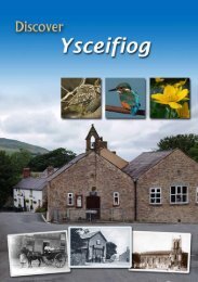
flintshire leisure tour taith hamd
flintshire leisure tour taith hamd
flintshire leisure tour taith hamd

Create successful ePaper yourself
Turn your PDF publications into a flip-book with our unique Google optimized e-Paper software.
<strong>flintshire</strong> <strong>leisure</strong> <strong>tour</strong><br />
a drive to explore
2<br />
credits<br />
Lighthouse at Point of Ayr<br />
Copywriting, design and production: White Fox 01352 840898 www.whitefox-design.co.uk<br />
Photography: © Crown copyright (2010) Visit Wales, Countryside Council for Wales, White Fox, Nick Critchley,<br />
Carolyn Thomas, Orange Imaging, Colin Varndell, Talacre Beach Caravan Sales Limited, NEWWildlife, Norman<br />
Closs-Parry, Tony Trasmundi.<br />
Jessie the Campervan: www.split-the-difference.co.uk<br />
Published November 2010 by Flintshire County Council and Cadwyn Clwyd in association with Flintshire Tourism Association. While every effort has<br />
been made to ensure accuracy, the publishers can accept no liability whatsoever for any errors, inaccuracies or omission or for any matter in any way<br />
connected with or arising out of the publication of the information. Copyright for material is held by the publishers and may not be reproduced in part<br />
or in whole in any form without written consent.
3<br />
contents<br />
A drive to explore 5<br />
How it works 6<br />
Profile: Mold 8<br />
Section 1: Mold to Holywell 10<br />
Profile: Holywell 12<br />
Section 2: Holywell to Llanasa 14<br />
Section 3: Llanasa to Caerwys 16<br />
Profile: Caerwys 18<br />
Section 4: Caerwys to Cilcain 20<br />
Section 5: Cilcain to Nercwys 22<br />
Section 6: Nercwys to Caergwrle 24<br />
Section 7: Caergwrle to Hawarden 26<br />
Section 8: Hawarden to Flint 28<br />
Profile: Flint 30<br />
Section 9: Flint to Mold 32<br />
Directory 34
<strong>flintshire</strong><br />
4<br />
Holyhead<br />
Llandudno<br />
Prestatyn<br />
A55<br />
Caernarfon<br />
A487<br />
Porthmadog<br />
Aberystwyth<br />
Bangor<br />
Dolgellau<br />
Machynlleth<br />
Irish Sea<br />
A5<br />
A470<br />
A487<br />
A470<br />
A55<br />
Betwsy-coed<br />
Bala<br />
Holywell<br />
WALES<br />
Liverpool<br />
Chester<br />
Mold<br />
Crewe<br />
Newtown<br />
Contains Ordnance Survey data © Crown copyright and database right 2010<br />
Produced by www.themappingcompany.co.uk<br />
A494<br />
A470<br />
A5<br />
A55<br />
A483<br />
Welshpool<br />
Ellesmere Port<br />
Shrewsbury<br />
Telford<br />
Wolverhampton<br />
Manchester<br />
Wrexham<br />
ENGLAND<br />
N A5<br />
A49<br />
M58<br />
M53M57<br />
M6<br />
M56<br />
M63<br />
A458<br />
M60<br />
M54<br />
M6<br />
Stafford<br />
Birmingham<br />
M5<br />
M6<br />
M42<br />
www.discover<strong>flintshire</strong>.co.uk/<strong>tour</strong>
5<br />
a drive to explore<br />
Come and join us. It won’t take you long.<br />
Flintshire is a beautiful Welsh border<br />
county that’s very handily placed for a day<br />
out or short break.<br />
And since you’ll be here double quick,<br />
you’ll have plenty of time to explore. We<br />
have rather a beguiling mix of countryside,<br />
coastline, market towns and historic<br />
attractions.<br />
So many things, in fact, that you won’t<br />
know where to start. Which is where the<br />
Flintshire Leisure Tour comes in.<br />
You’ll need a vehicle. One that you’ll probably<br />
find yourself stopping and parking on a<br />
fairly regular basis - because there’s a lot<br />
to see along the way.<br />
That’s why we’ve broken the 83-mile <strong>tour</strong><br />
into nine manageable sections. You may<br />
find you can only tackle one or two<br />
sections in a day. And that’s if you stick to<br />
the route.<br />
Once you’ve made the odd de<strong>tour</strong>, done<br />
some shopping, had a good pub lunch,<br />
wandered around a castle or walked up a<br />
hillfort, you may not have made as much<br />
progress as you expected.<br />
Shame. You’ll just have to book a bed – or<br />
a pitch - for the night and start again in<br />
the morning. Unless you already live here,<br />
of course. The Flintshire Leisure Tour can<br />
be a voyage of discovery for residents, too.<br />
For more information or to book a bed call 01352 759331<br />
or email <strong>tour</strong>@discover<strong>flintshire</strong>.co.uk
how it works<br />
6<br />
M53<br />
Llanasa<br />
River<br />
Mersey<br />
A548<br />
River Dee<br />
A5151<br />
Caerwys<br />
A55<br />
A5026<br />
Holywell<br />
A55<br />
A5119<br />
Flint<br />
A548<br />
ENGLAND<br />
N M56<br />
a i n R a n g e<br />
C w l d<br />
y<br />
A541<br />
Cilcain<br />
A541<br />
A494<br />
A525<br />
A494<br />
A5118<br />
A55<br />
A550<br />
A550<br />
Hawarden<br />
Mold<br />
A5104<br />
Nercwys<br />
NORTH<br />
A494<br />
WALES<br />
A5104<br />
A541<br />
Caergwrle<br />
A483<br />
0<br />
0<br />
1 mile<br />
2 km<br />
Contains Ordnance Survey data © Crown copyright and database right 2010<br />
Produced by www.themappingcompany.co.uk<br />
www.discover<strong>flintshire</strong>.co.uk/<strong>tour</strong>
7<br />
We recommend you start in Mold, next to this sign. But if<br />
you do decide to start elsewhere, it’s safer and simpler to<br />
drive the route anticlockwise. The same direction as the<br />
arrows on the map opposite.<br />
Look out for road signs like this – some people call it<br />
“following the dragon”. There are 104 of them in total and<br />
each has its own number. We refer to some of these<br />
numbers in the text to help you find places of interest or<br />
work out where to make a de<strong>tour</strong>.<br />
l<br />
tymwyn<br />
B512<br />
Greenfield<br />
Valley 12<br />
Holywell<br />
Greenfield<br />
Valley<br />
026<br />
Pentre<br />
Halkyn<br />
Halkyn<br />
Mountain<br />
Rhosesmor<br />
Holywell<br />
Pentre<br />
Halkyn<br />
Halkyn<br />
Mountain<br />
This booklet also contains maps to help you find your way.<br />
There’s one for each of the nine sections of the <strong>tour</strong>. Plus a<br />
street plan of all four towns en route. Where you see a blue<br />
circle with a number in it, that refers to a particular road<br />
sign on Bagillt the <strong>tour</strong>.<br />
Halkyn<br />
Gwernaffield<br />
Flint Mountain<br />
Halkyn<br />
Bagillt<br />
Contains Ordnance Survey data<br />
© Crown copyright and database right 2010<br />
Produced by www.themappingcompany.co.uk<br />
And where you see a red dotted line, that shows the route<br />
of the Flintshire Leisure<br />
Flint<br />
Tour. There. Couldn’t be simpler. All<br />
we ask is that you drive carefully along our sometimes<br />
narrow country roads and through our lovely villages. After<br />
all, you wouldn’t want to miss anything.<br />
The only way to see it all is to get out of your vehicle –<br />
and into your walking boots. Look out for this photograph.<br />
It shows where the <strong>tour</strong> connects with one of 25 Flintshire<br />
Northop<br />
Rural Walks.<br />
Rhydymwyn<br />
For more information or to book Soughton a bed call 01352 759331<br />
or email <strong>tour</strong>@discover<strong>flintshire</strong>.co.uk<br />
Buckley<br />
Flint<br />
Flint M
profile | mold<br />
8<br />
0<br />
0<br />
NORTH<br />
GWERNAFFIELD ROAD<br />
0.25 mile<br />
0.5 km<br />
DENBIGH ROAD<br />
Denbigh<br />
DREFLAN<br />
CLAYTON ROAD<br />
Bailey<br />
Hill<br />
PWLL G LAS<br />
A541 HALL VIEW<br />
B5444<br />
Museum<br />
& Library<br />
HIGH<br />
EARL RD<br />
LOVE<br />
STREET<br />
LANE<br />
KING ST<br />
Clwyd<br />
Theatr<br />
Cymru<br />
B5444<br />
LEAD<br />
MILLS<br />
RAIKES LA<br />
KING STREET<br />
104<br />
CHESTER STREET<br />
A5119<br />
River Alyn<br />
Flint<br />
Queensferry<br />
A494<br />
HENDY ROAD<br />
Town<br />
Park<br />
NEW STREET<br />
WREXHAM STREET<br />
M O L D<br />
CHESTER ROAD<br />
WOODLANDS ROA D<br />
Chester<br />
UPPER BRYN COCH<br />
UPPER BRYN COCH<br />
BRYN COC H LANE<br />
BROMFIELD L A<br />
QUEEN’S LANE<br />
A541<br />
A549<br />
A541<br />
A5119<br />
RUTHIN ROAD<br />
WREXHAM ROAD<br />
A494<br />
B5444<br />
A494<br />
MOLD BYPASS<br />
Contains Ordnance Survey data © Crown copyright and database right 2010<br />
Produced by www.themappingcompany.co.uk<br />
A494<br />
Wrexham
9<br />
Main pic: shopping in Mold. Facing pics (left to right): Bailey Hill, Mold market, Mold Gold Cape, St. Mary’s Church.<br />
The people of Mold believe slowness is a<br />
virtue. You may think they move pretty quickly<br />
when they’re hunting down a bargain every<br />
Wednesday and Saturday in the open-air<br />
market.<br />
But Mold wants to be a Slow Town. As part<br />
of the international Cittaslow movement, it<br />
refuses to join the global rat race that’s making<br />
every town centre feel the same.<br />
Instead it celebrates what’s local and unique.<br />
The food and drink, for example, which is so<br />
good there’s a whole festival devoted to it<br />
every September.<br />
Or the history – 4,000 years of it. That’s how<br />
long ago the fabulous Mold Gold Cape was<br />
laboriously beaten from a single ingot<br />
weighing half a kilo.<br />
The British Musuem has the original. But you<br />
can see a replica of one of the world’s great<br />
Bronze Age treasures in the museum in Earl<br />
Road.<br />
And you can stroll a town trail which includes,<br />
at the top of the High Street, the remains of a<br />
Norman motte and bailey castle. From the<br />
turbulent days when life in Mold was just a little<br />
faster than it is now.<br />
www.visitmold.com
section 1 | mold to holywell<br />
distance | 11 miles<br />
10<br />
Start: on A541 Denbigh Road,<br />
Mold, next to the Love Lane car<br />
park. See street plan page 8.<br />
Sat nav: N53.17084°, W3.14102°.<br />
Before you leave: have lunch<br />
or do a bit of shopping. Mold<br />
has a fine range of shops,<br />
restaurants and cafés. Or visit<br />
the world-leading Arthurian<br />
Collection of books at the County<br />
Hall complex (ring 01352 704400<br />
for an appointment). It has more<br />
than 2,000 items about King<br />
Arthur and Avalon - which some<br />
think was on Halkyn Mountain.<br />
En route: romantic wild<br />
uplands, shaped by centuries of<br />
industry, with stunning views<br />
over the Dee Estuary.<br />
look out for:<br />
The sheep on Halkyn common.<br />
They’ve been roaming freely there<br />
since medieval times.<br />
1<br />
2<br />
3<br />
Daniel Owen is Wales’s<br />
Charles Dickens and Mold’s<br />
most famous son. His statue<br />
stands outside the library<br />
and museum. Pop inside to<br />
find out more about him -<br />
or borrow one of his books.<br />
See street plan on page 8.<br />
If you can find the Valley<br />
Works in Rhydymwyn<br />
(de<strong>tour</strong> at Tour Sign 1)<br />
you’ll be doing better than<br />
enemy aircraft in World<br />
War Two. This chemical<br />
weapons factory, now a<br />
nature reserve, stayed<br />
top-secret throughout the<br />
war. Call 01352 741591 to<br />
book a visit.<br />
The Iron Age hillfort of<br />
Moel y Gaer commands<br />
spectacular views over the<br />
Dee Estuary. So we built a<br />
fire beacon there more<br />
than 2,000 years later just<br />
in case Napoleon decided<br />
to invade.<br />
www.discover<strong>flintshire</strong>.co.uk/<strong>tour</strong>
11<br />
Babell<br />
A5026<br />
Carmel<br />
A55<br />
Brynford<br />
6<br />
Greenfield<br />
12 Valley<br />
B5121<br />
A5026<br />
A5026<br />
Holywell<br />
River Dee<br />
Bagillt<br />
A548<br />
Flint<br />
NORTH<br />
0<br />
1 km<br />
0<br />
0.5 mile<br />
Contains Ordnance Survey data<br />
© Crown copyright and database right 2010<br />
Produced by www.themappingcompany.co.uk<br />
A541<br />
B5121<br />
Lixwm<br />
Nannerch<br />
A541<br />
Pentre<br />
Halkyn<br />
Halkyn<br />
Mountain<br />
4 5<br />
3<br />
Rhosesmor<br />
B5123<br />
Halkyn<br />
A5119<br />
Northop<br />
A548<br />
Flint Mountain<br />
B5125<br />
B5126<br />
B5129<br />
C l w y d i a n R a n g e<br />
Loggerheads Cadole<br />
Country Park<br />
The wild, open landscape of Halkyn<br />
Mountain Common has reverted to nature<br />
after the lead mining and quarrying booms<br />
of the 18th and 19th centuries. You can still<br />
see relics like shaft craters and horse-whim<br />
circles. But you’re just as likely to notice the<br />
wildflowers and circling buzzards.<br />
www.ccw.gov.uk<br />
4<br />
Cilcain<br />
Pantymwyn<br />
2<br />
Rhydymwyn<br />
1<br />
5<br />
A541<br />
Gwernaffield<br />
Mold<br />
A5119<br />
Gwernymynydd<br />
Soughton<br />
A494<br />
Flintshire Rural Walk 16<br />
takes you all over Halkyn<br />
Mountain. Download it at<br />
www.discover<strong>flintshire</strong>.co.uk/walks<br />
or call 01352 759331 for<br />
a copy.<br />
1<br />
6<br />
A494<br />
Buckley<br />
A549<br />
A55<br />
B5127<br />
Time for a sarnie.<br />
This sculpture in<br />
Brynford is a tribute<br />
to local quarrymen.<br />
And the importance<br />
of break times in<br />
their dusty, noisy day.
HALKYN ROAD<br />
profile | holywell<br />
12<br />
NORTH<br />
0<br />
0<br />
0.5 mile<br />
1 km<br />
GREENFIELD ROAD B5121<br />
A548 BAGILLT ROAD<br />
Greenfield Valley<br />
Heritage<br />
Park<br />
GREENFIELD STREET<br />
HOLYWELL<br />
A548<br />
A5026<br />
Bagillt<br />
WHIT F ORD ST<br />
12<br />
NEW RD<br />
B5121<br />
WELL ST<br />
St Winefride’s<br />
Chapel & Well<br />
PEN-Y-MAES ROAD<br />
A5026<br />
HIGH ST<br />
A5026<br />
VICTORIA ROAD<br />
A5026 FRON PARK ROAD<br />
BRY NFORD ST<br />
COLESHILL STREET<br />
HALKYN STREET<br />
B5432<br />
B5121 BRYNFORD RD<br />
A55<br />
Contains Ordnance Survey data © Crown copyright and database right 2010<br />
Produced by www.themappingcompany.co.uk
13<br />
Main pic: St Winefride’s Well. Facing pics (left to right): inside St Winefride’s Well, shopping, historic buildings, High Street.<br />
Never mind one of the Seven Wonders of Wales.<br />
St Winefride’s Well, which gives Holywell its<br />
name, is quite simply unique in the world.<br />
This reputedly healing spring has been a place<br />
of unbroken pilgrimage for 1,300 years. It was<br />
long-famous by the time King Henry V walked<br />
here from Shrewsbury to give thanks for his<br />
victory at Agincourt.<br />
According to legend Winefride was beheaded<br />
in 660AD by a local chieftain after she spurned<br />
his advances – and a spring rose from the spot<br />
where her head fell.<br />
All a bit gruesome but don’t despair. She was<br />
restored to life thanks to the prayers of her<br />
uncle St Beuno and lived another 22 years as<br />
a nun.<br />
This being the “Lourdes of Wales”, you can<br />
bathe in the pool beside the beautiful chapel<br />
built by Margaret Beaufort, mother of<br />
Henry VII.<br />
And if you haven’t brought your swimsuit you<br />
can still follow an audio trail through the<br />
grounds or visit a museum containing many<br />
rare relics. People of all faiths, and no faith, are<br />
welcome.<br />
www.holywell-town.co.uk
section 2 | holywell to llanasa<br />
distance | 11.5 miles<br />
14<br />
Start: next to St Winefride’s<br />
Well on the B5121 in Holywell.<br />
See street plan page 12.<br />
Before you leave: count the<br />
listed Georgian and Victorian<br />
buildings in Holywell town centre.<br />
There are more than 60 of them.<br />
With nearly 100 mostly familyrun<br />
shops. And a market every<br />
Thursday in the High Street.<br />
En route: countryside<br />
immortalised by Wales’s most<br />
famous naturalist and the tallest<br />
stone wheel cross in Britain,<br />
carved a millennium ago.<br />
look out for:<br />
The Keeper at Point of Ayr lighthouse.<br />
A stainless steel replica<br />
of a ghost who haunts<br />
the spot.<br />
1<br />
2<br />
3<br />
Within 70-acre Greenfield<br />
Valley Heritage Park is a<br />
very special farm museum.<br />
Not only does it contain<br />
real live animals. Its combine<br />
harvester is among the 10<br />
most important in Britain.<br />
And that’s official.<br />
www.greenfieldvalley.com<br />
Basingwerk Abbey was<br />
founded in 1132 by<br />
Cistercian monks. Now<br />
it’s a romantic ruin that<br />
you can see for free<br />
every day.<br />
www.cadw.wales.gov.uk<br />
A de<strong>tour</strong> at Tour Sign 28<br />
brings you to Gronant<br />
and Talacre Dunes Site of<br />
Special Scientific<br />
Interest. Where you<br />
might see rare natterjack<br />
toads and Wales’s only<br />
breeding colony of little<br />
terns. Or you could just<br />
build a sandcastle and<br />
work on your tan.<br />
www.discover<strong>flintshire</strong>.co.uk/<strong>tour</strong>
Prestatyn<br />
Rhuallt<br />
A548<br />
Gronant<br />
Llanasa<br />
Gwaenysgor<br />
Gop<br />
Hill<br />
Trelawnyd<br />
Llyn<br />
Helyg<br />
31<br />
A5151<br />
3<br />
Point of Ayr<br />
Talacre<br />
Gwespyr<br />
6<br />
Glan-yr-Afon<br />
Trelogan<br />
Berthengam<br />
5<br />
Maen<br />
Achwyfan<br />
4<br />
A55<br />
A5151<br />
Ffynnongroyw<br />
Mostyn<br />
A548<br />
Whitford<br />
Maes Pennant<br />
A5026<br />
Carmel<br />
0<br />
0<br />
Greenfield<br />
12<br />
Valley<br />
B5121<br />
NORTH<br />
River Dee<br />
1<br />
2<br />
0.5 mile<br />
A5026<br />
Holywell<br />
15<br />
1 km<br />
B5122<br />
Brynford<br />
Caerwys<br />
Babell<br />
A5026<br />
Contains Ordnance Survey data<br />
© Crown copyright and database right 2010<br />
Produced by www.themappingcompany.co.uk<br />
A541<br />
Afonwen<br />
B5121<br />
Lixwm<br />
Pentre<br />
Halkyn<br />
B5123<br />
A55<br />
4<br />
Naturalist and traveller Thomas<br />
Pennant, born in Whitford, was<br />
famous enough to be painted by<br />
Gainsborough. Now you can<br />
retrace five of his local walks -<br />
the fourth features the ancient<br />
lead-smelting house of Gadlys.<br />
www.thethomaspennantsociety.com<br />
5<br />
It’s 12 feet tall and 1,000 years<br />
old. It’s one of Britain’s finest<br />
sculptured stone crosses.<br />
And Maen Achwyfan is just<br />
standing there in a field near<br />
Tour Sign 21.<br />
6<br />
Flintshire Rural Walks 2 and 3 start<br />
in Ffynnongroyw and take you<br />
through the ancient woodland of<br />
Coed y Garth. Download them at<br />
www.discover<strong>flintshire</strong>.co.uk/walks<br />
or call 01352 759331 for a copy.
section 3 | llanasa to caerwys<br />
distance | 10 miles<br />
16<br />
Start: in the centre of Llanasa<br />
village with the church on the<br />
left, opposite Tour Sign 31.<br />
Before you leave: soak up<br />
the atmosphere. Llanasa is a<br />
perfect example of a small<br />
Welsh community virtually<br />
untouched by time. It has a<br />
fine 17th century gabled house<br />
called Henblas, an 18th century<br />
inn, tithe barn cottages and a<br />
Victorian former school. And<br />
the old village pump still stands<br />
beside the pond.<br />
En route: Gop Hill, site of<br />
Queen Boudica’s last battle.<br />
Allegedly.<br />
look out for:<br />
The flowers. Llanasa is<br />
famous for its gardens and<br />
opens them every year as part of<br />
the National Gardens Scheme.<br />
1<br />
2<br />
3<br />
Llanasa parish church<br />
contains two spectacular<br />
stained glass windows<br />
from Basingwerk Abbey.<br />
Not to mention the final<br />
resting place of Gruffydd<br />
Fychan, father of Welsh<br />
hero and freedom fighter<br />
Owain Glyndwr. Mind<br />
your feet. His sepulchral<br />
slab is set into the floor<br />
near the organ.<br />
Lepers weren’t entirely<br />
welcome at Gwaenysgor<br />
church in the 14th<br />
century. But they did<br />
have their own tiny<br />
window through which<br />
they could listen to the<br />
service and receive the<br />
sacrament. Take a de<strong>tour</strong><br />
at Tour Sign 32 to see it.<br />
Gwaenysgor is 650 feet<br />
above sea level. Which is<br />
why the vista that opens<br />
up from the viewpoint<br />
just outside the village is<br />
quite so spectacular. It<br />
includes a glimpse of<br />
North Hoyle, Britain’s first<br />
offshore wind farm.<br />
www.discover<strong>flintshire</strong>.co.uk/<strong>tour</strong>
17<br />
Prestatyn<br />
3<br />
2<br />
Gwaenysgor<br />
Gop<br />
Hill<br />
4<br />
5<br />
Trelawnyd<br />
Llanasa<br />
A5151<br />
1 31<br />
A548<br />
Glan-yr-Afon<br />
Trelogan<br />
Berthengam<br />
Ffynnongroyw<br />
Mostyn<br />
Maes Pennant<br />
River<br />
Dee<br />
Llyn<br />
Helyg<br />
Maen<br />
Achwyfan<br />
A5151<br />
Whitford<br />
A5026<br />
A548<br />
Carmel<br />
B5121<br />
Rhuallt<br />
A55<br />
Holywell<br />
B5122<br />
Brynford<br />
A55<br />
NORTH<br />
0<br />
1 km<br />
0<br />
0.5 mile<br />
Caerwys<br />
Contains Ordnance Survey data © Crown copyright and database right 2010<br />
Produced by www.themappingcompany.co.uk<br />
40<br />
A541<br />
Babell<br />
Afonwen<br />
B5121<br />
Lixwm<br />
4<br />
On top of Gop Hill is a<br />
mysterious stone cairn.<br />
It may have been a<br />
monument to the dead.<br />
Or just somewhere to gaze<br />
at the stars. What we know<br />
for sure is that it’s the<br />
second-largest prehistoric<br />
mound in Britain. And the<br />
views, if not the walk up<br />
to it, will take your<br />
breath away.<br />
www.cpat.org.uk<br />
5<br />
Flintshire Rural Walk 25 takes<br />
you from Trelawnyd village,<br />
past Gop Hill and along Offa’s<br />
Dyke Path. Download it at<br />
www.discover<strong>flintshire</strong>.co.uk/walks<br />
or call 01352 759331 for a copy.
profile | caerwys<br />
18<br />
NORTH<br />
B5122<br />
A55,<br />
Holywell & Rhyl<br />
0<br />
0<br />
250 metres<br />
250 yards<br />
CAE<br />
NORTH STREET<br />
RWYS<br />
DROVERS LANE<br />
HOLYWELL ROAD<br />
HIGH STREET<br />
WATER STREET<br />
SOUTH STREET<br />
PENYCEFN ROAD<br />
St Michael’s<br />
Church<br />
CHAPEL STREET<br />
40<br />
B5122<br />
Coed<br />
Nant-plas-Isaf<br />
Contains Ordnance Survey data © Crown copyright and database right 2010<br />
Produced by www.themappingcompany.co.uk<br />
A541<br />
Denbigh & Mold
19<br />
Main pic: Water Street. Facing pics (left to right): shopping, St Michael’s Church, Chapel Street.<br />
Caerwys may be small but it’s perfectly formed.<br />
So small indeed that the Guinness Book of<br />
Records thought it the tiniest town in Great<br />
Britain.<br />
And so perfectly formed, with its straight roads<br />
crossing each other at right angles, that it<br />
provided the model for Philadelphia in<br />
Pennsylvania, USA.<br />
(Sir William Penn, founder of Philadelphia, was<br />
accompanied to America by Caerwys surgeon<br />
Thomas Wynne, who must have bent his ear<br />
about its attractions.)<br />
We can thank King Edward I for the fact that<br />
Caerwys is a town at all. He granted it his Royal<br />
Charter in 1290. Seven hundred years later<br />
Princess Margaret attended the town’s anniversary<br />
celebrations on behalf of the Queen.<br />
Other monarchs with a soft spot for Caerwys<br />
include both Henry VIII and his daughter<br />
Elizabeth I. Henry declared it a place for<br />
“craftsmen of poetry and music” and Elizabeth<br />
proclaimed it “home of the Eisteddfod”.<br />
By doing so she enabled local arty types to<br />
avoid being lumped together with tramps,<br />
footpads, beggars and buskers. And she made<br />
Caerwys the natural headquarters of the<br />
Welsh bards.<br />
www.caerwys-town.com
section 4 | caerwys to cilcain<br />
distance | 7 miles<br />
20<br />
Start: at the top of South<br />
Street B5122 in Caerwys at<br />
Tour Sign 40. See street plan<br />
page 18.<br />
Before you leave: have a pub<br />
meal, buy some freshly baked<br />
bread or get yourself a haircut.<br />
Caerwys promotes itself under<br />
the banner “convenient,<br />
character, community”. Which<br />
means you can expect a warm<br />
welcome and a little something<br />
for your journey into the<br />
bargain.<br />
En route: a village made of<br />
limestone leading to one of the<br />
biggest Iron Age hillforts in<br />
Wales at Penycloddiau.<br />
look out for:<br />
The rare hazel dormice at<br />
Y Ddôl Uchaf nature reserve<br />
at Ddôl. Or more likely one or two<br />
of their nibbled nuts.<br />
Flintshire Rural Walk 1<br />
joins Caerwys with the fishing<br />
lakes of Ysceifiog, created<br />
by the Earl of Denbigh in<br />
1904. Download it at<br />
www.discover<strong>flintshire</strong>.co.uk/walks<br />
or call 01352 759331 for<br />
a copy.<br />
3<br />
2<br />
1<br />
Not content with<br />
having two naves, St<br />
Michael’s Church in<br />
Caerwys has a pair<br />
of lychgates, too.<br />
The south-western<br />
one still has an<br />
original pre-<br />
Reformation tie<br />
beam.<br />
Nannerch sits on a<br />
bedrock of carboniferous<br />
limestone in the wooded<br />
valley of the River<br />
Wheeler. Which may<br />
explain why lots of its<br />
buildings are made of<br />
limestone. And why it<br />
blends so perfectly with<br />
its surroundings. De<strong>tour</strong><br />
right two miles after Tour<br />
Sign 41.<br />
www.discover<strong>flintshire</strong>.co.uk/<strong>tour</strong>
21<br />
2<br />
B5122<br />
40<br />
Caerwys<br />
1<br />
Afonwen<br />
Ddôl<br />
Babell<br />
A541<br />
3<br />
Nannerch<br />
B5121<br />
Lixwm<br />
A5026<br />
Pentre<br />
Halkyn<br />
Halkyn<br />
Mountain<br />
B5123<br />
A55<br />
Halkyn<br />
4<br />
Penycloddiau<br />
C l w<br />
A541<br />
Rhosesmor<br />
y d i<br />
a n<br />
Moel<br />
Arthur<br />
R a n<br />
NORTH<br />
0<br />
1 km<br />
0<br />
0.5 mile<br />
Contains Ordnance Survey data<br />
© Crown copyright and database right 2010<br />
Produced by www.themappingcompany.co.uk<br />
g e<br />
5<br />
Cilcain<br />
45<br />
Loggerheads<br />
Country Park<br />
Rhydymwyn<br />
A541<br />
Pantymwyn<br />
Gwernaffield<br />
4<br />
5<br />
The Iron Age hillfort of Penycloddiau is a<br />
mystical place. So it might not feel quite right<br />
to fish out your mobile phone. But dial into<br />
the audio trail there and you can hear voices<br />
from the distant past. You may even be<br />
inspired to climb Moel Arthur, the hillfort next<br />
door, as well. www.heatherandhillforts.co.uk<br />
If you plan to stop in Cilcain, where parking is<br />
tight, make a de<strong>tour</strong> to the viewpoint after<br />
Tour Sign 44. Ahead of you is Moel Famau -<br />
highest point of the Clwydian Range. If that’s<br />
too daunting, just saunter down to the village.
section 5 | cilcain to nercwys<br />
distance | 9 miles<br />
22<br />
Start: at the crossroads in the<br />
centre of Cilcain next to Tour<br />
Sign 45.<br />
Before you leave: wander<br />
through the churchyard at<br />
Cilcain. You’ll be quite safe –<br />
it’s circular so that no demons<br />
could hide in the corners. Then<br />
go inside the church to see one<br />
of the finest carved oak<br />
hammer beam roofs in Wales.<br />
The door’s open until sunset.<br />
En route: a ruined shepherd’s<br />
cottage and a mountain that<br />
cost nearly half a million<br />
pounds to save.<br />
look out for:<br />
The badgers in Cilcain’s Millennium<br />
Woods. Don’t worry, you won’t startle<br />
them. They’re carved from wood.<br />
2<br />
Flintshire Rural Walk 19 goes<br />
to Cilcain, Walk 20 to Moel<br />
Famau and Walk 21 to Moel<br />
Findeg. And they all start<br />
from Loggerheads Country<br />
Park (de<strong>tour</strong> right at Tour Sign<br />
49). Download them at<br />
www.discover<strong>flintshire</strong>.co.uk/walks<br />
or call 01352 759331 for<br />
a copy.<br />
1<br />
Could you run four very<br />
hilly miles in under half<br />
an hour? You might win<br />
the Moel Famau<br />
Mountain Race. It takes<br />
place every August Bank<br />
Holiday as part of the<br />
Cilcain Show, which<br />
attracts a crowd of<br />
thousands.<br />
www.cilcainshow.org.uk<br />
The clue’s in the name.<br />
Abseiling 120 feet down the<br />
Devil’s Gorge can be a<br />
fearsome prospect. You could<br />
always just watch from the<br />
footbridge – then take a stroll<br />
along the Leete Path and have<br />
a nice cup of tea at<br />
Loggerheads Country Park.<br />
www.clwydianrangeaonb.org.uk<br />
3<br />
www.discover<strong>flintshire</strong>.co.uk/<strong>tour</strong>
23<br />
1 Cilcain<br />
A541<br />
A5119<br />
45<br />
Millennium<br />
Woods<br />
2<br />
Pantymwyn<br />
Gwernaffield<br />
Mold<br />
A494<br />
Loggerheads<br />
Country Park<br />
3<br />
A494<br />
Cadole<br />
A5119<br />
Gwernymynydd<br />
A494<br />
B5444<br />
NORTH<br />
Maeshafn<br />
Moel<br />
Findeg<br />
4<br />
54<br />
Nercwys<br />
0<br />
0.5 km<br />
0<br />
0.25 mile<br />
Contains Ordnance Survey data © Crown copyright and database right 2010<br />
Produced by www.themappingcompany.co.uk<br />
Nercwys<br />
Forest<br />
5<br />
4<br />
5<br />
Everybody loves mountains. And the people<br />
of Maeshafn loved Moel Findeg enough to<br />
help raise £465,000 to buy it and save it from<br />
quarrying. Now it’s a Local Nature Reserve.<br />
www.moelfindeg.co.uk<br />
De<strong>tour</strong> right after Tour Sign 53 to Nercwys<br />
Forest and the evocative ruins of a shepherd’s<br />
cottage hidden among the trees. The shepherd’s<br />
long gone. But he would have appreciated<br />
the new hay meadow and restored dry<br />
stone walls.
section 6 | nercwys to caergwrle<br />
distance | 10 miles<br />
24<br />
Start: next to Tour Sign 54 on<br />
the northern outskirts of<br />
Nercwys village.<br />
Before you leave: walk<br />
through Nercwys Forest to see<br />
the pavement at Bryn Alyn.<br />
That’s more exciting than it<br />
sounds when the pavement is<br />
very rare, made of deeply<br />
weathered limestone and the<br />
second-largest in Wales. So<br />
exciting, in fact, that it’s a Site<br />
of Special Scientific Interest.<br />
En route: a village where the<br />
Romans liked to take a hot<br />
bath after a hard day’s lead<br />
mining. A hypocaust was<br />
discovered at Ffrith in 1870.<br />
1<br />
In Victorian times,<br />
450 men were<br />
employed to mine<br />
coal and iron at<br />
Treuddyn (de<strong>tour</strong> left<br />
at Tour Sign 56). You’ll<br />
find reminders of this<br />
rich industrial heritage<br />
as you stroll nearby<br />
Coed Talon Bridleway,<br />
a former railway running<br />
through a 50-acre<br />
nature reserve.<br />
www.treuddyn.org.uk<br />
In the churchyard of St<br />
Mary’s at Nercwys you’ll find<br />
the great Nerquis Hall vault,<br />
which encases the remains of<br />
local bigwigs in a sarcophagus<br />
of white marble. Look out for<br />
the “elaborate heraldic<br />
cartouches”, or carved scrolls<br />
to you and me. There’s a<br />
1768 sundial, too, in case<br />
you’ve forgotten your watch.<br />
2<br />
look out for:<br />
The road signs in Nercwys.<br />
A reminder of the day in 1956<br />
when the village decided to stop<br />
calling itself Nerquis and revert to<br />
the original Welsh name.<br />
Flintshire Rural Walk 6 starts<br />
in Llanfynydd and takes in the<br />
remains of the pleasure grounds<br />
of now-demolished Nant y<br />
Ffrith Hall. Download it at<br />
www.discover<strong>flintshire</strong>.co.uk/walks<br />
or call 01352 759331<br />
for a copy.<br />
3<br />
www.discover<strong>flintshire</strong>.co.uk/<strong>tour</strong>
A494<br />
A5118<br />
25<br />
B5444<br />
54<br />
Nercwys<br />
A541<br />
A5104<br />
Penyffordd<br />
1<br />
Pontblyddyn<br />
Leeswood<br />
A550<br />
Coed Talon<br />
A541<br />
Treuddyn<br />
A5104<br />
Offa’s Dyke<br />
2<br />
Llanfynydd<br />
3<br />
B5101<br />
4<br />
Ffrith 5<br />
Waun y Llyn<br />
Country Park<br />
Caergwrle<br />
Hope<br />
Mountain<br />
Cefn-y-bedd<br />
B5102<br />
NORTH<br />
Hope<br />
66<br />
B5430<br />
Contains Ordnance Survey data © Crown copyright and database right 2010<br />
Produced by www.themappingcompany.co.uk<br />
B5102<br />
0<br />
0<br />
0.5 mile<br />
1 km<br />
4<br />
5<br />
Settled by the Romans, crossed by Offa’s Dyke<br />
and a centre for 19th century lead mining,<br />
Ffrith is packed with archaeological treasures.<br />
Channel 4’s Time Team has joined forces with<br />
the Clwyd-Powys Archaeological Trust to<br />
create an interactive map of the village.<br />
www.cpat.org.uk<br />
The rare packhorse bridge in Cymau Road<br />
dates from at least the mid-18th century and<br />
may even be medieval. At any rate it’s a<br />
Scheduled Ancient Monument. And it’s<br />
skewed. Which means it crosses the River<br />
Cegidog at an angle.
section 7 | caergwrle to hawarden<br />
distance | 8 miles<br />
26<br />
Start: opposite Caergwrle<br />
railway station, shortly after<br />
Tour Sign 66.<br />
Before you leave: walk across<br />
the 17th century packhorse<br />
bridge in Fellows Lane,<br />
Caergwrle. It was built with low<br />
walls to allow for the horses’<br />
bulging side packs. And don’t<br />
worry if you see a horse<br />
coming. You can wait in one of<br />
the special V-shaped bays for<br />
it to pass.<br />
En route: the oldest church in<br />
Flintshire and a village with<br />
curiously divided loyalties.<br />
Within living memory,<br />
Caergwrle was a<br />
thriving spa town.<br />
In its heyday the now<br />
defunct spa at<br />
Rhyddyn Hall produced<br />
14,000 bottles of saline<br />
fizz every day. Very<br />
good for “purging”,<br />
apparently.<br />
1<br />
2<br />
Caergwrle Castle was<br />
begun in 1277 by<br />
Dafydd ap Gruffudd<br />
and used as a base<br />
for his war against<br />
Edward I. For his<br />
trouble he became<br />
the first nobleman to<br />
be hanged, drawn<br />
and quartered in<br />
England.<br />
look out for:<br />
Fly agaric, a toadstool which<br />
grows in the acidic soil around<br />
Caergwrle Castle. Don’t touch it,<br />
though. It’s poisonous and<br />
hallucinogenic.<br />
Flintshire Rural Walk 14<br />
between Caergwrle and<br />
Hope includes part of Wat’s<br />
Dyke Way, a 61-mile linear<br />
trail from Shropshire to<br />
Holywell. Download it at<br />
www.discover<strong>flintshire</strong>.co.uk/walks<br />
or call 01352 759331 for<br />
a copy.<br />
3<br />
www.discover<strong>flintshire</strong>.co.uk/<strong>tour</strong>
A494<br />
Hawarden<br />
79<br />
27<br />
A55<br />
B5127<br />
A550<br />
B5125<br />
Saltney Ferry<br />
Buckley<br />
A5104<br />
A549<br />
Broughton<br />
A541<br />
A5104<br />
A5118<br />
Pontblyddyn<br />
Penyffordd<br />
6<br />
A55<br />
Lower<br />
Kinnerton<br />
Higher<br />
Kinnerton<br />
A550<br />
4<br />
Leeswood<br />
A5104<br />
A541<br />
Coed Talon<br />
4<br />
Waun y Llyn<br />
Country Park<br />
3<br />
Caergwrle<br />
Hope 1<br />
Mountain<br />
Offa’s<br />
Dyke Dyke<br />
Hope Mountain may be 1,080<br />
feet tall. But you can drive<br />
most of the way up and park at<br />
Waun y Llyn Country Park. A<br />
five-minute stroll and you can<br />
see as far as the mountains of<br />
Snowdonia. De<strong>tour</strong> left at Hope.<br />
5<br />
Hope<br />
5<br />
2<br />
66<br />
0<br />
0<br />
Contains Ordnance Survey data © Crown copyright and database right 2010<br />
Produced by www.themappingcompany.co.uk<br />
6<br />
NORTH<br />
0.5 mile<br />
1 km<br />
A483<br />
The villagers of Higher<br />
Kinnerton have to leave the<br />
country to visit Lower<br />
Kinnerton, a mile down the<br />
road in England. No passports<br />
are required.<br />
Hope Parish Church is the<br />
oldest in Flintshire, dating from<br />
1180. And it was beginning to<br />
show its age. The £500,000<br />
restoration in 2000 should<br />
keep it going for another<br />
millennium or so.
section 8 | hawarden to flint<br />
distance | 10.5 miles<br />
28<br />
Start: at the T-junction in the<br />
centre of Hawarden at Tour<br />
Sign 79.<br />
Before you leave: open the<br />
door in the mighty battlemented<br />
gate in the centre of Hawarden<br />
village and step through.<br />
Marvel at the views over<br />
Bilberry Wood. And take a<br />
short stroll, courtesy of the<br />
Gladstone family, for a glimpse<br />
of the ruined medieval castle<br />
on its prehistoric earthwork<br />
embankments.<br />
En route: our record-breaking<br />
bridge. Who would have<br />
thought an inverted Y-pylon<br />
118 metres tall could be so<br />
beautiful?<br />
look out for:<br />
The bats in Wepre Park. On certain<br />
dusky summer evenings you can<br />
join bat walks and use detectors to<br />
hear their sonic squeaks.<br />
The Gladstone Library at<br />
Hawarden was founded<br />
by four-times Prime<br />
Minister William Ewart<br />
Gladstone. With 32,000 of<br />
his own books. Now it’s<br />
the National Memorial<br />
to his life and work.<br />
www.st-deiniols.com<br />
1<br />
2<br />
Flintshire Rural Walk 4 is<br />
a five-mile circular route<br />
through Hawarden village<br />
and surrounding woodland.<br />
Download it at<br />
www.discover<strong>flintshire</strong>.co.uk/walks<br />
or call 01352 759331<br />
for a copy.<br />
Hawarden has two<br />
castles. The Georgian<br />
mansion, private<br />
home of statesman<br />
William Gladstone<br />
and his descendants,<br />
is called the New<br />
Castle. And the 13th<br />
century ruin is, oddly<br />
enough, called the<br />
Old Castle.<br />
3<br />
www.discover<strong>flintshire</strong>.co.uk/<strong>tour</strong>
Flint<br />
98<br />
River<br />
Dee<br />
Contains Ordnance Survey data © Crown copyright and database right 2010<br />
Produced by www.themappingcompany.co.uk<br />
NORTH<br />
0<br />
1 km<br />
A550<br />
29<br />
0<br />
A548<br />
0.5 mile<br />
A548<br />
A5119<br />
Flint Mountain<br />
4<br />
B5129<br />
Deeside<br />
Industrial Park<br />
Connah’s Quay<br />
A548<br />
A541<br />
A55<br />
A5119<br />
Mold<br />
Northop<br />
Soughton<br />
A494<br />
A549<br />
A494<br />
B5125<br />
Buckley<br />
B5126<br />
Ewloe Green<br />
B5127<br />
6<br />
A549<br />
5<br />
Wepre<br />
Park<br />
A55<br />
A494<br />
Ewloe<br />
Shotton<br />
A550<br />
A550<br />
B5441<br />
Deeside<br />
Queensferry<br />
79<br />
Hawarden<br />
2<br />
3 1<br />
B5125<br />
B5129<br />
Broughton<br />
A5104<br />
4<br />
Welcome to the iconic image<br />
of Flintshire. With a span of<br />
200 metres the £40 million<br />
Dee Crossing is the largest<br />
asymmetric cable-stayed<br />
bridge in Britain. And all around<br />
you is Deeside Industrial Park,<br />
one of the biggest in Europe.<br />
5<br />
Wepre Park has 160 acres of<br />
ancient woodland. It has pools,<br />
waterfalls and wildflower meadows.<br />
And it has a pet cemetery<br />
containing Rector the dog, who<br />
was shot because he “ate without<br />
stint lamb without mint”. It’s<br />
worth the de<strong>tour</strong> at Tour Sign 96.<br />
www.<strong>flintshire</strong>.gov.uk/countryside<br />
6<br />
In 1257 Llewelyn the Last<br />
built “a castle in the corner<br />
of the wood”. Ewloe Castle<br />
is still there. Still surrounded<br />
by trees. And less than a<br />
mile from the Wepre Park<br />
car park.
A5119<br />
profile | flint<br />
30<br />
Prestatyn<br />
NORTH<br />
Flint Castle<br />
ABER ROAD<br />
Red Wood<br />
A548 HOLYWELL ROAD<br />
0<br />
0<br />
0.25 mile<br />
0.5 km<br />
A5119<br />
EARL STREET<br />
98<br />
Railway Station<br />
River<br />
Dee<br />
OLD LONDON ROAD CORNIST ROAD<br />
WINDSOR DRIVE<br />
CORNIST DR<br />
HALKYN ST<br />
NORTHOP ROAD<br />
CHURCH ST<br />
CHAPEL ST<br />
DUKE STREET<br />
CHESTER ST<br />
FLINT<br />
CHESTER ROAD<br />
HALKYN ROAD<br />
Pen-goch<br />
Hill<br />
COED ONN ROAD<br />
A548<br />
Swinchiard Brook<br />
NORTHOP ROAD<br />
Queensferry<br />
Mold<br />
Contains Ordnance Survey data © Crown copyright and database right 2010<br />
Produced by www.themappingcompany.co.uk
31<br />
Main pic: cycling at Flint. Facing pics (left to right): riverside walk, Town Hall, the “Footplate” sculpture, Flint Castle.<br />
This is where it all began. In 1277 medieval<br />
Europe’s most ambitious building project<br />
started here at Flint.<br />
King Edward I was known as Longshanks<br />
because he was so tall. The Welsh probably<br />
had a few other names for him when he began<br />
a campaign to crush their independence with<br />
an “iron ring” of castles along the North Wales<br />
coast.<br />
It included the World Heritage Sites at Conwy,<br />
Caernarfon, Harlech and Beaumaris. But Flint<br />
Castle was the first.<br />
It took 2,300 men just seven years to build.<br />
And it’s still there, brooding spectacularly<br />
beside the Dee Estuary.<br />
Brian Fell’s sculpture entitled “Footplate” may<br />
not have quite the same gravitas. But it<br />
generated a little shock and awe of its own<br />
when it was installed in 1999 at the nearby<br />
railway station.<br />
As you’d expect from a steel foot that’s 11-foot<br />
high. A bike chain protruding from its hollow<br />
ankle, it celebrates Flint’s vital place in the<br />
National Cycling Network. From one Longshanks<br />
to another, you might say.<br />
www.fflint.co.uk
section 9 | flint to mold<br />
distance | 10.5 miles<br />
32<br />
Start: in Flint at Tour Sign 98<br />
where Church Street joins the<br />
A548. See street plan page 30.<br />
Before you leave: wander the<br />
streets of Flint. Even today<br />
they follow the grid pattern of<br />
the bastide, or fortified town,<br />
created by Edward I in the<br />
13th century. It’s a busy<br />
shopping centre now. With an<br />
open-air market every Friday<br />
in Market Square off Holywell<br />
Road.<br />
En route: “the nearest thing<br />
to a National Theatre of<br />
Wales”, according to the<br />
Sunday Times. It’s on a hilltop<br />
above Mold.<br />
look out for:<br />
Little egrets and spoonbills. Or at<br />
least an oystercatcher. The Dee<br />
Estuary is one of Britain’s best spots<br />
for wading birds.<br />
Flint is slap bang on<br />
National Cycle Route 5.<br />
Which means you can<br />
ride east to Chester<br />
along the banks of the<br />
River Dee - or start<br />
pedalling west along the<br />
North Wales coast. Stop<br />
when you get to<br />
Holyhead, though, or<br />
you’ll get very wet.<br />
www.sustrans.org.uk<br />
1<br />
3<br />
Flint Castle was built<br />
by Edward I, painted<br />
by Turner and<br />
described by<br />
Shakespeare. Fish<br />
out your camera and<br />
immortalise it some<br />
more.<br />
2<br />
The battlemented<br />
tower of St Eurgain<br />
and St Peter’s Church<br />
in Northop is 98-foot<br />
tall. That’s about the<br />
height of seven<br />
double-decker buses.<br />
No wonder it’s one of<br />
Flintshire’s landmarks.<br />
www.discover<strong>flintshire</strong>.co.uk/<strong>tour</strong>
A55<br />
A5026<br />
Pentre<br />
Halkyn<br />
Halkyn<br />
Halkyn<br />
Mountain<br />
B5123<br />
Rhosesmor<br />
A541<br />
A548<br />
A5119<br />
98<br />
Flint<br />
4<br />
Northop<br />
1<br />
A55<br />
A548<br />
Flint Mountain<br />
3<br />
5<br />
2<br />
River<br />
Dee<br />
B5125<br />
NORTH<br />
0<br />
1 km<br />
0<br />
0.5 mile<br />
B5126<br />
B5129<br />
A548<br />
33<br />
Deeside<br />
Industrial Park<br />
Connah’s Quay<br />
Wepre<br />
Park<br />
Shotton<br />
Deeside<br />
Rhydymwyn<br />
A541<br />
Pantymwyn<br />
Gwernaffield<br />
Mold<br />
Cadole<br />
B5444<br />
A5119<br />
Soughton<br />
6<br />
104<br />
A494<br />
A549<br />
A494<br />
Buckley<br />
Ewloe Green<br />
B5127<br />
A549<br />
A494<br />
Ewloe<br />
A55<br />
Contains Ordnance Survey data © Crown copyright and database right 2010<br />
Produced by www.themappingcompany.co.uk<br />
4<br />
Northop used to have seven<br />
pubs when it was a staging<br />
post on the London to Holyhead<br />
mail route. Back then Plymouth<br />
House was called The Yacht.<br />
It’s since featured on BBC2’s<br />
House Detectives. And it’s part<br />
of a heritage trail around the<br />
village. www.northop.org.uk<br />
5<br />
Flintshire Rural Walk 7 from<br />
Northop to Soughton offers<br />
glimpses of two historic houses –<br />
Gwysaney Hall and Soughton Hall.<br />
Download it at<br />
www.discover<strong>flintshire</strong>.co.uk/walks or<br />
call 01352 759331 for a copy.<br />
6<br />
Clwyd Theatr Cymru is the<br />
leading producing theatre in<br />
Wales. It also has a cinema,<br />
art gallery, recital room,<br />
book shop and restaurant. Not<br />
to mention a bar with a view<br />
that’s a performance in itself.<br />
www.clwyd-theatr-cymru.co.uk
directory<br />
34<br />
Tourist Information<br />
Wat’s Dyke Way<br />
You may not be able to see the whole of<br />
Flintshire in a day. But don’t worry, it will still be<br />
there next morning. The Tourist Information<br />
Centre in Mold will help you book a bed. And<br />
answer just about any question you might have.<br />
01352 759331, www.<strong>flintshire</strong>.gov.uk/<strong>tour</strong>ism<br />
Cycling<br />
Sixth century Wat’s Dyke is even older than<br />
Offa’s Dyke but a little less famous. Possibly<br />
because no one knows who Wat was. This<br />
61-mile trail follows his mysterious handiwork<br />
from Shropshire to Basingwerk Abbey at<br />
Holywell. www.watsdykeway.org<br />
Clwydian Range Area of Outstanding<br />
Natural Beauty<br />
Pedal power is a great way to get around the<br />
county. From Flint you can ride to Chester on<br />
National Route 5 and come back along the<br />
banks of the River Dee on Regional Route 89.<br />
Or you can follow the North Wales coastline all<br />
the way to Holyhead. www.sustrans.org.uk<br />
Offa’s Dyke National Trail<br />
This epic path passes though eight counties on<br />
its 177-mile journey from Sedbury Cliffs near<br />
Chepstow to Prestatyn. And one of them is<br />
Flintshire. www.nationaltrail.co.uk/offasdyke<br />
One of just five AONBs in Wales, this landscape<br />
of heather-clad uplands crowned with a series<br />
of Iron Age hillforts is shared between<br />
Flintshire and neighbouring Denbighshire.<br />
www.clwydianrangeaonb.org.uk<br />
Discover Flintshire<br />
Flintshire's <strong>tour</strong>ism website, hosted by<br />
Flintshire Tourism Association, tells you all<br />
you need to know about the history and<br />
culture of the county. And there are lists of<br />
where to stay, where to dine and what to do.<br />
www.discover<strong>flintshire</strong>.co.uk<br />
For more information or to book a bed call 01352 759331<br />
or email <strong>tour</strong>@discover<strong>flintshire</strong>.co.uk<br />
www.discover<strong>flintshire</strong>.co.uk/<strong>tour</strong>