Maciej DziÄgiel - Acta Geoturistica
Maciej DziÄgiel - Acta Geoturistica
Maciej DziÄgiel - Acta Geoturistica

Create successful ePaper yourself
Turn your PDF publications into a flip-book with our unique Google optimized e-Paper software.
<strong>Acta</strong> <strong>Geoturistica</strong> volume 2 (2011), number 1, 8-15<br />
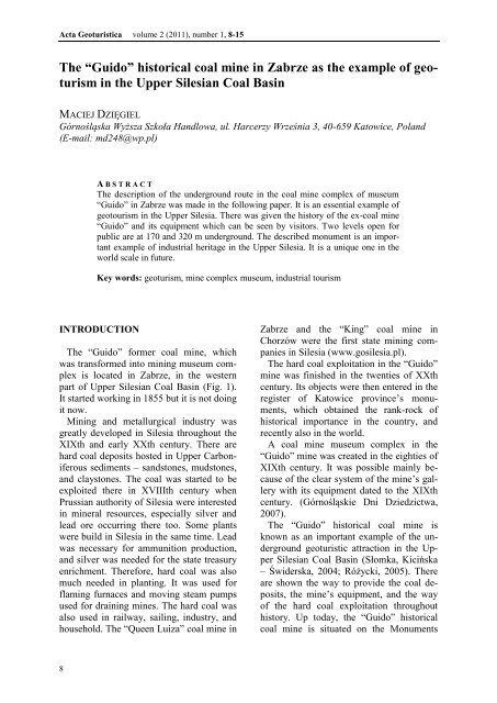
The “Guido” historical coal mine in Zabrze as the example of geoturism<br />
in the Upper Silesian Coal Basin<br />
MACIEJ DZIĘGIEL<br />
Górnośląska Wyższa Szkoła Handlowa, ul. Harcerzy Września 3, 40-659 Katowice, Poland<br />
(E-mail: md248@wp.pl)<br />
A B S T R A C T<br />
The description of the underground route in the coal mine complex of museum<br />
“Guido” in Zabrze was made in the following paper. It is an essential example of<br />
geotourism in the Upper Silesia. There was given the history of the ex-coal mine<br />
“Guido” and its equipment which can be seen by visitors. Two levels open for<br />
public are at 170 and 320 m underground. The described monument is an important<br />
example of industrial heritage in the Upper Silesia. It is a unique one in the<br />
world scale in future.<br />
Key words: geoturism, mine complex museum, industrial tourism<br />
INTRODUCTION<br />
The “Guido” former coal mine, which<br />
was transformed into mining museum complex<br />
is located in Zabrze, in the western<br />
part of Upper Silesian Coal Basin (Fig. 1).<br />
It started working in 1855 but it is not doing<br />
it now.<br />
Mining and metallurgical industry was<br />
greatly developed in Silesia throughout the<br />
XIXth and early XXth century. There are<br />
hard coal deposits hosted in Upper Carboniferous<br />
sediments – sandstones, mudstones,<br />
and claystones. The coal was started to be<br />
exploited there in XVIIIth century when<br />
Prussian authority of Silesia were interested<br />
in mineral resources, especially silver and<br />
lead ore occurring there too. Some plants<br />
were build in Silesia in the same time. Lead<br />
was necessary for ammunition production,<br />
and silver was needed for the state treasury<br />
enrichment. Therefore, hard coal was also<br />
much needed in planting. It was used for<br />
flaming furnaces and moving steam pumps<br />
used for draining mines. The hard coal was<br />
also used in railway, sailing, industry, and<br />
household. The “Queen Luiza” coal mine in<br />
Zabrze and the “King” coal mine in<br />
Chorzów were the first state mining companies<br />
in Silesia (www.gosilesia.pl).<br />
The hard coal exploitation in the “Guido”<br />
mine was finished in the twenties of XXth<br />
century. Its objects were then entered in the<br />
register of Katowice province’s monuments,<br />
which obtained the rank-rock of<br />
historical importance in the country, and<br />
recently also in the world.<br />
A coal mine museum complex in the<br />
“Guido” mine was created in the eighties of<br />
XIXth century. It was possible mainly because<br />
of the clear system of the mine’s gallery<br />
with its equipment dated to the XIXth<br />
century. (Górnośląskie Dni Dziedzictwa,<br />
2007).<br />
The “Guido” historical coal mine is<br />
known as an important example of the underground<br />
geoturistic attraction in the Upper<br />
Silesian Coal Basin (Słomka, Kicińska<br />
– Świderska, 2004; Różycki, 2005). There<br />
are shown the way to provide the coal deposits,<br />
the mine’s equipment, and the way<br />
of the hard coal exploitation throughout<br />
history. Up today, the “Guido” historical<br />
coal mine is situated on the Monuments<br />
8
<strong>Acta</strong> <strong>Geoturistica</strong> volume 2 (2011), number 1, 8-15<br />
Route of the Silesian Voivodeship. This<br />
route combines several historical premises<br />
which belonged to mining and planting in<br />
Upper Silesia (Kaganek 2000;<br />
www.gosilesia.pl). The “Guido” historic<br />
coal mine also joined the network of the<br />
9
<strong>Acta</strong> <strong>Geoturistica</strong> volume 2 (2011), number 1, 8-15<br />
European Route of Industrial Heritage<br />
(ERIH) in January 2010<br />
(www.zabrzanie.pl).<br />
GEOLOGICAL STRUCTURE<br />
AROUND ZABRZE<br />
Zabrze is situated in the western part of<br />
the Upper Silesian Coal Basin (fig. 1). This<br />
part of the Upper Silesian District area is<br />
composed of Upper Carboniferous, Triassic,<br />
and Quaternary sediments. Upper Carboniferous<br />
rocks, hosting hard coal deposits<br />
occur all over the area. They are mostly<br />
representative in the vicinity of Zabrze and<br />
Katowice, because they are outcropped in<br />
several places or covered only by thin Quaternary<br />
sediments (Fig. 2). That’s why the<br />
hard coal has been exploited just in Zabrze.<br />
Carboniferous formation (Silesian)<br />
around Zabrze is composed of the Upper<br />
Carboniferous rocks (Namurian, Westphalian).<br />
They occur in the form of four<br />
litostratigraphic series: paralic (Namurian<br />
A), Upper Silesian Sandstone (Namurian B<br />
and C), Mudstone (Westphalian A and B)<br />
and Kraków Sandstone (Westphalian C i D)<br />
(Osika, 1970; Pawlak, Dziekońska, 1974;<br />
Gabzdyl, 1997). The paralic series is composed<br />
of sandstones, mudstones, claystones<br />
and locally conglomerates with a great<br />
number of the hard coal seams. The total<br />
thickness of this series is 3,500 m and that<br />
of the hard coal seam varies between 10-20<br />
m (Fig. 2).<br />
The Upper Silesian sandstone series comprises<br />
two stratigraphic units: the Anticlinal<br />
Beds (Namurian B) and the Rudy beds<br />
(Namurian C). These units host the largest<br />
hard coal reserves in the Upper Silesian<br />
Coal Basin. The Anticlinal Beds include<br />
gravelstones, sandstones, mudstones and<br />
claystones. Their thickness varies from 80<br />
till 320 m and that of hard-coal seams is 28<br />
m, in average. The Rudy Beds, 530 m thick<br />
comprise mudstones and claystones. The<br />
total thickness of their hard coal seams is<br />
between 15 and 20 m (Fig. 2).<br />
The Mudstone Series is divided into the<br />
two stratigraphic units: the Załęże Beds<br />
(Westphalian A) and the Orzesze beds<br />
(Westphalian B). The Załęże Beds are<br />
composed of limnic sediments – mudstones<br />
and claystones. These units host quite a<br />
number of hard-coal seams, a few meters<br />
thick in average. The Orzesze Beds include<br />
mudstones and claystones of total thickness<br />
750 m and the average thickness of their<br />
hard coal seams is 38 m (Fig. 2).<br />
The Kraków Sandstone Series is composed<br />
of the Łaziska Beds (Westphalian C)<br />
and the Libiąż Beds (Westphalian D). The<br />
Łaziska Beds include mudstones and claystones<br />
with seventeen hard coal seams. Total<br />
thickness of the Łaziska Beds is between<br />
500 and 900 m. The Libiąż Beds are represented<br />
by sandstone with mudstone and<br />
claystone of total thickness about 525 m.<br />
These unit hosts nine hard-coal seams of<br />
thickness between 5 and 6 m (Stopa, 1957,<br />
1967; Słowańska, Ruehle, 1968; Osika,<br />
1970; Unrug, Dembowski, 1971; Pawlak,<br />
Dziekońska, 1974; Kotas, 1977; 1982;<br />
Gabzdyl, 1997; Stupnicka, 2007).<br />
Most of the vicinity of Zabrze area is<br />
covered by Quaternary alluvial and glacial<br />
sands of thickness about 10-20 m (Guzik,<br />
Piechulska, 1960; Malinowski, 1991). The<br />
beds of Productive Carboniferous around<br />
Zabrze are locally overburden by red and<br />
mottled clays of Lower Triassic (Bunter)<br />
(Guzik, Piechulska 1960; Stupnicka 2007).<br />
In the underground of the area around<br />
Zabrze, the Upper Silesian sandstone series,<br />
the Anticlinal Beds (Namurian B) and the<br />
Rudy beds (Namurian C) are the most representative<br />
there (Fig. 2). The hard coal was<br />
just exploited from those layers there.<br />
THE HISTORY OF THE “GUIDO”<br />
HARD COAL MINE<br />
The “Guido” historical hard coal mine is<br />
situated in the central part of Zabrze (Fig.<br />
1). It was built in 1855, during the industrial<br />
revolution in Silesia in XIXth century.<br />
A prince, Guido Henckel von Donnersmarck,<br />
an earth and great industrial mag-<br />
10
<strong>Acta</strong> <strong>Geoturistica</strong> volume 2 (2011), number 1, 8-15<br />
nate, built that mine and became its manager.<br />
The mine’s name was taken from his<br />
forename. Von Donnersmarck was also the<br />
manager of Zabrze’s plant for which he<br />
exploited hard coal. In 1855 the first shaft<br />
named “Barbara” was dug. In 1856 the exploitation<br />
of the coal was started at 97 m<br />
depth of the shaft named „Concordia”<br />
(„Guido”). In the seventies of XIXth century<br />
the shaft named “Kolejowy” was dug,<br />
which let start with regular coal exploitation<br />
there (fig. 3). Shaft top and shaft tower<br />
were built in the eighties of XIXth century.<br />
In 1882 coal scrubber was constructed in<br />
the “Guido” coal mine. It was the first device<br />
of this type used in the Upper Silesian<br />
Coal Basin. In 1887 the prince von Donnersmarck<br />
sold the “Guido” coal mine to<br />
Prussian Treasury. In 1890 the “Kolejowy”<br />
shaft was deepened to the level of 320 m<br />
underground. It created some possibility of<br />
connecting it with the “Delbrueck” shaft in<br />
1904. The shaft “Delbrueck” belonged to<br />
the “Makoszowy” coal mine located in<br />
Zabrze too. In 1906 the electric ventilator<br />
with its performance of 1855 m 3 /minute<br />
was given to the “Guido” shaft.<br />
In the twenties of the XXth century coal<br />
11
<strong>Acta</strong> <strong>Geoturistica</strong> volume 2 (2011), number 1, 8-15<br />
resources were exhausted. So the “Guido”<br />
coal mine was transformed into central<br />
node drainage of the adjacent mines. Since<br />
then the coal exploitation in the “Guido”<br />
mine was finished. It could be continued<br />
only in the “Makoszowy” mine, neighbouring<br />
the “Guido” one.<br />
In 1967 the “Guido” coal mine was transformed<br />
into the Experimental Coal Mine<br />
“M-300”. Since then there were made only<br />
exploiting experiments with machines being<br />
produced in the “KOMAG” institute of<br />
mining located in Gliwice.<br />
In 1982 old workings of the Experimental<br />
Coal Mine “M-300” were adapted into museum<br />
mine complex which became the<br />
branch of the Coal Mining Museum in<br />
Zabrze. In 1987 the old mine workings and<br />
buildings of the lifting machine and shaft<br />
top were entered in the register of Katowice<br />
province’s monuments. Some repairs and<br />
conservation in the museum mine complex<br />
were made in 1990 and after that it was<br />
open for the public.<br />
In 1996, local authorities decided to close<br />
the “Guido” coal mine because of the bad<br />
economical situation in Zabrze (Borkiewicz<br />
1998; Lamparska-Wieland et al. 2002).<br />
They did so only in 2002, but in result of<br />
the great reorganisation in Silesian mining a<br />
little bit later, there appeared some opportunity<br />
to save that historical coal mine. In<br />
2004 the “Guido” coal mine was given to<br />
the “Sośnica - Makoszowy” coal mine<br />
company in Zabrze as its property. It let the<br />
owners of the company come to an agreement<br />
with the authorities of Zabrze and<br />
Silesian Voivoidship about to make up the<br />
decision on putting the old exploiting tools<br />
and machines into exhibition as the example<br />
of industrial heritage in Upper Silesian<br />
Coal Basin. It took place in between 2004 –<br />
2006.<br />
In October 2006 the Industrial Monuments<br />
Route of the Silesian Voivodeship<br />
was designed. The “Guido” coal mine was<br />
put on this route then (www.gosilesia.pl)<br />
and since June 2007 it has been open for the<br />
public again (Gorzelik 2007). This object<br />
has been given the cultural institute status<br />
named “the “Guido” Historic Coal Mine”<br />
(Rozporządzenie Rady Ministrów, 2007). It<br />
includes a system of galleries and shafts<br />
sunk to 300 m depth.<br />
THE “GUIDO” HISTORICAL COAL<br />
MINE<br />
The old workings open for visiting are<br />
located at the level of 170 and 320 m. Their<br />
total length is about 2 km. There is also art<br />
level located at the level of 320 m. Tourists<br />
go down there by the lift of the “Kolejowy”<br />
shaft.<br />
The ground part of the “Guido” historical<br />
coal mine is consisted of the top shaft and<br />
tower of the “Kolejowy” shaft (Fig. 3).<br />
Large exhibits are collected there. The most<br />
valuable of them are engine exhaust from<br />
1927 and its wheel cars from 1934.<br />
At the level of 170 m tourists walk along<br />
the gallery named “ventilating crosscut”.<br />
The old stable is situated just there. Horses<br />
were used for pulling the haulage carriages.<br />
The “ventilating crosscut” is lined with<br />
wooden bars and wooden arches (Fig. 3).<br />
At the end of this crosscut, there are some<br />
rooms the exhibition of the old mining<br />
tools, lamps and saving equipment. It<br />
shows the traditional mining culture. There<br />
is also a small geological museum at the<br />
level of 170 m.<br />
At the level of 320 m tourists walk<br />
through the network of the galleries with a<br />
large number of some old machines left<br />
there. They were used for exploitation in<br />
that mine throughout the XIXth and XXth<br />
century. The old workings are partly covered<br />
by wall or steel and anchors. They are<br />
in the form of shafts, ditches, sidewalks,<br />
inclines and chambers. Total length of the<br />
tourist route at this level is about 1,2 km.<br />
Visitors can see the methods of the hard<br />
coal exploitation used in the XIXth century.<br />
The 18 degree incline is very interesting<br />
for tourists. They go down along and see<br />
the wooden gate there. This machine<br />
worked as a counterweight. This is the simplest<br />
and the oldest transporting<br />
12
<strong>Acta</strong> <strong>Geoturistica</strong> volume 2 (2011), number 1, 8-15<br />
13
<strong>Acta</strong> <strong>Geoturistica</strong> volume 2 (2011), number 1, 8-15<br />
device.<br />
Tourists enjoy also walking down the<br />
short wall excavations not more than one<br />
meter in height there. They go under dust<br />
and water barriers hung in the excavation.<br />
In that way they can see some simple methods<br />
of the galleries’ protection against coal<br />
dust explosion (Fig. 3).<br />
At this level the guide shows tourists<br />
quite a lot of the hard coal outcrops there.<br />
They can try to cut the rock with a pickaxe.<br />
At the end of the walk through the gallery<br />
the work of the mining drum combines and<br />
the comb conveyor belts are shown there<br />
(Fig. 3).<br />
There are also much of cultural activities<br />
in the “Guido” historical coal mine. Quite a<br />
number occasional concerts and theatrical<br />
performances are held in the old rebuilt<br />
chambers. Some of them are cyclic. The<br />
most interesting are: „Silesian Fajer on<br />
Gruba Guido” and „St. Barbra’s feast”<br />
(Żurek et al., 2009). Some chambers of that<br />
historical coal mine are also adapted for<br />
gastronomical and commercial activities.<br />
CONCLUSIONS<br />
The “Guido” historical coal mine with its<br />
equipment, known for two centuries is a<br />
typical example of heavy industry inherited<br />
in Zabrze. Up to now, this city is one of the<br />
biggest industrial centres in Europe<br />
(Burzyński, 2007). Zabrze is the main industrial<br />
tourism centre in Upper Silesia at<br />
present.<br />
In my opinion the “Guido” historical coal<br />
mine is very well prepared for visiting. At<br />
the level of 170 m, in the small geological<br />
museum the tourists can learn about the<br />
geological structure of Upper Silesian Coal<br />
Basin. On the depth of 320 m they can see<br />
the real spirit atmosphere in the mine, just<br />
when the tools and machines for rock’s<br />
cutting are on. Those can be the essential<br />
arguments for joining the “Guido” historical<br />
coal mine into the European Route of<br />
Industrial Heritage (ERIH) in January 2010.<br />
Thanks of that, this industrial monument<br />
has a great opportunity to be also known as<br />
a geotouristic attraction not only in Upper<br />
Silesia but also in Europe and in the world.<br />
The salt mines in Wieliczka and Bochnia in<br />
Małopolska have already been widely<br />
known around the world, mainly just from<br />
the geotouristic point of view.<br />
REFERENCES<br />
Borkiewicz M., 1998: Uratować skansen „Guido”,<br />
GIPH – Biuletyn Górniczy nr 7-8(37-38) Lipiec-<br />
Sierpień;<br />
Burzyński T., 2007: Turystyka dziedzictwa<br />
przemysłowego w Polsce, w: Dziedzictwo<br />
przemysłowe jako strategia rozwoju innowacyjnej<br />
gospodarki, IV Konferencja Naukowo-Praktyczna,<br />
Zabrze 6-7.09.2007;<br />
Gabzdyl W., 1997: Geologia i kopaliny Górnego<br />
Śląska, Politechnika Śląska, Zesz. nauk. Pol. Śl. Nr<br />
1361, Gliwice;<br />
Guzik O., Piechulska B. (red.), 1960: Szczegółowa<br />
Mapa Geologiczna Polski 1:50000. Arkusz Zabrze,<br />
IG, Wyd. Geol., Warszawa;<br />
Górnośląskie Dni Dziedzictwa, 2007,<br />
www.gornoslaskie-dziedzictwo.com;<br />
Kaganek K., 2000: Turystyka przemysłowa jako<br />
potencjalny produkt turystyczny, w: Planowanie<br />
turystyki na szczeblu regionalnym i lokalnym w:<br />
Strategia, współpraca i finansowanie w<br />
województwie śląskim – gminy pogórnicze, Szczyrk<br />
2000, wyd. GWSH Katowice, s. 99-117;<br />
Kotas A., 1977: Litostratigraphic characteristics of<br />
the Carboniferous in the Upper Silesian Coal Basin,<br />
Symp. on Carboniferous Stratigraphy. Prague.<br />
Kotas A., 1982: Zarys budowy geologicznej<br />
Górnośląskiego Zagłębia Węglowego, Przew. LIV<br />
Zjazdu PTG, Sosnowiec;<br />
Lampiarska-Wieland M., Srokosz Z., Lamparski<br />
H., 2002: Odtworzenie Kopalni Doświadczalnej<br />
Węgla Kamiennego „M-300” w Zabrzu oraz jej<br />
przekształcenie na Skansen Górnictwa Podziemnego<br />
„Guido”, „Przegląd Górniczy”, t. 58, nr 6, s. 30-38;<br />
Malinowski J. (red.), 1991: Budowa geologiczna<br />
Polski, t. VII Hydrogeologia, PIG, Wyd. Geol.,<br />
Warszawa, s. 182;<br />
Osika R. (red.), 1970: Geologia i surowce<br />
mineralne Polski, IG Wyd. Geol. Warszawa (Biul.<br />
251), s. 30,318-321;<br />
Pawlak I., Dziekońska I. (red.), 1974: Budowa<br />
geologiczna Polski, t. IV Tektonika, cz. I Niż Polski,<br />
IG Wyd. Geol. Warszawa, s. 226-233;<br />
Rozporządzenie Rady Ministrów z 2007 r.<br />
zmieniające rozporządzenie w sprawie objęcia<br />
przepisami Prawa geologicznego i górniczego<br />
prowadzenia określonych robót podziemnych z<br />
zastosowaniem techniki górniczej;<br />
14
<strong>Acta</strong> <strong>Geoturistica</strong> volume 2 (2011), number 1, 8-15<br />
Różycki P., 2005: Klasyfikacja współczesnych form<br />
turystyki, „Geoturystyka” I (2005) 13-23;<br />
Słomka T., Kicińska – Świderska A. 2004:<br />
Geoturystyka – podstawowe pojęcia. „Geoturystyka”<br />
I (2004) 5-7;<br />
Słowańska B., Ruehle W. (red.), 1968: Budowa<br />
geologiczna Polski, t. I Stratygrafia, cz. I Prekambr<br />
i Paleozoik, IG Wyd. Geol. Warszawa, s. 407-425;<br />
Stopa S. Z., 1957: Podział stratygraficzny karbonu<br />
produktywnego w Zagłębiu Górnośląskim, Biul. IG<br />
115;<br />
Stopa S. Z., 1967: Problematyka stratygraficzna<br />
podziału karbonu krakowskiego w świetle<br />
paleobotaniki, Rocz. PTG, t. 37, z. 1;<br />
Stupnicka E., 2007: Geologia regionalna Polski,<br />
Wyd. Geol. Warszawa, s. 101-109, 199-209;<br />
Unrug R., Dembowski Z., 1971: Rozwój<br />
diastroficzno – sedymentacyjny basenu morawskośląskiego,<br />
Rocz. PTG, t. 41, z. 1.<br />
Żurek L., Masoń T., Walerjański D., 2009:<br />
Zabytkowa Kopalnia Węgla Kamiennego „Guido” w<br />
Zabrzu,<br />
www.nzs.ae.katowice.pl/nowoczesnezasoby/files/gu<br />
ido.pdf<br />
www.gosilesia.pl<br />
www.zabrzanie.pl<br />
15