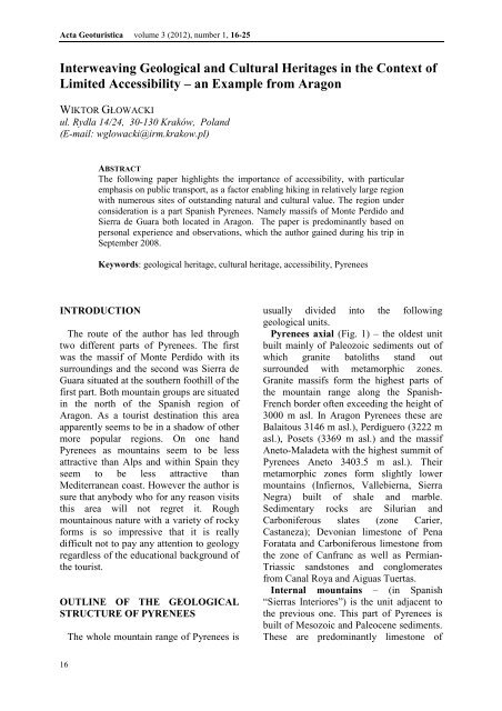
Interweaving Geological and Cultural Heritages ... - Acta Geoturistica
Interweaving Geological and Cultural Heritages ... - Acta Geoturistica
Interweaving Geological and Cultural Heritages ... - Acta Geoturistica

You also want an ePaper? Increase the reach of your titles
YUMPU automatically turns print PDFs into web optimized ePapers that Google loves.
<strong>Acta</strong> <strong>Geoturistica</strong> volume 3 (2012), number 1, 16-25<br />
<strong>Interweaving</strong> <strong>Geological</strong> <strong>and</strong> <strong>Cultural</strong> <strong>Heritages</strong> in the Context of<br />
Limited Accessibility – an Example from Aragon<br />
WIKTOR GŁOWACKI<br />
ul. Rydla 14/24, 30-130 Kraków, Pol<strong>and</strong><br />
(E-mail: wglowacki@irm.krakow.pl)<br />
ABSTRACT<br />
The following paper highlights the importance of accessibility, with particular<br />
emphasis on public transport, as a factor enabling hiking in relatively large region<br />
with numerous sites of outst<strong>and</strong>ing natural <strong>and</strong> cultural value. The region under<br />
consideration is a part Spanish Pyrenees. Namely massifs of Monte Perdido <strong>and</strong><br />
Sierra de Guara both located in Aragon. The paper is predominantly based on<br />
personal experience <strong>and</strong> observations, which the author gained during his trip in<br />
September 2008.<br />
Keywords: geological heritage, cultural heritage, accessibility, Pyrenees<br />
INTRODUCTION<br />
The route of the author has led through<br />
two different parts of Pyrenees. The first<br />
was the massif of Monte Perdido with its<br />
surroundings <strong>and</strong> the second was Sierra de<br />
Guara situated at the southern foothill of the<br />
first part. Both mountain groups are situated<br />
in the north of the Spanish region of<br />
Aragon. As a tourist destination this area<br />
apparently seems to be in a shadow of other<br />
more popular regions. On one h<strong>and</strong><br />
Pyrenees as mountains seem to be less<br />
attractive than Alps <strong>and</strong> within Spain they<br />
seem to be less attractive than<br />
Mediterranean coast. However the author is<br />
sure that anybody who for any reason visits<br />
this area will not regret it. Rough<br />
mountainous nature with a variety of rocky<br />
forms is so impressive that it is really<br />
difficult not to pay any attention to geology<br />
regardless of the educational background of<br />
the tourist.<br />
OUTLINE OF THE GEOLOGICAL<br />
STRUCTURE OF PYRENEES<br />
The whole mountain range of Pyrenees is<br />
usually divided into the following<br />
geological units.<br />
Pyrenees axial (Fig. 1) – the oldest unit<br />
built mainly of Paleozoic sediments out of<br />
which granite batoliths st<strong>and</strong> out<br />
surrounded with metamorphic zones.<br />
Granite massifs form the highest parts of<br />
the mountain range along the Spanish-<br />
French border often exceeding the height of<br />
3000 m asl. In Aragon Pyrenees these are<br />
Balaitous 3146 m asl.), Perdiguero (3222 m<br />
asl.), Posets (3369 m asl.) <strong>and</strong> the massif<br />
Aneto-Maladeta with the highest summit of<br />
Pyrenees Aneto 3403.5 m asl.). Their<br />
metamorphic zones form slightly lower<br />
mountains (Infiernos, Vallebierna, Sierra<br />
Negra) built of shale <strong>and</strong> marble.<br />
Sedimentary rocks are Silurian <strong>and</strong><br />
Carboniferous slates (zone Carier,<br />
Castaneza); Devonian limestone of Pena<br />
Foratata <strong>and</strong> Carboniferous limestone from<br />
the zone of Canfranc as well as Permian-<br />
Triassic s<strong>and</strong>stones <strong>and</strong> conglomerates<br />
from Canal Roya <strong>and</strong> Aiguas Tuertas.<br />
Internal mountains – (in Spanish<br />
“Sierras Interiores”) is the unit adjacent to<br />
the previous one. This part of Pyrenees is<br />
built of Mesozoic <strong>and</strong> Paleocene sediments.<br />
These are predominantly limestone of<br />
16
<strong>Acta</strong> <strong>Geoturistica</strong> volume 3 (2012), number 1, 16-25<br />
Fig. 1 Outline of the geological structure of Aragon, Source: [7], Pyrenees: 1 – Pyrenees axial Paleozoic; 2 -<br />
Pre-Pyrenees Meso-Cainozoic; Cordillera Iberica: 3 – Paleozoic; 4 – Trias <strong>and</strong> Jura 5- Cretaceous Basin of Ebro<br />
<strong>and</strong> Internal Depression: 6 – Oligocene; 7 – Miocene<br />
different purity sometimes they are mixed<br />
with s<strong>and</strong>stones. The huge b<strong>and</strong> of<br />
limestone extends from Alanos near the<br />
town Zuriza in the east through Petraforca,<br />
Bisaurin; to Aspe <strong>and</strong> Collarada-Pala de Ip-<br />
Punta Escarra (surroundings of Canfranc)<br />
<strong>and</strong> then through the Valley Tena-Otal it<br />
joins the huge nappe of Gabarnie-Monte<br />
Perdido <strong>and</strong> Cotiella so as to reach its<br />
western end in Jurassic limestone of<br />
Turbon.<br />
Intra-Pyrenean Depression- (in Spanish<br />
“Depresion intrapirenaica”) this unit itself<br />
consists of three different subunits. Namely<br />
flysh, proper depression <strong>and</strong> synclinorium<br />
la Gurga. Pyrenean flysh similarly to flysh<br />
sediments known from other mountain<br />
ranges consists of Eocene deep see<br />
sedimentary rocks – alternate layers of<br />
s<strong>and</strong>stone, marl <strong>and</strong> clay. These sediments<br />
had been strongly folded during the alpine<br />
orogenesis. These rocks occur on the<br />
surface in outlines of mountain groups to<br />
north from Canal de Berdun, Sierras de<br />
Biescas, Sobremonte, Sobrepuerto, Oturia,<br />
<strong>and</strong> Cotefablo as well as on the northern<br />
outline of the Aran Valley in La Fueba <strong>and</strong><br />
in the Isabena Valley. The proper<br />
depression is filled in mainly with marls.<br />
On its southern fringe there is a stripe of<br />
conglomerates folded in the end of alpine<br />
orogenesis. They can be seen in the<br />
surroundings of San Juan de la Pena, Oroel<br />
<strong>and</strong> Cancias. Finally the synclinorium La<br />
Guarga is filled in predominantly with grey<br />
<strong>and</strong> grey-blue marls.<br />
External mountains or Pre-Pyrenees (in<br />
Spanish “Sierras exteriors o Prepirineo”) –<br />
is the last <strong>and</strong> the southernmost unit, which<br />
has contact with sediments of Ebro Valley.<br />
It is built mainly of limestone. Tectonically<br />
external mountains are the last folds of the<br />
nappe, which slide from Gavarnie. The<br />
following mountain groups belong to this<br />
unit: Sierras de Santo Domingo, Loarre, La<br />
Pena, Gratal <strong>and</strong> Guara [6].<br />
17
<strong>Acta</strong> <strong>Geoturistica</strong> volume 3 (2012), number 1, 16-25<br />
The route of the author (Fig. 2) starts at the<br />
Village of Torla in Pyrenees then it runs<br />
through the Valley Ordesa, southern slopes<br />
of Monte Perdido to Pineta Valley <strong>and</strong> the<br />
village of Bielsa. Next to the town Ainsa<br />
<strong>and</strong> then enters Sierra de Guara where it<br />
runs through villages of Arcusa <strong>and</strong> Lecina<br />
to the end in the village of Alquezar. So its<br />
northern part crosses Internal Mountains<br />
(Sierras interiores) whereas its southern<br />
part runs through External Mountains<br />
(Sierras exteriores). The diversity of rocks<br />
<strong>and</strong> l<strong>and</strong>scapes is accompanied here with<br />
numerous monuments of human history,<br />
which date back to different époques from<br />
pre-history to relatively recent <strong>and</strong> painful<br />
memories of the Spanish civil war.<br />
NATURAL AND CULTURAL ASSETS<br />
IN THE SURROUNDINGS OF MONTE<br />
PERDIDO<br />
Torla can be reached by public transport<br />
with the only bus which arrives here from<br />
the town of Sabinanigo about the noon. The<br />
village owns its beauty to the picturesque<br />
location on a small hill over the deep valley<br />
of Ara river surrounded with much higher<br />
mountains <strong>and</strong> to its architecture. A small<br />
densely built up village with all<br />
characteristics of traditional Pyrenean<br />
architecture (thick walls built of stones,<br />
elegant gates of houses, decorative<br />
chimneys). The tower of the parish church<br />
dated to XVIth century dominates the group<br />
of buildings. Torla had changed its function<br />
many times in its long history. Being a<br />
border fortress for centuries it became a<br />
smuggling centre in 40s <strong>and</strong> 50s years of<br />
XXth century but now it is purely tourist<br />
village.<br />
Frequent bus service from Torla to<br />
Pradera de Ordesa makes the locality a real<br />
gate the National Park of Ordesa y Monte<br />
Perdido the oldest national park in Spain.<br />
Ordesa Valley called sometimes a canyon<br />
constitutes the core part of the national<br />
park. Bus delivers tourist to the place called<br />
Pradera de Ordesa. Upstream one have to<br />
go by foot.<br />
The elevation of valley’s bottom spans<br />
Fig. 2 Author’s route, Source: [9]<br />
18
<strong>Acta</strong> <strong>Geoturistica</strong> volume 3 (2012), number 1, 16-25<br />
Fig. 3 Ordesa Valley, Photo by: author<br />
from slightly above 1400 m asl at Pradera<br />
de Ordesa to above 1600 m asl at Soaso<br />
whereas the elevation of upper edges of<br />
both slopes fairly exceeds 2200 m asl. So<br />
the very depth makes the valley very<br />
impressive. Glaciers shaped the valley in<br />
the “U” form during the quaternary<br />
glaciations <strong>and</strong> then it has been modeled by<br />
fluvial erosion. As a result one can see a<br />
canyon-like valley, which in some parts has<br />
more “U” shape <strong>and</strong> in other parts more<br />
“V” shape with two or three rocky steps on<br />
its slopes curved in cretaceous limestone<br />
(Fig. 3). Tectonically the area is very<br />
complicated <strong>and</strong> there is a number of<br />
recumbent folds cut with the valley in such<br />
a way that slopes of the valley make a false<br />
impression of little disturbed, almost<br />
horizontal layout of rock layers [6]. The<br />
Arazar river has a few waterfalls out of<br />
which the Cola del Caballo (a horsetail)<br />
seems to be the best known. The lower<br />
parts of the valley are forested. In the upper<br />
part near the place called Guidas de Soaso<br />
the forests reaches its upper border with<br />
rare single dwarf pines <strong>and</strong> gives place to<br />
meadows, small bushes <strong>and</strong> large areas of<br />
naked rocks. To make the picture complete<br />
one should add that marmots are often seen<br />
on meadows or among stones as well as<br />
vultures on the sky.<br />
The author did not reach the very peak of<br />
this mountain. However Monte Perdido<br />
with its elevation of 3355 m asl is certainly<br />
worthy to climb as the highest limestone<br />
peak of Europe. The mountain hut “Refugio<br />
de Gόriz” enables climbing the peak within<br />
one day. However there is usually very<br />
short period in the year when the path is<br />
free from snow <strong>and</strong> ice. It is usually the<br />
first half of September. Access for tourists<br />
is possible from south-western side whereas<br />
the north eastern slope is covered with a<br />
glacier.<br />
Anisclo Canyon is similar to Ordesa as<br />
regards geology but it is less famous <strong>and</strong><br />
wilder. It is also particularly valuable as a<br />
habitat of some endemic plants. It is located<br />
to east from Ordesa valley. Two<br />
particularly exciting marked footpaths lead<br />
through its upper part. Ruta de abajo<br />
enables visiting the bottom of the canyon<br />
19
<strong>Acta</strong> <strong>Geoturistica</strong> volume 3 (2012), number 1, 16-25<br />
whereas Ruta de arriba provides execellent<br />
view from slopes of Monte Perdido to<br />
mountain Pico Interior de Anisclo rising on<br />
the opposite side of the canyon with clearly<br />
visible fold structures on its slopes.<br />
The glacial U-shape Pineta Valley is<br />
located to east from Monte Perdido. Its<br />
upper part is surrounded with magnificent<br />
summits of the main ridge of Pyrenees. It is<br />
drained by Cinca river which in its upper<br />
part is only a periodical watercourse.<br />
Special educational path provides the<br />
opportunity to learn about the geological<br />
history, relief <strong>and</strong> vegetation. Tourists can<br />
find a shelter for the night in the mountain<br />
hut Valle del Pineta. Asphalt road runs<br />
along the Valley to the nearest settlement<br />
Bielsa. However the valley is not served by<br />
any means of public transport.<br />
Bielsa together with the neighbouring<br />
village of Javierre form a settlement<br />
picturesquely situated at the junction of two<br />
Pyrenean valleys Valle de Pineta <strong>and</strong> Valle<br />
de Bielsa. A few historic buildings are<br />
monuments of the long history of both<br />
villages. The Romanesque Church in<br />
Javierre dates back to XII century; the<br />
parish church in Bielsa was built in XVII<br />
century as well as the Town Hall of Bielsa<br />
whose renaissance facade is one of the most<br />
beautiful architectural monuments in the<br />
whole district. However the majority of<br />
buildings are relatively new. This is the<br />
result of tragic events of the Spanish civil<br />
war. Namely Bielsa with its surroundings<br />
formed so called “Bolsa de Bielsa” (The<br />
Sack of Bielsa) i.e. the area of long lasting<br />
resistance of republican forces against<br />
Franco forces. In the end of the fight a lot<br />
of inhabitants fled out to France through<br />
Pyrenees <strong>and</strong> settlements were heavily<br />
destroyed. The monument in the centre of<br />
Bielsa commemorates victims of the war.<br />
There is also an exhibition in the local<br />
museum dedicated to those events.<br />
Furthermore the local cemetery where the<br />
oldest existing graves bear dates from early<br />
70s <strong>and</strong> relics of older graves date to 30s<br />
also reflects the gap in the development of<br />
the settlement.<br />
Now, Bielsa is a tourist village with a<br />
number of shops, restaurants <strong>and</strong><br />
accommodation facilities. It has the only<br />
bus connection with Ainsa - the centre of<br />
the district. It has operated every second<br />
day on weekdays. So only on Monday<br />
Wednesday <strong>and</strong> Friday morning one can<br />
leave Bielsa or arrive there by bus.<br />
The historic centre of Ainsa is a jewel of<br />
medieval architecture. It is situated on a hill<br />
at the junction of Ara <strong>and</strong> Cinca rivers. The<br />
historic quarter constitutes well preserved<br />
complex of stone-built houses built closely<br />
one to another along narrow streets with<br />
several churches market square <strong>and</strong> walls of<br />
the castle. Its beginning dates back to early<br />
stage of Reconquest when Ainsa was a<br />
capital of the Kingdom of Sobrarbe, which<br />
later was incorporated into Aragon. It is<br />
really difficult to judge what is more<br />
interesting: the architecture on the hill or<br />
the view from the hill to Pyrenean summits.<br />
Ainsa has relatively many bus<br />
connections with other towns <strong>and</strong> cities of<br />
Aragon <strong>and</strong> Bus station is combined with a<br />
bar <strong>and</strong> in the morning this is the only open<br />
building in the town.<br />
SITES OF INTEREST BETWEEN<br />
TWO MOUNTAIN GROUPS<br />
The area between High Pyrenees <strong>and</strong><br />
Sierra de Guara apparently seems to be far<br />
less attractive than neighbouring mountains.<br />
However a closer look let the tourist realise<br />
that this first impression is false <strong>and</strong> that<br />
lower altitude is compensated here with a<br />
particular harmony between historic<br />
settlements <strong>and</strong> diversified relief. This<br />
refers not only to Ainsa but also to the<br />
whole area between this historic town <strong>and</strong><br />
the village of Arcusa. To begin with the<br />
chapel of San Lino, which st<strong>and</strong>s lonely<br />
among dry grey pastures A few kilometres<br />
further to the south the village Santa Maria<br />
de Buil <strong>and</strong> its hamlet San Martin<br />
picturesquely stick to slopes of a rocky hill.<br />
The church of Santa Maria was built in<br />
XVth century in Aragon gothic style<br />
20
<strong>Acta</strong> <strong>Geoturistica</strong> volume 3 (2012), number 1, 16-25<br />
whereas the Romanesque church of San<br />
Martin dates to XIth century. Next, the<br />
picturesque village of Arcusa, with<br />
traditional Aragonian stone-built houses<br />
with characteristic decorative chimneys.<br />
Furthermore the area provides good<br />
opportunity to learn about scarcity of water<br />
in this dry area <strong>and</strong> ways of storing this<br />
precious resource. The modern water<br />
reservoir on Cinca River is visible to the<br />
east. Moreover a traditional roofed intake of<br />
water serving for watering cattle as well as<br />
a small irrigated vegetable garden can be<br />
seen at the entrance to Arcusa. The area is<br />
sparsely populated; some villages are not<br />
inhabited permanently. So, tourist cannot<br />
count here on public transport.<br />
Down the Vero river<br />
The famous Vero River as a permanent<br />
watercourse has its beginning in the big<br />
karst spring called in Spanish Fuente de<br />
Lecina (the spring of Lecina). However as a<br />
pre-Pyrenean river of Mediterranean regime<br />
it has a very irregular alimentation. So the<br />
upper part of the Vero basin is drained with<br />
periodical watercourses only. The dry<br />
stretch of this river has its beginning near<br />
the village El Pueyo de Morcat. Initially it<br />
runs southwards in a relatively narrow <strong>and</strong><br />
deep valley. Then it turns to southeast <strong>and</strong><br />
flows into a wide <strong>and</strong> plain part of the<br />
valley with villages Paules de Sarsa on left<br />
bank <strong>and</strong> Santa Maria de la Nuez on the<br />
right bank. The latter village is proud of its<br />
XVIth century sanctuary, which is now<br />
being renovated. Downstream the<br />
l<strong>and</strong>scaped changes <strong>and</strong> the plain gives<br />
place to hills (Fig. 4) where the dry bed of<br />
the river me<strong>and</strong>ers between slopes built of<br />
white marl covered with bushes.<br />
Walking further one can reach the village<br />
of Lecina. Here starts the most attractive<br />
part of Vero Valley. One of the most<br />
breathtaking places is called “Abrigos de<br />
Barfaluy”. This name encompasses a<br />
number of shallow caves situated to the<br />
south of the village at the merging point of<br />
two deep <strong>and</strong> narrow limestone canyons.<br />
The Canyon of Vero River <strong>and</strong> its right<br />
tributary called La Choca. Rocky<br />
precipitous slopes of canyons are full of<br />
such caves, which in Spanish are called<br />
Abrigos or Covachos. [1] A few of them<br />
contain prehistoric paintings. They brought<br />
to this valley the fame similar to cave<br />
paintings known from Altamira as well as a<br />
few other regions of Spain i.e. Vizcaya,<br />
Asturia, Guadalajara <strong>and</strong> Málaga [3].<br />
Prehistoric paintings in Vero valley<br />
represent different styles which developed<br />
in the area between 20 000 B.C <strong>and</strong> 1500<br />
B.C. [5] Those in Barfaluy (Fig.5) represent<br />
the schematic style <strong>and</strong> date back to 5000 –<br />
1500 B.C. Pictures are small but silhouettes<br />
of prehistoric inhabitants of the valley are<br />
still clear.<br />
Near the village of Lecina the Vero River<br />
finds in its course a huge massif of<br />
limestone particularly resistant to erosion.<br />
Therefore this relatively small area is cut<br />
through the network of deep narrow<br />
canyons formed by the Vero River as well<br />
as its tributaries. The latter are only<br />
periodically drained <strong>and</strong> have in Spanish a<br />
separate name ‘Barrancos”. Vertical rocky<br />
walls of canyons make the area particularly<br />
difficult to pass through, as there are few<br />
places where an ordinary hiker can cross<br />
the canyon. On the other h<strong>and</strong> the Vero<br />
canon is popular among funs of canyoning.<br />
They consider this canyon quite easy even<br />
for beginners in this sport. Narrow asphalt<br />
road dwindles on the left side of the valley<br />
with few opportunities to look down into<br />
the canyon. Similarly to other parts of the<br />
valley Lecina has no public transport<br />
connections.<br />
Following tips of the hotel owner in<br />
Lecina the author managed to go by foot<br />
through this labirynth of canyons. The path<br />
led first down to the spring of Lecina<br />
(Fuente de Lecina) a big karst spring, which<br />
gives the beginning to the Vero River as a<br />
permanent watercourse as well as it<br />
supplies tap water for Lecina. Then it<br />
ascended the left edge of the canyon with<br />
breathtaking view to the bottom of the<br />
canyon with the relics of the watermill.<br />
Then it led to the next cave with prehistoric<br />
21
<strong>Acta</strong> <strong>Geoturistica</strong> volume 3 (2012), number 1, 16-25<br />
paintings. This time it was “Abrigo de<br />
Arpan” with the impressive picture of a<br />
stag. This picture represents Levantine style<br />
<strong>and</strong> was painted between 12000 <strong>and</strong> 5000<br />
B.C. Further the route continued through<br />
the hill Pena Bolada hanging over the Vero<br />
Canyon <strong>and</strong> the ravine “Barranco de<br />
Lumos” to the bottom of Vero canyon<br />
(Fig. 6) at the bridge of Villacantal. Here<br />
water of the stream lets tourists relax a bit<br />
before ascending the right side of the<br />
canyon <strong>and</strong> entering Alquezar.<br />
Fig. 4 Dry part of Vero Valley, Photo by: author<br />
Fig. 5 Prehistoric paintings in Abrigos de Barfaluy, Photo by: author<br />
22
<strong>Acta</strong> <strong>Geoturistica</strong> volume 3 (2012), number 1, 16-25<br />
Fig. 6 Vero Canyon, Photo by: author<br />
This village is situated on a rocky hill that<br />
rises over the Vero valley. Its name is of<br />
Arabic origin as there was a fortress<br />
guarding the northern border of Muslim<br />
state in early Middle Age. When captured<br />
by Christians during the reconquest it<br />
guarded southern border of Christian state.<br />
With the progress of the reconquest the<br />
border moved further to the south <strong>and</strong><br />
Alquezar lost its military importance. So,<br />
the castle was converted into a monastery.<br />
Now the Collegiate Church of Santa Maria<br />
<strong>and</strong> the castle are the two most important<br />
monuments in this historic village. Main<br />
buildings of the church <strong>and</strong> the monastery<br />
date from the XIV century although some<br />
parts are much older e.g. the watchtower<br />
from XI century. The whole settlement is<br />
densely built-up with old small stone<br />
houses. Together with narrow streets it<br />
creates the historic character of the village.<br />
The lighting makes its night view<br />
particularly impressive. The rocky canyon<br />
of Vero ends a few kilometres to south<br />
from Alquezar <strong>and</strong> the river flows further. It<br />
debouches into plain of Ebro. Its floodplain<br />
is interesting from purely geological point<br />
of view [2] but it is far less attractive for<br />
tourists.<br />
NATURE PROTECTION<br />
Geopark is a form of protection of<br />
geological heritage <strong>and</strong> simultaneously<br />
geotourism is closely related to nature<br />
protection [4]. No wonder then, that the<br />
bulk of the above described objects<br />
administratively located in Sobrarbe<br />
district, is covered with a number of natural<br />
protected areas. Chronologically National<br />
Park Ordesa y Monte Perdido was the first<br />
of them established in 1918 <strong>and</strong><br />
significantly extended in 1982. In 1977<br />
UNESCO established Biosphere Reserve<br />
Ordesa-Viñamala , which covered a great<br />
deal of National Park with adjacent areas.<br />
Natural Park Sierra y Canones de Guara<br />
was established in 1990. Next natural park<br />
named Posets-Maladeta was established in<br />
1994 (Fig. 7). It covers the area located to<br />
east from National Park Ordesa y Monte<br />
Perdido.<br />
Moreover the Nature 2000 network<br />
overlaps these areas with 10 areas of<br />
Community Interest <strong>and</strong> 3 bird habitat<br />
areas. Furthermore the whole administrative<br />
district of Sobrarbe constitutes Sobrarbe<br />
Geopark, included in European Geopark<br />
Network since 2006. Exceptional<br />
23
<strong>Acta</strong> <strong>Geoturistica</strong> volume 3 (2012), number 1, 16-25<br />
Fig. 7 Geopark Sobrarbe <strong>and</strong> other protected areas, Source: [8]<br />
combination of prehistoric paintings <strong>and</strong><br />
l<strong>and</strong>scape of the canyon of Vero was main<br />
reason for establishing <strong>Cultural</strong> Park of<br />
Vero River in 2001. However UNESCO<br />
declared the very prehistoric paintings from<br />
the valley as World Heritage already in<br />
1998.<br />
POTENTIAL OF CONTINUITY<br />
VERSUS PUBLIC TRANSPORT<br />
CONSTRAINTS<br />
The above described variety of protection<br />
forms indicates clearly that the whole area<br />
of Sobrarbe districts is highly attractive in<br />
terms of geo-touristic, cultural <strong>and</strong> other<br />
attractions. It creates favorable conditions<br />
for long foot- or bike-trips, which lasts a<br />
few days. Numerous marked paths help to<br />
find the way across the region.<br />
Simultaneously, evenly distributed natural<br />
assets remain in contrast with uneven <strong>and</strong><br />
fragmented provision of public transport<br />
services. The most frequent bus service is<br />
between Torla <strong>and</strong> Pradera de Ordesa in the<br />
Ordesa Valley. Here buses run every half an<br />
hour all day. The purpose of this<br />
arrangement is to protect the national park<br />
against the air pollution <strong>and</strong> noise caused<br />
by individual vehicles. However the very<br />
village of Torla is connected with the rest of<br />
24
<strong>Acta</strong> <strong>Geoturistica</strong> volume 3 (2012), number 1, 16-25<br />
Aragon with the only bus that goes from<br />
Sabinanigo to Ainsa <strong>and</strong> back once a day.<br />
Any tourist, who crosses mountains<br />
between Ordesa Valley <strong>and</strong> Pineta Valley,<br />
cannot rely on similar service in the latter.<br />
Then the only bus runs from Bielsa to<br />
Ainsa only every second weekday. Ainsa<br />
has may bus connections with other cities<br />
of Aragon but villages between Ainsa <strong>and</strong><br />
Alquezar are not served at all <strong>and</strong> again the<br />
village of Alquezar (touristic centre of Vero<br />
Valley) has the only connection with the<br />
district city of Barbastro only on<br />
schooldays.<br />
CONCLUSIONS<br />
The above described case of Sobrarbe<br />
geopark illustrates clearly that public<br />
transport should be seen not only as a<br />
measure reducing air pollution <strong>and</strong> noise<br />
caused by individual transport. Furthermore<br />
it is not only a substitute of private car in<br />
protected areas. In large areas of continuous<br />
attractiveness it is logical that some tourists<br />
choose multi-day foot trip as the best way<br />
to get to know the area. Therefore the<br />
provision of adequate public service<br />
connections is necessary for them to start<br />
<strong>and</strong> to finish their trip, regardless of the<br />
possession of a private car. So, public<br />
transport should be regarded as necessary<br />
element enabling any geopark to perform its<br />
statutory functions.<br />
REFERENCES<br />
1. BALLARIN, O.: Parque Natural de la Sierra y<br />
Canones de Guara II Guia Excursionista, Prames,<br />
Zaragoza 2002.<br />
2. JONES, J.S., FROSTICK, L.E., ASTIN, T.R.:<br />
Braided stream <strong>and</strong> flood plain architecture: the<br />
Rio Vero Formation, Spanish Pyrenees.<br />
Sedimentary Geology, Vol. 139, Issues 3-4,<br />
pages 229-260, 1 March 2001, Elsevier Science<br />
B.V.<br />
3. KUCAŁA, D.: Hiszpania, Trio, Warsaw 2003.<br />
4. SŁOMKA, T., KICIŃSKA-ŚWIDERSKA, A.,<br />
Geoturystyka – podstawowe pojęcia,<br />
Geoturystyka I (2004) 5-7, 2004.<br />
5. http://www.somontano.org/turismo_cont_conoce<br />
.asp?m=rupestre “El Arte Rupestre”<br />
6. http://www.naturalezadearagon.com/geologia/pg<br />
026.php Parque Nacional de Ordesa y Monte<br />
Perdido (Huesca). El Patrimonio Geologico<br />
Aragones. Geologia en Aragon. Espana“<br />
7. http://naturalezadearagon.com/geologia/unidades<br />
.php “Unidades Geologicas de Aragon”<br />
8. http://www.turismosobrarbe.com<br />
9. http://www.vacances-location.net<br />
25