Section 06 - UKOTCF
Section 06 - UKOTCF
Section 06 - UKOTCF

You also want an ePaper? Increase the reach of your titles
YUMPU automatically turns print PDFs into web optimized ePapers that Google loves.
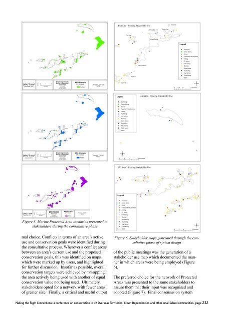
Figure 5. Marine Protected Area scenarios presented to<br />
stakeholders during the consultative phase<br />
mal choice. Conflicts in terms of an area’s active<br />
use and conservation goals were identified during<br />
the consultative process. Wherever a conflict arose<br />
between an area’s current use and the proposed<br />
conservation goals, this was identified on maps<br />
which were marked up by users, and highlighted<br />
for further discussion. Insofar as possible, overall<br />
conservation targets were achieved by “swapping”<br />
the area actively being used with another of equal<br />
conservation value not being used. Ultimately,<br />
stakeholders opted for a network with fewer areas<br />
of greater size. Finally, a critical and useful output<br />
Figure 6. Stakeholder maps generated through the consultative<br />
phase of system design<br />
of the public meetings was the generation of a<br />
stakeholder use map which documented the manner<br />
in which areas were being employed (Figure<br />
6).<br />
The preferred choice for the network of Protected<br />
Areas was presented to the same stakeholders to<br />
assure them that their input was recognised and<br />
adopted (Figure 7). Final consensus on system<br />
Making the Right Connections: a conference on conservation in UK Overseas Territories, Crown Dependencies and other small island communities, page 232