Proposed Amendment of the Kiltimagh Local Area Plan 2010-2016
Proposed Amendment of the Kiltimagh Local Area Plan 2010-2016
Proposed Amendment of the Kiltimagh Local Area Plan 2010-2016
You also want an ePaper? Increase the reach of your titles
YUMPU automatically turns print PDFs into web optimized ePapers that Google loves.
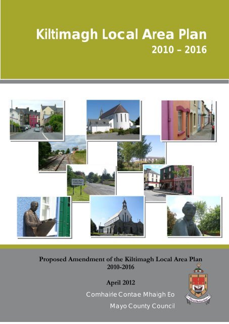
<strong>Kiltimagh</strong> <strong>Local</strong> <strong>Area</strong> <strong>Plan</strong><br />
<strong>2010</strong> – <strong>2016</strong><br />
<strong>Proposed</strong> <strong>Amendment</strong> <strong>of</strong> <strong>the</strong> <strong>Kiltimagh</strong> <strong>Local</strong> <strong>Area</strong> <strong>Plan</strong><br />
<strong>2010</strong>-<strong>2016</strong><br />
April 2012<br />
Comhairle Contae Mhaigh Eo<br />
Mayo County Council
Introduction & Background<br />
This document sets out details <strong>of</strong> <strong>the</strong> proposed <strong>Amendment</strong> to <strong>the</strong> <strong>Kiltimagh</strong> <strong>Local</strong> <strong>Area</strong> <strong>Plan</strong><br />
<strong>2010</strong>–<strong>2016</strong>. This amendment is necessary to ensure that <strong>the</strong> <strong>Local</strong> <strong>Area</strong> <strong>Plan</strong> (LAP) is consistent<br />
with <strong>the</strong> Mayo County Development <strong>Plan</strong> and its Core Strategy and <strong>the</strong> Regional <strong>Plan</strong>ning<br />
Guidelines for <strong>the</strong> West Region <strong>2010</strong>-2022.<br />
Under Section 7 <strong>of</strong> <strong>the</strong> <strong>Plan</strong>ning and Development (<strong>Amendment</strong>) Act <strong>2010</strong> <strong>the</strong> written statement<br />
<strong>of</strong> a County Development <strong>Plan</strong> is required to include a Core Strategy which shows that <strong>the</strong><br />
development objectives in <strong>the</strong> development plan are consistent, as far as practicable, with<br />
national and regional development objectives as set out in <strong>the</strong> National Spatial Strategy (NSS)<br />
and Regional <strong>Plan</strong>ning Guidelines (RPG’s).<br />
New Regional <strong>Plan</strong>ning Guidelines for <strong>the</strong> Western Region <strong>2010</strong>-2022 were adopted on <strong>the</strong> 19 th<br />
October <strong>2010</strong>. Accordingly Mayo County Development <strong>Plan</strong> 2008-2014 was varied (Variation<br />
No.2 ) on <strong>the</strong> 17 th <strong>of</strong> October 2011 in order to include a Core Strategy which reflects <strong>the</strong> revised<br />
population targets in <strong>the</strong> RPG’s.<br />
The <strong>Kiltimagh</strong> <strong>Local</strong> <strong>Area</strong> <strong>Plan</strong> <strong>2010</strong>–<strong>2016</strong> was made prior to <strong>the</strong> incorporation <strong>of</strong> <strong>the</strong> Core<br />
Strategy into <strong>the</strong> County Development <strong>Plan</strong>. Accordingly this amendment is required to align it<br />
with <strong>the</strong> revised population targets and associated residential land requirements in <strong>the</strong> Core<br />
Strategy.<br />
Implications <strong>of</strong> <strong>the</strong> Core Strategy for <strong>Kiltimagh</strong> <strong>Local</strong> <strong>Area</strong> <strong>Plan</strong><br />
The Core Strategy sets out population targets and associated residential land requirements for <strong>the</strong><br />
County overall and for <strong>the</strong> towns and villages in <strong>the</strong> settlement hierarchy. It also identifies <strong>the</strong><br />
shortfall/excess <strong>of</strong> residential zoned lands in relation to population targets 1 .<br />
In <strong>the</strong> current <strong>Kiltimagh</strong> <strong>Local</strong> <strong>Area</strong> <strong>Plan</strong>, <strong>the</strong>re are 60 hectares <strong>of</strong> residential zoned lands. The<br />
Core Strategy identifies a requirement <strong>of</strong> 41 hectares <strong>of</strong> residential zoned lands to meet<br />
population targets to <strong>the</strong> end <strong>of</strong> <strong>the</strong> <strong>Plan</strong> period (2015). Therefore, <strong>the</strong>re is an excess <strong>of</strong> 19<br />
hectares <strong>of</strong> residential zoned lands.<br />
This amendment proposes to address <strong>the</strong> excess zoning by:<br />
• Introducing a phased approach to future multiple residential development within <strong>the</strong> plan<br />
area.<br />
As a result <strong>of</strong> <strong>the</strong> above, changes shall be made to Map 1.5 Land Use Zoning and o<strong>the</strong>r sections<br />
<strong>of</strong> <strong>the</strong> LAP text.<br />
Format <strong>of</strong> this <strong>Amendment</strong>s Display Document<br />
This document sets out <strong>the</strong> proposed amendments to <strong>the</strong> <strong>Kiltimagh</strong> LAP <strong>2010</strong>-<strong>2016</strong> and<br />
includes <strong>the</strong> required text changes and changes to mapping. Text changes are set out below in <strong>the</strong><br />
order <strong>the</strong>y would appear in <strong>the</strong> LAP.<br />
Text which remains unchanged is in black.<br />
Text to be deleted from <strong>the</strong> <strong>Plan</strong> is shown with a strikethrough like this.<br />
<strong>Proposed</strong> new text is shown in green.<br />
Each proposed amendment to <strong>the</strong> plan is referenced like this: TA-1, TA-2 etc.<br />
<strong>Amendment</strong>s to Map 1 are referenced MA-1, MA-2 etc.<br />
A brief explanation <strong>of</strong> how each proposed amendment will alter <strong>the</strong> <strong>Plan</strong> is outlined in red text in<br />
this document, along with <strong>the</strong> page number <strong>of</strong> <strong>the</strong> <strong>Plan</strong> where <strong>the</strong> text will be amended.<br />
1 Core Strategy Tables 1, 2 and Table 10: Mayo County Development <strong>Plan</strong> 2008-2014<br />
3
Note that this amendment document shows only <strong>the</strong> relevant sections <strong>of</strong> <strong>the</strong> <strong>Local</strong> <strong>Area</strong> <strong>Plan</strong><br />
which it is proposed to change, not <strong>the</strong> entire plan. Therefore it is advisable that it be read in<br />
conjunction with <strong>the</strong> current <strong>Kiltimagh</strong> <strong>Local</strong> <strong>Area</strong> <strong>Plan</strong>.<br />
Making Written Submissions/Observations<br />
Any written submissions or observations made to <strong>the</strong> <strong>Plan</strong>ning Authority with respect to <strong>the</strong><br />
proposed <strong>Amendment</strong> and received before <strong>the</strong> date stated below will be taken into consideration<br />
in deciding on <strong>the</strong> proposed amendment.<br />
If you wish to make a submission on <strong>the</strong> proposed amendment, please note <strong>the</strong> following:<br />
• All submissions or observations should be marked ‘<strong>Amendment</strong> to <strong>Kiltimagh</strong> <strong>Local</strong> <strong>Area</strong> <strong>Plan</strong>’<br />
• The relevant amendment reference number (e.g. TA-1, TA-2) should be quoted<br />
• All submissions or observations should include <strong>the</strong> name and address <strong>of</strong> <strong>the</strong> person or body<br />
making <strong>the</strong> submission or observation<br />
• If you wish to make a written submission which refers to land, please include a legible OS map<br />
indicating <strong>the</strong> land you are referring to on <strong>the</strong> map (i.e. outline <strong>the</strong> land clearly in red) and<br />
indicate in writing on <strong>the</strong> map <strong>the</strong> townland in which <strong>the</strong> land is located. O<strong>the</strong>rwise it may not<br />
be possible to deal with <strong>the</strong> submission.<br />
Written submissions or observations should be addressed to:<br />
‘Dette Cunningham, Senior Executive <strong>Plan</strong>ner, Forward <strong>Plan</strong>ning Section, Mayo County Council,<br />
Aras and Chontae, The Mall, Castlebar, Co. Mayo<br />
or emailed to:<br />
forwardplanning@mayococo.ie<br />
The closing date for submissions or observations is Monday 9 h June 2012 (5pm).<br />
4
Schedule <strong>of</strong> <strong>Proposed</strong> <strong>Amendment</strong>s<br />
TA-1<br />
Introduction (p.2)<br />
Add an introduction to <strong>the</strong> text which sets out <strong>the</strong> format <strong>of</strong> <strong>the</strong> document and includes<br />
incorporation <strong>of</strong> <strong>the</strong> amendment into <strong>the</strong> plan<br />
This <strong>Local</strong> <strong>Area</strong> <strong>Plan</strong> for <strong>Kiltimagh</strong> is made in accordance with <strong>the</strong> requirements <strong>of</strong> <strong>the</strong><br />
<strong>Plan</strong>ning and Development Acts and in accordance with <strong>the</strong> objectives <strong>of</strong> <strong>the</strong> Mayo County<br />
Development <strong>Plan</strong>, 2008.<br />
The <strong>Plan</strong> –consisting <strong>of</strong> a written statement accompanied by maps, will guide development in <strong>the</strong><br />
area for 6 years from 14 th June <strong>2010</strong>.<br />
This document incorporates an amendment to <strong>the</strong> plan on (date) following a variation <strong>of</strong> <strong>the</strong><br />
County Development <strong>Plan</strong> which incorporated a Core Strategy.<br />
TA-2<br />
Sub-Section 1.2.1 National, Regional and <strong>Local</strong> Policy Context contained in Section 1.2<br />
Strategic Context (p6)<br />
Delete text and replace with text which incorporates updated RPG’s into <strong>the</strong> document:<br />
Regional <strong>Plan</strong>ning Guidelines for <strong>the</strong> West Region <strong>2010</strong>-2022<br />
The Regional <strong>Plan</strong>ning Guidelines not only promote <strong>the</strong> Gateways, Hubs and Linked Hubs but<br />
also support a settlement strategy that will encourage <strong>the</strong> growth <strong>of</strong> towns and villages.<br />
The guidelines subdivide <strong>the</strong> west into a number <strong>of</strong> zones <strong>of</strong> which <strong>Kiltimagh</strong> is located in<br />
‘Zone B: Central Mayo’. Key towns in Zone B include <strong>Kiltimagh</strong>, Charlestown and Westport.<br />
The guidelines acknowledge <strong>the</strong> potential and strengths <strong>of</strong> relevance to <strong>Kiltimagh</strong> which include:<br />
• Ireland West Airport Knock, which has <strong>the</strong> potential to act as a driver for economic<br />
growth for <strong>the</strong> region.<br />
• Served by <strong>the</strong> N5 and N26.<br />
• Potential good national rail links.<br />
• Potential for increased revenue from <strong>the</strong> fishing industry e.g. on <strong>the</strong> River Moy.<br />
Needs (or requirements for change/development) <strong>of</strong> relevance to <strong>Kiltimagh</strong> include:<br />
• Development <strong>of</strong> <strong>the</strong> Natural/Religious Tourist Attractions such as Croagh Patrick, Ballintober<br />
Abbey and Knock Shrine.<br />
• Develop <strong>the</strong> infrastructure at Ireland West Airport Knock to cater for increased passenger<br />
numbers, freight traffic and industrial activity preferring airport proximity.<br />
• Policies that streng<strong>the</strong>n <strong>the</strong> economic base <strong>of</strong> <strong>the</strong> zone and expand <strong>the</strong> employment<br />
opportunities in <strong>the</strong> hubs and key towns.<br />
• Increased access to Ireland West Airport Knock.<br />
• Provision <strong>of</strong> industrial/commercial park at/near Ireland West Airport Knock.<br />
The Regional <strong>Plan</strong>ning Guidelines set out a vision for <strong>the</strong> West Region which will be achieved<br />
through strategic goals and objectives. The development <strong>of</strong> <strong>the</strong> Region will be measured through<br />
targets for population and housing, infrastructure, economic and social trends and preservation<br />
<strong>of</strong> <strong>the</strong> environment. As a result <strong>the</strong> RPG’s have influenced <strong>the</strong> overall strategy, <strong>the</strong> Core Strategy,<br />
<strong>of</strong> <strong>the</strong> Mayo County Development <strong>Plan</strong>.<br />
5
TA-3<br />
Section 1.2 Strategic Context (p6):<br />
Delete text and add text incorporating <strong>the</strong> Core Strategy into <strong>the</strong> document<br />
Mayo County Development <strong>Plan</strong> 2008-2014 (MCDP)<br />
The Core Strategy contained in <strong>the</strong> MCDP 2008-2014 recognises <strong>Kiltimagh</strong> as a key town in its<br />
Settlement Hierarchy County Settlement Strategy.<br />
<strong>Kiltimagh</strong> has been identified as a key town in <strong>the</strong> overall development <strong>of</strong> <strong>the</strong> county and In<br />
order to realise its potential role as a key town, public and private investment will be required.<br />
Physical and social infrastructure including water services, roads connectivity,<br />
telecommunications, energy, development lands and business support infrastructure, social and<br />
recreational facilities will need to be ei<strong>the</strong>r upgraded or provided. The physical attractiveness <strong>of</strong><br />
<strong>the</strong> town as a place in which to invest, live and work in is also important and will <strong>the</strong>refore<br />
require attention to <strong>the</strong> built environment particularly <strong>the</strong> town centre in terms <strong>of</strong> caring for,<br />
restoring and renewing <strong>the</strong> physical fabric <strong>of</strong> <strong>the</strong> town.<br />
A number <strong>of</strong> policies have been included in <strong>the</strong> MCDP Core Strategy which set out <strong>the</strong><br />
strategic framework for key towns such as <strong>Kiltimagh</strong>, <strong>the</strong>se include:<br />
P/CSS - 2.1 Seeks to promote and facilitate <strong>the</strong> growth and sustainable development <strong>of</strong> a number<br />
<strong>of</strong> towns including <strong>Kiltimagh</strong> in <strong>the</strong>ir role as key support towns, towards achieving population<br />
targets set out in <strong>the</strong> Core Strategy, with an appropriate range <strong>of</strong> social and physical<br />
infrastructure, facilities and services, including retail and commercial and enterprise<br />
development, to serve <strong>the</strong> inhabitants <strong>of</strong> those towns and <strong>the</strong>ir rural hinterlands.<br />
P/CSS – 2.3 Seeks to promote and support <strong>the</strong> growth and sustainable development <strong>of</strong> towns<br />
located along <strong>the</strong> Western Rail Corridor.<br />
According to <strong>the</strong> County Settlement Strategy <strong>of</strong> <strong>the</strong> Mayo County Development <strong>Plan</strong> 2008-<br />
2014, <strong>the</strong> projected population growth <strong>of</strong> Westport & Key Towns (11 key towns in total) is 5,438<br />
persons by 2013. <strong>Kiltimagh</strong> is included as one <strong>of</strong> <strong>the</strong>se key towns. The County Development<br />
<strong>Plan</strong> has indicated that <strong>the</strong> population growth rates <strong>of</strong> <strong>the</strong> key towns will be 3.7% per annum up<br />
to 2013.<br />
The Core Strategy in <strong>the</strong> Mayo County Development <strong>Plan</strong> 2008-2014 sets out population targets<br />
for <strong>the</strong> County overall and for <strong>the</strong> towns and villages in <strong>the</strong> County Settlement Hierarchy. In <strong>the</strong><br />
Core Strategy, <strong>the</strong> target population for <strong>Kiltimagh</strong> by <strong>2016</strong> (<strong>the</strong> end <strong>of</strong> <strong>the</strong> plan period) is 1473<br />
persons, an increase <strong>of</strong> 225 persons over <strong>the</strong> <strong>2010</strong> population estimated at 1248.<br />
O<strong>the</strong>r <strong>Plan</strong>s and strategies at <strong>the</strong> local level relevant to <strong>the</strong> preparation <strong>of</strong> <strong>the</strong> <strong>Kiltimagh</strong> LAP include<br />
Le Neart Le Cheile, a 10 year Integrated Strategy for Economic Social and Cultural Development,<br />
Mayo County Council Housing Strategy 2008 and Mayo County Council Retail Strategy 2008<br />
TA-4<br />
Section 1.2.3 <strong>Local</strong> Context: Trends and Conditions in <strong>Kiltimagh</strong> Town (p.11)<br />
Add in additional bullet point in ‘Key issues identified in Population review’ to reflect current<br />
situation in relation to vacant housing units in <strong>the</strong> town:<br />
Key issues identified in Population review:<br />
• A recent analysis carried out in <strong>the</strong> Core Strategy contained in <strong>the</strong> Mayo County<br />
Development <strong>Plan</strong> identified a substantial number <strong>of</strong> vacant units in <strong>Kiltimagh</strong>. This is<br />
considered to be a significant trend in town and has been taken into consideration in<br />
determining residential land requirements for <strong>the</strong> town in <strong>the</strong> Core Strategy.<br />
6
TA-5<br />
Section 1.3.2 Strategic Vision (p12)<br />
Include text relating to <strong>the</strong> Core Strategy to <strong>the</strong> opening paragraph <strong>of</strong> <strong>the</strong> section:<br />
1.3.2 Strategic Vision<br />
The strategic vision for <strong>Kiltimagh</strong> has identified a number <strong>of</strong> key <strong>the</strong>mes for <strong>the</strong> future development<br />
<strong>of</strong> <strong>the</strong> town including balanced growth in accordance with <strong>the</strong> Core Strategy contained in <strong>the</strong><br />
Mayo County Development <strong>Plan</strong>, consolidation, environmental protection and <strong>the</strong> development<br />
<strong>of</strong> <strong>the</strong> Western Rail corridor.<br />
TA-6<br />
Section 1.4 Population Targets and Land Use Requirements for 2008-2014 (p15-17)<br />
Delete text and add additional text incorporating <strong>the</strong> requirements <strong>of</strong> <strong>the</strong> Core Strategy into <strong>the</strong><br />
LAP:<br />
1.4 Population Targets & Land Use Requirements for 2008-2014: Core Strategy<br />
Requirements for <strong>the</strong> <strong>Kiltimagh</strong> LAP<br />
<strong>Kiltimagh</strong> has been identified as a key town in <strong>the</strong> MCDP 2008-2014. Under <strong>the</strong> County Settlement<br />
Strategy, <strong>Kiltimagh</strong> is included in a category <strong>of</strong> key towns which include Westport and a number<br />
<strong>of</strong> o<strong>the</strong>r towns. The combined projected population growth for this category <strong>of</strong> towns up to 2013<br />
is 5,438. A 3.7% population increase per annum has been allocated under <strong>the</strong> County Settlement<br />
Strategy for this settlement category <strong>of</strong> towns. It is anticipated however that not all <strong>of</strong> <strong>the</strong>se<br />
towns will grow at similar rates. Some towns may exceed <strong>the</strong> 3.7% growth rate while o<strong>the</strong>rs may<br />
struggle to achieve this growth rate.<br />
Future projected population growth<br />
The 2006 Census recorded a population <strong>of</strong> 18,729 persons for Westport and <strong>the</strong> key towns. A<br />
population <strong>of</strong> 24,16 is projected for this category <strong>of</strong> towns in 2013. Not all towns are however<br />
<strong>of</strong> equal size and it is <strong>the</strong>refore important to give <strong>the</strong>m a weighting according to <strong>the</strong>ir populations<br />
in order to ascertain <strong>the</strong> possible growth projections. In <strong>the</strong> 2006 Census, <strong>Kiltimagh</strong> recorded a<br />
population <strong>of</strong> 1,096 persons or 5.85% <strong>of</strong> <strong>the</strong> population recorded for <strong>the</strong>se towns.<br />
If a figure <strong>of</strong> 5.85% is <strong>the</strong>n applied to projected increase in population (5,438), it would indicate a<br />
possible population increase <strong>of</strong> some 318 persons over <strong>the</strong> lifetime <strong>of</strong> this <strong>Local</strong> <strong>Area</strong> <strong>Plan</strong>.<br />
According to DoEHLG Guidelines on <strong>the</strong> formulation <strong>of</strong> Development <strong>Plan</strong>s or <strong>Local</strong> <strong>Area</strong><br />
<strong>Plan</strong>s, sufficient land should be zoned for nine years and indeed beyond. With that in mind and<br />
given <strong>the</strong> indicative population projections for that period, a matrix <strong>of</strong> land zonings and densities<br />
has been formulated (See Table 1.3).<br />
A 3.7% annual increase in population is a reasonable expectation <strong>of</strong> growth for a town <strong>the</strong> size<br />
<strong>of</strong> <strong>Kiltimagh</strong>.<br />
The growth <strong>of</strong> <strong>the</strong> population over <strong>the</strong> <strong>Plan</strong> period and beyond (nine years *) would possibly see<br />
an increase <strong>of</strong> 477 persons.<br />
DoEHLG recommends that a LAP zones enough land for a period <strong>of</strong> six years (plan period)<br />
plus three years to present choice and address inertia etc.<br />
Existing Town Population – 1096 persons<br />
Future Population Increase 2008-2014 (over six years) – 318 persons<br />
Future Population Increase 2008-2017 (over nine years) 477 persons<br />
Total projected population <strong>of</strong> <strong>Kiltimagh</strong> 2008-2017 (over next nine years)–1573<br />
7
Table 1.3: Residential Land Capacities and Densities<br />
Minimum No. <strong>of</strong><br />
Zonings<br />
Housing Units per Total <strong>Area</strong> in<br />
Hectare<br />
hectares<br />
Minimum No. <strong>of</strong><br />
Housing Units<br />
Population<br />
Equivalent<br />
Low Density 1 4.46 4 10<br />
Medium Density 16 14.06 225 585<br />
Town Centre * 27 7.69* 104 270<br />
Total 26.21 333 865<br />
Zonings<br />
Maximum No. <strong>of</strong><br />
Housing Units per<br />
Hectare<br />
Total <strong>Area</strong> in<br />
hectares<br />
Minimum No. <strong>of</strong><br />
Housing Units<br />
Population<br />
Equivalent<br />
Low Density 10 4.46 45 117<br />
Medium Density 26 14.06 365 949<br />
Town Centre * 35 7.69 * 135 351<br />
Total 26.21 545 1,417<br />
Source: NBA Survey an Analysis<br />
* It is assumed that 50% <strong>of</strong> development will be residential in TC.<br />
* For indicative plot ratios for residential, commercial and industrial use please refer to Section<br />
3.8.1 (A) Plot Ratio/Site Coverage in <strong>the</strong> Urban Design Assessment & Guidelines.<br />
Some 26.2 hectares <strong>of</strong> undeveloped land was deemed suitable for residential zoning based on<br />
projected population forecasts over <strong>the</strong> next nine years. The undeveloped land was identified<br />
under <strong>the</strong> following densities:<br />
L - low density = Up to 10 units per ha (up to 4 units per acre) M - medium<br />
density = 16-26 units per ha (6-10 units per acre) TC - town centre = 27-35 units<br />
per ha (11-14 units per acre)*<br />
Having identified <strong>the</strong> various zonings, <strong>the</strong> scenario <strong>of</strong> minimum densities was applied. If all<br />
undeveloped residentially zoned land were to be developed to its full potential, <strong>the</strong> lands could<br />
possibly accommodate a minimum <strong>of</strong> 865 persons or maximum 1,417 persons. These figures<br />
are unlikely to be achieved due to numerous circumstances such as <strong>the</strong> economic climate, lack <strong>of</strong><br />
land release and various infrastructural issues. This potential figure should be taken as an<br />
estimate only.<br />
It is expected that future population growth will be accommodated through a pattern <strong>of</strong><br />
consolidation with an emphasis on infill development and <strong>the</strong> development <strong>of</strong> outer edge sites to<br />
<strong>the</strong> northwest, west and south <strong>of</strong> <strong>the</strong> town. As previously stated, <strong>the</strong>re are sufficient lands zoned<br />
within this <strong>Plan</strong> to accommodate <strong>the</strong> projected population growth; however, it is expected that<br />
population growth in <strong>the</strong> town will not be <strong>of</strong> <strong>the</strong> same magnitude as <strong>the</strong> last plan period.<br />
Land Requiremnts<br />
In <strong>the</strong> short and medium term it is important that suitable lands are reserved to accommodate<br />
<strong>the</strong> required additional houses. It is also important that suitable lands are identified for longer<br />
term needs.<br />
In relation to densities and land requirements, particular issues arise in small towns like <strong>Kiltimagh</strong>,<br />
it is important to have an appropriate mix <strong>of</strong> densities. <strong>Kiltimagh</strong> also has a number <strong>of</strong> vacant town<br />
centre sites, which are optimum development opportunities. Suitable development lands on <strong>the</strong><br />
edge <strong>of</strong> <strong>the</strong> town should also be identified for a period longer than <strong>the</strong> <strong>Plan</strong> in order to avoid <strong>the</strong>se<br />
lands being compromised by unplanned development.<br />
A total <strong>of</strong> 26.2 hectares for residential use has <strong>the</strong>refore been identified for development.* This<br />
land will be zoned with appropriate densities so that it provides future land needs indicated by<br />
both Mayo County Councils population target for <strong>the</strong> town to 2013 and land needs up to <strong>2016</strong> and<br />
beyond. Additional lands will be zoned for commercial, public and community uses.<br />
8
* This figure excludes residential lands where planning permission has been granted but remains<br />
undeveloped. Although <strong>the</strong> phasing <strong>of</strong> residential development is recommended by <strong>the</strong><br />
Department <strong>of</strong> <strong>the</strong> Environment, Heritage and <strong>Local</strong> Government, <strong>the</strong> small and compact nature<br />
<strong>of</strong> <strong>the</strong> town means that any residential land zoned in this <strong>Plan</strong> is no more than a ten minute walk<br />
from <strong>the</strong> Town Centre. In order for <strong>the</strong> <strong>Plan</strong> to allow flexibility for residential development over<br />
<strong>the</strong> period <strong>of</strong> <strong>the</strong> <strong>Plan</strong> and beyond, a system <strong>of</strong> sequential residential development (with higher<br />
densities allowed closer to <strong>the</strong> Town Centre) would be <strong>the</strong> preferred option over a system <strong>of</strong><br />
phasing<br />
<strong>Kiltimagh</strong> <strong>Local</strong> <strong>Area</strong> <strong>Plan</strong> is required to be consistent with <strong>the</strong> Mayo County Development <strong>Plan</strong><br />
and its Core Strategy. The Core Strategy sets out population targets and associated residential<br />
land requirements for <strong>the</strong> County and <strong>the</strong> towns and villages in <strong>the</strong> settlement hierarchy.<br />
In <strong>the</strong> Core Strategy, <strong>the</strong> target population for <strong>Kiltimagh</strong> by <strong>2016</strong> (<strong>the</strong> end <strong>of</strong> <strong>the</strong> plan period) is<br />
1473 persons, an increase <strong>of</strong> 225 persons over <strong>the</strong> <strong>2010</strong> population estimated at 1248.<br />
In determining residential land requirements for <strong>the</strong> towns and villages <strong>the</strong> Core Strategy took<br />
into consideration <strong>the</strong> potential number <strong>of</strong> housing units that could be provided from:<br />
• Vacant units<br />
• Unfinished estates<br />
• Live planning permissions.<br />
Population targets and associated residential housing/land requirements for <strong>Kiltimagh</strong> toge<strong>the</strong>r<br />
with details <strong>of</strong> potential housing yield from vacant units, unfinished estates and live planning<br />
permissions and residential zoned lands including excess residential zoned lands are summarised<br />
below in Table 1.3 (based on Core Strategy Tables and Table 10: Core Strategy MCDP) 2 .<br />
Population<br />
Target<br />
to end<br />
<strong>of</strong><br />
plan period<br />
TABLE 1.3 KILTIMAGH LOCAL AREA: POPULATION TARGETS; ASSOCIATED HOUSING REQUIREMENTS; EXCESS<br />
Population<br />
Increase<br />
from <strong>2010</strong><br />
to end<br />
<strong>of</strong><br />
plan period<br />
(derived from Core Strategy in Mayo County Development <strong>Plan</strong> 2008-2014)<br />
No. <strong>of</strong> Res Units No <strong>of</strong> Housing Potential Res<br />
Residential<br />
Required from Units that could be Housing Units<br />
zoning <strong>2010</strong><br />
<strong>2010</strong> to end <strong>of</strong> plan provided from: Yield Shortfall to end <strong>of</strong> plan period based<br />
period<br />
Total 4 / Excess on shortfall or excess in Res<br />
Including 50%<br />
from (+/-)<br />
units<br />
Headroom<br />
VU from<br />
(Hectares)<br />
+ <strong>2010</strong> to<br />
UFE end <strong>of</strong><br />
VU 1 UFE 2 LP + plan<br />
P 3 LPP period<br />
T 5 UD 6 R/ND E 8<br />
1473 225 135 85 52 84 221 +86 60 24 41/5 19<br />
7<br />
The Core Strategy tables identify an excess zoning in <strong>the</strong> current LAP for <strong>Kiltimagh</strong> in <strong>the</strong> region<br />
<strong>of</strong> 19 hectares.<br />
2 Core Strategy Tables 1, 2 and 10 (Mayo County Development <strong>Plan</strong> 2008-2014) summarise <strong>the</strong> key statistics relating<br />
to <strong>the</strong> distribution <strong>of</strong> future population toge<strong>the</strong>r with associated housing requirements for <strong>2016</strong> and 2022 and <strong>the</strong><br />
shortfall/excess <strong>of</strong> residential lands in relation to population targets.<br />
1 VU= Estimated No. <strong>of</strong> Vacant Units; 2 UFE= Unfinished Housing Estate; 3 LPP= No. <strong>of</strong> units permitted (in<br />
developments <strong>of</strong> 2+ units) but not yet commenced; 4 Potential Housing Yield Total = VU+UFE+LPP; 5 T= Total lands<br />
zoned for residential development; 6 UD = Total lands that have a residential zoning but have not been developed; 7 R = Out<br />
<strong>of</strong> <strong>the</strong> total lands zoned residential, <strong>the</strong> area <strong>of</strong> land to be Retained as residential zoned lands to meet population projections<br />
<strong>of</strong> which /ND = <strong>the</strong> amount <strong>of</strong> land that is undeveloped (and which equates to lands which have live planning permissions<br />
that are not yet commenced on residentially zoned lands. 8 E = Out <strong>of</strong> <strong>the</strong> total land zoned residential, <strong>the</strong> area <strong>of</strong> land that<br />
is considered in Excess. These are <strong>the</strong> lands zoned for residential purposes that are undeveloped and considered excess for<br />
<strong>the</strong> population projections estimated for each town that has zoning objectives 2<br />
9
Having regard to <strong>the</strong> current surplus in potential housing units and residentially zoned land in <strong>the</strong><br />
plan area, and to ensure that <strong>the</strong> <strong>Kiltimagh</strong> <strong>Local</strong> <strong>Area</strong> <strong>Plan</strong> is, as far as practicable, consistent<br />
with <strong>the</strong> Mayo County Development <strong>Plan</strong> and its Core Strategy (and accordingly with <strong>the</strong> RPGs<br />
and NSS) it is necessary to:<br />
• Introduce a phased approach to future multiple residential development within <strong>the</strong> plan area;<br />
Phase 1 lands are residentially zoned lands that meet <strong>the</strong> needs <strong>of</strong> <strong>the</strong> projected population over<br />
<strong>the</strong> lifetime <strong>of</strong> <strong>the</strong> plan<br />
The revised zoning policy, which is shown on Map 1.5: Land Use Zoning is as follows:<br />
Phase 1 Residential Land<br />
Phase 1 residential lands comprise <strong>of</strong> all unfinished housing estates listed in <strong>the</strong> Department <strong>of</strong><br />
Environment, Community & <strong>Local</strong> Government’s National Housing Development Survey <strong>2010</strong>,<br />
and all existing residentially zoned land which currently have live planning permissions that have<br />
not yet commenced. This will result in a capacity in Phase 1 residential lands for <strong>the</strong> provision <strong>of</strong><br />
136 housing units which is an excess <strong>of</strong> <strong>the</strong> required number <strong>of</strong> units for <strong>the</strong> plan period by one<br />
unit.<br />
All land in Phase 1 shall be developed in compliance with <strong>the</strong>ir current zoning as indicated on<br />
Map 1.5 or in compliance with <strong>the</strong> existing planning permission (where relevant).<br />
Phase 2 Residential Land<br />
Phase 2 residential lands comprise <strong>of</strong> <strong>the</strong> surplus <strong>of</strong> residentially zoned lands indentified in <strong>the</strong><br />
Core Strategy. Phase 2 residential lands shall not be considered for development until such time<br />
as 70% <strong>of</strong> <strong>the</strong> lands in Phase 1 have been fully developed; and subject to <strong>the</strong> establishment <strong>of</strong> a<br />
proven demand for housing in accordance with RPG population projections.<br />
TA-7<br />
Table 1.5 Additional Land Use <strong>Area</strong>s <strong>Proposed</strong> (p17) contained in Section 1.4.1 Land Use<br />
Zoning:<br />
Add Phase 1 and Phase 2 zonings and include revised figures:<br />
Table 1.5: Additional Land Use <strong>Area</strong>s <strong>Proposed</strong><br />
Land Use Category<br />
Existing Hectares (Acres)<br />
Undeveloped<br />
Residential Low Density Phase 2 4.46 Ha (11 acres)<br />
Residential Medium Density Phase1 14.06 4.2 Ha (34.74 10.39acres)<br />
Residential Medium Density Phase2 14.11 Ha (34.88 acres)<br />
Town Centre<br />
7.69 (19 acres)<br />
Community Facilities<br />
1.36 Ha (3.36 acres)<br />
Industrial - Commercial<br />
6.12 Ha (15.12 acres)<br />
Open Space Amenity<br />
1.81 Ha (4.47 acres)<br />
Public Utility<br />
1.12 Ha (2.77 acres)<br />
Agricultural/Rural<br />
76.72 Ha (189.57 acres)<br />
TA-8<br />
It is proposed to amend Section 1.4.2 Zoning Objectives (p18) as follows:<br />
R1-R2: Residential (Phase 1 and Phase 2) - To provide for new residential development and<br />
services associated with residential development at appropriate densities. Housing is <strong>the</strong> primary<br />
use in this zone but childcare and recreational facilities are also envisaged for this zone.<br />
10
There are two different density zones:<br />
R1 (Phase 2) - Low Density at up to10 units/ha (up to 4 units/acre).<br />
R2 (Phase 1 and Phase 2) - Medium Density at 16-26 units/ha (6-10 units per acre).<br />
R1 and R2 Phase 2 residential lands shall not be considered for development until such time as<br />
70% <strong>of</strong> <strong>the</strong> lands in Phase 1 have been fully developed.<br />
TA-9<br />
Subsection 2.5.4 Housing Policies contained in Section 2.5 Housing (p26-28):<br />
Add additional text and new polices to implement <strong>the</strong> phasing approach and <strong>the</strong> requirements <strong>of</strong><br />
<strong>the</strong> Core Strategy<br />
HP1: Provide for sufficient zoned land to allow for <strong>the</strong> target population <strong>of</strong> an additional 477<br />
225 persons by <strong>2016</strong> from <strong>2010</strong>, in compliance with <strong>the</strong> Core Strategy contained in <strong>the</strong><br />
Mayo County Development <strong>Plan</strong> 2008-2014<br />
P27 New Policy:<br />
HP2: To ensure that Lands phased for development in Phase 2 shall only be considered for<br />
development when 70% <strong>of</strong> <strong>the</strong> land in Phase 1 has been fully developed and subject to<br />
<strong>the</strong> establishment <strong>of</strong> proven evidence based demand for <strong>the</strong> development in accordance<br />
with <strong>the</strong> Regional <strong>Plan</strong>ning Guidelines for <strong>the</strong> West Region.<br />
P27 New Policy:<br />
HP3:<br />
To monitor and to encourage <strong>the</strong> completion <strong>of</strong> unfinished housing developments in<br />
<strong>the</strong> plan area in accordance with <strong>the</strong> Department <strong>of</strong> <strong>the</strong> Environment, Community and<br />
<strong>Local</strong> Government guidance manual Managing and Resolving Unfinished Housing<br />
Developments (August 2011).<br />
P27 New Policy:<br />
HP4: To monitor and manage <strong>the</strong> implementation <strong>of</strong> <strong>the</strong> phasing policy within <strong>the</strong> plan area.<br />
All o<strong>the</strong>r policy numbers in this section shall be changed accordingly as follows:<br />
HP2 HP5: Ensure that <strong>the</strong> necessary services and utilities required in residential developments<br />
are provided concurrent with <strong>the</strong> construction <strong>of</strong> new dwellings.<br />
HP3 HP6: Promote orderly and sustainable development by encouraging where<br />
necessary land assembly and shared access arrangements.<br />
HP4 HP7: Promote <strong>the</strong> concept <strong>of</strong> living over <strong>the</strong> shop in order to preserve <strong>the</strong><br />
residential function <strong>of</strong> <strong>the</strong> town centre.<br />
HP5HP8: Ensure that residential development is managed in such a manner<br />
that infill development and backland development can be prioritised in advance<br />
<strong>of</strong> greenfield sites.<br />
HP6HP9: Require high standards <strong>of</strong> urban and architectural design in proposed<br />
residential developments. The Council will promote a permeable road/street<br />
network with a general presumption that connections to surrounding<br />
developments/lands will be facilitated.<br />
HP7HP10: Ensure <strong>the</strong> provision <strong>of</strong> a wide-range <strong>of</strong> housing types and sizes to cater for<br />
<strong>the</strong> differing needs <strong>of</strong> <strong>the</strong> population, including <strong>the</strong> provision <strong>of</strong> sheltered<br />
housing for <strong>the</strong> elderly.<br />
HP8HP11: Have regard to “Quality Housing For Sustainable Communities Best<br />
Practice Guidelines for Delivering Homes Sustaining Communities" (DoEHLG<br />
2007) in terms <strong>of</strong> scheme layout, dwelling design and internal design standards.<br />
HP9HP12: Ensure new developments shall not be considered on areas <strong>of</strong> lands designated<br />
as public open space in existing residential estates.<br />
HP10HP13: Encourage <strong>the</strong> integration <strong>of</strong> social and affordable units within private<br />
developments.<br />
11
TA-10<br />
Table 2.1 Housing Densities (p28) contained in Section 2.5.5 Housing Densities:<br />
Include Phase 1 and Phase 2 zonings in table as follows:<br />
Table 2.1: Housing Densities *<br />
Zoning Objective Densities<br />
R1 (Phase 2)<br />
(Low Density )<br />
Preserve and Improve residential amenity -<br />
Low Density* Proposals that would give rise<br />
to a multiple access/ribbon form <strong>of</strong><br />
development along approach roads will not<br />
be permitted.<br />
Development shall not be permitted on<br />
lands in Phase 2 until 70% <strong>of</strong> lands in Phase<br />
1 have been fully developed<br />
Up to 10 units per hectare<br />
(Up to 4 units per acre)<br />
R2 (Phase 1 )<br />
(Medium Density)<br />
Preserve and Improve residential amenity -<br />
Medium Density<br />
16-26 units per hectare<br />
(6 to 10 units per acre)<br />
R2 (Phase 2 )<br />
(Medium Density)<br />
TC<br />
(Town Centre)<br />
Preserve and Improve residential amenity -<br />
Medium Density<br />
Development shall not be permitted on lands in<br />
Phase 2 until 70% <strong>of</strong> lands in Phase 1 have been<br />
fully developed<br />
Preserve and Improve residential amenity -<br />
Town Centre<br />
16-26 units per hectare<br />
(6 to 10 units per acre)<br />
27-35 units per hectare (11<br />
to 14 units per acre)<br />
(assuming residential use<br />
constitutes up to 50% <strong>of</strong> a<br />
buildings Gross Floor<br />
<strong>Area</strong>)<br />
TA-11<br />
Sub-section 2.11.5 Surface Water Quality, Drainage Systems and Flood Control contained in<br />
Section 2.11 Infrastructure, Engineering and Utilities (p49)<br />
Include new text andpolicies and objectives for flood risk following <strong>the</strong> undertaking <strong>of</strong> SFRA on<br />
<strong>the</strong> plan area:<br />
2.11.5 Surface Water Quality, Drainage Systems and Flood Control<br />
According to <strong>the</strong> Office <strong>of</strong> Public Works, <strong>Kiltimagh</strong> town is not under threat from flooding.<br />
However flooding does occur occasionally at <strong>the</strong> GAA pitches due to its proximity to <strong>the</strong><br />
Pollagh River.<br />
Flood risk in <strong>the</strong> <strong>Plan</strong> area will be managed through compliance with <strong>the</strong> <strong>Plan</strong>ning System and<br />
Flood Risk Management – Guidelines for <strong>Plan</strong>ning Authorities 2009.<br />
The Guidelines outline three key principles that should be adopted by regional authorities, local<br />
authorities, developers and <strong>the</strong>ir agents when considering flood risk. These are:<br />
• Avoid <strong>the</strong> risk, where possible,<br />
• Substitute less vulnerable uses, where avoidance is not possible, and<br />
• Mitigate and manage <strong>the</strong> risk, where avoidance and substitution are not possible<br />
Flood Management Strategy<br />
Mayo County Council have adopted a comprehensive risk-based planning approach to flood<br />
management to prevent or minimise future flood risk. In accordance with <strong>the</strong> Guidelines, <strong>the</strong><br />
12
avoidance <strong>of</strong> development in areas where flood risk has been identified shall be <strong>the</strong> primary<br />
response.<br />
Proposals for mitigation and management <strong>of</strong> flood risk will only be considered where avoidance<br />
is not possible and where development can be clearly justified with <strong>the</strong> guidelines’ Justification<br />
Test.<br />
Avoidance <strong>of</strong> development in flood risk areas<br />
Flood zones are geographical areas within which <strong>the</strong> likelihood <strong>of</strong> flooding is in a particular range<br />
and <strong>the</strong>y are a key tool in flood risk management within <strong>the</strong> planning process as well as in flood<br />
warning and emergency planning. There are three types or levels <strong>of</strong> flood zones defined for <strong>the</strong><br />
purposes <strong>of</strong> <strong>the</strong> guidelines:<br />
• Flood zone A – where <strong>the</strong> probability <strong>of</strong> flooding is highest (greater than 1% or 1 in 100<br />
for river flooding or 0.5% or 1 in 200 for coastal flooding) and where a wide range <strong>of</strong><br />
receptors would be vulnerable;<br />
• Flood zone B – where <strong>the</strong> probability <strong>of</strong> flooding is moderate (between 0.1% or 1 in<br />
1000 and 1% or 1 in 100 for river flooding and between 0.1% or 1 in 1000 year and<br />
0.5% or 1 in 200 for coastal flooding); and<br />
• Flood zone C – where <strong>the</strong> probability <strong>of</strong> flooding is low (less than 0.1% or 1 in 1000 for<br />
both river and coastal flooding).<br />
As part <strong>of</strong> <strong>the</strong> Strategic Environmental Assessment Screening for <strong>the</strong> amendment to <strong>the</strong><br />
<strong>Kiltimagh</strong> LAP, a Flood Risk Assessment was carried out. This has identified areas within which<br />
development proposals shall be <strong>the</strong> subject <strong>of</strong> a site specific Flood Risk Assessment. Flood Risk<br />
Assessments shall be appropriate to <strong>the</strong> type and scale <strong>of</strong> <strong>the</strong> development being proposed and<br />
shall be carried out in line with <strong>the</strong> Guidelines.<br />
Taking a precautionary approach lands identified within areas <strong>of</strong> “Benefitting lands” shall also be<br />
<strong>the</strong> subject <strong>of</strong> a site specific Flood Risk Assessment.<br />
New Policy:<br />
FRM1: It is a policy <strong>of</strong> <strong>the</strong> Council to comply with <strong>the</strong> EU Floods Directive 2007/60/EC and<br />
S.I. No. 122/<strong>2010</strong>: European Communities (Assessment and Management <strong>of</strong> Flood Risks)<br />
Regulations.<br />
New Objective:<br />
O- FR M1: To protect areas prone to flooding within <strong>the</strong> LAP area from inappropriate<br />
development and to ensure that all new developments do not result in an increased risk <strong>of</strong><br />
flooding within <strong>the</strong> site or on o<strong>the</strong>r lands. Applications for development on lands identified as<br />
being located in an area <strong>of</strong> flood risk, sites adjoining an area <strong>of</strong> flood risk, shall be <strong>the</strong> subject <strong>of</strong> a<br />
site specific Flood Risk Assessment appropriate to <strong>the</strong> type and scale <strong>of</strong> <strong>the</strong> development being<br />
proposed, in line with <strong>the</strong> DoELG Guidelines “The <strong>Plan</strong>ning System and Flood Risk<br />
Management” November 2009.<br />
New Objective:<br />
O- FRM2: Applications for development on lands identified as benefitting lands, sites<br />
adjoining areas <strong>of</strong> benefitting lands, shall be <strong>the</strong> subject <strong>of</strong> a site specific Flood Risk Assessment.<br />
Although flooding is not an issue at present, it must be borne in mind that increased development<br />
in urban areas increases <strong>the</strong> area <strong>of</strong> impervious surfaces (car parks, roads, buildings) and<br />
<strong>the</strong>refore increases surface water run-<strong>of</strong>f. It is <strong>the</strong>refore also important to mitigate any negative<br />
impacts arising from surface water run-<strong>of</strong>f.<br />
Surface Water Systems shall be designed in accordance with SUDS (Sustainable Urban Drainage<br />
Systems) and Surface Water Attenuation provided to restrict flows from development to<br />
greenfield run-<strong>of</strong>f rates. Surface Water Management Systems shall be designed in accordance<br />
with Dublin Corporation Stormwater Management Policy for Developers.<br />
13
Underlying soil conditions will influence <strong>the</strong> suitability <strong>of</strong> <strong>the</strong> most appropriate control<br />
techniques. The Source Control approach should be adopted irrespective <strong>of</strong> whe<strong>the</strong>r <strong>the</strong> drainage<br />
is to surface water sewers or directly to a watercourse. Future development in <strong>Kiltimagh</strong> should<br />
incorporate <strong>the</strong> following guidelines (see Guidance Note 2.4) in order to reduce <strong>the</strong> rate <strong>of</strong><br />
surface run-<strong>of</strong>f.<br />
Guidance Note 2.4<br />
• Hard surface areas should be constructed from permeable or semi-permeable materials.<br />
• On site storm water ponds to store and or attenuate additional run-<strong>of</strong>f from <strong>the</strong><br />
development should be provided.<br />
• Soakways or french drains should be provided to increase filtration and minimise run-<strong>of</strong>f.<br />
TA-12<br />
Appendix D: List <strong>of</strong> Appropriate Uses in Land Use Zones (p100):<br />
Include Phase 1 and Phase 2 to land use objectives.<br />
Land Use Objective<br />
Land Use Zone RE: Existing Residential Phase 1<br />
To protect and enhance existing residential<br />
amenities and to accommodate appropriate infill<br />
residential development having regard to <strong>the</strong><br />
character and density <strong>of</strong> existing and adjacent<br />
developments and to provide new and improved<br />
ancillary services and appropriate community uses.<br />
Uses Generally Permitted<br />
(i)Apartments, Houses, Extensions, Granny Flat,<br />
Retirement Home, Childcare Facilities, Residential or<br />
Day Care Centres, Community Facilities, Recreational<br />
Facilities, Open Space.<br />
(ii) Use as a pr<strong>of</strong>essional <strong>of</strong>fice (Provided it does not<br />
reduce <strong>the</strong> amenity <strong>of</strong> <strong>the</strong> nearby dwellings, where <strong>the</strong><br />
layout <strong>of</strong> <strong>the</strong> site provides for sufficient car parking<br />
and where visual amenities are not disrupted by<br />
material alteration or demolition <strong>of</strong> front boundary<br />
walls, railings or o<strong>the</strong>r structures).<br />
Proposals for facilities such as a crèche, local shop etc.<br />
should have regard to <strong>the</strong> Childcare Guidelines and<br />
Mayo Retail Strategy.Uses that would not be<br />
compatible with existing residential uses will not<br />
generally be permitted. These include industry,<br />
warehouses, heavy engineering works or similar uses.<br />
Land Use Zone R1-R2: (Phase 1 and 2)<br />
R1 (Low Density) Residential<br />
at up to 10 units/ha (up to 4 units/acre).<br />
R2 (Medium Density) Residential<br />
at 16-26 units/ha (6-10 units per acre).<br />
(i) As above for Existing Residential Phase 1.<br />
To provide for new residential development and<br />
services associated with residential development<br />
at appropriate densities. Housing is <strong>the</strong> primary<br />
use in this zone but childcare and recreational<br />
facilities are also envisaged for this zone.<br />
Residential development shall not be<br />
permitted on Phase 2 lands until 70% <strong>of</strong> lands<br />
in Phase 1 have been fully developed<br />
14
MA-1<br />
It is proposed to make <strong>the</strong> following amendments to Map 1.5 Land use Zoning Map:<br />
Map <strong>Amendment</strong> MA1<br />
All lands previously designated Residential (Existing) shall be zoned Residential<br />
(Existing) Phase 1.<br />
Map <strong>Amendment</strong> MA2<br />
Lands previously designated Residential R2 shall be zoned Residential R2 Phase 1<br />
Map <strong>Amendment</strong> MA3<br />
Lands previously designated Residential R2 shall be zoned Residential R2 Phase 1<br />
Map <strong>Amendment</strong> MA4<br />
Lands previously designated Residential R2 shall be zoned Residential R2 Phase 1<br />
Map <strong>Amendment</strong> MA5<br />
Lands previously designated Residential R2 shall be zoned Residential R2 Phase 1<br />
Map <strong>Amendment</strong> MA6<br />
Lands previously designated Residential R2 shall be zoned Residential R2 Phase 2<br />
Map <strong>Amendment</strong> MA7<br />
Lands previously designated Residential R2 shall be zoned Residential R2 Phase 2<br />
Map <strong>Amendment</strong> MA-8<br />
Lands previously designated Residential R2 shall be zoned Residential R2 Phase 2<br />
Map <strong>Amendment</strong> MA9<br />
Lands previously designated Residential R2 shall be zoned Residential R2 Phase 2<br />
Map <strong>Amendment</strong> MA10<br />
Lands previously designated Residential R2 shall be zoned Residential R2 Phase 2<br />
Map <strong>Amendment</strong> MA11<br />
Lands previously designated Residential R2 shall be zoned Residential R2 Phase 2<br />
Map <strong>Amendment</strong> MA12<br />
All Lands previously designated Residential R1 shall be zoned Residential R1 Phase 2<br />
15


