Draft Status Quo Report for the Pixley Ka Seme ... - SRK Consulting
Draft Status Quo Report for the Pixley Ka Seme ... - SRK Consulting
Draft Status Quo Report for the Pixley Ka Seme ... - SRK Consulting

Create successful ePaper yourself
Turn your PDF publications into a flip-book with our unique Google optimized e-Paper software.
<strong>SRK</strong> <strong>Consulting</strong> in association with BKS<br />
<strong>Pixley</strong> <strong>Ka</strong> <strong>Seme</strong> Local Municipality EMF – <strong>Draft</strong> <strong>Status</strong> <strong>Quo</strong> <strong>Report</strong><br />
Page i<br />
Volume 1:<br />
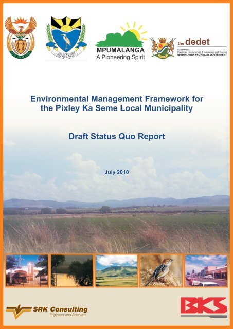
<strong>Draft</strong> <strong>Status</strong> <strong>Quo</strong> <strong>Report</strong> <strong>for</strong> <strong>the</strong> <strong>Pixley</strong> <strong>Ka</strong><br />
<strong>Seme</strong> Local Municipality<br />
Department of Environmental Affairs<br />
<strong>SRK</strong> <strong>Consulting</strong><br />
265 Ox<strong>for</strong>d Road, Illovo<br />
Johannesburg 2196<br />
P O Box 55291<br />
Northlands 2116<br />
Tel: +27 (0) 11 441 1111<br />
Fax: +27 (0) 11 880 8086<br />
Lyn Brown, Nicola Liversage, Margaret Beater & Darryl Kilian<br />
lbrown@srk.co.za<br />
nicolal@bks.co.za<br />
mbeater@srk.co.za<br />
dkilian@srk.co.za<br />
www.srk.co.za<br />
<strong>SRK</strong> Project Number 404946<br />
July 2010<br />
Authors<br />
Lyn Brown, Nicola Liversage & Margaret Beater<br />
Reviewed by<br />
Darryl Kilian<br />
KILI/BEAT G:\404946_PIXLEY EMF\7REPORTS\<strong>Status</strong> <strong>Quo</strong> report\<strong>Draft</strong> report\<strong>Draft</strong> status quo report, July 2010.docx July 2010
<strong>SRK</strong> <strong>Consulting</strong> in association with BKS<br />
<strong>Pixley</strong> <strong>Ka</strong> <strong>Seme</strong> Local Municipality EMF – <strong>Draft</strong> <strong>Status</strong> <strong>Quo</strong> <strong>Report</strong><br />
Page ii<br />
Table of Contents<br />
Acronyms and abbreviations ...................................................................................................... vii<br />
1 Introduction ..................................................................................................................... 9<br />
1.1 Scope of work ...................................................................................................................... 9<br />
1.2 Location of <strong>the</strong> PKSLM ........................................................................................................ 2<br />
1.3 Importance of <strong>the</strong> PKSLM .................................................................................................... 2<br />
1.4 Legal status of <strong>the</strong> PKSLM .................................................................................................. 2<br />
1.4.1 Constitution of South Africa (Act No. 108 of 1996) ................................................................ 2<br />
1.4.2 National Environmental Management Act (Act No. 107 of 1998) .......................................... 2<br />
1.4.3 National Environmental Management: Biodiversity Act (Act No. 10 of 2004) ........................ 3<br />
1.4.4 National Environmental Management: Protected Areas Act (Act No. 57 of 2003) ................. 3<br />
1.4.5 National Environmental Management: Air Quality Act (Act No. 39 of 2004) .......................... 3<br />
1.4.6 National Environmental Management: Waste Management Act (Act No. 59 of 2008) ........... 4<br />
1.4.7 National Water Act (Act No. 36 of 1998) ............................................................................... 4<br />
1.4.8 Environment Conservation Act (Act No. 73 of 1989) ............................................................. 5<br />
1.4.9 National Heritage Resources Act (Act No. 25 of 1999) ......................................................... 5<br />
1.4.10 Mineral and Petroleum Resources Development Act (Act No. 28 of 2002) ........................... 6<br />
1.4.11 Conservation of Agricultural Resources Act (Act No. 43 of 1983) ......................................... 6<br />
1.4.12 National Forest Act, 1998 (Act No. 84 of 1998) ..................................................................... 6<br />
1.4.13 Water Services Act (Act No. 108 of 1997) ............................................................................. 6<br />
1.4.14 Development Facilitation Act (Act No. 67 of 1995) ................................................................ 7<br />
1.4.15 Municipal Structures Act (Act No. 117 of 1998) ..................................................................... 7<br />
1.4.16 Municipal Systems Act (Act No. 32 of 2000) ......................................................................... 7<br />
1.4.17 International Agreements ...................................................................................................... 7<br />
1.4.18 National Policy .................................................................................................................... 11<br />
1.5 Legal status and nature of <strong>the</strong> EMF ................................................................................... 12<br />
1.6 Objectives of this report ..................................................................................................... 13<br />
2 Approach and methodology ........................................................................................ 14<br />
2.1 Sustainable development .................................................................................................. 14<br />
2.2 EMF – a tool <strong>for</strong> sustainable management ........................................................................ 14<br />
2.3 Project phasing .................................................................................................................. 14<br />
2.3.1 Project inception (Phase 1) ................................................................................................. 14<br />
2.3.2 <strong>Status</strong> quo assessment (Phase 2) ...................................................................................... 14<br />
2.3.3 Environmental management framework and plan (Phase 3) ............................................... 15<br />
2.4 Stakeholder engagement ................................................................................................... 16<br />
2.4.1 Phase 1: Awareness raising ................................................................................................ 16<br />
2.4.2 Phase 2: Input ..................................................................................................................... 16<br />
2.4.3 Phase 3: Feedback ............................................................................................................. 16<br />
2.5 Assumptions, limitations and uncertainties ........................................................................ 16<br />
KILI/BEAT G:\404946_PIXLEY EMF\7REPORTS\<strong>Status</strong> <strong>Quo</strong> report\<strong>Draft</strong> report\<strong>Draft</strong> status quo report, July 2010.docx July 2010
<strong>SRK</strong> <strong>Consulting</strong> in association with BKS<br />
<strong>Pixley</strong> <strong>Ka</strong> <strong>Seme</strong> Local Municipality EMF – <strong>Draft</strong> <strong>Status</strong> <strong>Quo</strong> <strong>Report</strong><br />
Page iii<br />
3 <strong>Status</strong> quo of <strong>the</strong> environment ................................................................................... 20<br />
3.1 Regional locality ................................................................................................................. 20<br />
3.2 Biophysical ......................................................................................................................... 20<br />
3.2.1 Climate................................................................................................................................ 20<br />
3.2.2 Air quality ............................................................................................................................ 21<br />
3.2.3 Soils .................................................................................................................................... 22<br />
3.2.4 Topography and geomorphology ........................................................................................ 23<br />
3.2.5 Geology .............................................................................................................................. 23<br />
3.2.6 Water resources .................................................................................................................. 24<br />
3.2.7 Aquatic and wetland ecology .............................................................................................. 27<br />
3.2.8 Terrestrial ecology .............................................................................................................. 28<br />
3.3 Infrastructure and services ................................................................................................ 31<br />
3.3.1 Waste management ............................................................................................................ 31<br />
3.3.2 Sanitation ............................................................................................................................ 31<br />
3.3.3 Water .................................................................................................................................. 32<br />
3.3.4 Energy sources ................................................................................................................... 33<br />
3.3.5 Transport ............................................................................................................................ 33<br />
3.3.6 Cemeteries ......................................................................................................................... 34<br />
3.3.7 Telecommunications ........................................................................................................... 34<br />
3.4 Spatial planning and land use ............................................................................................ 34<br />
3.4.1 Population context .............................................................................................................. 34<br />
3.4.2 Agriculture ........................................................................................................................... 34<br />
3.4.3 Mining ................................................................................................................................. 36<br />
3.4.4 Urban settlements ............................................................................................................... 37<br />
3.4.5 Open space ........................................................................................................................ 39<br />
3.4.6 Tourism ............................................................................................................................... 39<br />
3.4.7 Spatial planning .................................................................................................................. 40<br />
3.5 Socio-economic ................................................................................................................. 42<br />
3.5.1 Population size and distribution .......................................................................................... 42<br />
3.5.2 Economics .......................................................................................................................... 43<br />
3.5.3 Income ................................................................................................................................ 44<br />
3.5.4 Health and safety ................................................................................................................ 44<br />
3.5.5 Education ............................................................................................................................ 45<br />
3.5.6 Cultural resources ............................................................................................................... 45<br />
3.6 Resource economics ......................................................................................................... 46<br />
3.6.1 Overall economic trends and land use ................................................................................ 47<br />
3.6.2 Agriculture ........................................................................................................................... 47<br />
3.6.3 Tourism and recreation ....................................................................................................... 47<br />
3.6.4 Mining ................................................................................................................................. 48<br />
3.6.5 Forestry ............................................................................................................................... 49<br />
KILI/BEAT G:\404946_PIXLEY EMF\7REPORTS\<strong>Status</strong> <strong>Quo</strong> report\<strong>Draft</strong> report\<strong>Draft</strong> status quo report, July 2010.docx July 2010
<strong>SRK</strong> <strong>Consulting</strong> in association with BKS<br />
<strong>Pixley</strong> <strong>Ka</strong> <strong>Seme</strong> Local Municipality EMF – <strong>Draft</strong> <strong>Status</strong> <strong>Quo</strong> <strong>Report</strong><br />
Page iv<br />
3.6.6 Economic values associated with <strong>the</strong> maintenance of natural capital ................................. 49<br />
3.6.7 Economic costs/externalities associated with resource uses .............................................. 49<br />
4 Assets, opportunities, constraints and threats ........................................................ 51<br />
5 Conclusion .................................................................................................................... 65<br />
6 References .................................................................................................................... 98<br />
List of Tables<br />
Table 3-1: Details of <strong>the</strong> 14 Quaternary Catchments in <strong>the</strong> study area ........................................... 24<br />
Table 3-2: PES categories ............................................................................................................... 28<br />
Table 3-3: Vegetation types ............................................................................................................. 28<br />
Table 3-4: PKSLM landfill status ...................................................................................................... 31<br />
Table 3-5: PKSLM waste quantities ................................................................................................. 31<br />
Table 3-6: State of roads in PKSLM ................................................................................................ 33<br />
Table 3-7: Land use in PKSLM ........................................................................................................ 34<br />
Table 3-8: Average yield <strong>for</strong> each crop over <strong>the</strong> last five years ....................................................... 35<br />
Table 3-9: Grease mass and sales values in PKSLM ...................................................................... 35<br />
Table 3-10: Proposed housing delivery in PKSLM – 2010 to 2015 ................................................. 38<br />
Table 3-11: Population size and growth ........................................................................................... 42<br />
Table 3-12: Number of households and growth ............................................................................... 43<br />
Table 3-13: Occupations of <strong>the</strong> economically active ........................................................................ 43<br />
Table 3-14: Number of industries per sector .................................................................................... 44<br />
Table 3-15: Employment status ....................................................................................................... 44<br />
Table 3-16: Income of <strong>the</strong> economically active ................................................................................ 44<br />
Table 3-17: Bed numbers and likely accommodation related employment in <strong>the</strong> study area .......... 48<br />
Table 3-18: Total tourism related employment in <strong>the</strong> study area ..................................................... 48<br />
Table 4-1: Assets, opportunities and constraints/threats associated with surface and groundwater52<br />
Table 4-2: Assets, opportunities and constraints/threats associated with aquatic and wetland<br />
ecology ........................................................................................................................... 55<br />
Table 4-3: Assets, opportunities and constraints/threats associated with terrestrial ecology .......... 56<br />
Table 4-4: Assets, opportunities and constraints/threats associated with land use ......................... 56<br />
Table 4-5: Assets, opportunities and constraints/threats associated with agriculture ...................... 58<br />
Table 4-6: Assets, opportunities and constraints/threats associated with socio-economics ............ 60<br />
Table 4-7: Assets, opportunities and constraints/threats associated with cultural heritage ............. 62<br />
Table 4-8: Assets, opportunities and constraints/threats associated with resource economics ...... 63<br />
List of Figures<br />
Figure 2-1: An integrated conceptual model of sustainable development ....................................... 14<br />
Figure 3-1: Access to refuse removal in PKSLM ............................................................................. 31<br />
KILI/BEAT G:\404946_PIXLEY EMF\7REPORTS\<strong>Status</strong> <strong>Quo</strong> report\<strong>Draft</strong> report\<strong>Draft</strong> status quo report, July 2010.docx July 2010
<strong>SRK</strong> <strong>Consulting</strong> in association with BKS<br />
<strong>Pixley</strong> <strong>Ka</strong> <strong>Seme</strong> Local Municipality EMF – <strong>Draft</strong> <strong>Status</strong> <strong>Quo</strong> <strong>Report</strong><br />
Page v<br />
Figure 3-2: Sanitation in <strong>the</strong> PKSLM ................................................................................................ 32<br />
Figure 3-3: Energy sources used in <strong>the</strong> PKSLM .............................................................................. 33<br />
Figure 3-4: Population by age .......................................................................................................... 43<br />
Figure 3-5: The TEV framework ....................................................................................................... 47<br />
Figure 3-6: The link between Ecosystem Services and human well-being in <strong>the</strong> Millennium<br />
Ecosystem Assessment ................................................................................................. 47<br />
List of Maps<br />
Map 1: Regional map of <strong>Pixley</strong> <strong>Ka</strong> <strong>Seme</strong> Local Municipality ........................................................... 66<br />
Map 2: Locality of <strong>the</strong> <strong>Pixley</strong> <strong>Ka</strong> <strong>Seme</strong> Local Municipality ............................................................... 67<br />
Map 3: Institutional arrangement within <strong>the</strong> <strong>Pixley</strong> <strong>Ka</strong> <strong>Seme</strong> Local Municipality ............................. 68<br />
Map 4: Catchment basins of South Africa ........................................................................................ 69<br />
Map 5: Air quality within <strong>the</strong> <strong>Pixley</strong> <strong>Ka</strong> <strong>Seme</strong> Local Municipality ..................................................... 70<br />
Map 6: Transboundary influences on air quality within <strong>the</strong> <strong>Pixley</strong> <strong>Ka</strong> <strong>Seme</strong> Local Municipality ...... 71<br />
Map 7: Arability of soils within <strong>the</strong> <strong>Pixley</strong> <strong>Ka</strong> <strong>Seme</strong> Local Municipality ............................................ 72<br />
Map 8: Topography within <strong>the</strong> <strong>Pixley</strong> <strong>Ka</strong> <strong>Seme</strong> Local Municipality .................................................. 73<br />
Map 9: Geology within <strong>the</strong> <strong>Pixley</strong> <strong>Ka</strong> <strong>Seme</strong> Local Municipality ........................................................ 74<br />
Map 10: Coal borehole distribution within <strong>the</strong> <strong>Pixley</strong> <strong>Ka</strong> <strong>Seme</strong> Local Municipality .......................... 75<br />
Map 11: Potential underground and surface mining within <strong>the</strong> <strong>Pixley</strong> <strong>Ka</strong> <strong>Seme</strong> Local Municipality 76<br />
Map 12: Quaternary catchments and water management areas within <strong>the</strong> <strong>Pixley</strong> <strong>Ka</strong> <strong>Seme</strong> Local<br />
Municipality .................................................................................................................... 77<br />
Map 13: Surface water quality within <strong>the</strong> <strong>Pixley</strong> <strong>Ka</strong> <strong>Seme</strong> Local Municipality ................................. 78<br />
Map 14: Hydrogeology within <strong>the</strong> <strong>Pixley</strong> <strong>Ka</strong> <strong>Seme</strong> Local Municipality ............................................. 79<br />
Map 15: Existing land uses within <strong>the</strong> <strong>Pixley</strong> <strong>Ka</strong> <strong>Seme</strong> Local Municipality ...................................... 80<br />
Map 16: Hydro-morphic units of wetlands within <strong>the</strong> <strong>Pixley</strong> <strong>Ka</strong> <strong>Seme</strong> Local Municipality ................ 81<br />
Map 17: Present ecological state of wetlands within <strong>the</strong> <strong>Pixley</strong> <strong>Ka</strong> <strong>Seme</strong> Local Municipality .......... 82<br />
Map 18: Present ecological state of quinery catchments ................................................................. 83<br />
Map 19: Aquatic conservation within <strong>the</strong> <strong>Pixley</strong> <strong>Ka</strong> <strong>Seme</strong> Local Municipality .................................. 84<br />
Map 20: Aquatic biodiversity within <strong>the</strong> <strong>Pixley</strong> <strong>Ka</strong> <strong>Seme</strong> Local Municipality .................................... 85<br />
Map 21: Terrestrial biodiversity within <strong>the</strong> <strong>Pixley</strong> <strong>Ka</strong> <strong>Seme</strong> Local Municipality ................................ 86<br />
Map 22: Vegetation types within <strong>the</strong> <strong>Pixley</strong> <strong>Ka</strong> <strong>Seme</strong> Local Municipality ........................................ 87<br />
Map 23: Protected areas within <strong>the</strong> <strong>Pixley</strong> <strong>Ka</strong> <strong>Seme</strong> Local Municipality .......................................... 88<br />
Map 24: Identified hotspots within <strong>the</strong> <strong>Pixley</strong> <strong>Ka</strong> <strong>Seme</strong> Local Municipality ...................................... 89<br />
Map 25: Infrastructure within <strong>the</strong> <strong>Pixley</strong> <strong>Ka</strong> <strong>Seme</strong> Local Municipality .............................................. 90<br />
Map 26: Land claims within <strong>the</strong> <strong>Pixley</strong> <strong>Ka</strong> <strong>Seme</strong> Local Municipality ................................................ 91<br />
Map 27: Tourism sites within <strong>the</strong> <strong>Pixley</strong> <strong>Ka</strong> <strong>Seme</strong> Local Municipality .............................................. 92<br />
Map 28: Population density within <strong>the</strong> <strong>Pixley</strong> <strong>Ka</strong> <strong>Seme</strong> Local Municipality ...................................... 93<br />
Map 29: Health facilities within <strong>the</strong> <strong>Pixley</strong> <strong>Ka</strong> <strong>Seme</strong> Local Municipality ........................................... 94<br />
KILI/BEAT G:\404946_PIXLEY EMF\7REPORTS\<strong>Status</strong> <strong>Quo</strong> report\<strong>Draft</strong> report\<strong>Draft</strong> status quo report, July 2010.docx July 2010
<strong>SRK</strong> <strong>Consulting</strong> in association with BKS<br />
<strong>Pixley</strong> <strong>Ka</strong> <strong>Seme</strong> Local Municipality EMF – <strong>Draft</strong> <strong>Status</strong> <strong>Quo</strong> <strong>Report</strong><br />
Page vi<br />
Map 30: Cultural-heritage within <strong>the</strong> <strong>Pixley</strong> <strong>Ka</strong> <strong>Seme</strong> Local Municipality ........................................ 95<br />
Map 31: Land types within <strong>the</strong> <strong>Pixley</strong> <strong>Ka</strong> <strong>Seme</strong> Local Municipality ................................................. 96<br />
Map 32: Developments applications (since 2005) within <strong>the</strong> <strong>Pixley</strong> <strong>Ka</strong> <strong>Seme</strong> Local Municipality ... 97<br />
KILI/BEAT G:\404946_PIXLEY EMF\7REPORTS\<strong>Status</strong> <strong>Quo</strong> report\<strong>Draft</strong> report\<strong>Draft</strong> status quo report, July 2010.docx July 2010
<strong>SRK</strong> <strong>Consulting</strong> in association with BKS<br />
<strong>Pixley</strong> <strong>Ka</strong> <strong>Seme</strong> Local Municipality EMF – <strong>Draft</strong> <strong>Status</strong> <strong>Quo</strong> <strong>Report</strong><br />
Acronyms and abbreviations<br />
Page vii<br />
ADSL Asymmetric Digital Subscriber Line<br />
AMD Acid Mine Drainage<br />
ANC African National Congress<br />
AQA National Environmental Management: Air Quality Act (Act No. 39 of 2004)<br />
BID<br />
Background In<strong>for</strong>mation Document<br />
BKS BKS (Pty) Ltd.<br />
CCD Convention to Combating Desertification<br />
CITES Convention on <strong>the</strong> Illegal Trade in Endangered Species<br />
CMA Catchment Management Agency<br />
CO<br />
Carbon monoxide<br />
CS<br />
Community Survey<br />
DDT Dichlorodiphenyltrichloroethane<br />
DEA Department of Environmental Affairs<br />
DEAT Department of Environmental Affairs and Tourism<br />
DFA Development Facilitation Act (Act No. 67 of 1995)<br />
DMC DMC Coal Mining<br />
DME Department of Minerals and Energy<br />
DWA Department of Water Affairs<br />
DWAF Department of Water Affairs and Forestry<br />
EC<br />
Electrical Conductivity<br />
EIA<br />
Environmental Impact Assessment<br />
EMF Environmental Management Framework<br />
GGP Gross Geographic Product<br />
GHG Greenhouse Gas<br />
GIS<br />
Geographic In<strong>for</strong>mation System<br />
GSDM Gert Sibande District Municipality<br />
Ha<br />
Hectare<br />
HIA<br />
Heritage Impact Assessment<br />
HPA Highveld Priority Area<br />
I&APs Interested and Affected Parties<br />
ICM Integrated Catchment Management<br />
IDP<br />
Integrated Development Plan<br />
IPCC Intergovernmental Panel on Climate Change<br />
JWC Joint Water Commission<br />
KZN KwaZulu-Natal<br />
LRAD Land Redistribution <strong>for</strong> Agricultural Development<br />
LUMS Land Use Management Scheme<br />
MAP Mean Annual Precipitation<br />
MAR Mean Annual Runoff<br />
MBCP Mpumalanga Biodiversity Conservation Plan<br />
MDALA Mpumalanga Department of Agriculture and Land Administration<br />
MDEDET Mpumalanga Department of Economic Development, Environment and Tourism<br />
MEC Member of Executive Council<br />
MEGA Mpumalanga Economic Growth Agency<br />
MET Monitoring Station Measure Wea<strong>the</strong>r Changes<br />
MoU Memorandum of Understanding<br />
MPRDA Mineral and Petroleum Resources Development Act (Act No. 28 of 2002)<br />
MTGS Mpumalanga Tourism Growth Strategy<br />
MTPA Mpumalanga Tourism and Parks Agency<br />
NCHM National Cultural History Museum<br />
KILI/BEAT G:\404946_PIXLEY EMF\7REPORTS\<strong>Status</strong> <strong>Quo</strong> report\<strong>Draft</strong> report\<strong>Draft</strong> status quo report, July 2010.docx July 2010
<strong>SRK</strong> <strong>Consulting</strong> in association with BKS<br />
<strong>Pixley</strong> <strong>Ka</strong> <strong>Seme</strong> Local Municipality EMF – <strong>Draft</strong> <strong>Status</strong> <strong>Quo</strong> <strong>Report</strong><br />
Page viii<br />
NEMA National Environmental Management Act (Act No. 107 of 1998)<br />
NFA National Forest Act (Act No. 84 of 1998)<br />
NFSD National Framework <strong>for</strong> Sustainable Development<br />
NH3 Uniodised Ammonia<br />
NHRA National Heritage Resources Act (Act No. 25 of 1999)<br />
NOx Nitrogen Oxides<br />
NSDP National Spatial Development Perspective<br />
NWA National Water Act (Act No. 36 of 1998)<br />
NWRS National Water Resource Strategy<br />
O 3<br />
PA<br />
PES<br />
PGDS<br />
PKSLM<br />
PM<br />
PM 10<br />
POPs<br />
PSC<br />
Ramsar<br />
RDP<br />
SADC<br />
SAHRA<br />
SANBI<br />
SDF<br />
SEMP<br />
SLAG<br />
SMME<br />
SOER<br />
SOx<br />
<strong>SRK</strong><br />
StatsSA<br />
TDS<br />
TEV<br />
UCG<br />
UN<br />
UNEP<br />
UNFCCC<br />
VOC<br />
WMA<br />
WSDP<br />
WWTW<br />
Ozone<br />
Priority Area<br />
Present Ecological State<br />
Provincial Growth and Development Strategy<br />
<strong>Pixley</strong> <strong>Ka</strong> <strong>Seme</strong> Local Municipality<br />
Particulate Matter<br />
Particulate Matter 10 micrometres or less<br />
Persistent Organic Pollutants<br />
Project Steering Committee<br />
Convention on <strong>the</strong> Conservation of Wetlands especially as Waterfowl Habitat<br />
Reconstruction and Development Programme<br />
Sou<strong>the</strong>rn African Development Community<br />
South African Heritage Resources Agency<br />
South African National Biodiversity Institute<br />
Spatial Development Framework<br />
Strategic Environmental Management Plan<br />
Settlement Land Acquisition Grant<br />
Small, Medium and Micro Enterprise<br />
State of <strong>the</strong> Environment <strong>Report</strong><br />
Sulphur Oxides<br />
<strong>SRK</strong> <strong>Consulting</strong> (South Africa) (Pty) Ltd.<br />
Statistics South Africa<br />
Total Dissolved Solids<br />
Total Economic Value<br />
Underground Coal Gasification<br />
United Nations<br />
United Nations Environment Programme<br />
United Nations Framework Convention on Climate Change<br />
Volatile Organic Compound<br />
Water Management Area<br />
Water Services Development Plan<br />
Waste Water Treatment Work<br />
KILI/BEAT G:\404946_PIXLEY EMF\7REPORTS\<strong>Status</strong> <strong>Quo</strong> report\<strong>Draft</strong> report\<strong>Draft</strong> status quo report, July 2010.docx July 2010
<strong>SRK</strong> House<br />
265 Ox<strong>for</strong>d Road, Illovo<br />
Johannesburg 2196<br />
P O Box 55291<br />
Northlands 2116<br />
South Africa<br />
e-Mail: johannesburg@srk.co.za<br />
URL: http://www.srk.co.za<br />
BKS (Pty) Ltd Group Head office Postal Address Tel | + 27 (0) 12 421‐3500<br />
Reg no 1966/006628/07 Block D, PO Box 3173 Fax | + 27 (0) 12 421‐3501<br />
www.bks.co.za Hatfield Gardens Pretoria 0001 E‐mail | group@bks.co.za<br />
333 Grosvenor Street South Africa E‐mail | bkspta@bks.co.za<br />
Hatfield, Pretoria, 0083<br />
Tel: +27 (0) 11 441 1111<br />
Fax:+27 (0) 11 880 8086<br />
July 2010<br />
<strong>Report</strong> no. 404946<br />
<strong>Status</strong> <strong>Quo</strong> <strong>Report</strong> <strong>for</strong> <strong>the</strong> <strong>Pixley</strong> <strong>Ka</strong> <strong>Seme</strong> Local<br />
Municipality<br />
1 Introduction<br />
In February 2010, <strong>the</strong> National Department of<br />
Environmental Affairs (DEA) commissioned <strong>the</strong><br />
development of an Environmental Management<br />
Framework (EMF) to support decision-making that will<br />
ensure <strong>the</strong> sustainable development and management of<br />
<strong>the</strong> natural resource of <strong>the</strong> <strong>Pixley</strong> <strong>Ka</strong> <strong>Seme</strong> Local<br />
Municipality (PKSLM). <strong>SRK</strong> <strong>Consulting</strong> (South Africa)<br />
(Pty) Ltd. (<strong>SRK</strong>) in association with BKS (Pty) Ltd.<br />
(BKS) has been appointed to undertake <strong>the</strong> EMF. The<br />
EMF is being developed in terms of Guideline 6 of <strong>the</strong><br />
Integrated Environmental Management Guideline<br />
Series (Gazette No. 28854 of 19 May 2006) aimed at<br />
promoting sustainable development, and <strong>the</strong> new EMF<br />
Regulations (No. R547) under Sections 24(5) and 44 of<br />
<strong>the</strong> National Environmental Management Act (Act No.<br />
107 of 1998) (NEMA).<br />
The EMF will serve as a management and decisionmaking<br />
tool that provides authorities with in<strong>for</strong>mation<br />
about <strong>the</strong> ‘state of <strong>the</strong> environment’ and <strong>the</strong> associated<br />
planning parameters. It will identify and spatially<br />
represent areas of potential conflict between sensitive<br />
environments and development proposals thus assisting<br />
in integrating social, economic and environmental<br />
factors into planning. The EMF will be incorporated<br />
into relevant planning documents such as Integrated<br />
Development Plans (IDPs) and Strategic Development<br />
Frameworks (SDFs).<br />
1.1 Scope of work<br />
The broad objective of <strong>the</strong> project is to present <strong>the</strong><br />
status quo of <strong>the</strong> area, to describe <strong>the</strong> desired state of<br />
environment based on opportunities and constraints<br />
identified in <strong>the</strong> status quo, to prioritize development<br />
plans, and to develop practical guidelines <strong>for</strong> land use<br />
management and in<strong>for</strong>med decision-making.<br />
More specifically, <strong>the</strong> EMF process will:<br />
• Describe <strong>the</strong> environmental attributes;<br />
• Assess attributes in terms of <strong>the</strong>ir relative<br />
sensitivity to development, highlighting potential<br />
opportunities and constraints/threats;<br />
• Delineate <strong>the</strong> potential sensitivity;<br />
• Identify areas (or zones) where environmental<br />
authorisation will be required <strong>for</strong> certain activities<br />
in terms of <strong>the</strong> NEMA Regulations (2010); and<br />
• Establish a management framework and plan that<br />
guides decision-making.<br />
The approach to, and phasing of, this EMF process is<br />
presented in some detail in Section 2.<br />
Partners<br />
Directors<br />
Associate<br />
Partners<br />
AN Birtles, JCJ Boshoff, AH Bracken, MJ Braune, JM Brown, CD Dalgliesh, JR Dixon, DM Du<strong>the</strong>, R Gardiner, T Hart, MJ Hood,<br />
GC Howell. WC Joughin, PR Labrum, DJ Mahlangu, RRW McNeill, HAC Meintjes, MJ Morris, WA Naismith, GP Nel, VS Reddy,<br />
PN Rosewarne, PE Schmidt, PJ Shepherd, VM Simposya, AA Smi<strong>the</strong>n, KM Uderstadt, DJ Venter, ML Wertz, A Wood<br />
AJ Barrett, JR Dixon, DM Du<strong>the</strong>, MJ Hood, DJ Mahlangu, VS Reddy, PE Schmidt, PJ Terbrugge<br />
BM Engelsman, DJD Gibson, M Hinsch, DA Kilian, SA McDonald, M Ristic, MJ Sim, JJ Slabbert, CF Steyn, D Visser,<br />
MD Wanless<br />
Consultants AC Burger, BSc (Hons); IS Cameron-Clarke, PrSci Nat, MSc; JAC Cowan, PrSci Nat, BSc (Hons), JH de Beer, PrSci Nat,<br />
MSc; GA Jones, PrEng, PhD; TR Stacey, PrEng, DSc; OKH Steffen, PrEng, PhD; PJ Terbrugge, PrSci Nat, MSc; DW Warwick,<br />
PrSci Nat, BSc (Hons)<br />
Cape Town +27 (0) 21 659 3060<br />
Durban +27 (0) 31 279 1200<br />
East London +27 (0) 43 748 6292<br />
Johannesburg +27 (0) 11 441 1111<br />
Kimberley +27 (0) 53 861 5798<br />
Pietermaritzburg +27 (0) 33 345 6311<br />
Port Elizabeth +27 (0) 41 509 4800<br />
Pretoria +27 (0) 12 361 9821<br />
Rustenburg +27 (0) 14 594 1280<br />
<strong>SRK</strong> <strong>Consulting</strong> (South Africa) (Pty) Ltd Reg No 1995.012890.07<br />
Dar-es-Salaam +25 (5) 22 260 1881<br />
H +263 (4) 49 6182
<strong>SRK</strong> <strong>Consulting</strong> in association with BKS<br />
<strong>Pixley</strong> <strong>Ka</strong> <strong>Seme</strong> Local Municipality EMF – <strong>Draft</strong> <strong>Status</strong> <strong>Quo</strong> <strong>Report</strong> Page 2<br />
1.2 Location of <strong>the</strong> PKSLM<br />
The study area is located in south-eastern Mpumalanga,<br />
one of <strong>the</strong> seven local municipalities in <strong>the</strong> Gert<br />
Sibande District Municipality (GSDM) (see Map 1 and<br />
Map 2). The PKSLM covers an area of 522,204<br />
hectares (ha). Key towns include Volksrust,<br />
Amersfoort, Daggakraal, Perdekop and Wakkerstroom<br />
(see Map 3).<br />
1.3 Importance of <strong>the</strong> PKSLM<br />
The PKSLM area is characterised by many wetlands<br />
and pan systems, and is an important water catchment<br />
area. Many endemic and threatened grassland species<br />
occur in <strong>the</strong> area and of particular significance are <strong>the</strong><br />
areas around Wakkerstroom and Luneburg. Agriculture<br />
is <strong>the</strong> major contributor to <strong>the</strong> gross geographic product<br />
(GGP) in <strong>the</strong> municipal area. There is also a high<br />
potential <strong>for</strong> additional tourism and agriculture<br />
development and growth in this area.<br />
The PKSLM area is also strategically important because<br />
it contains <strong>the</strong> sources of three river systems, including<br />
an important source of water <strong>for</strong> <strong>the</strong> Gauteng region<br />
(see Map 4).<br />
1.4 Legal status of <strong>the</strong> PKSLM<br />
A number of laws guide <strong>the</strong> protection and management<br />
of PKSLM. It is important to provide <strong>the</strong> legal<br />
framework within which <strong>the</strong> EMF operates as well as<br />
o<strong>the</strong>r applicable legislation governing environmental<br />
matters in South Africa. South Africa is also signatory<br />
to a number of Conventions and treaties that are related<br />
to environmental management that must also be<br />
considered. Sections 1.4.1 to 1.4.18 provide a summary<br />
of <strong>the</strong> most applicable legislation and agreements.<br />
1.4.1 Constitution of South Africa (Act<br />
No. 108 of 1996)<br />
The Constitution is <strong>the</strong> over-arching framework of all<br />
o<strong>the</strong>r legislation in South Africa and its primary goal is<br />
to protect <strong>the</strong> rights of all citizens of <strong>the</strong> country. The<br />
Constitution binds <strong>the</strong> legislature, <strong>the</strong> executive and all<br />
organs of state.<br />
In terms of <strong>the</strong> environment, <strong>the</strong> Constitution states<br />
that:<br />
(S24) Everyone has <strong>the</strong> right -<br />
• to an environment that is not harmful to <strong>the</strong>ir health<br />
or well-being; and<br />
• to have <strong>the</strong> environment protected, <strong>for</strong> <strong>the</strong> benefit of<br />
present and future generation through reasonable<br />
legislative and o<strong>the</strong>r measures that –<br />
‣ prevent pollution and ecological degradation;<br />
‣ promote conservation; and<br />
‣ secure ecologically sustainable development<br />
and use of natural resources while promoting<br />
justifiable economic and social development.<br />
The Constitution aims to promote <strong>the</strong> integration of<br />
environmental laws and protection of resources at all<br />
levels of government and development and ensure<br />
accountability, transparency and participation.<br />
1.4.2 National Environmental<br />
Management Act (Act No. 107 of<br />
1998)<br />
The objective of <strong>the</strong> NEMA is to provide <strong>for</strong> cooperative<br />
environmental governance by establishing<br />
principles <strong>for</strong> decision making on matters affecting <strong>the</strong><br />
environment, institutions that will provide co-operative<br />
governance and procedures <strong>for</strong> coordinating<br />
environmental functions of relevant organs of state.<br />
NEMA establishes a number of principles that will<br />
apply throughout South Africa to all organizations or<br />
persons conducting activities that may have an impact<br />
on <strong>the</strong> environment. These principles provide a general<br />
framework <strong>for</strong> environmental planning and guide <strong>the</strong><br />
interpretation, administration and implementation of <strong>the</strong><br />
Act. Chapter 5 relates specifically to integrating<br />
environmental management into <strong>the</strong> planning and<br />
development process and to identifying, predicting and<br />
evaluating <strong>the</strong> effects that policies, programmes and<br />
plans may have on <strong>the</strong> environment.<br />
Chapter 6 gives effect to <strong>the</strong> international agreements to<br />
which South Africa is signatory to. Section 1.4.17 gives<br />
more detail on <strong>the</strong>se agreements.<br />
Environmental Impact Regulations<br />
The Minister of Environmental Affairs has identified<br />
and listed certain activities which may have significant<br />
negative effect on <strong>the</strong> environment. Any person who<br />
KILI/BEAT G:\404946_PIXLEY EMF\7REPORTS\<strong>Status</strong> <strong>Quo</strong> report\<strong>Draft</strong> report\<strong>Draft</strong> status quo report, July 2010.docx July 2010
<strong>SRK</strong> <strong>Consulting</strong> in association with BKS<br />
<strong>Pixley</strong> <strong>Ka</strong> <strong>Seme</strong> Local Municipality EMF – <strong>Draft</strong> <strong>Status</strong> <strong>Quo</strong> <strong>Report</strong> Page 3<br />
wants to conduct such an activity is required to<br />
complete an assessment of potential effects (positive<br />
and negative) of that activity on <strong>the</strong> environment and is<br />
subject to prosecution if he/she does not complete this<br />
assessment.<br />
The Atmospheric Pollution Prevention Act (Act No. 45<br />
of 1965) regulates <strong>the</strong> control of noxious and offensive<br />
gases emitted by industrial processes, <strong>the</strong> control of<br />
smoke and wind borne dust pollution, and emissions<br />
from diesel vehicles.<br />
Duty of Care<br />
Section 28 of <strong>the</strong> Act states that:<br />
Every person who causes, has caused or may cause<br />
significant pollution or degradation of <strong>the</strong> environment<br />
must take reasonable measures to prevent such<br />
pollution or degradation from occurring, continuing or<br />
recurring, or, in so far as such harm to <strong>the</strong> environment<br />
is authorised by law or cannot reasonably be avoided<br />
or stopped, to minimize and rectify such pollution or<br />
degradation of <strong>the</strong> environment.<br />
1.4.3 National Environmental<br />
Management: Biodiversity Act (Act<br />
No. 10 of 2004)<br />
The main objectives of this Act are to provide <strong>for</strong> <strong>the</strong><br />
management and conservation of biodiversity and <strong>the</strong><br />
sustainable use of natural resources. The Act was<br />
established under <strong>the</strong> framework of <strong>the</strong> NEMA and<br />
deals with biodiversity planning and monitoring,<br />
protection of threatened ecosystems and species,<br />
possible invasive species, bio-prospecting and<br />
permitting.<br />
1.4.4 National Environmental<br />
Management: Protected Areas Act<br />
(Act No. 57 of 2003)<br />
The purpose of this Act is to provide <strong>for</strong> <strong>the</strong> protection<br />
and conservation of ecologically viable areas which<br />
represent <strong>the</strong> biological diversity, natural landscapes<br />
and seascapes of South Africa. It also provides <strong>for</strong> <strong>the</strong><br />
establishment of a national register of all protected<br />
areas, whe<strong>the</strong>r national, regional or local, <strong>for</strong> <strong>the</strong><br />
management of those areas according to national<br />
standards and <strong>for</strong> <strong>the</strong> cooperation between government<br />
departments and public consultation in matters<br />
regarding protected areas or matters in connection<br />
<strong>the</strong>reto. This Act was also established under NEMA.<br />
1.4.5 National Environmental<br />
Management: Air Quality Act (Act<br />
No. 39 of 2004)<br />
A shift from national air pollution control based on<br />
source-based controls to decentralised air quality<br />
management through an effects-based approach is<br />
supported by <strong>the</strong> Air Quality Act (AQA), promulgated<br />
in terms of NEMA. An effects based approach requires<br />
<strong>the</strong> setting of ambient air quality standards. Ambient<br />
standards that define satisfactory air quality to ensure<br />
human health and welfare, <strong>the</strong> protection of <strong>the</strong> natural<br />
and build environment, and finally <strong>the</strong> prevention of<br />
significant decline in <strong>the</strong> quality of air may be<br />
established. Such standards provide <strong>the</strong> objectives <strong>for</strong><br />
air quality management. Multiple levels of standards<br />
provide <strong>the</strong> basis <strong>for</strong> both ‘continued improvements’ in<br />
air quality and <strong>for</strong> long term planning in air quality<br />
management. Although maximum levels of ambient<br />
concentrations should be set at a national level, more<br />
stringent ambient standards may be implemented by<br />
provincial and local authorities.<br />
Source-based controls, including best practicable means<br />
and best available technology not entailing excessive<br />
cost, cannot ensure air quality but ra<strong>the</strong>r represents one<br />
means of achieving and attaining ambient standards.<br />
Provision is also made <strong>for</strong> implementation of alternative<br />
regulatory approaches in programmes aimed at <strong>the</strong><br />
attainment and maintenance of ambient standards. Such<br />
alternative approaches include proactive controls,<br />
market incentives and disincentives, self-regulation,<br />
community-based initiatives and awareness and<br />
education campaigns. The integration of diverse<br />
emission reduction approaches is required to ensure<br />
innovative and flexible policies and plans of action<br />
tailored to suit local circumstances.<br />
The control and management of all sources of air<br />
pollution relative to <strong>the</strong>ir contributions to ambient<br />
concentrations is required to ensure that improvements<br />
in air quality are secured in <strong>the</strong> timeliest, evenhanded,<br />
and cost-effective way. The need to regulate diverse<br />
source types rein<strong>for</strong>ces <strong>the</strong> need <strong>for</strong> varied management<br />
approaches ranging from command and control<br />
methods to voluntary measures.<br />
KILI/BEAT G:\404946_PIXLEY EMF\7REPORTS\<strong>Status</strong> <strong>Quo</strong> report\<strong>Draft</strong> report\<strong>Draft</strong> status quo report, July 2010.docx July 2010
<strong>SRK</strong> <strong>Consulting</strong> in association with BKS<br />
<strong>Pixley</strong> <strong>Ka</strong> <strong>Seme</strong> Local Municipality EMF – <strong>Draft</strong> <strong>Status</strong> <strong>Quo</strong> <strong>Report</strong> Page 4<br />
Public participation in <strong>the</strong> air quality management<br />
process and public access to in<strong>for</strong>mation, including<br />
in<strong>for</strong>mation on environmentally harmful practices will<br />
be a crucial component of future legislation. It is<br />
recognised that <strong>the</strong> integration of public participation<br />
into <strong>the</strong> decision-making process will be enhanced<br />
through education and awareness programmes aimed at<br />
<strong>the</strong> empowerment of communities.<br />
Emphasis is to be placed on <strong>the</strong> integration of air<br />
quality issues into <strong>the</strong> transportation, housing and land<br />
use planning processes in order to ensure that air quality<br />
issues are addressed in <strong>the</strong> long term.<br />
Under <strong>the</strong> AQA local authorities are held responsible<br />
<strong>for</strong> air quality management planning. The<br />
decentralisation of air quality management has enabled<br />
management strategies aimed at securing ambient<br />
standards to be geared towards local environments.<br />
Decentralised air quality management is also more<br />
conducive to effective public participation in <strong>the</strong><br />
management process. In decentralised air quality<br />
management, caution is however needed to ensure a<br />
basis <strong>for</strong> effective air quality management, in terms of<br />
expertise, funds, and <strong>the</strong> consistent implementation of<br />
tools.<br />
Priority areas<br />
By notice in <strong>the</strong> government gazette <strong>the</strong> Minister may<br />
declare an area a priority area (PA) if <strong>the</strong> minister or<br />
member of executive council (MEC) reasonably<br />
believes that ambient air quality standards are/may be<br />
exceeded in an area, and specific management actions<br />
need to be implemented in order to rectify <strong>the</strong> situation.<br />
An area may be prioritised if it is considered that it is or<br />
may be impacting on <strong>the</strong> air quality of neighbouring<br />
countries, or if it affects <strong>the</strong> national interest. The<br />
MECs of two or more adjoining Provinces may by joint<br />
action declare an area falling within those Provinces a<br />
PA. Once an area has been declared a PA, an air quality<br />
management plan needs to be prepared and submitted to<br />
<strong>the</strong> relevant authority within <strong>the</strong> timeframe specified by<br />
that authority. Be<strong>for</strong>e approval of <strong>the</strong> plan a<br />
consultative process needs to be followed. The plan<br />
must aim to co-ordinate air quality management in <strong>the</strong><br />
area, address issues related to air quality and provide <strong>for</strong><br />
<strong>the</strong> implementation of <strong>the</strong> plan by a committee. The<br />
committee appointed should be representative of <strong>the</strong><br />
relevant role players.<br />
During <strong>the</strong> writing of this report only two air quality<br />
PAs had been declared under <strong>the</strong> AQA, namely <strong>the</strong><br />
Vaal Triangle and Highveld Priority Area (HPA), with<br />
PKSLM falling within <strong>the</strong> HPA. An air quality<br />
management plan is still under development <strong>for</strong> this<br />
area, with monitoring of key pollutants being<br />
undertaken within GSDM to in<strong>for</strong>m <strong>the</strong> development of<br />
intervention strategies aimed at reducing ambient<br />
pollution levels in <strong>the</strong> region.<br />
1.4.6 National Environmental<br />
Management: Waste Management<br />
Act (Act No. 59 of 2008)<br />
This Act was established to re<strong>for</strong>m <strong>the</strong> laws regulating<br />
waste management in order to protect <strong>the</strong> health and <strong>the</strong><br />
environment by implementing reasonable measures <strong>for</strong><br />
<strong>the</strong> prevention of pollution and ecological degradation<br />
and <strong>for</strong> ensuring sustainable development. It aims to<br />
establish national standards <strong>for</strong> <strong>the</strong> regulation of waste<br />
by all levels of government, provide <strong>for</strong> control of all<br />
waste management activities and implement<br />
remediation measures and compliance en<strong>for</strong>cement <strong>for</strong><br />
land which has been impacted by waste.<br />
1.4.7 National Water Act (Act No. 36 of<br />
1998)<br />
The national importance of water and <strong>the</strong> provision<br />
<strong>the</strong>reof has been acknowledged in <strong>the</strong> Constitution as a<br />
basic human right. The aim of <strong>the</strong> National Water Act<br />
(Act No. 36 of 1998) (NWA) is to ensure that <strong>the</strong> water<br />
resources are protected, used, developed, conserved and<br />
controlled by all reasonable measures. The NWA deals<br />
with <strong>the</strong> development of strategies to facilitate <strong>the</strong><br />
proper management of water resources, provides <strong>for</strong> <strong>the</strong><br />
protection of water resources, regulation of water use<br />
and o<strong>the</strong>r matters relating <strong>the</strong>reto.<br />
Water use is defined to incorporate surface and<br />
groundwater, and includes <strong>the</strong> act of taking water from<br />
a water resource, storing water, impeding or diverting<br />
<strong>the</strong> flow of a water course, engaging in stream flow<br />
reduction activities, discharging water containing waste<br />
or water that has been heated in an industrial process,<br />
altering <strong>the</strong> physical structure or character of a water<br />
course or removing, discharging or disposing of<br />
underground water <strong>for</strong> safety purposes.<br />
KILI/BEAT G:\404946_PIXLEY EMF\7REPORTS\<strong>Status</strong> <strong>Quo</strong> report\<strong>Draft</strong> report\<strong>Draft</strong> status quo report, July 2010.docx July 2010
<strong>SRK</strong> <strong>Consulting</strong> in association with BKS<br />
<strong>Pixley</strong> <strong>Ka</strong> <strong>Seme</strong> Local Municipality EMF – <strong>Draft</strong> <strong>Status</strong> <strong>Quo</strong> <strong>Report</strong> Page 5<br />
Generally, water use must be licensed under <strong>the</strong> NWA<br />
unless:<br />
• It is an existing water use;<br />
• It is permissible under a general authorization;<br />
• It is listed in Schedule 1 of <strong>the</strong> Act; and<br />
• A responsible authority has waived <strong>the</strong> need of a<br />
license.<br />
The NWA also takes into account <strong>the</strong> prevention of<br />
pollution of water resources and places a responsibility<br />
on all water users to take all reasonable measures to<br />
prevent or minimize water pollution. It also provides <strong>for</strong><br />
a framework <strong>for</strong> <strong>the</strong> remedying of water resources<br />
which have been polluted.<br />
1.4.8 Environment Conservation Act<br />
(Act No. 73 of 1989)<br />
The objectives of <strong>the</strong> Act are to provide effective<br />
protection of <strong>the</strong> environment, controlled use of natural<br />
resources and provision of guidelines to handling<br />
matters relating to environmental incidents. Most of <strong>the</strong><br />
provisions of this Act have been repealed by <strong>the</strong> suite of<br />
legislation promulgated in terms of NEMA.<br />
‣ Ancestral graves<br />
‣ Royal graves and graves of traditional leaders<br />
‣ Graves of victims of conflict<br />
‣ Graves of individuals designated by <strong>the</strong> Minister<br />
by notice in <strong>the</strong> Gazette<br />
‣ Historical graves and cemeteries<br />
‣ O<strong>the</strong>r human remains which are not covered in<br />
terms of <strong>the</strong> Human Tissue Act, 1983 (Act No.<br />
65 of 1983);<br />
• Sites of significance relating to <strong>the</strong> history of<br />
slavery in South Africa; and<br />
• Movable objects, including:<br />
‣ Objects recovered from <strong>the</strong> soil or waters of<br />
South Africa, including archaeological and<br />
palaeontological objects and material, meteorites<br />
and rare geological specimens<br />
‣ Objects to which oral traditions are attached or<br />
which are associated with living heritage<br />
‣ Ethnographic art and objects<br />
‣ Military objects<br />
1.4.9 National Heritage Resources Act<br />
(Act No. 25 of 1999)<br />
The National Heritage Resources Act (Act No. 25 of<br />
1999) (NHRA) defines <strong>the</strong> heritage resources of South<br />
Africa, which are of cultural significance or o<strong>the</strong>r<br />
special value <strong>for</strong> <strong>the</strong> present community and <strong>for</strong> future<br />
generations that must be considered part of <strong>the</strong> national<br />
estate to include:<br />
• Places, buildings, structures and equipment of<br />
cultural significance;<br />
• Places to which oral traditions are attached or<br />
which are associated with living heritage;<br />
• Historical settlements and townscapes;<br />
• Landscapes and natural features of cultural<br />
significance;<br />
• Geological sites of scientific or cultural importance;<br />
• Archaeological and palaeontological sites;<br />
• Graves and burial grounds, including:<br />
‣ Objects of decorative or fine art<br />
‣ Objects of scientific or technological interest<br />
‣ Books, records, documents, photographic<br />
positives and negatives, graphic, film or video<br />
material or sound recordings, excluding those<br />
that are public records as defined in section<br />
1(xiv) of <strong>the</strong> National Archives of South Africa<br />
Act, 1996 (Act No. 43 of 1996).<br />
Section 35(4) of <strong>the</strong> NHRA states that no person may,<br />
without a permit issued by <strong>the</strong> responsible heritage<br />
resources authority:<br />
• Destroy, damage, excavate, alter, deface or<br />
o<strong>the</strong>rwise disturb any archaeological or<br />
palaeontological site or any meteorite;<br />
• Destroy, damage, excavate, remove from its<br />
original position, collect or own any archaeological<br />
or palaeontological material or object or any<br />
meteorite;<br />
• Trade in, sell <strong>for</strong> private gain, export or attempt to<br />
export from <strong>the</strong> Republic any category of<br />
KILI/BEAT G:\404946_PIXLEY EMF\7REPORTS\<strong>Status</strong> <strong>Quo</strong> report\<strong>Draft</strong> report\<strong>Draft</strong> status quo report, July 2010.docx July 2010
<strong>SRK</strong> <strong>Consulting</strong> in association with BKS<br />
<strong>Pixley</strong> <strong>Ka</strong> <strong>Seme</strong> Local Municipality EMF – <strong>Draft</strong> <strong>Status</strong> <strong>Quo</strong> <strong>Report</strong> Page 6<br />
archaeological or palaeontological material or<br />
object, or any meteorite;<br />
• A comparative assessment of <strong>the</strong> feasible<br />
alternatives is made;<br />
• Bring onto or use at an archaeological or<br />
palaeontological site any excavation equipment or<br />
any equipment that assists in <strong>the</strong> detection or<br />
recovery of metals or archaeological and<br />
palaeontological material or objects, or use such<br />
equipment <strong>for</strong> <strong>the</strong> recovery of meteorites; or<br />
• Alter or demolish any structure or part of a<br />
structure which is older than 60 years as protected.<br />
1.4.10 Mineral and Petroleum Resources<br />
Development Act (Act No. 28 of<br />
2002)<br />
This Mineral and Petroleum Resources Development<br />
Act (MPRDA) aims to make provision <strong>for</strong> equitable<br />
access to and sustainable development of <strong>the</strong> nation’s<br />
mineral and petroleum resources by vesting<br />
custodianship <strong>the</strong>reof to <strong>the</strong> state and not to <strong>the</strong><br />
landowner. In doing so, it wants to expand opportunities<br />
<strong>for</strong> previously disadvantage persons, promote economic<br />
growth and employment and improve social and social<br />
security conditions of people.<br />
Schedule II to <strong>the</strong> Act provides <strong>for</strong> <strong>the</strong> treatment of<br />
prospecting and mining applications, <strong>the</strong> continuation<br />
of existing rights, and <strong>for</strong> <strong>the</strong> continuation of royalty<br />
payments in limited circumstances. The MPRDA is<br />
supported by guiding regulations (R527) that set out <strong>the</strong><br />
requirements <strong>for</strong> social and environmental processes<br />
(Part I), social and labour plans (Part II) and mineral<br />
development, petroleum exploration and production<br />
(Part III).<br />
Regulation 50 of <strong>the</strong> MPRDA outlines <strong>the</strong> reporting<br />
requirements of EIAs <strong>for</strong> mining activities. It specifies<br />
that <strong>the</strong> EIA report must ensure, as a minimum, that:<br />
• The environment likely to be affected by <strong>the</strong><br />
proposed mining operation and alternatives <strong>the</strong>reto<br />
is investigated;<br />
• Potential impacts, including cumulative impacts of<br />
<strong>the</strong> proposed operation and alternatives are<br />
investigated;<br />
• An assessment of impacts as described above is<br />
carried out;<br />
• Mitigatory measures are investigated and described<br />
<strong>for</strong> each significant impact;<br />
• The stakeholder engagement process is described<br />
with an indication of how issues raised have been<br />
addressed;<br />
• Knowledge gaps, adequacy of predictive methods,<br />
underlying assumptions, and uncertainties<br />
encountered are reported on;<br />
• Arrangements <strong>for</strong> monitoring and management are<br />
described; and<br />
• Technical and supporting in<strong>for</strong>mation are included<br />
as appendices.<br />
1.4.11 Conservation of Agricultural<br />
Resources Act (Act No. 43 of 1983)<br />
The Act aims to provide <strong>for</strong> <strong>the</strong> conservation of <strong>the</strong><br />
natural agricultural resources through maintaining <strong>the</strong><br />
production potential of land, through combating and<br />
preventing erosion or <strong>the</strong> weakening / destruction of<br />
water sources, and through <strong>the</strong> protection of vegetation<br />
by combating weeds and invader plants.<br />
1.4.12 National Forest Act, 1998 (Act No.<br />
84 of 1998)<br />
The National Forest Act (NFA) provides <strong>for</strong> sustainable<br />
<strong>for</strong>estry management and <strong>the</strong> restructuring of <strong>the</strong><br />
<strong>for</strong>estry sector in South Africa. The NFA promotes <strong>the</strong><br />
sustainable use of <strong>for</strong>ests <strong>for</strong> environmental, economic,<br />
educational, recreational, cultural, health and spiritual<br />
purposes and facilitates greater access to <strong>the</strong> country’s<br />
<strong>for</strong>ests. The NFA also recognises <strong>the</strong> relationships<br />
between people and <strong>the</strong> resources provided by <strong>for</strong>ests.<br />
An important innovation is a provision allowing<br />
communities that have rights in <strong>for</strong>est land or border<br />
State <strong>for</strong>est land to enter into community <strong>for</strong>estry<br />
agreements with <strong>the</strong> Minister <strong>for</strong> joint management of<br />
State <strong>for</strong>ests.<br />
1.4.13 Water Services Act (Act No. 108 of<br />
1997)<br />
This Act has been amended by <strong>the</strong> Water Services<br />
Amendment Act (Act No. 30 of 2007). The Act serves<br />
to provide <strong>for</strong> <strong>the</strong> right to basic water and sanitation and<br />
KILI/BEAT G:\404946_PIXLEY EMF\7REPORTS\<strong>Status</strong> <strong>Quo</strong> report\<strong>Draft</strong> report\<strong>Draft</strong> status quo report, July 2010.docx July 2010
<strong>SRK</strong> <strong>Consulting</strong> in association with BKS<br />
<strong>Pixley</strong> <strong>Ka</strong> <strong>Seme</strong> Local Municipality EMF – <strong>Draft</strong> <strong>Status</strong> <strong>Quo</strong> <strong>Report</strong> Page 7<br />
to establish a regulatory framework <strong>for</strong> water services<br />
institutions to establish norms and standards with<br />
regards to <strong>the</strong> supply of basic water and sanitation<br />
services to <strong>the</strong> citizens of South Africa. Ultimately,<br />
through monitoring, ga<strong>the</strong>ring and reporting <strong>the</strong><br />
relevant in<strong>for</strong>mation to <strong>the</strong> minister, it provides <strong>the</strong><br />
services to which citizens are entitled.<br />
1.4.14 Development Facilitation Act (Act<br />
No. 67 of 1995)<br />
The Development Facilitation Act (Act No. 67 of 1995)<br />
(DFA) introduced extraordinary measures to facilitate<br />
and speed up <strong>the</strong> implementation of reconstruction and<br />
development programs and projects in relation to land.<br />
In doing so, it laid down principles governing land<br />
development throughout South Africa and provided <strong>for</strong><br />
<strong>the</strong> establishment of a Development and Planning<br />
Commission <strong>for</strong> <strong>the</strong> purpose of advising government on<br />
policy and land development laws at national or<br />
regional level. It imposes on planning authorities an<br />
obligation to consider environmental aspects when<br />
deciding on an application <strong>for</strong> a change in land use. The<br />
conditions that may be imposed by <strong>the</strong> authority<br />
concerned must be brought in line with <strong>the</strong> “land<br />
development objectives which are inter alia to<br />
encourage <strong>the</strong> optimal use of natural resources and <strong>the</strong><br />
need <strong>for</strong> sustainable utilisation of natural resources. The<br />
DFA gives <strong>the</strong> provincial tribunal <strong>the</strong> power to suspend<br />
<strong>the</strong> application of any laws (including NEMA) or plans<br />
in order to facilitate land development.<br />
and economic enhancement of local communities and<br />
ensure af<strong>for</strong>dable access to essential services.<br />
1.4.17 International Agreements<br />
South Africa is party to a number of multilateral and<br />
regional environmental agreements that set out<br />
obligations which are of relevance to <strong>the</strong> study area and<br />
its future management. A summary of major<br />
agreements is presented below.<br />
Rio declaration on Environment and<br />
Development, 1992<br />
The Rio Declaration consisted of 27 principles intended<br />
to guide future sustainable development around <strong>the</strong><br />
world.<br />
Agenda 21<br />
Agenda 21 was established at <strong>the</strong> Rio Conference and<br />
provides a policy framework and action plan <strong>for</strong><br />
sustainable development at global, national and regional<br />
levels. Local Agenda 21 entails <strong>the</strong> participation and<br />
co-operation of local authorities to develop <strong>the</strong>ir own<br />
Local Agenda 21 plans and strategies according to <strong>the</strong><br />
region’s specific priorities and resources available. The<br />
plans need to be submitted by DEA and updated every<br />
five years.<br />
Convention on Biological Diversity, 1992<br />
The Convention on Biological Diversity has three main<br />
objectives. These are to:<br />
• Conserve biological diversity;<br />
1.4.15 Municipal Structures Act (Act No.<br />
117 of 1998)<br />
The Municipal Structures Act requires <strong>the</strong> municipality<br />
to develop an SDF as part of its IDP, which must<br />
include <strong>the</strong> provision of basic guidelines <strong>for</strong> a land use<br />
management system in <strong>the</strong> municipality. The Act also<br />
makes provision <strong>for</strong> <strong>the</strong> appropriate division of powers<br />
and electoral systems.<br />
1.4.16 Municipal Systems Act (Act No. 32<br />
of 2000)<br />
The Act looks at <strong>the</strong> legal nature and internal<br />
relationships of municipalities, municipal powers and<br />
functions. It aims to provide <strong>for</strong> core principles,<br />
mechanisms and processes that are necessary to enable<br />
municipalities to move progressively towards <strong>the</strong> social<br />
• Use biological diversity in a sustainable fashion;<br />
and<br />
• Share <strong>the</strong> benefits of biological diversity fairly and<br />
equitably.<br />
The underlying principle of this Convention is that<br />
states have <strong>the</strong> sovereign right to exploit <strong>the</strong>ir own<br />
resources, but that activities within a country should not<br />
cause damage to <strong>the</strong>ir environments and those of o<strong>the</strong>r<br />
states.<br />
Article 8 provides that: Each Contracting Party shall,<br />
as far as possible and as appropriate:<br />
(c) Regulate or manage biological resources important<br />
<strong>for</strong> <strong>the</strong> conservation of biological diversity whe<strong>the</strong>r<br />
within or outside protected areas, with a view to<br />
ensuring <strong>the</strong>ir conservation and sustainable use;<br />
KILI/BEAT G:\404946_PIXLEY EMF\7REPORTS\<strong>Status</strong> <strong>Quo</strong> report\<strong>Draft</strong> report\<strong>Draft</strong> status quo report, July 2010.docx July 2010
<strong>SRK</strong> <strong>Consulting</strong> in association with BKS<br />
<strong>Pixley</strong> <strong>Ka</strong> <strong>Seme</strong> Local Municipality EMF – <strong>Draft</strong> <strong>Status</strong> <strong>Quo</strong> <strong>Report</strong> Page 8<br />
(f) Rehabilitate and restore degraded ecosystems and<br />
promote <strong>the</strong> recovery of threatened species, inter alia,<br />
through <strong>the</strong> development and implementation of plans<br />
or o<strong>the</strong>r management strategies; and<br />
(g) Develop or maintain necessary legislation and/or<br />
regulatory provisions <strong>for</strong> <strong>the</strong> protection of threatened<br />
species or populations.<br />
Convention on <strong>the</strong> Conservation of Migratory<br />
Species of Wild Animals (Bonn Convention),<br />
1979<br />
The Bonn Convention aims to conserve terrestrial,<br />
marine and avian migratory species throughout <strong>the</strong>ir<br />
range. To avoid <strong>the</strong> migratory species from becoming<br />
endangered, <strong>the</strong> parties must:<br />
• Conserve or restore <strong>the</strong> habitats of endangered<br />
species;<br />
• Prevent, remove, compensate <strong>for</strong> or minimise <strong>the</strong><br />
adverse effects of activities or obstacles that impede<br />
<strong>the</strong> migration of <strong>the</strong> species; and<br />
• Prevent, reduce or control factors (to <strong>the</strong> extent<br />
feasible and appropriate) that are endangering or<br />
are likely to fur<strong>the</strong>r endanger <strong>the</strong> species.<br />
Several Agreements have been concluded to date under<br />
<strong>the</strong> auspices of <strong>the</strong> Convention <strong>for</strong> specific species or<br />
groups of wildlife within a particular area such as <strong>the</strong><br />
African-Eurasian Migratory Waterbirds. In addition,<br />
several Memoranda of Understanding (MoU) have been<br />
concluded to date under <strong>the</strong> Convention such as Marine<br />
Turtles of <strong>the</strong> Atlantic Coast of Africa MoU.<br />
Convention on <strong>the</strong> Illegal Trade in<br />
Endangered Species (CITES), 1973<br />
International trade in wildlife and wildlife products is<br />
regulated through <strong>the</strong> Convention on International<br />
Trade in Endangered Species of Wild Fauna and Flora<br />
which accords varying degrees of protection to more<br />
than 30,000 species of animals and plants to ensure that<br />
trade does not threaten <strong>the</strong>ir survival. South Africa<br />
ratified CITES in 1975 and is a significant importer and<br />
exporter of CITES-listed species.<br />
Basel Convention on <strong>the</strong> Control of<br />
Transboundary Movement of Hazardous<br />
Wastes and <strong>the</strong>ir Disposal (1989)<br />
The Basel Convention was designed to reduce <strong>the</strong><br />
movements of hazardous waste between nations, and<br />
specifically to prevent transfer of hazardous waste from<br />
developed to less developed countries. It does not,<br />
however, address <strong>the</strong> movement of radioactive waste.<br />
The Convention is also intended to minimize <strong>the</strong><br />
amount and toxicity of wastes generated, to ensure <strong>the</strong><br />
management of waste occurs as close to <strong>the</strong> source of<br />
<strong>the</strong> waste, and to assist less developed countries in<br />
managing hazardous and o<strong>the</strong>r wastes in an<br />
environmentally-sound fashion.<br />
Convention Concerning <strong>the</strong> Protection of <strong>the</strong><br />
World Cultural and Natural Heritage (1972)<br />
The Convention aims to encourage <strong>the</strong> identification,<br />
protection, and preservation of earth’s cultural and<br />
natural heritage. It recognizes that nature and culture<br />
are complementary and that cultural identity is strongly<br />
related to <strong>the</strong> natural environment in which it develops.<br />
The Convention provides <strong>for</strong> <strong>the</strong> protection of those<br />
cultural and natural 'properties' deemed to be of greatest<br />
value to humanity globally.<br />
United Nations Convention to Combat<br />
Desertification, 1994<br />
The Convention to Combat Desertification (CCD)<br />
promotes effective action to prevent land degradation<br />
through innovative local programmes and a network of<br />
international partnerships. The CCD recognizes that<br />
ef<strong>for</strong>ts to combat desertification should complement<br />
ef<strong>for</strong>ts to protect biodiversity. The CCD advocates<br />
international co-operation and an integrated approach<br />
that is consistent with Agenda 21 of <strong>the</strong> Convention on<br />
Biological Diversity. Although <strong>the</strong> CCD addresses <strong>the</strong><br />
specific problem of desertification and drought, it also<br />
advocates research into <strong>the</strong> causes of desertification and<br />
<strong>the</strong> implementation of action plans. The Convention on<br />
Biological Diversity, having a wider scope that<br />
concentrates on habitat and ecosystem conservation,<br />
works collaboratively with <strong>the</strong> CCD by recognizing <strong>the</strong><br />
importance of understanding <strong>the</strong> value of land and<br />
scarce water resources.<br />
Convention on <strong>the</strong> Conservation of Wetlands<br />
especially as Waterfowl Habitat (Ramsar),<br />
1971<br />
The Convention provides a framework <strong>for</strong> national<br />
action and international cooperation <strong>for</strong> <strong>the</strong><br />
conservation and wise use of wetlands <strong>for</strong> <strong>the</strong> benefit of<br />
humankind. The ‘wise use’ concept refers to <strong>the</strong><br />
maintenance of <strong>the</strong> wetlands ecological character which<br />
KILI/BEAT G:\404946_PIXLEY EMF\7REPORTS\<strong>Status</strong> <strong>Quo</strong> report\<strong>Draft</strong> report\<strong>Draft</strong> status quo report, July 2010.docx July 2010
<strong>SRK</strong> <strong>Consulting</strong> in association with BKS<br />
<strong>Pixley</strong> <strong>Ka</strong> <strong>Seme</strong> Local Municipality EMF – <strong>Draft</strong> <strong>Status</strong> <strong>Quo</strong> <strong>Report</strong> Page 9<br />
can be achieved through <strong>the</strong> “implementation of<br />
ecosystem approaches, within <strong>the</strong> context of sustainable<br />
development".<br />
As appears from its original name, <strong>the</strong> Ramsar<br />
Convention's original emphasis was on <strong>the</strong> conservation<br />
and wise use of wetlands in <strong>the</strong>ir capacity as habitat <strong>for</strong><br />
waterfowl. Over <strong>the</strong> years, <strong>the</strong> Convention has<br />
broadened its scope to cover all aspects of wetland<br />
conservation and wise use, recognizing wetlands as<br />
ecosystems that are extremely important <strong>for</strong><br />
biodiversity conservation and <strong>for</strong> <strong>the</strong> good of human<br />
communities.<br />
A broad definition of <strong>the</strong> types of wetlands covered in<br />
<strong>the</strong> Ramsar mission includes lakes and rivers, swamps<br />
and marshes, wet grasslands and peatlands, oases,<br />
estuaries, deltas and tidal flats, near-shore marine areas,<br />
mangroves and coral reefs, and human-made sites such<br />
as fish ponds, rice paddies, reservoirs, and salt pans.<br />
Although South Africa has designated 17 wetlands <strong>for</strong><br />
<strong>the</strong> List of Wetlands of International Importance in<br />
terms of <strong>the</strong> Convention, none of <strong>the</strong>se are found in<br />
PKSLM. However, contracting parties to <strong>the</strong><br />
Convention accept general obligations relating to <strong>the</strong><br />
conservation and wise use of all wetlands throughout<br />
<strong>the</strong>ir territory.<br />
An application has been submitted to Ramsar to obtain<br />
international recognition <strong>for</strong> pans and wetlands in <strong>the</strong><br />
area (Lindström, pers. comm.).<br />
Helsinki Rules<br />
The Helsinki Rules of 1966 provide general principles<br />
<strong>for</strong> reasonable and equitable sharing of water of<br />
international drainage basins by different states, but do<br />
not furnish regulations <strong>for</strong> <strong>the</strong> management of specific<br />
resources. These are agreed to on an ad hoc basis by <strong>the</strong><br />
respective states involved in cross-boundary resource<br />
management. The Helsinki Rules are especially<br />
pertinent to <strong>the</strong> PKSLM, which is located in two shared<br />
river basins:<br />
• Usutu Basin, shared with Swaziland and<br />
Mozambique; and<br />
• Upper Vaal, shared through <strong>the</strong> Orange-Senqu<br />
Basin, with Lesotho, Namibia and Botswana.<br />
United Nations Framework Convention on<br />
Climate Change (UNFCCC)<br />
The UNFCCC entered into <strong>for</strong>ce on 21 March 1994,<br />
and sets an overall framework <strong>for</strong> intergovernmental<br />
ef<strong>for</strong>ts to tackle <strong>the</strong> challenge posed by climate change.<br />
It recognizes that <strong>the</strong> climate system is a shared<br />
resource whose stability can be affected by industrial<br />
and o<strong>the</strong>r emissions of carbon dioxide and o<strong>the</strong>r<br />
greenhouse gases (GHGs). The Convention enjoys near<br />
universal membership, with 192 countries having<br />
ratified including South Africa. However, this treaty has<br />
no compulsory regulations on GHG emissions <strong>for</strong><br />
individual countries and contains no mechanisms of<br />
en<strong>for</strong>cement, <strong>the</strong>re<strong>for</strong>e it is legally non-binding.<br />
Under <strong>the</strong> UNFCCC, governments ga<strong>the</strong>r and share<br />
in<strong>for</strong>mation on GHG emissions, national policies and<br />
best practices. They also launch national strategies <strong>for</strong><br />
addressing GHG emissions and adapt to expected<br />
impacts, including <strong>the</strong> provision of financial and<br />
technological support to developing countries and<br />
cooperate in preparing <strong>for</strong> adaptation to <strong>the</strong> impacts of<br />
climate change.<br />
The treaty provides <strong>for</strong> updates (protocols) that would<br />
set mandatory emission limits such as <strong>the</strong> Kyoto<br />
Protocol.<br />
Kyoto Protocol<br />
The Kyoto Protocol is an international agreement linked<br />
to <strong>the</strong> UNFCCC. The major feature of <strong>the</strong> Kyoto<br />
Protocol is that it sets binding targets <strong>for</strong> 37<br />
industrialized countries and <strong>the</strong> European community<br />
<strong>for</strong> reducing GHG emissions. These amount to an<br />
average of 5% against 1990 levels over <strong>the</strong> five-year<br />
period 2008-2012.<br />
The Kyoto Protocol is generally seen as an important<br />
first step towards a truly global emission reduction<br />
regime that will stabilize GHG emissions, and provides<br />
<strong>the</strong> essential architecture <strong>for</strong> any future international<br />
agreement on climate change. The Kyoto Protocol was<br />
adopted in Kyoto, Japan, on 11 December 1997 and<br />
entered into <strong>for</strong>ce on 16 February 2005. One hundred<br />
and eighty nations including South Africa have ratified<br />
<strong>the</strong> treaty to date, in terms of which countries must meet<br />
<strong>the</strong>ir targets primarily through national measures.<br />
However, <strong>the</strong> Kyoto Protocol offers <strong>the</strong>m an additional<br />
KILI/BEAT G:\404946_PIXLEY EMF\7REPORTS\<strong>Status</strong> <strong>Quo</strong> report\<strong>Draft</strong> report\<strong>Draft</strong> status quo report, July 2010.docx July 2010
<strong>SRK</strong> <strong>Consulting</strong> in association with BKS<br />
<strong>Pixley</strong> <strong>Ka</strong> <strong>Seme</strong> Local Municipality EMF – <strong>Draft</strong> <strong>Status</strong> <strong>Quo</strong> <strong>Report</strong> Page 10<br />
means of meeting <strong>the</strong>ir targets by way of three marketbased<br />
mechanisms. The Kyoto mechanisms are:<br />
The Montreal Protocol on Substances that Deplete<br />
Ozone Layer is a protocol under <strong>the</strong> Vienna<br />
Convention. The Protocol controls <strong>the</strong> production and<br />
consumption of <strong>the</strong> most commercially and<br />
environmentally significant ozone-depleting substances<br />
– those listed in <strong>the</strong> Annexes to <strong>the</strong> Protocol. One<br />
feature of <strong>the</strong> Montreal Protocol which makes it unique,<br />
is Article 6 that requires <strong>the</strong> control measures to be<br />
revised at least every four years (starting 1990), based<br />
on <strong>the</strong> review and assessment of latest availablein<strong>for</strong>mation<br />
on scientific, environmental, technical and<br />
economic aspects of <strong>the</strong> depletion of <strong>the</strong> ozone layer.<br />
• Emissions trading – known as “<strong>the</strong> carbon market";<br />
• The Clean Development Mechanism; and<br />
• Joint Implementation.<br />
These mechanisms help stimulate green investment and<br />
help Parties meet <strong>the</strong>ir emission targets in a costeffective<br />
way.<br />
The Vienna Convention <strong>for</strong> <strong>the</strong> Protection of<br />
<strong>the</strong> Ozone Layer<br />
The ultimate objective of <strong>the</strong> Convention is to protect<br />
human health and <strong>the</strong> environment against adverse<br />
effects resulting from human activities modifying <strong>the</strong><br />
ozone layer and urges <strong>the</strong> Parties to take appropriate<br />
measures in accordance with <strong>the</strong> provisions in <strong>the</strong><br />
Convention and its Protocols which are in <strong>for</strong>ce <strong>for</strong> that<br />
Party. To achieve <strong>the</strong> a<strong>for</strong>ementioned objectives, <strong>the</strong><br />
Parties, within <strong>the</strong>ir capabilities, are expected to:<br />
• Cooperate to better understand and assess <strong>the</strong><br />
effects of human activities on <strong>the</strong> ozone layer and<br />
<strong>the</strong> effects of <strong>the</strong> modification of <strong>the</strong> ozone layer;<br />
• Adopt appropriate measures and cooperate in<br />
harmonizing appropriate policies to control <strong>the</strong><br />
activities that are causing <strong>the</strong> modification of <strong>the</strong><br />
ozone layer;<br />
• Cooperate in <strong>the</strong> <strong>for</strong>mulation of agreed measures<br />
<strong>for</strong> <strong>the</strong> implementation of this Convention; and<br />
• Cooperate with competent international bodies to<br />
effectively implement this Convention and o<strong>the</strong>r<br />
protocols to which <strong>the</strong>y are party.<br />
The Montreal Protocol on Substances that<br />
deplete <strong>the</strong> Ozone Layer<br />
The Stockholm Convention on Persistent<br />
Organic Pollutants<br />
The Stockholm Convention is an international legally<br />
binding agreement on persistent organic pollutants<br />
(POPs). In 1995, <strong>the</strong> Governing Council of <strong>the</strong> United<br />
Nations Environment Programme (UNEP) called <strong>for</strong><br />
global action to be taken on POPs, which it defined as<br />
“chemical substances that persist in <strong>the</strong> environment,<br />
bio-accumulate through <strong>the</strong> food web, and pose a risk of<br />
causing adverse effects to human health and <strong>the</strong><br />
environment”.<br />
Following this, <strong>the</strong> Intergovernmental Forum on<br />
Chemical Safety and <strong>the</strong> International Programme <strong>for</strong><br />
Chemical Safety prepared an assessment of <strong>the</strong> 12 worst<br />
offenders. Known as <strong>the</strong> Dirty Dozen, this list includes<br />
eight organo-chlorine pesticides: aldrin, chlordane,<br />
dichlorodiphenyltrichloroethane (DDT), dieldrin,<br />
endrin, heptachlor, mirex and toxaphene; two industrial<br />
chemicals: hexachlorobenzene and <strong>the</strong> polychlorinated<br />
biphenyl group; and two groups of industrial byproducts:<br />
dioxins and furans.<br />
The Convention entered into <strong>for</strong>ce on 17 th May, 2004<br />
with ratification by an initial 128 parties and 151<br />
signatories. Co-signatories agreed to outlaw nine of <strong>the</strong><br />
"dirty dozen" chemicals, limit <strong>the</strong> use of DDT to<br />
malaria control, and curtail inadvertent production of<br />
dioxins and furans. Parties to <strong>the</strong> Convention have<br />
agreed to a process by which POPs can be reviewed and<br />
added to <strong>the</strong> Convention, if <strong>the</strong>y meet certain criteria <strong>for</strong><br />
persistence and trans boundary threat. Several o<strong>the</strong>r<br />
substances are being considered <strong>for</strong> inclusion in <strong>the</strong><br />
Convention, and include: hexabromobiphenyl,<br />
octaBDE, pentaBDE, pentachlorobenzene, shortchained<br />
chlorinated paraffin’s, lindane, α- and β-<br />
hexachlorocyclohexane, dicofol, endosulfan,<br />
chlordecone and PFOS.<br />
The Convention sets out several objectives including:<br />
• The elimination from commerce of identified POPs<br />
and o<strong>the</strong>rs that may be identified in <strong>the</strong> future;<br />
• Encouraging <strong>the</strong> transition in commerce to safer<br />
alternatives;<br />
• Identifying additional POPs;<br />
KILI/BEAT G:\404946_PIXLEY EMF\7REPORTS\<strong>Status</strong> <strong>Quo</strong> report\<strong>Draft</strong> report\<strong>Draft</strong> status quo report, July 2010.docx July 2010
<strong>SRK</strong> <strong>Consulting</strong> in association with BKS<br />
<strong>Pixley</strong> <strong>Ka</strong> <strong>Seme</strong> Local Municipality EMF – <strong>Draft</strong> <strong>Status</strong> <strong>Quo</strong> <strong>Report</strong> Page 11<br />
• The clean-up of old stockpiles and equipment<br />
containing POPs; and<br />
• Encouraging all stakeholders to work towards a<br />
POP-free environment.<br />
International concerns around mercury<br />
There are international initiatives to address mercury<br />
but to date no international policy has been developed.<br />
A recent programme backed by <strong>the</strong> United Nations<br />
(UN) that aims to reduce <strong>the</strong> health and environmental<br />
impacts of mercury includes a two-year period of<br />
voluntary action to reduce emissions and an evaluation<br />
to determine whe<strong>the</strong>r an international treaty is<br />
necessary. It aims to develop partnerships between<br />
government, industry and o<strong>the</strong>r key groups to reduce<br />
emissions.<br />
SADC Protocol on Shared Waters<br />
The Sou<strong>the</strong>rn African Development Community<br />
(SADC) Protocol on Shared Water Systems was signed<br />
by thirteen of <strong>the</strong> fourteen member states in 1995. The<br />
Protocol was subsequently revised to bring it in line<br />
with <strong>the</strong> Convention on <strong>the</strong> Non-navigational Uses of<br />
International Watercourses adopted by <strong>the</strong> UN General<br />
Assembly in 1997. The Revised Protocol on Shared<br />
Watercourses was signed by <strong>the</strong> Heads of State of <strong>the</strong><br />
SADC member States in 2000, and entered into <strong>for</strong>ce in<br />
2003. The objectives of this protocol are to encourage<br />
closer co-operation between SADC states <strong>for</strong> judicious,<br />
sustainable and coordinated management, protection<br />
and utilization of shared watercourses.<br />
Swaziland / South Africa joint water<br />
commission<br />
In 1992 <strong>the</strong>se two countries signed two treaties with <strong>the</strong><br />
first being <strong>the</strong> Joint Water Commission (JWC) treaty.<br />
The JWC was established as a technical <strong>for</strong>um which<br />
would advise governments of both countries on water<br />
resource matters of common interest.<br />
Swaziland / Mozambique / South Africa<br />
tripartite agreement<br />
Based on <strong>the</strong> framework provided by <strong>the</strong> revised SADC<br />
protocol on shared water resources, <strong>the</strong> Interim<br />
Agreement <strong>for</strong> <strong>the</strong> Inkomati and Maputo river basins<br />
(<strong>the</strong> IncoMaputo Agreement) reflects <strong>the</strong> principle of<br />
reasonable and equitable sharing of water resources <strong>for</strong><br />
economic and social purposes between <strong>the</strong> three<br />
countries whilst still promoting environmental<br />
protection. The interim IncoMaputo Agreement will<br />
ensure that all future infrastructure development is<br />
investigated to protect o<strong>the</strong>r basin states against<br />
significant adverse affects.<br />
Article 13 of <strong>the</strong> agreement states that any planned<br />
water resources development projects and water<br />
utilisation project shall not commence if <strong>the</strong>y, by<br />
<strong>the</strong>mselves or by accumulation with <strong>the</strong> existing ones,<br />
have <strong>the</strong> potential of a significant transboundary impact<br />
on <strong>the</strong> watercourse. These projects may only commence<br />
if <strong>the</strong> provisions of Article 4(1) of <strong>the</strong> revised SADC<br />
Protocol, on <strong>the</strong> procedure of notifying o<strong>the</strong>r riparian<br />
countries of planned measures, have been complied<br />
with.<br />
1.4.18 National Policy<br />
National Water Resource Strategy<br />
The National Water Resource Strategy (NWRS)<br />
describes, in accordance with <strong>the</strong> requirements of <strong>the</strong><br />
policy and law, how <strong>the</strong> water resources of South Africa<br />
can be controlled, protected, used, developed,<br />
conserved and managed. The objective of <strong>the</strong> Strategy<br />
is to ensure that water is used to support fair and<br />
sustainable social and economic trans<strong>for</strong>mation and<br />
development.<br />
The NWRS also discusses <strong>the</strong> progressive transfer of<br />
<strong>the</strong> responsibility and authority <strong>for</strong> water resources<br />
management from <strong>the</strong> present operator Department of<br />
Water Affairs (DWA) to catchment management<br />
agencies (CMAs) and water user associations at a local<br />
level. This will allow <strong>for</strong> <strong>the</strong> effective participation in<br />
<strong>the</strong> management of water resources in <strong>the</strong>ir areas to<br />
enable DWA to focus on becoming a sector leader,<br />
policy maker, regulator and monitor.<br />
Land redistribution <strong>for</strong> agricultural<br />
development program<br />
In 1994, <strong>the</strong> newly elected democratic government<br />
compiled a land re<strong>for</strong>m policy to readdress <strong>the</strong> past<br />
restrictions on land possession and access. The policy<br />
addresses three issues:<br />
• Land restitution to restore land or provide financial<br />
compensation <strong>for</strong> people dispossessed of <strong>the</strong> land<br />
after 1913;<br />
• Land redistribution; and<br />
KILI/BEAT G:\404946_PIXLEY EMF\7REPORTS\<strong>Status</strong> <strong>Quo</strong> report\<strong>Draft</strong> report\<strong>Draft</strong> status quo report, July 2010.docx July 2010
<strong>SRK</strong> <strong>Consulting</strong> in association with BKS<br />
<strong>Pixley</strong> <strong>Ka</strong> <strong>Seme</strong> Local Municipality EMF – <strong>Draft</strong> <strong>Status</strong> <strong>Quo</strong> <strong>Report</strong> Page 12<br />
• Land tenure re<strong>for</strong>m.<br />
The Restitution of Land Rights Act 1994 was designed<br />
to provide <strong>for</strong> <strong>the</strong> restitution of rights to land to <strong>the</strong><br />
persons or communities who lost <strong>the</strong>ir property as a<br />
result of Apar<strong>the</strong>id laws or practices after 1913. During<br />
1994-1999, land was distributed to <strong>the</strong> disadvantaged<br />
and poor <strong>for</strong> housing and small scale farming activities.<br />
Two land grants were available <strong>for</strong> <strong>the</strong> purposes of<br />
assisting poor and landless black South Africans to buy<br />
and develop farm land. The Settlement Land<br />
Acquisition Grant (SLAG) was a R16,000 cash grant<br />
available until 2000 after which <strong>the</strong> Land Redistribution<br />
<strong>for</strong> Agricultural Development (LRAD) grant was<br />
introduced. The LRAD grant differed from <strong>the</strong> SLAG<br />
grant in that <strong>the</strong> beneficiaries did not have to be poor to<br />
apply <strong>for</strong> <strong>the</strong> minimum of R20,000 land grant.<br />
Medium term strategic framework<br />
The Medium Term Strategic Framework <strong>for</strong> 2010-2013<br />
<strong>for</strong> South Africa following <strong>the</strong> economic downturn<br />
highlights <strong>the</strong> need <strong>for</strong> securing jobs and prioritizes<br />
sectors <strong>for</strong> achieving objectives. Strategic objectives<br />
include <strong>the</strong> consolidation of trade links in Africa and<br />
<strong>the</strong> streng<strong>the</strong>ning of links with dynamic economies to<br />
foster South-South Trade. Support to small, medium<br />
and micro enterprises (SMMEs) <strong>for</strong>ms a fur<strong>the</strong>r key<br />
focus area (Department of Trade and Industry, 2010).<br />
National Spatial Development Perspective<br />
The National Spatial Development Perspective (NSDP)<br />
(2006) is intended to focus government action and<br />
provide a plat<strong>for</strong>m <strong>for</strong> greater alignment and<br />
coordination across <strong>the</strong> three spheres of government. It<br />
includes <strong>the</strong> following:<br />
• A set of principles and mechanisms <strong>for</strong> guiding<br />
infrastructure investment and development<br />
decisions;<br />
• A shared understanding of <strong>the</strong> national space<br />
economy by describing <strong>the</strong> spatial manifestations of<br />
<strong>the</strong> main social, economic and environmental<br />
trends; and<br />
• An interpretation of <strong>the</strong> spatial realities and <strong>the</strong><br />
implications <strong>for</strong> government intervention.<br />
Provincial growth and development strategy<br />
The Provincial Growth and Development Strategy<br />
(PGDS) is a development framework <strong>for</strong> <strong>the</strong> Province<br />
as a whole. The aim of <strong>the</strong> PGDS is to drive<br />
implementation within a Province and play a<br />
fundamental role in ensuring effectiveness and<br />
coordinated delivery on <strong>the</strong> overall development<br />
objectives.<br />
The PGDS includes <strong>the</strong> following:<br />
• Approach and characteristics set by <strong>the</strong> NSDP;<br />
• Direction and scope <strong>for</strong> Province-wide<br />
development programmes and projects;<br />
• Address <strong>the</strong> past apar<strong>the</strong>id space economy, provide<br />
sustainable development and ensure poverty<br />
reduction and employment;<br />
• Set a framework <strong>for</strong> both private and public sector<br />
investment; and<br />
• Address implementation issues.<br />
1.5 Legal status and nature of <strong>the</strong><br />
EMF<br />
Sections 24(5) and 44 of NEMA embed <strong>the</strong> legal<br />
requirement <strong>for</strong> an EMF. It requires <strong>the</strong> compilation of<br />
in<strong>for</strong>mation and maps that specify <strong>the</strong> attributes of <strong>the</strong><br />
environment that must be taken into account by every<br />
competent authority. Chapter 8, part 1 of Government<br />
National Regulation 385 provides fur<strong>the</strong>r in<strong>for</strong>mation<br />
on <strong>the</strong> scope and status of an EMF.<br />
The <strong>Draft</strong> Guideline 6 dealing with EMFs in support of<br />
<strong>the</strong> EIA regulations (Department of Environmental<br />
Affairs and Tourism (DEAT), 2005) provides fur<strong>the</strong>r<br />
detailed in<strong>for</strong>mation on <strong>the</strong> nature, status, scope and<br />
development of an EMF.<br />
The EMF Regulations (No. R547) specifies that <strong>the</strong><br />
contents of a draft EMF must:<br />
• Identify by way of a map or o<strong>the</strong>rwise <strong>the</strong><br />
geographical area to which it applies;<br />
• Specify <strong>the</strong> attributes of <strong>the</strong> environment in <strong>the</strong><br />
area, including <strong>the</strong> sensitivity, extent,<br />
interrelationship and significance of those<br />
attributes;<br />
KILI/BEAT G:\404946_PIXLEY EMF\7REPORTS\<strong>Status</strong> <strong>Quo</strong> report\<strong>Draft</strong> report\<strong>Draft</strong> status quo report, July 2010.docx July 2010
<strong>SRK</strong> <strong>Consulting</strong> in association with BKS<br />
<strong>Pixley</strong> <strong>Ka</strong> <strong>Seme</strong> Local Municipality EMF – <strong>Draft</strong> <strong>Status</strong> <strong>Quo</strong> <strong>Report</strong> Page 13<br />
• Identify any parts in <strong>the</strong> area to which those<br />
attributes relate;<br />
• State <strong>the</strong> conservation status of <strong>the</strong> area and in<br />
those parts;<br />
• State <strong>the</strong> environmental management priorities in<br />
<strong>the</strong> area;<br />
• Indicate <strong>the</strong> kind of developments or land uses that<br />
would have a significant impact on those attributes<br />
and those that would not;<br />
• Indicate <strong>the</strong> kind of developments or land uses that<br />
would be undesirable in <strong>the</strong> area or in specific part<br />
of <strong>the</strong> area;<br />
• Include <strong>the</strong> parts of <strong>the</strong> area with specific sociocultural<br />
values and <strong>the</strong> nature of those values;<br />
• Identify in<strong>for</strong>mation gaps;<br />
• Indicate a revision schedule <strong>for</strong> <strong>the</strong> environmental<br />
management framework; and<br />
• Include any o<strong>the</strong>r matters that may be specified.<br />
1.6 Objectives of this report<br />
This report presents <strong>the</strong> status quo assessment <strong>for</strong> <strong>the</strong><br />
PKSLM and provides <strong>the</strong> following:<br />
• An outline of <strong>the</strong> approach and phases of <strong>the</strong> EMF<br />
process;<br />
• The state of <strong>the</strong> environment of PKSLM, including<br />
its infrastructural capacity, biophysical assets,<br />
socioeconomic features and institutional<br />
arrangements;<br />
• A spatial representation of <strong>the</strong> status quo of <strong>the</strong><br />
study area, showing existing land uses; and<br />
• The opportunities, constraints and threats to assets<br />
in <strong>the</strong> study area, featuring points of potential<br />
conflict between development and sensitive<br />
biophysical areas.<br />
KILI/BEAT G:\404946_PIXLEY EMF\7REPORTS\<strong>Status</strong> <strong>Quo</strong> report\<strong>Draft</strong> report\<strong>Draft</strong> status quo report, July 2010.docx July 2010
<strong>SRK</strong> <strong>Consulting</strong> in association with BKS<br />
<strong>Pixley</strong> <strong>Ka</strong> <strong>Seme</strong> Local Municipality EMF – <strong>Draft</strong> <strong>Status</strong> <strong>Quo</strong> <strong>Report</strong> Page 14<br />
2 Approach and<br />
methodology<br />
The approach adopted <strong>for</strong> this EMF is one based on a<br />
broad conception of sustainable development as<br />
embodied within South Africa’s Constitution, policy<br />
and legislative framework, and recently rein<strong>for</strong>ced by<br />
<strong>the</strong> National Framework <strong>for</strong> Sustainable Development<br />
(NFSD) (DEAT, 2006). This was adopted by Cabinet in<br />
July 2008. The section that follows defines <strong>the</strong> concepts<br />
of sustainable development, focusing on EMFs as a tool<br />
<strong>for</strong> promoting sustainable decision-making. It also<br />
outlines <strong>the</strong> EMF process indicating where <strong>the</strong> status<br />
quo assessment fits into <strong>the</strong> process.<br />
2.1 Sustainable development<br />
NEMA defines sustainable development as “<strong>the</strong><br />
integration of social, economic and environmental 1<br />
factors into planning, implementation and decisionmaking<br />
so as to ensure that development serves present<br />
and future generations”.<br />
Sustainable development recognises <strong>the</strong><br />
interdependencies between <strong>the</strong> natural environment,<br />
economic stability and social well-being. South Africa’s<br />
draft NFSD (DEAT, 2006a) adopts an embedded model<br />
of sustainability that sets socio-economic development<br />
within its environmental resource base, with <strong>the</strong><br />
relationships between <strong>the</strong> components underpinned and<br />
regulated by a governance framework (see Figure 2-1).<br />
Ecosystem<br />
integrity<br />
People’s<br />
well-being<br />
Society<br />
Economic<br />
viability<br />
2.2 EMF – a tool <strong>for</strong> sustainable<br />
management<br />
A range of environmental tools, including <strong>the</strong> EMF,<br />
assist in integrating “social, economic and<br />
environmental factors into planning and decision<br />
making in order to ensure that development serves<br />
present and future generations” (NEMA, 1998).<br />
The EMF is a management and decision support tool<br />
that provides authorities with in<strong>for</strong>mation about <strong>the</strong><br />
‘state of environment’ and <strong>the</strong> planning parameters. Its<br />
purpose is to identify and spatially represent areas of<br />
potential conflict between sensitive environments and<br />
development proposals <strong>the</strong>reof. Using a Geographic<br />
In<strong>for</strong>mation System (GIS) plat<strong>for</strong>m, <strong>the</strong> EMF enables<br />
its application at various scales. The final stage in <strong>the</strong><br />
development of <strong>the</strong> EMF is <strong>the</strong> integration of base data<br />
sets into a single facet coverage depicting and spatially<br />
delineating <strong>the</strong> potential environmental sensitivity of<br />
<strong>the</strong> area. This in turn <strong>for</strong>ms <strong>the</strong> basis <strong>for</strong> a holistic<br />
environmental development framework that guides<br />
development and conservation priorities.<br />
These elements are incorporated in <strong>the</strong> EMF<br />
methodology presented in Section 2.3.<br />
2.3 Project phasing<br />
In<strong>for</strong>med by <strong>the</strong> Guideline Document <strong>for</strong> EMF (DEAT,<br />
2005), <strong>the</strong> process of developing <strong>the</strong> PKSLM EMF has<br />
been phased as described below.<br />
2.3.1 Project inception (Phase 1)<br />
The inception phase of <strong>the</strong> project was principally<br />
involved in setting up a Project Steering Committee<br />
(PSC), clarifying project scope and communication<br />
strategy, collecting available and up-to-date literature<br />
and spatial data, undertaking site visits and<br />
commissioning specialist investigation.<br />
Good Governance<br />
Figure 2-1: An integrated conceptual model of<br />
sustainable development<br />
Source: DEAT (2006)<br />
1<br />
In this paper, <strong>the</strong> term ‘environmental’ refers to biophysical<br />
components.<br />
2.3.2 <strong>Status</strong> quo assessment (Phase 2)<br />
The draft environmental <strong>Status</strong> <strong>Quo</strong> report defines and<br />
spatially represents <strong>the</strong> current state of <strong>the</strong> environment<br />
of <strong>the</strong> local municipality’s environment, as derived<br />
from <strong>the</strong> literature review, specialist studies and<br />
stakeholder consultation. This will be Volume 1 of <strong>the</strong><br />
EMF process deliverables. As part of <strong>the</strong> status quo<br />
KILI/BEAT G:\404946_PIXLEY EMF\7REPORTS\<strong>Status</strong> <strong>Quo</strong> report\<strong>Draft</strong> report\<strong>Draft</strong> status quo report, July 2010.docx July 2010
<strong>SRK</strong> <strong>Consulting</strong> in association with BKS<br />
<strong>Pixley</strong> <strong>Ka</strong> <strong>Seme</strong> Local Municipality EMF – <strong>Draft</strong> <strong>Status</strong> <strong>Quo</strong> <strong>Report</strong> Page 15<br />
assessment <strong>for</strong> this report, <strong>the</strong> following desktop studies<br />
were undertaken:<br />
• Spatial planning and land use;<br />
• Socio-economics;<br />
• Cultural heritage;<br />
• Surface water;<br />
• Groundwater;<br />
• Aquatic and wetland ecology;<br />
• Terrestrial ecology;<br />
• Agriculture; and<br />
• Resource economics.<br />
In addition to <strong>the</strong> sourcing and reviewing of available<br />
literature and data, specialists conducted site visits to<br />
familiarize <strong>the</strong>mselves with <strong>the</strong> study area and where<br />
necessary ‘ground-truth’ in<strong>for</strong>mation.<br />
The <strong>Status</strong> <strong>Quo</strong> report has been drafted using specialist<br />
in<strong>for</strong>mation, supplemented by additional data obtained<br />
by <strong>the</strong> study team. The <strong>Status</strong> <strong>Quo</strong> report provides <strong>the</strong><br />
basis <strong>for</strong> stakeholder and public consultation, as<br />
outlined in <strong>the</strong> consultation strategy in Section 2.4.<br />
2.3.3 Environmental management<br />
framework and plan (Phase 3)<br />
The third phase involves <strong>the</strong> development of an EMF<br />
and strategic environmental management plan (SEMP).<br />
Scheduled to commence once <strong>the</strong> <strong>Status</strong> <strong>Quo</strong> report has<br />
been finalised, this process will involve <strong>the</strong><br />
development of a framework comprising:<br />
• The desired state of environment using <strong>the</strong> <strong>Status</strong><br />
<strong>Quo</strong> report to set a vision <strong>for</strong> <strong>the</strong> study area and its<br />
key attributes – this will be Volume 2 of <strong>the</strong> EMF<br />
process deliverables;<br />
• The pressures and trends of key attributes order to<br />
set management actions in <strong>the</strong> SEMP required to<br />
reach <strong>the</strong> vision;<br />
• Environmental land use or development guideline<br />
to facilitate future decision-making on<br />
environmental requirements and acceptability of<br />
development applications will be proposed, and<br />
will be spatially represented;<br />
• Environmental zoning to facilitate future decisionmaking<br />
by focusing attention on important areas /<br />
attributes and to try and streamline <strong>the</strong> authorisation<br />
process in less-sensitive areas. These management<br />
zones will indicate:<br />
‣ Areas in which specific activities should be<br />
allowed to take place without fur<strong>the</strong>r<br />
investigation<br />
‣ Areas in which specific activities may be<br />
allowed subject to an environmental<br />
authorisation being granted in terms of <strong>the</strong><br />
NEMA EIA Regulations<br />
‣ Areas in which specific activities should not be<br />
authorised;<br />
• An implementation plan, which will comprise of a<br />
system to evaluate, monitor and report on progress<br />
made towards improving <strong>the</strong> state of <strong>the</strong><br />
environment and reaching <strong>the</strong> vision set <strong>for</strong> <strong>the</strong><br />
study area, including setting indicators / targets,<br />
which specify measurable time scales, roles and<br />
responsibilities of <strong>the</strong> relevant parties involved,<br />
financial and human resource requirements,<br />
awareness raising, monitoring, evaluation and<br />
reporting systems, and action plans required <strong>for</strong> <strong>the</strong><br />
successful implementation of <strong>the</strong> EMF. Included as<br />
part of <strong>the</strong> plan is a process <strong>for</strong> updating and<br />
refining <strong>the</strong> EMF as new in<strong>for</strong>mation becomes<br />
available. The institutional structure required to<br />
ensure <strong>the</strong> EMF is successfully implemented also<br />
<strong>for</strong>m part of <strong>the</strong> SEMP; and<br />
• A set of guidelines provided to assist authorities,<br />
including DEA, Mpumalanga Department of<br />
Economic Development, Environment and Tourism<br />
(MDEDET), GSDM and PKSLM, in makingdecisions<br />
when evaluating development<br />
applications in <strong>the</strong> study area.<br />
Following a review of <strong>the</strong> EMF and SEMP by <strong>the</strong> PSC,<br />
<strong>SRK</strong>/BKS will release <strong>the</strong> EMF report, which will be<br />
<strong>the</strong> final deliverable, Volume 3, to stakeholder and <strong>the</strong><br />
public <strong>for</strong> review. The study team will amend <strong>the</strong> EMF<br />
<strong>for</strong> incorporation into all subsequent spatial plans <strong>for</strong><br />
PKSLM.<br />
KILI/BEAT G:\404946_PIXLEY EMF\7REPORTS\<strong>Status</strong> <strong>Quo</strong> report\<strong>Draft</strong> report\<strong>Draft</strong> status quo report, July 2010.docx July 2010
<strong>SRK</strong> <strong>Consulting</strong> in association with BKS<br />
<strong>Pixley</strong> <strong>Ka</strong> <strong>Seme</strong> Local Municipality EMF – <strong>Draft</strong> <strong>Status</strong> <strong>Quo</strong> <strong>Report</strong> Page 16<br />
2.4 Stakeholder engagement<br />
The EMF development process described above is<br />
reliant on a consultation strategy, as per <strong>the</strong> DEA EMF<br />
guidelines. The purpose of <strong>the</strong> consultation process is<br />
to:<br />
• Raise awareness about <strong>the</strong> EMF development<br />
process;<br />
• Provide an opportunity <strong>for</strong> inputs from interested<br />
and affected parties (I&APs); and<br />
• Ensure feedback on <strong>the</strong> results of <strong>the</strong> process and<br />
allow an opportunity <strong>for</strong> <strong>the</strong>m to respond.<br />
As such <strong>the</strong> public participation process has been<br />
separated into three phases, namely:<br />
• Phase 1: Awareness raising;<br />
• Phase 2: Input; and<br />
• Phase 3: Feedback and response.<br />
2.4.1 Phase 1: Awareness raising<br />
The intention of <strong>the</strong> PKSLM to compile an EMF was<br />
advertised in newspapers. In addition, all I&APs on <strong>the</strong><br />
stakeholder database were sent personal invitations to<br />
one of three focus group meetings held on 8 and 9 June<br />
2010. A database of invited and registered I&APs was<br />
kept as a record.<br />
A background in<strong>for</strong>mation document (BID) was sent to<br />
all I&APs who registered. The BID provided a brief<br />
explanation of <strong>the</strong> EMF process, <strong>the</strong> full extent of <strong>the</strong><br />
study area and what <strong>the</strong> EMF aims to achieve. It also<br />
included details of <strong>the</strong> public participation process and<br />
how I&APs could get involved. Contact details of <strong>the</strong><br />
consultants were provided <strong>for</strong> I&APs to register or to<br />
enquire fur<strong>the</strong>r.<br />
2.4.2 Phase 2: Input<br />
The input phase involves <strong>the</strong> presentation of<br />
in<strong>for</strong>mation related to <strong>the</strong> EMF process and <strong>the</strong> roles<br />
and responsibilities of <strong>the</strong> stakeholders. In addition, <strong>the</strong><br />
opportunity will be provided <strong>for</strong> I&APs to in<strong>for</strong>m <strong>the</strong><br />
baseline data and raise specific concerns/issues that<br />
would influence <strong>the</strong> analysis of sensitivities and <strong>the</strong><br />
associated guidelines. The matters raised at <strong>the</strong><br />
meetings will be recorded in proceedings that are<br />
distributed <strong>for</strong> review. Attendance registers of all<br />
meetings held with stakeholders and <strong>the</strong> general public<br />
will be kept.<br />
2.4.3 Phase 3: Feedback<br />
Once <strong>the</strong> relative sensitivities of components of <strong>the</strong><br />
environment have been rated and guidelines developed<br />
in consultation with <strong>the</strong> PSC, <strong>the</strong> draft EMF report<br />
(including <strong>the</strong> SEMP) will be made available <strong>for</strong> <strong>the</strong><br />
public to peruse. Phase 3 of <strong>the</strong> public participation<br />
process will <strong>the</strong>re<strong>for</strong>e consist of <strong>the</strong> review of <strong>the</strong><br />
report, and public and focus group meetings to present,<br />
explain and discuss <strong>the</strong> findings with registered I&APs.<br />
Comments and concerns raised at <strong>the</strong>se meetings and<br />
noted in <strong>the</strong> proceedings will <strong>for</strong>m part of <strong>the</strong> final EMF<br />
report. Additional comments may also be received by<br />
fax, e-mail or post.<br />
2.5 Assumptions, limitations and<br />
uncertainties<br />
This section lists <strong>the</strong> key assumptions, limitations and<br />
uncertainties identified by <strong>the</strong> project team and <strong>the</strong><br />
specialists during <strong>the</strong> course of <strong>the</strong> status quo<br />
assessment.<br />
It must be noted that <strong>the</strong> status quo assessment does not<br />
include any primary research or comprehensive groundtruthing.<br />
Thus <strong>the</strong> assessment is reliant on <strong>the</strong> review of<br />
existing secondary in<strong>for</strong>mation sources. There is a risk<br />
that specialist investigations, given <strong>the</strong>ir reliance on<br />
existing sources <strong>for</strong> data, could be limited by what has<br />
been produced and <strong>the</strong> quality of <strong>the</strong> in<strong>for</strong>mation<br />
provided. It was assumed that <strong>the</strong> data provided was <strong>the</strong><br />
most up-to-date, accurate and adequately<br />
comprehensive.<br />
Surface water<br />
Much of <strong>the</strong> in<strong>for</strong>mation presented at quaternary and<br />
sub-catchment level is desktop in<strong>for</strong>mation that has<br />
been extrapolated from a limited number of monitoring<br />
sites.<br />
Groundwater<br />
<strong>SRK</strong> did not carry out large-scale baseline investigation<br />
of <strong>the</strong> groundwater resources and <strong>the</strong> data used was<br />
largely sourced from <strong>the</strong> Mpumalanga Department of<br />
Agriculture, Rural Development and Land<br />
Administration, MDEDET, Water Research<br />
Commission studies, DWA and existing data within<br />
KILI/BEAT G:\404946_PIXLEY EMF\7REPORTS\<strong>Status</strong> <strong>Quo</strong> report\<strong>Draft</strong> report\<strong>Draft</strong> status quo report, July 2010.docx July 2010
<strong>SRK</strong> <strong>Consulting</strong> in association with BKS<br />
<strong>Pixley</strong> <strong>Ka</strong> <strong>Seme</strong> Local Municipality EMF – <strong>Draft</strong> <strong>Status</strong> <strong>Quo</strong> <strong>Report</strong> Page 17<br />
<strong>SRK</strong>. Assumptions have been made that <strong>the</strong> data<br />
sourced are correct and complete. The SEMP will need<br />
to provide guidelines which must cover uncertainties<br />
regarding in<strong>for</strong>mation.<br />
It is fur<strong>the</strong>r assumed that input from key stakeholders<br />
during <strong>the</strong> public participation process will fine-tune<br />
in<strong>for</strong>mation in <strong>the</strong> <strong>Status</strong> <strong>Quo</strong> report. In<strong>for</strong>mation gaps<br />
include:<br />
• Very limited data on groundwater quantity, use,<br />
quality and influences on groundwater quality.<br />
Gaps in comprehensive groundwater quality and<br />
quantity data and groundwater monitoring<br />
programmes <strong>for</strong> <strong>the</strong> area are an important limitation<br />
<strong>for</strong> decision-making;<br />
• Location of waste dumps, registered landfill sites,<br />
cemeteries and o<strong>the</strong>r sources of impact on water<br />
quality; and<br />
• Sufficient data to carry out modelling of catchment<br />
management.<br />
Aquatic and wetland ecology<br />
• The resolution of <strong>the</strong> available data enables large<br />
spatial patterns to be detected, and is suitable <strong>for</strong><br />
strategic planning. In<strong>for</strong>mation has been presented<br />
mainly at a quinary level, and <strong>the</strong>re are 106 of <strong>the</strong>se<br />
within <strong>the</strong> study area. The average diameter of <strong>the</strong><br />
quinary catchments is about 6 km, which provides<br />
some indication of <strong>the</strong> resolution of <strong>the</strong> in<strong>for</strong>mation<br />
presented. The available database <strong>for</strong> fish contains<br />
in<strong>for</strong>mation <strong>for</strong> five monitoring sites only within<br />
<strong>the</strong> study area. The river health database, toge<strong>the</strong>r<br />
with unpublished data obtained from Johan<br />
Engelbrecht, contains aquatic invertebrate<br />
biomonitoring data <strong>for</strong> seven sites only within <strong>the</strong><br />
study area;<br />
• There were no data available to in<strong>for</strong>m <strong>the</strong> present<br />
ecological state of <strong>the</strong> any of <strong>the</strong> wetlands within<br />
<strong>the</strong> study area. As such, a surrogate measure of<br />
ecological state was based on <strong>the</strong> understanding<br />
that <strong>the</strong> condition of a wetland is influenced by land<br />
use in <strong>the</strong> catchment;<br />
• The delineation of wetlands <strong>for</strong> this study was<br />
conducted at a broad scale only, due largely to<br />
budgetary constraints and <strong>the</strong> large size of <strong>the</strong> study<br />
area. The wetland boundaries should <strong>the</strong>re<strong>for</strong>e be<br />
treated as a coarse guideline of suspected wetland<br />
areas, and can only be used as an indication of<br />
where wetland and riparian areas are likely to be<br />
found. The in<strong>for</strong>mation is suitable <strong>for</strong> strategic<br />
planning purposes only; and<br />
• The Aquatic and Wetland Ecology specialist report<br />
focused on <strong>the</strong> likely biodiversity support values of<br />
aquatic ecosystems. The assessment did not<br />
consider o<strong>the</strong>r potential functional values of aquatic<br />
ecosystems, such as water supply, flood<br />
attenuation, water quality enhancement and <strong>the</strong><br />
like. These values tend to be controversial, and<br />
differ from wetland to wetland. The scale used in<br />
this project did not allow <strong>for</strong> a reliable and<br />
consistent assessment of <strong>the</strong>se functional values<br />
across <strong>the</strong> study area.<br />
Terrestrial ecology<br />
• No live trapping was done due to <strong>the</strong> time- and<br />
financial-constraints placed on <strong>the</strong> study;<br />
• Limited site visits were conducted, limiting <strong>the</strong><br />
field survey to spring and late summer; and<br />
• No night surveys were done.<br />
Land use<br />
• The main limitation was <strong>the</strong> reliance on secondary<br />
data, with particular reference to demographic,<br />
socio-economic and infrastructure provision data,<br />
some of which was fairly outdated such as <strong>the</strong> 2001<br />
Census data. Of <strong>the</strong> range of recent documentation<br />
(2006 to 2009) used in <strong>the</strong> compilation of <strong>the</strong> Land<br />
Use specialist report, a number of sources of<br />
demographic data appear to be used, namely, <strong>the</strong><br />
2001 census, Department of Water Affairs and<br />
Forestry (DWAF) figures of 2005, <strong>the</strong> PKSLM<br />
Water Services Plan of 2006, <strong>the</strong> IHS Global<br />
Insight: Regional Explorer 388 (2.2b), and <strong>the</strong> 2007<br />
Community Census. For <strong>the</strong> purposes of clarity,<br />
statistics were aligned with <strong>the</strong> PKSLM IDP 2009-<br />
2010, which has predominantly used <strong>the</strong> WSDP,<br />
2006 and Global Insight data, <strong>for</strong> purposes of<br />
continuity as <strong>the</strong> baseline <strong>for</strong> <strong>the</strong> demographic data.<br />
However, where o<strong>the</strong>r statistical sources are used it<br />
is purely to indicate levels of relative magnitude<br />
ra<strong>the</strong>r than precise figures.<br />
KILI/BEAT G:\404946_PIXLEY EMF\7REPORTS\<strong>Status</strong> <strong>Quo</strong> report\<strong>Draft</strong> report\<strong>Draft</strong> status quo report, July 2010.docx July 2010
<strong>SRK</strong> <strong>Consulting</strong> in association with BKS<br />
<strong>Pixley</strong> <strong>Ka</strong> <strong>Seme</strong> Local Municipality EMF – <strong>Draft</strong> <strong>Status</strong> <strong>Quo</strong> <strong>Report</strong> Page 18<br />
• It should however, be noted that although <strong>the</strong> 2007<br />
Community Census in<strong>for</strong>mation is considered to be<br />
<strong>the</strong> baseline <strong>for</strong> <strong>the</strong> entire country and has been<br />
used in <strong>the</strong> GSDM SDF, completed in 2009,<br />
concerns have been expressed by statisticians about<br />
<strong>the</strong> accuracy of some of <strong>the</strong> data, and as such this<br />
report aligns with <strong>the</strong> local municipality’s IDP as<br />
indicated above. There was also limited verification<br />
in terms of extensive site visits or interviews.<br />
Agriculture<br />
• The agricultural specialist study only focussed on<br />
issues relating to agriculture, i.e.: agricultural<br />
systems, natural resource potential, agro-tourism,<br />
agricultural institutions, land re<strong>for</strong>m, and<br />
agricultural production and produce markets. It was<br />
assumed that o<strong>the</strong>r cross-cutting issues also<br />
intimately linked to agriculture such as <strong>the</strong><br />
environment and water management were covered<br />
by o<strong>the</strong>r specialists.<br />
• In<strong>for</strong>mation such as vulnerable land <strong>for</strong> soil<br />
erosion, environmental sensitive areas, availability<br />
of water resources <strong>for</strong> agriculture and agricultural<br />
potential, needed fur<strong>the</strong>r detailed research and<br />
assessments since <strong>the</strong>se were not available from<br />
current in<strong>for</strong>mation and satellite photos.<br />
Socio-economics<br />
Social statistics were primarily taken from <strong>the</strong> Census<br />
(2007), <strong>the</strong> PKSLM (2010) and <strong>the</strong> Statistics South<br />
Africa (Stats SA) Community Survey (CS) (2007).<br />
There are some concerns regarding social data<br />
integrity <strong>for</strong> <strong>the</strong> area, with over- and overestimations in<br />
some cases. An accurate and up-to-date survey is<br />
required in order to ensure that adequate and<br />
appropriate development planning is carried out <strong>for</strong><br />
PKSLM.<br />
Cultural heritage<br />
• There is a large gap in in<strong>for</strong>mation relating to <strong>the</strong><br />
history of this area. The South African Heritage<br />
Resources Agency (SAHRA) database is<br />
completely outdated and does not cover <strong>the</strong> latest<br />
resources proclaimed as heritage sites. SAHRA is<br />
in <strong>the</strong> process of combining maps of cultural<br />
resources identified through heritage impact<br />
assessment (HIA) reports, but this is not yet<br />
available. It also needs to be indicated that this area<br />
has not been well researched by historians and<br />
archaeologists in <strong>the</strong> past;<br />
• Cultural resources are all non-physical and physical<br />
man-made occurrences, as well as natural<br />
occurrences associated with human activity. These<br />
include all sites, structure and artifacts of<br />
importance, ei<strong>the</strong>r individually or in groups, in <strong>the</strong><br />
history, architecture and archaeology of human<br />
(cultural) development. Graves and cemeteries are<br />
included in this;<br />
• The significance of <strong>the</strong> sites, structures and artifacts<br />
is determined by means of <strong>the</strong>ir historical, social,<br />
aes<strong>the</strong>tic, technological and scientific value in<br />
relation to <strong>the</strong>ir uniqueness, condition of<br />
preservation and research potential. The various<br />
aspects are not mutually exclusive;<br />
• The latitude and longitude of any archaeological or<br />
historical site or feature, is to be treated as sensitive<br />
in<strong>for</strong>mation by <strong>the</strong> developer and should not be<br />
disclosed to members of <strong>the</strong> public;<br />
• All recommendations are made with full<br />
cognizance of <strong>the</strong> relevant legislation; and<br />
• The few sources available are biased and focus<br />
mostly on <strong>the</strong> cultural heritage of Europeans in <strong>the</strong><br />
area. The sources were however found to be very<br />
reliable apart from omitting in<strong>for</strong>mation.<br />
Resource economics<br />
• All technical, financial and o<strong>the</strong>r in<strong>for</strong>mation<br />
provided by o<strong>the</strong>r specialists and official sources is<br />
assumed to be correct;<br />
• Comprehensive baseline data on <strong>the</strong> costs and<br />
benefits of different land use alternatives was<br />
generally difficult to access or unavailable. This<br />
necessitated <strong>the</strong> use of assumptions and<br />
professional judgement combined with selected key<br />
expert inputs generally accessed through telephonic<br />
interviews;<br />
• The quantification of economic impacts in order to<br />
in<strong>for</strong>m <strong>the</strong> assessment of impacts was not possible,<br />
nor considered necessary, <strong>for</strong> all impacts. Where<br />
possible, quantification focused on impacts<br />
considered to be most important in <strong>the</strong> overall<br />
KILI/BEAT G:\404946_PIXLEY EMF\7REPORTS\<strong>Status</strong> <strong>Quo</strong> report\<strong>Draft</strong> report\<strong>Draft</strong> status quo report, July 2010.docx July 2010
<strong>SRK</strong> <strong>Consulting</strong> in association with BKS<br />
<strong>Pixley</strong> <strong>Ka</strong> <strong>Seme</strong> Local Municipality EMF – <strong>Draft</strong> <strong>Status</strong> <strong>Quo</strong> <strong>Report</strong> Page 19<br />
assessment. Assessments of impacts made without<br />
quantification (and based on a consideration of <strong>the</strong><br />
likely magnitudes of impacts and/or expert<br />
judgements) are, however, considered necessary<br />
and adequate <strong>for</strong> decision-making purposes;<br />
• Baseline statistical data on socio-economic<br />
conditions were sourced primarily from <strong>the</strong> most<br />
reliable and verifiable sources such as large sample<br />
surveys conducted by Statistics SA augmented by<br />
o<strong>the</strong>r sources primarily used in <strong>the</strong> compilation of<br />
<strong>the</strong> municipal IDP and SDF. Care was taken to<br />
ensure that any uncertainties regarding accurate<br />
statistics were taken into account when making<br />
recommendations;<br />
• A clearer understanding of <strong>the</strong> quantified<br />
magnitude of environmental externalities in coal<br />
mining and o<strong>the</strong>r land uses particularly over <strong>the</strong><br />
longer term;<br />
• Better data on <strong>the</strong> current economic benefits of<br />
tourism in <strong>the</strong> study area as well as its future<br />
potential.<br />
• A more clearly quantified estimation of <strong>the</strong><br />
economic benefits associated with <strong>the</strong> exploitation<br />
of marginal coal deposits <strong>for</strong> short term gain versus<br />
<strong>the</strong> damages and risks that <strong>the</strong>ir exploitation implies<br />
in environmental sensitive areas.<br />
KILI/BEAT G:\404946_PIXLEY EMF\7REPORTS\<strong>Status</strong> <strong>Quo</strong> report\<strong>Draft</strong> report\<strong>Draft</strong> status quo report, July 2010.docx July 2010
<strong>SRK</strong> <strong>Consulting</strong> in association with BKS<br />
<strong>Pixley</strong> <strong>Ka</strong> <strong>Seme</strong> Local Municipality EMF – <strong>Draft</strong> <strong>Status</strong> <strong>Quo</strong> <strong>Report</strong> Page 20<br />
3 <strong>Status</strong> quo of <strong>the</strong><br />
environment<br />
This chapter presents <strong>the</strong> current state of environment in<br />
<strong>the</strong> PKSLM.<br />
3.1 Regional locality<br />
The PKSLM is located in south-eastern Mpumalanga<br />
within GSDM. The PKSLM covers an area of 522,204<br />
ha and falls in <strong>the</strong> grassland biome – one of <strong>the</strong> most<br />
threatened biomes in South Africa. The Vaal River<br />
<strong>for</strong>ms part of <strong>the</strong> municipality’s nor<strong>the</strong>rn boundary and<br />
KwaZulu-Natal (KZN) and Free State <strong>for</strong>m <strong>the</strong><br />
sou<strong>the</strong>rn boundary. Major roads such as <strong>the</strong> R23 and<br />
N11 as well as a national rail link between Gauteng and<br />
KZN traverse <strong>the</strong> municipal area (see Map 1).<br />
PKSLM is predominantly rural in nature, with<br />
Volksrust being <strong>the</strong> sole major urban centre. The town<br />
is located on <strong>the</strong> border with KZN on <strong>the</strong> N11 which<br />
provides road access <strong>for</strong> freight and <strong>the</strong> tourist public.<br />
Volksrust provides administrative and commercial<br />
services to <strong>the</strong> surrounding centres and areas within<br />
PKSLM. Daggakraal is a densely settled area which<br />
supports approximately 33% of <strong>the</strong> PKSLM population,<br />
but is relatively poorly supplied with infrastructure and<br />
services. O<strong>the</strong>r smaller centres are located at<br />
Wakkerstroom, Amersfoort/Zamokuhle, Singobile,<br />
Siyasenzele, Ezamokuhle, Zizameleni, Perdekop and<br />
Daggakraal (see Map 2).<br />
(MAP) ranging from 600 to 800 mm in <strong>the</strong> west<br />
increasing to 800 to 1,000 mm in <strong>the</strong> east. The area<br />
upstream of <strong>the</strong> Heyshope Dam in <strong>the</strong> Usutu to<br />
Mhlatuze WMA receives more than 1,000 mm/ a.<br />
Summer rainfall is accompanied by severe<br />
thunderstorms.<br />
Summer temperatures range up to 40°C during <strong>the</strong> day,<br />
down to 10°C in <strong>the</strong> evening. Temperatures range from<br />
20°C during <strong>the</strong> day to 10°C at night during <strong>the</strong> mild<br />
winter. Light frost can occur from May to August and is<br />
expected on less than 30 days per annum. Wind speeds<br />
range from 1 m/s to just less than 8 m/s.<br />
Climate change<br />
Climate change could have a major effect on ecology<br />
and land use in <strong>the</strong> PKSLM. Widespread melting of<br />
snow and ice, and rising sea levels, are among <strong>the</strong> most<br />
obvious and undeniable indicators that global air<br />
temperatures are rising. The increase has been attributed<br />
to increased emissions of GHGs from various sources,<br />
mainly <strong>the</strong> combustion of oil, coal and gas (Bates et al.,<br />
2008). However, <strong>the</strong> relationship between global<br />
temperatures and human activities is highly complex,<br />
and <strong>the</strong>re is little agreement as to how much climate is<br />
affected by human activities. Likewise, <strong>the</strong> impact of<br />
global warming on agriculture is highly uncertain.<br />
Elevated concentrations of carbon dioxide are predicted<br />
to have a positive effect on plant growth, but this may<br />
be offset by increased evaporative demands as<br />
temperatures rise (Bates et al., 2008).<br />
The neighbouring local municipalities within <strong>the</strong><br />
GSDM are Lekwa, Msukaligwa and Mkhondo (see Map<br />
3). The local municipalities of Newcastle, Utrecht and<br />
Edumbe fall within KZN and border PKSLM to <strong>the</strong><br />
south. Phumelela lies to <strong>the</strong> south-west of PKSLM and<br />
is situated in Free State Province.<br />
3.2 Biophysical<br />
3.2.1 Climate<br />
PKSLM is situated in a subtropical climate zone where<br />
summer rainfall occurs from September to May, 95%<br />
falling from October to March. Maximum rainfall is<br />
usually in January or February, while 95% of <strong>the</strong><br />
rainfall is experienced during <strong>the</strong> summer months. The<br />
eastern parts of PKSLM experience higher rainfall that<br />
<strong>the</strong> western region, with mean annual precipitation<br />
The Intergovernmental Panel on Climate Change<br />
The Intergovernmental Panel on Climate Change<br />
(IPCC) is <strong>the</strong> leading body <strong>for</strong> <strong>the</strong> assessment of<br />
climate change, established by <strong>the</strong> UNEP and <strong>the</strong> World<br />
Meteorological Organization. In 2007 <strong>the</strong> IPCC<br />
reported that some areas of <strong>the</strong> world are likely to<br />
become wetter as temperatures rise, while o<strong>the</strong>r areas,<br />
including most of sou<strong>the</strong>rn Africa, are likely to become<br />
dryer (Bates et al., 2008). Likewise, climate variability<br />
is predicted to increase in some areas, and decrease in<br />
o<strong>the</strong>r areas (Bates et al., 2008). Cold days, cold nights<br />
and frosts are likely to become less frequent over most<br />
land areas. Aquatic ecosystems are predicted to be<br />
among <strong>the</strong> most vulnerable to climate change (Bates et<br />
al., 2008). In sou<strong>the</strong>rn Africa, surface water quality is<br />
KILI/BEAT G:\404946_PIXLEY EMF\7REPORTS\<strong>Status</strong> <strong>Quo</strong> report\<strong>Draft</strong> report\<strong>Draft</strong> status quo report, July 2010.docx July 2010
<strong>SRK</strong> <strong>Consulting</strong> in association with BKS<br />
<strong>Pixley</strong> <strong>Ka</strong> <strong>Seme</strong> Local Municipality EMF – <strong>Draft</strong> <strong>Status</strong> <strong>Quo</strong> <strong>Report</strong> Page 21<br />
anticipated to deteriorate because of <strong>the</strong> predicted<br />
decline in rainfall (Bates et al., 2008).<br />
in <strong>the</strong> area and need to be carefully managed to ensure<br />
<strong>the</strong> health of <strong>the</strong> environment and people.<br />
Increases in <strong>the</strong> distribution and prevalence of diseases,<br />
have been <strong>for</strong>ecast because of increased temperatures<br />
and rainfall. The effects of global temperatures are also<br />
certain to be costly, particularly in developing regions.<br />
Coal mining is probably <strong>the</strong> greatest contributor to<br />
global warming per area followed by agriculture,<br />
<strong>for</strong>estry and tourism. The recognition that reduced<br />
degradation and destruction of natural habitats should<br />
be an important part of <strong>the</strong> global response to climate<br />
change to maintain sequestration levels (mitigation), but<br />
also as an adaptation strategy to allow <strong>for</strong> species<br />
movement in natural areas <strong>the</strong>reby aiding <strong>the</strong>ir survival<br />
chances and to continue delivering its services.<br />
It is not clear at this stage how <strong>the</strong>se climate change<br />
related considerations need to <strong>the</strong> taken into account at<br />
a local spatial planning scale. The South African<br />
National Biodiversity Institute (SANBI) certainly see<br />
planning <strong>for</strong> biodiversity maintenance as an ever more<br />
legitimate goal given its probable additional benefits in<br />
terms of climate change adaptation. Local authorities<br />
are drawing up climate change mitigation strategies<br />
with implications <strong>for</strong> spatial planning (Cape Town <strong>for</strong><br />
example.).<br />
3.2.2 Air quality<br />
The HPA was declared by <strong>the</strong> Minister on 23<br />
November 2007 under <strong>the</strong> AQA. A PA is defined as an<br />
area where ambient air quality standards are being<br />
exceeded, or may be exceeded. The declaration<br />
necessitated <strong>the</strong> development of an Air Quality<br />
Management Plan <strong>for</strong> <strong>the</strong> area.<br />
The HPA includes Ekurhuleni, Lesedi, Govan Mbeki,<br />
Dipaleseng, Lekwa, Msukaligwa, PKSLM, Delmas,<br />
Emalahleni, and Steve Tshwete (see Map 5).<br />
A range of industrial, mining and agricultural activities<br />
are carried out in <strong>the</strong> PA, including power generation,<br />
commercial <strong>for</strong>estry and related industries, metal<br />
processing, petrochemical refining, ceramic processes,<br />
quarries, mining (primarily of coal), fertiliser and<br />
chemical production, explosives production, charcoal<br />
production, and o<strong>the</strong>r smaller scale industrial<br />
operations. These contribute to reduction of air quality<br />
Priority sources and pollutants<br />
Priority sources that have been found to be significant<br />
in terms of <strong>the</strong>ir contributions to ambient air pollutant<br />
concentrations and associated health risks within <strong>the</strong><br />
PKSLM include:<br />
• Household fuel burning;<br />
• Vehicle exhaust emissions;<br />
• Emissions from petrol stations;<br />
• Diesel fuel combustion emissions along rail lines;<br />
• Un-rehabilitated mine tailings;<br />
• Mining operations;<br />
• Agricultural activities;<br />
• Industrial and commercial fuel burning;<br />
• Large industrial activities;<br />
• Landfills;<br />
• Sewage works;<br />
• Biomass burning; and<br />
• Trans-boundary transport of pollutants into GSDM.<br />
Household fuel burning, particularly <strong>the</strong> use of coal<br />
and, to a lesser extent <strong>the</strong> use of wood as a combustion<br />
source, can have a significant impact on ambient air<br />
quality <strong>for</strong> some distance from this source. Despite <strong>the</strong><br />
national electrification programme, a large number of<br />
households in <strong>the</strong> district continue to burn fuel to meet<br />
all or a portion of <strong>the</strong>ir energy needs. Household fuel<br />
burning is predicted to be a very significant contributor<br />
to fine particulate concentrations within densely<br />
populated areas. Areas of particular concern are where<br />
in<strong>for</strong>mal settlements predominate and where <strong>the</strong>re is no<br />
electricity provision to households.<br />
Vehicle exhaust emissions and petrol station<br />
emissions (petrol and diesel vehicles) can be of<br />
significant concern with respect to <strong>the</strong> proximity of<br />
residents to busy roadways and petrol stations. Road<br />
traffic is <strong>the</strong> most significant source of nitrogen oxides<br />
(NOx), carbon monoxide (CO) and volatile organic<br />
compound (VOC) emissions and is anticipated to<br />
contribute significantly to ozone <strong>for</strong>mation. NOx and<br />
KILI/BEAT G:\404946_PIXLEY EMF\7REPORTS\<strong>Status</strong> <strong>Quo</strong> report\<strong>Draft</strong> report\<strong>Draft</strong> status quo report, July 2010.docx July 2010
<strong>SRK</strong> <strong>Consulting</strong> in association with BKS<br />
<strong>Pixley</strong> <strong>Ka</strong> <strong>Seme</strong> Local Municipality EMF – <strong>Draft</strong> <strong>Status</strong> <strong>Quo</strong> <strong>Report</strong> Page 22<br />
VOCs are both important precursors of photochemical<br />
products.<br />
Rail impacts relate to <strong>the</strong> combustion of diesel fuel by<br />
rail locomotives while transporting loads across rail<br />
networks. The main pollutant of concern with respect to<br />
diesel fuel combustion is diesel particulates, as well as<br />
NOx and CO emissions released to atmosphere.<br />
communities if not controlled. The type and extent to<br />
which <strong>the</strong>se pollutants could impact on local<br />
communities will vary based on <strong>the</strong> composition of <strong>the</strong><br />
waste being treated.<br />
Biomass burning from veld fires occur most frequently<br />
in September. The pollutants of concern generated by<br />
<strong>the</strong>se fires include PM, nitrogen dioxide and CO.<br />
Un-rehabilitated mine tailings impoundments and<br />
active mining works can be considered significant<br />
sources of nuisance dust fallout as well as inhalable<br />
particulate matter (PM). The reclamation of <strong>the</strong>se<br />
tailings impoundments also has a significant impact on<br />
ambient particulate impacts. The proximity of<br />
residential settlements (particularly low income<br />
households) close to <strong>the</strong>se sources is of concern.<br />
Agriculture. PKSLM has numerous farms coupled<br />
with agricultural activities that are responsible <strong>for</strong> <strong>the</strong><br />
release of large quantities of PM, with animal<br />
husbandry often being associated with foul odours.<br />
Industrial and commercial fuel burning, particularly<br />
uncontrolled coal fired boilers in close proximity to<br />
residential areas can be of concern. These can be<br />
associated with schools, light industrial areas and<br />
hospitals, etc. These sources contribute significantly to<br />
ambient sulphur dioxide and particulate matter 10<br />
microns or less (PM 10 ) concentrations.<br />
Large industries operating in <strong>the</strong> area could not be<br />
adequately quantified due to <strong>the</strong> absence of a<br />
comprehensive source and emissions inventory <strong>for</strong> <strong>the</strong><br />
district. Most of <strong>the</strong>se source types release emissions to<br />
<strong>the</strong> atmosphere via dedicated stacks, or via building<br />
fugitives. These emissions may be in both <strong>the</strong> gaseous<br />
and particulate <strong>for</strong>m.<br />
Landfill and incinerator operations are associated<br />
with toxic and odorous gases as well as fugitive dust<br />
emissions. Heavy metal and furan emission from waste<br />
incineration represent a considerable air quality and<br />
health risk.<br />
Sewage works often associated with foul odours, have<br />
little segregation of industrial and domestic waste water<br />
in South Africa. This often results in chemicals which<br />
pose human health risks being treated by municipal<br />
sewage works. The evaporative emissions of <strong>the</strong>se<br />
chemicals can result in health risks to neighbouring<br />
Transboundary pollution. Sources of pollution<br />
situated outside of PKLSM can still impact on <strong>the</strong> air<br />
quality in <strong>the</strong> area. Significant industrial and mining<br />
related sources located north of PKSLM are of<br />
particular concern. Map 6 provides an indication of <strong>the</strong><br />
location and extent to which this may be of significance<br />
to <strong>the</strong> area.<br />
Ambient monitoring and overall assessment<br />
of air quality impacts<br />
Four privately run monitoring stations located in <strong>the</strong><br />
PKSLM are summarised as follows (DEA, 2010):<br />
• Amersfoort: A SASOL operated monitoring station<br />
measuring wea<strong>the</strong>r changes (MET). This monitors<br />
sulphur oxides (SOx), PM and ozone (O 3 );<br />
• Verkykop: An ESKOM operated MET station,<br />
which monitors SOx, PM, O 3 and NOx; and<br />
• Majuba 1 and 2: An ESKOM operated MET<br />
station monitoring SOx and PM.<br />
Results of <strong>the</strong> Highveld Air Quality Baselines Study<br />
(DEA, 2010) indicate that PKSLM’s key air quality<br />
issues include biomass burning, household fuel burning,<br />
vehicle use and at a localized scale industrial use<br />
particularly from <strong>the</strong> Majuba power station. The main<br />
pollutants of concern in this region are SOx, with<br />
localized exceedances in <strong>the</strong> vicinity of Majuba power<br />
station, NOx and CO from vehicle emissions, and veld<br />
burning. However, <strong>the</strong> area generally stays within <strong>the</strong><br />
South African ambient standard noted <strong>for</strong> <strong>the</strong>se<br />
pollutants.<br />
3.2.3 Soils<br />
The rocks wea<strong>the</strong>r in situ to residual soils of various<br />
composition and depths. These soils are generally<br />
covered by transported soils such as scree, consisting of<br />
large rock fragments, and colluvial gravels that are<br />
found on <strong>the</strong> higher slopes of <strong>the</strong> dolerite and sandstone<br />
hills. Finer colluvium and hillwash materials are found<br />
KILI/BEAT G:\404946_PIXLEY EMF\7REPORTS\<strong>Status</strong> <strong>Quo</strong> report\<strong>Draft</strong> report\<strong>Draft</strong> status quo report, July 2010.docx July 2010
<strong>SRK</strong> <strong>Consulting</strong> in association with BKS<br />
<strong>Pixley</strong> <strong>Ka</strong> <strong>Seme</strong> Local Municipality EMF – <strong>Draft</strong> <strong>Status</strong> <strong>Quo</strong> <strong>Report</strong> Page 23<br />
lower down <strong>the</strong> slopes. The western extremity of <strong>the</strong><br />
study area is characterised by soils which are comprised<br />
of clay. The bulk of PKSLM has loam clay/loamy soils<br />
while <strong>the</strong> western section is dominated by sandy<br />
loam/loam. The far nor<strong>the</strong>rn portion along <strong>the</strong> Vaal<br />
River has sandy alluvial soils. The arability of <strong>the</strong> soils<br />
of <strong>the</strong> study area is depicted in Map 7. High potential<br />
arable soils are restricted to <strong>the</strong> north-eastern portion of<br />
<strong>the</strong> study area.<br />
3.2.4 Topography and geomorphology<br />
The north-western part of PKSLM is characterised by<br />
undulating landscape of <strong>the</strong> Highveld Grasslands. These<br />
areas reach heights of 1,600 to 1,700 m above sea level.<br />
The south eastern part of <strong>the</strong> municipal area is more<br />
rugged and hilly, characterised by low to high<br />
mountains in <strong>the</strong> Volksrust and Wakkerstroom areas as<br />
a result of <strong>the</strong> presence of <strong>the</strong> resistant sandstone beds.<br />
The Langkrans, Versamelberg, and Langberg in <strong>the</strong><br />
vicinity of Volksrust reach over 2,000 m above sea<br />
level, while those near Wakkerstroom reach above<br />
2,200 m. Dolerite sills give rise to characteristic flattopped<br />
hills. Topography of <strong>the</strong> study area is depicted in<br />
Map 8.<br />
3.2.5 Geology<br />
The study area is situated entirely on rocks of <strong>the</strong> <strong>Ka</strong>roo<br />
Supergroup. Dolerite sills are intruded along bedding<br />
planes of sedimentary rocks, or as dykes intruded at<br />
right angles to <strong>the</strong> bedding. The intrusion of <strong>the</strong> dolerite<br />
results in resistance to wea<strong>the</strong>ring and gives rise to hills<br />
and ridges (see Map 8 and Map 9). Dolerite wea<strong>the</strong>rs to<br />
clayey soils, which are expansive and problematic to<br />
building foundations.<br />
Coal resources<br />
Coal mining activity is limited in <strong>the</strong> PKSLM, with <strong>the</strong><br />
Savmore Coal Mine on <strong>the</strong> eastern extent being <strong>the</strong> only<br />
operational mine. There are small as well as defunct<br />
coal mining operations outside <strong>the</strong> study area near its<br />
eastern border, as well as to <strong>the</strong> north in <strong>the</strong> Ermelo<br />
district (<strong>SRK</strong>, 2010). Small-scale coal mining is<br />
occurring in <strong>the</strong> east where seams are close enough to<br />
<strong>the</strong> surface to support this level of exploitation.<br />
East of Amersfoort <strong>the</strong>re are prospecting rights <strong>for</strong> coal.<br />
There are also prospecting rights well to <strong>the</strong> south-east<br />
of Wakkerstroom. There has been a recent application<br />
(July 2010) <strong>for</strong> prospecting rights on a farm in <strong>the</strong><br />
Utrecht magisterial area of KZN. This farm is within<br />
<strong>the</strong> Enkangala Grassland Project domain, and about 3-4<br />
km outside of Wakkerstroom (Angus Burns, pers.<br />
comm.)<br />
The coal seams are generally flat-lying to gently<br />
undulating with a regional dip to <strong>the</strong> southwest.<br />
Faulting and associated dolerite intrusions are<br />
common throughout <strong>the</strong> coalfield, but increase to <strong>the</strong><br />
south where <strong>the</strong>y impact on mining potential.<br />
The coal resource <strong>for</strong>ms part of <strong>the</strong> Ermelo Coalfield,<br />
with five coal seams denoted from A to E starting at <strong>the</strong><br />
surface located in Vryheid Formation. The B and C<br />
seams are most widely developed to mineable<br />
thicknesses.<br />
The beds of <strong>the</strong> Vryheid Formation outcrop over <strong>the</strong><br />
eastern portion of PKSLM providing some potential <strong>for</strong><br />
open-cast coal mining. The highly wea<strong>the</strong>red seams are<br />
not generally amenable to good coal recovery, and<br />
activities are likely to be restricted to small-scale<br />
recovery by entrepreneurs using low-cost mining<br />
methods. Their marginal nature is likely to present a<br />
challenge to compliance with environmental<br />
management programmes and financial provision <strong>for</strong><br />
rehabilitation.<br />
The distribution of existing coal boreholes is shown in<br />
Map 10, while Map 11 shows <strong>the</strong> extent of potential<br />
underground and surface mining <strong>for</strong> PKSLM.<br />
Underground mining would be required to access coal<br />
reserves to <strong>the</strong> west where <strong>the</strong>y are overlain by shales<br />
and siltstones of <strong>the</strong> Volksrust Formation. There also<br />
appears to be potential <strong>for</strong> underground coal mining in<br />
<strong>the</strong> remainder of <strong>the</strong> study area where <strong>the</strong> coal resource<br />
is more than 50 m deep and <strong>the</strong> coal seam is at least 1 m<br />
wide (see Map 11).<br />
Since <strong>the</strong> Majuba Coal Mine was decommissioned, <strong>the</strong><br />
Majuba power station south of Amersfoort has been<br />
supplied by coal trucked from as far afield as Witbank.<br />
Underground Coal Gasification (UCG) technology<br />
converting unmined local coal seams into combustible<br />
gas is being piloted to supply <strong>the</strong> power station<br />
(Engineering News, 2007). Should <strong>the</strong> pilot project<br />
prove successful, it could give rise to similar projects<br />
utilizing <strong>the</strong> deep-lying coal resources.<br />
KILI/BEAT G:\404946_PIXLEY EMF\7REPORTS\<strong>Status</strong> <strong>Quo</strong> report\<strong>Draft</strong> report\<strong>Draft</strong> status quo report, July 2010.docx July 2010
<strong>SRK</strong> <strong>Consulting</strong> in association with BKS<br />
<strong>Pixley</strong> <strong>Ka</strong> <strong>Seme</strong> Local Municipality EMF – <strong>Draft</strong> <strong>Status</strong> <strong>Quo</strong> <strong>Report</strong> Page 24<br />
O<strong>the</strong>r mining<br />
The geological materials present in PKSLM are not<br />
considered to be that favourable <strong>for</strong> exploitation as<br />
construction materials. However <strong>the</strong>re is some sand and<br />
aggregate mining in <strong>the</strong> nor<strong>the</strong>rn and north eastern parts<br />
of <strong>the</strong> study area, and rock quarrying in <strong>the</strong> central parts<br />
(see Map 32).<br />
3.2.6 Water resources<br />
Surface water quantity<br />
The PKSLM is situated in <strong>the</strong> headwaters of three<br />
major rivers and Water Management Areas (WMAs),<br />
namely <strong>the</strong> Upper Vaal, Thukela and Usutu to Mhlatuze<br />
(see Map 12 <strong>for</strong> WMAs and major surface water<br />
sources, and Section 3.2.7 <strong>for</strong> in<strong>for</strong>mation on <strong>the</strong><br />
numerous wetlands in PKSLM). The bulk of <strong>the</strong> study<br />
area falls in <strong>the</strong> Upper Vaal WMA, while <strong>the</strong> eastern<br />
portion falls in Usutu to Mhlatuze WMA and <strong>the</strong> sou<strong>the</strong>astern<br />
portion lies in <strong>the</strong> Thukela WMA (in Van<br />
Niekerk et al., 2010).<br />
PKSLM totally and/or partially contains 14 quaternary<br />
catchments (see Table 3-1). The portion of <strong>the</strong> Upper<br />
Vaal WMA that falls within <strong>the</strong> PKSLM comprises<br />
tertiary catchments C11 and C13. The C11 catchment is<br />
upstream of Grootdraai Dam and C13 comprises <strong>the</strong><br />
Klip River that joins <strong>the</strong> Vaal River downstream of<br />
Grootdraai Dam. The Usutu WMA comprises <strong>the</strong><br />
Assegaai and Hlelelo Rivers as well as <strong>the</strong> Heyshope<br />
Dam in <strong>the</strong> tertiary catchment W51. The portion of <strong>the</strong><br />
PKSLM which falls within <strong>the</strong> Thukela WMA, includes<br />
<strong>the</strong> towns Wakkerstroom and Volksrust in tertiary<br />
catchment V31 upstream of Zaaihoek Dam in <strong>the</strong> Slang<br />
River, a tributary of <strong>the</strong> Buffalo River.<br />
Quaternary<br />
Catchment<br />
Table 3-1: Details of <strong>the</strong> 14 Quaternary<br />
Catchments in <strong>the</strong> study area<br />
Combined<br />
Catchment area Forestry Alien veg. Irrigated minor dams MAE MAP<br />
Gross Net area area area area volume<br />
(km 2 ) (km 2 ) (km 2 ) (km 2 ) (km 2 ) (km 2 ) (mcm) (mm) (mm)<br />
C11B 536 536 0.00 0.00 0.83 0.49 1.61 1,400 705<br />
C11C 450 450 0.00 0.00 0.71 0.10 0.38 1,400 765<br />
C11D 373 373 0.00 0.00 0.59 0.69 1.54 1,400 702<br />
C11E 1,157 1,157 0.00 0.00 1.78 0.81 1.31 1,400 697<br />
C11J 1,002 1,002 0.00 0.00 1.54 0.19 0.29 1,450 658<br />
C11L 948 948 0.00 0.00 1.48 0.61 1.63 1,450 675<br />
C13A 595 595 0.00 0.00 0.57 0.09 0.20 1,400 779<br />
C13B 616 616 0.00 0.00 0.71 0.00 0.00 1,400 683<br />
C13D 896 896 0.00 0.00 0.99 0.00 0.00 1,400 698<br />
V31A 622 622 0.00 1.70 4.42 0.02 0.30 1,400 916<br />
V31B 505 505 20.40 21.80 5.18 0.51 2.10 1,400 856<br />
W42C 377 377 10.40 1.10 0.00 0.00 0.00 1,400 1,017<br />
Source: WRC (2008)<br />
The accumulated stream flow varies greatly from a high<br />
264 mm in <strong>the</strong> east upstream of Heyshope Dam to a low<br />
57 mm in <strong>the</strong> west.<br />
The Upper Usutu to Mhlatuze WMA in PKSLM<br />
including <strong>the</strong> Zaaihoek Dam is already highly<br />
developed and cannot sustain additional water use.<br />
Water transfers to <strong>the</strong> Upper Vaal and Olifants WMA,<br />
and af<strong>for</strong>estation account <strong>for</strong> <strong>the</strong> bulk of available<br />
water.<br />
The Upper Vaal WMA receives <strong>the</strong> bulk of available<br />
water by relatively high quality water transfers from <strong>the</strong><br />
Upper Usutu to Mhlatuze. There is a large projected<br />
growth in demand in <strong>the</strong> WMA as a whole, but also <strong>for</strong><br />
additional requirements in its upper reaches <strong>for</strong> petrochemical<br />
industries and power generation.<br />
The Thukela WMA is <strong>the</strong> source of water <strong>for</strong> <strong>the</strong><br />
Thukela-Vaal Transfer Scheme which, inter alia,<br />
transfers water from <strong>the</strong> Thukela River catchment to <strong>the</strong><br />
Sterkfontein Dam in <strong>the</strong> Vaal River system.<br />
International obligations govern <strong>the</strong> supply of water to<br />
neighbouring countries of Namibia, Swaziland and<br />
Mozambique situated downstream of <strong>the</strong> three WMAs<br />
whose headwaters fall in <strong>the</strong> study area.<br />
Surface water quality<br />
The overall quality of <strong>the</strong> rivers in <strong>the</strong> region is<br />
acceptable. Besides mining activities in <strong>the</strong> PKSLM,<br />
discharge from <strong>the</strong> various Waste Water Treatment<br />
Works (WWTW) pose a potential threat to <strong>the</strong> water<br />
quality in <strong>the</strong> rivers (see Section 3.3.2). Surface water<br />
quality in <strong>the</strong> PKSLM is indicated in Map 13, and can<br />
generally be described as follows (in Van Niekerk et<br />
al., 2010):<br />
• Water resources in <strong>the</strong> vicinity of major centres<br />
have poorer water quality than outlying areas<br />
mainly due to effluent outflow from WWTW<br />
battling with under-capacity and maintenance;<br />
• Total Dissolved Solids (TDS) concentrations are<br />
below 270 mg/l or 30 mS/m, and are thus<br />
acceptable <strong>for</strong> drinking water;<br />
• Calcium sulphate salts are dominant in <strong>the</strong> rivers,<br />
indicating water quality influences from acid mine<br />
wastes and many o<strong>the</strong>r industrial processes such as<br />
tanneries, textile mills and processes using<br />
sulphuric acid or sulphates. Atmospheric sulphur<br />
KILI/BEAT G:\404946_PIXLEY EMF\7REPORTS\<strong>Status</strong> <strong>Quo</strong> report\<strong>Draft</strong> report\<strong>Draft</strong> status quo report, July 2010.docx July 2010
<strong>SRK</strong> <strong>Consulting</strong> in association with BKS<br />
<strong>Pixley</strong> <strong>Ka</strong> <strong>Seme</strong> Local Municipality EMF – <strong>Draft</strong> <strong>Status</strong> <strong>Quo</strong> <strong>Report</strong> Page 25<br />
dioxide, released on combustion of fossil fuels, can<br />
give rise to sulphuric acid in rainwater (acid-rain)<br />
and as such, this results in <strong>the</strong> return of sulphate to<br />
surface waters in <strong>the</strong> environment. Calcium<br />
sulphate is naturally released from <strong>the</strong> wea<strong>the</strong>ring<br />
of rocks such as Gypsum;<br />
• The concentration of heavy metals is generally low,<br />
with <strong>the</strong> exception of manganese identified at <strong>the</strong><br />
monitoring station adjacent to Maquasa West Mine;<br />
• Nutrient levels are slightly elevated in <strong>the</strong><br />
Skulpspruit, while <strong>the</strong> stream next to Maquasa<br />
West Mine, <strong>the</strong> Klip River and <strong>the</strong> Rietspruit at<br />
N11 Tapfontein bridge between Ermelo and<br />
Amersfoort can be classified as eutrophic,<br />
indicating high nutrient loads from pollutants. The<br />
final effluent discharge from Amersfoort WWTW,<br />
Volksrust Sewage Treatment Works and Volksrust-<br />
Vukuzakhe WWTW to <strong>the</strong> Mahawane Buffels<br />
River, is considered hypertrophic.<br />
Electrical conductivity<br />
Monitoring stations at WWTWs at Amersfoort,<br />
Volksrust canal and Vukuzakhe have electrical<br />
conductivity (EC) values exceeding <strong>the</strong> guideline value<br />
<strong>for</strong> domestic use. The high variability of <strong>the</strong> water<br />
quality data at <strong>the</strong> WWTW indicates highly variability<br />
in <strong>the</strong> quality of <strong>the</strong> inflowing water. Stations not<br />
associated with urban areas have an EC value within <strong>the</strong><br />
target range <strong>for</strong> domestic use. EC concentrations<br />
between 70-150 mS/m results in water having a salty<br />
taste, but no health effects are likely.<br />
Groundwater quantity<br />
Aquifer lithologies<br />
The regional hydrogeological zones in PKSLM are<br />
broadly defined by <strong>the</strong> underlying geology in <strong>the</strong> area<br />
comprising sedimentary rocks of <strong>the</strong> <strong>Ka</strong>roo Sequence<br />
intruded by dolerite sills and dykes.<br />
The groundwater potential of <strong>the</strong> <strong>Ka</strong>roo <strong>for</strong>mations is<br />
generally limited in <strong>the</strong>ir pristine state due to low<br />
permeability and storage capacity. Secondary processes,<br />
alteration due to contact metamorphism with <strong>the</strong><br />
intrusive dolerite, are recognised to enhance <strong>the</strong><br />
groundwater potential of <strong>the</strong>se lithological units (<strong>SRK</strong>,<br />
2010). Aquifer zones identified within <strong>the</strong>se lithologies<br />
generally include:<br />
• Intergranular upper wea<strong>the</strong>red aquifer within in <strong>the</strong><br />
wea<strong>the</strong>ring zone (5-12 m) below surface which is<br />
typically low yielding (1-10 m 3 /d) due to <strong>the</strong><br />
shallow thickness and usually provides storage to<br />
<strong>the</strong> underlying fractured rock aquifers.<br />
Groundwater flow is generally along <strong>the</strong> fractured<br />
transition zone between wea<strong>the</strong>red and fresh<br />
bedrock contact. The aquifers are likely to be semiconfined<br />
with a low to medium development<br />
potential as permeability, transmissivity and storage<br />
capacity may be limited especially in <strong>the</strong> shales,<br />
sandstones and siltstones of <strong>the</strong> <strong>Ka</strong>roo <strong>for</strong>mations;<br />
• Fractured rock aquifers of variable yield and<br />
occurrence with yields varying from 0.1-2.0 L/s.<br />
Fractured fault zones (such as in <strong>the</strong> sou<strong>the</strong>rn area),<br />
especially if related to tensional stresses, are<br />
potentially rich targets <strong>for</strong> groundwater<br />
development;<br />
• Saline deep-seated aquifers occurring below <strong>the</strong><br />
coal seams. Contacts between different rock<br />
lithologies, including coal seams, and bedding<br />
planes within <strong>the</strong> sediments, coal and adjacent<br />
strata (no fissures) have lower hydraulic<br />
conductivities of
<strong>SRK</strong> <strong>Consulting</strong> in association with BKS<br />
<strong>Pixley</strong> <strong>Ka</strong> <strong>Seme</strong> Local Municipality EMF – <strong>Draft</strong> <strong>Status</strong> <strong>Quo</strong> <strong>Report</strong> Page 26<br />
Map 14 (after GRAII: Department of Water Affairs and<br />
Forestry (DWAF), 2005) and Vegter, 1995) represents<br />
<strong>the</strong> regional hydrogeology, which comprises:<br />
• The Estcourt Formation (<strong>Ka</strong>roo Supergroup),<br />
extending from <strong>the</strong> south western to <strong>the</strong> western<br />
boundary of PKSLM (including <strong>the</strong> towns of<br />
Perdekop and Volksrust). This is characterised by<br />
arenaceous rocks made of mudstone subordinate<br />
sandstone and is locally intruded by dolerite dykes<br />
and sills. Yields vary from 0.5-2 L/s with a<br />
generally lower occurrence (0.0-0.1 L/s) in <strong>the</strong> area<br />
of Volksrust;<br />
• The Volksrust Formation (<strong>Ka</strong>roo Supergroup)<br />
underlying <strong>the</strong> centre of PKSLM consists of<br />
mudstones and shale subordinate silstones. Dolerite<br />
sills and dykes intrude <strong>the</strong> area. Yields vary from<br />
0.1 to 0.5 L/s increasing in <strong>the</strong> sou<strong>the</strong>rn area to<br />
between 0.5 – 2.0 L/s; and<br />
• The Vryheid Formation mainly on <strong>the</strong> eastern side<br />
of <strong>the</strong> PKSLM and comprises sandstone, shale with<br />
coal seams and intrusions of dolerite dykes and<br />
sills. Those rocks are characterised by massive, low<br />
porosity rocks with a few widely spaced joints and<br />
<strong>the</strong> yields vary between 0.5-2.0 L/s. The sandstone<br />
has very little storage capacity <strong>for</strong> water and<br />
transmits water slowly, mostly through fractures<br />
and faults.<br />
Groundwater recharge<br />
mbgl, and increases from west to east across <strong>the</strong> study<br />
area. Surface water and groundwater interaction occurs<br />
along <strong>the</strong> river and stream courses, where groundwater<br />
levels are likely to be not more than a few meters below<br />
surface.<br />
Fountains (springs or seeps) have been mapped<br />
(regionally) along <strong>the</strong> contacts of <strong>the</strong> <strong>Ka</strong>roo Vryheid<br />
Formation sediments and intrusive dolerite sills.<br />
Aquifer classification<br />
The aquifer is classified as a minor aquifer on a regional<br />
scale. The aquifer is nei<strong>the</strong>r classified as a sole source<br />
aquifer nor a special aquifer (South African Aquifer<br />
System Management Classification of South Africa, R.<br />
Parsons, 1995).<br />
Groundwater supply and use<br />
At a provincial scale, 65% of water resources available<br />
in Mpumalanga come from surface water resources.<br />
Water transfers into <strong>the</strong> Province provide 19% of total<br />
water availability, while groundwater accounts <strong>for</strong> 6%<br />
of available water (Mpumalanga State of Environment<br />
<strong>Report</strong> (SOER), 2003).<br />
Data <strong>for</strong> groundwater supply and use are limited and<br />
according to DWA WARMs database, <strong>the</strong>re is one<br />
registered water supply borehole located in <strong>the</strong> nor<strong>the</strong>rn<br />
part of <strong>the</strong> PKSLM, with a yield of 0.041 million m 3 /a.<br />
No o<strong>the</strong>r boreholes were listed and it is <strong>the</strong>re<strong>for</strong>e<br />
difficult to determine <strong>the</strong> current groundwater use.<br />
The upper wea<strong>the</strong>red aquifer is recharged by rainfall<br />
with <strong>the</strong> annual groundwater recharge expected to be in<br />
<strong>the</strong> order of 22 to 180 mm/a (GRAII, 2006), and<br />
increases from west to east across PKSLM. The mean<br />
annual groundwater recharge is presented, after Vegter<br />
(1995) and GRAII (2006), in Map 8.<br />
The recharge rate in wea<strong>the</strong>red sediments could be<br />
highly variable depending on <strong>the</strong> hydraulic conductivity<br />
of <strong>the</strong> overlying soils (clays would <strong>for</strong> example limit <strong>the</strong><br />
ingress of rainwater) and variable surface topography.<br />
Groundwater flow<br />
Groundwater levels would be expected to mimic<br />
surface topography in <strong>the</strong> catchment due <strong>the</strong> semiconfined<br />
nature of <strong>the</strong> aquifers. According to <strong>the</strong> GRAII<br />
database, <strong>the</strong> depth to groundwater ranges between 6-16<br />
The groundwater potential of <strong>the</strong> <strong>Ka</strong>roo <strong>for</strong>mations<br />
located in <strong>the</strong> study area is limited in <strong>the</strong>ir pristine state<br />
due to low permeability and storage capacity.<br />
Secondary processes, alteration due to contact<br />
metamorphism with <strong>the</strong> intrusive dolerite, are<br />
recognised to enhance <strong>the</strong> groundwater potential of<br />
<strong>the</strong>se lithological units. Minor faults are localised in <strong>the</strong><br />
sou<strong>the</strong>rn area and may increase <strong>the</strong> groundwater<br />
occurrence.<br />
The annual groundwater recharge is expected to be of<br />
<strong>the</strong> order of 22 to > 180 mm/a, and increases from west<br />
to east across PKSLM (Vegter, 1995 and GRAII, 2005).<br />
Groundwater levels would be expected to mimic<br />
surface topography in <strong>the</strong> catchment due <strong>the</strong> semiconfined<br />
nature of <strong>the</strong> aquifers. According to <strong>the</strong> GRAII<br />
database (DWAF, 2005), <strong>the</strong> depth to groundwater<br />
KILI/BEAT G:\404946_PIXLEY EMF\7REPORTS\<strong>Status</strong> <strong>Quo</strong> report\<strong>Draft</strong> report\<strong>Draft</strong> status quo report, July 2010.docx July 2010
<strong>SRK</strong> <strong>Consulting</strong> in association with BKS<br />
<strong>Pixley</strong> <strong>Ka</strong> <strong>Seme</strong> Local Municipality EMF – <strong>Draft</strong> <strong>Status</strong> <strong>Quo</strong> <strong>Report</strong> Page 27<br />
ranges between 6-16 mbgl. Surface water and<br />
groundwater interaction occurs along <strong>the</strong> river and<br />
stream courses, where groundwater levels are likely to<br />
be not more than a few meters below surface.<br />
Groundwater quality<br />
Limited in<strong>for</strong>mation is available regarding PKSLM<br />
groundwater quality. Indications are that <strong>the</strong><br />
hydrochemistry associated with <strong>the</strong> sediments is<br />
variable, with groundwater salinity associated with <strong>the</strong><br />
<strong>for</strong>mations in <strong>the</strong> study area having an EC of
<strong>SRK</strong> <strong>Consulting</strong> in association with BKS<br />
<strong>Pixley</strong> <strong>Ka</strong> <strong>Seme</strong> Local Municipality EMF – <strong>Draft</strong> <strong>Status</strong> <strong>Quo</strong> <strong>Report</strong> Page 28<br />
Map 18 and Map 19). Map 20 provides an overview of<br />
<strong>the</strong> aquatic biodiversity of PKSLM.<br />
Table 3-2: PES categories<br />
Category Description Rating System used <strong>for</strong> Wetlands<br />
A<br />
B<br />
C<br />
Unmodified, natural<br />
Largely natural, with<br />
few Modifications<br />
Moderately Modified<br />
Not within 100 m of any of <strong>the</strong><br />
above land use types<br />
Within 100 m of both urban areas<br />
and mines<br />
Within 100 m of ei<strong>the</strong>r cultivated<br />
areas or degraded areas<br />
The most important environmental factors that<br />
influence <strong>the</strong> distribution of <strong>the</strong> plant communities are<br />
terrain morphology and soil wetness. The vegetation<br />
types are depicted in Table 3-3 and Map 22.<br />
Table 3-3: Vegetation types<br />
Specialist classification Mucina and Ru<strong>the</strong>r<strong>for</strong>d (2006)<br />
Western Plains Grassland<br />
Central Plains Grassland<br />
Soweto Highveld Grassland<br />
Frank<strong>for</strong>t Highveld Grassland<br />
Amersfoort Highveld Clay<br />
Grassland<br />
D<br />
Largely Modified<br />
Within 100 m of urban areas, mines<br />
and commercial plantations<br />
Wakkerstroom Plains<br />
Grassland<br />
Wakkerstroom Montane<br />
Grassland<br />
E Extensively Modified<br />
F Critically Modified<br />
Source: DWAF (1999)<br />
Eastern Plains Grassland<br />
Escarpment Grassland<br />
Mountain Grassland<br />
Eastern Highveld Grassland<br />
Paulpietersburg Moist Grassland<br />
Low Escarpment Moist Grassland<br />
Wakkerstroom Montane<br />
Grassland<br />
3.2.8 Terrestrial ecology<br />
Bredenkamp (2010) provides an overview of <strong>the</strong><br />
Terrestrial Ecology of <strong>the</strong> PKSLM. Terrestrial<br />
biodiversity is represented in Map 21.<br />
Habitat loss, degradation and fragmentation in <strong>the</strong><br />
Mpumalanga Province have placed floral and faunal<br />
species under severe pressure. Factors that have<br />
contributed to this include (Mpumalanga SOER, 2003):<br />
• Agricultural development and inappropriate<br />
practices;<br />
• Commercial af<strong>for</strong>estation;<br />
• Human overpopulation;<br />
• Neglect of conservation of grasslands and wetlands;<br />
• Alien vegetation;<br />
• Overgrazing;<br />
• Inappropriate burning regimes; and<br />
• Modification of aquatic ecosystems e.g. rivers and<br />
wetlands.<br />
Areas within <strong>the</strong> PKSLM that are rated as Protected or<br />
Irreplaceable <strong>for</strong> terrestrial ecosystem are <strong>the</strong> high lying<br />
areas on <strong>the</strong> eastern side of <strong>the</strong> study area, including <strong>the</strong><br />
Paardeplaats Nature Reserve, Wakkerstroom vlei,<br />
<strong>Ka</strong>strol Nek and surrounding areas.<br />
Flora<br />
Forest<br />
Wetlands<br />
Western Plains Grassland<br />
Nor<strong>the</strong>rn Afromontane Forest<br />
Eastern Temperate Freshwater<br />
Wetlands<br />
This vegetation type is restricted to <strong>the</strong> western portion<br />
of <strong>the</strong> PKSLM, and is largely trans<strong>for</strong>med (25%). Large<br />
areas are already developed <strong>for</strong> agricultural purposes,<br />
which has led to <strong>the</strong> destruction of vast tracts of this<br />
grassland. Western Plains Grassland is extremely<br />
poorly conserved, with none of <strong>the</strong> vegetation type<br />
currently statutorily protected, though a small part is<br />
protected in <strong>the</strong> Bloukop and Reitvaal Conservancies<br />
situated within <strong>the</strong> PKSLM. This grassland is<br />
endangered mainly due to agriculture.<br />
Central Plains Grassland<br />
This type of grassland covers a large part of <strong>the</strong> study<br />
area (41%), and 27% is trans<strong>for</strong>med, mainly by<br />
agriculture. This is also poorly conserved with a small<br />
part protected within <strong>the</strong> area of <strong>the</strong> Reitvaal<br />
Conservancy and partly in <strong>the</strong> proposed Baltrasna<br />
Conservency in <strong>the</strong> PKSLM.<br />
Wakkerstroom Plains Grassland<br />
This grassland community occurs in <strong>the</strong> north-eastern<br />
parts of <strong>the</strong> study area, and is likewise trans<strong>for</strong>med by<br />
agriculture, comprising 17% of <strong>the</strong> area. The proposed<br />
KILI/BEAT G:\404946_PIXLEY EMF\7REPORTS\<strong>Status</strong> <strong>Quo</strong> report\<strong>Draft</strong> report\<strong>Draft</strong> status quo report, July 2010.docx July 2010
<strong>SRK</strong> <strong>Consulting</strong> in association with BKS<br />
<strong>Pixley</strong> <strong>Ka</strong> <strong>Seme</strong> Local Municipality EMF – <strong>Draft</strong> <strong>Status</strong> <strong>Quo</strong> <strong>Report</strong> Page 29<br />
Baltrasna Conservancy is <strong>the</strong> only area under<br />
protection.<br />
Eastern Plains Grassland<br />
This vegetation type covers a small area within <strong>the</strong><br />
PKSLM comprising a gently undulating plain and some<br />
low hills in <strong>the</strong> west. Many shallow drainage lines and<br />
vlei-like wetland areas occur in <strong>the</strong> valley bottoms,<br />
draining towards <strong>the</strong> Heyshope Dam. As some of <strong>the</strong><br />
land had been ploughed <strong>for</strong> agriculture in <strong>the</strong> central<br />
areas and <strong>for</strong>estry in <strong>the</strong> sou<strong>the</strong>rn and eastern areas, and<br />
with mining becoming more and more conspicuous, <strong>the</strong><br />
remaining natural grassland in this area should be<br />
regarded as endangered and <strong>the</strong>re<strong>for</strong>e sensitive.<br />
Escarpment Grassland<br />
Within PKSLM, this vegetation type occurs as a narrow<br />
belt in <strong>the</strong> sou<strong>the</strong>rn and eastern areas. Many kloofs with<br />
streams and bushy vegetation or <strong>for</strong>ests dissect <strong>the</strong> area.<br />
Most of <strong>the</strong> area is still natural grassland in a good<br />
condition. Small areas are trans<strong>for</strong>med by <strong>for</strong>estry, and<br />
due to <strong>the</strong> mountainous terrain, little agriculture is<br />
practised. Natural grassland covers <strong>the</strong> steeper slopes<br />
and occurs close to <strong>the</strong> streams or local wetlands.<br />
Escarpment grassland is only 2% trans<strong>for</strong>med and is in<br />
good condition, rich in <strong>for</strong>b species and with some<br />
scattered shrubs and bush on <strong>the</strong> rocky outcrops.<br />
Forests are often present in <strong>the</strong> moister kloofs.<br />
Mountain Grassland<br />
This is a grassland type that is restricted to <strong>the</strong><br />
mountainous area north of Wakkerstroom. The terrain is<br />
a continuation of <strong>the</strong> escarpment, and is composed of<br />
low mountains and undulating plains. Part of this area is<br />
protected within <strong>the</strong> proposed Baltrasna Conservancy.<br />
The Wakkerstroom Wetland is located within this<br />
vegetation type. This type of habitat is quite pristine,<br />
with only 6% trans<strong>for</strong>med. Mountain grassland is very<br />
rich in species and <strong>the</strong>re<strong>for</strong>e has a high conservation<br />
status and sensitivity. Parts north of Wakkerstroom are<br />
considered as Least Concern, due to inaccessibility,<br />
though some areas are considered as Important or even<br />
Irreplaceable by <strong>the</strong> Mpumalanga Biodiversity<br />
Conservation Plan (MBCP). This grassland has a high<br />
conservation status and sensitivity.<br />
Forests<br />
Small patches of <strong>for</strong>ests occur in <strong>the</strong> Escarpment<br />
Grassland and Mountain Grassland areas. These <strong>for</strong>ests<br />
occur in <strong>the</strong> proposed Mhlangampisi Conservancy and<br />
are not under threat.<br />
Conservation<br />
The National Grasslands Programme is an initiative of<br />
<strong>the</strong> SANBI which aims to sustain and secure <strong>the</strong> rich<br />
biodiversity and ecosystem services of <strong>the</strong> grassland<br />
biome <strong>for</strong> current and future generations. One of <strong>the</strong><br />
key targets of <strong>the</strong> Grasslands Programme is to secure<br />
22.3% of vegetation types within natural areas in <strong>the</strong><br />
grassland biome. Participating stakeholders include<br />
government roleplayers, as well as <strong>the</strong> private sector<br />
and civil society. One of <strong>the</strong> partnering organizations is<br />
World Wide Fund <strong>for</strong> Nature.<br />
SANBI also runs <strong>the</strong> Working <strong>for</strong> Wetlands Programme<br />
which champions <strong>the</strong> rehabilitation and sustainable use<br />
of wetlands through co-operative governance and<br />
partnerships. The Mondi Wetlands Project is ano<strong>the</strong>r<br />
organisation which works in <strong>the</strong> area <strong>for</strong> <strong>the</strong> protection<br />
and rehabilitation of wetlands. Fur<strong>the</strong>r institutions<br />
working in <strong>the</strong> area on <strong>the</strong> conservation of biodiversity<br />
include Birdlife South Africa, which delineated an<br />
important birding area in <strong>the</strong> vicinity of Wakkerstroom<br />
and have set up a bird tourism route in <strong>the</strong> area, as well<br />
as <strong>the</strong> Endangered Wildlife Trust which runs <strong>the</strong> Crane<br />
working Group concerned with <strong>the</strong> protection of crane<br />
species. The Escarpment Environment Projection<br />
Group, <strong>the</strong> Botanical Society of South Africa and<br />
Mpumalanga Wetland Forum are o<strong>the</strong>r organisations<br />
also working in <strong>the</strong> area.<br />
Only a small part of <strong>the</strong> area is under <strong>for</strong>mal or semi<strong>for</strong>mal<br />
protection (see Map 23). Only a single<br />
provincial nature reserve, Paardeplaats Nature Reserve,<br />
occurs in <strong>the</strong> area. The Wakkerstroom Wetland Reserve<br />
is a municipal protected area. Conservancies include <strong>the</strong><br />
Bloukop and Reitvaal Conservancies, and <strong>the</strong> newly<br />
proposed Mhlangampisi and Baltrasna Conservancies.<br />
The Western Plains Grassland, Central Plains Grassland<br />
and Wakkerstroom Plains Grassland are important<br />
agricultural areas, already highly trans<strong>for</strong>med. Due to<br />
<strong>the</strong> little remaining natural grassland, <strong>the</strong>se areas are<br />
considered as Endangered or Vulnerable. However, <strong>the</strong><br />
remaining natural grasslands are isolated patches,<br />
mostly close to wetlands. These patches are often<br />
KILI/BEAT G:\404946_PIXLEY EMF\7REPORTS\<strong>Status</strong> <strong>Quo</strong> report\<strong>Draft</strong> report\<strong>Draft</strong> status quo report, July 2010.docx July 2010
<strong>SRK</strong> <strong>Consulting</strong> in association with BKS<br />
<strong>Pixley</strong> <strong>Ka</strong> <strong>Seme</strong> Local Municipality EMF – <strong>Draft</strong> <strong>Status</strong> <strong>Quo</strong> <strong>Report</strong> Page 30<br />
intensively grazed. There is a medium-level need to<br />
protect smaller localised patches of grassland associated<br />
with wetlands.<br />
The Eastern Plains Grassland is considered to be<br />
Endangered / Vulnerable, due to extensive potential<br />
<strong>for</strong>estry and mining. Only a small part of this vegetation<br />
type occurs within <strong>the</strong> study area. There are currently<br />
applications <strong>for</strong> more mining in this vegetation type,<br />
within <strong>the</strong> study area. Consequently, <strong>the</strong> need <strong>for</strong><br />
protection is high.<br />
The mountainous, steeper and rocky areas of <strong>the</strong><br />
Escarpment Grassland and Mountain Grassland, as well<br />
as <strong>the</strong> Forests, are not really threatened due to less<br />
development on <strong>the</strong>se mountains. Due to <strong>the</strong><br />
ruggedness, <strong>the</strong>se areas are also best protected against<br />
development and habitation and <strong>the</strong> conservation status<br />
is <strong>the</strong>re<strong>for</strong>e Least Threatened. Although <strong>the</strong> threats are<br />
relatively small, <strong>the</strong> exceptional biodiversity and scenic<br />
beauty imply a high need <strong>for</strong> statuary protection.<br />
Threatened and endangered plant species<br />
The south-eastern parts of <strong>the</strong> study area are <strong>the</strong> most<br />
important as a hotspot area <strong>for</strong> Red Data taxa (see Map<br />
24). This area mainly includes Mountain Grassland and<br />
Escarpment Grassland as well as <strong>the</strong> Wakkerstroom<br />
Wetland area.<br />
Alien plants<br />
Alien vegetation, mainly black wattle, is prevalent in<br />
<strong>the</strong> sou<strong>the</strong>rn and eastern portions of <strong>the</strong> PKSLM. Alien<br />
invasive vegetation in <strong>the</strong> upper Buffalo River<br />
Catchment, and upper Vaal Catchment, are estimated to<br />
reduce <strong>the</strong> mean annual runoff (MAR) by 3.9 and 3.8 %<br />
respectively (Versveld et al., 1998). Alien vegetation<br />
also displaces indigenous species, and leads to a<br />
reduction in biodiversity. Fur<strong>the</strong>rmore, rooting systems<br />
of many alien plant species, such as black wattle, tend<br />
to be shallow and this makes stream banks that are<br />
colonised by such plants vulnerable to erosion.<br />
Fauna<br />
Mammals<br />
Threatened and endangered mammal species<br />
distribution was obtained from <strong>the</strong> Mpumalanga<br />
Tourism and Parks Agency (MTPA). The PKSLM area<br />
contains 76 species of mammals, which excludes<br />
animals found in <strong>the</strong> nature reserves or game farms.<br />
Red Data listed mammal species include 12 species.<br />
These include species such as Ourebia oribi (Oribi) and<br />
possibly Poecilogale albinucha (African Weasel), Lutra<br />
maculicollis (Spotted-necked Otter) as well as shrew<br />
species of <strong>the</strong> genera Crocidura and Myosorex.<br />
Birds<br />
According to <strong>the</strong> MTPA database 17 Red Data listed<br />
bird species have been recorded from <strong>the</strong> study area.<br />
Some of <strong>the</strong>se species are rare and protection of<br />
grasslands and wetlands is critical <strong>for</strong> <strong>the</strong>ir survival.<br />
Important Birding Areas are found almost throughout<br />
<strong>the</strong> entire municipality (see Map 27).<br />
Fish<br />
A number of fish species that are sensitive to water<br />
quality deterioration are expected to occur within <strong>the</strong><br />
PKSLM. These are located mainly in <strong>the</strong> Usutu<br />
Catchment, and less so in <strong>the</strong> Thukela River Catchment.<br />
There are no highly sensitive fish species in <strong>the</strong> upper<br />
Vaal River Catchment.<br />
Alien fish species identified in <strong>the</strong> study area include<br />
trout, bass, grass carp and common carp, all of which<br />
tend to have a negative impact on indigenous fish<br />
species diversity. Grass carp were introduced into<br />
Heyshope Dam, so <strong>the</strong>re is a possibility that <strong>the</strong>y may<br />
move into <strong>the</strong> tributaries upstream of <strong>the</strong> dam<br />
(Engelbrecht and Roux, 2008).<br />
Reptiles<br />
Sixty species of reptiles (snakes, lizards, geckos,<br />
tortoises) have been recorded in <strong>the</strong> study area, eight of<br />
<strong>the</strong>se being possible Red Data species.<br />
Amphibians<br />
Twenty-two frog species occur in <strong>the</strong> PKSLM.<br />
Although <strong>the</strong> MTPA data indicates Heleophryne<br />
natalensis (=Hadromophryne natalensis) and<br />
Vandijkophrynus gariepensis as Red Data listed frog<br />
species, nei<strong>the</strong>r are currently listed as Threatened.<br />
Invertebrates<br />
Data on threatened and endangered invertebrate species<br />
distribution was obtained from MTPA. A number of<br />
butterfly species were recorded from <strong>the</strong> study site;<br />
however, most of <strong>the</strong>m are widespread and not<br />
KILI/BEAT G:\404946_PIXLEY EMF\7REPORTS\<strong>Status</strong> <strong>Quo</strong> report\<strong>Draft</strong> report\<strong>Draft</strong> status quo report, July 2010.docx July 2010
<strong>SRK</strong> <strong>Consulting</strong> in association with BKS<br />
<strong>Pixley</strong> <strong>Ka</strong> <strong>Seme</strong> Local Municipality EMF – <strong>Draft</strong> <strong>Status</strong> <strong>Quo</strong> <strong>Report</strong> Page 31<br />
considered to be threatened. The only Red Data listed<br />
species from <strong>the</strong> area, with a doubtful distribution<br />
record (Henning et al., 2009), is Lepidochrysops<br />
swanepoeli.<br />
The Lepidopteran order (butterflies of <strong>the</strong> superfamily<br />
Papilionoidea) is plentiful in <strong>the</strong> PKSLM and is often<br />
used to describe <strong>the</strong> ecological habitat integrity of a<br />
system.<br />
Approximately 10,518 <strong>for</strong>mal households receive waste<br />
collection services and only 2,061 in<strong>for</strong>mal households<br />
receive <strong>the</strong> services. There is a causal link between this<br />
and <strong>the</strong> fact that <strong>the</strong> majority of <strong>the</strong> population resides<br />
in <strong>the</strong> semi urban and urban areas.<br />
There are four waste sites in <strong>the</strong> PKSLM jurisdiction<br />
listed in Table 3-4, with only Volksrust being a licensed<br />
landfill site.<br />
3.3 Infrastructure and services<br />
This section presents <strong>the</strong> status quo of <strong>the</strong> current<br />
services and infrastructure within <strong>the</strong> study area, which<br />
is located within <strong>the</strong> context of provincial and national<br />
trends.<br />
As is <strong>the</strong> case <strong>for</strong> many municipalities, <strong>the</strong> PKSLM has<br />
major challenges with regard to service delivery. Recent<br />
protests by residents in <strong>the</strong> GSDM over service delivery<br />
is evidence that much still needs to be done to provide<br />
sustainable services to all residents within <strong>the</strong> district<br />
including PKSLM.<br />
Addressing <strong>the</strong> backlogs in service delivery within <strong>the</strong><br />
PKSLM, especially <strong>for</strong> <strong>the</strong> provision of waste removal,<br />
water and sanitation is a major challenge due to <strong>the</strong><br />
largely rural nature of <strong>the</strong> municipality.<br />
3.3.1 Waste management<br />
Waste collection on a weekly basis in <strong>the</strong> PKSLM is<br />
approximately 57% of households according to Stats<br />
SA (2007) (see Figure 3-1).<br />
Removed by local<br />
authority (at least<br />
once a week)<br />
Removed by local<br />
authority (less often)<br />
Communal refuse<br />
dump<br />
Own refuse dump<br />
Figure 3-1: Access to refuse removal in PKSLM<br />
The PKSLM IDP (2009/2010) reports that some 78% of<br />
in<strong>for</strong>mal and <strong>for</strong>mal households receive waste removal<br />
services in <strong>the</strong> area, most of <strong>the</strong>se on a weekly basis.<br />
Town<br />
Table 3-4: PKSLM landfill status<br />
Mass (tons)<br />
in 2006<br />
Mass (tons)<br />
in 2026<br />
Air space<br />
Wakkerstroom 1,044 3,396 88,921<br />
Amersfoort 1,536 4,992 118,503<br />
Perdekop 744 2,412 71,111<br />
Volksrust 10,356 33,600 474,056<br />
Source: GSDM (2005)<br />
The waste quantities reflect waste collected by <strong>the</strong><br />
municipal waste removal services which covers <strong>the</strong><br />
main urban areas and includes predominantly domestic<br />
and garden waste (Table 3-5).<br />
Table 3-5: PKSLM waste quantities<br />
Waste quantities per month in PKSLM<br />
Domestic 1,001<br />
Building rubble 35<br />
Garden 99<br />
Hazardous 0<br />
Industrial 5<br />
Total waste produced 1,140<br />
Total waste per annum 13,680<br />
Source: GSDM (2005)<br />
According to <strong>the</strong> waste management plan (GSDM,<br />
2005) <strong>the</strong> Amersfoort, Wakkerstroom and Perdekop<br />
waste sites have no leachate control and none of <strong>the</strong><br />
landfill sites regularly cap <strong>the</strong> waste. This has<br />
potentially major impacts <strong>for</strong> groundwater quality and<br />
air quality in <strong>the</strong> area.<br />
3.3.2 Sanitation<br />
According to Stats SA (2007), 45% of households have<br />
access to flush toilets connected to <strong>the</strong> sewage system<br />
(see Figure 3-2). According to <strong>the</strong> PKSLM IDP<br />
(2009/2010) <strong>the</strong> municipality still has approximately
<strong>SRK</strong> <strong>Consulting</strong> in association with BKS<br />
<strong>Pixley</strong> <strong>Ka</strong> <strong>Seme</strong> Local Municipality EMF – <strong>Draft</strong> <strong>Status</strong> <strong>Quo</strong> <strong>Report</strong> Page 32<br />
6,318 households below reconstruction and<br />
development programme (RDP) sanitation standards.<br />
However, significant progress has been made as <strong>the</strong><br />
number of households below RDP standards of<br />
sanitation was 28,153 households in 2005.<br />
Flush toilet<br />
sewer<br />
Flsh toil tank<br />
Chemical toilet<br />
3.3.3 Water<br />
According to <strong>the</strong> PKSLM SDF, some 70% of<br />
households (urban and peri-urban) receive purified<br />
water via <strong>the</strong> bulk water supply system. The bulk of<br />
households receive <strong>the</strong>ir water supply via back yard<br />
connections (PKSLM, 2009a). The remainder of <strong>the</strong><br />
population residing in rural areas are reliant on borehole<br />
water and rivers <strong>for</strong> potable water.<br />
The SDF indicates that bulk water supply in <strong>the</strong> area is<br />
sourced as follows:<br />
Figure 3-2: Sanitation in <strong>the</strong> PKSLM<br />
The WWTWs that fall in <strong>the</strong> PKSLM jurisdiction are as<br />
follows (BKS, 2010) (see Map 25):<br />
• Volksrust Sewer Plant;<br />
• Vukuzakhe Sewage Treatment Plant;<br />
• Wakkerstroom Sewage Treatment Plant;<br />
• Amersfoort Sewage Treatment Plant; and<br />
• Perdekop Sewage Treatment Plant.<br />
Pit latrine<br />
W/vent<br />
Pit lat WO/vent<br />
The Wakkerstroom WWTW has a design capacity of<br />
2.5 Ml/day, but is currently running far in excess of this<br />
amount at an estimated 4.5 Ml/day (BKS, 2010). This<br />
results in significant negative impacts on <strong>the</strong> surface<br />
water quality in <strong>the</strong> Usuthu-Mhlatuze WMA. All <strong>the</strong><br />
o<strong>the</strong>r WWTW in PKSLM have not yet reached <strong>the</strong>ir<br />
maximum capacity. However treatment processes do<br />
not address salinity issues and all works exhibit<br />
elevated concentrations of TDS (Van Niekerk et al.,<br />
2010).<br />
None of <strong>the</strong> works con<strong>for</strong>m to <strong>the</strong> phosphate standard<br />
of 1mg/l, but of greater concern is <strong>the</strong> concentration of<br />
uniodised ammonia (NH 3 ) in <strong>the</strong> effluent from<br />
Volksrust WWTW. At 1 mg/l this effluent is potentially<br />
toxic to <strong>the</strong> receiving river as a function of temperature<br />
and pH. The o<strong>the</strong>r works also discharge water with high<br />
concentrations of NH 3 . Similarly, <strong>the</strong> concentration of<br />
nitrate in <strong>the</strong> effluent is also high.<br />
• Wakkerstroom and eSizameleni obtain water from<br />
Martins Dam;<br />
• Perdekop, Amersfoort and Siyazenzela obtain water<br />
via a bulk pipeline from <strong>the</strong> Amersfoort purification<br />
plant situated outside Amersfoort;<br />
• Volksrust and surrounding areas obtains bulk water<br />
from Schuilhoek, Mahawane and Balfour Dams<br />
and, additionally has backup pipelines from <strong>the</strong><br />
Slang River to Mahawane Dam; and<br />
• Daggakraal’s bulk water is pumped from<br />
Amersfoort.<br />
The large Zaaihoek Dam with a capacity of 185 million<br />
m 3 is, inter alia, <strong>the</strong> supplementary source of water to<br />
Greater Volksrust Area and potentially to <strong>the</strong> o<strong>the</strong>r<br />
towns in PKSLM. It is likely that as <strong>the</strong> future water<br />
requirements of PKSLM increase, <strong>the</strong> supply area’s<br />
dependence on Zaaihoek Dam will increase. The<br />
primary demands on water from <strong>the</strong> Zaaihoek Dam are<br />
<strong>for</strong> power generation at Majuba power station and water<br />
and supplementation of Grootdraai Dam, supplying<br />
water to o<strong>the</strong>r power stations in <strong>the</strong> Highveld area.<br />
Map 25 indicates <strong>the</strong> water treatment works which are<br />
situated at Volksrust, Vukuzahke, Wakkerstroom and<br />
Amersfoort (also supplying Perdekop and Daggakraal).<br />
The PKSLM is committed to attaining <strong>the</strong> Millennium<br />
Development Targets by ensuring access to water <strong>for</strong> all<br />
by 2014 (PKSLM, 2009a). This will be possible<br />
through partnerships with <strong>the</strong> private sector and all<br />
spheres of government. The municipality is also<br />
participating in <strong>the</strong> Water <strong>for</strong> All Flagship Project<br />
(PKSLM, 2009a).
<strong>SRK</strong> <strong>Consulting</strong> in association with BKS<br />
<strong>Pixley</strong> <strong>Ka</strong> <strong>Seme</strong> Local Municipality EMF – <strong>Draft</strong> <strong>Status</strong> <strong>Quo</strong> <strong>Report</strong> Page 33<br />
3.3.4 Energy sources<br />
According to <strong>the</strong> PKSLM IDP, 99% of urban areas and<br />
about 1% of farm workers have access to electricity<br />
(PKSLM, 2009a). Eskom and <strong>the</strong> municipality share <strong>the</strong><br />
mandate in supplying <strong>the</strong> area with power. The<br />
municipality still has approximately 7,567 electricity<br />
supply backlogs.<br />
Mpumalanga Province contributes 70% to <strong>the</strong><br />
generation of power within South Africa. The Majuba<br />
power station is situated within PKSLM, with several<br />
o<strong>the</strong>r power stations situated to <strong>the</strong> north of <strong>the</strong><br />
municipality. These power stations have an impact on<br />
<strong>the</strong> ambient air quality (see Section 3.2.2).<br />
In <strong>the</strong> PKSLM energy is mainly consumed <strong>for</strong> lighting,<br />
heating and cooking purposes. Approximately 81% of<br />
households in <strong>the</strong> PKSLM use electricity <strong>for</strong> lighting<br />
purposes (see Figure 3-3). The second most utilized<br />
energy source <strong>for</strong> lighting is candles, used <strong>for</strong> <strong>the</strong> most<br />
part by residents in in<strong>for</strong>mal settlements and rural areas.<br />
Approximately 50% of households still use coal <strong>for</strong><br />
heating while only 30% use electricity. This can<br />
partially be attributed by access to cheaper coal. With<br />
regards to cooking, electricity is used as often as coal<br />
within <strong>the</strong> municipality. Stats SA CS in 2007 does not<br />
have any records of solar energy <strong>for</strong> lighting, cooking<br />
or heating use.<br />
90<br />
80<br />
70<br />
60<br />
50<br />
40<br />
30<br />
20<br />
10<br />
0<br />
Electricity<br />
Gas<br />
Paraffin<br />
Candles<br />
Wood<br />
Coal<br />
Animal dung<br />
Solar<br />
O<strong>the</strong>r<br />
Source: Stats SA (2007)<br />
Lighting<br />
Heating<br />
Cooking<br />
Figure 3-3: Energy sources used in <strong>the</strong> PKSLM<br />
3.3.5 Transport<br />
The N11 national road traverses <strong>the</strong> municipality,<br />
linking it to KZN and <strong>the</strong> Msukaligwa Local<br />
Municipality north east of <strong>the</strong> PKSLM (see Map 25).<br />
There are three main provincial roads within <strong>the</strong><br />
municipality, namely <strong>the</strong> R543, R35 and R23. Most of<br />
<strong>the</strong> roads are in a bad state due to high volumes of coal<br />
trucks that transport coal to <strong>the</strong> power stations. The<br />
municipality is responsible <strong>for</strong> <strong>the</strong> provision and<br />
maintenance of all local roads. Table 3-6 outlines <strong>the</strong><br />
current state of roads in PKSLM. The main roads are<br />
tarred but most of <strong>the</strong> local roads are still gravel.<br />
Airports<br />
Table 3-6: State of roads in PKSLM<br />
Total (km)<br />
PKSLM roads<br />
Improvements per km from 2000<br />
122 km<br />
42,1 km<br />
Budget spent since 2000 R7 760<br />
In<strong>for</strong>mal areas (km)<br />
Gravel roads (km)<br />
Tarred roads (km)<br />
Source: PKSLM (2009a)<br />
2km<br />
30km<br />
90km<br />
According to <strong>the</strong> SDF, <strong>the</strong>re is an airfield near<br />
Volksrust (PKSLM, 2009b) (see Map 25). The majority<br />
of <strong>the</strong> small towns have landing strips <strong>for</strong> small planes<br />
(Jordaan and Jordaan, 2010). The Oliver Tambo<br />
International Airport situated in Gauteng Province is<br />
used <strong>for</strong> <strong>the</strong> export of produce such as agricultural<br />
products to Europe and o<strong>the</strong>r parts of <strong>the</strong> globe.<br />
Public transport<br />
Taxis constitute <strong>the</strong> majority of all commuter<br />
transportation in <strong>the</strong> Province. Their importance is<br />
estimated at roughly 95% of all public transport. The<br />
IDP highlights a programme <strong>for</strong> <strong>the</strong> development of an<br />
integrated public transport plan falling under <strong>the</strong><br />
auspices of <strong>the</strong> Mpumalanga Department of Roads and<br />
Transport (PKSLM, 2009a).<br />
Rail<br />
There are two railway lines that pass through <strong>the</strong><br />
PKSLM, <strong>the</strong> one is <strong>the</strong> main Johannesburg-Durban rail<br />
link, which follows <strong>the</strong> R23 from Standerton to<br />
Volksrust (PKSLM, 2009b) (see Map 25). The link is<br />
used <strong>for</strong> both freight and passenger transportation. The<br />
o<strong>the</strong>r line is a north-south alignment from Bethal<br />
passing through Amersfoort, Wakkerstroom and<br />
KILI/BEAT G:\404946_PIXLEY EMF\7REPORTS\<strong>Status</strong> <strong>Quo</strong> report\<strong>Draft</strong> report\<strong>Draft</strong> status quo report, July 2010.docx July 2010
<strong>SRK</strong> <strong>Consulting</strong> in association with BKS<br />
<strong>Pixley</strong> <strong>Ka</strong> <strong>Seme</strong> Local Municipality EMF – <strong>Draft</strong> <strong>Status</strong> <strong>Quo</strong> <strong>Report</strong> Page 34<br />
Volksrust, which is used exclusively <strong>for</strong> freight<br />
transportation.<br />
3.3.6 Cemeteries<br />
According to <strong>the</strong> GSDM SDF (2009), <strong>the</strong> district<br />
municipality is having difficulties maintaining its 94<br />
cemeteries, many of which are reaching full capacity.<br />
Within <strong>the</strong> PKSLM <strong>the</strong> district has prioritised seven<br />
new cemeteries in Daggakraal, which suggests a severe<br />
shortage in <strong>the</strong> area. Without adequate management<br />
measures, this could give rise to surface and<br />
groundwater quality issues. The IDP indicates that<br />
PKSLM has budgeted R3.5 million <strong>for</strong> <strong>the</strong><br />
establishment of new cemetery sites (PKSLM, 2009a).<br />
3.3.7 Telecommunications<br />
Forty-five % of households in PKSLM are dependent<br />
upon public telephones <strong>for</strong> communication, while 23%<br />
of households have access to cell phones (PKSLM,<br />
2009b). The telecommunication network is generally<br />
good with nearly <strong>the</strong> whole area covered with network<br />
coverage <strong>for</strong> cell phones. Coverage is limited in small<br />
areas between <strong>the</strong> mountains. Asymmetric Digital<br />
Subscriber Line (ADSL) connections are available <strong>for</strong><br />
internet usage, although broadband connectivity is not<br />
yet in place (Jordaan and Jordaan, 2010).<br />
3.4 Spatial planning and land use<br />
To promote continuity with <strong>the</strong> IDP, <strong>the</strong> Land Use<br />
specialist report <strong>for</strong> PKSLM (Klug, 2010) is aligned<br />
with <strong>the</strong> PKSLM IDP 2009-2010, which draws on <strong>the</strong><br />
IHS Global Insight (2008) data. The IDP has<br />
predominantly used <strong>the</strong> Water Services Development<br />
Plan (WSDP) (2006) and Global Insight (2008) data.<br />
On <strong>the</strong> o<strong>the</strong>r hand, <strong>the</strong> Stats SA (2007) community<br />
census in<strong>for</strong>mation (considered to be <strong>the</strong> baseline <strong>for</strong><br />
<strong>the</strong> entire country) has been used in <strong>the</strong> GSDM SDF<br />
completed in 2009. It is critical that <strong>the</strong> contradictions<br />
in data sets are addressed as <strong>the</strong>re are significant<br />
opposing implications on both housing and land.<br />
PKSLM has moved from fourth place in terms of level<br />
of urbanisation in <strong>the</strong> district in 1997 to second place at<br />
68.6%, well above <strong>the</strong> national and provincial averages<br />
(IHS Global Insight, 2008). The 20% increase in<br />
households over this period is not reflected in <strong>the</strong><br />
number of heads per household which has declined<br />
from 4.5 people per household in 2001 to 3.1 per<br />
household in 2007. Demographic processes contributing<br />
to <strong>the</strong>se statistics are likely to be in-migration into <strong>the</strong><br />
area and increased urbanisation tempered by <strong>the</strong> impact<br />
of HIV/AIDS, as well as <strong>the</strong> population breaking into<br />
smaller households (Klug, 2010) (see Section 3.5).<br />
PKSLM comprises a number of different land uses, as<br />
shown in Map 15. The main land use in <strong>the</strong><br />
municipality is unimproved natural grassland (see Table<br />
3-7). The second biggest land use is cultivated land<br />
followed by thicket bushlands. Significantly, <strong>the</strong> fourth<br />
largest land use type is water bodies and wetlands.<br />
While urban/built up areas of commercial, industrial<br />
and residential uses make up only 0.4%, mining and<br />
quarries only constitutes as little 0.04%.<br />
Table 3-7: Land use in PKSLM<br />
Class<br />
% Area<br />
Unimproved grassland 86.1<br />
Cultivated 9.8<br />
Thicket and bushland 1.9<br />
Degraded unimproved grassland 0.6<br />
Wetlands 0.4<br />
Urban / built-up land: residential 0.3<br />
Degraded thicket and bushland 0.2<br />
Forest natural 0.2<br />
Forest plantations 0.2<br />
Urban / built-up land: industrial / transport 0.1<br />
Waterbodies 0.1<br />
Bare rock and soil erosion 0.04<br />
Mines & quarries 0.04<br />
Improved grassland 0.01<br />
Urban / built-up land: commercial 0.01<br />
3.4.1 Population context<br />
Unlike <strong>the</strong> Stats SA (2007) data which indicates a<br />
decrease in population, <strong>the</strong> PKSLM IDP 2009-2010<br />
indicates an absolute increase in population from<br />
80,737 in 2001 to 91,091 in 2008, an annual increase of<br />
some 2% per annum. This links to <strong>the</strong> finding that<br />
3.4.2 Agriculture<br />
Jordaan and Jordaan (2010) provide an overview of <strong>the</strong><br />
agricultural activities of <strong>the</strong> PKSLM. Agriculture is <strong>the</strong><br />
second largest sector in <strong>the</strong> PKSLM. According to <strong>the</strong><br />
KILI/BEAT G:\404946_PIXLEY EMF\7REPORTS\<strong>Status</strong> <strong>Quo</strong> report\<strong>Draft</strong> report\<strong>Draft</strong> status quo report, July 2010.docx July 2010
<strong>SRK</strong> <strong>Consulting</strong> in association with BKS<br />
<strong>Pixley</strong> <strong>Ka</strong> <strong>Seme</strong> Local Municipality EMF – <strong>Draft</strong> <strong>Status</strong> <strong>Quo</strong> <strong>Report</strong> Page 35<br />
PKSLM SDF, <strong>the</strong> main types of agriculture are dry land<br />
cultivation and some animal farming (PKSLM, 2009b).<br />
Subsistence farming<br />
The majority of <strong>the</strong> land in <strong>the</strong> area is classified as<br />
unimproved grassland, which is suitable <strong>for</strong> <strong>the</strong> stock<br />
grazing industry <strong>for</strong> subsistence farmers. A large<br />
proportion of rural households depend on subsistence<br />
farming, which is a vital source of food <strong>for</strong> <strong>the</strong>se<br />
communities.<br />
Subsistence farming is primarily dependent on beef<br />
production on unfenced communal land. Challenges<br />
faced include overgrazing, inadequate breeding<br />
practices disease management and stock <strong>the</strong>ft. There is<br />
some subsistence farming of vegetables and o<strong>the</strong>r<br />
intensive crops on a small scale.<br />
Agricultural infrastructure<br />
Infrastructure to support <strong>the</strong> agricultural sector is welldeveloped<br />
with an extensive network of roads linking<br />
farms to towns and major markets. However, damage<br />
caused to roads by coal trucks is an ongoing problem. A<br />
good rail network is in place, but due to high costs use<br />
of this system to transport produce is limited. Silos<br />
owned by AFGRI (Pty) Ltd, a leading supplier of<br />
agricultural services, as well as smaller silos owned by<br />
farmers provide abundant storage capacity <strong>for</strong> grains.<br />
Storage and packaging facilities <strong>for</strong> seeds, fertilizers,<br />
chemicals and o<strong>the</strong>r products are also available. Internet<br />
coverage is important <strong>for</strong> ensuring business<br />
development <strong>for</strong> <strong>the</strong> farming community. Although<br />
<strong>the</strong>re is good cellphone coverage, lack of broadband<br />
connectivity is a limitation.<br />
Commercial farming<br />
PKSLM lends itself to commercial mixed farming with<br />
crop production occurring on higher potential soils,<br />
supplemented by beef and sheep farming. Irrigation of<br />
crops, fodder production and limited horticulture of<br />
apples, chickens and egg production contribute to <strong>the</strong><br />
mix of farming activities.<br />
The commercial agricultural sector is well-organised in<br />
PKSLM, with structures and organisations in place to<br />
represent <strong>the</strong> interests of <strong>the</strong> farming community. There<br />
are also sufficient banking institutions and input<br />
suppliers in <strong>the</strong> area. However, coordination between<br />
<strong>the</strong> commercial agricultural sector and <strong>the</strong> municipal<br />
<strong>for</strong>ums and committees remains a challenge.<br />
Organisation of <strong>the</strong> emerging farmers requires<br />
improvement, with inadequate representation on<br />
organisations serving <strong>the</strong>ir interests.<br />
The land re<strong>for</strong>m process, crime levels, and global<br />
competitiveness are major challenges facing <strong>the</strong><br />
agricultural community of PKSLM.<br />
Agricultural production<br />
The major crops produced in PKSLM are white and<br />
yellow maize, grain sorghum sunflower, dry beans and<br />
soya beans. Table 3-8 shows <strong>the</strong> average crop yield per<br />
ha <strong>for</strong> <strong>the</strong> region. Grain production plays an important<br />
role in <strong>the</strong> local economy. The value of grains delivered<br />
to Platrand (one of several silos in <strong>the</strong> district) during<br />
<strong>the</strong> 2009 season totalled approximately R145 million.<br />
Wool production in PKSLM is also a relatively large<br />
contributor to <strong>the</strong> local economy, both in terms of<br />
production and sales (see Table 3-9).<br />
Table 3-8: Average yield <strong>for</strong> each crop over <strong>the</strong><br />
last five years<br />
KILI/BEAT G:\404946_PIXLEY EMF\7REPORTS\<strong>Status</strong> <strong>Quo</strong> report\<strong>Draft</strong> report\<strong>Draft</strong> status quo report, July 2010.docx July 2010<br />
Crop<br />
Tons per hectare<br />
White maize 3-3.8<br />
Yellow maize 3-3.5<br />
Grain sorghum 3-3.2<br />
Sunflower 0.8-1.2<br />
Soya beans 1-1.3<br />
Table 3-9: Grease mass and sales values in<br />
PKSLM<br />
Crop Grease mass (kg) Sales value (R)<br />
Amersfoort 114,221 4,136,454<br />
Volksrust 156,510 6,493,826<br />
Wakkerstroom 298,740 13,785,480<br />
Total <strong>Pixley</strong> 569,471 24,415,760<br />
Total Mpumalanga 2,082,058 80,110,289<br />
Source: Cape Wools<br />
Dry land crop production is relatively high risk<br />
contributed to by market volatility. Irrigation, and crop<br />
diversification and alternative activities such as tourism<br />
assist with management of <strong>the</strong> risk. Animal farming is a<br />
key stabilizing sector and although margins are lower,<br />
significantly reduces <strong>the</strong> risk compared to crop farming.
<strong>SRK</strong> <strong>Consulting</strong> in association with BKS<br />
<strong>Pixley</strong> <strong>Ka</strong> <strong>Seme</strong> Local Municipality EMF – <strong>Draft</strong> <strong>Status</strong> <strong>Quo</strong> <strong>Report</strong> Page 36<br />
Agriculture generates downstream and upstream<br />
employment, including through processing and<br />
transport of produce.<br />
PKSLM is located near South Africa’s major markets<br />
with Gauteng <strong>the</strong> largest market, being less than 300 km<br />
away. Maize is <strong>the</strong> most traded product, with prices<br />
being fixed by SAFEX. AFGRI is one of <strong>the</strong> largest<br />
buyers although many farmers use a portion of <strong>the</strong>ir<br />
crop <strong>for</strong> animal feed.<br />
Agricultural potential<br />
Land capability throughout <strong>the</strong> study area is relatively<br />
high. This is contributed to by quite high average<br />
rainfall (710 mm) which increases from <strong>the</strong> west to<br />
eastern pasts of PKSLM. The moderate slope class <strong>for</strong><br />
most of <strong>the</strong> region is conducive to agriculture, although<br />
in <strong>the</strong> east and sou<strong>the</strong>ast <strong>the</strong> steep topography results in<br />
extreme cold and frost during winter.<br />
The three WMAs provide opportunity <strong>for</strong> irrigation, and<br />
numerous farms in PKSLM produce crops under pivot<br />
irrigation. The wetlands (see Sections 3.2.7 and 3.2.7<br />
and 3.6) contribute to agriculture including through<br />
provision of drinking water and supporting sustainable<br />
livelihoods. Wetlands also per<strong>for</strong>m functions such as<br />
reducing and preventing erosion through control of<br />
stormwater and flooding.<br />
Much of <strong>the</strong> district has high potential soils (see Map<br />
7). To <strong>the</strong> east and north-east of PKSLM soil is mainly<br />
sandy or loam-sand, but clay content increases in <strong>the</strong><br />
west and north-west to <strong>for</strong>m loam and clay soils. To <strong>the</strong><br />
north and north-west <strong>the</strong> soils are of <strong>the</strong> most optimal<br />
depth <strong>for</strong> cultivation. Shallow soils and steep<br />
topography in <strong>the</strong> remainder of <strong>the</strong> study area impact on<br />
<strong>the</strong> arability of <strong>the</strong> soils. Lower quality soils are<br />
associated with grazing and grasslands while optimal<br />
soils are often put under dry land crop production.<br />
Land re<strong>for</strong>m and land claims<br />
Land re<strong>for</strong>m is still taking place at a slow rate in <strong>the</strong><br />
GSDM. Commercial farmers claim that land re<strong>for</strong>m<br />
projects are a failure because <strong>the</strong>y do not operate at <strong>the</strong><br />
same productivity levels as be<strong>for</strong>e transfer. The success<br />
of <strong>the</strong>se projects has not been evaluated <strong>for</strong> this study.<br />
The PKSLM has eleven land claims, five of which have<br />
been dismissed, three of which are dormant, two are<br />
still under research, and one has been gazetted (see Map<br />
26).<br />
3.4.3 Mining<br />
Mining is an important sector in Mpumalanga,<br />
providing jobs and contributing to over one fifth of<br />
Mpumalanga’s GGP (Mpumalanga Department of<br />
Agriculture, Conservation and Environmental Affairs,<br />
2003). Mining employs approximately 12,000 people in<br />
<strong>the</strong> GSDM, although <strong>the</strong>re are relatively low numbers<br />
in PKSLM itself (see Section 3.6).<br />
Mpumalanga toge<strong>the</strong>r with KZN and <strong>the</strong> North West<br />
Province contributed almost 85% of South Africa’s<br />
total processed mineral sales revenue in 2007. These<br />
three Provinces also dominated <strong>the</strong> export sales revenue<br />
in 2007 (South Africa’s Mineral Industry, 2008).<br />
Mines in operation are scattered around <strong>the</strong> PKSLM<br />
and include sand, dolerite and coal mining. PKSLM is<br />
underlain by coal, although coal mining is very limited<br />
in extent. Small-scale open cast coal mining is being<br />
undertaken to <strong>the</strong> east of Wakkerstroom and <strong>the</strong>re is a<br />
coal mine adjoining <strong>the</strong> Majuba power station south<br />
west of Amersfoort.<br />
Coal mining<br />
Due to its large coal deposits, Mpumalanga<br />
accommodates most of <strong>the</strong> power stations in South<br />
Africa. Eight of <strong>the</strong> eleven operational coal-fired power<br />
stations in South Africa are situated in Mpumalanga and<br />
contribute roughly 70% of <strong>the</strong> total electricity generated<br />
in South Africa (Mpumalanga Department of<br />
Agriculture and Land Administration (MDALA),<br />
2003). Emissions from coal-fired power stations are a<br />
serious concern <strong>for</strong> Mpumalanga as <strong>the</strong>y cause impaired<br />
air quality.<br />
The total sales value of all minerals mined in<br />
Mpumalanga in 1996 amounted to R13.4 billion, of<br />
which coal represented 85% (Mpumalanga Investment<br />
Initiative, 2003).<br />
In 2008 <strong>the</strong> Department of Mineral Resources granted<br />
mining exploration rights to DMC Coal Mining (DMC),<br />
<strong>the</strong> largest holder of torbanite mineral rights in South<br />
Africa, to prospect in <strong>the</strong> PKSLM area, about 25 km<br />
east of Wakkerstroom, where a portion of <strong>the</strong><br />
prospecting area was being used <strong>for</strong> maize cultivation.<br />
Local farmers as well as local and international wildlife<br />
organisations challenged <strong>the</strong> prospecting permits. In<br />
April 2010, DMC withdrew its mining prospecting<br />
plans in response to this pressure from <strong>the</strong> local<br />
KILI/BEAT G:\404946_PIXLEY EMF\7REPORTS\<strong>Status</strong> <strong>Quo</strong> report\<strong>Draft</strong> report\<strong>Draft</strong> status quo report, July 2010.docx July 2010
<strong>SRK</strong> <strong>Consulting</strong> in association with BKS<br />
<strong>Pixley</strong> <strong>Ka</strong> <strong>Seme</strong> Local Municipality EMF – <strong>Draft</strong> <strong>Status</strong> <strong>Quo</strong> <strong>Report</strong> Page 37<br />
stakeholders. This incident demonstrates <strong>the</strong> power of<br />
<strong>the</strong> community in <strong>the</strong> area against mining activities in<br />
<strong>the</strong> municipality.<br />
The PKSLM SDF (2009) expresses concern over <strong>the</strong><br />
spread of coal mining into <strong>the</strong> Wakkerstroom area due<br />
to <strong>the</strong> extensive wetlands and high conservation value.<br />
Mining would seriously threaten <strong>the</strong> integrity of <strong>the</strong><br />
wetlands and o<strong>the</strong>r habitats. Open cast coal mining also<br />
has an impact on surface water and groundwater<br />
resources as a result of AMD and higher turbidity<br />
levels.<br />
Future mineral potential<br />
Fur<strong>the</strong>r exploration and potential development of<br />
precious metal/mineral production, including <strong>the</strong> reexamination<br />
of existing deposits, is likely to take place.<br />
The coal output is expected to grow <strong>for</strong> Mpumalanga<br />
over <strong>the</strong> short-term in response to both local and export<br />
markets (MDALA, 2003). A considerable amount of<br />
exploration <strong>for</strong> coal has taken place in recent years in<br />
<strong>the</strong> Mpumalanga coalfield. The potential <strong>for</strong> UCG of<br />
deep-lying coal deposits could fur<strong>the</strong>r increase coal<br />
mining activity. However, <strong>the</strong> long-term water quality<br />
impacts and o<strong>the</strong>r environmental implications <strong>for</strong>m<br />
UCG have yet to be determined.<br />
Given <strong>the</strong> low quality and limited thickness of much of<br />
<strong>the</strong> resource in <strong>the</strong> area, coal is likely to be mined using<br />
opencast methods. Generally, coal seams that occur<br />
close to <strong>the</strong> surface are highly wea<strong>the</strong>red and not<br />
amenable to good coal recovery. The considerable<br />
overburden and poor quality of <strong>the</strong> coal may also<br />
contribute to making such ventures unviable. Opencast<br />
mining fur<strong>the</strong>r has a significant impact on <strong>the</strong> water<br />
resources and sensitive ecology. The proper<br />
implementation of <strong>the</strong> mine’s environmental<br />
management programme including <strong>the</strong> final<br />
rehabilitation of <strong>the</strong> mine and disturbed areas could,<br />
however, prove to be severe challenges <strong>for</strong> <strong>the</strong><br />
operators.<br />
Future quarries are also likely to be developed <strong>for</strong><br />
construction materials where a market <strong>for</strong> such<br />
materials is identified close to materials sources – such<br />
materials would include builders sand and road<br />
aggregates.<br />
Environmental impacts due to mining<br />
AMD can arise from coal mining operations, ei<strong>the</strong>r<br />
from overburden and waste piles or from underground<br />
or opencast mines. Most mines will fill up with<br />
groundwater with time after closure and seepage or<br />
decanting of groundwater away from <strong>the</strong> filled mine<br />
will <strong>the</strong>n occur. This is likely to result in <strong>the</strong> decanting<br />
of <strong>the</strong> potentially contaminated water into surface water<br />
resources or o<strong>the</strong>r groundwater aquifers. Mines would<br />
need to determine <strong>the</strong> conditions of this decanting<br />
including a prediction of <strong>the</strong> water quality with time, as<br />
part of <strong>the</strong>ir environmental studies and monitoring, but<br />
certainly as part of <strong>the</strong>ir application <strong>for</strong> closure<br />
certificates.<br />
The extent of <strong>the</strong> potential development of AMD at<br />
each mine is dependent on how successfully <strong>the</strong> mine<br />
manages its water, from within <strong>the</strong> mine itself, or as<br />
seepage or runoff. This can usually only be managed<br />
with considerable technical skill and financial input.<br />
The extent and severity of actual occurrence of AMD at<br />
any mine can only be determined through detailed<br />
hydrogeological studies that would include borehole<br />
drilling, modelling and laboratory analyses.<br />
Pretorius (2008) notes that <strong>the</strong> examination of maps<br />
showing <strong>the</strong> distribution of mines in <strong>the</strong> Highveld coal<br />
region reveals that <strong>the</strong>re are only a small fraction of <strong>the</strong><br />
mines that are closed and currently decanting at full<br />
capacity. There<strong>for</strong>e a new wave of decanting is<br />
imminent in <strong>the</strong> next 10-15 years as additional mines<br />
start decanting contaminated water unless <strong>the</strong> method of<br />
prevention of AMD is not improved.<br />
3.4.4 Urban settlements<br />
The following urban areas occur in <strong>the</strong> PKSLM,<br />
namely:<br />
• Volksrust/Vukuzakhe;<br />
• Amersfoort/eZamokuhle;<br />
• Wakkerstroom/eSizameleni;<br />
• Daggakraal; and<br />
• Perdekop/Siyazenzela.<br />
Volksrust / Vukuzakhe<br />
Volksrust is <strong>the</strong> largest (in terms of economic activities)<br />
urban centre in PKSLM, and is located on <strong>the</strong> N11 and<br />
KILI/BEAT G:\404946_PIXLEY EMF\7REPORTS\<strong>Status</strong> <strong>Quo</strong> report\<strong>Draft</strong> report\<strong>Draft</strong> status quo report, July 2010.docx July 2010
<strong>SRK</strong> <strong>Consulting</strong> in association with BKS<br />
<strong>Pixley</strong> <strong>Ka</strong> <strong>Seme</strong> Local Municipality EMF – <strong>Draft</strong> <strong>Status</strong> <strong>Quo</strong> <strong>Report</strong> Page 38<br />
on <strong>the</strong> Mpumalanga / KZN border. The N11 is an<br />
important transport route <strong>for</strong> tourists and freight and<br />
has, in part, led to <strong>the</strong> diversified development of<br />
Volksrust. It is <strong>the</strong> central point of an area where maize,<br />
wool, sorghum, sunflower seed, beef and dairy are all<br />
farmed and produced. The establishment of Eskom’s<br />
Majuba power station on <strong>the</strong> outskirts of Volksrust<br />
along with <strong>the</strong> associated industry and commerce has<br />
led to increased economic development, which has<br />
improved <strong>the</strong> quality of life <strong>for</strong> <strong>the</strong> residents. The town<br />
is well served with engineering and social services and<br />
hence supports itself as well as <strong>the</strong> surrounding<br />
hinterland. In 2001, it was estimated to have a<br />
population of 20,471 (Census, 2001), which was<br />
approximately 25% of <strong>the</strong> local municipality’s<br />
population.<br />
Amersfoort / eZamokuhle<br />
Amersfoort is situated north of Daggakraal on <strong>the</strong><br />
intersection of <strong>the</strong> N11 and R35 from Bethal. It is a<br />
small urban centre with limited retail facilities, with<br />
only a few tertiary services. It has a railway station,<br />
grain silos, a police station and municipal offices. The<br />
town has basic infrastructure and services rendering it a<br />
minor urban settlement.<br />
Housing delivery<br />
Despite <strong>the</strong> apparent increasing population within <strong>the</strong><br />
municipality according to <strong>the</strong> IDP, <strong>the</strong> proposed amount<br />
of additional housing appears to be too high in certain<br />
areas (Table 3-10). Of particular concern is that 37% of<br />
<strong>the</strong>se houses are to be built in Daggakraal, an area of<br />
low economic potential and inadequate sanitation and<br />
solid waste infrastructure. Should <strong>the</strong>re not be economic<br />
diversification within <strong>the</strong> area within <strong>the</strong> next five years<br />
this may lead to disused houses which at least,<br />
constitutes visual pollution and at most inefficient use<br />
of potential agricultural land (Klug 2010).<br />
Table 3-10: Proposed housing delivery in PKSLM<br />
– 2010 to 2015<br />
Wakkerstroom / eSizameleni<br />
Wakkerstroom is <strong>the</strong> second oldest town in<br />
Mpumalanga established in 1859 and is located along<br />
<strong>the</strong> R543 east of Volksrust, on a north facing slope. It is<br />
a small urban area but comprises a police station,<br />
library, schools and some retail sites. Its economy is<br />
gradually growing as <strong>the</strong> area is starting to trans<strong>for</strong>m<br />
from a mere agricultural support centre to a tourist<br />
destination given <strong>the</strong> wide variety of bird species to be<br />
found in <strong>the</strong> area.<br />
While <strong>the</strong> town’s economic diversification is seen as a<br />
positive aspect, it poses certain threats. These include<br />
an increase in holiday accommodation and weekend<br />
houses. Given <strong>the</strong> nature of <strong>the</strong> underlying soils and <strong>the</strong><br />
slope, <strong>the</strong> town is located on significant areas within <strong>the</strong><br />
demarcated town and are subject to flooding in <strong>the</strong><br />
rainy season. Fur<strong>the</strong>rmore, given that <strong>the</strong> town is on a<br />
soak-pit sanitation system this could pose a threat to <strong>the</strong><br />
groundwater in <strong>the</strong> area.<br />
Source: PKSLM Housing Chapter (2009)<br />
Daggakraal<br />
Daggakraal and <strong>the</strong> nearby Vlakplaats are relatively<br />
unique settlements in South Africa as <strong>the</strong>y were bought<br />
by black farmers in 1912, and have been held in free<br />
hold tenure by black farmers since <strong>the</strong>n. During <strong>the</strong><br />
apar<strong>the</strong>id years <strong>the</strong>re was a population influx due to <strong>the</strong><br />
displacement of o<strong>the</strong>r communities. In <strong>the</strong> early 1980's<br />
staunch resistance by <strong>the</strong> people prevented <strong>the</strong><br />
government from relocating <strong>the</strong> community.<br />
The community now holds title to <strong>the</strong> neighbouring<br />
farm of Sommershoek, designated by Land Affairs<br />
Minister Derek Hanekom in 1997, who bought <strong>the</strong> land<br />
<strong>for</strong> R3.7 million out of a R5.8 million grant provided by<br />
government. R2.1 million was also used to build a<br />
piggery, which in 2000 was marketing 80 pigs a week.<br />
KILI/BEAT G:\404946_PIXLEY EMF\7REPORTS\<strong>Status</strong> <strong>Quo</strong> report\<strong>Draft</strong> report\<strong>Draft</strong> status quo report, July 2010.docx July 2010
<strong>SRK</strong> <strong>Consulting</strong> in association with BKS<br />
<strong>Pixley</strong> <strong>Ka</strong> <strong>Seme</strong> Local Municipality EMF – <strong>Draft</strong> <strong>Status</strong> <strong>Quo</strong> <strong>Report</strong> Page 39<br />
A chicken farm, a dairy herd and a technical high<br />
school were also planned at Daggakraal as part of this<br />
grant (African National Congress (ANC), 1997).<br />
Today, Daggakraal including Vlakplaats constitutes <strong>the</strong><br />
largest urban centre in <strong>the</strong> municipality in terms of land<br />
coverage and possibly population numbers. Classified<br />
as a misclassified town in a StatsSA (Statistics South<br />
Africa) report of 2003, <strong>the</strong> area was incorrectly<br />
classified as rural in <strong>the</strong> 1996 census but corrected to<br />
urban in <strong>the</strong> 2001 census. In terms of <strong>the</strong> population of<br />
Daggakraal <strong>the</strong>re appear to be vastly differing<br />
population estimates. The StatsSA report of 2003<br />
indicates that Daggakraal had a population of 17,357 in<br />
2001. According to <strong>the</strong> PKSLM SDF (2009)<br />
Daggakraal accommodated an estimated 33% of <strong>the</strong><br />
PKSLM’s population in 2001, which according to <strong>the</strong>ir<br />
overall figures used would be in <strong>the</strong> region of 28,000. In<br />
an ANC daily news briefing of 1997 <strong>the</strong> area was<br />
estimated to have 80,000 people. Despite <strong>the</strong> statistical<br />
anomalies, <strong>the</strong> maps of <strong>the</strong> area indicate a vast low<br />
density urban area (Klug, 2010).<br />
Perdekop / Siyazenzela<br />
Perdekop, although situated on <strong>the</strong> prominent R23<br />
between Volksrust and Standerton, is a very small<br />
urban area which is in a state of decline according to <strong>the</strong><br />
GSDM SDF (2009).<br />
3.4.5 Open space<br />
There is very limited state owned land within <strong>the</strong><br />
PKSLM, which suggests that <strong>the</strong> vast bulk of <strong>the</strong> land is<br />
in private ownership. This fur<strong>the</strong>r suggests that <strong>the</strong> state<br />
is going to need to work in partnership with private land<br />
owners to ensure <strong>the</strong> protection of <strong>the</strong> important<br />
wetland and grassland biospheres in <strong>the</strong> municipality.<br />
The Wakkerstroom wetland is a very important<br />
ecological wetland as a vital catchment <strong>for</strong> <strong>the</strong> Vaal,<br />
Usuthu and Thukela Rivers, and its rich diversity of<br />
plant and animal life. The wetland systems are home to<br />
all three of <strong>the</strong> crane species occurring in South Africa<br />
namely <strong>the</strong> Blue, Crowned and Wattled Cranes, as well<br />
as o<strong>the</strong>r protected bird, frog and plant species. There are<br />
also a number of Natural Heritage sites within <strong>the</strong><br />
municipality. According to <strong>the</strong> data sources available,<br />
<strong>the</strong>se areas are located around Wakkerstroom<br />
(Tafelkop, Boskop, Wakkerstroom and Kombewaira),<br />
as well as a large area near Warburton called<br />
Theespruit. Large portions of grassland near <strong>the</strong><br />
Wakkerstroom region remain in near-pristine condition<br />
because this region has not been considered well-suited<br />
<strong>for</strong> <strong>the</strong> cultivation of timber or crops and <strong>the</strong> grazing<br />
animals. The areas important <strong>for</strong> bird conservation are<br />
located primarily in a broad north south axis from<br />
Wakkerstroom to Carolina. In addition, <strong>the</strong> central<br />
portion of <strong>the</strong> municipality has also been identified as a<br />
bird conservation hotspot.<br />
The Wakkerstroom Wetlands are host to one of <strong>the</strong><br />
largest international wetland – and waterbird –<br />
conservation initiatives in <strong>the</strong> African-Eurasian region,<br />
Wings over Wetland, and is listed as an Important Bird<br />
Area. It is also home to <strong>the</strong> National Grasslands<br />
Programme's agricultural demonstration project and its<br />
grasslands have been assessed as "critically important"<br />
in terms of Mpumalanga's biodiversity plan. This<br />
programme falls under <strong>the</strong> auspices of <strong>the</strong> South<br />
African National Biodiversity Institute (PKSLM, 2009).<br />
3.4.6 Tourism<br />
Tourism in PKSLM including agro-tourism has great<br />
potential but is currently under-developed<br />
(Mpumalanga Tourism Growth Agency (MEGA),<br />
2010). The 2009-2012 IDP highlights <strong>the</strong> need <strong>for</strong><br />
promotion of local tourism resources including<br />
historical sites, museums as well as local arts and<br />
culture. Public-private partnerships are seen as <strong>the</strong><br />
means <strong>for</strong> building skills and resources <strong>for</strong> developing<br />
tourism.<br />
Of concern is that a 2009 presentation by <strong>the</strong> MTPA<br />
made no mention of <strong>the</strong> Wakkerstroom area in terms of<br />
tourism product to be developed.<br />
The Wakkerstroom Wetland Conservation area is a<br />
primary tourism focus and occupies 650 ha. It is<br />
recognized as a national asset and <strong>the</strong> town of<br />
Wakkerstroom is internationally known as a haven <strong>for</strong><br />
birdwatchers and ecotourists. Special species occurring<br />
in <strong>the</strong> area include Rudd’s Lark, Botha’s Lark, Yellowbreasted<br />
Pipit, Blue Korhaan and Sou<strong>the</strong>rn Bald Ibis.<br />
There are over 800 species of wildflowers, including 54<br />
species of orchid. An initiative is also underway to<br />
establish an internationally recognised grassland<br />
biosphere reserve (MEGA, 2010). There is a fur<strong>the</strong>r<br />
drive <strong>for</strong> <strong>the</strong> declaration of a Ramsar site. The<br />
Paardeplaas Nature Reserve is <strong>the</strong> only <strong>for</strong>mal<br />
KILI/BEAT G:\404946_PIXLEY EMF\7REPORTS\<strong>Status</strong> <strong>Quo</strong> report\<strong>Draft</strong> report\<strong>Draft</strong> status quo report, July 2010.docx July 2010
<strong>SRK</strong> <strong>Consulting</strong> in association with BKS<br />
<strong>Pixley</strong> <strong>Ka</strong> <strong>Seme</strong> Local Municipality EMF – <strong>Draft</strong> <strong>Status</strong> <strong>Quo</strong> <strong>Report</strong> Page 40<br />
conservation area within PKSLM, but a fur<strong>the</strong>r area<br />
which is receiving development support from<br />
authorities, is <strong>the</strong> Uthaka Game, Bird and Nature Park.<br />
Sites of cultural and historical importance include <strong>the</strong><br />
San (Stone Age) paintings situated at <strong>the</strong> foot of <strong>the</strong><br />
Amajuba Mountain, and <strong>the</strong> Mahatma Ghandi museum.<br />
PKSLM also has some of <strong>the</strong> key battle sites of South<br />
Africa, including Majuba Hill near Volkrust where <strong>the</strong><br />
Transvaal won independence from <strong>the</strong> British.<br />
Memorials in <strong>the</strong> town commemorate <strong>the</strong> Anglo-Boer<br />
wars in honour of concentration camp victims and those<br />
in active service (MEGA, 2010).<br />
Besides birding, outdoor recreation is based on<br />
resources including <strong>the</strong> Mahawane Waterfall, <strong>the</strong><br />
Amersfoort and Martins Dams. A well-known<br />
paragliding venue is situated at <strong>the</strong> Tamatiesberg to <strong>the</strong><br />
north of Volksrust (PKSLM, 2009). Fly-fishing is a<br />
fur<strong>the</strong>r popular outdoor pursuit in PKSLM. The sou<strong>the</strong>astern<br />
portion of PKSLM is mountainous and probably<br />
attracts ecotourism activities such as hiking and<br />
climbing.<br />
Tourism resources in PKSLM are depicted in Map 27.<br />
3.4.7 Spatial planning<br />
An outline of how legislation guides spatial planning is<br />
provided below. Key legislation with relevance <strong>for</strong> land<br />
use development within PKSLM, is <strong>the</strong> NEMA, DFA,<br />
Municipal Systems Act (Act No. 32 of 2000) and<br />
Town-planning and Townships Ordinance, 1986<br />
(Ordinance No. 15 of 1986) (Transvaal) (also see<br />
Section 1.4).<br />
NEMA and <strong>the</strong> DFA deal with <strong>the</strong> pace and impact of<br />
development. NEMA effectively sets out <strong>the</strong> provisions<br />
<strong>for</strong> EIA authorisation <strong>for</strong> all listed activities. The DFA<br />
was promulgated to establish appropriate integrated<br />
development principles as well as to expedite<br />
development of low income housing developments.<br />
However, <strong>the</strong> legislation has been used <strong>for</strong> a wide range<br />
of developments. If an application <strong>for</strong> a land<br />
development in <strong>the</strong> GSDM is made to <strong>the</strong> development<br />
tribunal <strong>for</strong> Mpumalanga, in <strong>the</strong>ory, that tribunal may<br />
suspend <strong>the</strong> application of any laws and plans in order<br />
to facilitate that land development.<br />
The majority of Land Use Management Schemes<br />
(LUMSs) around <strong>the</strong> country are being legally enabled<br />
using <strong>the</strong> old provincial ordinances in <strong>the</strong> absence of <strong>the</strong><br />
Land Use Management Bill being enacted. In <strong>the</strong> case<br />
of PKSLM it would be <strong>the</strong> Town-planning and<br />
Townships Ordinance, 1986 (Ordinance No. 15 of<br />
1986) (Transvaal). In <strong>the</strong> case of a conflict arising<br />
between a designated land use in <strong>the</strong> LUMS and <strong>the</strong><br />
EMF, <strong>the</strong>se would have to be viewed toge<strong>the</strong>r by legal<br />
specialists to come up with an amicable solution. The<br />
enactment of <strong>the</strong> Land Use Management Act in <strong>the</strong><br />
future may alter this situation.<br />
At present however, it should also be noted that a recent<br />
Constitutional Court decision on <strong>the</strong> DFA declared<br />
chapters V and VI of <strong>the</strong> DFA non-Constitutional,.<br />
Chapter V consists of sections 30 to 47. It defines <strong>the</strong><br />
process that must be followed in submitting<br />
applications to a development tribunal and outlines<br />
some of <strong>the</strong> powers and functions of <strong>the</strong> tribunals.<br />
Chapter VI consists of sections 48 to 60 and governs<br />
applications <strong>for</strong> development relating to small-scale<br />
farming. In so doing <strong>the</strong> court affirmed that <strong>the</strong> function<br />
of granting <strong>the</strong> change in land usage and <strong>for</strong><br />
establishing townships is that of <strong>the</strong> local municipality<br />
and not that of <strong>the</strong> Province, in terms of <strong>the</strong><br />
Constitution. However, given <strong>the</strong> lack of alternative<br />
legislation <strong>the</strong> court has suspended <strong>the</strong> ruling <strong>for</strong> two<br />
years to enable <strong>the</strong> government to amend and enact <strong>the</strong><br />
Land Use Management Bill within this period.<br />
The implications <strong>for</strong> <strong>the</strong> PKSLM is that <strong>the</strong>re is<br />
renewed pressure on national government to enact <strong>the</strong><br />
Land Use Management Act and <strong>the</strong>re<strong>for</strong>e <strong>the</strong> proposed<br />
LUMS <strong>for</strong> <strong>the</strong> municipality needs to be prepared in<br />
accordance with <strong>the</strong> new Act to be amended.<br />
Fur<strong>the</strong>rmore, any proposed major land developments<br />
that conflict with <strong>the</strong> future EMF, that are applied <strong>for</strong><br />
via a DFA tribunal process should possibly be deferred<br />
until <strong>the</strong> National Land Use Management Act is enacted<br />
to avoid any future legal conflicts.<br />
The Municipal Systems Act (Act No. 32 of 2000) was<br />
enacted to empower local government to fulfil its<br />
Constitutional obligations. Section 26(e) of <strong>the</strong> Act<br />
requires municipalities to produce ‘a SDF which must<br />
include <strong>the</strong> provision of basic guidelines <strong>for</strong> a land use<br />
management system <strong>for</strong> <strong>the</strong> municipality'. In terms of<br />
Chapter 5 of <strong>the</strong> Municipal Systems Act, local authority<br />
in South Africa is required to compile an IDP <strong>for</strong> its<br />
area of jurisdiction, which according to Section 26<br />
KILI/BEAT G:\404946_PIXLEY EMF\7REPORTS\<strong>Status</strong> <strong>Quo</strong> report\<strong>Draft</strong> report\<strong>Draft</strong> status quo report, July 2010.docx July 2010
<strong>SRK</strong> <strong>Consulting</strong> in association with BKS<br />
<strong>Pixley</strong> <strong>Ka</strong> <strong>Seme</strong> Local Municipality EMF – <strong>Draft</strong> <strong>Status</strong> <strong>Quo</strong> <strong>Report</strong> Page 41<br />
includes an SDF. The main focus of <strong>the</strong> IDP as <strong>the</strong><br />
master plan of a municipality, is to direct and prioritise<br />
municipal activities, ensuring that co-operative<br />
governance and sound municipal management is<br />
promoted and to maximize community and stakeholder<br />
participation on issues affecting community<br />
development and service delivery.<br />
The content of this spatial framework is fur<strong>the</strong>r spelled<br />
out in <strong>the</strong> Local Government: Municipal Planning and<br />
Per<strong>for</strong>mance Management Regulations, 2001<br />
(Government Notice 22605, 24 August 2001), which<br />
state that an SDF in a municipality's IDP must:<br />
• Give effect to <strong>the</strong> Chapter 1 principles of <strong>the</strong> DFA;<br />
• Ensure <strong>the</strong> sustainable use of land and o<strong>the</strong>r<br />
resources;<br />
• Ensure <strong>the</strong> channelling of resources to areas<br />
displaying both economic potential and<br />
development need;<br />
• Functionally link <strong>the</strong> main growth centres / areas of<br />
greatest economic activity;<br />
• Unlock <strong>the</strong> development potential of existing<br />
towns; and<br />
• Mitigate existing and potential future land use<br />
conflict(s) between urban development, mining /<br />
industry, agriculture, <strong>for</strong>estry and tourism.<br />
• Set out objectives that reflect <strong>the</strong> desired spatial<br />
<strong>for</strong>m of <strong>the</strong> municipality;<br />
• Contain strategies and policies regarding <strong>the</strong><br />
manner in which to achieve <strong>the</strong> objectives;<br />
• Set out basic guidelines <strong>for</strong> a land use management<br />
system;<br />
• Contain a strategic assessment of <strong>the</strong> environmental<br />
impact of <strong>the</strong> SDF;<br />
• Identify programmes and projects <strong>for</strong> <strong>the</strong><br />
development of land within <strong>the</strong> municipality; and<br />
• Provide a visual representation of <strong>the</strong> desired<br />
spatial <strong>for</strong>m of <strong>the</strong> municipality, including<br />
identification of where public and private land<br />
development and infrastructure investment should<br />
take place.<br />
Gert Sibande District Municipality<br />
Spatial planning in <strong>the</strong> district is guided by GSDM SDF<br />
(2009) which <strong>for</strong>ms part of <strong>the</strong> Revised IDP (2008/09).<br />
The SDF responds to new policy directives presented<br />
by documents such as <strong>the</strong> NSDP, <strong>the</strong> Mpumalanga<br />
PGDS, <strong>the</strong> National Integrated Sustainable Rural<br />
Development Strategy, and <strong>the</strong> Mpumalanga Rural<br />
Development Programme. In essence, <strong>the</strong> GSDF SDF<br />
strives to:<br />
• Create a more consolidated settlement structure, so<br />
as to allow <strong>for</strong> <strong>the</strong> cost-effective and sustainable<br />
provision of modern-day engineering and<br />
community services and infrastructure;<br />
While acknowledging <strong>the</strong> need to balance economic<br />
growth with environmental conservation <strong>the</strong> GSDM<br />
SDF does not provide a clear land use strategy <strong>for</strong> <strong>the</strong><br />
district, i.e. a strategy to balance <strong>the</strong>se two opposing<br />
land use demands. This is acknowledged in <strong>the</strong> GSDM<br />
IDP where it states that, “<strong>the</strong> current economic<br />
development strategies and planning are not aligned to<br />
<strong>the</strong> SDF plan.” This situation is compounded by <strong>the</strong><br />
“challenge of uncoordinated planning between <strong>the</strong><br />
department of local government and <strong>the</strong> local<br />
municipalities” (GSDM, 2007). Fur<strong>the</strong>rmore, <strong>the</strong> IDP<br />
goes on to state that: “Most of <strong>the</strong> current plans in <strong>the</strong><br />
municipalities are reactive to development proposals.<br />
They lack integrated planning alignment to <strong>the</strong><br />
conditions and advantages of spatial location and local<br />
economic conditions and advantages”.<br />
In term of actual land use management, it appears from<br />
data in <strong>the</strong> GSDM IDP that <strong>the</strong>re are as yet no<br />
consolidated land use schemes in place within <strong>the</strong> local<br />
municipalities.<br />
Future spatial and land use plans applicable to <strong>the</strong><br />
PKSLM area include (GSDM 2009):<br />
• Establishment of two mobility corridors N11 and<br />
R23 as strategic roads;<br />
• Establishment of an ecological corridor from<br />
Wakkerstroom arching around <strong>the</strong> eastern portion<br />
of <strong>the</strong> municipality to <strong>the</strong> Vaal River conservation<br />
areas in <strong>the</strong> north;<br />
• Establishment of a hierarchy of settlements <strong>for</strong><br />
service provision, with Volksrust being a 2nd Order<br />
service centre; and<br />
KILI/BEAT G:\404946_PIXLEY EMF\7REPORTS\<strong>Status</strong> <strong>Quo</strong> report\<strong>Draft</strong> report\<strong>Draft</strong> status quo report, July 2010.docx July 2010
<strong>SRK</strong> <strong>Consulting</strong> in association with BKS<br />
<strong>Pixley</strong> <strong>Ka</strong> <strong>Seme</strong> Local Municipality EMF – <strong>Draft</strong> <strong>Status</strong> <strong>Quo</strong> <strong>Report</strong> Page 42<br />
• The demarcation of <strong>the</strong> eastern portion of <strong>the</strong><br />
municipality as a service upgrading priority area,<br />
including <strong>the</strong> settlements of Wakkerstroom and<br />
Daggakraal.<br />
<strong>Pixley</strong> <strong>Ka</strong> <strong>Seme</strong> Local Municipality<br />
The PKSLM IDP (2009-2012) aims <strong>for</strong> “comprehensive<br />
integrated planning and economic development”.<br />
According to <strong>the</strong> IDP, <strong>the</strong> municipality will focus on<br />
addressing <strong>the</strong> community needs, improve service<br />
deliver and creating jobs, meeting <strong>the</strong> millennium goals,<br />
improving communication and community<br />
participation. Strategies developed to give effect to <strong>the</strong><br />
IDP intend to, amongst o<strong>the</strong>rs:<br />
• “Move faster and fur<strong>the</strong>r in providing <strong>the</strong> better life<br />
<strong>for</strong> all;<br />
• Halve unemployment and poverty by 2014;<br />
• Provide <strong>the</strong> skills required by <strong>the</strong> district <strong>for</strong><br />
economic development and growth;<br />
• Working with our National and Provincial<br />
Governments to improve service delivery and<br />
access to basic services;<br />
• Ensure participation of <strong>the</strong> people to allow citizens<br />
to identify <strong>the</strong> problems that <strong>the</strong>ir community face<br />
and partner in providing solutions to deal with <strong>the</strong>se<br />
problems and improve public service;<br />
• Speed up <strong>the</strong> delivery of free basic services;<br />
• Build sustainable human settlements and viable<br />
communities;<br />
• Provide infrastructure that will create an<br />
environment that is conducive to economic growth<br />
and development that facilitate and increase<br />
capacity to provide basic services, which will<br />
contribute to a safe and healthy environment; and<br />
• Create job opportunities and fight poverty through<br />
infrastructure development and service delivery,<br />
procurement and support <strong>for</strong> SMME’s and Broad<br />
Based Black Economic Development.”<br />
community participation, trained and motivated<br />
staff, rapid economic development and a<br />
tourism friendly environment”.<br />
3.5 Socio-economic<br />
The Socio-economic specialist report <strong>for</strong> <strong>the</strong> PKSLM<br />
(BKS, 2010) provides an overview of <strong>the</strong> study area,<br />
key aspects of which are summarized below. Statistics<br />
in this report were primarily taken from <strong>the</strong> StatsSA<br />
Community Survey conducted in 2007. It needs to be<br />
highlighted that population figures in <strong>the</strong> various<br />
reports studied varied greatly from a net decrease in<br />
population to a net increase in population. For<br />
consistency purposes, <strong>the</strong> Stats SA Community Survey<br />
(CS) data (Stats SA, 2007) covers all statistics required<br />
<strong>for</strong> this study, <strong>the</strong>re<strong>for</strong>e was used throughout <strong>the</strong> report.<br />
With all statistical data <strong>the</strong>re is a level of uncertainty<br />
and unlike <strong>the</strong> o<strong>the</strong>r available datasets <strong>the</strong> StatsSA<br />
(2007) CS data has documented possible<br />
irregularities and inconsistencies which have been<br />
summarised in <strong>the</strong> Socio-economic specialist report<br />
(Van Niekerk et al., 2010).<br />
3.5.1 Population size and distribution<br />
The Province is home to approximately 3.1 million<br />
people (see Table 3-11). This figure translates to a<br />
10.3% increase from approximately 2.8 million people<br />
in 1996. The current situation, according to Stats SA<br />
(2007), estimates <strong>the</strong> population to be at 3.6 million<br />
people (see Table 3-12). This translates to a 16.6%<br />
increase from 2001, approximately 3.3% per year over a<br />
period of five years.<br />
Table 3-11: Population size and growth<br />
Census<br />
2001<br />
CS 2007<br />
%<br />
Increase/<br />
decrease<br />
% GSDM<br />
population<br />
(2007)<br />
MP 3,122,990 3,643,435 16.6 100.0<br />
GS DM 900,011 890,700 -1.0 24.4<br />
PKSLM 80,737 65,932 -18.3 18.0<br />
Source: StatsSA, (2001 & 2007)<br />
• The PKSLM SDF 2009 which provides <strong>for</strong> <strong>the</strong><br />
spatial context <strong>for</strong> <strong>the</strong> IDP, aims <strong>for</strong> “cost<br />
effective and efficient service delivery which<br />
must be underpinned by good planning and a<br />
proper integrated plan … achieved through<br />
KILI/BEAT G:\404946_PIXLEY EMF\7REPORTS\<strong>Status</strong> <strong>Quo</strong> report\<strong>Draft</strong> report\<strong>Draft</strong> status quo report, July 2010.docx July 2010
<strong>SRK</strong> <strong>Consulting</strong> in association with BKS<br />
<strong>Pixley</strong> <strong>Ka</strong> <strong>Seme</strong> Local Municipality EMF – <strong>Draft</strong> <strong>Status</strong> <strong>Quo</strong> <strong>Report</strong> Page 43<br />
Table 3-12: Number of households and growth<br />
Census<br />
2001<br />
CS 2007<br />
%<br />
Increase<br />
% GSDM<br />
households<br />
(2007)<br />
MP 733,129 940,402 22.0 100.0<br />
GS DM 211,619 247,516 14.5 26.3<br />
PKSLM 18,002 21,605 16.3 2.3<br />
Source: StatsSA, (2001 & 2007)<br />
Figure 3-4 shows <strong>the</strong> age distribution in PKSLM. The<br />
highest number of individuals in <strong>the</strong> population falls in<br />
<strong>the</strong> age group of 0-19. This indicates that <strong>the</strong>re are a<br />
high number of individuals who are not able to work<br />
and contribute to <strong>the</strong> economy of <strong>the</strong> municipality, and<br />
rely on those few individuals who are able to work.<br />
Gert Sibande DM<br />
<strong>Pixley</strong> ka <strong>Seme</strong> LM<br />
Just over a quarter of <strong>the</strong> people living in Mpumalanga<br />
(29%), live in <strong>the</strong> GSDM (StatsSA, 2001). Compared to<br />
<strong>the</strong> Stats SA (2007) CS, GSDM’s population figure<br />
decreased by 1% since 2001. This might be as a result<br />
of <strong>the</strong> HIV/AIDS endemic, more favourable job<br />
opportunities in o<strong>the</strong>r district municipalities, and/or<br />
incorrect statistical in<strong>for</strong>mation. The number of<br />
households, however, increased by 14.5% (see Table 3-<br />
9). The implication is that members of households leave<br />
<strong>the</strong>ir house of origin to start <strong>the</strong>ir own household,<br />
resulting in an average household size of 3.4 people per<br />
household.<br />
StatsSA 2001 Census reported approximately 80,737<br />
people were living in <strong>the</strong> PKSLM at <strong>the</strong> time of <strong>the</strong><br />
census. The PKSLM IDP 2009-2010 indicates an<br />
absolute increase in population since 2001 to 91,091 in<br />
2008, an annual increase of some 2% (IHS Global<br />
Insight, 2008). However, StatsSA 2007 CS expects a<br />
decrease in <strong>the</strong> population figures estimating 65,932<br />
people now reside in <strong>the</strong> PKSLM. This equates to<br />
approximately 13 people per km 2 (Map 28). This would<br />
indicate that PKSLM still has one of <strong>the</strong> lowest<br />
densities within <strong>the</strong> district and Province of<br />
approximately. However, according to IHS Global<br />
Insight (2008), this density has increased to 18.1 people<br />
per km 2 .<br />
As indicated elsewhere in this <strong>Status</strong> <strong>Quo</strong> report, <strong>the</strong><br />
current discrepancy in population figures between <strong>the</strong><br />
SA Stats CS of 2007 and those from o<strong>the</strong>r studies needs<br />
to be resolved. The degree of possibilities between <strong>the</strong><br />
two extremes in <strong>the</strong> data would have significant<br />
opposing implications on <strong>the</strong> socio-economic<br />
environment specifically service delivery, housing and<br />
employment needs, which cannot be left unresolved<br />
(Klug, 2010).<br />
Age Group<br />
75+<br />
55‐74<br />
35‐54<br />
20‐34<br />
0‐19<br />
0 10 20 30 40 50<br />
Source: StatsSA, 2001<br />
Figure 3-4: Population by age<br />
Females make up approximately 53% of <strong>the</strong> entire<br />
population. There are more females than males in each<br />
age group.<br />
3.5.2 Economics<br />
In terms of individual earnings, people in PKSLM earn<br />
on average about R600 per month, well below <strong>the</strong><br />
GSDM‘s average of R1,475 per month (Census, 2007).<br />
This is also reflected in <strong>the</strong> low employment figure of<br />
29.3% in <strong>the</strong> area (Census, 2007).<br />
Table 3-13 and Table 3-14 indicate that employment<br />
comes mainly from o<strong>the</strong>r employment sectors,<br />
elementary occupation and professional industries<br />
(StatsSA, 2007).<br />
Table 3-13: Occupations of <strong>the</strong> economically<br />
active<br />
Occupation<br />
Percentage<br />
Total<br />
Senior officials 81<br />
Professionals 179<br />
Technician / associate professors 63<br />
Clerks 0<br />
Service workers 124<br />
Skilled agricultural workers 0<br />
O<strong>the</strong>r 9772<br />
Elementary occupation 462<br />
Plant operators 28<br />
KILI/BEAT G:\404946_PIXLEY EMF\7REPORTS\<strong>Status</strong> <strong>Quo</strong> report\<strong>Draft</strong> report\<strong>Draft</strong> status quo report, July 2010.docx July 2010
<strong>SRK</strong> <strong>Consulting</strong> in association with BKS<br />
<strong>Pixley</strong> <strong>Ka</strong> <strong>Seme</strong> Local Municipality EMF – <strong>Draft</strong> <strong>Status</strong> <strong>Quo</strong> <strong>Report</strong> Page 44<br />
Source: StatsSA (2007)<br />
Table 3-14: Number of industries per sector<br />
Industry<br />
Total<br />
Agriculture related 0<br />
Mining quarrying 0<br />
Manufacturing 0<br />
Utilities (electricity, gas, water) 58<br />
Construction 257<br />
Wholesale / retail 126<br />
Transport 0<br />
Business services 0<br />
Community services 58<br />
Source: StatsSA (2007)<br />
Persons not economically active make up 38% of <strong>the</strong><br />
municipality, while of <strong>the</strong> remaining 62%, only 47% are<br />
employed (see Table 3-15).<br />
Table 3-15: Employment status<br />
<strong>Status</strong><br />
Employed 10771<br />
Unemployed 12053<br />
Not Economically Active 13939<br />
Source: StatsSA (2007)<br />
3.5.3 Income<br />
Total<br />
Table 3-16 indicates that 43% of those persons who earn<br />
an income earn less than R3,200 per month (StatsSA,<br />
2007).<br />
Table 3-16: Income of <strong>the</strong> economically active<br />
Income<br />
Total number of individuals<br />
No Income 18,815<br />
R1 – R400 3,183<br />
R401 – R800 4,721<br />
R801 – R1600 6,467<br />
R1601 – R3200 1,420<br />
R3201 – R6400 957<br />
R6401 – R12800 611<br />
R12801 – R25600 500<br />
R25601 - R51200 39<br />
R51201 – R102400 63<br />
R102401 – R204800 0<br />
R204801 + 0<br />
Source: StatsSA (2007)<br />
3.5.4 Health and safety<br />
There is a poor distribution of health facilities (public<br />
hospitals, mobile clinics and primary health care<br />
clinics) within <strong>the</strong> PKSLM. In particular, <strong>the</strong>re is a<br />
severe shortage in <strong>the</strong> eastern half of <strong>the</strong> municipality.<br />
The PKSLM IDP (2009-2010) reports that only 14<br />
health facilities exist in <strong>the</strong> municipality, with no<br />
private hospital (see Map 29). Amersfoort is supplied<br />
with two hospitals and a clinic, while Daggakraal, <strong>the</strong><br />
largest settlement, only has a community health facility.<br />
HIV/AIDS statistics <strong>for</strong> Mpumalanga show a high<br />
prevalence, with 13% of <strong>the</strong> population infected. Forty<br />
thousand new cases of HIV/AIDS with approximately<br />
38,000 deaths, were reported during 2008. O<strong>the</strong>r<br />
prevalent diseases in Mpumalanga are malaria and<br />
tuberculosis.<br />
According to <strong>the</strong> 2008 Crime Statistics, crime has<br />
drastically declined in <strong>the</strong> GSDM (PKSLM, 2009). The<br />
PKSLM IDP identifies <strong>the</strong> following key issues<br />
pertaining to safety and security:<br />
• Poorly designed human settlements;<br />
• Houses in particular RDP component constructed<br />
with minimal or zero consideration of safety and<br />
security aspects <strong>for</strong> <strong>the</strong> inhabitants or <strong>the</strong>ir<br />
belongings;<br />
• Congested vehicle parking systems in most central<br />
business districts which complicate security<br />
measures;<br />
• High number of liquor stores often situated close to<br />
o<strong>the</strong>r community amenities. Additional licenses are<br />
also still awaiting approval;<br />
• Poor planning of taxi ranks across <strong>the</strong> district with<br />
particular emphasis on location of local taxi ranks<br />
as compared to <strong>the</strong> long distance ones;<br />
• Poor lighting in some of <strong>the</strong> areas coupled with<br />
conditions of roads particularly in rural areas;<br />
• Lack or insufficient support by communities to<br />
community safety programs;<br />
• Insufficient or lack of support by communities to<br />
provide evidence, report crime or in<strong>for</strong>mation on<br />
crime; and<br />
KILI/BEAT G:\404946_PIXLEY EMF\7REPORTS\<strong>Status</strong> <strong>Quo</strong> report\<strong>Draft</strong> report\<strong>Draft</strong> status quo report, July 2010.docx July 2010
<strong>SRK</strong> <strong>Consulting</strong> in association with BKS<br />
<strong>Pixley</strong> <strong>Ka</strong> <strong>Seme</strong> Local Municipality EMF – <strong>Draft</strong> <strong>Status</strong> <strong>Quo</strong> <strong>Report</strong> Page 45<br />
• Lack of duty of care by same communities or<br />
taking precautions to prevent crime.<br />
3.5.5 Education<br />
According to PKSLM IDP (2009/2010) <strong>the</strong>re are 44<br />
primary and secondary schools in <strong>the</strong> municipality.<br />
PKSLM does not have any tertiary institutions. The<br />
majority of <strong>the</strong> population has a basic education, but<br />
only 4% has received higher education (attending a<br />
college, technicon or university). Sixteen % of <strong>the</strong><br />
population has received no education.<br />
Esterhuysen and Smith, 2006). The database of <strong>the</strong><br />
SAHRA and <strong>the</strong> Archaeological Data Recording Centre<br />
at <strong>the</strong> National Cultural History Museum (NCHM) also<br />
do not list any Stone Age sites in PKSLM. This<br />
evidence may only indicate <strong>the</strong> lack of research in<br />
PKSLM as it is likely <strong>the</strong>re are rock art sites in <strong>the</strong> high<br />
mountains close to Wakkerstroom. This is corroborated<br />
by Hofmeyr and Smith (2009) who indicate that rock<br />
art has been identified on <strong>the</strong> farms Rietvlei,<br />
Driefontein and Doornhoek and that San people settled<br />
close to Wakkerstroom during <strong>the</strong> 1500’s.<br />
3.5.6 Cultural resources<br />
The legal context <strong>for</strong> conservation of cultural resources<br />
is provided mainly by <strong>the</strong> National Heritage Resources<br />
Act (NHRA) and NEMA. All cultural resources older<br />
than 60 years are potentially regarded as heritage and<br />
detailed studies would be required in order to determine<br />
whe<strong>the</strong>r <strong>the</strong>se indeed have cultural significance. Factors<br />
to be considered include aes<strong>the</strong>tic, scientific, cultural<br />
and religious value of such resources. Map 30<br />
represents those heritage sites considered significant in<br />
terms of Section 3(3) of <strong>the</strong> NHRA.<br />
The PKSLM has been inhabited by humans since Early<br />
Stone Age times. The relatively flat landscape with few<br />
trees would have meant that Stone Age people would<br />
probably not have settled here, although <strong>the</strong> good<br />
grazing may have encouraged hunting in <strong>the</strong> area.<br />
Cattle outposts are likely to have been situated in<br />
PKSLM during <strong>the</strong> Iron Age. During historical times,<br />
white farmers would also have settled in PKSLM due to<br />
good grazing available <strong>for</strong> <strong>the</strong>ir cattle (Van<br />
Vollenhoven, 2010).<br />
Stone Age<br />
The division <strong>for</strong> <strong>the</strong> Stone Age according to Korsman<br />
and Meyer (1999) is as follows:<br />
• Early Stone Age (2 million – 150,000 years ago);<br />
• Middle Stone Age (150,000 – 30,000 years ago);<br />
and<br />
• Late Stone Age (40,000 years ago – 1850 – A.D.).<br />
No important sites from <strong>the</strong> Early or Late Stone Age<br />
have been recorded in <strong>the</strong> study area (Inskeep, 1978;<br />
Willcocks, 1984; Phillipson, 1985; Mitchell, 2002;<br />
Iron Age<br />
Huffman (2007) divides <strong>the</strong> Iron Age as follows:<br />
• Early Iron Age (250 – 900 A.D.);<br />
• Middle Iron Age (900 – 1300 A.D.); and<br />
• Late Iron Age (1300 – 1840 A.D.).<br />
While no Early or Middle Iron Age sites have been<br />
identified in PKSLM, <strong>the</strong>re are a large number of Late<br />
Iron Ages sites (Mitchell, 2006; Bergh, 1999;<br />
Phillipson, 1984; Inskeep, 1978, SAHRA database;<br />
NCHM database). Late Iron Age sites are <strong>the</strong> easiest of<br />
archaeological sites to identify as <strong>the</strong>y usually contain a<br />
variety of stone walls and are situated against <strong>the</strong> slopes<br />
or on top of hills and mountains. In a band stretching<br />
from Wakkerstroom in <strong>the</strong> east to far within <strong>the</strong><br />
boundaries of <strong>the</strong> Free State Province (including<br />
Volksrust) 823 sites have been identified. Map 30<br />
provides approximate location of Late Iron Age sites.<br />
Remains of archaeo-metallurgy are not included in <strong>the</strong><br />
finds, although iron ore was mined by prehistoric<br />
people in <strong>the</strong> PKSLM area (Inskeep, 1978).<br />
Late Iron Age people moved into <strong>the</strong> Highveld areas of<br />
Mpumalanga by <strong>the</strong> 12 th century (Esterhuysen and<br />
Smith, 2006). Huffman (2007) indicates that Iron Age<br />
people from <strong>the</strong> Maguga facies of <strong>the</strong> <strong>Ka</strong>lundu tradition<br />
inhabited this area as early as 1100 A.D. During a<br />
recent survey in <strong>the</strong> Volksrust area some Late Iron Age<br />
stone walled sites were identified (A. Pelser, pers.<br />
comm.).<br />
Around 1,760 Swazi people settled at<br />
kwaMadlangampisi at <strong>the</strong> start of <strong>the</strong> Tshabalala<br />
dynasty (Hofmeyr and Smith, 2009). Today <strong>the</strong> Swazi’s<br />
remain <strong>the</strong> most dominant group in <strong>the</strong> area.<br />
KILI/BEAT G:\404946_PIXLEY EMF\7REPORTS\<strong>Status</strong> <strong>Quo</strong> report\<strong>Draft</strong> report\<strong>Draft</strong> status quo report, July 2010.docx July 2010
<strong>SRK</strong> <strong>Consulting</strong> in association with BKS<br />
<strong>Pixley</strong> <strong>Ka</strong> <strong>Seme</strong> Local Municipality EMF – <strong>Draft</strong> <strong>Status</strong> <strong>Quo</strong> <strong>Report</strong> Page 46<br />
The people that inhabited <strong>the</strong> sou<strong>the</strong>rn parts of<br />
Mpumalanga be<strong>for</strong>e <strong>the</strong> 19 th century were <strong>the</strong> Bakgatla,<br />
Barolong, Bantwane, Bakone, Bakopa and Sou<strong>the</strong>rn<br />
Ndebele communities (Makhura, 2006). The Eastern-<br />
Sotho, in this case consisting of <strong>the</strong> BaPai, inhabited an<br />
area close to modern day Swaziland during <strong>the</strong> 17 th<br />
century (Makhura, 2006).<br />
Historic period<br />
Due to factors such as population growth and a decrease<br />
in mortality rates, <strong>the</strong>re have been more inhabitants<br />
during <strong>the</strong> recent historical past, and far more cultural<br />
heritage resources from this era remain on <strong>the</strong><br />
landscape.<br />
None of <strong>the</strong> early trade routes in <strong>the</strong> interior of South<br />
Africa are known to have traversed <strong>the</strong> area of study<br />
(Bergh, 1999), although it is possible that secondary<br />
routes did pass through <strong>the</strong> south-east of Mpumalanga.<br />
It was <strong>the</strong>re<strong>for</strong>e mainly <strong>the</strong> Swazi who inhabited <strong>the</strong><br />
PKSLM area <strong>the</strong> beginning of <strong>the</strong> 19 th century<br />
(Makhura, 2006; and Mitchell, 2006). In 1800<br />
Dingiswayo fled to Hlubi close to Wakkerstroom. He<br />
died in 1818 and his empire was taken over and<br />
streng<strong>the</strong>ned by Shaka (Hofmeyr and Smith, 2009).<br />
During <strong>the</strong> Difaquane (1820-1837) <strong>the</strong> Ndebele of<br />
Mzilikazi moved through this landscape and some even<br />
settled here. The Phuthing fled to <strong>the</strong> south, while <strong>the</strong><br />
Swazi moved to <strong>the</strong> north and west, <strong>the</strong>re<strong>for</strong>e inhabiting<br />
<strong>the</strong> area (Bergh, 1999; and Bergh and Bergh, 1984).<br />
Remains of settlements of all three of <strong>the</strong>se groups<br />
should be expected, although <strong>the</strong> Ndebele usually didn’t<br />
develop <strong>the</strong>ir own settlements but reused those of <strong>the</strong><br />
people <strong>the</strong>y conquered.<br />
White farmers only moved into south-eastern<br />
Mpumalanga after 1853 when <strong>the</strong> government of <strong>the</strong><br />
South African Republic traded land from <strong>the</strong> Swazi.<br />
Wakkerstroom became a town and district shortly<br />
<strong>the</strong>reafter (Bergh, 1999). The town mainly served as<br />
market <strong>for</strong> local farmers (Hofmeyr and Smith, 2009).<br />
Volksrust was established in 1889 and Amersfoort in<br />
1890.<br />
Missionaries also came to this part of <strong>the</strong> country<br />
during <strong>the</strong> 19 th century. The Dutch Re<strong>for</strong>med Church<br />
and <strong>the</strong> Hermannsburg Missionaries established mission<br />
stations at Volksrust and Wakkerstroom during this<br />
time (Bergh, 1999).<br />
During <strong>the</strong> Anglo-Transvaal War (1880-1881) <strong>the</strong><br />
PKSLM area was <strong>the</strong> focus point of battles between <strong>the</strong><br />
British and <strong>the</strong> Boers. The British had a camp in<br />
Wakkerstroom and were beleaguered by <strong>the</strong> Boers.<br />
Important battles fought during 1881 were at<br />
Laingsnek, Schuinshoogte and Amajuba in <strong>the</strong><br />
Volksrust vicinity. Wakkerstroom cemetery has a<br />
commemorative stone <strong>for</strong> some of <strong>the</strong> British soldiers<br />
who died during this war as well as <strong>the</strong> Anglo-Boer<br />
War.<br />
The PKSLM also experienced action during <strong>the</strong> Anglo-<br />
Boer War (1899-1902). During <strong>the</strong> British offensive in<br />
1900, Volksrust and Amersfoort were occupied. A<br />
battle occurred to <strong>the</strong> north of Volksrust as well as a<br />
skirmish at <strong>Ka</strong>strolsnek near Wakkerstroom (Hofmeyr<br />
and Smith, 2009). During this war, a concentration<br />
camp <strong>for</strong> <strong>the</strong> Boer woman and children was established<br />
in Volksrust by <strong>the</strong> British (Bergh, 1999). Monuments<br />
were erected at <strong>the</strong> town hall commemorating <strong>the</strong><br />
women, children and soldiers who died during <strong>the</strong><br />
Anglo-Boer War.<br />
3.6 Resource economics<br />
The Resource Economics specialist report (Van Zyl,<br />
2010) presents <strong>the</strong> key issues and findings related to<br />
this topic <strong>for</strong> PKSLM. Resource economics focuses on<br />
<strong>the</strong> use of environmental resources and trade-offs<br />
arising between different resource uses. It generally<br />
attempts to quantify uses and trade-offs in monetary<br />
terms as far as is possible and sensible. With regard to<br />
<strong>the</strong> existing state of <strong>the</strong> environment, resource<br />
economics commonly disaggregates <strong>the</strong> Total<br />
Economic Value (TEV) of a given environment into<br />
different types of values in order to better understand<br />
how <strong>the</strong> environment creates values and contributes to<br />
economic development (see Figure 3-5).<br />
KILI/BEAT G:\404946_PIXLEY EMF\7REPORTS\<strong>Status</strong> <strong>Quo</strong> report\<strong>Draft</strong> report\<strong>Draft</strong> status quo report, July 2010.docx July 2010
<strong>SRK</strong> <strong>Consulting</strong> in association with BKS<br />
<strong>Pixley</strong> <strong>Ka</strong> <strong>Seme</strong> Local Municipality EMF – <strong>Draft</strong> <strong>Status</strong> <strong>Quo</strong> <strong>Report</strong> Page 47<br />
DIRECT USE<br />
- Consumptive<br />
e.g.food, timber<br />
- Non-consumptive<br />
e.g. tourism<br />
TOTAL<br />
ECONOMIC<br />
VALUE<br />
USE VALUE OPTION VALUE NON-USE VALUE<br />
INDIRECT USE<br />
- Regulating<br />
services e.g.<br />
carbon<br />
sequestration<br />
QUASI-OPTION<br />
VALUE<br />
Future use or<br />
delaying decisions<br />
until optimal<br />
decision may be<br />
reached<br />
BEQUEST VALUE<br />
-Payments <strong>for</strong><br />
future generations<br />
Figure 3-5: The TEV framework<br />
EXISTENCE<br />
VALUE<br />
- Knowledge that a<br />
resource exists<br />
natural environment. The water environment is<br />
important given <strong>the</strong> area’s importance <strong>for</strong> a number of<br />
major catchments. Services associated with natural<br />
terrestrial environments and <strong>the</strong> biodiversity that <strong>the</strong>y<br />
support are also prominent and help to maintain land<br />
productivity. The link between ecosystem services and<br />
continued sustainable production are clear. Option<br />
values and future use values are key to <strong>the</strong> EMF,<br />
particularly <strong>for</strong> areas that are growing rapidly. These<br />
values and <strong>the</strong>ir implications are <strong>the</strong>re<strong>for</strong>e assessed <strong>for</strong><br />
all major resource uses (Van Zyl, 2010).<br />
The interrelatedness of <strong>the</strong> environment, human welfare<br />
and economic development is shown in Figure 3-6.<br />
Figure 3-6: The link between Ecosystem Services<br />
and human well-being in <strong>the</strong> Millennium<br />
Ecosystem Assessment<br />
Key direct (consumptive and non-consumptive)<br />
resource uses identified <strong>for</strong> <strong>the</strong> study are:<br />
• Agriculture;<br />
• Tourism (focused on eco-tourism and heritage<br />
tourism) and recreation;<br />
• Mining (primarily coal);<br />
• Forestry;<br />
• Harvesting of resources from <strong>the</strong> natural<br />
environment; and<br />
• Aes<strong>the</strong>tic and cultural values not captured in<br />
tourism and recreational value.<br />
Key indirect uses or ecosystem services in <strong>the</strong> area are<br />
those associated with a healthy and sustainably utilised<br />
3.6.1 Overall economic trends and land<br />
use<br />
Economic development in PKSLM is primarily driven<br />
by <strong>the</strong> agriculture, <strong>for</strong>estry, mining and tourism sectors.<br />
Growth of <strong>the</strong> economy has approximately matched that<br />
of <strong>the</strong> national economy (Van Zyl, 2010).<br />
3.6.2 Agriculture<br />
The robust commercial agricultural sector, as well as<br />
<strong>the</strong> subsistence sector, are central to <strong>the</strong> economy of<br />
both PKSLM and <strong>the</strong> region. Agriculture is <strong>the</strong><br />
Province’s largest employer, especially <strong>for</strong> low-skilled<br />
workers. It is likely that between 2,700 and 2,725 direct<br />
agricultural jobs are currently supported in <strong>the</strong> study<br />
area (Van Zyl, 2010).<br />
Additional water availability <strong>for</strong> irrigation agriculture is<br />
limited and fur<strong>the</strong>r access would most likely involve<br />
costly transfers. Thus significant expansion of irrigated<br />
agriculture would most probably require increased<br />
water efficiency. Opportunities <strong>for</strong> agricultural<br />
expansion can be found through, <strong>for</strong> example, <strong>the</strong><br />
development of niche markets and products, <strong>the</strong><br />
development of a strong agro-processing industry and<br />
agro-eco tourism development. Institutional constraints<br />
also play a key role in <strong>the</strong> development of agriculture<br />
(Jordaan and Jordaan, 2010).<br />
3.6.3 Tourism and recreation<br />
The national tourism industry has exceeded <strong>the</strong> growth<br />
of virtually all o<strong>the</strong>r sectors in <strong>the</strong> post-apar<strong>the</strong>id era.<br />
With indirect spending taken into account, tourism<br />
contribution to gross domestic product is about 8.3%<br />
(Van Schalkwyk, 2009). The Mpumalanga Tourism<br />
Growth Strategy (MTGS) notes that direct employment<br />
KILI/BEAT G:\404946_PIXLEY EMF\7REPORTS\<strong>Status</strong> <strong>Quo</strong> report\<strong>Draft</strong> report\<strong>Draft</strong> status quo report, July 2010.docx July 2010
<strong>SRK</strong> <strong>Consulting</strong> in association with BKS<br />
<strong>Pixley</strong> <strong>Ka</strong> <strong>Seme</strong> Local Municipality EMF – <strong>Draft</strong> <strong>Status</strong> <strong>Quo</strong> <strong>Report</strong> Page 48<br />
represents just under 2% of <strong>for</strong>mal employment in <strong>the</strong><br />
Province, underestimating <strong>the</strong> wider tourism sector<br />
contribution.<br />
At a regional level, <strong>the</strong> municipal areas fall within <strong>the</strong><br />
Grass and Wetlands tourism region or ‘route’. Its<br />
attractions include a varied mixture of natural and<br />
heritage attractions (PKSLM, 2008). Visitor numbers to<br />
<strong>the</strong> municipality are probably between 150,000 and<br />
300,000 per year (Van Zyl, 2010). Table 3-17 provides a<br />
summary of <strong>the</strong> number of beds available in PKSLM.<br />
Table 3-17: Bed numbers and likely<br />
accommodation related employment in <strong>the</strong> study<br />
area<br />
Municipality/town<br />
No of beds -<br />
Low<br />
Income<br />
No of beds -<br />
Middle<br />
Income<br />
No of beds -<br />
High<br />
Income<br />
Total<br />
Wakkerstroom and surrounds 64 192 64 320<br />
Volksrust and surrounds 160 480 160 800<br />
O<strong>the</strong>r parts of <strong>Pixley</strong> ka <strong>Seme</strong> 20 60 20 100<br />
Total beds in study area 244 732 244 1220<br />
Ave jobs per bed 0.2 0.35 0.5<br />
Total jobs in accom 49 256 122 427<br />
Data on accommodation and o<strong>the</strong>r tourist-focused<br />
commercial activities in <strong>the</strong> study area indicates an<br />
estimate of between 636 and 776 total direct tourism<br />
jobs at present (see Table 4-5).<br />
Table 3-18: Total tourism related employment in<br />
<strong>the</strong> study area<br />
Estimated employees in <strong>the</strong><br />
municipal area<br />
Low Medium High<br />
Accommodation 385 427 470<br />
Restaurants 108 120 132<br />
Tourist products and shops 72 80 88<br />
O<strong>the</strong>r tourist services and activities 71 78 86<br />
Total 636 705 776<br />
There has been a highly impressive localised increase in<br />
tourism. Anecdotal evidence and interviews with<br />
stakeholders indicates that <strong>the</strong>re has been around 7 to<br />
10 times growth in <strong>the</strong> Wakkerstroom area over <strong>the</strong> last<br />
6-7 years based largely on birdwatching. This has been<br />
a major contributor to employment growth in <strong>the</strong> area<br />
(Van Zyl, 2010). Even with this level of growth,<br />
tourism is still relatively small both in absolute terms<br />
and relative to <strong>the</strong> rich tourism assets offered by<br />
Wakkerstroom and <strong>the</strong> wider region. It is thus likely<br />
that growth should remain high <strong>for</strong> some time<br />
particularly if <strong>the</strong> area is marketed well and appropriate<br />
steps are taken to ensure <strong>the</strong> protection of tourism assets<br />
(Van Zyl, 2010).<br />
Despite its growth, <strong>the</strong> tourism sector remains<br />
underdeveloped in <strong>the</strong> Province and certainly in <strong>the</strong><br />
study area and GSDM as a whole. Besides <strong>the</strong><br />
Important Birding Area status of Wakkerstroom, <strong>the</strong><br />
Volksrust area has significant potential <strong>for</strong> high levels<br />
of cultural tourism. Farm and game farm tourism<br />
focused on <strong>the</strong> eastern PKSLM has had increased<br />
interest and growth.<br />
The MTGS emphasizes that much more can be done to<br />
translate <strong>the</strong> Province’s natural, historical and cultural<br />
resource base into a significant tourism industry.<br />
Wakkerstoom is highlighted in <strong>the</strong> MTGS both as one<br />
of ten tourism development nodes in Mpumalanga, and<br />
as a key place of interest out of 15 such places<br />
identified throughout Mpumalanga.<br />
3.6.4 Mining<br />
Mining in <strong>the</strong> study area is dominated by relatively<br />
small scale coal production, with some sand and<br />
dolerite mining. The economic benefits associated with<br />
coal mining are not particularly significant in <strong>the</strong> local<br />
area, although <strong>the</strong>re most likely has been expansion<br />
since 2001. Employment is estimated between 100 and<br />
200 persons (Van Zyl, 2010).<br />
Current levels of mining activity in <strong>the</strong> area are<br />
particularly low considering <strong>the</strong> large extent of coal<br />
underlying PKSLM. The sizable deposits are at deeper<br />
levels and <strong>the</strong>re<strong>for</strong>e often uneconomical at present<br />
prices. Small-scale coal mining is occurring in <strong>the</strong> east<br />
of <strong>the</strong> municipal where seams are close enough to <strong>the</strong><br />
surface to support this level of exploitation. Over <strong>the</strong><br />
longer term demand <strong>for</strong> coal is likely to remain<br />
relatively high which may result in currently<br />
uneconomical deposits being mined. The use of UCG<br />
technology shows high levels of promise and may drive<br />
demand <strong>for</strong> deep-lying coal deposits. UCG allows<br />
access to o<strong>the</strong>rwise non-viable deep coal deposits by<br />
gasifying <strong>the</strong> coal underground and pumping it out as<br />
gas. Environmental benefits of <strong>the</strong> UCG include 15-<br />
25% less carbon emission per megawatt generated due<br />
to greater efficiencies and lower particulate sulphur<br />
dioxide and nitrogen dioxide emissions (in Van Zyl,<br />
2010).<br />
KILI/BEAT G:\404946_PIXLEY EMF\7REPORTS\<strong>Status</strong> <strong>Quo</strong> report\<strong>Draft</strong> report\<strong>Draft</strong> status quo report, July 2010.docx July 2010
<strong>SRK</strong> <strong>Consulting</strong> in association with BKS<br />
<strong>Pixley</strong> <strong>Ka</strong> <strong>Seme</strong> Local Municipality EMF – <strong>Draft</strong> <strong>Status</strong> <strong>Quo</strong> <strong>Report</strong> Page 49<br />
Coal mining involves <strong>the</strong> extraction of a non-renewable<br />
resource and benefits need to be compared with<br />
industries such as agriculture, <strong>for</strong>estry and tourism that<br />
involve renewable resource uses (Van Zyl, 2010).<br />
3.6.5 Forestry<br />
The <strong>for</strong>estry industry in PKSLM is small compared to<br />
GSDM as a whole and consists of plantations covering<br />
roughly 1,077 ha (or 0.21% of <strong>the</strong> total PKSLM land<br />
area). It is probable that roughly 25 to 40 direct jobs are<br />
supported by <strong>the</strong> sector based on provincial averages <strong>for</strong><br />
employment per ha of plantation.<br />
Demand <strong>for</strong> timber is unlikely to increase beyond<br />
normal growth levels. Water availability and <strong>the</strong><br />
availability of suitable land play are fur<strong>the</strong>r factors<br />
limiting expansion potential. In particular, <strong>the</strong> majority<br />
of <strong>the</strong> study area coincides with areas of stress or water<br />
deficit (DWAF 2004, 2004a and 2004b).<br />
3.6.6 Economic values associated with<br />
<strong>the</strong> maintenance of natural capital<br />
The high value of properly functioning ecosystems<br />
particularly in terms of water services provides an<br />
economic justification <strong>for</strong> <strong>the</strong>ir protection and<br />
restoration. PKSLM boasts grasslands that are generally<br />
in significantly better condition than those in <strong>the</strong><br />
Maloti-Drakensberg and care needs to be taken to avoid<br />
degradation. Improvements can be made in pockets of<br />
land that have become degraded.<br />
One of <strong>the</strong> key regulating ecosystem services provided<br />
by grasslands are associated with <strong>the</strong> water environment<br />
given <strong>the</strong> areas importance at <strong>the</strong> headwater of three<br />
major catchments/WMAs. Numerous wetlands are<br />
present in <strong>the</strong> area including <strong>the</strong> Wakkerstroom wetland<br />
which is of national prominence (Palmer, 2010). The<br />
Wakkerstroom wetland complex is one of few peatland<br />
wetlands in South Africa. They are centres of<br />
biodiversity, act as carbon sinks and are key to <strong>the</strong><br />
hydrological functioning of drainage systems (PKSLM,<br />
2008). The services provide water security <strong>for</strong> <strong>the</strong> area<br />
and also play a critical role as a ‘water factory’ area<br />
with national importance <strong>for</strong> water security (Van Zyl,<br />
2010).<br />
Thus far <strong>the</strong> waste sink function and o<strong>the</strong>r regulating<br />
functions of <strong>the</strong> aquatic and terrestrial environment<br />
appears to be working relatively well in most parts of<br />
PKSLM. Future planning and management will have to<br />
be exercised with care if ecological infrastructure in <strong>the</strong><br />
study area is to keep delivering. Intensively developed<br />
catchments nearby such as <strong>the</strong> Olifants River provide<br />
lessons regarding to <strong>the</strong> economic risks associated with<br />
<strong>the</strong> degradation of <strong>the</strong> water environment and natural<br />
capital (Van Zyl, 2010).<br />
3.6.7 Economic costs/externalities<br />
associated with resource uses<br />
Key resources uses (agriculture, tourism and recreation,<br />
mining, <strong>for</strong>estry and harvesting) have <strong>the</strong> potential to<br />
clash with each o<strong>the</strong>r and destroy/degrade natural<br />
capital or ecological infrastructure from terrestrial and<br />
aquatic natural areas.<br />
Mining primarily impacts on water quantity and quality,<br />
land degradation, air quality and biodiversity. It fur<strong>the</strong>r<br />
and exacerbates impacts through high volumes of truck<br />
traffic. Water pollution may impact downstream of <strong>the</strong><br />
pollution source with potential international<br />
implications.<br />
The available evidence and observation of <strong>the</strong> situation<br />
in o<strong>the</strong>r mining areas indicates a high risk of significant<br />
unmitigated cumulative impacts from intensive mining.<br />
Despite numerous EIAs and seemingly well funded<br />
Environmental Management Plans, significant damage<br />
is occurring in mining areas. Potentially unacceptable<br />
residual impacts appear to be a reality of coal mining,<br />
particularly where a number of mines operate in<br />
sensitive areas. Adequate mitigation does not equate<br />
with observable reality at this point and strongly<br />
suggests that <strong>the</strong> precautionary principle needs to be<br />
applied to <strong>the</strong> approval of mining in <strong>the</strong> first instance in<br />
sensitive areas (Van Zyl, 2010).<br />
The often parlous state of roads in Mpumalanga can act<br />
as a significant constraint to tourism development in<br />
remote areas such as PKSLM reliant on road access.<br />
Forestry has a marked impact on <strong>the</strong> natural<br />
environment and affects biodiversity, water and soil<br />
resources as well as air quality. Extensive <strong>for</strong>estry also<br />
has <strong>the</strong> ability to reduce available water substantially. In<br />
<strong>the</strong> Usutu River, <strong>for</strong> example, it is estimated that<br />
70 000 ha of pine plantations reduce water yield by<br />
about 50%. In addition, elevated sediment loads and<br />
pollution can be detrimental to water quality and <strong>the</strong><br />
availability of aquatic habitats.<br />
KILI/BEAT G:\404946_PIXLEY EMF\7REPORTS\<strong>Status</strong> <strong>Quo</strong> report\<strong>Draft</strong> report\<strong>Draft</strong> status quo report, July 2010.docx July 2010
<strong>SRK</strong> <strong>Consulting</strong> in association with BKS<br />
<strong>Pixley</strong> <strong>Ka</strong> <strong>Seme</strong> Local Municipality EMF – <strong>Draft</strong> <strong>Status</strong> <strong>Quo</strong> <strong>Report</strong> Page 50<br />
The potential impacts associated with agriculture are<br />
similar to those associated with <strong>for</strong>estry. Impacts<br />
include disturbance caused by <strong>the</strong> clearing of land,<br />
deterioration of soil quality, water quality impacts from<br />
siltation and agricultural wastes; as well as<br />
contamination of surface and groundwater from<br />
fertilizer and pesticide run-off.<br />
Currently environmental impacts associated with<br />
tourism in <strong>the</strong> study area are minor. Limited impacts are<br />
associated with low visitor numbers and unobtrusive<br />
developments as currently managed. As tourism<br />
expands it will need to go hand in hand with increased<br />
management ef<strong>for</strong>t if impacts are to be kept at<br />
acceptable levels. Particular attention will be needed <strong>for</strong><br />
sensitive ecological areas as well as heritage sites.<br />
The consideration of land use changes ideally needs to<br />
take climate change implications into account given <strong>the</strong><br />
importance of <strong>the</strong> ecosystem services that natural<br />
habitats provide in both mitigating and adapting to <strong>the</strong><br />
impacts of climate change. In essence, natural<br />
vegetation is <strong>the</strong> optimum from a GHG emissions<br />
perspective followed by <strong>for</strong>estry (which has potentially<br />
negative biodiversity and water use implications),<br />
agriculture (which can result in relative low emissions if<br />
well managed), and mining (which essentially extracts<br />
concentrated carbon in <strong>the</strong> <strong>for</strong>m of coal from <strong>the</strong> earth<br />
<strong>for</strong> burning and release into <strong>the</strong> atmosphere while also<br />
releasing methane gas embedded in <strong>the</strong> coal seam<br />
which has a global warming potential that is roughly 20<br />
times greater than that of carbon dioxide per volume).<br />
In addition, while management practices have a<br />
significant potential to reduce emissions <strong>for</strong> agriculture,<br />
<strong>the</strong>ir potential in <strong>the</strong> case of coal mining is low given<br />
current technologies.<br />
KILI/BEAT G:\404946_PIXLEY EMF\7REPORTS\<strong>Status</strong> <strong>Quo</strong> report\<strong>Draft</strong> report\<strong>Draft</strong> status quo report, July 2010.docx July 2010
<strong>SRK</strong> <strong>Consulting</strong> in association with BKS<br />
<strong>Pixley</strong> <strong>Ka</strong> <strong>Seme</strong> Local Municipality EMF – <strong>Draft</strong> <strong>Status</strong> <strong>Quo</strong> <strong>Report</strong> Page 51<br />
4 Assets, opportunities,<br />
constraints and<br />
threats<br />
This first phase of <strong>the</strong> EMF process (i.e. <strong>the</strong> status quo<br />
assessment) provides a description of <strong>the</strong> existing<br />
environmental and social baseline conditions in <strong>the</strong><br />
PSKLM. During <strong>the</strong> next phase, <strong>the</strong> desired state of<br />
environment will be defined. The main objective of <strong>the</strong><br />
status quo assessment is to identify <strong>the</strong> environmental<br />
and social assets that have importance or value, and <strong>the</strong><br />
associated constraints and/or threats on <strong>the</strong>se assets.<br />
These assets in turn assist in developing <strong>the</strong> desired<br />
state. The following definitions apply:<br />
Assets are characteristics or features in <strong>the</strong> study area<br />
that have importance or value. These include<br />
biophysical as well as socio-economic aspects. These<br />
assets induce a management response – normally<br />
protection or sustainable use. Assets may present<br />
constraints and/or opportunities <strong>for</strong> <strong>the</strong><br />
project/environment and may or may not be spatially<br />
defined.<br />
Constraints are limitations or restrictions placed on <strong>the</strong><br />
project/environment by <strong>the</strong> asset.<br />
Development activities could threaten <strong>the</strong> asset.<br />
There are various types of constraints and threats. These<br />
are defined as follows:<br />
Physical constraints/threats are physical limitations or<br />
restrictions placed on <strong>the</strong> environment by <strong>the</strong> asset<br />
(constraints) OR threats posed by <strong>the</strong> physical<br />
development activity on <strong>the</strong> asset (threat).<br />
Policy constraints/threats are policy-level limitations<br />
or restrictions placed on <strong>the</strong> environment by <strong>the</strong> asset<br />
(constraints) OR threats posed by policy weaknesses on<br />
<strong>the</strong> asset (threat).<br />
Institutional constraints/threats are institutional<br />
limitations or restrictions placed on <strong>the</strong> environment by<br />
<strong>the</strong> asset (constraints) OR threats posed by institutional<br />
weaknesses on <strong>the</strong> asset (threat).<br />
Developmental constraints/threats are developmental<br />
limitations or restrictions placed on <strong>the</strong> environment by<br />
<strong>the</strong> asset (constraints) OR threats posed by<br />
developmental weaknesses on <strong>the</strong> 1asset (threat).<br />
The assets and constraints/threats within <strong>the</strong> study area<br />
are described in this section. This was done by<br />
syn<strong>the</strong>sising and interpreting <strong>the</strong> baseline data and<br />
in<strong>for</strong>mation of <strong>the</strong> study area. Assets that are spatial in<br />
nature are depicted on maps. Tables 4-1 to 4-8 depict<br />
each asset with corresponding opportunities and<br />
constraints/threats.<br />
KILI/BEAT G:\404946_PIXLEY EMF\7REPORTS\<strong>Status</strong> <strong>Quo</strong> report\<strong>Draft</strong> report\<strong>Draft</strong> status quo report, July 2010.docx July 2010
<strong>SRK</strong> <strong>Consulting</strong> in association with BKS<br />
<strong>Pixley</strong> <strong>Ka</strong> <strong>Seme</strong> Local Municipality EMF – <strong>Draft</strong> <strong>Status</strong> <strong>Quo</strong> <strong>Report</strong> Page 52<br />
Table 4-1: Assets, opportunities and constraints/threats associated with surface and<br />
groundwater<br />
Asset Opportunity Constraint / Threat<br />
The strong legislative and<br />
framework is a powerful asset<br />
<strong>for</strong> <strong>the</strong> sustainable<br />
management of <strong>the</strong> water<br />
resource in <strong>the</strong> PKSLM<br />
Civil society individuals and<br />
groupings eager <strong>for</strong> sound<br />
management of <strong>the</strong> water<br />
resource<br />
Acceptable water quality from<br />
<strong>the</strong> three WMAs of <strong>the</strong><br />
PKSLM. This water is of high<br />
strategic importance (both<br />
quantity and quality) <strong>for</strong> power<br />
generation, irrigation and<br />
o<strong>the</strong>r economic uses beyond<br />
<strong>the</strong> WMAs both in South<br />
The legislative framework sets in place <strong>the</strong><br />
opportunity <strong>for</strong> effective catchment<br />
management structures including <strong>the</strong><br />
development of CMA and catchment<br />
management strategy <strong>for</strong> <strong>the</strong> WMA. A<br />
strong CMA will provide direction and focus<br />
<strong>for</strong> towards Integrated Catchment<br />
Management (ICM).<br />
CMAs bring a catchment perspective to <strong>the</strong><br />
IDP spatial planning process coordinated by<br />
Department of Planning and Local<br />
Government in IDP <strong>for</strong>ums and undertaken<br />
by municipalities; align <strong>the</strong> licensing<br />
process with <strong>the</strong> EIA process from a<br />
catchment management perspective; work<br />
with provincial government to draft an<br />
Environmental Implementation Plan, as a<br />
NEMA requirement.<br />
There are numerous instruments <strong>for</strong> water<br />
quality management, covering regulatory,<br />
market-based, self-regulatory and civil<br />
management approaches.<br />
Non-compliance with authorisations and <strong>the</strong><br />
legislative framework can result in<br />
successful prosecution, including through<br />
<strong>the</strong> involvement of ‘Green & Blue<br />
Scorpions’ where necessary. Use of <strong>the</strong> toll<br />
free hotline – 0800 205 005 with supporting<br />
in<strong>for</strong>mation should be encouraged.<br />
The surface- and groundwater monitoring<br />
programme run by DWA, River Health and<br />
Local Authorities are a critical component<br />
<strong>for</strong> <strong>the</strong> management of <strong>the</strong> water resource<br />
of <strong>the</strong> PKSLM, and can assist with <strong>the</strong><br />
identification of non-compliance.<br />
Partnerships between government and<br />
stakeholders who have an interest in a well<br />
managed water resource, such as Rand<br />
Water ecotourism initiatives, irrigation<br />
boards and Water Use Areas, ESKOM, and<br />
conservation groupings can be<br />
streng<strong>the</strong>ned.<br />
Building of knowledge of <strong>the</strong> legislative<br />
framework amongst local stakeholders, and<br />
<strong>the</strong> channels through which <strong>the</strong>y can<br />
‘whistle-blow’ suspected transgressions can<br />
assist authorities with taking action.<br />
Active monitoring of <strong>the</strong> area will bring<br />
about proactive identification of existing and<br />
potential water pollution sources, <strong>the</strong><br />
implementation of pollution prevention,<br />
effective containment, and treatment at<br />
source.<br />
The Usutu to Mhlatuze WMA is a net<br />
exporter of water via transfer schemes. In<br />
terms of <strong>the</strong> DWA raw water pricing policy,<br />
this will provide <strong>the</strong> CMAs with <strong>the</strong> facility to<br />
gain additional income <strong>for</strong> catchment<br />
management.<br />
Opportunities <strong>for</strong> <strong>the</strong> sustainable<br />
Poor implementation of <strong>the</strong> legislative<br />
framework, such as exceedances of<br />
authorisations, poses a threat to achieving<br />
and maintaining good water quality in <strong>the</strong><br />
PKSLM.<br />
Impetus to implement and effectively run<br />
CMAs.<br />
There is insufficient on-<strong>the</strong>-ground law<br />
en<strong>for</strong>cement capacity.<br />
Insufficient coordination between local<br />
municipalities, district municipality,<br />
provincial authorities and national<br />
authorities can hamper effective<br />
management of <strong>the</strong> water environment.<br />
Lack of active catchment/river <strong>for</strong>ums in <strong>the</strong><br />
PKSLM.<br />
Responsibility to neighbouring countries<br />
and requirement to comply with associated<br />
international obligations to ensure that <strong>the</strong>y<br />
receive water supply of sufficiently good<br />
water quality and quantity.<br />
Availability of water <strong>for</strong> activities including<br />
<strong>for</strong>estry, agriculture and coal mining is a<br />
KILI/BEAT G:\404946_PIXLEY EMF\7REPORTS\<strong>Status</strong> <strong>Quo</strong> report\<strong>Draft</strong> report\<strong>Draft</strong> status quo report, July 2010.docx July 2010
<strong>SRK</strong> <strong>Consulting</strong> in association with BKS<br />
<strong>Pixley</strong> <strong>Ka</strong> <strong>Seme</strong> Local Municipality EMF – <strong>Draft</strong> <strong>Status</strong> <strong>Quo</strong> <strong>Report</strong> Page 53<br />
Asset Opportunity Constraint / Threat<br />
Africa and internationally<br />
Water resources include:<br />
• Relatively high rainfall in<br />
<strong>the</strong> mountainous area<br />
providing inter alia,<br />
<strong>for</strong>estry and agricultural<br />
potential<br />
• Groundwater and springs<br />
• Dams<br />
• Natural resources include<br />
that associated with <strong>the</strong><br />
wetlands and pans.<br />
Wetlands in <strong>the</strong> PKSLM<br />
per<strong>for</strong>m essential<br />
ecosystem functions<br />
including flood<br />
attenuation, ‘polishing’ of<br />
water (cleaning) and<br />
habitat <strong>for</strong> aquatic<br />
ecosystems. They also<br />
act as ‘sponges’, and play<br />
a key role in <strong>the</strong><br />
sustaining of year-round<br />
water flow (Palmer, 2010)<br />
Mining (particularly coal) is an<br />
economically and strategically<br />
important activity in <strong>the</strong> GSDM<br />
with high potential <strong>for</strong><br />
expansion in <strong>the</strong> PKSLM<br />
Productive agricultural land<br />
(rough grazing and cultivation)<br />
and <strong>for</strong>estry are economically<br />
important in <strong>the</strong> PKSLM<br />
High tourism/ecotourism<br />
potential (including pans a<br />
wetlands and o<strong>the</strong>r ecological<br />
assets, geological features,<br />
scenic beauty, heritage and<br />
agriculture<br />
management of <strong>the</strong> PKSLM water resource<br />
are presented by:<br />
• Prevention of stormwater ingress into<br />
<strong>the</strong> mines and o<strong>the</strong>r routes into <strong>the</strong><br />
mining void, as well as fixing and<br />
upgrade of leaking water supply<br />
pipelines could reduce <strong>the</strong> AMD<br />
• A comprehensive strategy to deal with<br />
water quantity and quality issues facing<br />
<strong>the</strong> PKSLM and catchments beyond<br />
due to mine closures needs to be<br />
implemented<br />
• Streng<strong>the</strong>ning of sustainability<br />
underpinning <strong>the</strong> IDPs when <strong>the</strong>se<br />
come up <strong>for</strong> periodic review<br />
• Improved inter-departmental<br />
coordination <strong>for</strong> EIA and SEMP<br />
authorisations and water use licences.<br />
The opportunity is <strong>the</strong>re <strong>for</strong> proactive<br />
protection of <strong>the</strong> valuable water resources<br />
of <strong>the</strong> PKSLM, such as through <strong>the</strong> water<br />
sensitivity map.<br />
Agricultural production facilities and water<br />
treatment works can consider <strong>the</strong><br />
construction of artificial wetlands as one<br />
part of <strong>the</strong>ir strategy to treat effluent be<strong>for</strong>e<br />
it reaches surface and ground water<br />
(although this cannot be <strong>the</strong> primary<br />
treatment means).<br />
Appropriate management of water quality<br />
and quantity impacts from agriculture and<br />
af<strong>for</strong>estation in particular away from <strong>the</strong><br />
wetlands.<br />
limiting factor to development due to high<br />
demands <strong>for</strong> water use. Alien vegetation<br />
infestation fur<strong>the</strong>r poses a risk to water<br />
availability.<br />
Over allocation of water resources poses a<br />
risk to <strong>the</strong> aquatic ecosystems which play a<br />
key role in <strong>the</strong> maintenance of water quality<br />
and quantity.<br />
Problems associated with af<strong>for</strong>estation and<br />
agriculture include:<br />
• Agricultural production and<br />
af<strong>for</strong>estation contribute nutrient loads<br />
and o<strong>the</strong>r contaminants to surface and<br />
groundwater<br />
• Stream flow reduction (particularly by<br />
af<strong>for</strong>estation) poses a risk to water<br />
availability <strong>for</strong> ecological systems and<br />
o<strong>the</strong>r water uses.<br />
Problems associated with coal-mining<br />
include:<br />
• A large proportion of <strong>the</strong> collieries will<br />
eventually decant water onto <strong>the</strong><br />
surface following closure. Pollution<br />
from AMD poses a threat to <strong>the</strong><br />
surface-and groundwater quality of <strong>the</strong><br />
PKSLM and beyond, <strong>the</strong> fitness- <strong>for</strong>use<br />
of <strong>the</strong> water and ecosystem<br />
functioning. Prevention of decant of<br />
AMD.<br />
• A large contribution to AMD originates<br />
from stormwater ingress, also possibly<br />
contributed to by leaking water mains.<br />
• Difficulty of removal of pollution<br />
associated with AMD, with remediation<br />
technology such as reverse osmosis<br />
being very costly.<br />
• There are health risks to public reliant<br />
on AMD contaminated surface- and<br />
groundwater.<br />
Not all of <strong>the</strong> operational mines have<br />
approved Environmental Management<br />
Programmes.<br />
Degradation of <strong>the</strong> PKSLM could place <strong>the</strong><br />
RAMSAR site at risk.<br />
There appears to be a lack of a clear<br />
strategy on how to deal with <strong>the</strong> mine<br />
decant between government departments,<br />
as well as o<strong>the</strong>r stakeholders.<br />
Shallow-lying coal deposits may be mined<br />
by small-scale miners. Problems associated<br />
with small-scale mining in sou<strong>the</strong>rn Africa<br />
include:<br />
• Higher TDS levels in <strong>the</strong> rivers<br />
• Increased erosion and degradation of<br />
<strong>the</strong> rivers<br />
• Water quality impacts from AMD.<br />
Wetland system in <strong>the</strong><br />
Wakkerstroom area and<br />
surrounds<br />
Avoidance of development in <strong>the</strong> wetlands<br />
and riverine systems.<br />
The development of tourism needs to be<br />
done to maximise opportunities <strong>for</strong> local<br />
people without significantly impacting <strong>the</strong><br />
Wetlands and riverine systems beyond<br />
pose a physical limitation on <strong>the</strong><br />
development potential of <strong>the</strong> area:<br />
• Development near <strong>the</strong> rivers should be<br />
KILI/BEAT G:\404946_PIXLEY EMF\7REPORTS\<strong>Status</strong> <strong>Quo</strong> report\<strong>Draft</strong> report\<strong>Draft</strong> status quo report, July 2010.docx July 2010
<strong>SRK</strong> <strong>Consulting</strong> in association with BKS<br />
<strong>Pixley</strong> <strong>Ka</strong> <strong>Seme</strong> Local Municipality EMF – <strong>Draft</strong> <strong>Status</strong> <strong>Quo</strong> <strong>Report</strong> Page 54<br />
Asset Opportunity Constraint / Threat<br />
water resources.<br />
avoided<br />
• Development in <strong>the</strong> catchments of <strong>the</strong><br />
pans with no outlets should be avoided<br />
• Development of coal should be<br />
managed to minimise pollution of<br />
natural waterways<br />
• Forestry should be managed to<br />
minimise <strong>the</strong>ir impacts of natural<br />
waterways.<br />
Extensive network of streams<br />
and rivers in <strong>the</strong> PKSLM<br />
Wastewater treatment<br />
networks, solid waste disposal<br />
and stormwater infrastructure<br />
in <strong>the</strong> PKSLM are subject to<br />
overloading<br />
Relatively active research<br />
community, including<br />
individuals in <strong>the</strong> area<br />
Large community of learners,<br />
landowners, developers and<br />
interest groups in <strong>the</strong> PKSLM<br />
and downstream environment<br />
Synergistic impetus <strong>for</strong><br />
potential education<br />
programme provided by <strong>the</strong><br />
coexistence of cultural<br />
heritage, biodiversity<br />
importance and ground water<br />
resource and tourism interest<br />
in <strong>the</strong> area<br />
International significance of<br />
being situated on <strong>the</strong> water<br />
divides, with <strong>the</strong> study area<br />
supplying neighbouring<br />
countries<br />
Development of riverine habitat should not<br />
be disturbed.<br />
New developments in PKSLM must meet<br />
regulatory requirements in respect of<br />
stormwater management and also be<br />
required to implement on-site attenuation<br />
and related sustainable stormwater<br />
management methods.<br />
Individual owners of existing developments<br />
in <strong>the</strong> study area can be encouraged to<br />
implement retrofitting, including rainwater<br />
collection and installation of permeable<br />
paving.<br />
Appropriate budgeting to ensure<br />
maintenance of existing infrastructure and<br />
<strong>the</strong> necessary upgrades to infrastructure<br />
can be motivated based on <strong>the</strong> current noncompliance<br />
of some infrastructure.<br />
Regular monitoring and reporting on water<br />
quantity and quality of municipal point<br />
source discharges should be carried out to<br />
stakeholder groupings, such as river<br />
<strong>for</strong>ums.<br />
The GSDM waste management strategy<br />
must be reviewed where necessary and<br />
implemented.<br />
The municipality needs to absorb skilled<br />
people in <strong>the</strong> fields of hydrology and water<br />
resources management to ensure efficient<br />
protection and utilization of water recourses<br />
with sustainability in <strong>the</strong> area.<br />
Opportunities <strong>for</strong> awareness raising and<br />
building capacity <strong>for</strong> sustainable<br />
management of <strong>the</strong> water resource of <strong>the</strong><br />
PKSLM include:<br />
• Research needs publicized to<br />
universities and research institutions<br />
• A well-publicised central repository of<br />
in<strong>for</strong>mation on <strong>the</strong> PKSLM, to include<br />
research, community environmental<br />
projects, water monitoring data,<br />
suggestions <strong>for</strong> community based<br />
projects, and key lessons from <strong>the</strong><br />
PKSLM or equivalent projects can be<br />
posted on <strong>the</strong> central in<strong>for</strong>mation<br />
‘portal’<br />
• The PKSLM presents an excellent<br />
opportunity to showcase sustainable<br />
catchment management through an<br />
ICM education programme focussed on<br />
The frequent occurrence of storm events in<br />
<strong>the</strong> Highveld presents a high risk of<br />
flooding.<br />
Impervious developments (roads, roofing<br />
and canalization) in <strong>the</strong> upstream<br />
catchment cause increased flooding risks<br />
within <strong>the</strong> PKSLM, increase erosion,<br />
riverine habitat degradation, as well as loss<br />
of property and life.<br />
Capacity of <strong>the</strong> WWTW has not kept pace<br />
with increased demand, resulting in<br />
discharge of excessively contaminated<br />
water, and basic maintenance in some<br />
instances is insufficient.<br />
Fur<strong>the</strong>r, inappropriate sewage disposal.<br />
In<strong>for</strong>mal settlements and rural areas not<br />
supplied with adequate sanitation cause<br />
health risks through bacteriological<br />
contamination of water, including drinking<br />
water sources.<br />
Use of toilet technologies such as<br />
soakaways in areas surrounding wetlands<br />
is likely to result in contamination of <strong>the</strong><br />
water resource.<br />
Polluting and runoff-generating activities<br />
including mining, agriculture, stormwater,<br />
sewage treatment discharge. AMD in<br />
particular has potential to threaten<br />
economic activities such as aquaculture,<br />
crop production and diversity, as well as<br />
human health and <strong>the</strong> ecological<br />
environment.<br />
High staff turnover in government<br />
departments hampers continuity and<br />
decision-making <strong>for</strong> <strong>the</strong> PKSLM and buffer.<br />
The implementation of <strong>the</strong> legislative<br />
framework <strong>for</strong> sustainable water<br />
management is threatened by gaps in<br />
in<strong>for</strong>mation flow between various spheres of<br />
government.<br />
Roles and responsibilities of institutional<br />
structures relating to water management<br />
and governance are not always clearly<br />
defined.<br />
KILI/BEAT G:\404946_PIXLEY EMF\7REPORTS\<strong>Status</strong> <strong>Quo</strong> report\<strong>Draft</strong> report\<strong>Draft</strong> status quo report, July 2010.docx July 2010
<strong>SRK</strong> <strong>Consulting</strong> in association with BKS<br />
<strong>Pixley</strong> <strong>Ka</strong> <strong>Seme</strong> Local Municipality EMF – <strong>Draft</strong> <strong>Status</strong> <strong>Quo</strong> <strong>Report</strong> Page 55<br />
Asset Opportunity Constraint / Threat<br />
<strong>the</strong> PKSLM and <strong>the</strong> downstream<br />
context<br />
• Opportunity <strong>for</strong> curriculum-based<br />
education programme to ‘piggy-back’<br />
on existing initiatives<br />
• A high profile project which can be<br />
carried out in collaboration with<br />
national, provincial and local<br />
government, funders and o<strong>the</strong>r key<br />
role-players (such as water boards).<br />
Source: Adapted from <strong>SRK</strong> (2010) and Van Niekerk et al. (2010)<br />
Table 4-2: Assets, opportunities and constraints/threats associated with aquatic and wetland<br />
ecology<br />
Asset Opportunity Constraint / Threat<br />
Abundant supply of water<br />
Strategic location<br />
Unique aquatic habitats<br />
Pristine state<br />
Threatened species<br />
Sensitive fish<br />
Relevant ecological<br />
programmes<br />
Source: Palmer (2010)<br />
The study area is located within an area of<br />
high rainfall that is provided at a<br />
comparatively high level of assurance.<br />
The area is strategically important because<br />
of its location in <strong>the</strong> upper reaches of three<br />
primary catchments.<br />
The study area is characterised by an<br />
abundance of floodplains and unchannelled<br />
valley bottom wetlands, providing ideal<br />
habitat <strong>for</strong> high biodiversity, particularly <strong>for</strong><br />
bird species.<br />
The area is currently in comparatively good<br />
ecological condition. This is attributed to a<br />
combination of high altitudes, low<br />
temperatures and moderate rainfall. The<br />
area thus has a high conservation status as<br />
well as high ecotourism potential.<br />
Key faunal species include red data species<br />
of birds, species of fish and frog that are of<br />
conservation concern. These areas thus<br />
have a high conservation status and<br />
ecotourism potential particularly from bird<br />
watchers hoping to see <strong>the</strong>se rare species.<br />
The presence of a number of sensitive fish<br />
species indicates <strong>the</strong> water quality in that<br />
area is of good quality.<br />
There are a number of programmes in <strong>the</strong><br />
area aimed at enhancing ecological<br />
integrity through, <strong>for</strong> e.g. reducing <strong>the</strong><br />
effects of alien plant species on water<br />
sources (Working <strong>for</strong> Water). This<br />
programme contributes to increased water<br />
availability to a variety of users, as well as<br />
job creation. O<strong>the</strong>rs programmes include<br />
Working <strong>for</strong> Wetlands and Working on Fire.<br />
Water use by agriculture and <strong>for</strong>estry<br />
activities pose a threat to water supply.<br />
Because of <strong>the</strong> area’s strategic location, <strong>the</strong><br />
demands <strong>for</strong> power plant cooling, and<br />
domestic and industrial demands in<br />
Gauteng need to be met putting pressure<br />
on water quality and quantity restricting<br />
activities in <strong>the</strong> area.<br />
Mining license issued <strong>for</strong> an open cast coal<br />
mine near <strong>the</strong> Wakkerstroom wetland<br />
reserve but have since been withdrawn<br />
(April 2010).<br />
Cultivation often converts wetland areas<br />
due to <strong>the</strong> high water supply required.<br />
The ecological condition needs to be<br />
protected through conservation activities<br />
and sustainable development.<br />
The ecosystems in which <strong>the</strong>se species are<br />
found will need to be conserved, which will<br />
restrict agricultural and mining<br />
development.<br />
A number of fish species that are sensitive<br />
to water quality deterioration occur within<br />
<strong>the</strong> area. The survival of <strong>the</strong>se fish species<br />
depends on <strong>the</strong> quality of <strong>the</strong> water in <strong>the</strong><br />
area.<br />
The effectiveness of <strong>the</strong>se programmes can<br />
be constrained due to a lack of capacity and<br />
monitoring.<br />
KILI/BEAT G:\404946_PIXLEY EMF\7REPORTS\<strong>Status</strong> <strong>Quo</strong> report\<strong>Draft</strong> report\<strong>Draft</strong> status quo report, July 2010.docx July 2010
<strong>SRK</strong> <strong>Consulting</strong> in association with BKS<br />
<strong>Pixley</strong> <strong>Ka</strong> <strong>Seme</strong> Local Municipality EMF – <strong>Draft</strong> <strong>Status</strong> <strong>Quo</strong> <strong>Report</strong> Page 56<br />
Table 4-3: Assets, opportunities and constraints/threats associated with terrestrial ecology<br />
Asset Opportunity Constraint / Threat<br />
Western and Eastern Plains<br />
Grassland, Central Plains<br />
Grassland and Wakkerstroom<br />
Plains Grassland<br />
Escarpment Grassland<br />
Mountain Grassland<br />
Sou<strong>the</strong>rn Mountain Grassland<br />
Sour Bushveld<br />
Wetlands<br />
Forests in conserved area<br />
Serpentine Vegetation<br />
Fauna<br />
These areas have a high conservation<br />
status.<br />
This area is known to contain high plant<br />
species diversity and special endemic<br />
fauna species; thus <strong>the</strong> conservation value<br />
is high.<br />
As this area is well protected, it is important<br />
<strong>for</strong> local biodiversity conservation.<br />
This area is situated in low mountains and<br />
is mostly pristine, with a high conservation<br />
status.<br />
This area is mostly pristine and has a<br />
medium conservation status.<br />
The wetlands in <strong>the</strong> sou<strong>the</strong>rn parts of <strong>the</strong><br />
PKSLM are very important biological areas.<br />
The areas have very high biodiversity and<br />
are <strong>the</strong>re<strong>for</strong>e of particular interest <strong>for</strong> <strong>the</strong><br />
eco-tourism industry.<br />
Forests in <strong>the</strong> protected areas are<br />
important <strong>for</strong> local biodiversity<br />
conservation.<br />
This vegetation contains endemic flora and<br />
thus is an important area <strong>for</strong> conservation<br />
of biodiversity.<br />
Many red data species are found with high<br />
conservation status – this adds to <strong>the</strong><br />
ecological value of <strong>the</strong> study area.<br />
Important agricultural and mining areas.<br />
Within <strong>the</strong> PKSLM <strong>the</strong> South-western and<br />
Central grasslands are trans<strong>for</strong>med by<br />
agriculture and mining and is under<br />
extreme pressure. These vegetation<br />
types/ecosystems need to be conserved,<br />
which will restrict agricultural and mining<br />
development.<br />
Forestry and rural residential areas threaten<br />
this grassland. The eastern portion is a<br />
major <strong>for</strong>estry area and has contributed to<br />
<strong>the</strong> trans<strong>for</strong>mation of large areas of <strong>the</strong><br />
Eastern Undulating Grassland.<br />
The far north-eastern mountain area has<br />
very high plant and fauna diversity, and<br />
<strong>the</strong>se are well protected in statutory<br />
conservation areas. This area includes <strong>the</strong><br />
very limited natural Forests and also <strong>the</strong><br />
very limited Serpentine Vegetation with its<br />
endemic plant species. There may<br />
<strong>the</strong>re<strong>for</strong>e be building and development<br />
constraints.<br />
Development may impact on <strong>the</strong> aes<strong>the</strong>tic<br />
value of <strong>the</strong> study area, thus development<br />
should be controlled.<br />
Development may impact on <strong>the</strong> aes<strong>the</strong>tic<br />
value of <strong>the</strong> study area, thus rural<br />
residential areas and development should<br />
be restricted to low density and limited<br />
tourism facilities.<br />
Contradictory interests between mining,<br />
agriculture and conservation are of major<br />
concern.<br />
These are found in conserved areas where<br />
development restricted; thus this could<br />
place constraints on development.<br />
Rural residential areas and development<br />
should be restricted to low density and<br />
limited tourism facilities.<br />
To protect fauna, especially red data<br />
species, <strong>the</strong> habitat in which it occurs<br />
needs to be protected. Thus <strong>the</strong> mountain<br />
areas and grasslands need to be protected<br />
from new agricultural and mining<br />
development. Special attention needs to be<br />
given to aquatic fauna due to pressures on<br />
water quality.<br />
Source: Adapted from Bredenkamp (2010)<br />
Table 4-4: Assets, opportunities and constraints/threats associated with land use<br />
Asset Opportunity Constraint / Threat<br />
Political support<br />
Ensures <strong>the</strong> continued and enhanced<br />
protection of sensitive environments.<br />
Low income and high level of poverty.<br />
State pushed to prioritise short term<br />
political gains.<br />
KILI/BEAT G:\404946_PIXLEY EMF\7REPORTS\<strong>Status</strong> <strong>Quo</strong> report\<strong>Draft</strong> report\<strong>Draft</strong> status quo report, July 2010.docx July 2010
<strong>SRK</strong> <strong>Consulting</strong> in association with BKS<br />
<strong>Pixley</strong> <strong>Ka</strong> <strong>Seme</strong> Local Municipality EMF – <strong>Draft</strong> <strong>Status</strong> <strong>Quo</strong> <strong>Report</strong> Page 57<br />
Asset Opportunity Constraint / Threat<br />
State is not able to consider longer term<br />
and slower development options.<br />
Political support <strong>for</strong> energy as a result of<br />
<strong>the</strong> energy crisis in <strong>the</strong> country is a threat<br />
to sustainable land use in <strong>the</strong> area,<br />
particularly in close proximity to existing<br />
power stations but also <strong>for</strong> new power<br />
stations close to <strong>the</strong> coal reserves.<br />
The existence of an extensive<br />
legislative framework<br />
pertaining to environmental<br />
conservation and protection<br />
Social and political<br />
commitment and capacity to<br />
protect <strong>the</strong> sensitive<br />
ecosystems<br />
Historic assets<br />
Better utilization of animal products in <strong>the</strong><br />
local and international markets (i.e. use of<br />
lea<strong>the</strong>r from culled animals).<br />
Utilisation of waste materials to<br />
manufacture o<strong>the</strong>r goods.<br />
Maximised eco-tourism and sustainable<br />
tourism through careful management and<br />
protection.<br />
Enhancing <strong>the</strong> institutional and marketing<br />
structures that manage <strong>the</strong>se resources<br />
Increase and improve manufacturing in <strong>the</strong><br />
area such that value add of packaging or<br />
process is added to <strong>the</strong> already highly<br />
functional agricultural sector or through<br />
backward linkages / import replacement<br />
opportunities <strong>for</strong> products required to<br />
industry and mines in <strong>the</strong> area.<br />
Improve road conditions and access to<br />
natural, historical and cultural sites.<br />
Contribute to <strong>the</strong> growing tourism industry.<br />
Diversification of tourism products.<br />
Enhancing <strong>the</strong> institutional and marketing<br />
Few <strong>for</strong>mal environmental polices exist to<br />
balance environmental and development<br />
issues.<br />
Lack of environmental awareness and<br />
management and adherence to applicable<br />
legislation.<br />
Unresolved land claims.<br />
Insufficient community support <strong>for</strong><br />
environmental concerns.<br />
Political support <strong>for</strong> energy is a threat to<br />
sustainable land use in <strong>the</strong> area.<br />
Lack of co-ordination in spatial and land<br />
use planning and management.<br />
Insufficient financial resources.<br />
Limited political will.<br />
Increased demand <strong>for</strong> state provided low<br />
cost houses resulting from break up<br />
households into smaller unit poses a threat<br />
of under- utilized residential land and<br />
infrastructure.<br />
Urban sprawl resulting in unsustainable<br />
development impacting on natural areas,<br />
infrastructure provision and maintenance.<br />
Poor road conditions make access to sites<br />
and markets difficult, discouraging tourists<br />
from <strong>the</strong> area.<br />
The current discrepancy in population<br />
figures between <strong>the</strong> SA Stats Community<br />
Census of 2007 and <strong>the</strong> figures used in <strong>the</strong><br />
municipal IDP and SDF needs to be<br />
resolved. The census suggests a<br />
significant decline in population while <strong>the</strong><br />
IDP figures suggest continued growth in<br />
population. Ei<strong>the</strong>r of <strong>the</strong>se situations would<br />
have significant opposing implications on<br />
housing and land which cannot be left<br />
unresolved.<br />
The built <strong>for</strong>m of Daggakraal is increasing<br />
unsustainable in terms of infrastructure<br />
provision and maintenance given is<br />
extremely sprawled nature. This will<br />
negatively impact on <strong>the</strong> resident’s ability<br />
to explore alternative land use activities<br />
that support sustainable livelihoods, such<br />
as small scale intensive arable farming,<br />
small scale manufacturing etc. Poor road<br />
infrastructure and long distances to<br />
markets could impede <strong>the</strong>se possibilities,<br />
which also contribute to inefficient energy<br />
consumption.<br />
Development ad hoc, negatively impacting<br />
on <strong>the</strong> economy, and <strong>the</strong> social and<br />
natural environment.<br />
KILI/BEAT G:\404946_PIXLEY EMF\7REPORTS\<strong>Status</strong> <strong>Quo</strong> report\<strong>Draft</strong> report\<strong>Draft</strong> status quo report, July 2010.docx July 2010
<strong>SRK</strong> <strong>Consulting</strong> in association with BKS<br />
<strong>Pixley</strong> <strong>Ka</strong> <strong>Seme</strong> Local Municipality EMF – <strong>Draft</strong> <strong>Status</strong> <strong>Quo</strong> <strong>Report</strong> Page 58<br />
Asset Opportunity Constraint / Threat<br />
structures that manage <strong>the</strong>se resources.<br />
Development and commercialization of<br />
traditional skills such as bead work, arts<br />
and crafts and design blankets which can<br />
be marketed to tourists.<br />
Maximising sustainable tourism through <strong>the</strong><br />
protection and management of cultural,<br />
historical and natural features.<br />
EIAs considered in isolation.<br />
Limited integration between planning and<br />
development.<br />
Academic support from<br />
researchers<br />
International renowned<br />
ornithological sites<br />
A large number of cultural, historical and<br />
environmental features exist in <strong>the</strong> area <strong>for</strong><br />
investigation. Enhance <strong>the</strong> knowledge of<br />
<strong>the</strong>se sites to provide greater interest <strong>for</strong><br />
tourists.<br />
Provides a strong basis to gain widespread<br />
support <strong>for</strong> conservation initiatives as well<br />
as <strong>for</strong> growing a sustainable tourism<br />
market.<br />
Diversification of tourism products.<br />
Enhancement of <strong>the</strong> institutional and<br />
marketing structures that manage <strong>the</strong>se<br />
resources.<br />
Maximisation of eco-tourism through <strong>the</strong><br />
protection and management of<br />
environmental features.<br />
Limited funding <strong>for</strong> academic research.<br />
Fragmented available in<strong>for</strong>mation.<br />
Development ad hoc, negatively impacting<br />
on <strong>the</strong> economy, and <strong>the</strong> social and<br />
natural environment.<br />
EIAs considered in isolation.<br />
Limited integration between planning and<br />
development.<br />
Source: Adapted from Klug (2010)<br />
Table 4-5: Assets, opportunities and constraints/threats associated with agriculture<br />
Asset Opportunity Constraint / Threat<br />
Natural resource<br />
base – soil and water<br />
Infrastructural<br />
network<br />
Institutional network<br />
The soil and climatic conditions allows<br />
farmers to produce high quality agricultural<br />
produce of different types.<br />
The abundance of water allows <strong>for</strong> <strong>the</strong><br />
current irrigation systems and can assist<br />
even more with all farming activities (crop<br />
and animal farming).<br />
The area shows a competitive advantage<br />
toward cattle and sheep production.<br />
The well developed (but poor quality) road<br />
and rail network allows easy access <strong>for</strong> all<br />
farms to main roads.<br />
This allows <strong>for</strong> packaging, storage and<br />
marketing of agricultural produce.<br />
Good storage facilities <strong>for</strong> grain exists in <strong>the</strong><br />
western part of PKLM.<br />
The railway connection to Durban and<br />
Gauteng runs through PKLM.<br />
The well developed network allows <strong>for</strong> all<br />
services to be available to <strong>the</strong> agricultural<br />
sector and farmers in particular, providing<br />
access to all input suppliers and markets.<br />
Farmers <strong>the</strong>mselves are well organized into<br />
farmer’s associations, farm watches<br />
(security network) and fire associations.<br />
An opportunity exists <strong>for</strong> <strong>the</strong> agricultural<br />
sector and local government to set aside<br />
<strong>the</strong>ir differences, initiate meaningful dialogue<br />
and implement sustainable development<br />
Topography in <strong>the</strong> eastern part limit crop<br />
production.<br />
Poor conditions of some of <strong>the</strong> roads due to<br />
coal transport limits transport of agricultural<br />
produce.<br />
The poor quality of <strong>the</strong> roads has a negative<br />
impact on <strong>the</strong> dairy industry since large<br />
distributers from Gauteng are unwilling to send<br />
<strong>the</strong>ir trucks into <strong>the</strong> area <strong>for</strong> fresh milk<br />
collection. Most dairy farms closed down due<br />
to poor prices offered by <strong>the</strong>se large fresh milk<br />
distributors.<br />
The current mistrust between local<br />
government, and <strong>the</strong> farming and business<br />
sector limits <strong>the</strong> contribution of agriculture<br />
towards poverty alleviation and economic<br />
growth.<br />
Farmers and businesses do not trust <strong>the</strong> local<br />
government sector because of <strong>the</strong>ir poor<br />
record of service delivery. They believe <strong>the</strong><br />
focus of government is on land re<strong>for</strong>m and<br />
emerging farmers, which costs <strong>the</strong> commercial<br />
sector in <strong>the</strong> long run.<br />
KILI/BEAT G:\404946_PIXLEY EMF\7REPORTS\<strong>Status</strong> <strong>Quo</strong> report\<strong>Draft</strong> report\<strong>Draft</strong> status quo report, July 2010.docx July 2010
<strong>SRK</strong> <strong>Consulting</strong> in association with BKS<br />
<strong>Pixley</strong> <strong>Ka</strong> <strong>Seme</strong> Local Municipality EMF – <strong>Draft</strong> <strong>Status</strong> <strong>Quo</strong> <strong>Report</strong> Page 59<br />
Asset Opportunity Constraint / Threat<br />
plans based on scientific principles.<br />
The agricultural <strong>for</strong>ums at municipal level<br />
should be exploited optimally to promote<br />
proper regional planning.<br />
A good opportunity exists <strong>for</strong> local<br />
government to appoint people with <strong>the</strong><br />
necessary expertise to deal with agricultural<br />
issues. The Provincial Department of<br />
Agriculture is an equally important role<br />
player in this.<br />
Local government officials do not trust <strong>the</strong><br />
agricultural sector as <strong>the</strong>y believe <strong>the</strong> sector<br />
only acts in its own interest and does not<br />
support government policies.<br />
The lack of a properly institutionalised<br />
agricultural <strong>for</strong>um and leadership to make it<br />
work has a negative effect on both farmers<br />
and agricultural development in <strong>the</strong> region.<br />
Human capacity<br />
Land<br />
Farming animals<br />
The agricultural sector and farms in<br />
particular are managed at a very high level<br />
by very capable people (commercial<br />
farmers). A large percentage of farmers<br />
have University degrees and this potential<br />
has not yet been unlocked by <strong>the</strong> authorities<br />
to assist <strong>the</strong>m in issues such as land re<strong>for</strong>m<br />
and poverty alleviation<br />
High quality land available <strong>for</strong> production of<br />
various agricultural products.<br />
The area lends itself to high quality wool<br />
production.<br />
Game farming should be exploited,<br />
especially in areas with a high incidence of<br />
stock <strong>the</strong>ft.<br />
Emerging farmers lack experience and<br />
knowledge to manage farms successfully<br />
Extension services from Department of<br />
Agriculture not efficient with focus on<br />
extension work at commercial farm level<br />
Land is limited; thus <strong>the</strong> demand <strong>for</strong> land will<br />
coincide with economic development and<br />
population growth, which often requires land.<br />
In most cases agriculture has to give way to<br />
o<strong>the</strong>r developments, especially when<br />
developments are of national interest.<br />
The clearing of natural vegetation <strong>for</strong> activities<br />
such as mining and agriculture, and <strong>the</strong><br />
subsequent trans<strong>for</strong>mation of ecosystems,<br />
results in impacts such as:<br />
• Alien species invasions<br />
• Deterioration of soil quality from increased<br />
leaching of acids<br />
• Contamination of surface and<br />
groundwater, resulting in deteriorating<br />
water quality<br />
• Increased pressure on infrastructure – <strong>the</strong><br />
poor condition of <strong>the</strong> roads as a result of<br />
mining activities suffices as an example<br />
here<br />
• Pollution (air and environmental)<br />
• Aes<strong>the</strong>tic pollution, which has a direct<br />
impact on <strong>the</strong> tourism industry since<br />
people do not like to travel through<br />
spoiled landscapes with mining activities,<br />
heavy vehicles on <strong>the</strong> roads and air<br />
pollution.<br />
Crime and stock <strong>the</strong>ft are risks faced by<br />
farmers on <strong>the</strong>ft. Sheep farming, with a higher<br />
return than cattle farming, used to be a large<br />
sector in <strong>the</strong> PKSLM but only a few farmers<br />
now farm with sheep because of <strong>the</strong> high<br />
incidence of stock <strong>the</strong>ft. Time and money is<br />
wasted by farmers on self-protection units<br />
(farm watches) to per<strong>for</strong>m duties of police<br />
tasks. The small stock industry (sheep<br />
farming) is nearly wiped out because of high<br />
incidences of stock.<br />
KILI/BEAT G:\404946_PIXLEY EMF\7REPORTS\<strong>Status</strong> <strong>Quo</strong> report\<strong>Draft</strong> report\<strong>Draft</strong> status quo report, July 2010.docx July 2010
<strong>SRK</strong> <strong>Consulting</strong> in association with BKS<br />
<strong>Pixley</strong> <strong>Ka</strong> <strong>Seme</strong> Local Municipality EMF – <strong>Draft</strong> <strong>Status</strong> <strong>Quo</strong> <strong>Report</strong> Page 60<br />
Asset Opportunity Constraint / Threat<br />
Land re<strong>for</strong>m<br />
International market<br />
trends<br />
Local businesses<br />
Mining<br />
Coordination and combined planning should<br />
be extended to <strong>the</strong> land re<strong>for</strong>m process. The<br />
use of mentorship programs to support new<br />
beneficiaries is under exploited. Personal<br />
conversations with farmers disclose <strong>the</strong>ir<br />
willingness to provide mentorship and<br />
assistance to new farmers. It is in <strong>the</strong><br />
interest of all that land re<strong>for</strong>m succeeds; a<br />
view also expressed by most farmers. The<br />
Department of Agriculture and <strong>the</strong><br />
municipalities should use this offer from<br />
experienced farmers to assist.<br />
The potential exists to exploit niche markets<br />
with export potential, <strong>for</strong> e.g. apple<br />
production and berry production. A few<br />
farmers have started with <strong>the</strong> production and<br />
export of apples. The climate, soil and<br />
positioning of <strong>the</strong> area from <strong>the</strong> main<br />
markets and transport systems open up<br />
opportunities <strong>for</strong> various products.<br />
The Amajuba berry project near Volksrust<br />
should be used as an example on how to<br />
manage large scale projects.<br />
Introduce mentorship programs <strong>for</strong> beginner<br />
farmers in conjunction with commercial<br />
farmers.<br />
Agri processing can create numerous job<br />
opportunities and significantly contribute to<br />
poverty alleviation in <strong>the</strong> area. Farmers can<br />
also rectify <strong>the</strong> BEE profile of <strong>the</strong>ir<br />
businesses. Currently most of <strong>the</strong> produce is<br />
exported to Gauteng and KZN <strong>for</strong><br />
processing. Afterwards, <strong>the</strong>y are imported<br />
back into <strong>the</strong> area <strong>for</strong> consumers to<br />
purchase from retailers owned by people or<br />
companies in Gauteng.<br />
The building and maintenance of new roads<br />
by <strong>the</strong> mines could create additional markets<br />
<strong>for</strong> agricultural products.<br />
Mines should be taxed additionally because<br />
of <strong>the</strong> damage <strong>the</strong>y incur on <strong>the</strong> road<br />
infrastructure.<br />
The slow pace and lack of support to land<br />
re<strong>for</strong>m is a threat to <strong>the</strong> agricultural sector. All<br />
role players in agriculture in <strong>the</strong> region<br />
(farmers, agri businesses and banks) agreed<br />
that land re<strong>for</strong>m should take place. They are<br />
concerned however with <strong>the</strong> poor service<br />
delivery of land re<strong>for</strong>m and <strong>the</strong> lack of support<br />
from <strong>the</strong> Department of Agriculture to new<br />
farmers. New farmers don’t produce optimally<br />
and in some cases not at all, which pose a<br />
severe threat on agricultural production in <strong>the</strong><br />
region.<br />
Previous land re<strong>for</strong>m projects failed dismally<br />
because of a myriad of reasons, well-known to<br />
<strong>the</strong> Dept of Agriculture.<br />
A weak rand has a negative impact on grain<br />
production as costs in fertilizer, chemicals,<br />
seed, diesel and machinery increases.<br />
Subsidies <strong>for</strong> agriculture in Europe and <strong>the</strong><br />
US, increased crop production in Brasilia,<br />
Argentina and China has a negative impact on<br />
agricultural produce in South Africa.<br />
Poor road condition has a negative effect on<br />
most businesses ( except <strong>the</strong> tyre industry<br />
who benefit from poor roads).<br />
Mining is not active at a large scale in <strong>the</strong><br />
district. Exploration however indicates that<br />
lower quality coal is available and that might<br />
compete with agriculture <strong>for</strong> land – trade-offs<br />
between industry, agriculture and <strong>the</strong><br />
environment is an inherent element of<br />
development.<br />
Mining in neighbouring regions, however<br />
impact negatively on <strong>the</strong> road system in <strong>the</strong><br />
region. Roads are seriously damaged by coal<br />
trucks.<br />
The mining sector seems to be ignorant of <strong>the</strong><br />
damage <strong>the</strong>y incur on <strong>the</strong> environment, and<br />
<strong>the</strong> agricultural and tourism industry.<br />
Source: Adapted from Jordaan and Jordaan (2010)<br />
Table 4-6: Assets, opportunities and constraints/threats associated with socio-economics<br />
Asset Opportunity Constraint / Threat<br />
Natural environment<br />
Improvement in local ecotourism.<br />
Conservation of biodiversity through <strong>for</strong>mally<br />
Minimal infrastructure development.<br />
Lack of services and maintenance.<br />
KILI/BEAT G:\404946_PIXLEY EMF\7REPORTS\<strong>Status</strong> <strong>Quo</strong> report\<strong>Draft</strong> report\<strong>Draft</strong> status quo report, July 2010.docx July 2010
<strong>SRK</strong> <strong>Consulting</strong> in association with BKS<br />
<strong>Pixley</strong> <strong>Ka</strong> <strong>Seme</strong> Local Municipality EMF – <strong>Draft</strong> <strong>Status</strong> <strong>Quo</strong> <strong>Report</strong> Page 61<br />
Asset Opportunity Constraint / Threat<br />
protected areas.<br />
Diversification of economic activities in <strong>the</strong><br />
<strong>for</strong>m of tourism.<br />
Appropriate environmental policies and bylaws.<br />
Potential to declare a RAMSAR site at<br />
Wakkerstroom.<br />
Grow in Eco tourism activities such as<br />
fishing, and bird watching.<br />
Enhanced environmental awareness.<br />
Limited job creation.<br />
Need of land <strong>for</strong> housing.<br />
Potential increase in Mining and industries,<br />
over grazing.<br />
Poverty.<br />
Development of o<strong>the</strong>r economic sectors.<br />
Inadequate land management practices<br />
leading to damage of biodiversity.<br />
Lack of knowledge of value of natural and<br />
heritage environment.<br />
Increase in demand <strong>for</strong> water.<br />
Minimal protection of <strong>the</strong> natural environment.<br />
Tourism potential<br />
Governance<br />
Agricultural potential<br />
Natural, historical and cultural heritage<br />
conservation and protection.<br />
Sources of funding from private sector to<br />
invest in tourism projects.<br />
Skills development, job creation and poverty<br />
alleviation. Nationwide, one job is created <strong>for</strong><br />
every eight tourists visiting <strong>the</strong> country.<br />
Training and empowerment through on-<strong>the</strong>job<br />
training.<br />
Cultural exchange opportunities.<br />
Revenue generation from tourism to alleviate<br />
housing backlogs and decrease in<strong>for</strong>mation<br />
settlements.<br />
Accumulation of multiple skills that can<br />
potentially be used to diversify <strong>the</strong> local<br />
economy.<br />
Increase in money supply in <strong>the</strong> area to<br />
reach <strong>the</strong> poor communities.<br />
More entrepreneurial projects undertaken.<br />
Increase in money supply in <strong>the</strong> area which<br />
could reach poor communities through <strong>the</strong><br />
multiplier effect.<br />
Creation of secondary economic spin-offs.<br />
Political stability and strong leadership.<br />
Increased per<strong>for</strong>mance.<br />
Skills development and transfer within <strong>the</strong><br />
municipality.<br />
Reduction of services and housing backlogs.<br />
Strategic planning.<br />
Compatible with tourist activities.<br />
Job creation.<br />
Increase in waste production and pressure on<br />
landfill sites.<br />
Lack of environmental awareness and<br />
management and adherence to applicable<br />
legislation.<br />
Increase in traffic, pollution and water needs.<br />
Littering and human waste problems (tourists<br />
and locals).<br />
Pollution of water resources (physical or<br />
biological).<br />
Loss of local culture and way of life.<br />
Degradation of <strong>the</strong> vegetation.<br />
Poor environmental protection and<br />
management leading to loss of biodiversity.<br />
Services and housing backlogs reduces <strong>the</strong><br />
integrity of <strong>the</strong> area.<br />
Environmental, visual and noise impacts of<br />
o<strong>the</strong>r economic activities (mining, saw mills,<br />
etc.).<br />
Potential negative impact of visitors on <strong>the</strong><br />
characteristics, integrity and biodiversity of <strong>the</strong><br />
place, local access and <strong>the</strong><br />
social/economic/cultural well-being.<br />
Lack of funds and capacity to drive tourism.<br />
Tourism can provide local employment but<br />
badly managed tourism projects may result in<br />
a decline in natural resources. This, in turn, will<br />
impact tourism and employment figures.<br />
Threats to personal security and safety<br />
adversely affect tourism demand. A sense of<br />
personal security is also affected by <strong>the</strong><br />
prevalence of violent crime, petty <strong>the</strong>ft, water<br />
quality, disease or bad sanitation.<br />
Increase in services, housing and<br />
infrastructure backlogs.<br />
No strategic planning.<br />
Poor service delivery.<br />
Lack of capacity and funds.<br />
High community expectations and overreliance<br />
on government grants.<br />
Corruption and nepotism.<br />
Skills shortages and ineffective resource<br />
allocation.<br />
Over grazing and loss of grassland.<br />
Loss of biodiversity and natural habitats.<br />
KILI/BEAT G:\404946_PIXLEY EMF\7REPORTS\<strong>Status</strong> <strong>Quo</strong> report\<strong>Draft</strong> report\<strong>Draft</strong> status quo report, July 2010.docx July 2010
<strong>SRK</strong> <strong>Consulting</strong> in association with BKS<br />
<strong>Pixley</strong> <strong>Ka</strong> <strong>Seme</strong> Local Municipality EMF – <strong>Draft</strong> <strong>Status</strong> <strong>Quo</strong> <strong>Report</strong> Page 62<br />
Asset Opportunity Constraint / Threat<br />
Economically viable.<br />
Potential reduction in tourist numbers.<br />
Food security.<br />
Pressure on water resources.<br />
Mining and urban sprawl.<br />
Lack of land <strong>for</strong> housing development.<br />
Mining potential<br />
Employment generation.<br />
Skills development and transfer.<br />
Secondary economic spin-offs emanating<br />
from mining i.e. guest houses and local<br />
procurement of goods and services.<br />
Improved cooperation between institutions.<br />
Improved transport systems and road<br />
conditions.<br />
Higher tax revenue <strong>for</strong> government. With<br />
adequate management of state resources,<br />
community member will be in a position to<br />
benefit.<br />
Social development obligations of mines will<br />
assist community projects.<br />
Environmental support practices.<br />
Health impacts and potential conflict as a<br />
result of influx of job seekers and workers.<br />
Housing shortage.<br />
Basic services backlog.<br />
Increase in criminal activities.<br />
Contamination of surface and groundwater<br />
(e.g. AMD).<br />
The continuous movement of heavy haulage<br />
trucks degrading <strong>the</strong> condition of <strong>the</strong> roads.<br />
Cumulative and cross boundary impacts to air<br />
and water quality.<br />
Negative impact to biodiversity and wetlands.<br />
Unsustainable in <strong>the</strong> medium and long term.<br />
Impact on agricultural and tourism potential.<br />
Source: Adapted from BKS (2010)<br />
Table 4-7: Assets, opportunities and constraints/threats associated with cultural heritage<br />
Asset Opportunity Constraint / Threat<br />
Legal framework<br />
Local knowledge of<br />
cultural-heritage<br />
Potential <strong>for</strong> culturalheritage<br />
sites<br />
EIA processes must include a HIA which<br />
presents an opportunity <strong>for</strong> developing a<br />
database of heritage <strong>for</strong> <strong>the</strong> area. Everything<br />
older than 60 years is protected by law even if<br />
not <strong>for</strong>mally proclaimed as a heritage site.<br />
Presents research opportunities <strong>for</strong> scholars.<br />
The discovery of cultural-heritage may present<br />
opportunities to expand <strong>the</strong> tourism product in<br />
<strong>the</strong> PKSLM area. This should be guided by<br />
relevant cultural-heritage management plans<br />
to ensure <strong>the</strong> sustainable utilization of <strong>the</strong>se<br />
sites.<br />
Focus on <strong>the</strong> areas where it can be <strong>the</strong><br />
occurrence of cultural heritage resources can<br />
be predicted and attend to <strong>the</strong> rest as it is<br />
discovered.<br />
Opportunity to build up a database in <strong>the</strong><br />
PKSLM area.<br />
Development projects can be monitored and<br />
<strong>the</strong> database broadened accordingly.<br />
Limited knowledge of cultural heritage in <strong>the</strong><br />
area. Adequately qualified professionals are<br />
required to conduct <strong>the</strong> studies.<br />
Municipal culture offices have limited relevant<br />
capacity and knowledge.<br />
Very little academic research done in <strong>the</strong><br />
PKSLM area.<br />
The EMF process will only provide broad<br />
indication of cultural heritage resources in <strong>the</strong><br />
PKSLM area.<br />
No comprehensive analysis of culturalheritage<br />
in <strong>the</strong> PKSLM, <strong>the</strong>re<strong>for</strong>e <strong>the</strong>re is<br />
limited in<strong>for</strong>mation about <strong>the</strong> location and<br />
distribution of <strong>the</strong>se resources.<br />
Many archaeological and/or historical sites,<br />
features or artifacts have a subterranean<br />
presence. There will also be a chance that<br />
<strong>the</strong>se are accidentally discovered.<br />
Development activities could result in <strong>the</strong><br />
damage and/or disruption of cultural-heritage<br />
resources, which can in turn undermine<br />
tourism potential.<br />
Graves can be found anywhere in <strong>the</strong> study<br />
area making it difficult to <strong>for</strong>estall <strong>the</strong>m being<br />
damaged.<br />
Individual landowners such as farmers often<br />
believe that everything on <strong>the</strong>ir land belongs to<br />
<strong>the</strong>m.<br />
A lack of understanding between <strong>the</strong><br />
community and <strong>the</strong> government departments<br />
as to how <strong>the</strong> cultural heritage should be<br />
KILI/BEAT G:\404946_PIXLEY EMF\7REPORTS\<strong>Status</strong> <strong>Quo</strong> report\<strong>Draft</strong> report\<strong>Draft</strong> status quo report, July 2010.docx July 2010
<strong>SRK</strong> <strong>Consulting</strong> in association with BKS<br />
<strong>Pixley</strong> <strong>Ka</strong> <strong>Seme</strong> Local Municipality EMF – <strong>Draft</strong> <strong>Status</strong> <strong>Quo</strong> <strong>Report</strong> Page 63<br />
Asset Opportunity Constraint / Threat<br />
utilized and preserved.<br />
Historical towns<br />
Cultural heritage<br />
sites (e.g. historic<br />
buildings,<br />
cemeteries and<br />
memorials)<br />
The rich history of towns in <strong>the</strong> area af<strong>for</strong>ds an<br />
opportunity to expand <strong>the</strong> tourism activities in<br />
<strong>the</strong> PKSLM area.<br />
There are research opportunities <strong>for</strong> local<br />
historians and school children.<br />
Opportunity to expand <strong>the</strong> tourism product in<br />
<strong>the</strong> PKSLM area in a way that does not result<br />
in <strong>the</strong> damage and/or destruction of <strong>the</strong>se<br />
sites.<br />
There is limited or no documentation of <strong>the</strong><br />
history in rural areas. This makes it more<br />
difficult to identify places and sites of cultural<br />
significance that occur in <strong>the</strong>se areas.<br />
Limited focus on <strong>the</strong> preservation of cultural<br />
heritage in towns in <strong>the</strong> PKSLM area. Most of<br />
<strong>the</strong>se sites are in a poor state of repair.<br />
SAHRA database of heritage sites does not<br />
include all sites of cultural significance.<br />
There is little or no in<strong>for</strong>mation regarding <strong>the</strong><br />
location of sites, which means that it is difficult<br />
to determine whe<strong>the</strong>r <strong>the</strong> status of sites.<br />
Limits <strong>the</strong> opportunity to develop some of <strong>the</strong><br />
sites as part of <strong>the</strong> tourism industry.<br />
Some of <strong>the</strong> sites are located on private land<br />
which makes it difficult to access and monitor<br />
<strong>the</strong>ir conservation.<br />
Source: Adapted from Van Vollenhoven (2010)<br />
Table 4-8: Assets, opportunities and constraints/threats associated with resource economics<br />
Asset Opportunity Constraint / Threat<br />
Sustainable<br />
economy<br />
Intact ecosystems<br />
The opportunity to establish a diversified,<br />
robust and sustainable economy that achieves<br />
a balance between <strong>the</strong> maintenance of natural<br />
capital and its use in agriculture, mining,<br />
tourism and <strong>for</strong>estry.<br />
Presence of tourism assets particularly around<br />
Wakkerstroom and in <strong>the</strong> <strong>for</strong>m of heritage<br />
resources. The PGDS has set ambition goals<br />
and targets to improve <strong>the</strong> economic<br />
per<strong>for</strong>mance of tourism in recognition of its<br />
potential to deliver significant long term<br />
benefits. The target is to increase its<br />
contribution to Gross Domestic Product by<br />
10% per annum (MTPA, 2007).<br />
Relatively low level of degradation as yet in<br />
many parts of <strong>the</strong> study area resulting in<br />
economic benefits from ecosystem services<br />
that can be sustained at relatively minimal<br />
cost.<br />
The opportunity to remain a critical area <strong>for</strong><br />
<strong>the</strong> maintenance of water security in <strong>the</strong><br />
region and fur<strong>the</strong>r afield in South Africa.<br />
The opportunity to optimise <strong>the</strong> chances of<br />
being able to adapt to climate change (intact<br />
unfragmented and well-functioning<br />
ecosystems with adequate natural areas are<br />
more resilient to change and offer more<br />
opportunities <strong>for</strong> species movements and<br />
dispersal, a factor that will become<br />
increasingly important in <strong>the</strong> face of climate<br />
changes.<br />
Ecosystem services provision from areas<br />
Level of economic need can result in skewed<br />
focus on short term gains at <strong>the</strong> cost of longer<br />
term sustainable economic development. This<br />
can result in ‘quick fixes’ that are likely to be to<br />
<strong>the</strong> detriment of long term development.<br />
Low levels of awareness of <strong>the</strong> economic<br />
benefits associated with healthy environments<br />
tend to create a bias towards potentially<br />
unsustainable development.<br />
Careful consideration will have to be given <strong>the</strong><br />
preservation of <strong>the</strong> assets upon which tourism<br />
growth relies.<br />
Tourism development seems constrained by a<br />
lack of resources and limited institutional<br />
capacity at a local and regional level. To this<br />
can be added a lack of a clear tourism<br />
strategy and dedicated tourism staff <strong>for</strong><br />
PKSLM.<br />
The threat of serious ecological impacts in<br />
which <strong>the</strong> natural capital of <strong>the</strong> area is<br />
damaged to <strong>the</strong> point where it is no longer<br />
adaptable and no longer delivers economic<br />
benefits and can only be repaired at great<br />
cost, if at all. Exceeding environmental<br />
thresholds and having to pay a heavy price <strong>for</strong><br />
rehabilitation and restoration of critical<br />
ecological functions.<br />
Pressure to allow coal mining and o<strong>the</strong>r land<br />
conversion in particularly sensitive areas<br />
containing significant natural capital.<br />
Allowing alien invasive plants to spread<br />
<strong>the</strong>reby threatening indigenous vegetation and<br />
water security.<br />
Low absorptive capacity of sensitive area such<br />
as <strong>the</strong> Wakkerstroom wetlands.<br />
Claims that mitigation of mining impacts is<br />
KILI/BEAT G:\404946_PIXLEY EMF\7REPORTS\<strong>Status</strong> <strong>Quo</strong> report\<strong>Draft</strong> report\<strong>Draft</strong> status quo report, July 2010.docx July 2010
<strong>SRK</strong> <strong>Consulting</strong> in association with BKS<br />
<strong>Pixley</strong> <strong>Ka</strong> <strong>Seme</strong> Local Municipality EMF – <strong>Draft</strong> <strong>Status</strong> <strong>Quo</strong> <strong>Report</strong> Page 64<br />
Asset Opportunity Constraint / Threat<br />
containing natural capital and tourism are<br />
largely compatible. There is thus an<br />
opportunity to derive significant ecosystem<br />
and tourism values by limiting mining and<br />
o<strong>the</strong>r <strong>for</strong>ms of land conversion in particularly<br />
sensitive environments (such as <strong>the</strong><br />
Wakkerstroom area and o<strong>the</strong>rs with important<br />
habitats). A key finding of <strong>the</strong> SDF is that<br />
valuable environmental resources which must<br />
be protected and linked to tourism to inter alia<br />
retain good environmental qualities and<br />
increase economic diversification and<br />
generate o<strong>the</strong>r income <strong>for</strong> <strong>the</strong> local<br />
communities (PKS, 2009b).<br />
possible do not seem to con<strong>for</strong>m to <strong>the</strong> reality<br />
on <strong>the</strong> ground in o<strong>the</strong>r coal mining areas. The<br />
precautionary principle is thus particularly<br />
valid in sensitive areas where key ecosystem<br />
services are threatened along with o<strong>the</strong>r more<br />
sustainable land use options.<br />
Highly variable records of mining companies<br />
with respect to environmental mitigation<br />
makes it difficult to judge all companies and<br />
proposed mines in <strong>the</strong> same light. The most<br />
recent South African Mining Industry overview<br />
publication produced by Department of<br />
Minerals and Energy notes that “The small<br />
scale mining sector is, however, faced with<br />
many challenges such as lack of access to<br />
finance and markets, shortage of skills and<br />
inadequate or non-compliance with regulatory<br />
requirements” (Department of Minerals and<br />
Energy (DME), 2008). It is likely that <strong>the</strong>se<br />
constraints are faced my small miners in <strong>the</strong><br />
study area. From a sustainable environmental<br />
management perspective, non-compliance<br />
with regulatory requirements focused on <strong>the</strong><br />
environment is particularly concerning.<br />
Degraded systems with limited connectivity<br />
between natural areas will be more vulnerable<br />
to climate changes not only impacting on<br />
species in natural areas but also on <strong>the</strong><br />
agricultural systems that rely on natural areas<br />
<strong>for</strong> supporting ecosystem services.<br />
Economic data<br />
Critical input into strategic decision –making to<br />
maximize sustainability.<br />
The very limited availability of quantified<br />
estimates of <strong>the</strong> economic value associated<br />
with natural assets in <strong>the</strong> PKSLM. Although<br />
quantified estimates are not a pre-requisite <strong>for</strong><br />
making strategic decisions, <strong>the</strong>y can provide<br />
key insights and powerful arguments<br />
regarding <strong>the</strong> sustainable use and protection<br />
of natural assets. Their generation in <strong>the</strong><br />
municipality and o<strong>the</strong>r parts of <strong>the</strong> country<br />
should thus be encouraged and ways found to<br />
channel better funding towards <strong>the</strong> required<br />
primary research.<br />
Source: Adapted from Van Zyl (2010)<br />
KILI/BEAT G:\404946_PIXLEY EMF\7REPORTS\<strong>Status</strong> <strong>Quo</strong> report\<strong>Draft</strong> report\<strong>Draft</strong> status quo report, July 2010.docx July 2010
<strong>SRK</strong> <strong>Consulting</strong> in association with BKS<br />
<strong>Pixley</strong> <strong>Ka</strong> <strong>Seme</strong> Local Municipality EMF – <strong>Draft</strong> <strong>Status</strong> <strong>Quo</strong> <strong>Report</strong> Page 65<br />
5 Conclusion<br />
This <strong>Status</strong> <strong>Quo</strong> report outlines <strong>the</strong> current situation<br />
within <strong>the</strong> PKSLM area, both in terms of a literature<br />
review and <strong>the</strong> various specialist analyses that were<br />
undertaken. It shows that <strong>the</strong> PKSLM is presently<br />
subject to a host of competing interests, with ad hoc and<br />
uncoordinated development making overall<br />
management difficult. This in turn contributes to an<br />
increase in conflict between developers, government<br />
and landowners.<br />
While sustainable management of resources is not being<br />
attained at <strong>the</strong> moment, <strong>the</strong> process to develop an EMF<br />
<strong>for</strong> <strong>the</strong> PKSLM provides a basis to promote <strong>the</strong> trend<br />
<strong>for</strong> more environmentally and socially responsible<br />
development, supported by guidelines and incentives.<br />
It can be deduced from <strong>the</strong> in<strong>for</strong>mation presented in this<br />
report, PKSLM is experiencing immense pressure<br />
specifically from mining. The lack of an overarching<br />
development vision and guidelines has meant that<br />
development has mostly taken place in an ad hoc and<br />
uncoordinated manner. There is growing concern that<br />
mining activities pose a threat to water resources, air<br />
quality and ecological functioning, while providing job<br />
opportunities and economic development. These<br />
opportunities and constraints need to be balanced in<br />
order to achieve sustainable development of <strong>the</strong><br />
PKSLM.<br />
The next phase of <strong>the</strong> EMF is to determine <strong>the</strong> vision<br />
<strong>for</strong> <strong>the</strong> PKSLM based on <strong>the</strong> desires of its stakeholders.<br />
This phase will assess <strong>the</strong> development trends and <strong>the</strong>ir<br />
associated threats to <strong>the</strong> environment as well as <strong>the</strong><br />
opportunities and constraints that <strong>the</strong> environment poses<br />
<strong>for</strong> development.<br />
KILI/BEAT G:\404946_PIXLEY EMF\7REPORTS\<strong>Status</strong> <strong>Quo</strong> report\<strong>Draft</strong> report\<strong>Draft</strong> status quo report, July 2010.docx July 2010
<strong>SRK</strong> <strong>Consulting</strong> in association with BKS<br />
<strong>Pixley</strong> <strong>Ka</strong> <strong>Seme</strong> Local Municipality EMF – <strong>Draft</strong> <strong>Status</strong> <strong>Quo</strong> <strong>Report</strong> Page 66<br />
Map 1: Regional map of <strong>Pixley</strong> <strong>Ka</strong> <strong>Seme</strong> Local Municipality<br />
KILI/BEAT G:\404946_PIXLEY EMF\7REPORTS\<strong>Status</strong> <strong>Quo</strong> report\<strong>Draft</strong> report\<strong>Draft</strong> status quo report, July 2010.docx July 2010
<strong>SRK</strong> <strong>Consulting</strong> in association with BKS<br />
<strong>Pixley</strong> <strong>Ka</strong> <strong>Seme</strong> Local Municipality EMF – <strong>Draft</strong> <strong>Status</strong> <strong>Quo</strong> <strong>Report</strong> Page 67<br />
Map 2: Locality of <strong>the</strong> <strong>Pixley</strong> <strong>Ka</strong> <strong>Seme</strong> Local Municipality<br />
KILI/BEAT G:\404946_PIXLEY EMF\7REPORTS\<strong>Status</strong> <strong>Quo</strong> report\<strong>Draft</strong> report\<strong>Draft</strong> status quo report, July 2010.docx July 2010
<strong>SRK</strong> <strong>Consulting</strong> in association with BKS<br />
<strong>Pixley</strong> <strong>Ka</strong> <strong>Seme</strong> Local Municipality EMF – <strong>Draft</strong> <strong>Status</strong> <strong>Quo</strong> <strong>Report</strong> Page 68<br />
Map 3: Institutional arrangement within <strong>the</strong> <strong>Pixley</strong> <strong>Ka</strong> <strong>Seme</strong> Local Municipality<br />
KILI/BEAT G:\404946_PIXLEY EMF\7REPORTS\<strong>Status</strong> <strong>Quo</strong> report\<strong>Draft</strong> report\<strong>Draft</strong> status quo report, July 2010.docx July 2010
<strong>SRK</strong> <strong>Consulting</strong> in association with BKS<br />
<strong>Pixley</strong> <strong>Ka</strong> <strong>Seme</strong> Local Municipality EMF – <strong>Draft</strong> <strong>Status</strong> <strong>Quo</strong> <strong>Report</strong> Page 69<br />
Map 4: Catchment basins of South Africa<br />
KILI/BEAT G:\404946_PIXLEY EMF\7REPORTS\<strong>Status</strong> <strong>Quo</strong> report\<strong>Draft</strong> report\<strong>Draft</strong> status quo report, July 2010.docx July 2010
<strong>SRK</strong> <strong>Consulting</strong> in association with BKS<br />
<strong>Pixley</strong> <strong>Ka</strong> <strong>Seme</strong> Local Municipality EMF – <strong>Draft</strong> <strong>Status</strong> <strong>Quo</strong> <strong>Report</strong> Page 70<br />
Map 5: Air quality within <strong>the</strong> <strong>Pixley</strong> <strong>Ka</strong> <strong>Seme</strong> Local Municipality<br />
KILI/BEAT G:\404946_PIXLEY EMF\7REPORTS\<strong>Status</strong> <strong>Quo</strong> report\<strong>Draft</strong> report\<strong>Draft</strong> status quo report, July 2010.docx July 2010
<strong>SRK</strong> <strong>Consulting</strong> in association with BKS<br />
<strong>Pixley</strong> <strong>Ka</strong> <strong>Seme</strong> Local Municipality EMF – <strong>Draft</strong> <strong>Status</strong> <strong>Quo</strong> <strong>Report</strong> Page 71<br />
Map 6: Transboundary influences on air quality within <strong>the</strong> <strong>Pixley</strong> <strong>Ka</strong> <strong>Seme</strong> Local<br />
Municipality<br />
KILI/BEAT G:\404946_PIXLEY EMF\7REPORTS\<strong>Status</strong> <strong>Quo</strong> report\<strong>Draft</strong> report\<strong>Draft</strong> status quo report, July 2010.docx July 2010
<strong>SRK</strong> <strong>Consulting</strong> in association with BKS<br />
<strong>Pixley</strong> <strong>Ka</strong> <strong>Seme</strong> Local Municipality EMF – <strong>Draft</strong> <strong>Status</strong> <strong>Quo</strong> <strong>Report</strong> Page 72<br />
Map 7: Arability of soils within <strong>the</strong> <strong>Pixley</strong> <strong>Ka</strong> <strong>Seme</strong> Local Municipality<br />
KILI/BEAT G:\404946_PIXLEY EMF\7REPORTS\<strong>Status</strong> <strong>Quo</strong> report\<strong>Draft</strong> report\<strong>Draft</strong> status quo report, July 2010.docx July 2010
<strong>SRK</strong> <strong>Consulting</strong> in association with BKS<br />
<strong>Pixley</strong> <strong>Ka</strong> <strong>Seme</strong> Local Municipality EMF – <strong>Draft</strong> <strong>Status</strong> <strong>Quo</strong> <strong>Report</strong> Page 73<br />
Map 8: Topography within <strong>the</strong> <strong>Pixley</strong> <strong>Ka</strong> <strong>Seme</strong> Local Municipality<br />
KILI/BEAT G:\404946_PIXLEY EMF\7REPORTS\<strong>Status</strong> <strong>Quo</strong> report\<strong>Draft</strong> report\<strong>Draft</strong> status quo report, July 2010.docx July 2010
<strong>SRK</strong> <strong>Consulting</strong> in association with BKS<br />
<strong>Pixley</strong> <strong>Ka</strong> <strong>Seme</strong> Local Municipality EMF – <strong>Draft</strong> <strong>Status</strong> <strong>Quo</strong> <strong>Report</strong> Page 74<br />
Map 9: Geology within <strong>the</strong> <strong>Pixley</strong> <strong>Ka</strong> <strong>Seme</strong> Local Municipality<br />
KILI/BEAT G:\404946_PIXLEY EMF\7REPORTS\<strong>Status</strong> <strong>Quo</strong> report\<strong>Draft</strong> report\<strong>Draft</strong> status quo report, July 2010.docx July 2010
<strong>SRK</strong> <strong>Consulting</strong> in association with BKS<br />
<strong>Pixley</strong> <strong>Ka</strong> <strong>Seme</strong> Local Municipality EMF – <strong>Draft</strong> <strong>Status</strong> <strong>Quo</strong> <strong>Report</strong> Page 75<br />
Map 10: Coal borehole distribution within <strong>the</strong> <strong>Pixley</strong> <strong>Ka</strong> <strong>Seme</strong> Local Municipality<br />
KILI/BEAT G:\404946_PIXLEY EMF\7REPORTS\<strong>Status</strong> <strong>Quo</strong> report\<strong>Draft</strong> report\<strong>Draft</strong> status quo report, July 2010.docx July 2010
<strong>SRK</strong> <strong>Consulting</strong> in association with BKS<br />
<strong>Pixley</strong> <strong>Ka</strong> <strong>Seme</strong> Local Municipality EMF – <strong>Draft</strong> <strong>Status</strong> <strong>Quo</strong> <strong>Report</strong> Page 76<br />
Map 11: Potential underground and surface mining within <strong>the</strong> <strong>Pixley</strong> <strong>Ka</strong> <strong>Seme</strong> Local<br />
Municipality<br />
KILI/BEAT G:\404946_PIXLEY EMF\7REPORTS\<strong>Status</strong> <strong>Quo</strong> report\<strong>Draft</strong> report\<strong>Draft</strong> status quo report, July 2010.docx July 2010
<strong>SRK</strong> <strong>Consulting</strong> in association with BKS<br />
<strong>Pixley</strong> <strong>Ka</strong> <strong>Seme</strong> Local Municipality EMF – <strong>Draft</strong> <strong>Status</strong> <strong>Quo</strong> <strong>Report</strong> Page 77<br />
Map 12: Quaternary catchments and water management areas within <strong>the</strong> <strong>Pixley</strong> <strong>Ka</strong><br />
<strong>Seme</strong> Local Municipality<br />
KILI/BEAT G:\404946_PIXLEY EMF\7REPORTS\<strong>Status</strong> <strong>Quo</strong> report\<strong>Draft</strong> report\<strong>Draft</strong> status quo report, July 2010.docx July 2010
<strong>SRK</strong> <strong>Consulting</strong> in association with BKS<br />
<strong>Pixley</strong> <strong>Ka</strong> <strong>Seme</strong> Local Municipality EMF – <strong>Draft</strong> <strong>Status</strong> <strong>Quo</strong> <strong>Report</strong> Page 78<br />
Map 13: Surface water quality within <strong>the</strong> <strong>Pixley</strong> <strong>Ka</strong> <strong>Seme</strong> Local Municipality<br />
KILI/BEAT G:\404946_PIXLEY EMF\7REPORTS\<strong>Status</strong> <strong>Quo</strong> report\<strong>Draft</strong> report\<strong>Draft</strong> status quo report, July 2010.docx July 2010
<strong>SRK</strong> <strong>Consulting</strong> in association with BKS<br />
<strong>Pixley</strong> <strong>Ka</strong> <strong>Seme</strong> Local Municipality EMF – <strong>Draft</strong> <strong>Status</strong> <strong>Quo</strong> <strong>Report</strong> Page 79<br />
Map 14: Hydrogeology within <strong>the</strong> <strong>Pixley</strong> <strong>Ka</strong> <strong>Seme</strong> Local Municipality<br />
KILI/BEAT G:\404946_PIXLEY EMF\7REPORTS\<strong>Status</strong> <strong>Quo</strong> report\<strong>Draft</strong> report\<strong>Draft</strong> status quo report, July 2010.docx July 2010
<strong>SRK</strong> <strong>Consulting</strong> in association with BKS<br />
<strong>Pixley</strong> <strong>Ka</strong> <strong>Seme</strong> Local Municipality EMF – <strong>Draft</strong> <strong>Status</strong> <strong>Quo</strong> <strong>Report</strong> Page 80<br />
Map 15: Existing land uses within <strong>the</strong> <strong>Pixley</strong> <strong>Ka</strong> <strong>Seme</strong> Local Municipality<br />
KILI/BEAT G:\404946_PIXLEY EMF\7REPORTS\<strong>Status</strong> <strong>Quo</strong> report\<strong>Draft</strong> report\<strong>Draft</strong> status quo report, July 2010.docx July 2010
<strong>SRK</strong> <strong>Consulting</strong> in association with BKS<br />
<strong>Pixley</strong> <strong>Ka</strong> <strong>Seme</strong> Local Municipality EMF – <strong>Draft</strong> <strong>Status</strong> <strong>Quo</strong> <strong>Report</strong> Page 81<br />
Map 16: Hydro-morphic units of wetlands within <strong>the</strong> <strong>Pixley</strong> <strong>Ka</strong> <strong>Seme</strong> Local<br />
Municipality<br />
KILI/BEAT G:\404946_PIXLEY EMF\7REPORTS\<strong>Status</strong> <strong>Quo</strong> report\<strong>Draft</strong> report\<strong>Draft</strong> status quo report, July 2010.docx July 2010
<strong>SRK</strong> <strong>Consulting</strong> in association with BKS<br />
<strong>Pixley</strong> <strong>Ka</strong> <strong>Seme</strong> Local Municipality EMF – <strong>Draft</strong> <strong>Status</strong> <strong>Quo</strong> <strong>Report</strong> Page 82<br />
Map 17: Present ecological state of wetlands within <strong>the</strong> <strong>Pixley</strong> <strong>Ka</strong> <strong>Seme</strong> Local<br />
Municipality<br />
KILI/BEAT G:\404946_PIXLEY EMF\7REPORTS\<strong>Status</strong> <strong>Quo</strong> report\<strong>Draft</strong> report\<strong>Draft</strong> status quo report, July 2010.docx July 2010
<strong>SRK</strong> <strong>Consulting</strong> in association with BKS<br />
<strong>Pixley</strong> <strong>Ka</strong> <strong>Seme</strong> Local Municipality EMF – <strong>Draft</strong> <strong>Status</strong> <strong>Quo</strong> <strong>Report</strong> Page 83<br />
Map 18: Present ecological state of quinery catchments<br />
KILI/BEAT G:\404946_PIXLEY EMF\7REPORTS\<strong>Status</strong> <strong>Quo</strong> report\<strong>Draft</strong> report\<strong>Draft</strong> status quo report, July 2010.docx July 2010
<strong>SRK</strong> <strong>Consulting</strong> in association with BKS<br />
<strong>Pixley</strong> <strong>Ka</strong> <strong>Seme</strong> Local Municipality EMF – <strong>Draft</strong> <strong>Status</strong> <strong>Quo</strong> <strong>Report</strong> Page 84<br />
Map 19: Aquatic conservation within <strong>the</strong> <strong>Pixley</strong> <strong>Ka</strong> <strong>Seme</strong> Local Municipality<br />
KILI/BEAT G:\404946_PIXLEY EMF\7REPORTS\<strong>Status</strong> <strong>Quo</strong> report\<strong>Draft</strong> report\<strong>Draft</strong> status quo report, July 2010.docx July 2010
<strong>SRK</strong> <strong>Consulting</strong> in association with BKS<br />
<strong>Pixley</strong> <strong>Ka</strong> <strong>Seme</strong> Local Municipality EMF – <strong>Draft</strong> <strong>Status</strong> <strong>Quo</strong> <strong>Report</strong> Page 85<br />
Map 20: Aquatic biodiversity within <strong>the</strong> <strong>Pixley</strong> <strong>Ka</strong> <strong>Seme</strong> Local Municipality<br />
KILI/BEAT G:\404946_PIXLEY EMF\7REPORTS\<strong>Status</strong> <strong>Quo</strong> report\<strong>Draft</strong> report\<strong>Draft</strong> status quo report, July 2010.docx July 2010
<strong>SRK</strong> <strong>Consulting</strong> in association with BKS<br />
<strong>Pixley</strong> <strong>Ka</strong> <strong>Seme</strong> Local Municipality EMF – <strong>Draft</strong> <strong>Status</strong> <strong>Quo</strong> <strong>Report</strong> Page 86<br />
Map 21: Terrestrial biodiversity within <strong>the</strong> <strong>Pixley</strong> <strong>Ka</strong> <strong>Seme</strong> Local Municipality<br />
KILI/BEAT G:\404946_PIXLEY EMF\7REPORTS\<strong>Status</strong> <strong>Quo</strong> report\<strong>Draft</strong> report\<strong>Draft</strong> status quo report, July 2010.docx July 2010
<strong>SRK</strong> <strong>Consulting</strong> in association with BKS<br />
<strong>Pixley</strong> <strong>Ka</strong> <strong>Seme</strong> Local Municipality EMF – <strong>Draft</strong> <strong>Status</strong> <strong>Quo</strong> <strong>Report</strong> Page 87<br />
Map 22: Vegetation types within <strong>the</strong> <strong>Pixley</strong> <strong>Ka</strong> <strong>Seme</strong> Local Municipality<br />
KILI/BEAT G:\404946_PIXLEY EMF\7REPORTS\<strong>Status</strong> <strong>Quo</strong> report\<strong>Draft</strong> report\<strong>Draft</strong> status quo report, July 2010.docx July 2010
<strong>SRK</strong> <strong>Consulting</strong> in association with BKS<br />
<strong>Pixley</strong> <strong>Ka</strong> <strong>Seme</strong> Local Municipality EMF – <strong>Draft</strong> <strong>Status</strong> <strong>Quo</strong> <strong>Report</strong> Page 88<br />
Map 23: Protected areas within <strong>the</strong> <strong>Pixley</strong> <strong>Ka</strong> <strong>Seme</strong> Local Municipality<br />
KILI/BEAT G:\404946_PIXLEY EMF\7REPORTS\<strong>Status</strong> <strong>Quo</strong> report\<strong>Draft</strong> report\<strong>Draft</strong> status quo report, July 2010.docx July 2010
<strong>SRK</strong> <strong>Consulting</strong> in association with BKS<br />
<strong>Pixley</strong> <strong>Ka</strong> <strong>Seme</strong> Local Municipality EMF – <strong>Draft</strong> <strong>Status</strong> <strong>Quo</strong> <strong>Report</strong> Page 89<br />
Map 24: Identified hotspots within <strong>the</strong> <strong>Pixley</strong> <strong>Ka</strong> <strong>Seme</strong> Local Municipality<br />
KILI/BEAT G:\404946_PIXLEY EMF\7REPORTS\<strong>Status</strong> <strong>Quo</strong> report\<strong>Draft</strong> report\<strong>Draft</strong> status quo report, July 2010.docx July 2010
<strong>SRK</strong> <strong>Consulting</strong> in association with BKS<br />
<strong>Pixley</strong> <strong>Ka</strong> <strong>Seme</strong> Local Municipality EMF – <strong>Draft</strong> <strong>Status</strong> <strong>Quo</strong> <strong>Report</strong> Page 90<br />
Map 25: Infrastructure within <strong>the</strong> <strong>Pixley</strong> <strong>Ka</strong> <strong>Seme</strong> Local Municipality<br />
KILI/BEAT G:\404946_PIXLEY EMF\7REPORTS\<strong>Status</strong> <strong>Quo</strong> report\<strong>Draft</strong> report\<strong>Draft</strong> status quo report, July 2010.docx July 2010
<strong>SRK</strong> <strong>Consulting</strong> in association with BKS<br />
<strong>Pixley</strong> <strong>Ka</strong> <strong>Seme</strong> Local Municipality EMF – <strong>Draft</strong> <strong>Status</strong> <strong>Quo</strong> <strong>Report</strong> Page 91<br />
Map 26: Land claims within <strong>the</strong> <strong>Pixley</strong> <strong>Ka</strong> <strong>Seme</strong> Local Municipality<br />
KILI/BEAT G:\404946_PIXLEY EMF\7REPORTS\<strong>Status</strong> <strong>Quo</strong> report\<strong>Draft</strong> report\<strong>Draft</strong> status quo report, July 2010.docx July 2010
<strong>SRK</strong> <strong>Consulting</strong> in association with BKS<br />
<strong>Pixley</strong> <strong>Ka</strong> <strong>Seme</strong> Local Municipality EMF – <strong>Draft</strong> <strong>Status</strong> <strong>Quo</strong> <strong>Report</strong> Page 92<br />
Map 27: Tourism sites within <strong>the</strong> <strong>Pixley</strong> <strong>Ka</strong> <strong>Seme</strong> Local Municipality<br />
KILI/BEAT G:\404946_PIXLEY EMF\7REPORTS\<strong>Status</strong> <strong>Quo</strong> report\<strong>Draft</strong> report\<strong>Draft</strong> status quo report, July 2010.docx July 2010
<strong>SRK</strong> <strong>Consulting</strong> in association with BKS<br />
<strong>Pixley</strong> <strong>Ka</strong> <strong>Seme</strong> Local Municipality EMF – <strong>Draft</strong> <strong>Status</strong> <strong>Quo</strong> <strong>Report</strong> Page 93<br />
Map 28: Population density within <strong>the</strong> <strong>Pixley</strong> <strong>Ka</strong> <strong>Seme</strong> Local Municipality<br />
KILI/BEAT G:\404946_PIXLEY EMF\7REPORTS\<strong>Status</strong> <strong>Quo</strong> report\<strong>Draft</strong> report\<strong>Draft</strong> status quo report, July 2010.docx July 2010
<strong>SRK</strong> <strong>Consulting</strong> in association with BKS<br />
<strong>Pixley</strong> <strong>Ka</strong> <strong>Seme</strong> Local Municipality EMF – <strong>Draft</strong> <strong>Status</strong> <strong>Quo</strong> <strong>Report</strong> Page 94<br />
Map 29: Health facilities within <strong>the</strong> <strong>Pixley</strong> <strong>Ka</strong> <strong>Seme</strong> Local Municipality<br />
KILI/BEAT G:\404946_PIXLEY EMF\7REPORTS\<strong>Status</strong> <strong>Quo</strong> report\<strong>Draft</strong> report\<strong>Draft</strong> status quo report, July 2010.docx July 2010
<strong>SRK</strong> <strong>Consulting</strong> in association with BKS<br />
<strong>Pixley</strong> <strong>Ka</strong> <strong>Seme</strong> Local Municipality EMF – <strong>Draft</strong> <strong>Status</strong> <strong>Quo</strong> <strong>Report</strong> Page 95<br />
Map 30: Cultural-heritage within <strong>the</strong> <strong>Pixley</strong> <strong>Ka</strong> <strong>Seme</strong> Local Municipality<br />
KILI/BEAT G:\404946_PIXLEY EMF\7REPORTS\<strong>Status</strong> <strong>Quo</strong> report\<strong>Draft</strong> report\<strong>Draft</strong> status quo report, July 2010.docx July 2010
<strong>SRK</strong> <strong>Consulting</strong> in association with BKS<br />
<strong>Pixley</strong> <strong>Ka</strong> <strong>Seme</strong> Local Municipality EMF – <strong>Draft</strong> <strong>Status</strong> <strong>Quo</strong> <strong>Report</strong> Page 96<br />
Map 31: Land types within <strong>the</strong> <strong>Pixley</strong> <strong>Ka</strong> <strong>Seme</strong> Local Municipality<br />
KILI/BEAT G:\404946_PIXLEY EMF\7REPORTS\<strong>Status</strong> <strong>Quo</strong> report\<strong>Draft</strong> report\<strong>Draft</strong> status quo report, July 2010.docx July 2010
<strong>SRK</strong> <strong>Consulting</strong> in association with BKS<br />
<strong>Pixley</strong> <strong>Ka</strong> <strong>Seme</strong> Local Municipality EMF – <strong>Draft</strong> <strong>Status</strong> <strong>Quo</strong> <strong>Report</strong> Page 97<br />
Map 32: Developments applications (since 2005) within <strong>the</strong> <strong>Pixley</strong> <strong>Ka</strong> <strong>Seme</strong> Local<br />
Municipality<br />
KILI/BEAT G:\404946_PIXLEY EMF\7REPORTS\<strong>Status</strong> <strong>Quo</strong> report\<strong>Draft</strong> report\<strong>Draft</strong> status quo report, July 2010.docx July 2010
<strong>SRK</strong> <strong>Consulting</strong> in association with BKS<br />
<strong>Pixley</strong> <strong>Ka</strong> <strong>Seme</strong> Local Municipality EMF – <strong>Draft</strong> <strong>Status</strong> <strong>Quo</strong> <strong>Report</strong> Page 98<br />
6 References<br />
ANC In<strong>for</strong>mation Services,1997. ANC Daily News Briefing: Monday 23 June 1997, Department of<br />
In<strong>for</strong>mation and Publicity, Cape Town, http://70.84.171.10/~etools/newsbrief/1997/news0623<br />
Bates, B.C., Kundzewicz, Z.W., Wu, S. and Palutikof, J.P. (Eds.) 2008. Climate Change and Water.<br />
Technical Paper of <strong>the</strong> Intergovernmental Panel on Climate Change, IPCC Secretariat, Geneva, pp.<br />
210.<br />
Bergh J.S. & Bergh, A.P. 1984. Stamme en Ryke. Don Nelson: <strong>Ka</strong>apstad.<br />
Bergh, J.S. (ed.). 1999. Geskiedenisatlas van Suid-Afrika. Die vier noordelike provinsies. J.L. van<br />
Schaik: Pretoria.<br />
BKS, 2010. Environmental Management Framework <strong>for</strong> <strong>the</strong> PKSLM: Socio-economic Specialist<br />
report. Final <strong>Report</strong>, July 2010.<br />
Bredenkamp, Prof G. 2010. Environmental Management Framework <strong>for</strong> <strong>the</strong> PKSLM: Terrestrial<br />
Ecology Specialist report. Final <strong>Report</strong>, May 2010.<br />
Brinson, M. M. 1993. A hydrogeomorphic classification <strong>for</strong> wetlands. Wetlands Research Program<br />
Technical <strong>Report</strong> WRP-DE-4. U. S. Army Corps of Engineers, Waterway Experiment Station.<br />
Vicksburg, MS: Bridgham and Richardson.<br />
Cloete, P.G. 2000. The Anglo-Boer War: a chronology. Pretoria: JP van der Walt. Pp. 243.<br />
de Jager, F. S. J.,1976. Coal. In: Coetzee C. B. (ed.). Mineral Resources of <strong>the</strong> Republic of South<br />
Africa. Department of Geological Survey. Handbook 7. Fifth edition.<br />
Department of Environmental Affairs (DEA) 2010. <strong>Draft</strong> Air Quality Baseline Assessment <strong>for</strong> <strong>the</strong><br />
Highveld Priority Area. Prepared by uMoya-Nila, Environmental Science Associates, SE Solutions<br />
and BKS.<br />
Department of Environmental Affairs and Tourism (DEAT), 2005. <strong>Draft</strong> Guideline 6:<br />
Environmental Management Frameworks in support of <strong>the</strong> EIA Regulations 2005, Integrated<br />
Environmental Management Guidelines Series, Pretoria, GG 28854, 19 May 2006.<br />
Department of Environmental Affairs and Tourism (DEAT), 2006. National Framework <strong>for</strong><br />
Sustainable Development (NFSD), Government Gazette No 29293 http://www.environment.gov.za<br />
Department of Water Affairs and Forestry, 2004. Internal Strategic Perspective : Upper Vaal Water<br />
Management Area. <strong>Report</strong> No. P WMA 08/000/00/0304. DWAF, Pretoria.<br />
Department of Water Affairs and Forestry, 2004a. Internal Strategic Perspective: Usuthu to<br />
Mhlatuze Water Management Area. <strong>Report</strong> No. P WMA 06/000/00/0304. DWAF, Pretoria.<br />
Department of Water Affairs and Forestry, 2004b. Internal Strategic Perspective: Thukela Water<br />
Management Area. <strong>Report</strong> No P WMA 07/000/00/0304. DWAF, Pretoria.<br />
Department of Water Affairs and Forestry, 2005. Department of Water Affairs and Forestry<br />
Groundwater Resource Assessment Phase 2 (GRAII): Pretoria<br />
Department of Water Affairs and Forestry, 2004b. Upper Vaal WMA: Internal Strategic Perspective.<br />
Prepared by PDNA, WRP <strong>Consulting</strong> Engineers (Pty) Ltd, WMB and Kwezi-V3 on behalf of <strong>the</strong><br />
Directorate: National Water Resource Planning. DWAF <strong>Report</strong> No P WMA 08/000/00/0304.<br />
KILI/BEAT G:\404946_PIXLEY EMF\7REPORTS\<strong>Status</strong> <strong>Quo</strong> report\<strong>Draft</strong> report\<strong>Draft</strong> status quo report, July 2010.docx July 2010
<strong>SRK</strong> <strong>Consulting</strong> in association with BKS<br />
<strong>Pixley</strong> <strong>Ka</strong> <strong>Seme</strong> Local Municipality EMF – <strong>Draft</strong> <strong>Status</strong> <strong>Quo</strong> <strong>Report</strong> Page 99<br />
Engebrecht, J. and Roux, F.2008. The present health of <strong>the</strong> Assegaai River and tributaries, with<br />
reference to <strong>the</strong> introduction of Grass carp into <strong>the</strong> Heyshope Dam. Internal report.<br />
Esterhuysen, A. & Smith, J. 2006. The archaeology of Mpumalanga. Delius, P. (ed.). Mpumalanga<br />
history and heritage. Reclaiming <strong>the</strong> past, defining <strong>the</strong> future. University of Kwazulu Natal Press:<br />
Scottsville.<br />
Ferrar, A.A. & Lötter, M.C., 2007. Mpumalanga Biodiversity Conservation Plan Handbook.<br />
Mpumalanga Tourism & Parks Agency, Nelspruit.<br />
Gert Sibande District Municipality, 2005. PKSLM Integrated Waste Management Plan<br />
Gert Sibande District Municipality, 2007. Integrated Development Plan 2008-2009. Mpumalanga.<br />
Gert Sibande District Municipality, 2009. Spatial Development Framework<br />
Geskiedenisatlas van Suid-Afrika. Die vier noordelike provinsies. J.L. van Schaik: Pretoria.<br />
Hodgson, F.D.I., Vermeulen, P.D., Cruywagen, L.M. and de Necker, E. 2007. Investigation of water<br />
decant from <strong>the</strong> underground collieries in Mpumalanga, with special emphasis on predictive tools<br />
and long-term water quality management. On behalf of Institute <strong>for</strong> Groundwater Studies University<br />
of <strong>the</strong> Free State WRC <strong>Report</strong> No. 1263/1/0<br />
Hofmeyr, H. & Smith, K. 2009. Wakkerstroom juwel of Mpumalanga. Mediakor: Centurion.<br />
Huffman, T.N. 2007. Handbook to <strong>the</strong> Iron Age: The Archaeology of Pre-Colonial Farming<br />
Societies in Sou<strong>the</strong>rn Africa. University of KwaZulu-Natal Press: Scottsville.<br />
Huffman, T.N., 2005. Mapungubwe: ancient African civilisation on <strong>the</strong> Limpopo. Johannesburg:<br />
Wits University Press.<br />
IHS Global Insight 2008. Regional eXplorer 459 (2.3a), in<strong>for</strong>mation supplied by <strong>the</strong> PKSLM<br />
Inskeep, R.R. (1978). The peopling of sou<strong>the</strong>rn Africa. David Phillip: Cape Town.<br />
Jordaan, A.J. and Jordaan, A.D. 2010. Environmental Management Framework <strong>for</strong> <strong>the</strong> PKSLM:<br />
Agricultural Specialist report. Final <strong>Report</strong>, July 2010.<br />
Klug, N. 2010. Environmental Management Framework <strong>for</strong> <strong>the</strong> PKSLM: Land Use Specialist<br />
report. Final <strong>Report</strong>, July 2010.<br />
Korsman, S.A. & Meyer, A. 1999. Die Steentydperk en rotskuns. Bergh, J.S. (ed.).<br />
Lindström, pers. comm.<br />
Lurie, J., 2004. South African Geology For Mining, Metallurgical, Hydrological and Civil<br />
Engineers. 9th ed. Lupon Publishing cc, South Africa.<br />
Makhura, T. 2006. The pre-colonial history of Mpumalanga society until <strong>the</strong> 19th century. Delius, P.<br />
(ed.). Mpumalanga history and heritage. Reclaiming <strong>the</strong> past, defining <strong>the</strong> future. University of<br />
Kwazulu Natal Press: Scottsville.<br />
Metropolitan, 2009. website.<br />
Mpumalanga Investment Initiative,2003. Mpumalanga Investment Initiative<br />
Mitchell, P. 2002. The Archaeology of Sou<strong>the</strong>rn Africa. Cambridge University Press: Cambridge.<br />
Mitchell, P. 2002. The Archaeology of Sou<strong>the</strong>rn Africa. Cambridge University Press: Cambridge.<br />
KILI/BEAT G:\404946_PIXLEY EMF\7REPORTS\<strong>Status</strong> <strong>Quo</strong> report\<strong>Draft</strong> report\<strong>Draft</strong> status quo report, July 2010.docx July 2010
<strong>SRK</strong> <strong>Consulting</strong> in association with BKS<br />
<strong>Pixley</strong> <strong>Ka</strong> <strong>Seme</strong> Local Municipality EMF – <strong>Draft</strong> <strong>Status</strong> <strong>Quo</strong> <strong>Report</strong> Page 100<br />
Mpumalanga DACE, 2003. 2003 Mpumalanga State of <strong>the</strong> Environment <strong>Report</strong>. Mpumalanga<br />
Department of Agriculture, Conservation and Environment, Nelspruit.<br />
Mpumalanga Provincial Government, 2001. State of <strong>the</strong> Environment <strong>Report</strong> 2001. Mpumalanga<br />
Provincial Government, Nelspruit.<br />
Mucina, L. and Ru<strong>the</strong>r<strong>for</strong>d, M. C. (eds), 2006. The vegetation of South Africa Lesotho and<br />
Swaziland. Strelitzia 19. South African National Biodiversity Institute, Pretoria.<br />
Municipal Demarcation Board Website: http://www.demarcation.org.za/<br />
Palmer, Dr R. 2010. Environmental Management Framework <strong>for</strong> <strong>the</strong> PKSLM: Aquatic and Wetland<br />
Ecology Specialist report. Final <strong>Report</strong>, June, 2010.<br />
Parsons, R., 1995. South African Aquifer System Management Classification of South Africa,<br />
Pelser, A.J., Van Schalkwyk, J.A., Teichert, F. & Masiteng, I., 2007. The archaeological<br />
investigation of an Iron Age site on <strong>the</strong> farm Rietfontein 101IS, Emahlaleni district, Mpumalanga<br />
Province. NCHM Research Journal 2:1-24.<br />
Phillipson, D.W. 1985. African Archaeology. Cambridge University Press: Cambridge.<br />
PKSLM, 2009a. Integrated Development Plan 2009 – 2010<br />
PKSLM, 2009b. Spatial Development Framework<br />
<strong>Pixley</strong> <strong>Ka</strong> <strong>Seme</strong> Municipality. 2010. Housing Chapter 2010/2014, (Final <strong>Report</strong> 2009).<br />
Pretorius, J.P.,2008. Water quality and pollution challenges facing South Africa. Federation <strong>for</strong> a<br />
Sustainable Environment, June 2008.<br />
SAPS, 2009 Website: www.saps.gov.za/<br />
South Africa’s Mineral Industry, 2008. 2007-2008, Department of Minerals and Energy, Directorate<br />
Mineral Economics<br />
South African National Biodiversity Institute, 2009. Website: www.sanbi.org.za/<br />
South African Rivers Website http://www.waterinfo.co.za/misc/RiverVaal/defaulthydro.htm<br />
<strong>SRK</strong>, 2010. Environmental Management Framework <strong>for</strong> <strong>the</strong> PKSLM: Ground Water Specialist<br />
report. Final <strong>Report</strong> July 2010.<br />
StatsSA, 2007. Community Survey: Key Municipal Data, in<strong>for</strong>mation <strong>for</strong> <strong>Pixley</strong> <strong>Ka</strong> <strong>Seme</strong> Local<br />
Municipality, Statistics SA, Pretoria. Accessed from: Statistics South Africa Website<br />
http://www.statssa.gov.za/<br />
Taylor, M.O.V. 1979. Wildebeestfontein: a Late Iron Age site in <strong>the</strong> sou<strong>the</strong>astern Transvaal. In<br />
The Department of Trade and Industry.2010. Medium Term Strategic Framework <strong>for</strong> 2010-2013.<br />
Published by <strong>the</strong> The Department of Trade and Industry, 2010.<br />
Van der Merwe, N.J. & Huffman, T.N. (eds.), 1979. Iron Age studies in Sou<strong>the</strong>rn Africa. Goodwin<br />
Series No. 3. Cape Town: South African Archaeological Society.<br />
Van Niekerk, E; Howard, M. and Rossouw, J. 2010. Environmental Management Framework <strong>for</strong> <strong>the</strong><br />
PKSLM: Surface Water Specialist report. BKS Final <strong>Report</strong>, June 2010.<br />
KILI/BEAT G:\404946_PIXLEY EMF\7REPORTS\<strong>Status</strong> <strong>Quo</strong> report\<strong>Draft</strong> report\<strong>Draft</strong> status quo report, July 2010.docx July 2010
<strong>SRK</strong> <strong>Consulting</strong> in association with BKS<br />
<strong>Pixley</strong> <strong>Ka</strong> <strong>Seme</strong> Local Municipality EMF – <strong>Draft</strong> <strong>Status</strong> <strong>Quo</strong> <strong>Report</strong> Page 101<br />
Van Schalkwyk, M. 2009. Media statement by <strong>the</strong> office of Marthinus Van Schalkwyk, minister of<br />
environmental affairs and tourism. 14 April 2009. DEAT, Pretoria<br />
Van Vollenhoven, Dr A.C. 2010. Environmental Management Framework <strong>for</strong> <strong>the</strong> PKSLM: Cultural<br />
Heritage Specialist report. Final <strong>Report</strong>, July 2010.<br />
Van Zyl, Dr H., 2010. Environmental Management Framework <strong>for</strong> <strong>the</strong> PKSLM: Resource<br />
Economics Specialist report. Fianl <strong>Report</strong> June 2010.<br />
Vegter, JR. 1995. An Explanation of a set of National Groundwater Maps.<br />
Willcox, A.R. 1984. The rock art of Africa. Macmillan South Africa (Publishers) (Pty):<br />
Johannesburg.<br />
WRC, 2008. Water Resources of South Africa (WR2005).<br />
www.metam.co.za/documents_v2/File/RedRibbon_2009/Provincial%20HIV%20and%20AIDS%20s<br />
tatistics%20<strong>for</strong>%202008.pdf<br />
KILI/BEAT G:\404946_PIXLEY EMF\7REPORTS\<strong>Status</strong> <strong>Quo</strong> report\<strong>Draft</strong> report\<strong>Draft</strong> status quo report, July 2010.docx July 2010
<strong>SRK</strong> <strong>Consulting</strong> in association with BKS<br />
<strong>Pixley</strong> <strong>Ka</strong> <strong>Seme</strong> Local Municipality EMF – <strong>Draft</strong> <strong>Status</strong> <strong>Quo</strong> <strong>Report</strong> Page 102<br />
<strong>SRK</strong> <strong>Report</strong> Distribution Record<br />
Complete this <strong>for</strong>m and include it as <strong>the</strong> final page <strong>for</strong> each copy of <strong>the</strong> report produced.<br />
<strong>Report</strong> No. 404946<br />
Copy No.<br />
Name/Title Company Copy Date Authorised by<br />
Surprise Zwane DEA 1 July 2010 Darryll Kilian<br />
Oupa Mavuso PKSLM 2 July 2010 Darryll Kilian<br />
Aletta Ntshabele, Margaret<br />
Mothiba & Gavin Cowden<br />
MDEDET 3 July 2010 Darryll Kilian<br />
<strong>SRK</strong> 4 July 2010 Darryll Kilian<br />
Dan Hlanyane GSDM Electronic July 2010 Darryll Kilian<br />
Dave Richards DMR Electronic July 2010 Darryll Kilian<br />
Tendani Nditwani DWA Electronic July 2010 Darryll Kilian<br />
BKS Electronic July 2010 Darryll Kilian<br />
Public venues July 2010 Darryll Kilian<br />
KILI/BEAT G:\404946_PIXLEY EMF\7REPORTS\<strong>Status</strong> <strong>Quo</strong> report\<strong>Draft</strong> report\<strong>Draft</strong> status quo report, July 2010.docx July 2010