

PDF Download (2.6Mb) - Geological Survey of Ireland
PDF Download (2.6Mb) - Geological Survey of Ireland
PDF Download (2.6Mb) - Geological Survey of Ireland

You also want an ePaper? Increase the reach of your titles
YUMPU automatically turns print PDFs into web optimized ePapers that Google loves.
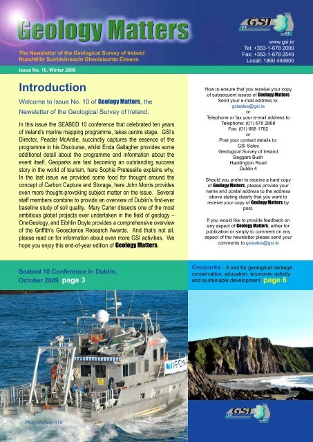
Geology Matters: Winter 2009<br />
The Newsletter <strong>of</strong> the <strong>Geological</strong> <strong>Survey</strong> <strong>of</strong> <strong>Ireland</strong><br />
Nuachtlitir Suirbhéireacht Gheolaíochta Éireann<br />
www.gsi.ie<br />
Tel: +353-1-678 2000<br />
Fax: +353-1-678 2549<br />
Locall: 1890 449900<br />
Issue No. 10, Winter 2009<br />
Introduction<br />
Welcome to Issue No. 10 <strong>of</strong> Geology Matters, the<br />
Newsletter <strong>of</strong> the <strong>Geological</strong> <strong>Survey</strong> <strong>of</strong> <strong>Ireland</strong>.<br />
In this issue the SEABED 10 conference that celebrated ten years<br />
<strong>of</strong> <strong>Ireland</strong>’s marine mapping programme, takes centre stage. GSI’s<br />
Director, Peadar McArdle, succinctly captures the essence <strong>of</strong> the<br />
programme in his Discourse, whilst Enda Gallagher provides some<br />
additional detail about the programme and information about the<br />
event itself. Geoparks are fast becoming an outstanding success<br />
story in the world <strong>of</strong> tourism, here Sophie Preteseille explains why.<br />
In the last issue we provided some food for thought around the<br />
concept <strong>of</strong> Carbon Capture and Storage, here John Morris provides<br />
even more thought-provoking subject matter on the issue. Several<br />
staff members combine to provide an overview <strong>of</strong> Dublin’s first-ever<br />
baseline study <strong>of</strong> soil quality. Mary Carter dissects one <strong>of</strong> the most<br />
ambitious global projects ever undertaken in the field <strong>of</strong> geology –<br />
OneGeology, and Eibhlin Doyle provides a comprehensive overview<br />
<strong>of</strong> the Griffith’s Geoscience Research Awards. And that’s not all,<br />
please read on for information about even more GSI activities. We<br />
hope you enjoy this end-<strong>of</strong>-year edition <strong>of</strong> Geology Matters.<br />
How to ensure that you receive your copy<br />
<strong>of</strong> subsequent issues <strong>of</strong> Geology Matters<br />
Send your e-mail address to:<br />
gsisales@gsi.ie<br />
or<br />
Telephone or fax your e-mail address to<br />
Telephone: (01) 678 2868<br />
Fax: (01) 668 1782<br />
or<br />
Post your contact details to:<br />
GSI Sales<br />
<strong>Geological</strong> <strong>Survey</strong> <strong>of</strong> <strong>Ireland</strong><br />
Beggars Bush<br />
Haddington Road<br />
Dublin 4<br />
Should you prefer to receive a hard copy<br />
<strong>of</strong> Geology Matters, please provide your<br />
name and postal address to the address<br />
above stating clearly that you want to<br />
receive your copy <strong>of</strong> Geology Matters by<br />
post.<br />
If you would like to provide feedback on<br />
any aspect <strong>of</strong> Geology Matters, either for<br />
publication or simply to comment on any<br />
aspect <strong>of</strong> the newsletter please send your<br />
comments to gsisales@gsi.ie<br />
Seabed 10 Conference In Dublin,<br />
October 2009 page 3<br />
Geoparks - A tool for geological heritage<br />
conservation, education, economic activity<br />
and sustainable development page 6<br />
Photo courtesy RTE
Geology Matters: Winter 2009<br />
Director’s Discourse<br />
A DECADE OF MAPPING IRELAND’S SEABED<br />
Peadar McArdle<br />
<strong>Ireland</strong> is a small island which lies on the<br />
continental shelf <strong>of</strong> the northeast Atlantic<br />
Ocean and which occupies a strategic<br />
European position. We are endowed<br />
with a huge seabed resource - almost<br />
ten times our land area - and stretching<br />
from our coastline to the deepest parts<br />
<strong>of</strong> the Atlantic Ocean. We are a nation<br />
with a proud seafaring tradition, one that<br />
stretches back to its earliest settlers some<br />
8,000-9,000 years ago. Our maritime<br />
history is reflected in our literature and<br />
music, in our explorers and scientists,<br />
their names are as diverse as St. Brendan<br />
and Robert Shackleton.<br />
Yet consider this quotation: “We probably<br />
have more information per square metre<br />
about the surface <strong>of</strong> the moon than we<br />
have about the seabed, which occupies<br />
three quarters <strong>of</strong> the earth’s surface. This<br />
is especially true in regard to our own<br />
(<strong>Ireland</strong>’s) area <strong>of</strong> sea floor.” Surely this is<br />
a nineteenth century assertion? Wrong! It<br />
is taken from an article published in 1996.<br />
Its author was none other than Ray Keary,<br />
our late distinguished colleague whose<br />
memory we celebrated in early October at<br />
the Seabed 10 conference in Liberty Hall.<br />
This reminds me <strong>of</strong> the link, however<br />
tenuous, between Liberty Hall and seabed<br />
mapping. That link comprises the ships<br />
Helga. Helga the second was stationed<br />
close to Liberty Hall at Easter 1916 in order<br />
to shell the buildings <strong>of</strong> central Dublin.<br />
But Helga the first was employed a few<br />
years earlier in the earliest exploration <strong>of</strong><br />
<strong>Ireland</strong>’s Atlantic seafloor. It would be many<br />
decades before the strength <strong>of</strong> opinion on<br />
the potential <strong>of</strong> our Marine would drive<br />
several key developments - a specific<br />
Government Minister and Department, the<br />
establishment <strong>of</strong> the Marine Institute and<br />
the first seabed surveys by PAD in 1995 to<br />
support our claim for seabed delineation<br />
under UNCLOS. As far as seabed<br />
mapping is concerned we, as a community<br />
<strong>of</strong> stakeholders, developed a shared vision<br />
<strong>of</strong> considerable challenge and sold it<br />
persistently and, eventually, successfully.<br />
In all this, I want to emphasise the driving<br />
determination <strong>of</strong> our partners, the Marine<br />
Institute, and the visionary leadership <strong>of</strong><br />
its Chief Executive, Dr. Peter Heffernan.<br />
As a result <strong>of</strong> the combined efforts <strong>of</strong><br />
many, Government invested €32 million<br />
in the period from 1999 to 2005 in order<br />
to complete the Irish National Seabed<br />
<strong>Survey</strong> (INSS), a comprehensive mapping<br />
programme <strong>of</strong> all our waters deeper than<br />
200m. Long-term investment in a truly<br />
valuable resource had started. In 2006,<br />
Government announced a new followup<br />
programme, called INFOMAR, which<br />
was intended to invest €4 million per<br />
annum in order to complete the nearshore<br />
seabed areas. Following a review <strong>of</strong> its<br />
initial progress which showed INFOMAR<br />
benefits running at four times its costs,<br />
Government at the end <strong>of</strong> 2008 confirmed<br />
its intention to continue support for<br />
INFOMAR although - given the current<br />
financial climate - at the understandably<br />
lower annual investment level <strong>of</strong> €3.4<br />
million. The special conference, Seabed<br />
10, was held to mark the tenth anniversary<br />
<strong>of</strong> the start <strong>of</strong> INSS and to launch the new<br />
GSI vessel, R.V. Keary.<br />
The seabed surveys are designed to<br />
produce comprehensive information on all<br />
aspects <strong>of</strong> our seabed, providing a sound<br />
basis for its sustainable management,<br />
supporting policy and regulation at national<br />
and European levels, and underpinning<br />
research and services for a wide spectrum<br />
<strong>of</strong> maritime activities. The speakers at<br />
Seabed 10 documented the breadth and<br />
depth <strong>of</strong> benefits arising from INFOMAR<br />
(see www.infomar.ie for the conference<br />
programme). While this has required<br />
significant financial investment it has also<br />
built an effective cooperation between<br />
a range <strong>of</strong> national and international<br />
partners. The partnership between the<br />
<strong>Geological</strong> <strong>Survey</strong> <strong>of</strong> <strong>Ireland</strong> and the<br />
Marine Institute has been particularly<br />
crucial to the success <strong>of</strong> the programme.<br />
Indeed the availability since 2003 <strong>of</strong> the<br />
R.V. Celtic Explorer, with berths for 19<br />
scientists, has been a key milestone in<br />
the history <strong>of</strong> Irish marine science and<br />
geoscience.<br />
Of course a mapping programme focused<br />
only in data acquisition would quickly<br />
fail. GSI has built what is a major digital<br />
data store by national standards, with a<br />
capacity <strong>of</strong> 16 terabytes, and there are<br />
backup copies in the Marine Institute and<br />
elsewhere. Earlier this year the INFOMAR<br />
team shared in an eGovernment Award for<br />
its cross-agency metadata infrastructure.<br />
INFOMAR databases have supported<br />
about 50 postgraduate studies - a level<br />
adequate to sustain a considerable<br />
skillsbase in geoscience and marine<br />
science in <strong>Ireland</strong>. At the same time<br />
media attention has enhanced public<br />
awareness <strong>of</strong> the value <strong>of</strong> our work and<br />
<strong>of</strong> the enterprise and career opportunities<br />
that arise from it. INFOMAR also<br />
supports key government policies such as<br />
developing the smart economy, increased<br />
pupil participation in S&T, and deepening<br />
scientific cooperation both between<br />
<strong>Ireland</strong> and Northern <strong>Ireland</strong>, and <strong>Ireland</strong><br />
and UK.<br />
<strong>Ireland</strong>’s seabed mapping is a story <strong>of</strong><br />
people - <strong>of</strong> scientists, crews, support staff,<br />
customers and stakeholders. I want to<br />
pay particular tribute to the INFOMAR<br />
team drawn from the Marine Institute<br />
and the <strong>Geological</strong> <strong>Survey</strong> <strong>of</strong> <strong>Ireland</strong>. Its<br />
membership is too extensive to allow for<br />
individual acknowledgement but I know<br />
that Peter Heffernan will join with me in<br />
saluting the excellent leaders over the<br />
years - Yvonne Shields, Mick Gillooly,<br />
John Evans and Tommy Furey <strong>of</strong> the<br />
Marine Institute, and Deepak Inamdar,<br />
Mick Geoghegan, Eibhín Doyle and Koen<br />
Verbruggen from GSI. However none<br />
<strong>of</strong> these will mind if I conclude the list<br />
with a mention <strong>of</strong> the late Ray Keary, a<br />
highly motivated and dedicated scientist,<br />
who constantly pointed to the value <strong>of</strong><br />
our <strong>of</strong>fshore resources, who provided<br />
encouragement to all marine scientists,<br />
and who was the inspiration for INSS. We<br />
were delighted that Barbara, his widow,<br />
and members <strong>of</strong> his family joined us for<br />
the launch <strong>of</strong> R.V. Keary.<br />
We have achieved much, but there is<br />
much left to do. Remaining areas, if<br />
investment is sustained at current levels,<br />
will not be fully surveyed before 2030.<br />
And given the uncertain financial climate<br />
we cannot assume that any specific level<br />
<strong>of</strong> support will be provided indefinitely. We<br />
must continue with great determination to<br />
produce excellent science and to ensure<br />
that our stakeholders are fully aware <strong>of</strong> its<br />
implications and potential benefits. If we<br />
continue to strive for these goals then the<br />
extent <strong>of</strong> our success will be constrained<br />
only by the level <strong>of</strong> our ambition.<br />
page 2
SEABED 10 Conference,<br />
Dublin, October 2009<br />
Geology Matters: Winter 2009<br />
Enda Gallagher and Koen Verbruggen<br />
What lies beneath….<br />
The oceans <strong>of</strong> the world are probably the<br />
last great unknown frontier. Geologists<br />
have explored and mapped almost all<br />
lands, even the most remote areas <strong>of</strong><br />
the Arctic and Antarctica. However, the<br />
majority <strong>of</strong> the Earth’s surface is covered<br />
by water and comparatively little is<br />
known about it. <strong>Ireland</strong>’s marine mapping<br />
programme, now 10 years in operation<br />
and many more in the making, is setting<br />
new standards globally in understanding<br />
the <strong>of</strong>fshore territory. A whole new detailed<br />
picture <strong>of</strong> the sea floor is emerging from<br />
a combination <strong>of</strong> state-<strong>of</strong>-the-art data<br />
collection techniques including, multibeam<br />
and side scan sonar measurements,<br />
underwater video footage and a variety<br />
<strong>of</strong> sampling operations. The discovery<br />
<strong>of</strong> cold water corals in deep Irish waters<br />
and the precise recording <strong>of</strong> hundreds<br />
<strong>of</strong> shipwrecks are just two fascinating<br />
aspects, but the seabed survey geological<br />
data are only just beginning to open a<br />
whole new world….<br />
Seabed 10<br />
The tenth anniversary <strong>of</strong> <strong>Ireland</strong>’s seabed<br />
mapping programme was marked in<br />
spectacular style by a two day conference<br />
in Dublin in October. The partners in the<br />
programme – GSI and the Marine Institute<br />
– organised a comprehensive conference<br />
programme covering a review <strong>of</strong> activities<br />
to date (including both the INSS and<br />
INFOMAR programmes), research based<br />
on survey data, noteworthy achievements<br />
and plans for the future.<br />
The conference, which was held in Liberty<br />
Hall theatre, incorporated the annual<br />
“seabed seminar” which usually provides<br />
a detailed review <strong>of</strong> that particular year’s<br />
activity. As well as hosting a poster<br />
exhibition it also saw the formal launch<br />
and naming <strong>of</strong> GSI’s new inshore mapping<br />
vessel, the RV Keary at a ministerial<br />
ceremony at Poolbeg Marina, Ringsend,<br />
Dublin. The 192 delegates across the twoday<br />
conference certainly came away with<br />
a comprehensive understanding <strong>of</strong> what is<br />
one <strong>of</strong> the world’s largest seabed mapping<br />
projects.<br />
Scientific Programme<br />
Highlights<br />
In his speech at the naming ceremony<br />
for the RV Keary, Conor Lenihan, T.D.,<br />
Minister <strong>of</strong> State at the Department <strong>of</strong><br />
Communications, Energy & Natural<br />
Resources, commented that he was<br />
“struck by the broad range <strong>of</strong> topics and<br />
areas being discussed.” He went on to say<br />
that this “compellingly reflected how the<br />
results <strong>of</strong> the seabed mapping campaign<br />
over the last ten years have fed into so<br />
many different sectors; from safety at sea,<br />
to new territorial claims, from shipwrecks<br />
to environmental protection and from<br />
energy to research.” This was an apt<br />
and succinct overview <strong>of</strong> an outstanding<br />
scientific programme.<br />
A particular highlight <strong>of</strong> the programme,<br />
and one that was very appropriate in<br />
these economically pessimistic times,<br />
was the economic overview <strong>of</strong> INFOMAR,<br />
provided by Gareth Hetherington,<br />
PriceWaterhouseCoopers (PWC). PWC<br />
have carried out an independent value-formoney<br />
study which has valued the benefits<br />
<strong>of</strong> the state’s marine mapping programme<br />
at €275 million. This is more than four<br />
times what will be spent completing the<br />
“INFOMAR” programme. He outlined<br />
in great detail that the benefits accrue<br />
across a range <strong>of</strong> sectors from fishing,<br />
tourism and energy, to compliance with<br />
international legislation and the research<br />
sector.<br />
page 3
Geology Matters: Winter 2009<br />
Another project presented provocatively<br />
by Dr. Colin Brown <strong>of</strong> NUI Galway was<br />
one about the investigation and protection<br />
<strong>of</strong> Irish Coral Reefs. As well as giving a<br />
broad overview <strong>of</strong> corals in Irish waters<br />
Dr. Brown was able to display a range <strong>of</strong><br />
imagery that was literally hot-<strong>of</strong>f-the press.<br />
The imagery was taken from a cruise that<br />
employed seabed survey data to locate and<br />
film for the very first time deepwater coral<br />
reefs on parts <strong>of</strong> the Rockall Bank. The<br />
survey partners - GSI, MI and the National<br />
Parks and Wildlife Service - employed the<br />
Marine Institute vessel, the Celtic Explorer<br />
and her new remotely operated vehicle,<br />
the ROV Holland. This study will assist the<br />
process <strong>of</strong> designation <strong>of</strong> new <strong>of</strong>fshore<br />
Special Areas <strong>of</strong> Conservation.<br />
The scientific programme included<br />
outstanding presentations across a<br />
wide range <strong>of</strong> additional Irish marine<br />
survey activity including a focus on the<br />
research being carried out in various<br />
Irish universities; an evaluation <strong>of</strong> where<br />
<strong>Ireland</strong>’s mapping programme fits in a<br />
European context, and how the survey<br />
data assist the fishing industry, petroleum<br />
research, in expanding <strong>Ireland</strong>’s sovereign<br />
territory, in identifying shipwrecks and in<br />
the production <strong>of</strong> <strong>of</strong>ficial navigation charts.<br />
Staff from the INFOMAR programme also<br />
presented movie “fly-throughs” <strong>of</strong> the data<br />
and demonstrated how to access the data<br />
online. The event was wrapped up in<br />
riveting style by the Marine Institute’s CEO,<br />
Dr. Peter Heffernan. The title<br />
<strong>of</strong> his talk “Conversations<br />
on Maritime <strong>Ireland</strong> in 2020<br />
(at SEABED 20)” provides<br />
a clue as to the strategic<br />
thrust <strong>of</strong> his musings!<br />
Further information on the INFOMAR<br />
programme is available at www.infomar.<br />
ie. If you’re interested in a brief overview<br />
<strong>of</strong> <strong>Ireland</strong>’s marine survey story you can<br />
download a guide with this name from the<br />
news section <strong>of</strong> www.gsi.ie.<br />
page 4
Geology Matters: Winter 2009<br />
The RV Keary<br />
The vessel is named after the celebrated geologist, Ray Keary, RIP. The RV Keary is a purpose<br />
built, aluminium catamaran designed for the survey <strong>of</strong> shallow waters, made possible by her<br />
shallow 1.7 metre draft. The 15 metre fully-equipped hydrographic/geophysical launch will<br />
also deliver survey data that will meet the required international surveying specifications.<br />
The minimum crew is 3 (Skipper, <strong>Survey</strong>or and Data Processor) but survey operations are<br />
usually undertaken by a crew <strong>of</strong> 4, operating during daylight hours, weather dependant (Sea<br />
state 4 or less).<br />
<strong>Survey</strong> operations throughout 2009 have been (and continue to be) concentrated on the<br />
remaining unsurveyed areas <strong>of</strong> Dublin Bay and completion <strong>of</strong> these will allow the UKHO to<br />
update the Dublin Chart in 2010. The first chart <strong>of</strong> Dublin Bay was undertaken in 1800 by<br />
Captain William Bligh, famous for the “Mutiny on the Bounty” incident and later went on to be<br />
the Governor <strong>of</strong> Australia. He completed the chart in 1803 and it was considered the most<br />
accurate map <strong>of</strong> the bay well into the 20th century!<br />
The RV Keary was commissioned to complement the survey capabilities <strong>of</strong> the Marine<br />
Institute vessels, the Celtic Explorer and the Celtic Voyager. The Explorer carries out deep<br />
sea mapping and research, the Voyager carries out mapping in median waters and there<br />
was a need for a state vessel to map our shallowest waters.<br />
Keary Specification<br />
Registered Dublin.<br />
Call Sign EIGO9.<br />
MSO P5 Licence for 12 Passengers.<br />
Vessel contract awarded to IMAR Tionscail with the assistance<br />
<strong>of</strong> Maritime Services Ltd<br />
Design by Nic De Waal <strong>of</strong> Teknicraft New Zealand<br />
Manafactured by Veecraft Marine <strong>of</strong> Capetown, South Africa<br />
Leading Particulars<br />
Length (OA)<br />
Length (Hull)<br />
Beam (moulded)<br />
Draft<br />
Engines<br />
Rating<br />
Speed (90% power)<br />
Fuel<br />
Hull Type<br />
Construction<br />
Equipment<br />
15.5 m<br />
14.6 m<br />
5.6 m<br />
1.7 m<br />
Cummins QSC 8.3-500 INT<br />
368 kW/2600 rpm<br />
22 kn<br />
2000 lt<br />
Asymmetrical catamaran<br />
Marine Grade Aluminium<br />
Simrad 3002D Multibeam, USBL, GPS<br />
systems, Applanix POS-MV, CHIRP,<br />
Single Beam, Quincy Navigation s<strong>of</strong>tware,<br />
AIS, SOLAS, Radar, AutoPilot<br />
Ray Keary RIP<br />
Ray Keary was a respected and important employee <strong>of</strong> the GSI<br />
for over two decades, where he founded the Marine Geology<br />
programme, having worked with NUIG for fifteen years prior to<br />
that. His influence in his chosen field <strong>of</strong> Marine Science was<br />
huge and his outstanding legacy is <strong>Ireland</strong>’s seabed mapping<br />
programme that he tirelessly lobbied for.<br />
page 5
Geology Matters: Winter 2009<br />
GEOPARKS<br />
A tool for geological<br />
heritage conservation,<br />
education, economic<br />
activity and sustainable<br />
development.<br />
Sophie Preteseille<br />
The Geopark Concept<br />
The origins <strong>of</strong> the Geopark concept date<br />
back to the late 1990s. At that time<br />
UNESCO (the United Nations for Education,<br />
Science and Culture Organisation)<br />
Division <strong>of</strong> Earth Sciences was looking<br />
at ways <strong>of</strong> using geological heritage<br />
to promote sustainable development<br />
among communities otherwise bypassed<br />
by economic growth, but also how to<br />
provide an international framework for the<br />
conservation <strong>of</strong> geological heritage, or<br />
geo-conservation, to enhance the value <strong>of</strong><br />
the heritage <strong>of</strong> the Earth.<br />
Meanwhile, four European territories<br />
(Reserve Géologique de Haute Provence-<br />
France, Vulkaneifel-Germany, Petrified<br />
Forest Lesvos-Greece, Maestrazgo<br />
Cultural Park-Spain) were interested<br />
in the same sustainable tourism for<br />
local communities issues. The concept<br />
<strong>of</strong> geological tourism or geotourism<br />
was born. Together, they founded the<br />
European Geoparks Network (EGN) in<br />
2000 and sought to spread the concept<br />
across Europe.<br />
In 2001, an agreement was signed<br />
between UNESCO’s Division <strong>of</strong> Earth<br />
Sciences and the EGN to join efforts as<br />
the network began to rapidly expand.<br />
The EGN would then operate under the<br />
auspices <strong>of</strong> UNESCO.<br />
As territories outside Europe - especially<br />
in China first - interested in the Geopark<br />
concept, wanted to join but no suitable<br />
structure was in place at the time, the<br />
Global Network <strong>of</strong> National Geoparks<br />
(also known as the Global Geoparks<br />
Network - GGN) was created, assisted<br />
by UNESCO in 2004. The GGN operates<br />
with regional/continental networks. For a<br />
European territory to become a member<br />
<strong>of</strong> the Global Network, it must first become<br />
a member <strong>of</strong> the EGN.<br />
At present (December 2009), there are 35<br />
Geoparks in 13 countries across Europe<br />
and 29 other in the rest <strong>of</strong> the world (China,<br />
Malaysia, Iran, Brazil, Australia, Japan),<br />
all <strong>of</strong> which are members <strong>of</strong> the GGN.<br />
Beigua Global Geopark, Italy<br />
What is a Geopark?<br />
Bedrock is the foundation <strong>of</strong> all landscapes<br />
on which biodiversity has developed over<br />
millions <strong>of</strong> years and humans have settled<br />
in more recent times. With no geological<br />
diversity (geodiversity), the rest wouldn’t<br />
exist as it is. This is the reason why<br />
geological heritage has to be protected<br />
and people have to be educated about it<br />
so they can benefit from it even more.<br />
The <strong>of</strong>ficial UNESCO definition <strong>of</strong> a<br />
Geopark is: “A Geopark is a nationally<br />
protected area containing a number <strong>of</strong><br />
geological heritage sites <strong>of</strong> particular<br />
importance, rarity or aesthetic appeal.<br />
These Earth heritage sites are part <strong>of</strong><br />
an integrated concept <strong>of</strong> protection,<br />
education and sustainable development.<br />
A Geopark achieves its goals through a<br />
three-pronged approach:<br />
CONSERVATION<br />
A Geopark seeks to conserve significant<br />
geological features, and explore and<br />
demonstrate methods for excellence in<br />
conservation. The management authority<br />
<strong>of</strong> each Geopark ensures adequate<br />
protection measures in consultation with<br />
collaborating universities, geological<br />
surveys or relevant statutory bodies in<br />
accordance with local traditions and<br />
legislative obligations.<br />
EDUCATION<br />
A Geopark organizes activities and<br />
provides logistic support to communicate<br />
geoscientific knowledge and<br />
environmental concepts to the public.<br />
This is accomplished through protected<br />
and interpreted geosites, museums,<br />
information centres, trails, guided tours,<br />
school class excursions, popular literature,<br />
maps, educational materials and displays,<br />
seminars and so on. A Geopark also<br />
fosters scientific research and cooperation<br />
with universities and research institutes,<br />
stimulating the dialogue between the<br />
geosciences and local populations.<br />
GEOTOURISM<br />
A Geopark stimulates economic activity<br />
and sustainable development through<br />
geotourism. By attracting increasing<br />
numbers <strong>of</strong> visitors, a Geopark stimulates<br />
local socio-economic development through<br />
the promotion <strong>of</strong> a quality label linked with<br />
the local natural heritage. It encourages<br />
the creation <strong>of</strong> local enterprises and<br />
cottage industries involved in geotourism<br />
and geoproducts.”<br />
page 6
What a Geopark is not:<br />
A Geopark is not an area <strong>of</strong> outstanding<br />
geological heritage alone; other facets<br />
<strong>of</strong> heritage (natural, cultural, historical,<br />
archaeological) must also be integrated<br />
as they’re all interlinked.<br />
A Geopark is not a single site either<br />
(Geoparks are territories large enough so<br />
development strategy can be emplaced).<br />
A Geopark is not an area fenced <strong>of</strong>f just<br />
for scientists and it is not a theme park<br />
either.<br />
A Geopark is not a formal, legislative<br />
designation. And, as such, it carries no<br />
legal obligations or restrictions. However<br />
because <strong>of</strong> the nature <strong>of</strong> conservation<br />
activities taking place in Geoparks, these<br />
territories and/or their collaborating<br />
partners are likely to be involved with<br />
policy making.<br />
Why is the concept becoming<br />
popular?<br />
Geoparks aim to protect geological<br />
heritage and geodiversity within national<br />
frameworks. Geoparks aim at promoting<br />
understanding <strong>of</strong> Earth history and<br />
legacy through education. Geoparks<br />
aim at supporting economic growth<br />
and sustainable development through<br />
geotourism. Geoparks aim at reconnecting<br />
people with Planet Earth.<br />
As Geoparks operate within a network,<br />
whether at a European level or a Global<br />
level, they are provided with a platform for<br />
exchange <strong>of</strong> knowledge and best practice.<br />
All territories have different geological<br />
heritage and communities but they are all<br />
driven by the same will to make it work:<br />
conserve geological heritage for the future<br />
generations, educate and develop in a<br />
sustainable and responsible way for the<br />
benefit <strong>of</strong> all.<br />
Access to the Network is achieved through<br />
a very selective process where applicants<br />
are asked to demonstrate that they are<br />
operating as a “de-facto” Geopark, i.e. a<br />
Geopark in everything but name, which<br />
also insures the quality <strong>of</strong> the applicants.<br />
Are there any Geoparks in<br />
<strong>Ireland</strong>?<br />
In 2000, Marble Arch Caves, in Co.<br />
Fermanagh and the Copper Coast, in Co.<br />
Waterford applied to join the EGN and<br />
were successfully accepted. To date they<br />
remain the only <strong>of</strong>ficial members <strong>of</strong> the<br />
EGN on the island <strong>of</strong> <strong>Ireland</strong>.<br />
Through successful applications to EU<br />
funding programmes, Marble Arch Caves<br />
Geology Matters: Winter 2009<br />
Marble Arch Caves Global Geopark,<br />
Co. Fermanagh and Co. Cavan<br />
and Copper Coast raised a considerable<br />
amount <strong>of</strong> funds to further develop<br />
themselves as territories, along with<br />
infrastructure, signage, staff, educational<br />
services and products, promotional<br />
resources, tourism products and raise<br />
awareness <strong>of</strong> the Geopark concept. Both<br />
territories became Global Geoparks in<br />
2004. Marble Arch Caves Global Geopark<br />
has since successfully extended to Co.<br />
Cavan in 2008, thus becoming the first<br />
international Geopark in the world.<br />
Copper Coast<br />
Global Geopark,<br />
Ballydwane,<br />
Co. Waterford<br />
page 7 page 7
Geology Matters: Winter 2009<br />
Other community groups in <strong>Ireland</strong> are<br />
becoming interested in the concept,<br />
believing in the outstanding value <strong>of</strong><br />
their geological heritage and its potential<br />
for tourism, education and sustainable<br />
development. Among them Kerry (Sneem-<br />
Caherciveen), Mourne Mountains/Cooley/<br />
Ring <strong>of</strong> Gullion and The Burren/Cliffs <strong>of</strong><br />
Moher, to name a few.<br />
The Geoparks <strong>Ireland</strong> Forum<br />
To answer the demand for information<br />
and insure the quality <strong>of</strong> the geological<br />
heritage put in the application to the<br />
EGN, the <strong>Geological</strong> <strong>Survey</strong> <strong>of</strong> <strong>Ireland</strong><br />
and the <strong>Geological</strong> <strong>Survey</strong> <strong>of</strong> Northern<br />
<strong>Ireland</strong>, both having experience and<br />
having been involved with the Geoparks<br />
listed above established the Geoparks<br />
<strong>Ireland</strong> Committee in 2007 as an all-island<br />
committee which would apply the highest<br />
standards <strong>of</strong> geoscience in assisting<br />
stakeholders to build the Geoparks brand<br />
throughout the island <strong>of</strong> <strong>Ireland</strong>. For terms<br />
<strong>of</strong> reference, see link at the end <strong>of</strong> the<br />
article.<br />
One <strong>of</strong> the Committee actions was to set<br />
up a Geoparks <strong>Ireland</strong> Forum to inform<br />
and guide stakeholders and provide<br />
networking opportunities. Membership<br />
is open to any body or group, including<br />
both community based and local authority<br />
organisations, seeking to develop a<br />
Geopark or already operating a Geopark.<br />
Stakeholders include existing and<br />
prospective Geoparks, local authorities,<br />
the Heritage Council, the Environment<br />
and Heritage Service, Tourism <strong>Ireland</strong><br />
Ltd., universities and regional and local<br />
tourism bodies.<br />
Meetings have been taking place once a<br />
year since the set up. They usually consist<br />
<strong>of</strong> presentations updating the forum about<br />
development in each territory along with<br />
a visit <strong>of</strong> the area when possible and<br />
suitable.<br />
The Burren meeting, 20th - 21st October<br />
2009<br />
The Geoparks <strong>Ireland</strong> Forum held its<br />
most recent meeting in the Burren<br />
aspiring Geopark. Delegates from the<br />
existing Geoparks and aspiring ones met<br />
in Ennistymon for presentations from<br />
each territory and exchange on the 20th<br />
October. The discussion revolved mainly<br />
around aspects <strong>of</strong> the application process<br />
to the Network, management issues,<br />
education, site access, site degradation,<br />
and local support. For presentations and<br />
notes <strong>of</strong> the discussion, see link at the end<br />
<strong>of</strong> the article.<br />
The following day was dedicated to<br />
discovering part <strong>of</strong> the geological heritage<br />
<strong>of</strong> the Burren led by Dr Ronán Hennessy,<br />
geologist with the Burren Connect Project,<br />
and visiting the Atlantic Edge at the Cliffs<br />
<strong>of</strong> Moher Visitor Centre where Geraldine<br />
Enright, Marketing Manager was on hand<br />
to answer numerous questions about the<br />
largest tourist attraction in <strong>Ireland</strong>.<br />
The next meeting in 2010 is likely to be<br />
hosted by the new kid on the block: the<br />
Joyce Country aspiring Geopark in Co.<br />
Mayo-Galway. Date will be announced<br />
next spring.<br />
If you wish to be added to the circulation<br />
list to be kept posted <strong>of</strong> any development<br />
in the Forum, contact Sophie Préteseille<br />
at sophie.preteseille@gsi.ie<br />
The Burren, Co.<br />
Clare<br />
More information:<br />
• UNESCO Division <strong>of</strong> Earth Sciences:<br />
www.unesco.org/science/earth and<br />
http://portal.unesco.org/science/en/<br />
ev.php-URL_ID=6400&URL_DO=DO_<br />
TOPIC&URL_SECTION=201.html<br />
• European Geoparks Network:<br />
www.europeangeoparks.org<br />
• Global Network <strong>of</strong> National Geoparks:<br />
www.globalgeopark.org and<br />
http://unesdoc.unesco.org/<br />
images/0015/001500/150007e.pdf<br />
• Marble Arch Caves Global Geopark:<br />
www.marblearchcaves.net<br />
• Copper Coast Global Geopark:<br />
www.coppercoastgeopark.com<br />
•<br />
Geoparks <strong>Ireland</strong> Forum:<br />
www.gsi.ie/Programmes/Heritage/<br />
Projects/Geoparks.htm<br />
page 8
Geology Matters: Winter 2009<br />
October saw the fieldwork phase <strong>of</strong> a<br />
first-ever baseline study <strong>of</strong> soil quality in<br />
Dublin. The Dublin SURGE Project sets<br />
out to establish geochemical baselines <strong>of</strong><br />
metals and organic chemicals in Dublin<br />
soils. The project will provide information<br />
on soil chemistry in the urban environment<br />
relevant to human health, land-use<br />
planning and urban regeneration. It will<br />
also allow us to identify and quantify<br />
human impact on soils in urban areas<br />
through comparison with adjacent rural<br />
soil baseline geochemistry.<br />
<strong>Survey</strong> <strong>of</strong> Dublin Soils<br />
Dublin SURGE Project<br />
- Soil Urban Geochemistry<br />
GSI and the Norwegian <strong>Geological</strong> <strong>Survey</strong><br />
(NGU) are co-ordinating the survey and<br />
the fieldwork phase is now complete. 1065<br />
soil samples have been collected and<br />
prepared for laboratory analysis. All four<br />
local authorities in the greater Dublin area<br />
supported the project and the vast majority<br />
<strong>of</strong> samples were taken from areas that are<br />
publicly accessible (e.g. public parks and<br />
school grounds). The results <strong>of</strong> the survey<br />
will be publicly available by early 2011.<br />
Mairead Glennon, Ray Scanlon, Michael<br />
Sheehy, Pat O’Connor, Enda Gallagher<br />
Sampling points<br />
page 9
Geology Matters: Winter 2009<br />
European Partnership<br />
Eighty per cent <strong>of</strong> the European<br />
population lives in cites. Most cities have<br />
well-established monitoring systems<br />
for air and water, while soils have<br />
received comparatively little attention. To<br />
remedy this, a consortium <strong>of</strong> European<br />
<strong>Geological</strong> <strong>Survey</strong>s has initiated an Urban<br />
Geochemistry Project to investigate the<br />
chemical make-up <strong>of</strong> urban soil in European<br />
cities. GSI has lobbied successfully to have<br />
Dublin included in the first phase <strong>of</strong> the<br />
project. This is a very significant outcome<br />
for <strong>Ireland</strong> since no baseline geochemical<br />
information <strong>of</strong> any significance exists for<br />
Irish urban environments, whilst many<br />
European cities have been developing<br />
such databases in the past decade.<br />
The first phase <strong>of</strong> this Euro-wide project<br />
will involve mapping soils in 10 selected<br />
cities across Europe for a wide range <strong>of</strong><br />
potentially harmful chemicals (e.g. heavy<br />
metals such as lead, arsenic, cadmium,<br />
chromium, and organic compounds such<br />
as ploychlorinated biphenlys – PCBs)<br />
which may pose risks to human health.<br />
The study is part-funded under the NDP,<br />
and by NGU, as part <strong>of</strong> what is an overall<br />
“EuroGeo<strong>Survey</strong>s” study.<br />
Fieldwork Programme<br />
1065 soil samples were collected to<br />
characterise the spatial variation in soil<br />
quality over an area <strong>of</strong> some 600 sq. km<br />
in the greater Dublin area. The sampling<br />
was carried out by teams <strong>of</strong> trained<br />
personnel from the <strong>Geological</strong> <strong>Survey</strong>s <strong>of</strong><br />
<strong>Ireland</strong> and Norway (Norway has already<br />
carried out very successful soil sampling<br />
surveys <strong>of</strong> its cities). <strong>Survey</strong> teams<br />
worked <strong>of</strong>f carefully planned and mapped<br />
schedules and in accordance with agreed<br />
procedures. At each sample site, GPS<br />
coordinates and field observations were<br />
recorded and two digital photographs<br />
were taken (a general landscape shot<br />
<strong>of</strong> the surrounding environment and a<br />
site photograph showing details <strong>of</strong> soil<br />
texture).<br />
Interpretation & Results<br />
The surface soil samples will be analysed<br />
at the geochemical laboratories <strong>of</strong> NGU.<br />
It is critical that the samples from all<br />
cities in the study are analysed at these<br />
particular labs as one <strong>of</strong> the primary aims<br />
<strong>of</strong> the project is to provide environmental<br />
geochemical data that are harmonised<br />
and interoperable. In this way the soil<br />
quality from city to city can be compared<br />
objectively. A Geographic Information<br />
System map database will be used to<br />
gather, display and interpret data from<br />
the Dublin SURGE project. Analytical<br />
data will be statistically processed and<br />
digital geochemical maps <strong>of</strong> all elements<br />
will be produced. The data will be freely<br />
available to municipal authorities and<br />
other stakeholders.<br />
Benefits <strong>of</strong> SURGE<br />
It is hoped that the study will have benefits<br />
in the following areas:<br />
• Establishing baselines for<br />
environmental monitoring;<br />
• Identifying city areas possibly in<br />
need <strong>of</strong> environmental remediation;<br />
• Assisting authorities in setting soil<br />
environmental standards for Irish<br />
cities;<br />
• Contributing to more informed<br />
urban planning for both brownfield<br />
redevelopment <strong>of</strong> inner city areas<br />
and suburban development.<br />
• Assisting in compliance with EU<br />
Directives (Soil and Water) and<br />
national legislation protecting<br />
groundwater, soils, habitats etc.<br />
•<br />
Contributing to a better scientific<br />
understanding <strong>of</strong> pollutant<br />
accumulation and transport in urban<br />
soil environments.<br />
Further information is available at<br />
www.gsi.ie/surge<br />
page 10
Worldwide Acclaim for Staff<br />
Member, Caoimhe Hickey!<br />
Monica Lee, Brian McMahon &<br />
Enda Gallagher<br />
Geology Matters: Winter 2009<br />
At a conference held in Croatia in<br />
September, a staff member <strong>of</strong> GSI, Caoimhe<br />
Hickey, won a prestigious international<br />
prize that recognised her specific scientific<br />
expertise. The conference was organised<br />
by the International Association <strong>of</strong><br />
Hydrogeologists (IAH) on Karst*, entitled<br />
“Sustainability <strong>of</strong> the Karst Environment”.<br />
Caoimhe was joint recipient <strong>of</strong> the “Young<br />
Karst Researcher Prize 2009” prize for her<br />
presentation <strong>of</strong> the excellent research that<br />
she has been carrying out in the karstic<br />
landscapes <strong>of</strong> county Roscommon.<br />
The IAH is the Worldwide Groundwater<br />
Organisation and this award is not only<br />
an outstanding personal achievement for<br />
Caoimhe, but also promotes her as an<br />
expert on Irish Karst in the international<br />
hydrogeological community. 2009 has<br />
been quite a year for Caoimhe – she was<br />
also awarded a PhD by Trinity College<br />
Dublin, for her research thesis entitled<br />
“Landforms and Hydrology <strong>of</strong> the Lowland<br />
Karst <strong>of</strong> County Roscommon, <strong>Ireland</strong>”.<br />
Well done, on both counts, Dr. Hickey!<br />
* Karst<br />
Karst is the name given to the landforms that develop when rocks are dissolved by<br />
water. Half <strong>of</strong> <strong>Ireland</strong> is underlain by limestones and their solution by water over millions<br />
<strong>of</strong> years has resulted in many <strong>of</strong> our most distinctive landscapes, including the Burren<br />
(“Burren” meaning stony place) and the north-western plateau areas encompassing<br />
Benbulben and the Bricklieve Mountains in Sligo and Cuilcagh and the Marble Arch<br />
cave complex and Global Geopark in Fermanagh. (See Geopark item elsewhere in this<br />
newsletter).<br />
page 11
Geology Matters: Winter 2009<br />
Retirements in 2009<br />
John O’Donoghue<br />
A number <strong>of</strong> staff across different GSI<br />
programmes retired over the past few<br />
months.<br />
Chris McDonnell (pictured left) was a<br />
Senior Laboratory Technician, who also<br />
retired at the end <strong>of</strong> September, 2009.<br />
He also worked for many years in GSI.<br />
His area <strong>of</strong> speciality was petrology –<br />
the study <strong>of</strong> the origin, structure and<br />
mineralogical and chemical composition <strong>of</strong><br />
rocks. His knowledge <strong>of</strong> this subject was<br />
considerable. Sadly in today’s financial<br />
climate his considerable skills are unlikely<br />
to be replaced and this will be a big loss to<br />
GSI corporate knowledge.<br />
Andy Sleeman (pictured above), Senior<br />
Geologist, retired earlier this year. Andy<br />
had been involved for many years with<br />
the publication <strong>of</strong> the 1:100, 000 Bedrock<br />
County map series and more recently the<br />
new 1: 50, 000 Bedrock series starting<br />
with County Wexford. His work has<br />
greatly advanced our knowledge and<br />
understanding <strong>of</strong> the bedrock geology <strong>of</strong><br />
<strong>Ireland</strong>. Andy is very well thought <strong>of</strong> by his<br />
colleagues and his work in GSI over many<br />
years is greatly appreciated by his peers.<br />
Clive Murray (pictured left) worked for<br />
many years in Central Technical Services,<br />
one <strong>of</strong> four support services in GSI, and<br />
retired at the end <strong>of</strong> September, 2009.<br />
Clive was the Chief Technologist and dealt<br />
with management <strong>of</strong> the Core Store, the<br />
drilling programme, the vehicle fleet and<br />
the lecture theatre. A few years ago a<br />
new high-tech Core Store was developed<br />
in Sandyford, Co. Dublin which holds a<br />
substantial number <strong>of</strong> cores from around<br />
the country and is a testament to Clive’s<br />
work. Clive’s contribution to GSI has been<br />
invaluable. The fact that Central Technical<br />
Services have been run so smoothly and<br />
so effectively over the years is down to<br />
Clive’s pr<strong>of</strong>essionalism, work output and<br />
dedication to duty.<br />
Staff Transfer<br />
Dr. Eibhlín Doyle transferred to Exploration<br />
and Mining Division in October, 2009.<br />
Eibhlín was a member <strong>of</strong> the Senior<br />
Management Team in GSI and had<br />
responsibility for the Groundwater and<br />
Minerals Programmes as well as strategic<br />
surveys. In recent years she has been<br />
actively involved in two major studies, the<br />
Historic Mines Sites project and Avoca<br />
Mines Remediation Study. She took a<br />
leading role in many strategic issues in<br />
GSI, including its research function, North-<br />
South cooperation, and staff training and<br />
development. GSI would like to thank<br />
Eibhlín for her significant contribution<br />
to GSI over many years and to wish her<br />
every success and happiness in her new<br />
post.<br />
All <strong>of</strong> these staff worked successfully<br />
in GSI and they can be proud <strong>of</strong> their<br />
individual contributions. They enjoyed<br />
the respect <strong>of</strong> their colleagues and will be<br />
sorely missed.<br />
page 12
Carbon Capture<br />
and Storage (CCS)<br />
John H. Morris<br />
CCS has emerged in recent years as a<br />
technology which has the potential to<br />
contribute very significantly to climate<br />
change mitigation actions by storing CO 2<br />
emissions in underground geological<br />
storage reservoirs, while at the same<br />
time facilitating a global transition towards<br />
lower dependency on consumption <strong>of</strong> all<br />
forms <strong>of</strong> fossil fuels.<br />
The concept is simple: CO 2<br />
is removed<br />
pre-combustion or from exhaust gases<br />
(post-combustion) emitted by major<br />
fossil fuel-powered power stations and<br />
industrial complexes, compressed into<br />
a liquid form and then transmitted by<br />
pipeline or ship to storage sites where it<br />
is injected deep underground into suitable<br />
geological reservoirs. This technology<br />
has been used safely and successfully for<br />
many years by the oil industry, particularly<br />
in the USA, where CO 2<br />
derived from<br />
various sources is injected into depleting<br />
oil reservoirs in order to enhance oil<br />
recovery. It has now been applied and<br />
expanded to encompass a whole new<br />
generation <strong>of</strong> CCS geological reservoirs,<br />
in particular fully depleted oil and gas<br />
fields, as well as deep saline aquifers for<br />
which the theoretical global CO 2<br />
storage<br />
potential is enormous. However, while the<br />
capture and transmission end <strong>of</strong> the CCS<br />
spectrum are reasonable well understood<br />
and developed, the same cannot be said<br />
for the S end – geology – which remains<br />
the least well researched and defined<br />
component, even though the whole CCS<br />
concept is ultimately totally dependent<br />
upon the safe, long term security <strong>of</strong> CO 2<br />
injected into geological reservoirs.<br />
Nonetheless, efforts to achieve full scale<br />
commercial CCS implementations are<br />
now developing very rapidly in many parts<br />
<strong>of</strong> the world, including the USA, Canada,<br />
Australia, China and, not least, in the EU.<br />
Very recently, the EU allocated over €1B<br />
to expedite development <strong>of</strong> a suite <strong>of</strong><br />
“flagship” CCS pilot demonstration plants,<br />
and, in October, announced the names <strong>of</strong><br />
the first 6 <strong>of</strong> these plants. In parallel, the<br />
EU also published its draft directives on<br />
the “<strong>Geological</strong> Storage <strong>of</strong> CO 2<br />
” [which<br />
may be the first time that geology has<br />
featured in the title <strong>of</strong> any EU directive] and<br />
its Emissions Trading Scheme [“ETS”].<br />
<strong>Ireland</strong> has lagged far behind in its efforts<br />
to address, develop and implement this<br />
technology, despite it being one <strong>of</strong> the<br />
largest per capita emitters <strong>of</strong> CO 2<br />
in the EU<br />
as a consequence <strong>of</strong> its major dependency<br />
on fossil fuels. That imbalance is, however,<br />
now starting to be addressed. A study <strong>of</strong><br />
the all-island onshore and <strong>of</strong>fshore CO 2<br />
storage potential, funded by the SEI and<br />
involving various agencies, including GSI<br />
and the <strong>Geological</strong> <strong>Survey</strong> <strong>of</strong> Northern<br />
<strong>Ireland</strong> (GSNI), was published in 2008.<br />
That report, and its recommendations,<br />
provided the framework for three followup<br />
actions:<br />
• an assessment <strong>of</strong> the deep saline<br />
aquifer storage potential in proximity<br />
to Moneypoint, Co. Clare, the single<br />
largest point source CO 2<br />
emitter in<br />
the State. This project, funded by the<br />
EPA and with technical supervision<br />
provided by GSI and PAD, DCENR,<br />
has been completed and will be<br />
published in 2009.<br />
Implementation <strong>of</strong> an all-island<br />
•<br />
cooperative effort to assess and better<br />
•<br />
Geology Matters: Winter 2009<br />
define CO 2<br />
reservoir potential in the<br />
Irish Sea. The Inter-Departmental<br />
CCS Committee chaired by DCENR<br />
mandated the GSI to implement this<br />
project in 2009 jointly with the British<br />
<strong>Geological</strong> <strong>Survey</strong> (BGS) and GSNI.<br />
Current efforts focus upon collation<br />
and integration <strong>of</strong> all pertinent data<br />
from all jurisdictions into a single<br />
digital data structure.<br />
On foot <strong>of</strong> an SEI initiative, preparation<br />
and submission <strong>of</strong> a research proposal<br />
to the EU FP7 programme for funding<br />
to enhance research and knowledge<br />
to advance commercialisation <strong>of</strong><br />
the CCS potential <strong>of</strong> the Kinsale<br />
Head gas field. The Irish partner<br />
group includes PSE Kinsale Energy<br />
Ltd, operators <strong>of</strong> the Kinsale Head<br />
Field, the ESB, UCD and GSI/SEI/<br />
PAD. A preliminary decision on that<br />
application is expected in December<br />
2009.<br />
page 13
Geology Matters: Winter 2009<br />
OneGeology<br />
Mary Carter<br />
Planet Earth<br />
Our planet Earth is one <strong>of</strong> the rocky<br />
planets in our solar system. Geology is<br />
the study <strong>of</strong> the solid and liquid matter that<br />
constitutes Earth. The outer surface <strong>of</strong> the<br />
earth, the crust, is divided into rigid rafts<br />
<strong>of</strong> rock, called tectonic plates. While the<br />
solid surface rock is visible in some places,<br />
sometimes providing magnificent scenery,<br />
as in the Cliffs <strong>of</strong> Moher, in many areas<br />
rock is hidden from view under soils and<br />
plants, or covered by water. <strong>Geological</strong><br />
maps give some indication <strong>of</strong> what type<br />
<strong>of</strong> rock is down there, showing geological<br />
features, rock units and strata.<br />
Natural Resources<br />
Who cares what lies beneath the Earth’s<br />
surface? For one thing the earth is a source<br />
<strong>of</strong> many <strong>of</strong> our Natural Resources. Natural<br />
Resources are referred to economically<br />
as land and raw materials. Raw materials<br />
found in the earth include such things as<br />
ores <strong>of</strong> old, copper, silver etc, as well as<br />
oils and gas. While many parts <strong>of</strong> the world<br />
are desperately short <strong>of</strong> natural resources,<br />
some economies are mainly based on<br />
their exploitation. <strong>Geological</strong> maps help<br />
us define where these resources can be<br />
found. Movements between the tectonic<br />
plates cause tsunamis, earthquakes and<br />
other natural disasters. Added to this is the<br />
growing public interest in the environment<br />
and in particular climate change, solving<br />
the problem <strong>of</strong> excess CO 2<br />
, or where<br />
energy is going to come from in the<br />
future. You then begin to understand the<br />
importance <strong>of</strong> geology. There has never<br />
been a bigger need to understand the<br />
global environment and to solve global<br />
environmental problems.<br />
Objectives <strong>of</strong> OneGeology<br />
OneGeology is an international project to<br />
make web-accessible the best available<br />
geological map data worldwide at a scale<br />
<strong>of</strong> about 1 to 1 million, initiated as a<br />
<strong>Geological</strong> <strong>Survey</strong> contribution to the UN<br />
International Year <strong>of</strong> Planet Earth 2008.<br />
This project capitalises on the wealth <strong>of</strong><br />
knowledge available in <strong>Geological</strong> <strong>Survey</strong>s<br />
in nations around the world. To end<br />
August 2009, 109 nations have committed<br />
to delivering their part <strong>of</strong> the <strong>Geological</strong><br />
jigsaw puzzle. Digital geological map data<br />
is <strong>of</strong>ten <strong>of</strong> variable quality and consistency.<br />
The aim is to bring it all together, making<br />
it easily accessible and creating an<br />
important source <strong>of</strong> global geological map<br />
data available in a standard data structure.<br />
The geoscience community also needs to<br />
accelerate the development and spread<br />
<strong>of</strong> simple, essential digital geological<br />
map standards. The project will also<br />
transfer practical know-how and the latest<br />
technology from more advanced countries<br />
to those less well advanced, reducing<br />
the length and expense <strong>of</strong> the learning<br />
curve, while at the same time producing<br />
maps and data that will attract interest and<br />
investment.<br />
Funding<br />
Funding has been raised to support<br />
OneGeology work and goals, €3.25<br />
million from eContent plus programme<br />
for the 21-nation OneGeology-Europe<br />
project. Starting in September 2008, it<br />
also supports the INSPIRE Directive.<br />
INSPIRE was brought into force in May<br />
2007, establishing an infrastructure for<br />
spatial information in Europe to support<br />
Community environmental policies, and<br />
policies or activities which may have an<br />
impact on the environment. In the USA<br />
50 state surveys received $700,000 for<br />
a Geoscience Information network, with<br />
similar aims.<br />
Technical Information<br />
Getting down to the technical details,<br />
OneGeology is based on the principal <strong>of</strong><br />
interoperability, with maps produced on<br />
individual servers, and sent directly to the<br />
web client. Currently 125 datasets are<br />
‘Images reproduced with the<br />
permission <strong>of</strong> the OneGeology<br />
Secretariat & registered<br />
Participants. All rights Reserved’<br />
View <strong>of</strong> some datasets on the<br />
www.onegeology.org portal<br />
page 14
eing served from 40 countries. Hosted by<br />
each <strong>Geological</strong> <strong>Survey</strong>, each participant<br />
delivers its map or maps through a<br />
standard web service (WMS/WFS). The<br />
list <strong>of</strong> metadata, or data about the data,<br />
is collected into a catalogue service and<br />
managed “centrally”. With this in place<br />
the portal can then display/aggregate all<br />
the maps. The central portal is located in<br />
France and is run by the French <strong>Geological</strong><br />
<strong>Survey</strong>, BRGM. There were 420,000 visits<br />
to the portal at www.onegeology.org in the<br />
first six months, 50,000 on the opening<br />
day. Recently, the portal stayed up even<br />
when hit 29 million times in one month, a<br />
testament to the resilience and strength <strong>of</strong><br />
the service provided. A Technical Working<br />
group defines standards for OneGeology,<br />
and provides technical specification for the<br />
services and the portal. They also provide<br />
“Cookbooks” which explain to participating<br />
<strong>Geological</strong> <strong>Survey</strong>s how to set up the<br />
services using open source s<strong>of</strong>tware, and<br />
they provide technical support. Another<br />
working group has developed a standard<br />
language to exchange geoscientific<br />
data, GeoSciML, which is based on<br />
GML (Geography Markup Language).<br />
To guarantee consistency, the project<br />
team also have links with standardization<br />
bodies.<br />
The Future<br />
Future aims include increasing the<br />
number <strong>of</strong> countries participating, and<br />
moving progressively from delivering<br />
data by WMS, which provides data as<br />
an image/raster, to WFS which provides<br />
data with Geometry (points, polygons,<br />
lines) and attributes (text). With the aim <strong>of</strong><br />
getting more sustainable governance and<br />
funding, it is hoped to move OneGeology<br />
to a not-for-pr<strong>of</strong>it incorporated status.<br />
EAGE Near Surface<br />
Geophysics Conference<br />
Dublin, September 2009<br />
Xavier Pellicer & Enda Gallagher<br />
Geology Matters: Winter 2009<br />
300 leading scientists from all over Europe converged on Dublin from 7-9<br />
September for a conference that celebrated cutting-edge Irish geological<br />
research. “Near surface geophysics” is an important component in <strong>Ireland</strong>’s<br />
recent infrastructural development. It involves the extensive study <strong>of</strong> the<br />
earth that lies immediately underground. The conference, which was hosted<br />
in Trinity College Dublin, highlighted various Irish projects and methodologies<br />
spread across a range <strong>of</strong> sectors including engineering, environment and<br />
archaeology, together with examples <strong>of</strong> their application to Irish projects.<br />
This is an area <strong>of</strong> geoscience with considerable potential for developing a<br />
specialist knowledge-based internationally-traded service industry. That<br />
was according to the minister who opened the conference, Conor Lenihan,<br />
Minister <strong>of</strong> State at the Department <strong>of</strong> Communications, Energy and Natural<br />
Resources. “The important role that engineering geophysics has played over<br />
the last 15 years in ground investigation for major infrastructural projects<br />
in <strong>Ireland</strong>’s National Development Plan has encouraged the conference<br />
organisers – the European Association <strong>of</strong> Geoscientists and Engineers - to<br />
select <strong>Ireland</strong> to host the conference for the very first time”, he said.<br />
In explaining the importance <strong>of</strong> near surface geophysics to <strong>Ireland</strong>, conference<br />
organiser, Peter O’Connor, referred to the unprecedented nature <strong>of</strong> <strong>Ireland</strong>’s<br />
infrastructural and industrial development over the last decade. Much <strong>of</strong><br />
this has required large scale ground investigation studies, he said. “These<br />
studies now make use <strong>of</strong> near surface geophysics techniques to help us<br />
gain a more detailed understanding <strong>of</strong> the underlying environment <strong>of</strong> the site,<br />
for example, how sound it is for its planned purpose.” Appropriate use <strong>of</strong><br />
geophysical methods assists in assessing if the siting <strong>of</strong> a development in a<br />
particular location is appropriate, reduces overall project costs and minimises<br />
risk, he said.<br />
Mapping the Earth’s rocks<br />
Electrical Resistivity Tomography (ERT) pr<strong>of</strong>ile. This technique generates pr<strong>of</strong>iles <strong>of</strong><br />
the sub-surface, showing variations on the resistivity <strong>of</strong> materials to electrical current.<br />
Lithological variations occurring within 25m <strong>of</strong> the subsurface can be inferred. Main<br />
variations are related to grain size and sorting. Moreover depth to bedrock can be<br />
estimated with high accuracy.<br />
page 15
Geology Matters: Winter 2009<br />
<strong>Ireland</strong>’s two biggest near surface<br />
geophysics projects were presented<br />
at the conference in great detail.<br />
These are the INFOMAR and<br />
TELLUS projects. The former refers<br />
to <strong>Ireland</strong>’s seabed survey that is<br />
currently concentrating on mapping<br />
the shallow seabed surrounding<br />
<strong>Ireland</strong> (and is documented<br />
elsewhere in this newsletter).<br />
The Tellus project was a recent<br />
airborne geophysical study <strong>of</strong> the<br />
earth across Northern <strong>Ireland</strong>. It<br />
collected scientific data on rocks and<br />
minerals which will help manage the<br />
environment and support sustainable<br />
natural resource development. As<br />
well as the presentation <strong>of</strong> these<br />
projects, Irish scientists from varying<br />
backgrounds presented on a range<br />
<strong>of</strong> subjects, including the mapping <strong>of</strong><br />
peat areas in the Irish midlands and<br />
the characterisation <strong>of</strong> landslides<br />
using a range <strong>of</strong> geophysical<br />
techniques. The conference website<br />
is hosted at www.eage.org.<br />
Third Irish Earth Observation<br />
Symposium, GSI, November 2009<br />
Irish Scientists Gaining Ground in Earth<br />
Observation Race<br />
Enda Gallagher<br />
Irish scientists make infrastructural projects more efficient by contributing information<br />
gathered remotely. That’s one <strong>of</strong> the messages that was repeatedly communicated at<br />
<strong>Ireland</strong>’s premier gathering <strong>of</strong> Earth Observation specialists which took place in GSI<br />
<strong>of</strong>fices 12-13 November last.<br />
Earth Observation is a fast-growing area <strong>of</strong> scientific research and, from a small base<br />
just a few short years ago, <strong>Ireland</strong> is now contributing a range <strong>of</strong> outstanding research<br />
methodologies and projects to global understanding <strong>of</strong> the dynamics <strong>of</strong> our Earth. The<br />
Third Irish Earth Science Observation Symposium proudly showcased some <strong>of</strong> the best<br />
contributions by Irish scientists to date.<br />
According to the Symposium’s Technical Director, Michael Sheehy (GSI), “information<br />
being acquired in <strong>Ireland</strong> is contributing to a global understanding <strong>of</strong> climate change<br />
and how our planet functions. For example, such information is being used to develop<br />
Screen shot from GSI’s new geovisionary s<strong>of</strong>tware<br />
page 16
Geology Matters: Winter 2009<br />
Griffith Geoscience Research<br />
Awards<br />
EurGeol Dr. Eibhlin Doyle PGeo<br />
strategies for coping with coastal and river<br />
flooding, and it is also being applied to<br />
indentify areas susceptible to landslides.”<br />
He went on to explain that Earth<br />
Observation is primarily delivered via a<br />
mechanism <strong>of</strong> remote sensing, whereby<br />
the sensor being used is not in contact<br />
(remote) with what it’s recording (sensing).<br />
Various applications are involved in Earth<br />
Observation – land, sea, air and space<br />
– and the technologies used include<br />
satellite, ship-based and airborne.<br />
A recurring theme throughout the<br />
proceedings was <strong>Ireland</strong>’s overall<br />
importance in the global Earth Observation<br />
story. Our unique geographical position<br />
at the edge <strong>of</strong> continental Europe and<br />
the North Atlantic presents interesting<br />
challenges in acquiring Earth Observation<br />
data. Many <strong>of</strong> the presentations,<br />
delivered by a strikingly youthful band <strong>of</strong><br />
Irish scientists, demonstrated remarkable<br />
achievements in successfully negotiating<br />
these challenges.<br />
The Symposium attracted over 80<br />
delegates who, as well as gaining<br />
exposure to a wide-ranging programme<br />
<strong>of</strong> talks, were treated to two different<br />
demonstrations by GSI and the Ordnance<br />
<strong>Survey</strong> <strong>of</strong> <strong>Ireland</strong> on their work in Earth<br />
Observation. GSI unveiled its new geovisionary<br />
suite in a very well-received<br />
workshop. The Symposium’s keynote<br />
speaker was the highly respected Earth<br />
Observation expert from the British<br />
<strong>Geological</strong> <strong>Survey</strong>, Dr. Colm Jordan,<br />
himself Irish. The Symposium also touched<br />
on the work <strong>of</strong> the European Space<br />
Agency, enabling <strong>Ireland</strong> to maximise her<br />
return on investment in this organisation.<br />
Proceedings concluded with Dr. Fiona<br />
Cawkwell, UCC, announcing that UCC<br />
were hoping to convene a working group/<br />
steering committee that will consider the<br />
future directions <strong>of</strong> Earth Observation<br />
in <strong>Ireland</strong>. Further details on the<br />
symposium, including the presentations,<br />
can be found at the dedicated web-pages<br />
available here http://www.gsi.ie/News/<br />
Earth+Observation+Symposium.htm.<br />
The Griffith Geoscience Research Awards were established<br />
in 2007. The Awards are in honour <strong>of</strong> Richard Griffith, the<br />
celebrated geologist and engineer, who lived from<br />
1784 to 1878, and is credited with developing the<br />
first geological map <strong>of</strong> <strong>Ireland</strong>. In previous<br />
newsletters we have briefly discussed<br />
these awards but now we will provide<br />
more detail.<br />
The geoscience sector is an important<br />
sector to <strong>Ireland</strong>’s growth and sustainable<br />
development. The sector provides raw<br />
material for the construction industry; has<br />
a base metal industry both in mining and<br />
exploration; provides information on the nature<br />
and stability <strong>of</strong> the ground for infrastructure<br />
projects; an understanding <strong>of</strong> our groundwater<br />
and its vulnerability; and encourages tourism<br />
through Global Geopark initiatives (see Geoparks<br />
item elsewhere in this newsletter). In 2006, it is<br />
estimated that the sector was worth €4.24 billion,<br />
representing 2.24% <strong>of</strong> GNP and employed over<br />
30,000 people (1.4% <strong>of</strong> total Irish employment).<br />
Building <strong>Ireland</strong>’s capacity in the geosciences<br />
is important. There is a need to manage and<br />
understand our resources, both mineral and water,<br />
as well as succeed in new areas such as Carbon<br />
Capture and Storage (CCS - see item elsewhere<br />
in this newsletter) and renewable energy to<br />
address issues such as climate change.<br />
Investing in geoscience research is<br />
necessary to provide answers and<br />
technologies for the future. It<br />
will build <strong>Ireland</strong>’s capacity in<br />
the geoscience sector and<br />
expand the knowledge<br />
economy.<br />
Four priority research categories were identified to guide the research to be carried<br />
out under the Griffith Geoscience Research Awards scheme. These priority areas<br />
also recognised the importance <strong>of</strong> making geological data easily available and<br />
the need to make geological information more accessible to the public and create<br />
awareness <strong>of</strong> the earth beneath our feet. The four areas identified are:<br />
1.<br />
2.<br />
3.<br />
4.<br />
Open access to GSI data on a web-enabled basis.<br />
Establish an Irish Geoscience Graduate Programme on an all-island basis<br />
which will provide access to specialised post graduate geoscience courses<br />
on a modular basis.<br />
Produce and distribute geoscience outreach products (for example, DVDs,<br />
rock specimen sets, classroom posters) to primary and/or secondary<br />
schools.<br />
To conduct high quality research on key geoscience topics especially on<br />
deep geothermal energy, carbon sequestration in geological formations and<br />
groundwater resources.<br />
page 17 17
Geology Matters: Winter 2009<br />
Galway Bay<br />
Applications for funding were open to<br />
Institutions on the Island <strong>of</strong> <strong>Ireland</strong> (32<br />
counties) with €10 million being made<br />
available for the period 2007 to 2013 from<br />
NDP funding. Following adjudication by a<br />
three person international panel, a total <strong>of</strong><br />
eight awards were made:<br />
1.<br />
2.<br />
3.<br />
4.<br />
5.<br />
Seabed and groundwater data to<br />
develop new services and to model<br />
climate change (Biogeoscience<br />
Research Group, NUI Galway);<br />
Protection <strong>of</strong> groundwater resources<br />
(Groundwater Research Group,<br />
Queen’s University Belfast);<br />
Improved understanding <strong>of</strong> deep<br />
seabed processes and basin analysis<br />
(Marine and Petroleum Geology<br />
Research Group, University College<br />
Dublin);<br />
Modelling storage <strong>of</strong> carbon<br />
underground (Geophysics Groups<br />
at University College Dublin and<br />
University <strong>of</strong> Ulster);<br />
Open access to GSI data on a webenabled<br />
basis (Coastal and Marine<br />
Resources Centre, University College<br />
Cork);<br />
6.<br />
7.<br />
8.<br />
Establishment <strong>of</strong> a fourth level Irish<br />
Geoscience Graduate Programme<br />
(Dublin Institute for Advanced<br />
Studies);<br />
Provision <strong>of</strong> a range <strong>of</strong> educational<br />
products (Geoschol Group, Trinity<br />
College Dublin); and<br />
A geoscience TV series (Holocene<br />
Ltd).<br />
Each <strong>of</strong> these research projects have<br />
progressed since they were awarded in<br />
2007 and in many cases have managed to<br />
leverage additional funds from the EU or<br />
private companies which could not have<br />
been done without the Griffith Research<br />
Awards acting as a catalyst. The following<br />
is a short description <strong>of</strong> each <strong>of</strong> the<br />
research awards<br />
Seabed and groundwater data to<br />
develop new services and to model<br />
climate change (Biogeoscience<br />
Research Group, NUI Galway)<br />
This research will expand our knowledge<br />
<strong>of</strong> Galway Bay’s seabed. In addition,<br />
information will be collected for onshore<br />
groundwater in what is a well known karstic<br />
environment. The aim will be to develop<br />
a more comprehensive understanding<br />
<strong>of</strong> groundwater, its vulnerability and<br />
interaction with seawater in the coastal<br />
area. The data collected and interpreted<br />
will provide information on past climate<br />
change which can inform our understanding<br />
<strong>of</strong> climate changes taking place today.<br />
The grant <strong>of</strong> €3,144,061 over the six year<br />
period provides funding for 4 post-doctoral<br />
research staff, 5 PhD students and 18<br />
under graduate fellowships.<br />
The grant has helped leverage EU<br />
funding for CORALFISH (>€15m) along<br />
with feeding into project such as Smart<br />
Bay and SLAN. It utilises data collected<br />
from the INSS and INFOMAR projects<br />
and demonstrates an excellent integrated<br />
approach both within the research team<br />
and with other projects.<br />
Protection <strong>of</strong> groundwater resources<br />
(Groundwater Research Group,<br />
Queen’s University Belfast)<br />
This research seeks to provide a better<br />
understanding <strong>of</strong> <strong>Ireland</strong>’s poorly<br />
productive aquifers and to evaluate<br />
page 18
Geology Matters: Winter 2009<br />
the impact <strong>of</strong> human behaviour on<br />
groundwater and how this affects the<br />
wider environment. Monitoring wells have<br />
been installed to study areas such as the<br />
Glencastle River Catchment (Co. Mayo),<br />
the Gortinlieve catchment (Co. Donegal),<br />
the Mattock catchment (Co. Louth) and at<br />
Oughterard (Co. Galway). The grant <strong>of</strong><br />
€1,783,507 over the six years funds 2 PhD<br />
students, 2 post-graduate students and 3<br />
under-graduates summer placements.<br />
The research has leveraged funding<br />
from the EPA Strive Pathways project <strong>of</strong><br />
approximately €2m and installation <strong>of</strong><br />
equipment on one test site by GSNI (value<br />
estimated at €200,000).<br />
Improved understanding <strong>of</strong> deep<br />
seabed processes and basin analysis<br />
(Marine and Petroleum Geology<br />
Research Group, University College<br />
Dublin)<br />
This research has two objectives: the first is<br />
to develop a comprehensive understanding<br />
<strong>of</strong> deep-water sedimentary processes, with<br />
a special focus on modern and ancient<br />
sediments on the Atlantic margins. This<br />
information will be important in helping<br />
to promote petroleum exploration in our<br />
waters by providing a better understanding<br />
<strong>of</strong> potential reservoir systems. It will also<br />
help to develop innovative techniques for<br />
sediment provenance analysis to assist<br />
in mapping sediment transport pathways.<br />
The second objective is to establish a<br />
premier global training site for petroleum<br />
geologists in County Clare where worldrenowned<br />
sedimentary sequences can be<br />
studied in outcrop and in drill core along<br />
with geophysical logs. It will provide an<br />
analogue for a range <strong>of</strong> reservoir types<br />
that are important in many parts <strong>of</strong> the<br />
world. Drilling has already taken place on<br />
the site.<br />
A grant <strong>of</strong> €1,545,257 over the six<br />
year period funds 2 post doctoral<br />
research posts, 4 PhD students and 5<br />
undergraduate summer students. This<br />
research has facilitated linkages with<br />
Petroleum Infrastructure Programme<br />
funded projects, access to new PRTLI<br />
funded analytical equipment, and has<br />
helped develop new links with industry.<br />
Additional research funding (>€100,000)<br />
from industry has been leveraged as a<br />
result <strong>of</strong> this Griffith award.<br />
Modelling storage <strong>of</strong> carbon<br />
underground (Geophysics Groups<br />
at University College Dublin and<br />
University <strong>of</strong> Ulster);<br />
This research develops methodologies to<br />
understand how injected carbon dioxide<br />
accumulates in underground reservoirs.<br />
Numerical simulations will be carried out<br />
on potential sites. The research will also<br />
assess the potential for deep geothermal<br />
energy based on the Earth’s deep natural<br />
heat. Synthetic seismograms and<br />
numerical codes are being developed<br />
and this will allow interpretation and<br />
identification <strong>of</strong> potential sites and the<br />
ability to monitor CO 2<br />
in the rocks in the<br />
future. This has significant benefits for<br />
<strong>Ireland</strong> in the search for potential sites for<br />
CCS to reduce our carbon emissions.<br />
The combined grant for the two Universities<br />
is €1,163,957 over the six year period<br />
facilitates 2 post-doctoral research posts,<br />
and 4 under-graduate students to work on<br />
this topic.<br />
Kilkee, Co. Clare. Image<br />
courtesy UCD Marine &<br />
Petroleum Geology Research<br />
Group<br />
page 19
Geology Matters: Winter 2009<br />
Open access to GSI data on a webenabled<br />
basis (Coastal and Marine<br />
Resources Centre, University College<br />
Cork)<br />
This project’s main objective is to facilitate<br />
open access to GSI data on a web enabled<br />
basis. To date a total <strong>of</strong> six reports have<br />
been completed based on findings <strong>of</strong><br />
research and investigations undertaken.<br />
These reports include detailed technical<br />
appraisals and focussed recommendations<br />
on geological datasets, systems, data<br />
models, data integration and user needs.<br />
Also covered in the reports are best<br />
practice for web-delivery <strong>of</strong> geological data<br />
and web enabled 3D/4D visualisation. A<br />
grant <strong>of</strong> €851,877 has been allocated for<br />
a period up to 2011 which facilitates three<br />
post-doctoral researchers to focus on<br />
these topics. A further €750 k in research<br />
funding for Irish participation in three new<br />
EU framework projects (2010-2013 has<br />
been leveraged in association with the<br />
Griffith award.<br />
Geoschol’s Planet Earth Poster<br />
Establishment <strong>of</strong> a fourth level Irish<br />
Geoscience Graduate Programme<br />
(Dublin Institute for Advanced Studies)<br />
This initiative involves five universities<br />
and one research institute and it aims<br />
to set up courses which will draw on the<br />
strengths, skills and expertise across<br />
them. It is hoped that this will broaden<br />
the background <strong>of</strong> PhD graduates by<br />
combining expertise between institutions<br />
and providing research and generic skills<br />
training. The main aim is to improve<br />
breadth and quality. A grant <strong>of</strong> €406,577<br />
has been allocated to achieve this<br />
objective.<br />
Provision <strong>of</strong> a range <strong>of</strong> educational<br />
products (Geoschol Group, Trinity<br />
College Dublin)<br />
The objective <strong>of</strong> this project is to produce<br />
and distribute geoscience outreach<br />
products to primary and secondary schools.<br />
Rock sets, four classroom posters and<br />
an activity book have been circulated to<br />
primary schools in <strong>Ireland</strong>, and a dedicated<br />
website established. This website (www.<br />
geoschol.com) carries digital versions <strong>of</strong><br />
the geoscience resources as well as links<br />
to geology institutions and educational<br />
sites. A grant <strong>of</strong> €120,000 was allocated<br />
to this project and it was completed in<br />
September <strong>of</strong> this year.<br />
A geoscience TV series (Holocene<br />
Ltd).<br />
The purpose <strong>of</strong> this project was to produce<br />
a TV series on “Planet Earth”. However,<br />
progress has been slow as additional<br />
funding from other sources has not been<br />
forthcoming.<br />
Progress on these projects was presented<br />
at the annual Griffith Research Awards<br />
seminar in GSI in October. Progress<br />
was reported through a mix <strong>of</strong> verbal<br />
presentations and poster displays.<br />
Researchers also availed <strong>of</strong> the<br />
opportunity for interact and engage with<br />
the other researchers present. Further<br />
information on the Awards, including<br />
seminar presentations, is available at<br />
http://www.gsi.ie/Geoscience+Initiatives/<br />
Griffith+Geoscience+Research+Awards.<br />
htm


