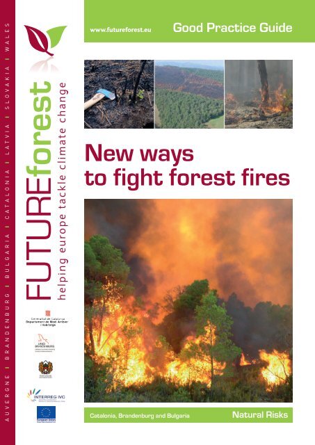
New ways to fight forest fires
New ways to fight forest fires
New ways to fight forest fires

Create successful ePaper yourself
Turn your PDF publications into a flip-book with our unique Google optimized e-Paper software.
A U V E R G N E I B R A N D E N B U R G I B U L G A R I A I C A T A L O N I A I L A T V I A I S L O V A K I A I W A L E S<br />
www.future<strong>forest</strong>.eu<br />
Good Practice Guide<br />
<strong>New</strong> <strong>ways</strong><br />
<strong>to</strong> <strong>fight</strong> <strong>forest</strong> <strong>fires</strong><br />
Catalonia, Brandenburg and Bulgaria<br />
Natural Risks
<strong>New</strong> <strong>ways</strong> <strong>to</strong><br />
<strong>fight</strong> <strong>forest</strong> <strong>fires</strong><br />
“extinction capacity”- and burn large areas of the<br />
<strong>forest</strong>.<br />
A balanced combination of both approaches is<br />
therefore needed <strong>to</strong> increase the chance of reducing<br />
<strong>forest</strong> fire damage <strong>to</strong> an acceptable threshold.<br />
Approach 1:<br />
Enhance efficiency in the response <strong>to</strong> <strong>forest</strong> <strong>fires</strong><br />
Background<br />
Wild<strong>fires</strong> are one of the main natural hazards affecting<br />
Europe. An average of 500.000 ha of <strong>forest</strong> is burnt<br />
across the EU annually, with associated emissions of<br />
CO2, other gases and particles.<br />
Use of high efficiency <strong>to</strong>ols<br />
for detection<br />
Case study - Brandenburg<br />
Large <strong>fires</strong> cause human casualties, damage property,<br />
reduce soil fertility through loss of organic matter, and<br />
hamper biodiversity conservation.<br />
The risk of <strong>forest</strong> <strong>fires</strong> is not only an issue of southern<br />
countries but it is becoming increasingly a problem in<br />
higher latitudes as well including Bulgaria and<br />
Germany.<br />
Fire incidence map for<br />
the EU. Source: EU<br />
project Fire-paradox<br />
Climate change is forecast <strong>to</strong> cause more droughts,<br />
higher temperatures and more windy periods. This will<br />
raise both the likelihood and the severity of <strong>fires</strong>, hence<br />
an increase of the burned areas in the EU is predicted.<br />
Two different approaches for the same problem<br />
When defining fire <strong>fight</strong>ing policies, there are 2 main<br />
objectives that need <strong>to</strong> be fulfilled:<br />
1. To provide a quick and efficient response <strong>to</strong> fire<br />
2. To minimise the number and intensity of large fire<br />
events.<br />
A quicker and more effective response <strong>to</strong> the majority<br />
of <strong>fires</strong> is the first step <strong>to</strong> take in any fire <strong>fight</strong>ing policy.<br />
Fast fire detection and good coordination amongst the<br />
responsible agents for fire suppression are two crucial<br />
issues.<br />
Nonetheless - as already shown in the Mediterranean<br />
regions that have highly improved these response<br />
measures in the last decade - there are al<strong>ways</strong> a<br />
number of wild<strong>fires</strong> (i.e. 4 % in Catalonia) for which<br />
these measures are not fully successful. These become<br />
large <strong>forest</strong> <strong>fires</strong> - <strong>fires</strong> that exceed the so called<br />
A new <strong>to</strong>ol with an au<strong>to</strong>matic, early warning<br />
system for <strong>forest</strong> <strong>fires</strong> has been developed in<br />
Brandenburg.<br />
The “FIRE WATCH” (FW) system is a terrestrial,<br />
digital, remote controlled surveillance system,<br />
which is capable of observing larger wooded areas.<br />
The camera delivers pictures of a 360 degree scan<br />
by turning every 6 <strong>to</strong> 8 minutes. The system<br />
recognises smoke clouds au<strong>to</strong>matically with a<br />
minimal size of 10m x 10m at a distance of 15 <strong>to</strong><br />
20 km and produces an acoustic and optic alarm<br />
by au<strong>to</strong>matic recognition. The system identifies the<br />
location of the <strong>forest</strong> fire and records pictures and<br />
relays fire report information.<br />
Results and experiences with FW:<br />
• 50 % of all <strong>forest</strong> <strong>fires</strong> are first detected by FW<br />
• The optical system observes more accurately<br />
than the human eye, especially in larger<br />
distance (15 <strong>to</strong> 20 km and more)<br />
• Detection - it recognises the fire while it is in its<br />
early stage<br />
• It provides a complete report with map, picture<br />
and facts of date, time and coordinates<br />
• Saves lives? Saves money?<br />
2
Improved co-ordination<br />
between organisations<br />
Case study - Bulgaria<br />
During the last 10 years two major steps have been<br />
undertaken in Bulgaria regarding fire <strong>fight</strong>ing:<br />
i) An overall strategy for efficient <strong>forest</strong> fire<br />
management<br />
ii) An Inter-institutional Council with the main<br />
responsibility <strong>to</strong> improve the coordination<br />
between the responsible institutions.<br />
These administrative measures combined, as well<br />
as favourable climate conditions have helped <strong>to</strong><br />
significantly diminish the number of <strong>fires</strong> and<br />
damage caused <strong>to</strong> the <strong>forest</strong>s.<br />
One good practice for prevention and<br />
extinguishing of <strong>fires</strong>, under national legislation, is<br />
the creation of local groups patrolling, observing<br />
and extinguishing <strong>forest</strong> <strong>fires</strong>. They consist of<br />
workers and volunteers and are organised by the<br />
State Forestry and Municipalities. These groups<br />
help in putting out <strong>forest</strong> <strong>fires</strong> regardless of the<br />
ownership of the <strong>forest</strong>s, <strong>to</strong>gether with the fire<br />
<strong>fight</strong>ers and <strong>forest</strong>ry employees. It is a very good<br />
example of co-operation between institutions at<br />
different levels – state, regional and local.<br />
<strong>to</strong>pographic fire, wind-in-plain-terrains fire, wind<br />
convection fire. This interaction can be devised for a<br />
particular region with the study and reconstruction of<br />
past large wild<strong>fires</strong> based on spread patterns. A system<br />
has been developed in the framework of the EU project<br />
‘Fireparadox’ <strong>to</strong> ease this process.<br />
Besides macro<strong>to</strong>pography, there is another crucial<br />
element that determines fire spread and intensity - the<br />
availability of biomass fuel, which depends on the<br />
species composition, stand structure and age. This is<br />
the only element that we can modify and we can do it<br />
only through specific <strong>forest</strong>ry practices.<br />
Several studies have demonstrated that <strong>forest</strong><br />
structures with low fuel accumulation and with no<br />
vertical continuity are more resistant <strong>to</strong> fire spread and<br />
have reduced fire intensity. The most common <strong>forest</strong>ry<br />
practices <strong>to</strong> achieve such a <strong>forest</strong> stand are:<br />
i) Reducing surface-fuel, <strong>to</strong> limit fire intensity;<br />
ii) Thinning and elimination of fuel, <strong>to</strong> lower the<br />
probability of vertical fire development;<br />
iii) Combined low and crown thinning, <strong>to</strong> avoid fire<br />
spreading through tree canopies.<br />
Mapping fire risk types<br />
Case study - Catalonia<br />
The possibility of identifying areas where <strong>forest</strong><br />
<strong>fires</strong> tend <strong>to</strong> show predictable behaviour, allowed<br />
for the production of the Map of fire-types of<br />
Catalonia. This map helps the <strong>forest</strong> managers in<br />
identifying the kind of fire that most probably will<br />
affect <strong>forest</strong>s and helping take the right <strong>forest</strong>ry<br />
practice <strong>to</strong> minimise its effects.<br />
Approach 2:<br />
Integration of fire prevention criteria in<strong>to</strong> <strong>forest</strong><br />
management<br />
As opposed <strong>to</strong> traditional beliefs, a new way of<br />
approaching fire-<strong>fight</strong>ing being used in Catalonia relies<br />
on the prediction of fire behaviour and spread. It is<br />
clear that a correlation exists between active <strong>forest</strong><br />
management and the reduction of fire risks but <strong>forest</strong><br />
management could play an even greater role, if we<br />
analyse – and appropriately use - the fac<strong>to</strong>rs affecting<br />
fire behaviour, how they spread, the effect of<br />
<strong>to</strong>pography, weather and fuel.<br />
Although we cannot control them, the existence of fire<br />
spread patterns (based on the macro-<strong>to</strong>pography and<br />
common weather types) allows for the definition of a<br />
set of “Fire types” or <strong>fires</strong> showing similar behaviour,<br />
linked <strong>to</strong> a given terri<strong>to</strong>ry - including standard<br />
Compared <strong>to</strong> other fire risk maps that usually only<br />
inform on probability of fire ignition, the Map of<br />
fire-type risk also provides information on the<br />
potential extinction difficulties and opportunities,<br />
and on fire spread capacity.<br />
3
<strong>New</strong> <strong>to</strong>ols for fire prevention<br />
at <strong>forest</strong> stand level<br />
Case study - Catalonia<br />
i) Classification of <strong>forest</strong> stands according <strong>to</strong><br />
their vulnerability <strong>to</strong> fire<br />
In Catalonia, the existing <strong>forest</strong> typologies have been<br />
classified according <strong>to</strong> their vulnerability <strong>to</strong> canopy<br />
fire in<strong>to</strong> three categories: high vulnerability (A),<br />
moderated (B) or low (C). A classification key<br />
particular <strong>forest</strong> stand falls in<strong>to</strong>. With such <strong>to</strong>ols,<br />
<strong>forest</strong> managers can identify the vulnerability degree<br />
of their <strong>forest</strong> stand and apply the most appropriate<br />
<strong>forest</strong>ry practices <strong>to</strong> achieve a <strong>forest</strong> stand structure<br />
with higher resistance <strong>to</strong> canopy fire (C structures).<br />
ii) Integrated <strong>forest</strong> management models<br />
In Catalonia, a set of sylvicultural models that<br />
integrate the reduction of fire vulnerability as a<br />
management objective have been defined.<br />
The models proposed for even age stands in areas<br />
with high fire risk, look for a stand structure with big<br />
trees, preferably including broadleaf species, and no,<br />
or little, presence of suppressed trees.<br />
The key management criteria are:<br />
i) To increase the rotation age,<br />
ii) To shorten the regeneration period (no longer<br />
than 15 years).<br />
The aim is <strong>to</strong> maintain low vulnerability structures<br />
for the longest period possible and reduce high<br />
vulnerability <strong>forest</strong> structures.<br />
BEFORE – B structure<br />
AFTER – C structure<br />
diagram has also been developed based on easy-<strong>to</strong>measure<br />
variables such as canopy cover and<br />
vegetation height - <strong>to</strong> identify which category each<br />
The models proposed for uneven age stands, in<br />
areas with high fire risk, advocate <strong>forest</strong>ry practices<br />
based on selective clear-cut in “medium sized<br />
groups” (from 0.5ha up <strong>to</strong> 1.0ha) <strong>to</strong> obtain mosaictype<br />
kind of <strong>forest</strong>s which break up the <strong>forest</strong> mass.<br />
Discussion<br />
Although the <strong>to</strong>ols described here can be used in <strong>forest</strong><br />
stands of any size, their efficiency is highly enhanced<br />
when applied in<strong>to</strong> <strong>forest</strong>ry planning at landscape (or<br />
massif) level -between 1,000 and 50,000 ha. This results<br />
in better control of fire behaviour, fire effects, and<br />
extinction costs.<br />
Landscape/massif is a good working scale <strong>to</strong>:<br />
1. Analyse potential large fire behaviour, which allows for<br />
the identification of strategic points, - those where<br />
fuel treatments are expected <strong>to</strong> be more effective in<br />
reducing wildfire spread rate and fire intensity -.<br />
2. Integrate fire prevention measures in Forest<br />
Management Plans at <strong>forest</strong> holding level.<br />
3. Develop specific Fire Prevention Plans.<br />
4. Promote collaboration between different stakeholders<br />
(e.g. <strong>forest</strong> owners associations, <strong>forest</strong> and fire<br />
governmental agencies, local bodies, protected areas,<br />
etc.).<br />
Further reading:<br />
The information regarding fire integration in<strong>to</strong> <strong>forest</strong>ry has been<br />
developed by the Fire Prevention administration of Catalonia in the<br />
framework of the EU project Fire-Paradox originated in the 6th<br />
Development Research European Programme and available at<br />
http://fireparadox.org/, and in the ORGEST project by the <strong>forest</strong>ry<br />
administration of Catalonia (CPF and DMAH), available, in Spanish,<br />
at Piqué & Vericat (2009) and Castellnou et al. (2009).<br />
www.gencat.cat/dmah/cpf<br />
Y. Birot (Ed.), 2009. Living with wild<strong>fires</strong>: What science can tell us.<br />
EFI Discussion Paper, 15. 82 pp.<br />
www.iqwireless.com/images/s<strong>to</strong>ries/pdf/Firewatch_brochure.pdf<br />
www.future<strong>forest</strong>.eu<br />
4