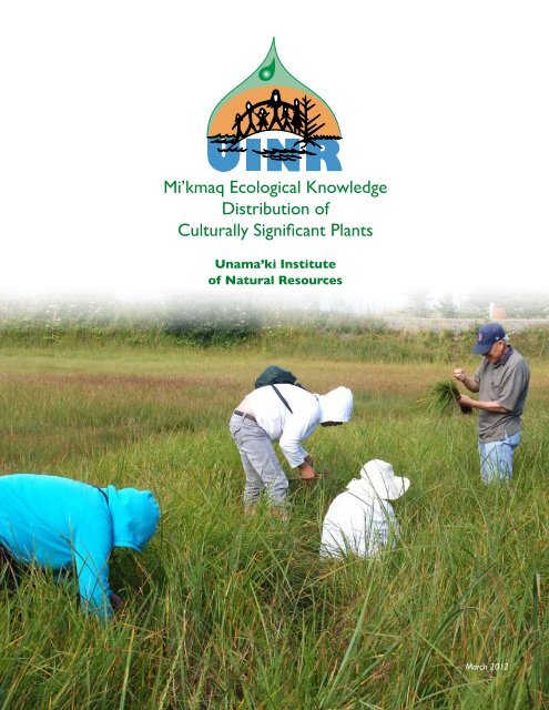
Mi'kmaq Ecological Knowledge Distribution of Culturally Significant ...
Mi'kmaq Ecological Knowledge Distribution of Culturally Significant ...
Mi'kmaq Ecological Knowledge Distribution of Culturally Significant ...

Create successful ePaper yourself
Turn your PDF publications into a flip-book with our unique Google optimized e-Paper software.
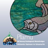
Mi’kmaq <strong>Ecological</strong> <strong>Knowledge</strong><br />
<strong>Distribution</strong> <strong>of</strong><br />
<strong>Culturally</strong> <strong>Significant</strong> Plants<br />
Unama’ki Institute<br />
<strong>of</strong> Natural Resources<br />
March 2012
Mi’kmaq <strong>Ecological</strong> <strong>Knowledge</strong><br />
<strong>Distribution</strong> <strong>of</strong> <strong>Culturally</strong><br />
<strong>Significant</strong> Plants<br />
Mi’kmaw <strong>Knowledge</strong>, Intellectual<br />
Property Rights, and Moral Rights:<br />
1. “Copyright” means the sole right to produce<br />
or reproduce a work or any substantial<br />
part there<strong>of</strong> in any material form whatever,<br />
to perform a work or any substantial part<br />
there<strong>of</strong> in public or, if the work is unpublished,<br />
to publish a work or any substantial part<br />
there<strong>of</strong>.<br />
a) The copyright in this work in<br />
its entirety, both published and<br />
unpublished, shall vest in the Unama’ki<br />
Institute <strong>of</strong> Natural Resources.<br />
2. “Intellectual Property Rights” means any and<br />
all intellectual property rights recognized by<br />
law, including but not limited to intellectual<br />
property rights protected through legislation.<br />
a) Any Intellectual Property Rights<br />
created by the members <strong>of</strong> the<br />
Mi’kmaq Nation in Nova Scotia<br />
participating in this <strong>Distribution</strong> <strong>of</strong><br />
<strong>Culturally</strong> <strong>Significant</strong> Plants Project<br />
shall vest in and remain the property<br />
<strong>of</strong> the Mi’kmaq Nation in Nova Scotia.<br />
3. “Moral Rights” means that the creator or<br />
knowledge holder has the right to the<br />
integrity <strong>of</strong> her or his work or knowledge and<br />
the right to be associated with the work as its<br />
author by name, under a pseudonym and the<br />
right to remain anonymous.<br />
a) every individual contributing to the<br />
intellectual property created by<br />
participation in this <strong>Distribution</strong> <strong>of</strong><br />
<strong>Culturally</strong> <strong>Significant</strong> Plants Project<br />
shall vest in and remain the property<br />
<strong>of</strong> the members <strong>of</strong> the Mi’kmaq<br />
Nation in Nova Scotia participating<br />
in the <strong>Distribution</strong> <strong>of</strong> <strong>Culturally</strong><br />
<strong>Significant</strong> Plants Project.<br />
Prepared by Membertou Geomatics Solutions<br />
Mi’kmaq plant names translated by Tuma Young<br />
© Unama’ki Institute <strong>of</strong> Natural Resources 2012<br />
The views in this report do not represent those <strong>of</strong> the entire Mi’kmaq nation. Participation by UINR and the Mi’kmaq in this research is not, and should not,<br />
be construed as consultation. Any new areas being proposed by the Crown(s) to have expanded legal protection would require separate consultation under the<br />
Mi’kmaq-Nova Scotia-Canada Consultation process.
Introduction<br />
Methodology<br />
Research Results<br />
Ground Truth Results<br />
Elders’ Plant Gathering Areas<br />
Conclusion<br />
4<br />
4<br />
12<br />
47<br />
51<br />
54<br />
Table <strong>of</strong> Contents
Introduction<br />
Parks Canada, Cape Breton Highlands<br />
National Park (CBHNP) has been a UINR<br />
partner since the late1990s on Northern<br />
Cape Breton habitat management issues<br />
and has provided support for conservation<br />
<strong>of</strong> the cultural and ecological heritage <strong>of</strong><br />
Northern Cape Breton.<br />
As early as 2001, Unama’ki Institute <strong>of</strong><br />
Natural Resources (UINR), and then<br />
StoraEnso and now NewPage Port<br />
Hawkesbury, have an agreement that has<br />
provisions for cooperating to identify and<br />
conserve rare or valuable plants <strong>of</strong> cultural<br />
significance to Mi’kmaq.<br />
In 2008, UINR partnered with Membertou<br />
Geomatics Consultants (MGC), now<br />
known as Membertou Geomatics Solutions<br />
(MGS), to access Geographic Information<br />
System (GIS) capacity to create a GIS<br />
database for management and sharing <strong>of</strong><br />
existing and new resource management<br />
data.<br />
The project partners came together on this<br />
project for the purpose <strong>of</strong> understanding<br />
the distribution and abundance <strong>of</strong> plant<br />
species <strong>of</strong> cultural significance to the<br />
Mi’kmaq <strong>of</strong> Unama’ki. Earlier phase activities<br />
included interviews with knowledgeable<br />
Mi’kmaq Elders to determine priority<br />
plant species and where the significant<br />
species could be found. Botanical<br />
source literature was also reviewed for<br />
distribution, conservation status, and<br />
habitat requirements. The resulting data<br />
was mapped and included in the GIS<br />
database to be utilized for following phases<br />
<strong>of</strong> fieldwork, and ground-truthing the GIS<br />
database for further use as a resource<br />
management and conservation tool.<br />
The GIS database and resultant mapping<br />
is intended to document known plant<br />
occurrences as well as predict potential<br />
occurrences by location and habitat<br />
requirements. Priority is given to<br />
potential occurrences on lands managed<br />
by Unama’ki Mi’kmaq, NewPage Port<br />
Hawkesbury, and Parks Canada. It was<br />
later determined that mapping all <strong>of</strong> Cape<br />
Breton for each identified plant’s habitat<br />
requirements was just as efficient, if not<br />
more efficient, than mapping the project<br />
partners’ management areas only.<br />
Methodology<br />
The activities covered in this phase <strong>of</strong> the<br />
study <strong>of</strong> Mi’kmaq culturally significant plants<br />
are divided into three groups <strong>of</strong> Research,<br />
Mapping, and Ground Truths.<br />
Research involved determining the habitat<br />
requirements <strong>of</strong> each plant and populating<br />
the columns and rows <strong>of</strong> habitat matrix<br />
tables. The habitat matrix tables were then<br />
referenced to produce mapping <strong>of</strong> all<br />
habitat-supporting areas for each <strong>of</strong> the<br />
research plants. The habitat-supporting<br />
mapping was then taken in the field to<br />
locate or ground truth selected plants<br />
species.<br />
Earlier phases <strong>of</strong> this project identified<br />
65 plant species that were <strong>of</strong> cultural<br />
importance to Mi’kmaq. The list <strong>of</strong> culturally<br />
important plant species was further<br />
classified by priority, based on susceptibility<br />
to potential impacts <strong>of</strong> forestry operations<br />
resulting in 10 High Priority plant species, 5<br />
Medium Priority, and 50 <strong>of</strong> Lower Priority.<br />
For practical reasons <strong>of</strong> budget and time<br />
constraints, the concentration <strong>of</strong> effort<br />
was given to the High and Medium Priority<br />
plant species. The Lower Priority plants<br />
are sufficiently represented in the project<br />
research and resulting materials, regardless<br />
that the 50 plants were not priority in the<br />
fieldwork portion <strong>of</strong> the project.<br />
The project research consisted <strong>of</strong><br />
identifying habitat requirements for each<br />
plant with respect to soil drainage, sun light,<br />
topography, and species-favoured habitat<br />
type. Initial research was provided by<br />
project partner, Parks Canada, and was later<br />
supplemented by Membertou Geomatics<br />
Solutions’ online research <strong>of</strong> each plant<br />
species. The research results were then<br />
compiled into an explicit list <strong>of</strong> species<br />
habitat requirements as well as matrix<br />
tables that matched each plant’s habitat<br />
requirements with available mapping data.<br />
4
Given the large list <strong>of</strong> Mi’kmaq culturally important plants, the large geographic area <strong>of</strong><br />
NewPage leased parcels, and Mi’kmaq plant gathering areas identified in the earlier phase,<br />
it was determined that all Cape Breton Island would be mapped for all plant species<br />
identified by Mi’kmaq Elders and gatherers. It was determined that a method <strong>of</strong> mapping<br />
was required to represent each plant’s favoured supporting habitat in a single map specific<br />
to each plant.<br />
A plant species mapping and analysis-decision making tool for Mi’kmaq and project<br />
partners must be explicit for duplication <strong>of</strong> results and accessible to a wide range <strong>of</strong><br />
technical skills, as to be understood by end-users consisting <strong>of</strong> Mi’kmaq community<br />
leaders, residents, as well as project partners. The proposed plant mapping and analysis<br />
method chosen is a revisit <strong>of</strong> the Grey Tone Method which was brought to prominence<br />
by Ian McHarg in the 1960s. It revolutionized land-use planning at that time and forms the<br />
foundation <strong>of</strong> modern GIS systems today.<br />
A typical application <strong>of</strong> McHarg’s method consists <strong>of</strong> mapping individual environmental<br />
factor maps relevant to the study, such as soil drainage, sun exposure, and habitat types.<br />
Each <strong>of</strong> these environmental factor maps is then assessed a value with respect to suitability<br />
for a particular land use or, in this case, suitable habitat for each plant species. In this<br />
project, values assigned to supporting environmental factors are typically either supporting<br />
or non-supporting, or characteristic to<br />
the environmental factor, such as Full<br />
Sun, Partial Shade, and Full Shade for the<br />
environmental factor <strong>of</strong> Sun Exposure.<br />
The values assigned to individual factors<br />
with respect to supporting habitat are<br />
typically arranged in the matrix tables <strong>of</strong><br />
environmental factors, and derived from<br />
the accompanying explicit list <strong>of</strong> species<br />
habitat requirements and assigned value.<br />
All environmental factor matrix tables <strong>of</strong><br />
plant species and assigned values can be<br />
found in the appendices.<br />
Grey Tone Map Composition:<br />
The resulting plant species’ potential<br />
supporting habitat factor maps can be<br />
viewed individually, but all relevant factor<br />
maps must be viewed collectively for<br />
analysis <strong>of</strong> the locations <strong>of</strong> High, Moderate,<br />
and Low supporting potential values.<br />
Overlaying shaded factor map transparencies<br />
based on assessed values are used to<br />
produce a composite graphic map <strong>of</strong><br />
habitat potential for each species <strong>of</strong> plant.<br />
Base Map with Soil Drainage Layer added<br />
Using the Grey Tone Method, each<br />
potential supporting habitat value is<br />
assigned a transparent grey or green value<br />
<strong>of</strong> dark green for High supporting potential,<br />
clear for Low supporting potential, and<br />
medium green for Moderate supporting<br />
potential. All the relevant factors maps and<br />
their assigned grey levels are overlain with<br />
each other to produce the composite map.<br />
Add Surficial Geology Drainage Layer<br />
5
The cumulative effect <strong>of</strong> shading produces<br />
dark green areas within the map, indicating<br />
areas <strong>of</strong> High supporting potential, light<br />
grey areas indicating Moderate supporting<br />
potential, and clear areas <strong>of</strong> Low<br />
supporting potential for each plant species.<br />
The Grey Tone Method is most suitable for<br />
First Nations in the context <strong>of</strong> accessibility<br />
to a wide range <strong>of</strong> technical skill capacity.<br />
The method is visual in representing and<br />
interpreting several layers <strong>of</strong> data and<br />
scalable from the community level to a<br />
regional level, thereby empowering First<br />
Nations to monitor relevant issues within<br />
and beyond their community boundaries.<br />
The method can be further enhanced<br />
with even more statistically robust analysis<br />
processes, with the use <strong>of</strong> weighted scores<br />
for priority rating as one example.<br />
Add Sun Exposure (Crown Closures) Layer<br />
Add Habitat Layers for completed Grey Tone map<br />
6
ENVIRONMENTAL FACTORS<br />
Soil Drainage:<br />
Project partner, NewPage, provided the digital file CB_FEC_SOIL_TYPES.shp and<br />
supporting files. The digital (electronic) file contains geo-referenced polygons <strong>of</strong> all soil<br />
types found within Cape Breton Island, as well as features such slope, stoniness, and<br />
drainage characteristics similar to Agriculture Canada Soil Surveys <strong>of</strong> the 1960s. The Soil<br />
Drainage feature codes contained within the file range from R=Rapid to VP=Very Poor.<br />
This study required that the drainage feature codes be grouped into three assigned values<br />
<strong>of</strong> Good, Moderate, and Poor for Grey Tone mapping. The following are the groupings <strong>of</strong><br />
feature codes that were extracted and exported into individual new shape (.shp) files for<br />
Grey Tone mapping.<br />
Export_CB_FEC_SOIL_TYPES_DRAINAGE_GOOD.shp:<br />
Good (Dry): R= Rapid Drainage<br />
W= Well Drained<br />
Export_CB_FEC_SOIL_TYPES_DRAINAGE_MODERATE.shp:<br />
Moderate (Mesic-Moist): M= Moderate<br />
I= Imperfect<br />
Export_CB_FEC_SOIL_TYPES_DRAINAGE_POOR.shp:<br />
Poor (Damp-Wet): P= Poor<br />
VP= Very Poor<br />
Sub-Soil Drainage:<br />
The electronic file, CB_FEC_SOIL_TYPES.shp, contains large polygons where the soil<br />
type was listed as “Not Surveyed” and had no entry for the drainage characteristics. The<br />
geographic area not surveyed was mostly the Cape Breton Highlands and the Highlands<br />
north <strong>of</strong> Mabou, as well as Kelly’s Mountain, and Washabuck Centre.<br />
To determine drainage characteristics within these areas, provincial surficial geology data<br />
was used to infer overlying surface drainage characteristics based on the underlying parent<br />
material characteristics. Parent materials are the tills and deposited materials left behind<br />
after the last ice sheets melted. Some <strong>of</strong> these deposits were derived from slumping <strong>of</strong><br />
materials out <strong>of</strong> decaying ice. Some deposits were settled on the bottom <strong>of</strong> temporary<br />
glacial lakes and others were deposited by flowing glacier melt water. Over time, these<br />
surficial deposits developed thin layers <strong>of</strong> soil that shared the characteristics <strong>of</strong> the parent<br />
material. Coarse-textured parent material produced coarse-textured soils with good<br />
drainage, as fine-textured parent material produced fine-textured soils with generally poor<br />
drainage characteristics.<br />
The original, downloadable NS Provincial electronic file, p92003gs.shp, has “Unit” features<br />
such as “stoney till plain”, “Alluvial Deposit”, and “Silty Drumlin” as a few examples, and<br />
is supported by unit descriptions detailing the structural characteristics <strong>of</strong> the parent<br />
material deposits. Units <strong>of</strong> the original surficial geology file were selected based on<br />
structure characteristics, and exported into new individual shape (.shp) files <strong>of</strong> the inferred<br />
drainage characteristics <strong>of</strong> “Good” , “Moderate”, and “Poor” drainage.<br />
To avoid double counting with the Soil Drainage layer outside the areas “Not Surveyed”,<br />
a mask was created to block out Sub-Surface Drainage Grey Tone mapping information<br />
overlaying the areas that already have Soil Drainage Grey Tone mapping.<br />
7
The following are the “Units” and drainage characteristic values assigned to each unit type:<br />
Export_CB_Surficial_Geology_SubSoil_DRAINAGE_GOOD_2.shp:<br />
Colluvial<br />
Residuum<br />
Stony Till Plain<br />
Kames & Eskers (Glaci<strong>of</strong>luvial Deposits)<br />
Stony Drumlin<br />
Export_CB_Surficial_Geology_SubSoil_DRAINAGE_MODERATE.shp:<br />
Alluvial Deposits<br />
Outwash Fans & Deltas<br />
Export_CB_Surficial_Geology_SubSoil_DRAINAGE_POOR<br />
Bedrock<br />
Silty Till Plain<br />
Glaciolacustrine Deposits<br />
Organic Deposits<br />
Silty Drumlin<br />
Sun Exposure:<br />
Project partner, NewPage, provided the electronic file, CB_Forest.shp and supporting files<br />
which consist <strong>of</strong> geo-referenced polygons <strong>of</strong> forest types, and numerous features relevant<br />
to the forestry industry. The feature <strong>of</strong> Crown Closures (“CRNCL”) is given in percentages<br />
and was utilized to determine three classes <strong>of</strong> sun exposure being Full Sun, Partial Shade,<br />
and Full Shade. The following are the assigned values <strong>of</strong> crown closures and corresponding<br />
range <strong>of</strong> crown closure percentages:<br />
CB_Forest_Export_60Plus_Closure.shp:<br />
Full Shade (Crown Closure <strong>of</strong> more than 60%)<br />
CB_Forest_Export_40to60_Closure.shp:<br />
Partial Shade (Crown Closure <strong>of</strong> 40 to 60%)<br />
CB_Forest_Export_40Minus_Closure.shp:<br />
Full Sun (Crown Closure <strong>of</strong> less than 40%)<br />
8
Habitat Type:<br />
The research portion <strong>of</strong> the project <strong>of</strong>ten resulted in finding descriptions <strong>of</strong> typical Habitat<br />
Types where individual plant species could be found. Depending on the plant species,<br />
preferred or supporting habitat types were typically described as “Found on floodplains,<br />
edge <strong>of</strong> lake shores and stream banks, and slopes. Also found within hardwood forests and<br />
brush”.<br />
The electronic file, CB_Forest.shp, provided by NewPage has feature codes for forest and<br />
non-forest (FORNON) habitat types. The following are the features codes selected that<br />
represent habitat types supporting a wide range <strong>of</strong> the Mi’kmaq culturally significant plants.<br />
For Grey tone mapping <strong>of</strong> individual plants, habitat types are either supporting or nonsupporting<br />
for a plant. Supporting habitats are assigned a dark tone <strong>of</strong> semi-transparent<br />
green, and non-supporting habitats have no tone assigned and are clear or white space<br />
within the Grey-Tone maps. The FORNON feature codes are further supplemented with<br />
the selected feature codes for COVER_TYPE which are Hardwood Cover, S<strong>of</strong>twood<br />
Cover, and Mixed Cover types that are frequently described in the research. The original<br />
CB_Forest.shp file was copied and renamed in the map legend, “CB_Forest_Habitat_<br />
Analysis”.<br />
The following are the Habitat Type and Cover Type features and feature codes selected to<br />
represent supporting habitat for Mi’kmaq culturally significant plants:<br />
CB_Forest_Habitat_Analysis.shp:<br />
Burn 2 Barren 85<br />
Oldfield 5 Agriculture 86<br />
Brush 33 Urban 87<br />
Wetland 70 Landfill 93<br />
Open Bog 72 Beach 94<br />
Treed Bog 73 Road Corridor 98<br />
Lake Wetland 75 Rail Corridor 99<br />
Coastal Cliffs 76 *S<strong>of</strong>twood Cover 2<br />
Inland Water 77 *Hardwood Cover 8<br />
Rock Barren 84 *Mixed Wood Cover 5<br />
*Cover Type Feature<br />
9
Habitat Edges:<br />
As with Habitat Types, the research into each plant species’ supporting habitat found<br />
mention edge habitats such as “edge <strong>of</strong> forest”, “edge <strong>of</strong> wetlands”, and “edge <strong>of</strong> fields”.<br />
Using the electronic file, CB_Forest.shp, the geo-referenced polygons <strong>of</strong> selected Habitat<br />
Types were exported and edited to ensure only outside edges <strong>of</strong> the selected Habitat<br />
Types are used in the Grey-Tone mapping. The Habitat Edges were given line thicknesses<br />
<strong>of</strong> 15-30m, and a dark green tone to represent the eco-tone or area <strong>of</strong> transition from<br />
one habitat to an adjacent habitat.<br />
The following Edge Habitats were selected and exported into individual shape (.shp) files:<br />
Edge_Meadow_Field_Export2.shp:<br />
Meadow and Field edge habitat is derived from Oldfield and Agriculture<br />
Habitat Types.<br />
Edge_Forest_Export2.shp:<br />
Forest edge habitat is derived from a selection <strong>of</strong> Habitat Type edges <strong>of</strong><br />
open areas that share an edge with a forest habitat such as Burn, Old Field,<br />
Agriculture, Open Bog, Barren, and Rock Barren.<br />
Edge_Swamp_Export3.shp:<br />
Edge <strong>of</strong> Swamp habitat is derived from Open Bog, Treed Bog, Lake,<br />
and Wetland Habitat Types.<br />
The following two Edge Habitat shape (.shp) files are derived from NSTDB 1:10 000 map<br />
sheet downloadable electronic files from N. S. Provincial web sites. Each Polygon Outline<br />
is given a dark and semi-transparent green tone for supportive habitats, and the polygon<br />
interior is not assigned a fill or green tone, leaving the polygon interior clear.<br />
Edge_Lake_Shoreline_Export3.shp:<br />
Edge Lake Shoreline utilizes the outlines <strong>of</strong> polygons provided for Lakes,<br />
Reservoirs, and Large River Systems. The polygon interiors show no<br />
colour fill, leaving only the polygon outline <strong>of</strong> dark green tone<br />
representing the shorelines <strong>of</strong> these bodies <strong>of</strong> freshwater.<br />
Water__Features__Merge_WaterCourses_Export_Buffer2:<br />
Watercourse Riparian Zones are derived from Line features that represent<br />
watercourses. A 15m buffer watercourse Line features provide a 30m<br />
wide corridor <strong>of</strong> Riparian Zone with the Watercourse being the centerline.<br />
The 15m buffer zone is assigned a semi-transparent dark green tone<br />
representing supportive habitat in the Riparian Zone.<br />
Slopes<br />
The research <strong>of</strong> supporting habitats for each <strong>of</strong> the Mi’kmaq culturally significant plants<br />
occasionally listed sloped topography as a habitat feature favoured by some plants. The<br />
NTDB (Digital Elevation Model) electronic files were utilized to produce raster mapping<br />
<strong>of</strong> 15% and greater slopes. The raster mapping was assigned the same semi-transparent<br />
dark green tone for supporting habitats and the clear, or white space, within the mapping<br />
are areas <strong>of</strong> low slopes <strong>of</strong> less than15% to near-level topography.<br />
10
Miscellaneous Environmental Factors<br />
As with the environmental factor <strong>of</strong> Slopes, occasionally Talus Slopes was a favoured<br />
habitat for some <strong>of</strong> the plant species researched. Talus slopes are steep slopes <strong>of</strong> naturally<br />
occurring fractured rock with a wide range <strong>of</strong> particle size, ranging from large boulders to<br />
smaller loose stone and gravel. To map Talus Slope habitat, the original downloadable N.S<br />
Provincial electronic file p92003gs.shp, for surficial geology was utilized. The feature Unit <strong>of</strong><br />
Colluvial deposits has an accompanying description <strong>of</strong> “weathered and frost fractured rock<br />
and soils which form a blanket <strong>of</strong> material on steep valley walls, talus cone or rotational<br />
slump formed by either downward creep or mass movement <strong>of</strong> material.” The new layer,<br />
Export_CB_Surficial_Geology_Slope, was created from the Export_CB_Surficial_Geology.<br />
shp file, and Colluvial deposit polygons were assigned semi-transparent dark green tone as<br />
supporting habitat <strong>of</strong> Talus Slopes.<br />
Due to the steep sloping characteristics <strong>of</strong> Colluvial Deposits, Colluvial deposit polygons<br />
were also utilized in conjunction with raster mapping as representative <strong>of</strong> sloped<br />
topography, where there are gaps in the raster mapping used for the environmental factor<br />
<strong>of</strong> Slopes. Used in the context <strong>of</strong> sloped topography, Colluvial Deposit polygons were<br />
assigned a semi-transparent dark green tone as supporting habitat for some species <strong>of</strong><br />
plants.<br />
Ground Truths<br />
Using the environmental factors and the populated Habitat Tables, Grey Tone (Green<br />
Tone) mapping was produced for each individual plant species on the High and Medium<br />
and Lower Priority list. The cumulative effect <strong>of</strong> the overlain, semi-transparent, habitat<br />
layers produced darkened areas within the maps, indicating an accumulation <strong>of</strong> supportive<br />
habitat, and lighter areas <strong>of</strong> the maps indicate areas <strong>of</strong> less-supportive habitat, depending<br />
on the plant.<br />
Target points were then selected for field visits to verify if the targeted plant species could<br />
be located based on the Grey-Tone mapping. These target points were uploaded to GPS<br />
(Global Positioning System) for fieldwork crews. During travel to the target points and<br />
upon arrival, a scan for other Mi’kmaq culturally significant plants was conducted, and all<br />
plants found were recorded with a newly-placed GPS point taken in the field.<br />
Fieldwork was done in three stages. Initial fieldwork involved visiting areas indicated<br />
by Elders as gathering places for various plants. The next stage formed the bulk <strong>of</strong> the<br />
fieldwork and involved visiting individual target points to locate specific plant species.<br />
The later stage was an attempt to locate specific plant species that proved to be elusive<br />
in earlier fieldwork stages. Both the Elder first stage and second stage field visits were<br />
attended by a botanist to verify plant species.<br />
Although the field crews attempted to visit NewPage parcels, due to time constraints and<br />
a large geographic area, field crews in the second stage <strong>of</strong> fieldwork chose target point<br />
locations in close proximity to public roads.<br />
Field-recorded, ground truth points are supplemented by previously recorded locations<br />
<strong>of</strong> plant species derived from Cape Breton University (CBU) archives. The CBU locations<br />
were given in Latitude and Longitude coordinates that were rounded <strong>of</strong>f to degrees and<br />
minutes. These points are shown in the mapping for each plant where CBU data was<br />
available, along with a 60-second window box representing an area where the plant could<br />
have been located, assuming the coordinates were rounded down to the nearest minute.<br />
All ground truth points recorded in the field are shown with the Grey Tone mapping<br />
for each plant and include points recorded during Elder site visits, and the CBU archive<br />
location points. All Grey Tone maps for each plant species can be found in the appendices.<br />
11
The initial research into habitat requirements for plants considered culturally significant<br />
to the Mi’kmaq, was conducted by project partner, Parks Canada. Additional web-based<br />
research was conducted by Membertou Geomatics Solutions to fill in some <strong>of</strong> the gaps<br />
in the environmental factors and to better populate the Habitat Tables. The additional<br />
research was necessary for geomatics staff to gain an insight into plant habitat to better<br />
select ground truth target points. The field visits were successful for some plant species but<br />
the Grey Tone mapping is much better interpreted with additional insight to favourablesupporting<br />
habitat for the plant species. An example <strong>of</strong> this insight would be the<br />
knowledge that, regardless <strong>of</strong> an accumulation <strong>of</strong> supporting environmental factors, some<br />
plants will not be found on the top <strong>of</strong> a mountain if they are known only to be found at<br />
the bottom <strong>of</strong> a river valley.<br />
Research Results<br />
The following are Mi’kmaq significant plant species accompanied by the environmental<br />
factors and supporting habitat conditions for each plant:<br />
HIGH PRIORITY PLANTS<br />
Dave Powell, USDA Forest Service, Bugwood.org<br />
A’MAQANSUTI Balsam Poplar Populus balsamifera L.<br />
Balsam Poplar Favourable Conditions:<br />
Soils Drainage:<br />
Moderately drained<br />
Sub-Surface Drainage:<br />
Moderately drained<br />
Sun Exposure:<br />
Full sun<br />
Habitat:<br />
Alluvial floodplains, river banks, field edges,<br />
brush<br />
Slopes:<br />
N/A<br />
Dave Powell, USDA Forest Service, Bugwood.org<br />
12
John R. Seiler, Virginia Polytechnic Institute and State University, Bugwood.org<br />
MALIPQWANJ Beaked Hazelnut Corylus cornuta<br />
Beaked Hazelnut Favourable Conditions:<br />
Soils Drainage:<br />
Sub-Surface Drainage:<br />
Sun Exposure:<br />
Habitat:<br />
Slopes:<br />
Moderate to well drained<br />
Moderate to well drained<br />
Partial shade to full shade<br />
Found within forested wetlands, streams<br />
and riverbanks riparian corridors, rocky<br />
slopes, deciduous and mixed forest, thickets<br />
as well as meadows and grassy areas. Also<br />
found in edges <strong>of</strong> woods, brush, fields, and<br />
roadsides, disturbed areas and slopes<br />
Yes<br />
Rob Routledge, Sault College, Bugwood.org<br />
Joseph O’Brien, USDA Forest Service, Bugwood.org<br />
Manfred Mielke, USDA Forest Service, Bugwood.org<br />
MALTEWEKNEJKL Bloodroot Sanguinaria canadensis<br />
Bloodroot Favourable Conditions:<br />
Soils Drainage:<br />
Moderate to poorly drained<br />
Sub-Surface Drainage:<br />
Moderate to poorly drained<br />
Sun Exposure:<br />
Partial shade to full shade<br />
Habitat:<br />
Found on floodplains, edge <strong>of</strong> lake shores<br />
and stream banks and slopes. Also found<br />
within hardwood forests and brush<br />
Slopes:<br />
Yes<br />
13
Large Toothed Aspen Populus grandidentata<br />
Paul Wray, Iowa State University, Bugwood.org<br />
Large Toothed Aspen Favourable Conditions:<br />
Soils Drainage:<br />
Moderate to well drained<br />
Sub-Surface Drainage: Moderate to well drained<br />
Sun Exposure:<br />
Full sun<br />
Habitat:<br />
Found on floodplains and lowland slopes, disturbed and<br />
burned sites. Associated with Trembling Aspen or mixed<br />
wood forests<br />
Slopes:<br />
Yes<br />
Paul Wray, Iowa State University, Bugwood.org<br />
MA’SUSI’L Ostrich Fern Matteuccia struthiopteris<br />
Ostrich Fern Favourable Conditions:<br />
Soils Drainage:<br />
Moderate to poorly drained<br />
Sub-Surface Drainage: Moderate to poor drainage<br />
Sun Exposure:<br />
Partial to full shade<br />
Habitat Type:<br />
Hardwood and mixed forests, floodplains, swamps and<br />
swamp edges, river bottoms and alluvial soils<br />
Slopes:<br />
N/A<br />
14
KNA’JI’JK Snow Berry (Wax Berry) Gaultheria hispidula<br />
Snow Berry Favourable Conditions:<br />
Soils Drainage:<br />
Moderate<br />
Sub-Surface Drainage: Moderate<br />
Sun Exposure:<br />
Partial shade<br />
Habitat Type:<br />
Mossy woodlands, barrens, treed bogs, edge <strong>of</strong> meadows,<br />
s<strong>of</strong>twood forests<br />
Slopes:<br />
N/A<br />
UINR<br />
UINR<br />
KETAQNIMUSI Staghorn Sumac Rhus typhina<br />
Staghorn Sumac Favourable Conditions:<br />
Soil Drainage:<br />
Well drained<br />
Sub-Surface Drainage: Well drained<br />
Sun Exposure:<br />
Full sun to partial shade<br />
Habitat Type:<br />
Oldfields, rock barrens, meadow and forest edges,<br />
roadsides, waste sites, dry river banks and disturbed areas.<br />
Also brush, rocky bluffs and riparian zones<br />
Slopes:<br />
Yes<br />
15
KI’KWESU’SK Sweet Flag (Flagroot) Acorus americanus<br />
Sweet Flag Favourable Conditions:<br />
Soils Drainage:<br />
Poorly drained<br />
Sub-Surface Drainage: Poorly drained<br />
Sun Exposure:<br />
Full sun<br />
Habitat Type:<br />
Habitat includes edges <strong>of</strong> ponds and moist soils, marshes,<br />
shallow waters<br />
Slopes:<br />
N/A<br />
UINR<br />
UINR<br />
KAJU Toothwort Cardamine diphylla<br />
Toothwort Favourable Conditions:<br />
Soils Drainage:<br />
Moderately drained<br />
Sub-Surface Drainage: Moderately drained<br />
Sun Exposure:<br />
Partial shade to shade<br />
Habitat:<br />
Moist, humus rich woodland edge habitats within<br />
hardwood or mixed wood forests<br />
Slopes:<br />
N/A<br />
16
ESKITMUKEWEY Wild Cucumber Medeola virginiana<br />
Wild Cucumber Favourable Conditions:<br />
Soils Drainage:<br />
Moderate to well drained<br />
Sub-Surface Drainage: Moderate to well drained<br />
Sun Exposure:<br />
Partial shade<br />
Habitat:<br />
Semi-open woods, hardwood forests on slopes<br />
Slopes:<br />
Yes<br />
Charles T. Bryson, USDA Agricultural Research Service,<br />
Bugwood.org<br />
17
Medium Priority Plants<br />
E’PSEMUSI American Mountain Ash Sorbus americana<br />
American Mountain Ash Favourable Conditions:<br />
Soils Drainage:<br />
Moderate to well drained<br />
Sub-Surface Drainage: Moderate to well drained<br />
Sun Exposure:<br />
Full sun and partial shade<br />
Habitat:<br />
Edge <strong>of</strong> swamps, forest, roadsides to rocky hillsides. More<br />
abundant in early succession communities, but present at<br />
low densities in old growth spruce-fir communities and<br />
shorelines<br />
Slopes:<br />
Yes<br />
UINR<br />
UINR<br />
Richard Webb, Self-employed horticulurist, Bugwood.org<br />
PUKULU’SKWIMANAQSI’L Common Elder Sambucus canadensis<br />
Common Elder Favourable Conditions:<br />
Soils Drainage:<br />
Moderate to poorly drained<br />
Sub-Surface Drainage: Moderate to poorly drained<br />
Sun Exposure:<br />
Full sun to partial shade<br />
Habitat:<br />
Oldfields, pastures, disturbed sites, pastures, bogs. Edge <strong>of</strong><br />
field/meadow, roadsides, swamps and riparian and flood<br />
zone <strong>of</strong> rivers and lakes<br />
Slopes:<br />
N/A<br />
UINR<br />
18
KAPAQTEJMUSI’L Gooseberry Ribes hirtellum<br />
Gooseberry Favourable Conditions:<br />
Soils Drainage:<br />
Moderately drained<br />
Sub-Surface Drainage: Moderately drained<br />
Sun Exposure:<br />
Full sun and partial shade<br />
Habitat:<br />
Edge <strong>of</strong> forest, meadows and river banks to rocky bluffs and<br />
bogs. Also found in pastures, wetlands and bogs<br />
Slopes:<br />
Yes<br />
The Dow Gardens Archive, Dow Gardens,<br />
Bugwood.org<br />
The Dow Gardens Archive, Dow Gardens, Bugwood.org<br />
NIPANMAQSI’L Highbush Cranberry Viburnum opulus<br />
Highbush Cranberry Favourable Conditions:<br />
Soils Drainage:<br />
Moderate to poorly drained<br />
Sub-Surface Drainage: Moderate to poorly drained<br />
Sun Exposure:<br />
Partial shade<br />
Habitat:<br />
Wet field/meadow, swamps intervals and riparian zone <strong>of</strong><br />
rivers and lakes<br />
Slopes:<br />
N/A<br />
19
Paul Wray, Iowa State University, Bugwood.org<br />
WJKULJE’MANAQSI Red Osier Dogwood Cornus sericea<br />
Red Osier Dogwood Favourable Conditions:<br />
Soils Drainage:<br />
Moderate to poorly drained<br />
Sub-Surface Drainage: Moderate to poorly drained<br />
Sun Exposure:<br />
Full sun to partial shade<br />
Habitat:<br />
Edge <strong>of</strong> forest, field/meadow and riparian zone <strong>of</strong> rivers<br />
and lakes<br />
Slopes:<br />
N/A<br />
Dave Powell, USDA Forest Service, Bugwood.org<br />
Lower Priority Plants<br />
UINR<br />
STOQN Balsam Fir Abies balsamea<br />
Balsam Fir Favourable Conditions:<br />
Soils Drainage:<br />
Found on textures from heavy clay to rocky soils but<br />
most common on cool, medium to wet sites<br />
Sub-Surface Drainage: Moderate to poorly drained<br />
Sun Exposure:<br />
Shade tolerant<br />
Habitat Type:<br />
Late successional or climax species found on a wide<br />
variety <strong>of</strong> upland and lowland sites, including alluvial flats,<br />
peatlands, and swamps, in pure, mixed coniferous and<br />
coniferous/deciduous stands<br />
Slopes:<br />
N/A<br />
Keith Kanoti, Maine Forest Service, Bugwood.org<br />
20
KLJIMANAQSI Bay Berry Myrica pensylvanica<br />
Derek Ramsey<br />
Bay Berry Favourable Conditions:<br />
Soils Drainage:<br />
Moderate to well drained<br />
Sub-Surface Drainage: Moderate to well drained<br />
Sun Exposure:<br />
Full to partial sun<br />
Habitat Type:<br />
Coastal headlands, beaches and open swamp and boggy<br />
forest, dry rocky forest and semi-open rocky ridges<br />
Slopes:<br />
Yes<br />
ALAWEY Beach (Sea) Pea Lathyrus maritimus<br />
Beach Pea Favourable conditions:<br />
Soils Drainage:<br />
Dry sandy soil, well drained<br />
Sub-Surface Drainage: Sandy, well drained<br />
Sun Exposure:<br />
Full sun<br />
Habitat Type:<br />
Shores, beaches, inland sands; in sandy soil<br />
Slopes:<br />
N/A<br />
UINR<br />
21
KINNICKICK Bearberry Arctostaphylos uva-ursi<br />
Dave Powell, USDA Forest Service, Bugwood.org<br />
Bearberry Favourable Conditions:<br />
Soils Drainage:<br />
Commonly found on well-drained soils with relatively low<br />
amounts <strong>of</strong> clay and silt. Frequently occurs on sandy soils<br />
Sub-Surface Drainage: Well drained, fine grained parent material<br />
Sun Exposure:<br />
Shade-intolerant. Grows best in high light situations and<br />
becomes very rare when shade becomes intense<br />
Habitat Type:<br />
Sand and well-drained sites in woodlands, open areas and<br />
fields<br />
Slopes:<br />
N/A<br />
UINR<br />
WISKOQ Black Ash Fraxinus nigra<br />
Black Ash Favourable Conditions:<br />
Soils Drainage:<br />
Moderate to poor drainage<br />
Sub-Surface Drainage: Moderate drainage to poor drainage<br />
Sun Exposure:<br />
Full sun to partial shade<br />
Habitat Type:<br />
Damp woods, low areas and swamps. Typically grows in<br />
bogs, along streams, or in poorly drained areas that <strong>of</strong>ten<br />
are seasonally flooded. Black ash is typical <strong>of</strong> swampy<br />
woodlands that have moving water and stream banks<br />
Slopes:<br />
N/A<br />
UINR<br />
22
KAWATKW Black Spruce (Bog Spruce) Picea mariana<br />
UINR<br />
Black Spruce Favourable Conditions:<br />
Soils Drainage:<br />
Commonly found on poorly drained acidic peatlands but<br />
productive stands are found on a variety <strong>of</strong> soil types from<br />
deep humus through clays, loams, sands, coarse till, boulder<br />
pavements and shallow soil mantles over bedrock<br />
Sub-Surface Drainage: Poorly drained<br />
Sun Exposure:<br />
Full sun<br />
Habitat Type:<br />
It is frequently found in cold, poorly drained areas, such<br />
as swamps and bogs, along with sphagnum mosses and<br />
horsetails. Also found on transitional sites between<br />
peatlands and uplands. Pioneer that invades the sedge mat<br />
in filled-lake bogs, Black Spruce typically seeds in promptly<br />
after fire, and with the continued absence <strong>of</strong> fire, will<br />
eventually dominate the hardwoods<br />
Slopes:<br />
N/A<br />
23
PKUMANAQSI Low Bush Blueberry Vaccinium angustifolium<br />
Low Bush Blueberry Favourable Conditions:<br />
Soils Drainage:<br />
Well drained acidic soils. Loam, sandy loam, gravelly loam,<br />
and silt or clay loam developed from sandstone, shale, or<br />
glacial drift<br />
Sub-Surface Drainage: Well drained till<br />
Sun Exposure:<br />
Shade is detrimental to the growth<br />
Habitat Type:<br />
Mixed conifer and hardwood forests, in headlands, upland<br />
bogs, peaty barrens, along sandy riverbanks, and on<br />
exposed rocky outcrops. It is also common in abandoned<br />
pastures, clear-cuts and along roadsides<br />
Slopes:<br />
N/A<br />
Blueberry (Velvet-Leaved) Vaccinium myrtilloides<br />
Blueberry (Velvet-Leaved) Favourable Conditions:<br />
Soils Drainage:<br />
Found on gravelly or sandy soils including well-drained<br />
coarse, or light-textured soils; fine sandy soils, loam, clay<br />
loam. Moderate to well drained<br />
Sub-Surface Drainage: Well drained till, and lacustrine deposits. Moderate to well<br />
drained.<br />
Sun Exposure:<br />
Generally tolerant <strong>of</strong> shade; grows well in open woods,<br />
though berry production is enhanced in sunny locations.<br />
Full to partial sun<br />
Habitat Type:<br />
Drier, relatively infertile conifer stands; also forested<br />
portions <strong>of</strong> bogs, in muskegs, peatlands, treeless mountain<br />
slopes, mountain meadows, barrens, headlands, boreal<br />
forests, and on rock outcrops. greatest abundance on<br />
disturbed sites such as clear-cuts or recent burns<br />
Slopes:<br />
Yes<br />
24
WSO’QMANAQSI’L Bunchberry Cornus canadensis<br />
Bunchberry Favourable Conditions:<br />
Soils Drainage:<br />
Normal, moist, clay, sand, loam, humus enriched (forest<br />
floor). Moderately to poorly drained<br />
Sub-Surface Drainage: Moderately to poorly drained<br />
Sun Exposure:<br />
Partial shade and full shade, growth most vigorous in<br />
partial shade<br />
Habitat Type:<br />
Forest, woodland, swamp/marsh (mature bogs), barrens<br />
Slopes:<br />
N/A<br />
UINR<br />
UINR<br />
UINR<br />
KAWATKW White Spruce (Cat Spruce) Picea glauca<br />
White Spruce Favourable Conditions:<br />
Soils Drainage:<br />
Grows well on loams, silt loams, and clays, but rather<br />
poorly on sandy soils<br />
Sub-Surface Drainage: Silt and clays (poorly drained)<br />
Sun Exposure:<br />
White Spruce seedlings establish under hardwoods,<br />
develop and grow slowly, and eventually replace them<br />
Habitat Types:<br />
Coniferous and mixed coniferous-hardwood forests.<br />
Abandoned farms and coastal headlands, burned areas<br />
Slopes:<br />
N/A<br />
25
LUIMANAQSI Choke Cherry Prunus virginiana<br />
Paul Wray, Iowa State University, Bugwood.org<br />
Choke Cherry Favourable Conditions:<br />
Soils Drainage:<br />
Most sites are characterized by silty or sandy soils with<br />
good depth, fertility, and drainage (moderate to well<br />
drained)<br />
Sub-Surface Drainage: Silty and sandy soil parent material, well to moderate<br />
drained<br />
Sun Exposure:<br />
Full sun, partial shade<br />
Habitat Type:<br />
Woods, clearings, hillsides and river terraces; <strong>of</strong>ten on<br />
dry and exposed sites. Growing preferentially along<br />
streams, springs, and seeps, where plants typically form<br />
dense thickets, chokecherry is generally intolerant <strong>of</strong> poor<br />
drainage. Edges <strong>of</strong> road/rail corridors, intervals and woods<br />
Slopes:<br />
N/A<br />
Rob Routledge, Sault College, Bugwood.org<br />
Mary Ellen (Mel) Harte, Bugwood.org<br />
MKUO’QMINAQSI’K Cloudberry (Bakeapple) Rubus chamaemorus<br />
Cloudberry Favourable Conditions:<br />
Soils Drainage:<br />
Poor to moderate drained<br />
Sub-Surface Drainage: Poor to moderate drained till<br />
Sun Exposure:<br />
Full sun<br />
Habitat Type:<br />
Coastal bogs and headlands, wet and dry meadows,<br />
around the margins <strong>of</strong> ponds, marshes, along streams,<br />
slopes, ridges<br />
Slopes:<br />
Yes<br />
Joy Viola, Northeastern University, Bugwood.org<br />
26
AJIOQJOMINAQSI Common Blackberry Rubus allegheniensis<br />
Common Blackberry Favourable Conditions:<br />
Soils Drainage:<br />
Sandy, well drained to moderate<br />
Sub-Surface Drainage: Sandy, well drained to moderate<br />
Sun Exposure:<br />
Full<br />
Habitat Type:<br />
Sandy ground, oldfields, open woods and clearings<br />
Slopes:<br />
N/A<br />
UINR<br />
UINR<br />
KINI’SKWEJI’JIK Low Bush (Common) Juniper Juniperus communis<br />
Low Bush Juniper Favourable Conditions:<br />
Soils Drainage:<br />
A variety <strong>of</strong> soil types including acidic and calcareous<br />
sands, loams, or marls. Well drained<br />
Sub-Surface Drainage: Well drained<br />
Sun Exposure:<br />
Intolerant <strong>of</strong> shade, found in open environments and<br />
tolerates full sun<br />
Habitat Type:<br />
Found on dry open woods, gravelly ridges, outcrops, and<br />
open rocky slopes. Also found on wooded hillsides, sand<br />
terraces, maritime escarpments, and on exposed slopes<br />
and plateaus and may spread into fields and pastures. May<br />
also be found in bogs<br />
Slopes:<br />
Yes<br />
27
WO’JEKUNMUSI Common Mullein Verbascum thapsus<br />
Common Mullein Favourable Conditions:<br />
Soils Drainage:<br />
Moderate to well drained<br />
Sub-Surface Drainage: Moderate to well drained<br />
Sun Exposure:<br />
Full sun<br />
Habitat Type:<br />
Agricultural areas, ruderal/disturbed areas, oldfield habitat,<br />
meadows and pasture lands, along fence rows, roadsides<br />
and in industrial areas<br />
Slopes:<br />
N/A<br />
UINR<br />
John Cardina, The Ohio State University, Bugwood.org<br />
WIJIKANIPKL Common Plantain Plantago major<br />
Common Plantain Favourable Conditions:<br />
Soils Drainage:<br />
Moderate drainage<br />
Sub-Surface Drainage: Moderate drainage<br />
Sun Exposure:<br />
Full sun<br />
Habitat Type:<br />
Urban, waste areas, roadsides and pastures<br />
Slopes:<br />
Yes<br />
UINR<br />
28
JIKJAWIKNEJEWIMUSI’L Common Wild Rose Rosa virginiana<br />
Common Wild Rose Favourable Conditions:<br />
Soils Drainage:<br />
Moist heavy clay soils. Poorly drained<br />
Sub-Surface Drainage: Poorly drained<br />
Sun Exposure:<br />
Full sun<br />
Habitat Type:<br />
Grows along the edges <strong>of</strong> salt marshes, roadsides and<br />
in pastures. Also found damp to dry thickets, clearings,<br />
swamps and shores<br />
Slopes:<br />
N/A<br />
UINR<br />
Simon Pierre Barrette<br />
MUJILA’PIJ Cow (Yellow Pond) Lily Nuphar variegata<br />
Cow Lily Favourable Conditions:<br />
Soils Drainage:<br />
With sediment soil. Moderate to well drained soil base<br />
Sub-Surface Drainage: Tills with high sediment content. Moderate to well drained<br />
Sun Exposure:<br />
Can grow in sun or shade but flowers more readily in<br />
good light<br />
Habitat Type:<br />
Pond margins, slow streams, pools, and marshes and<br />
where water is less than 7’ deep with s<strong>of</strong>t sediment<br />
bottom<br />
Slopes:<br />
N/A<br />
29
PAKO’SI Cow Parsnip (Masterwort) Heracleum lanatum<br />
UINR<br />
Cow Parsnip Favourable Conditions:<br />
Soils Drainage:<br />
Grows best on moist to semi-wet soils with good<br />
drainage. Clay, clay loam, and gravelly substrates and sandy<br />
loam. Moderate to poorly drained<br />
Sub-Surface Drainage: Moderate to poorly drained. Sand, gravelly and clay parent<br />
materials<br />
Sun Exposure:<br />
Full sun to partial shade<br />
Habitat Type:<br />
Moist forests, disturbed areas and riparian areas, stream<br />
terraces, alluvial benches, floodplains, and stream and lake<br />
margins, sea bluffs and coastal areas<br />
Slopes:<br />
Yes<br />
UINR<br />
E’PSEMUSI Dogberry (Mountain Ash) Sorbus decora<br />
Dogberry Favourable Conditions:<br />
Soils Drainage:<br />
Found on well-drained to imperfectly drained and grows<br />
in a stunted form in drier soils<br />
Sub-Surface Drainage: Well drained to moderate<br />
Sun Exposure:<br />
Shade intolerant<br />
Habitat Type:<br />
Prefers moist habitats from borders <strong>of</strong> swamps to rocky<br />
hillsides. Common in openings or in woods, scattered<br />
on uplands along edges <strong>of</strong> woods, roadsides and under<br />
semi-open stands. Densities highest on sites with scattered<br />
mature or semi-mature coniferous and deciduous species<br />
and lowest on conifer sites<br />
Slopes:<br />
N/A<br />
UINR<br />
30
TUPSI Downy Alder Alnus viridis<br />
Downy Alder Favourable Conditions:<br />
Soils Drainage:<br />
Moderate to poorly drained<br />
Sub-Surface Drainage: Moderate to poorly drained<br />
Sun Exposure:<br />
Full sun to partial shade<br />
Habitat Type:<br />
Coastal bluffs and headlands, heaths and oldfield habitat.<br />
Found along streams, lakeshores, coasts, bogs, or muskeg<br />
margins and within conifer forests<br />
Slopes:<br />
Yes<br />
UINR<br />
APU’TAM’KIE’JIT Eastern Larch (Tamarack) Larix laricina<br />
Eastern Larch Favourable Conditions:<br />
Soils Drainage:<br />
Most commonly wet/moist organic soils, such as sphagnum<br />
or woody peat, especially nutrient-poor, acid peatlands<br />
Sub-Surface Drainage: Poorly drained<br />
Sun Exposure:<br />
Full sun, shade intolerant: tends to cast light shade and<br />
have a dense undergrowth <strong>of</strong> shrubs<br />
Habitat Type:<br />
Wet/moist, poorly drained sites such as swamps, bogs,<br />
muskeg, stream, lake, and swamp edges and occasionally<br />
uplands. Pioneer species, <strong>of</strong>ten first tree to invade open<br />
bogs and burned peatlands, first tree to pioneer floating<br />
sphagnum mats<br />
Slopes:<br />
N/A<br />
31
Michael Wolf<br />
KAWIKSA’QOAQSI Fineberry Hawthorn Crataegus chrysocarpa<br />
Fineberry Hawthorn Favourable Conditions:<br />
Soils Drainage:<br />
Grows best on well-drained loamy soils and some<br />
moderate<br />
Sub-Surface Drainage: Well drained to moderate<br />
Sun Exposure:<br />
Grows best in full sunlight, partial shade<br />
Habitat Type:<br />
Open brush, field edges and urban<br />
Slopes:<br />
N/A<br />
Dan Aamlid, Forest and Landscape, Bugwood.org<br />
POQOMANNAQSI Foxberry (Mountain Cranberry)<br />
Vaccinum vitis-idaea<br />
Foxberry Favourable Conditions:<br />
Soils Drainage:<br />
Commonly grows on acidic sandy loams or loamy clays<br />
with poorest growth on sandy soils. Moderate to poor<br />
Sub-Surface Drainage: Glacial outwash sands and gravel. Moderate to poor<br />
Sun Exposure:<br />
Full sun<br />
Habitat Type:<br />
Coastal headlands, bogs, moist forests, rocky barrens, open<br />
slopes and dry woods<br />
Slopes:<br />
Yes<br />
32
WISAWTAQJI’JKL Gold Thread Coptis trifolia<br />
Gold Thread Favourable Conditions:<br />
Soils Drainage:<br />
Moist habitats on poor to moderately well drained<br />
Sub-Surface Drainage: Poor to moderate<br />
Sun Exposure:<br />
Intolerant <strong>of</strong> closed canopies but does require some<br />
shade, possibly because <strong>of</strong> its preference for moist sites<br />
Habitat Type:<br />
Coniferous forests, swamps, bogs and road banks. Also<br />
occurs in thickets and mossy places.<br />
Slopes:<br />
N/A<br />
UINR<br />
APUISTEKIE’JI’JIT Labrador Tea Ledum groenlandicum<br />
Labrador Tea Favourable Conditions:<br />
Soils Drainage:<br />
Dry and acidic soils. Also in moist, sterile soils.<br />
Poorly drained<br />
Sub-Surface Drainage: Poorly drained<br />
Sun Exposure:<br />
Full sun<br />
Habitat Type:<br />
Grows in bogs and wet shores.and sometimes on rocky<br />
alpine slopes, such as peat bogs, muskegs and heathlands.<br />
Shares habitat with black spruce, blueberry. Also, wet<br />
barrens and poorly drained clearings and pastures<br />
Slopes:<br />
Yes<br />
Paul Bolstad, University <strong>of</strong> Minnesota, Bugwood.org<br />
33
Michael Becker<br />
PLAMWIPKL Mint (Field Mint) Mentha arvensis<br />
Field Mint Favourable Conditions:<br />
Soils Drainage:<br />
Moderate<br />
Sub-Surface Drainage: Moderate<br />
Sun Exposure:<br />
Full sun<br />
Habitat Type:<br />
Cultivated fields, oldfield habitat, along streams and shores<br />
Slopes:<br />
N/A<br />
PLAMWIPKL Mint (Lemon Mint) Mentha x citrata<br />
Lemon Mint Favourable Conditions:<br />
Soils Drainage:<br />
Moderate<br />
Sub-Surface Drainage: Moderate<br />
Sun Exposure:<br />
Full sun<br />
Habitat Type:<br />
Damp and open areas<br />
Slopes:<br />
N/A<br />
Magnus Manske<br />
34
Sten Porse<br />
PLAMWIPKL Mint (Peppermint) Mentha x piperita<br />
Peppermint Favourable Conditions:<br />
Soils Drainage:<br />
Poor<br />
Sub-Surface Drainage: Poor<br />
Sun Exposure:<br />
Full sun<br />
Habitat Type:<br />
Wet and open areas, stream edges and drainage ditches<br />
Slopes:<br />
N/A<br />
PLAMWIPKL Mint (Spearmint) Mentha spicata<br />
Spearmint Favourable Conditions:<br />
Soils Drainage:<br />
Poor<br />
Sub-Surface Drainage: Poor<br />
Sun Exposure:<br />
Full sun<br />
Habitat Type:<br />
Wet areas near urban settlement<br />
Slopes:<br />
N/A<br />
Simon Eugster<br />
35
MASKWE’SMANAQSI Pin Cherry Prunus pensylvanica<br />
Pin Cherry Favourable Conditions:<br />
Soils Drainage:<br />
Sand, loam, well drained ranging from very stony to<br />
extremely stony, sandy loams to loams<br />
Sub-Surface Drainage: Non-stratified glacial till, moderate to well drained<br />
Sun Exposure:<br />
Sun<br />
Habitat Type:<br />
Found at forest clearings, hillsides and riverbanks; usually<br />
on well-drained sites, commonly after fire or other<br />
disturbances. Oldfields, edges <strong>of</strong> fields<br />
Slopes:<br />
Yes<br />
UINR<br />
UINR<br />
MKOQEWIK Pitcher Plant Sarrancenia purpurea<br />
Pitcher Plant Favourable Conditions:<br />
Soils Drainage:<br />
Poorly drained<br />
Sub-Surface Drainage: Poorly drained<br />
Sun Exposure:<br />
Full sun<br />
Habitat Type:<br />
Bogs, open bogs, swamp edges, lake edges<br />
Slopes:<br />
N/A<br />
UINR<br />
36
LMU’JI’JMNAQSI Pussy Willow Salix discolor<br />
Vern Wilkins, Self employed, Bugwood.org<br />
Pussy Willow Favourable Conditions:<br />
Soils Drainage:<br />
Moist, wet clay, sand, loam, damp to wet<br />
Sub-Surface Drainage: Moderate to poorly drained<br />
Sun Exposure:<br />
Pussy willow is shade intolerant, requires full sun<br />
Habitat Type:<br />
Found at swamps, fens, stream banks, floodplains, marsh<br />
borders, ditches and other wet habitats such as wet<br />
pastures and swamp edges. Prefers moist site conditions<br />
and rarely persists beyond the water’s edge in climax<br />
forest vegetation<br />
Slopes:<br />
N/A<br />
Mary Ellen (Mel) Harte, Bugwood.org<br />
KLITAWMANAQSI’K Red Raspberry Rubus idaeus<br />
Red Raspberry Favourable Conditions:<br />
Soils Drainage:<br />
Moist to well drained clay, sand, loam<br />
Sub-Surface Drainage: Clay, sand, loam parent material, moderate to well drained<br />
Sun Exposure:<br />
Full sun, partial shade<br />
Habitat Type:<br />
Forest edge, frequently grows in old-field communities<br />
and sites which have been subject to wind-throw, fire, or<br />
timber harvest. Also, talus slopes and rocky ground<br />
Slopes:<br />
Yes<br />
Mary Ellen (Mel) Harte, Bugwood.org<br />
37
WOPAPA’KJUKAL Sarsaparilla (Wild) Aralia nudicaulis<br />
UINR<br />
Wild Sarsaparilla Favourable Conditions:<br />
Soils Drainage:<br />
Soils range from fine loamy clay to coarse loam, moderate<br />
to rich in nutrients, poorly to well drained, but prefers<br />
sandy, acid soil<br />
Sub-Surface Drainage: Fine loamy clay to coarse loam soil parent material. Poor<br />
to well drained<br />
Sun Exposure:<br />
Shade tolerant<br />
Habitat Type:<br />
Common in moist or dry woodlands, thickets, riparian<br />
areas, and prairie or bog edges. Also found in dry to moist<br />
hardwoods and mixed-woods<br />
Slopes:<br />
N/A<br />
UINR<br />
NUTKE’JMANAQSI Small Cranberry Vaccinium oxycoccus<br />
Small Cranberry Favourable Conditions:<br />
Soils Drainage:<br />
An indicator <strong>of</strong> moist to very wet, nitrogen-poor soils and<br />
high surface groundwater. Sand, loam, moderate to poorly<br />
drained<br />
Sub-Surface Drainage: Sand, loam parent material. Moderate to poorly drained.<br />
Sun Exposure:<br />
Shade intolerant, full sun<br />
Habitat Type:<br />
Open bogs, mounds <strong>of</strong> sphagnum moss, well drained<br />
swamps<br />
Slopes:<br />
N/A<br />
38
KLMUEJMNAQSI Smooth Serviceberry Amelanchier laevis<br />
Smooth Serviceberry Favourable Conditions:<br />
Soils Drainage:<br />
Clay, sand, loam, humus enriched (forest floor)<br />
Sub-Surface Drainage: Well drained to moderate<br />
Sun Exposure:<br />
Full sunlight to partial shade<br />
Habitat Type:<br />
Found on forested slopes, open rocky woods, cliff edges;<br />
also bogs, wet sites and forest edges<br />
Slopes:<br />
Yes<br />
UINR<br />
Vanessa Richins, About.com, Bugwood.org<br />
Rob Routledge, Sault College, Bugwood.org<br />
TUPSI Speckled Alder Alnus incana<br />
Speckled Alder Favourable Conditions:<br />
Soils Drainage:<br />
Moist and nutrient-rich soils. Also grows in sandy loams,<br />
peatlands, alluvial soils, and ericaceous bogs. Sand, loam,<br />
humus enriched (forest floor), moderately to poorly<br />
drained<br />
Sub-Surface Drainage: Grows in mucky soils, which are relatively shallow over<br />
glacial till or deep over lacustrine peat. Moderate to poorly<br />
drained<br />
Sun Exposure:<br />
Described as shade intolerant to intermediately shade<br />
intolerant (ull sun to partial shade)<br />
Habitat Type:<br />
Moist lowlands, frequently bordering streams and lakes,<br />
common in swamps and the older zones <strong>of</strong> bogs.<br />
Frequently found in riparian, bog, and nutrient-rich swamp<br />
communities<br />
Slopes:<br />
N/A<br />
Bill Cook, Michigan State University, Bugwood.org<br />
39
Dave Powell, USDA Forest Service, Bugwood.org<br />
ATUOMKMINAQSI Strawberry Fragaria virginiana<br />
UINR<br />
Strawberry Favourable Conditions:<br />
Soils Drainage:<br />
Moist (moderately drained)<br />
Sub-Surface Drainage: Moderately drained<br />
Sun Exposure:<br />
Full sun<br />
Habitat Type:<br />
Grows in patches in open fields, oldfield habitats, roadsides<br />
and edges <strong>of</strong> woods, <strong>of</strong>ten in disturbed areas<br />
Slopes:<br />
N/A<br />
John Ruter, University <strong>of</strong> Georgia, Bugwood.org<br />
MIMKUTAQO’Q Striped Maple (Moosewood) Acer pensylvanicum<br />
Striped Maple Favourable Conditions:<br />
Soils Drainage:<br />
Common on sandy loams, moist, acid soils, well drained,<br />
fine, sandy loam. Moderate to well drained<br />
Sub-Surface Drainage: Sandy loam soil parent material. Moderate to well drained<br />
Sun Exposure:<br />
Shade<br />
Habitat Type:<br />
Deep valleys and on cool, moist, shaded, north-facing<br />
slopes. Occurences increased on slopes<br />
Slopes:<br />
Yes<br />
UINR<br />
40
SNAWEY Sugar Maple Acer saccharum<br />
Paul Wray, Iowa State University, Bugwood.org<br />
Sugar Maple Favourable Conditions:<br />
Soils Drainage:<br />
Typically does best on deep, moist, fertile, well-drained<br />
soils. It grows on sand, loamy sand, sandy loam, silty loam<br />
and loam. Moderate to well drained<br />
Sub-Surface Drainage: Commonly associated with alluvial or calcareous soils,<br />
it will also grow on stabilized dunes. Moderate to well<br />
drained<br />
Sun Exposure:<br />
Very tolerant <strong>of</strong> shade and can persist for long periods<br />
beneath a dense forest canopy. It is noted for its ability to<br />
quickly occupy gaps created in the forest canopy<br />
Habitat Type:<br />
Often associated with stream terraces, streambanks,<br />
valleys, canyons, ravines and wooded natural levees;<br />
occasionally found on dry rocky hillsides. Mixed woods<br />
Slopes:<br />
Yes<br />
Graves Lovell, Alabama Department <strong>of</strong> Conservation and Natural Resources, Bugwood.org<br />
PESAQANATKW Sphagnum Moss Sphagnum spp.<br />
Sphagnum Moss Favourable Conditions:<br />
Soils Drainage:<br />
Poorly drained<br />
Sub-Surface Drainage: Poorly drained<br />
Sun Exposure:<br />
Full<br />
Habitat Type:<br />
Found in damp or wet places beside streams, in wet<br />
woodland, on moorland and, in particular, bogs and coastal<br />
bogs<br />
Slopes:<br />
N/A<br />
41
KJIMSKIKU Sweetgrass Hierochloe odorata<br />
Sweetgrass Favourable Conditions:<br />
Soils Drainage:<br />
Moist (/oderate)<br />
Sub-Surface Drainage: Moderate<br />
Sun Exposure:<br />
Full sun<br />
Habitat Type:<br />
Moist heavy soils, tidal marsh, inland shores<br />
Slopes:<br />
N/A<br />
UINR<br />
Joseph O’Brien, USDA Forest Service, Bugwood.org<br />
KA’QAJU’MANNAQSI Teaberry (Wintergreen) Gaultheria procumbens<br />
Teaberry Favourable Conditions:<br />
Soils Drainage:<br />
Sandy<br />
Sub-Surface Drainage: Well drained to poorly drained<br />
Sun Exposure:<br />
Partial shade<br />
Habitat Type:<br />
Dry to wet woods and clearings, sphagnum bogs, barrens,<br />
swamps, oldfield/pasture and forest edges<br />
Slopes:<br />
N/A<br />
42
MITI Trembling Aspen (Poplar) Populus tremuloides<br />
Trembling Aspen Favourable Conditions:<br />
Soils Drainage:<br />
From shallow and rocky to deep, heavy clays, including:<br />
infertile dry sands, rich loams, waterlogged mineral soils<br />
and peats. Growth generally best on rich, moist loams or<br />
on well-drained silt or clay loams<br />
Sub-Surface Drainage: Silt and clay parent material. Poor to well drained<br />
Sun Exposure:<br />
Extremely intolerant <strong>of</strong> shade; nearly full sunlight is<br />
necessary for good growth and survival<br />
Habitat Type:<br />
One <strong>of</strong> several species that colonizes immediately after<br />
landslides and <strong>of</strong>ten re-forests mining waste dumps and<br />
abandoned borrow pits. Abandoned pastures and talus<br />
slopes<br />
Slopes:<br />
Yes<br />
UINR<br />
Paul Wray, Iowa State University, Bugwood.org<br />
MASKWI White Birch Betula papyrifera<br />
White Birch Favourable Conditions:<br />
Soils Drainage:<br />
Grows best on deep, well-drained to moderately welldrained<br />
sandy or silty soils common on glacial deposits<br />
Sub-Surface Drainage: A wide range <strong>of</strong> soil textures from gravels to silts and in<br />
organic bog and peat soils, well drained to moderately<br />
well-drained<br />
UINR<br />
43
Sun Exposure:<br />
Habitat Type:<br />
Slopes:<br />
Shade-intolerant; abundant on burned or cut lands, <strong>of</strong>ten<br />
in pure stands. Restricted to openings in older forests<br />
Abundant on rolling upland terrain and floodplain sites<br />
and also grows on open slopes, avalanche tracks, swamp<br />
margins and in bogs. Also, mountain slopes, open slopes,<br />
rock slides, muskegs and borders <strong>of</strong> bogs and swamps.<br />
Rapidly colonizes open disturbed sites created by wildfire<br />
or wind-throw. Mixed wood and hardwood cover<br />
Yes<br />
Gil Wojciech, Polish Forest Research Institute, Bugwood.org<br />
White Wood Sorrel Oxalis acetosella<br />
White Wood Sorrel Favourable Conditions:<br />
Soils Drainage:<br />
Soils are shallow sandy loams to loamy tills. Saturated soils<br />
may be poor to moderately well drained<br />
Sub-Surface Drainage: Tills, moderate to well drained<br />
Sun Exposure:<br />
Ability to grow in deep shade<br />
Habitat Type:<br />
Occurs on level to steep slopes and any aspect with the<br />
ability to grow on steep ground. Moss coverage can be<br />
low to high. Often grows in humus on bedrock in sprucefir<br />
forests<br />
Slopes:<br />
Yes<br />
44
ALAWEY Wild Pea Lathyrus palustris<br />
Kristian Peters<br />
Wild Pea Favourable Conditions:<br />
Soils Drainage:<br />
Moist (moderate to poorly drained)<br />
Sub-Surface Drainage: Moderately to poorly drained<br />
Sun Exposure:<br />
Full sun<br />
Habitat Type:<br />
Wet to moist; meadows, shores, marshes, freshwatermarsh,<br />
bogs/fens. Also coastal headlands, roadsides, fields,<br />
thickets, waste grounds and urban<br />
Slopes:<br />
N/A<br />
UINR<br />
NIMNOQN Yellow Birch Betula alleghaniensis<br />
Yellow Birch Favourable Conditions:<br />
Soils Drainage:<br />
Grows best on well-drained, fertile loams and moderately<br />
well-drained sandy loams. Moderate to well drained<br />
Sub-Surface Drainage: Moderate to well drained<br />
Sun Exposure:<br />
Yellow birch is intermediate in shade tolerance<br />
Habitat Type:<br />
Found on glacial tills, outwash sands, lacustrine deposits,<br />
shallow loess deposits, and residual soils derived from<br />
sandstone, limestone, and igneous and metamorphic rock.<br />
Hardwood and mixed wood forests. Found on lowlands<br />
and slopes and requires disturbance for seeding<br />
Slopes:<br />
Yes<br />
UINR<br />
45
James H. Miller & Ted Bodner, Southern Weed Science Society, Bugwood.org<br />
Yellow Wood-Sorrel Oxalis stricta<br />
Yellow Wood-Sorrel Favourable Conditions:<br />
Soils Drainage:<br />
Moist, prefers loam soils having a friable crumb structure<br />
Sub-Surface Drainage: Moderate<br />
Sun Exposure:<br />
Full sun<br />
Habitat Type:<br />
Urban, cultivated fields, roadsides, woodland edges<br />
Slopes:<br />
N/A<br />
46
Overall results <strong>of</strong> the Fieldwork and Ground Truth Analyses varied among the individual<br />
plant species where some species were elusive to the field crews, but scored “Very Good”<br />
in the Predictive Rating category <strong>of</strong> the Ground Truth Analysis. It was rare that a plant<br />
species found and recorded in the field had three or more supportive habitat map layers<br />
at the exact plant location. However, it was more likely that an additional supportive<br />
habitat map layer was within a short distance <strong>of</strong> 31m (100 ft.) to the plant location.<br />
Ground Truth Results<br />
As previously described in the Methodology, Field Crews chose fieldwork stage 2 and<br />
3 target points that were accessible by public roads, and recorded any other culturally<br />
significant plants found near the target points. New GPS points were not created for<br />
target species not found, nor were new GPS points created for other plant locations<br />
found near the target point. New GPS points that were created are representative <strong>of</strong> all<br />
culturally significant plants found within the vicinity <strong>of</strong> the original target species point.<br />
However, in post processing <strong>of</strong> the collected field data, each individual plant was separated<br />
from other plants represented by the field GPS point, and each provided a new GIS point<br />
with the same coordinates as the original GPS point.<br />
An example <strong>of</strong> a fieldwork scenario is that a field crew stopped on the road side, or<br />
walked a short distance into nearby woods or field looking for a target species. The field<br />
crew spots several species within the vicinity <strong>of</strong> the target at various distances, such<br />
as across the road, at the edge <strong>of</strong> the field, or within a few paces <strong>of</strong> the target point.<br />
Occasionally, plants not included in any <strong>of</strong> the priority plant lists were recorded out <strong>of</strong><br />
interest but not included in further GIS mapping or Ground Truth results.<br />
A system <strong>of</strong> rating the predictive ability <strong>of</strong> the Grey Tone method chosen for this project<br />
must consider field data collection methods in which each point is not necessarily an exact<br />
location <strong>of</strong> a plant species found. Another consideration is the various scales <strong>of</strong> the habitat<br />
data utilized in the Grey Tone mapping. Some <strong>of</strong> the data sources are at provincial scale<br />
whereas the Cape Breton data was extracted from a larger province-wide source, such<br />
as the Surficial Geology data used for this project. Other sources <strong>of</strong> data are at a national<br />
or provincial scale, but the detail provided is comparable to a local scale where individual<br />
habitats such a field, quarry or forest clear-cut are identifiable.<br />
To analyze the utility <strong>of</strong> the project GIS database and mapping method in predicting and<br />
locating <strong>Culturally</strong> <strong>Significant</strong> Plant Species to the Mi’kmaq, the following criteria was used<br />
to assess the Ground Truth results:<br />
Ground Truth Predictive Rating –Aug. 05 to Oct. 21, 2010<br />
Accumulation <strong>of</strong><br />
Habitat Support Layers<br />
Habitat Support<br />
Layer at Point<br />
Location<br />
Proximity <strong>of</strong> Nearest Additional<br />
Habitat Support Layer<br />
Within<br />
31m (100ft)<br />
Beyond<br />
31m (100ft)<br />
0 Habitat Support Layers Poor Fair Poor Poor<br />
1 Habitat Support Layer Fair Good Fair Fair<br />
2 Habitat Support Layers Good Very Good Good Good<br />
3+ Habitat Support Layers Very Good Very Good Very Good Very Good<br />
Where a High Priority or Medium Priority plant was not located in the field, or fewer<br />
than three locations were found, plant locations derived from Cape Breton University<br />
(CBU) Archives were mapped and included with the assessment <strong>of</strong> Ground Truth points.<br />
Lower Priority plants were not targeted in the field work and not all were located in the<br />
field. Similar to the High and Medium Priority plants, CBU archive points were utilized<br />
to represent Lower Priority plants with fewer than three Ground Truth point locations.<br />
Latitude and Longitude coordinate locations <strong>of</strong> CBU archive points are rounded <strong>of</strong>f to<br />
the nearest minute and were mapped with a 60-second window where the plant location<br />
may exist. For this reason the same criteria for assessing Ground Truth results utilized for<br />
field points was utilized for CBU archive plant point locations with the addition <strong>of</strong> the 60-<br />
second window:<br />
n/a’s<br />
47
Ground Truth Predictive Rating –CBU Archive Points Only<br />
Accumulation <strong>of</strong><br />
Habitat Support Layers<br />
Habitat Support<br />
Layer at Point<br />
Location<br />
Proximity <strong>of</strong> Nearest<br />
Additional<br />
Habitat Support Layer*<br />
Within<br />
31m (100ft)<br />
Beyond<br />
31m (100ft)<br />
Within<br />
Lat-Long<br />
60” Window<br />
0 Habitat Support Layers Poor Fair Poor Poor<br />
1 Habitat Support Layer Fair Good Fair Fair<br />
2 Habitat Support Layers Good Very Good Good Good<br />
3+ Habitat Support Layers Very Good Very Good Very Good Very Good<br />
* Only applies to areas outside the Lat-Long 60” window<br />
A total <strong>of</strong> 429 individual plants were identified and recorded by the field crews,<br />
representing all the new GPS points created in all the combined stages <strong>of</strong> fieldwork. In<br />
addition to coordinate locations and plant species and GPS reference number, the GPS<br />
points are supplemented by hardcopy field notes which further record date, regional<br />
location, GPS point reference number, sunlight conditions, canopy closure, soil type, habitat<br />
type, moisture conditions, abundance, and any other relevant notes associated with the<br />
point location.<br />
Not all 429 plants identified in the field were carried through to final analysis, as some<br />
were not on the priority lists or the specific species were not identified, such as was the<br />
case with alders and willows. The analysis consists <strong>of</strong> counting the number <strong>of</strong> supporting<br />
habitat layers at each individual plant location, the number <strong>of</strong> support habitat layers<br />
available within the GIS map for each individual plant species, and measured proximity <strong>of</strong><br />
nearest additional mapped habitat support layer to each individual plant location.<br />
The Ground Truth Results Analysis information was assessed using the Ground Truth<br />
Predictive Rating tables applied to assign a Predictive Rating <strong>of</strong> “Poor”, “Fair”, “Good”, or<br />
“Very Good” for each individual plant location. The Predictive Ratings were then totalled<br />
within each plant species to assign an Overall Assessment <strong>of</strong> the predictive utility <strong>of</strong> the<br />
method chosen to map and locate the plant species <strong>of</strong> Cultural Significance to Mi’kmaq.<br />
The Overall Assessment consists <strong>of</strong> the same ratings as the Predictive Ratings with the<br />
exception <strong>of</strong> ties in the Predictive Ratings, or differences <strong>of</strong> only one between two ratings<br />
totals in which case both ratings are assigned to the Overall Assessment (eg. Fair =1,<br />
Good=2, Overall: Fair to Good).<br />
Elder Plant Gathering Area Predictive Rating 2010 Elder Interviews<br />
Accumulation <strong>of</strong><br />
Habitat Support Layers<br />
Support Layers<br />
Within Plant<br />
Gathering Area<br />
Within<br />
61m (200ft)<br />
Proximity <strong>of</strong> Nearest Additional<br />
Habitat Support Layer<br />
Beyond<br />
61m (200ft)<br />
0 Habitat Support Layers Poor Fair Poor<br />
1 Habitat Support Layer Fair Good Fair<br />
2 Habitat Support Layers Good Very Good Good<br />
3+ Habitat Support Layers Very Good Very Good Very Good<br />
48
The following is a summary <strong>of</strong> the plant species Overall Assessment ratings for predictive<br />
utility derived from the Ground Truth Results Analysis table:<br />
High Priority Plants<br />
Balsam Poplar<br />
Beaked Hazelnut<br />
Bloodroot<br />
Largetooth Aspen<br />
Ostrich Fern<br />
Snowberry<br />
Staghorn Sumac<br />
Sweetflag<br />
Toothwort<br />
Wild Cucumber<br />
Medium Priority Plants<br />
American Mountain Ash<br />
Common Elder<br />
Gooseberry<br />
Highbush Cranberry<br />
Red Osier Dogwood<br />
Lower Priority Plants<br />
Balsam Fir<br />
Bayberry<br />
Beach Pea<br />
Bearberry<br />
Black Ash<br />
Low Bush Blueberry<br />
Velvet Leaved Blueberry<br />
Bunchberry<br />
White (Cat) Spruce<br />
Choke Cherry<br />
Cloudberry<br />
Common Blackberry<br />
Common Juniper<br />
Common Mullein<br />
Common Plantain<br />
Common Wild Rose<br />
Cow (Yellow Pond) Lily<br />
Cow Parsnip (Masterwort)<br />
Dog Berry (Mountain Ash)<br />
Downy Alder<br />
Tamarack (Eastern Larch)<br />
Fineberry Hawthorn<br />
Foxberry<br />
Labrador Tea<br />
Overall: Good<br />
Overall: Good<br />
No Data<br />
Overall: Very Good<br />
Overall: Very Good<br />
Overall: Fair to Good<br />
Overall: Very Good<br />
Overall: Poor to Fair<br />
Overall: Good<br />
Overall: Very Good<br />
Overall: Fair<br />
Overall: Very Good<br />
Overall: Good<br />
Overall: Good<br />
Overall: Good<br />
Overall: Very Good<br />
Overall: Poor to Fair<br />
Overall: Fair<br />
Overall: Poor<br />
No Data<br />
Overall: Poor to Fair<br />
Overall: Fair to Good<br />
Overall: Good<br />
Overall: Good<br />
Overall: Good to Very Good<br />
Overall: Very Good<br />
Overall: Fair<br />
Overall: Fair<br />
Overall: Poor to Fair<br />
Overall: Poor to Fair<br />
Overall: Poor to Fair<br />
No Data<br />
Overall: Fair<br />
Overall: Good<br />
Overall: Fair<br />
Overall: Fair<br />
Overall: Fair<br />
Overall: Fair to Good<br />
Overall: Good<br />
49
Gold Thread<br />
Overall: Fair to Good<br />
Mint (Field Mint)<br />
Overall: Good to Very Good<br />
Mint (Lemon Mint)<br />
No Data<br />
Mint (Peppermint)<br />
No Data<br />
Mint (Spearmint)<br />
No Data<br />
Pin Cherry<br />
Overall: Fair to Good<br />
Pitcher Plant<br />
No Data<br />
Pussy Willow<br />
Overall: Good to Very Good<br />
Red Raspberry<br />
Overall: Good<br />
Sarsaparilla<br />
Overall: Good<br />
Small Cranberry<br />
Overall: Poor<br />
Smooth Serviceberry<br />
Overall: Fair<br />
Speckled Alder<br />
Overall: Good<br />
Sphagum Moss<br />
No Data<br />
Striped Maple<br />
Overall: Very Good<br />
Wild Strawberry<br />
Overall: Fair to Good<br />
Sugar Maple<br />
Overall: Very Good<br />
Sweet Grass<br />
Overall: Good<br />
Tea Berry (Wintergreen)<br />
Overall: Fair to Good<br />
Trembling Aspen<br />
Overall: Good<br />
White Birch<br />
Overall: Good<br />
White Wood Sorrel<br />
Overall: Good<br />
Yellow Birch<br />
Overall: Good<br />
Yellow Wood Sorrel<br />
No Data<br />
Total Number <strong>of</strong> Plant Species = 65 100.00% = 57 100.00%<br />
Total Poor = 2 3.07% = 2 3.51%<br />
Total Poor to Fair = 6 9.23% = 6 10.52%<br />
Total Fair = 9 13.85% = 9 15.79%<br />
Total Fair to Good = 7 10.77% = 7 12.28%<br />
Total Good = 20 30.77% = 20 35.09%<br />
Total Good to Very Good = 4 6.15% = 4 7.02%<br />
Total Very Good = 9 13.85% = 9 15.79%<br />
Total No Data = 8 12.31% N/A<br />
The combined priority lists <strong>of</strong> <strong>Culturally</strong><br />
<strong>Significant</strong> Plants to Mi’kmaq consist <strong>of</strong> a<br />
total 65 plant species <strong>of</strong> which 57 species<br />
were carried through to final analysis within<br />
the Ground Truth Results Analysis table. The<br />
distribution <strong>of</strong> Overall Assessment ratings<br />
indicate a positive result for the mapping<br />
and predictive utility <strong>of</strong> the project<br />
methodology with 57.90% <strong>of</strong> the 57 plant<br />
species analyzed rated Good or Better, and<br />
85.97% rating Fair or Better. The Poor and<br />
Poor to Fair ratings accounted for 14.03%<br />
<strong>of</strong> the 57 plant species. Of the total 65<br />
plants, 12.31% <strong>of</strong> species had No Data and<br />
were not included in the Ground Truth<br />
analysis<br />
With the exception <strong>of</strong> Bloodroot, most<br />
species with No Data were Lower Priority<br />
plants and were not specifically targeted<br />
in the fieldwork. Also there was no CBU<br />
Archive plant location points for those<br />
species or none was available. The High<br />
Priority plant species, Bloodroot, may<br />
have slipped through the cracks as that<br />
plant did not seem to be an elusive plant<br />
that field crews were eagerly trying to<br />
locate, as were Wild Cucumber, High Bush<br />
Cranberry, Ostrich Fern and Largetooth<br />
Aspen. No Wild Cucumber plants were<br />
located in the field and the final analysis<br />
had to rely on CBU archive plant locations.<br />
Perhaps it was too late in the season for<br />
Wild Cucumber, or it was not a flowering<br />
season where the top half <strong>of</strong> the plant’s<br />
two foot height is absent. However, Wild<br />
Cucumber did rate Very Good in the<br />
Ground Truth Results Analysis and that may<br />
have been a result <strong>of</strong> refining the mapping<br />
with additional habitat research postfieldwork<br />
data collection.<br />
50
Another source for checking the predictive utility <strong>of</strong> the project methodology is the Elders’<br />
interviews conducted in the earlier phase <strong>of</strong> the project. Elders provided known locations<br />
from personal knowledge <strong>of</strong> various plant species. Using topographic map sheets, Elders<br />
transferred their knowledge by circling areas <strong>of</strong> plant locations and providing details<br />
such as the season, method, and time frame (years) in which they gather plants at these<br />
locations.<br />
Elders’<br />
Plant Gathering Areas<br />
The knowledge provided by the Elders was then processed and entered into a GIS<br />
Database. The topographic map information was digitized into geographic-referenced<br />
GIS polygons and included in the earlier phase <strong>of</strong> GIS mapping. This phase <strong>of</strong> the project<br />
also included the Elders’ plant locations in the GIS Database and GIS mapping, initially as<br />
background information to determine fieldwork target locations during field trips that<br />
were accompanied by an Elder or <strong>Knowledge</strong> Holder. The Elders’ information can now be<br />
utilized in an analysis <strong>of</strong> the predictive utility <strong>of</strong> the project methodology to supplement<br />
the Ground Truth Analysis.<br />
A total <strong>of</strong> 157 Elders’ plant location polygons from the earlier phase were brought<br />
forward into this phase <strong>of</strong> the project and included in the GIS mapping <strong>of</strong> each plant<br />
species. Although not included in the hardcopy maps <strong>of</strong> this phase, the Elders’ information<br />
is accessible within each plant species electronic version <strong>of</strong> the GIS map when zoomed<br />
in from 1:50,000 to 1:1. Of the 157 Elders’ polygons, 132 polygons representing 40 plant<br />
species were selected for further analysis based on clarity <strong>of</strong> plant species identified. Some<br />
plant species polygons were not included in the analysis due to ambiguity in the exact<br />
species identified, such as the alders, poplars, mountain ash, willows, and spruce. The Grey<br />
Tone mapping is very species specific and an analysis <strong>of</strong> these ambiguous species would<br />
not be valid. In some cases, such as blueberry and mint, the assumption was made that<br />
these plants are low-bush blueberry and field mint.<br />
The Elders transferred their plant location knowledge to 1:50,000 topographic sheets,<br />
circling locations with a pen. Taking this into consideration, the digitized GIS polygons were<br />
given an additional 61m (200 ft.) outside-buffer distance for consideration in the analysis.<br />
Similar to the Ground Truth Analysis, the Elders’ Gathering Area Analysis criteria consider<br />
the number <strong>of</strong> accumulative, supporting habitat layers within the plant location polygon,<br />
and within the 61m buffer as follows:<br />
Accumulative number <strong>of</strong> Habitat Support Layers within the plant location GIS<br />
polygon.<br />
Distance <strong>of</strong> nearest additional Habitat Support layer within or beyond 61m (200ft.) <strong>of</strong><br />
plant location GIS polygon.<br />
The Elders’ Plant Gathering Area Results Analysis information was assessed using<br />
the Elders’ Plant Gathering Area Predictive Rating table applied to assign a Predictive<br />
Rating <strong>of</strong> “Poor”, “Fair”, “Good” or “Very Good”, for each individual plant location. The<br />
Predictive Ratings were then totalled within each plant species to assign an Overall<br />
Assessment <strong>of</strong> the predictive utility <strong>of</strong> the method chosen to map and locate the<br />
plant species <strong>of</strong> Cultural Significance to Mi’kmaq. The Overall Assessment consists <strong>of</strong><br />
the same ratings as the Predictive Ratings with the exception <strong>of</strong> ties in the Predictive<br />
Ratings, or differences <strong>of</strong> only one between two ratings totals in which case both<br />
ratings are assigned to the Overall Assessment (eg. Fair =1, Good=2, Overall: Fair to<br />
Good).<br />
51
The following is a summary <strong>of</strong> the plant species Overall Assessment ratings for predictive<br />
utility derived from the Elders’ Plant Gathering Area Results Analysis Table:<br />
High Priority Plants<br />
Balsam Poplar<br />
Beaked Hazelnut<br />
Bloodroot<br />
Largetooth Aspen<br />
Ostrich Fern<br />
Snowberry<br />
Staghorn Sumac<br />
Sweetflag<br />
Toothwort<br />
Wild Cucumber<br />
Medium Priority Plants<br />
American Mountain Ash<br />
Common Elder<br />
Highbush Cranberry<br />
Red Osier Dogwood<br />
Gooseberry<br />
Lower Priority Plants<br />
Balsam Fir<br />
Bayberry<br />
Beach Pea<br />
Bearberry<br />
Black Ash<br />
Low Bush Blueberry<br />
Velvet Leaved Blueberry<br />
Bunchberry<br />
Choke Cherry<br />
White (Cat) Spruce<br />
Cloudberry<br />
Common Blackberry<br />
Common Juniper<br />
Common Mullein<br />
Common Plantain<br />
Common Wild Rose<br />
Cow (Yellow Pond) Lily<br />
Cow Parsnip (Masterwort)<br />
Dog Berry (Mountain Ash)<br />
Downy Alder<br />
Tamarack (Eastern Larch)<br />
Fineberry Hawthorn<br />
Foxberry<br />
Gold Thread<br />
No Data<br />
Overall: Very Good<br />
Overall: Very Good<br />
No Data<br />
Overall: Very Good<br />
Overall: Fair to Good<br />
Overall: Very Good<br />
Overall: Fair<br />
Overall: Good<br />
Overall: Very Good<br />
No Data<br />
No Data<br />
No Data<br />
Overall: Fair to Good<br />
Overall: Good to Very Good<br />
Overall: Very Good<br />
Overall: Good to Very Good<br />
Overall: Very Good<br />
Overall: Fair<br />
No Data<br />
Overall: Good<br />
No Data<br />
Overall: Good<br />
No Data<br />
No Data<br />
Overall: Very Good<br />
Overall: Fair<br />
Overall: Good<br />
Overall: Good to Very Good<br />
Overall: Good to Very Good<br />
Overall: Good to Very Good<br />
Overall: Good to Very Good<br />
Overall: Good<br />
No Data<br />
No Data<br />
Overall: Very Good<br />
Overall: Good<br />
Overall: Good to Very Good<br />
Overall: Poor to Fair<br />
52
Labrador Tea<br />
Mint (Field Mint)<br />
Mint (Lemon Mint)<br />
Mint (Peppermint)<br />
Mint (Spearmint)<br />
Pin Cherry<br />
Pitcher Plant<br />
Pussy Willow<br />
Red Raspberry<br />
Sarsaparilla<br />
Small Cranberry<br />
Smooth Serviceberry<br />
Speckled Alder<br />
Sphagnum Moss<br />
Strawberry (Wild)<br />
Striped Maple<br />
Sugar Maple<br />
Sweet Grass<br />
Tea Berry (Wintergreen)<br />
Trembling Aspen<br />
White Birch<br />
White Wood Sorrel<br />
Wild Pea<br />
Yellow Birch<br />
Yellow Wood Sorrel<br />
Overall: Good<br />
Overall: Fair<br />
No Data<br />
No Data<br />
Overall: Poor to Fair<br />
No Data<br />
Overall: Very Good<br />
Overall: Very Good<br />
No Data<br />
Overall: Very Good<br />
No Data<br />
Overall: Very Good<br />
No Data<br />
No Data<br />
Overall: Good<br />
Overall: Very Good<br />
No Data<br />
Overall: Very Good<br />
Overall: Very Good<br />
No Data<br />
No Data<br />
No Data<br />
Overall: Poor<br />
No Data<br />
No data<br />
Total Number <strong>of</strong> Plant Species = 65 100.00% = 40 100.00%<br />
Total Poor = 1 1.54% = 1 2.50%<br />
Total Poor to Fair = 2 3.08% = 2 5.00%<br />
Total Fair = 4 6.15% = 4 10.00%<br />
Total Fair to Good = 2 3.08% = 2 2.50%<br />
Total Good = 8 12.30% = 8 20.00%<br />
Total Good to Very Good = 7 10.77% = 7 17.50%<br />
Total Very Good = 16 24.62% = 16 40.00%<br />
Total No Data = 25 38.46% N/A<br />
The combined priority lists <strong>of</strong> <strong>Culturally</strong> <strong>Significant</strong> Plants to Mi’kmaq consists <strong>of</strong> a total <strong>of</strong><br />
65 plant species <strong>of</strong> which 40 species were carried through to final analysis within the Elders’<br />
Gathering Area Results Analysis Table. The distribution <strong>of</strong> Overall Assessment ratings again<br />
indicate a positive result for the mapping and predictive utility <strong>of</strong> the project methodology,<br />
with 77.50% <strong>of</strong> the 40 plant species analyzed rated Good or better and 92.5% rating Fair<br />
or better. The Poor and Poor to Fair ratings accounted for 7.50% <strong>of</strong> the 40 plant species<br />
analyzed. Of the total 65 plants <strong>of</strong> all priority lists, 38.46% <strong>of</strong> species had No Data, mostly<br />
due to an ambiguity in exact species.<br />
53
The project GIS database and GIS Grey Tone mapping provide useful tools in assisting<br />
Mi’kmaq, researchers, and the forestry industry in predicting the distribution and location<br />
<strong>of</strong> culturally significant plants to the Mi’kmaq in Cape Breton Island (Unama’ki).<br />
Conclusion<br />
Habitat requirements were extensively researched and the GIS database continually<br />
refined and updated throughout the duration <strong>of</strong> the project, as were the GIS maps.<br />
Lessons learned during early fieldwork were carried forward and improved upon for<br />
subsequent fieldwork throughout the project, such as refining habitat requirements and<br />
developing more intuitive skills about possible plant locations through additional research<br />
and field experience.<br />
The GIS database and GIS Mapping can still be improved over time. Plant species that<br />
rated Poor and Poor to Fair may be still be missing a key habitat requirement not obvious<br />
in the project research to date, slope aspect, or temperature requirements (as influenced<br />
by altitude and topography) being possible examples.<br />
The large percentage <strong>of</strong> plant species rating Good and better in both the Ground Truth<br />
and Elders’ Gathering Area overall assessment ratings indicates a strong predictive utility<br />
in the GIS database and GIS Grey Tone mapping method. The project methodology<br />
attempts to explicitly state all data inputs and processes throughout all stages <strong>of</strong> the<br />
project so that others can duplicate the results or improve project methodology.<br />
54
Mailing Address<br />
PO Box 8096<br />
Eskasoni NS B1W 1C2<br />
Street Address<br />
4102 Shore Road<br />
Eskasoni NS B1W 1C2<br />
Phone<br />
902 379 2163<br />
Toll Free<br />
1 888 379 UINR (8467)<br />
Fax<br />
902 379 2250<br />
E-mail<br />
info@uinr.ca<br />
Web<br />
www.uinr.ca