Condit Dam Removal Condit Dam Removal - Access Washington
Condit Dam Removal Condit Dam Removal - Access Washington
Condit Dam Removal Condit Dam Removal - Access Washington

Create successful ePaper yourself
Turn your PDF publications into a flip-book with our unique Google optimized e-Paper software.
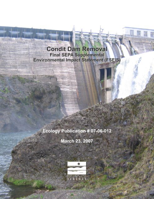
<strong>Condit</strong> <strong>Dam</strong> <strong>Removal</strong><br />
Final SEPA Supplemental<br />
Environmental Impact Statement (FSEIS)<br />
Ecology Publication # 07-06-012<br />
March 23, 2007
CONDIT DAM REMOVAL SEPA<br />
SUPPLEMENTAL<br />
ENVIRONMENTAL IMPACT<br />
STATEMENT<br />
This report is available on the Department of Ecology Web site at:<br />
http://www.ecy.wa.gov/biblio/0706012.html<br />
For a CD or printed copy of this report contact:<br />
Joanne R. Wellner<br />
Department of Ecology<br />
15 West Yakima Avenue, Suite 200<br />
Yakima WA 98902<br />
Phone (509) 575-2680<br />
Refer to Publication number 07-06-012<br />
If you need this publication in an alternate format, please contact Tim Schlender in Ecology’s Shorelands<br />
and Environmental Assistance Program at (360) 407-6096. Persons with hearing loss can call 711 for<br />
<strong>Washington</strong> Relay Service. Persons with a speech disability can call (877) 833-6341.<br />
THIS DOCUMENT WAS PRINTED ON RECYCLED PAPER
March 23, 2007<br />
Dear interested parties:<br />
The <strong>Washington</strong> State Department of Ecology (Ecology) has prepared and issued this State<br />
Environmental Policy Act (SEPA) Final Supplemental Environmental Impact Statement (FEIS) to<br />
address the proposal by PacifiCorp to remove the <strong>Condit</strong> Hydroelectric Project on the White Salmon<br />
River, a tributary of the Columbia River. The Final SEIS supplements the following National<br />
Environmental Policy Act (NEPA) documents: <strong>Condit</strong> Hydroelectric Project Final Environmental Impact<br />
Statement, FERC No. 2342-005, <strong>Washington</strong> (Federal Energy Regulatory Commission, October 1996);<br />
and Final Supplemental Final Environmental Impact Statement, <strong>Condit</strong> Hydroelectric Project,<br />
<strong>Washington</strong>, FERC Project No. 2342, (Federal Energy Regulatory Commission, June 2002). As part of<br />
the SEIS, Ecology is adopting these documents pursuant to provisions of WAC 197-11-610 and 630.<br />
The aforementioned documents identify and evaluate a range of reasonable alternatives to the proposal,<br />
identify probable significant impacts associated with the proposal and its alternatives, and address<br />
mitigation measures to be imposed by the Federal Energy Regulatory Commission. The NEPA<br />
documents were evaluated to verify, from the Department of Ecology’s perspective, whether a reasonable<br />
range of alternatives were considered and whether all probable significant adverse impacts associated<br />
with the proposal were adequately identified and assessed. Based on that evaluation, it was determined<br />
that, while the NEPA documents form a substantial basis for environmental review of the project and<br />
largely meet Ecology’s environmental review standards, some supplemental evaluation of probable<br />
significant adverse impacts would be needed to satisfy the requirements of SEPA. Among the issues<br />
associated with the proposal that are addressed in the Final SEIS are the potential for sedimentation and<br />
turbidity in the White Salmon and Columbia Rivers; effects of dam removal activities on fish, including<br />
those listed under the Endangered Species Act; removal of potential barriers to fish passage; loss of<br />
wetlands; impacts to surrounding land use; noise, air quality, and aesthetic effects; provisions for public<br />
safety; and impacts to public services and utilities.<br />
Sincerely yours,<br />
Derek I. Sandison<br />
Central Regional Director
<strong>Condit</strong> <strong>Dam</strong> Hydroelectric Project<br />
Final Supplemental EIS<br />
Fact Sheet<br />
Project Title<br />
<strong>Condit</strong> <strong>Dam</strong> <strong>Removal</strong><br />
Proponent<br />
PacifiCorp<br />
825 NE Multnomah St., Suite 1500<br />
Portland, Oregon 97232-2135<br />
Proposed Action<br />
PacifiCorp proposes to remove the <strong>Condit</strong> Hydroelectric Project on the White Salmon River in<br />
accordance with the <strong>Condit</strong> Hydroelectric Project Settlement Agreement, as amended in 2005.<br />
<strong>Removal</strong> of the project would enable the river and watershed to return to the conditions of a freeflowing<br />
river. Originally completed in 1913, <strong>Condit</strong> <strong>Dam</strong> has since accumulated sediment and<br />
blocked fish passage. Removing the dam is expected to provide access to as much as 33 miles of<br />
river and tributary habitat for anadromous steelhead and salmon and restore connectivity to<br />
foraging, spawning, rearing, and overwintering habitat for bull trout in the lower White Salmon<br />
River. The removal also would restore natural bed load movement processes in the river.<br />
Combined with a stable and natural flow regime, dam removal would result in increased<br />
salmonid (steelhead, salmon, and bull trout) production potential.<br />
The proposed action includes draining the reservoir through a tunnel that would be constructed<br />
through the dam, removing the dam, removing the wood stave pipeline, the surge tower and the<br />
two penstocks, and filling in the tail race at the power house. Concrete from the dam and wood<br />
from the pipeline would be disposed of and/or temporarily stored for recycling on property near<br />
the dam.<br />
Previous NEPA EISs were prepared by the FERC, but were found by Ecology not to adequately<br />
cover all SEPA issues. This Final Supplemental Environmental Impact Statement (Final SEIS)<br />
is intended to address the environmental impacts of removal of the <strong>Condit</strong> <strong>Dam</strong> and is being<br />
prepared pursuant to the State Environmental Policy Act (SEPA). This EIS evaluates one<br />
alternative, the Proposed Action to remove the <strong>Condit</strong> <strong>Dam</strong> and associated facilities.<br />
Lead Agency Information<br />
Responsible Official and Contact:<br />
Derek Sandison and Joanne Wellner<br />
<strong>Washington</strong> State Department of Ecology<br />
Central Regional Office<br />
15 W Yakima Ave, Ste 200<br />
Yakima WA 98902-3452<br />
(509) 575-2680<br />
i
<strong>Condit</strong> <strong>Dam</strong> Hydroelectric Project<br />
Final Supplemental EIS<br />
Permits, Certifications, and Licenses, and Other Required Actions or<br />
Approvals<br />
Clean Water Act Section 404 permit from the U.S. Army Corps of Engineers<br />
Clean Water Act Section 401 Water Quality Certification from the Department of Ecology<br />
Construction Stormwater General NPDES permit<br />
Hydraulic Project Approval from the Department of Fish and Wildlife (unless preempted by the<br />
Federal Power Act)<br />
It was not known at the time of publication of this Final SEIS if FERC or the courts will<br />
determine that the Federal Power Act would preempt state and local permits as PacifiCorp has<br />
asserted. If the Federal Power Act is determined not to preempt local authority, then permits<br />
from Klickitat County and/or Skamania County may be required.<br />
Date of Issue of Draft SEIS<br />
September 30, 2005<br />
Date of Issue of Final SEIS<br />
March 23, 2007<br />
Document Availability<br />
Information regarding the availability of this Final SEIS will appear in the Skamania County<br />
Pioneer and the White Salmon Enterprise. The Final SEIS can be viewed on line at<br />
http://www.ecy.wa.gov/biblio/0706012.html. Hard copies of the Final SEIS can be obtained<br />
at a cost of $40 per copy. The FINAL SEIS is also available on CD at no charge. Hard copies or<br />
CDs can be obtained by contacting Joanne Wellner. Please specify the desired format. Persons<br />
with disabilities may request this information be prepared and supplied in alternative<br />
formats.<br />
Copies of the Final SEIS can be reviewed at the Department of Ecology’s Central Regional<br />
Office, 15 W Yakima Avenue, Ste. 200, Yakima, <strong>Washington</strong> or at the following libraries:<br />
White Salmon Valley Community Library<br />
#5 Town & Country Square<br />
White Salmon, WA<br />
98672<br />
Goldendale Community Library<br />
131 West Burgen<br />
Goldendale, WA<br />
98620<br />
ii
<strong>Condit</strong> <strong>Dam</strong> Hydroelectric Project<br />
Final Supplemental EIS<br />
Location of Background Material<br />
The <strong>Condit</strong> Hydroelectric Project Final Environmental Impact Statement, FERC No. 2342-005,<br />
<strong>Washington</strong> (Federal Energy Regulatory Commission, October 1996); and Final Supplemental<br />
Final Environmental Impact Statement, <strong>Condit</strong> Hydroelectric Project, <strong>Washington</strong>, FERC Project<br />
No. 2342, (Federal Energy Regulatory Commission, June 2002), both adopted as part of this<br />
SEIS, were both distributed to a broad range of tribes, agencies, and the public by the Federal<br />
Energy Regulatory Commission. Copies of these documents are on file at the Department of<br />
Ecology’s Central Regional Office, 15 W Yakima Avenue, Ste. 200, Yakima, <strong>Washington</strong>.<br />
iii
<strong>Condit</strong> <strong>Dam</strong> Hydroelectric Project<br />
Final Supplemental EIS<br />
Table of Contents<br />
Fact Sheet........................................................................................................................ i<br />
Acronyms and Abbreviations...........................................................................................ix<br />
Glossary ..........................................................................................................................xi<br />
1.0 SUMMARY ........................................................................................................1-1<br />
1.1 INTRODUCTION ....................................................................................1-1<br />
1.2 PROJECT BACKGROUND ....................................................................1-1<br />
1.3 ADOPTION OF NATIONAL ENVIRONMENTAL POLICY ACT<br />
DOCUMENTS.........................................................................................1-2<br />
1.4 FOCUS OF SEPA SEIS..........................................................................1-3<br />
1.5 DESCRIPTION OF PROPOSED ACTION..............................................1-3<br />
1.6 IMPACTS AND MITIGATION MEASURES ............................................1-8<br />
2.0 PROJECT BACKGROUND ............................................................................... 2-1<br />
2.1 INTRODUCTION .................................................................................... 2-1<br />
2.2 FERC RELICENSING PROCESS SINCE 1991 ..................................... 2-1<br />
2.3 NEED FOR STATE ENVIRONMENTAL REVIEW.................................. 2-2<br />
2.4 SCOPE OF THIS SEIS........................................................................... 2-5<br />
3.0 PROPOSED ACTION........................................................................................ 3-1<br />
3.1 PRE-DAM REMOVAL ACTIVITIES ........................................................ 3-1<br />
3.2 DAM BREACHING AND REMOVAL..................................................... 3-18<br />
3.3 POST-REMOVAL MANAGEMENT....................................................... 3-21<br />
3.4 SCHEDULE .......................................................................................... 3-23<br />
4.0 AFFECTED ENVIRONMENT, IMPACTS, MITIGATION MEASURES, AND<br />
SIGNIFICANT UNAVOIDABLE ADVERSE IMPACTS ................................... 4.1-1<br />
4.1 GEOLOGY, SOILS, AND SEDIMENTS............................................... 4.1-1<br />
4.2 WATER RESOURCES ........................................................................ 4.2-1<br />
4.3 AQUATIC RESOURCES ..................................................................... 4.3-1<br />
4.4 WETLAND RESOURCES.................................................................... 4.4-1<br />
4.5 TERRESTRIAL RESOURCES ............................................................ 4.5-1<br />
4.6 TRANSPORTATION............................................................................ 4.6-1<br />
4.7 AIR QUALITY ...................................................................................... 4.7-1<br />
4.8 NOISE.................................................................................................. 4.8-1<br />
4.9 LAND USE/CRITICAL AREAS ............................................................ 4.9-1<br />
4.10 AESTHETICS AND SCENIC RESOURCES...................................... 4.10-1<br />
4.11 PUBLIC SAFETY............................................................................... 4.11-1<br />
4.12 PUBLIC SERVICES........................................................................... 4.12-1<br />
5.0 REFERENCES .................................................................................................. 5-1<br />
v
<strong>Condit</strong> <strong>Dam</strong> Hydroelectric Project<br />
Final Supplemental EIS<br />
Table of Contents<br />
(Continued)<br />
6.0 LIST OF PREPARERS...................................................................................... 6-1<br />
7.0 DISTRIBUTION LIST......................................................................................... 7-1<br />
Appendices<br />
A Memorandum of Agreement Modifying the <strong>Condit</strong> Hydroelectric Project<br />
Settlement Agreement<br />
B City of White Salmon Production Well #2 Well Log<br />
C Supplemental Aquatic Resources Information<br />
Comments and Responses<br />
vi
<strong>Condit</strong> <strong>Dam</strong> Hydroelectric Project<br />
Final Supplemental EIS<br />
Table of Contents<br />
(Continued)<br />
Figures<br />
1-1 Location Map .................................................................................................1-5<br />
3-1 Project Facilities Index ...................................................................................3-3<br />
3-2 Project Facilities, Sheet 1...............................................................................3-5<br />
3-3 Project Facilities, Sheet 2...............................................................................3-7<br />
3-4 Project Facilities, Sheet 3...............................................................................3-9<br />
3-5 Project Facilities, Sheet 4.............................................................................3-11<br />
3-6 Project Facilities, Sheet 5.............................................................................3-13<br />
4.2-1 Surface Water and Groundwater Features .................................................4.2-3<br />
4.3-1 Fish Passage Barriers.................................................................................4.3-3<br />
4.3-2 Current Documented Distribution of Native Salmonids Above <strong>Condit</strong><br />
<strong>Dam</strong> ............................................................................................................4.3-5<br />
4.3-3 Potentially <strong>Access</strong>ible Anadromous Salmonid Habitat Above <strong>Condit</strong><br />
<strong>Dam</strong> ............................................................................................................4.3-7<br />
4.4-1 Wetlands 2 Through 25 in the Project Vicinity.............................................4.4-3<br />
4.4-2 Wetland 26 in the Project Vicinity................................................................4.4-7<br />
4.6-1 Existing Roadway System...........................................................................4.6-3<br />
4.10-1 Looking south toward dam........................................................................ 4.10-3<br />
4.10-2 Looking south and west toward dam......................................................... 4.10-3<br />
4.10-3 Looking west across lake.......................................................................... 4.10-4<br />
4.10-4 Looking west and north from east side of lake.......................................... 4.10-4<br />
4.10-5 Looking north from west side of lake......................................................... 4.10-5<br />
4.10-6 Looking east from west side of lake .......................................................... 4.10-5<br />
4.10-7 Looking south toward cabins from west side of lake ................................. 4.10-6<br />
4.10-8 Looking south from Northwestern Lake Bridge at Northwestern Park....... 4.10-6<br />
4.10-9 Looking south from Northwestern Lake Bridge at Northwestern Park....... 4.10-7<br />
4.10-10 Looking north (upstream) from Northwestern Lake Bridge........................4.10-7<br />
vii
<strong>Condit</strong> <strong>Dam</strong> Hydroelectric Project<br />
Final Supplemental EIS<br />
Table of Contents<br />
(Continued)<br />
Tables<br />
1-1 Summary of Impacts and Mitigation Measures ............................................1-13<br />
3-1 Summary of <strong>Access</strong> Road Names and Proposed Use...................................3-2<br />
3-2 Proposed Project Schedule..........................................................................3-23<br />
4.3-1 Potentially <strong>Access</strong>ible Anadromous Salmonid Stream Habitat Above<br />
<strong>Condit</strong> <strong>Dam</strong>.................................................................................................4.3-9<br />
4.3-2 Changes in Endangered Species Act Listing Status and Critical Habitat<br />
Designations for Federally Listed, Proposed, or Candidate Salmonids in<br />
the White Salmon River ............................................................................ 4.3-12<br />
4.3-3 Changes in Critical Habitat Designations for Endangered Species Act<br />
Federally Listed Salmonids in the White Salmon River and Bonneville<br />
Pool...........................................................................................................4.3-13<br />
4.4-1 Summary of Wetland Areas, Classes, and Ratings ....................................4.4-2<br />
4.4-2 Summary of Impacted Wetland Areas and Expected New Area .................4.4-9<br />
4.6-1 Existing and Estimated Future Traffic Volumes ..........................................4.6-4<br />
4.6-2 Level of Service Standards for Roadways (per lane per hour)....................4.6-5<br />
4.6-3 Level of Service Standards for Intersections...............................................4.6-5<br />
4.7-1 Ambient Air Quality Standards ....................................................................4.7-2<br />
4.8-1 Maximum Permissible Environmental Noise Levels....................................4.8-2<br />
4.8-2 Anticipated Noise Sources..........................................................................4.8-4<br />
4.8-3 Noise Modeling Results ..............................................................................4.8-7<br />
4.10-1 Existing Visual <strong>Condit</strong>ion Types................................................................ 4.10-1<br />
viii
<strong>Condit</strong> <strong>Dam</strong> Hydroelectric Project<br />
Final Supplemental EIS<br />
ACRONYMS AND ABBREVIATIONS<br />
ADT<br />
AST<br />
bgs<br />
BMP<br />
CFR<br />
CWA<br />
cfs<br />
dBA<br />
DPS<br />
DSFEIS<br />
EA<br />
Ecology<br />
ESA<br />
ESU<br />
EVC<br />
FEIS<br />
FEMA<br />
FERC<br />
FPA<br />
FSFEIS<br />
g/L<br />
gpm<br />
HDPE<br />
Hz<br />
KCC<br />
km<br />
kV<br />
LOS<br />
mcy<br />
mg/L<br />
average daily traffic<br />
aboveground storage tank<br />
below ground surface<br />
best management practice<br />
Code of Federal Regulations<br />
Clean Water Act<br />
cubic feet per second<br />
A-weighted decibels<br />
distinct population segment<br />
Draft Supplemental Final Environmental Impact Statement<br />
extensive agriculture<br />
<strong>Washington</strong> State Department of Ecology<br />
Endangered Species Act<br />
evolutionarily significant unit<br />
existing visual conditions<br />
Final Environmental Impact Statement<br />
Federal Emergency Management Agency<br />
Federal Energy Regulatory Commission<br />
Federal Power Act<br />
Final Supplemental Final Environmental Impact Statement<br />
grams per liter<br />
gallons per minute<br />
high-density polyethylene<br />
hertz<br />
Klickitat County Code<br />
kilometer<br />
kilovolt<br />
level of service<br />
million cubic yards<br />
milligram per liter<br />
ix
<strong>Condit</strong> <strong>Dam</strong> Hydroelectric Project<br />
Final Supplemental EIS<br />
mm<br />
MOA<br />
NEPA<br />
NMFS<br />
NOAA<br />
NCRS<br />
NTU<br />
OS<br />
OSHA<br />
PAH<br />
PCB<br />
ppm<br />
RL<br />
RM<br />
RR<br />
SCC<br />
SEIS<br />
SEPA<br />
SR<br />
SWCAA<br />
TSS<br />
USFS<br />
USFWS<br />
VOC<br />
vpd<br />
WAC<br />
WDFW<br />
WSDOT<br />
millimeter<br />
Memorandum of Agreement<br />
National Environmental Policy Act<br />
National Marine Fisheries Service<br />
National Oceanic and Atmospheric Administration<br />
Natural Resources Conservation Service<br />
nephelometric turbidity unit<br />
open space<br />
Occupational Safety and Health Administration<br />
polynuclear aromatic hydrocarbon<br />
polychlorinated biphenyl<br />
parts per million<br />
resource lands<br />
river mile<br />
rural residential<br />
Skamania County Code<br />
Supplemental Environmental Impact Statement<br />
State Environmental Policy Act<br />
State Route<br />
Southwest Clean Air Agency<br />
total suspended solids<br />
U.S. Forest Service<br />
U.S. Fish and Wildlife Service<br />
volatile organic compound<br />
vehicles per day<br />
<strong>Washington</strong> Administrative Code<br />
<strong>Washington</strong> Department of Fish and Wildlife<br />
<strong>Washington</strong> State Department of Transportation<br />
x
<strong>Condit</strong> <strong>Dam</strong> Hydroelectric Project<br />
Final Supplemental EIS<br />
Glossary<br />
Aggregate: Sand and gravel.<br />
Adfluvial (fish): A fish population that migrates into tributary streams to spawn. This term is<br />
sometimes applied in the literature to fluvial-adfluvial fish.<br />
Anadromous (fish): A fish population that migrates from the sea into freshwater streams to<br />
spawn.<br />
Aquifer: Any saturated permeable geologic unit that under normal conditions can transmit<br />
significant quantities of water.<br />
A-weighted decibels: The weighted decibel scale that best approximates the response of the<br />
human ear to noise.<br />
Bed: The smallest division of a stratified geologic series, and marked by a plane from its<br />
neighbors above and below. Generally these are regional in scale and will have similar physical<br />
properties throughout their extent.<br />
Benthic Macroinvertebrate: Usually applies to aquatic insect larvae that live on or in the<br />
substrate of a stream (or lake). It can apply to clams, worms, and crustaceans (any nonmicroscopic<br />
invertebrate) that live at the bottom of a lake or stream.<br />
Capacity: The maximum sustainable flow rate of persons or vehicles that can reasonably be<br />
expected to travel through a segment of roadway or other facility in a specified time period.<br />
Typically stated in persons per hour (pph), vehicles per hour (vph), or passenger car equivalents<br />
per hour (pcph).<br />
Decibels: Unit on a scale used to measure noise.<br />
Delay: Additional travel time experienced by a driver or passenger while traveling at speeds<br />
below the posted speed. Freeway delay comprises traffic delay (including mainline and ramp<br />
meter delay) and incident delay. Surface street delay typically comprises traffic delay and signal<br />
delay.<br />
Ecotype: A population of organisms adapted to a particular set of environmental conditions. A<br />
steelhead is a rainbow trout ecotype adapted to long distance migrations into the ocean<br />
(anadromous), while a resident rainbow is an ecotype adapted to maturing and remaining in<br />
freshwater.<br />
Ephemeral stream: Any stream which can vary from dry to running with the seasons.<br />
Facies: The physical appearance of a geologic unit used to describe its origins in relation to<br />
other units.<br />
xi
<strong>Condit</strong> <strong>Dam</strong> Hydroelectric Project<br />
Final Supplemental EIS<br />
Fall-run Chinook salmon: Chinook salmon that return to freshwater in the fall as mature fish<br />
and spawn soon after. Fall-run Chinook are generally ocean-type fish that outmigrate from<br />
freshwater as sub-yearling smolts.<br />
Fluvial: Derived from or pertaining to rivers and their processes.<br />
Fluvial (fish): A fish population that rears in a stream or river. This term is often applied to<br />
fluvial-adfluvial fish, which are fluvial fish rearing in larger streams that spawn in tributaries to<br />
their rearing stream. Fluvial can be used as a general term that includes fluvial-adfluvial fish.<br />
Fluvial-adfluvial (fish): A migatory fish population that rears in a mainstem river environment<br />
and migrates to tributaries to spawn. The life history is also sometimes called “fluvial” or<br />
“adfluvial” in the literature, but this term more accurately refers to a fish that both rears and<br />
spawns in the same stream. Although this document refers to the rainbow and coastal cutthroat<br />
trout that rear in the mainstem of the White Salmon River as fluvial-adfluvial, a sizable portion<br />
of the mainstem rainbow trout population appears to spawn in the mainstem and are true<br />
“fluvial” trout.<br />
Fugitive dust: Dust emissions caused by dispersion of dust particles by prevailing winds and/or<br />
the turbulence caused by moving machinery and trucks.<br />
Genotype: The internally coded, inheritable (genetic) characteristics of an individual or an<br />
average individual from a population of organisms.<br />
Glacial: Pertaining to or characteristic of, produced by, or derived from a glacier.<br />
Hydrogeologic unit: A single continuous geologic layer with similar physical properties<br />
throughout.<br />
Incident Delay: Additional travel time experienced as a result of a breakdown, crash, or other<br />
occurrence that impedes the flow of traffic.<br />
Introgression: Hybridization of a population of organisms with another population that<br />
produced fertile offspring (i.e. a coastal cutthroat trout population can become introgressed with<br />
hatchery rainbow trout).<br />
Lacustrine: Derived from or pertaining to lake environments.<br />
Lacustrine (fish): A fish population that rears in a lake environment. This term is often applied<br />
to lacustrine-adfluvial fish, which are lacustrine fish that spawn in tributary streams. Lacustrine<br />
can be used as a general term that includes lacustrine-adfluvial fish. Fish populations that spawn<br />
in outlet streams are allacustrine.<br />
Lacustrine-adfluvial (fish): Lacustrine refers to lake rearing and adfluvial refers to making<br />
spawning migrations into inlet streams, hence this term refers to a lake rearing fish population<br />
that makes spawning migrations into tributary streams.<br />
Lens: A discontinuous hydrogeologic unit.<br />
xii
<strong>Condit</strong> <strong>Dam</strong> Hydroelectric Project<br />
Final Supplemental EIS<br />
Level of service: A measure of the quality of traffic flow based on speed and travel time,<br />
freedom to maneuver, and traffic interruptions. Level of service (LOS) is rated from A to F, with<br />
A being the best (free-flow) conditions and F being the worst.<br />
Limnetic: Pertaining to or inhabiting fresh water.<br />
Littoral: Pertaining to or existing on or near shore.<br />
Mode: A particular variety or form. In this EIS, usually a particular form of transportation such<br />
as automobile, bus, carpool or bicycle.<br />
Natal: Pertains to the birthplace of an organism.<br />
Ocean-type: Refers to a Chinook salmon that migrates from its natal stream to the ocean as a<br />
sub-yearling (age 0 fish).<br />
Off-Peak: Any time during the day outside the peak travel period, typically when traffic flows<br />
are not constrained by roadway or facility capacity.<br />
Outmigrant: An outmigrant is a salmonid smolt that migrates from the stream where it was<br />
spawned to the ocean (the migration can also be to a larger stream or lake).<br />
Peak Direction: Direction of maximum traffic flow during the peak hour. For example, this<br />
may be westbound during the AM peak hour and eastbound during the PM peak hour.<br />
Peak Hour: The hours within the day during which the maximum volume of traffic passes a<br />
defined roadway point: one hour in the morning (AM) and one hour in the afternoon (PM). The<br />
peak hour typically correlates to “rush hour.”<br />
Peak Period: A time period during which the maximum volume of traffic passes a defined<br />
roadway point. In the DEIS, both three-hour and six-hour periods are considered.<br />
Phenotype: The outward physical manifestation or physical characteristics of an individual or<br />
an average individual from a population of organisms.<br />
Queuing: In the context of traffic analysis, vehicles lined up awaiting a turn or change of traffic<br />
signal.<br />
Recharge: The entry into the saturated zone (i.e., aquifers) from surface water infiltration.<br />
Redd: A salmonid “nest” where eggs are buried in gravel. Redds appear as clean depressions in<br />
stream gravel during spawning surveys.<br />
Resident Rainbow Trout: Refers to a rainbow trout that never leaves freshwater.<br />
Residual: An individual in a population that is characteristically sea-run that never goes to sea<br />
(“residualized”). “Residuals” are typically precocious males that mature earlier and at a smaller<br />
size than anadromous individuals. Approximately four times more male juvenile steelhead<br />
residualize than female juveniles.<br />
xiii
<strong>Condit</strong> <strong>Dam</strong> Hydroelectric Project<br />
Final Supplemental EIS<br />
Riparian: Pertaining to the banks of a body of water, especially including the vegetation.<br />
River Mile (RM): River mile above the mouth of a stream.<br />
Salmonid: A member of the family Salmonidae, which in North America includes Pacific<br />
salmon (coho, Chinook, pink, sockeye, and chum salmon), Atlantic salmon, brown trout, western<br />
trout (rainbow and cutthroat trout), char (brook trout, bull trout, lake trout, and Dolly Varden),<br />
grayling, and whitefish. Pacific salmon and western trout belong to the genus Oncorhynchus,<br />
Atlantic salmon and brown trout belong to the genus Salmo, char to the genus Salvelinus,<br />
grayling to the subfamily Thymallinae, and whitefish to the subfamily Coregoninae.<br />
Smolt: A juvenile salmonid that has gone through a physiological change in freshwater before<br />
migrating to the ocean. Usually, this entails developing the physiological capacity to<br />
osmoregulate in salt water. Smolts also take on a silvery appearance, their scales become looser,<br />
and their bodies become more streamlined.<br />
Slough: A place of deep mud or mire; an inlet on a river; or a creek or marsh in a tide flat.<br />
Spawner: A sexually mature fish that will soon reproduce (spawn) or is undergoing a migration<br />
to spawn (spawning migrations can occur before a fish is sexually mature).<br />
Spring-run Chinook Salmon: Chinook salmon that return to freshwater as immature adults in<br />
the spring and spawn in the fall. They also tend to spawn higher in a stream basin than fall-run<br />
Chinook salmon.<br />
Stream Resident Rainbow Trout: Refers to a rainbow trout that remains in smaller tributary<br />
streams throughout its life.<br />
Steelhead Trout: An anadromous (sea-run) rainbow trout. The capacity to become a steelhead<br />
is usually an inherited trait, but juvenile steelhead can remain in freshwater (residualize) without<br />
migrating to saltwater. A steelhead can be considered an ecotype, phenotype, or genotype of the<br />
rainbow trout.<br />
Summer-run Chinook salmon: Chinook salmon that return to freshwater in the summer and<br />
spawn in the fall. Summer-run Chinook are generally ocean-type fish that outmigrate from<br />
freshwater as sub-yearling smolts<br />
Summer-run Steelhead Trout: Steelhead that return to freshwater as immature adults in the<br />
spring or summer (although inland steelhead may not reach their natal stream until late fall or<br />
winter). Summer-run steelhead mature and spawn during the spring or early summer of the<br />
following year after returning to freshwater.<br />
Stream-type: Refers to a Chinook salmon that migrates from its natal stream to the ocean as a<br />
yearling (age 1 fish). Stream-type Chinook salmon generally return as immature adults in the<br />
spring and spawn in the fall. They also tend to spawn higher in a stream basin than ocean-type<br />
Chinook salmon.<br />
Traffic Delay: Reduction in speed below free-flow conditions as a result of vehicle interaction.<br />
xiv
<strong>Condit</strong> <strong>Dam</strong> Hydroelectric Project<br />
Final Supplemental EIS<br />
Viewscape/viewshed: The area visible from a designated viewpoint.<br />
Water table: The point at which the zone of saturation meets the zone of aeration, or the point at<br />
which hydraulic pressure equals atmospheric pressure. This corresponds to the top of an<br />
unconfined or perched aquifer.<br />
Winter-run Steelhead Trout: Steelhead that return to freshwater in the late fall and winter as<br />
mature adults and spawn from late winter through early summer.<br />
xv
<strong>Condit</strong> <strong>Dam</strong> Hydroelectric Project<br />
Final Supplemental EIS<br />
1.0 SUMMARY<br />
1.1 INTRODUCTION<br />
The <strong>Condit</strong> Hydroelectric Project, located on the White Salmon River in Klickitat and Skamania<br />
Counties, <strong>Washington</strong>, was constructed in 1912 and 1913 and has produced electricity since that<br />
time. PacifiCorp is proposing to cease electricity generation at the <strong>Condit</strong> Hydroelectric Project<br />
on October 1, 2008 and commence removal later the same month. The <strong>Washington</strong> State<br />
Department of Ecology (Ecology) is conducting an environmental review under the State<br />
Environmental Policy Act (SEPA) comparing the effects of continued operation of the dam (the<br />
no-action alternative) with the removal of the dam (proposed action).<br />
1.2 PROJECT BACKGROUND<br />
On December 27, 1991, PacifiCorp filed an application with the Federal Energy Regulatory<br />
Commission (FERC) for a new license to continue operating the <strong>Condit</strong> Hydroelectric Project.<br />
In October 1996, FERC issued a National Environmental Policy Act (NEPA) Final<br />
Environmental Impact Statement (FEIS) that analyzed the environmental and economic effects<br />
of five alternatives: 1) continuing to operate the project with no additional mitigation or<br />
enhancement measures (no-action alternative); 2) operating the project as proposed by<br />
PacifiCorp; 3) operating the projects as proposed by PacifiCorp with additional staffrecommended<br />
measures; 4) a staff-developed alternative for dam removal; and 5) a staffdeveloped<br />
alternative involving partial removal of the dam with a new upstream diversion. In<br />
the 1996 FEIS, FERC staff recommended the third alternative, PacifiCorp’s licensing proposal<br />
with modifications that included fish passage facilities and several other changes to benefit fish.<br />
On October 29, 1999, PacifiCorp filed an application to amend the current license to extend the<br />
license term to October 1, 2006, and to incorporate the terms and conditions of a Settlement<br />
Agreement that provided for removal of the dam upon the expiration of the proposed amended<br />
license term and established a date for commencing the removal. The Settlement Agreement<br />
also established PacifiCorp’s financial commitment to dam removal with a capped monetary<br />
limit.<br />
FERC determined that the October 1999 application filed by PacifiCorp was in essence an<br />
application to surrender the existing license to operate the dam. Thus, the surrender alternative,<br />
reached through settlement negotiations, became the proposal before FERC. A NEPA<br />
Supplemental Environmental Impact Statement (SEIS) was prepared by FERC to augment the<br />
October 1996 FEIS. The Final Supplemental FEIS (FSFEIS) (June 2002) assessed the effects of<br />
surrendering the dam operating license, including dam removal, removal with mitigation<br />
measures, and project retirement without dam removal.<br />
Between November 16, 2004 and February 8, 2005, the parties to the Settlement Agreement all<br />
signed a Memorandum of Agreement (MOA) modifying the <strong>Condit</strong> Hydroelectric Project<br />
Settlement Agreement. A fundamental conclusion implicit in each signatory entity’s approval of<br />
the Settlement Agreement and the modification was that, from their perspective, the long-term<br />
and overall benefits would outweigh the short-term impacts of implementing the Settlement<br />
1-1
<strong>Condit</strong> <strong>Dam</strong> Hydroelectric Project<br />
Final Supplemental EIS<br />
Agreement. That MOA modifies the Settlement Agreement by changing the implementation<br />
date for dam removal from 2006 to 2008; increasing the cap on mitigation costs; and increasing<br />
the total cost cap. In February 2005, PacifiCorp filed an application with FERC to amend the<br />
decommissioning application to be consistent with the terms of the MOA.<br />
Ecology is both the Lead Agency for SEPA and the regulatory decisionmaker for a portion of the<br />
permits that require SEPA documentation to support permit decisions. Ecology determined that<br />
the 1996 and 2002 NEPA documents analyzing the impacts of the dam removal were not<br />
adequate to meet all requirements of SEPA and that a SEPA SEIS would be required.<br />
This SEPA SEIS builds on previous environmental documents. The 1996 FERC FEIS on<br />
relicensing of the <strong>Condit</strong> <strong>Dam</strong> described and analyzed the effects of a no-action alternative<br />
which would continue operation of the <strong>Condit</strong> Hydroelectric Project under the terms and<br />
conditions of the existing license. That analysis of the no-action alternative and other pertinent<br />
information are adopted as part of this SEPA SEIS. The 2002 FERC FSFEIS addressing the<br />
license surrender proposal and removal of <strong>Condit</strong> <strong>Dam</strong> analyzed a range of dam removal<br />
alternatives. Under SEPA, no further analysis of the alternatives other than the proposed action<br />
is required, as the other alternatives would have greater impacts than the proposed alternative or<br />
are already adequately analyzed.<br />
1.3 ADOPTION OF NATIONAL ENVIRONMENTAL POLICY ACT<br />
DOCUMENTS<br />
The Draft SEIS supplements the following NEPA documents:<br />
• <strong>Condit</strong> Hydroelectric Project Final Environmental Impact Statement, FERC No.<br />
2342-005, <strong>Washington</strong> (FERC 1996)<br />
• Final Supplemental Final Environmental Impact Statement, <strong>Condit</strong> Hydroelectric<br />
Project, <strong>Washington</strong>, FERC Project No. 2342 (FERC 2002)<br />
These documents identify and evaluate a range of reasonable alternatives to the proposal,<br />
identify probable significant impacts associated with the proposal and its alternatives, and<br />
addresses mitigation measures to be imposed by FERC. The NEPA documents were evaluated<br />
to verify, from Ecology’s perspective, whether a reasonable range of alternatives were<br />
considered and whether all probable significant adverse impacts associated with the proposal<br />
were adequately identified and assessed. It was determined that, while these documents form a<br />
substantial basis for environmental review of the project and largely meet Ecology’s<br />
environmental review standards, some supplemental evaluation of probable significant adverse<br />
impacts, would be needed to satisfy the requirements of SEPA (Chapter 43.21C RCW) and<br />
SEPA Rules (Chapter 197-11 WAC).<br />
Pursuant to the provisions of WAC 197-11-610 and 630, Ecology hereby adopts the<br />
aforementioned NEPA documents to partially satisfy its requirements for SEPA compliance.<br />
1-2
<strong>Condit</strong> <strong>Dam</strong> Hydroelectric Project<br />
Final Supplemental EIS<br />
1.4 FOCUS OF SEPA SEIS<br />
The focus of this SEPA SEIS will primarily be on the “Settlement Agreement with<br />
Modifications” Alternative since it was the FERC staff-recommended alternative in their<br />
FSFEIS. The issues identified by Ecology for additional assessment as part of the SEPA process<br />
include: increased erosion, sedimentation, and turbidity in the White Salmon River from dam<br />
breaching and removal; impacts to water quality in the White Salmon River and Columbia River;<br />
impacts to groundwater quality; increased turbidity in stormwater runoff; effects on fish;<br />
potential barriers to fish passage; potential effects on priority species and habitats due to clearing<br />
vegetation or grading staging areas; loss of wetlands; sedimentation or scour of wetlands;<br />
impacts to local roadways; impacts to air quality and potentially to human health from fine<br />
particles; construction noise; land use impacts; visual impacts from reservoir and vegetation<br />
removal; public safety; impacts to public services including temporary interruption of water<br />
supplies and increased need for services of local police and fire personnel; and possibly local<br />
permits. (See Section 2.4 for a complete list of issues.)<br />
1.5 DESCRIPTION OF PROPOSED ACTION<br />
The existing <strong>Condit</strong> Hydroelectric Project includes a concrete dam, an approximately 1.8-milelong<br />
reservoir, a 13.5-foot-diameter wood-stave pipeline of approximately one mile in length, a<br />
reinforced-concrete surge tower, two 650-foot-long penstocks (one steel and one wood), and a<br />
powerhouse structure housing two turbines with an installed capacity of 14,700 kilowatts<br />
(Figure 1-1).<br />
The proposed action includes draining the reservoir through a tunnel that would be constructed<br />
through the dam, removing the dam, removing the wood stave pipeline, the surge tower and the<br />
two penstocks, and partial filling of the tail race at the power house. Concrete and wood from<br />
the pipeline would be disposed of and/or staged for recycling on property near the dam. Details<br />
of the proposed action are described in the <strong>Condit</strong> Hydroelectric Project, FERC Project No.<br />
2342, Project Description (PacifiCorp 2004). The project description includes numerous plans<br />
designed to minimize or eliminate potential impacts related to the project. The stages of the<br />
project are: pre-dam removal activities, dam breaching and removal, and post-removal<br />
management. The activities associated with each of these stages and the project schedule are<br />
summarized below.<br />
1.5.1 Pre-<strong>Dam</strong> <strong>Removal</strong> Activities<br />
• In order to perform the removal and associated restoration work, temporary work<br />
areas, staging areas, and access roads would need to be established and utilized.<br />
These staging areas and access roads are located on the east side of the White Salmon<br />
River in proximity to the dam.<br />
• A fueling station would be located at staging area SA-2 adjacent to the dam. Fueling<br />
of remote equipment, such as cranes or highlines would be accomplished by tank<br />
trucks and would use required preventative and protective measures against spills.<br />
1-3
<strong>Condit</strong> <strong>Dam</strong> Hydroelectric Project<br />
Final Supplemental EIS<br />
• A new temporary water supply pipeline would be installed across the lake with a<br />
cable support system before the dam is breached in order to assure that service from<br />
the existing pipeline is not interrupted by a potential failure during dam breaching.<br />
After the reservoir is drained and sediment has been stabilized, a new permanent<br />
water line would be installed.<br />
• The supports for Northwestern Lake Bridge, located 1.8 miles upstream from the<br />
dam, would be modified to enable the bridge to withstand the long-term scouring<br />
action of the river channel.<br />
• Mount Adams Orchard currently withdraws irrigation water from Northwestern Lake.<br />
A new intake and pump system or well would be designed and installed near the<br />
current dam in coordination with Mount Adams Orchard personnel to assure the<br />
needs of the orchard are met.<br />
• Prior to draining Northwestern Lake, the hardware on the crest of <strong>Condit</strong> <strong>Dam</strong> would<br />
be removed and a 12-foot-high by 18-foot-wide, slightly bell-shaped drain tunnel<br />
would be excavated from the downstream side near the base of the dam to provide<br />
rapid reservoir drainage.<br />
1.5.2 <strong>Dam</strong> Breaching and <strong>Removal</strong><br />
• Prior to the blast that opens the final 15 feet of the drain tunnel, a barge-mounted<br />
clamshell crane would be used to excavate sediment and debris from the upstream<br />
face of the dam in the area where the tunnel would be opened.<br />
• The final 15 feet of the tunnel would be breached by blasting out the remaining<br />
concrete. The tunnel size would allow an approximate maximum flow of<br />
10,000 cubic feet per second (cfs) to pass through. At this tunnel size, the reservoir<br />
pool is expected to lower to stream level within six hours, causing substantial<br />
amounts of sediment and woody debris currently trapped behind the dam to be<br />
flushed downstream.<br />
• In order to assure that the drawdown/stabilization process is successful, an assessment<br />
of slope conditions would be made to determine whether active management of the<br />
sediment would be required. Options for active management of the sediment include<br />
the use of water cannons, blasting charges, and/or mechanical means.<br />
• Once the reservoir is drained, the concrete dam would be cut and blasted into large<br />
blocks or rubble. This concrete would be loaded with either a crane or a highline<br />
yarder-type system onto trucks and then hauled to an 8-acre storage/disposal area<br />
located a few thousand feet upstream of the dam and owned by PacifiCorp. If a<br />
concrete recycling recipient is available, then the disposal site would be a transfer site<br />
or a temporary storage site.<br />
• Historic photographs and drawings show that a cofferdam system was used in the<br />
original construction of the dam and was left behind in the reservoir and subsequently<br />
flooded. It is hoped that this structure can be removed by blasting and the use of a<br />
1-4
<strong>Condit</strong> <strong>Dam</strong> Hydroelectric Project<br />
Final Supplemental EIS<br />
Figure 1-1 Location Map<br />
Color. Takes 2 pages. Start on odd numbered page.<br />
1-5
<strong>Condit</strong> <strong>Dam</strong> Hydroelectric Project<br />
Final Supplemental EIS<br />
Figure 1-1 (Continued)<br />
1-6
<strong>Condit</strong> <strong>Dam</strong> Hydroelectric Project<br />
Final Supplemental EIS<br />
• logging highline yarder, but it may be necessary to construct an access road into the<br />
area so that other equipment can assist in this work.<br />
• The wood stave flowline and the two penstocks would be removed and transported to<br />
a temporary storage area located a few hundred feet east of the flowline.<br />
• The steel-reinforced concrete surge tank would be disassembled using conventional<br />
track-mounted breakers along with drilling and blasting. The above-grade portions of<br />
the existing concrete spillway that extends from the surge tank to the river would be<br />
demolished. Excess materials that are not used to fill the spillway channel would be<br />
trucked to the concrete disposal site.<br />
• As part of the removal activities, PacifiCorp would reconfigure the two 69 kilovolt<br />
(kV) transmission lines that terminate at the <strong>Condit</strong> Hydroelectric Project.<br />
• PacifiCorp would not remove the project powerhouse and associated parking area.<br />
The powerhouse tailrace retaining wall would, however, be removed and hauled to<br />
the disposal area. The upper portion of the tailrace would be filled in with rock.<br />
1.5.3 Post-<strong>Removal</strong> Management<br />
• At the conclusion of the proposed action, all temporarily disturbed areas, including<br />
the staging areas, disposal areas, and the former reservoir area, would be revegetated.<br />
• Monitoring is proposed to demonstrate that performance criteria are met for several of<br />
the management plans included in PacifiCorp’s project description (PacifiCorp 2004).<br />
For several of these plans, monitoring would continue during the post-removal<br />
management period. Depending on the results of the monitoring, additional actions<br />
may be required. The duration of the monitoring is variable, but would generally<br />
continue until specific performance criteria are met.<br />
1.5.4 Schedule<br />
The Settlement Agreement was entered into in 1999 to resolve all issues in the proceeding for<br />
relicensing the project by FERC. It was amended in 2005. Under the Settlement Agreement and<br />
upon FERC approval, PacifiCorp would continue to operate the project under the terms of its<br />
existing FERC license until October 1, 2008, whereupon PacifiCorp would cease generating<br />
power at the project.<br />
If all applicable permits, easements, and contracts have been obtained, project removal activities<br />
would commence in August 2008. The demolition and removal of <strong>Condit</strong> <strong>Dam</strong> and other project<br />
facilities are estimated to take one year. Monitoring would then continue until performance<br />
criteria are met.<br />
1-7
<strong>Condit</strong> <strong>Dam</strong> Hydroelectric Project<br />
Final Supplemental EIS<br />
1.6 IMPACTS AND MITIGATION MEASURES<br />
1.6.1 Beneficial Effects of <strong>Dam</strong> <strong>Removal</strong><br />
Since a major impetus for removing the <strong>Condit</strong> <strong>Dam</strong> is to provide benefits to fish, it is<br />
appropriate to summarize the beneficial effects that are expected. This will allow a direct<br />
comparison of the adverse effects in order to understand the tradeoffs of the proposed action.<br />
The most notable beneficial effects would accrue to the fish and aquatic organisms that would<br />
use the free-flowing stream. Potentially, 32 miles of new steelhead habitat and 15 miles of new<br />
salmon habitat may be accessed by anadromous salmonids after dam removal, increasing the run<br />
size of anadromous salmonids in the White Salmon River and increasing the availability of<br />
salmon and steelhead angling opportunities in the White Salmon river basin. New thermal<br />
refuge habitat for migrating Columbia River anadromous salmonids from other sub-basins also<br />
will be accessible after the removal of <strong>Condit</strong> <strong>Dam</strong>. Additional stream habitat for resident fish<br />
will be created in the lakebed of the former reservoir. Additionally, the small increase in water<br />
temperature below <strong>Condit</strong> <strong>Dam</strong> from the discharge of warmed reservoir surface water will be<br />
eliminated, improving the quality of thermal refuge, and the recruitment of gravel and large<br />
woody debris from sources above the dam site will be reestablished. Foraging, wintering, and<br />
refuge habitat, and possibly spawning habitat, will be created for Columbia River bull trout.<br />
Juvenile anadromous salmonids will provide forage for bull trout, and salmon carcasses in the<br />
watershed above the site of <strong>Condit</strong> <strong>Dam</strong> will provide an additional source of marine-derived<br />
nutrients to the watershed. There will be more suitable substrate for stream-dwelling aquatic<br />
macroinvertebrates after the stream substrate has stabilized.<br />
In addition to benefits to aquatic organisms, there will be other changes that will benefit some<br />
users and adversely affect others. For example, while there would no longer be reservoir-based<br />
recreation opportunities, there would be river-based recreation opportunities, such as kayaking<br />
and stream fishing.<br />
1.6.2 Direct Impacts and Mitigation Measures<br />
The impacts and mitigation measures for the proposed action alternative (dam removal) are<br />
summarized by element of the environment in Table 1-1 at the end of this chapter.<br />
1.6.3 Significant Unavoidable Adverse Impacts<br />
Geology, Soils and Sediments<br />
Downstream from the dam, movement of sediment through the channel and floodplain<br />
redevelopment and formation are unavoidable adverse impacts. Therefore, much more sediment<br />
will be deposited in the Bonneville pool of the Columbia River than with the <strong>Condit</strong> <strong>Dam</strong> in<br />
place, especially at and near the in-lieu site at the mouth of the White Salmon River. The natural<br />
sediment flux in the lower White Salmon River will then deposit into the Bonneville pool rather<br />
than a free-flowing Columbia River. The sediment deposition will be a result of the Bonneville<br />
dam.<br />
1-8
<strong>Condit</strong> <strong>Dam</strong> Hydroelectric Project<br />
Final Supplemental EIS<br />
Water Resources<br />
Significant unavoidable adverse impacts identified with respect to surface water include massive<br />
turbidity and sediment transport as part of the dam breaching and removal. Total suspended<br />
solids (TSS) within the six hours after the dam breach could range from 100,000 to 250,000 Parts<br />
per million (ppm) and turbidity values could range from 50,000 to 127,000 nephelometric<br />
turbidity units (NTUs). Elevated TSS and NTU are expected through the first year following the<br />
dam breach as bank and river channel stabilization occurs. These turbidity spikes are predicted<br />
to near background levels within 3 to 5 years. Elevated turbidity levels are expected in the<br />
Bonneville pool, where the waters of the Columbia River and the White Salmon River mix. Clay<br />
particles will likely remain suspended in the Columbia River, thus temporarily increasing<br />
turbidity, all the way to the mouth of the Columbia River.<br />
Significant unavoidable adverse impacts were not identified with respect to groundwater.<br />
Aquatic Resources<br />
All fish and aquatic macroinvertebrates within the White Salmon River channel downstream of<br />
the dam will likely be killed or displaced by the load of suspended solids that will occur during<br />
dam breaching. While the actions having the effects will be short-term in duration and will<br />
diminish as the level of suspended sediments is reduced over time, the effect on populations of<br />
macroinvertebrates will likely take several years to fully reestablish.<br />
One potential year-class of the few naturally spawned chum salmon imprinted to return to the<br />
White Salmon River is expected to be lost due to the high concentrations of suspended and<br />
deposited sediment and their inability to access stream habitat above the dam or cofferdam.<br />
Chum salmon spawners that pass Bonneville <strong>Dam</strong> will not enter the White Salmon River during<br />
the fall and winter months following dam removal and will spawn in other Columbia River<br />
tributary or mainstem habitat. Run size during the years the lost year-class would be expected to<br />
return as mature spawners will be reduced and composed entirely of spawners from other yearclasses.<br />
This impact will be long-term (potentially several generation cycles for chum salmon).<br />
In addition, it is likely that the spawning substrate necessary for their reproduction will be<br />
impaired by fine sediment during the second year (and not fully recovered for 1 to 3 years after<br />
that). New gravel recruited from upstream may not reach the lower 2.6 miles during that time.<br />
The result will be essentially a loss of several year-classes of chum salmon. The small number<br />
of chum salmon spawners currently documented to occur in the White Salmon are likely strays<br />
from a population below Bonneville <strong>Dam</strong> and do not represent a viable population. The NMFS<br />
Biological Opinion (NMFS 2006) provides for the incidental take. The long-term increase in<br />
available chum salmon spawning habitat is expected to increase chances of successful<br />
recolonization of the White Salmon River basin by chum salmon.<br />
During the period immediately following the breaching of the dam, suspended sediment<br />
concentrations entering the Bonneville Pool will be relatively high and the discharge of the<br />
White Salmon River will make up approximately seven percent of the Columbia River flow.<br />
Columbia River fish may be displaced from the most sediment-laden portions of the plume until<br />
it has completely mixed with the Columbia River, approximately three miles downstream from<br />
the mouth of the White Salmon River (PacifiCorp 2005). Beyond this point, the plume may<br />
briefly interfere with foraging behavior and predator-prey relationships through the Bonneville<br />
Pool and downstream of Bonneville <strong>Dam</strong> (PacifiCorp 2005, Korstrom and Birtwell 2006).<br />
1-9
<strong>Condit</strong> <strong>Dam</strong> Hydroelectric Project<br />
Final Supplemental EIS<br />
Because listed fish would be in the Bonneville Pool at that time, they could be displaced by the<br />
heavy sediment plume, which has been considered a “take” under the Endangered Species Act<br />
(NMFS 2006).<br />
There would be an unavoidable short-term impact to available thermal refuge in the White<br />
Salmon River until sediment deposited in: (1) pools between river mile (RM) 0.5 and RM 3.3;<br />
and (2) the lake bed between RM 3.3 and RM 5.0 is transported to below RM 0.5 and a channel<br />
forms below RM 0.5. However, new thermal refuge habitat will be available above RM 5.0 as<br />
soon as passage is possible past the dam and cofferdam sites.<br />
Blasting during the removal of <strong>Condit</strong> <strong>Dam</strong>, the cofferdam, sediment slopes, or woody debris<br />
jams would create hydrostatic shock waves that cause direct mortalities to any fish in the vicinity<br />
of a blast. A short-term unavoidable adverse impact to local fish populations would occur due to<br />
the mortality of fish in the proximity of in-water blasting activities (if blasting activities occur<br />
when fish are present).<br />
Sediments flushed out of the reservoir would bury and kill any adult California floater mussels, if<br />
they are present in the river below RM 3.3. If any adult California floaters are present in<br />
Northwestern Lake, they could be flushed downstream and deposited in pools. California<br />
floaters that are deposited near the surface of the substrate in appropriate habitat may survive,<br />
while those that are buried or deposited in fast riffles and runs are unlikely to survive.<br />
Depending on the presence of adult California floaters upstream of the reservoir or the<br />
reestablishment of a population from the migration of host fish into the river reach below RM<br />
5.0, a short- or long-term unavoidable adverse impact may occur if California floaters are present<br />
in the White Salmon River below RM 5.0.<br />
After dam breaching, sediment accumulations with an average depth of approximately 5 feet will<br />
occur in the Columbia River downstream from the mouth of the White Salmon River. This area<br />
will extend into the Columbia River channel about 1,500 feet and downstream for about 1 mile,<br />
and cover about 100 acres (PacifiCorp 2005). The Bonneville pool is about 4,000 feet wide at<br />
this location and sediment depth is expected to be zero in the navigation channel. Benthic<br />
macroinvertebrates, such as crustaceans, aquatic insects, and freshwater mussels will be<br />
physically buried (PacifiCorp 2005). With the exception of mussels, recolonization should occur<br />
within 6 months to a year. Mussels have longer life-spans and are relatively slow growing and<br />
will take more time to recolonize new substrates.<br />
Wetland Resources<br />
Unavoidable adverse wetland impacts include the loss of approximately 2.8 acres of lake fringe<br />
wetlands. These impacts are expected to be mitigated by the establishment of riverine and slope<br />
wetlands within 1 to 5 years of dam removal.<br />
Terrestrial Resources<br />
There will be no significant unavoidable adverse impacts.<br />
Transportation<br />
With the implementation of the identified mitigation measures, no significant unavoidable<br />
adverse impacts are expected to occur to transportation or traffic.<br />
1-10
<strong>Condit</strong> <strong>Dam</strong> Hydroelectric Project<br />
Final Supplemental EIS<br />
Air Quality<br />
There are unlikely to be any significant unavoidable adverse impacts from demolition of the<br />
<strong>Condit</strong> <strong>Dam</strong> if the mitigation measures are implemented fully and in a timely fashion.<br />
Noise<br />
Several residences (i.e., sensitive noise receptors) are located adjacent to the dam, the concrete<br />
disposal site, and the roads along which trucks and construction equipment would travel during the<br />
proposed action. Intermittently, construction noise levels at these residences would significantly<br />
exceed the modeled noise levels. The noise levels at these sensitive receptors due to construction<br />
activities do not exceed state or local noise standards due to exemptions for construction in the<br />
Klickitat County, Skamania County, and State of <strong>Washington</strong> noise regulations. However,<br />
construction noise impacts to adjacent residential properties would be significant due to the duration<br />
and intensity of noise that would be received. Therefore, construction noise impacts to adjacent<br />
residential properties are considered a short-term significant unavoidable adverse impact for the<br />
proposed action.<br />
Land Use/Critical Areas<br />
If the PacifiCorp Sediment Assessment and Management, Bank Stabilization, and Canyon and<br />
Woody Debris Management Plans (PacifiCorp 2004) are implemented, no long-term<br />
unavoidable significant adverse impacts to land use/critical areas are anticipated. There would<br />
be short-term unavoidable impacts to sites along or near the reservoir that would be used for<br />
work areas, construction staging or for disposal, and from the access roads that would be built in<br />
several locations.<br />
Aesthetics and Scenic Resources<br />
Short-term significant unavoidable adverse impacts to views along the reservoir would occur<br />
until revegetation occurs and the free flowing river is reestablished. One overall significant<br />
long-term change to aesthetics and scenic resources would remain and would be unavoidable.<br />
That would be the change from a lake view to a view of a stream corridor. However, depending<br />
on one’s perception, this may or may not be a significant impact.<br />
Public Safety<br />
If the proposed mitigation measures for public safety are implemented, no significant<br />
unavoidable impacts are expected.<br />
Public Services<br />
If the Public Safety and Traffic Control Management Plans prepared by PacifiCorp (2004) are<br />
implemented, no significant unavoidable adverse impacts are expected.<br />
1.6.4 Secondary and Cumulative Effects<br />
Secondary or indirect effects are those that are caused by the proposed project that are later in<br />
time or farther removed in distance than direct impacts, but which are still reasonably<br />
foreseeable. Examples are changes in land use and economic vitality (including rate of new<br />
development, growth related to improved or changed access and travel conditions, pressure to<br />
more intensively develop existing areas, and population changes), and related effects on water<br />
quality and natural resources.<br />
1-11
<strong>Condit</strong> <strong>Dam</strong> Hydroelectric Project<br />
Final Supplemental EIS<br />
Cumulative effects are impacts on the environment that result from the incremental<br />
consequences of a project when added to other past or reasonably foreseeable future actions<br />
(regardless of who would take the future action). The cumulative effects may be undetectable<br />
when viewed individually, but add to other disturbances and eventually lead to a measurable<br />
change. Examples are changes to land use, the loss of wetland areas, the elimination of wildlife<br />
habitats, changes in traffic and transportation, or increased noise levels.<br />
The removal of <strong>Condit</strong> <strong>Dam</strong> would have direct impacts on a number of elements of the<br />
environment during the pre-dam, dam breaching and removal, and post-removal management.<br />
Secondary and cumulative effects would primarily be limited to aquatic resources,<br />
transportation, and land use.<br />
Aquatic Resources<br />
The primary consideration for cumulative effects on aquatic resources is concern whether<br />
anadromous salmonid stocks that are already depressed by the effects of dams and reservoirs on<br />
the Columbia River and other influences will have the ability to recover from additional impacts<br />
of the sediment released from Northwestern Lake from the breaching of <strong>Condit</strong> <strong>Dam</strong>. The<br />
mitigation proposed to protect the fall Chinook salmon is trapping and hatchery rearing one yearclass<br />
appears to address the concern for that species. Another species of potential concern is the<br />
Columbia River chum salmon. It is probably not feasible to trap them for hatchery rearing, and<br />
it may not be possible to restore suitability in the following year to their spawning gravel unless<br />
storm flows in the White Salmon River are particularly favorable. However, long-term effects<br />
are viewed as beneficial.<br />
Transportation<br />
The proposed project would create approximately 25 full-time jobs and an estimated 200 vehicle<br />
trips per day from the dam removal site. With the majority of trips being located on-site<br />
(removal of debris to areas a few thousand feet upstream of the dam), the small increase in trips<br />
on local roads associated with the proposed project is not anticipated to create traffic congestion<br />
or a diminution of the level of service (LOS) at any affected intersection.<br />
Other approved projects in the area are not anticipated to have overlapping construction and/or<br />
demolition periods. It is anticipated that construction/demolition vehicles for these overlapping<br />
projects traveling into or out of <strong>Washington</strong> State would be via State Route (SR) 14 and not<br />
result in cumulative impacts on SR 141 or Powerhouse Road.<br />
Land Use/Critical Areas<br />
The change from a dam and lake to a free-flowing stream will likely change the long term land<br />
use characteristics around the stream. Future land use will be controlled by the comprehensive<br />
plan and zoning designations of the respective counties.<br />
1-12
<strong>Condit</strong> <strong>Dam</strong> Hydroelectric Project<br />
Final Supplemental EIS<br />
Table 1-1<br />
Summary of Impacts and Mitigation Measures<br />
Impacts<br />
Mitigation<br />
Geology, Soils, and Sediments<br />
Pre-<strong>Dam</strong> <strong>Removal</strong> Activities<br />
Pre-<strong>Dam</strong> <strong>Removal</strong> Activities<br />
Haul Roads and Staging Areas<br />
Haul Roads and Staging Areas<br />
• Disturbed areas would tend to erode by wind and water • Areas where soil has been disturbed would be revegetated in accordance<br />
with the Plan for Revegetation of Reservoir Area and Other Areas<br />
Disturbed by Construction Activities (PacifiCorp 2004). Erosion control<br />
for construction activities as described in the Upland (non-reservoir area)<br />
Stormwater and Erosion Control Plan (PacifiCorp 2004).<br />
• At the conclusion of the proposed action all work sites would be regraded<br />
and revegetated in accordance with these plans. This work is expected to<br />
stop erosion and sediment release to the White Salmon River associated<br />
with these activities.<br />
• Fill for temporary roads on reservoir sediment might interfere with<br />
revegetation.<br />
• Fill placed in support of temporary roads on the reservoir sediments would<br />
be removed once the roads are no longer needed.<br />
• Compliance requirements extend beyond construction period. • Compliance monitoring would be independent from construction<br />
activities.<br />
Northwestern Lake Bridge<br />
Northwestern Lake Bridge<br />
• Bridge support structure work would allow sediment to get into the lake. • As described in the Sediment Assessment and Management Plan<br />
(PacifiCorp 2004), silt curtains would be used during sheet pile installation<br />
to minimize silt entrainment in the water, or construction would be<br />
performed as the water level is being lowered. In either case, silt entering<br />
the water column would be minimized (PacifiCorp 2004).<br />
• Work on the bank could allow sediment to get into the water. • Any work near the river would use erosion control mats and silt fencing to<br />
protect the river from sediment release.<br />
<strong>Dam</strong> Breaching and <strong>Removal</strong><br />
<strong>Dam</strong> Breaching and <strong>Removal</strong><br />
Drain Tunnel<br />
Drain Tunnel<br />
• Woody debris released from the reservoir sediment might clog the drain<br />
tunnel and interfere with draining the reservoir.<br />
• The tunnel will be slightly bell shaped with the large end downstream.<br />
Measures to prevent clogging and means of clearing clogs (crane, blasting)<br />
will be implemented as needed.<br />
1-13
<strong>Condit</strong> <strong>Dam</strong> Hydroelectric Project<br />
Final Supplemental EIS<br />
Impacts<br />
Sediment Transport<br />
• The longer the sediment takes to exit the reservoir, the greater the impacts<br />
on water quality and aquatic organisms.<br />
Table 1-1 (Continued)<br />
Summary of Impacts and Mitigation Measures<br />
Geology, Soils, and Sediments (Continued)<br />
Sediment Transport<br />
Mitigation<br />
• The dam would be breached in October to minimize the risk of harm to<br />
seasonal fish runs and to take advantage of the rainy season when there<br />
would be fewer adverse effects on aquatic life and recreation. The higher<br />
seasonal flows would aid the transport of sediment from the reservoir.<br />
• Dislodging unstable sediment and woody debris would help to ensure that<br />
the reservoir sediment is transported downstream quickly, therefore within<br />
the predicted three- to five-year period, and does not affect long-term<br />
water quality. It might also help to mitigate downstream flooding related<br />
to sediment transport and deposition.<br />
• If possible, the Bonneville pool level would be lowered by the Corps of<br />
Engineers when the dam would be breached to facilitate sediment moving<br />
past the in-lieu site.<br />
• Much sediment would be deposited in the in-lieu site. • As part of the Settlement Agreement, funds would be provided to the<br />
tribes. These funds could be used for maintenance, including dredging, at<br />
the “in lieu” site. Because of the natural flux of sediment that would be<br />
transported downstream after the dam is removed, removal of sediment<br />
from the “in lieu” site may need to be accomplished repeatedly after dam<br />
breaching. Any dredging would be subject to a separate environmental<br />
review and permit process.<br />
Post-<strong>Removal</strong> Management<br />
Upstream Sediment Management<br />
• Unstable sediment slopes in the former reservoir area pose safety and<br />
aquatic organism impact concerns.<br />
Post-<strong>Removal</strong> Management<br />
Upstream Sediment Management<br />
• Sediment that remains in the former reservoir area would be evaluated for<br />
stability in accordance with the Bank Stabilization Plan (PacifiCorp 2004),<br />
and unstable sediment would be dislodged in a way that protects public<br />
and worker safety and the environment.<br />
• Use of mechanical means to modify unstable sediment slopes would<br />
require building temporary access roads across the reservoir sediment.<br />
<strong>Access</strong> roads across reservoir sediment would be removed after they are<br />
no longer necessary.<br />
• To avoid fish passage and erosion issues the delta at Mill Creek will have<br />
a stable channel cut through it by equipment that is onsite for other<br />
sediment management activities if fish passage does not develop naturally<br />
by May 1 of the year following dam breaching.<br />
1-14
<strong>Condit</strong> <strong>Dam</strong> Hydroelectric Project<br />
Final Supplemental EIS<br />
Impacts<br />
• There is a potential for ongoing erosion of exposed sediments by wind and<br />
water.<br />
Pre-<strong>Dam</strong> <strong>Removal</strong> Activities<br />
Haul Roads and Staging Areas<br />
• Erosion of exposed work areas could allow sediment to affect downslope<br />
water quality.<br />
Table 1-1 (Continued)<br />
Summary of Impacts and Mitigation Measures<br />
Geology, Soils, and Sediments (Continued)<br />
Mitigation<br />
• To minimize long-term erosion and transport of sediment to the White<br />
Salmon River and tributary streams, revegetation would be initiated as<br />
described in the Plan for Revegetation of Reservoir Area and Other Areas<br />
Disturbed by Construction Activities (PacifiCorp 2004). Revegetation<br />
efforts would take place once underlying sediment has been stabilized.<br />
Water Resources<br />
Pre-<strong>Dam</strong> <strong>Removal</strong> Activities<br />
Haul Roads and Staging Areas<br />
• Implement the BMPs as described in the Upland Stormwater and Erosion<br />
Control Plan (PacifiCorp 2004). Proper implementation of these BMPs<br />
should minimize turbidity in stormwater runoff related to disturbance of<br />
soil in the upland areas. The BMPs may not be as effective in areas where<br />
there are steep slopes (such as along roads that may be constructed down<br />
into the canyon and in the area of the surge tank spillway).<br />
Petroleum Products and Hazardous Materials<br />
Petroleum Products and Hazardous Materials<br />
• Spills of fuel or other hazardous materials would impair water quality. • Implement PacifiCorp’s proposed Spill Prevention and Containment Plan<br />
(PacifiCorp 2004).<br />
• PacifiCorp would use BMPs during the construction, dam removal, and<br />
restoration activities at the project site, thus minimizing the potential for<br />
spills and other releases of hazardous substances.<br />
• Because a portion of the equipment fueling would take place where<br />
surface water could be impacted by a spill or release (such as fueling of<br />
the demolition crane situated on the dam spillway), prevention and<br />
management of spills, such as through temporary containment, would be<br />
practiced.<br />
<strong>Dam</strong> Breaching and <strong>Removal</strong><br />
<strong>Dam</strong> Breaching and <strong>Removal</strong><br />
Drain Tunnel<br />
Drain Tunnel<br />
• Concrete particles getting in the river could affect pH. • Water used in drilling into the dam to develop the drain tunnel would be<br />
collected and removed from the site. Air drilling may be used, in which<br />
case water collection would not be needed.<br />
• Large blocks of concrete would be removed from the stream. Downstream<br />
from the powerhouse, pH will be monitored continuously and compared<br />
with background levels.<br />
• Blasting would be accomplished in accordance with the Blasting Plan.<br />
1-15
<strong>Condit</strong> <strong>Dam</strong> Hydroelectric Project<br />
Final Supplemental EIS<br />
Impacts<br />
• Deposition of sediment in the in-lieu site could potentially raise flood<br />
elevations near the mouth of the White Salmon River until the sediment is<br />
flushed out.<br />
Table 1-1 (Continued)<br />
Summary of Impacts and Mitigation Measures<br />
Water Resources (Continued)<br />
Mitigation<br />
• Potential changes in the floodplain downstream of the dam, although they<br />
appear to be small, could be minimized if the dam breaching were to occur<br />
at a time when the Bonneville pool elevation is near the lower end of its<br />
range of fluctuation. Breaching the dam during a time when the<br />
Bonneville pool is low would reduce the flood elevations at the in-lieu<br />
site. PacifiCorp would consult with the U.S. Army Corps of Engineers to<br />
determine the feasibility of lowering the Bonneville pool prior to dam<br />
breaching, in the event that the pool elevation is near the higher end of its<br />
range of fluctuation.<br />
Reconstruction of Mt. Adams Orchard Diversion<br />
Reconstruction of Mt. Adams Orchard Diversion<br />
• Replacing the irrigation diversion will have impacts • Instream sediment management during the diversion construction should<br />
be similar to in-stream mitigation measures for the reinforcement of<br />
Northwestern Lake Bridge (e.g., use of silt curtains).<br />
• As the specific plans for the diversion construction are developed, the<br />
scope of work would include mitigation measures to minimize impacts to<br />
surface water quality.<br />
• A well could substitute for withdrawal from the river and eliminate those<br />
impacts. Wells are generally considered preferable to surface water<br />
withdrawals. Since a change in the point of diversion would be required, a<br />
well would be strongly considered and used if permits can be secured in<br />
time.<br />
Post-<strong>Removal</strong> Management<br />
• The potential for water quality effects will extend past the initial activities<br />
planned for dam removal and sediment stabilization.<br />
Post-<strong>Removal</strong> Management<br />
• To assess the effectiveness of the Sediment Management and Revegetation<br />
Plans (PacifiCorp 2004), long-term water quality monitoring is proposed.<br />
• Monitoring of applicable water quality parameters, including turbidity,<br />
total suspended solids, and pH, as well as observation and documentation<br />
of banks and fish passage, will continue from a month before the<br />
commencement of dam removal activities until such time that performance<br />
criteria are met (PacifiCorp 2004). In addition, PacifiCorp would conduct<br />
turbidity monitoring in the Bonneville pool for 4 weeks after the dam is<br />
breached and conduct turbidity monitoring at three locations in the White<br />
Salmon River for a period of 10 years after the dam is breached.<br />
1-16
<strong>Condit</strong> <strong>Dam</strong> Hydroelectric Project<br />
Final Supplemental EIS<br />
Table 1-1 (Continued)<br />
Summary of Impacts and Mitigation Measures<br />
Impacts<br />
Mitigation<br />
Aquatic Resources<br />
Pre-<strong>Dam</strong> <strong>Removal</strong> Activities<br />
Pre-<strong>Dam</strong> <strong>Removal</strong> Activities<br />
Haul Roads, Staging Areas, and Disposal Sites<br />
Haul Roads, Staging Areas, and Disposal Sites<br />
• Sediment movement and deposition as well as other water quality effects<br />
could affect aquatic organisms.<br />
• Mitigation measures applied for water quality maintenance and sediment<br />
management will also protect aquatic organisms.<br />
Northwestern Lake<br />
Northwestern Lake<br />
• Work at the Northwestern Lake bridge could affect aquatic organisms. • Silt curtains will be used during sheet pile installation to minimize silt<br />
entrainment in the water, or construction will be performed as the water<br />
level is lowered. In either case, silt entering the water column will be<br />
minimized (PacifiCorp 2004). Any work near the river will use erosion<br />
control mats and silt fencing to protect the river and aquatic fauna from<br />
sediment release.<br />
• Hazardous chemicals and fuel would be stored in secured storage areas<br />
with secondary containment. Spill prevention and spill containment plans<br />
would be in place for the contingency of a spill occurring or chemical<br />
contaminants reaching the lake or river.<br />
<strong>Dam</strong> Breaching and <strong>Removal</strong><br />
<strong>Dam</strong> Breaching and <strong>Removal</strong><br />
Drain Tunnel<br />
Drain Tunnel<br />
• An increase in pH from concrete particles in water could kill aquatic<br />
organisms if it goes above pH 9.<br />
• Water used in drilling into the dam to develop the drain tunnel will be<br />
collected and removed from the site. Air drilling may be used, in whch<br />
case water collection would be needed.<br />
• Concrete rubble from construction of the tunnel will be captured and<br />
prevented from entering the river. After dam breaching, any blocks of<br />
concrete that get in the stream will be removed. Downstream from the<br />
powerhouse, pH will be monitored continuously and compared with<br />
background levels.<br />
• Blasting in the water can directly kill fish that are too close to the source. • Blasting will be accomplished in accordance with the Blasting Plan<br />
(PacifiCorp 2004).<br />
• Spilled fuel is toxic to aquatic organisms. • A fuel spill and clean up plan will be in place to mitigate any spills of fuel<br />
or hazardous chemicals that occur.<br />
1-17
<strong>Condit</strong> <strong>Dam</strong> Hydroelectric Project<br />
Final Supplemental EIS<br />
Impacts<br />
Sediment Transport<br />
• Transport of the mass of sediment from the reservoir downstream to the<br />
Columbia River will kill most aquatic organisms. The longer the high<br />
concentrations continue, the longer or more difficult it will be for fish to<br />
recolonize the reach of the White Salmon River below the <strong>Condit</strong> <strong>Dam</strong> site<br />
or anadromous fish to migrate up the White Salmon River.<br />
• Salmon trying to enter the White Salmon River to spawn while the mass of<br />
sediment is passing would be killed and no reproduction of anadromous<br />
fish will occur until levels of suspended fall below lethal levels and<br />
migration upstream above the upstream end of the reservoir to suitable<br />
spawning gravels becomes possible.<br />
• Sediment will likely fill the fish-rearing channels of the U.S. Fish and<br />
Wildlife Service’s fish rearing facility at river mile 1.4.<br />
<strong>Dam</strong> and Appurtenance <strong>Removal</strong><br />
• The old cofferdam in the reservoir upstream of the dam is expected to be a<br />
barrier to upstream migration by anadromous fish.<br />
Post-<strong>Removal</strong> Management<br />
Upstream Sediment Management<br />
• Unstable or erodible sediments could continue to adversely affect the<br />
substrate habitat for aquatic organisms and slow recovery of habitable<br />
substrate.<br />
• The delta at the mouth of Mill Creek is likely to be a barrier to access by<br />
fish from the river.<br />
Table 1-1 (Continued)<br />
Summary of Impacts and Mitigation Measures<br />
Aquatic Resources (Continued)<br />
Sediment Transport<br />
Mitigation<br />
• The dam will be breached in October to minimize the risk of harm to<br />
seasonal fish runs. The timing would also take advantage of the rainy<br />
season when there will be fewer adverse effects on recreation and aquatic<br />
life. The high flows of the season will aid in transporting sediment from<br />
the reservoir.<br />
• Dislodging unstable sediment and woody debris will help ensure that the<br />
reservoir sediment is transported downstream quickly, therefore within the<br />
predicted 3–5 year period, and does not affect long-term water quality,<br />
pool depths, or spawning gravels.<br />
• PacifiCorp has proposed to capture and transport to a hatchery the fall<br />
Chinook returning to the White Salmon River before the dam is breached<br />
in October to prevent the loss of a Chinook year-class.<br />
• PacifiCorp will take measures to protect the fish rearing facility from high<br />
flows and reservoir sediments.<br />
<strong>Dam</strong> and Appurtenance <strong>Removal</strong><br />
• Cofferdam removal will either occur as soon as possible after dam<br />
removal and be accomplished by blasting while suspended sediment levels<br />
exclude upstream migrating fish, or mechanical means will be used rather<br />
than blasting. The cofferdam will be removed by May following dam<br />
breaching so that steelhead returning to the river can pass quickly<br />
upstream to less turbid areas of the stream or its tributaries.<br />
Post-<strong>Removal</strong> Management<br />
Upstream Sediment Management<br />
• After the initial dam breaching, sediment management will be conducted<br />
above the dam until all unstable slopes have been stabilized and areas of<br />
bare sediment in the former lakebed are revegetated.<br />
• If the delta is a barrier on May 1 at the year following dam removal, heavy<br />
equipment would be used to cut through the delta and lake sediments<br />
overlaying the Mill Creek (RM 4.0) channel to avoid barriers to fish<br />
passage forming at head-cuts and to shorten the time required to stabilize<br />
the stream channel.<br />
1-18
<strong>Condit</strong> <strong>Dam</strong> Hydroelectric Project<br />
Final Supplemental EIS<br />
Table 1-1 (Continued)<br />
Summary of Impacts and Mitigation Measures<br />
Impacts<br />
Mitigation<br />
Aquatic Resources (Continued)<br />
• Blasting in the water can kill fish. • If blasting is used to stabilize slopes or remove debris, it would be<br />
confined to daylight hours when salmonids are least likely to be actively<br />
moving. This will reduce the number of fish exposed to hydrostatic shock<br />
from blasting activities.<br />
Wetland Resources<br />
• About 2.8 acres of reservoir-fringe wetlands will no longer be wetlands. • Wetlands will reestablish along the river, tributaries, and seeps on the<br />
slopes that will be similar in area.<br />
• A small area of seep-supported wetlands and reservoir-fringe wetlands<br />
will be excavated or filled for construction of access roads.<br />
• Some of the wetlands will be restored in place as the access roads are<br />
decommissioned. Others will be offset by new areas of wetland<br />
developing along seeps and tributaries.<br />
Terrestrial Resources<br />
• Natural habitat will be cleared for construction of access roads and staging<br />
areas.<br />
• Construction and worker vehicles will increase traffic hazards for other<br />
drivers.<br />
• <strong>Removal</strong> of the reservoir may increase the scouring of materials around<br />
the bridge piers and increase the risk of bridge failure.<br />
Transportation<br />
• PacifiCorp has provided a revegetation plan designed to encourage<br />
development of natural habitats. When the reservoir is gone and the<br />
slopes have revegetated, more natural terrestrial habitat will be there than<br />
before the dam is removed.<br />
• PacifiCorp will contribute $25,000 (1999 dollars) for habitat enhancement.<br />
Construction safety: Provide traffic safety signs during the 8-month peak<br />
demolition period warning vehicles traveling along SR 141, SR 14, and<br />
Powerhouse Road of upcoming truck access points.<br />
Traffic and Parking: Promote ride-share and vanpool programs during the 8-<br />
month peak construction period for construction workers to reduce vehicle<br />
trips.<br />
Northwestern Lake Road (Bridge): Implement the mitigation measures<br />
listed in the report by DCI Engineers (2004), including:<br />
• Drive a steel sheet pile to refusal at bedrock depth around the two central<br />
piers in a semi-circular pattern to create two separate cofferdams bounding<br />
the river channel.<br />
• Build concrete wing walls and a crib structure, tying the existing bridge<br />
abutments to the new sheet pile cofferdams with circumferential<br />
galvanized cables near the top of the cofferdam wall.<br />
1-19
<strong>Condit</strong> <strong>Dam</strong> Hydroelectric Project<br />
Final Supplemental EIS<br />
Table 1-1 (Continued)<br />
Summary of Impacts and Mitigation Measures<br />
Impacts<br />
Mitigation<br />
Transportation (Continued)<br />
• If embedment depth of piles into the bedrock cannot be ascertained by a<br />
geotechnical engineer, excavate the soil and dewater inside the cofferdam<br />
to an elevation near the bottom tip of the sheet piles. Provide temporary<br />
bracing to the existing piers and sheet pile walls in stages as required for<br />
temporary construction stability while the cofferdam soil is removed.<br />
• Install reinforced concrete grade ties from the existing concrete pile caps<br />
to the new concrete wing walls to increase the lateral strength and stability<br />
of the pile caps. Anchor wing walls to the bedrock above the river channel<br />
with high strength grouted Dywidag Threadbar rock anchors.<br />
• Backfill the cofferdam and concrete crib structure with granular structural<br />
fill to finish grade elevations.<br />
• Provide riprap along river revetment slopes on both sides to protect shore<br />
from high velocity flow.<br />
Air Quality<br />
• Construction activities will generate dust that could affect nearby<br />
residents.<br />
• Implement the PacifiCorp proposed dust control plan with appropriate<br />
BMPs to reduce emissions generated by demolition activities and<br />
vehicular traffic.<br />
• Exposed sediment could become dry and airborne by the wind, thus<br />
affecting nearby residents.<br />
• Implement the PacifiCorp proposed revegetation plan and BMPs for<br />
erosion and sedimentation control. When the reservoir is drained,<br />
sediments would be exposed to sun and wind. The revegetation plan<br />
would require implementation to reduce local dust generation, although<br />
the sediments are probably too large to be carried beyond the immediate<br />
area, and would have no likelihood of impacting the Gorge areas.<br />
• Blasting will be conducted according to the Blasting Plan to minimize<br />
both worker and public exposure to dust and concrete pollutants.<br />
Noise<br />
• Noise during quiet times can affect people’s rest. • Construction activities will not be conducted within ¼ mile (1,320 feet) of<br />
an occupied dwelling on weekends, legal holidays, or between 10 pm and<br />
7 am on other days<br />
• Construction noise can affect nearby residents and recreationists • All construction equipment would be equipped with noise control devices<br />
no less effective than those provided on the original equipment<br />
• Operation of equipment with unmuffled exhaust systems would not be<br />
allowed<br />
1-20
<strong>Condit</strong> <strong>Dam</strong> Hydroelectric Project<br />
Final Supplemental EIS<br />
Table 1-1 (Continued)<br />
Summary of Impacts and Mitigation Measures<br />
Impacts<br />
Mitigation<br />
Noise (Continued)<br />
• Noise reduction measures should be required during construction,<br />
including turning off idling equipment and using the quietest effective<br />
back up alarms<br />
• Blasting during weather conditions that could exacerbate the noise effects<br />
at nearby sensitive receptors should be avoided<br />
• Blasting will be managed by a blasting consultant to minimize noise<br />
effects.<br />
• Nearby sensitive receptors (e.g., residences) should be alerted of the<br />
impending blast noise by means of a warning horn or similar device<br />
• Blasting operations will not be performed within ¼ mile (1,320 feet) of an<br />
occupied dwelling on weekends, legal holidays, or between 8 pm and 8 am<br />
on other days<br />
Land Use/Critical Areas<br />
• Municipal water supply systems could be disrupted by dam removal<br />
activities.<br />
• Coordinate with the City of White Salmon to protect Well No. 2 by not<br />
conducting work within the well setback area. Provide protection<br />
measures around the disposal site to prevent potential long term leaching.<br />
• Provide temporary pipe to maintain the water supplied by the water line<br />
that crosses Northwestern Lake, and replace the line across the reservoir<br />
once the sediment has stabilized.<br />
• Changed land use opportunities after dam removal will require public See Public Safety below.<br />
safety measures<br />
Aesthetics and Scenic Resources<br />
• Bare sediment exposed on the reservoir slopes will adversely affect scenic<br />
resources.<br />
• The visual opportunities will be changed by removal of the reservoir, dam,<br />
and associated facilities.<br />
• Implement the revegetation plan on suitable substrate along the former<br />
shoreline and slopes. The revegetation efforts may take several years.<br />
The vegetation would be monitored over time.<br />
• New visual opportunities will develop. Construct new or enhance existing<br />
recreational facilities to facilitate enjoyment of new visual opportunities.<br />
Specifically, extend the boat launch at Northwestern Lake Park to access<br />
the river.<br />
1-21
<strong>Condit</strong> <strong>Dam</strong> Hydroelectric Project<br />
Final Supplemental EIS<br />
Impacts<br />
• Various members of the public could be at risk during dam breaching and<br />
sediment stabilization activities.<br />
Table 1-1 (Continued)<br />
Summary of Impacts and Mitigation Measures<br />
Public Safety<br />
Mitigation<br />
• Implement the Public Safety Plan (PacifiCorp 2004). Key elements of the<br />
Public Safety Plan include: issuing a countywide (Klickitat and Skamania<br />
Counties) public notice prior to commencement of any major construction<br />
activities; and coordinating with local police and fire personnel for<br />
potentially hazardous areas and the schedule for blasting and dam<br />
breaching.<br />
• Standard construction safety practices include isolating the public and<br />
workers from direct exposure to hazards including tunnel-driving and dam<br />
removal operations.<br />
• Any blasting used as part of dam removal activities would be<br />
accomplished in areas isolated from the public as described in the Blasting<br />
Plan (PacifiCorp 2004). Key elements of the Blasting Plan include:<br />
blasting shall be performed only by trained and authorized personnel and<br />
in accordance with OSHA safety standards; and signs shall be posted to<br />
restrict public trespass within the vicinity of blasting activities.<br />
• Just before the final blast that breaches the dam is to be detonated, the<br />
White Salmon River would be cleared of people along its banks all the<br />
way from the dam to the mouth of the river.<br />
• At the same time, access to the river downstream from the Northwestern<br />
Lake Bridge would be prevented. This will prevent fishers, boaters,<br />
kayakers or other water sports enthusiasts from entering the river and<br />
being caught in hazardous waters, facilities, or sediments as the reservoir<br />
drains.<br />
• The general public would be barred from traversing the reservoir<br />
sediments or using the White Salmon River below Northwestern Lake<br />
Bridge until after the unstable sediments have been stabilized as described<br />
in the Sediment Assessment and Management and Bank Stabilization<br />
Plans prepared by PacifiCorp (2004).<br />
• Public notices will ensure that the general public is educated about public<br />
safety issues, including ones associated with new opportunities for access<br />
and recreation. They will also provide information about new conditions<br />
to be expected.<br />
1-22
<strong>Condit</strong> <strong>Dam</strong> Hydroelectric Project<br />
Final Supplemental EIS<br />
Table 1-1 (Continued)<br />
Summary of Impacts and Mitigation Measures<br />
Impacts<br />
Mitigation<br />
Public Services<br />
• Public services will be temporarily disrupted by dam removal activities. • Coordinate with local police, fire and emergency service personnel on<br />
potentially hazardous areas, the schedule for blasting and dam breaching,<br />
and public notification. Continue this coordination for post-removal<br />
management activities.<br />
• Coordinate with the <strong>Washington</strong> State Patrol during dam removal and<br />
post-removal management activities relative to traffic impacts on state<br />
highways.<br />
• Implement a traffic control plan during dam removal and post-removal<br />
management activities that provides for police, fire and emergency service<br />
access to minimize impacts to response times.<br />
• In coordination with the City of White Salmon, install a temporary water<br />
supply (probably 14-inch HDPE pipe) across the lake with a cable support<br />
system before the dam is breached. Install a permanent line after the dam<br />
is breached, low enough to be protected from river scour.<br />
1-23
<strong>Condit</strong> <strong>Dam</strong> Hydroelectric Project<br />
Final Supplemental EIS<br />
2.0 PROJECT BACKGROUND<br />
2.1 INTRODUCTION<br />
The <strong>Condit</strong> Hydroelectric Project, located on the White Salmon River in Klickitat and Skamania<br />
Counties, <strong>Washington</strong>, was constructed in 1912 and 1913 and has produced electricity since that<br />
time. PacifiCorp is proposing to remove the <strong>Condit</strong> Hydroelectric Project following the<br />
October 1, 2008, expiration of its license extension with FERC. Ecology is conducting an<br />
environmental review under SEPA comparing the effects of continued operation of the dam (the<br />
no-action alternative) with the removal of the dam (proposed action).<br />
2.2 FERC RELICENSING PROCESS SINCE 1991<br />
On December 27, 1991, PacifiCorp Electric Operations, which has since changed its name to<br />
PacifiCorp, filed an application with FERC for a new license authorizing the continued operation<br />
and maintenance of the <strong>Condit</strong> Hydroelectric Project.<br />
In response to PacifiCorp’s application, FERC issued a NEPA FEIS in October 1996 that<br />
analyzed the environmental and economic effects of five alternatives: 1) continuing to operate<br />
the project with no additional mitigation or enhancement measures (no-action alternative);<br />
2) operating the project as proposed by PacifiCorp (PacifiCorp’s licensing proposal);<br />
3) operating the projects as proposed by PacifiCorp with additional staff-recommended measures<br />
(PacifiCorp’s licensing proposal with modifications); 4) a staff-developed alternative involving<br />
project retirement (1996 FEIS dam removal alternative); and 5) a staff-developed alternative<br />
involving partial removal with a new upstream diversion (partial dam removal alternative). In<br />
the 1996 FEIS, FERC staff recommended PacifiCorp’s licensing proposal with modifications<br />
that included fish passage facilities and several other changes to benefit fish.<br />
Subsequently, on October 29, 1999, PacifiCorp filed an application to amend the current license<br />
to extend the license term to October 1, 2006 (increasing the current license term from 28 to 41<br />
years), and to incorporate the terms and conditions of a Settlement Agreement that provides for<br />
removal of the dam upon the expiration of the proposed amended license term. The Settlement<br />
Agreement, formally entitled <strong>Condit</strong> Hydroelectric Project Settlement Agreement, was signed in<br />
September 1999 by PacifiCorp, the National Marine Fisheries Service (NMFS), the U.S.<br />
Department of the Interior, the U.S. Forest Service (USFS), the Columbia River Intertribal Fish<br />
Commission, the Yakama Indian Nation, Ecology, the <strong>Washington</strong> Department of Fish and<br />
Wildlife (WDFW), and a number of other organizations including American Rivers, American<br />
Whitewater Affiliation, Columbia Gorge Audubon Society, Columbia Gorge Coalition,<br />
Columbia River United, Federation of Fly Fishers, Friends of the Columbia Gorge, Friends of<br />
the Earth, Friends of the White Salmon, The Mountaineers, Rivers Council of <strong>Washington</strong>, The<br />
Sierra Club, Trout Unlimited, <strong>Washington</strong> Trout, and the <strong>Washington</strong> Wilderness Coalition. The<br />
Settlement Agreement incorporated a dam removal plan and established a date for commencing<br />
the removal. The Settlement Agreement also established PacifiCorp’s financial commitment to<br />
dam removal with a capped limit. Terms for modification, withdrawal, and termination of the<br />
Settlement Agreement were also specified. A key factor for approval from each signatory<br />
2-1
<strong>Condit</strong> <strong>Dam</strong> Hydroelectric Project<br />
Final Supplemental EIS<br />
agency or organization was that, from their perspective, the long-term and overall benefits would<br />
outweigh the short-term impacts.<br />
In a declaratory order issued December 21, 2001, FERC determined that the<br />
amendment/settlement application is in essence an application to surrender the existing license to<br />
operate the dam with a future effective date, and would be treated as such. Thus, the surrender<br />
alternative, reached through settlement negotiations, became the proposal before FERC. A<br />
NEPA SEIS was prepared by FERC to augment the October 1996 FEIS. The June 2002 FSFEIS<br />
assessed the effects associated with approval and implementation of the Settlement Agreement,<br />
including staff-identified modifications, as well as other surrender alternatives, including project<br />
retirement without dam removal.<br />
In its declaratory order, FERC noted that it sees no statutory barrier to deferring the processing<br />
of a timely-filed relicense (previously this was referred to as a “new license”) application while it<br />
considers an alternative proposal reached through settlement negotiations. Therefore, if the<br />
surrender is not granted, or is granted and not accepted by PacifiCorp, it is possible that the<br />
relicensing proceeding might resume. In order to save any additional time and effort that might<br />
be required if this occurs, the FSFEIS also provided updated data related to the relicense<br />
proposals presented in the 1996 FEIS. Rather than increasing the term of the license, FERC has<br />
granted year-by-year extensions.<br />
Between November 16, 2004 and February 8, 2005, the parties to the Settlement Agreement all<br />
signed an MOA modifying the <strong>Condit</strong> Hydroelectric Project Settlement Agreement. That MOA<br />
modifies the Settlement Agreement by changing the implementation date from 2006 to 2008;<br />
changing the $2,000,000 cap on mitigation costs to $5,300,000; and changing the total cost cap<br />
from $17,150,000 to $20,450,000. PacifiCorp then filed an application with FERC for<br />
amendment of decommissioning and request for continued abeyance of decommissioning and<br />
licensing proceedings on February 25, 2005.<br />
2.3 NEED FOR STATE ENVIRONMENTAL REVIEW<br />
Ecology is both the Lead Agency for SEPA and the regulatory decisionmaker for a portion of the<br />
permits that require SEPA documentation to support permit decisions. In December 2001,<br />
during the time that FERC was developing their FSFEIS, Ecology initiated an evaluation of<br />
SEPA procedural requirements relative to the removal of the <strong>Condit</strong> <strong>Dam</strong>, and the extent to<br />
which the NEPA process adequately covered issues that needed to be addressed under SEPA,<br />
including those raised during the SEPA public scoping process conducted by Ecology in late<br />
2001. Based on that evaluation, Ecology determined that the NEPA documents were not<br />
adequate to meet all requirements of SEPA, a SEPA SEIS would be required, and the preparation<br />
of this SEPA SEIS was initiated.<br />
Pursuant to <strong>Washington</strong> Administrative Code (WAC) 197-11-620, the SEPA SEIS focuses on<br />
issues not adequately covered in the FERC FEIS or the FSFEIS. A number of items have been<br />
included because some SEPA requirements differ from those of NEPA. Also, the FERC<br />
documents did not provide adequate information for State decisions. In other cases, the SEPA<br />
requirements demanded more detailed description of actions that would cause impacts; therefore,<br />
the SEPA SEIS evaluates potential impacts related to details of the project that were provided<br />
2-2
<strong>Condit</strong> <strong>Dam</strong> Hydroelectric Project<br />
Final Supplemental EIS<br />
after the FERC FSFEIS. Those SEPA elements determined to be adequately covered under the<br />
FERC NEPA document were: recreation, energy and natural resources, housing (no impacts),<br />
light and glare, historic and cultural preservation, and utilities.<br />
This SEPA SEIS builds on previous environmental documents. The 1996 FERC FEIS on<br />
relicensing of the <strong>Condit</strong> <strong>Dam</strong> described and analyzed the effects of a no-action alternative<br />
which would continue operation of the <strong>Condit</strong> Hydroelectric Project under the terms and<br />
conditions of the existing license. That analysis of the no-action alternative and other pertinent<br />
information are adopted as part of this SEPA SEIS. The no-action alternative is the only 1996<br />
alternative that was considered relevant to this SEPA SEIS. All other alternatives considered in<br />
the 1996 FEIS were adequately analyzed or would have greater impacts than the proposed action<br />
and are therefore not required by SEPA to be included in this SEIS.<br />
The process used to evaluate the adequacy of the FERC Draft Supplemental FEIS (DSFEIS)<br />
(2001) and the FSFEIS for SEPA purposes and to determine the scope of a SEPA SEIS included<br />
several steps. After determining the SEPA requirements for the project, Ecology submitted<br />
comments on the FERC DSFEIS in order to cover as many SEPA issues as possible in the<br />
FSFEIS. After completion of the FSFEIS, URS in consultation with Ecology prepared the<br />
<strong>Condit</strong> <strong>Dam</strong> Phase III SEPA Adequacy Review Report (URS 2003) that identified SEPA issues<br />
and potential impacts not adequately addressed in the FSFEIS.<br />
PacifiCorp subsequently produced additional documents to help address issues identified by<br />
Ecology. The following documents have been produced since the FSFEIS and have been used to<br />
update the project description and assess impacts in this SEPA SEIS:<br />
• Wetland Delineation and Functional Assessment Report for the <strong>Condit</strong> Hydroelectric<br />
Project <strong>Removal</strong>, FERC Project No. 2342, CH2M Hill, dated August 20, 2003<br />
• Northwestern Lake Bridge Evaluation Report, DCI Engineers, dated March 16, 2004<br />
• Revised Project Description, PacifiCorp, dated June 4, 2004, including:<br />
− Revegetation Plan<br />
− Wetland Mitigation Plan<br />
− Sediment Assessment and Management Plan<br />
− Bank Stabilization Plan<br />
− Canyon and Woody Debris Management Plan<br />
− Stormwater and Erosion Control Plan<br />
− Blasting Plan<br />
− Dust Control Plan<br />
− Spill Prevention and Containment Plan<br />
− Traffic Control Plan<br />
− Public Safety Plan<br />
• <strong>Condit</strong> Hydroelectric Project Sediment Behavior Analysis Report, G&G Associates,<br />
dated May 2004<br />
2-3
<strong>Condit</strong> <strong>Dam</strong> Hydroelectric Project<br />
Final Supplemental EIS<br />
• <strong>Condit</strong> Hydroelectric Project Sediment Behavior Effects on Beneficial Uses Report,<br />
G&G Associates, dated May 2004<br />
Since the SEPA DSEIS, the following additional documents have been produced and were used<br />
to complete this Final SEIS:<br />
• Letter to Jim Hemstreet, Senior Engineer, at PacifiCorp re: <strong>Condit</strong> <strong>Dam</strong> and<br />
Northwestern Lake Hydrographic Surveys, Finley Engineering Company, dated<br />
August 8, 2006<br />
• Biological Opinion and Magnuson-Stevens Fishery Conservation and Management<br />
Act Consultation. NMFS Northwest Region, Hydropower Division. NMFS Log<br />
Number 2002/00977, dated October 12, 2006<br />
2.3.1 Issues Resolved<br />
Some of the potential impacts and unresolved issues initially identified by Ecology have since<br />
been determined not to be significant or have been resolved. These issues and impacts and the<br />
manner in which they have been resolved are discussed below and not further addressed in this<br />
SEPA Final SEIS.<br />
Issue 1: The natural gas pipeline crossing the upper end of the reservoir could be impacted by<br />
erosion and scour following removal of the dam.<br />
Resolution: Available information and drawings regarding the gas pipeline indicate that it is<br />
buried in a trench through bedrock. It is therefore not expected to be affected by scour.<br />
Issue 2: Critical aquifer recharge areas adjacent to the reservoir could be affected by removal of<br />
the dam and reservoir.<br />
Resolution: No adjacent area around the reservoir has been designated a critical aquifer<br />
recharge area by either Skamania or Klickitat Counties. Consequently, there would be no impact<br />
to critical aquifer recharge areas.<br />
Issue 3: Thermal refuge for fish at the mouth of the White Salmon River could be lost.<br />
Resolution: According to information provided by PacifiCorp, thermal refuge in the White<br />
Salmon River would not be lost, but would change in location. The bypass reach between the<br />
dam and the powerhouse is not a depositional area and contains deep pools that would provide<br />
thermal refuge for dip-in fish. Also, cold water from the White Salmon River after dam removal<br />
would provide thermal refuge near the mouth of the White Salmon River. Thermal refuge also<br />
would be available upstream of river mile 5 after dam removal. Finally, according to<br />
PacifiCorp’s analysis, after dam removal, water in the lower reach of the White Salmon River is<br />
expected to become colder even in those areas that become shallower, because the removal of the<br />
reservoir would eliminate a source of warming.<br />
2-4
<strong>Condit</strong> <strong>Dam</strong> Hydroelectric Project<br />
Final Supplemental EIS<br />
Based on telephone conversations with local WDFW, National Oceanic and Atmospheric<br />
Administration (NOAA) (formerly NMFS), and USFWS biologists, observed behavior patterns<br />
of dip-in anadromous salmonids indicate that they utilize deep pools throughout the bypass reach<br />
for thermal refuge. The increased flows in the bypass reach and colder water after dam removal<br />
would increase both the quality and quantity of thermal refuge habitat, compensating for any<br />
potential loss of thermal refuge below the bypass reach.<br />
Issue 4: Temporary migration impacts to steelhead associated with the presence of the<br />
cofferdam after the dam is removed could occur.<br />
Resolution: PacifiCorp has committed to remove the cofferdam by May 1 of the year following<br />
dam removal to prevent blocking passage for migrating salmonids. The FSFEIS (FERC 2002)<br />
indicates that the entire year-class of age-0 (juveniles produced during the spring of the year of<br />
dam removal) winter-run steelhead are expected to be lost as a result of turbidity levels in the<br />
river associated with the proposed dam removal. According to PacifiCorp, the cofferdam would<br />
be removed in time for the following summer run to pass unobstructed. PacifiCorp does not<br />
anticipate migration impacts to winter or summer steelhead from the cofferdam.<br />
The FSFEIS acknowledges the loss of most of the fish in the river channel at the time of dam<br />
removal and the loss of a year-class of winter-run steelhead as a result of turbidity levels<br />
associated with dam removal. The cofferdam would be removed in time for summer steelhead,<br />
salmon, and subsequent year-classes of winter-run steelhead passage to upstream habitat. Thus,<br />
unavoidable impacts to fish from dam removal have been recognized. There is enough overlap<br />
in the life history of winter-run steelhead (i.e., a portion of adult winter-steelhead from other<br />
year-classes will return to the White Salmon River during the years that adults from the lost yearclass<br />
would have potentially returned) that the run from that year-class would likely rebuild over<br />
the long term.<br />
Issue 5: There is a potential for erosion and scour impacts to the structural stability of the two<br />
downstream bridges (one highway, one railroad) across the White Salmon River.<br />
Resolution: The supports for the downstream highway and railroad bridges are located in the<br />
slack water pool at the mouth of the river created by Bonneville <strong>Dam</strong>. These bridge supports<br />
have withstood historical flood flows, including the flow from the 1996 flood estimated at<br />
45,000 cfs. The highest flow anticipated from the dam breach is 10,000 cfs. Because the dam<br />
breach flows are less than one-quarter the flow from the 1996 flood, no significant erosion or<br />
scour impacts are anticipated from the short-term high flows associated with the dam breach.<br />
2.4 SCOPE OF THIS SEIS<br />
The focus of this SEPA SEIS is the “Settlement Agreement with Modifications” alternative,<br />
since it was the FERC staff-recommended alternative in the FSFEIS. The description of that<br />
alternative has been supplemented with additional detail provided by PacifiCorp. The no-action<br />
alternative and its analysis from the FEIS is adopted and not further addressed. In the FSFEIS,<br />
FERC considered an adequate range of alternatives, which are not addressed further here.<br />
2-5
<strong>Condit</strong> <strong>Dam</strong> Hydroelectric Project<br />
Final Supplemental EIS<br />
The issues identified by Ecology that required additional assessment as part of the SEPA process<br />
are:<br />
Local Permits<br />
• Whether or not Klickitat County and Skamania County must issue permits, such as a<br />
land use <strong>Condit</strong>ional Use Permit, to allow concrete disposal outside of the shoreline<br />
near the dam site.<br />
Geology, Soils, and Sediment<br />
• Increased erosion, sedimentation and turbidity in the White Salmon River from dam<br />
breaching and removal, cofferdam removal, woody debris removal, and sediment<br />
management.<br />
Water Resources<br />
• Impacts to water quality in the White Salmon River from concrete and explosives<br />
residue contamination that may result from the construction of the drain tunnel or<br />
from dam breaching and removal of the dam.<br />
• Impacts to groundwater quality from leachate from disposal of concrete and other<br />
construction debris.<br />
• Increased turbidity in stormwater runoff resulting from construction of access roads<br />
and disposal of dam hardware, woody debris, concrete, and cofferdam.<br />
• Increased turbidity in Northwestern Lake or the White Salmon River as a result of<br />
reinforcing Northwestern Lake Bridge and reconstructing the Mt. Adams Orchard<br />
diversion.<br />
• Impacts to water quality from fuel or oil spills from equipment or storage areas during<br />
removal of the cofferdam, woody debris, or sediment.<br />
Aquatic Resources<br />
• Effects on fish (such as vibration from pile driving and spills from equipment) in<br />
Northwestern Lake as a result of reinforcing Northwestern Lake Bridge and installing<br />
the temporary water supply pipeline.<br />
• Impacts to salmonids from increased turbidity, pH, or spills/leaks from mechanical<br />
equipment in the reservoir or river.<br />
• Impacts to salmonids from blasting during cofferdam and woody debris removal.<br />
2-6
<strong>Condit</strong> <strong>Dam</strong> Hydroelectric Project<br />
Final Supplemental EIS<br />
• Impacts to salmonids from turbidity and sedimentation resulting from dam breaching,<br />
cofferdam removal, and sediment management.<br />
• Potential impacts to the California Floater mussel that may be present downstream of<br />
the dam in the White Salmon River or the Bonneville pool.<br />
• Potential barriers to fish passage into tributary streams because of delta materials.<br />
Terrestrial Resources<br />
• The potential effects on priority species and habitats from clearing vegetation and<br />
grading of staging areas, disposal sites, the Mt. Adams Orchard diversion structure,<br />
work areas for the temporary water supply pipeline, and access roads.<br />
• Loss of reservoir wetland areas and wetland functions from dam removal.<br />
• Sedimentation or scour of downstream wetlands from dam removal and woody debris<br />
removal.<br />
Transportation<br />
Air Quality<br />
• Impacts (accelerated wear and tear) to local roadways and transportation<br />
infrastructure from increased traffic including heavy trucks and equipment.<br />
• Impacts to air quality and potentially to human health from fine particles of soil or<br />
concrete that may become entrained in the air during drilling, blasting, grading, and<br />
construction activities.<br />
Noise<br />
• Noise from construction activities (grading, drilling, blasting etc.), increased traffic<br />
on local roadways, and woody debris or sediment management activities.<br />
Land Use/Critical Areas<br />
• Potential impacts to land use/critical areas from work in or near critical areas.<br />
Aesthetics and Scenic Resources<br />
• Visual impacts related to the removal of vegetation at staging and disposal sites,<br />
construction of access roads, drainage of the reservoir, removal of the dam, disposal<br />
of the dam components, and management of sediment and woody debris.<br />
2-7
<strong>Condit</strong> <strong>Dam</strong> Hydroelectric Project<br />
Final Supplemental EIS<br />
Public Safety<br />
• Potential impacts to public safety resulting from the dam breaching and reservoir<br />
dewatering.<br />
• Potential impacts to public safety resulting from potentially unstable slopes in the<br />
area of the former reservoir.<br />
Public Services<br />
• Temporary interruption of water supply during the installation of a temporary or<br />
permanent water supply pipeline.<br />
• Potential impacts to local police and fire departments from emergencies or other<br />
incidents that may occur during the dam breaching and reservoir dewatering activities<br />
that would warrant a response.<br />
2-8
<strong>Condit</strong> <strong>Dam</strong> Hydroelectric Project<br />
Final Supplemental EIS<br />
3.0 PROPOSED ACTION<br />
PacifiCorp proposes to remove the <strong>Condit</strong> Hydroelectric Project on the White Salmon River in<br />
accordance with the <strong>Condit</strong> Hydroelectric Project Settlement Agreement, as amended<br />
(Appendix A). <strong>Removal</strong> of the project would enable the river and watershed to return to its<br />
natural free-flowing condition. Originally completed in 1913, <strong>Condit</strong> <strong>Dam</strong> has since<br />
accumulated sediment and blocked fish passage. Removing the dam would begin the process of<br />
reversing many of the original impacts from building and operating the dam and hydroelectric<br />
facilities. Restoring river flow without the dam would provide access to as much as 15 to 32<br />
miles of river and tributary habitat for anadromous salmon and steelhead, respectively, and<br />
would restore connectivity to foraging, spawning, rearing, and overwintering habitat for bull<br />
trout in the lower White Salmon River. The removal also would restore natural bed load<br />
movement processes in the river. This would result in an increased gravel supply for bull trout<br />
spawning habitat. Combined with a stable and natural flow regime, dam removal would result in<br />
increased salmonid (steelhead, salmon, and bull trout) production potential.<br />
The existing <strong>Condit</strong> Hydroelectric Project includes a concrete dam, an approximately 1.8-milelong<br />
reservoir, a 13.5-foot-diameter wood-stave pipeline of approximately one mile in length, a<br />
reinforced-concrete surge tower, two 650-foot-long penstocks (one steel and one wood), and a<br />
powerhouse structure housing two double-runner horizontal Francis turbines with an installed<br />
capacity of 14,700 kilowatts.<br />
The proposed action includes draining the reservoir through a tunnel that would be constructed<br />
through the dam, removing the dam, removing the wood stave pipeline, the surge tower and the<br />
two penstocks, and filling in the tail race at the power house. Concrete from the dam and wood<br />
from the pipeline would be disposed of and/or staged on property near the dam. Details of the<br />
proposed action are described in the <strong>Condit</strong> Hydroelectric Project, FERC Project No. 2342,<br />
Project Description (PacifiCorp 2004). The project description includes numerous plans<br />
designed to minimize or eliminate potential impacts related to the project. The stages of the<br />
project are: (1) pre-dam removal activities, (2) dam breaching and removal, and (3) postremoval<br />
management.<br />
3.1 PRE-DAM REMOVAL ACTIVITIES<br />
In order to implement the terms of the Settlement Agreement and perform the removal and<br />
associated restoration work, temporary work areas, staging areas, and access roads would need to<br />
be established and utilized. All locations were chosen to minimize potential impacts by<br />
establishing them in or near previously used access roads and work areas when possible.<br />
Table 3-1 summarizes access road names and their proposed uses. Figures 3-1 through 3-6 show<br />
the dam, associated facilities, staging areas, and haul routes.<br />
3.1.1 Staging Areas and Disposal Areas<br />
Sites would be required to stage the heavy equipment that would be used for building or<br />
upgrading access roads and preparing the dam and associated facilities for demolition. The<br />
3-1
<strong>Condit</strong> <strong>Dam</strong> Hydroelectric Project<br />
Final Supplemental EIS<br />
Table 3-1<br />
Summary of <strong>Access</strong> Road Names and Proposed Use<br />
Designation Road Name Proposed Use<br />
WA-1 Work Area at <strong>Dam</strong> Site <strong>Dam</strong> removal and dam access.<br />
AR-2 Powerhouse Road to dam <strong>Access</strong> to upstream side of dam.<br />
SA-1 Staging Area adjacent to Powerhouse Road at Staging area for work at dam site. PacifiCorp Property.<br />
dam<br />
SA-2 Staging Area at Powerhouse Road Bend Staging area for work at dam site.<br />
AR-3 <strong>Access</strong> Road to dam and Staging Area 3 <strong>Access</strong> road to dam and Staging Area 3.<br />
AR-4 Powerhouse Road to Staging Area 3 <strong>Access</strong> to Staging Area 3 via Tamarack Lane.<br />
SA-3 Staging Area 3 Staging area and stockpile materials.<br />
AR-5 Powerhouse Road to dam (Lower) <strong>Access</strong> road to downstream side of dam and flow line.<br />
WA-2 Work Area for Flow line <strong>Removal</strong> Remove flow line, approx. 1 mile.<br />
AR-7 Powerhouse Road to Flow line (Lower) <strong>Access</strong> to lower portion of flow line.<br />
SA-4 Staging Area for Flow line (Upper) Staging area for removal of flow line.<br />
WA-3<br />
Remove two 9-foot diameter penstocks, each<br />
Penstock <strong>Removal</strong><br />
approximately 650 feet long.<br />
AR-8 <strong>Access</strong> Road for Penstock <strong>Removal</strong> (Upper) <strong>Access</strong> to upper portion of penstocks.<br />
AR-9 <strong>Access</strong> Road for Penstock <strong>Removal</strong> (Lower) <strong>Access</strong> to lower portion of penstocks at the powerhouse.<br />
WA-4 Work Area for Surge Tank <strong>Removal</strong> Remove surge tank.<br />
WA-5 Work Area for Tail Race Backfill Fill in tailrace.<br />
AR-11 <strong>Access</strong> Road for Tail Race Grading <strong>Access</strong> road for tail race grading or backfill.<br />
WA-6 Work Area for Substation <strong>Removal</strong> Remove substation and reconnect to BPA lines.<br />
AR-12 <strong>Access</strong> Road for Substation <strong>Removal</strong> <strong>Access</strong> road for substation removal.<br />
WA-7 Work Area for Powerline <strong>Removal</strong> <strong>Removal</strong> of approx 1 mile of powerline from the<br />
powerhouse to the dam.<br />
AR-13 <strong>Access</strong> Road from Powerhouse to Staging <strong>Access</strong> road from powerhouse to Staging Area 5.<br />
Area 5<br />
SA-5 Staging Area at Becker Site Staging area for flow line materials and dam removal<br />
equipment.<br />
AR-14 Graves Road to Lake <strong>Access</strong> road to lake for management of unstable slopes<br />
and large woody debris.<br />
AR-15 Cabin Road to Lower Lake <strong>Access</strong> road to lower lake for management of unstable<br />
slopes and large woody debris.<br />
AR-16<br />
<strong>Access</strong> road to mid lake for management of unstable<br />
Cabin Road to Mid Lake<br />
slopes and large woody debris.<br />
AR-17 Highway SR 141-A and Powerhouse Road Primary access to <strong>Condit</strong> Hydroelectric Project area.<br />
AR-18 Highway SR 141-A to Big White Fish Ponds <strong>Access</strong> to Big White Fish Ponds.<br />
WA-8 Big White Fish Ponds Cleaning ponds of any sediment and woody debris.<br />
AR-19 Northwestern Lake Road to Northwestern Lake<br />
Park<br />
<strong>Access</strong> to Northwestern Lake Park.<br />
WA-9 Northwestern Lake Bridge Enable modifications to the bridge.<br />
3-2
<strong>Condit</strong> <strong>Dam</strong> Hydroelectric Project<br />
Final Supplemental EIS<br />
Figure 3-1<br />
Project Facilities Index<br />
[2 pages; odd-no. page]<br />
3-3
<strong>Condit</strong> <strong>Dam</strong> Hydroelectric Project<br />
Final Supplemental EIS<br />
Figure 3-1 (Page 2)<br />
3-4
<strong>Condit</strong> <strong>Dam</strong> Hydroelectric Project<br />
Final Supplemental EIS<br />
Figure 3-2 Project Facilities, Sheet 1<br />
[2 pages; odd-no. page]<br />
3-5
<strong>Condit</strong> <strong>Dam</strong> Hydroelectric Project<br />
Final Supplemental EIS<br />
Figure 3-2 (Page 2)<br />
3-6
<strong>Condit</strong> <strong>Dam</strong> Hydroelectric Project<br />
Final Supplemental EIS<br />
Figure 3-3 Project Facilities, Sheet 2<br />
[2 pages; odd-no. page]<br />
3-7
<strong>Condit</strong> <strong>Dam</strong> Hydroelectric Project<br />
Final Supplemental EIS<br />
Figure 3-3 (Page 2)<br />
3-8
<strong>Condit</strong> <strong>Dam</strong> Hydroelectric Project<br />
Final Supplemental EIS<br />
Figure 3-4 Project Facilities, Sheet 3<br />
[2 pages; odd-no. page]<br />
3-9
<strong>Condit</strong> <strong>Dam</strong> Hydroelectric Project<br />
Final Supplemental EIS<br />
Figure 3-4 (Page 2)<br />
3-10
<strong>Condit</strong> <strong>Dam</strong> Hydroelectric Project<br />
Final Supplemental EIS<br />
Figure 3-5 Project Facilities, Sheet 4<br />
[2 pages; odd-no. page]<br />
3-11
<strong>Condit</strong> <strong>Dam</strong> Hydroelectric Project<br />
Final Supplemental EIS<br />
Figure 3-5 (Page 2)<br />
3-12
<strong>Condit</strong> <strong>Dam</strong> Hydroelectric Project<br />
Final Supplemental EIS<br />
Figure 3-6 Project Facilities, Sheet 5<br />
[2 pages; odd-no. page]<br />
3-13
<strong>Condit</strong> <strong>Dam</strong> Hydroelectric Project<br />
Final Supplemental EIS<br />
Figure 3-6 (Page 2)<br />
3-14
<strong>Condit</strong> <strong>Dam</strong> Hydroelectric Project<br />
Final Supplemental EIS<br />
staging areas also would be used for a temporary office trailer, equipment parts and supplies<br />
storage, equipment and vehicle parking, equipment fueling, and an explosives magazine.<br />
Staging areas include sites adjacent to Powerhouse Road next to the dam. SA-2 is occupied<br />
by a private residence (which would have to be purchased) and SA-1 is occupied by a shed<br />
owned by PacifiCorp. Disposal areas (e.g., SA-3 and SA-5) may temporarily double as<br />
staging areas. Additional small flat areas adjacent to access roads would also be used as<br />
staging areas (for example, SA-4 adjacent to the flowline to be removed). At the primary<br />
sites, preparation would include removal of existing buildings, some grading, and laying an<br />
all-weather surface with gravel. Smaller sites would require clearing of vegetation, grading,<br />
and gravelling.<br />
The concrete to be removed from the dam and surge tank would either be recycled or buried<br />
and covered on SA-3, the 8-acre site a few thousand feet upstream of the dam and owned by<br />
PacifiCorp. About 7 acres of SA-3 would be available for use, as the site is subject to City of<br />
White Salmon well-setback limitations for the water supply well located at the eastern end of<br />
the parcel. The 2 to 3 acres nearest to the lake are proposed for temporary storage or<br />
permanent disposal. This section would need to be cleared of forest vegetation. Topsoil<br />
would be removed and stockpiled, probably between the disposal location and an adjacent<br />
residence. Some additional redistribution of earth would likely be necessary to facilitate<br />
disposal and covering of the concrete. When work on this parcel is complete, the area would<br />
be graded to naturally drain to the west (as before) and the entire site would be revegetated.<br />
Concrete recycling, the preferred disposal method, would occur at a site not yet identified<br />
that is assumed to have the following characteristics. The recycling site would be<br />
independent of the <strong>Condit</strong> project and would have or would acquire its own permits. For<br />
analysis purposes, the site is assumed to be within 30 miles of <strong>Condit</strong> <strong>Dam</strong> and would require<br />
hauling the concrete on SR 14 and SR 141. Any concrete crushing would occur at the<br />
recycling site.<br />
A temporary disposal/storage area for the wood from the wood-stave flowline and penstock<br />
would be established on property owned by the Becker family located a few hundred feet<br />
east of the flowline (SA-5). The site is a grass field that may be used as is or graded to<br />
accommodate stacking the treated lumber staves and loading them onto trucks to go to the<br />
recycling site. The driveway (AR-13) would require upgrading to accommodate truck traffic.<br />
The wood may go to a facility to be remilled for use in other wood-stave pipelines or<br />
remilled as lumber. The steel from the flowline hoops and other facility components may be<br />
temporarily stored at the Becker site or staging locations before it is hauled away for<br />
recycling.<br />
At the conclusion of the proposed action, all temporarily disturbed areas, including the<br />
staging areas, would be regraded and revegetated consistent with the proponent’s<br />
revegetation plan.<br />
3.1.2 <strong>Access</strong> Roads<br />
<strong>Access</strong> roads throughout the project area are necessary to perform the removal operations<br />
defined by the Settlement Agreement and the associated reclamation and monitoring<br />
3-15
<strong>Condit</strong> <strong>Dam</strong> Hydroelectric Project<br />
Final Supplemental EIS<br />
activities (Figures 3-1 through 3-6). Although most of the work areas can be accessed using<br />
established roads, some areas would require reestablishing roads that have become<br />
overgrown and others where new segments of road would be built to access specific<br />
facilities.<br />
To access the top of the dam, the access road to the current boat launch area near the dam<br />
(AR-2) would be upgraded. It diverges from Powerhouse Road, passes through the parking<br />
area at the boat launch, and continues to the dam. It would be widened, requiring removal of<br />
adjacent trees.<br />
The proposed concrete disposal area can be accessed via Tamarack Lane, a private road<br />
owned by SDS Lumber Company. However, to reduce the amount of traffic on Tamarack<br />
Lane, a second, direct access road (AR-3) would be established along the eastern banks of<br />
the reservoir in the same alignment as an old road, part of which has become overgrown with<br />
vegetation. This road would connect from the boat-launch parking area near the dam across<br />
a small stream via a temporary culvert, and would follow the old road route to the concrete<br />
disposal site (SA-3). It would require widening and grading, and perhaps some minor<br />
realignment through a mature forested area. This road may branch by ramping down the<br />
tributary canyon to the existing cofferdams and to other reservoir areas that may require<br />
access for reservoir sediment stabilization.<br />
An access road to the lower side of the dam (AR-5) would be required early in the removal<br />
process in order to get the equipment in place to tunnel through the dam. This road would<br />
extend west to near the flowline from Powerhouse Road south of the dam along an existing<br />
small access road that would be upgraded. From that point, the road would be new and<br />
would follow a topographic bench approximately parallel with the flowline to where the<br />
flowline would be bridged. A bridge over the flowline would be necessary to keep the<br />
flowline operating until the dam is breached. The road would extend to the spillway of the<br />
dam, where a large crane would be set up to move equipment and materials to the tunneling<br />
area. The road surface would be cleared, graded, and gravelled.<br />
Additional short segments of new or upgraded access roads would be required for access to<br />
the lower part of the flowline and the surge tank (AR-7 and AR-8), the penstock (AR-9), and<br />
the powerhouse and tailrace (AR-11).<br />
<strong>Access</strong> roads would be required within the current reservoir footprint to stabilize slopes, for<br />
revegetation, and to help manage woody debris. One such road would be an extension of<br />
Graves Road (AR-14) about halfway up the reservoir extending from SR 141 to the east side<br />
of the reservoir. This road would also access the temporary waterline replacement area.<br />
Other access points would probably be at Northwestern Lake Park at the upper end of the<br />
reservoir, at the waterline on the west side of the reservoir, and off Cabin Road on the lower<br />
west side of the reservoir (AR-15 and AR-16). The needed upgrades on these roads or the<br />
exact locations have not been determined at this time, as the topography that would exist<br />
after reservoir draw-down and the specific needs cannot be known before the reservoir is<br />
drained. Parts of these temporary roads would be built in the remaining reservoir sediment<br />
and would be reinforced using imported materials. When these temporary access roads are<br />
no longer needed, fill material used within the floodplain would be removed and all areas<br />
3-16
<strong>Condit</strong> <strong>Dam</strong> Hydroelectric Project<br />
Final Supplemental EIS<br />
would be revegetated. The removed fill materials may be used as backfill for construction<br />
staging area reclamation and for filling in the tailrace.<br />
3.1.3 Temporary Water Supply<br />
Currently, a 14-inch municipal water line is located across the reservoir, approximately<br />
1 mile upstream of the dam, buried in the sediment of the lake. In order to assure service is<br />
not interrupted by a potential failure during dam breaching, a temporary high-density<br />
polyethylene (HDPE) pipeline would be installed across the lake with a cable support system<br />
before the dam is breached. After the reservoir is drained and sediment has been stabilized in<br />
the area of the pipeline, a permanent water line would be installed below the pre-dam<br />
thalweg, low enough to be protected from river scour. New water line construction is<br />
anticipated to occur in the spring following reservoir breaching and would be completed<br />
prior to the beginning of the fall rainy season. This would be during the period of active<br />
sediment management and stabilization and before reestablishment of full use of the area by<br />
aquatic organism. Design and construction of the temporary and permanent water lines<br />
would be coordinated with the municipality. Best management practices would be used<br />
during construction.<br />
3.1.4 Northwestern Lake Bridge<br />
Northwestern Lake Bridge, located 1.8 miles upstream from the dam (Figure 1-1), would be<br />
modified to enable it to withstand the long-term scouring action of the river channel.<br />
PacifiCorp commissioned a study, completed by DCI Engineers in 2004, to produce a plan<br />
for the protection of the bridge piles. This report details the proposed sheet pile system that<br />
would be installed prior to draining the reservoir in order to assure long-term stability of the<br />
structure.<br />
In-water work would be performed utilizing silt curtains for trenching and any required<br />
cofferdams. Work performed on the bank of the reservoir would be stabilized with erosion<br />
control mats and silt fencing. BMPs contained in Section 2.9 Spill Prevention and<br />
Containment Plan of the Project Description would be utilized (PacifiCorp 2004).<br />
3.1.5 Mount Adams Orchard Water Supply Relocation<br />
Mount Adams Orchard currently operates an orchard directly east of the dam site. The<br />
orchard utilizes a water right for 0.7 cfs (314.2 gallons per minute [gpm]) for irrigation. This<br />
water is currently withdrawn from Northwestern Lake. A new intake and pump system<br />
would be designed and installed in coordination with Mount Adams Orchard personnel in<br />
order to assure the needs of the orchard are met. The system would be near the current dam<br />
in a location that would allow reliable operation and access. The intake would be screened<br />
using a configuration that meets current WDFW criteria for irrigation diversions. To help<br />
mitigate any impacts from construction of the new irrigation diversion, work would be<br />
performed after the dam has been breached and completed prior to the spring irrigation<br />
season. Alternatively, the possibility of changing the surface water appropriation to a<br />
groundwater appropriation would be investigated. If the change can be approved in time, this<br />
may become the preferred approach.<br />
3-17
<strong>Condit</strong> <strong>Dam</strong> Hydroelectric Project<br />
Final Supplemental EIS<br />
3.1.6 Hardware <strong>Removal</strong> and Tunneling<br />
Prior to draining Northwestern Lake, the reservoir behind <strong>Condit</strong> <strong>Dam</strong>, the hardware on the<br />
crest of <strong>Condit</strong> <strong>Dam</strong> would be removed. The hardware on the dam crest includes a 167-footlong<br />
Obermeyer spillway gate, a 6-foot-wide vertical timber lift gate, and five 10-foot-wide<br />
by 10-foot-high radial gates.<br />
A 12-foot-high by 18-foot-wide drain tunnel (somewhat bell shaped with the larger end<br />
downstream) would be excavated from the downstream side near the base of the dam (at<br />
elevation 174 feet) to provide rapid reservoir drainage. Concrete would be excavated from<br />
the tunnel (by drilling and explosives) and would be transported by truck to the proposed<br />
concrete disposal area. A rough-terrain crane would be used to load trucks with the<br />
excavated concrete.<br />
Tunnel drilling would begin at the downstream face of the dam and continue through the dam<br />
until within 15 feet of the upstream water-face of the dam, whereupon a final explosive<br />
charge would be used to remove the final 15 feet of concrete. Except for the final blast, the<br />
concrete materials from the tunnel would be kept away from the river and hoisted out of the<br />
canyon using a crane.<br />
3.1.7 Petroleum Products and Hazardous Materials<br />
A vehicles and equipment fueling station would be located at staging area SA-2 adjacent to<br />
the dam (Figure 3-4). The station would consist of an aboveground storage tank (AST)<br />
placed on a portable trailer. Fueling of remote equipment, such as cranes or highlines, would<br />
be accomplished by tanker trucks. Equipment such as the crane used to remove concrete<br />
from the dam site would be located in proximity to surface water at the site. The Spill<br />
Prevention and Containment Plan in Section 2.9 of the Project Description (PacifiCorp 2004)<br />
would be followed.<br />
Other hazardous materials stored at the site may include equipment lubricants and herbicides.<br />
These materials would be stored in secured storage with secondary containment, and the<br />
aggregate volume of these materials is not expected to exceed 100 gallons.<br />
3.2 DAM BREACHING AND REMOVAL<br />
3.2.1 <strong>Removal</strong> of Woody Debris Upstream of Tunnel<br />
Prior to the blast to open the final 15 feet of the drain tunnel in October, PacifiCorp would<br />
float a barge-mounted clamshell crane to the dam, or position one atop the dam, to excavate<br />
sediment and debris from the upstream face of the dam where the tunnel would be opened.<br />
This would help assure the drain tunnel would not become blocked by accumulated woody<br />
debris directly in front of the tunnel. The cranes would remove the woody debris and move it<br />
to the boat ramp area, where it would be stored for habitat enhancement use. Sediment<br />
would be deposited in the reservoir immediately upstream of the removal area. In the event<br />
that the woody debris could not be used on site, it would be disposed of off site. At this time,<br />
it is estimated that the on-site storage area would occupy an area of approximately 25 feet by<br />
3-18
<strong>Condit</strong> <strong>Dam</strong> Hydroelectric Project<br />
Final Supplemental EIS<br />
25 feet, but this area could be larger or smaller, depending on the amount of debris<br />
encountered.<br />
3.2.2 <strong>Dam</strong> Breaching<br />
The final 15 feet of the tunnel would be breached by blasting out the remaining concrete.<br />
The tunnel size would allow an approximate maximum flow of 10,000 cfs to pass through.<br />
At this tunnel size, the reservoir pool is expected to lower to stream level within six hours,<br />
causing substantial amounts of sediment and some woody debris currently trapped behind the<br />
dam to be flushed downstream. Because of the large size and bell shape of the tunnel, it is<br />
unlikely that it would plug up with woody debris. However, if a plug occurs, a crane could<br />
be used to clear it, or explosives would be lowered into the plugged area and blasted to open<br />
the tunnel.<br />
3.2.3 Bank Stabilization<br />
During the rapid drawdown of the reservoir, saturated fine sediment within the entrenched<br />
canyon would become unstable and the slopes would fail. Once the reservoir is drained, the<br />
river would carve through the sediment toward its former channel, further destabilizing the<br />
sediment and causing further slope failures. This process would continue until the bank<br />
becomes stable by reaching its natural angel of repose. In order to assure a successful<br />
drawdown/stabilization process, an assessment of slope conditions would be made to<br />
determine whether active management of the sediment would be required. Where sediment<br />
slopes are steeper than expected (i.e., steeper than the natural angle of repose), PacifiCorp<br />
would attempt to determine the cause. If the cause is “natural” (i.e., rock cliff or other<br />
feature pre-existing dam construction), the sediment on the slope would not be actively<br />
managed. If the steeper than expected slope is “artificial” or is not expected to remain stable,<br />
active management of the sediment would be considered. Options for active management of<br />
the sediment include the use of water cannons, blasting charges, and/or mechanical means.<br />
The actual method used to dislodge the slopes would be chosen by the onsite engineer.<br />
3.2.4 Concrete <strong>Dam</strong> Demolition<br />
Once the reservoir is drained, dam excavation would begin at the east end of the dry, upper<br />
portion of the structure. Beginning at the top of the dam, crews would remove pieces of the<br />
dam in a series of top slicing cuts at 10-foot intervals. The two upper 10-foot horizontal cuts<br />
of the dam, and the sections along the downstream and upstream faces in each cut would then<br />
be blasted into large blocks (4 feet deep by 6 feet wide by 10 feet high). Blasting would be<br />
limited to the use of 12 pounds of explosives per delay (delay time more than 8 milliseconds<br />
between detonations). These blocks would be loaded with either a crane or a highline yardertype<br />
system onto trucks and then hauled off the dam to the designated storage/disposal area<br />
SA-3 (Figure 3-4). PacifiCorp would drill and blast the inner portions of the dam into rubble<br />
that would be loaded onto trucks with an excavator and hauled off the dam to the disposal<br />
area. As the top slice cuts proceed below elevation 225 feet (approximately 75 feet below<br />
the top of the dam), a crane would be deployed to the spillway slab to hoist concrete from the<br />
lower area. As the excavation reaches the level of the drain tunnel, center portions of the<br />
dam adjacent to the tunnel would be excavated down to the bedrock. The edges of the dam<br />
3-19
<strong>Condit</strong> <strong>Dam</strong> Hydroelectric Project<br />
Final Supplemental EIS<br />
along the tunnel and the upstream and downstream faces would be left in place to keep the<br />
river flow out as the concrete is removed from within the edges of the dam. When the inner<br />
portions of the dam are removed down to the bedrock so that only the edges remain, the<br />
edges of the dam would be blasted into blocks and hoisted out of the river channel. It is<br />
estimated that dam removal would take approximately one year.<br />
3.2.5 Concrete <strong>Dam</strong> <strong>Removal</strong>, Storage, and Disposal<br />
Approximately 29,000 cubic yards of concrete would be removed from the dam. About<br />
2,500 cubic yards of steel reinforced concrete would be removed from the spillway and surge<br />
tank. Concrete remaining from dam and spillway would be hauled to the proposed concrete<br />
disposal/storage site, where it would be transferred to trucks that would haul it to an off-site<br />
recycling facility, or it would be buried in place. Concrete rubble would be temporarily<br />
stored or permanently disposed of over 2 to 4 acres at the concrete disposal area. The haul<br />
route is proposed to be a one-way loop up the new access road from the dam to the disposal<br />
site, with empty trucks returning via Tamarack Lane and Powerhouse Road. If use<br />
agreements with SDS Lumber (the owner of Tamarack Lane) and the County (for<br />
Powerhouse Road) cannot be reached, then the trucks would travel both directions on the<br />
new access road. Trucks hauling to an off-site recycling facility could use the access road<br />
and Powerhouse Road or Tamarack Lane and Wallace Road or Powerhouse Road to get to<br />
SR 141 (Figures 3-1 and 3-4).<br />
Prior to demolition, PacifiCorp would conduct a marketing study to determine whether<br />
recycling is a viable alternative. In order for recycling to be a viable alternative, the buyer<br />
would have to have permits or be able to get them, and have enough demand for the materials<br />
to take all or most of the approximately 30,000 cubic yards of concrete. The materials would<br />
also have to be accepted when PacifiCorp needs to get rid of them. If recycling is an option,<br />
then the disposal site could become a transfer site or a temporary storage site.<br />
3.2.6 Upstream Cofferdam <strong>Removal</strong> and Disposal<br />
Historic photographs and drawings show that a cofferdam system was used in the original<br />
construction of the dam and was left behind in the reservoir and subsequently flooded. This<br />
cofferdam would be removed by the May following dam breaching. This date was selected<br />
at the request of federal and state resource agencies and the Yakama Nation to minimize<br />
adverse impacts on fishery resources. It is hoped that this structure can be removed by<br />
blasting and the use of a logging highline yarder but it may be necessary to construct an<br />
access road into the area so that other equipment can assist in this work. If necessary, this<br />
access road would come off the dam as demolition progresses downward to approximately<br />
elevation 235 and it would run along the east slope of the drained reservoir. The concrete,<br />
stones, boulders, and original timber members of the cofferdam would be excavated, placed<br />
onto trucks, and transported to one of the nearby disposal areas. Some of the timbers from<br />
the cofferdam may be washed downstream as the structure is taken apart.<br />
3-20
<strong>Condit</strong> <strong>Dam</strong> Hydroelectric Project<br />
Final Supplemental EIS<br />
3.2.7 Wood Stave Pipeline and Wood and Steel Penstock <strong>Removal</strong> and<br />
Disposal<br />
The 5,100-foot-long, 13.5-foot-diameter wood stave flowline located along the east bank of<br />
the lower White Salmon River and the two 9-foot-diameter, 650-foot-long (one steel and one<br />
wood stave) penstocks would be removed from the site. Minor access road construction<br />
would be required to gain access to selected areas to facilitate demolition and removal.<br />
Recycling these wood products is preferable to permanent disposal. A total of 2 acres at the<br />
Becker disposal site would be required to store the wood once it is dismantled and until it can<br />
be sold as commercial lumber. The timber would need to be stored in the open, in well<br />
ventilated, loosely stacked piles to allow air drying. PacifiCorp estimates that the<br />
dismantling and stockpiling work would take 7 weeks.<br />
3.2.8 Concrete Surge Tank <strong>Removal</strong> and Disposal<br />
The 40-foot diameter, 45-foot-high steel-reinforced concrete surge tank would be<br />
disassembled using conventional track-mounted breakers along with drilling and blasting.<br />
The above-grade portions of the existing concrete spillway that extends from the surge tank<br />
to the river would be demolished. The concrete material removed from the surge tank and<br />
the aboveground parts of its spillway would be used to fill in that spillway and bring it back<br />
to near the original contours. At the conclusion of all demolition work, the area would be<br />
graded to match the natural surrounding conditions and revegetated. Excess materials that<br />
are not used to fill the spillway channel would be trucked to the concrete disposal site.<br />
3.2.9 Power Facilities <strong>Removal</strong> and Disposal<br />
As part of the removal activities, PacifiCorp would reconfigure the two 69 kV transmission<br />
lines that terminate at the <strong>Condit</strong> Hydroelectric Project. The existing <strong>Condit</strong> to Bald<br />
Mountain 69 kV line and the <strong>Condit</strong> to Bingen 69 kV line would be reconfigured to form a<br />
Bald Mountain to Bingen 69 kV line. In addition, the power line that currently supplies<br />
power from the substation near the powerhouse to the dam would be removed.<br />
PacifiCorp would not remove the project powerhouse and associated parking area, as it is a<br />
historical structure and it is not necessary to remove it. The powerhouse tailrace retaining<br />
wall would, however, be removed and hauled to the disposal area. At least the upper portion<br />
tailrace would be filled in with rock. This work is being done to eliminate the potential for<br />
fish stranding in this deep section. Rock would be hauled to the tailrace area on the access<br />
road.<br />
3.3 POST-REMOVAL MANAGEMENT<br />
3.3.1 Site Revegetation<br />
During a post-reservoir draining assessment, areas for seeding (i.e., revegetation areas)<br />
would be identified. Seeding may occur in different revegetation areas of the reservoir<br />
footprint on a varying schedule depending on site factors affecting likely success. No<br />
irrigation of the seeded area is expected.<br />
3-21
<strong>Condit</strong> <strong>Dam</strong> Hydroelectric Project<br />
Final Supplemental EIS<br />
Seeding is expected to discourage surface erosion and minimize noxious weed establishment<br />
in advance of natural revegetation. Following the initial seeding during the spring following<br />
dam breaching, subsequent localized spot seeding may be necessary to accomplish<br />
performance criteria for revegetation. This work is expected to be completed by the fall of<br />
the same year as initial seeding. Subsequent reseeding would be conducted as needed with<br />
the goal of reaching the vegetative cover performance criteria within two years.<br />
3.3.2 Management of Sediments and Woody Debris<br />
Most of the estimated 24,000 cubic yards of woody debris would be washed downstream<br />
along with the sediment during the initial movement of the sediment out of the reservoir.<br />
Whatever remains behind in the sediments would be moved downstream by subsequent high<br />
flow events. PacifiCorp proposes to allow this large woody debris to be released over time<br />
along with the sediment within which it is contained. According to the USFWS Biological<br />
Opinion (USFWS 2005), although the gradient and confined channel would preclude large<br />
accumulations of large woody debris, some would collect, at least temporarily, below the<br />
dam and may be beneficial in the creation of backwater zones and niches for juvenile fish<br />
and the production of macroinvertebrates. However, intervention in this process would occur<br />
if woody debris were to cause unstable slope conditions, as defined in the Bank Stabilization<br />
Plan, Section 2.4 of the Project Description (PacifiCorp 2004), or if woody debris were found<br />
to be adversely affecting fish passage. A decision to remove large woody debris would only<br />
be made with the guidance of the fish management agencies.<br />
When this condition exists, the preferred action would be to mechanically remove the woody<br />
debris using equipment such as dozers and excavators and move the woody debris to a<br />
storage area until it can be recycled or utilized for habitat enhancement. If the debris is in a<br />
location that is unsafe to access with equipment, or if doing so would cause adverse<br />
environmental impacts, the materials would be dislodged manually or with explosives and<br />
allowed to mobilize downstream. Since this material would then be washed downstream<br />
where it could potentially cause physical fish passage issues, the stream below the action area<br />
would be assessed after the reservoir is drained. If the woody debris has accumulated or<br />
positioned itself where it is creating a physical fish barrier, it would be remobilized or<br />
removed at the downstream location.<br />
3.3.3 Monitoring<br />
Monitoring is proposed to demonstrate that performance criteria are met for several of the<br />
management plans included in the Project Description (PacifiCorp 2004). For several of<br />
these plans, monitoring would continue during the post-removal management period. The<br />
proposed monitoring would include:<br />
• Continuous turbidity monitoring at a minimum of three new water quality monitoring<br />
sites using electronic data loggers<br />
• Visual inspection of all fugitive dust sources and effectiveness of dust control<br />
methods<br />
• Monitoring revegetation and presence of noxious weeds<br />
3-22
<strong>Condit</strong> <strong>Dam</strong> Hydroelectric Project<br />
Final Supplemental EIS<br />
• Topographic sediment mapping to assess effectiveness of bank stabilization<br />
• Visual inspection of stormwater erosion control measures and their effectiveness<br />
• Identification and monitoring of wetland establishment areas<br />
• Fish passage evaluation and record keeping<br />
The duration of the monitoring is variable, but would generally continue until specific<br />
performance criteria are met.<br />
3.4 SCHEDULE<br />
The Settlement Agreement was entered into in 1999 to resolve all issues in the proceeding<br />
for relicensing the project by FERC. It was amended in 2005. Under the Settlement<br />
Agreement and upon FERC approval, PacifiCorp would continue to operate the project under<br />
the terms of its FERC license until October 1, 2008, whereupon PacifiCorp would cease<br />
generating power at the project. Certain conditions, as specified in Section 5 of the<br />
Settlement Agreement, could preclude PacifiCorp from removing the dam and facilities at<br />
the end of the amended license term. Examples of these conditions include PacifiCorp’s<br />
inability to: (1) obtain required permits consistent with the Settlement Agreement (including<br />
the expiration of application permit appeal periods and resolution of all appeals); (2) obtain<br />
required easements, rights-of-way, other interests in property, or third-party consent; or<br />
(3) obtain contracts to perform the removal and mitigation consistent with Settlement<br />
Agreement and required permits.<br />
If all applicable permits, easements and contracts have been obtained, commencement of the<br />
agreed-upon construction schedule would occur no later than August 1, 2008. Project<br />
removal would commence during October 2008. The demolition and removal of <strong>Condit</strong><br />
<strong>Dam</strong> and other project facilities are estimated to take one year. There are no plans to remove<br />
the powerhouse.<br />
Under Section 4.4 of the Settlement Agreement, the Settlement parties would consider<br />
commencing removal at an earlier date (October 2007 or earlier) if additional funding is<br />
available to PacifiCorp to implement the removal plan and all necessary permits and<br />
authorizations have been obtained. In either case, removal is scheduled to be completed by<br />
December 31, 2009. The project schedule is outlined in Table 3-2.<br />
Table 3-2<br />
Proposed Project Schedule<br />
Time Period<br />
March–May 2008<br />
August 2008<br />
August – September 2008<br />
August – October 2008<br />
September 2008<br />
Action<br />
Mt. Adams Orchard water supply relocation<br />
Mobilization<br />
Construction of access roads including road to spillway slab below dam<br />
Site layout – setup and clearing staging areas, set up barge in reservoir<br />
Construct drain tunnel<br />
3-23
<strong>Condit</strong> <strong>Dam</strong> Hydroelectric Project<br />
Final Supplemental EIS<br />
Table 3-2 (Continued)<br />
Proposed Project Schedule<br />
Time Period<br />
September – October 2008<br />
October 2008<br />
October 2008 – April 2009<br />
November 2008<br />
November 2008 – July 2009<br />
February – April 2009<br />
March – May 2009<br />
March 2009 – March 2010<br />
August 2009<br />
Source: PacifiCorp 2004<br />
Action<br />
Remove Obermeyer gates, Tainter gate and radial gates<br />
Install temporary water line<br />
Northwestern Lake Bridge modification<br />
Remove debris from drain tunnel location<br />
Remove debris from drain tunnel location<br />
Blast tunnel plug and drain reservoir<br />
Cofferdam removal<br />
Demolish headworks<br />
Demolish dam<br />
Fill in tail race<br />
Remove flowline, penstocks, and surge tank<br />
Remove transmission line and substation<br />
Demobilization for dam removal activities<br />
3-24
<strong>Condit</strong> <strong>Dam</strong> Hydroelectric Project<br />
Final Supplemental EIS<br />
4.0 AFFECTED ENVIRONMENT, IMPACTS, MITIGATION<br />
MEASURES, AND SIGNIFICANT UNAVOIDABLE<br />
ADVERSE IMPACTS<br />
4.1 GEOLOGY, SOILS, AND SEDIMENTS<br />
This section describes the affected environment and the effects of dam breaching and removal<br />
activities and processes on geology and soils. It also describes sediment movement and potential<br />
sedimentation that could occur from the dam removal and other removal activities. For a<br />
discussion of the impacts of sedimentation on water quality, please see Section 4.2 (Water<br />
Resources). Mitigation for sedimentation effects on the environment is described below, along<br />
with significant unavoidable impacts.<br />
4.1.1 Affected Environment<br />
The affected environment for geology, soils, and sediments includes Northwestern Lake (<strong>Condit</strong><br />
<strong>Dam</strong> reservoir), the area immediately surrounding <strong>Condit</strong> <strong>Dam</strong>, access roads to work areas and<br />
staging areas, the tailrace from the power plant, the corridor occupied by the wood stave pipe and<br />
the power line, and the spillway from the surge tank to the White Salmon River. It includes the<br />
White Salmon River and its floodplain from the dam down to and including part of the pool for<br />
the Bonneville <strong>Dam</strong> on the Columbia River.<br />
The project site is located on the White Salmon River in an area of rugged topography<br />
approximately three miles upstream from the confluence of the White Salmon and Columbia<br />
Rivers (USGS 1994). Soils in the White Salmon River Basin are generally characterized as<br />
loams and silt-loams derived from the regional basaltic bedrock, andesite, and pumice. Near<br />
<strong>Condit</strong> <strong>Dam</strong>, these soils are shallow and typically underlain by an intermediate gravel unit above<br />
the bedrock. Bedrock outcrops are common in areas of steeper topography along the river<br />
(FERC 1996).<br />
Immediately west of the dam, the geology is dominated by colluvial deposits, capped by coarse<br />
glacial outwash material at the rim of the canyon. East of the dam, the topography is somewhat<br />
less severe, supporting a thin veneer of soil over the basaltic bedrock. North of the dam, the soils<br />
along the shores of Northwestern Lake are composed principally of the Hood loam (USDA<br />
1990). Bedrock is present over much of the channel of the White Salmon River below the dam.<br />
At the time of dam removal, an estimated 2.7 million cubic yards of sediment (2.3 million<br />
according to Finley 2006), primarily silt and sand with some gravel, will have accumulated in<br />
Northwestern Lake since the construction of <strong>Condit</strong> <strong>Dam</strong> in 1913. More than 7,500 feet<br />
upstream from the dam and primarily upstream from Northwestern Lake Bridge, the size of<br />
reservoir sediments is dominantly in the sand (.075-4.75 mm) and gravel (4.75-75 mm) range.<br />
Closer to the dam, the sediments are primarily sand and silt (.0039-.075 mm), and finally silt and<br />
clay (
<strong>Condit</strong> <strong>Dam</strong> Hydroelectric Project<br />
Final Supplemental EIS<br />
collected in the reservoir basin behind the dam. Laboratory analysis of the lake sediments<br />
indicated a limited distribution of low to trace concentrations of chlorinated pesticide residue and<br />
selected metals. Metals were generally present at concentrations consistent with established<br />
background levels. Volatile organic compounds (VOCs), polynuclear aromatic hydrocarbons<br />
(PAHs), dioxins, and polychlorinated biphenyls (PCBs) were not detected in the lake sediment<br />
samples (FERC 1996).<br />
4.1.2 Impacts<br />
Pre-<strong>Dam</strong> <strong>Removal</strong> Activities<br />
Pre-dam removal activities that affect soils, geology, and sediment transport include new haul<br />
road construction, upgrading existing roads, staging areas, and stabilization of the Northwestern<br />
Lake Bridge.<br />
Haul Roads, Staging Areas, and Disposal Sites<br />
Soil, rock and vegetation would be removed from the site as part of road widening for the new or<br />
upgraded access roads as described in Table 3.1. Although these actions are not expected to<br />
trigger slope instability, there would be erosion from bare soil surfaces prior to revegetation.<br />
Vehicle use on gravel access roads would generate sediment. Staging areas would be converted<br />
from natural vegetation and residential uses to a gravel pad. Disposal sites would be cleared of<br />
vegetation and topsoil. Water runoff may increase, and the runoff would carry sediment. <strong>Access</strong><br />
roads within the current reservoir area would require fill materials to be placed on the sediment.<br />
All of these impacts are considered short-term construction effects and would be minimized by<br />
routine application of best management practices (BMPs).<br />
Northwestern Lake Bridge<br />
As discussed in the Northwestern Lake Bridge Evaluation Report (DCI Engineers 2004), the<br />
potential scouring of the footings of Northwestern Lake Bridge would be addressed by isolating<br />
the bridge piers with sheet piles (PacifiCorp 2004). No impact to the lake is expected to occur<br />
from this construction, except for minor disturbance of the bottom sediment as the sheet piles are<br />
driven in place. Work near the riverbanks would cause sediment to be released to the lake, if the<br />
work occurs before the reservoir is drained.<br />
<strong>Dam</strong> Breaching and <strong>Removal</strong><br />
PacifiCorp proposes moving as much reservoir sediment as possible downstream as quickly as<br />
possible. To accomplish this rapid sediment transport, initial dam breaching would involve<br />
draining the reservoir using a tunnel advanced into the base of the dam from the downstream<br />
side. According to G&G Associates (PacifiCorp 2004), additional reservoir sediment would<br />
continue to move downstream over the next three to five years, as described below. More<br />
limited sediment transport would be associated with removal of the dam itself, and removal of<br />
dam appurtenances.<br />
Sediment Transport<br />
Absent any obstructions in the tunnel, the reservoir would drain during the first six hours<br />
immediately after breaching <strong>Condit</strong> <strong>Dam</strong>. The dam would be breached in late fall so that most of<br />
the reservoir sediment would be transported downstream during the fall-winter rainy season.<br />
4.1-2
<strong>Condit</strong> <strong>Dam</strong> Hydroelectric Project<br />
Final Supplemental EIS<br />
Immediately after the dam is breached, sediment-laden waters would begin pouring out of the<br />
reservoir at a rate of approximately 8,000 to 10,000 cfs. Approximately 75 percent of the<br />
accumulated reservoir sediment is in a size range that would readily be suspended in the river<br />
and transported downstream to the mouth of the White Salmon River and ultimately into the<br />
Columbia River. Sediment would erode from the reservoir through river channel formation by<br />
the White Salmon River and its tributaries in the reservoir area, surface erosion of the reservoir<br />
sediment, and floodplain development.<br />
River Channel Formation<br />
Immediately after dam breaching, river channel formation would be a dominant factor in the<br />
erosion of reservoir sediments trapped by the dam. Initially, a narrow slot would be cut in the<br />
sediments. As that slot deepens and widens, sediment would slough into the new river channel<br />
and be removed through the breach in the dam. Woody debris likely present in the reservoir<br />
sediments may interfere with draining the lake through the drain tunnel; however, provisions<br />
have been made before and after breaching to remove debris using blasting techniques or a crane.<br />
As the river channel widens and erodes down to bedrock, reservoir sediment would continue to<br />
erode.<br />
In addition to direct erosion and transport by the White Salmon River, tributary streams would<br />
erode the reservoir sediment adjacent to those channels. Where deltas have been built into the<br />
reservoir by the tributaries, those tributary streams would erode their former deltas when<br />
streamflow is sufficiently high to mobilize the sediments. Erosion of deltaic sediments would<br />
proceed more slowly than the erosion of the finer reservoir sediments, because of the larger size<br />
of these materials. This delayed erosion may present a barrier to fish passage until a stable<br />
channel through the delta is formed. Coarser sediment in both the deltas and the upstream portion<br />
of the reservoir (more than 7,500 feet upstream) would be transported primarily at the bottom of<br />
the stream channel (bed load) and would likely be retained by the cofferdam thought to be<br />
present in the bottom of the channel near the dam. However, the cofferdam may be full of<br />
sediment that cannot be eroded by the flows at the time the dam has been removed and before the<br />
cofferdam is removed. In this case, the bed load sediments would be transported over the top of<br />
the cofferdam and likely would fill in downstream pools in the White Salmon River.<br />
Although it may take longer than three to five years to move accumulated gravel and cobbles<br />
downstream, flows that move these materials would occur, and eventually the downstream pools<br />
in bedrock would be filled with gravels. This delay would help to avoid the deposition of fine<br />
reservoir sediment in the space between gravel particles. The movement of these gravels and the<br />
time it takes to achieve a stable channel configuration are of concern because of the role that<br />
gravels without fine sediment play in providing fish habitat. Carving graded channels in the<br />
deltaic materials with construction equipment as soon as they are accessible would accelerate the<br />
channel stabilization process and decrease the time that is needed to evacuate sediments<br />
downstream. This would prevent the deltaic materials from acting as a barrier to fish passage<br />
into Mill Creek.<br />
Surface Erosion<br />
Surface erosion and transport of reservoir sediments that are not eroded and transported by the<br />
White Salmon River or its tributaries would continue until vegetation is fully established.<br />
Because of the steep underlying bedrock topography, steep unstable slopes on the reservoir<br />
4.1-3
<strong>Condit</strong> <strong>Dam</strong> Hydroelectric Project<br />
Final Supplemental EIS<br />
sediment may be present. The water content of these sediments would make site access initially<br />
difficult.<br />
Flood Scouring<br />
Once the White Salmon River has established a stable channel through the reservoir sediments,<br />
successively higher flood levels would erode areas not previously reached by floods. This<br />
process would continue over time, but the frequency and magnitude of the erosion events would<br />
vary over time. Computer model simulations by G&G Associates using actual flow records for<br />
the White Salmon River show that only two floodplain widening events are likely to occur<br />
subsequent to the fifth year after breaching (PacifiCorp 2004).<br />
Downstream Effects<br />
As the water levels fall after dam breaching, coarser sediment would be stranded within<br />
floodplain areas downstream of the dam. Finer sediment would be suspended and continue to be<br />
transported downstream. Pools in the river might fill with some larger sediment present along<br />
the current stream bank; however, reservoir and deltaic gravels would not yet have been moved<br />
by the river unless very high river flows occur soon after breaching occurs. A large portion of<br />
the reservoir sediment would be deposited in the lower 0.8 mile of the river, which is part of the<br />
Columbia River Bonneville <strong>Dam</strong> pool. Approximately 0.6 million cubic yards of the predicted<br />
1.6 to 2.2 million cubic yards of sediment eroded from the reservoir would be deposited in the<br />
lower portion of the river known as the “in lieu site.” Finer suspended materials would form a<br />
plume that extends into the Bonneville pool. The sediment concentration of this plume would<br />
decline downstream because of settling in the water column, spreading of the plume, and dilution<br />
with flow from tributaries. The mixing zone would extend approximately three miles<br />
downstream from the mouth of the White Salmon River (PacifiCorp 2004). After the first six<br />
hours, when the flow would return to normal, sediment concentrations in the Columbia River<br />
would drop dramatically and continue to drop to background levels within approximately one to<br />
two weeks. Brief spikes may occur over approximately the first two months.<br />
As long as sediment retained behind the dam is subject to river transport, even on an intermittent<br />
basis, turbidity levels in the White Salmon River would be affected. Computer model<br />
simulations have been used in an attempt to address expected erosion of the reservoir sediments;<br />
however, the actual rates of erosion depend on the unknown bedrock geometry, sediment sizes,<br />
rainfall, and river flow conditions. These unknown factors may affect the model predictions and<br />
require additional sediment management, as described below.<br />
<strong>Dam</strong> and Appurtenance <strong>Removal</strong><br />
Impacts associated with dam and appurtenance removal are associated with the use of haul roads,<br />
staging areas, and disposal sites. As part of removal of the structures associated with the dam,<br />
the surge tank tailrace would be filled in.<br />
The original cofferdam present beneath the reservoir sediment would be removed by blasting and<br />
log yarding equipment with little impact to the geology, soils, and sediment. If removal by that<br />
means is not possible, an access road would be required. The access road would require blasting<br />
and would change the topography. After cofferdam removal, the sediment trapped behind the<br />
cofferdam would be released.<br />
4.1-4
<strong>Condit</strong> <strong>Dam</strong> Hydroelectric Project<br />
Final Supplemental EIS<br />
As concrete is removed from the dam, concrete particles could enter the White Salmon River.<br />
Post-<strong>Removal</strong> Management<br />
Upstream Sediment Management<br />
After the initial dam breaching, PacifiCorp would manage areas above the dam until all unstable<br />
slopes have been stabilized and areas of bare sediment in the former reservoir area have been<br />
revegetated. Sediment management also may be needed downstream of the dam until sediment<br />
deposited downstream during breaching is transported to the mouth of the river, and sediment<br />
transport attains a stable post-dam pattern.<br />
Efforts to stabilize unstable reservoir sediment embankments would cause sediment to be<br />
released into the river quickly. Mechanical equipment or water cannons also would cause<br />
increases in sediment released to the river. Woody debris that may collect in the White Salmon<br />
River channel upstream or downstream from the dam after breaching would be removed, if<br />
deemed necessary by fish management agencies, using heavy equipment, which could create<br />
additional turbidity in the river during the removal operations.<br />
Cofferdam removal would release any sediments trapped behind it into the White Salmon River.<br />
If an access road needs to be built as part of cofferdam removal, additional sediment may be shed<br />
into the river during road building and later road reclamation.<br />
Over the long term, the natural sediment load of the White Salmon River currently retained<br />
behind <strong>Condit</strong> <strong>Dam</strong> would be transported downstream. This sediment load is estimated at about<br />
30,000 cubic yards per year. It would create turbidity levels in the river below the former<br />
location of the dam that have not been present, except at flood stage, since the dam was built. It<br />
also would maintain and locally build sand and gravel bars in the White Salmon River that were<br />
built during the initial dam breaching. These long-term changes would return the river to a<br />
condition somewhat similar to its condition prior to dam construction. Where the White Salmon<br />
River current becomes slack adjacent to the Columbia River, sediment would be deposited<br />
during periods of low flow, only to be transported into the Columbia pool during higher flows.<br />
Downstream Sediment Management<br />
Immediately after breaching of the reservoir, sediment would be deposited in the floodplain areas<br />
at progressively lower levels as the river flow subsides. This sediment would be transported<br />
downstream during natural flood events. Woody debris would wash downstream during the<br />
reservoir draining, and could lodge in various areas between the dam and the river mouth.<br />
Ultimately the woody debris would be transported to the Bonneville reservoir pool. The debris<br />
could interfere with downstream transport of sediment and development of natural riverbanks.<br />
As the river approaches the in-lieu site, deposition of reservoir sediment would occur as the<br />
result of slack water created by the pool formed behind the Bonneville <strong>Dam</strong> on the Columbia<br />
River.<br />
The sediment currently retained by the dam would be allowed to move downstream via natural<br />
flux of river flow, thereby increasing downstream turbidity. Downstream turbidity would<br />
include a transport of sediment into the Bonneville pool along a mixing zone that is<br />
approximately three miles long. This flux would be similar to the one that was present before the<br />
4.1-5
<strong>Condit</strong> <strong>Dam</strong> Hydroelectric Project<br />
Final Supplemental EIS<br />
dam was built. Initially, pools in the White Salmon River below the dam would be filled by<br />
coarser sediment from the upper portion of the reservoir and from erosion of the tributary deltas.<br />
Over the longer term, natural sediment flux would periodically fill these pools. Alternate<br />
scouring and filling of these pools based on the ability of the river to erode and transport coarser<br />
sediments is a natural process and a consequence of the river being returned to a more natural<br />
state. Deposition of sediment in the Bonneville pool may be similar to that at the month of the<br />
Klickitat River assuming relative sediment loads are similar. Any contaminants in the sediment<br />
would move with the sediment. The small amount detected in the samples and the overall<br />
mixing and dilution would make the levels very small and the consequences of mobilizing it<br />
minor.<br />
4.1.3 Mitigation Measures<br />
Pre-<strong>Dam</strong> <strong>Removal</strong> Activities<br />
Haul Roads and Staging Areas<br />
• Areas where soil has been disturbed would be revegetated in accordance with the<br />
Plan for Revegetation of Reservoir Area and Other Areas Disturbed by Construction<br />
Activities (PacifiCorp 2004).<br />
• Fill placed in support of temporary roads on the reservoir sediments would be<br />
removed once the roads are no longer needed.<br />
• Erosion control for construction activities outside the dam and reservoir area as<br />
described in the Upland (non-reservoir area) Stormwater and Erosion Control Plan<br />
(PacifiCorp 2004). This plan provides for erosion stabilization for all roads, storage<br />
or construction staging areas.<br />
• Compliance monitoring would be independent from construction activities.<br />
• At the conclusion of the proposed action all work sites would be regraded and<br />
revegetated in accordance with these plans. This work is expected to stop erosion and<br />
sediment release to the White Salmon River associated with these activities.<br />
Northwestern Lake Bridge<br />
• As described in the Sediment Assessment and Management Plan (PacifiCorp 2004),<br />
silt curtains would be used during sheet pile installation to minimize silt entrainment<br />
in the water, or construction would be performed as the water level is being lowered.<br />
In either case, silt entering the water column would be minimized (PacifiCorp 2004).<br />
• Any work near the river would use erosion control mats and silt fencing to protect the<br />
river from sediment release.<br />
<strong>Dam</strong> Breaching and <strong>Removal</strong><br />
Drain Tunnel<br />
• The drain tunnel would be constructed with a slight bell shape with the largest<br />
diameter downstream to prevent large woody debris from clogging the tunnel.<br />
4.1-6
<strong>Condit</strong> <strong>Dam</strong> Hydroelectric Project<br />
Final Supplemental EIS<br />
Sediment Transport<br />
• The dam would be breached in late autumn to take advantage of the rainy season<br />
when there would be fewer adverse effects on aquatic life and recreation.<br />
• Removing unstable sediment and woody debris would help to ensure that the<br />
reservoir sediment is transported downstream quickly, therefore within the predicted<br />
three- to five-year period and does not affect long-term water quality. It might also<br />
help to mitigate downstream flooding related to sediment transport and deposition.<br />
• As part of the Settlement Agreement, funds would be provided to the tribes. These<br />
funds could be used for maintenance, including dredging, at the “in lieu” site.<br />
Because of the natural flux of sediment that would be transported downstream after<br />
the dam is removed, the tribes may elect to remove sediment from the “in lieu” site<br />
more than once after dam breaching. Any dredging would be subject to a separate<br />
environmental review and permit process.<br />
Post-<strong>Removal</strong> Management<br />
Upstream Sediment Management<br />
• Sediment that remains in the former reservoir area would be evaluated for stability in<br />
accordance with the Bank Stabilization Plan (PacifiCorp 2004), and unstable<br />
sediment would be removed in a way that protects public and worker safety and the<br />
environment.<br />
• Use of mechanical means to modify unstable sediment slopes would require building<br />
temporary access roads across the reservoir sediment.<br />
• <strong>Access</strong> roads would be built to manage any unstable sediment and would be removed<br />
after they are no longer necessary.<br />
• To avoid fish passage and erosion issues for deltas built into the reservoir by tributary<br />
streams, stable channels need to be cut through them. Artificially carving a stable<br />
channel would prevent these deltas from being a barrier to fish as well as a sediment<br />
source that extends beyond the currently anticipated three- to five-year time frame. If<br />
natural stream flow does not create a channel passable to fish through the Mill Creek<br />
delta by May 1 of the year following dam breaching, it will be done using<br />
construction equipment. This effort would be accomplished in the field under the<br />
oversight of an engineering geologist or field engineer once the reservoir has been<br />
drained and the geometry of the deltas is known.<br />
• To minimize long-term erosion and transport of sediment to the White Salmon River<br />
and tributary streams, revegetation would be initiated as described in the Plan for<br />
Revegetation of Reservoir Area and Other Areas Disturbed by Construction Activities<br />
(PacifiCorp 2004). Revegetation efforts would take place once underlying sediment<br />
has been stabilized.<br />
4.1-7
<strong>Condit</strong> <strong>Dam</strong> Hydroelectric Project<br />
Final Supplemental EIS<br />
Downstream Sediment Management<br />
• As described in the Canyon and Woody Debris Management Plan (PacifiCorp 2004),<br />
the White Salmon River canyon below the dam would be surveyed to identify and<br />
dislodge any woody debris that may be hindering fish passage. <strong>Removal</strong> of such<br />
blockage would facilitate downstream transport of sediment and the natural formation<br />
of riverbanks. Log jam removal would only be done in consultation with the fish<br />
management agencies.<br />
4.1.4 Significant Unavoidable Adverse Impacts<br />
Downstream from the dam, movement of sediment from the reservoir through the channel and<br />
floodplain redevelopment and formation are unavoidable adverse impacts. Therefore, large<br />
volumes of sediment will move through the lower White Salmon River and into the Bonneville<br />
pool of the Columbia River. The in-lieu site is likely to be filled with sediment until flood flows<br />
flush it into the Bonneville pool. These deposition effects could be viewed as resulting from<br />
Bonneville <strong>Dam</strong> creating a slack-water pool, rather than as a result of removing <strong>Condit</strong> <strong>Dam</strong>.<br />
4.1-8
<strong>Condit</strong> <strong>Dam</strong> Hydroelectric Project<br />
Final Supplemental EIS<br />
4.2 WATER RESOURCES<br />
The water resources discussed in this section include surface water features such as rivers,<br />
streams, and lakes, as well as groundwater that might be affected by activities associated with<br />
removal of <strong>Condit</strong> <strong>Dam</strong>, the resulting actions during removal, or the absence of the reservoir.<br />
Adjacent areas that might affect the water also are discussed.<br />
4.2.1 Affected Environment<br />
The affected environment for water resources includes Northwestern Lake, the White Salmon<br />
River downstream from <strong>Condit</strong> <strong>Dam</strong>, and the portion of the Columbia River downstream at the<br />
confluence with the White Salmon River (Figure 4.2-1). Upland areas where work would occur<br />
that could affect water resources include the area immediately surrounding <strong>Condit</strong> <strong>Dam</strong>, access<br />
roads to work areas and staging areas, the tailrace from the power plant, the corridor occupied by<br />
the wood stave pipe and power line, and spillway from the surge tank to the White Salmon<br />
River.<br />
Surface Water<br />
The White Salmon River basin is approximately 386 square miles in area. The drainage basin is<br />
typically rugged, and the river has eroded canyons into the basalt bedrock. The river is generally<br />
narrow (30 to 60 feet in width), except at Northwestern Lake and near the mouth of the river at<br />
its outlet into the Columbia River. Basin stream gradients are relatively steep, falling<br />
approximately 6,800 feet from the headwaters to the Columbia River, although the gradient<br />
decreases significantly in the last river mile. At river mile (RM) 0.5, the river emerges from the<br />
narrow canyon and widens in an area referred to at the ‘Riffles’ prior to flowing into the<br />
Columbia River.<br />
The headwaters of the basin derive their water from snowmelt and glacial melt from the White<br />
Salmon and Avalanche glaciers on Mount Adams at an elevation of approximately 7,500 feet<br />
above sea level. Major tributaries to the river include Spring Creek, Cascade Creek, Trout Lake<br />
Creek, and Rattlesnake Creek. Stream discharge is monitored at USGS gauging station<br />
#14123500 at Underwood, approximately one river mile downstream of <strong>Condit</strong> <strong>Dam</strong>. <strong>Condit</strong><br />
<strong>Dam</strong> currently alters natural streamflow, and discharges vary based on inflow rates, seasonal<br />
recreational use, and electrical power demand. Normal observed flows at the gauging station<br />
average 900 cfs, with monthly averages ranging from approximately 550 cfs in October to 1,600<br />
cfs in April (FERC 1996).<br />
The White Salmon River is classified as a Class A (excellent) water body by Ecology. Several<br />
studies of the White Salmon River have indicated that values for most water quality indices are<br />
generally consistent with Ecology standards. In addition to hydroelectric power generation,<br />
surface water in the project area is used for municipal and domestic supply and limited irrigation<br />
(FERC 1996).<br />
In addition to the White Salmon River, Northwestern Lake is fed by several smaller tributaries<br />
that discharge directly into the lake. These tributaries include Buck Creek, Spring Creek, Little<br />
Buck Creek, and Mill Creek to the west, as well as several small unnamed drainages on the east<br />
4.2-1
<strong>Condit</strong> <strong>Dam</strong> Hydroelectric Project<br />
Final Supplemental EIS<br />
and west sides of the lake. The streams entering the lake on the western side typically have<br />
headwaters located along peaks and ridgelines at elevations of 2,500 to 3,000 feet in the Gifford<br />
Pinchot National Forest. Where the drainages enter the lake, small deltas have been deposited.<br />
Groundwater<br />
Groundwater in the project vicinity occurs in both unconsolidated sediments overlying the basalt<br />
bedrock and within the bedrock, typically within interflow zones (Ecology 1979). Groundwater<br />
discharges as springs where the basalt bedrock is exposed along the valley walls and contributes<br />
a significant amount of baseflow to the White Salmon River in the project vicinity (Ecology<br />
1979). Specific groundwater flow direction information was not readily available, but based on<br />
the project vicinity geology and topography, groundwater flow is expected to be to the westsouthwest<br />
toward the White Salmon and Columbia Rivers on the eastern side of the river and<br />
lake, where the majority of activities (road construction, staging areas, demolition, etc.) will take<br />
place.<br />
A review of well logs in the project vicinity indicated that the majority of wells in the area<br />
appear to be completed to depths from 150 to 600 feet (Ecology 2005). The wells typically<br />
utilize groundwater occurring within the basalt, as surficial deposits tend to be fine-grained and<br />
thin in nature and do not represent a productive aquifer. Groundwater in the basalt aquifer is<br />
typically confined, and depths to groundwater within these wells ranged from 0 to over 200 feet<br />
below ground surface (bgs) (Ecology 2005). With the exception the City of White Salmon well,<br />
wells in the site vicinity are relatively small and are used for domestic purposes.<br />
The City of White Salmon Production Well #2 is located within the project area (Figure 3-4).<br />
This well is located adjacent to the east edge of Staging Area SA-3, which is proposed for use as<br />
concrete debris storage and/or disposal. The well was drilled to a total depth of 1,242 feet bgs<br />
and cased and sealed to 804 feet bgs, with open hole to the total depth. According to the driller’s<br />
log (Ecology 2005), silt to silty clay was encountered between ground surface and a depth of<br />
91 feet bgs. Basalt bedrock was encountered at 91 feet bgs, and the boring encountered multiple<br />
basalt flows between 91 feet and the total depth of the well. A copy of the well log is included as<br />
Appendix B.<br />
The aquifer at the city well location is confined in nature, and the static water level in the well<br />
was at ground surface at the time of the well’s construction. The well was pump-tested at 1,380<br />
gpm. Water quality information for the well was not readily available.<br />
4.2.2 Impacts<br />
The individual activities that may affect water resources are described in more detail in the<br />
following subsections. Surface and groundwater features for this project are presented on<br />
Figure 4.2-1.<br />
Pre-<strong>Dam</strong> <strong>Removal</strong> Activities<br />
Pre-dam removal activities that may affect surface water and/or groundwater include:<br />
• Reinforcement of the Northwestern Lake Bridge<br />
4.2-2
<strong>Condit</strong> <strong>Dam</strong> Hydroelectric Project<br />
Final Supplemental EIS<br />
Figure 4.2-1 Surface Water and Groundwater Features<br />
Color. Takes 2 pages, Starts on an odd numbered page.<br />
4.2-3
<strong>Condit</strong> <strong>Dam</strong> Hydroelectric Project<br />
Final Supplemental EIS<br />
Figure 4.2-1 (Continued)<br />
4.2-4
<strong>Condit</strong> <strong>Dam</strong> Hydroelectric Project<br />
Final Supplemental EIS<br />
• Reconstruction of Mt. Adams Orchard diversion and temporary water supply pipeline<br />
• Construction or upgrading of haul roads<br />
• Preparation of staging areas and disposal sites<br />
• Preparation of work areas<br />
• Potential fuel or oil spills from equipment and storage areas<br />
Potential impacts related to each of these activities are described below. All of these potential<br />
impacts are considered short-term construction effects.<br />
Reinforcement of the Northwestern Lake Bridge<br />
The bridge was designed and constructed in 1958 to replace an existing bridge spanning<br />
Northwestern Lake. The bridge was constructed well after accumulation of sediments in the lake<br />
had begun, and there is concern that the rapid drawdown and accompanying erosion of the<br />
accumulated sediments will destabilize the bridge. To alleviate this problem, seven measures are<br />
proposed to protect the bridge:<br />
• Sheet pile around two central piers<br />
• Concrete wing walls and crib structure to tie existing bridge abutments to new sheet<br />
pile cofferdams<br />
• Temporary bracing to existing piers and sheet pile walls in stages, as required for<br />
temporary construction stability<br />
• Reinforce concrete grade ties from the existing concrete pile caps to new concrete<br />
wingwalls<br />
• Possible construction of new base footing within cofferdam<br />
• Backfill of cofferdam and concrete crib structures<br />
• Armor rock along river revetment slopes on both sides of the bridge near the<br />
abutment approaches<br />
Fine grained sediments would be suspended in the water surrounding the bridge piers, potentially<br />
increasing turbidity during installation of the sheet pile, construction of the wing walls and crib<br />
structure, construction of a new base footing (contingency), backfilling of cofferdam and crib<br />
structures, and placement of armor rock. Coarse-grain sediments disturbed during this process<br />
would not migrate due to this construction activity. In accordance with the Sediment<br />
Assessment and Management Plan (PacifiCorp 2004) silt curtains would be installed to help<br />
minimize migration of suspended fines. With the implementation of the proposed measures, the<br />
amount of fines that would migrate from the construction area for the Northwestern Lake Bridge<br />
is expected to be small and would occur over a short duration, and therefore is considered to be a<br />
less than significant impact.<br />
4.2-5
<strong>Condit</strong> <strong>Dam</strong> Hydroelectric Project<br />
Final Supplemental EIS<br />
Reconstruction of Mt. Adams Orchard Diversion<br />
The replacement of the water supply diversion would take place after the dam has been breached,<br />
but prior to the commencement of the spring irrigation season. As part of the replacement, a<br />
pipeline and intake would be constructed at a location that allows reliable access and operation.<br />
Sediment and erosion control for the disturbed upland areas associated with pipeline and intake<br />
installation would be addressed under BMPs as described in the Project Description (PacifiCorp<br />
2004).<br />
It is likely that instream work would be required to install the diversion structure. Similar to the<br />
instream work associated with the Northwestern Lake Bridge, fine grained sediments would be<br />
suspended in the water surrounding the intake structure, potentially increasing turbidity during<br />
installation.<br />
Alternatively, the possibility of changing the surface water appropriation to a groundwater<br />
appropriation would be investigated. If the change can be approved in time, that may become<br />
the preferred approach. If that change occurred, there would be no direct effects on surface<br />
waters. Effects on groundwater would be negligible.<br />
Haul Roads<br />
Soil, rock and vegetation would be removed from the road sites as part of road widening for the<br />
new or upgraded access roads and staging areas as described in the Project Description<br />
(PacifiCorp 2004). Although most of the project work areas would be accessible by existing<br />
roads, new or improved roadways would be required, such as former (now overgrown) reservoir<br />
access roads along the east side of the lake, and road extensions necessary to access proposed<br />
work areas (such as access to the lower portion of the dam). <strong>Access</strong> roads have been identified<br />
as being required for the dam decommissioning project:<br />
AR-2 Powerhouse Road to dam existing<br />
AR-3 <strong>Access</strong> road to dam and SA-3 existing and new<br />
AR-4 Powerhouse Road to SA-3 existing and new<br />
AR-5 Powerhouse Road to dam (lower) and to Flowline (upper) existing and new<br />
AR-7 Powerhouse Road to surge tank, flowline (lower) & penstock (upper) new<br />
AR-9 <strong>Access</strong> road for penstock removal (lower) existing<br />
AR-11 <strong>Access</strong> road for tailrace grading existing and new<br />
AR-12 <strong>Access</strong> road to substation existing<br />
AR-13 <strong>Access</strong> road from Powerhouse to SA-5 existing and new<br />
AR-14 Graves Road to lake existing<br />
AR-15 Cabin Road to lower lake existing and new<br />
AR-16 Cabin Road to lower lake existing and new<br />
Segments of all roads are relatively steep (8 percent or greater). New construction would require<br />
clearing, excavation and fill along the designated rights-of-way. Existing roads may be realigned<br />
and upgraded, but would require significantly less right-of-way preparations.<br />
During construction, access roads would be vulnerable to rainfall, prior to placement of roadway<br />
surfacing and installation of cut/fill slope protection. Vehicle use on gravel access roads would<br />
generate sediment, and stormwater runoff may increase and would carry sediment. <strong>Access</strong> roads<br />
within the current reservoir area would require fill materials to be placed on the sediment.<br />
4.2-6
<strong>Condit</strong> <strong>Dam</strong> Hydroelectric Project<br />
Final Supplemental EIS<br />
BMPs would be implemented to minimize erosion and thus turbidity, as described in the Upland<br />
Stormwater and Erosion Control Plan (PacifiCorp 2004). Applicable BMPs should be effective<br />
for reducing the coarser grained sediment through even the small sand grain sizes. However,<br />
colloidal materials would not be removed and runoff would be turbid. If stormwater events<br />
occur during the construction phase, stormwater flows to the lake and to the White Salmon River<br />
would locally contribute suspended solids to the receiving water bodies. Because of the size of<br />
the receiving water bodies and the timing of construction (normally a dry period in most years),<br />
the impact of stormwater total suspended solids (TSS) from the construction areas is considered<br />
to be less than significant.<br />
Preparation of Staging Areas and Disposal Sites<br />
Prior to removal of the dam, the staging areas would be prepared for the concrete storage<br />
(perhaps for several years) and disposal (SA-3) and for temporary storage of the<br />
decommissioned wood stave pipe materials (SA-5). Other staging areas (SA-1, SA-2, and SA-5)<br />
would be temporary through the decommissioning work, but would be revegetated at the end of<br />
the decommissioning project. Except for SA-5 and SA-4, all sites that would be cleared of<br />
native vegetation are grass-covered. SA-5 has been cleared of apple trees recently (in transition<br />
to a pear orchard). A stand of deciduous trees covers part of SA-4. Staging areas would be<br />
converted from natural vegetation and residential uses to a gravel pad. Disposal sites would be<br />
cleared of vegetation and topsoil.<br />
During site preparation of all staging areas, standard BMPs, as described in the Upland<br />
Stormwater and Erosion Control Plan (PacifiCorp 2004) would be employed to prevent sediment<br />
from being carried by stormwater to Northwestern Lake. BMPs also would be employed to<br />
minimize soil from the staging area being deposited on access roads, where stormwater could<br />
carry accumulated sediment into Northwestern Lake. The grades on the staging areas and<br />
disposal sites are generally less than the steeper grades associated with the roads, and therefore<br />
the degree of erosion and increased levels of TSS in stormwater is considered to be less than<br />
significant.<br />
Preparation of Work Areas<br />
A total of seven work areas would be utilized for this project. Preparation of each work area<br />
would be nearly identical to preparation of staging areas, and the same BMPs would be<br />
implemented to control erosion and minimize turbidity in stormwater runoff. As a result, the<br />
amount of sediment that stormwater could transport to the receiving waters is considered to be<br />
less than significant.<br />
Petroleum Products and Hazardous Materials<br />
Potential impacts related to the use and storage of petroleum products include contamination of<br />
stormwater runoff or surface water by accidental petroleum product spills associated with fueling<br />
or the potential rupture of a small tank or drum that may contain petroleum products. Petroleum<br />
hydrocarbons (such as diesel fuel) would be the most likely contaminants. Large volumes of<br />
petroleum hydrocarbons would be stored in double-wall tanks/tractor-trailer with secondary<br />
containment, making high volume spills unlikely.<br />
4.2-7
<strong>Condit</strong> <strong>Dam</strong> Hydroelectric Project<br />
Final Supplemental EIS<br />
The possibility of spills during fueling of the cranes or other equipment could impact surface<br />
water. The largest quantity of potential pollutants without secondary containment would be<br />
contained in a 55-gallon drum or in fuel tanks of large machinery. Therefore, a potential release<br />
would not be expected to exceed 55 gallons. Prevention of releases of hazardous substances and<br />
responses to releases, if they were to occur, would be mitigated in accordance with procedures<br />
outlined in the Spill Prevention and Containment Plan (PacifiCorp 2004). With proper planning<br />
and implementation of the Spill Prevention and Containment Plan, the potential for a release of<br />
petroleum products or hazardous substance that would cause a significant water quality impact is<br />
considered to be low.<br />
<strong>Dam</strong> Breaching and <strong>Removal</strong><br />
<strong>Dam</strong> breaching and removal would result in water quality impacts in the White Salmon River.<br />
Management of the concrete from the dam would include stockpiling and/or disposal of the<br />
concrete debris on the 8-acre site owned by PacifiCorp (SA-3) (Figure 3-4). Potential surface<br />
water and groundwater quality impacts include increased sediment load and changes to pH.<br />
Impacts from storage of petroleum products and fueling of equipment would be similar to those<br />
described above.<br />
Drain Tunnel Construction and <strong>Dam</strong> <strong>Removal</strong><br />
Concrete debris from drain tunnel construction and dam removal may alter surface water quality<br />
downstream of the dam. Squier Associates performed a bench-scale test of the alkalinity effects<br />
from pulverized concrete on behalf of PacifiCorp (Squier Associates 1998). Four concrete core<br />
samples collected from the dam were pulverized and fine sand size and smaller fragments (less<br />
than 0.25 millimeter diameter) were mixed into solution with river water samples at<br />
concentrations from 0 grams per liter (g/L) to 100 g/L. The samples were held at a stable<br />
temperature and pH values were recorded periodically over 30 days. At the end of the test<br />
period, solutions of 5.0, 10.0, 25.0, and 100.0 g/L concrete fragments demonstrated pH values of<br />
greater than 10 standard units. The maximum pH values recorded during the test typically<br />
occurred between 7 and 16 days. Squier Associates estimated that the majority of surface water<br />
impact from pH would occur as a result of the initial creation of the lake drainage tunnel through<br />
the dam. According to PacifiCorp, the discharge from the lake would be approximately 10,000<br />
cfs for a period of approximately 6 hours. Based on the discharge volume and estimated volume<br />
of concrete pulverized during the final blasting of the tunnel, Squier Associates (1998) estimated<br />
that the river water pH immediately downstream of the dam would immediately increase to<br />
approximately 11.4 standard units, then decrease to a slightly elevated level within 5 hours. A<br />
check of the assumptions used by Squier Associates and recalculation revealed that any spike in<br />
pH is likely to be diluted to less than lethal levels in less than a minute and be near normal in 15<br />
minutes or less. This impact is considered to be a very localized and short-term effect that would<br />
not extend very far downstream and would not, for example, be likely to reach the Bonneville<br />
pool on the Columbia River.<br />
Water used in drilling into the dam to develop the drain tunnel will be collected and removed<br />
from the site. Larger blocks of concrete in the stream will also be removed. As part of the<br />
Sediment Assessment and Management Plan (PacifiCorp 2004), pH levels will be monitored<br />
continuously at the powerhouse downstream of the dam and compared to background pH levels<br />
to observe potential effects from the concrete cutting and blasting.<br />
4.2-8
<strong>Condit</strong> <strong>Dam</strong> Hydroelectric Project<br />
Final Supplemental EIS<br />
Immediately after breaching <strong>Condit</strong> dam, absent any obstructions in the tunnel, the reservoir<br />
would be drained during the first six hours. The dam would be breached in late fall so that most<br />
of the reservoir sediment would be transported downstream during the fall-winter rainy season.<br />
Immediately after the dam breaching sediment-laden waters would begin pouring out of the<br />
reservoir at a rate of approximately 8,000 to 10,000 cfs, draining the reservoir in about 6 hours.<br />
Suspended sediment concentrations in the White Salmon River during the initial spike could<br />
briefly reach 250,000 ppm. During the first day, while the reservoir is draining and soft<br />
sediments are sliding into the river, the average sediment concentration could be 150,000 ppm.<br />
The elevated turbidity levels would extend from the dam downstream and into the Bonneville<br />
pool and clay particles are expected to remain suspended all the way to the mouth of Columbia<br />
River, where it discharges into the Pacific Ocean. These suspended sediment concentrations are<br />
predicted to become episodic (e.g., pulses in response to streamflow and surface runoff) and fall<br />
off rapidly to about 3,000 ppm in the White Salmon River after three months and 200 ppm after<br />
6 months.<br />
During the high flows immediately following the beaching of the dam, the White Salmon River<br />
would compose approximately 7 percent of the average flow of the Columbia River (G&G<br />
Associates 2004a and 2004b, PacifiCorp 2005). During the period immediately following the<br />
breaching of the dam, suspended sediment concentrations would be relatively high. After<br />
mixing with the Columbia River for about three miles downstream from the mouth of the White<br />
Salmon River, water in the reservoir may have suspended sediment concentrations of 2,300 to<br />
5,800 ppm; at Bonneville <strong>Dam</strong>, the concentrations may range from 1,100 to 2,600 ppm; and in<br />
the lower Columbia River, the concentrations may range from 900 to 2,200 ppm (G&G<br />
Associates 2004a and 2004b and PacifiCorp 2005). The range of estimated concentrations<br />
reflects the potential variability of flow in the Columbia River and the uncertainty of the volume<br />
of sediments that will be eroded initially following dam breaching and the amount of sediment<br />
that will settle out in the White Salmon River near the in-lieu site and in the Columbia River. In<br />
any event, the concentrations are predicted to generally decrease downstream as sediments are<br />
deposited in the White Salmon River and in the Bonneville pool. Dilution would also occur<br />
downstream of the Bonneville <strong>Dam</strong> as a result of tributary flows and longitudinal spreading of<br />
sediment as it move downstream at different velocities (G&G 2004b).<br />
After the initial six hours, the White Salmon River would return to a normal flow and make up<br />
only approximately 0.6 percent of the Columbia River flow. This would dramatically reduce<br />
suspended sediment concentrations as they mix with the Bonneville pool. The anticipated<br />
concentrations would range from 200 to 1,700 ppm after complete mixing with the Columbia<br />
River a few miles downstream from the mouth of the White Salmon River; from 100 to 750 ppm<br />
at Bonneville <strong>Dam</strong>; and from 80 to 625 ppm in the lower Columbia River (G&G Associates<br />
2004a and 2004b and PacifiCorp 2005). After approximately the first week, sustained<br />
concentrations in the Columbia River would be at essentially background levels, with brief<br />
spikes in concentrations occurring over the first month. Any contaminants in the sediment<br />
would move with the sediment. The small amount detected in the samples and the overall<br />
mixing and dilution would make the levels very small, and the consequences on water quality<br />
from mobilizing the contaminants would be minor.<br />
4.2-9
<strong>Condit</strong> <strong>Dam</strong> Hydroelectric Project<br />
Final Supplemental EIS<br />
During this period, water quality criteria in the White Salmon River and portions of the<br />
Columbia River are not expected to meet numeric criteria under <strong>Washington</strong> State Water Quality<br />
Standards for surface water.<br />
Sediment management may include the use of explosives or other mechanical means to<br />
accelerate the movement of sediment downslope and into the river. If explosives are used as part<br />
of these efforts, explosive residues such as ammonium nitrate or nitroglycerin would likely be<br />
introduced to the river, but in very dilute concentrations. Mechanical equipment or water<br />
cannons also would cause increases in sediment and thus spikes in turbidity. Likewise, woody<br />
debris that may collect in the White Salmon River channel upstream or downstream from the<br />
dam after breaching would be removed using heavy equipment, if woody debris is hindering<br />
downstream transport of sediment. This would be expected to create additional turbidity in the<br />
river.<br />
Concrete Disposal<br />
If on-site disposal of the concrete debris is selected as the preferred disposal option,<br />
approximately 7 acres of the SA-3 parcel would be used for permanent disposal of concrete<br />
removed from the dam and the surge tank. A City of White Salmon well site is located adjacent<br />
to SA-3, and groundwater from beneath this area likely discharges into the White Salmon River<br />
as baseflow. The concrete disposal area would not intrude on the required setback required by<br />
Ecology for well-site protection.<br />
Groundwater at the SA-3 disposal area may be affected by concrete debris. If on-site disposal<br />
occurs, concrete debris (approximately 30,000 cubic yards) would be buried at the disposal site.<br />
The majority of the concrete debris would be the result of concrete cutting and blasting during<br />
the dam removal process, and would be large debris, limiting the surface area of fresh concrete<br />
faces. Only a very small amount of concrete powder would be expected to adhere to these larger<br />
pieces of concrete debris. According to the well log of the City of White Salmon production<br />
well (Appendix B), the upper 91 feet of soils at the location consist of silts and silty clays, with<br />
limited granular materials. Water from precipitation or stormwater runoff could accumulate<br />
within the debris and perch on the surface of the fine-grained soils underlying the disposal site<br />
excavation. The pH of this water may increase due to exposure to the concrete. However,<br />
impacts to groundwater at the disposal area vicinity are expected to be limited to localized<br />
increases in pH. The aquifer utilized by the City of White Salmon well is greater than 800 feet<br />
bgs, and the well is cased and sealed to a depth of 804 feet bgs. The disposal site is not<br />
considered to be within a regional recharge area for the deeper aquifer. Infiltration through the<br />
fine-grained surficial deposits in the project vicinity would be expected to be slow and<br />
insignificant with respect to regional aquifer recharge and underflow. Additionally, the finegrained<br />
soils at the site would be expected to buffer the pH levels over time. Overall, pH levels<br />
in shallower groundwater may increase slightly, but would not be expected to impact the city<br />
well or water quality in the White Salmon River.<br />
In the event that concrete debris is temporarily stored at the SA-3 staging area prior to transport<br />
to an off-site recycling facility, minor changes to pH of stormwater exposed to the debris may<br />
occur. However, due to the relatively short exposure time and surface area of the large debris<br />
fragments, concrete storage would not be expected to create a significant impact at the project<br />
4.2-10
<strong>Condit</strong> <strong>Dam</strong> Hydroelectric Project<br />
Final Supplemental EIS<br />
site. Implementation of BMPs should minimize any offsite impacts to water quality related to<br />
turbidity.<br />
Post-<strong>Removal</strong> Management<br />
After the first year, sediment concentrations are expected to return to background concentrations<br />
with less frequent spikes in turbidity as unstable embankments of reservoir sediment fail.<br />
Limited duration spikes in turbidity are expected to continue for 3 to 5 years after breaching<br />
(PacifiCorp 2004). Duration and intensity of the spikes would depend on flow rates in the river,<br />
the intensity and duration of storm events, sediment sizes, and the effectiveness of the sediment<br />
stabilization and revegetation. Water quality criteria would be expected to meet <strong>Washington</strong><br />
State Water Quality Standards for surface water (Ecology 2003) within this three- to five-year<br />
period.<br />
Over the long term, the natural sediment load of the White Salmon River retained behind <strong>Condit</strong><br />
<strong>Dam</strong> would be transported downstream. This sediment load is estimated at about 30,000 cubic<br />
yards per year. It would create turbidity levels in the river below the former location of the dam<br />
that have not been present, except at flood stage, since the dam was built. These long-term<br />
changes would return the river to a condition similar to what existed prior to dam construction.<br />
The removal of the dam would result in changes to the floodplain in the immediate vicinity of<br />
Northwestern Lake. The floodplain in the area would return to a configuration similar to the<br />
configuration prior to the construction of the dam, except for the presence of the Bonneville<br />
pool. The deposition of sediment in the lower reaches of the White Salmon River also may have<br />
some small effect on the floodplain below the dam. In this case, the level of the floodplain may<br />
temporarily rise due to deposition of sediment. The changes in the floodplain would not extend<br />
into the lowest reach of the river that is inundated by the Bonneville pool. During the flushing of<br />
the reservoir, the water elevations below the dam will temporarily increase. However, the levels<br />
would be substantially lower than during the 1996 flood event. The only potentially vulnerable<br />
structures of note are at the in-lieu site.<br />
4.2.3 Mitigation Measures<br />
Pre-<strong>Dam</strong> <strong>Removal</strong> Activities<br />
Haul Roads and Staging Areas<br />
• Implement the BMPs as described in the Upland Stormwater and Erosion Control<br />
Plan (PacifiCorp 2004). Proper implementation of these BMPs should minimize<br />
turbidity in stormwater runoff related to disturbance of soil in the upland areas. The<br />
BMPs may not be as effective in areas where there are steep slopes (such as along<br />
roads that may be constructed down into the canyon and in the area of the surge tank<br />
spillway).<br />
Petroleum Products and Hazardous Materials<br />
• Implement PacifiCorp’s proposed Spill Prevention and Containment Plan (PacifiCorp<br />
2004).<br />
4.2-11
<strong>Condit</strong> <strong>Dam</strong> Hydroelectric Project<br />
Final Supplemental EIS<br />
• PacifiCorp would use BMPs during the construction, dam removal, and restoration<br />
activities at the project site, thus minimizing the potential for spills and other releases<br />
of hazardous substances.<br />
• Because a portion of the equipment fueling would take place where surface water<br />
could be impacted by a spill or release (such as fueling of the demolition crane<br />
situated on the dam spillway), prevention and management of spills, such as through<br />
temporary containment, would be practiced.<br />
Additional mitigation measures are not recommended.<br />
<strong>Dam</strong> Breaching and <strong>Removal</strong><br />
Drain Tunnel<br />
• Water used in drilling into the dam to develop the drain tunnel would be collected and<br />
removed from the site.<br />
• Large blocks of concrete would be removed from the stream. Downstream from the<br />
powerhouse, pH would be monitored continuously and compared with background<br />
levels.<br />
• Blasting would be accomplished in accordance with the Blasting Plan (PacifiCorp<br />
2004).<br />
• Implementation of the plans developed by PacifiCorp should minimize the impacts<br />
related to the drain tunnel, and no additional mitigation measures are recommended.<br />
• Potential changes in the floodplain downstream of the dam, although they appear to<br />
be small, could be minimized if the dam breaching were to occur at a time when the<br />
Bonneville pool elevation is near its lower end of the range of fluctuation. Breaching<br />
the dam during a time when the Bonneville pool is low would reduce the flood<br />
elevations at the in-lieu site. PacifiCorp should consult with the U.S. Army Corps of<br />
Engineers to determine the feasibility of lowering the Bonneville pool prior to dam<br />
breaching, in the event that the pool elevation is near the higher end of its range of<br />
fluctuation.<br />
Reconstruction of Mt. Adams Orchard Diversion<br />
The instream work associated with this diversion has the potential to suspend sediments in the<br />
river, thus increasing turbidity.<br />
• Instream sediment management during the diversion construction should be similar to<br />
in-stream mitigation measures for the reinforcement of Northwestern Lake Bridge<br />
(e.g., use of silt curtains).<br />
• As the specific plans for the diversion construction are developed, the scope of work<br />
should include mitigation measures to minimize impacts to surface water quality and<br />
should consider alternative replacement options. This plan would need to include an<br />
application for a change in the point of diversion.<br />
4.2-12
<strong>Condit</strong> <strong>Dam</strong> Hydroelectric Project<br />
Final Supplemental EIS<br />
• A well could substitute for withdrawal from the river and eliminate those impacts.<br />
Wells are generally considered preferable to surface water withdrawals. Since a<br />
change in the point of diversion would be required, a well would be strongly<br />
considered.<br />
Post-<strong>Removal</strong> Management<br />
• To assess the effectiveness of the Sediment Management and Revegetation Plans<br />
(PacifiCorp 2004), long-term water quality monitoring is proposed.<br />
• Monitoring of applicable water quality parameters, including turbidity, total<br />
suspended solids, and pH, as well as observation and documentation of banks and fish<br />
passage, will continue from the commencement of dam removal activities until such<br />
time that performance criteria are met (PacifiCorp 2004). Infrequent, short-term<br />
turbidity spikes are expected to continue for three to five years, and the monitoring<br />
would continue at least as long as the reservoir sediment-induced turbidity spikes are<br />
still evident.<br />
• If on-site disposal of the concrete debris is selected as the preferred disposal option,<br />
shallow groundwater monitoring downgradient of the concrete disposal site would be<br />
performed to confirm that groundwater quality meets applicable standards.<br />
• Periodic water quality analyses are performed as part of normal public water supply<br />
well requirements at the City of White Salmon production well to document water<br />
quality and track changes to water chemistry over time. Impacts are not anticipated;<br />
therefore, additional sampling or mitigation is not recommended.<br />
4.2.4 Significant Unavoidable Adverse Impacts<br />
Significant unavoidable adverse impacts identified with respect to surface water include massive<br />
turbidity and sediment transport as part of the dam breaching and removal. Total suspended<br />
solids in the White Salmon River within the six hours after the dam breach could range from<br />
100,000 to 250,000 ppm and turbidity values could range from 50,000 to 127,000 NTUs.<br />
Elevated turbidity levels also are expected in the Bonneville pool, where the water of the<br />
Columbia River and the White Salmon River mixes. Clay particles will likely remain suspended<br />
in the Columbia River, thus increasing turbidity, all the way to the mouth of the Columbia River.<br />
Decreasingly frequent episodes of elevated TSS and NTUs are expected through the first year<br />
following the dam breach, as bank and river channel stabilization occurs. These turbidity spikes<br />
are predicted to return to near background levels within three to five years.<br />
Significant unavoidable adverse impacts were not identified with respect to groundwater.<br />
4.2-13
<strong>Condit</strong> <strong>Dam</strong> Hydroelectric Project<br />
Final Supplemental EIS<br />
4.3 AQUATIC RESOURCES<br />
Aquatic resources in this document are the fish, aquatic insects, and other aquatic<br />
invertebrates that live in the waters of the project, as well as the habitat elements within and<br />
adjacent to the waters that they rely upon. Other organisms, including amphibians and some<br />
reptiles, birds, and mammals, spend significant parts of their life cycles in the water or have<br />
critical linkages to the water. These organisms could be considered aquatic resources, but in<br />
this document, they are primarily covered in the wildlife section.<br />
4.3.1 Affected Environment<br />
The affected environment for aquatic resources includes Northwestern Lake, the White<br />
Salmon River below <strong>Condit</strong> <strong>Dam</strong>, the Bonneville pool of the Columbia River, the river and<br />
stream channels inundated by Northwestern Lake, and the White Salmon River and its<br />
tributaries above <strong>Condit</strong> <strong>Dam</strong> up to the maximum upstream extent that anadromous and<br />
fluvial salmonids may be expected to migrate. The aquatic resources will be affected by<br />
removal of the dam and reservoir and may be affected by activities in the area immediately<br />
surrounding <strong>Condit</strong> <strong>Dam</strong>, the access roads, and the work areas and staging areas.<br />
Barrier Falls<br />
The upstream extent that anadromous and fluvial salmonids may be expected to migrate is<br />
defined by barriers to fish passage. Known barriers to upstream fish migration within the<br />
range of anadromy in the White Salmon River basin after the removal of <strong>Condit</strong> <strong>Dam</strong> are<br />
shown on Figure 4.3-1. Where local names are commonly applied to existing waterfalls by<br />
kayakers, rafters, fishermen, and local residents, they are used in this SEIS. Where needed to<br />
identify locations, such as waterfalls and barriers to fish migration, river miles (RMs) are<br />
placed in parenthesis after the location. Tributaries that flow directly into the White Salmon<br />
River are identified by the RM (in parenthesis) where they join the river. Tributaries that do<br />
not flow directly into the White Salmon River are identified in parenthesis by the name and<br />
RM or the tributary they flow into.<br />
The upstream limit of all anadromous fish migration, except possibly Pacific lamprey<br />
(Lampetra tridentata), in the White Salmon River is Big Brother Falls (RM 16.2). BZ Falls<br />
(RM 12.4) is likely to be a barrier for all salmonids, except for steelhead trout<br />
(Onchorynchus mykiss) and possibly spring-run Chinook salmon (O. tshawytscha). Husum<br />
Falls (RM 7.6) was a historic barrier to fall-run Chinook salmon, sea-run coastal cutthroat<br />
trout (O. clarki clarki), and perhaps coho salmon (O. kisutch), but the height of the falls was<br />
reduced shortly after the construction of <strong>Condit</strong> <strong>Dam</strong> to facilitate construction of a highway<br />
bridge (LLA 1981). Husum Fall is not currently a barrier to the passage of adult resident or<br />
anadromous salmonids, but is likely a barrier to the upstream passage of juvenile salmonids<br />
and adult chum salmon. A barrier to the passage of juvenile salmonids and possibly adult<br />
chum salmon is also located at RM 2.6 of the White Salmon River and numerous barrier falls<br />
≥ 4 feet in height on the river between Husum and Big Brother Falls are partial or complete<br />
barriers to the upstream migration of juvenile salmonids (LeMier and Smith 1955).<br />
4.3-1
<strong>Condit</strong> <strong>Dam</strong> Hydroelectric Project<br />
Final Supplemental EIS<br />
With the exception of steelhead and possibly coho salmon under ideal flow conditions, falls<br />
at RM 1.5 on Rattlesnake Creek and RM 0.8 on Mill Creek are barriers to upstream<br />
migration for all salmonids. A diversion dam at RM 1.9 on Buck Creek is a barrier to the<br />
upstream migration of salmonids < 9 inches in length (Bair et al. 2002). A waterfall at RM<br />
3.2 on Buck Creek (RM 5.0) and at the hydro project dam at RM 0.7 on Spring Creek (RM<br />
6.6) are complete barriers to upstream salmonid migration, as is a fall at RM 10.6 on<br />
Rattlesnake Creek.<br />
Additional information about barriers to fish passage and their effects on fish distribution can<br />
be found in Section 1 of Appendix C.<br />
Fish Resources above <strong>Condit</strong> <strong>Dam</strong><br />
The current distribution of native salmonids above <strong>Condit</strong> <strong>Dam</strong> is shown on Figure 4.3-2 and<br />
the potential anadromous salmonid stream habitat above <strong>Condit</strong> <strong>Dam</strong> is shown on Figure<br />
4.3-3. Potential anadromous salmonid habitat above <strong>Condit</strong> <strong>Dam</strong> is listed in Table 4.3-1.<br />
Additional information concerning the distribution of salmonids in the White Salmon River<br />
basin is given in Sections 1, 2, and 4 of Appendix C.<br />
Resident Coastal Rainbow Trout<br />
Resident rainbow trout are found throughout the White Salmon River basin. Hatchery<br />
rainbow trout planted in Northwestern Lake are quickly caught and have not established any<br />
known reproducing populations (Weinheimer 2005). Tributary streams such as Buck and<br />
Rattlesnake Creeks are known spawning tributaries for fluvial-adfluvial rainbow trout<br />
residing in the mainstem of the White Salmon River (Allen et al. 2003, Bair et al. 2002).<br />
Although migrations of several miles have been documented in tagged rainbow trout, most<br />
resident rainbow trout in the mainstem of the White Salmon River remain within<br />
approximately one half mile of their birth location (Allen et al. 2003), indicating that resident<br />
rainbow trout spawn in the limited spawning gravels of both the river’s mainstem and its<br />
tributaries.<br />
Coastal Cutthroat Trout<br />
Resident coastal cutthroat trout have been documented in Rattlesnake, Indian (RM 0.5 of<br />
Rattlesnake Creek), Mill (RM 4.0), Spring (RM 6.6), and Little Buck (RM 3.5) Creeks<br />
(Rawding 2005, Connolly et al. 2002, Allen et al. 2003, Blakley et al. 2000, Thiesfeld 2005).<br />
A population of coastal cutthroat has been documented in the White Salmon River between<br />
RM 3.3 and RM 7.6 (Connolly 2005c). They may rear in the stream or lake and spawn in<br />
tributaries.<br />
Bull Trout<br />
Two sightings of bull trout have been reported above <strong>Condit</strong> <strong>Dam</strong>, both by WDFW biologists.<br />
One fish (10.75 inches long) was captured in a gill net set in the spring of 1986 in<br />
Northwestern Lake (WDFW 1998, Weinheimer 2005). The other fish (about 12 inches long)<br />
was checked in the opening day creel census in April 1989 (WDFW 1998, Weinheimer 2005).<br />
Two reliable sightings were reported by sport anglers below <strong>Condit</strong> <strong>Dam</strong> in recent years<br />
(WDFW 1998, Weinheimer 2005). A total of four surveys of potential bull trout spawning<br />
habitat throughout the White Salmon River have not detected any bull trout (Bryne 2005), but<br />
4.3-2
<strong>Condit</strong> <strong>Dam</strong> Hydroelectric Project<br />
Final Supplemental EIS<br />
Figure 4.3-1 Fish Passage Barriers<br />
Color. Takes 2 pages, Starts on an odd numbered page.<br />
4.3-3
<strong>Condit</strong> <strong>Dam</strong> Hydroelectric Project<br />
Final Supplemental EIS<br />
Figure 4.3-1 (Continued)<br />
4.3-4
<strong>Condit</strong> <strong>Dam</strong> Hydroelectric Project<br />
Final Supplemental EIS<br />
Figure 4.3-2 Current Documented Distribution of Native Salmonids Above <strong>Condit</strong><br />
<strong>Dam</strong><br />
Color. Takes 2 pages, Starts on an odd numbered page.<br />
4.3-5
<strong>Condit</strong> <strong>Dam</strong> Hydroelectric Project<br />
Final Supplemental EIS<br />
Figure 4.3-2 (Continued)<br />
4.3-6
<strong>Condit</strong> <strong>Dam</strong> Hydroelectric Project<br />
Final Supplemental EIS<br />
Figure 4.3-3 Potentially <strong>Access</strong>ible Anadromous Salmonid Habitat Above <strong>Condit</strong> <strong>Dam</strong><br />
Color. Takes 2 pages, Starts on an odd numbered page.<br />
4.3-7
<strong>Condit</strong> <strong>Dam</strong> Hydroelectric Project<br />
Final Supplemental EIS<br />
Figure 4.3-3 (Continued)<br />
4.3-8
<strong>Condit</strong> <strong>Dam</strong> Hydroelectric Project<br />
Final Supplemental EIS<br />
Table 4.3-1<br />
Potentially <strong>Access</strong>ible Anadromous Salmonid Stream Habitat Above <strong>Condit</strong> <strong>Dam</strong><br />
New Stream Habitat a Steelhead b Salmon c<br />
Main Channel Habitat (miles)<br />
White Salmon River between RM 3.3 and 16.2 12.9 9.1<br />
Total Main Channel Habitat 12.9 9.1<br />
Tributary Habitat (miles)<br />
Rattlesnake Creek (enters White Salmon River at RM 7.6) 10.6 1.5<br />
Indian Creek (enters Rattlesnake Creek at RM 0.5) 1.4 0<br />
Mill Creek (enters Rattlesnake Creek at RM 8.7) 1.7 0<br />
Spring Creek (enters White Salmon River at RM 6.6) 0.7 0.7<br />
Buck Creek (enters White Salmon River at RM 5.0) 3.2 3.2<br />
Mill Creek (enters White Salmon River at RM 4.0) 1.9 0.8<br />
Total Tributary Habitat 20.1 4.9<br />
Total New Stream Habitat 32.4 15.3<br />
Note: See Section 1 of Appendix C for more detailed information.<br />
a. Resident coastal cutthroat trout have had the opportunity to colonize the White Salmon River above Husum Falls<br />
(RM 7.6) since the falls was reduced from its historic height, but have not (possibly due to a total lack of tributary<br />
spawning habitat between Husum and BZ Falls). Pacific lamprey (Lampetra tridentata) could have access above<br />
Big Brother Falls (RM 16.2). Fluvial-adfluvial coastal cutthroat trout populations with spawning habitat below<br />
barriers in Mill Creek, Indian Creek, and Mill Creek may establish anadromous (sea-run cutthroat) populations.<br />
b. Assumes that: (1) steelhead will be able to pass barriers at RM 12.4 on White Salmon River, RM 1.5 on Rattlesnake<br />
Creek, RM 1.9 on Buck Creek, and RM 0.8 on Mill Creek and (2) steelhead juveniles will rear through accessible<br />
portions of tributary streams (road culverts on Indian Creek are likely to prevent juvenile access to upper reaches of<br />
stream). The lack of spawning tributaries and favorable habitat conditions for the resident ecotype may restrict<br />
steelhead populations in the White Salmon River between BZ Falls (RM 12.4) and Big Brother Falls (RM 16.2).<br />
c. Assumes that: (1) Chinook and coho salmon will not be able to pass BZ Falls (RM 12.4), Lower Rattlesnake Falls,<br />
Spring Creek above the hydro project dam (RM 0.7), and Mill Creek above falls (RM 0.8) and (2) fall-run Chinook<br />
salmon and coho salmon will be able to pass Husum Falls (RM 7.6), which has been reduced from its historical<br />
height since the construction of <strong>Condit</strong> <strong>Dam</strong> (before the height of Husum Falls was reduced, spring-run Chinook<br />
and coho were the only salmon likely capable of passing Husum Falls). Individual coho salmon may be able to<br />
occasionally pass the lower barriers on Rattlesnake and Mill Creeks under ideal flow conditions and individual<br />
spring-run Chinook salmon may be able to occasionally pass over BZ Falls when flow conditions are perfect, but<br />
because of the low frequency of such conditions, viable populations could not be established or maintained, and for<br />
the purposes of this table, the habitat above the barriers is not considered accessible to these species. Coho salmon<br />
utilization of the White Salmon River above Husum Falls (RM 7.6) may be restricted due to a lack of spawning<br />
tributaries and restricted upstream passage for coho juveniles due to numerous waterfalls and cascades.<br />
difficult access and safety concerns prevented surveys of the mainstem of the White Salmon<br />
River between RM 7.6 and RM 32.5 and Spring Creek (RM 6.6) above the hydro project dam.<br />
The final report concluded that a small population of bull trout may exist in the basin above<br />
<strong>Condit</strong> <strong>Dam</strong> at a very low population density (Bryne 2005).<br />
Nonsalmonid Fish<br />
Three species of nonsalmonid fish that are likely to occur in the Bonneville pool, and<br />
potentially in the lower White Salmon River below <strong>Condit</strong> <strong>Dam</strong>, were not documented in the<br />
1996 FEIS (FERC 1996) or 2002 FSFEIS (FERC 2002) for the <strong>Condit</strong> Hydroelectric Project.<br />
These are the leopard dace (Rhinichthys falcatus), mountain sucker (Catostomus<br />
platyrhynchus), and river lamprey (Lampetra ayresi), which are documented to occur in the<br />
Bonneville Reach of the Columbia River (Wydoski and Whitney 2003). All three of these<br />
species are <strong>Washington</strong> state Candidate species. If these species occur in the White Salmon<br />
River, they most likely are found in the large pool at the in-lieu site.<br />
4.3-9
<strong>Condit</strong> <strong>Dam</strong> Hydroelectric Project<br />
Final Supplemental EIS<br />
Three species of nonsalmonid fish, longnose dace, western brook lamprey, and shorthead<br />
sculpin have been documented to occur in the White Salmon River above <strong>Condit</strong> <strong>Dam</strong> (Allen<br />
et al. 2003).<br />
Aquatic Invertebrates<br />
California Floater (Anodonta californiensis)<br />
The California floater is a <strong>Washington</strong> state Candidate Species. In the Draft White Salmon<br />
River Subbasin Summary prepared for the Northwest Power Planning Council WDFW 2002,<br />
Dan Rawding states, “Freshwater mussels are known to inhabit certain portions of the basin;<br />
however, the current species assemblages, distribution, and status are unknown.” A large<br />
population of freshwater mussels is known to exist in Rattlesnake and Indian Creeks (Parker<br />
2005). The priority species status review by the WDFW documents their presence in the<br />
Columbia River about 20 miles upstream from the mouth of the White Salmon River. There<br />
is no known survey for benthic invertebrates closer to the project area. Molly Hallock, a<br />
WDFW biologist, stated in a phone conversation that she was unaware of any mollusk<br />
surveys that have been conducted by WDFW or USFWS in the White Salmon River Basin<br />
(Hallock 2005). Additional information is available in Section 3 of Appendix C.<br />
Benthic Macroinvertebrates<br />
The benthic macroinvertebrate community in the White Salmon River below <strong>Condit</strong> <strong>Dam</strong> is<br />
currently adapted to a cold, well oxygenated, relatively high gradient confined glacial river<br />
channel flowing through a basaltic bedrock canyon. Gammon (1970) studied substrate types<br />
and their relation to benthic macroinvertebrate numbers. Rubble substrates, such the one in<br />
the White Salmon River, were one of the most occupied substrates, while silt rated lowest.<br />
Although the primary productivity necessary to maintain high population densities is<br />
constrained by low water temperatures, the White Salmon River benthic habitat maintains a<br />
healthy and diverse macroinverterbrate community (caddisflies, stoneflies, mayflies, etc.)<br />
typical of large freestone streams.<br />
Threatened and Endangered Fish Species<br />
The status of all federally listed Chinook salmon (O. tshawytscha), chum salmon (O. keta),<br />
coho salmon (O. kisutch), steelhead trout (O. mykiss), coastal cutthroat trout, and bull trout<br />
(Salvelinus confluentus) likely to be found in the White Salmon River has been reevaluated<br />
since the June 2002 publication of the FSFEIS for the <strong>Condit</strong> Hydroelectric Project. In<br />
addition, critical habitat has been withdrawn and new critical habitat was proposed and<br />
finalized for six of the listed Pacific salmon and steelhead evolutionarily significant units<br />
(ESUs), and critical habitat has been designated for the Columbia River bull trout distinct<br />
population segment (DPS) on October 6, 2004 and redesignated on September 15, 2005.<br />
Changes in Endangered Species Act (ESA) listing status and critical habitat designation for<br />
federally listed, proposed, or candidate salmonids in the White Salmon River and Bonneville<br />
pool of the Columbia River are listed in Tables 4.3-2 and 4.3-3. Additional information<br />
concerning changes in ESA listing status or critical habitat designations can be found in<br />
Section 4 of Appendix C. Federally listed threatened and endangered fish species and<br />
4.3-10
<strong>Condit</strong> <strong>Dam</strong> Hydroelectric Project<br />
Final Supplemental EIS<br />
Table 4.3-2<br />
Changes in Endangered Species Act Listing Status and<br />
Critical Habitat Designations for Federally Listed, Proposed,<br />
or Candidate Salmonids in the White Salmon River<br />
Salmonid Species<br />
Evolutionarily<br />
Significant Unit (ESU)<br />
or Distinct Population<br />
Segment (DPS)<br />
Previous Endangered<br />
Species Act Listing<br />
Status<br />
Current Endangered<br />
Species Act Listing<br />
Status a<br />
Previous Critical<br />
Habitat Designation<br />
New or Proposed<br />
Critical Habitat<br />
Designation<br />
Sockeye Salmon Snake River Endangered (R) Endangered (F) Yes Original designation is<br />
in effect<br />
Chinook Salmon Upper Columbia River Endangered (R) Endangered (F) Yes Final<br />
Spring-run<br />
Snake River<br />
Spring/Summer-run<br />
Threatened (R) Threatened (F) Yes Original designation is<br />
in effect<br />
Snake River Fall-run Threatened (R) Threatened (F) Yes Original designation is<br />
in effect<br />
Lower Columbia River Threatened (R) Threatened (F) Yes Final<br />
Coho Salmon Lower Columbia River Candidate (R) Threatened (F) None None<br />
Chum Salmon Columbia River Threatened (R) Threatened (F) Yes Final<br />
Steelhead<br />
Upper Columbia River Endangered (R) Threatened (P) Yes Final<br />
Middle Columbia River Threatened (R) Threatened (P) Yes Final<br />
Snake River Basin Threatened (R) Threatened (P) Yes Final<br />
Coastal Cutthroat Columbia River/ Threatened (P, R) Species of Concern None None<br />
Trout<br />
Bull Trout Columbia River Threatened Threatened None New Final<br />
Note: See Section 4 of Appendix C for more detailed information.<br />
a. Status of resident rainbow/steelhead trout populations under review.<br />
R=Listing action under review since FERC 2002<br />
P=Proposed new rule<br />
F=New final rule<br />
4.3-11
<strong>Condit</strong> <strong>Dam</strong> Hydroelectric Project<br />
Final Supplemental EIS<br />
Table 4.3-3<br />
Changes in Critical Habitat Designations for Endangered Species Act Federally Listed<br />
Salmonids in the White Salmon River and Bonneville Pool<br />
Salmonid<br />
Species<br />
Sockeye<br />
Salmon<br />
Chinook<br />
Salmon<br />
Evolutionarily Significant<br />
Unit (ESU) or Distinct<br />
Population Segment (DPS)<br />
Snake River<br />
Upper Columbia River Springrun<br />
Snake River Spring/Summerrun<br />
Snake River Fall-run<br />
Lower Columbia River<br />
Critical Habitat Designation a<br />
Unchanged<br />
Columbia River Freshwater Migration Corridor<br />
(proposed change)<br />
Unchanged<br />
Unchanged<br />
White Salmon River below <strong>Condit</strong> <strong>Dam</strong> (proposed<br />
change)<br />
Coho Salmon Lower Columbia River None proposed<br />
Chum Salmon Columbia River White Salmon River below <strong>Condit</strong> <strong>Dam</strong> (proposed<br />
change)<br />
Steelhead<br />
Upper Columbia River<br />
Middle Columbia River<br />
Snake River Basin<br />
Columbia River Freshwater Migration Corridor<br />
(proposed change)<br />
White Salmon River below <strong>Condit</strong> <strong>Dam</strong> (proposed<br />
change)<br />
Columbia River Freshwater Migration Corridor<br />
(proposed change)<br />
Bull Trout Columbia River White Salmon River on non-federal lands that have<br />
greater than ½ mile of river frontage from Big Brother<br />
Falls at RM 16.2 to its mouth (new)<br />
a. See Section 4 of Appendix C for more detailed information.<br />
proposed and candidate species likely to be found in the White Salmon River are listed<br />
below.<br />
Snake River Sockeye Salmon<br />
Although the ESA listing status came under review, the listing as endangered was retained in<br />
the final listing. Migrating adults and juveniles are expected to use the lower White Salmon<br />
River for thermal refuge. Sockeye salmon are the Oncorhynchus species most vulnerable to<br />
elevated water temperatures and are most dependent on thermal refuge sites along their<br />
migratory corridors for survival.<br />
Snake River Spring/Summer-Run Chinook Salmon<br />
Although the ESA listing status came under review, the listing as threatened was retained in<br />
the final listing. Migrating adults and juveniles are expected to use the lower White Salmon<br />
River for thermal refuge.<br />
Snake River Fall-Run Chinook Salmon<br />
Although the ESA listing status came under review, the listing as threatened was retained in<br />
the final listing.<br />
4.3-12
<strong>Condit</strong> <strong>Dam</strong> Hydroelectric Project<br />
Final Supplemental EIS<br />
At the publication of the FSFEIS for the <strong>Condit</strong> Hydroelectric Project (FERC 2002) it was<br />
assumed that fall-run Chinook salmon juveniles in the Snake River basin adhered strictly to<br />
an ocean-type life history characterized by saltwater entry at age 0 and first-year wintering in<br />
the ocean. Recent research has shown that some fall-run Chinook salmon juveniles in the<br />
Snake River basin spend their first winter in a reservoir and resume seaward movement the<br />
following spring at age 1 (Connor et al. 2005). This newly-discovered ecotype has been<br />
defined as a “reservoir-type” juvenile. Ocean-type juveniles average 4.4 to 5.5 inches in<br />
length, while reservoir-type juveniles average 8.7 to 8.8 inches. The large size of reservoirtype<br />
juveniles suggests a high potential for ocean survival. The reservoir-type juveniles may<br />
spend more time in locations such as the in-lieu site at the mouth of the White Salmon River.<br />
Because reservoir-type juveniles use the Bonneville pool for both rearing and downstream<br />
migration, they are expected to utilize thermal refuge in the White Salmon River more than<br />
other species of anadromous salmonids that use Bonneville pool primarily as a migratory<br />
corridor.<br />
Upper Columbia River Spring-Run Chinook Salmon<br />
Although the ESA listing status came under review, the listing as endangered was retained in<br />
the final listing. A new critical habitat designation has been proposed and finalized.<br />
Migrating adults and juveniles are expected to use the lower White Salmon River for thermal<br />
refuge.<br />
Lower Columbia River Chinook Salmon<br />
Although the ESA listing status came under review, the listing as threatened was retained in<br />
the final listing. A new critical habitat designation has been proposed and finalized.<br />
Migrating adults and juveniles from other sub-basins are expected to use the lower White<br />
Salmon River for thermal refuge.<br />
Columbia River Chum Salmon<br />
Although the ESA listing status came under review, the listing as threatened was retained in<br />
the final listing. A new critical habitat designation, including the White Salmon River from<br />
<strong>Condit</strong> <strong>Dam</strong> to its mouth, has been proposed and finalized. The White Salmon River is the<br />
only <strong>Washington</strong> tributary of the Columbia River above Bonneville <strong>Dam</strong> in which adult<br />
chum salmon have been detected (Ehlke and Keller 2003). Due to the late fall migration of<br />
spawning adults, absence of known populations upstream from the White Salmon River, and<br />
the quick downstream migration of smolts after emergence from spawning gravels; chum<br />
salmon are unlikely to utilize the White Salmon River as thermal refuge from elevated water<br />
temperatures in the Columbia River.<br />
Snake River Basin Steelhead<br />
Although the ESA listing status came under review, the listing as threatened was retained in<br />
the proposed listing. A new critical habitat designation has been proposed and finalized.<br />
Unpublished data from adult tracking studies conducted by Peery and Keefer at the<br />
University of Idaho suggests that significant numbers of “drop-in” steelhead hatchery-strays<br />
from other basins move into the Deschutes River temporarily, then return downstream to the<br />
Columbia and continue to other watersheds (Cramer et al. 2003). Steelhead collected at<br />
Bonneville <strong>Dam</strong> were outfitted with transmitters. These fish were later detected in the<br />
4.3-13
<strong>Condit</strong> <strong>Dam</strong> Hydroelectric Project<br />
Final Supplemental EIS<br />
Deschutes River at RM 0.3 and RM 43 (Sherars Falls). Approximately 60–70 percent of the<br />
steelhead detected within the mouth of the Deschutes were later detected in other watersheds,<br />
and 30–40 percent of steelhead detected near Sherars Falls were later detected in other<br />
watersheds. Up to 25 percent of the radio-tagged steelhead known to have traveled as far<br />
upstream as Sherars Falls were later found in the Snake River. Although these “drop-in”<br />
steelhead are primarily hatchery steelhead from the Snake River basin, the lower portion of<br />
the Deschutes was famous in the 1950s for sports catches of large wild B-run steelhead trout<br />
of 20 pounds or more (Migdalski 1962) that were likely “drop-in” fish from the Snake River<br />
basin. Based on this information, it is likely that “drop-in” steelhead (and other andromous<br />
salmonids) from Columbia River and Snake River ESUs upstream of the White Salmon<br />
River will utilize pools for refuge from high summer water temperatures in the Bonneville<br />
pool throughout the reaches of the White Salmon River that become accessible after the<br />
removal of <strong>Condit</strong> <strong>Dam</strong>.<br />
Although Snake River steelhead are not residents of the White Salmon River, adults are<br />
attracted to and stray into the cooler waters of the White Salmon River during the summer.<br />
The lower White Salmon River provides an excellent thermal refuge for summer steelhead<br />
migrating upstream in the Columbia River (WDFW 2000), and the Peery and Keefer research<br />
presented in Cramer et al. (2003) indicates that Snake River basin steelhead will likely utilize<br />
thermal refuge as far upstream as RM 16.2 after dam removal. Migrating juveniles also are<br />
expected to use the lower White Salmon River for thermal refuge.<br />
Upper Columbia River Steelhead<br />
The ESA listing status came under review and down-listing the ESU from endangered to<br />
threatened has been proposed. A new critical habitat designation has been proposed and<br />
finalized.<br />
Upper Columbia River steelhead are not residents of the White Salmon River; however, they<br />
may use pools in the White Salmon River as thermal refuge (as described above under Snake<br />
River basin steelhead). Migrating juveniles also are expected to use the lower White Salmon<br />
River for thermal refuge.<br />
Middle Columbia River Steelhead<br />
Although the ESA listing status came under review, the listing as threatened was retained in<br />
the proposed listing. A new critical habitat designation has been proposed and finalized.<br />
Migrating adults and juveniles from other sub-basins are expected to use the lower White<br />
Salmon River for thermal refuge.<br />
Bull Trout<br />
Critical habitat for the Columbia River bull trout DPS has been proposed and a final rule<br />
published. Adult and sub-adult bull trout using the Columbia River as a migratory corridor<br />
between spawning, foraging, and wintering habitat in other sub-basins are expected to use the<br />
lower White Salmon River for thermal refuge. The White Salmon River is currently thought<br />
to be used by bull trout from other sub-basins as foraging, wintering, and thermal refuge<br />
habitat. After dam removal, migratory fluvial bull trout may establish a new spawning<br />
population in the upper White Salmon River that utilizes habitat in the lower White Salmon<br />
River, Bonneville pool, and nearby sub-basins. Bull trout are the salmonid species most<br />
4.3-14
<strong>Condit</strong> <strong>Dam</strong> Hydroelectric Project<br />
Final Supplemental EIS<br />
vulnerable to elevated water temperatures and require stepping-stone thermal refuge sites<br />
along their migratory corridors during periods of elevated water temperatures in the<br />
Bonneville pool.<br />
Southwest <strong>Washington</strong>/Columbia River Cutthroat Trout<br />
The NMFS transferred jurisdiction for coastal cutthroat trout to the USFWS, which withdrew<br />
the proposed rule to list the southwestern <strong>Washington</strong>/Columbia River DPS of the coastal<br />
cutthroat trout as threatened. The coastal cutthroat trout in the White Salmon River basin is<br />
now considered a species of concern by the USFWS. As Columbia River gorge populations<br />
recover, migrating adults and juveniles from other sub-basins are expected to use the lower<br />
White Salmon River for thermal refuge.<br />
Lower Columbia River/Southwest <strong>Washington</strong> Coho Salmon<br />
The ESA listing status came under review and the status of the ESU was changed from<br />
candidate to threatened in the final listing determination. A critical habitat designation has<br />
not been proposed. Migrating adults and juveniles from other sub-basins are expected to use<br />
the lower White Salmon River for thermal refuge.<br />
4.3.2 Impacts<br />
Pre-<strong>Dam</strong> <strong>Removal</strong> Activities<br />
Pre-dam removal activities that may affect aquatic resources include new access road<br />
construction, upgrading existing roads, preparation of staging areas and disposal sites,<br />
preparation of work areas, potential fuel or chemical spills from equipment and storage areas,<br />
and stabilization of the Northwestern Lake Bridge. The main effects will be temporary<br />
turbidity and sedimentation in the aquatic habitat, which might affect productivity of aquatic<br />
insects or the usability of the habitat. All of these potential impacts are considered short-term<br />
construction effects.<br />
<strong>Access</strong> Roads, Staging Areas, and Disposal Sites<br />
Vegetation, topsoil, and rock in some locations would be removed from the sites as part of<br />
construction or road widening for the new or upgraded access roads, staging areas, and<br />
storage/disposal sites, as described in the Project Description (PacifiCorp 2004). Most of the<br />
project work areas would be accessible by existing roads, but roads would require widening,<br />
upgrading, and, in some cases, realignment. A former reservoir access road along the east<br />
shore of the lake would have to be rebuilt. This road would cross a small stream (<strong>Condit</strong><br />
Creek) and associated wetland. Road extensions would be necessary to access proposed<br />
work areas at the base of the dam, surge tank, and other staging and work areas. Vehicle use<br />
on gravel access roads would generate sediment that may affect stream habitat.<br />
Seven work areas would be utilized for the project (Figures 3-1 through 3-5). Except for<br />
parts of SA-3 and SA-4, all sites are cleared of native vegetation and are grassy fields. SA-5<br />
was recently cleared of apple trees in preparation for planting pears. Part of a stand of<br />
second-growth conifer forest would be removed at SA-3. Part of a stand of deciduous trees<br />
would be removed to create SA-4. Staging areas would be converted from their present uses<br />
to gravel pads, and disposal sites would be cleared of vegetation and topsoil.<br />
4.3-15
<strong>Condit</strong> <strong>Dam</strong> Hydroelectric Project<br />
Final Supplemental EIS<br />
Water runoff would increase, and that runoff would carry sediment to the tributaries, the<br />
reservoir, or the river. <strong>Access</strong> roads within the current reservoir area would require fill<br />
materials to be placed on the sediment. The movement of sediment and effects of sediment<br />
on aquatic habitat would be considered short-term construction effects and would be<br />
minimized by routine application of BMPs. Applicable BMPs would not prevent the<br />
smallest sediment particles from transport by surface runoff during storm events, and some<br />
fine sediment would flow into receiving bodies such as the lake and river. The sediment<br />
delivery to the river is most likely to occur during the period when turbidity would be high<br />
from the sediment in the reservoir being removed. Because of the size of the receiving<br />
bodies and the application of BMPs, the impact of suspended sediment from construction<br />
areas to the aquatic environment would likely be small and inconsequential.<br />
A fueling station would be located at staging area SA-2. Fueling of remote equipment would<br />
most likely be accomplished by tanker trucks. Besides fuel, chemicals that could potentially<br />
be spilled include lubricants and solvents. Hazardous chemicals would be stored in secured<br />
storage areas with secondary containment. Spill prevention and spill containment plans<br />
would be implemented for preventing or addressing the contingency of a spill occurring or<br />
chemical contaminants reaching the lake or river.<br />
Northwestern Lake<br />
Stability of Northwestern Lake Bridge would be addressed by isolating the bridge piers with<br />
sheet piles (PacifiCorp 2004). A minor disturbance of the bottom sediment is expected to<br />
occur as the sheet piles are driven in place. Work near the riverbanks would cause sediment<br />
to be released into the lake if the work occurs before the reservoir is drained. Pile driving<br />
would create hydrostatic shock waves. Sound waves from impact pile driving have been<br />
associated with direct mortality to fish (Hastings and Popper 2005). Direct mortalities can<br />
occur due to the rupture of swim bladders. In studies reviewed by Burgess et al. (2005), the<br />
levels that led to damage of the ear were 60 to over 100 dB above threshold levels, as<br />
determined behaviorally (Fay 1988). Fish in the vicinity of a pile driver often exhibit a<br />
startle response, but do not move away from the source of the sound. A short-term<br />
unavoidable adverse impact to local fish populations would occur due to the mortality of fish<br />
in the immediate proximity of pile driving activities. Other short-term adverse impacts<br />
include those caused by increased turbidity (minor effects) or accidental spills of hazardous<br />
chemicals such as fuel.<br />
<strong>Dam</strong> Breaching and <strong>Removal</strong><br />
Drain Tunnel<br />
Water used in drilling into the dam to develop the drain tunnel would be collected and<br />
removed from the site. The concrete rubble from creating the tunnel would be captured to<br />
prevent it from getting into the river. When the last 15 feet of the tunnel is blasted to release<br />
the reservoir, it will be impossible to capture the concrete. That concrete might raise the pH<br />
of the river water temporarily. If the pH rises too much, aquatic organisms can be adversely<br />
affected, and levels above pH 9 are likely to be increasingly lethal to salmonids, especially if<br />
the increase is rapid (Wagner et al. 1997). Downstream from the powerhouse, the pH would<br />
be monitored continuously and compared with background levels. Blasting would be<br />
accomplished in accordance with the Blasting Plan (PacifiCorp 2004). According to a report<br />
4.3-16
<strong>Condit</strong> <strong>Dam</strong> Hydroelectric Project<br />
Final Supplemental EIS<br />
by Squier Associates (1998), immediately after the final blast to breach the tunnel in the dam,<br />
the pH of the stream may reach lethal levels (pH of about 11.4) quickly and then decrease to<br />
nominal levels. A check of the assumptions used by Squier Associates and recalculation<br />
revealed that any spike in pH is likely to be diluted to less than lethal levels in less than a<br />
minute and be near normal in 15 minutes or less. Elevated pH water is not likely to go<br />
downriver as far as the powerhouse.<br />
Any fish in the vicinity of blasting in-water prior to breaching, especially in the reservoir,<br />
would likely suffer hydrostatic shock and die from a ruptured air bladder. A reasonable<br />
assumption, based on projected levels of total suspended solids in the water, is that all fish<br />
within the White Salmon stream channel below the dam are likely to be killed by the load of<br />
suspended solids that would occur directly following dam breaching. Some fish may survive<br />
the sediment and be flushed into the Bonneville pool of the Columbia River. Many of the<br />
fish in the reservoir would be flushed downstream at this time and most of these fish<br />
probably would be killed. Fish that are not flushed below the dam after the initial breaching<br />
would either be stranded on the dewatered reservoir substrate or end up in the new stream<br />
channel created in the bed of the reservoir. The load of suspended solids would likely kill<br />
most of these fish, but some may survive to migrate downstream to the Bonneville pool or<br />
upstream into tributaries or the river above the reservoir.<br />
All of the benthic macroinvertebrates present in the stream channel, such as freshwater<br />
mussels and aquatic insects, also are likely to be killed by suffocation or burial. The level of<br />
suspended sediments would diminish over time. Within 7 to 30 days, the average sustained<br />
levels of suspended sediments should drop to concentrations that are not immediately lethal<br />
(with an exposure of 12–24 hours), but still lethal over an exposure period of several days<br />
(Bash et al. 2001). However, where populations of aquatic organisms are eliminated, they<br />
will have to recolonize. The length of time needed for recolonization will depend on how<br />
rapidly the substrate returns to habitable condition for the species and the distance,<br />
accessibility, and mechanisms the colonizing organisms must overcome. Full recolonization<br />
is likely to take several years and possibly longer for some. However, there should be more<br />
accessible habitat for all of the species except those adapted for reservoir existence.<br />
Potential impacts related to petroleum products and erosion in upland areas would be similar<br />
to those described above for pre-dam removal activities.<br />
Once space is available, a trash rack would be installed on the upstream side of the tunnel to<br />
collect woody debris that might plug the tunnel and interfere with sediment transport and fish<br />
passage (PacifiCorp 2004). As the tunnel is constructed, holes would be drilled in the sides<br />
of the tunnel to provide resting pockets for fish as they pass through the tunnel. This is<br />
intended to reduce the velocity barrier to migrating salmonid passage until the dam is<br />
completely removed.<br />
Sediment Transport<br />
Immediately after draining the reservoir, sediment would be deposited downstream in the<br />
floodplain areas as the river flow subsides. This sediment would then be further transported<br />
downstream during natural storm and flood events and additional sediment from the reservoir<br />
and upstream would be moved downstream by the river, especially during storm flows and<br />
4.3-17
<strong>Condit</strong> <strong>Dam</strong> Hydroelectric Project<br />
Final Supplemental EIS<br />
when reservoir sediment slumps occur. The repeated movement of high concentrations of<br />
sediment in the water would have major effects on fish and other aquatic organisms for<br />
several months.<br />
Increases in sediment would prevent fish from entering the river until the concentration of<br />
suspended sediments reduces to a level that fish can tolerate during upstream migration (at<br />
least the first three months). Fish remaining in the river channel that develops in the bed of<br />
the reservoir or chum salmon and winter steelhead migrating through the Bonneville pool<br />
may attempt to enter or migrate through the lower White Salmon River after the initial<br />
breaching of <strong>Condit</strong> <strong>Dam</strong>. Temporary reductions in suspended sediment concentrations may<br />
occur during dry periods with low flows, but if fish move into the river, they would be<br />
vulnerable to the next spike of sediment concentration. The only refuge habitat would be in<br />
accessible reaches of Mill Creek, Buck Creek, and the White Salmon River and its tributaries<br />
between RM 5.0 and RM 16.2. These areas would not become accessible to fish moving<br />
upriver from below the dam until the removal of the cofferdam in May of the following year.<br />
Spawning or rearing habitat would therefore not be available for anadromous salmonids until<br />
the removal of the cofferdam. It is reasonable to assume that no natural recruitment of fallrun<br />
Chinook salmon or chum salmon would occur during the fall and winter following the<br />
breaching of the dam and that one year-class of fry naturally produced in the White Salmon<br />
River would be lost. Chum salmon are not likely to enter Bonneville pool or its tributaries<br />
until after <strong>Condit</strong> <strong>Dam</strong> is breached. The high levels of suspended sediments in the White<br />
Salmon River below the dam site are expected to prevent chum salmon spawners from<br />
entering, and any chum salmon that may have been expected to spawn in the White Salmon<br />
River will either spawn in other tributaries of the Columbia River or drop back over<br />
Bonneville <strong>Dam</strong> and spawn in the Columbia River mainstem. No chum salmon smolts<br />
would be produced in the White Salmon River and be imprinted to return to the White<br />
Salmon River during the years following dam removal. Hence, a potential year-class of<br />
chum salmon smolts imprinted to return to the White Salmon River would not be produced.<br />
The number of adult chum salmon documented in the White Salmon River in recent years is<br />
very small and is likely composed of strays from a spawning population in the mainstem of<br />
the Columbia River below Bonneville <strong>Dam</strong>. Stray chum salmon from the spawning<br />
population in the Columbia River below Bonneville <strong>Dam</strong> have the potential of providing<br />
seed stock for the eventual recolonization of the White Salmon River by chum salmon, but<br />
do not represent a viable White Salmon River population.<br />
Although natural spawning of fall-run Chinook would not occur during the year of dam<br />
removal, PacifiCorp has proposed to capture and transport to a hatchery the fall Chinook<br />
returning to the White Salmon River before the dam is breached in October. Out-planting of<br />
the juveniles back to the White Salmon River after river conditions are again suitable would<br />
have a high chance of preventing a major effect on the year-class. As a result, although a<br />
year-class of naturally spawned fall-run Chinook salmon would be lost, the year-class would<br />
be supplemented by hatchery smolts produced from spawning Chinook salmon captured<br />
from the White Salmon River.<br />
Run size during the years the lost year-class would be expected to return as mature spawners<br />
would be reduced and composed entirely of spawners from other year-classes. This impact<br />
would be long-term (at least several 3- to 5-year generation cycles for Chinook and chum<br />
4.3-18
<strong>Condit</strong> <strong>Dam</strong> Hydroelectric Project<br />
Final Supplemental EIS<br />
salmon). There is some variation in age-at-return for Chinook and chum salmon year-classes<br />
and over several generations, the lost year-class would rebuild. The number of generation<br />
cycles required would be dependent on the survival rates of year-classes immediately prior<br />
and subsequent to the year-class lost. In the case of chum salmon, the number of<br />
documented spawning adults in the White Salmon River is very low and likely represents<br />
strays from a population below Bonneville <strong>Dam</strong> that have the potential of eventually<br />
recolonizing the White Salmon River basin and reestablishing a viable population. The loss<br />
of one or two stray chum salmon during the removal of <strong>Condit</strong> <strong>Dam</strong> would not be expected<br />
to have a measurable effect on the number of potential chum salmon colonists entering the<br />
White Salmon River and other Columbia River tributaries above Bonneville <strong>Dam</strong>.<br />
Sediments released during the initial draining of the reservoir also have the potential to<br />
damage or fill-in the intake structure and ponds of the U.S. Fish and Wildlife Service’s fish<br />
rearing facility at RM 1.4. PacifiCorp would take measures to protect and restore the rearing<br />
facility from high flows and reservoir sediments.<br />
During the high flows immediately following the beaching of the dam, the White Salmon<br />
River would compose approximately 7 percent of the average flow of the Columbia River<br />
(G&G Associates 2004a and 2004b, PacifiCorp 2005). During the period immediately<br />
following the breaching of the dam, suspended sediment concentrations would be relatively<br />
high. After mixing with the Columbia River for about three miles downstream from the<br />
mouth of the White Salmon River, water in the reservoir may have suspended sediment<br />
concentrations of 2,300 to 5,800 ppm; at Bonneville <strong>Dam</strong>, the concentrations may range from<br />
1,100 to 2,600 ppm; and in the lower Columbia River, the concentrations may range from<br />
900 to 2,200 ppm (G&G Associates 2004a and 2004b and PacifiCorp 2005). Except for the<br />
immediate vicinity of the mouth of the White Salmon River, Columbia River fish are<br />
unlikely to be harmed by sediment entering the river, but they may be displaced from the<br />
most sediment-laden portions of the plume until it has completely mixed with the Columbia<br />
River, approximately three miles downstream from the mouth of the White Salmon River.<br />
Beyond this point, the plume will continue to dissipate through settling and further dilution<br />
by Columbia River tributaries, but may briefly interfere with foraging behavior and predatorprey<br />
relationships through the Bonneville pool and downstream of Bonneville <strong>Dam</strong><br />
(PacifiCorp 2005, Korstrom and Birtwell 2006). Predation upon juvenile salmonids will be<br />
minimized because dam breaching will occur after the downstream migration of salmonid<br />
smolts through the Bonneville pool has been completed, when few juvenile salmonids are<br />
present or rearing.<br />
After the initial six hours, the White Salmon River would return to a normal flow and make<br />
up only approximately 0.6 percent of the Columbia River flow. This would dramatically<br />
reduce suspended sediment concentrations as they mix with the Bonneville pool. The<br />
anticipated concentrations would range from 200 to 1,700 ppm after complete mixing with<br />
the Columbia River a few miles downstream from the mouth of the White Salmon River;<br />
from 100 to 750 ppm at Bonneville <strong>Dam</strong>; and from 80 to 625 ppm in the lower Columbia<br />
River (G&G Associates 2004a and 2004b and PacifiCorp 2005). After approximately the<br />
first week, sustained concentrations in the Columbia River would be at essentially<br />
background levels, with brief spikes in concentrations occurring over the first month. Fish<br />
should only be displaced from an area on the north side of the river downstream of the mouth<br />
4.3-19
<strong>Condit</strong> <strong>Dam</strong> Hydroelectric Project<br />
Final Supplemental EIS<br />
of the White Salmon River, and migration in the Columbia River should not be impacted.<br />
Downstream of this area, interference with foraging behavior and predator-prey relationships<br />
may persist for two to three days and intermittently for several weeks within Bonneville pool.<br />
Downstream of Bonneville <strong>Dam</strong>, no potentially adverse effects are anticipated after the<br />
initial sediment plume passes (PacifiCorp 2005).<br />
Even after episodic suspended sediment levels drop to sub-lethal levels (probably by six<br />
months) fish may exhibit avoidance behavior and stray to nearby watersheds. Sub-lethal<br />
levels of average sustained concentrations of suspended sediments would continue for<br />
approximately an additional six months, causing sub-lethal (physiological, behavioral, or<br />
habitat) effects to fish and other aquatic organisms. Once migration resumes for steelhead<br />
trout in the lower river, fish can migrate to less turbid habitat upstream of the lakebed where<br />
resting pools are available. If one assumes that no barriers to migration exist at the dam and<br />
coffer dam sites in spring and early summer, summer-run steelhead returning to the river in<br />
the summer following dam breaching should be able to pass upstream to suitable spawning<br />
habitat above the reservoir site. High levels of turbidity during the first six months following<br />
dam removal may prevent winter-run steelhead from entering the White Salmon River.<br />
These fish would likely seek out other rivers in which to spawn. If White Salmon River<br />
winter-run steelhead remain in the Bonneville pool until turbidity levels drop in the spring,<br />
they may not be able to pass the cofferdam site until removal is completed. If winter-run<br />
steelhead cannot access spawning gravels above RM 5.0 before late spring (May or June), a<br />
year-class of age-0 (juveniles produced during the spring of the year of dam removal) winterrun<br />
steelhead will be lost. This would substantially reduce the number of expected returning<br />
adult winter-run steelhead 4 years in the future, when the majority of the lost year-class<br />
would have been expected to return. During that year, the return of winter-run steelhead<br />
would be primarily composed of 3-year-old steelhead and strays from other river basins.<br />
Returns of winter-run steelhead would likely be reduced every fourth year for several<br />
generation cycles. A portion of the previous year-class of steelhead juveniles (age-1 fish)<br />
would also be lost. This impact will be long term and recovery will occur in a similar<br />
fashion to that of chum and fall-run Chinook salmon.<br />
Until fine sediments deposited from the reservoir are cleaned out of gravels by higher<br />
velocity storms or spring runoff and the effects of salmon cleaning their redds during<br />
spawning, gravels will be embedded and egg-to-fry survival would be poor in the reach of<br />
the river from the head of the lake bed (RM 5.0) to the mouth of the river. As levels of<br />
suspended sediment are reduced over time and channel-building flow events redistribute<br />
bedload through the stream channel, pool habitat would deepen and gravels and cobble will<br />
become less embedded. Deposition of fine sediment between gravel particles is a natural<br />
process that happens in riverbeds. The spikes in sediment concentration in the White Salmon<br />
River described in Section 4.1-4 are related to potential major floods that would provide<br />
sufficient movement of bedload sediments to mitigate the plugging of gravels by fine<br />
sediment. The predicted spikes in sediment concentration after five years are minor<br />
compared to the amount of natural sediment carried in a glacial river draining the Cascade<br />
Mountains during flood stage. West coast salmonids evolved in and are adapted to a natural<br />
environment that sends periodic pulses of suspended and bedload sediments down river<br />
channels.<br />
4.3-20
<strong>Condit</strong> <strong>Dam</strong> Hydroelectric Project<br />
Final Supplemental EIS<br />
Spawning gravels in the lower 5 miles of the White Salmon River should begin to become<br />
usable by spawning salmonids within one to two years of dam breaching as fines are flushed<br />
from the embedded gravels during higher flows (Beschta and Jackson 1979, Bash et al.<br />
2001), and fines embedded within the interstitial spaces of spawning gravels should reach a<br />
point of equilibrium with the environmental baseline level within three to five years. The<br />
benthic macroinvertebrate community in the lower 5 miles of the river would not recover to<br />
baseline levels until the substrate composition approaches an equilibrium condition, where<br />
gravel recruitment and fine sediment deposition reach a balance with bedload transport,<br />
gravel storage, and flushing flows. During the first year or two after dam breaching, much of<br />
the benthic substrate would be composed largely of silt and sands. Benthic<br />
macroinvertebrates colonizing this habitat from upstream reaches of the river would not find<br />
appropriate habitat until channel building processes produce a suitable substrate, similar to<br />
that of the river above <strong>Condit</strong> <strong>Dam</strong>. The benthic macroinvertebrates are an important<br />
component of salmonid rearing, so a secondary impact of the dam removal would be the<br />
effect on salmon and steelhead rearing from the slow recovery of the benthic invertebrates<br />
that are the primary food base for the juvenile fish. The recovery of both the<br />
macroinvertebrate populations and spawning and rearing habitat for anadromous salmonids<br />
are likely to occur over approximately the same time frame. In the long run, substantially<br />
more suitable area will be available than before the dam is removed.<br />
Following the 1980 eruption of Mount St. Helens, many fishery managers predicted that<br />
recovery of aquatic organisms and salmonid populations would take decades because riverine<br />
habitats had been so extensively damaged. The two major Toutle River tributaries (South<br />
Fork Toutle River and Green River) eroded through mudflow or tephra-fall deposits and<br />
returned to preeruption streambeds within a few years (Bisson et al. 2005).<br />
Returning adult salmon and steelhead to the Toutle River watershed were scarce for the first<br />
3 years after the eruption (Lieder 1989). Peak suspended sediment concentrations of<br />
1,770,000 mg/L were recorded in the Toutle River and were often greater than 10,000 mg/L<br />
for several years after the eruption, yet some adult steelhead returned to the river during the<br />
first year after the eruption (Bisson et al. 2005). Mudflows continued in the Toutle River<br />
system for years following the 1980 eruption. Numbers of steelhead redds (egg deposition<br />
sites) observed in the mainstem of South Fork Toutle River rose from 0 in 1980 to an average<br />
of 5.7 redds/km in 1984 and further to 21.5 redds/km in 1987 (Lucas and Pointer 1987).<br />
After an initial population crash from direct mortality from debris flows and exposure to high<br />
temperatures and levels of suspended sediments, a rapid posteruption rebound in primary<br />
productivity, aquatic and terrestrial invertebrate populations, and rearing salmonid<br />
populations occurred (Bisson et al. 2005). Within 2- to 3-years, productivity and the<br />
abundance of invertebrates and rearing fish reached preeruption levels and by 5-years,<br />
productivity and abundances exceeded preeruption levels. A gradual return to the range of<br />
preeruption abundance occurred after the initial spike in abundance, with a return to the<br />
natural range approximately 15 years after the eruption (Bisson et al. 2005).<br />
The larger sediment particles (gravel and larger) would not move downriver of the dam until<br />
the dam and probably the cofferdam are removed. The deposition of granular material in the<br />
in-lieu site and development of a stable channel may eventually provide a habitat similar to<br />
4.3-21
<strong>Condit</strong> <strong>Dam</strong> Hydroelectric Project<br />
Final Supplemental EIS<br />
that which naturally occurred at the mouth of the White Salmon River before the creation of<br />
the Bonneville pool. It is likely that the majority of the production of fall-run Chinook<br />
salmon before the construction of <strong>Condit</strong> <strong>Dam</strong> occurred in the lower 2.6 miles of the river<br />
and particularly in the low gradient reach near the mouth of the river. Juveniles produced in<br />
this stretch are limited to the habitat available below falls such as the one at RM 2.6, because<br />
they cannot ascend over any but the most minor falls. This section of the river would not<br />
experience significant recruitment and production of Chinook and chum salmon until<br />
spawning gravels become established and free of fines in approximately 3 to 5 years.<br />
Chinook salmon would be able to spawn in gravels in the river and several tributary streams<br />
upriver after the removal of the cofferdam, where available spawning and rearing habitat<br />
appears to equal or exceed that presently available below <strong>Condit</strong> <strong>Dam</strong>. Compared to<br />
Chinook salmon, chum salmon have less capacity to leap water falls and generally do not<br />
migrate as far upstream as Chinook salmon, particularly in higher gradient rivers with<br />
frequent falls, such as the White Salmon River (Johnson et al. 1997). Reiser et al. (2006) set<br />
the maximum jumping height of chum salmon as 4 feet. The fall at RM 2.6 on the mainstem<br />
of the White Salmon River and other falls on the mainstem may be barriers to the upstream<br />
migration of chum salmon adult spawners. Because chum salmon characteristically utilize<br />
the lower reaches of high-gradient streams, they may not be able to access this habitat, and<br />
additional year-classes may be lost until clean spawning gravels are formed in the lower<br />
couple of miles of river channel. The documentation of two adult chum salmon is not<br />
evidence that chum salmon are actually reproducing in the White Salmon River at the present<br />
time, but represents the potential for eventual recolonization of the river if suitable spawning<br />
habitat is available. The long-term effect would be an improvement of spawning conditions<br />
for chum salmon and fall-run Chinook salmon, but it is not known at this time if chum<br />
salmon would be able to utilize additional habitat above the dam.<br />
After coarse sediments can move past the dam, pools in the river below the dam will be filled<br />
with coarse sediments. It would then likely be 1 to 2 years before the stream power of the<br />
river could remove and redistribute enough bedload to restore the pools, depending on storm<br />
flows. Once migration resumes for steelhead trout in the lower river, fish could migrate to<br />
less turbid habitat upstream of the lakebed where resting pools are available.<br />
Any California Floater mussels present in the river channel or the in-lieu site would be killed<br />
through physical burial during the flushing of sediments from the reservoir. The river<br />
channel would not be reseeded again with young California Floaters until host fish reenter<br />
the river channel as flow and suspended sediments subside. More area suitable to them may<br />
be available after the substrate upriver of the dam becomes suitable.<br />
After dam breaching, sediment accumulations with an average depth of approximately 5 feet<br />
would occur in the Columbia River downstream from mouth of the White Salmon River.<br />
This area would extend into the Columbia River channel about 1,500 feet and downstream<br />
for about one mile, and cover about 100 acres (PacifiCorp 2005). The Bonneville pool is<br />
about 4,000 feet wide at this location and sediment depth would be expected to be zero in the<br />
navigation channel. Benthic macroinvertebrates, such as crustaceans, aquatic insects, and<br />
freshwater mussels will be physically buried (PacifiCorp 2005). With the exception of<br />
mussels, recolonization should occur within 6 months to a year. Mussels have longer life-<br />
4.3-22
<strong>Condit</strong> <strong>Dam</strong> Hydroelectric Project<br />
Final Supplemental EIS<br />
spans and are relatively slow growing and would take more time to recolonize new<br />
substrates.<br />
As part of the Settlement Agreement, sediment deposited at the in lieu site could be removed<br />
by the Tribes with mitigation money for maintenance in order to ensure boat access. Any<br />
such actions would be undertaken at the discretion of the Tribes and would be the subject of<br />
separate permits and review. Channel dredging and deepening at the in lieu site might reduce<br />
the total area of spawning gravel created at the mouth of the White Salmon River after dam<br />
breaching and might therefore have a long-term impact on available spawning habitat for<br />
Chinook and chum salmon.<br />
<strong>Dam</strong> and Appurtenance <strong>Removal</strong><br />
Impacts associated with dam and appurtenance removal are primarily associated with the use<br />
of haul roads, staging area, and disposal sites. These impacts have been described above.<br />
When the surge tank tailrace is filled in for safety reasons, BMPs would be used to avoid the<br />
release of fine sediments or concrete particles into the river channel. Impacts to fish from<br />
spills and leaks of fuel and hazardous chemicals would be similar to those described above.<br />
As described above under sediment transport, the cofferdam could create a barrier to the<br />
passage of winter-run steelhead to usable spawning gravel above RM 5.0 during the first year<br />
following dam breaching. Blasting during cofferdam removal would create short-term<br />
effects by killing any fish in the vicinity of the blast through hydrostatic shock. If the<br />
cofferdam is removed soon after the reservoir is drained and while the sediment levels<br />
exclude winter-run steelhead, then blasting would have little or no effect. If the cofferdam<br />
cannot be removed until later, when both winter-run and summer-run fish may be stopped<br />
just below it, then blasting would have major mortalities unless the fish were trapped and<br />
removed or the cofferdam was removed mechanically without blasting.<br />
Tributary Deltas<br />
After dam breaching, Little Buck Creek and Mill Creek would not be able to down-cut<br />
through the cobble and large gravel deposited in the deltas created where the streams enter<br />
Northwestern Lake until major storm events transport the material to the White Salmon River<br />
or the material is removed during post dam removal sediment management. The likely result<br />
would be a fish barrier at Mill Creek that would probably prevent upstream migration of fish<br />
from the river. Until Mill Creek down-cuts to its original channel and access to migratory<br />
salmonids is restored, a short- or long-term adverse impact would occur to fluvial and<br />
anadromous salmonids. The channel could be modified mechanically to remove the barrier,<br />
and PacifiCorp has agreed to do that once at the time equipment is in the vicinity for<br />
sediment management work, after the reservoir is drained.<br />
At Mill Creek, the residual delta sediments, if left to wait for storm removal, might provide a<br />
relatively large slug of sediment that could produce safety or habitat concerns later. The<br />
sediments at tributary deltas will be evaluated as part of the evaluation of unstable sediments<br />
following draining of the reservoir.<br />
4.3-23
<strong>Condit</strong> <strong>Dam</strong> Hydroelectric Project<br />
Final Supplemental EIS<br />
Potential Impact of Anadromous Salmonids on Resident Rainbow Trout<br />
The establishment of anadromous rainbow trout (steelhead) above <strong>Condit</strong> <strong>Dam</strong> is unlikely to<br />
have a measurable impact on the population of river-resident rainbow trout in the mainstem<br />
of the White Salmon River where conditions are most favorable for resident rainbow trout<br />
(Cramer et al. 2003 and 2005, Nielsen 2005). It is, however, possible that a portion of the<br />
production of small stream resident rainbow trout and juvenile rainbow trout in the<br />
Rattlesnake Creek subbasin may convert to juvenile steelhead trout. This would be due to<br />
the low flows and high temperatures of the Rattlesnake Creek watershed favoring the<br />
production of steelhead juveniles over resident rainbow trout. Cooler tributaries entering<br />
from the west (Buck and Mill Creeks) are likely to have habitat more favorable to resident<br />
rainbow trout (Cramer et al. 2003 and 2005). Production of steelhead smolts upstream of<br />
Husum Falls is likely to be low due to the mainstem habitat being favorable to the production<br />
of resident rainbow trout and difficult upstream passage for juvenile steelhead trout produced<br />
in tributary streams below the falls. Additional information about the interactions of resident<br />
and anadromous rainbow trout ecotypes can be found in Section 5 of Appendix C.<br />
If hatchery supplementation is used to reintroduce a reproducing population of steelhead<br />
trout, impacts to resident rainbow trout populations can be minimized by methodologies<br />
listed in Section 5 of Appendix C.<br />
Beneficial Effects of <strong>Dam</strong> <strong>Removal</strong> on Fish<br />
Potentially, 32.4 miles of new steelhead habitat and 15.3 miles of new salmon habitat may be<br />
accessed by anadromous salmonids after dam removal, increasing the run size and long-term<br />
viability of anadromous salmonid populations in the White Salmon River and increasing the<br />
availability of salmon and steelhead angling opportunities in the White Salmon River basin.<br />
The benefits of restoring access to anadromous and migratory salmonid habitat in the White<br />
Salmon River through the removal of <strong>Condit</strong> <strong>Dam</strong> are discussed in the <strong>Washington</strong><br />
Conservation Commission WRIA 29 limiting factors report (WCC 1999) and the White<br />
Salmon River subbasin summary prepared for the Northwest Power Planning Council by<br />
WDFW (2000) and are part of the larger recovery effort for ESA-listed salmonids in the<br />
lower Columbia River. New thermal refuge habitat for migrating Columbia River<br />
anadromous salmonids from other sub-basins also would be accessible after the removal of<br />
<strong>Condit</strong> <strong>Dam</strong>. Additional stream habitat for resident fish would be created in the lakebed of<br />
the former reservoir. Additionally, the small increase in water temperature below <strong>Condit</strong><br />
<strong>Dam</strong> from the discharge of warmed reservoir surface water would be eliminated, improving<br />
the quality of thermal refuge, and the recruitment of gravel and large woody debris from<br />
sources above the dam site would be reestablished. Foraging, wintering, and refuge habitat,<br />
and possibly spawning habitat, would be created for Columbia River bull trout. Juvenile<br />
anadromous salmonids would provide forage for bull trout, and salmon carcasses in the<br />
watershed above the site of <strong>Condit</strong> <strong>Dam</strong> would provide an additional source of marinederived<br />
nutrients to the watershed. There would be more suitable substrate for streamdwelling<br />
aquatic macroinvertebrates after the stream substrate has stabilized.<br />
4.3-24
<strong>Condit</strong> <strong>Dam</strong> Hydroelectric Project<br />
Final Supplemental EIS<br />
Post-<strong>Removal</strong> Management<br />
Upstream Sediment Management<br />
Unstable slopes, high angles of repose, and lateral channel migration until the river and its<br />
tributaries downcut to their original bedrock channels would create temporary pulses of<br />
suspended sediments that can have physiological and behavioral impacts to fish that can<br />
result in injuries, stress, reduced foraging efficiency, increased predation rates, etc. (Bash et<br />
al. 2001).<br />
Coarse sediment and large woody debris released during dam removal may create debris<br />
dams that create fish passage issues. The banks of the channel created by the river downcutting<br />
through lakebed sediments are likely to be deep and have a very steep angle of<br />
repose. Deep drawdowns for dam maintenance operations on dams in the Boise River<br />
watershed of Idaho created extensive flats of mud and sand through which the river downcut,<br />
creating steep banks that slough continually as the river migrated laterally (Salow 2004).<br />
Bank sloughs can have lethal consequences for fish as radio tagging studies have shown.<br />
During a study by Salow (2004) stationary tags often had to be dug out of a bank slough<br />
along with the tagged fish that was buried during the collapse of the streambank (Salow<br />
2004). This could be a problem for returning fish, especially during the first year after<br />
breaching the dam.<br />
Blasting to stabilize slopes or remove debris jams during the migration of winter- and<br />
summer-run steelhead in the spring and summer following dam breaching would expose<br />
steelhead to hydrostatic shock, and some fish mortalities are likely to occur in proximity to<br />
blasts.<br />
Any fish occupying lacustrine habitat at the time of dam removal would probably be flushed<br />
through the tunnel and downstream to the Bonneville pool. Many will be killed by high<br />
concentrations of suspended solids suffocating them or direct physical injury, but those that<br />
survive the trip down to the Bonneville pool would probably resume a lacustrine or<br />
lacustrine-adfluvial life history in the pool.<br />
Downstream Sediment Management<br />
Immediately after breaching of the reservoir, sediment would be deposited in the floodplain<br />
areas at progressively lower levels as the river flow subsides. This sediment would be<br />
transported downstream during natural storm and flood events. Woody debris trapped<br />
behind the dam would be washed downstream and accumulate at various points along the<br />
river, creating log-jams. If woody debris in the river does not interfere with downstream<br />
transport of large quantities of bedload or normal development of streambanks, it would help<br />
to store gravel in the river channel to eventually be used as spawning gravel. If blasting is<br />
required to redistribute large woody debris, any fish in the proximity of blasts would likely<br />
be killed by hydrostatic shock. Attempts to scare fish away from blasting are unlikely to be<br />
successful unless some form of chemical can be used as a repellent (perhaps the scent of a<br />
predator).<br />
4.3-25
<strong>Condit</strong> <strong>Dam</strong> Hydroelectric Project<br />
Final Supplemental EIS<br />
The deposition of granular material in the in-lieu site and development of a stable channel<br />
may eventually provide a habitat similar to that which naturally occurred at the mouth of the<br />
White Salmon River before the creation of the Bonneville pool. It is likely that the majority<br />
of the production of fall-run Chinook salmon before the construction of <strong>Condit</strong> <strong>Dam</strong><br />
occurred in the lower 2.6 miles of the river and particularly in the low gradient reach near the<br />
mouth of the river. Juveniles produced in this stretch are limited to the habitat available<br />
below falls such as the one at RM 2.6 because they cannot ascend over any but the most<br />
minor falls.<br />
The banks of the channel created by the river down-cutting through sediments deposited at<br />
the in-lieu site also may e deep and have a very steep angle, well above the stable angle of<br />
repose. Bank sloughs can have lethal consequences for fish, as described above in the<br />
upstream sediment management section. The situation may be prevented if the dam is<br />
breached at a time when the Bonneville pool is at the low end of the range of pool depths.<br />
4.3.3 Cumulative Impacts<br />
The notable potential cumulative impacts from removal of the <strong>Condit</strong> <strong>Dam</strong> relate to<br />
management of the fish and fisheries in the river. The new fish stocks that will occur above<br />
the current dam site would undoubtedly attract fishermen. A definite potential exists for the<br />
fishermen to adversely affect resident trout populations while pursuing anadromous fish.<br />
This would be both an indirect and a cumulative impact, since fishermen currently catch<br />
resident trout in the reservoir and the river system above it. The impacts are manageable by<br />
WDFW fishing regulation modifications and enforcement. Therefore, there is no need to<br />
consider the effects to be either significant or unavoidable.<br />
The other potential adverse cumulative effect could result from supplemental hatchery<br />
actions that might be used to help the anadromous fish stocks to become established after the<br />
dam is removed. If fish stocks are brought in from elsewhere to get a start or supplement the<br />
establishment, there are risks of causing unintended adverse impacts on other stocks, such as<br />
interactions with residual steelhead, or introgression that might reduce their fitness, or<br />
outright competition. Specific measures can be taken to minimize or avoid such impacts<br />
(Nielsen 2005). Therefore, these effects also are avoidable or manageable to a level that<br />
would probably be insignificant. All such actions would be managed by the state and federal<br />
resource agencies responsible for the fish.<br />
There would also be long-term cumulative beneficial impacts, since there are regional efforts<br />
to recover populations of anadromous salmonids. The regional efforts would be furthered by<br />
the removal of <strong>Condit</strong> <strong>Dam</strong>.<br />
4.3.4 Mitigation Measures<br />
Pre-<strong>Dam</strong> <strong>Removal</strong> Activities<br />
Haul Roads, Staging Areas, and Disposal Sites<br />
• To reduce the delivery of fine sediments to the White River stream channel, areas<br />
where soil has been disturbed will be revegetated in accordance with the plan for<br />
4.3-26
<strong>Condit</strong> <strong>Dam</strong> Hydroelectric Project<br />
Final Supplemental EIS<br />
revegetation of the reservoir area and other areas disturbed by construction<br />
activities (PacifiCorp 2004).<br />
• Fill placed in support of temporary roads on reservoir sediments will be removed<br />
once roads are no longer needed, and erosion stabilization will be used for all<br />
roads, storage areas, or construction staging areas.<br />
• Compliance monitoring will be independent from construction activities. At the<br />
end of the proposed action, all work sites will be regraded and revegetated to stop<br />
erosion and the release of fine sediments into the White Salmon River associated<br />
with these activities.<br />
• The spill prevention and spill clean-up plans will be used to prevent or minimize<br />
impacts to fish from spills and leaks of fuel and hazardous chemicals.<br />
Northwestern Lake<br />
• Silt curtains will be used during sheet pile installation to minimize silt<br />
entrainment in the water, or construction will be performed as the water level is<br />
lowered. In either case, silt entering the water column will be minimized<br />
(PacifiCorp 2004). Any work near the river will use erosion control mats and silt<br />
fencing to protect the river and aquatic fauna from sediment release.<br />
• Hazardous chemicals and fuel would be stored in secured storage areas with<br />
secondary containment. Spill prevention and spill containment plans would be in<br />
place for the contingency of a spill occurring or chemical contaminants reaching<br />
the lake or river.<br />
<strong>Dam</strong> Breaching and <strong>Removal</strong><br />
Drain Tunnel<br />
• Water used for drilling into the dam to develop the drain tunnel will be collected<br />
and removed from the site.<br />
• Concrete rubble from construction of the tunnel will be captured and prevented<br />
from entering the river. After dam breaching, any blocks of concrete that get in<br />
the stream will be removed. Downstream from the powerhouse, pH will be<br />
monitored continuously and compared with background levels.<br />
• Blasting will be accomplished in accordance with the Blasting Plan (PacifiCorp<br />
2004). A temporary weir below the dam site or cofferdam could prevent<br />
upstream migrating winter and summer steelhead from approaching closely<br />
enough to be injured during blasting, if their presence interferes with removal<br />
activities.<br />
• A fuel spill and clean up plan will be in place to mitigate any spills of fuel or<br />
hazardous chemicals that occur.<br />
4.3-27
<strong>Condit</strong> <strong>Dam</strong> Hydroelectric Project<br />
Final Supplemental EIS<br />
Sediment Transport<br />
• The dam will be breached in late autumn to take advantage of the rainy season<br />
when there will be fewer adverse effects on aquatic life.<br />
• Dislodging unstable sediment and woody debris will help ensure that the reservoir<br />
sediment is transported downstream over the predicted three- to five-year period<br />
and does not affect long-term water quality, pool depths, or spawning gravels.<br />
• Heavy equipment should be used to cut channels through tributary lake sediment<br />
delta at Mill Creek to hasten the creation of a stable stream channel and prevent<br />
fish passage blockage by the sediment.<br />
• PacifiCorp has proposed to capture and transport to a hatchery the fall Chinook<br />
returning to the White Salmon River before the dam is breached in October to<br />
prevent the loss of a Chinook year-class.<br />
• PacifiCorp will take measures to coordinate with managers and protect the<br />
USFWS fish rearing facility at RM 1.4 from high flows and reservoir sediments.<br />
<strong>Dam</strong> and Appurtenance <strong>Removal</strong><br />
• Use of BMPs will avoid or minimize impacts associated with the use of haul<br />
roads, staging area, and disposal sites, and filling the surge tank tailrace.<br />
• Cofferdam removal will either occur as soon as possible after dam removal and be<br />
accomplished by blasting while suspended sediment levels excluded upstream<br />
migrating fish, or mechanical means will be used rather than blasting. The<br />
cofferdam will be removed by May following dam breaching so that steelhead<br />
returning to the river can pass quickly upstream to less turbid areas of the stream<br />
or its tributaries.<br />
Post-<strong>Removal</strong> Management<br />
Upstream Sediment Management<br />
• After the initial dam breaching, sediment management will be conducted above<br />
the dam until all unstable slopes have been stabilized and areas of bare sediment<br />
in the former lakebed are revegetated.<br />
• Heavy equipment should be used to cut through the delta and lake sediments<br />
overlaying the Mill Creek (RM 4.0) channel to avoid barriers to fish passage<br />
forming at head-cuts and to shorten the time required to stabilize the stream<br />
channel.<br />
• If blasting is used to stabilize slopes or remove debris, it should be confined to<br />
daylight hours when salmonids are least likely to be actively moving. This will<br />
reduce the number of fish exposed to hydrostatic shock from blasting activities.<br />
4.3-28
<strong>Condit</strong> <strong>Dam</strong> Hydroelectric Project<br />
Final Supplemental EIS<br />
4.3.5 Significant Unavoidable Adverse Impacts<br />
All fish and aquatic macroinvertebrates within the White Salmon River channel downstream<br />
of the dam would likely be killed or displaced by the load of suspended solids released<br />
during dam breaching. While the actions having the effects will be short-term in duration<br />
and will diminish as the level of suspended sediments is reduced over time, the effect on<br />
populations of macroinvertebrates would likely take several years to fully reestablish.<br />
One potential year-class of chum salmon naturally spawned in the White Salmon River<br />
would be lost because of the high concentrations of suspended and deposited sediment and<br />
their inability to access stream habitat above the dam or cofferdam. Potential chum salmon<br />
spawners that enter the Bonneville pool during the fall and winter immediately following<br />
dam removal would spawn in other tributaries of the Columbia River or in the mainstem of<br />
the Columbia River. Potential chum salmon production is not expected to be lost, but chum<br />
salmon smolts that are imprinted to return to the White Salmon River would not be produced.<br />
This impact would be long term (at least several 3- to 5-year generation cycles for chum<br />
salmon), but slight because chum salmon are in the early stages of recolonizing tributaries of<br />
the Bonneville pool through the process of straying from natal spawning grounds below<br />
Bonneville <strong>Dam</strong>. Because of their poor jumping ability relative to other species of salmon in<br />
the White Salmon River, adult chum salmon may not be able to pass a fall located at RM 2.6<br />
on the mainstem of the White Salmon River to utilize spawning habitat located upstream of<br />
<strong>Condit</strong> <strong>Dam</strong>. In addition, it is likely that the spawning substrate necessary for their<br />
reproduction will be impaired by fine sediment during the second year (and not fully<br />
recovered for 1 to 3 years after that). New gravel recruited from upstream may not reach the<br />
lower 2.6 miles during that time, and what gravel does reach the lower portion of the stream<br />
will likely be heavily embedded with fine sediments. The result would be essentially a<br />
potential loss of several naturally produced year-classes of chum salmon smolts that have<br />
been imprinted to return to the White Salmon River. The number of documented spawning<br />
adult chum salmon in the White Salmon River is very low and likely represents strays from a<br />
population below Bonneville <strong>Dam</strong> that have the potential of eventually recolonizing the<br />
White Salmon River basin and reestablishing a viable population. The loss of these stray<br />
chum salmon during the removal of <strong>Condit</strong> <strong>Dam</strong> and recovery of spawning gravels in the<br />
lower White Salmon River would not be expected to have a measurable effect on the number<br />
of potential chum salmon colonists entering the White Salmon River and other Columbia<br />
River tributaries above Bonneville <strong>Dam</strong>. The increase in available spawning habitat in the<br />
White Salmon River after natural channel building processes remove deposited fine<br />
sediments should increase the potential for a successful recolonization of the White River<br />
basin by chum salmon. The removal of <strong>Condit</strong> <strong>Dam</strong> may also open available chum salmon<br />
spawning habitat above the dam, but chum salmon characteristically spawn in the lower<br />
reaches of high-gradient rivers and may not migrate past the fall at RM 2.6 or upstream<br />
above the <strong>Condit</strong> <strong>Dam</strong> site. Large returns of chum salmon can cause competition for<br />
spawning gravel and cause chum salmon to migrate farther upstream than normal. However,<br />
even if none of the falls present in the river below <strong>Condit</strong> dam or under reservoir sediments is<br />
a barrier to chum salmon migration, this is unlikely to occur at the present levels of chum<br />
salmon occurrence in the White Salmon River.<br />
4.3-29
<strong>Condit</strong> <strong>Dam</strong> Hydroelectric Project<br />
Final Supplemental EIS<br />
Natural spawning by the year-class of fall-run Chinook salmon returning to the White<br />
Salmon River during the year of dam removal would be lost due to the high concentrations of<br />
suspended and deposited sediment and their inability to access stream habitat above the dam<br />
or cofferdam. Although natural spawning of fall-run Chinook will not occur during the year<br />
of dam removal, PacifiCorp has proposed to capture and transport to a hatchery the fall<br />
Chinook returning to the White Salmon River before the dam is breached in October to<br />
mitigate for the loss of natural spawning for one year-class of Chinook salmon. After<br />
restoration of passage through the dam site and the removal of the cofferdam, fall-run<br />
Chinook salmon would be able to access upstream spawning and rearing habitat. Therefore,<br />
subsequent year-classes should have adequate spawning and rearing areas in the upstream<br />
reaches.<br />
Sediments flushed out of the reservoir would settle at the mouth of the White Salmon River<br />
and fill in the large pool between RM 0 and RM 0.5. These sediments also would likely fill<br />
in the pools and runs in the lower 2.8 miles of the White Salmon River between RM 0.5 and<br />
RM 3.3. High flow events subsequent to dam removal would transport the sediments<br />
deposited in pools above RM 0.5 and form a channel over 100 feet wide and up to 17 feet<br />
deep through the deposited sediments. This would likely occur within one year of dam<br />
removal. There would be an unavoidable short-term impact to available thermal refuge until<br />
sediment deposited in 1) pools between RM 0.5 and RM 3.3 and 2) the lake bed between RM<br />
3.3 and RM 5.0, is transported to below RM 0.5 and a channel forms below RM 0.5.<br />
However, new thermal refuge habitat would be available above RM 5.0 as soon as passage is<br />
possible past the dam and cofferdam sites. When passage is restored past the cofferdam,<br />
there would be a net gain in available thermal refuge that would increase over time as<br />
sediments deposited in pools after dam breaching are removed by high flow events. The<br />
quality of thermal refuge below the dam site will also be slightly improved because of lower<br />
water temperatures after dam removal.<br />
During the period immediately following the breaching of the dam, suspended sediment<br />
concentrations entering the Bonneville pool would be relatively high and the discharge of the<br />
White Salmon River would make up approximately seven percent of the Columbia River<br />
flow. Columbia River fish may be displaced from the most sediment-laden portions of the<br />
plume until it has completely mixed with the Columbia River, approximately three miles<br />
downstream from the mouth of the White Salmon River (PacifiCorp 2005). Beyond this<br />
point, the plume may briefly interfere with foraging behavior and predator-prey relationships<br />
through the Bonneville pool and downstream of Bonneville <strong>Dam</strong> (PacifiCorp 2005, Korstrom<br />
and Birtwell 2006). Because there are listed fish that would be in the Bonneville pool at that<br />
time, this has been considered a take by NMFS (2006).<br />
After the initial six hours, the White Salmon River would return to a normal flow and make<br />
up only approximately 0.6 percent of the Columbia River flow, dramatically reducing<br />
suspended sediment concentrations as they mix with the Bonneville pool. After<br />
approximately the first week, sustained concentrations in the Columbia River would be at<br />
essentially background levels, with brief spikes in concentrations occurring over the first<br />
month. Fish may be displaced from an area on the north side of the river downstream of the<br />
mouth of the White Salmon River, but migration in the Columbia River should not be<br />
impacted (PacifiCorp 2005). Downstream of this area, interference with foraging behavior<br />
4.3-30
<strong>Condit</strong> <strong>Dam</strong> Hydroelectric Project<br />
Final Supplemental EIS<br />
and predator-prey relationships may persist for two to three days and intermittently for<br />
several weeks within Bonneville pool. Downstream of Bonneville <strong>Dam</strong>, no potentially<br />
adverse effects are anticipated after the initial sediment plume passes (PacifiCorp 2005).<br />
After dam breaching, sediment accumulations with an average depth of approximately 5 feet<br />
would occur in the Columbia River downstream from mouth of the White Salmon River.<br />
This area would extend into the Columbia River channel about 1,500 feet and downstream<br />
for about one mile, and cover about 100 acres (PacifiCorp 2005). The Bonneville pool is<br />
about 4,000 feet wide at this location and sediment depth is expected to be zero in the<br />
navigation channel. Benthic macroinvertebrates, such as crustaceans, aquatic insects, and<br />
freshwater mussels would be physically buried (PacifiCorp 2005). With the exception of<br />
mussels, recolonization should occur within six months to a year. Mussels have longer lifespans<br />
and are relatively slow growing and would take more time to recolonize new<br />
substrates.<br />
Blasting during the removal of <strong>Condit</strong> <strong>Dam</strong>, the cofferdam, sediment slopes, or woody debris<br />
jams would create hydrostatic shock waves that cause direct mortalities to any fish in the<br />
vicinity of a blast. It is unlikely that fish in the vicinity of a charge, such as upstream<br />
migrating steelhead spawners, can be removed or scared away before detonation, and<br />
removal before blasting would be impractical. A short-term unavoidable adverse impact to<br />
local fish populations would occur due to the mortality of fish in the proximity of blasting<br />
activities (if blasting activities occur when fish are present).<br />
Northwestern Lake would no longer exist to provide lake habitat for lake-resident trout and<br />
char or lacustrine fish species. The loss of the reservoir sport fishery would be a long-term<br />
adverse impact, but not significant to the fish.<br />
Sediments flushed out of the reservoir would bury and kill any adult California floaters, if<br />
they are present in the river below RM 3.3. If any adult California floaters are present in<br />
Northwestern Lake, they would be flushed downstream and deposited in pools. California<br />
floaters that are deposited near the surface of the substrate in appropriate habitat may survive,<br />
while those that are buried or deposited in fast riffles and runs are unlikely to survive.<br />
Depending on the presence of adult California floaters upstream of the reservoir or the<br />
reestablishment of a population from the migration of host fish into the river reach below RM<br />
5.0, a short- or long-term unavoidable adverse impact may occur if California floaters are<br />
present in the White Salmon River below RM 5.0.<br />
4.3-31
<strong>Condit</strong> <strong>Dam</strong> Hydroelectric Project<br />
Final Supplemental EIS<br />
4.4 WETLAND RESOURCES<br />
This section evaluates wetland resources that could be affected as a result of the proposed<br />
action.<br />
4.4.1 Affected Environment<br />
Three types of wetlands associated with the project may be affected by the removal of the<br />
<strong>Condit</strong> <strong>Dam</strong> and reservoir. Lake-fringe wetlands located along the edge of the reservoir<br />
(Northwestern Lake) depend entirely on the reservoir for water. Riverine wetlands<br />
associated with tributary streams receive their water from the stream. Slope wetlands are fed<br />
as seeps by groundwater discharge. Where tributary streams intersect the lake, the delta<br />
wetlands are influenced by both the lake and stream water. Likewise, where seep wetlands<br />
extend to the lake, the intersecting edge is influenced by both sources of water. Wetlands<br />
downstream from the dam are stream margin/floodplain (riverine) wetlands.<br />
In 1991, Ebasco identified 17 wetlands with a total acreage of 3.4 acres (Ebasco 1991).<br />
CH2M Hill updated the wetland delineation in 2003, locating 22 wetlands totaling about 6.7<br />
acres (CH2M Hill 2003). Differences between the 1991 and 2003 surveys are likely due to a<br />
number of causes, including but not limited to temporal changes, wetland type and boundary<br />
definition differences, increased survey accuracy, and use of digital orthophotography. URS<br />
staff identified one additional wetland (Wetland 26) in May 2005 that is associated with a<br />
recent revision to the access road corridor.<br />
Wetland numbers assigned during the 1991 Ebasco survey were retained by CH2M Hill in<br />
2003. However, this resulted in the omission of some wetland numbers. Remaining wetland<br />
numbers are not consecutive. For example, the 2003 wetland delineation combined some<br />
wetlands (Wetlands 4 and 9 became Wetland 9), reclassified one wetland as a “vegetated<br />
shallow” (Wetland 1), and omitted others not observed during the 2003 assessment<br />
(Wetlands 13 and 14). New wetlands were given higher consecutive numbers.<br />
All delineated wetlands are identified as non-tidal palustrine wetlands dominated by trees,<br />
shrubs, or persistent emergent vegetation. Existing wetland conditions are summarized in<br />
Table 4.4-1. Detailed descriptions of Wetlands 2 through 25 are available in the Wetland<br />
Delineation and Functional Assessment Report for the <strong>Condit</strong> Hydroelectric Project <strong>Removal</strong><br />
(CH2M Hill 2003). Wetlands 2 through 25 are shown on Figure 4.4-1.<br />
There are twelve lake-fringe wetlands (Wetlands 2, 3, 7, 9, 11, 17-20, and 23-25) around<br />
Northwestern Lake, one of which (Wetland 3) contains a substantial slope wetland<br />
component. Lake-fringe wetlands total about 4 acres in area. Wetlands 2 and 3 account for<br />
2.4 of these acres and are rated as Category III wetlands using the <strong>Washington</strong> Department of<br />
Ecology Rating System for Eastern <strong>Washington</strong> (Ecology 2002). The remaining ten lakefringe<br />
wetlands are rated as Category IV wetlands. Three additional slope wetlands occur on<br />
the slopes of the reservoir (Wetlands 6A, 6B, and 21). Slope wetlands total just over one<br />
acre. All four of the slope wetlands are rated as Category III wetlands. Four riverine<br />
wetlands (Wetlands 5, 8, 10, and 12) are situated on deltas associated with tributary streams<br />
4.4-1
<strong>Condit</strong> <strong>Dam</strong> Hydroelectric Project<br />
Final Supplemental EIS<br />
Acreage by Cowardin<br />
Class<br />
Table 4.4-1<br />
Summary of Wetland Areas, Classes, and Ratings<br />
Acreage by Hydrogeomorphic<br />
Class a<br />
Ecology Rating Category for<br />
Eastern <strong>Washington</strong><br />
Based on<br />
Based on Special<br />
Functions Characteristics<br />
Total 1.0 0.5 0.5 0.5 0.5<br />
a. Hydrogeomorphic class highlighted in bold used for Ecology Rating.<br />
b. PEM - palustrine emergent wetland<br />
c. PFO - palustrine forested wetland<br />
d. PSS - palustrine scrub/shrub wetland<br />
e. Rating Category for WSDOT Functional Assessment added for clarification; defined by number of function categories<br />
provided: High = 11-14; Moderate = 6-10; Low = 0-5<br />
f. 0.0 indicates where wetlands were delineated but were less than 0.05 acre, which is rounded to zero.<br />
Source: CH2M Hill (2003) with wetland 26 added by URS Corporation.<br />
WSDOT Functional Assessment<br />
Functional Rating<br />
Assessment Category<br />
Description (H/M/L) e<br />
Wetland Total<br />
Lake<br />
ID Acreage PEM b PFO c PSS d Fringe Riverine Slope<br />
Northwestern Lake Reservoir<br />
2 1.6 1.0 0.6 1.6 III N/A Likely High<br />
3 1.3 0.8 0.5 0.8 0.5 III N/A Likely High<br />
5 0.4 0.4 0.0 f 0.0 f 0.4 II N/A Likely High<br />
6A 0.2 0.2 0.2 III N/A Not Likely Low<br />
6B 0.3 0.3 0.3 III II Likely Moderate<br />
7 0.1 0.1 0.1 IV N/A Not Likely Moderate<br />
8 0.1 0.0 f 0.1 0.0 f 0.1 II II Likely High<br />
9 0.8 0.8 0.8 IV N/A Not Likely Moderate<br />
10 0.1 0.0 f 0.1 0.0 f 0.1 II II Likely High<br />
11 0.2 0.2 0.2 IV N/A Not Likely Moderate<br />
12 0.4 0.1 0.3 0.1 0.3 III N/A Likely High<br />
17 0.0 f 0.0 f 0.0 f IV N/A Likely Moderate<br />
18 0.0 f 0.0 f 0.0 f IV N/A Not Likely Moderate<br />
19 0.2 0.2 0.2 IV N/A Not Likely Moderate<br />
20 0.0 f 0.0 f 0.0 f IV N/A Not Likely Moderate<br />
21 0.0 f 0.0 f 0.0 f III N/A Not Likely Low<br />
23 0.0 f 0.0 f 0.0 f IV N/A Not Likely Moderate<br />
24 0.0 f 0.0 f 0.0 f IV N/A Not Likely Moderate<br />
25 0.0 f 0.0 f 0.0 f IV N/A Not Likely Moderate<br />
26 0.0 f 0.0 f 0.0 f IV N/A Not Likely Low<br />
Total 5.7 3.6 2.1 0 3.8 0.9 1.0<br />
Downstream of <strong>Condit</strong> <strong>Dam</strong><br />
15 0.5 0.5 0.5 III N/A Likely High<br />
16 0.3 0.3 0.3 IV N/A Likely Moderate<br />
22 0.2 0.2 0.2 IV N/A Likely Moderate<br />
4.4-2
<strong>Condit</strong> <strong>Dam</strong> Hydroelectric Project<br />
Final Supplemental EIS<br />
Figure 4.4-1 Wetlands 2 Through 25 in the Project Vicinity<br />
Color. Takes 2 pages, Starts on an odd numbered page.<br />
4.4-3
<strong>Condit</strong> <strong>Dam</strong> Hydroelectric Project<br />
Final Supplemental EIS<br />
Figure 4.4-1 (Continued)<br />
4.4-4
<strong>Condit</strong> <strong>Dam</strong> Hydroelectric Project<br />
Final Supplemental EIS<br />
and contain one edge that is lake fringe. Delta wetlands total 0.9 acre in area. Wetlands 5, 8,<br />
and 10 are rated as Category II and Wetland 12 along <strong>Condit</strong> Creek is rated as Category III.<br />
Wetland 26 was identified by URS staff during a May 30, 2005 site visit to review recent<br />
changes in the proposed deconstruction plan. It is shown on Figure 4.4-2. This 4-foot-wide<br />
by 45-foot-long (0.004 acre) roadside wetland is located about 1,000 feet southeast of <strong>Condit</strong><br />
<strong>Dam</strong> directly west of Powerhouse Road. This palustrine emergent slope wetland is watered<br />
by a seep that appears to receive seasonal groundwater discharge fed by an irrigated orchard<br />
about 100 feet upslope on the opposite side of Powerhouse Road. Water moves through the<br />
small wetland and continues across the surface of the existing dam access road before<br />
infiltrating underground further down the slope. In the winter there may be more flow<br />
causing the downslope section to be an ephemeral stream for a short distance, but there are<br />
no wetland characteristics beyond the area delineated as Wetland 26. Soils were saturated to<br />
the surface with free water at 10 inches in the soil pit during the May 30, 2005 site visit. The<br />
dark brown (10YR 3/3) A soil horizon to 9 inches over a deep dark grayish brown (10YR<br />
3/2) B soil horizon generally matches the Hood loam soil series identified for this site in the<br />
Natural Resources Conservation Service (NRCS) Soil Survey of Klickitat County (CH2M<br />
Hill 2003, Haagen 1990). Soils are possibly relic disturbed or fill material from the adjacent<br />
two roadways. Dominant vegetation includes the herbaceous giant horsetail (Equisetum<br />
telmateia/FACW) and bluejoint reedgrass (Calamagrostis canadensis/FACW+). Other<br />
species present include cleavers (Galium aparine/FACU), small fruited bulrush (Scirpus<br />
microcarpus/OBL), and creeping bentgrass (Agrostis stolonifera/FAC). Wetland 26 is rated<br />
as a Category IV wetland. The wetland data sheet is available in Appendix D.<br />
4.4.2 Impacts<br />
Pre-<strong>Dam</strong> <strong>Removal</strong> Activities<br />
Wetland 12 would be partially filled for construction of a haul road between the eastern end<br />
of the dam and the proposed concrete storage/disposal area. A culvert is anticipated to be<br />
placed within the wetland at the <strong>Condit</strong> Creek crossing. At the probable crossing location,<br />
the delta wetland is up to 25 feet wide on each side of the creek where it meets the lake.<br />
Because the road would need to turn just past the crossing, it is presumed that a culvert 40<br />
feet long would be required. Up to 1,000 square feet of wetland on each side of the <strong>Condit</strong><br />
Creek crossing could be filled.<br />
At Wetland 21, a maximum of 875 square feet of wetland would be filled in order to<br />
complete the concrete storage/disposal area haul road, if it follows the old road route at this<br />
point. Since this would include the point of discharge of the seep that feeds the wetland, it is<br />
presumed that the seep would be culverted to allow it to continue supplying water to the<br />
downslope part of the wetland. It appears that the road could be rerouted at this location to<br />
avoid part of the wetland and put the road farther from a cabin. If that is done, the wetland<br />
impact is estimated to be about 440 square feet.<br />
Wetland 26 would be filled during expansion of the access road from Powerhouse Road to<br />
the lower side of the dam for construction vehicles and machinery. It is presumed that all of<br />
Wetland 26 (180 square feet) would be excavated and/or filled in order to build the access<br />
4.4-5
<strong>Condit</strong> <strong>Dam</strong> Hydroelectric Project<br />
Final Supplemental EIS<br />
road to the lower part of the dam. However, the seep would continue to generate water. The<br />
new slope between the Powerhouse Road and the access road is likely to regrow wetland<br />
vegetation. Therefore, there may be only a short temporal loss of wetland area and function<br />
at this location.<br />
Altogether, up to 3,055 square feet, or 0.07 acre of wetland would be filled for the access<br />
road construction. About 2,000 square feet of the affected Wetland 12 would be dewatered<br />
by the draining of the lake and would lose a key feature that makes it a wetland.<br />
<strong>Dam</strong> Breaching and <strong>Removal</strong><br />
Lake-fringe Wetlands 2, 3, 7, 9, 11, 17, 18, 19, 20, 23, 24, and 25 would lose their primary<br />
hydrologic source with the drawdown of Northwestern Lake. It is reasonable to assume that<br />
all of Wetlands 7, 9, 11, 17, 18, 19, 20, 23, 24, and 25 would no longer be wetlands.<br />
However, it is also reasonable to assume that part of Wetlands 2 and 3 would remain as<br />
wetlands watered by a seep (Wetland 3) or an ephemeral stream (Wetland 2) or other runoff<br />
and seepage from the slope not previously identified. Therefore, it is reasonable to assume<br />
that Wetland 3 would shrink from a total of 1.3 acres to about 0.8 acre and that Wetland 2<br />
would shrink from 1.6 acres to about 0.6 acre. The total reduction in lake-fringe wetland<br />
would be approximately 2.8 acres.<br />
Tributary riverine Wetlands 5, 8, 10, and 12 would decrease in size and extent below the<br />
point where these streamside wetlands are influenced by the hydrologic patterns of<br />
Northwestern Lake. Over time, the streams would cut down through the deposited delta<br />
sediments and the adjacent wetland areas would no longer have wetland hydrology. A<br />
reasonable assumption is that the wetland area would be reduced by half (0.5 acre total).<br />
This reduction includes the 2,000 square feet of Wetland 12 that would be filled for the<br />
access road. However, the tributaries will continue to be tributaries, and pockets of wetland<br />
may develop along the route between the current lake edge and the restored confluence with<br />
the White Salmon River. It is not unreasonable to expect that among the dozen or so<br />
tributaries, that the collective area of associated new wetland would total 0.5 acre, and<br />
perhaps as much as 2 acres (PacifiCorp 2004).<br />
Slope/lake fringe Wetlands 3, 6A, 6B, and 21 would lose their lake-fringe components.<br />
However, it is reasonable to assume that the seeps would influence additional areas<br />
downslope at each location. This phenomenon has been accounted for regarding Wetland 3.<br />
Wetlands 6A and 6B are located toward the upper end of the reservoir, where the slope<br />
exposed by removal of the reservoir would be less than further downstream. However, the<br />
sediments in the lake are relatively deep in that area, and any residual deposits directly<br />
wetted by the seep or spring from above would likely become wetland. It is therefore<br />
reasonable to conclude that Wetlands 6A and 6B would increase in size to 0.3 and 0.45 acre,<br />
respectively. Wetland 21 is in an area with steeper and higher sidewalls, so it would<br />
probably remain very narrow and increase less than 0.1 acre in size. The net increase in<br />
wetland area at Wetlands 6A, 6B, and 21 would be expected to be 0.25 acre. It is also likely<br />
4.4-6
<strong>Condit</strong> <strong>Dam</strong> Hydroelectric Project<br />
Final Supplemental EIS<br />
Figure 4.4-2 Wetland 26 in the Project Vicinity<br />
Color. Takes 2 pages, Starts on an odd numbered page.<br />
4.4-7
<strong>Condit</strong> <strong>Dam</strong> Hydroelectric Project<br />
Final Supplemental EIS<br />
Figure 4.4-2 (Continued)<br />
4.4-8
<strong>Condit</strong> <strong>Dam</strong> Hydroelectric Project<br />
Final Supplemental EIS<br />
that removal of the reservoir would expose many more seeps that would support wetland<br />
vegetation over time. A modest estimate would be that a total of 0.5 acre of new wetland<br />
seeps would appear within the reservoir. One likely problem with the developing wetlands is<br />
the spread of reed canarygrass and other invasive species from areas that are now lake-fringe<br />
wetlands. These mitigation wetlands are expected to be similar to ones being lost, but not<br />
ideal for mitigation. Active management would be required to prevent dominance by reed<br />
canarygrass near where thriving populations of it occur.<br />
Wetlands 15, 16, and 22, located downstream of the dam, would experience higher than<br />
normal levels of scouring and sedimentation as Northwestern Lake is drawn down and builtup<br />
sediments within the reservoir are flushed downstream. The flows would be within the<br />
range of normal seasonal flood events and much smaller than the 1996 flood, but the<br />
sediment load would be dramatically higher. Two wetlands identified by Ebasco in 1991<br />
apparently disappeared with the 1996 flood and were not found in 2003 by CH2M Hill. Any<br />
wetlands that are at seeps would probably recover as wetlands after the sediments have<br />
stabilized. Wetlands that are located on sediment adjacent to the river in this reach would<br />
recover in place if the sediment and wetness during the growing season are about the same<br />
after the dam breaching events are past and sediments have stabilized. However, the<br />
equivalent areas (sediments adjacent to the river that are wetted during the growing season by<br />
the river) could either be smaller or larger than prior to dam removal. Since this reach of the<br />
river has been sediment-starved because the dam has stopped downstream movement of<br />
sediment, it is reasonable to expect that the net area of such streamside wetlands would<br />
increase as a result of deposition of sediment from the reservoir and continued movement of<br />
sediment through the system. A conservative estimate is that such wetlands would occupy<br />
twice as much area in this reach of the river as previously. That would be a net increase of<br />
1 acre. However, the lower segment of the river is part of the Bonneville pool of the<br />
Columbia River. There will be more sediment dropped in this segment both during dam<br />
breaching and by ongoing sediment movement in the river thereafter. Therefore, a more<br />
realistic estimate of wetland increase as wetland vegetation colonizes the sediment kept wet<br />
by the river in the lower part of the White Salmon River would be higher, perhaps as high as<br />
2 acres total. Of course, the streamside wetlands would be subject to variation in size and<br />
character as a result of flooding effects.<br />
Some wetland development is expected along the river upstream of the dam in areas where<br />
sediment deposition occurs. A conservative estimate is that it would be comparable to the<br />
area currently downstream of the dam, or somewhere between 0.5 and 1.0 acre.<br />
Post-<strong>Removal</strong> Management<br />
The primary effects of activities after dam removal on wetlands will be from two activities.<br />
If wetlands have to be crossed by access roads to stabilize the sediments or remove woody<br />
debris, then there would be additional wetland loss, at least temporarily. If tributary delta<br />
sediments have to be manipulated in order to prevent fish passage barriers from developing,<br />
then the activities of machines such as dozers and trackhoes may hasten the conversion of<br />
some delta wetlands to uplands.<br />
4.4-9
<strong>Condit</strong> <strong>Dam</strong> Hydroelectric Project<br />
Final Supplemental EIS<br />
4.4.3 Mitigation Measures<br />
This is a project with very little opportunity to avoid wetland impacts. There may be an<br />
opportunity to route the access road from the dam to the concrete storage/disposal area to<br />
minimize impacts to Wetland 21, but that will depend on engineering feasibility and impact<br />
trade-offs with forest clearing. Wetlands directly associated with the reservoir or the river<br />
cannot be avoided nor impacts minimized.<br />
On the other hand, the changes associated with removing the dam and reservoir provide the<br />
natural regeneration of wetlands that will be worthy of consideration as compensation for the<br />
unavoidable losses of wetlands. In addition, other benefits of dam removal tend to offset<br />
impacts on lake-associated wetlands. The wetland impacts and expected new wetlands are<br />
summarized below.<br />
While these totals (both impacts and mitigation) differ somewhat from those in the Wetland<br />
Mitigation Plan (PacifiCorp 2004), it appears that the total area of currently existing wetland<br />
would be very similar to that after the <strong>Condit</strong> Project is gone and the system has stabilized (1<br />
to 5 years). The specific functions would be different for some wetlands and the same for<br />
others. Overall, the wetlands being lost are category III or IV lake-fringe wetlands. These<br />
wetlands would probably be replaced with Category III wetlands, with potential for some to<br />
become Category II over time. If monitoring as proposed by PacifiCorp (2004) shows that a<br />
smaller amount of wetlands develop than shown in Table 4.4-2, it would be necessary to<br />
determine whether manipulation of residual reservoir sediment may be possible to increase<br />
the amount of wetland in certain areas.<br />
Table 4.4-2<br />
Summary of Impacted Wetland Areas and Expected New Area<br />
Wetland Type<br />
Impact Area<br />
(acres)<br />
Expected New Area<br />
(acres)<br />
Lake-fringe wetlands 2.8 —<br />
Slope wetlands 0.024 0.75<br />
Tributary riverine wetlands 0.5 0.5 or more<br />
Mainstem riverine wetlands 1.0 temporary impact 2 downstream, 1 upstream<br />
Totals 3.324 permanent, 1 temporary 4.25 or more<br />
4.4.4 Significant Unavoidable Adverse Impacts<br />
Unavoidable adverse wetland impacts include the loss of approximately 2.8 acres of lakefringe<br />
wetlands. These impacts are expected to be mitigated by the establishment of riverine<br />
and slope wetlands within 1 to 5 years of dam removal.<br />
4.4-10
<strong>Condit</strong> <strong>Dam</strong> Hydroelectric Project<br />
Final Supplemental EIS<br />
4.5 TERRESTRIAL RESOURCES<br />
4.5.1 Affected Environment<br />
The vegetation cover was well described in the 1996 FERC FEIS (FERC 1996). The FEIS<br />
described 13 upland plant community types in the study area. About two-thirds of the upland<br />
area was occupied by relatively undisturbed plant communities, primarily forests and<br />
woodlands. About a third of the study area was occupied by modified cover including<br />
pastures, orchards, and residential areas. Those cover types are essentially the same in 2005.<br />
The 1996 FEIS described six habitats of special concern. The Oregon White Oak Forest is<br />
found on slopes above the lower part of the White Salmon River and will not be affected by<br />
removal of the <strong>Condit</strong> Project. Wetlands are discussed in Section 4.4 of this SEPA SEIS.<br />
Old-growth forests do not occur in the immediate vicinity of the project. Some patches of<br />
mature second-growth forest do occur, and one of these mature stands will be affected by the<br />
access road from the dam to the concrete storage/disposal site. Riparian areas occur along<br />
tributaries that enter the reservoir and along the river downstream from the dam. The lake<br />
fringe has some areas of vegetation that are riparian in nature and that will be far from the<br />
water after the dam and reservoir are gone. Cliffs were noted as a prevalent habitat<br />
occupying two percent or about 59 acres. The 1996 FEIS concluded that the project lands do<br />
not provide suitable deer wintering habitat.<br />
The 1996 FEIS adequately described most of the wildlife resources of the project area,<br />
potentially including 84 species. Additional language covering the northwestern pond turtle<br />
(Clemmys marmmorata) and Canada lynx (Lynx canadensis) was added to the FSFEIS<br />
(FERC 2002). Neither the 1996 FEIS nor 2002 FSFEIS addressed insects. There is some<br />
potential that the Columbia River tiger beetle (Cicindela columbica) may use sand shores of<br />
the Bonneville pool and lower reaches of the White Salmon River (Leffler 1976 and 1979).<br />
This species depends on sandy, unvegetated habitats, in which they lay eggs and burrow.<br />
Larvae dig tunnels as deep as 12 inches where they prey on other insect species. The<br />
Columbia River tiger beetle is a <strong>Washington</strong> State candidate species (WDFW 2005).<br />
The threatened and endangered species potentially in the project area were discussed in the<br />
1996 FEIS and in the 2002 FSFEIS. The 1996 FEIS discussed five plant species listed by the<br />
state of <strong>Washington</strong> as sensitive or monitor species. Based on 2005 information, the greenfruited<br />
sedge and the yellow sedge are either no longer considered sensitive species or are not<br />
reported from Klickitat County.<br />
4.5.2 Impacts<br />
Pre-<strong>Dam</strong> <strong>Removal</strong> Activities<br />
Site inspections of 1) the areas to be cleared of vegetation and graded at the staging areas and<br />
disposal sites, 2) the Mt. Adams Orchard diversion structure replacement area, 3) the work<br />
areas for the temporary water supply pipeline, and 4) the access roads showed that none of<br />
the priority species or habitats occur in those locations. Therefore, there will be no impacts<br />
on the protected plant or animal species.<br />
4.5-1
<strong>Condit</strong> <strong>Dam</strong> Hydroelectric Project<br />
Final Supplemental EIS<br />
<strong>Dam</strong> Breaching and <strong>Removal</strong><br />
Sedimentation or scour of downstream riparian habitat from dam removal and woody debris<br />
removal is likely to remove or kill much of the vegetation. The new deposits of sediment<br />
along the river edge will be colonized by riparian vegetation. The end result will be a similar<br />
amount of riparian area, but there will be some temporal loss.<br />
Sediment will probably cover and kill any existing Columbia River tiger beetle larvae<br />
occupying sandy beach habitat along the White Salmon River. The amount of available<br />
sandy beach habitat in the lower reach of the river should increase significantly after dam<br />
breaching and Columbia River tiger beetle populations, if they exist in the project area,<br />
should recover quickly to a higher than pre-project levels due to the increase in available<br />
habitat. This increase should be long-term, but will decrease over time as sandy sediments<br />
are transported from the lower reach of the river and into the Bonneville pool.<br />
Post-<strong>Removal</strong> Management<br />
No new impacts are expected.<br />
4.5.3 Mitigation Measures<br />
• PacifiCorp has provided a revegetation plan designed to encourage development<br />
of natural habitats.<br />
• PacifiCorp will contribute $25,000 (1999 dollars) for habitat enhancement.<br />
4.5.4 Significant Unavoidable Adverse Impacts<br />
There will be no significant unavoidable adverse impacts.<br />
4.5-2
<strong>Condit</strong> <strong>Dam</strong> Hydroelectric Project<br />
Final Supplemental EIS<br />
4.6 TRANSPORTATION<br />
This section addresses the impacts of the proposed action on transportation and traffic in the<br />
project area. The project area extends from the Northwestern Lake Bridge to the White<br />
Salmon River’s confluence with the Columbia River at the in-lieu site near the Underwood<br />
in-lieu site. The methodology adopted for impact assessment process included contacts with<br />
federal, state, and local agencies, as well as field observation.<br />
4.6.1 Affected Environment<br />
Site Area Roadway System<br />
The proposed project would be located in an area west of SR 141, north of the junction of<br />
SR 141 and SR 14 in Skamania and Klickitat Counties. The dam would be accessed during<br />
demolition by SR 141 and Powerhouse Road and/or new access roads when they are<br />
developed. The existing roadway system in the vicinity is shown on Figure 4.6-1. The<br />
roadways potentially affected by the proposed project include:<br />
• SR 141 – SR 141 is a northwest/southeast limited access roadway that originates<br />
at the Indian Heaven Wilderness in the Gifford Pinchot National Forest and ends<br />
at SR 14. The posted speed limit is 55 mph and it is classified as a Rural Major<br />
Collector by the <strong>Washington</strong> State Department of Transportation (WSDOT). The<br />
2004 WSDOT Annual Traffic Report shows traffic on SR 141 north of the spur<br />
intersection is approximately 4,000 vehicles per day.<br />
• SR 14 – SR 14 is an east/west highway that runs along the <strong>Washington</strong> State side<br />
of the Columbia River from I-82 in Benton County to I-5 in Clark County. SR 14<br />
is classified as a Rural Principal Arterial by WSDOT. The posted speed limit in<br />
the study area is 55 mph. The Annual Traffic Report (WSDOT 2005) shows<br />
traffic along the SR 14 corridor before the SR 141 intersection to be 6,500<br />
vehicles per day (vpd), with 5,700 vehicles per day east of the intersection with<br />
SR 141.<br />
• Powerhouse Road – Powerhouse Road is a 2-lane (one lane in each direction)<br />
local access road in Klickitat County with a 25 mph posted speed limit. The first<br />
0.6 mile off SR 141 is paved, with the rest (approximately 1.78 miles) composed<br />
of gravel surface on an easement provided by Northwestern Electric in 1939.<br />
Previous traffic counts on Powerhouse Road 0.3 mile west of SR 141 showed a<br />
count of 211 vpd on July 21, 2001, and 108 vpd on May 13, 2003. It is likely the<br />
2001 count included seasonal traffic, resulting in a higher than average count. For<br />
the 2003 count, vehicle classification counts showed truck percentages of<br />
10.7 percent in the southbound direction and 3.8 percent in the northbound<br />
direction for the pm peak hour. Klickitat County reports no accidents on this<br />
roadway in the past three years.<br />
• Graves Road – Graves Road is a paved 2-lane (one lane in each direction) local<br />
access road in Klickitat County without a posted speed limit (speed limit is based<br />
4.6-1
<strong>Condit</strong> <strong>Dam</strong> Hydroelectric Project<br />
Final Supplemental EIS<br />
on conditions up to 50 mph). There is no existing count, but it is estimated that<br />
50 vpd use this roadway. There have been no accidents reported to Klickitat<br />
County in the past three years on this roadway.<br />
• Northwestern Lake Road – Northwestern Lake Road is a paved 2-lane (one lane<br />
in each direction) local access road in both Klickitat and Skamania Counties with<br />
a posted speed limit of 35 mph. Previous traffic counts (taken on Northwestern<br />
Lake Road east of the Northwestern Lake Bridge) shows a count of 874 vpd in<br />
2001 and 939 vpd in 2003. For the 2003 traffic count, vehicle classification<br />
counts showed a truck percentage of 4.4 percent in the westbound direction and<br />
5.8 percent in the eastbound direction for the pm peak hour. It should be noted<br />
that the 2003 count was a Saturday count and classification counts may not be<br />
accurately reflected. The bridge that crosses the lake (Northwestern Lake Bridge,<br />
located 1.8 miles upstream from the dam) has load restrictions on it and is posted<br />
as one-way truck traffic. In other words, a truck must wait until there is no<br />
oncoming traffic and drive down the middle of the bridge. Sufficient sight<br />
distance exists in both directions. There have been no accidents reported in<br />
Klickitat County in the past three years on this roadway.<br />
• Cabin Road – Cabin Road is a private roadway within Skamania County, but<br />
isn’t owned or maintained with County funds. This roadway may be used as a<br />
portion of an access roadway in conjunction with post removal management<br />
efforts. See Figure 3-4 for location. (Cabin Road is designated AR-15 on the<br />
figure.)<br />
• Tamarack Lane – Tamarack Lane is a private roadway in Klickitat County<br />
owned by SDS Lumber Company that may be used to access the concrete<br />
disposal area. Only temporary use of this roadway is projected. See Figure 3-4<br />
for the location.<br />
Existing Traffic Volumes<br />
Traffic data for SR 14 and SR 141 were obtained from WSDOT. In addition, manual traffic<br />
count data was obtained from Skamania and Klickitat Counties and presented above. Not all<br />
roadways had counts available.<br />
The average daily traffic (ADT) for the study area roadways is shown in Table 4.6-1. Using<br />
a conservative factor of 1 percent per year growth (even though traffic counts in the area for<br />
2002 through 2004 showed no change or a slight decline), an estimate of traffic on each<br />
roadway can be calculated and is shown in Table 4.6-1.<br />
For the pm peak travel period on Powerhouse Road, approximately 10.7 percent of all<br />
vehicles were trucks traveling in the southbound direction and approximately 3.8 percent of<br />
all vehicles were trucks for the northbound direction. For conversion from vehicles/day to<br />
peak hour, 10 percent of all daily traffic usually occurs within the peak period. For the<br />
volumes listed below, these are two-way counts. To obtain a northbound/southbound or<br />
eastbound/westbound split, more information would be necessary.<br />
4.6-2
<strong>Condit</strong> <strong>Dam</strong> Hydroelectric Project<br />
Final Supplemental EIS<br />
Figure 4.6-1 Existing Roadway System<br />
Color. Takes 2 pages, Starts on an odd numbered page.<br />
4.6-3
<strong>Condit</strong> <strong>Dam</strong> Hydroelectric Project<br />
Final Supplemental EIS<br />
Figure 4.6-1 (Continued<br />
4.6-4
<strong>Condit</strong> <strong>Dam</strong> Hydroelectric Project<br />
Final Supplemental EIS<br />
Table 4.6-1<br />
Existing and Estimated Future Traffic Volumes<br />
Location<br />
Year of<br />
count<br />
Traffic count<br />
(vehicles/day)<br />
Year 2008 Estimated Traffic<br />
(beginning of Demolition)<br />
(vehicles/day) a<br />
SR 141 (north of SR 141 spur) 2004 4,000 4,162<br />
SR 141 (south of Glenwood Highway) 2004 2,400 2,497<br />
SR 14 (west of SR 141 intersection) 2005 6,500 6,697<br />
Powerhouse Road (0.3 miles west of SR 141) 2003 108 114<br />
Graves Road - 50 (estimated) 55 (estimated)<br />
Northwestern Lake Road (east of Bridge) 2003 939 987<br />
Cabin Road -- -- --<br />
Notes: State road counts (SR 14 and SR 141) were included in the Annual Traffic Report (WSDOT 2005). Other roadway<br />
counts were provided by Klickitat County.<br />
a Estimates of 2008 traffic are based on known traffic counts and applying a 1percent growth rate from the last known<br />
years’ traffic count and projected to 2008.<br />
Existing Level of Service<br />
Roadway Level of Service<br />
Using the highway segment analysis for a 55 mph two-lane rural highway (SR 141 and<br />
SR 14), the LOS of the roadway segment can be calculated. LOS is an estimate of the<br />
performance efficiency and quality of a roadway as established by the Transportation<br />
Research Board’s Highway Capacity Manual (2000). The system used in the manual<br />
measures the degree of delay along segments of roadway and at intersections using the letter<br />
rating “A” for the least amount of congestion and letter rating “F” for the largest amount of<br />
congestion, as shown in Table 4.6-2 for segments and Table 4.6-3 for intersections. An LOS<br />
of C or better is typically considered to be acceptable for a rural setting such as found in this<br />
project. If the LOS falls below the allowable threshold, improvements are required to<br />
improve the capacity of the intersection or roadway section in question.<br />
Table 4.6-2<br />
Level of Service Standards for Roadways (per lane per hour)<br />
Facility Type Free-flow Speed A B C D E<br />
Freeway 55 mph 550 880 1,320 1,744 2,250<br />
Principal Arterial 50 mph 540 900 1,260 1,503 1,800<br />
45 mph 510 850 1,190 1,419 1,700<br />
35 mph 453 756 1,058 1,261 1,600<br />
30 mph 378 630 882 1,051 1,500<br />
Minor Arterial 35 mph 398 664 928 1,105 1,400<br />
30 mph 369 616 862 1,025 1,300<br />
20 mph 284 474 663 789 1,000<br />
Collectors 30 mph 398 663 927 1,105 1,400<br />
25 mph 341 568 795 947 1,200<br />
Local Streets 25 mph - - 250 - -<br />
Source: Transportation Research Board (2000), Table 12-15<br />
4.6-5
<strong>Condit</strong> <strong>Dam</strong> Hydroelectric Project<br />
Final Supplemental EIS<br />
Table 4.6-3<br />
Level of Service Standards for Intersections<br />
Level of<br />
Service Signalized Intersections Unsignalized Intersections<br />
Expected Delay to Minor<br />
Street Traffic<br />
A delay < 10 seconds delay < 10 seconds Little or no delay<br />
B 10 seconds < delay < 20 seconds 10 seconds < delay < 15 seconds Short traffic delay<br />
C 20 seconds < delay < 35 seconds 15 seconds < delay < 25 seconds Average traffic delay<br />
D 35 seconds < delay < 55 seconds 25 seconds < delay < 35 seconds Long traffic delay<br />
E 55 seconds < delay < 80 seconds 35 seconds < delay < 50 seconds Very long traffic delay<br />
F 80 < delay 50 < delay Even longer traffic delays<br />
Source: Transportation Research Board (2000), page 10-15 and 17-2.<br />
Using the classification of R1 (Rural Principal Arterial for SR 14 with a speed limit of 55<br />
mph) and R2 (Rural Major Collector for SR 141 with a speed limit of 55 mph), along with<br />
Table 4.6-1, which lists the known daily traffic counts in the area, the LOS for the roadway<br />
segment can be found. Table 4.6-2 shows capacity per hour per lane. Therefore, in the pm<br />
peak hour (the worst case scenario), approximately 12 percent of the daily traffic can be<br />
attributed to that one hour. Therefore, for SR 14, SR 141, and the remaining roadways in the<br />
study area, the number of vehicles occurring in any one hour would result in an LOS A<br />
classification.<br />
Intersection Level of Service<br />
The second type of LOS calculation examines the intersection delay given the turning<br />
movements at a location. Table 4.6-3 shows the calculation for both signalized and<br />
unsignalized intersections.<br />
No existing intersection turning movement counts were available. Therefore, intersection<br />
LOS data was not calculated, although with the low traffic volumes on SR 141 in the vicinity<br />
of the project, the LOS of the unsignalized intersection with Powerhouse Road (the proposed<br />
access point for all vehicles) should operate well within established acceptable levels of<br />
service.<br />
Estimated Future Traffic Volumes<br />
The proposed demolition of the <strong>Condit</strong> <strong>Dam</strong> is expected to begin in 2008. Traffic volumes in<br />
2008 without the addition of demolition vehicles were estimated for the study area. The<br />
2008 traffic volumes serve as the baseline condition for examination of the effects of the<br />
proposed project. Background traffic volumes were assumed to increase one percent<br />
annually between the last available traffic count year (2003 to 2005) and beginning of<br />
demolition (2008). This growth factor was based on the average annual population and labor<br />
force growth in the local region and from historical traffic data obtained from WSDOT. The<br />
resulting am and pm peak hour volumes along SR 141, SR 14 and Powerhouse Road are<br />
shown in Table 4.6-1. Since no intersection turning movement counts were available, no<br />
intersection LOS calculations were performed. With the increase in traffic occurring in the<br />
am and pm peak hours, and the minimal traffic occurring along SR 141 currently and<br />
projected in the future, the delay to vehicles traveling on SR 141 would be minimal.<br />
4.6-6
<strong>Condit</strong> <strong>Dam</strong> Hydroelectric Project<br />
Final Supplemental EIS<br />
Estimated Future Level of Service<br />
The LOS analysis for the projected 2008 conditions show that peak hour traffic volumes<br />
along Powerhouse Road and SR 141 will continue to experience little delay, even with the<br />
assumed growth in background auto and truck traffic. Roadway segment LOS for SR 141<br />
will remain at LOS A for 2008 without the additional traffic associated with the removal of<br />
<strong>Condit</strong> <strong>Dam</strong>. If concrete recycling is determined to be feasible and it occurs, the roadway<br />
segment and intersection LOS for SR 141 and SR 14 would not be reduced during<br />
construction, because the change in traffic volume is so small.<br />
Parking and Demolition Site <strong>Access</strong><br />
Currently, the demolition site(s) for the dam are difficult to access directly. Northwestern<br />
Lake is adjacent to the demolition site to the east. Powerhouse Road is a partially paved<br />
local access roadway that intersects SR 141. Traffic associated with the current operations at<br />
the dam is minimal and seasonal at best.<br />
Demolition access would be off Powerhouse Road with the possible construction of<br />
temporary access roads to staging or disposal sites.<br />
4.6.2 Impacts<br />
Pre-<strong>Dam</strong> <strong>Removal</strong> and <strong>Dam</strong> Breaching and <strong>Removal</strong><br />
The proposed project would affect traffic flow on roadways in the site area during<br />
construction (or demolition). During construction/demolition of the proposed project, an<br />
average of 25 workers would be employed at the site during the peak of dam removal.<br />
Approximately 75 truck roundtrips are anticipated for dam removal activities. The work is<br />
anticipated to occur from 8:00 am to 5:00 pm Monday through Friday. It is anticipated that<br />
29,059 cy of concrete and 2,532 cy of steel-reinforced concrete material would be removed<br />
and relocated a few thousand feet upstream from the dam. Additionally, 5,100 lineal feet of<br />
wood stave flowline would be removed, stockpiled, and recycled. Further, the existing<br />
concrete surge tank (40-foot diameter, 45-foot-high steel reinforced concrete) would be<br />
disassembled and used to fill the spillway with the remainder to be recycled. All affected<br />
areas would be revegetated at the end of the project.<br />
The proposed demolition of <strong>Condit</strong> <strong>Dam</strong> would bring additional truck trips to the area during<br />
demolition. An existing portion of Powerhouse Road as well as SR 141 and SR 14 would be<br />
impacted. New access roads would be built to accommodate access to/from dam removal<br />
and staging areas.<br />
As the preferred method of disposal of the concrete, concrete recycling may occur if a<br />
suitable recycling operation is found. A scenario for this possibility is discussed under Trip<br />
Generation below.<br />
Trip Generation<br />
Construction activities for the proposed project would extend for approximately 12 months<br />
and would result in increased traffic activity in the area. Traffic delays could occur during<br />
4.6-7
<strong>Condit</strong> <strong>Dam</strong> Hydroelectric Project<br />
Final Supplemental EIS<br />
the maneuvering of large vehicles and from the overall number of additional vehicles<br />
arriving at or leaving the proposed demolition site via Powerhouse Road. These additional<br />
vehicles would include construction workers and trucks delivering and removing materials.<br />
Peak construction activity is estimated to last up to 8 months, with approximately 25<br />
construction workers entering and leaving the plant site on a daily basis. It is likely no<br />
carpooling would occur to this site. Daily truck activity is estimated to be as high as 150<br />
daily truck trips (75 truck roundtrips) during this peak construction period.<br />
The concrete within the dam would be removed from the existing site, trucked to a location a<br />
few thousand feet upstream of the dam via project access roads, and staged for recycling or<br />
buried and covered on a site that is owned by PacifiCorp. The wood-stave flowline and the<br />
steel located in the site would be removed and temporarily stored at another site within a few<br />
thousand feet before recycling.<br />
The distribution of construction traffic trips would be mostly on site, with the proposed<br />
removal of concrete to a site a few thousand feet upstream of the dam. Therefore, all<br />
construction workers would enter the site in the am peak period and leave in the pm peak<br />
period with trucks operating within the site throughout the day. Short-term delays are<br />
anticipated during the pm peak at the intersection of SR 141 and Powerhouse Road. No<br />
significant construction impact is anticipated.<br />
SR 141 is a limited access highway, which allows for efficient travel time and increases<br />
overall safety of the SR 141 corridor. Short-term minimal potential impacts to travel safety<br />
may occur due to the turning movements of trucks onto and off of SR 141 at Powerhouse<br />
Road in the am and pm peak periods during peak construction.<br />
Using projected work force and anticipated debris removal quantities, the number of<br />
anticipated vehicle trips for this project was calculated. A worst-case assumption was used<br />
assuming a workforce slightly higher than anticipated (25 employees) with each employee<br />
driving to work alone and accounting for 50 daily site trips (25 entering and 25 exiting). In<br />
addition, it is estimated that 150 daily site trips (75 entering and 75 exiting) would occur for<br />
service vehicles and haul trucks at the peak period. Therefore, a total of 200 daily vehicle<br />
trips (100 entering and 100 exiting) would be generated by the proposed project. It is<br />
anticipated that, under this scenario, the majority of truck trips would stay on site, removing<br />
concrete to a location a few thousand feet upstream of the dam.<br />
The peak-hour generation includes a total of 43 vehicle trips per hour (all workers arriving<br />
and 18 truck trips for that hour). The am peak hour would result in approximately 34<br />
vehicles entering and 9 vehicles exiting, while the pm peak hour would be the reverse, with<br />
34 vehicles exiting and 9 vehicles entering.<br />
It is anticipated that most of the employees and trucks to the <strong>Condit</strong> <strong>Dam</strong> demolition would<br />
come from SR 141 spur off of SR 14. Most of the trucks would use very short haul routes,<br />
under this scenario, to move concrete to the site a few thousand feet upstream of the dam and<br />
to temporary sites at a similar distance for storage of the wood-stave flowline and steel<br />
removal.<br />
4.6-8
<strong>Condit</strong> <strong>Dam</strong> Hydroelectric Project<br />
Final Supplemental EIS<br />
The potential project-generated traffic volumes were distributed onto the surrounding<br />
roadway network for the beginning and ending trips per day because most of the internal<br />
trips are on private or local roadways. Peak hour traffic volumes that include the proposed<br />
project (a total of 34 vehicle trips) were developed.<br />
A peak hour LOS analysis for the roadway segments in the project area was undertaken. The<br />
results show that the small increase in traffic traveling to the study area as well as the<br />
intersection of SR 141/Powerhouse Road would cause little or no perceptible change to<br />
operations. As stated above, the maximum change would involve the addition of 9 truck<br />
trips and 25 vehicle trips (employees) traveling to the project site during the am and pm peak<br />
hours. This increase in truck and vehicle traffic only changes the operations minimally for<br />
any vehicle turning from Powerhouse Road onto SR 141 (the worst-case scenario).<br />
If concrete recycling occurs, the location of the recycling would be off-site, assumed to be<br />
within 30 miles. Under this scenario, the approximately 30,000 cubic yards of concrete<br />
would require 3,000 truck loads, assuming 10 yards per load. If that is distributed evenly<br />
over the 8-month deconstruction period, it would be less than 3 loads per hour entering SR<br />
141. The same number of empty trucks would return to the site. Those truck trips would be<br />
added to the vehicle trips noted above expected to travel on Powerhouse Road, SR 141 and<br />
SR 14. Under this scenario, the truck traffic would increase from 9 to 12 per hour. This<br />
change would not reduce the LOS on roadways and at intersections throughout the day. The<br />
additional trucks would slightly increase the potential for accidents.<br />
Parking/Staging<br />
Parking and staging areas would be necessary. Primary sites for staging are adjacent to<br />
Powerhouse Road next to the dam. These sites include an area occupied by a private<br />
residence (which would have to be purchased) and by a shed owned by PacifiCorp. There<br />
are additional small flat areas adjacent to access roads that would also be used as staging<br />
areas and parking areas. Areas would require the removal of existing buildings, clearing of<br />
vegetation, grading and gravelling (where necessary).<br />
Alternative <strong>Access</strong> Roads<br />
It is anticipated that alternative access roads would need to be constructed to allow access to<br />
different parts of the dam demolition. The project vehicle trip generation would be the same<br />
as described above. The building of alternative access points would still need to intersect<br />
Powerhouse Road or SR 141 at some point.<br />
An alternative access road for removal of the demolished dam materials would result in the<br />
same trip generation. It is anticipated that most truck trips would be from the dam site to a<br />
few thousand feet upstream, the proposed concrete disposal site.<br />
Post-<strong>Removal</strong> Management<br />
Due to the demolition of the dam, stability concerns concerning the Northwestern Lake Road<br />
bridge have been raised in a report by DCI Engineers (2004). Sediment around the H-piles<br />
would be washed away, resulting in a decrease in lateral load capacity and a decrease in axial<br />
load buckling strength, possibly resulting in a collapse of the bridge. Erosion of the banks<br />
4.6-9
<strong>Condit</strong> <strong>Dam</strong> Hydroelectric Project<br />
Final Supplemental EIS<br />
may cause settlement and collapse of the abutments and bridge piers. DCI Engineers has<br />
proposed a scheme to protect the four bridge piers and approach pavements.<br />
4.6.3 Cumulative Impacts<br />
The proposed project would create approximately 25 full-time jobs and an estimated 200<br />
vehicle trips per day from the dam removal site. If the majority of trips being located on-site<br />
(removal of debris to areas approximately 1,000 feet upstream of the dam), the small increase<br />
in trips on local roads associated with the proposed project is not anticipated to create traffic<br />
congestion or a diminution of the LOS at any affected intersection. If concrete recycling<br />
occurs, there would be an increase in trips on local roads. This would result in some increase<br />
in traffic congestion and a slight increase in accident risk, particularly at intersections.<br />
Other approved projects in the area are not anticipated to have overlapping construction<br />
and/or demolition periods. It is anticipated that construction/demolition vehicles for these<br />
overlapping projects traveling into or out of <strong>Washington</strong> State would be via SR 14 and not<br />
result in cumulative impacts on SR 141 or Powerhouse Road.<br />
4.6.4 Mitigation Measures<br />
This section discusses the proposed mitigation measures that would be implemented to<br />
reduce project-related impacts to traffic circulation in the project area.<br />
Construction safety: Provide traffic safety signs during the 8-month peak demolition period<br />
warning vehicles traveling along SR 141, SR 14, and Powerhouse Road of upcoming truck<br />
access points.<br />
Traffic and Parking: Promote ride-share and vanpool programs during the 8-month peak<br />
construction period for construction workers to reduce vehicle trips.<br />
<strong>Access</strong> Roadways: Continued monitoring of access roadways constructed for this project to<br />
minimize erosion and stabilization problems. All access roadways should minimize<br />
alteration of existing native vegetation. If concrete recycling occurs, coordinate increased<br />
truck traffic on Powerhouse Road, SR 141, and SR 14 with WSDOT and local agencies. A<br />
traffic management plan would be developed and coordinated with the agencies.<br />
If needed, repave or resurface roadway surfaces along Powerhouse Road, SR 141, SR 14 and<br />
other local roadways that may experience increased loading and volumes.<br />
Northwestern Lake Road (Bridge): Implement the mitigation measures listed in the report<br />
by DCI Engineers (2004), including:<br />
• Drive steel sheet pile to refusal at bedrock depth around the two central piers in a<br />
semi-circular pattern to create two separate cofferdams bounding the river<br />
channel.<br />
4.6-10
<strong>Condit</strong> <strong>Dam</strong> Hydroelectric Project<br />
Final Supplemental EIS<br />
• Build concrete wing walls and a crib structure, tying the existing bridge<br />
abutments to the new sheet pile cofferdams with circumferential galvanized<br />
cables near the top of the cofferdam wall.<br />
• If embedment depth of piles into the bedrock cannot be ascertained by a<br />
geotechnical engineer, excavate the soil and dewater inside the cofferdam to an<br />
elevation near the bottom tip of the sheet piles. Provide temporary bracing to the<br />
existing piers and sheet pile walls in stages as required for temporary construction<br />
stability while the cofferdam soil is removed.<br />
• Install reinforced concrete grade ties from the existing concrete pile caps to the<br />
new concrete wing walls to increase the lateral strength and stability of the pile<br />
caps. Anchor wing walls to the bedrock above the river channel with high<br />
strength grouted Dywidag Threadbar rock anchors.<br />
• Backfill the cofferdam and concrete crib structure with granular structural fill to<br />
finish grade elevations.<br />
• Provide riprap along river revetment slopes on both sides to protect shore from<br />
high velocity flow.<br />
• Include provisions for navigational markers and, if necessary, signage on the<br />
bridge in accordance with accepted design standards.<br />
4.6.5 Significant Unavoidable Adverse Impacts<br />
With the implementation of the mitigation measures identified above, no significant<br />
unavoidable adverse impacts are expected to occur to transportation or traffic.<br />
4.6-11
<strong>Condit</strong> <strong>Dam</strong> Hydroelectric Project<br />
Final Supplemental EIS<br />
4.7 AIR QUALITY<br />
This section addresses air quality impacts associated with the proposed removal of <strong>Condit</strong><br />
<strong>Dam</strong> on the White Salmon River. The White Salmon River is the border between Klickitat<br />
and Skamania Counties and is also on the border between two cognizant air pollution control<br />
agencies.<br />
4.7.1 Affected Environment<br />
The region of interest to air quality is the immediate dam area and roadways that would be<br />
used by work crews and trucks for removing demolition materials. This extends from<br />
approximately the Columbia River to the upper end of the reservoir.<br />
The White Salmon River is the boundary between Skamania County, which is in the<br />
Southwest Clean Air Agency (SWCAA) jurisdiction, and Klickitat County, which is under<br />
Ecology jurisdiction. Therefore, all activities that have the potential to affect air quality must<br />
be resolved with the appropriate agency. In actions such as this, the agencies often agree that<br />
a single agency will take the lead for engineering review and regulatory inspections. The<br />
lead agency for air quality is often the one that would issue a permit for permanent or<br />
temporary sources of air pollution, such as rock crushers or asphalt plants. No such facilities<br />
are identified in the project description or supporting documents. General rules regarding<br />
fugitive dust and non-permitted sources of air pollution are considered here.<br />
Assuming a high degree of coordination and similarity of missions, the rules and policies of<br />
the SWCAA will be used as guidance in this analysis. The SWCAA is responsible for<br />
enforcing federal, state, and local outdoor air quality standards. This means areas outside of<br />
residences and businesses to which the public may reasonably have access. SWCAA has<br />
jurisdiction over all the sources of air pollution during dam removal except automobiles,<br />
which are the responsibility of Ecology statewide. SWCAA prohibits burn barrels and<br />
outdoor burning of all materials except natural vegetation grown on the property, and bans<br />
outdoor burning for fire safety, to avoid nuisances, and when air quality is impaired.<br />
SWCAA and Ecology maintain air quality standards for a number of pollutants (Table 4.7-1).<br />
The standards specify the maximum concentration and duration of each pollutant, and the<br />
agencies operate a number of monitoring stations to ensure that air quality stays below the<br />
health and welfare standards.<br />
Currently, all of these standards are attained in the project area. Because the project is in the<br />
Columbia Gorge, the additional air quality concern of visibility is a very significant factor in<br />
determining project impacts. Gorge visibility is protected from degradation by gaseous and<br />
particulate emissions.<br />
4.7-1
<strong>Condit</strong> <strong>Dam</strong> Hydroelectric Project<br />
Final Supplemental EIS<br />
Table 4.7-1<br />
Ambient Air Quality Standards<br />
4.7-2
<strong>Condit</strong> <strong>Dam</strong> Hydroelectric Project<br />
Final Supplemental EIS<br />
4.7.2 Impacts<br />
Pre-<strong>Dam</strong> <strong>Removal</strong> Activities<br />
There are no existing regulated emission sources at the project site, and any temporary or<br />
permanent new sources associated with dam removal are not expected to cause significant<br />
adverse air quality impacts. Pre-dam removal impacts could result from drilling the tunnel<br />
that would be used to drain the reservoir. Assuming liberal use of water during concrete<br />
drilling, little or no concrete dust should be made airborne during this activity. PacifiCorp<br />
project mitigation documents (dust control, etc.) do not speak to the potential to create dust<br />
during tunnel drilling. The final 15 feet of concrete would be blasted; however, the rush of<br />
water into the tunnel should negate that impact to the air.<br />
Road building would be necessary to gain access to the various areas of demolition. Road<br />
construction companies are familiar with regulations to minimize fugitive dust emissions,<br />
and use water and chemical binders during dry periods. Since much of the work would be<br />
during the wet season, road construction emissions are unlikely to present a problem.<br />
Ecology provides a number of pamphlets to assist construction companies to comply with<br />
fugitive dust rules, such as Windblown Dust (Publication #04-02-009); Building and<br />
Construction Projects (Publication 95-1004); and Outdoor Burning (Publication 92-04).<br />
<strong>Dam</strong> Breaching and <strong>Removal</strong><br />
Temporary and intermittent dust would be created by the combination of concrete cutting and<br />
blasting used in the dam demolition. During blasting operations, blasting compounds<br />
sometimes create very localized hazardous and/or toxic emissions. These emissions would<br />
be of concern to workers during demolition activities. Blasting emissions are very<br />
intermittent and are not regulated by the agencies as a source. Demolition contractors will<br />
control safety of blasting operations and report to industrial oversight agencies.<br />
Post-<strong>Removal</strong> Management<br />
Post-demolition concerns are probably greatest for the sediments deposited in the reservoir.<br />
Some of these sediments would be fine particles capable of becoming airborne during dry<br />
weather with high winds. Since winds are channeled up and down the river valley, the<br />
potential to impact visibility in the Gorge would be a potential concern. PacifiCorp has<br />
scheduled the dam breaching for the typical beginning of the wet season and has taken care<br />
to provide dust control plans and characterize the sediments. Stabilization and revegetation<br />
is important for a number of reasons, including maintaining good air quality in the vicinity.<br />
Toxic chemicals such as pesticides were reported in only one sediment sample in the<br />
sediments, so it is assumed that the sediments are not a hazardous or toxic air pollutant<br />
concern. Wood debris exposed by draining the reservoir are unlikely to be of a fine enough<br />
grain size to become airborne off site, causing public exposure.<br />
4.7.3 Mitigation Measures<br />
Mitigation measures are detailed in the dust control and revegetation plans (PacifiCorp<br />
2004). PacifiCorp will implement all of the BMPs for dust control and revegetation of the<br />
4.7-3
<strong>Condit</strong> <strong>Dam</strong> Hydroelectric Project<br />
Final Supplemental EIS<br />
sediments. Air quality in the area attains all standards, and visibility is a highly important<br />
natural attribute of the Columbia Gorge, which must be maintained during and after<br />
demolition. Some of the measures outlined in the mitigation plans are included below.<br />
• Implement the PacifiCorp proposed dust control plan with appropriate BMPs to<br />
reduce emissions generated by demolition activities and vehicular traffic.<br />
• Implement the PacifiCorp proposed revegetation plan and BMPs for erosion and<br />
sedimentation control. When the reservoir is drained, sediments would be<br />
exposed to sun and wind. The revegetation plan would require implementation to<br />
reduce local dust generation, although the sediments are probably too large to be<br />
carried beyond the immediate area, and would have no likelihood of impacting<br />
the Gorge areas.<br />
4.7.4 Significant Unavoidable Adverse Impacts<br />
If the mitigation measures noted above are implemented fully and in a timely fashion, no<br />
significant unavoidable adverse impacts are expected.<br />
4.7-4
<strong>Condit</strong> <strong>Dam</strong> Hydroelectric Project<br />
Final Supplemental EIS<br />
4.8 NOISE<br />
This section addresses potential impacts from noise associated with the Proposed Action.<br />
The two main sources of noise are anticipated to be blasting during dam removal, and<br />
construction activities prior to and after dam removal.<br />
4.8.1 Affected Environment<br />
The affected environment for the Proposed Action is composed of the areas along<br />
Northwestern Lake (reservoir) and the White Salmon River in the vicinity of the <strong>Condit</strong><br />
<strong>Dam</strong>. This would include areas both upstream (e.g., Northwestern Lake) and downstream<br />
(e.g., White Salmon River) of the dam. Based on background measurements conducted for<br />
similar projects, current ambient noise levels in the vicinity of the Proposed Action are likely<br />
between 30 and 40 A-weighted decibels (dBA) (Klickitat County 2005). Exceptions include<br />
areas near the dam, major roads, population centers, and industrial areas. In addition,<br />
background noise levels would be higher near natural features such as streams and waterfalls.<br />
Sensitive receptors in the vicinity of the dam include several residences located immediately<br />
north of the dam and between the dam and the proposed concrete disposal site. There are<br />
also residences located near the property that would be used to store the wood staves from<br />
the flowline.<br />
Klickitat County Regulations 1<br />
Klickitat County Code (KCC), Chapter 9.15: Public Disturbance Noises prohibits any person<br />
from causing or allowing sound that is a public disturbance noise. Under KCC 9.15.010,<br />
public disturbance noises include:<br />
• Frequent, repetitive or continuous motor vehicle noise in residential areas<br />
• Public address systems operated between the hours of 8:00 pm and 7:00 am<br />
• Any loud or raucous sounds within 1,000 feet of a school or medical facility that<br />
unreasonably interferes with the operation of the facility or the peace, comfort, or<br />
repose of the people within<br />
• Sounds from motor vehicle audio systems at volumes audible greater than 50 feet<br />
away<br />
The following would be exempt from the provisions of KCC 9.15.010 under the specified<br />
conditions:<br />
• Sounds from horns or sirens when used as a warning of danger or required by law<br />
1 Note that state and local regulations would apply if not preempted by the Federal Power Act.<br />
4.8-1
<strong>Condit</strong> <strong>Dam</strong> Hydroelectric Project<br />
Final Supplemental EIS<br />
• Noise created by safety and protective devices, where noise suppression would<br />
defeat the safety intent of the device<br />
• Noise created by fire alarms and emergency equipment<br />
• Noise created by warning devices not operated continuously for more than 30<br />
minutes per incident<br />
• Noise emanating from temporary construction sites between the hours of 7:00 am<br />
and 10:00 pm on weekdays, and between the hours of 8:00 am and 6:00 pm on<br />
weekdays and holidays<br />
The KCC does not regulate specific noise levels. Instead, noise levels emanating from a site<br />
or operation would be regulated by Ecology through WAC 173-60.<br />
Skamania County Regulations 2<br />
Skamania County has established maximum permissible environmental noise levels, which<br />
are found in Skamania County Code (SCC) Chapter 8.22: Noise Regulations, Section<br />
8.22.090: Maximum Noise Levels. The SCC noise limits (summarized in Table 4.8-1) are<br />
based on the land use (i.e., Class A – residential, Class B – commercial, Class C – industrial)<br />
of the emitting and receiving parcels, the time of day, and the duration of the noise-emitting<br />
activity during the loudest hour. The noise limits apply at the closest property line of the<br />
receiving parcel, regardless of whether there are any occupied structures or activities at the<br />
property line.<br />
Table 4.8-1<br />
Maximum Permissible Environmental Noise Levels<br />
Duration of Noise<br />
Daytime Noise Limit at Receivers<br />
(dBA)<br />
Nighttime a Noise Limit at Receivers<br />
(dBA)<br />
Source Residential Commercial Industrial Residential Commercial Industrial<br />
Continuous noise (L eq ) b 60 65 70 50 65 70<br />
15 cumulative minutes<br />
per hour (L 25 ) c 65 70 75 55 70 75<br />
5 cumulative minutes per<br />
hour (L 8.33 ) a 70 75 80 60 75 80<br />
1.5 cumulative minutes<br />
per hour (L 2.5 ) e 75 80 85 65 80 85<br />
Notes:<br />
Sources: Skamania County Code (SCC) Title 8: Health and Safety, Chapter 8.22 Noise Regulations, Subsections<br />
8.22.090 Maximum Noise Levels and 8.22.100: Deviations from Noise Levels; and<br />
<strong>Washington</strong> State Department of Ecology, WAC 173-60, Maximum Environmental Noise Levels.<br />
Listed noise limits apply for Class C (e.g., industrial) noise sources impacting Class A (e.g., residential), Class B<br />
(e.g., commercial) and Class C (e.g., industrial) receiving properties.<br />
“Nighttime” is defined as 10:00 pm through 7:00 am.<br />
a. L eq = equivalent sound level over the given noise measurement period<br />
2 Note that state and local regulations would apply if not preempted by the Federal Power Act.<br />
4.8-2
<strong>Condit</strong> <strong>Dam</strong> Hydroelectric Project<br />
Final Supplemental EIS<br />
b. L 25 = the sound level exceeded during 25 percent of the measurement period (i.e., 15 minutes per hour)<br />
c. L 8.33 = the sound level exceeded during 8.33 percent of the measurement period (i.e., 5 minutes per hour)<br />
d. L 2.5 = the sound level exceeded during 2.5 percent of the measurement period (i.e., 1.5 minutes per hour)<br />
Noise sources covered by this regulation would include voices (e.g., yelling, shouting, etc.),<br />
horns or sirens (unless used as a warning device or required by law), motor vehicles and<br />
construction equipment. Noise generated by operations at the project site would be required<br />
to comply with SCC 8.22.090. However, the noise emanating from the Proposed Action area<br />
during construction activities would largely be exempt from the SCC regulations.<br />
The following would be exempt from the provisions of SCC 8.22.090 under the specified<br />
conditions:<br />
• Sounds created by blasting operations between the hours of 7:00 am and 10:00<br />
pm<br />
• Sounds created by vehicles operating for onsite construction between the hours of<br />
7:00 am and 10:00 pm<br />
• Sounds created by motor vehicles when operated on public roadways<br />
• Sounds created by motor vehicles when operated off public roadways (e.g., on the<br />
project site), except when such sounds are received in residential properties<br />
• Sounds created by warning devices not operated continuously for more than five<br />
minutes<br />
• Sounds created by safety and protective devices where noise suppression would<br />
defeat the intent of the device or is not economically feasible<br />
<strong>Washington</strong> State Regulations 3<br />
As they apply to the Proposed Action, the noise regulations enforced by Ecology (WAC 173-<br />
60) are identical to the Skamania County regulations described in Section 4.8.1.<br />
4.8.2 Impacts<br />
Anticipated Noise Sources<br />
As stated previously, the blasting and construction noise to be generated by the Proposed<br />
Action are not specifically regulated by Klickitat County, and are exempt from the maximum<br />
permissible noise levels enforced by Skamania County and Ecology. However, in order to<br />
satisfy the requirements of SEPA, URS assessed anticipated noise levels in the vicinity of the<br />
Proposed Action area due to construction activities.<br />
3 Note that state and local regulations would apply if not preempted by the Federal Power Act.<br />
4.8-3
<strong>Condit</strong> <strong>Dam</strong> Hydroelectric Project<br />
Final Supplemental EIS<br />
Based on the project description and management plans provided by PacifiCorp, URS<br />
assembled an inventory of operations and equipment that would generate noise during each<br />
phase of construction. Table 4.8-2 summarizes the operations associated with the Proposed<br />
Action, and the types and numbers of equipment that are expected to be operating during<br />
each phase of work. Reference noise emission data for blasting and each piece of equipment<br />
(compiled during previous construction noise assessments conducted by URS for similar<br />
projects) are also summarized in Table 4.8-2. For the purposes of this assessment, each piece<br />
of equipment was assumed to operate continuously during daytime hours (defined by<br />
Skamania County and Ecology as 7:00 am to 10:00 pm), Monday through Friday. Predictive<br />
noise modeling and potential noise impacts for each activity related to the Proposed Action<br />
are described in the following sections.<br />
Table 4.8-2<br />
Anticipated Noise Sources<br />
Action<br />
Pre-<strong>Dam</strong> <strong>Removal</strong> Activities<br />
Hardware <strong>Removal</strong> & Tunneling<br />
<strong>Dam</strong> Breaching & <strong>Removal</strong><br />
Concrete <strong>Dam</strong> Demolition<br />
Concrete <strong>Removal</strong>, Storage, Disposal<br />
Coffer <strong>Dam</strong> <strong>Removal</strong><br />
Wood Stave Pipeline <strong>Removal</strong> &<br />
Disposal<br />
Concrete Surge Tank <strong>Removal</strong> &<br />
Disposal<br />
Power Facilities <strong>Removal</strong> & Disposal<br />
Sources<br />
Reference<br />
Noise Level<br />
Reference<br />
Distance<br />
Number<br />
On Site<br />
Blasting 122 dBPeak a ¼ mile c NA<br />
Drill rig 74 dBA b 200 feet 1<br />
Rough terrain crane 88 dBA 50 feet 1<br />
Barge-mounted clamshell crane 88 dBA 50 feet 1<br />
Loader 85 dBA 50 feet 2<br />
Excavator 82 dBA 50 feet 2<br />
Dozer 85 dBA 50 feet 2<br />
Truck 88 dBA 50 feet 10<br />
Pickup 72 dBA 50 feet 2<br />
Blasting 122 dBPeak NA NA<br />
Crane 88 dBA 50 feet 1<br />
Loader 85 dBA 50 feet 2<br />
Dozer 85 dBA 50 feet 2<br />
Truck 88 dBA 50 feet 10<br />
Pickup 72 dBA 50 feet 2<br />
Crane 88 dBA 50 feet 1<br />
Loader 85 dBA 50 feet 2<br />
Excavator 82 dBA 50 feet 2<br />
Scraper 89 dBA 50 feet 2<br />
Dozer 85 dBA 50 feet 2<br />
Truck 88 dBA 50 feet 10<br />
Pickup 72 dBA 50 feet 2<br />
Blasting 122 dBPeak NA NA<br />
Crane 88 dBA 50 feet 1<br />
Loader 85 dBA 50 feet 2<br />
Dozer 85 dBA 50 feet 2<br />
Truck 88 dBA 50 feet 10<br />
Pickup 72 dBA 50 feet 2<br />
Loader 85 dBA 50 feet 2<br />
Truck 88 dBA 50 feet 10<br />
Pickup 72 dBA 50 feet 2<br />
Blasting 122 dBPeak NA NA<br />
Drill rig 74 dBA 200 feet 1<br />
Loader 85 dBA 50 feet 2<br />
Excavator 82 dBA 50 feet 2<br />
Scraper 89 dBA 50 feet 2<br />
Truck 88 dBA 50 feet 10<br />
Pickup 72 dBA 50 feet 2<br />
Loader 85 dBA 50 feet 1<br />
Dozer 85 dBA 50 feet 10<br />
Pickup 72 dBA 50 feet 2<br />
4.8-4
<strong>Condit</strong> <strong>Dam</strong> Hydroelectric Project<br />
Final Supplemental EIS<br />
Action<br />
Post-<strong>Removal</strong> Management<br />
Management of Sediment and Woody<br />
Debris following <strong>Dam</strong> <strong>Removal</strong><br />
Table 4.8-2 (Continued)<br />
Anticipated Noise Sources<br />
Sources<br />
Reference<br />
Noise Level<br />
Reference<br />
Distance<br />
Number<br />
On Site<br />
Blasting 122 dBPeak NA NA<br />
Drill rig 74 dBA 200 feet 1<br />
Loader 85 dBA 50 feet 2<br />
Excavator 82 dBA 50 feet 2<br />
Scraper 89 dBA 50 feet 2<br />
Truck 88 dBA 50 feet 10<br />
Pickup 72 dBA 50 feet 2<br />
Notes:<br />
a. dBPeak = Peak decibels (C-weighted)<br />
b. dBA = A-weighted decibels<br />
c. URS assumes the blast charges for the Proposed Action would be sized to produce peak acoustical overpressures below<br />
122 dBPeak (C-weighted) at ¼ mile from the project site, i.e., the distance from <strong>Condit</strong> <strong>Dam</strong> to the nearest residential<br />
property (sensitive land use). Typically, blast charges are sized so as to produce peak acoustical overpressures below 122<br />
dBPeak (the threshold of annoyance for blasts recommended by the U.S. Army) at any sensitive land uses.<br />
Predictive Modeling of Project Noise Levels<br />
Sound propagating outdoors through the atmosphere generally decreases in level with<br />
increasing distance between the noise source and receiver. In the vicinity of the Proposed<br />
Action, this attenuation is the result of several mechanisms, discussed in the following<br />
sections.<br />
Attenuation by Geometrical Divergence (A div )<br />
Because sound energy spreads spherically as it radiates from a source, its apparent loudness<br />
also decreases. For a single point source, the sound level decreases at a rate of 6 dBA per<br />
doubling of the distance from the source due to geometrical divergence. Attenuation due to<br />
divergence of sound energy (A div ) is the same for all frequencies, and is independent of any<br />
weighting scale used. In the absence of hills or berms, distance is the primary mechanism for<br />
decreasing the noise from a site.<br />
Attenuation of noise levels generated by construction activities associated with the Proposed<br />
Action site due to geometrical divergence over specific distances from the sources was<br />
calculated using the following equation (Piercy and Daigle 1991):<br />
A div = 20 log 10 r + 10.9 – C<br />
where:<br />
r = distance from the noise source to the receiver in meters<br />
C = correction term (dependent on temperature and atmospheric pressure)<br />
Because A div depends on temperature and atmospheric pressure, attenuation may differ<br />
slightly between summer and winter months. According to the construction schedule<br />
included in the Project Description (PacifiCorp 2004), the Proposed Action would occur<br />
during both summer and winter months. Therefore, A div was calculated under both summer<br />
(i.e., 20°C, 1 atmosphere) and winter (i.e., 0°C, 1 atmosphere) atmospheric conditions.<br />
4.8-5
<strong>Condit</strong> <strong>Dam</strong> Hydroelectric Project<br />
Final Supplemental EIS<br />
Attenuation Resulting From Air Absorption (A air )<br />
Some of the energy in a sound wave is absorbed by the atmosphere. The amount of<br />
absorption depends on the frequency of the sound and the temperature and relative humidity<br />
of the atmosphere. Because of the more effective absorption at higher frequencies,<br />
atmospheric absorption would also tend to lower the pitch of noise generated at the site. This<br />
effect is small and ignored for short distances, but becomes significant as the distance<br />
between the source and the receiver increases.<br />
Attenuation of noise levels generated by construction activities associated with the Proposed<br />
Action due to air absorption (A air ) over specific distances from the sources was calculated<br />
using the following equation (Piercy and Daigle 1991):<br />
where:<br />
A air = α d<br />
1,000<br />
α = air attenuation coefficient (dependent on temperature and relative humidity)<br />
d = distance from the noise source to the receiver in meters<br />
Because A air depends on temperature and relative humidity, attenuation may differ slightly<br />
between summer and winter months. Therefore, A air was calculated under summer (i.e.,<br />
20°C, 30 percent relative humidity) and winter (i.e., 0°C, 90 percent relative humidity)<br />
atmospheric conditions.<br />
Attenuation by Foliage (A foliage )<br />
Trees and bushes normally provide very little noise attenuation as a result of shielding.<br />
However, if the foliage is dense enough to completely obstruct the view and also intercepts<br />
the path of acoustic propagation (as in a dense forest), some attenuation can be quantified. A<br />
practical upper limit to noise attenuation by foliage (A foliage ) is reached at a path length<br />
through the foliage of approximately 200 meters (656 feet). In addition to distance, the<br />
magnitude of A foliage depends on the frequency of the sound.<br />
Attenuation of noise levels generated by construction activities associated with the Proposed<br />
Action due to foliage was calculated using the following equation (Piercy and Daigle 1991):<br />
A foliage = 0.04 dB / m<br />
where: dB = decibels<br />
m = length of sound propagation path through foliage in meters (maximum 200<br />
meters)<br />
Noise Level Calculations<br />
After appropriate noise sources were identified, noise levels at 1/8, 1/4, 3/8, 1/2, 5/8, 3/4, 7/8,<br />
and one mile from the Proposed Action caused by construction activities were modeled<br />
considering the noise reductions caused by distance, topography, foliage, and atmospheric<br />
stability and absorption (Piercy and Daigle 1991), Mestre and Wooten 1980), as described in<br />
the previous sections. The key assumptions used for the modeling were as follows:<br />
4.8-6
<strong>Condit</strong> <strong>Dam</strong> Hydroelectric Project<br />
Final Supplemental EIS<br />
• Sound waves propagate from each source according to hemispherical spreading.<br />
• No attenuation due to ground attenuation from vegetation was assumed.<br />
• The inventory of equipment (noise sources) that would be used during each phase of<br />
construction was assembled based on the scope of work presented in the Project<br />
Description document.<br />
• No octave-band sound frequency data were available for the construction equipment<br />
to be used at the project site. In accordance with ISO Standard 9613-2 “Attenuation<br />
of Sound During Propagation Outdoors: A General Method of Calculation” the<br />
reference noise levels for these sources were assigned to the 500 hertz (Hz) octave<br />
band for purposes of estimating atmospheric absorption.<br />
• All noise sources were assumed to be operational and emitting noise continually<br />
during daytime hours.<br />
Table 4.8-3 summarizes calculated cumulative noise levels at specific distances from the<br />
Proposed Action due to noise generated by construction activities.<br />
Table 4.8-3<br />
Noise Modeling Results<br />
Action<br />
Pre-<strong>Dam</strong> <strong>Removal</strong> Activities<br />
Hardware <strong>Removal</strong> & Tunneling<br />
<strong>Dam</strong> Breaching & <strong>Removal</strong><br />
Concrete <strong>Dam</strong> Demolition<br />
Concrete <strong>Removal</strong>, Storage, Disposal<br />
Distance<br />
(miles)<br />
SUMMER<br />
Cumulative noise level<br />
(dBA) a<br />
WINTER<br />
Cumulative noise level<br />
(dBA) a<br />
1/8 34 35<br />
1/4 28 28<br />
3/8 24 24<br />
1/2 21 22<br />
5/8 18 19<br />
3/4 16 18<br />
7/8 15 16<br />
1 14 15<br />
1/8 34 34<br />
1/4 27 28<br />
3/8 23 24<br />
1/2 20 21<br />
5/8 18 19<br />
3/4 16 17<br />
7/8 14 16<br />
1 13 14<br />
1/8 35 35<br />
1/4 28 29<br />
3/8 24 25<br />
1/2 21 22<br />
5/8 19 20<br />
3/4 17 18<br />
7/8 15 16<br />
1 14 15<br />
4.8-7
<strong>Condit</strong> <strong>Dam</strong> Hydroelectric Project<br />
Final Supplemental EIS<br />
Table 4.8-3 (Continued)<br />
Noise Modeling Results<br />
Action<br />
Coffer <strong>Dam</strong> <strong>Removal</strong><br />
Wood Stave Pipeline <strong>Removal</strong> &<br />
Disposal<br />
Concrete Surge Tank <strong>Removal</strong> &<br />
Disposal<br />
Power Facilities <strong>Removal</strong> & Disposal<br />
Post-<strong>Removal</strong> Management<br />
Management of Sediment and Woody<br />
Debris following <strong>Dam</strong> <strong>Removal</strong><br />
Note:<br />
a. dBA = A-weighted decibels<br />
Distance<br />
(miles)<br />
SUMMER<br />
Cumulative noise level<br />
(dBA) a<br />
WINTER<br />
Cumulative noise level<br />
(dBA) a<br />
1/8 34 34<br />
1/4 27 28<br />
3/8 23 24<br />
1/2 20 21<br />
5/8 18 19<br />
3/4 16 17<br />
7/8 14 16<br />
1 13 14<br />
1/8 33 33<br />
1/4 26 27<br />
3/8 22 23<br />
1/2 19 20<br />
5/8 17 18<br />
3/4 14 16<br />
7/8 13 14<br />
1 11 13<br />
1/8 34 34<br />
1/4 27 28<br />
3/8 24 24<br />
1/2 21 21<br />
5/8 18 19<br />
3/4 16 18<br />
7/8 15 16<br />
1 14 15<br />
1/8 33 33<br />
1/8 27 27<br />
1/8 24 24<br />
1/8 22 23<br />
1/8 21 22<br />
1/8 21 21<br />
1/8 20 21<br />
1/8 20 21<br />
1/8 34 34<br />
1/4 27 28<br />
3/8 24 24<br />
1/2 21 21<br />
5/8 18 19<br />
3/4 16 18<br />
7/8 15 16<br />
1 14 15<br />
The cumulative noise levels in Table 4.8-3 were calculated using the equation below. It<br />
should be noted that sound levels do not combine arithmetically. For example, 21 dBA of<br />
noise received at a given location due to operation of a pickup, combined with 40 dBA of<br />
noise received at the same location due to operation of a dozer does not result in a cumulative<br />
4.8-8
<strong>Condit</strong> <strong>Dam</strong> Hydroelectric Project<br />
Final Supplemental EIS<br />
noise level of 61 dBA. Instead, the cumulative sound level is a logarithmic sum calculated<br />
using the following equation:<br />
Cumulative sound level = 10 log 10 (10 (Lp1/10) + 10 (Lp2/10) )<br />
where:<br />
Lp1 = sound pressure level of a sound source in decibels<br />
Lp2 = sound pressure level of a second sound source in decibels<br />
Using the example above, the cumulative sound level resulting from 21 dBA of noise from<br />
one source reaching a receiver, combined with 40 dBA of noise from another source reaching<br />
the same receiver would be:<br />
Cumulative sound level = 10 log 10 (10 (40/10) + 10 (21/10) ) = 40.05 dBA<br />
Cumulative noise levels at specific distances from the Proposed Action were calculated using<br />
the referenced equation. The following sections summarize the cumulative sound levels at<br />
1/8, 1/4, 3/8, 1/2, 5/8, 3/4, 7/8, and one mile from the Proposed Action. It should be noted<br />
that these modeled noise level estimates are “worst-case” scenarios, i.e., all of the noise<br />
sources were assumed to be operating at the same time, and all were assumed to be emitting<br />
noise continually during daytime hours.<br />
Pre-<strong>Dam</strong> <strong>Removal</strong>, <strong>Dam</strong> Breaching and <strong>Removal</strong>, and Post-<strong>Removal</strong><br />
Management<br />
Three types of activities performed for the project would create noise impacts: pre-dam<br />
removal activities, dam breaching and removal activities, and post-removal management<br />
activities. Section 3.0 includes a detailed description of these activities. Pre-dam removal<br />
activities would include hardware removal and tunneling. <strong>Dam</strong> breaching and removal<br />
activities would include concrete dam demolition; concrete removal, storage, and disposal;<br />
upstream coffer dam removal and disposal; wood stave pipeline and wood and steel<br />
penstocks removal and disposal; concrete surge tank removal and disposal; and power<br />
facilities removal and disposal. Post-removal management activities would include<br />
management of sediment and woody debris following dam removal.<br />
Construction noise modeling (see Table 4.8-3) indicates that individual and cumulative noise<br />
levels at 1/8 mile from the Proposed Action due to these three types of activities, excluding<br />
blasting noise, would be:<br />
• Pre-dam removal activities—approximately 34 dBA<br />
• <strong>Dam</strong> breaching and removal activities—approximately 33–35 dBA<br />
• Post-removal management activities—approximately 34 dBA<br />
These levels are similar to assumed current ambient noise levels (i.e., between 30 and 40<br />
dBA). Assuming an ambient noise level of 35 dBA, the cumulative sound level (calculated<br />
using the equation 10 log 10 (10 (40/10) + 10 (21/10) ) = 40.05 dBA at 1/8 mile from the Proposed<br />
Action would be approximately 38 dBA. This 3 dBA increase may be perceptible at<br />
sensitive noise receptors. However, 38 dBA is still very quiet, and a 3 dBA increase in<br />
ambient noise levels would not be expected to elicit an adverse community response.<br />
4.8-9
<strong>Condit</strong> <strong>Dam</strong> Hydroelectric Project<br />
Final Supplemental EIS<br />
All three types of activities would include blasting. Blasting noise is considered an impulse<br />
noise because of its rapid onset and decay. It can cause temporary and permanent shifts in the<br />
threshold of hearing depending on the decibel level. The U.S. Occupational Safety and Health<br />
Administration (OSHA) standards do not allow employees to be exposed to an impulse noise<br />
that exceeds 140 dB. Studies conducted by the U.S. Army also indicate that no hearing<br />
protection is required for single blasts with peak levels below 140 dB. Blast charges are<br />
typically sized so as to produce peak acoustical overpressures below 122 dBPeak (C-weighted)<br />
(the threshold of annoyance for blasts recommended by the U.S. Army) at any sensitive land<br />
uses.<br />
URS assumes the blast charges would be sized to produce peak acoustical overpressures below<br />
122 dBPeak (C-weighted) at 1/4 mile from the Proposed Action, i.e., the distance from <strong>Condit</strong><br />
<strong>Dam</strong> to the nearest residential property (sensitive land use), because:<br />
• Pre-dam removal activities would require blasting of only the final 15 feet of<br />
concrete on the upstream water-face of the dam.<br />
• The intent of blasting for dam breaching and removal activities would be to fracture<br />
the residual concrete of the dam for removal rather than blast it out of place.<br />
• The intent of blasting for post-removal management activities would be only to<br />
dislodge woody debris causing unstable slope conditions or adversely affecting fish<br />
passage.<br />
Several residences (i.e., sensitive noise receptors) are located near the dam, the concrete<br />
disposal site, and the roads along which trucks and construction equipment would travel during<br />
the Proposed Action. Intermittently, construction noise levels at these residences would<br />
significantly exceed the modeled noise levels. The noise levels at these sensitive receptors due<br />
to construction activities do not exceed state or local noise standards due to exemptions for<br />
construction in the Klickitat County, Skamania County, and State of <strong>Washington</strong> noise<br />
regulations. However, construction noise impacts to adjacent residential properties would be<br />
significant due to the duration and intensity of noise that would be received.<br />
4.8.3 Mitigation Measures<br />
Recommended mitigation measures for the Proposed Action include:<br />
• Construction activities should not be conducted within ¼ mile (1,320 feet) of an<br />
occupied dwelling on weekends, legal holidays, or between 10 pm and 7 am on<br />
other days<br />
• All construction equipment should be required to be equipped with noise control<br />
devices no less effective than those provided on the original equipment<br />
• Operation of equipment with unmuffled exhaust systems should not be allowed<br />
• Noise reduction measures should be required during construction, including<br />
turning off idling equipment and using the quietest effective back up alarms<br />
4.8-10
<strong>Condit</strong> <strong>Dam</strong> Hydroelectric Project<br />
Final Supplemental EIS<br />
• Explosives used per delay should be reduced to a minimum<br />
• A quiet initiation or bottom hole initiation system should be used during blasting<br />
• The timing of the blasting activities should be coordinated with local agencies and/or<br />
residents as needed<br />
• Nearby sensitive receptors (e.g., residences) should be alerted of the impending blast<br />
noise by means of a warning horn or similar device<br />
• Blasting operations should not be performed within ¼ mile (1,320 feet) of an<br />
occupied dwelling on weekends, legal holidays, or between 8 pm and 8 am on other<br />
days<br />
4.8.4 Significant Unavoidable Adverse Impacts<br />
As previously stated, several residences (i.e., sensitive noise receptors) are located adjacent to<br />
the dam, the concrete disposal site, and the roads along which trucks and construction<br />
equipment would travel during the Proposed Action. Intermittently, construction noise levels at<br />
these residences would significantly exceed the modeled noise levels. The noise levels at these<br />
sensitive receptors due to construction activities do not exceed state or local noise standards due<br />
to exemptions for construction in the Klickitat County, Skamania County, and State of<br />
<strong>Washington</strong> noise regulations. Implementation of the mitigation measures noted above would<br />
minimize most impacts. However, construction noise impacts to adjacent residential properties<br />
would be significant due to the duration and intensity of noise that would be received.<br />
Therefore, construction noise impacts to adjacent residential properties are considered a shortterm<br />
significant unavoidable adverse impact for the Proposed Action.<br />
4.8-11
<strong>Condit</strong> <strong>Dam</strong> Hydroelectric Project<br />
Final Supplemental EIS<br />
4.9 LAND USE/CRITICAL AREAS<br />
This section evaluates land use and critical areas that could be affected as a result of the<br />
proposed action. Recreational impacts and mitigation measures were addressed in previous<br />
FERC documents and are not addressed in this section. Other discussions related to land<br />
use/critical areas are included in Water Resources (Section 4.2), Aquatic Resources<br />
(Section 4.3), Public Safety (Section 4.11) and Public Services (Section 4.12).<br />
PacifiCorp has asserted that the Federal Power Act preempts local authority. It is not known<br />
at the time of publication of the Draft SEIS whether FERC or the courts will determine that<br />
the Federal Power Act would preempt local permits. If the Federal Power Act does preempt<br />
local authority, then the discussions in this section would be academic. If the Federal Power<br />
Act does not preempt local authority, then procedures to acquire county permits would be<br />
required, and the impacts relative to county regulations would be important.<br />
4.9.1 Affected Environment<br />
For the Proposed Action (dam removal), the affected area analyzed would be the area from<br />
the Northwestern Lake Bridge extending to the Underwood (in-lieu) site adjacent to the<br />
Columbia River. Both Klickitat and Skamania counties, on the east and west sides of<br />
Northwestern Lake (reservoir) and the White Salmon River have land use jurisdiction. The<br />
USFS manages lands upstream from the reservoir (surface area approximately 92 acres) as<br />
part of the Lower White Salmon National Wild and Scenic River area. The USFS also<br />
manages the Columbia River Gorge National Scenic Area, which extends over virtually the<br />
entire proposed action area. The discussion below includes land use and critical areas.<br />
Land Use<br />
Current land uses in the area include resource lands along the reservoir. Private rural<br />
residences occur along the canyon slopes and residences leased from PacifiCorp occur along<br />
the shoreline. There are a few orchards and agricultural uses on the upland slopes along the<br />
river near the dam. Forest lands are located north of the reservoir and along the higher west<br />
slopes. In addition, Northwestern Park is located on or near the northern end of the reservoir.<br />
Some of the lands south of the dam are owned by SDS Timber Company.<br />
Current zoning by Klickitat County (east side of reservoir) includes Resource Lands (RL),<br />
along the reservoir shoreline and the White Salmon River; Rural Residential (RR) along SR<br />
141; Extensive Agriculture (EA) east of SR 141; Open Space (OS) east of SR 141; and<br />
Forest Resources (FR), east of SR 141. There are a number of principal uses permitted<br />
outright as well as accessory uses in the RL zone. In addition, there are several conditional<br />
uses allowed, subject to a conditional use permit.<br />
The Comprehensive Plan includes lands designated RL along the reservoir shoreline. The<br />
RL designation (as all uses noted in the County Land Use Map) is intended as a guide to the<br />
development of the county, based on County goals and policies.<br />
4.9-1
<strong>Condit</strong> <strong>Dam</strong> Hydroelectric Project<br />
Final Supplemental EIS<br />
Current zoning by Skamania County (on the west side of reservoir) includes Residential (R2<br />
and R5), along the reservoir shoreline to an area just north of the <strong>Condit</strong> <strong>Dam</strong>; Open Space<br />
(OS) from the reservoir just north of the dam and along the White Salmon River to the<br />
Underwood site; Forest (F-3) along the higher west slopes of the White Salmon River; and<br />
Agriculture (AG-1 and AG-2), also along the higher west slopes of the White Salmon River.<br />
As noted above for Klickitat County, there are uses permitted outright as well as accessory<br />
uses for the zoning classifications. In addition, there are conditional uses allowed, subject to<br />
a conditional use permit.<br />
The Comprehensive Plan designations include Rural 2 and Conservancy, extending along the<br />
west side of the reservoir from the Northwestern Lake Bridge to the Underwood site. These<br />
designations also are intended to serve as a guide to the development of the County goals and<br />
policies. Skamania County also has development regulations as part of a special<br />
management area for the Columbia River Gorge National Scenic Area. The intent of these<br />
regulations also is to protect water resources.<br />
Zoning classifications include sections requiring conditional use permits for activities that are<br />
not a preferred land use within a zone classification. The activity needing a permit requires a<br />
public hearing and is reviewed for consistency with the Comprehensive Plan; if it meets the<br />
purpose and intent of the zoning classification; if it is compatible with the existing and<br />
permitted uses allowed in the zoning classification; and if it conforms with environmental<br />
ordinances and any other findings during review. Permit conditions are established on case<br />
by a case-by-case basis, depending on the activity.<br />
Critical Areas and Shoreline Master Programs<br />
Klickitat and Skamania Counties adopted Critical Areas Ordinances in 2003 and 1996,<br />
respectively. In addition, both counties have adopted Shoreline Master Programs (the 1996<br />
and 1986 updates, respectively).<br />
Klickitat County Critical Areas include wetlands; critical fish/wildlife habitat conservation<br />
areas; geologically hazardous areas; aquifer recharge areas; and frequently flooded areas.<br />
Under Klickitat County’s Shoreline Master Program, proposed construction activities within<br />
200 feet of a jurisdictional shoreline (such as the reservoir) would require a shoreline<br />
substantial development permit. This program lists the proposed action area as a<br />
conservancy environment. The purpose and intent of a conservancy environment is to<br />
protect, conserve and manage existing natural resources and/or unique, valuable, aesthetic,<br />
historic and cultural areas in order to achieve sustained resource utilization and provide<br />
recreational opportunities.<br />
Skamania County critical areas include watershed protection areas; wetlands, ponds, lakes,<br />
rivers, streams and creeks and associated riparian and buffer areas; frequently flooded areas;<br />
aquifer recharge areas; fish and wildlife habitat critical areas; geologically hazardous areas;<br />
landslide hazard areas; seismic hazard areas; volcanic hazard areas; mine hazard areas; and<br />
rockfall hazard areas. Skamania County’s Shoreline Master Program also requires a<br />
shoreline substantial development permit for construction activities within 200 feet of a<br />
shoreline. This program lists the proposed action area as a conservancy environment. In<br />
4.9-2
<strong>Condit</strong> <strong>Dam</strong> Hydroelectric Project<br />
Final Supplemental EIS<br />
addition, the County lists the lower White Salmon River as a shoreline of state-wide<br />
significance. Shorelines of state-wide significance are recognized as deserving consideration<br />
beyond that prescribed to other bodies.<br />
Wetlands, rivers, buffers, fish and wildlife habitat conservation areas, and geologically<br />
hazardous, seismic and landslide hazards are all discussed in more detail in other sections.<br />
Volcanic and mine hazard areas are outside the proposed action area.<br />
There are no aquifer recharge areas mapped in Klickitat or Skamania Counties in the<br />
proposed action area. However, as part of the Shoreline Master Programs, various activities<br />
may be reviewed to determine potential effects and may require permits on a case-by-case<br />
basis. Although frequently flooded areas are not currently present in most of the project area<br />
because of the dam and canyon, floodplains are present. Various activities may be reviewed<br />
on a case-by-case basis.<br />
4.9.2 Impacts<br />
Pre-<strong>Dam</strong> <strong>Removal</strong> and <strong>Dam</strong> Breaching and <strong>Removal</strong><br />
Land Use<br />
The proposed action would affect land uses along or near the former shoreline both during<br />
and after construction. During construction, sites along or near the reservoir would be used<br />
for work areas, construction staging, or for disposal. In addition, access roads would be built<br />
in several locations.<br />
Work areas identified include one around the dam site for dam removal; one along the<br />
flowline for its removal; one near the powerhouse to remove the penstock; one near the surge<br />
tank for tank removal; one near the tail race to place fill in the area; one near the substation<br />
for substation removal and one along the powerline for powerline removal; one near the Big<br />
White Fish Ponds to clean the ponds; one near Northwestern Lake Bridge for bridge<br />
modifications; one along Northwestern Lake for sediment stabilization, woody debris<br />
management, and boat dock and cofferdam removals; and one along the shoreline about 1<br />
mile above the dam to reestablish a water line below the sediment level. Work areas are<br />
shown on Figures 3-1 through 3-6 in Chapter 3.<br />
Staging areas identified include one adjacent to Powerhouse Road near the dam; one near the<br />
Powerhouse Road bend; one in the upland area off of Powerhouse Road for staging and<br />
stockpiling; one near the flowline; and one at the Becker site for flowline materials and dam<br />
removal equipment. Staging areas and associated access roads are shown on Figures 3-1<br />
through 3-6 in Chapter 3.<br />
In the upland staging area, about 7 acres would be located on PacifiCorp’s land near Well<br />
No. 2 (City of White Salmon) and near proposed Klickitat County plats (near Tamarack<br />
Road).<br />
Potential impacts to the well relate to a well setback area (aquifer recharge and protection)<br />
and to County subdivision procedures. In addition, a portion of this area (about 2 acres) may<br />
be used for concrete storage or disposal.<br />
4.9-3
<strong>Condit</strong> <strong>Dam</strong> Hydroelectric Project<br />
Final Supplemental EIS<br />
Critical Areas and Shoreline Master Programs<br />
Some of the proposed work would occur near or affect Klickitat County Critical Areas or<br />
buffers. Along the reservoir, small wetlands are situated along the north and west shoreline<br />
in Skamania County between Buck Creek and Mill Creek and near the confluence of Little<br />
Buck and Spring Creeks and the reservoir (See Section 4.4). On the south and east sides of<br />
the shoreline in Klickitat County there are wetlands upstream of the dam. Other small<br />
wetland areas exist downstream of the dam (see Section 4.4).<br />
Work would occur near or along the shoreline at various locations along the reservoir and<br />
near the White Salmon River downstream from the site. In addition, work at the delta of Mill<br />
Creek and at sediment access points and the water pipeline crossing on the north and west<br />
shorelines may affect Skamania County Critical Areas or buffers.<br />
Sediment that will be deposited at the mouth of the White Salmon River may change flood<br />
elevations. No structures in either county are expected to be affected.<br />
Post-<strong>Removal</strong> Management<br />
Once the dam has been removed and because of the changed conditions, both counties would<br />
need to review land use designations along the former reservoir. In addition, critical areas<br />
designations and the Shoreline Management Program would need to be reviewed and perhaps<br />
revised. This would result in the redefinition of floodplains and floodplain map revisions<br />
under the Federal Emergency Management Agency (FEMA) National Flood Insurance<br />
Program (44 CFR, Part 60).<br />
4.9.3 Mitigation Measures<br />
PacifiCorp has prepared several plans and proposed construction BMPs to address impacts<br />
from the proposed action. Some measures to address impacts to land use and critical areas<br />
include:<br />
• Protect City of White Salmon Well No. 2 by not conducting work within the well<br />
setback area. Provide protection measures around the disposal site to prevent<br />
potential long term leaching.<br />
• Align access roads to avoid wetlands and minimize impacts to critical area buffers,<br />
including well setback (wellhead protection) areas.<br />
• Revegetate disturbed areas after construction.<br />
• Regrade exposed areas and other bank stabilization measures after construction as<br />
part of the Sediment Assessment and Management and Bank Stabilization Plans<br />
(PacifiCorp 2004).<br />
• Implement the Canyon and Woody Debris Management Plan (PacifiCorp 2004).<br />
• Implement the temporary erosion and stormwater control plan during construction.<br />
4.9-4
<strong>Condit</strong> <strong>Dam</strong> Hydroelectric Project<br />
Final Supplemental EIS<br />
4.9.4 Significant Unavoidable Adverse Impacts<br />
If the PacifiCorp Sediment Assessment and Management, Bank Stabilization, and Canyon<br />
and Woody Debris Management Plans and other mitigation measures are implemented, no<br />
long-term unavoidable significant adverse impacts to land use/critical areas are anticipated.<br />
There would be short-term significant unavoidable adverse impacts to sites along or near the<br />
reservoir that would be used for work areas, construction staging or for disposal, and from<br />
the access roads that would be built in several locations.<br />
4.9-5
<strong>Condit</strong> <strong>Dam</strong> Hydroelectric Project<br />
Final Supplemental EIS<br />
4.10 AESTHETICS AND SCENIC RESOURCES<br />
This section evaluates Aesthetics and Scenic Resources that could be affected as a result of<br />
the proposed action. Recreational impacts and mitigation measures were addressed in<br />
previous FERC documents and are not addressed in this section. Other discussions related to<br />
aesthetics and scenic resources are included in Land Use/Critical Areas (Section 4.9) and<br />
Aquatic Resources (Section 4.3). A previous document entitled <strong>Condit</strong> Hydroelectric Project<br />
Visual Analysis (PacifiCorp 1991), prepared in conjunction with the FERC NEPA<br />
environmental process, is used as a reference for the analysis in this document. The previous<br />
documents followed the USFS Visual Management System, Existing Visual <strong>Condit</strong>ions<br />
(EVC) evaluation procedure. This method is used in this document.<br />
4.10.1 Affected Environment<br />
For the proposed action, the affected area analyzed is the area from Northwestern Lake<br />
(reservoir), extending about 1.8 miles from the dam to approximately the Northwestern Lake<br />
Road bridge. Other aesthetic and scenic resources in the vicinity include the Lower White<br />
Salmon National Wild and Scenic River area upstream of the reservoir and the Columbia<br />
Gorge National Scenic Area, which extends over virtually the entire proposed action area.<br />
The EVC evaluation procedure involves a comparison of the natural appearing landscape<br />
with degrees of differences in landscape alteration. Landscapes are classified into six types<br />
(Table 4.10-1).<br />
Table 4.10-1<br />
Existing Visual <strong>Condit</strong>ion Types<br />
Type I Areas in which only ecological change has taken place except for trails needed for access. They appear<br />
to be untouched by human activities.<br />
Type II Areas in which changes in the landscape are not visually evident to the average person unless pointed<br />
out. They are normally not noticed.<br />
Type III Areas in which changes in the landscape are noticed by the average forest visitor, but they do not attract<br />
attention. The natural appearance of the landscape still remains dominant. They appear to be minor<br />
disturbances.<br />
Type IV Areas in which changes in the landscape are easily noticed by the average forest visitor and may attract<br />
some attention.<br />
Type V Areas in which changes in the landscape are strong and are obvious to the average forest visitor. These<br />
changes stand out as a dominating impression of the landscape. They appear to be major disturbances.<br />
Type VI Areas in which changes in the landscape are in glaring contrast to the natural appearance. Almost all<br />
forest visitors would be displeased with the effect. They appear to be drastic disturbances.<br />
Source: USFS 1980<br />
The 2002 Final SEIS evaluated key areas along the reservoir. These areas included the<br />
<strong>Condit</strong> <strong>Dam</strong> and Forebay Boat Ramp, the Reservoir Shoreline, and Northwestern Lake Park<br />
(Figures 4.10-1 through 4.10-10 show the general areas).<br />
<strong>Condit</strong> <strong>Dam</strong>/Forebay Boat Ramp<br />
The dam is visible from the forebay boat ramp area, which is about 500 feet north of the dam.<br />
Public access is currently available to the dam via Powerhouse Road. Public access to the<br />
4.10-1
<strong>Condit</strong> <strong>Dam</strong> Hydroelectric Project<br />
Final Supplemental EIS<br />
boat ramp, a small turnaround, and a parking area is off of Powerhouse Road. Views in all<br />
directions around the dam are predominantly natural and were classified as Type IV. An<br />
EVC rating of III was assigned to the boat ramp area because of the presence of the dam and<br />
a nearby residence. The boat launch itself received a rating of Type IV because of the<br />
naturally-appearing portions of the lake. Figures 4.10-1 through 4.10-3 show the area around<br />
the dam.<br />
Reservoir Shoreline<br />
The reservoir shoreline is visible from a number of residences and viewpoints along both<br />
sides. Approximately 35 percent of the reservoir shoreline contains seasonal residences,<br />
including private residences and cabins leased from PacifiCorp. Most of the reservoir<br />
shoreline was classified as Type 1 and II except near the areas of residential development,<br />
which were classified as Type IV and V. Figures 4.10-4 through 4.10-7 were taken in the<br />
Ellis Road vicinity (east side of reservoir) and from the opposite (west) side.<br />
Northwestern Park/Northwestern Lake Bridge<br />
Northwestern Park is situated just south of the Northwestern Lake Bridge. It is maintained<br />
by PacifiCorp although kiosk information also is provided by USFS. The park, which<br />
generally blends into the landscape and is rustic in appearance, has restrooms, a changing<br />
facility for water-related activities, wooden tables, a picnic area, a boat launch and deck, and<br />
other park amenities. From the bridge or lake surface the park was classified as a<br />
combination of Type III and IV. Figures 4.10-8 through 4.10-10 were taken from the bridge.<br />
4.10.2 Impacts<br />
Pre-<strong>Dam</strong> <strong>Removal</strong>, <strong>Dam</strong> Breaching and <strong>Removal</strong>, and Post-<strong>Removal</strong><br />
Management<br />
The Proposed Action would change the visual character and the EVC types for the reservoir<br />
area from the dam to the Northwestern Lake bridge. The dam would no longer be in place<br />
and the White Salmon River would generally return to its former stream canyon channel that<br />
existed prior to dam construction as a free flowing stream. The reservoir views would be lost<br />
and replaced by views of a stream corridor. Because the White Salmon River downstream<br />
from the dam is in a deep canyon and not as visible as the reservoir, short-term aesthetic and<br />
scenic resources impacts to the area below the dam would be minimal.<br />
<strong>Condit</strong> <strong>Dam</strong>/Forebay Boat Ramp<br />
The area around the dam and the boat ramp would resemble a stream corridor over time.<br />
However, initially, the area currently impounded in the reservoir would not be vegetated and<br />
some sediments would remain along the former reservoir and along the stream until they are<br />
eventually washed downstream as part of a free-flowing stream. The time frame could range<br />
from a few months for sediment settling and dispersal to a year or more until vegetation is<br />
reestablished. <strong>Dam</strong> removal would result in impacts to views along the canyon slopes but<br />
would be less noticeable here than other areas along the reservoir. The current Forebay Boat<br />
4.10-2
<strong>Condit</strong> <strong>Dam</strong> Hydroelectric Project<br />
Final Supplemental EIS<br />
Figure 4.10-1 Looking south toward dam<br />
Figure 4.10-2 Looking south and west toward dam<br />
Starts on odd numbered page. Takes only one pageholder. Printing double-sided.<br />
4.10-3
<strong>Condit</strong> <strong>Dam</strong> Hydroelectric Project<br />
Final Supplemental EIS<br />
Figure 4.10-3 Looking west across lake<br />
Figure 4.10-4 Looking west and north from east side of lake<br />
Takes only 1 pageholder. Printing double-sided.<br />
4.10-4
<strong>Condit</strong> <strong>Dam</strong> Hydroelectric Project<br />
Final Supplemental EIS<br />
Figure 4.10-5 Looking north from west side of lake<br />
Figure 4.10-6 Looking east from west side of lake<br />
Takes only 1 pageholder. Printing double-sided.<br />
4.10-5
<strong>Condit</strong> <strong>Dam</strong> Hydroelectric Project<br />
Final Supplemental EIS<br />
Figure 4.10-7 Looking south toward cabins from west side of lake<br />
Figure 4.10-8 Looking south from Northwestern Lake Bridge at Northwestern Park<br />
Takes only 1 pageholder. Printing double-sided.<br />
4.10-6
<strong>Condit</strong> <strong>Dam</strong> Hydroelectric Project<br />
Final Supplemental EIS<br />
Figure 4.10-9 Looking south from Northwestern Lake Bridge at Northwestern Park<br />
Figure 4.10-10 Looking north (upstream) from Northwestern Lake Bridge<br />
Takes 2 pageholders.<br />
4.10-7
<strong>Condit</strong> <strong>Dam</strong> Hydroelectric Project<br />
Final Supplemental EIS<br />
Figures 4.10-9 and 4.10-10 (Continued)<br />
4.10-8
<strong>Condit</strong> <strong>Dam</strong> Hydroelectric Project<br />
Final Supplemental EIS<br />
Ramp function would be lost. EVC types may degrade in the short-term from a Type IV to<br />
Type V before reverting back to Type IV or Type III or higher in the long term.<br />
Reservoir Shoreline<br />
The area along the former shoreline between the former dam and the Northwestern Lake<br />
Bridge would have the same short-term impacts as described above. However, this area is<br />
more visible from private homes along or above the current shoreline. EVC Types I and II<br />
would temporarily degrade to III and IV. Areas currently classified as Types IV and V could<br />
degrade to Type VI. Over time, most of the areas on the slopes will revert to Types II or III.<br />
Northwestern Park/Northwestern Lake Bridge<br />
This area would experience the same impacts as the other areas. Visual impacts from the<br />
park or bridge viewpoints would degrade in the short-term from Type III and IV to Type IV<br />
and V, then revert back with revegetation of slopes.<br />
4.10.3 Mitigation Measures<br />
PacifiCorp has proposed several measures to mitigate impacts from the Proposed Action.<br />
The measures include:<br />
• Implement a revegetation plan on suitable substrate along the former shoreline<br />
and slopes. The newly formed river channel is expected to average about 128 feet<br />
wide. The revegetation efforts may take a year or more. The vegetation would be<br />
monitored over time. Preconstruction photographs and preproject bathymetry<br />
show flatter and rockier areas for a few thousand feet above the current dam.<br />
About 40 to 50 percent of the acreage along the shoreline would include areas of<br />
residual sediments that could be revegetated. The other 50 to 60 percent consists<br />
of rocky substrate in an incised channel about 2,000 feet upstream of the existing<br />
dam. The goals of the plan would be to minimize the long-term potential for<br />
erosion and minimize the presence of noxious weeds. The specific site areas<br />
would not be known until after dam removal (See the Revegetation Plan).<br />
• Remove unstable residual sediments as quickly as feasible after dam removal.<br />
Sediment assessment and management and bank stabilization plans have been<br />
prepared.<br />
• Implement an upland stormwater and erosion control plan.<br />
• Construct new or enhance existing recreational facilities impacted by the<br />
Proposed Action. Specifically, extend the boat launch at Northwestern Lake Park<br />
to access the river. New recreational opportunities (kayaking, rafting, and stream<br />
fishing) would provide different aesthetic/scenic perspectives that may<br />
compensate in some ways for the loss of reservoir-based aesthetic/scenic resource<br />
perspectives.<br />
4.10-9
<strong>Condit</strong> <strong>Dam</strong> Hydroelectric Project<br />
Final Supplemental EIS<br />
4.10.4 Significant Unavoidable Adverse Impacts<br />
Short-term significant unavoidable adverse impacts to views along the reservoir would occur<br />
until revegetation occurs and the free-flowing river is reestablished. One overall significant<br />
long-term visual impact to aesthetics and scenic resources would remain and would be<br />
unavoidable. That would be the change from a lake view to a view of a stream corridor.<br />
However, depending on one’s perception, this may or may not be a significant impact.<br />
4.10-10
<strong>Condit</strong> <strong>Dam</strong> Hydroelectric Project<br />
Final Supplemental EIS<br />
4.11 PUBLIC SAFETY<br />
This section evaluates public safety, which could be affected as a result of the Proposed<br />
Action. A related section, Public Services (Section 4.12), also includes relevant public safety<br />
discussions.<br />
4.11.1 Affected Environment<br />
The Proposed Action extends over an area including Northwestern Lake (reservoir) to the<br />
<strong>Condit</strong> <strong>Dam</strong> and along the White Salmon River from the dam to the Underwood (in-lieu) site<br />
adjacent to the Columbia River (see Figures 3-1 through 3-6 in Section 3). This would<br />
include not only the area, but all points of access (state and local roads).<br />
In addition to PacifiCorp, the public service providers to the area would be involved in<br />
coordination of proposed safety plans and measures. The providers include the Klickitat and<br />
Skamania County Sheriff’s departments, Fire District No. 3 (Klickitat County side), the<br />
Underwood Fire Department (Skamania County side), and the <strong>Washington</strong> State Patrol (state<br />
roads). Emergency service providers include ambulances (Stevenson) and other emergency<br />
service operations (Skyline Hospital in White Salmon).<br />
4.11.2 Impacts<br />
Pre-<strong>Dam</strong> <strong>Removal</strong> Activities<br />
Limited blasting may occur in association with access road building and road widening<br />
operations. Because of the locations, this would not have an impact on access to the<br />
proposed action area for the service providers and the public.<br />
<strong>Dam</strong> Breaching and <strong>Removal</strong><br />
Drain Tunnel and <strong>Dam</strong><br />
Lake tap tunneling is considered among the most dangerous tunneling operations for<br />
workers. Blasting operations would be dangerous for members of the public if they were<br />
allowed to be too close to the drain tunnel. Water levels in the river would rise rapidly as the<br />
reservoir drains, quickly engulfing the river floodplain between the dam and the Underwood<br />
site. Water would be drained rapidly through the tunnel and a vortex with strong currents<br />
would likely form in the reservoir during the first six hours as the reservoir drains. <strong>Dam</strong><br />
removal will involve blasting the concrete and hauling it to a disposal site. Blasting will be<br />
conducted according to a blasting plan by highly experienced contract specialists.<br />
Sediment Transport<br />
Water would drain out of the reservoir over the first six hours after the dam was breached.<br />
The White Salmon River would quickly cut a new course through the reservoir sediments,<br />
and the river edge would be unstable and fall into the river, creating a hazard to any person or<br />
animal near the river. People will, of course, be excluded. In addition, access to the<br />
proposed action area by the service providers could be affected.<br />
4.11-1
<strong>Condit</strong> <strong>Dam</strong> Hydroelectric Project<br />
Final Supplemental EIS<br />
Post-<strong>Removal</strong> Management<br />
Drained reservoir sediments would continue to be unstable adjacent to the White Salmon<br />
River and on oversteepened areas that would be exposed until they are stabilized. This<br />
would pose a potential safety hazard for recreational and other visitors to the area.<br />
4.11.3 Mitigation Measures<br />
Mitigation measures are listed below for pre-dam removal, dam breaching and removal, and<br />
post-removal management activities. PacifiCorp has prepared public safety and blasting<br />
plans as part of overall project mitigation:<br />
• Implement the Public Safety Plan (PacifiCorp (2004). Key elements of the Public<br />
Safety Plan include: issuing a countywide (Klickitat and Skamania Counties)<br />
public notice prior to commencement of any major construction activities; and<br />
coordinating with local police and fire personnel for potentially hazardous areas<br />
and the schedule for blasting and dam breaching.<br />
• Standard construction practice includes isolating the public and workers from<br />
direct exposure to hazards, including tunnel-driving and dam removal activities.<br />
• Any blasting used as part of dam removal activities would be accomplished in<br />
areas isolated from the public as described in the Blasting Plan (PacifiCorp 2004).<br />
Key elements of the Blasting Plan include: blasting shall be performed only by<br />
trained and authorized personnel and in accordance with OSHA safety standards;<br />
and signs shall be posted to restrict public trespass within the vicinity of blasting<br />
activities.<br />
• Just before the final blast that breaches the dam is to be detonated, the White<br />
Salmon River would be cleared of people along its banks all the way from the<br />
dam to the mouth of the river.<br />
• At the same time, access to the river downstream from the Northwestern Lake<br />
Bridge would be prevented. This will prevent fishers, boaters, kayakers or other<br />
water sports enthusiasts from entering the river and being caught in hazardous<br />
waters, facilities, or sediments as the reservoir drains.<br />
• The general public would be barred from traversing the reservoir sediments or<br />
using the White Salmon River below Northwestern Lake Bridge until after the<br />
unstable sediments have been stabilized as described in the Sediment Assessment<br />
and Management and Bank Stabilization Plans prepared by PacifiCorp (2004).<br />
• Public notices will ensure that the general public is educated about public safety<br />
issues, including ones associated with new opportunities for access and recreation.<br />
They will also provide information about new conditions to be expected.<br />
4.11-2
<strong>Condit</strong> <strong>Dam</strong> Hydroelectric Project<br />
Final Supplemental EIS<br />
4.11.4 Significant Unavoidable Adverse Impacts<br />
If the mitigation measures described above are implemented, no significant unavoidable<br />
impacts are expected.<br />
4.11-3
<strong>Condit</strong> <strong>Dam</strong> Hydroelectric Project<br />
Final Supplemental EIS<br />
4.12 PUBLIC SERVICES<br />
This section evaluates public services that could be affected as a result of the proposed<br />
action. Public services include police, fire and related emergency services. In addition, two<br />
entities operate water supply or intake facilities underneath or from Northwestern Lake<br />
(reservoir). Other discussions related to public services are included in Section 4.2, Water<br />
Resources.<br />
4.12.1 Affected Environment<br />
The proposed action extends over an area that includes the reservoir from Northwestern Lake<br />
Bridge to the <strong>Condit</strong> <strong>Dam</strong> and along the White Salmon River from the dam to the<br />
Underwood (in-lieu) site adjacent to the Columbia River. Police services to the local area are<br />
provided by the Klickitat County and Skamania County sheriffs’ departments. Police service<br />
along the State highways is provided by the <strong>Washington</strong> State Patrol, with offices in<br />
Vancouver and Goldendale. Fire protection services to the area are provided by Fire District<br />
No. 3 (Klickitat County portion) and the Underwood Fire Department (Skamania County<br />
portion). A mutual aid agreement is in effect between the County departments and the City<br />
of White Salmon. Response times vary from a few minutes for the Klickitat County Sheriff<br />
(from the West End Services Building in White Salmon) and the Skamania County Sheriff<br />
(Stevenson) to several minutes for the respective fire departments, depending on location and<br />
access.<br />
Emergency response services are provided to the area from the cities of Stevenson<br />
(ambulance) and White Salmon (Skyline Hospital). The other closest hospital is in Hood<br />
River, Oregon. Response times vary from a few to several minutes, depending on location<br />
and access.<br />
A 14-inch steel water supply line (PacifiCorp 2004) owned by the City of White Salmon<br />
crosses the reservoir midway between the dam and the Northwestern Lake Bridge (about 1<br />
mile north of the dam). The pipe, buried in lake sediments, provides service from the White<br />
Salmon water system (wells and storage reservoir) to homes and other facilities on the west<br />
side of the reservoir in Skamania County.<br />
4.12.2 Impacts<br />
Pre-<strong>Dam</strong> <strong>Removal</strong> and <strong>Dam</strong> Breaching and <strong>Removal</strong><br />
The proposed action would result in impacts to the public service providers. The respective<br />
County sheriff and fire departments would need to adjust staff and coordinate with other<br />
departments and PacifiCorp to prepare for and respond to the proposed action. The proposed<br />
action is planned to occur during the fall of 2008, which may be toward the end of the fire<br />
season. If a fire occurs in the vicinity, access to fight the fire could be impaired without<br />
some preparation. Likewise, emergency service providers would need to make similar<br />
adjustments to those noted above. Response times could be affected without adequate<br />
preparation.<br />
4.12-1
<strong>Condit</strong> <strong>Dam</strong> Hydroelectric Project<br />
Final Supplemental EIS<br />
The City of White Salmon’s 14-inch supply line across the reservoir would be affected by<br />
dam breaching and removal activities, potentially resulting in a disruption of service to water<br />
use customers.<br />
Post-<strong>Removal</strong> Management<br />
The proposed action would result in some impacts to the public service providers, although<br />
to a lesser extent than the pre-dam removal and dam breaching and removal activities.<br />
Impacts related to sediment management and safety could affect staffing as well as response<br />
times. Minimal impacts from post-removal management would occur on the water supply<br />
utilities if the pre-dam and dam removal impacts are mitigated.<br />
4.12.3 Mitigation Measures<br />
PacifiCorp has proposed several mitigation measures for the pre-dam removal, dam removal,<br />
and post-removal management activities, including those listed below. The proposed<br />
mitigation measures are described further in the Public Safety and Traffic Control<br />
Management Plans prepared by (2004) PacifiCorp.<br />
• Coordinate with local police, fire and emergency service personnel on potentially<br />
hazardous areas, the schedule for blasting and dam breaching, and public<br />
notification. Continue this coordination for post-removal management activities.<br />
• Coordinate with the <strong>Washington</strong> State Patrol during dam removal and postremoval<br />
management activities affecting state highways.<br />
• Implement a traffic control plan during dam removal and post-removal<br />
management activities that provides for police, fire and emergency service access<br />
to minimize impacts to response times.<br />
• In coordination with the City of White Salmon, install a temporary water supply<br />
(probably 14-inch HDPE pipe) across the lake with a cable support system before<br />
the dam is breached. Install a permanent line after the dam is breached, low<br />
enough to be protected from river scour.<br />
4.12.4 Significant Unavoidable Adverse Impacts<br />
If mitigation measures noted above are implemented, no significant unavoidable adverse<br />
impacts are expected.<br />
4.12-2
<strong>Condit</strong> <strong>Dam</strong> Hydroelectric Project<br />
Final Supplemental EIS<br />
5.0 REFERENCES<br />
Allen, M.B., P.J. Connolly, and K. Martens. 2003. Characterization of flow, temperature,<br />
habitat conditions, and fish populations in the Rattlesnake Creek watershed. In<br />
Assess current and potential salmonid production in Rattlesnake Creek associated<br />
with restoration efforts, 2002 Annual Report, Editor, P.J. Connolly. Contract<br />
No. 00005068, Project No. 2001-025-00. Prepared by U.S. Geological Survey.<br />
Bair, B., D. Grover, and P. Powers. 2002. Effects of the proposed <strong>Condit</strong> <strong>Dam</strong> removal on<br />
fish populations and habitat in the White Salmon Wild and Scenic River. U.S Forest<br />
Service, March 15, 2002.<br />
Bash, J., C. Berman, and S. Bolton. 2001. Effects of turbidity and suspended solids on<br />
salmonids. Prepared for the <strong>Washington</strong> State Department of Transportation,<br />
Olympia, <strong>Washington</strong> by the University of <strong>Washington</strong>, Center for Streamside<br />
Studies, Seattle, <strong>Washington</strong>.<br />
Beschta, R.L. and W.L. Jackson. 1979. The intrusion of fine sediments into a stable gravel<br />
bed. Journal of the Fisheries Research Board of Canada 36:204-204.<br />
Bisson, P.A., C.M. Crisafulli, B.R. Fransen, R.E. Lucas, and C.P. Hawkins. 2005.<br />
Responses of fish to the 1980 eruption of Mount St. Helens. In Ecological responses<br />
to the 1980 eruption of Mount St. Helens. Editors, V.H. Dale, F.J. Swanson, C.M.<br />
Crisafulli. Springer Science+Business Media, Inc., New York, New York.<br />
Blakley, A., B. Leland, and J. Ames (editors). 2000. 2000 salmonid stock inventory, coastal<br />
cutthroat trout. <strong>Washington</strong> Department of Fish and Wildlife, Olympia, <strong>Washington</strong>.<br />
Burgess, W.C., S.B. Blackwell, and R. Abbott. 2005. Underwater acoustic measurements of<br />
vibratory pile driving at the Pipeline 5 crossing in the Snohomish River, Everett,<br />
<strong>Washington</strong>. Report 322-2, Greeneridge Sciences, Inc., for URS Corporation (Project<br />
33756899) and the City of Everett, <strong>Washington</strong> (Project UP 3148), February 3, 2005.<br />
Byrne, J. 2005. Phone conversation with Jim Byrne, Fisheries Biologist, <strong>Washington</strong><br />
Department of Fish and Wildlife, Vancouver, <strong>Washington</strong>. June 7, 2005.<br />
Chapman, D.W., W.S. Platts, and M. Hill. 1990. Evaluation of introduction of anadromous<br />
salmonids upstream from <strong>Condit</strong> <strong>Dam</strong> in the White Salmon River, <strong>Washington</strong>.<br />
Prepared for PacifiCorp Electric Operations by Don Chapman Consultants, Inc.<br />
Boise, Idaho. December 20, 1990.<br />
CH2M Hill. 2003. Wetland Delineation and Functional Assessment Report for the <strong>Condit</strong><br />
Hydroelectric Project <strong>Removal</strong>, FERC Project No. 2342. Prepared for PacifiCorp.<br />
Bellevue, <strong>Washington</strong>. August 20.<br />
5-1
<strong>Condit</strong> <strong>Dam</strong> Hydroelectric Project<br />
Final Supplemental EIS<br />
Connolly, P.J., C.S. Sharpe, and S. Sauter. 2002. Evaluate status of coastal cutthroat trout in<br />
the Columbia River basin above Bonneville <strong>Dam</strong>, 2001 Annual Report. Contract<br />
No. 00005678, Project# 2001-007-00. Prepared by USGS, Western Fisheries<br />
Research Center, Columbia River Research Laboratory, and <strong>Washington</strong> Department<br />
of Fish and Wildlife.<br />
Connor, W.P., J.G. Sneva, K.F. Tiffan, R.K. Steinhorst, and D. Ross. 2005. Two alternative<br />
juvenile life history types for fall Chinook salmon in the Snake River basin.<br />
Transactions of the American Fisheries Society 134: 391-304.<br />
Cramer, S.P., D.B. Lister, P.A. Monk, and K.L. Witty. 2003. A review of abundance trends,<br />
hatchery and wild fish interactions, and habitat features for the Middle Columbia<br />
Steelhead ESU. Prepared for Mid Columbia Stakeholders by S.P. Cramer &<br />
Associates, Inc. http://www.spcramer.com/spcramer.html (Reports, 2003).<br />
Cramer, S.P., D.B. Lister, P.A. Monk, B.J. Pyper, and K.L. Witty. 2005. Viability of the<br />
Middle Columbia Steelhead ESU. Prepared by by S.P. Cramer & Associates, Inc. for<br />
the Yakima Basin Joint Board http://www.spcramer.com/spcramer.html (Reports,<br />
2004).<br />
DCI Engineers. 2004. Northwestern Lake Bridge Evaluation Report. March.<br />
Ebasco. 1991. Final Report <strong>Condit</strong> Hydroelectric Project FERC Project No. 2342,<br />
Vegetation Mapping and Threatened and Endangered Species Inventory. Prepared<br />
for PacifiCorp Electric Operations. Bellevue, <strong>Washington</strong>. January.<br />
Ehlke, R.D. and K. Keller. 2003. 2002 chum salmon spawning ground surveys on the<br />
mainstem Columbia and its <strong>Washington</strong> Tributaries, annual report. BPA Contract<br />
Number 00004287, WDFW Contract Number 33032084, PSMFC Contract Number<br />
528.03. Prepared by the Pacific States Marine Fisheries Commission, Vancouver,<br />
<strong>Washington</strong> for the Bonneville Power Administration, Portland, Oregon.<br />
Embrey, S.S., and Frans, L.M. 2003. Surface-Water Quality of the Skokomish, Nooksack,<br />
and Green-Duwamish Rivers, and Thornton Creek, Puget Sound Basin, <strong>Washington</strong>,<br />
1995–98. U.S. Geological Survey Water-Resources Investigations Report 02-4190.<br />
Fay, R.R. 1988. Hearing in Vertebrates: a Psychophysics Databook. Hill-Fay Associates,<br />
Winnetka, Illinois.<br />
Federal Energy Regulatory Commission (FERC). 1996. <strong>Condit</strong> Hydroelectric Project Final<br />
Environmental Impact Statement.<br />
———. 2001. Draft Supplemental Final Environmental Impact Statement, <strong>Condit</strong><br />
Hydroelectric Project, <strong>Washington</strong>.<br />
———. 2002. Final Supplemental Final Environmental Impact Statement, <strong>Condit</strong><br />
Hydroelectric Project, <strong>Washington</strong>. FERC/FSFEIS – 0103, June 2002.<br />
5-2
<strong>Condit</strong> <strong>Dam</strong> Hydroelectric Project<br />
Final Supplemental EIS<br />
Finley Engineering Company, Inc. 2006. Letter to Jim Hemstreet, Senior Engineer, at<br />
PacifiCorp re: <strong>Condit</strong> <strong>Dam</strong> and Northwestern Lake Hydrographic Surveys.<br />
August 8, 2006.<br />
G&G Associates. 2004a. <strong>Condit</strong> Hydroelectric Project Sediment Behavior Analysis Report.<br />
May.<br />
———. 2004b. <strong>Condit</strong> Hydroelectric Project Sediment Behavior Effects on Beneficial Uses<br />
Report. May.<br />
Gammon, J.R. 1970. The effect of inorganic sediment on stream biota. Environmental<br />
Protection Agency, Water Pollution Control Research Series 18050 DWC12/70.<br />
<strong>Washington</strong>, D.C.<br />
Good, T.P., R.S. Waples, and P. Adams (editors). 2005. Updated status of federally listed<br />
ESUs of west coast salmon and steelhead. U.S. Dept. of Commer., NOAA Tech.<br />
Memo, NMFS-NWFSC-66.<br />
Haagen, Edward. 1990. Soil Survey of Skamania County Area, <strong>Washington</strong>. USDA Natural<br />
Resource Conservation Service, <strong>Washington</strong>, D.C.<br />
Hallock, M. 2005. Phone conversation with Molly Hallock, Fisheries Biologist, <strong>Washington</strong><br />
Department of Fish and Wildlife, Olympia, <strong>Washington</strong>. May 16, 2005.<br />
Hastings, M. and A. Popper. 2005. Effects of Sound on Fish. Prepared for the California<br />
Department of Transportation by Jones & Stokes, Sacramento, California.<br />
www.life.umd.edu/biology/popperlab/research/Effects%20of%20Sound%20%20Fish.<br />
pdf.<br />
International Organization for Standardization (ISO). 1996. Attenuation of Sound During<br />
Propagation Outdoors: A General Method of Calculation.<br />
Johnson, O.W., W.S. Grant, R.G. Kope, K. Neely, F.W. Waknitz, and R.S. Waples. 1997.<br />
Status review of chum salmon from <strong>Washington</strong>, Oregon, and California. National<br />
Marine Fisheries Service, Northwest Fisheries Science Center, Conservation Biology<br />
Division, Seattle, <strong>Washington</strong>.<br />
Julien, P. Y. 2002. River Mechanics. Cambridge University Press.<br />
Klickitat County. 2005. Klickitat County Energy Overlay FEIS.<br />
Korstrom, J.S. and I.K. Birtwell. 2006. Effects of suspended sediment on the escape<br />
behavior and cover-seeking response of Juvenile Chinook salmon in freshwater.<br />
Transactions of the American Fisheries Society 135:1006-1016.<br />
Lane and Lane Associates (LLA). 1981. The White Salmon River Indian Fisheries and<br />
<strong>Condit</strong> <strong>Dam</strong>. Prepared by Lane and Lane Associates with Douglas Nash.<br />
Department of the Interior, Bureau of Indian Affairs, Portland, Oregon.<br />
5-3
<strong>Condit</strong> <strong>Dam</strong> Hydroelectric Project<br />
Final Supplemental EIS<br />
Leffler, S.R. 1976. Tiger Beetles of <strong>Washington</strong>. Cicindela 8(2/3):21-59.<br />
———. 1979. Tiger Beetles of the Pacific Northwest (Coleoptera, Cicindelidae). Thesis,<br />
University of <strong>Washington</strong>.<br />
Lieder, S.A. 1989. Increased straying by adult steelhead, Salmo gairdneri, following the<br />
1980 eruption of Mount St. Helens. Environmental Biology of Fishes 24:219-229.<br />
LeMier, E.H. and W.E. Smith. 1955. Biological appraisal of the Big White Salmon River.<br />
<strong>Washington</strong> Department of Fisheries, Olympia, <strong>Washington</strong>.<br />
Lucas, R.E. and K. Pointer. 1987. Wild steelhead spawning escapement estimates for<br />
Southwest <strong>Washington</strong> streams-1987. Fishery Management Report 87-6.<br />
<strong>Washington</strong> Department of Fish and Wildlife, Fisheries Management Division,<br />
Olympia, <strong>Washington</strong>.<br />
Mestre, V.E. and D.C. Wooten. 1980. Chapter 4 Noise Impact Analysis. In Environmental<br />
Impact Analysis Handbook. J.G. Rau and D.C. Wooten, eds. McGraw-Hill.<br />
Migdalski, E.C. 1962. Fresh water sport fishes. The Ronald Press Company, New York,<br />
New York.<br />
National Marine Fisheries Service (NMFS). 2006. Biological Opinion and Magnuson-<br />
Stevens Fishery Conservation and Management Act Consultation. NMFS Northwest<br />
Region, Hydropower Division. NMFS Log Number 2002/00977. October 12.<br />
Nielsen, R.G. 2005. A review of issues associated with and expected interactions between<br />
reestablished anadromous Onchorynchus mykiss populations and existing resident<br />
salmonids and management options. In Press.<br />
Osborn, J.F. 1985. New concepts in fish ladder design. Bonneville Power Administration,<br />
Portland, Oregon.<br />
PacifiCorp. 1991. <strong>Condit</strong> Hydroelectric Project Visual Analysis. Appendix 19-1.<br />
———. 2004. <strong>Condit</strong> Hydroelectric Project, FERC Project No. 2342, Project Description.<br />
———. 2005. U.S. Army Corps of Engineers Permit Application No. 200400523,<br />
PacifiCorp’s reply to public comments, <strong>Condit</strong> Hydroelectric Project.<br />
Parker, S.S. 2005. Comment letter from Steven S. Parker (Fisheries Resource Management<br />
Program, Yakama Nation) to Derek Sandison, <strong>Washington</strong> Department of Ecology,<br />
Yakima, <strong>Washington</strong>) on the <strong>Condit</strong> <strong>Dam</strong> <strong>Removal</strong> DSEIS.<br />
Phelps., S.R., N. Switzler, and B. Ingram. 1990. Electrophoretic characterization of five<br />
rainbow trout collections from the White Salmon River. Unpublished document.<br />
<strong>Washington</strong> Department of Fish and Wildlife, Olympia, <strong>Washington</strong>.<br />
5-4
<strong>Condit</strong> <strong>Dam</strong> Hydroelectric Project<br />
Final Supplemental EIS<br />
Piercy, J.E. and G.A. Daigle. 1991. Chapter 3, Sound Propagation in the Open Air. In<br />
Handbook of Acoustical Measurements and Noise Control. C.M. Harris, ed.<br />
McGraw-Hill.<br />
Powers, P.D. and J.F. Osborn. 1985. Analysis of barriers to upstream fish migration.<br />
Bonneville Power Administration, Portland, Oregon.<br />
Rawding, D. 2005. Phone conversation with Dan Rawding, Fisheries Biologist, <strong>Washington</strong><br />
Department of Fish and Wildlife, Vancouver, <strong>Washington</strong>. May 16, 2005.<br />
Reiser, D.W., C-M. Huang, S. Beck, M. Gagner, and E. Jeanes. 2006. Defining flow<br />
windows for upstream passage of adult anadromous salmonids at cascades and falls.<br />
Transactions of the American Fisheries Society 135:668-679.<br />
Salow, T. 2004. Movement and mortality patterns of adult adfluvial bull trout (Salvelinus<br />
confluentus) in the Boise River basin, Idaho. Presented at the North Pacific<br />
International Chapter of American Fisheries Society 2004 Annual Meeting,<br />
Stevenson, <strong>Washington</strong>.<br />
Squier Associates. 1997. Additional Geotechnical Exploration and Laboratory Testing at the<br />
<strong>Condit</strong> Hydroelectric Project. Appendix 2 to the DR Gathard & Associates (March<br />
1998) report. November 20.<br />
———. 1998. Evaluation of pH Effects Due to Pulverized Concrete from the <strong>Condit</strong><br />
Hydroelectric Project. April 1.<br />
Thiesfeld, S.L. 2005. Phone conversation with Stephen Thiesfeld, Fisheries Biologist,<br />
<strong>Washington</strong> Department of Fish and Wildlife, Vancouver, <strong>Washington</strong>. June 7, 2005.<br />
Transportation Research Board. 2000. Highway Capacity Manual.<br />
United States Department of Agriculture (USDA). 1990. Soil Survey of Skamania County<br />
Area.<br />
U.S. Fish and Wildlife Service (USFWS). 2000. Biological Assessment, effects of boating<br />
activities on White Salmon & Klickitat River bull trout populations as required by<br />
Section 7 of the Endangered Species Act, Columbia River Gorge National Scenic<br />
Area. Fish and Wildlife Service, Western <strong>Washington</strong> Office, Lacey, <strong>Washington</strong>.<br />
———. 2005. Reinitiation of Consultation on Bull Trout (Salvelinus confluentus) and<br />
Consultation on Bull Trout Critical Habitat for <strong>Condit</strong> <strong>Dam</strong> <strong>Removal</strong> and <strong>Dam</strong><br />
Operation. FWS Reference 1-3-05-F-0059. Lacey, <strong>Washington</strong>. November.<br />
U.S. Forest Service (USFS). 1980. Visual Management System, Existing Visual <strong>Condit</strong>ions.<br />
U.S. Geological Survey (USGS). 1980.<br />
. May.<br />
5-5
<strong>Condit</strong> <strong>Dam</strong> Hydroelectric Project<br />
Final Supplemental EIS<br />
———. 1994. Northwestern Lake 7.5 min Quadrangle.<br />
URS. 2003. <strong>Condit</strong> <strong>Dam</strong> Phase III SEPA Adequacy Review Report.<br />
Wagner, E.J., T. Bosakowski, and S. Intelman. 1997. Combined effects of temperature and<br />
high pH on mortality and the stress response of rainbow trout after stocking.<br />
Transactions of the American Fisheries Society 126:985-998.<br />
<strong>Washington</strong> Conservation Commission (WCC). 1999. Salmon and Steelhead Habitat<br />
Limiting Factors in WRIA 29. <strong>Washington</strong> Conservation Commission. Lacey,<br />
<strong>Washington</strong>.<br />
<strong>Washington</strong> Department of Fish and Wildlife (WDFW). 1998. 1998 <strong>Washington</strong> salmonid<br />
stock inventory, bull trout/Dolly Varden. WDFW Fish Program, Olympia,<br />
<strong>Washington</strong>.<br />
———. 2000. Draft White Salmon River Subbasin Summary. Prepared for the Northwest<br />
Power Planning Council.<br />
———. 2005. Species of Concern: State Candidate Species.<br />
http://wdfw.wa.gov/wlm/diversity/soc/candidat.htm.<br />
<strong>Washington</strong> State Department of Ecology (Ecology). 1979. Geology and Water Resources<br />
of Klickitat County, <strong>Washington</strong>. Water Supply Bulletin No. 50. August.<br />
———. 2001. Stormwater Management Manual. August.<br />
———. 2002. <strong>Washington</strong> Department of Ecology Rating System for Eastern <strong>Washington</strong>.<br />
Draft Revised.<br />
———. 2003. Water Quality Standards for Surface Waters of the State of <strong>Washington</strong>,<br />
Chapter 173-201A WAC. Amended July 1.<br />
———. 2005. Water Well Log Report Search and Viewer. http://apps.ecy.wa.gov/welllog/.<br />
<strong>Access</strong>ed May 20.<br />
<strong>Washington</strong> State Department of Transportation (WSDOT). 2002. Annual Traffic Report.<br />
Weinheimer, J. 2005. Phone Conversation with John Weinheimer, Fisheries Biologist,<br />
<strong>Washington</strong> Department of Fish and Wildlife, Vancouver, <strong>Washington</strong>. June 17,<br />
2005.<br />
Wydoski, R.S. and R.R. Whitney. 2003. Inland Fishes of <strong>Washington</strong>. 2nd ed. American<br />
Fisheries Society, Bethesda, Maryland, in association with University of <strong>Washington</strong><br />
Press, Seattle, <strong>Washington</strong>.<br />
5-6
<strong>Condit</strong> <strong>Dam</strong> Hydroelectric Project<br />
Final Supplemental EIS<br />
6.0 LIST OF PREPARERS<br />
Ecology<br />
Derek Sandison, R.S. (Ecology Project Manager/Responsible Official)<br />
M.S., Natural Resource Management, Central <strong>Washington</strong> University, 1993<br />
B.A., Biological Science, Central <strong>Washington</strong> University, 1974<br />
URS Corporation<br />
Don Benson, ASLA, AICP, Landscape Architect/Planner (Land Use/Critical Areas, Aesthetics,<br />
Public Safety, Public Services)<br />
B.S., Landscape Architecture, <strong>Washington</strong> State University, 1978<br />
B.S., Geography, New Mexico State University, 1971<br />
Julie Blakeslee, AICP, Planner<br />
B.A., Geography, University of <strong>Washington</strong>, 1987<br />
American Institute of Certified Planners<br />
Robert Burk, PhD, LG, LEG, Geologist (Public Safety, Geology, Soils and Sediment)<br />
Ph.D., Geology, Quaternary Research, University of <strong>Washington</strong>, 1979<br />
M.S., Geology, University of <strong>Washington</strong>, 1971<br />
B.S., Geology, San Diego State University, California, 1969<br />
Licensed Geologist and Engineering Geologist<br />
Alan Carpenter, PE, Environmental Scientist (Air Quality)<br />
M.S.E., Air Resources Management, University of <strong>Washington</strong>, 1981<br />
M.S., Nuclear Physics, University of Iowa, 1973<br />
B.A., Physics and Mathematics, University of Iowa, 1971<br />
Registered Professional Engineer (Mechanical), <strong>Washington</strong><br />
David Every, PhD, Ecologist (Project Manager, Terrestrial Resources, Wetlands)<br />
Ph.D., Botany, University of <strong>Washington</strong>, 1977<br />
M.S., Botany, University of Utah, 1969<br />
B.S., Zoology, University of Utah, 1967<br />
James Flynn, Hydrogeologist (Water Resources)<br />
M.S., Earth Sciences and Resources, Hydrogeology Emphasis, University of California,<br />
Davis, 1987<br />
B.A., Geological Sciences, University of California, Santa Barbara, 1984<br />
Karen Granzow, Technical Editor (Technical Editing)<br />
B.A., English, University of California, Berkeley, 1976<br />
Susan Gygi, Transportation Engineer (Transportation)<br />
Urban Planning Graduate Certificate, University of <strong>Washington</strong>, 1996<br />
6-1
<strong>Condit</strong> <strong>Dam</strong> Hydroelectric Project<br />
Final Supplemental EIS<br />
M.S., Civil Engineering, University of <strong>Washington</strong>, 1996<br />
B.S., Civil Engineering, University of Utah, 1992<br />
Registered Professional Engineer, <strong>Washington</strong><br />
Claire Hoffman, Environmental Planner<br />
B.S., Biology, University of Victoria, 1997<br />
Brian Nichols, Staff Scientist (Noise)<br />
M.S., Toxicology, University of <strong>Washington</strong>, 1999<br />
B.A., Biology, Chemistry Minor, Whitman College, 1996<br />
Robert Nielsen, Fisheries Biologist (Aquatic Resources)<br />
Ph.D., Fisheries, University of <strong>Washington</strong>, 1995<br />
M.S., Fisheries, University of <strong>Washington</strong>, 1992<br />
B.S., Fisheries, University of <strong>Washington</strong>, 1988<br />
Jeffrey Walker, PWS, Botanist/Wetland Biologist (Terrestrial Resources)<br />
B.S., University of <strong>Washington</strong>, 1995<br />
6-2
<strong>Condit</strong> <strong>Dam</strong> Hydroelectric Project<br />
Final Supplemental EIS<br />
7.0 DISTRIBUTION LIST<br />
American Rivers<br />
4005 20th Ave. W., Ste. 221<br />
Seattle, WA 98199-1290<br />
American Rivers, Inc.<br />
Northwest Regional Office<br />
150 Nickerson St., Ste. 311<br />
Seattle, WA 98109-1634<br />
Kevin R. Colburn<br />
National Stewardship Director<br />
American Whitewater Affiliation<br />
329 N Jefferson St.<br />
Moscow, ID 83843-2641<br />
Bob Bernstein<br />
1730 SE 35th Pl.<br />
Portland, OR 97214-5117<br />
Mayor<br />
Town of Bingen<br />
Town Hall<br />
Bingen, WA 98605<br />
Bonneville Power Administration<br />
Director<br />
P.O. Box 3621<br />
Portland, OR 97208-3621<br />
Kathleen Carlile<br />
3337 NE Oregon St.<br />
Portland, OR 97232-2545<br />
Johnny Jackson<br />
Chief<br />
Cascade Klickitat<br />
P.O. Box 190<br />
Underwood, WA 98651-0190<br />
Kevin Kilduff<br />
Central Cascades Alliance<br />
P.O. Box 1104<br />
Hood River, OR 97031-0038<br />
Tracy Hanson<br />
Central Klickitat Conservation District<br />
1107 S. Columbus Ave.<br />
Goldendale, WA 98620-9268<br />
Victor & Phyllis Clausen<br />
River Ford Farm<br />
37 Stoller Rd.<br />
Trout Lake, WA 98650-9712<br />
John R. Donaldson, Ph.D.<br />
Executive Director<br />
Columbia Basin Fish & Wildlife Authority<br />
2501 SW 1st Ave., Suite 200<br />
Portland, OR 97201-4724<br />
Dennis White<br />
Columbia Gorge Audubon Society<br />
367 Oak Ridge Rd.<br />
White Salmon, WA 98672-8115<br />
Richard Benner<br />
Columbia River Gorge Commission<br />
P.O. Box 730<br />
White Salmon, WA 98672-0730<br />
FERC Coordinator<br />
Columbia River Gorge Nat'l Scenic Area<br />
902 Wasco St., Suite 200<br />
Hood River, OR 97031-3103<br />
Columbia River Inter-Tribal Fish<br />
Commission<br />
729 NE Oregon St., Suite 200<br />
Portland, OR 97232-2174<br />
7-1
<strong>Condit</strong> <strong>Dam</strong> Hydroelectric Project<br />
Final Supplemental EIS<br />
Cyndy Debruler<br />
Columbia River United<br />
P.O. Box 912<br />
Bingen, WA 98605-1612<br />
Allen Thomas<br />
The Columbian<br />
P.O. Box 180<br />
Vancouver, WA 98666-0180<br />
Elizabeth F.M. Nason<br />
Confederated Tribes & Bands of the<br />
Yakama<br />
P.O. Box 151<br />
Toppenish, WA 98948-0151<br />
Jim and Sharon Day<br />
P.O. Box 261<br />
The Dalles, OR 97058-0261<br />
Ted Dodd<br />
835 SW Broadway Dr.<br />
Portland, OR 97201-3105<br />
Amy Haverland<br />
ENTRIX<br />
2701 1st Ave., Ste. 240<br />
Seattle, WA 98121-1133<br />
H. Paul Friesema<br />
Environmental Policy Program, IPR<br />
2040 Sheridan Rd.<br />
Northwestern University<br />
Evanston, IL 60208-0001<br />
Federal Energy Regulatory Commission<br />
Regional Engineer<br />
Portland Regional Office<br />
101 SW Main St., Ste. 905<br />
Portland, OR 97204-3217<br />
Edward J. Perez<br />
Federal Energy Regulatory Commission<br />
101 SW Main St., Ste. 905<br />
Portland, OR 97204-3217<br />
Magalie R. Salas<br />
Federal Energy Regulatory Commission<br />
888 First St. NE, Rm. 1A<br />
<strong>Washington</strong>, DC 20426<br />
Peter W. Soverel<br />
Federation of Fly Fishers<br />
16430 72nd Ave W.<br />
Edmonds, WA 98026-4908<br />
Nathan J. Baker<br />
Friends of the Columbia Gorge<br />
522 SW 5th Ave., Suite 720<br />
Portland, OR 97204<br />
William Fulton<br />
7102 Little Buck Creek Rd.<br />
White Salmon, WA 98672-9002<br />
Frank W. Frisk, Jr.<br />
Great Lakes Electric Consumers Assoc.<br />
1054 31st St. NW, Ste. 125<br />
<strong>Washington</strong>, DC 20007-4403<br />
Forest J. Hofer<br />
P.O. Box 1879<br />
White Salmon, WA 98672-1879<br />
William Dickas<br />
Kell, Alterman & Runstein<br />
520 SW Yamhill St., Ste. 600<br />
Portland, OR 97204-1329<br />
City Clerk<br />
City of Hood River<br />
City Hall, Second Street<br />
Hood River, OR 97031<br />
Jim Rhodes<br />
Husum/BZ Corner Community Council<br />
17 Fordyce Rd.<br />
White Salmon, WA 98672-8306<br />
Raymond S. Kindley<br />
Schwabe, Williamson & Wyatt<br />
1211 SW 5 th Ave, Ste. 1600-1900<br />
Portland, OR 97204<br />
7-2
<strong>Condit</strong> <strong>Dam</strong> Hydroelectric Project<br />
Final Supplemental EIS<br />
Mark King<br />
172 Upper Lakeview Rd.<br />
White Salmon, WA 98672-8100<br />
John Graham<br />
White Salmon Conservation League<br />
20700 SE Curtis Rd.<br />
Clackamas, OR 97015-6747<br />
Timothy S. O’Neill<br />
Klickitat County<br />
205 S. Columbus Ave.<br />
Goldendale, WA 98620-9279<br />
James E. Amundsen<br />
Klickitat Road Department<br />
228 W. Main St.<br />
Goldendale, WA 98620-9597<br />
P. Stephen DiJulio<br />
Foster Pepper & Shefelman<br />
1111 3rd Ave., Ste. 3400<br />
Seattle, WA 98101-3264<br />
Roy L. Eiguren<br />
Givens, Pursley & Huntley<br />
P.O. Box 2720<br />
Boise, ID 83701-2720<br />
Klickitat County<br />
Board of County Commissioners<br />
205 S. Columbus Ave.<br />
Goldendale, WA 98620-9279<br />
Lee S. Sherline<br />
Leighton & Sherline<br />
8211 Chivalry Rd.<br />
Annandale, VA 22003-1337<br />
Thomas P. Graves<br />
Mid-West Electric Consumers Assn.<br />
4350 Wadsworth Blvd, Suite 330<br />
Wheat Ridge, CO 80033-4641<br />
Norman L. Winn<br />
The Mountaineers<br />
300 3rd Ave W.<br />
Seattle, WA 98119-4120<br />
Kelly McAffrey<br />
The Mountaineers<br />
300 3rd Ave W.<br />
Seattle, WA 98119-4120<br />
Keith Kirkendall<br />
National Marine Fisheries Service<br />
Hydro Division<br />
1201 NE Lloyd Blvd, Ste. 1100<br />
Portland, OR 97232-1274<br />
Robert Lohn<br />
National Marine Fisheries Service<br />
7600 Sand Point Way NE, BIN C15700<br />
Seattle, WA 98115-6349<br />
Clayton R. Hawkes<br />
National Marine Fisheries Service<br />
525 NE Oregon St., Ste. 500<br />
Portland, OR 97232-2778<br />
Scott Carlon<br />
National Marine Fisheries Service<br />
1201 NE Lloyd Blvd, Ste. 1100<br />
Portland, OR 97232-1274<br />
Ritchie J. Graves<br />
National Marine Fisheries Service<br />
525 NE Oregon Street, Suite 500<br />
Portland, OR 97232<br />
Brett Joseph<br />
National Oceanic & Atmospheric Admin.<br />
1315 E West Hwy, Ste. 15752<br />
Silver Spring, MD 20910-6233<br />
Wallace F. Tillman<br />
National Rural Electric Cooperative Assn<br />
4301 Wilson Blvd<br />
Arlington, VA 22203-1867<br />
Rick Applegate<br />
Northwest Power Planning Council<br />
851 SW 6th Ave, Suite 1100<br />
Portland, OR 97204-1337<br />
7-3
<strong>Condit</strong> <strong>Dam</strong> Hydroelectric Project<br />
Final Supplemental EIS<br />
William G. Laitner<br />
Olympic National Park<br />
600 E. Park Ave.<br />
Port Angeles, WA 98362-6757<br />
Todd Olsen<br />
PacifiCorp<br />
825 NE Multnomah St., Ste. 1500<br />
Portland, OR 97232-2135<br />
Michael P O’Connell<br />
Stoel Rives LLP<br />
600 University St., Ste. 3600<br />
Seattle, WA 98101-4109<br />
Jeffrey S. Lovinger<br />
Lovinger Norling Kaufmann, LLP<br />
825 NE Multnomah, Suite 925<br />
Portland, OR 97232<br />
Michael G. Neff<br />
Haglund, Kirtley, Kelley & Horngren, LLP<br />
101 SW Main St., Suite 1800<br />
Portland, OR 97204-3228<br />
John A. Whittaker IV<br />
Winston & Strawn LLP<br />
1700 K St. NW<br />
<strong>Washington</strong>, DC 20006-3817<br />
B. Gil Sharp<br />
P.O. Box 457<br />
Hood River, OR 97031-0015<br />
Jim Young<br />
Sierra Club Northwest Office<br />
180 Nickerson St., Ste. 207<br />
Seattle, WA 98109-1631<br />
Liz Frenkel<br />
Sierra Club Oregon Chapter<br />
2950 SE Stark St., Ste. 110<br />
Portland, OR 97214-3082<br />
Bradley W. Andersen<br />
Skamania County, <strong>Washington</strong><br />
P.O. Box 790<br />
Stevenson, WA 98648-0790<br />
County Commissioners<br />
Skamania County<br />
P.O. Box 790<br />
Stevenson, WA 98648-0790<br />
William Slockish Jr.<br />
P.O. Box 782<br />
The Dalles, OR 97058-0782<br />
Anthony Grover<br />
Northwest Power Planning Council<br />
851 SW 6th Ave, Suite 1100<br />
Portland, OR 97204-1337<br />
Forest F. Stacy<br />
c/o Oglethorpe Power Corporation<br />
2100 E Exchange Pl.<br />
Tucker, GA 30084-5336<br />
Stephen Wille<br />
Southwest <strong>Washington</strong> Anglers<br />
1701 Broadway St., #246<br />
Vancouver, WA 98663-3436<br />
Ted Coombes<br />
Southwestern Power Resources Assn<br />
P.O. Box 471827<br />
Tulsa, OK 74147-1827<br />
Donald E. Kempf<br />
Stillaguamish Tribe<br />
P.O. Box 277<br />
Arlington, WA 98223-0277<br />
Leon F Szeptycki<br />
Environmental Counsel<br />
Trout Unlimited<br />
1300 17th St N., Ste. 500<br />
Arlington, VA 22209-3800<br />
Jeff Curtis<br />
Trout Unlimited<br />
231 SW Ash, Suite 208<br />
Portland, OR 97204<br />
7-4
<strong>Condit</strong> <strong>Dam</strong> Hydroelectric Project<br />
Final Supplemental EIS<br />
Dan Haas<br />
U.S.D.I. National Park Service<br />
909 1st Ave<br />
Seattle, WA 98104-1055<br />
Ron Corbyn<br />
U.S. National Park Service<br />
1111 Jackson St., # 4700<br />
Oakland, CA 94607-4807<br />
Steve Stampfli<br />
Underwood Conservation District<br />
P.O. Box 96<br />
White Salmon, WA 98672-0096<br />
Secretary<br />
U.S. Army Corps of Engineers<br />
P.O. Box 2870<br />
Portland, OR 97208-2870<br />
Dr. James T. Kardatzke<br />
U.S. Bureau of Indian Affairs<br />
711 Stewarts Ferry Pike<br />
Nashville, TN 37214-2751<br />
Stanley Speaks<br />
U.S.D.I. Bureau of Indian Affairs<br />
911 NE 11th Ave.<br />
Portland, OR 97232-4128<br />
State Director (OR-936.1)<br />
U.S. Bureau of Land Management<br />
P.O. Box 2965<br />
Portland, OR 97208-2965<br />
Barbara Scott-Brier<br />
U.S. Department of the Interior<br />
Office of the Solicitor<br />
500 NE Multnomah St., Ste. 607<br />
Portland, OR 97232-2036<br />
Thomas M. Wolf<br />
Trout Unlimited, Oregon Council<br />
22875 NW Chestnut St.<br />
Hillsboro, OR 97124-6545<br />
Terence N. Martin<br />
U.S. Department of the Interior<br />
1849 C St. NW, MS-2340-MIB<br />
<strong>Washington</strong>, DC 20240-0001<br />
John E. Bregar<br />
U.S. Environmental Protection Agency<br />
MS ECO-088<br />
1200 6th Ave.<br />
Seattle, WA 98101-3123<br />
Craig Hansen<br />
U.S. Fish and Wildlife Service<br />
510 Desmond Dr. SE<br />
Lacey, WA 98503-1263<br />
U.S. Fish and Wildlife Service<br />
Attn: Director or FERC Coordinator<br />
911 NE 11th Ave.<br />
Portland, OR 97232-4169<br />
Preston Sleeger<br />
U.S. Department of the Interior<br />
500 NE Multnomah St., Ste. 356<br />
Portland, OR 97232-2033<br />
Lou Ellyn Jones<br />
U.S. Fish and Wildlife Service<br />
510 Desmond Dr. SE, Ste. 102<br />
Lacey, WA 98503<br />
John Butruille<br />
U.S. Forest Service<br />
P.O. Box 3623<br />
333 SW 1st Ave.<br />
Portland, OR 97204-3440<br />
Steve Mellor<br />
U.S. Forest Service<br />
902 Wasco St., Ste. 200<br />
Hood River, OR 97031-3104<br />
James Hulbert<br />
Columbia Gorge Nat’l Scenic Area<br />
902 Wasco St., Ste. 200<br />
Hood River, OR 97031-3104<br />
7-5
<strong>Condit</strong> <strong>Dam</strong> Hydroelectric Project<br />
Final Supplemental EIS<br />
Mona M. Janopaul<br />
Hydropower Program Manager<br />
U.S. Forest Service<br />
201 14th St. SW, Fl. 4<br />
<strong>Washington</strong>, DC 20250-0001<br />
Gordon Sloane<br />
U.S. Forest Service<br />
Aquatic Center Forest Wetlands Research<br />
2730 Savannah Hwy<br />
Charleston, SC 29414-5329<br />
Area Manager<br />
Columbia River Gorge National Scenic Area<br />
902 Wasco St., Ste. 200<br />
Hood River, OR 97031-3117<br />
Honorable Patty Murray<br />
U.S. Senate<br />
<strong>Washington</strong>, DC 20510<br />
Honorable Maria Cantwell<br />
U.S. Senate<br />
717 Hart Senate Office Building<br />
<strong>Washington</strong>, DC 20515-0001<br />
Craig Burley<br />
<strong>Washington</strong> Department of Fish & Wildlife<br />
2108 Grand Blvd - MS S-19<br />
Vancouver, WA 98563<br />
Douglas Robison<br />
<strong>Washington</strong> Department of Fish & Wildlife<br />
8702 N Division St.<br />
Spokane, WA 99218-1106<br />
<strong>Washington</strong> Dept. of Fish & Wildlife<br />
Chief, Habitat Division<br />
600 N. Capitol Way<br />
Olympia, WA 98504-0001<br />
John Weinheimer<br />
<strong>Washington</strong> Dept. of Fish & Wildlife<br />
2108 Grand Blvd<br />
Vancouver, WA 98661-4624<br />
Mark Hunter<br />
<strong>Washington</strong> Dept. of Fish & Wildlife<br />
600 Capitol Way North<br />
Olympia, WA 98504-0001<br />
Hal Beecher<br />
<strong>Washington</strong> Dept. of Fish & Wildlife<br />
600 Capitol Way N.<br />
Olympia, WA 98501-1076<br />
William C. Frymire<br />
<strong>Washington</strong> Office of Attorney General<br />
P.O. Box 40100<br />
Olympia, WA 98504-0100<br />
Stephanie Kramer<br />
<strong>Washington</strong> Office of Archaeology &<br />
Historic Preservation<br />
111 W. 21st Avenue, KL-11<br />
Olympia, WA 98504-0001<br />
Brian Faller<br />
<strong>Washington</strong> Office of Attorney General<br />
P.O. Box 40117<br />
Olympia, WA 98504-0117<br />
Jay J. Manning, Director<br />
<strong>Washington</strong> State Department of Ecology<br />
P.O. Box 47600<br />
Olympia, WA 98504-7600<br />
Kurt Beardslee<br />
Wild Fish Conservancy<br />
P.O. Box 402<br />
Duvall, WA 98019-0402<br />
<strong>Washington</strong> Utilities and Transportation<br />
P.O. Box 47250<br />
Olympia, WA 98504-7250<br />
John Leary<br />
<strong>Washington</strong> Wilderness Coalition<br />
4649 Sunnyside Ave N, Suite 242<br />
Seattle, WA 98103-6900<br />
7-6
<strong>Condit</strong> <strong>Dam</strong> Hydroelectric Project<br />
Final Supplemental EIS<br />
Joe Walicki<br />
<strong>Washington</strong> Wilderness Coalition<br />
4649 Sunnyside Ave N, Suite 209<br />
Seattle, WA 98103-6900<br />
Jim Anderson<br />
White Salmon River Steelheaders<br />
P.O. Box 1362<br />
White Salmon, WA 98672-1362<br />
Aaron Kilgore<br />
White Salmon River Steelheaders<br />
P.O. Box 556<br />
White Salmon, WA 98672-0556<br />
John P. Williams<br />
19815 NW Nestucca Dr.<br />
Portland, OR 97229-2833<br />
Steve Parker<br />
Yakama Indian Nation<br />
P.O. Box 151<br />
Toppenish, WA 98948-0151<br />
Tom Ring<br />
Yakama Indian Nation<br />
P.O. Box 151<br />
Toppenish, WA 98948-0151<br />
Governor Christine O. Gregoire<br />
Office of the Governor<br />
P.O. Box 40002<br />
Olympia, WA 98504-0002<br />
City Clerk<br />
City of White Salmon<br />
P.O. Box 505<br />
White Salmon, WA 98672-0505<br />
State of Oregon<br />
Department of Environmental Quality<br />
811 SW 6 th Avenue<br />
Portland, OR 97204-1390<br />
Confederated Tribes of Warm Springs<br />
Reservation<br />
P.O. Box C<br />
Warm Springs, OR 97761<br />
SEPA Center<br />
WA State Department of Natural Resources<br />
P.O. Box 47015<br />
Olympia, WA 98504-7015<br />
Ms. Linda Crerar<br />
WA Department of Agriculture<br />
P.O. Box 42560<br />
Olympia, WA 98504-2560<br />
Dr. Robert Whitlam<br />
Office of Archaeology & Historic<br />
Preservation<br />
P.O. Box 48343<br />
Olympia, WA 98504-8343<br />
Jan Haywood<br />
WA Department of Health<br />
P.O. Box 47820<br />
Olympia, WA 98504-7820<br />
Mr. Peter Riley<br />
WA Dept. of Community Development<br />
P.O. Box 48300<br />
Olympia, WA 98504-8300<br />
WA Parks & Recreation Commission<br />
P.O. Box 42668<br />
Olympia, WA 98504-2668<br />
Ms. Barbara Ritchie<br />
WA Department of Ecology<br />
P.O. Box 47600<br />
Olympia, WA 98504-7600<br />
Mr. Bob Hubenthal<br />
WA Dept. of Social and Health Services<br />
P.O. Box 45848<br />
Olympia, WA 98504-5848<br />
Ms. Teresa Eturaspe<br />
WA Dept. of Fish and Wildlife<br />
P.O. Box 43200<br />
Olympia, WA 98504-3155<br />
7-7
<strong>Condit</strong> <strong>Dam</strong> Hydroelectric Project<br />
Final Supplemental EIS<br />
Ms. Carol Lee Roalkvam<br />
WA Dept. of Transportation<br />
P.O. Box 47330<br />
Olympia, WA 98504-7330<br />
Mr. Travis Goddard<br />
Clark County<br />
P.O. Box 9810<br />
Vancouver, WA 98668-9810<br />
Ms. Karen Witherspoon<br />
Skamania County Dept. of Planning<br />
P.O. Box 790<br />
Stevenson, WA 98648-0790<br />
Mr. Charles J. Beyer<br />
Wahkiakum County<br />
P.O. Box 97<br />
Cathlamet, WA 98612-0097<br />
Mr. Curt Dreyer<br />
Klickitat County<br />
228 West Main St., MS-CH-17<br />
Goldendale, WA 98620<br />
Mr. Monte Brachmann<br />
City of Camas<br />
P.O. Box 1055<br />
Camas, WA 98607-0055<br />
Mr. Kent Anderson<br />
City of Kelso<br />
105 Allen St.<br />
Kelso, WA 98626<br />
John Granholm or Maryann Duncan-Cole<br />
City of Stevenson<br />
P.O. Box 371<br />
Stevenson, WA 98648<br />
Mr. Robert Millspaw<br />
City of Longview<br />
P.O. Box 128<br />
Longview, WA 98632-7080<br />
Mr. Chad Elkin<br />
City of Vancouver<br />
P.O. Box 1995<br />
Vancouver, WA 98668-1995<br />
Loree Randall<br />
WA Department of Ecology<br />
P.O. Box 47600<br />
Olympia, WA 98504-7600<br />
Mr. David Joyner<br />
Southwest Clean Air Agency<br />
1308 NE 134 th St.<br />
Vancouver, WA 98685-2747<br />
City of Washougal<br />
1701 C St.<br />
Washougal, WA 98671-2333<br />
Bruce Sheppard<br />
Burlington Northern/Santa Fe Railroad<br />
2454 Occidental Avenue S, Suite 1A<br />
Seattle, WA 98134<br />
Nez Perce Tribe<br />
P.O. Box 365<br />
Lapwai, ID 83540<br />
Confederated Tribes of the Umatilla Nation<br />
P.O. Box 638<br />
Pendleton, OR 97801<br />
Tom Tebb<br />
Department of Ecology<br />
15 W Yakima Ave. Ste. 200<br />
Yakima WA 98902<br />
Polly Zehm<br />
Deputy Director<br />
Department of Ecology<br />
P.O. Box 47600<br />
Olympia, WA 98504-7600<br />
Goldendale Community Library<br />
131 West Burgen<br />
Goldendale, WA<br />
98620<br />
7-8
<strong>Condit</strong> <strong>Dam</strong> Hydroelectric Project<br />
Final Supplemental EIS<br />
White Salmon Valley Community Library<br />
#5 Town & Country Square<br />
White Salmon, WA<br />
98672<br />
Bob Vocke<br />
PO Box 267<br />
Husum, WA 98623<br />
Judy Linton<br />
CE-NWP-OP-GP<br />
333 SW First Avenue<br />
Portland, OR 97208<br />
Shirley Dallas<br />
<strong>Washington</strong> State Library<br />
PO Box 42470<br />
Olympia, WA 98504-2470<br />
Mail Stop 42470<br />
Patricia Arnold<br />
Friends of the White Salmon River<br />
472 Sunnyside Road<br />
Trout Lake, WA 98650<br />
Brett Swift<br />
American Rivers<br />
320 SW Stark Street, Suite 418<br />
Portland, OR 97204<br />
Sarah Arnold<br />
PO Box 352<br />
Trout Lake, WA 98650<br />
Lon Ball, President<br />
Klickitat Organics, LLC<br />
149 Little Mountain Road<br />
Trout Lake, WA 98650<br />
David Bean<br />
Wild Salmon Nation<br />
3100 SE Tenth Avenue<br />
Portland, OR 97202<br />
Kimberly R. Burkland<br />
2414 W. Mission Avenue<br />
Spokane, Wa 99201<br />
Pat Campbell<br />
PO Box 873206<br />
Vancouver, WA 98687-3206<br />
James Contos, Ph.D.<br />
PO Box 19024<br />
Seattle, WA 98109-1024<br />
Daniel Dancer<br />
PO Box 693<br />
Moiser, OR 97040<br />
Karen Hensley<br />
Paddle Trails Canoe Club<br />
515 Whitworth Avenue South<br />
Renton, WA 98055<br />
Stuart Johnson<br />
PO Box 505<br />
Lyle, WA 98635-0011<br />
James L Kacena<br />
PO Box 2024<br />
White Salmon, WA 98672<br />
Mark Lesage<br />
PO Box 158<br />
Husum, WA 98623<br />
Jay Letto<br />
1208 Snowden Road<br />
White Salmon, WA 98672<br />
John O’Shea<br />
433 SE 70th Avenue<br />
Portland, OR 97215<br />
TM Parkinson<br />
PO Box 616<br />
White Salmon, WA 98672<br />
Richard Sisson<br />
1501 K Street<br />
Washougal, WA 98671<br />
7-9
<strong>Condit</strong> <strong>Dam</strong> Hydroelectric Project<br />
Final Supplemental EIS<br />
Jason Spadaro<br />
PO Box 266<br />
Bingen WA 98605<br />
Elizabeth Vogt<br />
PO Box 2211<br />
White Salmon, WA 98672<br />
Mark Zoller<br />
1248 Hwy 141<br />
White Salmon, WA 98672<br />
Rebecca Sherman<br />
NW Coordinator-Hydropower<br />
Reform Coalition<br />
320 SW Stark Street, Suite 429<br />
Portland, OR 97204-2634<br />
Thomas O’Keefe<br />
Pacific NW Stewardship Director<br />
3537 NE 87th Street<br />
Seattle, WA 98115<br />
Michael O’Connell<br />
One Union Square<br />
600 University Street, Suite 3600<br />
Seattle, WA 98101-3197<br />
Keith Kirkendall, Chief<br />
NOAA Portland Office<br />
1201 NE Lloyd Blvd, Suite 1100<br />
Portland, OR 97232-1274<br />
Bill Bakke<br />
PO Box 19570<br />
Portland, OR 97280<br />
John Graham, President<br />
White Salmon Conservation League<br />
41 Private Lake Rd<br />
White Salmon, WA 98672<br />
Rob Kirschner<br />
Columbia Riverkeeper<br />
721 NW 9th Avenue, Suite 300<br />
Portland, OR 97209<br />
Curtis Kroger<br />
Associated Earth Sciences, Inc<br />
911 5th Avenue, Suite 100<br />
Kirkland, WA 98033<br />
Carl Hadley<br />
Cedarock Consultants, Inc<br />
19609 244th Avenue NE<br />
Woodenville, WA 98077<br />
Andrew Kindig<br />
AC Kindig & Co.<br />
12501 Bellevue Redmond Road, Suite 110<br />
Bellevue, Wa 98005<br />
7-10
Appendix A<br />
Memorandum of Agreement Modifying the <strong>Condit</strong><br />
Hydroelectric Project Settlement Agreement
Appendix B<br />
City of White Salmon Production Well #2 Well Log
Appendix C<br />
Supplemental Aquatic Resources Information
<strong>Condit</strong> <strong>Dam</strong> Hydroelectric Project<br />
Final Supplemental EIS<br />
Appendix C<br />
Supplemental Aquatic Resources Information<br />
Section 1 Fish Distribution Above and Below Barrier Falls<br />
Where local names are commonly applied to existing waterfalls by kayakers, rafters, fishermen,<br />
and local residents, they will be used. River miles (RM) will be placed in parenthesis after<br />
waterfalls, barriers, and stream locations mentioned in this report. Where needed to identify<br />
locations, such as waterfalls and barriers to fish migration, RM will be placed in parenthesis after<br />
the location. Tributaries that flow directly into the White Salmon River will be identified by the<br />
RM (in parenthesis) where they join the river. Tributaries that do not flow directly into the<br />
White Salmon River will be identified in parenthesis by the name and RM or the tributary they<br />
flow into.<br />
White Salmon River<br />
An 8-foot waterfall at the RM 2.6 (Chapman et al. 1990) below <strong>Condit</strong> <strong>Dam</strong> may represent a<br />
barrier to the upstream migration of juvenile salmonids. Husum Falls (RM 7.6) has been<br />
estimated to be about 15 feet high before the completion of <strong>Condit</strong> <strong>Dam</strong> (Chapman et al. 1990).<br />
Dynamiting reduced the height of Husum Falls to approximately 8 to 10 feet (depending upon<br />
flows) after the completion of <strong>Condit</strong> <strong>Dam</strong> to facilitate construction of a highway bridge over the<br />
falls (LLA 1981). Before dynamiting, Husum Falls was a barrier to juvenile salmonids, resident<br />
trout, and coho salmon (Oncorhynchus kisutch) passage and probably a partial or complete<br />
barrier to the passage of Chinook salmon (O. tshawytscha). Steelhead would have been able to<br />
pass over the falls. Husum falls is still likely a barrier to upstream juvenile salmonid passage,<br />
but resident trout, salmon, and steelhead can pass over the Husum Falls during all but the highest<br />
or lowest flows.<br />
BZ Falls (RM 12.4) is about 15 to 17 feet high and presents a passage problem for anadromous<br />
salmonids (Chapman et al. 1990). BZ Falls blocks upstream passage of juvenile salmonids and<br />
resident salmonids and (depending upon flows) is likely a barrier to upstream passage for all<br />
salmonids except steelhead trout (O. mykiss) and possibly spring-run Chinook salmon.<br />
Modification of BZ Falls to allow better passage is unlikely due to the reach between Buck<br />
Creek (RM 5.0) and Gilmer Creek (RM 12.7) being within a designated wild and scenic<br />
classification area (Chapman et al. 1990). Chapman et al. (1990) considered the two falls at RM<br />
16.2 to be a complete block to all anadromous fish passage at all times. The upper falls (Big<br />
Brother) has a drop of 21 feet and the lower falls (Little Brother) has a drop of 16.5 feet<br />
(Chapman et al. 1990). The height of the drops, lack of resting spots for intermediate jump<br />
starts, and shallow plunge pools present an insurmountable obstacle to all upstream migrating<br />
fish species except perhaps Pacific lamprey (Chapman et al. 1990). Historic reports of steelhead<br />
occurring above Big Brother Falls (LLA 1981) appear to have been due to observers mistaking<br />
large resident rainbow trout (O. mykiss) for steelhead (Chapman et al. 1990, Bair et al. 2002).<br />
There are also numerous falls over 4 feet in height between Husum and Big Brother Falls that<br />
limit the upstream migration of juvenile and all but the largest resident trout (LeMier and Smith<br />
1955).<br />
C-1
<strong>Condit</strong> <strong>Dam</strong> Hydroelectric Project<br />
Final Supplemental EIS<br />
Resident rainbow trout are the dominant salmonid documented to occur in the mainstem White<br />
Salmon River below Big Brother Falls, with small numbers of brook trout (Salvelinus fontinalis)<br />
and coastal cutthroat trout (O. clarki clarki) documented to occur below Husum Falls. During<br />
spring redd counts of the White Salmon River conducted during the spring (March to June) of<br />
2001, two redds were observed at RM 9.4 and five redds were found immediately below the first<br />
riffle at the confluence of the White Salmon River with Northwestern Lake (Bair et al. 2002).<br />
These would have been wild trout because the only hatchery fish currently being planted in the<br />
basin are Goldendale strain rainbow trout, which spawn between October and January<br />
(Weinheimer 2005, Crawford 1979). Hatchery rainbow trout (catchables, fry, and broodstock)<br />
planted in Northwestern Lake are quickly caught by the sport fishery with very few carryovers<br />
from year to year and have not established reproducing populations (Weinheimer 2005). The<br />
brook trout is an introduced species that was introduced into many of the tributaries of Trout<br />
Creek (a tributary of the upper White Salmon River above RM 16.2) where it has become locally<br />
abundant. Occasional brook trout “drop-downs” may occur in the White Salmon River below<br />
the confluence of Trout Creek, but brook trout are most commonly encountered in the vicinity of<br />
the confluence of Spring Creek (RM 6.6). Based on surveys of tributary streams, shorthead<br />
sculpin (Cottus confusus), longnose dace (Rhinichthys osculus), western brook lamprey<br />
(Lampetra richardsoni) may occur in reaches of the mainstem of the White Salmon River. With<br />
the exception of the Trout Creek subbasin, native resident rainbow (found throughout the basin)<br />
are the dominant salmonid in the upper White Salmon River basin above RM 16.2, with the trout<br />
becoming progressively smaller and less abundant as the elevation increases.<br />
Rattlesnake Creek (RM 7.5)<br />
There are two sets of barrier falls in Rattlesnake Creek, which enters the White Salmon River a<br />
few hundred yards downstream from Husum Falls. The lower waterfall on the mainstem of<br />
Rattlesnake Creek at RM 1.5 is composed of three individual drops, with the middle one being<br />
the largest (about 11.8 feet in total height, but with a step and 4.5 foot pocket at 6.8 feet) (Allen<br />
et al. 2003). This lower fall (RM 1.5) is most likely a barrier to resident fish (including trophy<br />
size resident rainbow trout), but may not have been a barrier to large salmonids, such as salmon<br />
and, particularly, steelhead (Allen et al. 2003, Connolly 2005a, 2005b). The upper falls at RM<br />
10.6 has two separate drops of about 72 to 82 feet each to form a complete barrier to the<br />
upstream migration of fish. A total of 2.2 miles of the lower 9 miles of Rattlesnake Creek were<br />
surveyed by electroshocking methodology (primarily single pass) in 2001 and 2002 (Allen et al.<br />
2003). The average gradient in surveyed reaches of Rattlesnake Creek varied from 1.3 to 2.7<br />
percent and the maximum temperatures measured varied from 68.5ºF in the highest reach<br />
measured to 75.4ºF in the lower reaches.<br />
Six species of fish (rainbow trout, coastal cutthroat trout, brook trout, shorthead sculpin,<br />
longnose dace, and western brook lamprey) have been captured in Rattlesnake Creek below the<br />
lower water fall (RM 1.5). A single brook trout captured in Rattlesnake Creek below the lower<br />
fall is the sole representative of this species captured in the Rattlesnake Creek watershed during<br />
continuing studies between 2001 and 2002 (Connolly 2005b, 2005c). Because of the issue of<br />
bull trout (Salvelinus confluentus) in the White Salmon River watershed, a tissue sample from<br />
the brook trout was collected for genetic analysis, but results are not available at this date. Brook<br />
trout occur in small numbers in the White Salmon River below Husum Falls, but no 0 age brook<br />
trout have been collected in the Rattlesnake Creek watershed during intensive sampling for over<br />
C-2
<strong>Condit</strong> <strong>Dam</strong> Hydroelectric Project<br />
Final Supplemental EIS<br />
two years and it is not believed that a reproducing population of brook trout exists in the<br />
Rattlesnake Creek basin (Allen et al. 2003). Only rainbow trout, longnose dace, and shorthead<br />
sculpin are found above the lower waterfall on Rattlesnake Creek, with all three species found as<br />
far upstream as the lower 9 miles of the stream that were surveyed. A Pacific giant salamander<br />
(Dicamptodon tenebrosus) was collected in the reach immediately above the lower set of<br />
waterfalls.<br />
Although resident rainbow trout were relatively robust throughout Rattlesnake Creek, the<br />
biomass of longnose dace was approximately double that of salmonids and longnose dace<br />
generally outnumbered salmonids by an order of magnitude. Age 0 salmonids were far more<br />
numerous than older salmonids throughout Rattlesnake Creek. The maximum size of rainbow<br />
trout sampled in summer was less than 7 inches in fork length (FL) below the lower waterfall at<br />
RM 1.5 and as high as 10 inches immediately above the lower waterfall. A continuing survey of<br />
resident rainbow trout tagged with PIT tags in Northwestern Lake, the White Salmon River and<br />
Rattlesnake Creek subbasin became operational in 2001 (Jezorek and Connolly 2003). A<br />
companion study was conducted with radio tagged rainbow trout that were collected in the White<br />
Salmon River. A total of 64 fish received radio tags (Connolly 2005c). A portion of the rainbow<br />
trout tagged above the lower waterfall on Rattlesnake Creek were observed to migrate<br />
downstream into the lower reach of Rattlesnake Creek and into the White Salmon River (Jezorek<br />
and Connolly 2003, Connolly 2005a, 2005b). Most of the tagged resident rainbow trout from the<br />
White Salmon River that have been detected at the site were from the section of the White<br />
Salmon River within 220 yards upstream (below Husum Falls) and 660 yards downstream of the<br />
confluence with Rattlesnake Creek. Over 600 PIT tags in 2001 and 900 PIT tags in 2002 were<br />
inserted in fish from the mainstem White Salmon River and the Rattlesnake Creek watershed.<br />
The study is ongoing and fish are still being collected and tagged in Northwestern Lake, the<br />
White Salmon River and the Rattlesnake Creek watershed. Although 139 fish have been tagged<br />
in the White Salmon River outside of the half mile section at the confluence of Rattlesnake<br />
Creek, very few have been detected in Rattlesnake Creek (Jezorek and Connolly 2003, Connolly<br />
2005a, 2005b). The length and growth of recaptured rainbow trout in Rattlesnake Creek below<br />
the lower falls showed annual growth, but a lack of growth during the summer months. Virtually<br />
no movement of Rattlesnake Creek trout was recorded in July, August, or September.<br />
Rattlesnake downstream migrants were recorded in all other months except February. White<br />
Salmon River migrants were recorded in Rattlesnake Creek during the months of December,<br />
February, March, and April. During redd surveys, large rainbow trout were observed on redds in<br />
Rattlesnake Creek below the lower falls (Connolly 2005c). These fish are much larger than<br />
those observed during population surveys conducted in the summer and are believed to be fish<br />
from the White Salmon River that use Rattlesnake Creek for spawning. Large resident wild<br />
rainbow trout that were tagged in the White Salmon River have been recorded spawning in both<br />
Rattlesnake Creek below the lower waterfall and in Indian Creek above the lower road culvert<br />
(Connolly 2005a, 2005b, 2005c). During the spring of 2001, a large wild rainbow trout radio<br />
tagged in Northwestern Lake was observed spawning in Rattlesnake Creek below the lower falls<br />
(Bair et al. 2002, Connolly 2005a, 2005b, 2005c).<br />
Indian Creek is a tributary of Rattlesnake Creek, entering at RM 0.5. There is a culvert less than<br />
0.1 mile from the mouth of Indian Creek that was thought to be a potential barrier to fish<br />
migration (Allen et al. 2003). Resident rainbow and coastal cutthroat trout captured and tagged<br />
in the White Salmon River and Rattlesnake Creek below the lower falls have since been recorded<br />
C-3
<strong>Condit</strong> <strong>Dam</strong> Hydroelectric Project<br />
Final Supplemental EIS<br />
in Indian Creek above the lower road culvert (Connolly 2005a, 2005b, 2005c). This indicates<br />
that Indian Creek is used by spawning fluvial-adfluvial rainbow and coastal cutthroat trout from<br />
the White Salmon River. Resident trout occur in Indian Creek at least as far upstream as<br />
permission to survey has been granted (1.9 miles). A total of 1.1 miles of Indian Creek was<br />
surveyed by single pass electroshocking methodology in 2001 and 2002 (Allen et al. 2003).<br />
Over 81 percent of the age 1 or older salmonid population collected were coastal cutthroat trout,<br />
with the rest of the salmonids composed of rainbow trout. All but one trout captured in the upper<br />
0.6 miles of surveyed stream were coastal cutthroat trout. The upper 0.6 miles of surveyed<br />
stream was above 2 road culverts that apparently restrict access by spawning rainbow trout from<br />
Rattlesnake Creek and the White Salmon River to the upper reaches of Indian Creek. The only<br />
other fish documented in Indian Creek were shorthead sculpin, which occurred throughout the<br />
surveyed reaches. The average gradient of Indian Creek varied from 2.8 percent in the lower<br />
surveyed reach to 4.7 percent in the upper surveyed reach and the maximum temperature<br />
measured during the summer was 71.2ºF. During a survey of the lower 0.5 mile of Indian Creek<br />
in August, rainbow trout had a maximum of 6 inches FL and coastal cutthroat trout had a<br />
maximum of 8 inches FL. The majority of rainbow collected were age 0 fish, while the majority<br />
of coastal cutthroat collected were age 1 or older fish.<br />
Mill Creek is a tributary of Rattlesnake Creek entering at RM 8.7. It was surveyed from its<br />
mouth to 0.6 mile upstream and for 196 yards starting at a point 1.6 miles upstream (Allen et al.<br />
2003). It contained resident rainbow trout and shorthead sculpin in the lower surveyed reach and<br />
only rainbow trout in the upper surveyed reach. The average gradient of Mill Creek was 8.1<br />
percent and the maximum water temperature measured during the summer was 60.3ºF. During a<br />
survey in October, resident rainbow trout up to 7.3 inches FL were collected in the lower 0.6<br />
mile of Mill Creek. The majority of trout collected were age 1 or older fish.<br />
Spring Creek (RM 6.6)<br />
A private hydro dam at RM 0.7 is a complete barrier to fish passage (Chapman et al. 1990).<br />
Coastal cutthroat have been documented in Spring Creek above the dam (Rawding 2005, Blakley<br />
et al. 2000). Resident rainbow trout were documented below the dam during snorkel surveys on<br />
August 13, 2001 (Thiesfeld et al. 2001). Water temperature during the surveys was recorded as<br />
53ºF and the average gradient was 1.2 percent. Spring Creek had a rainbow trout density of<br />
13.79 fish per 100 yards 2 . A few brook trout (1.11 fish per 100 yards 2 ) and sculpin (Cottus sp.)<br />
were seen during night snorkeling.<br />
Buck Creek (RM 5.0)<br />
A diversion dam at RM 1.9 (Chapman et al. 1990) is a partial barrier to fish passage. U.S. Forest<br />
Service biologists observed fish attempting to jump over this structure and noted that trout over<br />
approximately 9 inches in length were able to pass over the structure (Bair et al. 2002). The<br />
diversion dam located at RM 3.8 and the 12- to 14-foot water fall located at RM 3.2 are complete<br />
barriers to the passage of anadromous fish (Chapman et al. 1990, Thiesfeld et al. 2001). Also,<br />
the 20-foot falls located at RM 4.0 is a barrier.<br />
Snorkel surveys were conducted on June 26, 2001 at RM 1.4, above the diversion dam at RM<br />
3.9, and in the Middle Fork at RM 0.1 (which enters Buck Creek at RM 4.9). Water<br />
C-4
<strong>Condit</strong> <strong>Dam</strong> Hydroelectric Project<br />
Final Supplemental EIS<br />
temperatures of 50.5ºF (lower site), 54.0ºF (upper site), and 47ºF (Middle Fork) were recorded<br />
(Thiesfeld et al. 2001). Average gradients were 3.0 percent (lower Site), 4.1 percent (upper site),<br />
and 12.5 percent (Middle Fork). Buck Creek had a rainbow trout density of 9.34 fish per 100<br />
yards 2 at RM 1.4 and 9.07 fish per 100 yards 2 at RM 3.9. A few sculpin (Cottus sp.) were<br />
present at RM 1.4, Pacific giant salamanders were found at both RM 1.4 and RM 3.9, while<br />
tailed frog (Ascaphus truei) tadpoles were found at only RM 3.9. No fish were observed in the<br />
Middle fork, but tailed frog tadpoles and Pacific giant salamanders were observed. Rainbow<br />
trout were the only salmonids observed in Buck Creek and they were found up to the end of the<br />
mainstem of Buck Creek at the confluence of the North and Middle Forks (RM 5.0), RM 0.4 of<br />
the North Fork, and RM 0.6 of the South Fork (Thiesfeld 2005).<br />
The temperature of Buck Creek during a walking survey on June 28, 2000 was 46.9ºF (Bryne et<br />
al. 2001). Redd surveys conducted on the lower portion of Buck Creek during the spring (March<br />
to June) of 2001 counted 49 trout redds between the confluence with Northwestern Lake and the<br />
4 foot high diversion dam at RM 1.9 (Bair et al. 2002, Connolly 2005c). Twelve of the 64<br />
rainbow trout fitted with radio tags were found in Buck Creek during this period and all returned<br />
to Northwestern Lake after the spawning season (Bair et al. 2002). Although Buck Creek is<br />
within the distribution range of coastal cutthroat in the White Salmon River watershed, rainbow<br />
trout are the only salmonid documented in the watershed.<br />
Mill Creek (RM 4.0)<br />
Mill Creek drains into Northwestern Lake. A 5-foot-high natural falls at RM 0.8 probably limits<br />
upstream migration of salmon, but steelhead should be able to pass (Chapman et al. 1990). The<br />
falls would also prevent upstream migration by resident trout, but rainbow trout are found at least<br />
as far upstream as RM 1.7 and may occur as far upstream as RM 2.6. Chapman et al. (1990)<br />
considered the stream up to RM 1.05 marginal salmon habitat. Approximately 800 feet of<br />
stream channel is inundated by Northwestern Lake and covered by up to 50 feet of granular<br />
sediments (Vestra 1990, Squier 1994). Based on depth profiles of the 1927 river bottom and<br />
1990 lake bed (Vestra 1990) and a lake sediment sampling study by Squier Associates (1994), it<br />
is estimated that the new Mill Creek stream channel would have an average gradient of about 7<br />
percent and, unless a bedrock barrier fall forms, would not be a barrier to upstream salmonid<br />
migration.<br />
A delta has formed at the mouth of Mill Creek where it enters the Mill Creek Arm of<br />
Northwestern Lake. During a site visit to Northwestern Lake, a URS geologist estimated the<br />
delta at it’s mouth to be approximately 200 feet long and 78 feet wide (Burk 2005). The depth of<br />
sediment near the mouth is unknown; however, it was speculated that it could be 10 feet deep.<br />
Bedrock was present at both streambanks and the stream flow was approximately 10 to 15 cfs.<br />
The sediments in the delta appeared to be primarily in the 0.5 to 1.0 inch range, armored with 4<br />
to 6 inch cobble. After dam breaching, Mill Creek would be expected to begin down-cutting<br />
through the sediments and a head-cut would form where Mill Creek enters the new channel of<br />
the White Salmon River. A portion of the lake sediments covering the original channel of Mill<br />
Creek would be flushed away through the drain tunnel at the time of dam breaching. Over time,<br />
this head-cut would move upstream and eventually reach the top of the delta formed at the mouth<br />
of Mill Creek. Until this process is finished, the area of active head-cutting is likely to represent<br />
either a velocity barrier to salmonid migration or create an actual barrier fall. It is unlikely that<br />
C-5
<strong>Condit</strong> <strong>Dam</strong> Hydroelectric Project<br />
Final Supplemental EIS<br />
the normal flow regime of Mill Creek generates sufficient stream power to transport bedload<br />
quickly enough to drive the area of active head-cutting all the way to the head of the current delta<br />
and create a stable channel within the three to five years previously estimated to create stable<br />
stream channels in the lakebed. After a stable channel forms in the former lakebed, it is<br />
estimated that approximately 0.95 mile of stream habitat below the 5-foot barrier fall would be<br />
available for salmon (primarily coho), steelhead, fluvial-adfluvial and resident rainbow trout, and<br />
resident or sea-run coastal cutthroat trout. Between 0.9 and 1.8 miles of additional stream habitat<br />
would become available above the falls for steelhead and resident rainbow trout.<br />
Mill Creek was electroshocked at RM 1.7 on September 20, 2001 (Thiesfeld et al. 2001). Four<br />
age classes of rainbow trout up to 6.9 inches FL were the only fish species captured and they<br />
were abundant. The sample site had a low gradient and a water temperature of 53.6ºF. Coastal<br />
cutthroat trout, rainbow trout, and rainbow/cutthroat hybrids have been documented to occur<br />
downstream from the barrier fall (Johnson 2005, Connolly et al. 2002). Redds were observed in<br />
Mill Creek during a spring (March to June) 2001 spawning survey, but they appeared to be much<br />
smaller than redds observed in Buck Creek and the White Salmon River (Bair et al. 2002). This<br />
may be due to the redds being made by smaller resident coastal cutthroat trout.<br />
Little Buck Creek (RM 3.5)<br />
Little Buck Creek drains into Northwestern Lake. Chapman et al. (1990), state that spawning<br />
habitat extends upstream to about RM 0.5 and that potential steelhead rearing habitat extends<br />
further upstream. Approximately 400 feet of stream channel is inundated by Northwestern Lake<br />
and covered by 20 to 25 feet of fine sediments (Vestra 1990, Squier 1994). Based on depth<br />
profiles of the 1927 river bottom and 1990 lake bed (Vestra 1990) and a lake sediment sampling<br />
study by Squier Associates (1994), it is estimated that the new Little Buck Creek stream channel<br />
would have an average gradient of about 24 percent. It is likely that the new channel would<br />
either be a velocity barrier to salmonid migration or contain waterfalls that would prevent the<br />
upstream passage of salmon. Considering the narrowness of the White Salmon River Canyon at<br />
this point, it is unlikely that enough floodplain exists near the river for a very short lower<br />
gradient channel to form near Little Buck Creek’s mouth.<br />
A delta has formed at the mouth of Little Buck Creek where it enters a small bay of<br />
Northwestern Lake formed by the valley of the stream. During a site visit to Northwestern Lake,<br />
a delta similar to the delta formed at the mouth of Mill Creek, but on a smaller scale, was<br />
observed. The sediments in the delta appeared to be primarily in the 0.5 to 1.0 inch range,<br />
armored with 4- to 6-inch cobble. After dam breaching, Little Buck Creek would be expected to<br />
begin down-cutting through the fine lakebed sediments and a head-cut would form where Little<br />
Buck Creek enters the new channel of the White Salmon River. A portion of the lake sediments<br />
covering the original channel of Little Buck Creek would be flushed away through the drain<br />
tunnel at the time of dam breaching. Over time, this head-cut would move upstream and<br />
eventually reach the top of the delta formed at the mouth of Little Buck Creek. Even with an<br />
average gradient of approximately 24 percent, the normal flow regime of Little Buck Creek may<br />
not generate sufficient stream power to transport the bedload quickly enough to drive the area of<br />
active head-cutting all the way to the head of the current delta and create a stable channel within<br />
the 3-5 years estimated time required to create stable stream channels in the lakebed. Until the<br />
C-6
<strong>Condit</strong> <strong>Dam</strong> Hydroelectric Project<br />
Final Supplemental EIS<br />
stream cuts down to the original bedrock channel, erosional processes would continue to deliver<br />
substantial quantities of fine sediments to the White Salmon River during storm runoff.<br />
Little Buck Creek was electroshocked during a bull trout population assessment conducted by<br />
the <strong>Washington</strong> Department of Fish and Wildlife (WDFW) and found to contain a robust<br />
population of coastal cutthroat trout (Thiesfeld 2005). Tailed frogs and Pacific giant<br />
salamanders were noted during the survey. Although due to its steep gradient, it is unlikely that<br />
anadromous or fluvial-adfluvial salmonids will be able to utilize Little Buck Creek, the steep<br />
gradient should protect a population of resident coastal cutthroat from introgression with resident<br />
rainbow trout and steelhead trout. In addition, portions of the channel exposed after dam<br />
breaching should create additional stream habitat for the coastal cutthroat population.<br />
Spring Creek (RM 3.45)<br />
Spring Creek drains into Northwestern Lake. The stream is spring fed and water temperatures<br />
are cool the year around, but a steep gradient and high water velocities limit its potential for<br />
salmonid production (Chapman et al. 1990). The portion of the Spring Creek channel inundated<br />
by Northwestern Lake is similar in gradient and sediment depths to that of Little Buck Creek.<br />
Erosion of the fine sediments in the new channel would continue to deliver fine sediments to the<br />
White Salmon River during storm runoff until the stream cuts down to the original bedrock<br />
channel.<br />
Based on the distribution of salmonids in Mill Creek and Little Buck Creek, it is possible that a<br />
population of coastal cutthroat trout exist in Spring Creek. Although due to its steep gradient, it<br />
is unlikely that anadromous or fluvial-adfluvial salmonids will be able to utilize Spring Creek,<br />
the steep gradient should protect any existing population of resident coastal cutthroat from<br />
introgression with resident rainbow trout and steelhead trout. In addition, portions of the channel<br />
exposed after dam breaching should create additional stream habitat for resident trout.<br />
Potential Anadromous Salmonid Stream Habitat<br />
Based on the above information, fall-run Chinook salmon are only likely to utilize the 9.1 miles<br />
of new main channel habitat below BZ Falls at RM 12.4 and may use habitat in the lower<br />
portions of Buck Creek (1.9 miles), Rattlesnake Creek (1.5 miles), and Spring Creek at RM 6.6<br />
(0.7 miles) for spawning, rearing, and refuge. It is also possible that a small amount of Chinook<br />
salmon habitat may be provided in the lower reaches of Mill Creek (RM 4.0). Spring-run<br />
Chinook salmon may occasionally be able to pass over BZ falls during exceptionally favorable<br />
flows, but they are unlikely to be able to maintain a viable population above the falls.<br />
Coho salmon are only likely to utilize the 4.3 miles of new main channel habitat below Husum<br />
Falls at RM 7.6 because there is no accessible tributary spawning habitat above Husum Falls and<br />
juvenile cohos are unlikely to be able to pass over Husum Falls. Coho salmon should be able to<br />
utilize all of the tributary habitat listed above for Chinook salmon and may be able to utilize<br />
additional tributary habitat.<br />
Chum salmon distribution would be limited to below Husum Falls on the mainstem of the White<br />
Salmon River as well as below barrier falls further downstream on the mainstem and on<br />
tributaries of the White Salmon River. A partial barrier to fish passage located at RM 2.6 and<br />
C-7
<strong>Condit</strong> <strong>Dam</strong> Hydroelectric Project<br />
Final Supplemental EIS<br />
potential small falls and cascades in the reservoir reach may also prevent upstream passage of<br />
chum salmon spawners.<br />
Steelhead should be able to utilize the full 12.9 miles of new main channel habitat, but potential<br />
usage above Husum Falls and BZ Falls may become progressively less due to the lack of<br />
spawning tributaries and scarcity of spawning gravel in the river and difficulty for juvenile<br />
steelhead to ascend upstream past many of the falls and cascades in the river. Cold water<br />
temperatures will be limiting factors for steelhead production above Husum Falls, with the<br />
resident rainbow trout phenotype likely to be the dominant form (Cramer et al. 2003, Nielsen<br />
2005).<br />
Steelhead should be able to reach much of the available tributary habitat, either as spawning<br />
adults or as rearing juveniles (McMichael et al. 2000, Hubble 1992, Zimmerman and Reeves<br />
2002, Cramer et al.2003 and 2005, Nielsen 2005, Everest 1973). Usage will be determined by<br />
summer water temperatures and flows, with steelhead primarily produced in the warmer streams<br />
with the lowest stream flows (Hubble 1992, Cramer et al. 2003, Nielsen 2005). An impassable<br />
fall on Buck Creek limits steelhead access to the stream above RM 3.2.<br />
Fluvial-adfluvial populations of rainbow and coastal cutthroat trout will not be able to access<br />
Mill Creek above RM 0.8, Rattlesnake Creek above RM 1.5 (or Mill Creek in the Rattlesnake<br />
Creek watershed), and, with the exception of large fish, Buck Creek above RM 1.9. However,<br />
PIT tagging studies in the Rattlesnake Creek watershed would seem to indicate that resident<br />
populations of trout above barrier falls are contributing to the population of fluvial trout that are<br />
resident in the White Salmon River (Allen et al. 2003, Jezorek and Connolly 2003, Connolly<br />
2005a, 2005b, 2005c).<br />
Section 2. Fish Resources<br />
This section updates the status of non-federally-listed state priority species likely to be found in<br />
the White Salmon River.<br />
Resident Rainbow Trout<br />
Rainbow trout native to the White Salmon River basin are assumed (Kostow 1995) to belong to<br />
the coastal subspecies of rainbow trout (O. mykiss irideus) (Behnke 1992 and 2002, Wydoski and<br />
Whitney 2003). Stocking of hatchery rainbow trout in the White Salmon River basin began as<br />
early as 1934 (Bair et al. 2002), but no hatchery rainbow trout alleles were detected during<br />
genetic analysis of five collections of resident rainbow trout from the White Salmon River<br />
(Phelps et al. 1990, Phelps et al. 1995, Weinheimer 2005). Genetic analysis of summer-run<br />
steelhead collected from the White Salmon River below <strong>Condit</strong> <strong>Dam</strong> indicated that they are O.<br />
m. gairdneri (Phelps et al. 1994) and are genetically distinct from resident rainbow trout<br />
collections from above <strong>Condit</strong> <strong>Dam</strong> (Larson and Bowdon 1995).<br />
Steelhead from the 3 federally listed upriver steelhead Distinct Populations Segments (DPSs)<br />
likely to enter the White Salmon River basin belong to the interior redband subspecies of<br />
rainbow, O. mykiss gairdneri (Phelps et al. 1994, Behnke 1992 and 2002, Wydoski and Whitney<br />
C-8
<strong>Condit</strong> <strong>Dam</strong> Hydroelectric Project<br />
Final Supplemental EIS<br />
2003). Hatchery steelhead planted in the White Salmon River have primarily been Skamania<br />
Hatchery stocks that belong to the coastal subspecies of rainbow.<br />
Anadromous steelhead and resident rainbow populations within river basins, such as the White<br />
Salmon River are more closely related to each other than to populations in other river basins.<br />
For example, resident rainbow in the Hood River are more closely related to Hood River winter<br />
and summer-run steelhead than they are to White Salmon River resident rainbow. If a native<br />
population of steelhead exists in the lower White Salmon River, it would also be a member of the<br />
coastal subspecies and closely related to the resident rainbow trout in the upper White Salmon<br />
River watershed. Genetic analysis of juvenile steelhead collected from the White Salmon River<br />
below <strong>Condit</strong> <strong>Dam</strong> indicated a mixture of coastal and interior O. mykiss (steelhead or rainbow)<br />
subspecies, distinctly different than displayed by native resident rainbow trout populations found<br />
above <strong>Condit</strong> <strong>Dam</strong>. This indicats that steelhead below <strong>Condit</strong> <strong>Dam</strong> are likely descendents of<br />
strays from upriver stocks of steelhead (interior subspecies) and out of basin hatchery stocks of<br />
the coastal subspecies (i.e. Skamania Hatchery winter- and summer-run steelhead).<br />
Resident coastal rainbow appear to be native and distributed throughout the White Salmon River<br />
watershed (Bair et al. 2002, Bryne 2001, Allen et al. 2003, Connolly 2005a, Jezorek and<br />
Connolly 2003, Thiesfeld et al. 2001). Native resident rainbow trout are found above many<br />
existing natural barriers to fish passage (Connolly 2005a) in the White Salmon River watershed<br />
and occur far into the headwaters of many of the tributaries (Thiesfeld 2005). Resident rainbows<br />
likely coexisted in the White Salmon River basin with the andromous ecotype (steelhead before<br />
the construction of <strong>Condit</strong> <strong>Dam</strong> as far upstream as RM 16.2 (Cramer et al. 2003, Nielsen 2005).<br />
Based on their present distribution, small resident rainbow trout were probably distributed<br />
throughout the headwater streams (Thiesfeld et al. 2001, Allen et al. 2003, Bryne 2001). Large<br />
fluvial-adfluvial rainbow trout probably were and still are found in the mainstem of the White<br />
Salmon River as far upstream as RM 16.2 and perhaps as far upstream as the Trout Lake area<br />
(LLA 1981). Because of the prevailing temperature regimes in the river and its tributaries, the<br />
number and size of fluvial-adfluvial rainbow trout diminished as a function of temperature and<br />
channel size and flow in the mainstem, with trout becoming smaller in upstream reaches (Cramer<br />
et al. 2003 and 2005, Nielsen 2005, Bair et al.2002, Connolly 2005a and 2005b). Although<br />
substantial movements are possible, large fluvial-adfluvial rainbow trout in the White Salmon<br />
tend to spawn within a mile of their holding and foraging habitat in the mainstem of the river.<br />
They will frequently utilize tributaries for spawning when they are close by because gravel is<br />
relatively scarce in the main channel of the river.<br />
It is difficult to reconstruct the historic steelhead runs or spawning and rearing habitat available<br />
to steelhead before the construction of <strong>Condit</strong> <strong>Dam</strong>, but steelhead spawning in the middle<br />
Columbia River tributary rivers tends to occur primarily in warmer tributaries, lower in the<br />
basins, where low summer flows and high water temperatures limit growth (McMichael et al.<br />
2000, Hubble et al. 1992, Zimmerman and Reeves 2002, Cramer et al. 2003 and 2005, Nielsen<br />
2005, Everest 1973). Steelhead juveniles utilize intermittent reaches, moving down or upstream<br />
to perennial reaches or holding in pools (Cramer et al. 2003, 2005, Zimmerman and Reeves<br />
2002, Hubble et al. 1992, Nielsen 2005). While segregated spatially in some basins (Hubble et<br />
al. 1992, Zimmerman and Reeves 2000, 2002), the ranges of resident and anadromous ecotypes<br />
of both coastal and interior redband rainbow trout often overlap, both spatially and temporally<br />
(McMichael et al. 2000, Cramer et al. 2003 and 2005, Nielsen 2005). Under these conditions the<br />
C-9
<strong>Condit</strong> <strong>Dam</strong> Hydroelectric Project<br />
Final Supplemental EIS<br />
resident and anadromous ecotypes of rainbow trout frequently interbreed (McMichael et al.<br />
2000, Cramer et al. 2003, Zimmerman et al. 2003, Nielsen 2005). In some river basins, shifts<br />
from one ecotype to another have occurred when habitat conditions change (Marshall et al. 2004,<br />
Nielsen 2005).<br />
Coastal Cutthroat Trout<br />
On July 5, 2002, the USFWS withdrew the proposed rule to list southwestern<br />
<strong>Washington</strong>/Columbia River distinct population segment (DPS) of the coastal cutthroat trout as<br />
threatened (USFWS 2002b). The coastal cutthroat trout in the White Salmon River basin is now<br />
considered a species of Concern by the USFWS (USFWS 2005a). Coastal cutthroat trout<br />
populations in the White Salmon River basin are near the end of their interior range and their<br />
distribution within the watershed reflects a species near the edge of their range (Rawding 2005,<br />
Connolly 2005a).<br />
Cutthroat trout were sampled from Mill Creek (RM 4.0), a tributary of Northwestern Lake, for<br />
genetic analysis by NMFS (Johnson 2005, Connolly et al. 2002, Connolly 2005a, Rawding 2005,<br />
Campton 2005). The collection took place in Mill Creek between Northwestern Reservoir and<br />
the lowest road crossing (Rawding 2005), where 40 trout were selected for their close<br />
resemblance to the coastal cutthroat phenotype. Allozyme analysis suggested that the White<br />
Salmon coastal cutthroat were relatively similar to cutthroat trout in the Washougal subbasin but,<br />
collectively, the White Salmon/Washougal River cutthroat trout were genetically distinct from<br />
coastal cutthroat trout elsewhere in the lower Columbia River basin (Connolly et al. 2002).<br />
Because of the distinct differences between the White Salmon/Washougal and other populations<br />
of coastal cutthroat trout in the lower Columbia River basin, the data was reexamined to<br />
determine if this was an artifact of introgression with rainbow trout (i.e., the specimens represent<br />
a cutthroat/rainbow trout hybrid swarm) (Connolly et al. 2002, Campton 2005). Analysis of the<br />
sample data determined that 16 of the trout were coastal cutthroat trout, 20 were<br />
cutthroat/rainbow hybrids, and four were pure rainbow trout (Johnson 2005, Campton 2005).<br />
Coastal cutthroat trout were also collected from Spring Creek (RM 6.6) at the pond behind a<br />
private dam at RM 0.7 (Rawding 2005, Blakley et al. 2000). Little Buck Creek was<br />
electroshocked during a bull trout population assessment conducted by the WDFW and found to<br />
contain a robust population of coastal cutthroat trout (Thiesfeld 2005). The Rattlesnake Creek<br />
(RM 7.5) drainage was electroshocked during surveys conducted in 2001 and 2002. Coastal<br />
cutthroat trout were found in the lower reaches of Rattlesnake Creek below the lower waterfall<br />
(RM 1.5) and throughout the sampled reaches of Indian Creek (a tributary of Rattlesnake Creek,<br />
entering at RM 0.5) (Allen et al. 2003). Fluvial-adfluvial cutthroat trout have been observed<br />
spawning in these reaches of Rattlesnake and Indian Creeks (Connolly 2005a, 2005b, 2005c).<br />
Coastal cutthroat trout have been observed in the White Salmon River between Husum Falls and<br />
Northwestern Lake, but not above Husum Falls. Some of these fish have been documented to<br />
spawn in Rattlesnake and Indian Creeks (Connolly 2005a, 2005b, 2005c). Buck Creek is the<br />
only surveyed tributary of the White Salmon River between <strong>Condit</strong> <strong>Dam</strong> and Husum Falls that<br />
hasn’t been documented to contain a population of coastal cutthroat trout. While coastal rainbow<br />
trout appear to be native and distributed throughout the White Salmon River watershed, coastal<br />
cutthroat trout appear to be native to the White Salmon River and its tributaries from Husum<br />
C-10
<strong>Condit</strong> <strong>Dam</strong> Hydroelectric Project<br />
Final Supplemental EIS<br />
Falls (RM 7.6), downstream (with spawning populations in at least 5 tributaries) (Connolly<br />
2005a, 2005b, Thiesfeld 2005). It is not known why they haven’t been detected between Husum<br />
Falls and BZ Falls (RM 12.4). This may be because appropriate spawning habitat is not<br />
available for them above Husum Falls. Coastal cutthroat primarily spawn in steeper gradient<br />
reaches of tributary streams (Trotter 1987, 1997). There are no spawning tributaries between<br />
Husum and BZ Falls. In addition, Chapman et al. (1990) documented Husum Falls to be about<br />
15 feet high before the completion of <strong>Condit</strong> <strong>Dam</strong>. Dynamiting reduced the height of Husum<br />
Falls to 8-10 feet after the completion of <strong>Condit</strong> <strong>Dam</strong> to facilitate construction of a highway<br />
bridge over the falls (LLA 1981). At 15 feet in height, Husum Falls would probably have been a<br />
barrier to migration for coastal cutthroat trout and even after dynamiting, the lack of suitable<br />
spawning habitat may have prevented coastal cutthroat trout from colonizing the White Salmon<br />
River between Husum and BZ Falls.<br />
The lack of sea-run cutthroat trout below <strong>Condit</strong> <strong>Dam</strong> may be related to the absence of suitable<br />
spawning tributaries below <strong>Condit</strong> <strong>Dam</strong>. In this case, since a fluvial-adfluvial life history has<br />
been documented to currently exist above <strong>Condit</strong> <strong>Dam</strong>, it is possible that a portion of this<br />
population of coastal cutthroat trout may assume an anadromous life history. There are<br />
anecdotal reports of sea-run resident coastal cutthroat trout in the White Salmon River and native<br />
sea-run and resident populations occur in the Hood River, Oregon, which enters the Columbia<br />
River a short distance upstream of the mouth of the White Salmon River (Blakley et al. 2000,<br />
Johnson et al. 1999, Hall et al. 1997).<br />
Hatchery cutthroat westslope cutthroat trout (O. clarki lewisi) have been planted in the White<br />
Salmon River basin between 1936 and 1941 (Connolly et al. 2002), but extensive surveys<br />
throughout the basin for bull trout have not detected the presence of any reproducing populations<br />
(Thiesfeld et al. 2001, Byrne 2001, Connolly 2005a). The only other records of cutthroat trout<br />
stocked in the White Salmon River basin were plants from the Vancouver hatchery that were<br />
stocked in 1966 and 1967 (Connolly et al. 2002). These fish were probably coastal cutthroat<br />
trout because Vancouver maintained two strains of coastal cutthroat broodstock (Beaver Creek<br />
and Alsea River) at that time for planting in lower Columbia River tributaries in <strong>Washington</strong><br />
State (Crawford 1979). It is possible that these plants are the source of some of the White<br />
Salmon coastal cutthroat populations, but enough genetic samples have been collected that the<br />
native status of White Salmon River basin populations could be determined by comparing them<br />
to the two hatchery stocks.<br />
Bull Trout<br />
Two sightings of bull trout have been reported above <strong>Condit</strong> <strong>Dam</strong>, both by WDFW biologists.<br />
One fish (10.75 inches FL) was captured in a gill net set in the spring of 1986 in Northwestern<br />
Lake (WDFW 1998, Weinheimer 2005). The other fish (about 12 inches long) was checked in<br />
the opening day creel census in April 1989 (WDFW 1998, Weinheimer 2005). Two reliable<br />
sightings were reported by sport anglers below <strong>Condit</strong> <strong>Dam</strong> in recent years (WDFW 1998,<br />
Weinheimer 2005). The bull trout seen below <strong>Condit</strong> <strong>Dam</strong> are not believed to reproduce in the<br />
White Salmon River and electroshocking in the lower river has not turned up any juvenile bull<br />
trout (WDFW 1998). WDFW fisheries biologists believe the bull trout in the lower White<br />
Salmon River below <strong>Condit</strong> <strong>Dam</strong> are “dip-ins’ from the Hood River in Oregon, which contains a<br />
small population of bull trout (WDFW 1998).<br />
C-11
<strong>Condit</strong> <strong>Dam</strong> Hydroelectric Project<br />
Final Supplemental EIS<br />
Bull trout populations in the White Salmon River were assessed by WDFW surveys conducted in<br />
2000 and 2001 (Bryne et al. 2001 and Thiesfeld et al. 2001). In 2000, Bryne et al. (2001)<br />
conducted night and day snorkel surveys of the White Salmon River between Husum Falls and<br />
Northwestern Lake. They did not survey Spring Creek (RM 6.6), but conducted walking surveys<br />
along Buck and Rattlesnake Creeks. They conducted day snorkel surveys of about 4.2 miles and<br />
night snorkel surveys of 2 quarter mile reaches of the White Salmon River above RM 36.9.<br />
Morrison Creek (RM 32.5) and Cascade Creek (RM 36.9) were surveyed by night snorkeling and<br />
Ninefoot Creek (36.2) was day snorkeled. No fish were observed in Morrison Creek and only<br />
rainbow trout were observed in the upper White Salmon River, Cascade Creek and Ninefoot<br />
Creek. It was determined that Buck Creek was too small to snorkel and no habitat or snorkel<br />
surveys were conducted in Rattlesnake Creek because it was considered unsuitable for bull trout<br />
due to low flows and high temperatures. No bull trout were observed during day and night<br />
snorkel surveys of the White Salmon River below Husum Falls, but many large trophy rainbows<br />
(14 to 24 inches in total length) were observed. Although no bull trout were observed, additional<br />
areas of cold-water habitat remain to be surveyed (Bryne et al. 2001). The reaches of the White<br />
Salmon River between Husum Falls and the upper reaches of the White Salmon River that were<br />
surveyed remain to be surveyed (Bryne et al. 2001). The White Salmon River is supplied by<br />
glacial run-off and cold groundwater seeping from the canyon walls and bottom. It was<br />
concluded that these canyon areas and Spring Creek (RM 6.6) above the private hydro project at<br />
RM 0.7 should be investigated as possible bull trout habitat (Bryne et al. 2001, Bryne 2005).<br />
During 2001, Thiesfeld et al. (2001) snorkeled or electroshocked cool water tributaries between<br />
RM 4.0 and RM 6.6 (Mill, Buck, Middle Fork Buck, and Spring Creeks) along with tributaries of<br />
the White Salmon River above the upper limits of anadromous fish migration at Big Brother<br />
Falls (Beaver, Croften, Elmer Canyon, Lost, Smokey, Cultus, Little Goose, Meadow, and<br />
Mosquito Creeks and six unnamed tributaries of the White Salmon River headwaters). Only<br />
rainbow and brook trout were detected and no bull trout were found during the course of these<br />
surveys.<br />
Additional surveys were conducted in 2002 and 2004 and reports (including a final report) for<br />
both seasons were written but have not been published (Bryne 2005). The upper reaches of<br />
Spring Creek (RM 6.6) were not surveyed due to lack of access on private land, while difficult<br />
access and safety concerns prevented surveys of the White Salmon River between RM 7.6 and<br />
RM 32.5. The bull trout surveys were unable to locate or identify spawning areas, although a<br />
small population of bull trout may exist in the basin above <strong>Condit</strong> <strong>Dam</strong> at a very low population<br />
density (Bryne 2005).<br />
Although suitable spawning areas for bull trout are limited in the tributaries of the White Salmon<br />
River below RM 16.2 and only limited spawning gravel exists in the mainstem of the White<br />
Salmon River, the mainstem channel of the White Salmon River does contain excellent coldwater<br />
habitat for bull trout. Juvenile bull trout spend much of the daylight hours in the substrate.<br />
The high frequency of falls in the mainstem of the White Salmon River also presents a barrier to<br />
upstream migration of bull trout, limiting their options for seeking suitable rearing habitat.<br />
Although Northwestern Lake provides an excellent source of lacustrine habitat for a lacustrineadfluvial<br />
population of bull trout to have developed since the construction of <strong>Condit</strong> <strong>Dam</strong>, it is<br />
possible that the limited amount of tributary spawning habitat and scarcity of gravel in the<br />
mainstem to provide spawning for adult bull trout and refuge for juvenile bull trout, combined<br />
C-12
<strong>Condit</strong> <strong>Dam</strong> Hydroelectric Project<br />
Final Supplemental EIS<br />
with limits on upstream juvenile migration, have combined to limit the population density of bull<br />
trout below a threshold of detectability by any practicable level of surveying.<br />
Nonsalmonid fish<br />
Three species of nonsalmonid fish that are likely to occur in the Bonneville Pool, and potentially<br />
in the lower White Salmon River below <strong>Condit</strong> <strong>Dam</strong>, were not documented in the 1996 FEIS<br />
(FERC 1996) or 2002 FSFEIS (FERC 2002) for the <strong>Condit</strong> Hydroelectric Project. These are the<br />
leopard dace (Rhinichthys falcatus), mountain sucker (Catostomus platyrhynchus), and river<br />
lamprey (Lampetra ayresi). All three of these species are <strong>Washington</strong> state Candidate species.<br />
If these species occur in the White Salmon River, they most likely are found in the large pool at<br />
the in-lieu site.<br />
Three species of nonsalmonid fish, longnose dace, western brook lamprey, and shorthead sculpin<br />
have been documented to occur in the White Salmon River above <strong>Condit</strong> <strong>Dam</strong> (Allen et al.<br />
2003).<br />
Section 3 Freshwater Mussels<br />
California Floater (Anodonta californiensis)<br />
The California floater is a <strong>Washington</strong> state Candidate Species. In the Draft White Salmon River<br />
Subbasin Summary prepared for the Northwest Power Planning Council by the WDFW, Dan<br />
Rawding (2000) states, “Freshwater mussels are known to inhabit certain portions of the basin;<br />
however, the current species assemblages, distribution, and status are unknown.” A large<br />
population of freshwater mussels is known to exist in Rattlesnake and Indian creeks (Parker<br />
2005). The priority species status review by the WDFW documents their presence in the<br />
Columbia River about 20 miles upstream from the mouth of the White Salmon River. This is the<br />
closest known survey for benthic invertebrates to the project area. Molly Hallock, a WDFW<br />
biologist, stated in a phone conversation that she was unaware of any mollusk surveys that have<br />
been conducted by WDFW or USFWS in the White Salmon River Basin (Hallock 2005).<br />
Terrence Frest, one of the malacologists most familiar with Columbia Basin mollusks, stated that<br />
he wasn’t aware of any surveys conducted in this portion of the Bonneville Pool. He also<br />
acknowledged that suitable habitat was likely present, that the project site was within the historic<br />
range of the species, and that a survey would be required to document its absence from the site<br />
(Frest 2003, 2004).<br />
The lower reaches of the White Salmon River and Columbia River in the vicinity of the project<br />
contains suitable historic habitat for California floaters. Management Recommendations for<br />
<strong>Washington</strong> State priority invertebrate species (Larsen et al. 1995) state that baseline surveys are<br />
required to adequately monitor, manage, and mitigate for losses of the California floater and/or<br />
its habitat and that this species should be considered when projects are planned which might<br />
cause erosion, siltation, or bedload movements in streams. Pending survey/inventory data from<br />
the project area documenting the absence of California floaters, documentation from WDFW or<br />
USFWS to the effect that baseline inventories of freshwater mussels in the project area have<br />
C-13
<strong>Condit</strong> <strong>Dam</strong> Hydroelectric Project<br />
Final Supplemental EIS<br />
established the absence of California floaters, it is impossible to determine that project-related<br />
impacts to California floaters will not occur (Strayer and Smith 2003).<br />
Section 4 Threatened and Endangered Fish Species<br />
The status of all federally listed, proposed, or candidate Chinook salmon, chum salmon (O. keta),<br />
coho salmon, steelhead trout, and coastal cutthroat trout likely to be found in the White Salmon<br />
River has been reevaluated since the June 2002 publication of the FSFEIS for the <strong>Condit</strong><br />
Hydroelectric Project. In addition, critical habitat has been withdrawn and proposed for six of<br />
the listed Pacific salmon and steelhead ESUs and critical habitat for the Columbia River bull<br />
trout DPS has been designated.<br />
On February 11, 2002, the National Marine Fisheries Service (NMFS) published a notice of<br />
findings for six petitions to delist 15 ESUs of Pacific salmon and steelhead (Oncorhynchus spp.)<br />
(NMFS 2002). NMFS determined that a status review was warranted for 14 of the petitioned<br />
ESUs and added 10 additional listed ESUs as well as a candidate ESU [Lower Columbia<br />
River/Southwestern <strong>Washington</strong> Coho Salmon (O. kisutch)] for a total of 25 ESUs to be updated.<br />
ESUs likely to be found in the White Salmon River that were reviewed included the Snake River<br />
Spring/Summer Chinook Salmon, Snake River Fall Chinook Salmon, Lower Columbia River<br />
Chinook Salmon, Upper Columbia River Spring Chinook Salmon, Lower Columbia/Southwest<br />
<strong>Washington</strong> Coho Salmon, Columbia River Chum Salmon, Upper Columbia River Steelhead,<br />
Middle Columbia River Steelhead, and Snake River Basin Steelhead. On June 14, 2004, NMFS<br />
published proposed listing determinations for 27 ESUs of west coast salmonids (NMFS 2004a).<br />
The proposed listing determinations included two additional ESUs, the Snake River Sockeye<br />
(likely to be found in the Bonneville Pool) and the Southern California Steelhead. The status of<br />
all 10 listed Pacific salmon and steelhead ESUs likely to be found in the White Salmon River has<br />
been reviewed and new listing determinations proposed.<br />
On June 28, 2005, NMFS published the final listing determination for 16 ESUs of West Coast<br />
Salmon and final 4(d) protective regulations for threatened salmonid ESUs (NMFS 2005a),<br />
finalizing the listing determinations for Snake River Spring/Summer Chinook Salmon, Snake<br />
River Fall Chinook Salmon, Lower Columbia River Chinook Salmon, Upper Columbia River<br />
Spring Chinook Salmon, Lower Columbia/Southwest <strong>Washington</strong> Coho Salmon, Snake River<br />
Sockeye, and Columbia River Chum Salmon.<br />
On June 28, 2005, NMFS published a 6-month extension of the final listing determination for 10<br />
ESUs of West Coast Oncorhynchus mykiss (NMFS 2005b), extending the date for the listing<br />
determinations of Upper Columbia River Steelhead, Middle Columbia River Steelhead, and<br />
Snake River Basin Steelhead for six months. One of the primary issues concerns determining<br />
whether resident rainbow trout populations should be included in the ESUs. A final listing<br />
determination for steelhead was published on January 5, 2006 (NMFS 2006) which also replaced<br />
the ESU designation with a DPS designation. The listed steelhead DPSs are now defined as<br />
containing all naturally spawned anadromous O. mykiss populations below natural and manmade<br />
impassable barriers, but not including resident freshwater populations of rainbow trout (O.<br />
mykiss) that are sympatric (rearing in the same stream) with anadromous populations.<br />
C-14
<strong>Condit</strong> <strong>Dam</strong> Hydroelectric Project<br />
Final Supplemental EIS<br />
On April 30, 2002, the U.S. District Court for the District of Columbia approved an NMFS<br />
consent decree withdrawing critical habitat designation for 19 salmon and steelhead populations<br />
on the west coast (USDC 2002). Critical habitat designation was withdrawn for the 19 ESUs<br />
listed in the final rule published on February 16, 2000 (NMFS 2000). Critical habitat<br />
designations for the Upper and Lower Columbia River Spring Chinook, Columbia River Chum,<br />
Snake River Steelhead, and Upper and Middle Columbia River Steelhead likely to be found in<br />
the White Salmon River were included among the 19 ESUs, but critical habitat determinations<br />
for the Snake River Spring/Summer and Fall Chinook Salmon and Snake River Sockeye were<br />
allowed to remain in effect. The final rule to remove critical habitat designations for these ESUs<br />
plus the Northern California Steelhead ESU was published on September 29, 2003 (NMFS<br />
2003). On December 14, 2004 critical habitat designations were proposed for 13 salmonid<br />
ESUs, including the six listed ESUs likely to be found in the White Salmon River for which<br />
critical habitat was reviewed (NMFS 2004b). Final critical habitat designations were published<br />
on September 2, 2005 for 12 salmonid ESUs, including the six listed ESUs likely to be found in<br />
the White Salmon River (NMFS 2005c). No changes from the proposed critical habitat<br />
designations were made in the project area.<br />
On April 21, 2000, NMFS and the USFWS published a notice transferring jurisdiction for coastal<br />
cutthroat trout from NMFS to the USFWS (NMFS and USFWS 2000). All coastal cutthroat<br />
trout ESUs were redesignated as DPSs. On July 5, 2002, the USFWS withdrew the proposed<br />
rule to list southwestern <strong>Washington</strong>/Columbia River DPS of the coastal cutthroat trout as<br />
threatened (USFWS 2002b).<br />
On November 29, 2002, designation of critical habitat for the Columbia River bull trout DPS<br />
was proposed and the availability of a draft recovery plan for the Columbia River bull trout DPS<br />
was announced (USFWS 2002a). Critical habitat for the Columbia River bull trout DPS was<br />
proposed on June 25, 2004 (USFWS 2004a) and a final rule published on October 6, 2004<br />
(USFWS 2004b). USFWS published a revised final rule for critical habitat of for all bull trout<br />
DPSs on September 15, 2005 (USFWS 2005b).<br />
The status by ESU/DPS of federally listed threatened and endangered fish species and proposed<br />
and candidate species likely to be found in the White Salmon River is updated below.<br />
Snake River Sockeye Salmon<br />
Section 3.4.5 of the FSFEIS for the <strong>Condit</strong> Hydroelectric Project (FERC 2002) gives a<br />
description of the origin, life history, critical habitat designation and ESA listing determination<br />
of Snake River sockeye salmon in the White Salmon River and Columbia River/Bonneville Pool<br />
as of June 2002. On February 11, 2002 the ESA listing determination of endangered came under<br />
review (NMFS 2002). On December 14, 2004, it was proposed that the ESA listing of<br />
endangered be continued (NMFS 2004a) and the determination was finalized in a notice<br />
published on June 16, 2004 (NMFS 2005a).<br />
Snake River Spring/Summer-Run Chinook Salmon<br />
Section 3.4.5 of the FSFEIS for the <strong>Condit</strong> Hydroelectric Project (FERC 2002) gives a<br />
description of the origin, life history, critical habitat designation and ESA listing determination<br />
C-15
<strong>Condit</strong> <strong>Dam</strong> Hydroelectric Project<br />
Final Supplemental EIS<br />
of Snake River spring/summer-run Chinook salmon in the White Salmon and Columbia<br />
River/Bonneville Pool River as of June 2002. On February 11, 2002 the ESA listing<br />
determination of threatened came under review (NMFS 2002). On December 14, 2004, it was<br />
proposed that the ESA listing of threatened be continued (NMFS 2004a) and the determination<br />
was finalized in a notice published on June 16, 2004 (NMFS 2005a).<br />
Snake River Fall-Run Chinook Salmon<br />
Section 3.4.5 of the FSFEIS for the <strong>Condit</strong> Hydroelectric Project (FERC 2002) gives a detailed<br />
description of the origin, life history, critical habitat designation and ESA listing determination<br />
of Snake River fall-run Chinook salmon in the White Salmon River and Columbia<br />
River/Bonneville Pool as of June 2002. On February 11, 2002 the ESA listing determination of<br />
threatened came under review (NMFS 2002). On December 14, 2004, it was proposed that the<br />
ESA listing of threatened be continued (NMFS 2004a) and the determination was finalized in a<br />
notice published on June 16, 2004 (NMFS 2005a).<br />
At the publication of the FSFEIS for the <strong>Condit</strong> Hydroelectric Project (FERC 2002) it was<br />
assumed that fall-run Chinook salmon juveniles in the Snake River basin adhered strictly to an<br />
ocean-type life history characterized by saltwater entry at age 0 and first-year wintering in the<br />
ocean. Recent research has shown that some fall-run Chinook salmon juveniles in the Snake<br />
River basin spend their first winter in a reservoir and resume seaward movement the following<br />
spring at age 1 (Connor et al. 2005). This newly discovered ecotype has been defined as a<br />
“reservoir-type” juvenile. Ocean-type juveniles average 4.4 to 5.5 inches FL, while reservoirtype<br />
juveniles average 8.7 to 8.8 inches FL. The large size of reservoir-type juveniles suggests a<br />
high potential for ocean survival.<br />
Upper Columbia River Spring-Run Chinook Salmon<br />
Section 3.4.5 of the FSFEIS for the <strong>Condit</strong> Hydroelectric Project (FERC 2002) gives a<br />
description of the origin, life history, critical habitat designation and ESA listing determination<br />
of Upper Columbia River spring-run Chinook salmon in the White Salmon River and Columbia<br />
River/Bonneville Pool as of June 2002. On February 11, 2002 the ESA listing determination of<br />
endangered came under review (NMFS 2002). On December 14, 2004, it was proposed that the<br />
ESA listing of endangered be continued (NMFS 2004a) and the determination was finalized in a<br />
notice published on June 16, 2004 (NMFS 2005a).<br />
The U.S. District Court for the District of Columbia approved an NMFS consent degree on April<br />
30, 2002 (USDC 2002), withdrawing the critical habitat designation. The final rule which<br />
removed the critical habitat designation was not published until September 29, 2003 (NMFS<br />
2003). An assessment of critical habitat was prepared by the NOAA Fisheries critical habitat<br />
analytical review team (NOAA 2004) and on December 14, 2004 a new critical habitat<br />
designation was proposed designating Upper Columbia River spring Chinook critical habitat to<br />
include the Columbia River (including Bonneville Pool) (NMFS 2004b). Critical habitat was<br />
defined as including the stream channel within the proposed stream reach, including a lateral<br />
extent as defined by the ordinary high-water line. In areas where the ordinary high-water line<br />
has not been defined, the lateral extent is defined by the bankfull elevation. Bankfull elevation is<br />
the level at which water begins to leave the channel and move into the floodplain and is reached<br />
C-16
<strong>Condit</strong> <strong>Dam</strong> Hydroelectric Project<br />
Final Supplemental EIS<br />
at a discharge which generally has a recurrence interval of 1 to 2 years on the annual flood series.<br />
Critical habitat in lake areas is defined by the perimeter of the water body as displayed on<br />
standard 1:24,000 scale topographic maps or the elevation of ordinary high water, whichever is<br />
greater. The Columbia River is defined as a freshwater migration corridor with the following<br />
primary constituent elements: free of obstruction and excessive predations, with water quantity<br />
and quality conditions and natural cover supporting juvenile and adult mobility and survival.<br />
Final critical habitat designations were published on September 2, 2005 (NMFS 2005c). No<br />
changes from the proposed critical habitat designations were made in the project area.<br />
Lower Columbia River Chinook Salmon<br />
Section 3.4.5 of the FSFEIS for the <strong>Condit</strong> Hydroelectric Project (FERC 2002), along with<br />
Section 4.3.1.2 and Appendix E of the FEIS for the <strong>Condit</strong> Hydroelectric Project (FERC 1996)<br />
give a detailed description of the origin, life history, critical habitat designation and ESA listing<br />
determination of Lower Columbia River Chinook salmon in the White Salmon River and<br />
Columbia River/Bonneville Pool as of June 2002. On February 11, 2002 the ESA listing<br />
determination of threatened came under review (NMFS 2002). On December 14, 2004, it was<br />
proposed that the ESA listing of threatened be continued (NMFS 2004a) and the determination<br />
was finalized in a notice published on June 16, 2004 (NMFS 2005a).<br />
The U.S. District Court for the District of Columbia approved an NMFS consent degree on April<br />
30, 2002 (USDC 2002), withdrawing the critical habitat designation and the final rule removing<br />
the critical habitat designation was published on September 29, 2003 (NMFS 2003). An<br />
assessment of critical habitat was prepared by the NOAA Fisheries critical habitat analytical<br />
review team (NOAA 2004) and on December 14, 2004 a new critical habitat designation was<br />
proposed designating Lower Columbia River Chinook critical habitat to include the White<br />
Salmon River from the base of <strong>Condit</strong> <strong>Dam</strong> to its mouth (NMFS 2004b). Critical habitat was<br />
defined as including the stream channel within the proposed stream reach, including a lateral<br />
extent as defined by the ordinary high-water line. In areas where the ordinary high-water line<br />
has not been defined, the lateral extent is defined by the bankfull elevation. Bankfull elevation is<br />
the level at which water begins to leave the channel and move into the floodplain and is reached<br />
at a discharge which generally has a recurrence interval of 1 to 2 years on the annual flood series.<br />
Critical habitat in lake areas is defined by the perimeter of the water body as displayed on<br />
standard 1:24,000 scale topographic maps or the elevation of ordinary high water, whichever is<br />
greater. The White Salmon River contains the following primary constituent elements: 1)<br />
freshwater spawning sites with water quantity and quality conditions and substrate supporting<br />
spawning, incubation and larval development; 2) freshwater rearing sites with floodplain<br />
connectivity, forage supporting juvenile development, and natural cover; and 3) a freshwater<br />
migration corridor with the following primary constituent elements: free of obstruction and<br />
excessive predations, with water quantity and quality conditions and natural cover supporting<br />
juvenile and adult mobility and survival. Final critical habitat designations were published on<br />
September 2, 2005 (NMFS 2005c). No changes from the proposed critical habitat designations<br />
were made in the project area.<br />
C-17
<strong>Condit</strong> <strong>Dam</strong> Hydroelectric Project<br />
Final Supplemental EIS<br />
Columbia River Chum Salmon<br />
Section 3.4.5 of the FSFEIS for the <strong>Condit</strong> Hydroelectric Project (FERC 2002) gives a<br />
description of the origin, life history, critical habitat designation and ESA listing determination<br />
of Columbia River chum salmon in the White Salmon River and Columbia River/Bonneville<br />
Pool as of June 2002. On February 11, 2002 the ESA listing determination of threatened came<br />
under review (NMFS 2002). On December 14, 2004, it was proposed that the ESA listing of<br />
threatened be continued (NMFS 2004a) and the determination was finalized in a notice published<br />
on June 16, 2004 (NMFS 2005a).<br />
The U.S. District Court for the District of Columbia approved an NMFS consent degree on April<br />
30, 2002 (USDC 2002), withdrawing the critical habitat designation and the final rule removing<br />
the critical habitat designation was published on September 29, 2003 (NMFS 2003). An<br />
assessment of critical habitat was prepared by the NOAA Fisheries critical habitat analytical<br />
review team (NOAA 2004) and on December 14, 2004 a new critical habitat designation was<br />
proposed designating Columbia River chum salmon critical habitat to include the White Salmon<br />
River from the base of <strong>Condit</strong> <strong>Dam</strong> to its mouth (NMFS 2004b). Critical habitat was defined as<br />
including the stream channel within the proposed stream reach, including a lateral extent as<br />
defined by the ordinary high-water line. In areas where the ordinary high-water line has not been<br />
defined, the lateral extent is defined by the bankfull elevation. Bankfull elevation is the level at<br />
which water begins to leave the channel and move into the floodplain and is reached at a<br />
discharge which generally has a recurrence interval of 1 to 2 years on the annual flood series.<br />
Critical habitat in lake areas is defined by the perimeter of the water body as displayed on<br />
standard 1:24,000 scale topographic maps or the elevation of ordinary high water, whichever is<br />
greater. The White Salmon River contains the following primary constituent elements: 1)<br />
freshwater spawning sites with water quantity and quality conditions and substrate supporting<br />
spawning, incubation and larval development; 2) freshwater rearing sites with floodplain<br />
connectivity, forage supporting juvenile development, and natural cover; and 3) a freshwater<br />
migration corridor with the following primary constituent elements: free of obstruction and<br />
excessive predations, with water quantity and quality conditions and natural cover supporting<br />
juvenile and adult mobility and survival. Final critical habitat designations were published on<br />
September 2, 2005 (NMFS 2005c). No changes from the proposed critical habitat designations<br />
were made in the project area.<br />
The decision to include the White Salmon River from the base of <strong>Condit</strong> <strong>Dam</strong> to its mouth was<br />
based on spawning ground surveys conducted on the mainstem Columbia River and its<br />
tributaries in 2002 (NMFS 2005d, Ehlke and Keller 2003). It’s likely the actual spawning<br />
escapement upstream from Bonneville <strong>Dam</strong> is actually less than the dam counts. Of the 188<br />
adult chum salmon observed passing Bonneville <strong>Dam</strong> in 2002, five salmon were trapped and<br />
tagged in November through Thanksgiving and the fish released upstream from the trap (Ehlke<br />
and Keller 2003). Two fish were detected downstream from Bonneville <strong>Dam</strong> and one in the<br />
Dalles <strong>Dam</strong> ladder entrance. Historical counts of chum salmon passing over Bonneville <strong>Dam</strong><br />
have most likely been underestimated because visual counting at Bonneville was usually<br />
terminated on November 15 (Ehlke and Keller 2003). However, video tape studies have shown<br />
only about half of the chum salmon passing Bonneville <strong>Dam</strong> pass through the ladder by mid-<br />
November during normal counting periods. Video counts conducted in 2004 from April 1<br />
C-18
<strong>Condit</strong> <strong>Dam</strong> Hydroelectric Project<br />
Final Supplemental EIS<br />
though October 31 indicate only 21 of the 188 fish (11%) had passed the dam by November 15<br />
(Ehlke and Keller 2003).<br />
The White Salmon River was the only <strong>Washington</strong> State tributary of the Columbia River in<br />
which chum salmon were detected (Ehlke and Keller 2003). A total of one male and one<br />
unspawned female chum salmon were observed in the White Salmon River during three surveys<br />
conducted between November 6 and 20th, 2000 (Ehlke and Keller 2003). Considering that the<br />
majority of chum salmon passed Bonneville <strong>Dam</strong> after November 15, it is reasonable to assume<br />
that more than two chum salmon may have spawned in the White Salmon River during the fall of<br />
2002.<br />
The documentation of two adult chum salmon is not evidence that chum salmon are actually<br />
reproducing in the White Salmon River at the present time, but represents the potential for<br />
eventual recolonization of the river if suitable spawning habitat is available. It is unknown at<br />
this time if chum salmon would be able to access spawning habitat in the White Salmon River<br />
above <strong>Condit</strong> <strong>Dam</strong> or a partial barrier fall at RM 2.6. However, providing suitable spawning<br />
habitat for chum salmon in the White Salmon River would require restoration of gravel<br />
recruitment to the river channel that can only be accomplished through the removal of the dam.<br />
Snake River Basin Steelhead<br />
Section 3.4.5 of the FSFEIS for the <strong>Condit</strong> Hydroelectric Project (FERC 2002) gives a<br />
description of the origin, life history, critical habitat designation and ESA listing determination<br />
of Snake River basin steelhead in the White Salmon River and Columbia River/Bonneville Pool<br />
as of June 2002. On February 11, 2002 the ESA listing determination of threatened came under<br />
review (NMFS 2002). On December 14, 2004, it was proposed that the ESA listing of<br />
threatened be continued (NMFS 2004a) and the date for determination was extended six months<br />
on June 16, 2004 (NMFS 2005b). A final listing determination published on January 5, 2006<br />
(NMFS 2006), continuing the ESA listing of threatened and replacing the ESU designation with<br />
a DPS designation. The DPS is now defined as containing all naturally spawned anadromous O.<br />
mykiss populations below natural and manmade impassable barriers and does not include<br />
resident freshwater populations of rainbow trout (O. mykiss) that are sympatric (rearing in the<br />
same stream) with anadromous populations.<br />
The U.S. District Court for the District of Columbia approved an NMFS consent degree on<br />
April 30, 2002 (USDC 2002), withdrawing the critical habitat designation and the final rule<br />
removing the critical habitat designation was published on September 29, 2003 (NMFS 2003).<br />
An assessment of critical habitat was prepared by NOAA Fisheries critical habitat analytical<br />
review team (NOAA 2004). On December 14, 2004 a new critical habitat designation was<br />
proposed to include the Columbia River (including Bonneville Pool) with the Snake River basin<br />
steelhead critical habitat (NMFS 2004b). Critical habitat was defined as including the stream<br />
channel within the proposed stream reach, including a lateral extent as defined by the ordinary<br />
high-water line. In areas where the ordinary high-water line has not been defined, the lateral<br />
extent is defined by the bankfull elevation. Bankfull elevation is the level at which water begins<br />
to leave the channel and move into the floodplain and is reached at a discharge which generally<br />
has a recurrence interval of 1 to 2 years on the annual flood series. Critical habitat in lake areas<br />
is defined by the perimeter of the water body as displayed on standard 1:24,000 scale<br />
C-19
<strong>Condit</strong> <strong>Dam</strong> Hydroelectric Project<br />
Final Supplemental EIS<br />
topographic maps or the elevation of ordinary high water, whichever is greater. The Columbia<br />
River is defined as a freshwater migration corridor with the following primary constituent<br />
elements: free of obstruction and excessive predations, with water quantity and quality<br />
conditions and natural cover supporting juvenile and adult mobility and survival. Final critical<br />
habitat designations were published on September 2, 2005 (NMFS 2005c). No changes from the<br />
proposed critical habitat designations were made in the project area.<br />
Unpublished data from adult tracking studies conducted by Peery and Keefer at the University of<br />
Idaho suggests that significant numbers of “drop-in” steelhead hatchery-strays from other basins<br />
move into the Deschutes River temporarily, then return downstream to the Columbia and<br />
continue to other watersheds (Cramer et al. 2003). Steelhead collected at Bonneville <strong>Dam</strong> were<br />
outfitted with transmitters. These fish were later detected in the Deschutes River at RM 0.3 and<br />
RM 43 (Sherars Falls). Approximately 60-70% of the steelhead detected within the mouth of the<br />
Deschutes were later detected in other watersheds, and 30-40% of steelhead detected near<br />
Sherars Falls were later detected in other watersheds. Up to 25% of the radio-tagged steelhead<br />
known to have traveled as far upstream as Sherars Falls were later found in the Snake River.<br />
Although these “drop-in” steelhead are primarily hatchery steelhead from the Snake River basin,<br />
the lower portion of the Deschutes was famous in the 1950s for sports catches of large wild B-<br />
run steelhead trout of 20 pounds or more (Migdalski 1962) that were likely “drop-in” fish from<br />
the Snake River basin. Based on this information, it is likely that “drop-in” steelhead (and other<br />
andromous salmonids) from Columbia River and Snake River DPSs upstream of the White<br />
Salmon River will utilize pools for refuge from high summer water temperatures in the<br />
Bonneville Pool throughout the reaches of the White Salmon River that become accessible after<br />
the removal of <strong>Condit</strong> <strong>Dam</strong>.<br />
Although Snake River steelhead are not residents of the White Salmon River, adults are attracted<br />
to and stray into the cooler waters of the White Salmon River during the summer. The lower<br />
White Salmon River provides an excellent thermal refuge for summer steelhead migrating<br />
upstream in the Columbia River (Rawding 2000), and the Peery and Keefer research presented in<br />
Cramer et al. (2003) indicates that Snake River basin steelhead will likely utilize thermal refuge<br />
as far upstream as RM 16.2 after dam removal.<br />
Upper Columbia River Steelhead<br />
Section 3.4.5 of the FSFEIS for the <strong>Condit</strong> Hydroelectric Project (FERC 2002) gives a<br />
description of the origin, life history, critical habitat designation and ESA listing determination<br />
of Upper Columbia River steelhead in the White Salmon River and Columbia River/Bonneville<br />
Pool as of June 2002. On February 11, 2002, the ESA listing determination of endangered came<br />
under review (NMFS 2002). On December 14, 2004, it was proposed that the ESU be downlisted<br />
to an ESA determination of threatened (NMFS 2004a) and the date for determination was<br />
extended six months on June 16, 2004 (NMFS 2005b). A final listing determination published<br />
on January 5, 2006 (NMFS 2006), downlisted the Upper Columbia River steelhead and replaced<br />
the ESU designation with a DPS designation. The DPS is now defined as containing all<br />
naturally spawned anadromous O. mykiss populations below natural and manmade impassable<br />
barriers but not including resident freshwater populations of rainbow trout (O. mykiss) that are<br />
sympatric (rearing in the same stream) with anadromous populations.<br />
C-20
<strong>Condit</strong> <strong>Dam</strong> Hydroelectric Project<br />
Final Supplemental EIS<br />
The U.S. District Court for the District of Columbia approved an NMFS consent degree on April<br />
30, 2002 (USDC 2002), withdrawing the critical habitat designation and the final rule removing<br />
the critical habitat designation was published on September 29, 2003 (NMFS 2003). An<br />
assessment of critical habitat was prepared by the NOAA Fisheries critical habitat analytical<br />
review team (NOAA 2004) and on December 14, 2004 a new critical habitat designation was<br />
proposed designating Upper Columbia River steelhead critical habitat to include the Columbia<br />
River (including Bonneville Pool) (NMFS 2004b). Critical habitat was defined as including the<br />
stream channel within the proposed stream reach, including a lateral extent as defined by the<br />
ordinary high-water line. In areas where the ordinary high-water line has not been defined, the<br />
lateral extent is defined by the bankfull elevation. Bankfull elevation is the level at which water<br />
begins to leave the channel and move into the floodplain and is reached at a discharge which<br />
generally has a recurrence interval of 1 to 2 years on the annual flood series. Critical habitat in<br />
lake areas is defined by the perimeter of the water body as displayed on standard 1:24,000 scale<br />
topographic maps or the elevation of ordinary high water, whichever is greater. The Columbia<br />
River is defined as a freshwater migration corridor with the following primary constituent<br />
elements: free of obstruction and excessive predations, with water quantity and quality<br />
conditions and natural cover supporting juvenile and adult mobility and survival. Final critical<br />
habitat designations were published on September 2, 2005 (NMFS 2005c). No changes from the<br />
proposed critical habitat designations were made in the project area.<br />
Unpublished data from adult tracking studies conducted by Peery and Keefer at the University of<br />
Idaho suggests that significant numbers of “drop-in” steelhead hatchery-strays from other basins<br />
move into the Deschutes River temporarily, then return downstream to the Columbia and<br />
continue to other watersheds (Cramer et al. 2003). Steelhead collected at Bonneville <strong>Dam</strong> were<br />
outfitted with transmitters. These fish were later detected in the Deschutes River at RM 0.3 and<br />
RM 43 (Sherars Falls). Approximately 60-70% of the steelhead detected within the mouth of the<br />
Deschutes were later detected in other watersheds, and 30-40% of steelhead detected near<br />
Sherars Falls were later detected in other watersheds. Up to 25% of the radio-tagged steelhead<br />
known to have traveled as far upstream as Sherars Falls were later found in the Snake River.<br />
Although these “drop-in” steelhead are primarily hatchery steelhead from the Snake River basin,<br />
the lower portion of the Deschutes was famous in the 1950s for sports catches of large wild B-<br />
run steelhead trout of 20 pounds or more (Migdalski 1962) that were likely “drop-in” fish from<br />
the Snake River basin. Based on this information, it is likely that “drop-in” steelhead (and other<br />
andromous salmonids) from Columbia River and Snake River DPSs upstream of the White<br />
Salmon River will utilize pools for refuge from high summer water temperatures in the<br />
Bonneville Pool throughout the reaches of the White Salmon River that become accessible after<br />
the removal of <strong>Condit</strong> <strong>Dam</strong>.<br />
Although Upper Columbia River steelhead are not residents of the White Salmon River, adults<br />
are attracted to and stray into the cooler waters of the White Salmon River during the summer.<br />
The lower White Salmon River provides an excellent thermal refuge for summer steelhead<br />
migrating upstream in the Columbia River (Rawding 2000), and the Peery and Keefer research<br />
presented in Cramer et al. (2003) indicates that Upper Columbia River steelhead will likely<br />
utilize thermal refuge as far upstream as RM 16.2 after dam removal.<br />
C-21
<strong>Condit</strong> <strong>Dam</strong> Hydroelectric Project<br />
Final Supplemental EIS<br />
Middle Columbia River Steelhead<br />
Section 3.4.5 of the FSFEIS for the <strong>Condit</strong> Hydroelectric Project (FERC 2002), along with<br />
Section 4.3.1.2 and Appendix E of the FEIS for the <strong>Condit</strong> Hydroelectric Project (FERC 1996)<br />
give a detailed description of the origin, life history, and status of steelhead in the White Salmon<br />
River. On February 11, 2002 the ESA listing determination of threatened came under review<br />
(NMFS 2002). On December 14, 2004, it was proposed that the ESA listing of threatened be<br />
continued (NMFS 2004a) and the date for determination was extended six months on June 16,<br />
2004 (NMFS 2005b). A final listing determination published on January 5, 2006 (NMFS 2006),<br />
continuing the ESA listing of threatened and replacing the ESU designation with a DPS<br />
designation. The DPS is now defined as containing all naturally spawned anadromous O. mykiss<br />
populations below natural and manmade impassable barriers but not including resident<br />
freshwater populations of rainbow trout (O. mykiss) that are sympatric (rearing in the same<br />
stream) with anadromous populations.<br />
The U.S. District Court for the District of Columbia approved an NMFS consent degree on April<br />
30, 2002 (USDC 2002), withdrawing the critical habitat designation, and the final rule removing<br />
the critical habitat designation was published on September 29, 2003 (NMFS 2003). An<br />
assessment of critical habitat was prepared by the NOAA Fisheries critical habitat analytical<br />
review team (NOAA 2004) and on December 14, 2004 a new critical habitat designation was<br />
proposed designating Middle Columbia River steelhead critical habitat to include the White<br />
Salmon River from the base of <strong>Condit</strong> <strong>Dam</strong> to its mouth (NMFS 2004b). Critical habitat was<br />
defined as including the stream channel within the proposed stream reach, including a lateral<br />
extent as defined by the ordinary high-water line. In areas where the ordinary high-water line<br />
has not been defined, the lateral extent is defined by the bankfull elevation. Bankfull elevation is<br />
the level at which water begins to leave the channel and move into the floodplain and is reached<br />
at a discharge which generally has a recurrence interval of 1 to 2 years on the annual flood series.<br />
Critical habitat in lake areas is defined by the perimeter of the water body as displayed on<br />
standard 1:24,000 scale topographic maps or the elevation of ordinary high water, whichever is<br />
greater. The White Salmon River contains the following primary constituent elements: 1)<br />
freshwater spawning sites with water quantity and quality conditions and substrate supporting<br />
spawning, incubation and larval development; 2) freshwater rearing sites with floodplain<br />
connectivity, forage supporting juvenile development, and natural cover; and 3) a freshwater<br />
migration corridor with the following primary constituent elements: free of obstruction and<br />
excessive predations, with water quantity and quality conditions and natural cover supporting<br />
juvenile and adult mobility and survival. Final critical habitat designations were published on<br />
September 2, 2005 (NMFS 2005c). No changes from the proposed critical habitat designations<br />
were made in the project area.<br />
Bull Trout<br />
Section 3.4.5 of the FSFEIS for the <strong>Condit</strong> Hydroelectric Project (FERC 2002) gives a<br />
description of the origin, life history, critical habitat designation and ESA listing determination<br />
of the Columbia River bull trout DPS in the White Salmon River and Columbia River/Bonneville<br />
Pool as of June 2002. On November 29, 2002, designation of critical habitat for the Columbia<br />
River bull trout DPS was proposed and the availability of a draft recovery plan for the Columbia<br />
River bull trout DPS was announced (USFWS 2002a). Critical habitat for the Columbia River<br />
C-22
<strong>Condit</strong> <strong>Dam</strong> Hydroelectric Project<br />
Final Supplemental EIS<br />
bull trout DPS was proposed on June 25, 2004 (USFWS 2004a) and a final rule published on<br />
October 6, 2004 that designated critical habitat in the project area to include the White Salmon<br />
River from Big Brother Falls at RM 16.2 downstream to its mouth, but only for non-federal lands<br />
that have greater than ½ mile of river frontage (USFWS 2004b). USFWS published a revised<br />
final rule for critical habitat of for all bull trout DPSs on September 26, 2005 (USFWS 2005b).<br />
Critical habitat was defined as including the stream channels within the defined stream reaches<br />
indicated on the maps in the critical habitat designation, including a lateral extent from the<br />
bankfull elevation on one bank to the bankfull elevation on the opposite bank. Bankfull<br />
elevation is the level at which water begins to leave the channel and move into the floodplain and<br />
is reached at a discharge which generally has a recurrence interval of 1 to 2 years on the annual<br />
flood series. If bankfull elevation is not evident on either bank, the ordinary high-water line shall<br />
be used to determine the lateral extent of critical habitat. Critical habitat in lake areas is defined<br />
by the perimeter of the water body as displayed on standard 1:24,000 scale topographic maps or<br />
the elevation of ordinary high water, whichever is greater. The White Salmon River contains the<br />
following primary constituent elements: 1) water temperatures ranging from 36 to 59ºF with<br />
adequate thermal refugia available for temperatures at the upper end of this range; 2) complex<br />
stream channels; 3) substrates that ensure success of egg and embryo survival and fry to juvenile<br />
survival; 4) a natural hydrograph or, if regulated a hydrograph that minimizes daily and day-today<br />
fluctuations and departures from the natural flow cycles; 5) subsurface water connectivity to<br />
contribute to water quality and quantity; 6) migratory corridors with minimal impediments<br />
between spawning, rearing, overwintering, and foraging habitats; 7) an abundant food base; 8)<br />
few or no nonnative predatory, interbreeding, or competitive species present; and 9) permanent<br />
water of sufficient quantity and quality for normal reproduction, growth and survival. Critical<br />
habitat also excludes non-Federal lands regulated under the <strong>Washington</strong> Forest Practice Act<br />
(RCW Ch. 76.09).<br />
Southwest <strong>Washington</strong>/Columbia River Cutthroat Trout<br />
Section 3.4.5 of the FSFEIS for the <strong>Condit</strong> Hydroelectric Project (FERC 2002) gives a<br />
description of the origin, life history, and status of Southwest <strong>Washington</strong>/Columbia River<br />
cutthroat trout in the White Salmon River and Columbia River/Bonneville Pool as of June 2002.<br />
On April 21, 2000, NMFS and the USFWS published a notice transferring jurisdiction for coastal<br />
cutthroat trout from NMFS to the USFWS (NMFS and USFWS 2000). All coastal cutthroat<br />
trout ESUs were redesignated as Distinct Population Segments (DPSs). On July 5, 2002, the<br />
USFWS withdrew the proposed rule to list the southwestern <strong>Washington</strong>/Columbia River DPS of<br />
the coastal cutthroat trout as threatened (USFWS 2002b). The coastal cutthroat trout in the<br />
White Salmon River basin is now considered a species of concern by the USFWS (USFWS<br />
2005a).<br />
Lower Columbia River/Southwest <strong>Washington</strong> Coho Salmon<br />
Section 3.4.5 of the FSFEIS for the <strong>Condit</strong> Hydroelectric Project (FERC 2002), along with<br />
Section 4.3.1.2 and Appendix E of the FEIS for the <strong>Condit</strong> Hydroelectric Project (FERC 1996)<br />
give a detailed description of the origin, life history, and status of coho salmon in the White<br />
Salmon River. On February 11, 2002 the candidate Lower Columbia River/Southwest<br />
<strong>Washington</strong> Coho Salmon ESU was added to a list of 25 west coast salmon and steelhead ESUs<br />
C-23
<strong>Condit</strong> <strong>Dam</strong> Hydroelectric Project<br />
Final Supplemental EIS<br />
to have their status updated (NMFS 2002). On December 14, 2004, it was proposed that the<br />
ESU candidate status be changed to an ESA determination of threatened (NMFS 2004a) and the<br />
determination was finalized in a notice published on June 16, 2004 (NMFS 2005a).<br />
Section 5 Potential Impact of Anadromous Salmonids on Resident<br />
Rainbow Trout<br />
Where there is a strong out-migration of age 1 resident trout from a spawning stream (particular<br />
warmer tributaries with low summer flows), the potential exists for a landlocked resident<br />
population of rainbow trout to select for an anadromous ecotype when the barrier to migration is<br />
removed or habitat conditions change to favor the anadromous ecotype (Marshal et al. 2004).<br />
The following key was developed by Cramer et al. (2003) for determining where in a stream<br />
basin trout are most likely to develop anadromous or resident ecotypes<br />
Stream key for anadromy vs. residency<br />
Resident rainbow streams<br />
Streams draining to a river with summer base flow 500–1,000 cfs and mean August temperature<br />
of 50-59ºF. Migratory habits of rainbow in the tributary network of the main river would be<br />
expected as follows.<br />
• Tributaries with August temperature > 59ºF. Rainbow fluvial to main river.<br />
• Tributaries with summer base flow < 150 cfs. Rainbow fluvial to main river.<br />
• Tributaries with August temperature < 59ºF, and summer base flow > 150 cfs.<br />
Rainbow rearing through adulthood, with some fluvial to main river.<br />
• Tributaries with August temperature > 59ºF and summer base flow < 150 cfs. May<br />
produce steelhead if abundance of competitors in main stem is high and average<br />
survival during smolt migration to the ocean is high.<br />
Anadromous rainbow streams<br />
These are all other streams, most with mean August temperature > 59ºF. Theoretically, there<br />
could be a zone of overlap between resident and anadromous populations, but environmental<br />
gradients are sharp enough that no clear examples of zones were both types are common were<br />
analyzed.<br />
The general assumption among the public and many professional biologists that streams in<br />
western <strong>Washington</strong> never contained significant populations of resident trout is erroneous when<br />
it applies to larger streams at low to moderate elevations. In the first half of the 20 th century, the<br />
Grays River, a tributary of the lower Columbia River, contained an abundance of 16 to 22 inch<br />
resident trout (Burns 1953). This was attributed to the remoteness of the river and lack of fishing<br />
pressure. Large resident rainbow occurred in the canyon reach of the Puyallup River between<br />
Anderson Creek and the Electron Powerhouse in a period from the 1960s through the 1980s<br />
C-24
<strong>Condit</strong> <strong>Dam</strong> Hydroelectric Project<br />
Final Supplemental EIS<br />
(Nielsen 2005). They also occurred during that period in the Nisqually River for several miles<br />
below LaGrande <strong>Dam</strong> and several spring creeks in the Puyallup River valley (Nielsen 2005).<br />
Snorkel surveys of the upper Washougal River that has been closed to fishing for decades<br />
(McMillian 1985, 1986) and in the more inaccessible areas of the Wind River Canyon<br />
(McMillan and Nawa 1985, McMillan 1988) have found that substantial numbers of resident<br />
fluvial rainbow are present in mature breeding ages as estimated by their large size (15 to 22<br />
inches). Limited bank access and catch restrictions was also one of the factors that has enabled<br />
the McKenzie River (a westside river) to sustain a trophy fishery for resident coastal rainbows.<br />
Limited access or catch restrictions have almost always played a major role in creating or<br />
maintaining trophy fisheries in northwestern rivers. The relative lack of trophy rainbow trout (or<br />
trophy coastal cutthroat trout and bull trout) in larger western <strong>Washington</strong> streams is primarily an<br />
artifact of regulations that have allowed too high a harvest of larger resident trout (Nielsen 2005).<br />
The potential exists that the genotype for anadromy continues to exist in the resident population<br />
of rainbow trout above <strong>Condit</strong> <strong>Dam</strong>, particularly the fluvial-adfluvial population spawning in the<br />
Rattlesnake and Buck Creek watersheds. The removal of <strong>Condit</strong> <strong>Dam</strong> may allow over time for<br />
the selection of an anadromous ecotype (Bilby et al. 2005, Sanderson et al. 2004, Nielsen 2005).<br />
The genetic traits necessary for anadromy have been documented to persist for decades in<br />
landlocked steelhead populations (Thrower et al. 2004a, 2004b). However, genetic drift can<br />
cause a loss of fitness for the anadromous ecotype. This can manifest as a reduced survivability<br />
during freshwater and particularly marine migrations (Bilby et al. 2005, Sanderson et al. 2004,<br />
Nielsen 2005).<br />
If selection for the anadromous phenotype doesn’t occur fast enough to be practical, it may be<br />
possible to create a native anadromous broodstock by trapping and raising outmigrants (Phelps et<br />
al. 2001). Since interbreeding has been documented to occur between anadromous and resident<br />
ecotypes of rainbow trout (McMichael et al. 2000, Cramer et al. 2003, Zimmerman et al. 2003,<br />
Nielsen 2005), maintaining a close genetic link between the two ecotypes helps to prevent any<br />
loss of survival traits that have been selected for in a native population.<br />
Potential for adverse impacts resulting from ecological interactions among wild resident<br />
rainbows and hatchery steelhead is greatest when (McMichael et al. 2000, Nielsen 2005 Pearsons<br />
et al. 1996):<br />
• Hatchery fish do not emigrate quickly<br />
• Water temperatures are over 8ºC (Hillman et al. 1992)<br />
• Hatchery fish are larger than the wild rainbows<br />
• Habitat and/or food is limiting<br />
Ecological interactions of hatchery steelhead with wild resident rainbows can be minimized by<br />
releasing (McMichael et al. 2000, McMichael 1994, McMichael et al. 1994, Pearsons et al. 1996,<br />
Nielsen 2005):<br />
• Only actively migrating smolts (no residuals)<br />
C-25
<strong>Condit</strong> <strong>Dam</strong> Hydroelectric Project<br />
Final Supplemental EIS<br />
• Smolts using an acclimation pond and stop releases when emigrants no longer exhibit<br />
smolt characteristics (Viola and Schuck 1995)<br />
• No hatchery steelhead after June 1 (likely to become residuals)<br />
• Fish reared at low density (less than half of traditionally accepted loading densities)<br />
(Banks 1994, Ewing and Ewing 1995).<br />
• Hatchery fish of a size that minimizes interaction potential (smaller than wild fish:<br />
mean size < 7 inches FL)<br />
• The minimum number necessary to meet management objectives<br />
• Fish that do not exhibit counter-productive and inappropriate behaviors (e.g. less<br />
likely to engage wild fish in agonistic encounters)<br />
• When water temperatures are relatively cold (less than 46ºF)<br />
• Hatchery fish at dusk or shortly thereafter (McMichael et al. 1992)<br />
To minimize risks of adverse ecological interactions, hatchery steelhead should only be released<br />
in areas where (McMichael et al. 2000).<br />
• Coexisting wild salmonid populations are either absent or abundant and healthy<br />
• Limitations to wild populations exist due to a density-independent pre-smolt stage<br />
bottleneck<br />
• Habitat diversity is complex<br />
In situations where hatchery residuals remain in a stream, remove in a way that does not<br />
adversely impact wild resident fish. Angling regulations could be adopted that encourage the<br />
harvest of hatchery steelhead residuals marked with clipped fins. In addition to angling<br />
regulations targeting residual hatchery steelhead, Martin et al. (1993) also recommended<br />
releasing hatchery steelhead smolts in locations that were easily accessible to anglers. A season<br />
on marked hatchery steelhead can be timed to occur after the period of active smolt migration<br />
(June 1). In any case, incidental mortality to wild fish is possible when undersized or unmarked<br />
fish are hooked and released (Ferguson and Tufts 1992, McMichael et al. 2000).<br />
C-26
<strong>Condit</strong> <strong>Dam</strong> Hydroelectric Project<br />
Final Supplemental EIS<br />
References:<br />
Allen, M.B., P.J. Connolly, and K. Martens. 2003. Characterization of flow, temperature,<br />
habitat conditions, and fish populations in the Rattlesnake Creek watershed. In Assess<br />
current and potential salmonid production in Rattlesnake Creek associated with<br />
restoration efforts, 2002 Annual Report, Editor, P.J. Connolly. Contract# 00005068,<br />
Project# 2001-025-00. Prepared by U.S. Geological Survey, Western Fisheries Research<br />
Center, Columbia River Research Laboratory, Cook, <strong>Washington</strong> for Bonneville Power<br />
Administration, Environment, Fish and Wildlife Division, Portland, Oregon.<br />
Bair, B., D. Grover, and P. Powers. 2002. Effects of the proposed <strong>Condit</strong> <strong>Dam</strong> removal on fish<br />
populations and habitat in the White Salmon Wild and Scenic River. U.S Forest Service,<br />
March 15, 2002.<br />
Banks, J.L. 1994. Raceway density and water flow as factors affecting spring Chinook salmon<br />
(Oncorhynchus tshawytscha) during rearing and after release. Aquaculture 119:201-217.<br />
Behnke, R.J. 1992. Native trout of western North America. American Fisheries Society<br />
Monograph 6, American Fisheries Society, Bethesda, Maryland.<br />
———. 2002. Trout and Salmon of North America. The Free Press, New York, New York.<br />
Bilby, R.E., P.A. Bisson, C.C. Coutant, D. Goodman, S.Hanna, N. Huntly, E.J. Loudenslager, L.<br />
McDonald, D.P. Philip, B. Riddell, J. Olsen, and R. Williams. 2005. Viability of ESUs<br />
containing multiple types of populations. Independent Scientific Advisory Board for the<br />
Northwest Power and Conservation Council, Columbia River Basin Indian Tribes, and<br />
NOAA Fisheries, Portland, Oregon.<br />
Blakley, A., B. Leland, and J. Ames (editors). 2000. 2000 salmonid stock inventory, coastal<br />
cutthroat trout. <strong>Washington</strong> Department of Fish and Wildlife, Olympia, <strong>Washington</strong>.<br />
Burk, RobertL. 2005. Principal Geologist, URS Corporation, Seattle, <strong>Washington</strong>. E-mail<br />
communication with Rob Nielsen, URS. May 2, 2005.<br />
Burns, E. 1953. Advanced Fly Fishing. Stackpole Books, Harrisburg, Pennsylvania.<br />
Byrne, J., R. McPeak, and B. McNamara. 2001. Bull trout population assessment in the<br />
Columbia River Gorge, FY-2000 Annual Report. BPA Report DOE/BP-00004474-1.<br />
Bonneville Power Administration, Portland, Oregon.<br />
Campton, Don. 2005. Fisheries Biologist, U.S. Fish and Wildlife Service, Aberdeen Station,<br />
<strong>Washington</strong>. Phone conversation with Rob Nielsen, URS. May 16, 2005.<br />
Chapman, D.W., W.S. Platts, and M. Hill. 1990. Evaluation of introduction of anadromous<br />
salmonids upstream from <strong>Condit</strong> <strong>Dam</strong> in the White Salmon River, <strong>Washington</strong>. Prepared<br />
for PacifiCorp Electric Operations by Don Chapman Consultants, Inc. Boise, Idaho.<br />
December 20, 1990.<br />
C-27
<strong>Condit</strong> <strong>Dam</strong> Hydroelectric Project<br />
Final Supplemental EIS<br />
Connolly, P.J. 2005a. Fisheries Biologist, U.S. Geological Survey, Western Fisheries Research<br />
Center, Columbia River Research Laboratory, Cook, <strong>Washington</strong>. Phone Conversation<br />
with Rob Nielsen, URS. May 11, 2005.<br />
———. 2005b. Fisheries Biologist, U.S. Geological Survey, Western Fisheries Research<br />
Center, Columbia River Research Laboratory, Cook, <strong>Washington</strong>. Phone Conversation<br />
with Rob Nielsen, URS. June 1, 2005.<br />
———. 2005c. Fisheries Biologist, U.S. Geological Survey, Western Fisheries Research<br />
Center, Columbia River Research Laboratory, Cook, <strong>Washington</strong>. Phone Conversation<br />
with Rob Nielsen, URS. June 7, 2005.<br />
Connolly, P.J., C.S. Sharpe, and S. Sauter. 2002. Evaluate status of coastal cutthroat trout in the<br />
Columbia River basin above Bonneville <strong>Dam</strong>, 2001 Annual Report. Contract#<br />
00005678, Project# 2001-007-00. Prepared by U.S. Geological Survey, Western<br />
Fisheries Research Center, Columbia River Research Laboratory, Cook, <strong>Washington</strong> and<br />
<strong>Washington</strong> Department of Fish and Wildlife, Kelso, <strong>Washington</strong> for Bonneville Power<br />
Administration, Environment, Fish and Wildlife Division, Portland, Oregon.<br />
Connor, W.P., J.G. Sneva, K.F. Tiffan, R.K. Steinhorst, and D. Ross. 2005. Two alternative<br />
juvenile life history types for fall Chinook salmon in the Snake River basin.<br />
Transactions of the American Fisheries Society 134: 391-304.<br />
Cramer, S.P., D.B. Lister, P.A. Monk, B.J. Pyper, and K.L. Witty. 2005. Viability of the Middle<br />
Columbia Steelhead ESU. Prepared for the Yakima Basin Joint Board, Yakima,<br />
<strong>Washington</strong> by S.P. Cramer & Associates, Inc., Gresham, Oregon.<br />
http://www.spcramer.com/spcramer.html (Reports, 2004).<br />
Cramer, S.P., D.B. Lister, P.A. Monk, and K.L. Witty. 2003. A review of abundance trends,<br />
hatchery and wild fish interactions, and habitat features for the Middle Columbia<br />
Steelhead ESU. Prepared for Mid Columbia Stakeholders by S.P. Cramer & Associates,<br />
Inc., Sandy, Oregon. http://www.spcramer.com/spcramer.html (Reports, 2003).<br />
Crawford, B.A. 1979. The origin and history of the trout brood stocks of the <strong>Washington</strong><br />
Department of Game. <strong>Washington</strong> State Game Department, Olympia, <strong>Washington</strong>.<br />
Ehlke, R.D. and K. Keller. 2003. 2002 chum salmon spawning ground surveys on the mainstem<br />
Columbia and its <strong>Washington</strong> Tributaries, annual report. BPA Contract Number<br />
00004287, WDFW Contract Number 33032084, PSMFC Contract Number 528.03.<br />
Prepared by the Pacific States Marine Fisheries Commission, Vancouver, <strong>Washington</strong> for<br />
the Bonneville Power Administration, Portland, Oregon.<br />
Everest, F.H. 1973. Ecology and management of summer steelhead in the Rogue River.<br />
Fisheries Research Paper 7, Oregon State Game Commission, Portland.<br />
Ewing, R.D. and S.K. Ewing. 1995. Review of the effects of rearing density on survival to<br />
adulthood for Pacific salmon. The Progressive Fish-Culturist 57:1-25.<br />
C-28
<strong>Condit</strong> <strong>Dam</strong> Hydroelectric Project<br />
Final Supplemental EIS<br />
Federal Energy Regulatory Commission (FERC). 1996. Final Environmental Impact Statement,<br />
<strong>Condit</strong> Hydroelectric Project, <strong>Washington</strong>. FERC Project No. 2342-005. Federal Energy<br />
Regulatory Commission, <strong>Washington</strong>, DC.<br />
———. 2002. Final Supplemental Final Environmental Impact Statement, <strong>Condit</strong><br />
Hydroelectric Project, <strong>Washington</strong>. FERC Project No. 2342. Federal Energy Regulatory<br />
Commission, <strong>Washington</strong>, DC.<br />
Frest, T.J. 2003. Some recent and historical records for northwestern U.S. Unionoids. In<br />
Workshop on the freshwater mussels of the Pacific northwest, Wednesday, February 19,<br />
2003, Vancouver Water Resources Center, Vancouver, WA: Workshop Report. U.S.<br />
Fish and Wildlife Service, Columbia River Fisheries Program Office, Vancouver,<br />
<strong>Washington</strong>.<br />
Frest, Terrence. 2004. Malacolgist, Deixis, Seattle, <strong>Washington</strong>. Phone conversation with Rob<br />
Nielsen, URS.<br />
Hall, J.D., P.A. Bisson, and R.E. Gresswell, editors. 1997. Sea-run cutthroat trout: biology,<br />
management, and future conservation. Oregon Chapter, American Fisheries Society,<br />
Corvallis, Oregon.<br />
Hallock, Molly. 2005. Fisheries Biologist, <strong>Washington</strong> Department of Fish and Wildlife,<br />
Olympia, <strong>Washington</strong>. Phone conversation with Rob Nielsen, URS. May 16, 2005.<br />
Hillman, T.W., J.W. Mullan, and J.S. Griffith. 1992. Accuracy of underwater counts of juvenile<br />
Chinook salmon, coho salmon, and steelhead. North American Journal of Fisheries<br />
Management 12(3):598-603.<br />
Hubble, J.D. 1992. A study of the summer steelhead in several intermittent tributaries of the<br />
Satus Creek basin, <strong>Washington</strong>. M.S. Thesis, Central <strong>Washington</strong> University,<br />
Ellensburg, <strong>Washington</strong>.<br />
Jezorek, I.G. and P.J. Connolly. 2003. Instream PIT-tag detection system. In Assess current<br />
and potential salmonid production in Rattlesnake Creek associated with restoration<br />
efforts, 2002 Annual Report, Editor, P.J. Connolly. Contract# 00005068, Project# 2001-<br />
025-00. Prepared by U.S. Geological Survey, Western Fisheries Research Center,<br />
Columbia River Research Laboratory, Cook, <strong>Washington</strong> for Bonneville Power<br />
Administration, Environment, Fish and Wildlife Division, Portland, Oregon.<br />
Johnson, Orlay. 2005. Fisheries Biologist, National Marine Fisheries Service, Seattle,<br />
<strong>Washington</strong>. E-mail communication with Rob Nielsen, URS. May 16, 2005.<br />
Johnson, O.W., M.H. Ruckelshaus, W.S. Grant, F.W. Waknitz, A.M. Garrett, G.J. Bryant, K.<br />
Neely, and J.J. Hard. 1999. Status review of coastal cutthroat trout from <strong>Washington</strong>,<br />
Oregon, and California. Technical Memo NMFS-NWFSC-27. National Marine<br />
Fisheries Service, Seattle, <strong>Washington</strong>.<br />
C-29
<strong>Condit</strong> <strong>Dam</strong> Hydroelectric Project<br />
Final Supplemental EIS<br />
Kostow, K. editor. 1995. Biennial Report on the Status of Wild Fish in Oregon. Oregon<br />
Department of Fish and Wildlife, Salem, Oregon.<br />
Lane and Lane Associates (LLA). 1981. The White Salmon River Indian Fisheries and <strong>Condit</strong><br />
<strong>Dam</strong>. Prepared by Lane and Lane Associates with Douglas Nash. Department of the<br />
Interior, Bureau of Indian Affairs, Portland, Oregon.<br />
Larsen, E.M., E. Rodrick, and R. Milner, Editors. 1995. Management Recommendations for<br />
<strong>Washington</strong>’s Priority Species, Volume I: Invertebrates, California Floater, Anodonta<br />
californiensis. <strong>Washington</strong> Department of Fish and Wildlife, Olympia, <strong>Washington</strong>.<br />
Larson, R.L. and D. Bawdon. 1995. Potential interactions between resident trout and<br />
anadromous salmonids. USDA Forest Service. CRGNSA. Pacific Northwest Region.<br />
LeMier, E.H. and W.E. Smith. 1955. Biological appraisal of the Big White Salmon River.<br />
<strong>Washington</strong> Department of Fisheries, Olympia, <strong>Washington</strong>.<br />
McMichael, G.A. 1994. Effects of parentage, rearing density, and size at release of hatcheryreared<br />
steelhead smolts on smolt quality and post-release performance in natural streams.<br />
In T.N. Pearsons, G.A. McMichael, S.W. Martin, E.L. Bartrand, M. Fischer, and S.A.<br />
Leider, editors. Yakima River species interactions studies, Annual Report 1993. BPA<br />
Report DOE/BP-99852-2. Bonneville Power Administration, Portland, Oregon.<br />
McMichael, G.A., J.P. Olson, E.L. Bartrand, N. Fischer, J.N. Bindman, S.A. Leider. 1992.<br />
Yakima River species interactions studies, annual report 1991. BPA Report DOE/BP-<br />
01483-2. Bonneville Power Administration, Portland, Oregon.<br />
McMichael, G.A., T.N. Pearsons, and S.A. Leider. 1994. The effects of releases of hatcheryreared<br />
steelhead on wild salmonids in natural streams. In T.N. Pearsons, G.A.<br />
McMichael, S.W. Martin, E.L. Bartrand, M. Fischer, and S.A. Leider, editors. Yakima<br />
River species interactions studies, Annual Report 1993. BPA Report DOE/BP-99852-2.<br />
Bonneville Power Administration, Portland, Oregon.<br />
McMichael, G.A., T.N. Pearsons, and S.A. Leider. 2000. Minimizing ecological impacts of<br />
hatchery-reared juvenile steelhead on wild salmonids in a Yakima basin tributary. In<br />
Knudson, E.E., C.R. Steward, D.D. MacDonald, J.E. Williams, D.W. Reiser, editors.<br />
Sustainable fisheries management: Pacific salmon. Lewis Publishers, CRC Press LLC,<br />
Boca Raton, Florida.<br />
McMillan, B. 1988. The Clark-Skamania Flyfishers’ snorkel surveys of Wind River (1987).<br />
Clark-Skamania Flyfishers, Vancouver, <strong>Washington</strong>.<br />
McMillan, B. and R. Nawa. 1985. The Clark-Skamania Flyfishers’ snorkel surveys of Wind<br />
River (1983-85). Clark-Skamania Flyfishers, Vancouver, <strong>Washington</strong>.<br />
Marshall, A.R., M. Small, and S. Foley. 2004. Genetic relationships among anadromous and<br />
non-anadromous Oncorhynchus mykiss in Cedar River and Lake <strong>Washington</strong> –<br />
implications for steelhead recovery planning. <strong>Washington</strong> Department of Fish and<br />
C-30
<strong>Condit</strong> <strong>Dam</strong> Hydroelectric Project<br />
Final Supplemental EIS<br />
Wildlife, Fish Program, Science Division and Fish Management Division, Region 5,<br />
Olympia and Mill Creek, <strong>Washington</strong>.<br />
Martin, S.W., A.E. Viola, and M.L. Schuck. 1993. Investigations of the interactions among<br />
hatchery reared summer steelhead, rainbow trout, and wild spring Chinook salmon in<br />
southeast <strong>Washington</strong>. <strong>Washington</strong> Department of Wildlife, Olympia, <strong>Washington</strong>.<br />
Migdalski, E.C. 1962. Fresh Water Sport Fishes. The Ronald Press Company, New York, New<br />
York.<br />
National Marine Fisheries Service (NMFS). 2000. Designated critical habitat: critical habitat<br />
for 19 evolutionarily significant units of salmon and steelhead in <strong>Washington</strong>, Oregon,<br />
Idaho, and California. Federal Register. Vol. 65, No. 32, 7764-7787. February 16,<br />
2000.<br />
National Marine Fisheries Service (NMFS). 2002. Findings on petitions to delist Pacific<br />
salmonid ESUs. Federal Register. Vol. 67, No. 28, 6215-6220. February 11, 2002.<br />
———. 2003. Advance notice of Proposed rulemaking to designate critical habitat for 20 listed<br />
evolutionarily significant units of Pacific salmon and steelhead. Federal Register. Vol.<br />
68, No. 188, 55926-55932. September 29, 2003.<br />
———. 2004a. Proposed listing determination for 27 ESUs of west coast salmonids. Federal<br />
Register. Vol. 69, No. 113, 33102-33179. June 14, 2004.<br />
———. 2004b. Designation of critical habitat for 13 evolutionarily significant units of Pacific<br />
salmon (Oncorhynchus spp.) and steelhead (O. mykiss) in <strong>Washington</strong>, Oregon, and<br />
Idaho; proposed rule. Federal Register. Vol. 69, No. 239, 74572-74820. December 14,<br />
2004.<br />
———. 2005a. Final listing determinations for 16 ESUs of West Coast Salmon, and final 4(d)<br />
protective regulations for threatened salmonid ESUs. Federal Register. Vol. 70, No.<br />
123, 37160-37204. June 28, 2005.<br />
———. 2005b. 6-month extension of the final listing determinations for ten Evolutionarily<br />
Significant Units of West Coast Oncorhynchus mykiss. Federal Register. Vol. 70, No.<br />
123, 37219-37220. June 28, 2005.<br />
———. 2005c. Designation of critical habitat for 12 evolutionarily significant units of west<br />
coast salmon and steelhead in <strong>Washington</strong>, Oregon, and Idaho; final rule. Federal<br />
Register. Vol. 70, No. 170, 52630-52858. September 2, 2005.<br />
———. 2005d. Appendix F, CHART assessment for the Columbia River chum salmon ESU.<br />
In Final Assessment of NOAA fisheries critical habitat analytical review teams for 12<br />
evolutionarily significant units of west coast salmon and steelhead. NOAA Fisheries<br />
Protected Resources Division, Portland, Oregon.<br />
C-31
<strong>Condit</strong> <strong>Dam</strong> Hydroelectric Project<br />
Final Supplemental EIS<br />
———. 2006. Final listing determinations for 10 distinct population segments of west coast<br />
steelhead. Federal Register. Vol. 71, No. 71, 834-862. January 5, 2006.<br />
National Marine Fisheries Service and United States Fish and Wildlife Service (NMFS and<br />
USFWS). 2000. Notice of change of jurisdiction for coastal cutthroat trout. Federal<br />
Register. Vol. 65, No. 78, 21376-20123. April 21, 2000.<br />
Nielsen, R.G. 2005. A review of issues associated with and expected interactions between<br />
reestablished anadromous Onchorynchus mykiss populations and existing resident<br />
salmonids. In Press.<br />
NOAA Fisheries (NOAA). 2004. Initial assessment of NOAA Fisheries’ critical habitat<br />
analytical review teams for 13 evolutionarily significant units of Pacific salmon and O.<br />
mykiss. NOAA Fisheries, Protected Resources Division, Portland, Oregon.<br />
Parker, S.S. 2005. Comment letter from Steven S. Parker (Fisheries Resource Management<br />
Program, Yakama Nation) to Derek Sandison, <strong>Washington</strong> Department of Ecology,<br />
Yakima, <strong>Washington</strong>) on the <strong>Condit</strong> <strong>Dam</strong> <strong>Removal</strong> DSEIS.<br />
Pearsons, T.N., G.A. McMichael, S.W. Martin, E.L. Bartrand, J.A. Long, and S.A. Leider.<br />
1996. Yakima River species interactions studies, Annual report 1994. BPA Report<br />
DOE/BP-99852-3. Bonneville Power Administration, Portland, Oregon.<br />
Phelps, S.R., B.M. Baker, P.L. Hulett, and S.A. Leider. 1994. Genetic analysis of <strong>Washington</strong><br />
steelhead: Initial electrophoretic analysis of wild and hatchery steelhead and rainbow<br />
trout. Report #94-0. <strong>Washington</strong> Department of Fish and Wildlife, Fisheries<br />
Management Program, Olympia, <strong>Washington</strong>.<br />
Phelps, S.R., J.M. Hiss, and R.J. Peters. 2001. Genetic relationships of Elwha River<br />
Oncorhynchus mykiss to hatchery-origin rainbow trout in <strong>Washington</strong> steelhead.<br />
Prepared for the National Park Service, Olympic National Park, Port Angeles,<br />
<strong>Washington</strong> by <strong>Washington</strong> Department of Fish and Wildlife, Olympia, <strong>Washington</strong> and<br />
U.S. Fish and Wildlife Service, Western <strong>Washington</strong> Office, Division of Fisheries and<br />
Watershed Assessment, Lacey, <strong>Washington</strong>.<br />
Phelps, S.R., S. Leider, P. Hulett, B. Baker, and T. Johnson. 1995. Electrophoretic<br />
characterization of five rainbow trout collections from the White Salmon River,<br />
<strong>Washington</strong> and determination of their genetic similarities to four hatchery strains.<br />
Unpublished document. <strong>Washington</strong> Department of Fish and Wildlife, Olympia,<br />
<strong>Washington</strong>.<br />
Phelps, S.R., N. Switzler, and B. Ingram. 1990. Electrophoretic characterization of five rainbow<br />
trout collections from the White Salmon River. Unpublished document. <strong>Washington</strong><br />
Department of Fish and Wildlife, Olympia, <strong>Washington</strong>.<br />
Rawding, D. 2000. Draft White Salmon River subbasin summary. Prepared for the Northwest<br />
Power Planning Council by the <strong>Washington</strong> Department of Fish and Wildlife, Olympia,<br />
<strong>Washington</strong>.<br />
C-32
<strong>Condit</strong> <strong>Dam</strong> Hydroelectric Project<br />
Final Supplemental EIS<br />
Rawding, Dan. Fisheries Biologist, <strong>Washington</strong> Department of Fish and Wildlife, Vancouver,<br />
<strong>Washington</strong>. Phone conversation with Rob Nielsen, URS. May 16, 2005.<br />
Sanderson, B., J. Travis, R. Lande, M. Mangel, R.A. Myers, P. Peterson, M. Power, D.<br />
Simberloff. 2004. Report for the meeting held December, 2004. National Marine<br />
Fisheries Service, Southwest Fisheries Science Center, Santa Cruz, California.<br />
Squier Associates (Squier). 1994. Northwest Lake Sediment Sampling Study. Squier<br />
Associates, Lake Oswego, Oregon.<br />
Strayer, D.L. and D.R. Smith. 2003. A guide to sampling freshwater mussel populations.<br />
American Fisheries Society Monograph 8, American Fisheries Society, Bethesda,<br />
Maryland.<br />
Thiesfeld, Stephen L. 2005. Fisheries Biologist, <strong>Washington</strong> Department of Fish and Wildlife,<br />
Vancouver, <strong>Washington</strong>. Phone conversation with Rob Nielsen, URS. June 7, 2005.<br />
Thiesfeld, S.L., R.H. McPeak, B.S. McNamara, and I. Honanie. 2001. Bull trout population<br />
assessment in the White Salmon and Klickitat Rivers, Columbia Gorge, <strong>Washington</strong>,<br />
Fiscal Year 2001 Annual Report. BPA Contract# 00004474-00001, Project# 1999-024-<br />
00. Bonneville Power Administration, Portland, Oregon.<br />
Thrower, F., C. Guthrie III, J. Nielsen, and J. Joyce. 2004a. A comparison of genetic variation<br />
between an anadromous steelhead, Oncorhynchus mykiss, population and seven derived<br />
populations sequestered in freshwater for 70 years. Environmental Biology of Fishes<br />
69:111-125.<br />
Thrower, F.P., J.J. Hard, and J.E. Joyce. 2004b. Genetic architecture of growth and early lifehistory<br />
transitions in anadromous and derived freshwater populations of steelhead.<br />
Journal of Fish Biology 65 Supplement A:286-307.<br />
Trotter, P.C. 1987. Cutthroat, Native Trout of the West. Colorado Associated University Press,<br />
Boulder, Colorado.<br />
———. 1997. Sea-run cutthroat trout: Life history profile. In J.D. Hall, P.A. Bisson, and R.E.<br />
Gresswell, editors. Sea-run cutthroat trout: biology, management, and future<br />
conservation. Oregon Chapter, American Fisheries Society, Corvallis, Oregon.<br />
United States District Court (USDC). 2002. National Association of Home Builders et al.,<br />
Plaintiffs, v. Donald L. Evans, Secretary of Commerce, et al., Defendants, Civil Action<br />
No. 00-2799 (CKK), Memorandum Order (April 30, 2002). United States District Court,<br />
District of Columbia.<br />
United States Fish and Wildlife Service (USFWS). 2002a. Proposed designation of critical<br />
habitat for the Klamath River and Columbia River distinct population segments of bull<br />
trout. Federal Register. Vol. 67, No. 230, 71236-71284. November 29, 2002.<br />
C-33
<strong>Condit</strong> <strong>Dam</strong> Hydroelectric Project<br />
Final Supplemental EIS<br />
———. 2002b. Withdrawal of proposed rule to list the southwestern <strong>Washington</strong>/Columbia<br />
River distinct population segment of the coastal cutthroat trout as threatened. Federal<br />
Register. Vol. 67, No. 129, 44934-44961. July 5, 2002.<br />
———. 2004a. Proposed designation of critical habitat for populations of bull trout. Federal<br />
Register. Vol. 69, No. 122, 35768-35857. June 25, 2004.<br />
———. 2004b. Designation of critical habitat for the Klamath River and Columbia River<br />
populations of bull trout. Federal Register. Vol. 69, No. 193, 59996-60076. October 6,<br />
2004.<br />
———. 2005a. Endangered, threatened, proposed, and candidate species, critical habitat, and<br />
species of concern in western <strong>Washington</strong>.<br />
http://westernwashington.fws.gov/se/splisttableMar05.pdf.<br />
———. 2005b. Designation of critical habitat for the bull trout. Federal Register. Vol. 70, No.<br />
185, 56212-56311. September 26, 2005.<br />
Vestra Resources (Vestra). 1990. Depth profiles of Northwestern Lake. Vestra Resources,<br />
Redding, California.<br />
Viola, A.E. and M.L. Schuck. 1995. A method to reduce the abundance of residual hatchery<br />
steelhead in rivers. North American Journal of Fisheries Management 15:488-493.<br />
<strong>Washington</strong> Department of Fish and Wildlife (WDFW). 1998. 1998 <strong>Washington</strong> salmonid<br />
stock inventory, bull trout/Dolly Varden. <strong>Washington</strong> Department of Fish and Wildlife,<br />
Fish Program, Olympia, <strong>Washington</strong>.<br />
Weinheimer, J. 2005. Fisheries Biologist, <strong>Washington</strong> Department of Fish and Wildlife,<br />
Vancouver, <strong>Washington</strong>. Phone Conversation with Rob Nielsen, URS. June 17, 2005.<br />
Wydoski, R.S. and R.R. Whitney. 2003. Inland Fishes of <strong>Washington</strong>. Second edition.<br />
American Fisheries Society, Bethesda, Maryland and University of <strong>Washington</strong> Press,<br />
Seattle, <strong>Washington</strong>.<br />
Zimmerman, C.E., K.V. Kuzishchin, M.S. Gruzdeva, D.S. Pavlov, J.A. Stanford, and K.A.<br />
Savvaitova. 2003. Experimental determination of the life history strategy of the<br />
Kamachatka Mykizha Parassalmo mykiss (Walb.) (Salmonidae, Salmonidformes) on the<br />
basis of analysis of the Sr/Ca ratio in otholiths. Doklady Biological Sciences 389:138-<br />
142.<br />
Zimmerman, C.E. and G.H. Reeves. 2000. Population structure of sympatric anadromous and<br />
non-anadromous Oncorhynchus mykiss: evidence from spawning surveys and otolith<br />
microchemistry. Canadian Journal of Fisheries and Aquatic Sciences 57:2152-2162.<br />
———. 2002. Identification of steelhead and resident rainbow trout progeny in the Deschutes<br />
River, Oregon, revealed with otolith microchemistry. Transactions of the American<br />
Fisheries Society 131(5):986-993.<br />
C-34
Comments and Responses
Agency and Organization Letters and Responses<br />
Public Meeting Letters and Responses<br />
Individual Letters and Responses<br />
Contents
Agencies and Organizations
Agency and Organization Letters<br />
Contents<br />
Letter<br />
Number<br />
Agency or Organization<br />
A1 American Rivers, Trout Unlimited, and Friends of the White Salmon<br />
River (Agencies A1)<br />
A2 American Whitewater (Agencies A2 A3)<br />
A3 Columbia Riverkeeper (Agencies A2 A3)<br />
A4 Confederated Tribes and Bands of the Yakima Nation (Agencies A4 A5)<br />
A5 Friends of the Columbia Gorge (Agencies A4 A5)<br />
A6 Klickitat and Skamania Counties (Agencies A6A) Agencies A6B)<br />
Agencies A6C) (Agencies A6D) (Agencies A6E) (Agencies A6F)<br />
(Agencies A6G) (Agencies A6H) (Agencies A6I)<br />
A7 National Marine Fisheries Service (Agencies A7 A8 A9)<br />
A8 Native Fish Society (Agencies A7 A8 A9)<br />
A9 White Salmon Conservation League (Agencies A7 A8 A9)<br />
A10 PacifiCorp (Agencies A10)
Public Meetings
Contents<br />
Public Meetings<br />
Response Public Meetings A<br />
Response Public Meetings B
Individuals
Contents<br />
Individuals<br />
Individuals A-B<br />
Individuals C-J<br />
Individuals K-L<br />
Individuals M-Z