2-App-NMP minutes-2-Authorities-WHK - Enviro Dynamics Namibia
2-App-NMP minutes-2-Authorities-WHK - Enviro Dynamics Namibia
2-App-NMP minutes-2-Authorities-WHK - Enviro Dynamics Namibia

Create successful ePaper yourself
Turn your PDF publications into a flip-book with our unique Google optimized e-Paper software.
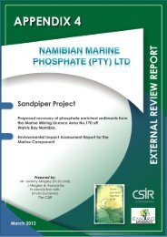
<strong>Namibia</strong>n Marine Phosphate: Sandpiper Phosphate Project<br />
20 September 2011, 14h30<br />
NamPower Convention Centre, Windhoek<br />
Minutes: Windhoek <strong>Authorities</strong><br />
1.1 Introduction and Welcoming<br />
Stephanie van Zyl from <strong>Enviro</strong> <strong>Dynamics</strong> cc, the facilitator, welcomed everyone present to<br />
the meeting. The agenda for the meeting was outlined followed by an introduction of the<br />
proponent, EIA team and specialists. The role of the attendees was also explained as to<br />
provide input and assist the team with gathering data and identifying issues that need to be<br />
studied. It was also highlighted that the process is now in the scoping phase, thus answers<br />
to the questions cannot be provided at this stage.<br />
It was further explained that the study will be conducted in three phases. The EIA process is<br />
currently in the data gathering phase which will be used to make assessments, followed by<br />
the reporting phase. The importance of feedback was highlighted, hence the fact that all the<br />
reports will be circulated to the stakeholders for their comments.<br />
The role of the proponent was explained as to provide project information including aspects<br />
which interact with the environment, while the EIA team has to share this information with<br />
the interested and affected parties and facilitate sincere discussions. The audience was<br />
again encouraged to provide their inputs.<br />
1.2. Project Overview<br />
The following information on the proposed project was provided by Roger Daniel, one of the<br />
Directors of <strong>NMP</strong>:<br />
<strong>NMP</strong> is a joint venture between Tungeni Investments, Minemakers and Union Resources.<br />
Each party had their own EPL(s) thus by forming a joint venture; the license area was jointly<br />
larger and these companies will not be in competition with each other in the market place.<br />
This allowed the companies to combine their various skills and expertise and is seen as the<br />
best way forward for developing this project.<br />
The Board of Directors was introduced followed by a highlighting of major milestones. This<br />
included the signing of the shareholder agreement, a pre-feasibility study, securing the<br />
mining license in July 2011, upgrading the resource in August 2011 and then commencing<br />
the EIA study in September 2011.<br />
The project location was indicated on a map, showing it to be located between Walvis Bay<br />
and Lüderitz, approximately 60km offshore. Another map was presented showing the areas<br />
1
which have been tested for phosphates. Currently, an area of approximately 2,233km² has<br />
been issued as a mining licence area, while the remainder of approximately 4,700km² held<br />
as EPL(s).<br />
It was mentioned that marine sediments will be mined. A key to this project is the fact that<br />
this resource is accessible and can be mined using current dredging technology, at a depth<br />
of 225m.<br />
A map indicating the granted mining license area (MLA) and the resource blocks were<br />
shown. This was followed by information of the process used for testing the resource which<br />
constitutes a gravity corer dropped into the seafloor, extracting a sample.<br />
The resource was found to be compliant with international stock exchange standards. Two<br />
cut-off grades were identified, namely 10% and 15%. Ignoring anything less than 15%, an<br />
inferred resource containing 19% phosphate was found, which is very good. The resource is<br />
generally up to 3m thick, but historical data shows it can be up to 6m in some areas.<br />
<strong>Namibia</strong> ranks 7 th in the world in terms of this phosphate resource.<br />
The rationale for investing in <strong>Namibia</strong> was mentioned, which includes the country’s<br />
attractiveness physically and to work in, good infrastructure, good governance, and good<br />
facilities at the port of Walvis Bay.<br />
Economic Scoping<br />
Mr. Daniel also presented the findings of the pre-feasibility study which was based on a 25-<br />
year base-case model. The operating costs, freight on board was found to be under<br />
US$60/ton whereas other similar projects in the world have much higher costs. The selling<br />
price was estimated to be US$90/ton, this showing strong economics for the project.<br />
During the pre-feasibility phase, a number of companies were worked with. These consisted<br />
of Jan De Nul (dredging specialists), Bateman (Phosphates), Paterson and Cooke (specialist<br />
in moving slurry) and IHC (a mining engineering company).<br />
Maps and images of the proposed processing plant site on land, the pipeline routes, the<br />
dredging vessel to be used and the way it dredges the material were shown. It was<br />
explained that the ship will transport the material to a fixed-point mooring point<br />
(approximately 1km offshore) to the south of Walvis Bay from where it will be pumped into a<br />
buffer pond. From here, the material will be transported to the preferred process plant site<br />
(agreements are underway with the Walvis Bay Municipality and the State to acquire the<br />
land) where the oversize will be scalped and de-watered. This phosphate sands (known as<br />
phosphate rock in the industry) will then be transported to the harbor for export. Alternative<br />
transport options to the port are being investigated.<br />
An example of a sinker pipeline and the operations in the holding pond, were shown. It was<br />
mentioned that existing dredging technology was used and that the Cristobal Colon, a<br />
trailing suction hopper dredge (TSHD) is the preferred vessel for this project.<br />
2
Product Marketing<br />
It was explained by Mr. Daniel that no chemicals will be added in the processing of the of the<br />
phosphate slurry. The product (‘phosphate rock’) has been tested and was found to be<br />
reactive with soils under the right climatic conditions (wet & humid). Therefore it can be<br />
applied directly to the ground – Direct <strong>App</strong>lication Phosphate, there is a large market in<br />
India. The product will be exported into Africa, also to South America and Asia. There are<br />
downstream beneficiation possibilities, which may be developed at a later stage, 5 to 10<br />
years down the line. They will undergo separate EIA processes to identify and address<br />
specific environmental and social risks.<br />
<strong>Namibia</strong> is well located between the potential markets. For example, transport will take 9<br />
days from <strong>Namibia</strong> to South America which is a very competitive timeframe.<br />
As for the development plans, future activities will include bulk sampling, more sampling to<br />
upgrade the resource in 2012. The project is planned to be commissioned in 2013.<br />
A short film on the proposed mining process was shown, based on operations of the<br />
Cristobal Colon.<br />
Questions asked for clarification purposes by the end of this section of the presentation, are<br />
presented in the table below:<br />
Commentator Issue/Comments Response By Whom<br />
W. Nashandi<br />
Did you get all this information<br />
Initially samples were taken<br />
R. Daniel<br />
(MTI:<br />
Director)<br />
Deputy<br />
from the gravity corer?<br />
using a grab system. This<br />
was followed up with the<br />
gravity corer.<br />
(<strong>NMP</strong>)<br />
W. Nashandi<br />
Should I take it that this EIA is<br />
We will process up to<br />
R. Daniel<br />
(MTI:<br />
Director)<br />
Deputy<br />
only being done for the marine<br />
part? Will the terrestrial EIA<br />
include further beneficiation<br />
phosphate rock. The<br />
separate EIAs for the<br />
marine and land<br />
(<strong>NMP</strong>)<br />
J. Midgley<br />
processes?<br />
components include this<br />
scope. We might further<br />
process the phosphate in<br />
(JMA-<br />
Consultant)<br />
future, but for this we will<br />
need a new site along with<br />
a new EIA process.<br />
W. Nashandi<br />
What is the total size of the<br />
2.233km²<br />
R. Daniel<br />
(MTI:<br />
Deputy<br />
mining area?<br />
(<strong>NMP</strong>)<br />
Director)<br />
3
Commentator Issue/Comments Response By Whom<br />
W. Nashandi<br />
How far can the dredge arm go<br />
The arm is dropped<br />
R. Daniel<br />
(MTI:<br />
Director)<br />
Deputy<br />
sideways?<br />
vertically adjacent to the<br />
vessel. It can only move up<br />
and down, but not really<br />
(<strong>NMP</strong>)<br />
J. Midgley<br />
sideways. On the<br />
photograph the arm shown<br />
is about 190m long, but it<br />
(JMA-<br />
Consultant)<br />
will be longer than the<br />
vessel, the final length is no<br />
yet known.<br />
W. Nashandi<br />
How long is the vessel?<br />
220m long.<br />
P. Morant<br />
(MTI:<br />
Deputy<br />
I was worried that if the arm<br />
There will be signals by day<br />
(CSIR)<br />
Director)<br />
goes sideways far away from<br />
and lights by night to<br />
the ship, it can potentially cause<br />
indicate the activities of the<br />
collisions with passing ships.<br />
dredger.<br />
W. Nashandi<br />
Should the EIA not include up<br />
The resource that we have<br />
R. Daniel<br />
(MTI:<br />
Director)<br />
Deputy<br />
to a depth of 6m to indicate if<br />
the resource is located deeper<br />
than 3m?<br />
identified is located within<br />
the top 3m. The resource<br />
is large and according to<br />
(<strong>NMP</strong>)<br />
studies there is enough in<br />
3m for 20-25 years of<br />
mining.<br />
1.3. EIA Process:<br />
Stephanie van Zyl explained that this EIA is being done in line with <strong>Namibia</strong>n legislation such<br />
as the <strong>Enviro</strong>nmental Management Act of 2007, the Prospecting and Mining Act, as well as<br />
other various treaties and conventions. International standards, specifically the Equator<br />
Principles and the Performance Standards of the International Funding Corporation (IFC) are<br />
adhered to, so that the EIA documents will be of an acceptable standard to apply for<br />
international funding.<br />
A map was shown to explain how the project has two distinct components, namely marine<br />
and terrestrial. Even though the project should be considered in its entirety, with the<br />
required integration, two separate EIAs are being conducted for these two components.<br />
It was explained that the EIA process is currently in the scoping phase during which data<br />
and issues are gathered. This information will feed into a scoping report which will be<br />
circulated to all registered stakeholders. The issues identified during this process will also<br />
4
determine the scope of the EIA and will be used to confirm the terms of reference of the<br />
specialists so that all potential impacts identified are adequately investigated.<br />
The scoping phase will be followed by the <strong>Enviro</strong>nmental Assessment (EA) phase. This will<br />
include the specialist investigations and assessment of potential impacts according to predetermined<br />
standard assessment criteria. Mitigation or enhancement measures will also be<br />
identified and included in the EA report which will be circulated for comments. Once all the<br />
comments have been incorporated and the report finalized, it will be submitted to the<br />
relevant authorities for environmental clearance. An <strong>Enviro</strong>nmental Management Plan<br />
(EMP) will also be compiled which is a detailed document that specifies how, when and by<br />
whom the identified impacts should be managed during design, construction, operation and<br />
decommissioning.<br />
The EIA process considers the combination of public values and technical facts. Thus, there<br />
is the public consultation process as well as the technical environmental analyses of facts by<br />
the specialists.<br />
1.4. <strong>Enviro</strong>nmental Matters<br />
This section of the presentation was conducted by Jeremy Midgley, the EIA team leader for<br />
this project. The information presented, was as follow:<br />
The material will be dredged and transported to shore, before the vessel returns to mine the<br />
site again. This will be a three day cycle. The material will be transferred from the vessel at<br />
the offshore mooring point to the shore into a holding pond, from where it will be sent via<br />
pump station and pipeline to the process plant. The pipeline will be 30cm in diameter and<br />
approximately 23km long. Archaeology has already been evaluated at in the area of the<br />
proposed pipeline, process plant site and coastal buffer pond. Once the product arrives at<br />
the pump station, the fine black sand containing phosphate will be separated from the shells.<br />
The latter might be used in the cement industry, but other options are also being<br />
investigated.<br />
The product will be transferred from the site, which is situated 5km outside Walvis Bay, to<br />
the harbour from where it will be shipped. A combination of methods to transport the final<br />
product to the port are being investigated, these include conveyor belts, trucks and the<br />
railway options.<br />
As for the mining operations, seven options were investigated and evaluated from an<br />
economic as well as environmental perspective. There are two principal approaches to<br />
mining offshore 1) a mother vessel supported by several transport barges; 2) a large ship<br />
with hopper (hold) in which the material mined can be transported to shore. A number of<br />
factors determined the outcome of the preferred option mining method, these included<br />
safety, pollution caused by spillage, the footprint of the mining control head (as the preferred<br />
5
option removes a layer of 0,5m deep and 11m wide) as well as its handling and storage<br />
capacity. The TSPH is the preferred method of mining.<br />
Different techniques for mining were also investigated. This constituted of the crawler,<br />
mechanical grab or large diameter drill and the trailing suction hopper dredge (TSHD). The<br />
latter was identified as the preferred option since it has a holding capacity of 46,000m³, can<br />
complete a cycle in three days, and has well established environmental controls and the<br />
dredge head can also be accurately controlled.<br />
It was explained that during Year 1 of the mining operations, 1.33mt will be mined over a<br />
period of 11 weeks. This will increase to 5.5mt in Year 3 over 47 weeks. The latter is also<br />
expected to be the ongoing rate of mining.<br />
The Mining Licence Area for this project was indicated on a map showing the different<br />
concentrations of phosphate distribution. These deposits were initially identified during the<br />
1970s. At this stage, it was mentioned that phosphate is an important component of<br />
fertilizers. China has stopped exporting their phosphate and instead opts to keep it incountry<br />
for agricultural purposes.<br />
A schematic of the dredging operations was shown. Aspects such as the depth of each<br />
mining cut and the fact that excess water will be discharged from the vessel containing fine<br />
sediments, were highlighted.<br />
The production ramp-up was also discussed. In Year 1 approximately 1.33mt of solids will<br />
be mined, exporting 0.5 to 1.0mt. This is expected to increase to 5.5mt being mined and<br />
3.0mt to be exported by Year 3.<br />
It was explained that there are different mining areas within the licence area. <strong>NMP</strong> has<br />
obtained a 20-year mining licence to mine the deposit, the resource is a huge. An initial<br />
mining target are of 8 × 22km² has been identified. The deposit is between 1.5m to 3.0m<br />
thick. Up to 3km² will be mined annually.<br />
The following potential environmental impacts have been:<br />
• the annual removal of up to 3km²;<br />
• the removal of up to 3m of the seabed;<br />
• mortalities in benthic fauna and disturbance to their foraging areas and food sources;<br />
• modifications to the water column and disturbance to the benthic fauna ecosystem.<br />
One needs to understand the marine environment and establish baseline information on it<br />
which will in this case include marine fauna, seabed and benthos, as well as the water<br />
column. The specialist’s studies will consider these aspects.<br />
A map indicating the locality of the mining areas in relation to the commercial fishing and<br />
spawning grounds was presented. Hake and monk fish are found within the project area<br />
and it was acknowledged that these are important commercially to the fishing industry.<br />
6
Looking at the overlaps between the MLA and the fishing grounds, only 1.92%, 4.54% and<br />
2.54% fall within the hake and monk fishing areas, and the sole spawning and hake<br />
spawning areas respectively. Considering the initial mining area of 8 × 22km², it does not<br />
overlap with the either the hake or monk fishing areas nor hake spawning areas. An overlap<br />
of 0.63% occurs between this block and the sole spawning area. (NOTE: it was indicated by<br />
MFMR that the fish distribution information is outdated).<br />
As for the benthos, 100 samples have been collected from 20 stations across the initial<br />
mining target area, in which species such as polyceates were found. These benthic fauna<br />
can also be found elsewhere along the coast. These samples were taken at both in- and<br />
outside the mining area, providing a control against which one can measure change.<br />
Potential impacts on the water column were also presented in a schematic. Impacts such as<br />
the release of hydrogen sulphide, gill clogging, mortalities, an impact on oxygen levels and<br />
the increase in turbidity caused by dredging and the discharge, will be assessed by the<br />
specialists. The significance of the impacts will be established by specialist studies. The<br />
significance of the information gathered will be assessed after which the mitigation measures<br />
will be identified.<br />
This section of the presentation was followed by questions asked for clarification purposes,<br />
which are presented in the table below:<br />
Commentator Issue/Comments Response By Whom<br />
W. Nashandi<br />
As for mortalities, is it only<br />
Some fish spend time on the<br />
P. Morant<br />
(MTI:<br />
Director)<br />
Deputy<br />
macro fauna or are there<br />
any other species on the<br />
seabed that can be<br />
seabed. Some of them hide<br />
there. It is important to<br />
understand the relationship<br />
(CSIR)<br />
impacted?<br />
between the fauna on the<br />
seabed and those in the<br />
middle waters.<br />
W. Nashandi<br />
What is the total distance<br />
The Marine Protected Area<br />
J. Midgley<br />
(MTI:<br />
Director)<br />
Deputy<br />
from the shore? The whole<br />
area might be under a<br />
protected area for<br />
(MPA) has recently been<br />
proclaimed. It extends from<br />
the NAM-RSA border up to<br />
(JMA-<br />
Consultant)<br />
spawning.<br />
Meob bay.<br />
The MPA is<br />
landward of the project area<br />
and there is no conflict with<br />
the protected area (areas<br />
shown on map). It does also<br />
not mean that nothing can<br />
happen in the conservation<br />
area, for example, diamond<br />
7
Commentator Issue/Comments Response By Whom<br />
mining.<br />
The MPA might extend<br />
northwards and they can also<br />
extend it seawards. But if it<br />
becomes too big it cannot be<br />
policed.<br />
W. Nashandi<br />
It will be interesting to know<br />
True. We should know the<br />
J. Midgley<br />
(MTI:<br />
Director)<br />
Deputy<br />
how far the hydrogen<br />
sulphide will be released<br />
from the dredging site.<br />
footprint of the project as this<br />
will also protect you should<br />
someone accuse you of<br />
(JMA-<br />
Consultant)<br />
something.<br />
W. Nashandi The 6m dredge head; will it<br />
be a landing fast? How will<br />
it impact on the fish with its<br />
downward and extraction<br />
force?<br />
If it lands on a fish, it will be<br />
sucked up. The same is true<br />
for benthic fauna. It is<br />
expected that the vibration<br />
noise might cause some fish<br />
to flee. Yet, some fish will still<br />
be caught.<br />
Dredging will take place at a<br />
speed of 2km/hour. Pilchards,<br />
anchovies and hake are<br />
unlikely to get caught.<br />
J. Midgley<br />
(JMA-<br />
Consultant)<br />
P. Morant<br />
(CSIR)<br />
(MTI: Deputy<br />
Director)<br />
The pilchards might be hurt<br />
more than the other<br />
species.<br />
Pilchards are higher up in the<br />
water column. They will not<br />
go into the ‘fog’ caused by<br />
P. Morant<br />
(CSIR)<br />
dredging.<br />
From previous experience,<br />
J. Midgley<br />
jellyfish tend to colonize mined<br />
areas, and they will get sucked<br />
up. We expect this to be a<br />
(JMA-<br />
Consultant)<br />
possible issue.<br />
W. Nashandi<br />
What is the size of the pipe<br />
¾ of a meter.<br />
R. Daniel<br />
(MTI:<br />
Deputy<br />
from the head?<br />
(<strong>NMP</strong>)<br />
Director)<br />
8
1.5. Questions and Comments<br />
The floor was opened for discussions and this was facilitated by Ms S. Van Zyl. All the<br />
questions and comments are presented in the table below.<br />
Commentator Issue/Comments Response By Whom<br />
P. Paulus<br />
We are concerned about the<br />
The terrestrial EIA will be<br />
J. Midgley<br />
(Water Affairs)<br />
quality of the water. We<br />
control the permits for which<br />
you will have to apply<br />
rolled out in approximately a<br />
month to 6 weeks’ time and<br />
your comment might be more<br />
(JMA-<br />
Consultant)<br />
should you want to<br />
applicable then. Dr. Carter will<br />
discharge water.<br />
look at the marine water<br />
column issues. He also has<br />
experience in the diamond<br />
mining activities.<br />
A.W. Shilongo<br />
We are interested in<br />
This initial process is a simple<br />
R. Daniel<br />
(ODC)<br />
manufacturing. Do you<br />
want to apply for an EPZ?<br />
one and does not qualify for<br />
an EPZ, but we can consider<br />
(<strong>NMP</strong>)<br />
this at a later stage.<br />
A.W. Shilongo<br />
How many people will be<br />
It can accommodate 46<br />
J. Midgley<br />
(ODC)<br />
onboard the vessel? What<br />
will be their water demand?<br />
people, but the crew may be<br />
30 people. They have a water<br />
purifier on board the ship for<br />
(JMA-<br />
Consultant)<br />
drinking water.<br />
A.W. Shilongo<br />
Will there be an input of<br />
This will fall under the<br />
R. Daniel<br />
(ODC)<br />
chemicals?<br />
terrestrial component. There<br />
will be a need for fresh<br />
(<strong>NMP</strong>)<br />
washing water, rather than<br />
chemicals. We can also use<br />
retreated sewage water from<br />
the municipality, up to 3000m³<br />
per day. This water is<br />
currently thrown away. Only<br />
some is used for watering<br />
municipal gardens.<br />
9
1.6. Conclusion<br />
Everyone was thanked for their inputs. The attendees were also invited to submit comments<br />
electronically should they wish by no later than 30 September 2011. It was mentioned that<br />
the presentations will also be made available on the <strong>Enviro</strong> <strong>Dynamics</strong> website and that a<br />
notification with the link will be e-mailed to all stakeholders.<br />
The meeting was adjourned.<br />
10
Attendance list:<br />
11