CHAPTER 4 - Western Pennsylvania Conservancy
CHAPTER 4 - Western Pennsylvania Conservancy
CHAPTER 4 - Western Pennsylvania Conservancy

Create successful ePaper yourself
Turn your PDF publications into a flip-book with our unique Google optimized e-Paper software.
Connoquenessing Creek Watershed Conservation Plan<br />
Chapter 4. Biological Resources<br />
<strong>CHAPTER</strong> 4. BIOLOGICAL RESOURCES<br />
Ecosystems are groups of plants and animals that live and interact together. Not only are plants and<br />
animals essential to healthy ecosystems, biological resources sustain and enhance our quality of life.<br />
Wood products, crops, and livestock offer economic income to the Connoquenessing region. Wild game<br />
and fish species offer opportunities for hunting, fishing, and wildlife watching. Trees, wildflowers, birds,<br />
and butterflies enhance our outdoor experiences. Bees, bats, and other pollinators ensure sufficient crop<br />
yields and beautifully blooming gardens. Having a diversity of living creatures and community<br />
interactions is termed biodiversity. Even humans are a biological component of watersheds and<br />
ecosystems. In this chapter, biological resources, habitats, and threats to those resources will be discussed.<br />
Natural Setting<br />
Ecoregion Characteristics<br />
In addition to being located in the Appalachian Plateaus<br />
geomorphic province (as described in chapters 1 and 2), the<br />
area also is located in the Humid Temperate Domain<br />
ecoregion. As defined by the World Wildlife Federation<br />
(2005), an ecoregion is an area of land or water that contains<br />
geographic characteristics and species that interact<br />
ecologically to enhance their longevity. Although both<br />
province and ecoregion delineations consider the geology of<br />
the area, the difference is that an ecoregion also considers<br />
climate, ecology, and the interactions between animal and<br />
plant species.<br />
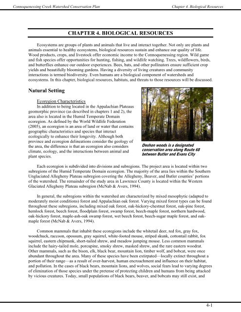
Deshon woods is a designated<br />
conservation area along Route 68<br />
between Butler and Evans City<br />
Each ecoregion is subdivided into divisions and subregions. The project area is located within two<br />
subregions of the Humid Temperate Domain ecoregion. The majority of the area lies within the Southern<br />
Unglaciated Allegheny Plateau subregion covering the Allegheny, Beaver, and Butler counties’ portions<br />
of the watershed. The remainder of the study area in Lawrence County is located within the <strong>Western</strong><br />
Glaciated Allegheny Plateau subregion (McNab & Avers, 1994).<br />
In general, the subregions within the watershed are characterized by mixed mesophytic (adapted to<br />
moderately moist conditions) forest and Appalachian oak forest. Varying mixed forest types can be found<br />
throughout these subregions, including mixed oak forest, oak-hickory-chestnut forest, oak-pine forest,<br />
hemlock forest, beech forest, floodplain forest, swamp forest, beech-maple forest, northern hardwood,<br />
oak-hickory forest, maple-ash-oak swamp forest, wet beech forest, beech-sugar maple forest, and oakmaple<br />
forest (McNab & Avers, 1994).<br />
Common mammals that inhabit these ecoregions include the whitetail deer, red fox, gray fox,<br />
woodchuck, raccoon, opossum, gray squirrel, white-footed mouse, striped skunk, cottontail rabbit, fox<br />
squirrel, eastern chipmunk, short-tailed shrew, and meadow jumping mouse. Less common mammals<br />
include the hairy-tailed mole, porcupine, smoky shrew, masked shrew, and the rare eastern woodrat.<br />
Other mammals, such as the bison, elk, black bear, mountain lion, timber wolf, and bobcat, were once<br />
abundant throughout the area. Many of these species have been extirpated—locally extinct throughout a<br />
portion of their range—as a result of over-harvest, human encroachment and influence on their habitat,<br />
and pollution. In the cases of black bears, mountain lions, and wolves, social fears lead to varying degrees<br />
of elimination of those species under the pretense of protecting children and humans from being attacked<br />
by vicious creatures. Today, small populations of black bears, beaver, and bobcats may still exist, and<br />
4-1
Connoquenessing Creek Watershed Conservation Plan<br />
Chapter 4. Biological Resources<br />
these species are rebounding from the devastating effects humans have had on their species (McNab &<br />
Avers, 1994).<br />
Typical bird species found within these ecoregions<br />
include the wild turkey, ruffed grouse, barred owl, pileated<br />
woodpecker, red-bellied woodpecker, eastern phoebe, bluegray<br />
gnatcatcher, Acadian flycatcher, white-eyed vireo,<br />
ovenbird, Kentucky warbler, yellow-breasted chat, summer<br />
tanager, red-tailed hawk, great-horned owl, belted kingfisher,<br />
northern flicker, great crested flycatcher, white-breasted<br />
nuthatch, red-breasted nuthatch, eastern bluebird, gray catbird,<br />
American redstart, scarlet tanager, chipping sparrow, rubythroated<br />
hummingbird, screech owl, and wood duck, to name a<br />
few. Many migrating birds nest in the region during the spring<br />
American robin<br />
and summer months, and offer spectacular displays for bird<br />
watchers to enjoy. Also, wild turkey and ruffed grouse are<br />
important game species for hunters. Peregrine falcons and bald eagles, once devastated by pollution and<br />
adverse effects of DDT and other pesticides in the food chain, are rebounding and returning to western<br />
<strong>Pennsylvania</strong>. These species are high profile examples of nature’s resiliency and serve as good<br />
educational tools in teaching the youth about environmental responsibility.<br />
Amphibians and reptiles typically found within these ecoregions include the red-spotted newt, dusky<br />
salamander, fence lizard, American toad, wood frog, spring peeper, box turtle, snapping turtle, painted<br />
turtle, ringneck snake, northern water snake, black rat snake, copperhead, smooth green snake, and milk<br />
snake. Many amphibians, particularly lungless salamanders, can be studied as indicators of ecosystem<br />
quality. Reptiles, such as snakes, turtles, and lizards, help to keep populations of pests, such as mice,<br />
voles, and insects, under control.<br />
Fish species vary depending on the size, temperature, and degree of pollution in a particular stretch<br />
of stream. Species common in smaller, cold-water streams include trout, southern redbelly dace, creek<br />
chub, barred fantail darter, and greenside darter. Largemouth bass, bluegills, channel catfish, and crappies<br />
can often be found in the warmer, larger waters of man-made reservoirs and larger, slower moving<br />
sections of the creek.<br />
Natural Habitats<br />
Backyard Habitat<br />
Forestlands provide habitat for plant and animal species,<br />
timber for fuel and wood products, income possibilities from<br />
other forest products for private forest owners, and recreational<br />
opportunities. Not only are the rural forest blocks and riparian<br />
buffer areas we typically envision important for the<br />
sustainability of healthy ecosystems and water quality, but<br />
urban forestry also is an important aspect of watershed<br />
conservation. Trees planted in urban settings and along<br />
roadways perform a number of functions, ultimately<br />
improving the livability and attractiveness of communities.<br />
Even small wooded lots may host a<br />
diverse array of plants and animals<br />
Trees in urban settings help to regulate heat radiation and ambient air temperature by shading sidewalks,<br />
parking lots, and roads. They may control erosion and help manage stormwater. Trees can be utilized to<br />
reduce energy costs and improve property values. Trees in urban settings will also improve the air quality<br />
of the city, improve a community’s sense of pride, and enhance business and economic development.<br />
<strong>Pennsylvania</strong> Community Forests (2007) and <strong>Pennsylvania</strong> Department of Conservation and Natural<br />
4-2
Connoquenessing Creek Watershed Conservation Plan<br />
Chapter 4. Biological Resources<br />
Resources (DCNR) Bureau of Forestry (2007) are able to assist municipalities and commissions in<br />
organizing and implementing urban and community forestry management programs (Appendix N).<br />
If a town or city, regardless of size, meets four standards set forth by the Arbor Day Foundation, it<br />
may become certified as a Tree City USA. To meet the requirements, a community must have: a tree<br />
board department, tree care ordinance, community forestry program with an annual budget of $2 per<br />
capita, and an Arbor Day observance and proclamation. There are many benefits associated with<br />
becoming certified as a Tree City USA, including an action framework set-up to ensure the community<br />
success in implementing its forestry program, educational opportunities, improved public image and sense<br />
of community pride, preferences for financial assistance, and publicity (Arbor Day Foundation, 2007).<br />
Developing or maintaining a woodlot and natural habitat<br />
in your yard attracts a variety of wildlife, such as songbirds,<br />
butterflies, toads and other amazing creatures, which may<br />
help to reduce stress and anxiety at the end of a long work<br />
day or commute. These species also help to rid your yard of<br />
pests, and reduce or eliminate the need for chemical<br />
pesticides.<br />
Forests, woodlots, and backyard habitats offer<br />
opportunities for families to learn and bond together while<br />
enjoying their own little ecosystem. Backyard habitats and<br />
nearby natural areas also encourage outdoor recreation, Fall foliage at Deshon Woods<br />
which helps to combat the childhood obesity epidemic<br />
sweeping the nation, as more and more children are accustomed to sitting in front of the television and<br />
playing video games. Having even a small backyard habitat or nearby woodlot offers opportunities for<br />
exploration of nature and self, while children remain close to home in a safer area.<br />
Private property owners are encouraged to consider natural landscaping with native wildflowers,<br />
trees, and shrubs versus mowing their entire lawn, especially areas adjacent to water sources. Native plant<br />
species that are adapted to the local weather conditions are best, as they require minimal watering and<br />
maintenance. They are often preferred by native wildlife for food and cover, as well. Reducing the<br />
amount of “lawn” on your property will also save money in maintenance costs for gasoline powered<br />
equipment and it will save energy used for electrical equipment, which both reduce the amount of<br />
pollutants that are released into the air. Carefully planning your landscaping to include a variety of<br />
aesthetically pleasing plants that bloom and provide color<br />
Planting trees on your property will help to manage stormwater runoff and erosion. When planted<br />
according to a specific scheme, one can create windbreaks using evergreen trees and native shrubs to<br />
protect their homes from harsh winter winds, which may help to reduce home heating bills. In addition to<br />
planting wind breaks, shrubs planted close to a home create “dead air” space, which essentially adds<br />
another insulating layer to your home. Shade trees also can be utilized to reduce energy bills. During<br />
summer months when deciduous trees have a full crown of leaves, shade on the house will lower the<br />
temperature naturally, reducing cooling costs. It has also been shown that shading the cooling unit itself<br />
can result in a 10 percent increase in efficiency. In the winter, when the tree crown is bare, sunlight is<br />
permitted through to warm the home and reduce heating costs (U.S. Department of Energy, 2007).<br />
Forest Habitat<br />
Forests play an important role in the regulation of global climate change and air quality. Carbon<br />
dioxide, one of the most abundant greenhouse gases, is naturally present in the atmosphere. When plants<br />
“breathe,” the process of photosynthesis converts water and carbon dioxide from the atmosphere into<br />
4-3
Connoquenessing Creek Watershed Conservation Plan<br />
Chapter 4. Biological Resources<br />
Native sassafras trees have been<br />
utilized for timber, medicines, tea, and<br />
dying fabrics; they also provide food<br />
for a variety of wildlife species; note<br />
the non-native hosta in the lower left<br />
corner, a commonly used landscaping<br />
plant<br />
sugar for the plants’ growth and oxygen, which is released<br />
back into the air. The carbon removed from the atmosphere is<br />
stored, or sequestered, in the plant components (leaves, stems,<br />
branches, roots, etc.) When leaves or trees are downed, the<br />
carbon is contributed to the soil matter. Carbon dioxide is also<br />
released back into the atmosphere through respiration and the<br />
decomposition of organic matter. This natural exchange of<br />
carbon, along with other greenhouse gases (including those<br />
released from the burning of fossil fuels and gas combustion),<br />
contributes to the “greenhouse effect.”<br />
In the absence of greenhouse gases, the earth would be a<br />
cold, desolate planet that harbors no life. Excess greenhouse<br />
gases contribute to the opposite effect, global warming.<br />
Human activities, such as deforestation, poor agricultural<br />
practices, vehicle exhaust, and the burning of fossil fuels have<br />
greatly increased the contribution of carbon dioxide to the<br />
atmosphere. The preservation of forests, maintenance of<br />
riparian forest buffers, and forest management practices that leave residual trees to grow at a faster rate<br />
aid in the storage of carbon from the atmosphere into plant and soil materials. In the grand scheme of<br />
things, this will contribute to the prevention or hindrance of global warming.<br />
Protecting and maintaining available woodlots and “green” space throughout the watershed is<br />
especially important in this rapidly developing region north of the city of Pittsburgh. Few large,<br />
contiguous (uninterrupted) forest blocks remain in the watershed. Most of the forest tracks of the<br />
Connoquenessing are fragmented by roads, urban and residential development, and different land uses. It<br />
will be imperative to protect what remains for the continued health, livability, and community appeal of<br />
the region.<br />
Sustainable forestry practices and the use of Best Management Practices (BMPs) when utilizing<br />
forest resources will ensure the future health of forest ecosystems throughout the watershed. Often,<br />
foresters and landowners desire the quickest and greatest monetary return from a timber harvest, resulting<br />
in poor forestry practices. Clear-cuts eliminate all vegetation in a cut area, while high-grading removes<br />
the largest, most valuable timber in the lot. While both of these practices will provide a substantial return,<br />
they are neither ecologically or economically sensible, and the return is a one-time gain. A forest of<br />
economic value may take 20 years or more to regenerate. In addition, all of the best potential seed sources<br />
are eliminated from the area. Service Foresters are available to assist private and public landowners with<br />
technical advice on sustainable forest management. Certified foresters provide cost-share assistance,<br />
Forest Stewardship Plans, regional planning, education, and assistance with tree planting and riparian<br />
buffer restoration (DCNR Bureau of Forestry, 2007).<br />
By selectively planning a harvest with a certified forester, one can ensure the continual return for<br />
their investment. Trees can be harvested on a staggered schedule to provide recurring income. The best<br />
quality trees can be left to reseed the area. Nearby, competing trees of less value can be removed to allow<br />
remaining trees a greater allocation of resources and nutrients, ensuring a faster growth rate and higher<br />
quality of wood. As tree leaves continue to fall to the ground each autumn, the soil is amended with<br />
organic matter and nutrients, which also contribute to better growth rates. Erosion and sedimentation are<br />
reduced by leaving trees to stabilize the soil.<br />
Pruning and other maintenance activities will improve the quality of the timber in the forest lot.<br />
Selectively eliminating diseased and infested trees will improve the overall health of the forest. Wildlife<br />
4-4
Connoquenessing Creek Watershed Conservation Plan<br />
Chapter 4. Biological Resources<br />
should also be considered when harvesting a forest area. Brush piles made of cut limbs and saplings<br />
provide cover for small game, birds, reptiles, and amphibians. Dead, standing trees (called snags) are<br />
utilized by cavity nesting birds and other wildlife for shelter. Insects that eat the decaying wood material<br />
provide food for many forest birds, as well. Although, snags that are particularly large or hazardous<br />
should be downed to eliminate the safety risk, some snags should remain to provide habitat. Downed<br />
woody debris should also be left for creatures of the forest floor, such as amphibians, spiders, insects, etc.<br />
Maintaining a diversity of tree species in a forest is important to protect the forest from the<br />
devastating effects of insect and disease outbreaks. Plantation-style monocultures (an area consisting<br />
primarily of one species) are particularly vulnerable to invasive pest species that attack one species or<br />
family of trees, such as the emerald ash borer. More will be discussed on invasive species later in this<br />
chapter.<br />
Forestlands also offer products other than timber, which can be utilized for income by the landowner.<br />
Herbs and mushrooms harvested in a sustainable manner may provide ample educational, recreational,<br />
and economical benefits. Botanicals and medicines may be derived from forest species. Wreaths and other<br />
crafts can be made from limbs, vines, and other forest vegetation. Other forest products include: maple<br />
syrup, fence posts, fuel wood, fruits, and nuts.<br />
Successional Forest Habitat<br />
When a disturbance occurs in a forest, such as a logging, or perhaps a natural event, such as a<br />
tornado, or as the edge of a forested area transitions over time, the process called “succession” occurs.<br />
Succession is the natural process of forest regeneration overtime. For example, if an area adjacent to a<br />
forest once occupied by croplands laid fallow, herbaceous vegetation, like wildflowers and grasses, would<br />
occupy the area. As time went on, shrubs and small woody vegetation, tree seedlings and saplings, would<br />
grow. Eventually, trees would establish, and a mature forest habitat would again occupy the land. The<br />
entire process may take a very long time, and can occur at varying scales from several hundred acres to<br />
very small areas, such as that created when an old tree falls in a forest and opens a gap of canopy.<br />
The period in the process when the ecosystem is referred<br />
to as “early-successional” habitat, is when the land is primarily<br />
occupied by grasses, herbaceous vegetation, and small shrubs<br />
and tree saplings. This type of edge habitat is critical for<br />
certain species of birds, mammals, amphibians, reptiles, etc.<br />
During this time, grasses, seeds, berries, and twigs provide<br />
abundant forage, and shrubs and dense vegetation offer cover<br />
and safety for birds and small mammals. A variety of wildlife<br />
species prefer this stage of succession, such as rabbits,<br />
warblers, and American woodcock (Rodewald, 2006).<br />
During the middle-successional stage of forest<br />
regeneration, otherwise known as the pole timber stage, trees<br />
Grassland bordered by forest near<br />
Harmony is in early succession<br />
are growing and dominate the landscape. The understory is still relatively dense, with seedlings and some<br />
shrubby species that are more tolerant of shade. Some trees may still be competing for light with moredominant<br />
canopy trees. Salamanders and interior-forest birds may prefer this type of transitional habitat<br />
(<strong>Pennsylvania</strong> Envirothon, 2007).<br />
Once trees mature, the habitat is referred to as a mature forest habitat. During this stage, trees that<br />
have been overtopped by competing, faster-growing, or longer-lived trees tend to die and form “snags”<br />
that provide food, perches, and opportunities for cavity nesters, such as owls, woodpeckers, raccoons, and<br />
even bats. Retaining downed wood on the forest floor also serves to provide habitat for invertebrates,<br />
4-5
Connoquenessing Creek Watershed Conservation Plan<br />
Chapter 4. Biological Resources<br />
reptiles, amphibians, etc. There is a greater abundance of mast-producing trees in a mature forest that<br />
offer acorns, nuts, and soft or fleshy fruits and seeds. Species, such as wild turkey, black bear, and<br />
pileated woodpeckers, prefer mature forest habitats (<strong>Pennsylvania</strong> Envirothon, 2007).<br />
Landowners and forest land managers should promote differing stages of succession to offer a<br />
variety of habitats for wildlife species. Also, when timbering an area, foresters should stagger and soften<br />
the edges of cuts by leaving some older trees and shrubs on the perimeter, and cutting in a meandering<br />
fashion to avoid abrupt transitions between habitats, which may lead to higher incidents of predation.<br />
Grassland Habitat<br />
As mentioned above in the forestry section, reducing the percentage of mowed-grass lawn on one’s<br />
property will reduce energy use, fuel consumption, and pollution emissions, as well as save the landowner<br />
money on maintenance of the lawn. As with forest habitats and tree plantings, native wildflowers, grasses,<br />
forbs, and prairie-type habitats can be used to beautify the property, enhance ecological interactions, and<br />
overall reduce the amount of lawn to be maintained. Native grassland habitats, small or large, may<br />
provide food, cover, and nesting material for a diversity of wildlife. Many of these native species that will<br />
be attracted to the grassland may offer pest control of insects, weeds, and vermin, free of charge. Not only<br />
does this reduce costs associated with controlling these pests, but it also is more environmentally friendly<br />
compared to harsh chemical pesticides and inhumane traps.<br />
U.S. Department of Agriculture (USDA) Natural Resources Conservation Service (NRCS) suggests<br />
planting drought tolerant warm season grasses suitable to the region, such as big bluestem, little bluestem,<br />
buffalo grass, and beardgrass. These adapted grasses will provide shelter and forage for wildlife, help<br />
improve soils, and will require little maintenance. When maintaining a warm-season grassland, it is very<br />
important to schedule hay harvest around the nesting season for ground-nesting birds, generally before<br />
May 1 st and after August 15 th , which will allow enough time for grass regrowth to provide cover<br />
throughout the winter months (USDA-NRCS, 2007). Snake mortality in association with mowing is<br />
another concern, especially when relating to species of special concern, such as the eastern massasauga<br />
rattlesnake. If possible, mowing should occur in the colder months when snakes and other reptiles and<br />
amphibians are overwintering (December through March).<br />
Wetlands<br />
Wetlands are very functional ecological components of a watershed. Some species of plants can only<br />
grow in wetlands—defined as having anaerobic or hydric soils, wetland vegetation, and evidence of the<br />
area being inundated with water (permanently or seasonally). Though the Connoquenessing watershed is<br />
experiencing rapid development in some areas, which threatens the existence of wetlands and other<br />
natural areas, many of these important landscapes still exist in the watershed, and are worth noting and<br />
protecting. Many feeder streams originate from wetlands in headwater areas, which aid in groundwater<br />
recharge. Wetlands in riparian areas and on the margins of<br />
farmlands are vital in filtering excess nutrients, chemical<br />
pollutants, and sediment from water before it enters streams.<br />
Wetlands harbor a multitude of plants and animals, making<br />
them biodiversity hot spots of the watershed as well.<br />
Wetland near Hereford Manor Lakes<br />
Wetland vegetation plays an important role in filtering<br />
water, slowing the flow of water to allow sediments to drop<br />
out, and allowing groundwater recharge. Wetland vegetation<br />
also provides a variety of food sources, cover, and nesting<br />
material for insects, birds, mammals, and other forms of<br />
wildlife. Invertebrates and other lower-order forms of wildlife<br />
build the basis of the food chain, upon which many other<br />
4-6
Connoquenessing Creek Watershed Conservation Plan<br />
Chapter 4. Biological Resources<br />
species depend. Protecting wetland areas will, therefore, protect a variety of plant and animal species<br />
along with them.<br />
Forested wetland and floodplain areas are unique features found in the Connoquenessing watershed.<br />
These areas provide critical habitat for species of waterfowl, warblers, turtles, and an assortment of other<br />
wildlife. They also play an important role in filtering water supply, controlling flood waters, groundwater<br />
recharge, and offering recreation potential. Forested wetlands are threatened by deforestation, hydrology<br />
alterations, and damming of associated streams.<br />
Conserving wetlands and riparian buffers on agricultural lands is essential to maintaining wetlands<br />
and water quality throughout the watershed. Farmers may enroll their marginal lands in the Conservation<br />
Reserve Enhancement Program (CREP), fence riparian areas adjacent to streams, create stabilized stream<br />
crossings, and restrict access to streams for cattle and other livestock. A number of benefits can be<br />
realized from these actions. Cleaner water improves the overall health of the surrounding ecosystem and<br />
livestock herds. Riparian area buffers improve water quality and bank stabilization, and host a variety<br />
biological species. Pollinators attracted to the farm enhance the benefits to the farmer by increasing<br />
productivity of crops. Birds, bats, and predatory insects offer natural pest reduction services to further aid<br />
in the protection of crops. In addition, the variety of life and activity adds to the aesthetic appeal and<br />
property value. Farmers and other landowners are encouraged to protect or create wetlands and riparian<br />
areas on their property, not only for the ecological benefits, also for the direct benefits to the property<br />
owner.<br />
Rivers and Streams<br />
Many of the biological organisms that live in rivers and<br />
streams indicate the quality of water in which they live. These<br />
creatures are called bio-indicators. Freshwater mussels,<br />
aquatic macroinvertebrates, and lungless salamanders are all<br />
natural indicators of water quality and ecosystem health.<br />
Groups like Connoquenessing Watershed Alliance (CWA)<br />
sample and study these organisms to gain a better<br />
understanding of the overall health of the ecosystem. Trout<br />
Unlimited has local chapters of citizens and professionals who<br />
may be available for education, instruction, and conservation<br />
project assistance, as well. Contact information for these<br />
groups can be found in Appendix N.<br />
Looking downstream on the<br />
Connoquenessing Creek from Calgon<br />
ledge near Ellwood City<br />
Headwater streams are smaller and shallower, versus the larger order streams that they flow into,<br />
which tend to be wider and deeper. Streams throughout the Connoquenessing drainage vary greatly from<br />
slow, calm waters, to fast rushing rapids. With these varying characteristics comes a variety of plants and<br />
animals that inhabit each section of stream. Smaller, headwater streams are home to small fry (young fish)<br />
and aquatic macroinvertebrates. Small and fast flowing streams, especially those with an intact riparian<br />
forest buffer tend to have cold water, and host species of fish, such as trout and dace. Streams that may be<br />
slightly warmer, but still have “coolwaters,” are host to species of fish, such as chubs, shiners, and<br />
suckers. These fish provide food for larger fish, birds, and mammals.<br />
In larger, slower flowing streams and rivers, adult fish and larger organisms can be found. In pool<br />
areas along the stream, and in streams with little or no riparian vegetation to shade and cool the water,<br />
fish that thrive in warmwater, such as bass, bluegills, and sunfish, thrive. More information on the aquatic<br />
organism communities that may be found in the Connoquenessing watershed may be found in Appendix<br />
M. Aquatic Community Classification.<br />
4-7
Connoquenessing Creek Watershed Conservation Plan<br />
Chapter 4. Biological Resources<br />
Wildlife<br />
In order to manage for a diversity of wildlife, a diversity of quality<br />
habitats must be preserved to support various wildlife communities. Wildlife<br />
depends on the availability of food in all seasons, clean water, cover (for<br />
protection from predators and the elements), and space (to forage, raise<br />
young, and expand territory). Both year-round residents and migratory<br />
species depend on the resources of the Connoquenessing. By conserving<br />
natural areas, improving soil and water quality, and restoring degraded<br />
habitats, wildlife populations will benefit.<br />
Wildlife species are a critical component in all ecosystems. Every living<br />
thing, from the worms in the ground to eagles flying high above, plays an<br />
integral role in the continuation of life on Earth and quality of life for<br />
humans. The continued balance of nature depends on the existence of<br />
biodiversity. Each species and wildlife community provides ecosystem<br />
benefits, some of which include: food for other wildlife and humans,<br />
pollination, clean water, decomposition, nutrient cycles, clean air, and soil<br />
improvements.<br />
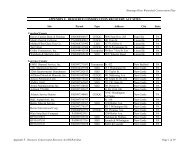
Table 4-1. Top Ten<br />
Most Popular<br />
Recreation Activities in<br />
DCNR Region 10<br />
1. Walking<br />
2. Sightseeing<br />
3. View nature<br />
4. Swimming<br />
5. Visit wild areas<br />
6. Picnicking<br />
7. Nature walks<br />
8. Hiking<br />
9. Fishing<br />
10. Jogging<br />
A diversity of wildlife and fisheries benefits recreation potential for the area, which in turn improves<br />
the local economy and quality of life and health of watershed residents. According to <strong>Pennsylvania</strong>’s<br />
Recreation Plan 2004-2008 (DCNR, 2004a), walking, nature watching, wilderness and natural areas,<br />
nature walks, fishing, hiking, camping, wildlife watching, bird watching, and hunting were all among the<br />
top 20 favorite recreational activities of <strong>Pennsylvania</strong>ns. All of those activities also are enhanced by the<br />
presence of biodiversity, high quality habitats, and clean air and water.<br />
Locally, the majority of survey participants from DCNR Region 10, which includes all of the<br />
counties of the watershed except Lawrence County, ranked the ten most popular recreational activities in<br />
the region, which are listed in Table 4-1 (DCNR, 2004a). Results from DCNR Region 9, which includes<br />
Lawrence County, were very similar. The major difference was the inclusion of camping and bicycling in<br />
Region 9, instead of hiking and jogging. Most of these activities inherently include the preservation and<br />
conservation of wildlife, fisheries, and their associated<br />
habitats. The report also acknowledged a growing trend in bird<br />
and wildlife watching.<br />
Great blue heron in flight, this species<br />
has been spotted in the watershed and<br />
nesting nearby<br />
The Connoquenessing region has experienced a great deal<br />
of stress on its natural resources over the past few decades,<br />
from development and habitat fragmentation to resource<br />
extraction and pollution. Despite all of the environmental<br />
degradation, there are diverse natural areas, rebounding<br />
species, and an abundance of wildlife in many areas. Wildlife<br />
that is more adaptable to ever-changing human-altered<br />
landscapes will continue to endure. Those species that are less<br />
tolerant of change will need additional protection and<br />
consideration to ensure their survival.<br />
A sampling of some of the wildlife resources that can be found throughout the watershed are<br />
highlighted in this section. While some of these species may actually occupy neighboring watersheds,<br />
4-8
Connoquenessing Creek Watershed Conservation Plan<br />
Chapter 4. Biological Resources<br />
such as the Slippery Rock Creek subwatershed, they still depend on the high quality habitats of the<br />
Connoquenessing to support their population and allow for expansion of their range.<br />
Birds<br />
Bald Eagle<br />
Once, bald eagle populations were ravaged by the secondary effects of excessive hunting and<br />
pesticide pollution in the environment; now bald eagles are on the rebound. In the 1980s breeding pairs in<br />
<strong>Pennsylvania</strong> had dwindled to three pairs. Reintroductions of juveniles and protection through the<br />
Endangered Species Act led to a steady increase in populations. As a result, the bald eagle’s status was<br />
downgraded from endangered to threatened. <strong>Pennsylvania</strong> Game Commission (PGC 4 ) manages this<br />
important bird species in the state.<br />
As a symbol of our nation, this regal creature is a top predator on its food chain, and it is one of the<br />
largest birds of prey, weighing up to 17 pounds with a wingspan of seven feet (PGC 4 ). Bald eagles<br />
primarily feed upon fish, other birds, and small mammals, but they have often been observed stealing<br />
prey from other birds. As of 2002, two successful sites were confirmed in Butler County slightly north of<br />
the watershed (PGC 4 ). At least one unconfirmed nest sighting has been reported in the Connoquenessing<br />
watershed (Kemp, personal communication). Several sightings of adult and juvenile bald eagles visiting<br />
the watershed have also been reported.<br />
The greatest threat to the continued successful recovery of bald eagle populations in the state is<br />
human disturbance. Over-use of recreational waters, which bald eagles heavily rely on for food sources,<br />
hinders their ability to thrive. In addition, too much human disturbance may lead to nest abandonment and<br />
decreased reproductive success (PGC 4 ).<br />
Osprey<br />
The osprey, also known as the “fish hawk,” has greatly recovered<br />
in the state since 1979, when they were thought to be extirpated<br />
(locally extinct in the state of <strong>Pennsylvania</strong>). Like the bald eagle,<br />
osprey populations were reduced by the effects of pesticides, such as<br />
DDT, and habitat destruction. In 1986, there was believed to be one<br />
nesting pair, and in 2004, 65 pairs were found to be nesting throughout<br />
the state. This astounding recovery was due in large part to a<br />
management program initiated in 1980 that continued for 16 years,<br />
reintroducing nestlings throughout the state, including a reintroduction<br />
program at Moraine State Park, which borders the Connoquenessing<br />
watershed to the north (PGC 5 ).<br />
Ospreys nest near large bodies of water, and they prey primarily<br />
on fish. They build large stick nests atop large trees or other tall<br />
structures. Migratory in nature, they fly to South America and other<br />
points south for the winter, and return to nest in <strong>Pennsylvania</strong> in the<br />
spring. The osprey is currently listed as threatened in <strong>Pennsylvania</strong>.<br />
Osprey nest at Moraine State<br />
Park adjacent to the<br />
Connoquenessing Creek<br />
watershed<br />
Short-eared Owl<br />
The short-eared owl is listed as endangered in <strong>Pennsylvania</strong>. Some owls have tufts of feathers on<br />
their heads that are commonly referred to as “ears.” The short-eared owl lacks these tufts upon its head,<br />
hence the name. Short-eared owls are migratory, and spend most of their time in <strong>Pennsylvania</strong> during<br />
winter. These owls prefer open spaces, and have been found to inhabit reclaimed mine areas in the region<br />
(PGC 2 ).<br />
4-9
Connoquenessing Creek Watershed Conservation Plan<br />
Chapter 4. Biological Resources<br />
Unlike most nocturnal owls that are active at night, the short-eared owl is active at dusk and dawn, a<br />
behavior called crepuscular. All owls are beneficial to farmers for their pest control capabilities, feeding<br />
on mice and other rodents that damage crops. Agricultural lands comprise a majority of the large, open<br />
areas throughout the watershed that this species prefers. Conservation programs on agricultural lands may<br />
help to sustain this species, when tall grasses are left on fields over the winter (PGC 2 ).<br />
Amphibians and Reptiles<br />
Eastern Massasauga Rattlesnake<br />
This reptile was once abundant throughout western <strong>Pennsylvania</strong>, but after decades of habitat<br />
destruction and human disturbance, the species is now endangered throughout the state. The eastern<br />
massasauga is a small, venomous snake that may reach three to four feet in length, leading to one of its<br />
pseudonyms, the “pygmy rattler.”<br />
This snake hibernates over winter, typically in crayfish burrows, and may eat up to nine pounds of<br />
rodents per year. As a natural pest control, they are beneficial to farmers of crops typically affected by<br />
mice, voles, and other rodent pests.<br />
Like most venomous snakes, the eastern massasauga will only use its precious venom, which it needs<br />
to obtain prey for sustenance, as a last resort of self defense against humans. The snake will typically<br />
avoid human interaction by utilizing camouflage to hide and its rattle to warn potential encroachers of its<br />
location. It may strike if stepped upon or if it feels cornered. One should be vigilant and attentive when<br />
hiking or traveling through rattlesnake territory.<br />
If you happen to encounter an eastern massasauga<br />
rattlesnake, do not harm the animal, as its endangered status<br />
in <strong>Pennsylvania</strong> makes it illegal to catch, harm, or kill the<br />
species. If possible, document your specimen with a<br />
photograph, note the location of your encounter, and report<br />
your findings to <strong>Western</strong> <strong>Pennsylvania</strong> <strong>Conservancy</strong> (WPC).<br />
WPC is conducting studies to document existing populations<br />
of eastern massasaugas. See Appendix N. Resources Guide<br />
for contact information.<br />
Eastern massasauga rattlesnake<br />
If your property is inhabited by massasaugas, be mindful of your land management techniques, and<br />
avoid mowing during the summer months when massasaugas are most active. This species reproduces<br />
only once every two to three years, so the loss of one individual may have a significant impact on the<br />
entire population. Avoid any habitat disturbance between April and November.<br />
Mammals<br />
Mammal diversity, in general, is low throughout the region encompassing the study area. Mammal<br />
diversity is typically associated with large, intact tracks of forest, which are not prevalent in the<br />
Connoquenessing watershed. Small mammals and game species, such as the whitetail deer, squirrels,<br />
rabbits, and foxes, do exist in many of the natural areas. These species, among others, provide<br />
opportunities for hunting and trapping recreation and wildlife viewing.<br />
Whitetail deer<br />
Proper management of whitetail deer populations may help to keep the impacts associated with the<br />
species to a minimum. In areas that are overpopulated with deer, forest regeneration may be hindered,<br />
crops may be damaged, and resources may be scarce for other wildlife. Habitat destruction by the<br />
overabundant deer population is having a huge impact on songbird populations, especially woodland<br />
4-10
Connoquenessing Creek Watershed Conservation Plan<br />
Chapter 4. Biological Resources<br />
warblers. Many of the birds impacted are in decline. In addition, overabundant deer populations pose a<br />
significant risk to the safety of motorists and damage to vehicles when roadway collisions occur.<br />
Whitetail deer management occurs at the state level through hunting permit allocations by PGC.<br />
Public land managers experiencing high density deer<br />
populations should incorporate considerations into land and<br />
habitat management techniques. Food plots may be established<br />
to improve herd health and decrease the animals’ dependency<br />
on natural areas. Public and private landowners may now<br />
enroll in a program through PGC called the Deer Management<br />
Assistance Program (DMAP), which provides hunters with<br />
additional permits to hunt antlerless deer on registered<br />
properties and help reduce deer populations (PGC 1 ).<br />
Beaver<br />
Beavers were once trapped to extirpation throughout the<br />
Evidence of beaver activity in the<br />
watershed<br />
state for their prized furs. Reintroductions occurred in several locations in <strong>Pennsylvania</strong> in the early<br />
1900s. Those parent populations reproduced and expanded their territory to include approximately 15<br />
counties. Evidence suggests that beavers exist within a portion of the study area.<br />
These small mammals are capable of extraordinary feats, like downing trees several feet in diameter,<br />
though they more commonly use small saplings and trees for food and the construction of their lodges and<br />
dams. By damming small streams, beavers create wetlands, thus providing habitat for a variety of other<br />
species; sometimes their incessant behavior of damming to hush the sound of running water may lead to<br />
problems, especially when they clog drainage pipes used to regulate water levels of reservoirs and lakes.<br />
Beaver-proof cages can be constructed around drainage pipes to deter clogging by this unique species.<br />
Bats<br />
Bats are common throughout <strong>Pennsylvania</strong>, and despite myths and common misperceptions, they do<br />
not readily spread rabies or entangle hair. On the contrary, bats are very beneficial creatures to humans<br />
and the environment. Bats control pests, pollinate plants, and disperse seeds. They are both economically<br />
and environmentally beneficial. Two important bat species that utilize resources of the Connoquenessing<br />
watershed are the northern myotis and Indiana bat.<br />
Depending on the species, bats may roost and/or hibernate under the bark of trees, in cavities, or in<br />
caves. These habitats are most vulnerable to degradation. Forestry and mining activities, especially, can<br />
disrupt and displace an entire colony of bats. If the species utilizing an abandoned mine, for instance, was<br />
an endangered or threatened species, such as the two listed above, disturbances to those habitats could<br />
have damaging implications to the species as a whole. Gates constructed at the entrance of abandoned<br />
mines and caves allow for the passage of bats and exclusion of humans to limit disturbance to the habitat.<br />
Fish and Freshwater Mussels<br />
Two previously conducted studies occurred in the Connoquenessing to document the species of<br />
mussels that exist in the streams of the watershed and to infer the communities of fish and freshwater<br />
mussels that may inhabit the streams based on scientific research and data analysis. More information<br />
about fish and freshwater mussels of the Connoquenessing watershed can be found in the previous studies<br />
section at the end of this chapter.<br />
4-11
Connoquenessing Creek Watershed Conservation Plan<br />
Chapter 4. Biological Resources<br />
Species of Special Concern<br />
Species of plants and animals are given rankings at the state and<br />
global levels based on the number of times the species has been<br />
documented in that geographic area. Most species have a rank assigned<br />
to them, even if they are not threatened or endangered. In <strong>Pennsylvania</strong>, a<br />
species is commonly considered to be of “special concern” if it has a<br />
ranking of “vulnerable” or lower. Global ranks are assigned based on<br />
data collected at similar state offices worldwide as a part of a network<br />
called NatureServe.<br />
Jack in the pulpit flower is<br />
native to <strong>Pennsylvania</strong><br />
The Endangered Species Act of 1973 (and its amendments) provides<br />
broad protection for aquatic and terrestrial species of wildlife and plants<br />
that are listed as threatened or endangered in the U.S. or elsewhere. An<br />
endangered species is a species that is considered to be in danger of<br />
becoming extinct throughout its range. A threatened species is a species<br />
at risk of becoming endangered unless special action is taken. A<br />
candidate species is one that is proposed by a state or federal agency for<br />
listing as threatened or endangered at the state or local level.<br />
In <strong>Pennsylvania</strong>, threatened or endangered status is determined by the appropriate state agency. For<br />
instance, the PGC is responsible for assigning state statuses to bird and mammal species, while<br />
<strong>Pennsylvania</strong> Fish and Boat Commission (PFBC) is responsible for fish, amphibians, and reptiles. Since<br />
there is no state agency that oversees invertebrates, such as moths and butterflies, these species can only<br />
receive threatened or endangered status if they are federally listed. Therefore, there may be some species<br />
that technically meet the state threatened or endangered requirements, but have not officially been given<br />
this designation. These species are typically monitored by <strong>Pennsylvania</strong> Natural Heritage Program<br />
(PNHP).<br />
Provisions are made for listing species, as well as for the development of recovery plans and the<br />
designation of critical habitat for listed species. As part of both federal and state acts, an environmental<br />
assessment of properties for species of concern is required before development projects can be permitted.<br />
However, rather than stopping development altogether, changes in design or timing of construction can<br />
often be made to protect the habitat for these resources.<br />
Within the Connoquenessing Creek watershed, 101 species of concern have been identified,<br />
including 66 plants, 17 birds, seven invertebrates, six mussels, three reptiles, one fish, and one mammal<br />
species. For protection purposes, the location of individual species cannot be provided. Appendix H lists<br />
state and global rankings for species of concern identified within the project area.<br />
Conservation Areas<br />
Natural Heritage Areas<br />
County Natural Heritage Inventories (CNHIs) are being<br />
conducted by PNHP for every county in the Commonwealth.<br />
These inventories identify and map the most significant natural<br />
places in a county for rare, threatened, and endangered species,<br />
as well as unique natural communities. Additionally,<br />
landscape level elements, such as large contiguous blocks of<br />
forest and high-quality watersheds, are also identified. The<br />
Connoquenessing Creek at ECOZ Park<br />
4-12
Connoquenessing Creek Watershed Conservation Plan<br />
Chapter 4. Biological Resources<br />
final product of the CNHI is a report highlighting specific areas and giving detailed management<br />
recommendations for their protection. The report should be utilized by local municipalities, counties,<br />
utility companies, and groups involved with comprehensive planning, zoning, review of development<br />
proposals, and other objectives.<br />
The PNHP is a collaborative organization dedicated to the collection, tracking, and interpretation of<br />
information regarding <strong>Pennsylvania</strong>’s biodiversity. PNHP partners include WPC, DCNR, PGC, and<br />
PFBC. PNHP is a member of NatureServe, which coordinates natural heritage efforts in all 50 U.S.<br />
states, Canada, Latin America and the Caribbean.<br />
The Connoquenessing Creek watershed is located in<br />
Allegheny, Beaver, Butler, and Lawrence counties. All of<br />
the counties have completed CNHIs. PNHP is currently<br />
conducting an update on the Butler County CNHI, which<br />
was originally completed in 1991. The anticipated<br />
completion of the Butler County updated CNHI is 2009, and<br />
should be referenced at that time for the most up to date<br />
conservation areas and recommendations for their protection<br />
(for more information contact PNHP at 412-288-2777 or<br />
visit their website at http://www.naturalheritage.state.pa.us/).<br />
Generally, any intact floodplain forest or wetland is<br />
significant to the watershed, and will likely have at least<br />
county significance in the Butler update. All undeveloped,<br />
forested areas within the watershed should be considered<br />
significant on the watershed level or county level due to<br />
their ability to buffer water flowing into the rivers.<br />
Forget-me-nots are just one of the<br />
beautiful wildflowers that grow in the<br />
Connoquenessing watershed, though<br />
native and non-native varieties look very<br />
similar<br />
The natural areas identified in CNHIs are termed:<br />
Biological Diversity Area (BDA):<br />
An area of land recognized as supporting populations of state, nationally, or globally significant<br />
species or natural communities; high-quality examples of natural communities or ecosystems; or natural<br />
exceptional native diversity. These areas are typically small, and contain a buffer that protects the natural<br />
community or habitat that is needed to support the site.<br />
Landscape Conservation Area (LCA):<br />
A larger area of land compared to a BDA that contains minimal human disturbance, and allows<br />
ecosystems to function on a landscape level. These areas often contain multiple BDAs.<br />
Dedicated Area (DA):<br />
An area of land recognized by an owner’s specific intention to protect it, which could result in the<br />
site becoming a BDA in the future, or a high-quality area within an already designated BDA. Numerous<br />
areas within the watershed could be DAs in the future through landowner agreements, special programs,<br />
or other methods.<br />
4-13
Connoquenessing Creek Watershed Conservation Plan<br />
Chapter 4. Biological Resources<br />
The following section describes BDAs located within the Connoquenessing Creek watershed (Figure<br />
4-1). Specific names and exact locations of rare species are omitted from CNHIs and this report to protect<br />
those species. Complete CNHIs can be downloaded from the PNHP website at:<br />
www.naturalheritage.state.pa.us.<br />
Butler County<br />
Table 4-2. Significance Rankings for BDAs<br />
Significance Rank<br />
Description<br />
Sites are of exceptional importance for the biological diversity and ecological<br />
integrity of the county or region, containing one or more occurrences of state or<br />
Exceptional<br />
national species of special concern or a rare natural community of adequate size,<br />
condition, and extent. These areas deserve complete and strong protection.<br />
High<br />
Notable<br />
County<br />
Sites are highly important for biological diversity of the county or region, and just<br />
like exceptional sites, contain species of special concern or natural communities<br />
that are highly ranked. Typically large and primarily undisturbed, these sites<br />
deserve strong protection.<br />
Sites contain occurrences of species of special concern or natural communities that<br />
are either more common or of smaller size and extent than exceptional or high rank<br />
areas, or have activity and disturbance. These sites deserve special protection<br />
within the context of their characteristics, degree of disturbance, and place in the<br />
community.<br />
Sites have great potential for protecting biodiversity in the county, but have not yet<br />
been found to contain species of special concern or state significant natural<br />
communities. Because of their size, undisturbed character, or proximity to other<br />
significant areas, these sites deserve further study and investigation as possible<br />
high or exceptional sites.<br />
Connoquenessing Creek Nature Reserve BDA<br />
Significance: High<br />
Location: Jackson Township and Zelienople Borough<br />
Description: One of the last remaining natural areas near Zelienople, this area is located directly<br />
north of the town along Connoquenessing Creek. The Ecologically Concerned of Zelienople<br />
(E.C.O.Z.) own and manage this forested natural area. A silver maple floodplain forest<br />
community exists along the creek, and is dominated by maturing silver maple and American<br />
basswood. A variety of herbaceous species are supported by the rich, moist soils in the floodplain.<br />
To the north of this floodplain, lies a mature, sugar maple-basswood forest community of red oak,<br />
white oak, American basswood, yellow poplar, and sugar maple along the steep, wooded slopes<br />
and into the upland areas. Any vernal wetlands and oxbows existing at this site create important<br />
habitat for wetland plant and animal species.<br />
Rare Occurrences: This site contains two significant natural features, a silver maple floodplain<br />
forest community and a sugar maple-basswood forest community.<br />
Threats and Stresses: Loss of suitable buffer zone surrounding the entire area to allow for the<br />
expansion of the forest communities is the only present threat to the reserve. Commercial<br />
development to the east and west may also impact the quality of the resources within the area.<br />
Invasive plant species also are a threat to this site. Many invasives, such as privet, honeysuckle,<br />
4-14
Connoquenessing Creek Watershed Conservation Plan<br />
Chapter 4. Biological Resources<br />
garlic mustard, barberry, multiflora rose, tree-of-heaven, Norway maple, dame’s rocket, and lily<br />
of the valley, were found in and around this BDA.<br />
Recommendations: Protect the site by maintaining a forested buffer surrounding the entire site to<br />
allow the forest to mature and sustain itself. Control invasive species where possible.<br />
Connoquenessing Floodplain BDA<br />
Significance: High<br />
Location: South of the Semiconon Valley LCA in Connoquenessing Township<br />
Description: This site is located on the southeast side of Little Connoquenessing Creek along the<br />
floodplain. Most of the canopy is oak and hickory and their associates. The surrounding land<br />
tends to be intact forest with some residential housing.<br />
Rare Occurrences: A plant species of concern exists within this site.<br />
Threats and Stresses: Some minor logging occurred close to the stream. Fragmenting features,<br />
such as small power lines and roads, occur in and around the site. Lands near the stream also are<br />
fenced for livestock, and gypsy moth damage appears to be high at this site.<br />
Recommendations: Logging in the habitat should be avoided, as it could remove the rare plant<br />
from the site or make the habitat inhospitable for the species of concern. Agricultural practices<br />
should be monitored to avoid impacts to downstream water quality. Gypsy moth management<br />
may increase suitable habitat for the rare species, as well.<br />
Muddy Creek BDA (small portion touches watershed)<br />
Significance: High<br />
Location: Clay and Center townships<br />
Description: This site is unique in that it is one of the largest wetland systems in the county and<br />
contains a variety of wetland types. Located east of Moraine State Park, the dominant wetland<br />
community within it is the alder-ninebark wetland. This large ecosystem is important for<br />
supporting a variety of wetland plants and animals.<br />
Rare Occurrences: A significant natural community, alder-ninebark wetland, exists within this<br />
site.<br />
Threats and Stresses: Road and railroad construction throughout the site impact water flow and<br />
have altered the original vegetative composition. Farmlands on adjacent lands jeopardize the<br />
quality of this BDA. Grazing on the edge of the habitat could lead to the elimination of certain<br />
plant species. Runoff and pollutants, such as fertilizers and pesticides, may affect the water<br />
quality at the site. Any physical or chemical alterations, such as mining, logging, and<br />
development that occur upstream or upslope of the wetlands could pose a threat.<br />
Recommendations: Carefully review activities that pose a threat to the wetlands area to address<br />
how they might affect water quality, water level, flow rates, or otherwise cause potential<br />
detrimental effects. Protect the site by maintaining a<br />
forested buffer that will help protect the water quality in<br />
Muddy Creek and its tributaries.<br />
Redwing Floodplain Swamp BDA<br />
Significance: High<br />
Location: Forward Township<br />
Description: Redwing Floodplain Swamp is an area of<br />
high quality habitat remaining in the Connoquenessing<br />
watershed, containing a state significant forested<br />
floodplain swamp dominated by white oak trees, and<br />
characterized by several vernal floodplain pools. The<br />
edges of these pools are one of the few known sites in<br />
Shore spiders, commonly found near<br />
streams in the watershed, prey upon<br />
small fish, tadpoles, and aquatic insects<br />
4-15
Connoquenessing Creek Watershed Conservation Plan<br />
Chapter 4. Biological Resources<br />
western <strong>Pennsylvania</strong> for a <strong>Pennsylvania</strong> endangered plant. Only a small area in the southwest<br />
corner of the floodplain shows evidence of logging, but the majority of the wetland is in a pristine<br />
condition.<br />
Rare Occurrences: A forested floodplain swamp and one <strong>Pennsylvania</strong> endangered plant species<br />
exist at this site.<br />
Threats and Stresses: The use of ATVs and horses on a pipeline at the southeastern edge of the<br />
floodplain has resulted in an erosion and sedimentation problem. Another issue is invasion of the<br />
pipeline right-of-way by native plants.<br />
Recommendations: A forested buffer should be maintained along the entire perimeter of the<br />
swamp to protect it from invasive species and hydrological alterations. ATV use should be<br />
restricted, and impacts from horseback riding and corralling should be mitigated. Any<br />
developments, logging, or damming of the creek which could change the water table should be<br />
avoided.<br />
Thorn Reservoir BDA<br />
Significance: High<br />
Location: Oakland Township<br />
Description: Wetlands at the northernmost end of Thorn Reservoir provide habitat for many plant<br />
and animal species, including a species of special concern found within relatively undisturbed wet<br />
meadows and open canopy wetland areas.<br />
Rare Occurrences: These sites provide habitat for one animal species of special concern.<br />
Threats and Stresses: Large fluctuations in the water level of Thorn Reservoir, as well as<br />
development and coal mining, are activities that could destroy habitat for the species of special<br />
concern.<br />
Recommendations: Development should be guided away from these sites, and activities such as<br />
strip mining for coal or clearing of land for development should be carefully monitored. Any<br />
disturbance between April and November should be avoided. Also, as with the Oneida BDA,<br />
authorities should be advised to limit the fluctuation of water levels in the impoundment.<br />
Buhls Channel BDA<br />
Significance: Moderate<br />
Location: Forward Township<br />
Description: Buhls Channel is a remnant oxbow lake formed in an abandoned stream bend, which<br />
has become separated from Connoquenessing Creek by a change in the course of the creek. A<br />
natural pond community has formed along with a robust emergent marsh, providing habitat for<br />
aquatic animals and plants, as well as breeding habitat for waterfowl. The oxbow pond located at<br />
the base of the steep hillside appears to have been cut by the forces of Connoquenessing Creek.<br />
The dry oak-heath forest community on the hillside is composed primarily of old growth red oak,<br />
white oak, and chestnut oak. Acidic rock outcrops that line the hillside also characterize the<br />
community.<br />
Rare Occurrences: This site contains two significant natural communities, a natural pond<br />
community and a dry oak-heath forest community.<br />
Threats and Stresses: The forest community on the hillside is considered to be in an overall<br />
pristine condition and is one of the few relatively intact natural areas in Butler County. However,<br />
the oxbow has been somewhat impacted by development pressures along its western edge. Forest<br />
has been cleared and summer homes have been built in the area between the oxbow and<br />
Connoquenessing Creek. Although it remains a significant community, it is not well buffered and<br />
erosion and sedimentation have occurred in areas where the land is being cleared for construction.<br />
Additionally, part of the wetland has been drained at its northern end. This community is<br />
vulnerable to the impact of the gypsy moth since oak is a preferred food. Although the potential<br />
for alteration of this forest exists, spraying pesticides is not recommended.<br />
4-16
Connoquenessing Creek Watershed Conservation Plan<br />
Chapter 4. Biological Resources<br />
Recommendations: A forested buffer should be maintained around the entire site so that<br />
communities can continue to function as an ecologically pristine forest and associated wetland.<br />
Drastic disturbances, such as logging, that cause erosion or physical disturbance should be<br />
avoided.<br />
Connoquenessing Creek LCA<br />
Significance: Moderate<br />
Location: Forward and Penn townships<br />
Description: A variety of habitats including second growth deciduous forests, remnant oxbow<br />
ponds, old growth floodplain forests, and old growth hillside forests occur within this<br />
conservation area along the Connoquenessing Creek. The high degree of biodiversity and<br />
presence of significant sites that are the only representatives of such habitat in Butler County<br />
warrant the protection of this conservation area.<br />
Rare Occurrences: See the Redwing Floodplain Swamp BDA, which is included in this LCA.<br />
Threats and Stresses: This site is subject to rapid growth and development spreading northward<br />
from the city of Pittsburgh, which could lead to habitat degradation and fragmentation.<br />
Recommendations: Protect this site and the entire Connoquenessing Creek Valley from<br />
development pressures. Maintain a forested buffer, and mitigate any disturbance which may lead<br />
to diminished habitat or water quality.<br />
Greece City #1 & #2 BDAs<br />
Significance: Moderate<br />
Location: Concord Township<br />
Description: These two areas around the town of Greece City<br />
provide suitable habitat for an animal species of special<br />
concern. Relatively undisturbed, wet meadows and open<br />
canopy wetland areas are some of the habitat requirements for<br />
this species.<br />
Rare Occurrences: These sites provide habitat for one animal<br />
species of special concern.<br />
Threats and Stresses: Habitat destruction, primarily through<br />
activities, such as mineral extraction and residential<br />
development threaten the resources upon which this animal<br />
species of special concern depends.<br />
Recommendations: Protect sites that function as habitat for the<br />
animal species of special concern.<br />
Sprouting ferns<br />
Harmony Junction Wetland BDA<br />
Significance: High<br />
Location: Jackson Township<br />
Description: A small site containing an oxbow wetland and robust emergent marsh community<br />
that is relatively undisturbed, except for a culvert under a railroad bed at the southern end. There<br />
is a silver maple floodplain forest community associated with the oxbow wetland along its<br />
northwestern edge. The wetland, dominated by large, mature red oaks, is also inhabited by a<br />
variety of wetland plant and animal species. The site is rich and moist, with vernal pools, and a<br />
high diversity of herbaceous species. Bordering the site are active railroads, second-growth<br />
upland forest, and a disturbed robust emergent marsh community.<br />
4-17
Connoquenessing Creek Watershed Conservation Plan<br />
Chapter 4. Biological Resources<br />
Rare Occurrences: This site contains two significant<br />
natural communities, a robust emergent marsh<br />
community and a silver maple floodplain forest<br />
community.<br />
Threats and Stresses: The construction of the railroad<br />
near the southern end has caused some erosion and<br />
filling of the wetland. Active railroad tracks border<br />
both communities causing disturbance and erosion<br />
concerns. Farms and other land-use practices in the<br />
vicinity threaten to limit expansion of the wetland and<br />
encroach upon the habitat.<br />
Recommendations: These communities represent a<br />
significant level of biodiversity and should be<br />
protected. A buffer zone around the site should be<br />
maintained to aid in that protection. Upslope activities<br />
Frogs are common inhabitants of<br />
wetlands and they consume a multitude<br />
of flying insects<br />
should be evaluated for their potential to pollute the site or disturb the wetland and its hydrology.<br />
Oneida Lake #1, #2, & #3 BDAs<br />
Significance: Moderate<br />
Location: Oakland Township<br />
Description: Oneida Lake is an artificial lake formed by the damming of Connoquenessing Creek.<br />
Wetlands formed at the northernmost end that provide habitat for many species of plants and<br />
animals, including one species of special concern. This species requires relatively undisturbed,<br />
wet meadows, and open canopy wetland areas.<br />
Rare Occurrences: These sites provide habitat for one animal species of special concern.<br />
Threats and Stresses: Habitat destruction is the biggest threat to the habitat and species of special<br />
concern. Unusual fluctuations in water level could<br />
result in flooding or drying out of habitat. Mineral<br />
extraction and residential development, both of which<br />
occur in the area, could also destroy habitat for this<br />
species.<br />
Recommendations: Development should be guided<br />
away from these sites and activities should be<br />
monitored to limit activities, such as strip mining for<br />
coal and other minerals and clearing land for<br />
development and farming. Further monitoring of this<br />
species is recommended. Also, authorities should<br />
Wetlands, like this area of Lake Oneida,<br />
host a diversity of biological species<br />
year round<br />
avoid large fluctuations in lake level that may be<br />
detrimental to its survival. All disturbances should be<br />
limited, especially between April and November.<br />
Vic-nor Valley BDA<br />
Significance: Moderate<br />
Location: Forward Township<br />
Description: Downstream from Buhls Channel on Connoquenessing Creek, this valley is<br />
characterized by a high diversity of vegetation and a mesic central forest community of maturing<br />
second growth that occupies the valley and slopes. An intermittent stream that is bordered by<br />
sandstone outcrops adds to the diversity of the site. An unusual geologic feature referred to as a<br />
“hogback” forms the valley’s southern slope. The side facing the creek has been recently logged<br />
4-18
Connoquenessing Creek Watershed Conservation Plan<br />
Chapter 4. Biological Resources<br />
and is composed of a young second growth mixed deciduous community. The valley community<br />
extends onto a floodplain, adding to the diversity of the site.<br />
Rare Occurrences: This site contains a significant mesic central forest community.<br />
Threats and Stresses: Land use practices upslope from the valley pose a potential threat. A<br />
majority of the upland has been planted for sod, which requires continuous removal of the sod<br />
and part of the topsoil leading to erosion concerns.<br />
Recommendations: A forested buffer should be established and maintained upslope of the valley<br />
and stream to reduce impacts associated with the farming practices occurring on the land above.<br />
Waddell Floodplain BDA<br />
Significance: Moderate to High<br />
Location: Forward Township<br />
Description: West of Vic-nor Valley, along the Connoquenessing Creek, lies this forested<br />
floodplain community with a high level of biodiversity. The site is characterized by an abundance<br />
of vernal pools and herbaceous vegetation, along with rich, mesic soils. Red oaks, red maples,<br />
and black cherry trees dominate this maturing second-growth mixed deciduous forest. Other than<br />
past logging and occasional flooding, this high quality wetland is relatively undisturbed.<br />
Rare Occurrences: A floodplain forest community of significance occurs at this site.<br />
Threats and Stresses: There seem to be no apparent threats to the site at the time of the study.<br />
Lying adjacent to the creek on one side and a contiguous upland forest on the other, the site is<br />
somewhat protected from surrounding land uses.<br />
Recommendations: Maintain the forested buffer, both upland and along the creek and limit<br />
logging to within 100 meters of the floodplain.<br />
Wahlville Hillside BDA<br />
Significance: Moderate<br />
Location: Jackson and Forward townships<br />
Description: This steep slope community along<br />
Connoquenessing Creek is a significant natural feature<br />
of Butler County that has not been disturbed by<br />
logging due to the inaccessibility of the site. The old<br />
growth trees occurring in this red oak-mixed<br />
hardwood forest community seem to be stunted due to<br />
harsh conditions, and therefore are not accurately A pair of mallard ducks wade in a stream<br />
representative of their age. The community is<br />
dominated by white oak, sugar maple, and shagbark hickory. The hillside has moist seepage areas<br />
and downed trees offer a variety of habitat and opened the canopy up to allow natural succession<br />
to occur.<br />
Rare Occurrences: A red oak-mixed hardwood forest community occurs at this site.<br />
Threats and Stresses: Logging, the biggest threat to this BDA, and ATV usage have impacted the<br />
upland forest area. A scarcely used road traverses the bottom edge of the hill, but doesn’t pose a<br />
major threat; and cottages occupy the floodplain between the road and the creek.<br />
Recommendations: Maintain a forested buffer around the hillside community, so it may expand<br />
and continue to be self-sustaining.<br />
Semiconon Valley LCA<br />
Significance: Low<br />
Location: Connoquenessing and Franklin townships<br />
Description: This Land Conservation site is located south of Moraine State Park. It is owned by<br />
Lutherlyn and managed as a church camp for educational and recreational purposes. It is forested<br />
4-19
Connoquenessing Creek Watershed Conservation Plan<br />
Chapter 4. Biological Resources<br />
with second growth northern hardwoods in the mid-successional stage of regeneration. It provides<br />
open space and habitat for wildlife, as well as recreational opportunities for visitors.<br />
Rare Occurrences: No rare occurrences were noted for this site.<br />
Threats and Stresses: Strip mining to the south of this site poses a threat to the integrity and<br />
quality of the natural resources contained within it.<br />
Recommendations: This area should be protected from mining activities that may threaten its<br />
resources.<br />
Trillium Hill LCA<br />
Significance: Low<br />
Location: Jackson, Lancaster, and Connoquenessing townships<br />
Description: Located along the south shore of the Little Connoquenessing Creek, this area<br />
contains maturing second growth woodland, despite having been logged in the past. Steepness at<br />
the top of the hill along Swain Hill Road has limited development in that area. Maturing northern<br />
hardwood forest communities occupy the hillside and valleys along the creek, and display<br />
stunning wildflower blooms in the springtime. Wildlife and recreation depend on the open space<br />
provided by Trillium Hill, which is important due to its short distance from the highly developed<br />
areas of Butler County and the Pittsburgh suburbs.<br />
Rare Occurrences: No rare occurrences were noted for this site.<br />
Threats and Stresses: Horseback riding and ATV usage throughout the site have caused erosion<br />
and sedimentation impacts.<br />
Recommendations: Reduce the harmful effects of the<br />
abovementioned activities through landowner<br />
education. A forested buffer should be maintained<br />
around the site to reduce the amount of sedimentation<br />
entering the stream, and to protect and improve the<br />
qualities of the site.<br />
Beaver County<br />
Camp Kon-o-kwee Floodplain BDA<br />
Significance: High<br />
Location: Franklin and Marion townships<br />
Twelve-spotted skimmer, this dragonfly<br />
was “spotted” in the watershed<br />
Description: This area occurs along Connoquenessing Creek, and provides special habitat to a<br />
plant species of special concern that is rare in the state. A floodplain forest dominated by silver<br />
maple, green ash, swamp white oak, American elm, and silky dogwood is another important<br />
feature of this BDA. While recovering from past disturbance, this floodplain is characterized by<br />
maturing trees and a diversity of herbaceous plants. The small (less than 15 acres) natural<br />
community is restricted by development occurring in the floodplain.<br />
Rare Occurrences: One plant species of special concern and an important floodplain forest natural<br />
community exist at this site.<br />
Threats and Stresses: Maintenance of the area, use of the resources, and expansion of recreation<br />
areas including a boathouse and archery/shooting range threaten the overall area, especially the<br />
rare plant species and important floodplain community contained within. A mowed path through<br />
the floodplain connecting two developed areas fragments that forest community. Road<br />
construction and maintenance jeopardize the survival of the rare plant species in particular, as<br />
those activities and stormwater runoff associated with the impervious surface can impact the plant<br />
species. Road salt, roadside weeds, and trampling also may affect the vitality of this plant<br />
population.<br />
4-20
Connoquenessing Creek Watershed Conservation Plan<br />
Chapter 4. Biological Resources<br />
Recommendations: Avoid expanding developed areas adjacent to the floodplain, as well as<br />
upland areas that extend to the edge of the floodplain. Impacts associated with mowing,<br />
development, road construction or expansion, etc., should be evaluated to determine their<br />
potential impacts on the BDA, and in particular the rare plant population. Reduce the width of the<br />
mowed trail through the floodplain to four feet and maintain it with non-mechanical maintenance<br />
methods, such as hand trimming, so it can be utilized for nature study. Herbicide usage along the<br />
road to control weedy vegetation should be avoided or eliminated to avoid potential impacts to<br />
the rare plant species. Tree growth near the road could be encouraged, as that would naturally<br />
impede weedy growth and provide canopy cover, a habitat requirement, for the plant species of<br />
special concern.<br />
Brush Creek Floodplain BDA<br />
Significance: Notable<br />
Location: New Sewickley Township<br />
Description: This BDA contains a small stand of<br />
mature trees and an associated recovering shrub<br />
wetland, along a pattern of oxbow ponds and a small<br />
tributary stream where Brush Creek once flowed,<br />
but appears to have been cut off by the construction<br />
of the <strong>Pennsylvania</strong> Turnpike (Rt. 76). The mature<br />
trees serve as nesting habitat for the animal species<br />
of special concern, which depends on old-growth<br />
trees and wetlands or floodplains for nesting habitat.<br />
Approximately 30 nests have been reported, making<br />
this the largest nesting site of the species in Beaver<br />
County.<br />
Rare Occurrences: One animal species of special concern inhabits this site.<br />
This ebony jewelwing is a predatory<br />
damselfly that helps to keep insect<br />
populations under control<br />
Threats and Stresses: The small size of the stand of mature trees limits the availability of suitable<br />
nesting sites for the animal species of special concern. The site is bordered on one side by a major<br />
road, the turnpike, and on the other by a pasture and another road. Therefore, it lacks a buffer and<br />
the potential for expansion of the habitat, which threatens the nesting habitat.<br />
Recommendations: Attempts should be made to limit human access and disturbance to the site,<br />
especially during the nesting period from early spring to mid summer. Development of the land in<br />
the immediate area of the site should be evaluated for potential impacts to the animal species of<br />
special concern. The <strong>Pennsylvania</strong> Turnpike Commission should also be made aware of the site,<br />
and efforts should be made to avoid impacts to the species as a result of activities along Route 76.<br />
Big Knob<br />
Significance: This is the highest point in Beaver County at an elevation of 1,383 feet.<br />
Location: New Sewickley Township<br />
Description: Residential development occupies the base and lower slopes of the knob, while<br />
much of the forest has been cleared. One of two geological features recognized in the Natural<br />
Heritage Inventory of Beaver County occurs at Big Knob; this site is a remnant of the glacial<br />
period.<br />
Rare Occurrences: No rare occurrences were noted on this site.<br />
Threats and Stresses: Residential development expansion.<br />
Recommendations: No recommendations were noted for this site.<br />
4-21
Connoquenessing Creek Watershed Conservation Plan<br />
Chapter 4. Biological Resources<br />
Brush Creek County Park<br />
Significance: Managed land<br />
Location: Marion and North Sewickley townships<br />
Description: This park, established in the 1970s, sits atop 645 acres, making it the second largest<br />
county park in Butler County, while providing recreational outlets for the citizens in the<br />
northeastern part of the county. The park offers mowed picnic areas, baseball and soccer fields,<br />
tennis courts, paved roads, and a man-made pond. Brush Creek flows through the area; its<br />
floodplain is occupied by the above amenities. Some areas along the stream are forested with<br />
second growth trees, though a large portion of the upland and floodplain areas are in an unnatural<br />
state due to the development of park facilities. Some forested areas remain in the floodplain,<br />
representing a recovering mesic central forest community dominated by sugar maple and black<br />
cherry; bridges and hiking trails have been established to promote the use of this and other natural<br />
areas within the park.<br />
Rare Occurrences: No rare occurrences were noted in the park.<br />
Threats and Stresses: Utility right-of-ways cross the park in several areas fragmenting some of the<br />
forested resources and restricting them to small areas. Further development and maintenance of<br />
recreational areas within the park impact the natural resources. Abandoned mine drainage (AMD)<br />
pollution impacts Brush Creek, though the creek is recovering.<br />
Recommendations: Encourage the expansion and recovery of the natural areas within the park,<br />
and attempt to acquire land adjacent to the forested areas to allow ample space for buffers and<br />
encourage natural succession. Discourage any further development that would decrease the<br />
amount and size of natural areas within the park.<br />
Green Valley Park<br />
Significance: Managed land<br />
Location: New Sewickley Township (own and manage the site)<br />
Description: This park is located south of the turnpike (Rt. 76) along Brush Creek, and it has been<br />
cleared and developed for recreational uses. The areas along the stream offer ball fields, picnic<br />
pavilions, swing sets, and other recreational amenities for citizens of the area. Some forested<br />
areas remain along the slopes and in tributary valleys, representing a second growth Dry Mesic<br />
Acidic Central Forest community.<br />
Rare Occurrences: No rare occurrences were noted at this particular site.<br />
Threats and Stresses: There could be impacts associated with construction activities, noise, and<br />
pollution stemming from the nearby turnpike. The developed areas of the park limit the<br />
possibility for expansion of the natural, forested areas and buffer zones.<br />
Recommendations: Properly manage the forested areas, so that their natural qualities may<br />
improve. Provide buffer zones in the uplands and<br />
bottomlands surrounding the forest. Permit adjacent<br />
areas that have cleared to revert back to forest to<br />
provide this buffering zone. Expand the park by<br />
acquiring private lands bordering to the south,<br />
southeast, and northwest of the park.<br />
Hereford Manor Lakes<br />
Significance: Managed land<br />
Location: Franklin Township<br />
Description: Consisting of two impoundments and<br />
their associated wetlands, this property is owned by<br />
the <strong>Pennsylvania</strong> Fish and Boat Commission (PFBC),<br />
and has resulted from the reclamation of a strip-mined<br />
Improving biodiversity enhances<br />
recreation at sites like Hereford Manor<br />
Lakes<br />
4-22
Connoquenessing Creek Watershed Conservation Plan<br />
Chapter 4. Biological Resources<br />
area. Second growth forests occupy the upland area surrounding the lakes. High walls and AMD<br />
in some of the tributaries still exist as a result of the past mining activity on the land. The site is<br />
utilized by fishermen and for outdoor recreation.<br />
Rare Occurrences: No rare occurrences have been noted on this site.<br />
Threats and Stresses: The remaining high walls in the area could pose a hazard to human safety,<br />
and the AMD in tributary streams affects water quality and the health of the natural ecosystem.<br />
Recommendations: Using a “hands-off” management approach, the natural areas around the lakes<br />
could recover and improve. Reclamation of high walls would reduce the safety hazard and allow<br />
more recreational opportunities. Treatment of AMD impacted waters is needed to improve the<br />
overall water quality and health of the ecosystem.<br />
Steifel Park Mine BDA<br />
Significance: Notable<br />
Location: North Sewickley Township, Ellwood City Borough<br />
Description: A rare natural community that supports sensitive species of concern.<br />
Rare Occurrences: Supports a sensitive species of concern, a rare natural community, and a<br />
<strong>Pennsylvania</strong> threatened plant species<br />
Threats and Stresses: Human disturbance is the greatest threat to this BDA.<br />
Recommendations: Activity should be limited around this site, and human disturbance should be<br />
kept at a minimum.<br />
Lawrence County<br />
Rock Point BDA<br />
Significance: Notable<br />
Location: Wayne Township and New Beaver Borough in Lawrence County and North Sewickley<br />
Township in Beaver County.<br />
Description: Located at the confluence of Connoquenessing Creek and Beaver River, this large,<br />
contiguous forest area is surrounded by a variety of non-forest land uses. Steep sandstone cliffs<br />
and whitewater rapids characterize the area. With an<br />
intact canopy and mixture of scrub and open areas in<br />
the understory, the area is described as a red oakmixed<br />
hardwoods forest. It is dominated by red maple,<br />
sugar maple, American beech, white oak, and red oak.<br />
A variety of herbaceous species, native and exotic, can<br />
be found in the understory.<br />
Rare Occurrences: No rare occurrences were noted at<br />
this site during the survey, but several rare species<br />
occurrences have been reported, yet unconfirmed.<br />
Carolina willow had previously been recorded in the<br />
Wooded, rocky area at Rock Point<br />
site’s history, though subsequent field visits did not<br />
reveal its presence. The site provides valuable foraging<br />
and nesting habitat for a federally endangered animal species of concern. Rock Point possesses<br />
outstanding botanical diversity, evident by an unsurpassed spring floral display. A series of rare<br />
upland vernal pools have also been found at this site.<br />
Threats and Stresses: Invasive exotic plant species, such as multiflora rose, Japanese barberry,<br />
and Amur honeysuckle, can compete with native species for space and resources. While Japanese<br />
knotweed, another invasive species, was found to be present upstream. Therefore, knotweed has<br />
the potential to be transported to the site and compete with native species. Unpermitted ATV<br />
4-23
Connoquenessing Creek Watershed Conservation Plan<br />
Chapter 4. Biological Resources<br />
activity, primarily on the steep south bank of the creek, and unregulated recreation could cause<br />
erosion, pressure sensitive species, and lead to further development of the site.<br />
Recommendations: This large, unfragmented forest, along with an unfragmented Slippery Rock<br />
Creek gorge, provides a corridor for migrating birds and other wildlife. Protecting this forested<br />
area will serve to maintain that corridor for those species. Control of invasive species is also<br />
recommended to curtail the negative effects they have on the habitat and native species found in<br />
the area.<br />
Conservation Lands<br />
State Parks<br />
Moraine State Park is primarily situated within the Slippery Rock Creek subwatershed, though a<br />
small portion of it does abut the Connoquenessing watershed near the headwaters of Crab Run in<br />
Muddycreek Township, Butler County. Muddy Creek, the primary stream feeding Lake Arthur, also abuts<br />
the Connoquenessing watershed near Route 308 in the southeast corner of Clay Township, Butler County.<br />
Moraine State Park has been identified as an Important Bird Area (IBA) by <strong>Pennsylvania</strong> Audubon, the<br />
state chapter of the National Audubon Society. Lake Arthur and other areas of the park host a variety of<br />
wildlife and habitats. It also serves as an important nearby recreational facility for the residents of the<br />
Connoquenessing watershed. Moraine State Park is habitat for rare plant and animal species, contains part<br />
or all of four BDAs, and also is part of two LCAs.<br />
State Game Lands<br />
A portion of the 456-acre State Game Lands (SGL) 164 is within the watershed. It lies within<br />
portions of Donegal, Clearfield, Oakland, and Summit townships, Butler County. SGL 164 is public land<br />
managed by PGC. Food plots exist within the area, and the land is open for hunting, fishing, and<br />
recreation (PGC 5 ).<br />
Important Bird Areas<br />
Areas that support critical habitat for a diversity of birds<br />
species or species of special concern are designated as IBAs<br />
by the National Audubon Society <strong>Pennsylvania</strong> Chapter. Site<br />
conservation plans are developed to guide conservation<br />
initiatives and management activities based on the specific<br />
needs of the area. While no IBAs exist within the project area,<br />
several nearby IBAs surround the region. IBAs are designated<br />
at Moraine State Park, McConnell’s Mill State Park, The<br />
Glades – SGL 95, and Buffalo Creek Valley (Audubon<br />
<strong>Pennsylvania</strong>). Conserving critical habitats within the<br />
Connoquenessing watershed will support bird migration, and<br />
allow for population expansion supporting those IBAs.<br />
Bald eagles, like this adult from<br />
elsewhere in <strong>Pennsylvania</strong>, have been<br />
reported in and near the watershed<br />
Important Mammal Areas<br />
Similar to IBAs, Important Mammal Areas Project (IMAP) designates areas that support mammal<br />
species of special concern and a diversity of mammal species. IMAP is a partnership of sportsmen,<br />
scientists, and conservation groups and professionals. Two IMAs exist near the watershed, CS & M Mine<br />
in Lawrence County, north of Ellwood City, and Latadomi Environmental Education Center near<br />
Wexford, Allegheny County (IMA). Conserving habitats and connecting natural corridors to these IMAs<br />
will help to sustain those mammal species that depend on the resources of the region.<br />
4-24
Connoquenessing Creek Watershed Conservation Plan<br />
Chapter 4. Biological Resources<br />
Invasive Species<br />
A non-native invasive species can be defined as a plant,<br />
animal, or other organism introduced to an ecological system<br />
that causes economic or environmental harm, or harm to<br />
human health. Invasive species are one of the most<br />
significant threats to wildlife conservation in <strong>Pennsylvania</strong>.<br />
Not all non-native species are harmful to other species or to<br />
wildlife, but some exotic species may have severe impacts.<br />
Invasive plant species can impact agricultural activities and<br />
inhibit forest regeneration in areas where disturbance (by<br />
deer, erosion, or human activities) gives them a competitive<br />
advantage. They may outcompete native, preferred species,<br />
causing cascading effects throughout the food chain, and<br />
reducing food availability and quality for species, such as<br />
turkey, bear, and birds.<br />
A Japanese knotweed infestation<br />
dominates the banks of<br />
Connoquenessing Creek near Butler<br />
Exotic species may have been introduced for a specific purpose or inadvertently. For example,<br />
autumn olive, an invasive shrub species, was introduced to many state parks by PGC for food and cover<br />
for wildlife and soil stabilization. Alternatively, invasive insects may burrow into the wood pallets of<br />
packing material to emerge in another country, and invade that ecosystem unbeknownst to anyone<br />
involved in the shipping of that product.<br />
When invasive species dominate an area, they often cause decreased land value, increased<br />
maintenance and control costs, degraded soil or water quality, or direct human health concerns. West Nile<br />
Virus is one example of a non-native pathogen that has the potential to affect human health. Weeds<br />
associated with agricultural crops or grazeland may decrease crop yields, affect livestock health, and<br />
require costly control efforts. On private lands, invasive species may be aesthetically unpleasing,<br />
encroach upon homes and gardens, affect landscaping, and threaten pets and humans.<br />
Integrated Pest Management (IPM) techniques incorporate science and information about the target<br />
pest, varying economic approaches, and utilization of ecologically sensitive control tactics to deal with<br />
infestations. In order to be effective at managing invasive species, the first step is prevention. Most<br />
invasive species are opportunistic, and take advantage of disturbed areas and weakened species. By<br />
managing landscapes and protecting pristine natural areas, invasive species are less likely to overtake an<br />
area. By preventing an invasive species from establishing or spreading to an area, little or no money<br />
and/or chemicals will be necessary to control it.<br />
The second step is to detect early, and begin control as soon as possible. Early detection and rapid<br />
response will result in less money and effort required to control the species. Numerous tools and<br />
publications are available to help one properly identify invasive species. Two starting points to access that<br />
information are USDA National Invasive Species Information Center (NISIC) at:<br />
www.invasivespeciesinfo.gov and the Global Invasive Species Database: www.issg.org/database.<br />
Small, isolated populations should be contained to control spreading. Once established, invasive<br />
pests may be controlled by mechanical (physically pulling or cutting weeds, for example), chemical<br />
(pesticides), or biological (utilizing another living species to control the invasive target) means. Often, for<br />
well-established invasive species, a combination of control methods is necessary to effectively and<br />
efficiently control the invasive. When chemical means are necessary to control an invasive pest (weed,<br />
insect, or animal) the person(s) applying the pesticide must be certified by the State of <strong>Pennsylvania</strong>.<br />
4-25
Connoquenessing Creek Watershed Conservation Plan<br />
Chapter 4. Biological Resources<br />
Landowners and land managers should contact their county Cooperative Extension office or a private,<br />
certified applicator to seek assistance.<br />
Education is a critical component in the management of invasive species. Volunteers, land managers,<br />
and citizens in general should be taught the correct identification of invasive species that threaten the<br />
watershed, so they can be detected and reported to the proper agency at the first sign of encroachment.<br />
Addressing the problem early also helps to minimize the negative impacts on native species and natural<br />
resources. Once well established, many of these species are difficult and costly to control. Fact sheets on<br />
invasive species can be downloaded at the U.S. Forest Service website: http://www.fs.fed.us/<br />
invasivespecies/speciesprofiles/index.shtml. Other useful resource links can be found in Appendix O.<br />
Useful Websites.<br />
Plants<br />
Invasive species pose the most significant<br />
threat in areas that have been altered by<br />
disturbances, such as impoundment, development,<br />
mining, oil and gas extraction, poor forestry, and<br />
poor agriculture management practices; or those that<br />
border development with invasive plants in the<br />
landscaping. In disturbed areas, invasive species can<br />
displace native plants intolerant to the changing<br />
conditions. To make matters worse, native wildlife<br />
often prefers native species, and thus tend to avoid<br />
feeding on invasive plants, which allows the<br />
invasive to proliferate. When a non-native species<br />
establishes itself in a foreign habitat, it usually<br />
escapes its natural predators and pathogens,<br />
allowing it to spread and multiply with little natural<br />
controls.<br />
Table 4-3. Noxious Weeds of <strong>Pennsylvania</strong> that<br />
have legal controls and penalties<br />
marijuana (Cannabis sativa)<br />
Canada thistle (Cirsium arvense)<br />
multiflora rose (Rosa multiflora)<br />
Johnson grass (Sorghum halepense)<br />
mile-a-minute (Polygonum perfoliatum)<br />
kudzu (Pueraria Montana v. lobata)<br />
bull or spear thistle (Cirsium vulgare)<br />
musk or nodding thistle (Carduus nutans)<br />
shattercane (Sorghum bicolor)<br />
jimsonweed (Datura stramonium)<br />
purple loosestrife (Lythrum salicaria)<br />
giant hogweed (Heracleum mantegazzianum)<br />
goatsrue (Galega officinalis)<br />
Some invasive plants pose a threat to health and human safety, and are categorized as noxious<br />
weeds. This federal designation, set forth by USDA Animal and Plant Health Inspection Service<br />
(APHIS), adds additional penalties and controls on those species. According to the <strong>Pennsylvania</strong><br />
Department of Agriculture (PDA), it is illegal in <strong>Pennsylvania</strong> to propagate, sell, or transfer any of the<br />
state designated noxious weeds (PDA, 2007b). Giant hogweed, one of the state listed noxious weeds, can<br />
cause chemical burns to skin that comes in contacts with its sap. A complete listing of the state noxious<br />
weeds is found in Table 4-3.<br />
A good source of information on invasive plants which are not addressed below, but that may<br />
already be found within the watershed or that pose a potential risk of invading the area, can be found in<br />
Plant Invaders of Mid-Atlantic Natural Areas, a guide produced by the National Park Service and U.S.<br />
Fish and Wildlife Service (Swearingen et al., 2002).<br />
Japanese knotweed<br />
One invasive exotic plant species that was found within the project area, and could pose serious<br />
threats to the native biodiversity of the area is Japanese knotweed. Japanese knotweed has been reliably<br />
identified in disturbed areas on the banks Connoquenessing Creek and some of its tributaries. It spreads<br />
mainly through its root system, and one plant can grow to encompass miles of streambank. Very small<br />
root and stem fragments are capable of sprouting to generate new growth, and streambank erosion can<br />
transport these plant parts downstream to take root in new areas. In urbanized areas, such as Butler, this<br />
species can cause major destruction to flood walls, pavement, and even buildings.<br />
4-26
Connoquenessing Creek Watershed Conservation Plan<br />
Chapter 4. Biological Resources<br />
On trails and natural areas, knotweed is unsightly, and may be considered a safety hazard. Knotweed<br />
monocultures (an area dominated by one species) can encroach upon trails, inhibit growth of trees in<br />
riparian areas, cause increased erosion, and offer little habitat value to native species. Knotweed grows<br />
and spreads aggressively, making it very costly to control once established.<br />
The best control method for well-established knotweed monocultures is to cut the stalks close to the<br />
base throughout the spring and summer to prevent flowering and seeding. Cutting also encourages<br />
regrowth and expenditure of stored energy, which weakens the plant’s reserves. Do not mulch any cut<br />
vegetation, as regrowth can occur from each fragment. An herbicide application may be applied before<br />
the first killing frost in the fall, which will carry herbicide from the leaves to the roots, resulting in more<br />
effective control. A certified herbicide applicator should be contracted to ensure appropriate application<br />
procedures and regulations are followed. As with any control strategy for invasive species, persistence is<br />
the key to success.<br />
Multiflora rose<br />
Multiflora rose was first introduced to the U.S. as rootstock for ornamental plants in 1866. The U.S.<br />
Soil Conservation Service and PGC later promoted it for purposes, such as living fence around livestock<br />
pastures, and as wildlife habitat for small game and bird species. The tenacious growing behavior of the<br />
plant enables it to quickly dominate large areas and consume resources that would otherwise benefit<br />
native shrubs and herbaceous species. The thickets formed by multiflora rose are dense, and it can<br />
completely overtake pastures, excluding livestock from grazing large portions of pasture. The large<br />
monocultures decrease biodiversity, as the variety of food and nesting habitat available to native birds and<br />
wildlife is decreased. Furthermore, the fruits do not contain the proper fat ratio migrating birds need to<br />
survive. Larger mammals, including humans, are often excluded from areas occupied by multiflora rose,<br />
as the thorny plant weaves tight, impenetrable assemblage of stems.<br />
To control multiflora rose, bushes may be pulled, but ensure that all of the root system was removed,<br />
otherwise regrowth will occur. Herbicides may be effective in controlling this persistent species. A<br />
naturally occurring virus spread by mites called rose rosette disease, is one example of a biological<br />
control for multiflora rose. However, this disease also affects cultivated roses, and may be considered<br />
undesirable by some.<br />
Animals<br />
Invasive animal species include forest pests, such as the<br />
emerald ash borer, gypsy moth, and hemlock woolly adelgid,<br />
and aquatic species, such as the zebra mussel. The gypsy moth<br />
is prevalent throughout <strong>Pennsylvania</strong> and the hemlock woolly<br />
adelgid has been identified in many counties, including those<br />
within the Connoquenessing Creek watershed.<br />
Emerald Ash Borer<br />
The emerald ash borer (EAB), an invasive insect, was<br />
first positively identified in <strong>Pennsylvania</strong> on June 21, 2007 in<br />
Cranberry Township, Butler County. The EAB has already<br />
defoliated millions of trees throughout the country, and now<br />
threatens <strong>Pennsylvania</strong>’s forests. An immediate ban on the<br />
import of firewood to State Parks and State Forests was<br />
relayed throughout the state to suppress the spread of the<br />
species. Because it is difficult for the average person to tell<br />
Some biological controls, like this multicolored<br />
Asian lady beetle that was<br />
introduced to the U.S. to control aphids<br />
and other crop pests, became pests<br />
themselves; swarms can encroach upon<br />
homes in autumn seeking winter shelter<br />
in homes<br />
4-27
Connoquenessing Creek Watershed Conservation Plan<br />
Chapter 4. Biological Resources<br />
what species of tree the firewood was derived from, the ban includes all hardwoods. In addition, PDA has<br />
quarantined Allegheny, Butler, Beaver, and Lawrence counties. The quarantine restricts or prohibits the<br />
transport and sale of ash wood products and plants that may harbor the pest (DCNR, 2007a).<br />
It is not the adult emerald ash borer beetles that cause the devastating effects of girdling and killing<br />
trees, but rather their larvae that feed under the bark. As the larvae eat paths under the bark, called<br />
“galleries,” they disconnect the cells that carry nutrients and water to the limbs and leaves of the tree.<br />
Over time, usually within three years of the infestation, the tree dies as a result of stress and inability to<br />
circulate life-sustaining nutrients and water throughout the plant.<br />
EAB presence is most easily identified by the D-shaped exit holes bored into the wood of a tree.<br />
Adult beetles are approximately a half inch long and slender with dark green metallic coloration. If you<br />
suspect the presence of EAB in your area, notify your regional DNCR Bureau of Forestry, PDA, Penn<br />
State Cooperative Extension, or the EAB hotline: 1-866-253-7189.<br />
Gypsy Moth<br />
The gypsy moth was introduced to the U.S. from Europe in the 1980s. It feeds while in the larval, or<br />
caterpillar, stage. Eggs are deposited in July, and overwinter on bark and stones. Gypsy moth caterpillars<br />
hatch and begin feeding from mid- to late-April in southern <strong>Pennsylvania</strong>, and in early-to mid-May in the<br />
northern part of the state. Oaks, sugar maple, beech, and aspen trees are preferred food sources for this<br />
caterpillar’s voracious appetite. Large gypsy moth populations may strip entire trees of their foliage,<br />
leaving them weakened and susceptible to disease, drought, and attack by other pests. A tree begins to<br />
suffer when 30 percent or more of its leaf surface is lost (Purdue Research Foundation, 2004).<br />
According to the 2006 <strong>Pennsylvania</strong> Annual Pest Conditions Report compiled by DCNR, Bureau of<br />
Forestry, Division of Forest Pest Management (2006), “Gypsy moth defoliated more acres of forest than<br />
any other pest or pathogen in 2006, and is considered to be at outbreak levels.” The state of <strong>Pennsylvania</strong><br />
initiated a suppression program in 2006, which included the cooperation of five counties, four forest<br />
districts, one state park, the PGC, and two stewardship landowners. Gypsy moth populations are expected<br />
to continue to increase and the suppression program will expand in the year 2007 to include at least 14<br />
counties on 45,474 acres of land, though those estimates are expected to change.<br />
Gypsy moth populations are typically highest following wet, more temperate winters, while cold, dry<br />
winters cause the death of egg masses. Private landowners with forested land containing 250 or more egg<br />
masses per acre may be eligible for insecticide applications administered through the DCNR Bureau of<br />
Forestry. However, the biggest factor controlling populations is a natural fungus, which grows on most<br />
hardwoods, and adversely affects the gypsy moth (Purdue Research Foundation, 2004). Gypsy moths<br />
pose a particular threat to areas predominately composed of oak species, such as the Buhls Channel BDA,<br />
because oak is one of their preferred foods.<br />
Hemlock Woolly Adelgid<br />
This tiny, fluid-feeding insect was introduced from Japan in the early 20 th century, and was first<br />
discovered in <strong>Pennsylvania</strong> in 1969. Forty-four counties in <strong>Pennsylvania</strong> have been infected, including<br />
Allegheny County within the Connoquenessing Creek watershed. Infestation is currently heaviest in<br />
southcentral and eastern <strong>Pennsylvania</strong>, and low in the western portion, which includes the project area.<br />
Cold weather may contribute to high mortality, and will likely prevent expansion of this pest, unless<br />
global warming eventually defeats very cold weather in the area. The hemlock woolly adelgid most<br />
commonly affects hemlocks, but can also affect spruce trees (DCNR).<br />
The species prefers mild conditions, and is most active from October to June. Eggs hatch in February<br />
or March. Damage is inflicted when an immature nymph or adult sucks sap from twigs, which causes<br />
4-28
Connoquenessing Creek Watershed Conservation Plan<br />
Chapter 4. Biological Resources<br />
hosts to lose needles, and possibly die. Biological control agents include a beetle, which was released by<br />
DCNR in 2004 on affected hemlock trees in central and southern <strong>Pennsylvania</strong>. DCNR is also in the<br />
process of establishing sites for chemical applications against the hemlock woolly adelgid (Spichiger,<br />
2004).<br />
Zebra Mussel<br />
Zebra mussels were brought to the U.S. in the 1980s in the ballasts of European ships. Since that<br />
time, they have colonized many lakes and streams in the Great Lakes region and also the entire stretch of<br />
the Mississippi River. These thumbnail-size mussels impose damage by removing all of the microscopic<br />
food, including plankton and zooplankton, depriving other organisms, and altering the food chain<br />
(<strong>Pennsylvania</strong> Sea Grant, 2003).<br />
The <strong>Pennsylvania</strong> Zebra Mussel Monitoring Network was established in 1990–1991 to monitor the<br />
spread of zebra mussels in the state. Volunteer personnel from a variety of agencies report sightings of the<br />
species to DEP. Due to its ecological requirements; the species is restricted to slow-flowing rivers,<br />
impoundments, reservoirs, and lakes. For instance, it has been identified in the Monongahela, Ohio, and<br />
Allegheny rivers, and in French Creek above an impoundment (Shaw, personal communication, 2006).<br />
The zebra mussel is most commonly transported in ship ballasts and on recreational boats that utilize<br />
multiple waterways. Boaters should always clean their vessels thoroughly before transporting to another<br />
waterbody to prevent the spread of mussels, invasive aquatic plants, and other nuisances. According to the<br />
Connoquenessing Creek Watershed Mussel Survey (Lang, 2002) report, no zebra mussels were detected<br />
within the watershed, although the species has been detected in the Ohio River drainage.<br />
Previous Studies<br />
Connoquenessing Creek Watershed Mussel Survey, 2002<br />
A survey was conducted along Connoquenessing Creek, Thorn Creek, Little Connoquenessing<br />
Creek, Glade Run, Brush Creek, Bonnie Brook, Breakneck Creek, and Camp Run to gather baseline data<br />
on mussel populations within the watershed. Fourteen species of freshwater mussels and clams were<br />
found through the study. Species were more diverse and individuals more abundant in the downstream<br />
third of Connoquenessing Creek, downstream of Zelienople. Several of the species’ populations were or<br />
were believed to be reproducing (fluted shell, plain pocketbook, fat mucket, creeper, giant floater, spike,<br />
and the Asiatic and pea clams), while others were present, but not reproducing (mucket, black sandshell,<br />
and rainbow, which is a <strong>Pennsylvania</strong> endangered species), and dead shells of some species (threeridge,<br />
kidneyshell, and round pigtoe) were found, though no live specimens were recorded.<br />
Bruce Kemp, a member of CWA and the<br />
watershed conservation plan steering<br />
committee, searches Connoquenessing<br />
Creek for mussels<br />
Humans have contributed to the historic decline of<br />
mussels throughout the watershed. Activities, such as<br />
industrial pollution, rechannelization from road and railroad<br />
corridors, erosion and sedimentation, pollution from<br />
abandoned mines, sewage, nutrient runoff, urban sprawl,<br />
timber harvest, and dams have adversely affected freshwater<br />
mussels in the Connoquenessing Creek. The presence,<br />
diversity, and abundance of freshwater mussels in a system act<br />
as an indicator of the water quality and health of the<br />
ecosystem. Mussels are intolerant of pollution, certain water<br />
temperatures, slow flow, and sedimentation, making them<br />
habitat-specific. Therefore, streams impacted by AMD,<br />
erosion and sedimentation, industrial pollution, damming, and<br />
4-29
Connoquenessing Creek Watershed Conservation Plan<br />
Chapter 4. Biological Resources<br />
poorly forested riparian zones are less likely to support a thriving population of mussels. In addition,<br />
generally sedentary mussels depend of specific host fish species for their reproductive cycle and for<br />
dispersal. This dependency also hinders the survival of mussels when those fish species are confined by<br />
dams or affected by pollution and water temperature. Results of this study will serve as baseline data, by<br />
which to compare changing conditions of the mussel populations and water quality over time.<br />
Aquatic Community Classification<br />
A biological community represents a group of organisms that occur together in a particular habitat.<br />
These organisms require similar habitats, may be dependent on each other for food or other resources, and<br />
may be dependent on similar processes in their environment.<br />
The aquatic communities report refers to two types of organisms found in streams: mussels and fish.<br />
The community types described here are restricted to flowing water habitats, such as rivers and streams.<br />
As a statewide project of PNHP, WPC researchers working on the <strong>Pennsylvania</strong> Aquatic Community<br />
Classification (ACC) project collected aquatic datasets from state and federal agencies, interstate basin<br />
commissions, and universities. The biological, habitat, and water chemistry data was first centralized into<br />
a large database. The information was then analyzed with standard statistical methods in order to identify<br />
biological community types and stream habitat associations.<br />
In some places, the most common community type in each stream reach was chosen to represent<br />
typical watershed organisms and habitats. Although other community types may exist in a particular<br />
reach, the major community type is described. Both types of organisms hold unique niches in<br />
<strong>Pennsylvania</strong>’s streams and rivers. Food resources and spawning habitats can be specific for different<br />
species of fish as different species will have different habitat requirements and habitat needs. Fish are<br />
influenced by stream quality and the condition of the watershed. For example, sediment from erosion at a<br />
mismanaged construction site near a stream may cover substrates that are necessary for fish, such as<br />
brook trout, to lay their eggs. Layers of fine particles from sedimentation, such as this, can smother the<br />
habitats that developing fish require, preventing them from reaching adult life stages.<br />
As filter feeders, which siphon water to extract particles of food, mussels also require relatively clean<br />
water to survive. They are particularly sensitive to industrial discharge, abandoned mine drainage, and<br />
urban runoff pollution. Mussels generally require gravelly, sandy, or muddy habitats where they can<br />
burrow into the stream bottom. They typically occur in larger streams and in rivers that contain sufficient<br />
nutrient levels to supply them with food.<br />
Many factors influence the occurrence of aquatic communities, including natural variations in stream<br />
environments. Fast-flowing, cold streams flowing from ridge tops provide different habitat types than<br />
slow, warmer rivers meandering through valleys. Aquatic communities reflect these differences in stream<br />
type and environment. Geology also varies across <strong>Pennsylvania</strong>, and flowing water may have unique<br />
chemical compositions based on the types of rocks that it contacts.<br />
Human alterations to aquatic environments can exert much stronger effects than any type of natural<br />
variation discussed above. Many changes within a watershed can be detected within its streams and<br />
rivers. If implemented improperly, timber harvest, agriculture, urban development and road management<br />
are among some watershed alterations that may cause changes in water quality and stream habitats from<br />
nonpoint source pollution. Additionally, a number of pollutants can enter aquatic systems from point<br />
sources, such as discharges from sewage treatment plants, abandoned mines, and other industrial sources.<br />
4-30
Connoquenessing Creek Watershed Conservation Plan<br />
Chapter 4. Biological Resources<br />
Species of conservation concern (considered state or<br />
globally rare) that may occur with each community type are<br />
listed (Appendix H. Species of Concern). State rankings refer to<br />
an animal’s rarity status in <strong>Pennsylvania</strong>, and the Global<br />
rankings refer to an organism’s rarity on the global scale.<br />
NatureServe, the parent organization of Natural Heritage<br />
programs, works with Heritage biologists to assign these<br />
rankings to each species individually and use these rankings as a<br />
way to quantify the rarity, and therefore conservation priority, of<br />
all organisms.<br />
How does the ACC compare to other classifications of<br />
<strong>Pennsylvania</strong>’s streams? The state of <strong>Pennsylvania</strong> protects<br />
aquatic life using a “designated use” classification system of<br />
waters in the Commonwealth under the federal Clean Water Act.<br />
Four types of aquatic life should be propagated and maintained<br />
based on their designation in <strong>Pennsylvania</strong> (PA Code, 1997):<br />
Asiatic clam shells scattered along the<br />
bank of Connoquenessing Creek<br />
represent a large invasive population<br />
which may be outcompeting native<br />
freshwater mussels in the watershed<br />
• Cold Water Fishes (CWF): Fishes and associated aquatic flora and fauna preferring colder<br />
waters (trout species are included in the cold water fishes).<br />
• Warm Water Fishes (WWF): Fishes and associated aquatic flora and fauna preferring warmer<br />
waters.<br />
• Trout Stocked Fishes (TSF): Stocked trout species (maintained from Feb 15 to July 31) and<br />
warm-water flora and fauna.<br />
• Migratory Fishes (MF): Fishes (those having anadromous, catadromous or similar life histories)<br />
which must migrate through flowing waters to their breeding habitats.<br />
Additionally, some waterbodies receive additional special protections as “Exception Value” or “High<br />
Quality” waters because they are especially valued for aquatic life, water quality, and/or recreation.<br />
Meeting relatively high water quality and other standards qualify the water bodies for additional<br />
protections from degradation beyond the aquatic life uses (PA Code, 1997).<br />
The purpose and meanings differ between the classes defined in <strong>Pennsylvania</strong> aquatic life use/special<br />
protection designations and aquatic fish assemblages from the ACC. The similar nomenclature of both<br />
classifications may be confusing, but in both cases it is meant to relatively define the organisms and<br />
aquatic habitats along a gradient of water temperatures (and associated stream size). The PA stream<br />
designations broadly encompass habitats occupied by several ACC fish assemblages, and are used in<br />
water quality regulation. More information regarding the ACC and individual communities within<br />
Connoquenessing Creek is available in Appendix M.<br />
4-31