Proposed development of M61 Corridor near Horwich, Westhoughton & Blackrod

Create successful ePaper yourself
Turn your PDF publications into a flip-book with our unique Google optimized e-Paper software.
Matter 8: Additional<br />
site allocations<br />
Statement by Peel<br />
Holdings (Land and<br />
Property) Ltd<br />
March 2014<br />
Stephen Harris<br />
Bolton Allocations Plan<br />
Contents:<br />
1. Introduction 1<br />
2. Question 1 1<br />
3. Land south east <strong>of</strong> Junction 4, <strong>M61</strong> 2<br />
4. Land to the south <strong>of</strong> Chequerbent,<br />
<strong>Westhoughton</strong> 4<br />
5. <strong>Horwich</strong> Golf Club, <strong>Horwich</strong> 7<br />
6. Question 4 8<br />
7. Appendices 8
Project<br />
Client<br />
: HS6-9334-SH-jc<br />
: Peel Holdings (Land and<br />
Property) Ltd<br />
This report has been prepared for the<br />
client by Emery Planning with all<br />
reasonable skill, care and diligence.<br />
Version : 1.0<br />
Date : March 2014<br />
Author : Stephen Harris<br />
No part <strong>of</strong> this document may be<br />
reproduced without the prior written<br />
approval <strong>of</strong> Emery Planning.<br />
Emery Planning Partnership Limited trading<br />
as Emery Planning.
Matter 8: Additional site allocations<br />
Peel Holdings (Land and Property) Ltd<br />
March 2014<br />
1. Introduction<br />
1.1 This statement has been prepared in answer to the questions set out by the Inspector.<br />
1.2 Peel’s overall position is that whilst the Allocations Plan accords with the Core Strategy, the Core<br />
Strategy itself fails to provide for the full, objectively assessed <strong>development</strong> needs <strong>of</strong> the borough.<br />
It is therefore no longer up-to-date and fails to take account <strong>of</strong> the NPPF, which was published after<br />
the Core Strategy was adopted. Peel considers that a review <strong>of</strong> the strategic policies is required.<br />
As a minimum, the Allocations Plan should programme an immediate review <strong>of</strong> the strategic<br />
policies <strong>of</strong> the Local Plan. Alternatively and due to the concerns we raise, the Allocations Plan<br />
should be immediately subsumed into a wider review <strong>of</strong> the Core Strategy in the format <strong>of</strong> a new<br />
Local Plan.<br />
2. Question 1<br />
Are additional allocations required to meet <strong>development</strong> needs or otherwise<br />
make the Plan sound?<br />
2.3 Yes. As we have set out in other hearing statements, in particular matter 3, there is a shortfall in the<br />
overall housing supply and also the 5 year supply. Additional sites are required to meet the housing<br />
requirement, and also to provide the plan with the inbuilt flexibility to deal with potential nondelivery<br />
<strong>of</strong> sites.<br />
2.4 Peel owns the following sites which it consider could be brought forward to help meet the<br />
<strong>development</strong> needs <strong>of</strong> the Borough:<br />
· Land south east <strong>of</strong> Junction 4, <strong>M61</strong><br />
· Land to the south <strong>of</strong> Chequerbent, <strong>Westhoughton</strong><br />
· <strong>Horwich</strong> Golf Club, <strong>Horwich</strong><br />
2.5 Matter 8: questions 2 and 3 are answered below in having regard to each site.<br />
1
Matter 8: Additional site allocations<br />
Peel Holdings (Land and Property) Ltd<br />
March 2014<br />
3. Land south east <strong>of</strong> Junction 4, <strong>M61</strong><br />
3.6 Peel owns the land south east <strong>of</strong> Junction 4 <strong>of</strong> the <strong>M61</strong>, which is immediately to the north <strong>of</strong> the<br />
draft Cutacre allocation. A site location plan is appended at EP1. The site comprises 9.1 hectares.<br />
The site provides an excellent opportunity for a commercial and/or gateway leisure <strong>development</strong>.<br />
3.7 Planning permission was recently granted for the Logistics North <strong>development</strong>, which forms part <strong>of</strong><br />
the broad location in the Core Strategy. The Council is proposing to amend the Green Belt<br />
boundaries in accordance with the boundaries <strong>of</strong> the planning permission. However this creates<br />
an illogical Green Belt boundary, with a strip <strong>of</strong> Green Belt separating the site in the middle, and a<br />
residual parcel <strong>of</strong> Green Belt between the site and the <strong>M61</strong> (i.e. the land owned by Peel). The <strong>M61</strong><br />
is a permanent physical feature which we consider forms the logical Green Belt boundary in this<br />
location.<br />
3.8 Peel’s site forms part <strong>of</strong> the <strong>M61</strong> corridor and the Broad Location, as shown at figure 5.5 <strong>of</strong> the CS<br />
(page 73). We consider that Peel’s site should be included within the land released from the Green<br />
Belt and allocated for <strong>development</strong>, for the following reasons:<br />
· The Green Belt boundary can only be changed through the Local Plan process. There are<br />
exceptional circumstances already established for the release <strong>of</strong> Green Belt at Cutacre. The<br />
question is what is the appropriate boundary having regard to NPPF paragraph 85.<br />
· The addition <strong>of</strong> the Peel site would provide a longer term Green Belt boundary and greater<br />
economic flexibility and potential within the Plan period (not the first few years only), which<br />
would be consistent with national planning policy.<br />
· Logistics North is due to be completed within 10 years (see Appendix EP2 Harworth letter) so<br />
the proposed additional land would provide for further <strong>development</strong> within the plan period.<br />
· The Peel site would be suitable and developable as either future expansion or gateway<br />
leisure/service facilities for the wider <strong>development</strong> – it would be consistent with meeting<br />
sustainable <strong>development</strong> needs.<br />
2
Matter 8: Additional site allocations<br />
Peel Holdings (Land and Property) Ltd<br />
March 2014<br />
· The inclusion <strong>of</strong> the site within the Allocation would bring Logistics North to a strong and<br />
permanent boundary <strong>of</strong> the <strong>M61</strong>, giving the wider <strong>development</strong> more prominence to the<br />
motorway. This could assist in attracting and retaining businesses and maximising the<br />
economic benefits <strong>of</strong> the scheme as a whole. Such ‘frontage’ situations can be seen at most<br />
comparable employment parks. In that sense, the site would complement and support the<br />
consented site.<br />
· If the site is not released from the Green Belt, it requires ‘very special circumstances’ to clearly<br />
outweigh harm caused by <strong>development</strong> in the Green Belt, to which substantial weight is<br />
attached. If the Council wanted to see <strong>development</strong> on the site at some point, this would<br />
require Peel (or whoever brought forward such a proposal) to establish such a case and take<br />
a significant risk on a planning application in the Green Belt. This is contrary to a plan-led<br />
approach. The Allocations Plan is the right forum to look holistically at the Green Belt<br />
boundary in this area. Once defined, the Green Belt boundaries need to be capable <strong>of</strong><br />
enduring beyond the plan period.<br />
3.9 We recognise that the Core Strategy’s approach to Green Belt release at Cutacre was based on<br />
the now-consented site but in light <strong>of</strong> the above factors the Allocations Plan would be made sound<br />
by bringing the additional land into the employment Allocation. Indeed the <strong>M61</strong> economic<br />
corridor is prominent within the Core Strategy hence any ‘departure’, if it exists, is one <strong>of</strong> detail.<br />
3.10 Furthermore, we would also draw attention to our representations on employment land as set out in<br />
response to Matter 2. It is apparent that even if the Council’s supply <strong>of</strong> employment land is taken<br />
on face value, the Council has opted for the very lowest end <strong>of</strong> the requirement range (145ha).<br />
We consider that this is contrary to the NPPF’s objectives for economic growth, and fails the test <strong>of</strong><br />
being ‘positively prepared’ particularly when there are deliverable sites available. It also appears<br />
from the supply that the Council is not allocating sufficient sites in order to actually meet the CS<br />
minimum requirement. Therefore additional sites are required. Our client’s site, which is located<br />
within the <strong>M61</strong> corridor and the established broad location for employment <strong>development</strong>,<br />
represents a logical and deliverable solution to increasing the supply <strong>of</strong> employment land.<br />
3
Matter 8: Additional site allocations<br />
Peel Holdings (Land and Property) Ltd<br />
March 2014<br />
3.11 Peel’s proposal to include their site within the Cutacre Broad location is supported by Harworth<br />
Estates, the owner and developer <strong>of</strong> the consented ‘Logistics North’ scheme at Cutacre (i.e. the<br />
site currently proposed for release from the Green Belt). A letter from Harworth Estates confirming<br />
their support is appended at EP2.<br />
3.12 In conclusion, we consider that this land should be released from the Green Belt and added to the<br />
Cutacre allocation. A plan showing how we consider that the Green Belt boundary should be<br />
amended is attached at Appendix EP3.<br />
4. Land to the south <strong>of</strong> Chequerbent, <strong>Westhoughton</strong><br />
4.13 Peel control and are promoting the land to the south <strong>of</strong> Chequerbent, <strong>Westhoughton</strong>. A site<br />
location plan is appended at EP4. The site is currently designated as Protected Open Land on the<br />
adopted Proposals Map. We consider that it would comprise a sustainable urban extension <strong>of</strong><br />
<strong>Westhoughton</strong> for residential or mixed use <strong>development</strong>. The site was not specifically promoted at<br />
the Publication stage because Peel acknowledged in their representations that the CS does not<br />
provide a policy mechanism for the release <strong>of</strong> Protected Open Land and it had been clear<br />
throughout the Allocations Plan process that POL was effectively beyond the scope <strong>of</strong> the plan.<br />
4.14 Peel’s duly made representations stated “As part <strong>of</strong> Peel’s previous representations seeking a wider<br />
plan review, a number <strong>of</strong> sites were put forward for <strong>development</strong>. These are located within<br />
Protected Open Land or the Green Belt and hence given the focus <strong>of</strong> the Allocations Plan on<br />
implementing the Core Strategy (which protects those designations) it would not appear to within<br />
the scope <strong>of</strong> the Allocations Plan to allocated those sites. We therefore do not include detailed<br />
objections proposing those sites but await the opportunity to promote those sites at plan review<br />
stage”. However in light <strong>of</strong> the Inspector’s questions and the housing supply shortfall, which<br />
suggests that a more flexible approach to <strong>development</strong> <strong>of</strong> Protected Open Land is needed to<br />
boost supply in both the short and long term, it is now appropriate for those sites to be considered.<br />
4.15 In any event, if additional land is to be released to meet <strong>development</strong> needs, there will inevitably<br />
need to be a process <strong>of</strong> considering reasonable alternatives (as required by Sustainability<br />
Appraisal) and finding a sustainable and achievable approach in line with national policy. Relying<br />
4
Matter 8: Additional site allocations<br />
Peel Holdings (Land and Property) Ltd<br />
March 2014<br />
only on sites that developers have speculated representations upon, outwith the defined scope <strong>of</strong><br />
a formal consultation process, would clearly fail to meet those requirements. We therefore provide<br />
information on this site to ensure that the Council and the Inspector are aware <strong>of</strong> the opportunity,<br />
and to inform the aforementioned process <strong>of</strong> identifying what land should be brought forward for<br />
<strong>development</strong>.<br />
4.16 A document has been prepared by Randall Thorp with contributions from Emery Planning and i-<br />
Transport setting out an appraisal <strong>of</strong> site constraints and opportunities, with a conceptual<br />
masterplan outlining a potential broad form <strong>of</strong> <strong>development</strong>. This is appended at EP5. This<br />
demonstrates that the site has the potential to deliver approximately 1,700 new homes at an<br />
average net density <strong>of</strong> 30 dwellings per hectare, education and community facilities and new<br />
green infrastructure proposals. The vision document demonstrates that there is a deliverable option<br />
for addressing the housing supply shortfall.<br />
4.17 The site is located on the edge <strong>of</strong> the <strong>Westhoughton</strong> in a highly sustainable location. It is close to<br />
the town centre where there is a range <strong>of</strong> local facilities and services within walking distance. As<br />
well as strategic road connections, there are two rail stations in close proximity as well as a range <strong>of</strong><br />
bus services. The site is well contained by permanent physical features, namely existing housing to<br />
the north and west, the railway to the south and the dismantled railway to the east. The railway<br />
line and former railway line embankments are tree lined and would provide a logical, well defined<br />
settlement boundary.<br />
4.18 The site is deliverable and can commence promptly within the next 5 years. It is a greenfield site<br />
and has no known constraints. Highways and access matters have been considered by I-Transport<br />
consultants, and their findings are set out in the vision document. Importantly, the site could help<br />
bring forward longstanding aspirations for a link road connecting the <strong>M61</strong> and M6, passing through<br />
settlements between Bolton and Wigan, and Wigan itself.<br />
4.19 The site could realistically be brought forward as follows:<br />
· 2014 – Submission <strong>of</strong> outline planning application; granting <strong>of</strong> outline planning permission;<br />
submission <strong>of</strong> reserved matters planning application.<br />
5
Matter 8: Additional site allocations<br />
Peel Holdings (Land and Property) Ltd<br />
March 2014<br />
· 2015 – granting <strong>of</strong> reserved matters planning permission; completion <strong>of</strong> legal agreement;<br />
discharging <strong>of</strong> conditions.<br />
4.20 It is therefore anticipated that <strong>development</strong> could start on site in approximately early 2016, with the<br />
first dwellings being delivered in 2016/17. From a site <strong>of</strong> this size Peel would expect an average<br />
delivery rate <strong>of</strong> 80-100 dwellings per annum (assuming 2 main housebuilders plus a Registered<br />
Provider) thereafter. Therefore we propose that the following rates <strong>of</strong> delivery could be achieved<br />
on the site:<br />
16/17 17/18 18/19onward<br />
s<br />
25 75 100 per<br />
annum<br />
therefafter<br />
Total to 2026<br />
900 (remaining balance post<br />
2026 = 800)<br />
4.21 The proposed <strong>development</strong> <strong>of</strong> the land is considered viable and attractive to the housing market<br />
with high levels <strong>of</strong> market demand. There are no known significant cost factors that would prohibit<br />
or delay <strong>development</strong> from commencing immediately, subject to planning permission being<br />
granted.<br />
4.22 In conclusion, the site represents a suitable, deliverable option for addressing the housing supply<br />
shortfall. Therefore if the Inspector is minded to agree that additional housing land is required over<br />
the plan period and/or in the next 5 years, the site could be allocated in the Allocations Plan<br />
through further work and assessment post these Examination sessions. Whilst we recognise that this<br />
would not accord with the approach to Protected Open Land <strong>of</strong> the CS, the delivery <strong>of</strong> housing is<br />
imperative and as we have set out in our response to Matters 2 and 3, there is an urgent need to a<br />
need to review the CS due to an out <strong>of</strong> date requirement and shortfall in supply. Therefore the<br />
Allocations Plan could allocate Protected Open Land now, or as a minimum introduce flexibility<br />
into the plan to allow for sites to come forward to address the shortfall. The alternative is that the<br />
6
Matter 8: Additional site allocations<br />
Peel Holdings (Land and Property) Ltd<br />
March 2014<br />
Allocations Plan is found unsound because it fails to provide for an adequate supply <strong>of</strong> housing<br />
land.<br />
5. <strong>Horwich</strong> Golf Club, <strong>Horwich</strong><br />
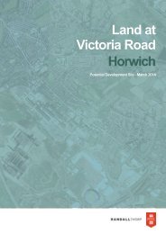
5.23 The site comprises <strong>Horwich</strong> Golf Club, which is located <strong>of</strong>f Victoria Road, <strong>Horwich</strong>. A site location<br />
plan is appended at EP6. The site is currently designated as Protected Open Land on the adopted<br />
Proposals Map. <strong>Horwich</strong> Golf Club was not specifically promoted to the Publication consultation<br />
although Peel did confirm that they controlled sites designed as Protected Open Land and Green<br />
Belt. Therefore the Council has been aware <strong>of</strong> this source <strong>of</strong> land. However the site is put forward<br />
now for the same reasons we have put forward for the Chequerbent site.<br />
5.24 A vision document has been prepared by Randall Thorp with contributions from Emery Planning<br />
and i-Transport setting out an appraisal <strong>of</strong> site constraints and opportunities, with a conceptual<br />
masterplan outlining a potential broad form <strong>of</strong> <strong>development</strong>. This is appended at EP7. This<br />
demonstrates that the site has the potential to deliver approximately 240 new homes at an<br />
average net density <strong>of</strong> 30 dwellings per hectare. The vision document demonstrates that there is a<br />
developable option for addressing the housing supply shortfall.<br />
5.25 The site comprises an existing golf club in a highly sustainable location. It is surrounded by residential<br />
<strong>development</strong> on three sides and represents a logical rounding <strong>of</strong>f <strong>of</strong> <strong>Horwich</strong>. We consider that it<br />
would comprise a sustainable urban extension <strong>of</strong> <strong>Horwich</strong> for residential or mixed use <strong>development</strong>.<br />
5.26 The site has easy access to a range <strong>of</strong> destinations including Bolton to the east, Greater<br />
Manchester, Chorley, Preston, the East Lancashire towns and to the west towards Wigan and the<br />
M6. Thus the site is therefore accessible to a range <strong>of</strong> larger destinations but is also close to <strong>Horwich</strong><br />
town centre where there is a range <strong>of</strong> local facilities and services within walking distance. The site<br />
benefits from easy and close connections to the strategic road network but is also close to <strong>Horwich</strong><br />
Parkway railway station, which provides direct services to Bolton, Salford, Manchester, Chorley and<br />
Preston. The site is also close to a range <strong>of</strong> bus services in <strong>Horwich</strong>. Thus the site has excellent<br />
transport connectivity to the main highway and public transport networks, with a range <strong>of</strong> local<br />
and regional destinations within easy reach.<br />
7
Matter 8: Additional site allocations<br />
Peel Holdings (Land and Property) Ltd<br />
March 2014<br />
5.27 The site is owned by Peel and is developable. It is currently a 9-hole golf course. It has no known<br />
insurmountable constraints. Highways and access matters have been considered by I-Transport<br />
consultants, and their findings are set out in the vision document. It is anticipated that the site<br />
could be developed over a 5-7 year build period following grant <strong>of</strong> planning permission.<br />
5.28 The proposed <strong>development</strong> <strong>of</strong> the land is viable and has been subject to internal <strong>development</strong><br />
appraisal by Peel. <strong>Horwich</strong> is an attractive housing market with high levels <strong>of</strong> market demand.<br />
There are no known significant cost factors that would prohibit or delay <strong>development</strong>, subject to<br />
planning permission being granted.<br />
5.29 In conclusion, the site represents a suitable, deliverable option for addressing the housing supply<br />
shortfall.<br />
6. Question 4<br />
What would be the practical and procedural implications?<br />
6.30 The Allocations Plan would need to be amended, resulting in the need for further site assessment<br />
work and additional public consultation and Sustainability Appraisal. However in our view the<br />
changes are required in order to make the plan sound. Alternatively the Inspector could direct the<br />
council to withdraw the Allocations Plan and prepare a comprehensive Local Plan including a<br />
review <strong>of</strong> the Core Strategy immediately.<br />
7. Appendices<br />
EP1. Site location plan - Land south east <strong>of</strong> Junction 4, <strong>M61</strong><br />
EP2. Letter from Harworth Estates<br />
EP3. <strong>Proposed</strong> amendment to Green Belt boundary at Cutacre<br />
EP4. Site location plan - Land to the south <strong>of</strong> Chequerbent, <strong>Westhoughton</strong><br />
EP5. Vision document - Land to the south <strong>of</strong> Chequerbent, <strong>Westhoughton</strong><br />
EP6. Site location plan - <strong>Horwich</strong> Golf Club<br />
EP7. Vision document - <strong>Horwich</strong> Golf Club<br />
8
EP1
Drain<br />
A 6<br />
Drain<br />
16<br />
Moss Hall<br />
Drain<br />
Drain<br />
Drain<br />
1<br />
Moss Hall Farm<br />
Farm Cottages<br />
Track<br />
118.8m<br />
A 6<br />
Pond<br />
WATERGATE<br />
DRIVE<br />
A 6<br />
421<br />
PH<br />
119.5m<br />
SALFORD ROAD<br />
WATERGATE LANE<br />
Path (um)<br />
Subway<br />
Path<br />
BACK LANE<br />
Cutacre Brook<br />
117.0m<br />
SALFORD ROAD<br />
Drain<br />
Bewshill's Farm<br />
ETL<br />
BACK LANE<br />
Drain<br />
115.6m<br />
Pond<br />
601<br />
Pond<br />
607<br />
Drain<br />
Drain<br />
Drain<br />
113.4m<br />
Cutacre<br />
Gas Gov<br />
Brook<br />
SALFORD ROAD<br />
South East <strong>of</strong> J4 <strong>M61</strong><br />
22.48 acres, 9.10 ha<br />
WB<br />
112.2m<br />
651<br />
Scale: 1:2500<br />
@ A3<br />
Date: 27:01:12<br />
113.7mThis material has been reproduced from<br />
Ordnance Survey digital map data with<br />
the permission <strong>of</strong> the Controller <strong>of</strong><br />
Her Majesty's Stationary Office.<br />
© Crown copyright.<br />
Licence Number 100018033<br />
Ref: AH / RK<br />
Def<br />
659<br />
650<br />
Drain<br />
63
EP2
EP3
<strong>Proposed</strong> Green Belt Boundary<br />
<strong>Proposed</strong> Green Belt Boundary<br />
BDS: RK/ <strong>Proposed</strong> Greenbelt Boundary<br />
This material has been reproduced from<br />
Ordnance Survey digital map data with<br />
the permission <strong>of</strong> the Controller <strong>of</strong><br />
Her Majesty's Stationary Office.<br />
© Crown copyright.<br />
Licence Number 100018033<br />
Ref: RP/ RK<br />
Date: 20:03:14 Scale: 1:10000<br />
@ A3
EP4
EP6