Proposed Housing Development of Horwich Golf Club.
Peel Holdings produced this plan in 2012 having required the land. It still has to go to planning for approval which may be within the next 5 years.
Peel Holdings produced this plan in 2012 having required the land. It still has to go to planning for approval which may be within the next 5 years.

Create successful ePaper yourself
Turn your PDF publications into a flip-book with our unique Google optimized e-Paper software.
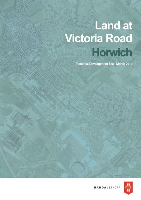
Land at<br />
Victoria Road<br />
<strong>Horwich</strong><br />
Potential <strong>Development</strong> Site - March 2014
Peel Holdings (Land & Property) Ltd<br />
Peel Dome<br />
The Trafford Centre<br />
Manchester<br />
M17 8PL<br />
THE TEAM<br />
Planning<br />
Emery Planning Partnership<br />
South Park Court<br />
Macclesfield<br />
SK11 8BS<br />
Masterplanning<br />
Randall Thorp<br />
Canada House<br />
3 Chepstow Street<br />
Manchester<br />
M1 5FW<br />
Highways &<br />
Transportation<br />
i-Transport LLP<br />
Centurion House<br />
129 Deansgate<br />
Manchester<br />
M3 3WR<br />
© Crown copyright, All rights reserved. 2012 Licence number 100018033
CONTENTS<br />
INTRODUCTION 1<br />
STRATEGIC LOCATION 3<br />
SITE AND SURROUNDINGS 5<br />
PLANNING POLICY 7<br />
SUSTAINABILITY ASSESSMENT 9<br />
OPPORTUNITIES AND CONSTRAINTS 11<br />
DEVELOPMENT CONCEPT 13<br />
DELIVERY 15
INTRODUCTION<br />
Additional land is required to be identified to meet the<br />
objectively assessed housing needs <strong>of</strong> Bolton.<br />
Land <strong>of</strong>f Victoria Road, <strong>Horwich</strong> is an opportunity to help<br />
meet these needs. <strong>Development</strong> <strong>of</strong> the site as an urban<br />
extension would enable planned growth to the south east <strong>of</strong><br />
<strong>Horwich</strong>.<br />
Following a site appraisal it is considered that the land<br />
represents a logical and sustainable location that is suitable<br />
and achievable for development.<br />
The site is largely owned by Peel Investments (North) Ltd<br />
(‘Peel’) a subsidiary <strong>of</strong> Peel Holdings (Land and Property)<br />
Ltd, which has a track record in bringing forward major<br />
development sites. Part <strong>of</strong> the area is in other ownerships<br />
however it has been considered appropriate to define a<br />
logical planning boundary for the purposes <strong>of</strong> this exercise.<br />
Peel commissioned a pr<strong>of</strong>essional team comprised <strong>of</strong> Randall<br />
Thorp, Emery Planning and I-Transport to prepare this<br />
document.<br />
The document is to inform the progression <strong>of</strong> the Bolton<br />
Local Plan.<br />
1
© 2014 Google
KEY<br />
Waterways<br />
Railways<br />
Railway station<br />
Settlement<br />
Arterial road<br />
Urban area<br />
Site<br />
3
STRATEGIC LOCATION<br />
<strong>Horwich</strong> lies to the north-western part <strong>of</strong> Bolton Borough,<br />
approximately half-way between Bolton and Chorley. The<br />
site is c.2.0km (as the crow flies) from Junction 6 <strong>of</strong> M61<br />
motorway, with the motorway providing connections to<br />
M60 to the south east and M6 to the north.<br />
The site has easy access to a range <strong>of</strong> destinations including<br />
Bolton to the east, Greater Manchester, Chorley, Preston,<br />
the East Lancashire towns and to the west towards Wigan<br />
and the M6.<br />
Thus the site is therefore accessible to a range <strong>of</strong> larger<br />
destinations but is also close to <strong>Horwich</strong> town centre and<br />
Middlebrook where there is a range <strong>of</strong> local facilities and<br />
services within walking distance.<br />
The site benefits from easy and close connections to the<br />
strategic road network but is also close to <strong>Horwich</strong> Parkway<br />
railway station, which provides direct services to Bolton,<br />
Salford, Manchester, Chorley and Preston. The site is also<br />
close to a range <strong>of</strong> bus services in <strong>Horwich</strong>. Thus the site<br />
has excellent transport connectivity to the main highway and<br />
public transport networks, with a range <strong>of</strong> local and regional<br />
destinations within easy reach.<br />
4
HORWICH<br />
Chorley Old Road<br />
Mayfair<br />
Knowles<br />
Farm<br />
Bond Close<br />
Site<br />
Victoria Road<br />
Chorley New Road<br />
<strong>Horwich</strong><br />
College<br />
Nellie’s<br />
Clough<br />
Asda<br />
MIDDLEBROOK<br />
Bolton<br />
Wanderers FC<br />
Tesco<br />
DeHavilland Way<br />
<strong>Horwich</strong> Parkway<br />
Train Station<br />
J6 M61<br />
© 2014 Google<br />
5
SITE AND SURROUNDINGS<br />
SITE LOCATION<br />
The proposed development site is located on land<br />
currently used by <strong>Horwich</strong> <strong>Golf</strong> <strong>Club</strong>. It covers an area <strong>of</strong><br />
approximately 16 hectares (40 acres).<br />
The immediate context <strong>of</strong> the site is characterised by the<br />
following land uses:<br />
• To the north is Lever Park School and existing housing<br />
<strong>of</strong>f Kensington Drive.<br />
• To the east is agricultural fields associated with<br />
Knowles Farm and existing housing <strong>of</strong>f Gloucester<br />
Avenue / Brunswick Avenue and Sandringham Road /<br />
Buckingham Avenue.<br />
• To the south is the <strong>Horwich</strong> Centre (a campus <strong>of</strong><br />
Bolton College) and St. Mary’s R.C. Primary School.<br />
• To the west is existing housing <strong>of</strong>f Bond Close / Fairways<br />
and along Victoria Road.<br />
SITE DESCRIPTION<br />
The site is broadly rectangular and is situated to the south<br />
east <strong>of</strong> <strong>Horwich</strong> town centre. Open agricultural fields form<br />
the boundary <strong>of</strong> the site to the east whilst existing urban<br />
development bounds the site on all other sites.<br />
The site is currently used as a 9 hole golf course. The north<br />
eastern corner <strong>of</strong> the site is agricultural land used for grazing.<br />
Three lengths <strong>of</strong> public right <strong>of</strong> way run within the site,<br />
following the north, west and south eastern boundaries.<br />
The topography <strong>of</strong> the site broadly falls from east to west,<br />
with the lowest land being located along Victoria Road.<br />
Within the site there are steeply sloping areas, mainly in the<br />
south eastern part <strong>of</strong> the site. Nellie’s Clough runs along the<br />
south eastern boundary <strong>of</strong> the site in a small wooded valley.<br />
There are areas <strong>of</strong> tree cover along Nellie’s Brook, along<br />
the southern site boundaries and in the western corner <strong>of</strong><br />
the site. A wedge <strong>of</strong> woodland extends into the centre <strong>of</strong><br />
the site from the southern boundary, with smaller areas<br />
<strong>of</strong> woodland alongside an existing ditch line. There are<br />
also smaller areas <strong>of</strong> woodland and individual tree planting<br />
associated with the layout <strong>of</strong> the golf course greens.<br />
A small reservoir is located in the southern corner <strong>of</strong> the site<br />
and a network <strong>of</strong> ditches broadly follows the east to west<br />
sloping topography.<br />
6
PLANNING<br />
POLICY<br />
The proposed development seeks to meet national and local planning policy.<br />
NATIONAL PLANNING POLICY<br />
The National Planning Policy Framework (NPPF)<br />
was published on the 27 March 2012. It sets out the<br />
Government’s planning policies in a single document, is a<br />
material consideration in all planning decisions.<br />
At the heart <strong>of</strong> the NPPF is a presumption in favour <strong>of</strong><br />
sustainable development, which should be seen as a golden<br />
thread running through both plan making and decisiontaking.<br />
Local planning authorities should positively seek<br />
opportunities to meet the development needs <strong>of</strong> their<br />
area and approve development that accords with the<br />
development plan without delay.<br />
The NPPF requires local authorities to significantly boost<br />
the supply <strong>of</strong> housing, and widen the choice <strong>of</strong> high quality<br />
homes, by identifying a sufficient supply <strong>of</strong> deliverable sites<br />
and considering housing applications in the context <strong>of</strong> the<br />
presumption in favour <strong>of</strong> sustainable development.<br />
DEVELOPMENT PLAN GUIDANCE<br />
The development plan comprises the Bolton Core Strategy<br />
and saved policies <strong>of</strong> the Bolton Unitary <strong>Development</strong> Plan<br />
(UDP). The site is currently designated as Protected Open<br />
Land on the adopted proposals map.<br />
The Council is currently in the process <strong>of</strong> preparing an<br />
Allocations Plan to allocate specific sites for development.<br />
This has reached Examination stage. Additional sites are<br />
required to provide an adequate and deliverable supply <strong>of</strong><br />
housing land. One <strong>of</strong> the options for addressing the shortfall<br />
would involve Protected Open Land, so the land <strong>of</strong>f Victoria<br />
Road opportunity should be considered for release.<br />
The additional land could help Bolton meet the objectively<br />
assessed needs <strong>of</strong> the housing market area and provide an<br />
adequate supply <strong>of</strong> housing both for the next 5 years and<br />
also the plan period.<br />
The site is an existing golf club in a highly sustainable location.<br />
It is surrounded by residential development on three sides<br />
and represents a logical rounding <strong>of</strong>f <strong>of</strong> <strong>Horwich</strong>. The site<br />
represents a suitable, deliverable option for addressing the<br />
housing land supply shortfall.<br />
7
SUSTAINABILITY<br />
APPRAISAL<br />
The land <strong>of</strong>f Victoria Road can play an important role in supporting and facilitating sustainable and<br />
inclusive communities.<br />
PUBLIC TRANSPORT CONNECTIVITY<br />
Public transport connections are available by train and bus.<br />
There are train services at <strong>Horwich</strong> Parkway station, c.2km<br />
from the site. Direct services provided from the station<br />
include to Bolton, Salford, Manchester, Chorley and Preston.<br />
<strong>Horwich</strong> Parkway also has a large and popular Park and Ride<br />
facility.<br />
As well as the linkages available from <strong>Horwich</strong> Parkway,<br />
there are several bus services that run close to the site along<br />
Victoria Road, Chorley New Road and Church Street.<br />
High frequency bus connections are available from the site<br />
with bus services to <strong>Horwich</strong> town centre and Bolton,<br />
including the bus station and Bolton interchange.<br />
WALKING AND CYCLING<br />
The site is within easy walking distance <strong>of</strong> retail, leisure and<br />
employment at <strong>Horwich</strong> town centre and Middlebrook. All<br />
routes to the town centre have footways and are generally<br />
<strong>of</strong> good quality, suitable for walking.<br />
There are public footpaths that run around the edges <strong>of</strong> the<br />
site and these will be retained within the scheme.<br />
Victoria Road is an on-road cycle route and there are onward<br />
linkages along other routes to <strong>Horwich</strong> town centre.<br />
There are cycle routes towards Bolton along Chorley New<br />
Road and Chorley Old Road.<br />
ACCESSIBILITY TO FACILITIES AND<br />
SERVICES<br />
EDUCATION<br />
There are several primary schools within the vicinity <strong>of</strong> the<br />
site including:<br />
• St Mary’s RC Primary on Victoria Road, close to the site<br />
entrance.<br />
• Chorley New Road Primary School on Chorley New<br />
Road opposite Victoria Road.<br />
• <strong>Horwich</strong> Parish C<strong>of</strong>E Primary.<br />
• Claypool Primary.<br />
• Lord Street Community Primary School.<br />
• St Catherine’s C<strong>of</strong>E Primary School.<br />
These schools are all within easy walking distance <strong>of</strong> the site.<br />
There are two secondary schools in <strong>Horwich</strong>; St Joseph’s<br />
RC High School at Chorley New Road, c.1km from the site;<br />
and Rivington and Blackrod High School at Rivington Lane,<br />
c.3km to the north <strong>of</strong> the site. Regular bus services run<br />
close to the latter school and there are school buses along<br />
Chorley New Road.<br />
HEALTHCARE<br />
The nearest GP surgery to the site is the Kildonan House<br />
Group surgery on Ramsbottom Road, c.800km from<br />
the site. There is also a pharmacy at the surgery and an<br />
additional pharmacy nearby. These are within easy walking<br />
distance <strong>of</strong> the site.<br />
There are two other GP surgeries in <strong>Horwich</strong> town centre<br />
and pharmacies and a dentist in the town centre. There are<br />
also dentists on Chorley New Road and Victoria Road.<br />
RETAIL AND LEISURE<br />
There are local shops close to the site on Chorley New<br />
Road and <strong>Horwich</strong> town centre, which has a range <strong>of</strong><br />
shopping facilities including a Post Office, is within walking<br />
distance <strong>of</strong> the site.<br />
There are large Tesco and ASDA supermarkets at<br />
Middlebrook as well as a comprehensive range <strong>of</strong> other<br />
non-food retail outlets. These shopping facilities are within<br />
walking distance <strong>of</strong> the site. Higher-order retail facilities are<br />
available at Bolton and, further afield, Manchester and can be<br />
accessed by public transport.<br />
<strong>Horwich</strong> town centre has a library and <strong>Horwich</strong> Leisure<br />
Centre is close to the site. There are various other parks and<br />
leisure facilities in the area including at Middlebrook.<br />
EMPLOYMENT<br />
<strong>Horwich</strong> <strong>of</strong>fers a range <strong>of</strong> employment opportunities and<br />
there are nearby large employment areas at Middlebrook<br />
and Lostock Industrial Estate to the south <strong>of</strong> the site.<br />
Employment is also available within the nearby larger towns<br />
and cities which can be accessed by train and/or bus.<br />
9
KEY<br />
PRIMARY SCHOOLS<br />
1 St Mary’s RC Primary School<br />
2 Chorley new Road Primary School<br />
3 <strong>Horwich</strong> Parish C<strong>of</strong>E Primary School<br />
4 Claypool Primary School<br />
5 St Catherine’s C<strong>of</strong>E Primary School<br />
6 Lord Street Community Primary School<br />
SECONDARY SCHOOLS &<br />
COLLEGES<br />
1 St Joseph’s RC High School & Sports College<br />
2 Lever Park School (Specialist School)<br />
3 Rivington & Blackrod High School &<br />
Technology College<br />
1<br />
2<br />
PUBLIC TRANSPORT<br />
<strong>Horwich</strong> Parkway Railway Station<br />
Blackrod Railway Station<br />
HEALTH<br />
GP’S<br />
1<br />
RETAIL<br />
Middlebrook Retail Park<br />
1 Bolton Community Practice CIC - The Market 2 Tesco Extra<br />
2<br />
3<br />
1<br />
2<br />
3<br />
1<br />
2<br />
3<br />
1<br />
2<br />
3<br />
4<br />
5<br />
6<br />
Surgery<br />
Pike View Medical Centre<br />
Kildonan House Group Surgery<br />
DENTISTS<br />
<strong>Horwich</strong> Dental Practice<br />
The Smile Clinic (<strong>Horwich</strong>)<br />
Highton & Bate<br />
PHARMACIES<br />
Hootons Pharmacy<br />
Rowlands Pharmacy (x2)<br />
Kildonan Pharmacy<br />
LEISURE<br />
<strong>Horwich</strong> Library<br />
Reebok stadium (Bolton Wanderers FC)<br />
<strong>Horwich</strong> Leisure Centre<br />
Old Station & Park Sports Pitches<br />
<strong>Horwich</strong> Cricket <strong>Club</strong><br />
Bolton <strong>Golf</strong> Course<br />
3<br />
4<br />
5<br />
6<br />
7<br />
8<br />
9<br />
1<br />
2<br />
3<br />
4<br />
5<br />
Aldi<br />
<strong>Horwich</strong> Town Centre - Lee Lane<br />
Local Shops Along Chorley New Road<br />
Winter Hey Post Office<br />
Chorley New Road Post Office<br />
Asda<br />
Sainsburys<br />
EMPLOYMENT<br />
<strong>Horwich</strong> Town Centre<br />
Middlebrook Retail Park<br />
Lostock Industrial Estate<br />
<strong>Horwich</strong> Loco Industrial Estate<br />
Paragon Business Park<br />
CATCHMENTS<br />
1 km Walking Catchment<br />
2 km Walking Catchment<br />
10
CONSTRAINTS AND<br />
OPPORTUNITIES<br />
There are no constraints preventing the allocation or future development <strong>of</strong> land <strong>of</strong>f Victoria Road<br />
The site is well contained by existing development and<br />
existing landscape features. The site is largely unconstrained<br />
and provides an opportunity to create a sustainable urban<br />
extension to <strong>Horwich</strong>. An appropriate masterplan for the<br />
site should take into account the following:<br />
ACCESS<br />
There are a number <strong>of</strong> logical and feasible site access options<br />
and combinations. There is potential to accommodate<br />
vehicular access into the site at the following locations:<br />
• Bond Close<br />
• Mayfair<br />
• Sandringham Road<br />
• Victoria Road<br />
PUBLIC RIGHTS OF WAY<br />
The existing public rights <strong>of</strong> way which pass through<br />
the site should be sensitively accommodated within the<br />
development. Care should be taken to retain the routes<br />
on their current alignment and to incorporate them into a<br />
strong landscape framework.<br />
TOPOGRAPHY<br />
The topography <strong>of</strong> the site broadly falls from east to west,<br />
from approximately 184m AOD around the Mayfair access<br />
point to 148m AOD at the Victoria Road access point.<br />
<strong>Development</strong> would sensitively work with the existing<br />
landform and internal roads could be constructed to<br />
acceptable gradients.<br />
HYDROLOGY<br />
The existing small reservoir, Nellie’s Brook and ditches<br />
across the site should be sensitively accommodated within<br />
the development. The open space around the reservoir and<br />
existing ditch lines should be designed to become attractive<br />
visual features and to provide maximum ecological value.<br />
ECOLOGY<br />
The protection and enhancement <strong>of</strong> green spaces across the<br />
site is important in order to conserve natural assets, protect<br />
local distinctiveness and minimise habitat fragmentation.<br />
The development provides opportunities to enhance<br />
pedestrian movement across the site, promoting<br />
connectivity to the wider area.<br />
LANDSCAPE<br />
There is a strong network <strong>of</strong> mature trees across the site.<br />
Where possible these should be retained and incorporated<br />
into a well-connected green space network.<br />
The development provides the opportunity to create new<br />
areas <strong>of</strong> public open space which can meet the recreational<br />
needs <strong>of</strong> existing and future local residents.<br />
The development should create an appropriate interface<br />
between the development and the nearby open countryside<br />
and the eastern edge <strong>of</strong> the site could become a defensible<br />
boundary.<br />
11
Mayfair<br />
Knowles<br />
Farm<br />
Bond Close<br />
Victoria Road<br />
Reservoir<br />
Nellie’s Clough<br />
Sandringham Road<br />
Chorley New Road<br />
© 2014 Google<br />
KEY<br />
Site boundary<br />
Existing trees/woodland<br />
Existing public right <strong>of</strong> way<br />
Existing waterbodies<br />
Greenbelt<br />
Contours at 2m<br />
Existing ditches<br />
Potential access points<br />
Defensible green boundary<br />
12
DEVELOPMENT<br />
CONCEPT<br />
The development has the potential to deliver approximately 240 new<br />
homes at an average density <strong>of</strong> 30 dwellings per net hectare.<br />
A Conceptual Masterplan has been prepared for the site to<br />
demonstrate how the design and form <strong>of</strong> development can<br />
respond sensitively to the characteristics <strong>of</strong> the site and the<br />
wider area. It is intended that the scheme will be further<br />
developed in consultation with key stakeholders.<br />
ACCESS<br />
The site has several potential connections to the local<br />
highway network:<br />
• Bond Close connects with the western side <strong>of</strong> the<br />
site; it is a typical residential street and leads to Stocks<br />
Park Drive. Access would be formed by extending the<br />
existing cul-de-sac into the site.<br />
• Mayfair connects with the northern end <strong>of</strong> the site and<br />
is again a typical residential street, connecting with The<br />
Strand and then Stocks Park Drive. The existing cul-desac<br />
would be extended into the site.<br />
• Victoria Road - the existing access could be retained for<br />
vehicle use.<br />
• Sandringham Road - access from this point would cross<br />
Nellie’s Brook and require a sensitively designed bridge.<br />
Access to the site would be agreed through consultation<br />
with the local roads authority and detailed through any future<br />
transport assessment.<br />
LANDSCAPE FRAMEWORK<br />
The conceptual layout is shaped by the existing landscape<br />
features. The woodland, individual trees and waterbodies<br />
would be retained to create a unique sense <strong>of</strong> place and<br />
add instant maturity. The development would work with the<br />
topography <strong>of</strong> the site, allowing existing levels to influence<br />
the layout.<br />
The existing PRoW’s would be retained within generous<br />
greenways and attractive new connections will be created<br />
through the green spaces.<br />
A landscape buffer would be provided along the eastern site<br />
boundary to create a strong defensible edge to the site.<br />
URBAN FORM<br />
Secure development blocks would be created where the<br />
housing is orientated to maximise views over woodland,<br />
green spaces and internal open spaces - providing natural<br />
surveillance and an attractive outlook for residents. The<br />
size and shape <strong>of</strong> these blocks are dictated by the existing<br />
landscape features.<br />
A comprehensive network <strong>of</strong> green pedestrian links<br />
throughout the development would provide easy<br />
connections to public transport and local facilities, reducing<br />
the need for private car journeys.<br />
MOVEMENT AND STREETS<br />
The emphasis throughout much <strong>of</strong> the development<br />
would be on prioritising non-vehicular movements and on<br />
the social use <strong>of</strong> spaces. For this reason, streets would be<br />
designed more generally to restrain speeds using methods<br />
such as appropriate carriageway narrowing, reduced forward<br />
visibility and the materiality <strong>of</strong> street surfaces.<br />
13
Mayfair<br />
Knowles<br />
Farm<br />
Bond<br />
Close<br />
Victoria Road<br />
Nellie’s Clough<br />
Sandringham Road<br />
© Crown copyright, All rights reserved. 2014 Licence number 100018033<br />
KEY<br />
Site boundary<br />
Residential<br />
Existing trees/woodland<br />
New woodland/trees<br />
Open landscape<br />
<strong>Proposed</strong> spine road<br />
Potential access across Nellie’s Brook<br />
Existing public right <strong>of</strong> way<br />
Existing waterbodies<br />
New footpath<br />
14
DELIVERY<br />
The site is achievable, suitable and available in accordance with the principles <strong>of</strong> the NPPF<br />
The site is presently greenfield land. It is located in a stable<br />
and successful market area. The sensitive development<br />
<strong>of</strong> the site would create a highly attractive residential<br />
community that could be brought forward from early within<br />
the plan period, with phased development sustained over a<br />
number <strong>of</strong> years.<br />
It is anticipated that the site would be developed by a housebuilder<br />
at a rate <strong>of</strong> circa 30 dwellings per annum, alongside<br />
a Registered Provider delivering affordable homes. The<br />
development would take 5-7 years to complete, and could<br />
be commenced in 2015 / 16.<br />
15