Collaborative Strategies for Detecting and Avoiding Water-resource ...
Collaborative Strategies for Detecting and Avoiding Water-resource ...
Collaborative Strategies for Detecting and Avoiding Water-resource ...
You also want an ePaper? Increase the reach of your titles
YUMPU automatically turns print PDFs into web optimized ePapers that Google loves.
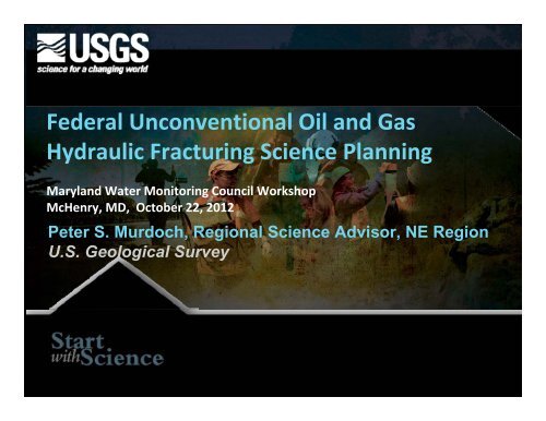
Federal Unconventional Oil <strong>and</strong> GasHydraulic Fracturing Science PlanningMaryl<strong>and</strong> <strong>Water</strong> Monitoring Council WorkshopMcHenry, MD, October 22, 2012Peter S. Murdoch, Regional Science Advisor, NE RegionU.S. Geological Survey
<strong>Collaborative</strong> strategies <strong>for</strong> detecting <strong>and</strong>avoiding water‐<strong>resource</strong> disturbance fromshale gas developmentMaryl<strong>and</strong> <strong>Water</strong> Monitoring Council WorkshopMcHenry, MD, October 22, 2012Peter S. Murdoch, Regional Science Advisor, NE RegionU.S. Geological Survey
Comprehensive Science Plan For theAppalachian Basin Region• Goal: Facilitate a joint Federal, State,Academic, <strong>and</strong> Industry approach toevaluate current <strong>and</strong> potentialenvironmental effects of shale gasproduction in the Marcellus <strong>and</strong> UticaShale Plays.• Our Intent: To recommend acollaborative science strategy thatidentifies the essential conditionassessments, research, <strong>and</strong> monitoring<strong>for</strong> addressing potential environmentalimpacts of shale‐gas development, <strong>and</strong>ways to minimize that impact
Agency Representatives• EPA• DOE• DOI• ACE• USDA
Science Objective: Response toSocietal Questions• Will shale gas development degrade our rivers,lakes, wetl<strong>and</strong>s, <strong>and</strong> groundwater?• Will shale-gas development or associatedwaste disposal cause earthquakes?• Will gas development degrade indoor oroutdoor air quality?• How will development alter the l<strong>and</strong>scape,wildlife habitat, <strong>and</strong> rural communities?• How likely are the risks?• Are there ways to develop shale gas withoutthese risks? Where are we most vulnerable?
The Plan: Focus on Key ScienceQuestions• 9 Key Thematic Science Issues–– The Hydrogeologic Framework– <strong>Water</strong> availability (how much, where)– <strong>Water</strong> quality– Induced Seismicity– Air quality (gas source <strong>and</strong> occurrence)– L<strong>and</strong>scape integrity– Biological <strong>resource</strong>s (plant <strong>and</strong> animal)– Human Health– Ecosystem Services
Appalachian Basin Science PlanPurpose & Scope• Chapters to address each Key Science Issue:• Background• Science questions <strong>and</strong> associated research orassessment strategies• New Data <strong>and</strong> Research Requirements• Anticipated work products <strong>and</strong> decision‐support tools• Anticipate, Detect, <strong>and</strong> Mitigate Degradation ofnatural <strong>resource</strong>s
Effect on <strong>Water</strong> AvailabilitySurface water <strong>and</strong> groundwater withdrawals <strong>for</strong>Shale-gas extraction activities may have animpact on human <strong>and</strong> ecological needs.Design:•Compilation of water‐use in<strong>for</strong>mation•Apply <strong>Water</strong> Use models: <strong>Water</strong> AnalysisScreening Tool (WAST) <strong>for</strong>describing/predicting water use•Assess <strong>and</strong> redesign the SW <strong>and</strong> GWnetworks in the Appalachian Basin•Build dataset of ecological flow needs•Adjust <strong>for</strong> climate change estimates• Wetl<strong>and</strong>sPhoto Courtesy of Susquehanna River BasinCommission
Effects on <strong>Water</strong> QualityProblem: Shale-gas development may result inwater quality degradation through introduction<strong>and</strong>/or release of :• Brines from produced waters• Naturally occurring radionuclidematerials (NORM)• Stray gas (methane)• Organic Constituents in flowbackwaters• Sediment from l<strong>and</strong>scapedisturbance*Each treated as a separate issue inplan
Effects of Flowback <strong>Water</strong>sIn each Assessment Area-– Map flowback quality from existing data– Establish an isotope signature “Library”(Marcellus, Utica, Shallow lenses)– Fill gaps in spatial database, Define the 7proposed assessment areas.– Identify organic compounds in each alreadydeveloping assessment area. Characterize bydepth.
Unconventional Oil & GasExtraction Impacts On theL<strong>and</strong>scapeHighest visibility:• Drinking water contamination• Roads <strong>and</strong> pad erosion• Induced Seismicity• L<strong>and</strong>scape Fragmentation/Disruption• Ecological Flows• <strong>Water</strong> Availability• Geomorphology <strong>and</strong> sediment issues• Disinfection byproducts/flowback treatment
Leveraging Ongoing Work: The EPA plan <strong>for</strong>studying Hydraulic Fracturing Impacts onDrinking <strong>Water</strong> SuppliesPlan <strong>for</strong> Monitoring be<strong>for</strong>e,during, <strong>and</strong> after drillingDeveloping a waterqualitybaseline <strong>for</strong> abroad sweep ofparametersStarting study sites:Range Resources, Inc.drilling well nearPittsburgh airport.
A Varied <strong>and</strong> Complex Province• Structure varies watershed towatershed• Multiple sources of “stray” gas• Ecosystem resilience thresholds vary• Ab<strong>and</strong>oned wells, current uses, etcBoth vertically <strong>and</strong> horizontally variable
Example: Defining the True BaselineArea shown in JacobiArea shown inStone <strong>and</strong> WebsterFault Map in the New York Shale GasEnvironmental Impact Statement
119Nitrogen in (Mg/L7531Indicator Stations , Susquehanna River Basin
Putting Fixed Sites in a Regional ContextMedian summer nitrogen concentrations from indicator fixed sitesare shown where they intersect the study-unit distribution.
Science Challenges• Appalachian Hydro-Geology iscomplex <strong>and</strong> poorly understood• Natural system masked by historic<strong>and</strong> current development• Reference conditions poorly defined• Studies in a few watersheds will notprovide the scope of in<strong>for</strong>mationneeded <strong>for</strong> the region.Unconventional Oil <strong>and</strong> Gasdevelopment requiresunconventional scientificassessment methods
Assessment Strategy1) Describe baseline conditions: Hydrogeologic, geochemical, l<strong>and</strong>scape,<strong>and</strong> biological <strong>and</strong> ecological characteristics2) Determine the geochemical signatures: Geochemical characteristics<strong>and</strong> volume of waste products including drill cuttings <strong>and</strong> flowback3) Determine Current Development Effects: Distribution <strong>and</strong> flowpaths offreshwater, saltwater, <strong>and</strong> gas above the Marcellus; induced seismicity;l<strong>and</strong>scape changes4) Underst<strong>and</strong> potential contaminant sources <strong>and</strong> pathways: includingsurface spills, waste disposal, poorly sealed wells, ab<strong>and</strong>oned wells,natural fractures, <strong>and</strong> induced fractures5) Underst<strong>and</strong>, map, <strong>and</strong> track the risks: air <strong>and</strong> water quality, inducedseismicity, associated health risks, habitat, monitoringLeverage, share, <strong>and</strong> collaborate
What is the stratigraphic <strong>and</strong> lithologic framework,<strong>and</strong> how does it affect hydrocarbon occurrence,migration, <strong>and</strong> the potential contamination offreshwater aquifers?Recommendations:– Assessment of existing data <strong>and</strong> gaps– Characterize first 1000 ft- through salt/fresh interface– Characterize heads, permeability above the Marcellus <strong>and</strong>Utica shales (3000-5000 ft). (incremental profiles)– Map surface lineaments by remote sensing (lidar)– Ground truth with seismic, relation to QW
• Leverage existingdata collection sites• Leverage long-termrecords• Integratelocal/regional needs• Try to establishinter-disciplinarywatershed -scaleframes of reference
Implement the BaselineAssessmentSelect indicator measurements <strong>for</strong> defining baselineenvironmental <strong>and</strong> geologic conditions across theplay, <strong>and</strong> fingerprinting source waters.(e.g. salinity, methane, salam<strong>and</strong>ers)•Compile/Assess existing data <strong>for</strong> 1 st Indicators•Studies may be needed to define some indicators•Fill gaps with surveys where needed•Create GIS coverages of existing conditions, <strong>and</strong>recommend optimized monitoring
Assessment Strategy Continueda)Establish multipleintegrated researchwatersheds:a)Leverage existingprogramb)Represent a gradientof conditionsc)Leverage existingresearch
<strong>Water</strong>shed ApproachInputsOutputs
Assessment Strategy Continueda)Establish earlywarningmonitoring:a) Integrated datacollection acrossspatial <strong>and</strong>temporal scalesb) Pick stations <strong>and</strong>core variablesbased on researchc) Track changes inbaseline conditions
Multi-scale Integrated Observation<strong>and</strong> ResearchPercent of PopulationIndicator Concentration/ConditionDefining status <strong>and</strong> trends throughdefining the range of population changes
Upper Delaware River <strong>and</strong> Tributaries:Linked spatial <strong>and</strong> temporal observing
Conclusions• The science recommended in thisplan is not an optional luxury, butrather an opportunity <strong>for</strong> both costeffective<strong>and</strong> safe development.• Unconventional energy developmentrequires unconventional science thatintegrates from local to regionalscales, <strong>and</strong> across disciplines.• A strong foundation of research <strong>and</strong>monitoring is available to get startedif collaborations are established.
The Road Ahead• Complete draft of Federal recommendations byNovember 15• Open <strong>for</strong> review <strong>and</strong> revision by broaderpartners (States, Industry, NGOs, etc)• Begin implementation steps by Spring of 2013
Groundwater• Models have limited regional extension• Determining the pressure gradients• Mapping preferential flowpaths• Mapping shallow gas traps• Where is the gas in shallow Devonian strata?Were grouting off the freshwater aquifer <strong>and</strong> notgrouting till production zone – grouted there.Created 1000 feet of annular space not sealed.Use west-bay to assess pressure gradients abovethe marcellus, along transect N to S.
<strong>Water</strong> Quality ParametersContaminant concerns:• TDS, Cl, Br, Ba, Sr, B, As, Ra, other radionuclides…• Hydrofracking adjuvants (e.g. organic contaminants)• Suspended sediments <strong>and</strong> associated contaminants• Acid sulfate generation• Dissolved gases (e.g. methane, ethane, otherorganics)• Disinfection/treatment byproducts (e.g. Bromo<strong>for</strong>m)
Appalachian Shale-Gas Science PlanThe Basics• A regional response to the National Federal Plan• Calls <strong>for</strong> integrated study of the environmental effects ofMarcellus <strong>and</strong> Utica Shale Gasproduction• Regional Coverage is 3 River basins: Delaware, Ohio, <strong>and</strong>Susquehanna• Considers observed <strong>and</strong> potential environmental effects• Leverages multiple Federal programs – e.g.. CBP, LCCs,CO2 sequestration, Forest Inventory <strong>and</strong> Analyses (FIA),Conservation Effects Assessment Project (CEAP)• Planned partners with industry, States, NGOs, Academia
Selecting Research Topics <strong>and</strong>LocationsSelect study locations with Industry <strong>for</strong> sciencequestions that require new research to answer.Recommendations:•Leverage existing infrastructure <strong>and</strong> knowledge•Represent the 7 regions <strong>and</strong> 3 rivers (Susquehanna,Ohio, <strong>and</strong> Delaware)•Locations <strong>for</strong> combining studies within an integratingl<strong>and</strong>scape (eg a watershed)•Include locations with a range of development
<strong>Water</strong> Data Collection SolutionsUnconventional Oil <strong>and</strong> Gasdevelopment requiresunconventional assessment methods– Nested observations– Co-located research along conditiongradients (“extensive watershedapproach”)– Track trends at multiple flow regimes– Carefully integrate existing <strong>and</strong> newdata– Model based on actual data
<strong>Water</strong> Quality ScienceNeeds• Baseline WQ monitoring <strong>and</strong> assessments (streams<strong>and</strong> groundwaters)• Compilation of industry - provided data.• Source <strong>and</strong> migration studies (chemical/isotopicsignatures; tracers)• Fresh/brackish groundwater interface monitoring.
Assessment Strategya) Describe baseline conditions: Compile <strong>and</strong> integrate existing dataa) Are the data comparable in quality <strong>and</strong> measurement units?b) Are there spatial <strong>and</strong> temporal gaps that preclude regionalassessment?c) What science questions cannot be answered by existing datab) Determine key gaps in underst<strong>and</strong>ing: Compile <strong>and</strong> integrate existingknowledgea) What are the key science questions that still need answers?b) Where are those studies best done, <strong>and</strong> by what methods?
Assessment Strategya) Determine the initial Science Questions: Our “known unknowns”a) Describe baseline conditions: Compile <strong>and</strong> integrate existing dataa) Are the data comparable in quality <strong>and</strong> measurement units?b) Are there spatial <strong>and</strong> temporal gaps that preclude regionalassessment?c) What science questions cannot be answered by existing datab) Determine key gaps in underst<strong>and</strong>ing: Compile <strong>and</strong> integrate existingknowledgea) What are the key science questions that still need answers?b) Where are those studies best done, <strong>and</strong> by what methods?
Step 1:Organizing A Science FrameworkDefine a set of logical study regions that, ifdescribed, would represent the range of energydevelopment effects we might expect. Proposedcriteria:• Different geologic conditions affecting gasdevelopment <strong>and</strong> extraction• Extent of existing energy development(heavily developed, just starting, historical,non‐developed)
QW issues• increased sedimentation from l<strong>and</strong>scapedisturbances, brine wastes drawn up the wellsthat contain high concentrations of totaldissolved solids (TDS), salts, <strong>and</strong> trace elementsincluding naturally‐occurring radioactivematerials (NORMs), man‐made organiccompounds, dissolved methane, <strong>and</strong> otherinorganic constituents <strong>and</strong> organic compounds inthe solid (cuttings, muds, sludges) <strong>and</strong> liquid(flowback or produced waters) wastes.
Putting Fixed Sites in a RegionalContextPotomac River BasinIndicator SitesMuddy CreekPotomac Study UnitCumlative Distributionfrom EMAPMonocacyCatoctin Cr.S. Fork S. Br. Potomac Accotink CreekMedian summer nitrogen concentrations from indicator fixed sitesare shown where they intersect the study-unit distribution.
• L<strong>and</strong>scapechange• Gas releases• <strong>Water</strong>contamination• Earthquakes• <strong>Water</strong> Use• Pipelines• Traffic• Communitydisruption• Permanence
What is the stratigraphic <strong>and</strong> lithologic framework,<strong>and</strong> how does it affect hydrocarbon occurrence,migration, <strong>and</strong> the potential contamination offreshwater aquifers?Recommendations:– Assessment of existing data <strong>and</strong> gaps– Characterize first 1000 ft- through salt/fresh interface– Characterize heads, permeability above the Marcellus <strong>and</strong>Utica shales (3000-5000 ft). (incremental profiles)– Map surface lineaments by remote sensing (lidar)– Ground truth with seismic, relation to QW
Utica Shale Gas Allocation Units
Presidential ExecutiveOrder• Signed April 13 to coordinate Federal activities tosupport safe <strong>and</strong> responsible development ofdomestic natural gas <strong>resource</strong>s• High‐level interagency working group to promoteclose interagency coordination• Coordinate sharing of in<strong>for</strong>mation• Coordinate plans <strong>for</strong> long‐term research, <strong>resource</strong>assessment, <strong>and</strong> infrastructure development
Interagency Memor<strong>and</strong>umof Agreement• Also signed in April• Promote multi‐agency collaboration onunconventional oil <strong>and</strong> gas production amongDepartment of the Interior, Department ofEnergy, US Environmental Protection Agency• Each agency focuses on core capabilities• Steering Committee• Formal research plan <strong>and</strong> annual report
Multi‐Year National Research Plan• In early 2013, the agencies will publish a Research Plan that will:• Analyze <strong>and</strong> synthesize the state of knowledge• Identify, categorize, <strong>and</strong> prioritize research topics• Identify gaps in available data• Identify research milestones <strong>and</strong> deliverables• Describe steps to maximize stakeholder participation• Determine future plans <strong>and</strong> objectives• The agencies will seek stakeholder <strong>and</strong> public comment on adraft of the Research Plan.48
Research Plan Areas49
119Nitrogen in (Mg/L7531Indicator Stations , Susquehanna River Basin
Putting Fixed Sites in a Regional ContextMedian summer nitrogen concentrations from indicator fixed sitesare shown where they intersect the study-unit distribution.
Marcellus Shale Gas 2011 AssessmentTotal Mean = 84.2 TCFG + 3.4 BBL NGL = 103.8 TCFeUSGS Fact Sheet 2011–3092
Utica Shale Gas 2012 Assessment
New Infrastructure Growth• PA DEP approved first new power plant to useMarcellus gas – Brad<strong>for</strong>d County –Oct. 10• Marathon to build truck‐to‐barge loadingfacility at Wellsville, Ohio to take Utica Shaleliquids to Catlettsburg, KY <strong>for</strong> refining• Former Sunoco refinery in Marcus Hook, PA toprocess Marcellus Shale propane <strong>and</strong> ethane
Activities Leading to Comprehensive Plan• Federal Program Priorities <strong>and</strong> Concerns• Delaware River Basin Commission Draft Regs• Congressional Interest <strong>and</strong> Concerns• June 2010 PA Geological Survey Workshop• 50 Federal & State Participants• Form a Federal Shale Gas Working Group –Forum <strong>for</strong>Coordinating Federal Activities with States, NGOs,Industry, <strong>and</strong> Academia• USGS Authors Workshop January 9‐11, 2012• Federal Partners Workshops, June & August,2012
Appalachian Shale Comprehensive PlanKey Thematic Science Issues• Hydrogeologic Framework• <strong>Water</strong> Availability• <strong>Water</strong> Quality• Air Quality• Induced Seismicity• L<strong>and</strong>scape Changes• Biological Resources


