Download Full Catalogue - swalim
Download Full Catalogue - swalim
Download Full Catalogue - swalim

Create successful ePaper yourself
Turn your PDF publications into a flip-book with our unique Google optimized e-Paper software.
PrefaceSWALIM’s primary objective is to contribute to better decisions on the use of water andland resources in Somalia by providing reliable and up-to-date information. Our mainstakeholders are Somali administrations, UN organizations, development agencies andNGOs. The information collected and processed includes, but is not limited to:• rainfall and other climatic parameters• river levels and stream flow data• geological, topographic and soil characteristics• land cover, land use and land suitability features, and• previous studies, maps and data series on water and land resourcesTo support data collection and processing efforts, relevant observation networks havebeen and are being established.Responsible decisions, however, require processed and properly analyzed information, notjust raw data. All data are checked for quality, stored in structured data bases, technicallyanalysed, and presented to our clients in the form of tables, maps, GIS databases andreports. So far SWALIM has prepared over 35 reports with corresponding maps anddatasets.The most important characteristics of the SWALIM information management philosophyare that 1) information systems should be question oriented, 2) they should respond toclients’ needs at the appropriate scales and resolutions (national, regional and sub-regionallevel) and 3) users should be empowered with the knowledge, capacity and relevant toolsrequired to fully utilize the information generated. The above principles imply that:a.)b.)c.)The SWALIM system is designed to feed into solutions for demand drivenchallenges and questions, related, among others, to climate, state of irrigationschemes; suitability of land for crop production or animal husbandry; theamount of water in the rivers that can be utilized for irrigation; flood forecastingand management; and domestic water supply. The system gives full support torecognized decision makers without encroaching upon their authority.Small-scale decisions (e.g. what crops can be grown at a given farm) alwaysneed a site survey. While maps and databases created in SWALIM provide soundorientation at the district, regional or national levels, actual site specific decisionsrequire customized studies.Capacity building in SWALIM includes training, facilitating and workingtogether. The information management system is based on the team work ofmany individuals, institutions, NGOs and other partner organisations.The information management process covers data collection, processing and dissemination;there is not much use of databases and maps that are not accessible by potential users.Data and information are available to anyone working in related fields through differentoutlets, including the SWALIM website (www.fao<strong>swalim</strong>.org) with two online catalogues1
IntroductionThe aim of this catalogue is to provide descriptions of SWALIM information productsto enable you to identify the ones that are relevant for you. The catalogue is organizedalong the three SWALIM themes of Water Resources, Land Resources and InformationManagement. For water and land resource products, presentation reflects the threeformats used by SWALIM to package information – reports, datasets and maps. Thecatalogue consists of 13 parts:Part 1 - Water resources products include technical reports and databases on climate,irrigation, water sources, floods, potential for rainwater harvesting, flood forecasting andresponse and hydrometeorological data inventory.Part 2 - Land resources products cover technical reports and databases on landforms,soil surveys, land cover, pastoral resource assessment, land degradation, land use andland suitability.Parts 3 to 11 - Information management products cover online data catalogues, theSomalia Dynamic Atlas, SWALIM information resource centres, SWALIM website,Atlas of Somali Water and Land Resources, Atlas of the Juba and Shabelle Rivers, aerialphotographic dataset of Juba and Shabelle Rivers and informations sytems on floods andirrigation.Part 12 - Other spatial datasets and maps cover spatial datasets and maps not includedin Parts 1 to 11 or those originating from other agencies collaborating with SWALIM.Part 13 - Annexes contain additional supporting information.To find information, you should first use this catalogue to identify relevant informationresources and then use the online links (URL) provided for each product to accessinformation from our website. You will also find it useful to search our online catalogues,using appropriate keywords. In most cases, information will be available for downloadfrom the website or via the online catalogues. Where downloading is not possible, forexample because of bandwidth limitations, you can request information by sending anemail to enquiries@fao<strong>swalim</strong>.org, following which SWALIM will prepare the requestedinformation and inform you when it is ready for collection, or where possible, email itto you. Use this email address to also make enquiries, obtain clarification and requestadditional support, demonstration or training. Email enquiries sent to SWALIM are dealtwith on a daily basis, and feedback is provided within the shortest time possible.When using SWALIM products and associated data, please make sure you accuratelycite them. Technical reports and publications should be cited as directed on the reports– see first page. Where citation information is not provided, products should be cited asfollows:Somalia Water and Land Information Management (SWALIM) project (Year), Title / Name of Product.The copyright of all SWALIM products belongs to the Food and Agriculture Organization (FAO) ofthe United Nations.3ii
1.WaterResourcesProducts
1.1 Reports on Water Resourceshttp://www.fao<strong>swalim</strong>.org/theme_groups/water/water_reports_seriesThe Climate of SomaliaClimate is one of the first questions to be considered whenstarting a development or humanitarian project or planning otheractivities. This report describes the climate of Somalia using easilyunderstandable maps, charts and graphs, based on scientificanalyses of historical data extracted from SWALIM and FAOclimate databases. The report provides well structured informationon temporal and spatial characteristics of rainfall, temperature,evapotranspiration, humidity, wind patterns, water balance andlength of growing period. Although the observation gaps that existduring the period of Somalia’s recent instability are difficult to fill in, the report updatesand extends in a scientifically sound manner the still available pre-war reports onSomali climate.Somalia Rainfall Observers’ ManualThis handbook is a comprehensive guide that deals with installingand using rain gauges for rainfall data collection. Based on the WorldMeteorological Organization’s (WMO) recommended procedures,it describes the types of rain gauges commonly used in Somalia;gives tips on how to select an appropriate location/site that is freeof distorting factors; shows how to install and maintain each typeof rain gauge and ensure that the resulting catch is representativeof the rainfall area. The report gives detailed instructions on how tomake and record readings, as well as on how to complete, archiveand transmit all forms associated with the rain gauge. It is intended for use by anyoneinvolved with rainfall observation in Somalia. To promote widespread use of thismanual, excerpts of the practical sections have been translated into the Somali language.Inventory of Hydro meteorological Data for SomaliaProlonged civil strife in Somalia saw the collapse of most, if notall, of the hydrometeorological monitoring network in the country.Additionally, a centralised hydrometeorological database neverexisted. This report presents the inventory of the hydrometeorologicaldata for Somalia based on both historical data that was recovered bySWALIM as well as current data collected by SWALIM since 2002in order to build the national climate and river flow archives for thecountry. The report also includes a number of thematic climate mapsand analyses. The data is presented in a well organised format thatis easy to understand even for non-experts. It is a useful report for those interested inidentifying changes in weather conditions in Somalia over time.5
Status of Medium to Large Irrigation Schemes in Southern SomaliaAlthough irrigated agriculture was the life-line of the Somalieconomy before the start of civil strife in 1990, much of theinformation on the pre-war irrigation systems is lost and little isknown about their present status. This report documents the findingsof an assessment carried out by SWALIM to determine the statusof medium to large irrigation schemes in Southern Somalia andtheir irrigation infrastructure. Comprehensive literature review, keycontact interviews and extensive remotely sensed data analyseswere carried out to arrive at the assessment results. Baselineinformation on the water barrages, canal systems and the irrigationschemes was generated and a GIS irrigation infrastructure database was constructed.About 5,000 km of canals were identified and compared with satellite images. Theboundaries and the status of 34 medium to large irrigation schemes were identified. Thedata is well structured and accessible through desktop GIS software or through the webbased Geonetwork software. The results obtained, together with the recommendations,are expected to form the basis for the infrastructure rehabilitation efforts by the donorcommunity.SWIMS Manuals: Volumes I and IIThe Somalia Water Sources Information Management System(SWIMS) is a software application developed by SWALIM to manageinformation on the principal water sources in Somalia. Two manualswere developed to guide SWIMS software users. Volume I is the fielddata collection manual that describes the procedures to be followedin collecting data, using SWIMS standard field data collection sheets.Technicians collecting data in the field can make use of the manualto determine the attributes to measure, to calculate the precisionrequired, etc. Volume II is the software guide for experts using SWIMSto manage their water sources data. It describes the different functions of the software,data entry, data management, report generation, etc. By using SWIMS, governmentministries and partners in the water sector in Somalia contribute to the building of anational database for the water sources in the country.Rural Water Supply AssessmentThis report documents findings of an assessment carried out bySWALIM in three regions: Puntland, Somaliland, and South-CentralSomalia. The objective was to determine the situation of water supplyin the rural areas of Somalia. The main source of information for thisassessment were the Somalia Water Sources Information ManagementSystem (SWIMS) national database, reports from previous studies andinterviews with key partners in the water sector in Somalia. The reporthighlights the available water sources, technologies in use and waterquality, among other matters. Government authorities, donors andintervening i agencies can make use of the report to determine priority intervention areasin meeting the demand for water in the rural areas of Somalia.6
Hydraulic Behaviour of the Juba and Shabelle Rivers: Basic Analysis forIrrigation and Flood Management PurposesWater resources management of the Juba and Shabelle Riversinvolves two major issues: flood management and irrigation watersupply. This study was commissioned to determine the hydrologyand hydraulics of the two rivers to support these issues. The generalhydraulic characteristics of the two rivers were determined and,water availability and water balance at key locations were calculated.Furthermore, detailed analyses of the characteristics of the tworiver catchments and their hydrological and hydraulic features wereundertaken. Irrigation water requirements for general croppingpatterns in the Juba and Shabelle river areas were derived. The results and informationproduced are useful for planning activities in irrigation and river management by policymakers, planners and donors.Analysis of General Climatic Conditions of Somalia in Support ofDrought MonitoringDrought in the Horn of Africa is one of the most important, mostfrequent and often misinterpreted natural phenomena. The definitionitself requires clarification. “Drought” is used to explain manydifferent types of food shortage situations caused by rainfall deficit,crop disease, armed conflicts, market problems, or just by aridity.Because of the incorrect diagnosis, the treatment may also bewrong. Most existing drought related indexes are single parameterindicators, not able to reflect the complex nature of the drought andvery difficult to use in a data scarce environment, like the one in theHorn of Africa, especially in Somalia. This document takes initialsteps to create a drought index combining rainfall, temperature andNormalised Difference Vegetation Index (NDVI) characteristics and compares the actualsituation with the multi-year average characteristics.Somalia Flood Forecasting SystemIn response to the recurring floods in the riverine areas of the Jubaand Shabelle Rivers in southern Somalia, SWALIM started developinga flood forecasting system that is capable of advancing early warninginformation to the vulnerable communities in order to save livesand assets and mitigate the damage caused by floods. The first steptowards developing this system, involved testing several hydrologicalmodels to establish the most appropriate one for Somali conditions.This report describes the data requirements, application andpreliminary results obtained from the different hydrological modelstested. The results and recommendations of this report form the basis for the developmentof a functional real time flood forecasting system which will be a key input to theemergency flood risk and response management system for Somalia.8
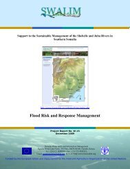
Water Sources Inventory for Central and South SomaliaAfter the successful completion of the northern Somalia strategicpoint water sources survey that was conducted in 2008, SWALIMin collaboration with UNICEF carried out a survey of the watersources in central – south Somalia. The findings and results of thesurvey are presented in this report. The total number of sourcesvisited in the central – south regions is 645. Out of this, 125 areboreholes, 400 shallow wells, 17 springs and 103 are communaldams. The information and products generated and that arepresented in this report include district maps showing the location,operational status, physical parameters, water quality and management of the source.Additional information on fact sheets for each of region surveyed could be obtainedfrom SWALIM. Due to insecurity in some of the areas, some parts were not covered bythe survey - these are mainly the regions of Hiraan, Middle Shabelle, Lower Shabelleand Lower Juba. The Somali Government, donors, UN agencies and non-governmentalorganizations working in the water sector will find the report a very useful tool forplanning their future interventions.Flood Risk and Response ManagementNatural and man made floods disasters regularly lead toemergencies in Somalia, and in particular along the Jubaand Shabelle Rivers in the southern part of the country. Theirmanagement requires usable and reliable information aboutproduced scenarios and flood history. Flood risk and responsemanagement provides a range of measures for flood hazardmitigation, emergency preparedness; impact response and disasterrecovery. This study is intended to provide the Somali interagencywith an online information system consisting of data on historicalfloods, current flood situation and areas affected besides logistics data. The system alsoprovides directions on effective coordination possibilities for flood risk and responsemechanisms in order to provide assistance during flood emergencies and developmentto the local communities who are the victims of flood calamities. The major output of thestudy is an information system; the Flood Risk and Response Management InformationSystem (FRRMIS).Inventory of Drainage Basins of Northern SomaliaThe inventory of northern Somalia drainage basins provides a broadappreciation of the drainage basins with baseline information onadministrative, physical environment, climate, water and landresources of the four major drainage basins in the region - Gulfof Aden, Darror, Tug Der/Nugal and Ogaden. Historical averageclimatological and hydrological data were used to create theinformation on water resources for the drainage basins, whilephysiographic data on terrain, soils, vegetation, etc. were usedto generate the land resources information. The information andproducts generated are presented in the form of maps for each drainage basin. Thedocument will be updated as more data is collected. Emergency, rehabilitation anddevelopment planners in northern Somalia will find this a useful working document.9
Urban Water Supply AssessmentSWALIM in collaboration with UNICEF carried out an assessment ofthe urban water supply in Somalia in 2006. The assessment was carriedout in the cities of Borama, Bossasso and Ceerigabo and focused ontechnical information such as availability of strategic water sources andtheir status, water service providers, water quality and water consumers.The socio-economic aspects focussed on consumers’ ability andwillingness to connect and pay for water services and sustainability ofwater institutions. The information collected in the assessment forms abaseline which can be used for future monitoring of the urban watersupply in Somalia towards meeting millennium development goal No. 7 target No.10 “tohalve by 2015 the proportion of people without sustainable access to safe drinking water”.UNICEF’s Water Interventions Mapping (2005-2009)The major objective of the mapping exercise was to evaluate progressmade in the water sector in terms of coverage of water services andincrease in number of beneficiaries served through UNICEF’s EC fundedprogramme. The report documents the results of interventions for theperiod 2005 to 2009 under the programme “Integrated Water ResourceManagement and Rural Water and Sanitation Programme in Somalia”.SWALIM carried out the mapping exercise at the request of UNICEF. Theinformation products from the exercise include maps showing annualprogress, regional maps for rural interventions and water supply systemmaps for major towns.10
1.2 Water Resources DatasetsSWALIM has developed a number of water resources datasets including climate, riverflow, water sources and irrigation. These are briefly described below:• Climate data set contains data from 68 stations rehabilitated by SWALIM andpartners and five automatic weather stations. Most of the data is on rainfall,but a few stations have other parameters, such as temperature, wind speed andevaporation. The data recorded spans over 100 years. Due to the civil war, somegaps exist, mainly between 1991 and 2002. A summary of these data is presentedin the inventory report entitled: “Inventory of Hydrometeorological Data forSomalia - Project Report no W-03 - October 2007”, (see Section 1.1), and a list ofthe rainfall recording stations is provided in Annex I.• River flow data contains daily and monthly river flows and stream gauge heightsover a 30-year period for 15 river gauging stations that were previously operatedby the Somali Government (seven on the Juba river and eight on the Shabelleriver). The data is currently stored in HYDATA database and MS Excel sheets.There is a gap from 1991 to 2002 due to the civil war during this period. Asummary of this data is presented in the inventory report entitled: “Inventoryof Hydrometeorological Data for Somalia - Project Report no W-03 - October2007”, (see Section 1.1). A list of the river gauging stations is provided in AnnexII.• Water sources data has been generated through partners working in the watersector in Somalia and through surveys carried out by SWALIM in Somaliland,Puntland and south central Somalia. 2 250 records of strategic water sources(boreholes, shallow wells, springs and dams) were added to the Somalia WaterSources Information Management System (SWIMS). The survey data and resultsare compiled in a DVD accessible from SWALIM. The the survey results arereported in two reports titled, “Water Sources Survey for Northern Somalia,Project Report no W-12” and “Water Sources Survey for Central and SouthSomalia, Project Report no W-13” (see Section 1.1). A summary of the watersources database is provided in Annex III.• Irrigation infrastructure data set contains records of Southern Somalia’s prewarirrigation infrastructure including barrages, primary and secondary canals,schemes/projects and partner agencies rehabilitated infrastructure. These arestored in GIS format. The data provides information on the status of the irrigationschemes and their infrastructure. The database was generated using GeographicInformation System (GIS) analysis of 1:100,000 topographic maps and recentsatellite images. The database has been verified through rapid field assessmentand workshops in Baidoa and Nairobi. A summary of this data is provided inAnnex IV. SWALIM has also used data from an aerial survey which covers most ofthe irrigation schemes (See section 6.0)11
1.3 Somalia Water sourcesInformation Management System(SWIMS)http://www.fao<strong>swalim</strong>.org/thematic_areas/water/swimsThe Somalia Water sources Information Management System (SWIMS) is a databaseapplication developed by SWALIM for agencies working in the Somali water sector tomonitor and manage data for the point sources:- boreholes, dams, berkads, dug-wells, springsand others. The application allows agencies working in different parts of the country tocontribute to the national water sources database.SWIMS has three key modules: location, source records and interventions. The locationmodule ranks higher in the data hierarchy, and all sources records and interventions arelinked to a location. The use of a switchboard allows easy navigation between the differentmodules. Data entry interface have the same format as the field data collection sheets foreasy and fast transfer of data from the field data collection sheets into the system.The SWIMS interface was designed to allow users with limited computing skills to performdifferent kinds of information management tasks through switch board menus (see figurebelow).SWIMS main switch boardSWALIM distributes SWIMS software free of charge, trains and gives technical support toall partners working in the water sector in Somalia. The partner agencies using the softwareare in return expected to contribute to the national water sources database through theapplication. Two manuals, one on field data collection and another on the system, have beendeveloped to guide SWIMS users in data collection and application of the software.For technical support on SWIMS, agencies can reach SWALIM’s dedicated help desk throughswims@fao<strong>swalim</strong>.org.12
1.4 Somalia Climate MonitoringNetworkhttp://www.fao<strong>swalim</strong>.org/subsites/climate/index.phpAn online data access interface with capability for data download from the expandedweather monitoring network in Somalia is available through the SWALIM website. Themonitoring network that now consists of 67 manual rain gauges and five automatic weatherstations (AWS) generates essential ground data to supplement satellite predictions. SWALIMinstalled the AWS in Garowe, Hargeisa, Boroma, Galckayo and Eerigavo and re-establishedthe 67 manual raingauges in partnership with local and international NGOs in Somalia. Fourmore AWS and 6 river gauging are planned for installation along the Juba and Shabelle Riversat Luuq, Bardere, Buaale, Beletweyne, Burlo Burti and Jowhar.Screenshot of the climate data access interfaceData from the gauging stations is transmitted on a weekly basis or as requested by SWALIMvia e-mail or telephone to its Nairobi office where the Somalia Climate archive is maintained.The AWS records weather data on an hourly basis and transmits the data every four hours tothe central unit at SWALIM’s office in Nairobi.To maintain this network and develop a national weather service in future, SWALIM worksin close collaboration with the ministries of Agriculture in Puntland and Somaliland. So far,weekly and monthly weather bulletins for the two regions are published in addition to a tenday rainfall bulletin that covers the whole country and a weekly flood watch bulletin for theriverine areas.13
1.5 Water Resources Mapshttp://www.fao<strong>swalim</strong>.org/Topic Description Map Reference AreaCoveredClimateDrainageFloodsMonthly Rainfall distribution maps -12 maps from Jan to DecMonthly Temperature distributionmaps - 12 maps form Jan to DecAnnual Temperature distribution mapAnnual Rainfall distribution mapSeasonal rainfall distribution for theGu rainy seasonSeasonal rainfall distribution for theDeyr rainy seasonAnnual PET distribution mapAnnual Relative Humiditydistribution mapAnnual Windspeeddistribution mapTopographic maps of areassurrounding barrages (7 Maps)Juba and Shabelle Basins (Somalia/Ethiopia)Historical flood extents for 1968,1981, 1997 and 2006 from varioussourcesWAT-CLIM-20070702-NAT-Monthrain-A3-001WAT-CLIM-20070702-NAT-Monthtemp-A3-001WAT-CLIM-20070702-NAT-Annualtemp-A3-001WAT-CLIM-20070702-NAT-Annualrain-A3-001WAT-CLIM-20070702-NAT-Gurain-A3-001WAT-CLIM-20070702-NAT-Deyrrain-A3-002WAT-CLIM-20070702-NAT-AnnualPET-A3-001WAT-CLIM-20070702-NAT-AnnualRH-A3-002WAT-CLIM-20070702-NAT-AnnualWS-A3-003WAT-BARRAGE-20060327-NA-38-*-L-SHABELLE-A1-001WAT-HYDRO-20060516-HORN-A1-003Maps are available for alldistrictsNationalNationalNationalNationalNationalNationalNationalNationalNationalFileFormatGridGridGridGridGridGridGridGridGrid- JPEGSomalia &EthiopiaSouthernSomaliaJPEGPDF/JPEG- WAT-FLOOD-STATUS-20081125-JUBA-SHABELLE-A3-001Juba andShabellePDFWaterSourcesHistorical and current point watersources (boreholes, springs, berkads,dug wells etc) from various sourcesincluding NGOs, UN, topographicmaps and the SWALIM SWIMSdatabaseMaps are available for alldistrictsNationalPDF14
Topic Description Map Reference AreaCoveredWater SupplyUrban Water Supply, Bossaso town.Contains water pipeline, water kiosks,water sourcesRiver Gauging StationUrban Water Supply, Erigavo town.Contains water pipeline, water kiosks,water sourcesUrban Water Supply, Bossaso town.Contains water pipeline, water kiosks,water sources, SWIMS dug wells andUN-HABITAT layersWater sources inventory, regionscovered include:• Awdal• Woqooyi Galbeed• Togdheere• Sanaag• Sool• Bari• Nugaal• Mudug• Galgadud• Bakool• Gedo• Bay• Middle JubaWATER SUPPLY-BOSSASO-20070220-A2-001/2.pdfWAT-RGS-STATUS-20081125-JUBA-SHABELLE-A3-001WATER SUPPLY-ERIGAVO-20070220-A2-001/2.pdfADMIN-QBIRD-20070413-BOSSASO-A1-003BossasoJuba andShabelleErigavoBossaso- Northern andSouth CentralSomaliaFileFormatPDFPDFPDFPDFPDF15
2.LandResourcesProducts
2.1 Land Reports Serieshttp://www.fao<strong>swalim</strong>.org/theme_groups/land/land_reports_seriesLandform of Selected Study Areas in Somaliland and Southern SomaliaA key outcome of this study is a new landform dataset for theselected areas of interest (AOI). The mapping of landforms wascarried out at a semi detailed scale of 1:50 000 to 1:100 000 andcurrently constitutes the most recent, detailed and consistent datasetover large portions of the Somali territory. Landscape and relief weremapped through visual interpretation of satellite images combinedwith geomorphometry. The report contains two landform maps, onefor each of the two study areas. The report can be used for naturalresource inventory and management. It has potential applications insoil and land cover mapping and land suitability assessment.Land Cover of Selected Study Areas in Somaliland and Southern SomaliaFor this study, land cover classes were created using the Land CoverClassification System (LCSS) of FAO, satellite image interpretation,and field validation. A description of the main land cover types andvegetation units and their locations are given in detail for the twostudy areas – one in Somaliland and the other in Southern Somalia.The landcover maps developed from this study will be useful in thegeneration of land use maps and during land suitability analaysis. Thereport is a valuable resource in natural resources management.Land Use Characterisation of a Selected Study Area in SomalilandThe objective of this study was to characterise and map current landuse in the Dur-Dur and Gebiley area of Somaliland. Land-use typeswere identified through interpretation of land cover data, semistructuredinterviews and satellite image interpretation for a totalarea 12 939 km 2. This information can be used to assist in makingwise choices about land use, determining where best to locate newsettlements, cropping, drainage, irrigation, where and when to applynew technologies and to respond to many other questions aboutmanagement, use and conservation of the natural environmentSoil Survey of a Selected Study Area in SomalilandSoil physical and chemical properties are key elements for naturalresource management. This report contains information obtainedfrom a description of 82 soil profiles within a selected area inSomaliland. Major soil types were classified according to the WorldReference Bureau (WRB). Soil maps were produced at 1:100,000and 1:50,000 scales and show spatial variability of soil attributes. Atechnical assessment of the main soil attributes is also available. Thisreport is useful to many different users, as soil physical and chemicalcharacteristics have effects on many applications.17
Field Survey ManualThe field survey manual was developed to guide SWALIM landresources baseline data collection activities. It provides a theoreticaland practical basis for collecting land resources data in the field.The manual contains five sections covering landform mapping, soilsurvey, land degradation assessment, land use survey and land covermapping. Each section is followed by a set of field data collectionforms or questionnaires. Although the manual was developed for usein Somalia, it is applicable for other areas with similar bio-physicalenvironment.Land Use Characterisation of the Juba and Shabelle Riverine Areas inSouthern SomaliaLand use types in the Juba and Shabelle riverline areas wereidentified through land cover analysis, interviews with land usersand the use of past and current satellite images. The report alsoshows the characterisation of different land use present in the Jubaand Shabelle riverine areas. Land-use classes in the study area weredetermined through land cover analysis, semi-structured interviewsand interpretation of satellite imagery, and are described with theirspecific attributes. Users will obtain a detailed overview of land useactivities in the study area.Land Suitability Assessment of a Selected Study Area in SomalilandAs an input to guiding policy decisions on land use planning, thisstudy defines the capacity of the study area to support specificland use types. The main land use types considered were rainfedagriculture, extensive grazing (pastoralism) and forestry. Landsuitability is presented in the form of tables, maps and narrativesfor specific types of land use defined by individual crops, grazinganimals or forestry species. This report also gives details of theSomalia Automated Land Evaluation System (SOMALES), whichis an application of the FAO Framework for Land Evaluation andAutomated Land Evaluation Software (ALES) for Somalia.Land Suitability Assessment of the Juba and Shabelle Riverine Areas inSouthern SomaliaThis report describes physical land suitability for rainfed agriculture,irrigated agriculture, extensive grazing (pastoralism) and forestry inthe Juba and Shabelle riverine areas. Land suitability is presented inthe form of tables, maps and narratives for specific types of land usedefined by individual crops, grazing animals or forestry species. Thisreport also gives details of the Somalia Automated Land EvaluationSystem (SOMALES), which is an application of the FAO Frameworkfor Land Evaluation and ALES software for Somalia. The report isuseful in guiding policy decisions on land use planning.18
Soil survey of the Juba and Shabelle Riverine Areas in Southern SomaliaSoil information is a key element for natural resources planning.A key output of this study is a soil map with a scale of 1:100, 000containing the major soil types as well as soil maps for some of theirrigation projects along the Juba and Shabelle river catchments.Further, the report contains information on soil physical andchemical properties, which are key elements for natural resourcemanagement. Soil spatial variability is described for an area ofapproximately 88,000 km 2 in the Juba and Shabelle riverine areasin Southern Somalia. This study is essential for carrying out landsuitability and land degradation assessments.Land Degradation Assessment and Recommendation for a MonitoringFramework in SomalilandAs a useful guide for conservation efforts in land resourcesmanagement in Somaliland, this report describes the prevalent typesof land degradation, their causes and impacts. This comprehensivestudy involved two levels of assessment. One covering the wholearea using the LADA-WOCAT expert assessment method and theother focusing on a local area and using a combination of methodsi.e LADA-WOCAT expert assessment, time-series (1982 to 2008)analysis of satellite images, and analysis of historical soil propertiesdata. The most common land degradation types identified includeloss of vegetation, soil erosion, and decline in soil nutrient.Land Degradation Assessment and Monitoring Framework in SomaliaApart from establishing baseline information on land degradationfor future monitoring, this study also identified local spots withincreasing trends of land degradation. The report also describes theprevalent land degradation types, their causes and impacts, andsustainable land management practices to combat land degradationin Somalia. Two methods were used for this assessment. The LADA-WOCAT expert assessment was used to identify the key typesof degradation, their status and trends, their causes and impactsand the responses put in place to address them. The experts whoundertook this assessment were Somali professionals with field experience. To enhancethe expert assessment, time series (1982 to 2008) analysis of satellite images wascarried out. This report is useful in identifying areas where there is an increasing trendof land degradation so that detailed assessment can be carried out. It is useful in guidingdecision making to combat land degradation in Somalia.19
Application of Remote Sensing Techniques for the Assessment of PastoralResources in Puntland, SomaliaThis report examines the application of remote sensing techniquesin the assessment of pastoral resources for two areas in Puntland,one north and the other south of Garowe. Each study area coveredan area of about 7000 km 2 . The study focused on land coverchange, invasion by non-palatable species, drought, and impactsof settlements and water points on the environment. Ecologicalsurveys, NDVI analysis and interviews with the local people usingsemi-structured questionnaires were used for the assessment. For thenorthern study area, the report also examines the vegetation typesand their herbaceous biomass.Book of Abstracts from the Workshop on The Potentialities andLimitations in the use of Remote Sensing for Detecting and MonitoringEnvironmental Change in The Horn of Africa – Nairobi, 12 - 13 June2007The book of abstracts is a collection of all abstracts received for theworkshop organised by SWALIM on “Potentialities and Limitationsin the Use of Remote Sensing for Detecting and MonitoringEnvironmental Change in the Horn of Africa”. The workshop washeld in Nairobi on the 12 th and 13 th June, 2007. The format of thebook of abstracts follows the programme of the workshop sessionson: Resource Base Inventory, Assessing Environmental Change, andProcess Modelling.Land Resources of SomaliaBased on structured, up-to-date, and location specific information,a strategic overview of land resources of Somalia is provided in thisreport. It summarizes and consolidates the main findings of variousland resources surveys and studies carried out by SWALIM and otheragencies in three study areas. National-level maps in this reportinclude Length of Growing Period, Soils, and Agro-ecological zones.Area-specific maps show the resource base and land suitability for avariety of uses in the Durdur and Gabiley area (Somaliland) and inthe Juba and Shabelle river basins (Southern Somalia). Information onland resources contained in this report is useful for supporting policy decisions on landuse planning and for guiding natural resource management in Somalia.20
Land Use Planning Guidelines for SomalilandLand Use Planning Guidelines describes principles and proceduresfor planning land use in general and specifically in Somaliland. Theguidelines in this report were developed through a participatoryprocess involving all stakeholders (traditional authorities andgovernment institutions) in Somaliland. The report providesinformation on the activities that need to be undertaken at thedifferent levels of land use planning, e.g. village level, district/regional level and national level and how the different levels interrelate.Detection of Tree Cutting in the Rangelands of North Eastern SomaliaUsing Remote SensingThis report outlines how very high resolution satellite imagery wasused to estimate the rate of tree-cutting in Puntland. The study usedvisual interpretation of Ikonos and Quickbird images for 2001 and2006 respectively to generate tree density maps for the two years.Through collaboration between SWALIM and the EC Joint ResearchCentre at Ispra, Italy, an automatic procedure for identifying andclassifying trees was also tested. Both techniques produced similarresults, which showed an overall decrease in tree density between2001 and 2006. The results also showed some areas where thetree densities have increased due to environmental conservation through communityinterventions. The method used can be up-scaled to other parts of Somalia to supportafforestation campaigns and environmental conservation.Soil Erosion and Sedimentation Modelling and Monitoring of Juba andShabelle Riverine Areas in Southern SomaliaSufficient information on soil erosion and sedimentation rates,potential sediment sources, and sediment flow-rate in the Jubaand Shabelle rivers is needed for development interventions in theriverine area. This study was initiated with the general objective ofpreparing an assessment of soil erosion and sedimentation of theriverine areas between Rivers Juba and Shabelle and to provide inputinto soil erosion-sedimentation monitoring framework which willalso contribute to improved management of the irrigation systems insouth Somalia. The study identified areas prone to high soil erosionrates and sediment flux into river Juba and Shabelle in south Somalia. It also proposeda comprehensive monitoring framework which will support routine identification of soilerosion and sedimentation problems for quick and targeted interventions.21
2.2 Land Resources DatasetsDuring 2005 and 2006 SWALIM undertook a detailed land resources assessment inthe Durdur and Gebiley areas in Somaliland and in the riverine areas of the Juba andShabelle rivers. The assessment combined satellite image interpretation and field datacollection. The exercise generated a large set of land resources data from which anumber of databases have been created, accompanied by 1:50,000 and 1:100,000maps.Databases/Datasets that have been generated include:• Soils database contains soil attributes data derived from detailed soil profiledescription and laboratory analysis by FAO-SWALIM in 2006. The data isstored in the FAO multilingual soil profile database. Data cover generalcharacterization and classification, profile descriptions and detailed physicaland chemical parameters. A large number of profile photographs is alsoavailable. In addition, there are historical soil datasets (soil profile descriptionsand analytical data) from SOGREAH (1983) for north-western Somalia andmany feasibility studies carried out along river Juba and Shabelle valleys as wellas soil texture data for some parts of north-eastern Somalia. There are also soilmaps: Soil map of a selected area in north-western Somalia (at 1:100,000 and1:50, 000), soil map of the riverine area in Southern Somalia (at 1:100,000),detailed soil maps of irrigation schemes in South Somalia (at varied scales), anda soil map of Somalia (at 1:1,000,000).• Land cover and vegetation dataset contains descriptions of the main land coverand vegetation units and their locations, classified using the FAO land coverclassification system (LCCS). The data is stored in an MS Access database andMS Excel Workbooks. Maps, filled-in field data forms and pictures showingtypes of land cover for selected areas in Southern Somalia, north-westernSomalia, and north-eastern Somalia are also available. An AFRICOVER map ofland cover types for Somalia is also available.• Landform dataset contains geomorphologic data. Maps, filled-in field dataforms, and pictures with types of landform for selected areas in SouthernSomalia and north-western Somalia are also available. 90-m Digital ElevationModel (DEM), slope, geology and landform maps of Somalia (at 1: 200,000) arealso available.• Land use dataset contains land use classes and attributes resulting fromland cover data (emanating from satellite image interpretation) and semistructuredinterviews. The different classes of land use are described with theirspecific attributes. The data is stored in an MS Access database and MS ExcelWorkbooks. Maps, filled-in field data forms, and pictures showing types of landcover for selected areas in Southern Somalia, north-western Somalia, and northeasternSomalia are also available.22
• Tree cutting dataset contains tree density maps in two time periods, 2001and 2006, in the Tiger Bush area of interest (AOI) in Puntland. The trees weremapped using available very high resolution satellite images of Ikonos in 2001and Quick Bird in 2006. Field pictures and field data forms are also available• Biomass dataset contains descriptions of the herbaceous biomass in an Area ofinterest (AOI) in Puntland. Biomass data was derived from field clippings whichwere oven dried to provide dry herbaceous biomass in the various vegetationtypes in the study area. A biomass map and medium resolution satellite imagesare also available.• Land degradation dataset contains descriptions of land degradation classesin Somaliland and the whole of Somalia. Available datasets for derivingland degradation products include rainfall data, Normalised DifferenceVegetation Index (NDVI) images, field-measurements, site pictures as well asquestionnaires filled in by Somali experts. A land use systems (LUS) map andmaps of land degradation types in Somalia are also available.• Land suitability dataset contains descriptions of land suitability for rainfedagriculture, grazing and forestry. The land suitability was mapped using theAutomated Land Evaluation Software (ALES) by matching the resource baseto the land use type (LUT) requirements. Maps for selected areas in SouthernSomalia, north-western Somalia and north-eastern Somalia are also available.• Length of growing period dataset contains data on the length of growing periodfor Somalia. It was derived from rainfall and soil regimes of Somalia. Thedataset and a map contain descriptions on the general length of growing periodsfor Somalia.• Agro Ecological Zones dataset contains descriptions and a map of AgroEcological Zones for Somalia. The Agro Ecological Zones were derived fromthe resources maps of Somalia.• Soil erosion and sedimentation contains descriptions and maps on soil erosionand sedimentation of the riverine areas of Juba and Shabelle.23
2.3 Land Resources Mapshttp://www.fao<strong>swalim</strong>.org/Category Description Area FormatLand CoverLandformsLand Cover of Somalia. Published by FAO AfricoverProject in 2003 at scale 1:200,000. Produced by visualinterpretation of digitally enhanced Landsat TM images(bands 4, 3 & 2)Land Cover of North-West Somalia. Published by FAO-SWALIM. Produced by visual interpretation of digitallyenhanced Landsat ETM images (bands 4, 3 & 2) of 2001Land Cover of Southern Somalia. Published by FAO-SWALIM. Produced by visual interpretation of digitallyenhanced Landsat ETM images (bands 4, 3 & 2) of 2001.Scale 1:100,000Land Cover North and South Garowe (Puntland). Publishedby FAO-SWALIM. Produced by visual interpretation ofdigitally enhanced Landsat ETM images (bands 4, 3 & 2) of2001. Scale 1:100,000. Field surveys in April 2007Land cover North and South Garowe (Puntland). Publishedby FAO-SWALIM. Produced by automatic classificationof Landsat MSS images (bands 4, 3 & 2) of 1988. Scale1:100,000. Field surveys in April 2007Land Cover North and South Garowe (Puntland). Publishedby FAO-SWALIM. Produced by automatic classificationof Landsat MSS images (bands 4, 3 & 2) of 2001. Scale1:100,000. Field surveys in April 2007Herbaceous Biomass for North Garowe (Puntland).Published by FAO-SWALIM. Produced by automaticclassification of Landsat MSS images (bands 4, 3 & 2)of 2001. Scale 1:100,000. Field surveys in April 2007.Produced by visual interpretation of digitally enhancedLandsat ETM images (bands 4, 3 & 2) of 2001. Scale1:100,000.Landforms of Somalia. Published by FAO AfricoverProject in 2003 at scale 1:300,000. Produced by visualinterpretation of digitally enhanced Landsat TM images(bands 4, 3 & 2) of 1995 and 1998.Relief of North-West Somalia. Published by FAO-SWALIMusing satellite images (Landsat ETM, ASTER, Ikonos,Quickbird), existing maps and datasets and literature.Landscape of North-West Somalia. Published by FAO-SWALIM using satellite images (Landsat ETM, ASTER,Ikonos, Quickbird), existing maps and datasets andliterature.Relief of Southern Somalia. Published by FAO-SWALIMusing satellite images (Landsat ETM, ASTER, Ikonos,Quickbird), existing maps and datasets and literature.Landscape of Southern Somalia. Published by FAO-SWALIM using satellite images (Landsat ETM, ASTER,Ikonos, Quickbird), existing maps and datasets andliterature.SomaliaNorth-WestSomaliaSouth SomaliaPuntlandPuntlandPuntlandPuntlandSomaliaNorth-WestSomaliaNorth-WestSomaliaSouth SomaliaSouth SomaliaPDFPDFPDFPDFPDFPDFPDFPDFPDFPDFPDFPDF24
Category Description Area FormatDigital Elevation ModelsSatellite ImageryGeology and SoilsHillshade map of North Western Somalia. Derived fromthe NASA 90 meter SRTM – DEMElevation map for the Juba and Shabelle riverine area.Also for the whole of Somalia. Derived from the NASA 90meter SRTM – DEMSlope map of North Western Somalia. Derived from theNASA 90 meter SRTM – DEMElevation map for the North Western Somalia. Also for thewhole of Somalia. Derived from the NASA 90 meter SRTM– DEMNorth-WestSomaliaNorth-WestSomaliaNorth-WestSomaliaNorth-WestSomaliaMODIS NDVI 16 day composites (2000-2004) Somalia PDFASTER IMAGERY for Somalia (2000-2007) Somalia PDFMonthly Sea Surface Temperature and NDVI images 1982 AfricaPDF- 1999MODIS Terra/Aqua 250m imagery for the Nov/Dec 2006 SomaliaPDFfloods (includes NDVI and 721 composites)LANDSAT Archive (MSS, TM, ETM): 1970s - 2003 Somalia PDFHigh Resolution Imagery for selected towns and otherareas in Somalia, supplied by UN-HABITAT (Adaale,Baidoa, Burao, Belet Weyne, Berbera, Boroma, Bosasso,Dusamareb, Erigabo, Gabharey, Galkayo, Garowe,Gebiley, Hargeisa, Hudur, Jowhar, Kismayo, Lasaanod,Merca, Sheikh, Xaafun, Mogadishu); Janaale, Mashallay,Balcad barrage areasTownsPDFGeological Map of Somalia at 1:500,000 scale. Publishedby University of Frolence ITALY, Somali National Universityand Ministry of Water and Mineral. Elaboration bySWALIMDominant Soils in Somalia at scale 1:1,000,000. Publishedby FAO Africover Project in 2003 at scale 1:1,000,000Lithological map of Somalia at 1:1,000,000 scale.Published by FAO-AfricoverGeological map of North-East Somalia 1:200,000 scale(Fantozzi, et al 1994)Geological map of the Daban Basin. Published byUniversity of Frolence ITALY, Somali National UniversityGeology of the Gedo, Bay and Bakool Region at scale1:250,000 (Kassim, et al 1994). Digitised polygons andlegends Geology of the Bay Region at scale 1:250,000 (HMAbdirahman, et al 1994)Soils of North-West Somalia. Published by FAO-SWALIM.Produced by visual interpretation of digitally enhancedLandsat ETM images of 2001. Scale 1:100,000Soils of Southern Somalia. Published by FAO-SWALIM.Produced by visual interpretation of digitally enhancedLandsat ETM images of 2001. Scale 1:100,000Agro-Ecological Zones of Somalia. Produced by FAO-SWALIM using climate, land form and soils and/or landcoverSomaliaSomaliaSomaliaNE SomaliaDaban Basin,SomaliaSouthern SomaliaNorth-WestSomaliaSouthern SomaliaSomaliaPDFPDFPDFPDFPDFPDFPDFPDFPDFPDFPDFPDFPDF25
Category Description Area FormatGeology and Soils contd.Length of Growing Periods (LGP). Produced by FAO-SWALIM. 15 LGP zones are outlinedLand Use (1:100,000) for the Northern SWALIM Area ofInterest. Produced by FAO-SWALIM in 2006Land Use (1:100,000) for the Southern SWALIM Area ofInterest. Produced by FAO-SWALIM in 2007SomaliaNorth-WesternSomaliaSouthern SomaliaSuitability for Rainfed Agriculture – North west Somalia and South SomaliaLand Suitability (1:100,000) for rainfed Maize for theNorthern SWALIM Area of InterestLand Suitability (1:100,000) for rainfed Sorghum for theNorthern SWALIM Area of InterestLand Suitability (1:100,000) for rainfed Cowpea for theNorthern SWALIM Area of InterestLand Suitability (1:100,000) for rainfed Maize for theSouthern SWALIM Area of InterestLand Suitability (1:100,000) for rainfed Sorghum for theSouthern SWALIM Area of Interest.Land Suitability (1:100,000) for rainfed Cotton for theSouthern SWALIM Area of InterestResources Base map of the Northern SWALIM Area ofInterest. Produced by FAO-SWALIM in 2006Resources Base map of the Southern SWALIM Area ofInterest. Produced by FAO-SWALIM in 2007North WesternSomaliaNorth WesternSomaliaNorth WesternSomaliaSouthern SomaliaSouthern SomaliaSouthern SomaliaNorth WesternSomaliaSouthern SomaliaSuitability for tree crops – North west Somalia and South SomaliaLand Suitability (1:100,000) Azadirachta indica for theNorthern SWALIM Area of InterestLand Suitability (1:100,000) Acacia nilotica for theNorthern SWALIM Area of InterestLand Suitability (1:100,000) Dobera glabra for the NorthernSWALIM Area of InterestLand Suitability (1:100,000) Balanites aegyptica for theNorthern SWALIM Area of InterestLand Suitability (1:100,000) Faidherbia albida for theNorthern SWALIM Area of InterestLand Suitability (1:100,000) of Azadirachta indica for theSouthern SWALIM Area of InterestLand Suitability (1:100,000) of Acacia nilotica for theSouthern SWALIM Area of InterestLand Suitability (1:100,000) of Acacia tortilis for theSouthern SWALIM Area of InterestLand Suitability (1:100,000) of Conocarpus lancifolius forthe Southern SWALIM Area of InterestNorth WesternSomaliaNorth WesternSomaliaNorth WesternSomaliaNorth WesternSomaliaNorth WesternSomaliaSouthern SomaliaSouthern SomaliaSouthern SomaliaSouthern SomaliaSuitability for extensive grazing – North west Somalia and South SomaliaLand Suitability (1:100,000) of Camels for the NorthernSWALIM Area of Interest. Extensive grazingLand Suitability (1:100,000) of Cattle for the NorthernSWALIM Area of Interest. Extensive grazingNorth WesternSomaliaNorth WesternSomaliaPDFPDFPDFPDFPDFPDFPDFPDFPDFPDFPDFPDFPDFPDFPDFPDFPDFPDFPDFPDFPDFPDF26
Category Description Area FormatGeology and Soils contd.Land DegradationLand Suitability (1:100,000) of Goats for the NorthernSWALIM Area of Interest. Extensive grazingLand Suitability (1:100,000) Sheep for the NorthernSWALIM Area of Interest. Extensive grazingLand Suitability (1:100,000) for Camels for the SouthernSWALIM Area of Interest. Extensive grazingLand Suitability (1:100,000) for Sheep for the SouthernSWALIM Area of Interest. Extensive grazingLand Suitability (1:100,000) for Goats for the SouthernSWALIM Area of Interest. Extensive grazingSuitability for Irrigated agriculture – South SomaliaLand Suitability (1:100,000) irrigated Paddy rice for theSouthern SWALIM Area of InterestLand Suitability (1:100,000) irrigated Sugar Cane for theSouthern SWALIM Area of InterestLand Suitability (1:100,000) irrigated Citrus for theSouthern SWALIM Area of InterestChemical Degradation (1:100,000) for the NorthernSWALIM Area of Interest. Produced by FAO-SWALIM in2007Biological Degradation (1:100,000) for the NorthernSWALIM Area of Interest. Produced by FAO-SWALIM in2007Physical Degradation (1:100,000) for the NorthernSWALIM Area of Interest. Produced by FAO-SWALIM in2007Combined Degradation (1:100,000) for the NorthernSWALIM Area of Interest. Produced by FAO-SWALIM in2007Participatory Land Degradation (1:100,000) for theNorthern SWALIM Area of Interest. LADA and WOCATapproaches. Produced by FAO-SWALIM in 2007North WesternSomaliaNorth WesternSomaliaSouthern SomaliaSouthern SomaliaSouthern SomaliaSouthern SomaliaSouthern SomaliaSouthern SomaliaNorth WesternSomaliaNorth WesternSomaliaNorth WesternSomaliaNorth WesternSomaliaNorth WesternSomaliaPDFPDFPDFPDFPDFPDFPDFPDFPDFPDFPDFPDFPDF27
3.On-line<strong>Catalogue</strong>s
3.1 Spatial Data <strong>Catalogue</strong>http://geonetwork.fao<strong>swalim</strong>.org/geonetwork/Many UN agencies, NGOs, government ministries and others need access to maps andspatial datasets for their day to day work. Maps in particular are effective communicationtools for decision makers in need of quick, reliable and user-friendly products to planand monitor their activities.Although these data exist, it is difficult to know where to find them and when accessed,they are usually not well-documented for effective use. To address this problem,SWALIM has set up a spatial data catalogue based on the FAO Geo-Network software.The catalogue provides access to a large database of spatial data and maps withcomplete documentation.GeoNetwork also provides access to a huge volume of spatial data from differentorganizations (who have also deployed the software) and also provides a web-basedinteractive map viewer that allows people to composite maps, picking layers fromdifferent servers on the internet.Screenshot of SWALIM Geonetwork home pageThis information can be accessed as follows:• Step 1: http://geonetwork.fao<strong>swalim</strong>.org:8080/geonetwork• Step 2: Type a keyword e.g. ‘flood’ and click ‘Search’• Step 3: All data that match your search words will be listed. Select a dataset tosee more details and metadata• Step 4: Click ‘<strong>Download</strong>’ to download your map or datasetMost of SWALIM’s spatial datasets and maps have been catalogued within Geonetwork,thus making it the first reference point for those searching for spatial datasets and maps.SWALIM has included Geonetwork training in its training portfolio and, in the near29
future, will conduct Geonetwork training courses for its partners both in Nairobi andSomalia.SWALIM is also a member of the Somalia Interagency Mapping and Coordination(SIMaC) group, which brings together personnel working in spatial data and informationfor Somalia. The group has a list server that provides subscribers with a forum to postquestions regarding data, software and related technical problems. To subscribe to thisnetwork, go to http://lists.eogeo.org/mailman/listinfo/simac30
3.2 Digital Documents <strong>Catalogue</strong>http://agris.fao<strong>swalim</strong>.org/In an effort to recover lost information, SWALIM has collected and scanned over 300documents from previous water and land studies carried out in Somalia, sourcingthem from donor document repositories, consultants of previous studies, individualspreviously working with government ministries, etc.To provide access to these documents, SWALIM has set up a document catalogue basedon the FAO AGRIS software.Screenshot of SWALIM AGRIS home pageThese documents can be accessed as follows:• Step 1: http://agris.fao<strong>swalim</strong>.org• Step 2: Type a keyword e.g. ‘irrigation’ and click ‘Search’• Step 3: Documents that match your search words will be listed. Select adocument to see more details and downloadFor users with slow internet connections, SWALIM provides these documents on DVDand responds to requests made by email (enquiries@fao<strong>swalim</strong>.org) for specific documents.31
4.DynamicAtlas
4.1 Dynamic AtlasTo provide access to spatially referenced data without using GIS systems, SWALIM isusing the FAO Dynamic Atlas software to publish digital atlases. We choose to use thissoftware because many of the institutions and organizations that use our informationdo not have Geographic Information System (GIS) software. Even where they have, themajority of their staff do not work with GIS on a daily basis.Currently, SWALIM has published four atlases - one dedicated to SWALIM’s water andland datasets while the other three cover a wide range of sectors in Somalia with datacollected from different agencies.Screenshot of Dynamic Atlas InterfaceThe atlas is a stand-alone application, which does not need any GIS software or skills touse. It integrates maps, spreadsheets and text documents and is structured either by areaor by topic.The atlas exports data to Microsoft’s PowerPoint and Excel to allow users to furtheranalyse or publish data. Where necessary, users can export data to the ArcView GISapplication and undertake additional GIS analysis there.To facilitate the use of the Dynamic Atlas, SWALIM frequently undertakes training inNairobi and in Somalia. We are also improving the process of collecting informationfor inclusion in the Atlas by identifying a contact person in each agency. We aim tocollect information from the agencies every quarter and release an atlas every year. Alldata submitted are properly cited and their copyright remains with the agency supplyingthem.33
5.ResourceCentres
5.1 Resource CentresTo serve our clients better, we have established information resource centres in Nairobi,Hargeisa and Garowe. The facilities available at the resource centres include:• Reference library with hard copy documents relating to Somali water andland resources collected from different sources in an effort to recover lostinformation. Currently, we have over 300 documents. For more information,visit: http://www.fao<strong>swalim</strong>.org/resource_center/reference_library/• Computer terminal for accessing SWALIM water and land databases for usersthat may want to interact with these databases directly. These databases coverclimate, water sources, irrigation and land resources among other topics.• Geographic Information System (GIS) facility is intended for ministries workingwith SWALIM. The facility has complete GIS hardware and software which areshared by line ministries.SWALIM staff serving clients at Hargeisa Resource e Centre (left) and PSAWEN Data Centre, Garowe (right)Most information products available at the resource centres are also available on CD-ROM and can be supplied to clients and partners on request. The resource centres alsoprovide an e-mail service through which clients can make requests. Once a requestis received, the information required is processed and sent to the client by email.For requests that cannot be served by email due to their size, clients may collect theinformation at the SWALIM office. Clients can use the email service by writing toenquiries@fao<strong>swalim</strong>.org.The resource centres are open to all clients during working hours on week days. Touse the GIS facility, ministry staffs are required to book in advance through the LiaisonOffice.35
6.AerialPhotograhyDataset
6.1 Dataset of the Juba andShabelle RiversSWALIM commissioned an aerial survey of the Juba and Shabelle Rivers in January-February 2008 with the aim of getting detailed images and topography of the river andsurrounding irrigation schemes. The principal aim was to get baseline information tosupport flood risk management and irrigation infrastructure rehabilitation.A total of 982 digital photos werecaptured in both the Visible (VIS)and Near Infra Red (NIR) bandsof the electromagnetic spectrumusing the latest camera availablein the market (Voxel Ultracam).The area covered consists of abuffer of almost 10 km centeredon each river, in the upper reach,and a buffer of between 3 and5km on either side of the riverplus all the major irrigationschemes (most of which are inthe Jowhar area and in the LowerShabelle Region). The imageshave a pixel resolution of 50 cmin the upper reach and 25 cm inthe lower reach.Beside the images, the aerialsurvey produced also anextremely accurate DigitalTerrain Model (DTM) capturingsmall terrain morphologicalThe Juba River encircles Luuq townvariations. The DTM verticalresolution is of 50 cm for the upper reach and 25 cm for the lower reach. Several orthophotomosaics have been created combining images and DTM.A number of preliminary features have already been extracted from this impressivedataset: roads, bridges, build up areas, river embankments, vegetated areas, verydetailed contour lines, irrigation canals and embankments, river cross and longitudinalsections, and flood prone areas.The potential use of this unique dataset is enormous and SWALIM welcomesdevelopment and humanitarian actors to visit our offices to discuss how your agencies’work can benefit from this dataset.An Atlas of the two Rivers was published based from this dataset. See 11.0 for details37
7.Flood Riskand Response
7.1 Flood Risk and ResponseManagement Systemhttp://www.fao<strong>swalim</strong>.org/subsites/frrmis/index.phpThe lower reaches of the Juba and Shabelle Rivers frequently experience devastatingfloods during the rainy seasons. For effective response that saves live and property,timely data is needed on the current flood situation, areas affected and availability ofemargency kits and other materials.SWALIM developed a Flood Risk and Response Information portal, to support thework of the Somalia Interagency Flood Working Group. The major output is a floodinformation web site: http://www.fao<strong>swalim</strong>.org/subsites/frrmis/index.php. Theinformation available includes information on:• historical floods• river levels• flooded areas• road conditions and estimation of populations under flood• response management showing contact information for cluster leadsScreenshot of the Flood Risk and Response Information portalThe system’s value and importance relies on information provided by partners. Thesystem is expected to evolve with time to include more strategic information on logistics.39
8.Irrigation
8.1 Irrigation Information SystemThe regions along the Shabelle and Juba Rivers are often described as the bread basket ofSomalia. Before the civil strife, this region enjoyed a vibrant irrigation system that madeit possible to produce tonnes of food both for local consumption and export. But manyyears of civil strife left the system in need of rehabilitation. To make meaningful andstrategic rehabilitation possible, SWALIM and partners recognised the need for a centralsource of information on the irrigation infrastructure status, interventions and agriculture.This Irrigation Information Management System was developed to provide users witha platform to discover what is available, query the system for specific datasets, carryout basic analysis, print maps and also download and transfer data and information totypical desktop data processing and presentation applications.The system consists of four modules: Irrigation infrastructure module captures data oncanals, barrages, bridges and culverts. Agriculture module, consisting of schemes, soiltypes and crops grown. Climate module that consists of location of weather stations.Intervention module consists of information on activities of various agencies involved inirrigation interventions in Southern Somalia.Screenshot of the irrigation information systemThis system is designed to run on Arc Reader and is provided on a DVD that installs thedatabase and software. It is easy to install and a simplified user manual is included in theDVD. The database is updated by SWALIM with data provided by partners in the field.41
9.SWALIMWebsite
9.1 SWALIM Websitehttp://www.fao<strong>swalim</strong>.orgThe website provides our clients access to our information products, regardless of theirlocation around the globe. The site is well structured, easy to use and is frequently updated.It is organized along the three themes of SWALIM, i.e. Water Resources, Land Resources andInformation Management. The pages are designed to fit on a single screen so that users canfind information with minimum scrolling.Screenshotof the SWALIM Website home pageThe site is driven by a content management system that enables it to be dynamic, interactiveand also increases flexibility when updating site content. This facility allows SWALIMpartners to upload data to SWALIM and is utilized for data access and exchange withSWALIM partners and clients.To enable users to find the information they need, the website has four search engines:• Normal page text search allows text searches over the entire website. This ispowered by a database that indexes all pages and links by keywords.• SWALIM digital library search allows document searches. It allows users to searchand download documents and publications from a document database. Currentlyover 300 digital documents are available. and more documents are being added.• SWALIM Geonetwork search allows spatial dataset searches. Users can search anddownload spatial datasets and maps from a growing database. Currently over 160datasets with complete metadata are available.• SWALIM Climate data downloads is web based and allows users to search anddownload climate data in simple formats.The website is also available on CD, offering full functionality of a normal website. Thisallows the user to browse even without an internet connection. A copy of this CD is availableat our offices in Nairobi and the liaison offices in Garowe and Hargeisa.43
10.Atlas of Somali Waterand Land Resources
10.1 Atlas of Somali Water and LandResourcesEach month, SWALIM receives many requests for maps of Somalia. The requests coverboth general and specific topics on water and land resources. In the process of servingthese requests, SWALIM has developed a large set of maps which are served to clientsthrough a diverse range of platforms. To increase access to these maps, SWALIM hascompiled them into an Atlas of Somali Water and Land Resources. The first edition of theAtlas was published in January 2009. It has over 120 maps and an accompanying DVDwith digital versions of the maps.The maps in the atlas are grouped into five chapters – Administration, Physicalenvironment, Climate, Water and Land. Each chapter starts with a short explanation,followed by a series of maps. A reference index is included at the end of the atlas.A standard layout is adopted throughout the Atlas and each map has a reference numberto facilitate easy referencing when requesting these maps from SWALIM – either to getlarger formats or additional copies.The atlas is free and is to be distributed widely in Nairobi and Somalia.ChapterAdministrationPhysicalEnvironmentClimateWaterLandSome of the maps includedAdministrative boundaries, Settlements, Roads, Towns, Airstrips andAirports, Schools, Health facilities, Satellite Images of TownsDrainage basins, Bathymetry, Topography, Slope, Hillshade andMorphologyCurrent and Pre-War rainfall stations, Rainfall Variability, SeasonalAverage Rainfall – Gu and Dyer, Temperature, Annual Wind Speed,Relative Humidity, Annual Potential Evapotranspiration, ClimateclassificationDrainage basins and their hydro-geomorphological characteristics,River gauging stations, Pre-War river barrages, Irrigation schemesand their infrastructure by district, Flood extent (68, 81, 97, 00,02,06), Groundwater aquifers, Water sources, Water supply mapsfor selected towns and Rain water harvesting for selected townsGeology, Landform, Landscape, Relief, Soil, Soil erosion risk, Landcover, Land use, Agro ecological zones, Length of growing period,Land suitability for selected areas - Suitability assessment donefor Acacia nilotica, Acacia tortilis, Azadirachta indica, Balanitesaegyptica, Casuarina equisetifolia, Conocarpus lancifolius, Doberaglabra, Faidherbia albida, Cowpea, Maize, Sorghum, Citrus,Cotton, Cowpea, Irrigated rice, Irrigated sugarcane, Tamarindusindica, Camels, Cattle, Goats and Sheep.45
11.
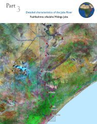
11.1 Atlas of the Juba and ShabelleRiversThe principal source of information for the Atlas of the Juba and Shabelle Rivers isthe aerial photographic survey conducted in January-February 2008 (see full datasetinformation in 6.0). This user-friendly Atlas contains maps and data of the two perennialrivers of south Somalia and their catchments. Development and emergency interventionsthat deal with water and land resources in the region will benefit from the richness of theinformation contained in the Atlas.The Atlas is divided into three parts; Part one presents the whole river basin and the land,drainage and climatic features over the entire extent of the Juba-Shabelle transboundaryriver basin: Part two and three present general features with detailed descriptions of theShabelle and Juba Rivers in 12 sections.For each section of the Rivers, the following features are covered to demonstratetechniques of using the dataset at very large scale, and their application to a variety ofpursuits.• Major physical characteristics: Catchments and drainage network, terrain andslopes, general morphology of the rivers and surrounding floodplains, crosssections of the rivers at major locations, etc.• Water Resources: Hydrology and surface water, flow hydrographs at keylocations, mean annual runoff in the sub-basins, potential flood areas, rainfallvariation and water resources, etc.• Land Resources: Crop types and other vegetation types, major soils, length ofgrowing period, etc.• Irrigation: Irrigation infrastructure such as barrages and primary and secondarycanals, major irrigation schemes, cross sections of canals, etc.• Settlements and road networks.The Atlas is provided with a DVD which contains a complete digital copy of the printedversion as well as a full set of thematic maps for the entire extent of the area surveyed.47
12.Other SpatialDatasets andMaps
12.1 Other Spatial DatasetsMajorThemeAerial PhotographyRasterDescription Area TypeOrthophotographs: Available both in Visible and Near Infraredbands. The images have a resolution of 25cm in the lower reach ofthe rivers and a 50cm on the upper reach.DTM: Digital Terrain Model in two parts, for the lower and upperreach. DTMs of the lower reach have horizontal resolution (pixelsize) of 50cm and vertical accuracy of 25cm, while those of theupper reach have horizontal resolution (pixel size) of 100cm andvertical accuracy of 25cmJuba/ShabelleShabelle/JubaTIFFGridAerial PhotographyVectorContours: Available at a vertical interval of 25cm and 50cm.Irrigation canals: Canal distribution, canals profiles can beobtained from the high resolution DTMSettlements and Infrastructure: Settlements, built-up areasand other infrastructure within the area covered by the aerialphotography surveyRiver Morphology: River centre line, extent, flow path, channel etccaptured from the high resolution. Other hydrological features.Juba/ShabelleJuba/ShabelleJuba/ShabelleJuba/ShabelleShapefileShapefileShapefileShapefileClimateEuropean Centre for Medium-range Weather Forecast (ECWMF)(http://www.ecmwf.int/) Climate Model Data (1989-2005). Thisincludes surface data for Average temperature, Evapotranspirationover water and soil, Global Radiation, Max and Min Temperatureand PrecipitationCurrent and historical Rainfall Observation stations (SWALIMproduct)AfricaSomaliaTIFFShapefileMonthly and yearly average Rainfall and Temperature grids(SWALIM products)SomaliaGridElevationBasins, Aspect, Flow accumulation, Flow direction, Shaded Relief,Slope derived from 30 metre SRTM by USGS for SWALIM (Juba &Shabelle basins). Similar products derived from the 90 metre SRTMby SWALIM for the rest of SomaliaCliffs, Contour Lines and Spot Heights for the whole countrydigitized from 1:100,000 Topographic MapsGlobal Bathymetry data (about 3.7 km/degree resolution)(www.shadedrelief.com/cleantopo2)Juba &ShabelleBasins(30m);Somalia(90m)SomaliaGlobalGridShapefileTIFFShuttle Radar Topography Mission (SRTM) 90 metre DigitalElevation Model (DEM) date for Somalia (cleaned, gaps filledversion from the CGIAR centre (http://srtm.csi.cgiar.org/)Horn ofAfricaTIFF49
Water ResourcesRivers, Streams data derived from 30 metre SRTM by USGS forSWALIM (Juba & Shabelle basins). Similar products derived fromthe 90 metre SRTM by SWALIM for the rest of SomaliaComprehensive Groundwater Development Survey. Mapsprovided by USAIDHistorical Flood extents for 1968, 1981, 1997 & 2006 fromvarious sourcesFlood inundation risk by USGS. The grids indicate theoreticalinundation areas based on the height of the river level and a DEMproduced from topographic map contoursWater Sources – Historical and current point water sources(boreholes, springs, berkads, dug wells, etc) from various sourcesincluding NGOs, UN, topographic maps and the SWALIM SWIMSdatabaseIrrigation - Scanned and georeferenced maps of various pre-warirrigation schemesIrrigation infrastructure (canals) baseline digitised from 1:100,000Topographic Maps and supplemented by Landsat and Asterimagery (includes boundaries of irrigation schemesJuba &ShabelleBasins(30m);Somalia(90m)Bay regionSouthernSomaliaSouthernSomaliaSomaliaSouthernSomaliaSouthernSomaliaShapefileTIFFShapefileGridShapefileJPEGShapefileLocation of River gauging stationSouthern ShapefileSomaliaRivers digitized from Dec 2007 Aerial Images Somalia ShapefileLocation of known Barrages and River gauging stationsSouthern ShapefileSomaliaRivers digitised from 1:100,000 Topographic Maps Somalia ShapefileRivers digitised from 2000/2001 Landsat by SWALIM for theNorthern Area of Interest 1:50,000Urban Water Supply - Contains water pipelines, water kiosks,water sources for selected towns. Data provided by UNICEF andSWALIMNorthSomaliaBossaso,Baidoa,Erigavo,BoromaShapefileShapefileMean Annual Surface Runoff / Rainfall Depth (mm) Somalia ESRI GridSatellite ImageryEmbankments - Breakage points from agencies’ surveysSouthernSomaliaShapefileMODIS NDVI 16 day composites (2000-2004) Somalia TIFFASTER IMAGERY for Somalia (2000-2007) Somalia TIFFMonthly Sea Surface Temperature and NDVI images 1982 - 1999 Africa IDRISIMODIS Terra/Aqua 250m imagery for the Nov/Dec 2006 floods Somalia JPEG(includes NDVI and 721 composites)LANDSAT Archive (MSS, TM, ETM): 1970s - 2003 Somalia TIFFHigh Resolution Imagery for selected towns supplied by UN-HABITAT and other areas in Somalia (Adaale, Baidoa, Burao,Beletweyne, Berbera, Boroma, Bosasso, Dusamareb, Erigabo,Gabharey, Galkayo, Garowe, Gebiley, Hargeisa, Hudur, Jowhar,Kismayo, Lasaanod, Merca, Sheikh, Xaafun, Mogadishu); Janaale,Mashallay, Balcad barrage areasTowns TIFF50
Geology, GeomorphologyHealthHistoricalGeological Map of Ethiopia and Somalia at 1:2,000,000 scale(Merla, et al 1973)Somalia/EthiopiaGeological Map of Ethiopia at scale 1:2,000,000 Ethiopia TIFFGeological Map of Kenya with Bouguer Gravity Contours at Kenya TIFF1:1,000,000 scaleGeological map of North-East Somalia at 1:200,000 scale(Fantozzi, et al 1994)NE Somalia TIFFGeological map of the Ogaden and surrounding areas at1:1,000,000 scaleGeology of the Bay Region at scale 1:250,000 (HM Abdirahman,et al 1994). Digitised polygons and legendsGeology of the Daban Basin at scale 1:100,000 (Bruni, et al 1987).Digitised polygons and legendsGeology of the Gedo and Bakool region at scale 1:250,000(Kassim, et al 1994). Digitised polygons and legendsOgadenregionBay regionDaban basinGedo/BakoolregionGeology Somalia at 1:1,500,000 scale (Abate, et al) Somalia TIFFHydrogeological Map of Ethiopia and Eritrea at 1:2,000,000 scale Ethiopia/ TIFFEritreaRegional Map of Major Landforms (Merla, et al, 1973)Horn of TIFFAfricaLandform from FAO-Africover Project Somalia ShapefileDetailed Landform (incl. landscape & relief) for the Northern andSouthern SWALIM Area of InterestNW andSouthSomaliaTIFFTIFFTIFFTIFFTIFFShapefileUNICEF Health facilities Somalia ShapefileHIV prevalence in Somalia, agencies working with HIV issues andnumber of people trained. Received from UNAIDS in Feb 2007(2006 survey)Somalia ShapefileInfant mortality rate for the year 2000, the number of children whodie before their first birthday for every 1,000 live births. In order topreserve precision in integer format, data are furnished per 10,000live births. From layers provided by FAO-LADA for the GlobalLADA stratificationSomalia1938 Map of Mogadishu Mogadishu JPEGMap of Horn of Africa 1925Horn of TIFFAfricaGridLand Cover – National (1:200,000) coverage, from the FAO-Africover project (www.africover.org)Somalia -Land ResourcesLand Cover (1:100,000) for the Northern and Southern SWALIMArea of InterestLand Use (1:100,000) for the Northern and Southern SWALIMArea of InterestLand Suitability (1:100,000) (of selected crops) for the Northernand Southern SWALIM Area of InterestNW &SouthernSomaliaNW &SouthernSomaliaNW &SouthernSomaliaShapefileShapefileShapefileLivelihood and Food Economy Zones from FSAU(www.fsausomali.org)NW &SouthernSomaliaShapefile51
Land Resources contd.LivestockMaps of land use, drainage and possible improvement fromSogreah Consulting Engineers (NW Somalia)Length of growing period. Refined LGP using SWALIM climatedataSoils - European Digital Archive of Soil Maps DVD - Soil Mapsof Africa. Scanned maps of historical soil and other land relatedmapsSoils (1:100,000) for the Northern and Southern SWALIM Area ofInterestLivestock - bovine density, cattle density, pigs density, poultrydensity, sheep density, small ruminants density, from layersprovided by FAO-LADA for the Global LADA stratification- TIFFSomaliaAfricaNW &SouthernSomaliaSomaliaShapefileJPEGShapefileGridOrientationPopulation1:100,000 and 1:500,000 scales Topographic Maps (scanned and Somalia TIFFgeoreferenced)Detailed vector data for selected towns, supplied by UN-HABITAT Towns ShapefileSUDP project, MadMappers, UNICEF, UNOSAT and SWALIM(roads, rivers, buildings, points of interest) (Afgooye, Mogadishu,Beletweyne, Adale, Baidoa, Berbera, Borama, Bosasso, Burao,Erigavo, Galkaio, Gardo, Garowe, Gebiley, Hargeisa, Xudur,Jowhar, Sheikh, Zaafun, Las Anod, BaidoaAir routes map of the region from major airportsHorn of TIFFAfricaAirfields collated from WFP, UNCAS, DIMU and ICAO. Checked Somalia Shapefileagainst Landsat imagery by SWALIMAdministrative boundaries (Districts, Regions) Somalia ShapefileTowns and settlements (UNDP) 2006 Somalia ShapefileTowns and settlements (UNDP) 1999 Somalia ShapefileLocation of UNHCR offices, refugee camps and IDP settlementssupplied by UNHCRSomalia/Horn ofAfricaShapefileMarket locations (incl Livestock markets) from FSAU Somalia ShapefileRoads digitized from 1:100,000 Topographic Maps Somalia ShapefileRoads - primary and secondary corridors, from WFP Somalia ShapefileLocation of Schools (UNICEF) Somalia ShapefileSomalia Reference Grid (SWALIM product) – grid to report Somalia Shapefilelocations without the use of a GPS deviceTactical Pilotage ChartsHorn of JPEGAfricaUS NIMA town maps (not referenced) Towns JPEGClan distribution of Somalis by Abikar A. 1999 Somalia TIFFClan distribution in the Horn of Africa, based on Lewis IM, 1955,Peoples of the Horn of AfricaHorn ofAfricaEthnicity Map of Africa from Meur, CL:2001 Peoples of Africa Africa JPEGIDP movements in Somalia, provided by UNHCR (2006/2007) Somalia ShapefileTIFF52
Population contd.Landscan 2005. Global Population and Density distribution (1km) Africa GridRural and Urban Population map from the Rural/Urban database(under publication). From layers provided by FAO-LADA for theGlobal LADA stratificationSomalia GridHistorical Rangeland Monitoring Sites• Rangeland Vegetation• Rangeland SurveysBy Murray WatsonSomaliaTIFF53
12.2 Other MapsSWALIM has a large set of ready-to-use maps. Most of these are available in the onlinespatial data catalogue. (See section 3.1)Below are samples maps.Admin MapsClimate MapsGeology MapsWater Resource Maps54
13.Annexes
Annex I: Rainfall StationsStation Name Region Start Year End Year No. ofyearsNo. ofMonthlyRecordsBorama Awdal 1924 1990 67 804 66Budhuxul Bakool 1984 1990 7 84 79Huddur* Bakool 1922 1990 69 828 43Jameko_Mubarak Bakool 1984 1990 7 84 79Mogadishu* Banadir 1911 1990 80 960 99Qardo* Bari 1939 1980 42 504 85Bur-Acaba Bay 1984 1990 7 84 76Dinsor Bay 1939 1990 52 624 26Baidoa* Bay 1922 1990 69 828 80Elbur* Galgadud 1930 1974 45 528 60Bardera* Gedo 1922 1990 69 828 85Luuq* Gedo 1922 1990 69 828 77Belet Weyne* Hiraan 1926 1990 65 780 92Jalalaqsi Hiraan 1987 1990 4 48 71Kerialo Hiraan 1988 1989 2 24 100Dudunle L. Shabelle 1987 1990 4 48 66Barro Weyne L.Juba 1979 1988 10 120 78Gololey L.Juba 1988 1989 2 24 100Kismayo* L.Juba 1894 1990 97 1164 94Mogambo L.Juba 1984 1988 5 60 80Modu_moden L.Juba 1987 1988 2 24 100Caagbashi L.Shabelle 1987 1990 4 48 69Genale* L.Shabelle 1929 1990 62 744 60Lafoole L.Shabelle 1981 1988 8 96 100Modun L.Shabelle 1985 1990 6 72 64Allesandra* M.Juba 1930 1990 61 708 43Bualle* M.Juba 1987 1990 4 48 62Jilib M.Juba 1923 1990 68 816 45Mareere M.Juba 1977 1990 14 168 87Lambar_Kon M.Juba 1987 1990 4 48 60Qalimow M.Juba 1987 1990 4 48 66Afgoi* M.Shabelle 1922 1990 69 828 69Balad M.Shabelle 1922 1990 69 828 41Jowhar M.Shabelle 1922 1990 69 828 51Galckayo* Mudug 1933 1990 58 696 99Fill(%)57
Station Name Region Start Year End Year No. ofyearsNo. ofMonthlyRecordsObbia* Mudug 1924 1982 59 708 63Allula Nuugal 1944 1967 24 276 67Bossaso* Nuugal 1933 1976 44 528 100Erigavo Sanaag 1925 1990 66 792 37Las_Anod Sool 1944 1969 26 312 46Burao Togdheer 1921 1990 70 840 97Berbera* W.Galbeed 1906 1978 73 864 74Gebilley W.Galbeed 1944 1980 37 444 45Hargeisa* W.Galbeed 1921 1990 70 840 90Note: The stations with an asterisk (*) have other climatic data (temperature, windspeed, humidity radiation)Annex II: River Flow StationsRiver Station Longitude Latitude CatchmentsArea (km 2 )River levels and Flow - Historical dataStartYearEndYearLuuq 03:47:29 42:32:30 166,000 Mar-1951 Oct-1990 74Bardheere 02:20:30 42:17:00 216,730 Jun-1963 Oct-1990 57Fill(%)AvailableData (%)JubaMarere 00:27:00 42:42:00 240,000 Jul-1977 Jan-1990 97Mogambo 00:09:00 42:44:00 260,000 May-1983 Dec-1989 74ShebelleShabelle JubaKaitoi 00:47 42:40:00 240,000 Jan-1963 Dec-1979 49Jamame 00:01:10 42:41:00 268,800 May-1963 Jul-1990 41Belet Weyne 04:44 45:12:20 207,000 Apr-1951 Oct-1990 80Bulo Burti 03:51:20 45:34:20 231,000 May-1963 Aug-1990 63M.Weyne 02:58:20 45:31:50 255,300 Jan-1963 Sep-1990 70Balcad 02:21:00 45:23:30 272,700 Apr-1963 Nov-1979 65Afgoi 02:08:40 45:07:30 278,000 May-1963 Sep-1990 90Awdhegle 01:59:10 44:50:00 280,000 Jan-1963 May-1990 54River levels and Flow - Current dataLuuq 03:47:29 42:32:30 166,000 Sep-2001 Ongoing 100Bardheere 02:20:30 42:17:00 216,730 Sep-2001 Ongoing 100Bualle 01:24:10 42:32:21 - Sep-2008 Ongoing 100Belet Weyne 04:44 45:12:20 207,000 Apr-2002 Ongoing 100Bulo Burti 03:51:20 45:34:20 231,000 Apr-2002 Ongoing 100Jowhar 02:46:11 45:30:00 - Jan-1999 Ongoing 10058
Annex III: Water Sources SummarySourceTypeDrilled WellsDug WellsSpringsBerkads and othersNo. ofRecordsAgencies Involved429 • UNICEF• Horn Relief• Concern World Wide• COOPI/CEFA• ICRC• Intersos• ADRA• PSAWEN• MWMR• SWALIM1374 • UNICEF• Concern World Wide• German Agro Action• German Red Cross• Intersos• ADRA• ICRC• Horn Relief• COOPI/CEFA• PSAWEN• SWALIMDams 227 • German Red Cross• SWALIM305 • German Agro Action• ICRC• Concern Worldwide• ADREA• UNICEF• COOPI/CEFA• Horn Relief• MWMR• SWALIM346 • SWISS Group Caritas• German Red Cross• Horn Relief• ICRC• Concern World Wide• ADRA• PSAWEN• UNICEF• SWALIMRegions (records)• Awdal (25)• Woqooyi Galbeed (43)• Togdheer (14)• Sanaag (32)• Sool (18)• Bari (53)• Nugaal (48)• Mudug (48)• Galgadud (44)• Bakool (16)• Gedo (9)• Bay (43)• Middle Juba (6)• Middle Shabelle (4)• Awdal (104)• Woqooyi Galbeed (212)• Togdheer (86)• Sanaag (107)• Sool (86)• Bari (127)• Nugaal (115)• Mudug (91)• Galgadud (113)• Bakool (57)• Gedo (100)• Bay (32)• Middle Juba (32)• Middle Shabelle (53)• Lower Shabelle (59)• Awdal (14)• Woqooyi Galbeed (87)• Togdheer (19)• Sanaag (2)• Sool (2)• Bakool (9)• Gedo (55)• Bay (17)• Middle Juba (22)• Awdal (37)• Woqooyi Galbeed (34)• Togdheer (20)• Sanaag (30)• Sool (3)• Bari (108)• Nugaal (55)• Mudug (1)• Bakool (3), Gedo (11), Bay (2)• Middle Juba (1)• Awdal (26)• Woqooyi Galbeed (44)• Sanaag (33)• Togdheer (191)• Nugaal (2)• Bari (13)• Mudug (6)• Bakool (2), Sool (20) , Bari (3)• Gedo (10), Bay (9)59
Annex IV: Irrigation Data SummaryProject Name Area (ha) District Region OperationalStatusMilitary Farm/Crash 1,435 Belet Weyne Hiraan PartialProgramKurtunwarey Settlement 29,742 Kurtunwarey Lower Shabelle PartialHawaay Project 395 Barawe Lower Shabelle Not OperationalAgricultural Research 1,560 Afgooye Lower Shabelle PartialCentreQoryooley Project 6,379 Qoryooley Lower Shabelle PartialGolweyn Project 3,313 Merka Lower Shabelle PartialShalambood Project 6,993 Merka Lower Shabelle PartialWaagade Zone 3,461 Merka Lower Shabelle PartialHaduuman Zone 1,960 Qoryooley Lower Shabelle PartialBandar Zone 2,929 Qoryooley Lower Shabelle Not FunctioningRefugee Farm 5,487 Kurtunwarey Lower Shabelle Not functioning& QoryooleyMukoy Dumis Project 9,132 Kurtunwarey & Lower Shabelle PartialMerkaJeerow Zone 9,086 Kurtunwarey Lower Shabelle Partial& QoryooleyDer Flood Project 862 Qoryooley Lower Shabelle Not FunctioningFaraxaane Project 4,883 Qoryooley & Merka Lower Shabelle Not FunctioningTahliil Zone 2,903 Qoryooley& Merka Lower Shabelle PartialEDF Grapefruit2,064 Merka Lower Shabelle Not FunctioningProduction SchemePrimo Secondario 3,956 Qoryooley & Merka Lower Shabelle PartialBanana ZoneBanana Drainage Project 3,884 Qoryooley & Merka Lower Shabelle PartialMajabto Zone 1,628 Qoryooley Lower Shabelle PartialAsayle Project 4,563 Qoryooley Lower Shabelle PartialDegwariiri Zone 6,748 Qoryooley Lower Shabelle PartialJanaale Zone 9,220 Qoryooley & Merka Lower Shabelle PartialJowhar Sugar Estate 10,580 Jowhar & Balcad Middle Shabelle PartialAfgoi-Mordile Project 19,365 Afgooye Lower Shabelle PartialBalad Flood IrrigationProject40,352 Balcad & Afgooye Lower &Middle ShabellePartialBarroweyne 4,194 Jowhar Middle Shabelle PartialFarjano Project 28,740 Sablale & Barawe Lower Shabelle PartialJuba (Mareerey) SugarProject9,636 Afmadow, Jamaame& JilibLower &Middle JubaNot functioningFanoole II Project 13,496 Jilib Middle Juba Not FunctioningFanoole I Project 25,690 Bualle & Jilib Middle Juba Not Functioning60
Project Name Area (ha) District Region OperationalStatusBanana Estates (MediumPump Schemes)Mogambo IrrigationProjectHomboy SettlementIrrigation Project4,470 Jamaame &KismayoLower JubaPartial7,691 Jamaame Lower Juba Not Functioning14,318 Jamaame & Jilib Lower &Middle JubaAnnex V: List of SelectedDocumentshttp://agris.fao<strong>swalim</strong>.org/Never ImplementedAgriculture1. Agricultural and Water Surveys for Somalia, Final Report, Volume 1: General (FAO1967)2. Agricultural and Water Surveys for Somalia - Final Report Volume IV: Livestock andcrop production (Lockwood 1966).3. Agricultural and Water surveys Somalia, Final Report Volume V: EngineeringAspects of Development (Lockwood Survey corporation 1968)4. Agricultural and Water surveys, Somalia - Final Report Volume VI: Social andeconomic aspects of Development (Lockwood Survey Corporation Ltd, 1968)5. Agricultural support project - Belet Weyne district, Hiran region, Somalia Mid-termreview (Fox, E.J. 2002)6. Banana Sector Study for Somalia - Preliminary analysis and strategic options report(Hack H. and McWilliams H. 2003)7. Banana Sector Study for Somalia - Agricultural development and diversification inlower Shabelle (Mckilligan H. 2003)8. Banana Sector Study for Somalia - Marketing Study in the Lower Shabelle region(Ouko J.O. 2003)9. Compendium of agricultural statistics (FEWS - Department, Ministry of Agriculture,Somalia Democratic Republic 1988)10. Crop investment and diversification, processing and marketing in the ShabelleValley Project (CIDPM) and strengthening of agricultural activities in Shabelleproject (SAASV) - Mid term review (Fox, E. J. Intermedia NCG, Maina, B. M.Independent Consultant, Hassan, A. M. Acacia Consultants 2003)11. Dara Salaam Busley Agricultural Development Project - Annexes 1: Soils and 2:Water resources (Sir M MacDonald & Partners Limited 1988)12. Dara Salaam Busley Agricultural Development Project - Main Report (Sir MMacDonald & Partners Limited 1988)13. Dara Salaam Busley Agricultural Development Project - Annex 3: Social Economics(Sir M MacDonald & Partners Limited 1988)14. Dara Salaam Busley Agricultural Development Project - Main Report (Sir MMacDonald & Partners Limited 1988)15. Dara Salaam Busley Agricultural Development Project Annexe 6-11 (Sir M61
MacDonald & Partners Limited 1988)16. Development of rice cultivation, processing and marketing in Jowhar and Qorioleydistricts - End of term review (Fox, J. NCG, Kenya 2002)17. Estimation of forest resources and some considerations regarding forestmanagement and plantations (Micski J. 1989)18. Farming systems and poverty: Improving Farmers’ Livelihoods in a Changing World(Dixon J. Gibbon D. Gulliver A. 2001)19. Improved agricultural production in the Oases of Bari region, North East Somalia.Mid-term review (Fox, J.,E. 2002)20. Master plan for Juba valley development, Main report (Somali DemocraticRepublic, German Agency for Technical Cooperation 1990)Master plan for Juba valley development, Annexes 5-14: (Somali DemocraticRepublic, German Agency for Technical Cooperation 1990)21. North West Region Agricultural Development Project Report: Feasibility study andtechnical Assistance - Technical Report No.2: Climatology (Sogreah ConsultingEngineers 1982)22. North-West Region Agricultural Development Project: Feasibility study andtechnical assistance - Agricultural Development Programme - B. IrrigatedAgriculture: Main Report and Annexes (Sogreah Consulting Engineers 1983)23. Shabelle Agricultural Rehabilitation Project (SHARP), Mid-term review (Fox, E.J.Intermedia NCG, Maina B.M. Independent Consultant, Hassan, M.A ACACIAconsultants,. 2003)Development Projects1. Farahaane Irrigation Rehabilitation Project - Topographical and Cadastral SurveyReport (Sir M MacDonald & Partners Limited 1987)2. Farahaane Irrigation Rehabilitation Project - Water Management Report (Sir MMacDonald & Partners Limited 1988)3. Farahaane Irrigation Rehabilitation Project - Design Report (Sir M MacDonald &Partners Limited 1988)4. Farjano settlement project - Land evaluation (Sir M. MacDonald & Partners Ltd,1985)5. Farjano settlement project - Land evaluation: Soil retention results (Sir M.MacDonald & Partners Ltd. 1985)6. Feasibility study and technical Assistance: Implementation of 20 One HectareIrrigated Farms in Jaleelo and Xunbaweyne Area and Geed-Deeble ExperimentalFarm - Study of Irrigation Network (Sogreah Consulting Engineers 1982)7. Genale Bulo Marerta Project, Annex 1 – Soils (Sir M MacDonald & Partners Limited,Somali Democratic Republic 1978)8. Genale Bulo Marerta Project, Annex 2 - Water Resources (Sir M MacDonald &Partners Limited 1978)9. Genale Bulo Marerta Project, Volume 1 - Master plan: Main report (Sir MMacDonald & Partners Limited 1978)10. Genale Bulo Marerta Project, Annex III - Human resources and Institutions (SirM MacDonald & Partners Limited Somali Democratic Republic 1978). Title pageMissing11. Genale Bulo Marerta Project – Annex IV: Existing Agriculture (Sir M MacDonald &Partners Limited 1978)12. Genale Bulo Marerta Project - Annex V: Livestock (Sir M MacDonald & PartnersLimited 1978)62
13. Genale Bulo Marerta Project - Annex VI: Potential for Agricultural Development (SirM MacDonald & Partners Limited 1978)14. Genale Bulo Marerta Project – Annex VII: Engineering (Sir M MacDonald & PartnersLimited 1978)15. Genale Bulo Marerta Project - Annex X: Survey Data, Annex XI: Inception Report(Sir M MacDonald & Partners Limited 1978)16. Homboy area and small holder banana cultivation in the lower Juba Valley andassessment of agricultural benefits – Main report (Sir M Macdonald & Partners1981)17. Homboy area and small holder banana cultivation in the lower Juba Valley andassessment of agricultural benefits - Feasibility study (Sir M MacDonald & Partners1981)18. Homboy area and small holder banana cultivation in the lower Juba Valley andassessment of agricultural benefits, Annex 2 and 3 (Sir M Macdonald & Partners1981)19. Homboy irrigated settlement project- Design criteria; Irrigation and Drainage Works(Sir M. Macdonald & Partners 1980)20. Homboy irrigated settlement project - Ground water (Hunting Technical ServicesLimited 1978)21. Homboy irrigated settlement project- Volume 1: Soils (Settlement DevelopmentAuthority, Hunting Technical Services Limited 1978)22. Homboy Irrigated Settlement Project - Volume 2: Physical Planning (HuntingTechnical Services Ltd 1980)23. Homboy Irrigated Settlement Project - Volume 3: Agricultural Planning (HuntingTechnical Services Ltd 1980)24. Homboy irrigated settlement project - Volume 4: Main Report (Hunting TechnicalServices Limited 1980)25. Jowhar Sugar Estate Feasibility Study for Rehabilitation - Final Report: Annex 1- Irrigation and Drainage (Instrupa Consulting GMBH, Sir M MacDonald & PartnersLimited, Somali Democratic Republic HVA International BV 1984)26. Jowhar Sugar Estate Feasibility Study for Rehabilitation Final Report Annex VI–IX (Sir M MacDonald & Partners Limited, Instrupa Consulting GMBH HVAInternational BV, 1984)27. Mogambo Irrigation Project, Additional study for and alternative development (Sir,M MacDonald and Partners Limited 1979)28. Mogambo Irrigation Project, Report on phase II development - Surface irrigation(Sir, M MacDonald and Partners Limited 1986)29. Mogambo rice mill feasibility study: Preliminary report (Sir M MacDonald &Partners Limited 1982)30. Mogambo Irrigation Project - Agricultural operations and mechanisation report (SirM MacDonald & Partners Limited 1984)31. Appraisal of Mogambo irrigation project - Supplementary study (Sir. M Macdonaldand Partners Limited 1979)32. Mogambo Irrigation Project - Design criteria (Sir M MacDonald & Partners Limited1982)33. Mogambo Irrigation Project - Electrification of pump station: Final Report (Sir MMacDonald & Partners Limited 1988)34. Mogambo Irrigation Project - Feasibility study: Main report (1977) MogamboIrrigation Project - Feasibility study: Summary report (Financial and Technical63
Services, Tippetts-Abbett-Mc Cathy-Stratton, Somali Democratic Republic 1977)35. Mogambo Irrigation Project – Feasibility Study: Appendices Volume 2 (Financialand Technical Services, Tippetts-Abbett-Mc Cathy-Stratton, Somali DemocraticRepublic 1977) Mogambo Irrigation Project – Feasibility Study: Appendices Volume3 (Financial and Technical Services, Tippetts-Abbett-Mc Cathy-Stratton, SomaliDemocratic Republic 1977) Northern Rangeland Development Project – Report onsoils in the project area (Sir William Halcrow & Partners 1982)36. North-West Region Agricultural Development Project- Feasibility Study andTechnical Assistance: Soil survey (Sogreah Consulting Engineers 1983)37. Project for the water control and management of the Shabelle river of Somalia- Volume I: General Report (Hunting Technical Services Ltd., Sir M. Macdonald andPartners, Consulting Engineers, UNDP 1969)38. Project for the water control and management of the Shabelle river of Somalia- Volume II: Balad Flood Irrigation Feasibility Study (Sir M. Macdonald & Partners,Consulting Engineers Hunting Technical Services Ltd. United Nations DevelopmentProgram 1969)39. Project for the water control and management of the Shabelle River- VolumeIIA: The Balad flood irrigation project feasibility study, technical annex (HuntingTechnical Services Ltd., Sir M. Macdonald & Partners, Consulting Engineer, UNDP1969)40. Project for the water control and management of the Shabelle river of Somalia-Volume III: Afgoi Mordille Flood controlled irrigation feasibility study (HuntingTechnical Services Ltd., Sir M. Macdonald & Partners, Consulting Engineers, UNDP1969)41. Project for the water control and management of the Shabelle river of Somalia-Volume III A: Afgoi Mordille Flood controlled irrigation feasibility study andTechnical Annex (Hunting Technical Services Ltd., Sir M. Macdonald & Partners,Consulting Engineers, UNDP 1969)42. Project for water Control and Management of the Shabelle River of Somalia- Volume IV: Water Resources and Engineering (Sir .M. Macdonald & PartnersHunting Technical Services Ltd, 1969)43. Project for the water control and management of the Shabelle river of Somalia.Volume V - Soils and Agriculture (Hunting Technical Services Ltd, Sir M. Macdonald& Partners, Consulting Engineers, UNDP 1969)44. Project for the Water Control and Management of the Shebelle River Somalia -Annexes to Volumes IV and V: Water Resources, Engineering, Soils and Agriculture(Hunting Technical Services Ltd., Sir M. Macdonald & Partners 1969)Fisheries1. Development of artisanal marine fishery monitoring: Methods and Tools (Elst , R.(Dr.) Oceanographic Research Institute Kwa Zulu-Natal (SA) 1997)Floods1. Flood damage assessment study - Main report (Sir M MacDonald & Partners Limited1981)2. Flood relief channel head regulator - Report on 1985 scour damage (Sir MMacDonald & Partners Limited 1984)3. Middle Shabelle flood control study - Draft Report (Mott MacDonald Group 1996)64
4. Middle Shabelle flood control study - Final Report (EC, MacDonald Group 1996)5. Synthesis of flood warning and control for the Juba and Shabelle rivers (Print, C.SWALIM 2001)6. Somalia inter-agency flood response operation - Phase 1 November - December1997: An Evaluation (Bradbury, M. Coultan, V. 1998)Geology/Geomorphology/Hydrogeology1. Applied fluvial geomorphology for river engineering and management (Thorne C.,R. (Eds.) Hey, R.D, Nelson, M.D 2005)2. Geology and mineral resources of Somalia and surrounding regions: A - Regionalgeology (with a geological map of Somalia 1:1,500,000) (Abbate, E Sagri, M. Sassi,F.P. (Eds.) 1993)3. Geology and Mineral Resources of Somalia and Surrounding Region: B Mineralsand water resources (with a geological map of Somalia 1:1,500,000) (Abbate, E.Sagri, M. Sassi, F.P. (Eds.) 1993)4. Geomorphology and River Management: Application of river styles framework(Brierley, Gary J. 2004)5. Technical Assistance to North-West Agricultural development project (II phase)Somalia: Consultancy Report on Hydro geological Short Term Mission (DanishRural Development Consultants 1987)6. (Somalia) Water Well Drilling Team (China National Complete Plant ExportCorporation 1986)General1. Research data management (Muraya P. (ICRAF, Kenya) Coe R. (ICRAF, Kenya)Garlick C. (SSC, UK) 2002)2. Social economic survey 2002: Somalia; Technical report on design andimplementation (United Nations Development Program, World Bank 2002)Ground Water1. Comprehensive groundwater development project Volume I- Executive Summary:End of Project Report (Louise Berger Int’l inc Roscoe Moss Inc 1986)2. Comprehensive groundwater development project Volume II – General activities:End of Project Report (Louise Berger Int’l inc Roscoe Moss Inc 1986)3. Comprehensive groundwater development project Volume III: Hydrogeology: Endof Project Report (Louise Berger Int’l inc Roscoe Moss Inc 1986)4. Groundwater Salinity Study October - November 1987 (Sir M MacDonald &Partners Limited; John Bingle Pty. Limited 1987)5. Kismayo Hydrogeological Study (Parkes, A.J. (GIBB East Africa Ltd.) 1997)6. Somalia Comprehensive Groundwater Project paper (UNICEF 1979)Hydrology / Drought / Climate1. Agroclimatology of Somalia, Technical report No. 12 (FEWS Department SomaliDemocratic Republic 1988)2. Brief description of major drainage basins affecting Somalia with reference tosurface water resources (Kameer, D. 1989)3. Climate, hydrology, and water resources of Arsi and Bale zones (Lule, A. Arsi BaleRural Development Project 1997)65
4. Daily, Monthly and Annual Rainfall for the Bakool and Gedo Region includingstations (FEWS Department Ministry of Agriculture, Somalia Democratic Republic1988)5. Drought and hydrological variability in Southern Somalia: A dissertation (Musgrave,H. Imperial College of Science, Technology and Medicine 2002)6. Flow forecasting models for Juba and Shabelle rivers (Sir M MacDonald & PartnersLimited 1990)7. Hydrometry Project Somalia - Annual flow hydrographs Juba and Shabelle Rivers1951-1989 (Sir M MacDonald & Partners Limited, Institute of Hydrology 1990)8. Hydrometry Project Somalia - Hydrometric Data Book Juba and Shabelle Rivers1951-1989 (Sir M MacDonald & Partners Limited, Institute of Hydrology 1990)9. Hydrological data collection and upgrading of the national hydrometric networkOn Juba and Shebelle rivers the in-service training of the field operation staff:Volume 1 - Main Report (Gemmell A., P. 1982)10. Hydrological data collection and upgrading of the national hydrometric networkOn Juba and Shebelle rivers the in-service training of the field operation staff:Volume 2 - Juba Hydrometric data (1980/81) (Gemmell A., P. 1982)11. Hydrological data collection and upgrading of the national hydrometric networkOn Juba and Shebelle rivers the in-service training of the field operation staff:Volume 3 - Shabelle Hydrometric Data (Gemmell A., P. 1982)12. Hydrological data collection and upgrading of the national hydrometric networkOn Juba and Shebelle rivers, also the in-service training of the field operation staff;Operational Drawings Volume 4 (Gemmell A.,P. 1982)13. North-West Region Agricultural Development - Project Feasibility Study andTechnical Assistance: Technical Report No 4. - Hydrogeology (Sogreah ConsultingEngineers 1982)14. Rainfall, environment and water resource development in Somaliland and the Sahel(Print, C. Imperial College of Science, Technology and Medicine, University ofLondon 1999)15. Surface and underground water resources of Shabelle River (Faillace, C. 1964)16. Water resources assessment, water supply, planning and rehabilitation surveysHydrological and geophysical surveys Gedo region Somalia January/February 2002(Gajsek, C. International Committee of the Red Cross/Crescent, Gicheru, C., M.Earth water Ltd. 2002)Irrigation1. Banana Sector study for Somalia - Rehabilitation and Management of the IrrigationSystem on Lower Shabelle (Fino D. 2003)2. Emergency rehabilitation of the Congo and Hanshonley Irrigation canals, Jowhardistrict, Middle Shabelle Region, Somalia: Proposal (ADRA 1997)3. Review note on Fanoole rice project rice milling facilities (Sir M MacDonald &Partners Limited 1985, John Bingle Pty. Limited 1985)4. Present and future irrigated agriculture in the Shabelle and Juba rivers (Henry, J.C.1979)66
Land Resources Development/Natural ResourcesManagement/ Environment1. Agricultural and Water Surveys for Somalia Volume III - Landforms and Soils (FAO1966)2. Charcoal in Somalia (Bird, N. Shepherd G. 1989)3. Case study on Impact of Charcoal on Socio Economy and Environment (Ministry ofPastoral Development and Environment Somalia Democratic Republic)4. Environmental Study of Degradation in the Sool Plateau and Gebi Valley (OduoriM.O. Alim, M.S.Gomes, N. Horn Relief 2006).5. Ecological assessment of the coastal plain on North Western Somalia (Somaliland)- (Sommerlatte, M. Umar, A 2000)6. General Survey of the Somaliland Protectorate Final report on an economic surveyand reconnaissance of the Somaliland Protectorate and welfare scheme (Hunt, M.,A. 1951)7. Integrated Planning For Sustainable Management of Land Resources CD (FAO 1999)8. Juba environmental and socioeconomic studies Volume IV (USAID, Associatesin Rural Development Ministry of National planning, Juba Valley development(Somalia) 1987)9. Land husbandry: Components and strategy (Roose Eric 1996)10. Land policy, Mogadishu Somalia (Planning and development collaborativeInternational 1985)11. Local level natural resources monitoring and evaluation (Muthui, V. The worldConservation Union. Inglis, A.S. 1997)12. Pilot watershed management for soil and water conservation and Small GardenDevelopment, Volume 1 (Tippetts-Abbett-Mc Cathy-Stratton 1986)13. Renewable natural resources and production systems (Herlocker, D. `Forbes, A. Theworld Conservation Union, Douthwaite, R. 1997)14. Trocaire intervention on agriculture, environment and sustainable natural resourcemanagement in Bullahawa -Dolow, Gedo region, Somalia (Jalie, T.H. UNEP 1996)Pastoral Systems1. North West Region Agricultural Development Project Technical Report No.6 -Range and Livestock Survey (Sogreah Consulting Engineers 1983)Water Resources Development and Management1. Atlas of water resources and irrigation in Africa (FAO, UNESCO 2001)2. Anthropological report for the water rehabilitation and development programme inthe context of food and health security (Gomes N. 2000)3. Agricultural and Water surveys Somalia, Volume II - Water Resources (FAO, UNDP1968)4. Bari water rehabilitation study Volume I Final report (Lieshout R. (SAWA) BoumanD. (SAWA) Saleh S. (SPDS) Habash M. S. A. Eng. Samanter Ali M. A. (Agricultureand Community Services) Mohamed S. (SPDS) 1995).5. Baseline survey and assessment for water and sanitation development andrehabilitation project in Bari region, Puntland: Final Report (ETC East Africa 2002)6. Evaluation of water projects and assessment of water needs in Hiraan and MiddleShabelle Regions (ETC East Africa 1996)7. Environmental impact assessment manual and guidelines for the Somali water67
sector Agrisystems (EA) Ltd. (The world Conservation Union 1997)8. Inception Report of the Integrated Water Resource Management Plan(Groundwater Survey (K) Ltd. 2005)9. (Somalia) National Water Centre catalogue (UNDP, FAO, Somali DemocraticRepublic Ministry of Agriculture 1988)10. Monitoring mission report on deep well drilling project in Middle Shabelle region(Egal H. 1995)11. Reconnaissance and Pre-Feasibility Studies in Jalalagsie & Jowhar Districts andGedo Region; Pre-Feasibility Report for Gedo region (Sir M MacDonald & PartnersLimited 1980)12. Reconnaissance and Pre-Feasibility Studies in Jalalagsie & Jowhar Districtsand Gedo Region; Pre-Feasibility Report for Jalalagsie & Jowhar District. (Sir MMacDonald & Partners Limited 1980)13. Rural Water and Sanitation Interventions in Northern and Southern Somalia VolumeII - Preliminary assessment and strategic approaches report (MWH Brinckerhoff P.2003)14. Water from dry riverbeds (Nissen-Petersen E. 2006)15. Water for rural communities (Nissen-Petersen E. Madsen B. Katui-Katua 2006)16. Water management in developing countries Policies and priorities for EUdevelopment cooperation (EC 2001)17. Water resources sector strategy (World Bank, SSS 2003)18. Water Quality Data Book of Somalia: Hydrogeology and water quality of centralSomalia Volume I - Text (Faillace, C; FaillaceE.,R. 1986)19. Water Quality Data Book of Somalia: Hydrogeology and water quality of centralSomalia Volume II - Hydro geochemical data (Faillace, C; Faillace E.,R. 1986)20. Water Quality Data Book of Somalia: Hydrogeology and water quality of NorthernSomalia Volume 1: Text (Faillace, C; Faillace E.,R. 1986)21. Water Quality Data Book of Somalia: Hydrogeology and water quality of SouthernSomalia Volume 1: Text (Faillace, C; Faillace E.,R. 1986)22. Water Quality Data Book of Somalia: Hydrogeology and water quality of SouthernSomalia Volume II: Hydrogeochemical data (Faillace, C; Faillace E.,R. 1986)23. Water Quality Data Book of Somalia: Hydrogeology and water quality of NorthernSomalia Volume II: Hydro geochemical data (Faillace, C; Faillace E.R. 1986)Water Sources / Water Supply1. Access to water and institutional capacity building in Mudbug and Galgaduudregions of Somalia - Project Inception Report El Der District (No author)2. Inventory of permanent water sources in Somaliland (UNICEF 1999)3. Inventory of permanent water sources in Sool and Sanaag Regions (UNICEF 1999)4. Inventory of permanent water sources in Hiraan region (UNICEF 1999)5. Pre-Feasibility and Geophysical Investigations, Garowe Town Water supply,Puntland State Somalia (ADRA 1998).6. Rehabilitation program for water supply systems in small towns and urban centresin the Bari region of Somalia (Moynihan M. (SAWA) Saleh S. (SPDS) Borsboom P.(SAWA) 1997)7. Water supply policy green paper (PSAWEN, UNICEF 2001)8. Water from dry riverbeds (Nissen-Petersen E. 2006)9. Water yards for potable water and livestock in Adale District, Middle ShabelleRegion (En) Egal H. 1994)10. Will water be enough? Will food be enough? (Vakkilainen, P. Varis, O. 1999).68
SWALIM serves water and land information needs of Somali administrations, UN Organizations,Development Agencies and NGOs. To reach this goal, we are re-establishing data collection networksin collaboration with Somali institutions and partner agencies and at the same time recovering lostinformation from all over the world. The information-building process involves collecting primary and secondarydata needed for water and land resources management, generating user-friendly information from the data,storing the information in easily accessible databases and disseminating it through conventional and electronicmedia.Our products are available for free to all organizations and individuals working in related fields in Somalia. Theyinclude 35 technical reports on water and land resources of Somalia and related datasets, our website whichprovides access to 2 searchable online data catalogues and links to other products and a reference library anddata access terminal at each of our 3 information resource centres.These products can be accessed at our Nairobi office, online by visiting our website (www.fao<strong>swalim</strong>.org),through email request (enquires@fao<strong>swalim</strong>.org) or by visiting our field information resources centres at Hargeisaand Garowe.To facilitate the eventual transfer of SWALIM’s function to Somali authorities, SWALIM is working with SomaliMinistries and institutions to build their information management capacity.Somalia Water and Land Information ManagementNgecha Road, off Lower Kabete Road, P.O. Box 30470 - 00100, NAIROBI, KENYATel: +254 20 4000300 Fax: +254 20 4000333 Email: enquiries@fao<strong>swalim</strong>.orgWebsite: www.fao<strong>swalim</strong>.orgFunded by the European Union and implemented by the Food and Agriculture Organization of the United Nations