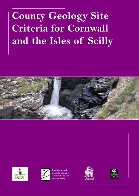
County Geology Site Criteria for Cornwall and the Isles of Scilly
County Geology Site Criteria for Cornwall and the Isles of Scilly
County Geology Site Criteria for Cornwall and the Isles of Scilly

Create successful ePaper yourself
Turn your PDF publications into a flip-book with our unique Google optimized e-Paper software.
Heading<strong>County</strong> <strong>Geology</strong> <strong>Site</strong><strong>Criteria</strong> <strong>for</strong> <strong>Cornwall</strong><strong>and</strong> <strong>the</strong> <strong>Isles</strong> <strong>of</strong> <strong>Scilly</strong>EnvironmentalRecords Centre <strong>for</strong><strong>Cornwall</strong> <strong>and</strong> <strong>the</strong><strong>Isles</strong> <strong>of</strong> <strong>Scilly</strong>
We are very grateful to all those who provided input <strong>and</strong> comments during <strong>the</strong> production <strong>of</strong> this document.Particular thanks go to Peter Ealey <strong>and</strong> <strong>the</strong> o<strong>the</strong>r members <strong>of</strong> <strong>the</strong> <strong>Cornwall</strong> RIGS Group who willingly shared <strong>the</strong>irknowledge <strong>and</strong> expertise <strong>and</strong> whose contribution has been invaluable.ERCCIS <strong>and</strong> <strong>Cornwall</strong> Wildlife Trust (2010)<strong>County</strong> <strong>Geology</strong> <strong>Site</strong> <strong>Criteria</strong> <strong>for</strong> <strong>Cornwall</strong> <strong>and</strong> <strong>the</strong> <strong>Isles</strong> <strong>of</strong> <strong>Scilly</strong>Written by Susan Hocking, with contributions from <strong>the</strong> <strong>Cornwall</strong> RIGS GroupEdited by Victoria Whitehouse, Cheryl Marriott <strong>and</strong> Fay RobinsonDesigned by Sheila McCann-DownesDrawings by Sarah McCartneyCopies can be obtained from:ERCCISc/o <strong>Cornwall</strong> Wildlife TrustFive AcresAlletTruroTR4 9DJwis@cornwallwildlifetrust.org.uk
COUNTY GEOLOGY SITE CRITERIA FORCORNWALL AND THE ISLES OF SCILLYCONTENTS1 Introduction 12 Context <strong>and</strong> Background 22.1 The Geological Heritage <strong>of</strong> <strong>Cornwall</strong> <strong>and</strong> <strong>the</strong> <strong>Isles</strong> <strong>of</strong> <strong>Scilly</strong> 22.2 <strong>Site</strong>s <strong>of</strong> National Importance 32.3 <strong>Site</strong>s <strong>of</strong> Local Importance 32.4 Background to <strong>County</strong> <strong>Geology</strong> <strong>Site</strong>s/RIGS in <strong>Cornwall</strong> 33 <strong>County</strong> <strong>Geology</strong> <strong>Site</strong> Selection 43.1 The Role <strong>of</strong> <strong>the</strong> JNCC (1977) Guidelines 43.2 Nature Conservancy Council (NCC) (1990) Guidelines 43.3 Framework <strong>for</strong> Establishing <strong>the</strong> <strong>County</strong> <strong>Geology</strong> <strong>Site</strong>/RIGS System 53.4 Guiding Principles <strong>for</strong> <strong>County</strong> <strong>Geology</strong> <strong>Site</strong>/RIGS Selection 53.5 Procedures <strong>for</strong> <strong>County</strong> <strong>Geology</strong> <strong>Site</strong>/RIGS Selection 73.6 <strong>Site</strong> Boundaries 84 <strong>Criteria</strong> <strong>for</strong> <strong>County</strong> <strong>Geology</strong> <strong>Site</strong>/RIGS Selection in <strong>Cornwall</strong> &The <strong>Isles</strong> <strong>of</strong> <strong>Scilly</strong> 9BIBLIOGRAPHY 12APPENDICESAppendix 1 – List <strong>of</strong> <strong>County</strong> <strong>Geology</strong> <strong>Site</strong>s/RIGS in <strong>Cornwall</strong> & The <strong>Isles</strong> <strong>of</strong> <strong>Scilly</strong>Appendix 2 – The Geological Conservation Review (GCR) Background to <strong>Site</strong> SelectionAppendix 3 – Example <strong>of</strong> a <strong>County</strong> <strong>Geology</strong> <strong>Site</strong>/RIGS Summary SheetAppendix 4 – Protocol <strong>for</strong> amending <strong>County</strong> <strong>Geology</strong> <strong>Site</strong>/RIGS boundaries (DRAFT)
1. INTRODUCTIONThe aim <strong>of</strong> this document is to provide a systematic basis <strong>for</strong> <strong>the</strong> selection <strong>and</strong> designation <strong>of</strong>non-statutory or ‘Local’ Earth science sites in <strong>Cornwall</strong> <strong>and</strong> <strong>the</strong> <strong>Isles</strong> <strong>of</strong> <strong>Scilly</strong>. These sites, initiallyknown as Regionally Important Geological/Geomorphological <strong>Site</strong>s or RIGS, are now called ‘<strong>County</strong><strong>Geology</strong> <strong>Site</strong>s’ (CGSs) in <strong>Cornwall</strong>. On <strong>the</strong> <strong>Isles</strong> <strong>of</strong> <strong>Scilly</strong>, which is not a county but administered byits own Council, <strong>the</strong> name RIGS has been retained.These CGSs/RIGS:provide a local/regional network <strong>of</strong> sites that complements <strong>the</strong> national network <strong>of</strong> <strong>Site</strong>s <strong>of</strong> SpecialScientific Interest (SSSIs) <strong>and</strong> plays an important role in implementing Planning Policy Statement9: Biodiversity <strong>and</strong> Geological Conservation (PPS9) (2005), <strong>and</strong> delivering Local GeodiversityAction Plans (LGAPS);<strong>for</strong>m an integral part <strong>of</strong> <strong>the</strong> natural history <strong>of</strong> <strong>Cornwall</strong> <strong>and</strong> <strong>the</strong> <strong>Isles</strong> <strong>of</strong> <strong>Scilly</strong>;represent local character <strong>and</strong> distinctiveness;contribute to <strong>the</strong> quality <strong>of</strong> life <strong>and</strong> <strong>the</strong> well-being <strong>of</strong> <strong>the</strong> community, with many sites providingopportunities <strong>for</strong> education, research <strong>and</strong> leisure.CGSs/RIGS are an established feature <strong>of</strong> <strong>the</strong> statutory planning process in <strong>Cornwall</strong> <strong>and</strong> are at <strong>the</strong><strong>for</strong>efront <strong>of</strong> <strong>the</strong> county’s geodiversity conservation. They are an important factor taken into accountwhen planning decisions are made <strong>and</strong> are shown in <strong>the</strong> <strong>County</strong> Minerals, Waste, <strong>and</strong> LocalDevelopment Frameworks.For this reason it is important that <strong>the</strong> rationale <strong>for</strong> site selection is recorded <strong>and</strong> published <strong>and</strong><strong>the</strong> process <strong>of</strong> site selection is transparent. This document is <strong>the</strong>re<strong>for</strong>e <strong>of</strong> importance <strong>for</strong> planners,l<strong>and</strong>owners, developers <strong>and</strong> those working in geological conservation.<strong>Geology</strong> determines <strong>the</strong> nature <strong>of</strong> <strong>the</strong> l<strong>and</strong>scape <strong>and</strong> <strong>the</strong> location <strong>of</strong> habitats <strong>and</strong> <strong>the</strong>re<strong>for</strong>e has adirect effect on species distribution <strong>and</strong> numbers <strong>and</strong> underpins many conservation goals. CGSs/RIGSare selected <strong>and</strong> maintained primarily <strong>for</strong> <strong>the</strong>ir Earth science importance but many also have wildlifeinterest. There are obvious links with ecology in some habitats e.g. coastal habitats, mines <strong>and</strong> minewaste tips, quarries, road <strong>and</strong> rail cuttings. Management <strong>of</strong> a site <strong>for</strong> purely geological reasons (i.e.maintaining <strong>the</strong> maximum amount <strong>of</strong> 'clean' rock) would <strong>of</strong>ten be contrary to management goals<strong>for</strong> biological interest, so <strong>the</strong>re are obvious advantages to running <strong>the</strong> two site systems in parallel<strong>and</strong> producing holistic management plans <strong>for</strong> each site, in order to minimise conflict <strong>and</strong> to preventfeatures such as mine waste tips <strong>and</strong> quarries falling between <strong>the</strong> two disciplines.An equivalent document (<strong>County</strong> Wildlife <strong>Site</strong>s <strong>Criteria</strong> <strong>for</strong> <strong>Cornwall</strong>) has been produced to providea similar basis <strong>for</strong> <strong>the</strong> identification <strong>of</strong> <strong>County</strong> Wildlife <strong>Site</strong>s. These two documents provide criteria toensure a comprehensive local sites system is in place <strong>for</strong> <strong>Cornwall</strong>.The documents are produced in line with guidance given by <strong>the</strong> Government’s Department <strong>for</strong> <strong>the</strong>Environment, Food <strong>and</strong> Rural Affairs, in its publication 'Local <strong>Site</strong>s: Guidance on <strong>the</strong>ir identification,selection <strong>and</strong> management' (DEFRA 2006). This, in response to Government guidance issued inPPS9, aims to promote more transparent <strong>and</strong> consistent approaches to <strong>the</strong> development <strong>and</strong> operation<strong>of</strong> systems to identify sites <strong>of</strong> local importance <strong>for</strong> nature conservation in Engl<strong>and</strong>.<strong>County</strong> <strong>Geology</strong> <strong>Site</strong> <strong>Criteria</strong> <strong>for</strong> <strong>Cornwall</strong> & The <strong>Isles</strong> <strong>of</strong> <strong>Scilly</strong>Page 1Kynance Cove.
2. CONTEXT AND BACKGROUND2.1 The Geological Heritage <strong>of</strong> <strong>Cornwall</strong> <strong>and</strong> <strong>the</strong> <strong>Isles</strong><strong>of</strong> <strong>Scilly</strong>The geological history <strong>of</strong> <strong>Cornwall</strong> <strong>and</strong> <strong>the</strong> <strong>Isles</strong> <strong>of</strong> <strong>Scilly</strong>extends over a period <strong>of</strong> 500 million years <strong>and</strong> hasresulted in a great diversity <strong>of</strong> rocks, mineral deposits,<strong>and</strong> l<strong>and</strong>scapes. Its geology is dominated by <strong>the</strong> events(400–200 million years ago (Ma)) associated with <strong>the</strong>Variscan Orogeny. This mountain building episode onlyaffected <strong>the</strong> area that was to become south-west Britain,extending into central Europe. It post-dated <strong>the</strong> earlierCaledonian/Acadian orogenic episodes (c. 400 Ma <strong>and</strong>earlier), affecting north-west Britain, Sc<strong>and</strong>inavia <strong>and</strong>eastern North America.Prior to <strong>the</strong> onset <strong>of</strong> <strong>the</strong> Variscan Orogeny, Devoni<strong>and</strong>eposition in <strong>Cornwall</strong> was predominantly marine<strong>and</strong> associated with volcanic activity. It contrastswith <strong>the</strong> non-marine (‘Old Red S<strong>and</strong>stone’) desert,depositional environments fur<strong>the</strong>r north in <strong>the</strong> areas <strong>of</strong>Britain affected by <strong>the</strong> Caledonian/Acadian mountainbuilding. The Devonian <strong>and</strong> younger Carboniferousrocks <strong>of</strong> North <strong>Cornwall</strong> were deposited in a series <strong>of</strong>geographically distinct sedimentary basins, each with itsown geological history.The initial compressive phase <strong>of</strong> <strong>the</strong> Variscan Orogeny,caused by <strong>the</strong> northward advance <strong>of</strong> <strong>the</strong> super-continentGondwanal<strong>and</strong>, folded <strong>the</strong>se deposits dramatically <strong>and</strong>sometimes completely detached units into separatethrust slices. The unique Lizard Complex with its record<strong>of</strong> a pre-Variscan ocean floor, is a particularly goodexample <strong>of</strong> this.This Variscan folding <strong>and</strong> thrusting led to a great pile <strong>of</strong>sediments on <strong>Cornwall</strong>, resulting in gravitational collapse,which created its own geological structures <strong>and</strong> meltingat depth, resulting in <strong>for</strong>mation <strong>of</strong> <strong>the</strong> granite backbone<strong>of</strong> <strong>the</strong> county, now exposed in <strong>the</strong> line <strong>of</strong> topographicallyprominent moors, from Dartmoor through BodminMoor on to <strong>the</strong> <strong>Isles</strong> <strong>of</strong> <strong>Scilly</strong>. The granite intrusion wasfollowed by circulation <strong>of</strong> metal-rich fluids associatedwith <strong>the</strong>ir crystallisation, <strong>and</strong> cooling with attendanthydro<strong>the</strong>rmal circulation that led to <strong>the</strong> <strong>for</strong>mation <strong>of</strong><strong>Cornwall</strong>’s renowned china clay deposits.Deep tropical wea<strong>the</strong>ring during <strong>the</strong> Tertiary (65-1.8 Ma) led to <strong>the</strong> <strong>for</strong>mation <strong>of</strong> an extensive levellederosion surface which was subsequently incised byfalls in sea level associated with <strong>the</strong> subsequent coldglacial periods. The only area undoubtedly affectedby glaciation itself was <strong>the</strong> nor<strong>the</strong>rn <strong>Isles</strong> <strong>of</strong> <strong>Scilly</strong>.The o<strong>the</strong>r areas were affected by periglacial frozenconditions found at <strong>the</strong> outer edges <strong>of</strong> <strong>the</strong> glaciers,giving rise to extensive ‘head’ <strong>and</strong> wind-blown dustdeposits. The intervening warm interglacial periodsgave rise to raised beaches <strong>and</strong> <strong>the</strong> drowning <strong>of</strong> rivervalleys to <strong>for</strong>m rias such as <strong>the</strong> Fal <strong>and</strong> <strong>the</strong> Tamar. The<strong>Isles</strong> <strong>of</strong> <strong>Scilly</strong> were essentially drowned, giving rise to anarchipelago <strong>and</strong> coastal processes that give <strong>the</strong> isl<strong>and</strong>s<strong>the</strong>ir unique marine habitats.The result <strong>of</strong> <strong>the</strong>se geological processes is a l<strong>and</strong>scape<strong>the</strong> qualities <strong>of</strong> which are conserved <strong>and</strong> enhanced bydesignations as an Area <strong>of</strong> Outst<strong>and</strong>ing Natural Beauty(AONB) <strong>and</strong> Heritage Coast.The physical geography <strong>of</strong> <strong>the</strong> area has an influenceon <strong>the</strong> study <strong>and</strong> conservation <strong>of</strong> its geology <strong>and</strong>geomorphology. <strong>Cornwall</strong> is a long, narrow peninsulawith over 300km <strong>of</strong> coastline <strong>and</strong> a wealth <strong>of</strong> coastalexposure. On <strong>the</strong> north coast <strong>the</strong> battering <strong>of</strong> <strong>the</strong>Atlantic has <strong>for</strong>med rugged cliffs that cut across most <strong>of</strong><strong>the</strong> main rock groups that <strong>for</strong>m <strong>the</strong> county, giving greatopportunities <strong>for</strong> <strong>the</strong>ir study. The low-lying south coasthas been flooded by <strong>the</strong> sea <strong>and</strong> <strong>the</strong> lower reaches <strong>of</strong><strong>the</strong> river valleys <strong>for</strong>m rias, which fur<strong>the</strong>r extend <strong>the</strong>exposure available <strong>for</strong> study. Outcrops away from <strong>the</strong>coast are much less numerous, elevating <strong>the</strong> importance<strong>of</strong> inl<strong>and</strong> exposures such as quarries <strong>and</strong> road/railcuttings, <strong>and</strong> temporary exposures (building <strong>and</strong> majorconstruction sites) in <strong>the</strong>se areas.Tor, Bodmin Moor.Millook Cliffs.<strong>County</strong> <strong>Geology</strong> <strong>Site</strong> <strong>Criteria</strong> <strong>for</strong> <strong>Cornwall</strong> & The <strong>Isles</strong> <strong>of</strong> <strong>Scilly</strong>Page 2
2.2 <strong>Site</strong>s <strong>of</strong> National ImportanceNature Conservation, encompassing both wild flora <strong>and</strong>fauna <strong>and</strong> geological <strong>and</strong> physiographic features, hastraditionally been <strong>the</strong> responsibility <strong>of</strong> English Nature(now part <strong>of</strong> Natural Engl<strong>and</strong>) <strong>and</strong> its predecessor<strong>the</strong> Nature Conservancy Council. Its inception in1949 began <strong>the</strong> identification <strong>of</strong> <strong>the</strong> most importantbiological <strong>and</strong> Earth science sites in Britain. This iscarried out through <strong>the</strong> <strong>Site</strong> <strong>of</strong> Special Scientific Interest(SSSI) network <strong>of</strong> nationally <strong>and</strong> regionally importantsites. There are currently 168 SSSIs in <strong>Cornwall</strong> <strong>and</strong><strong>the</strong> <strong>Isles</strong> <strong>of</strong> <strong>Scilly</strong>, protected under <strong>the</strong> provision <strong>of</strong><strong>the</strong> Wildlife <strong>and</strong> Countryside Act 1981 (as amended),113 <strong>of</strong> which are notified wholly or partly <strong>for</strong> <strong>the</strong>irbiological importance <strong>and</strong> 88 (52%) wholly or partly <strong>for</strong><strong>the</strong>ir geological <strong>and</strong>/or geomorphological importance(<strong>the</strong>se figures are from <strong>the</strong> latest downloads availablefrom <strong>the</strong> Natural Engl<strong>and</strong> website, accessed October2010). When compared to <strong>the</strong> national figure <strong>of</strong> 30%<strong>of</strong> English SSSIs being <strong>of</strong> Earth science interest, thisillustrates <strong>the</strong> importance <strong>of</strong> Earth science in <strong>Cornwall</strong>.The Geological Conservation Review (GCR) in 1977-1990, saw a review <strong>of</strong> <strong>the</strong> coverage <strong>of</strong> Earth scienceSSSIs <strong>and</strong> a more systematic approach to site selection.The GCR sites <strong>for</strong>m <strong>the</strong> basis <strong>of</strong> statutory Earth heritageconservation in Britain. The results <strong>of</strong> this major revieware being published in 42 volumes.2.3 <strong>Site</strong>s <strong>of</strong> Local ImportanceThe national system <strong>of</strong> statutory sites (SSSIs) is not meantto be comprehensive. It provides a representative suite<strong>of</strong> <strong>the</strong> nation’s most important wildlife <strong>and</strong> geologicalsites, not every site <strong>of</strong> interest is included. There<strong>for</strong>e, tosafeguard <strong>the</strong> biodiversity <strong>and</strong> geodiversity <strong>of</strong> <strong>Cornwall</strong><strong>and</strong> <strong>the</strong> <strong>Isles</strong> <strong>of</strong> <strong>Scilly</strong>, a fur<strong>the</strong>r level <strong>of</strong> recognition <strong>and</strong>protection is needed.In <strong>the</strong> late 1980s <strong>the</strong> extent <strong>of</strong> local Earth heritageconservation was patchy across <strong>the</strong> UK <strong>and</strong> <strong>the</strong>re wasa need to provide a national focus <strong>and</strong> identity <strong>for</strong>regionally <strong>and</strong> locally important Earth science sites.The Nature Conservancy Council (NCC), a predecessorto Natural Engl<strong>and</strong>, created <strong>the</strong> RIGS (RegionallyImportant Geological/Geomorphological <strong>Site</strong>s) initiativeto meet this need, which stimulated local/regionalgeoconservation. The RIGS initiative aims to conservea series <strong>of</strong> locally important sites; to involve people inEarth heritage conservation; to raise public awareness<strong>of</strong> Earth heritage <strong>and</strong> to draw planning authorities’attention to features <strong>of</strong> local value, so that <strong>the</strong>irconsideration becomes an integral part <strong>of</strong> <strong>the</strong> planningprocess. RIGS, now called <strong>County</strong> <strong>Geology</strong> <strong>Site</strong>s in<strong>Cornwall</strong>, underpin <strong>and</strong> exp<strong>and</strong> <strong>the</strong> SSSI network <strong>and</strong>should not be seen as ‘second-tier’ SSSIs. They areequivalent to <strong>County</strong> Wildlife <strong>Site</strong>s <strong>and</strong> are <strong>of</strong> regionalor local importance in <strong>the</strong>ir own right.environment, recognised that Local <strong>Site</strong>s have afundamental role to play in helping to meet overallnational biodiversity/geodiversity targets, contributingto <strong>the</strong> quality <strong>of</strong> life <strong>and</strong> <strong>the</strong> well-being <strong>of</strong> <strong>the</strong> localcommunity <strong>and</strong> supporting research <strong>and</strong> education.In addition, Planning Policy Guidance Note 17:Planning <strong>for</strong> Open Space, Sport <strong>and</strong> Recreation (2002)recognises that open spaces may also have biodiversityor geodiversity interest <strong>and</strong> states that this should betaken into account <strong>and</strong> protected.Local sites - CWSs <strong>and</strong> CGSs/RIGS, provide acomprehensive system <strong>of</strong> sites that represent localcharacter <strong>and</strong> distinctiveness <strong>and</strong> complement o<strong>the</strong>rnational, regional <strong>and</strong> local site networks.2.4 Background to <strong>County</strong> <strong>Geology</strong> <strong>Site</strong>s/RIGS in<strong>Cornwall</strong> <strong>and</strong> <strong>the</strong> <strong>Isles</strong> <strong>of</strong> <strong>Scilly</strong>Local geoconservation ef<strong>for</strong>ts in <strong>Cornwall</strong> date back toat least <strong>the</strong> 1860s, when <strong>the</strong> Cheesewring <strong>and</strong> o<strong>the</strong>rtors on Bodmin Moor were protected from quarrying. In1991, <strong>the</strong> <strong>Cornwall</strong> RIGS Group, with <strong>the</strong> Cheesewringas its logo, was founded. The group is affiliated to<strong>Cornwall</strong> Wildlife Trust <strong>and</strong> is made up <strong>of</strong> geologists inindustry; geologists with experience <strong>of</strong> education at alllevels, from primary to postgraduate <strong>and</strong> representativesfrom o<strong>the</strong>r bodies involved in conservation such asNatural Engl<strong>and</strong>, The National Trust, museums <strong>and</strong>geological societies.On its inception, <strong>the</strong> <strong>Cornwall</strong> RIGS Group immediatelystarted <strong>the</strong> process <strong>of</strong> identifying <strong>and</strong> designatingsites but as <strong>the</strong> work is carried out entirely by unpaidvolunteers, <strong>the</strong> process is nowhere near complete. Atotal <strong>of</strong> 113 (figure correct at 22nd November 2010)sites have been designated so far <strong>and</strong> are registered with<strong>Cornwall</strong> Council. These sites are <strong>of</strong> at least <strong>County</strong>importance <strong>for</strong> <strong>the</strong>ir Earth science interest, many are <strong>of</strong>regional or even greater significance. A full list <strong>of</strong> CGSs/RIGS in <strong>Cornwall</strong> <strong>and</strong> <strong>the</strong> <strong>Isles</strong> <strong>of</strong> <strong>Scilly</strong> is given inAppendix 1.Planning Policy Statement 9: Biodiversity <strong>and</strong>Geological Conservation (PPS9) (2005) which statescurrent national planning policy <strong>for</strong> <strong>the</strong> natural<strong>County</strong> <strong>Geology</strong> <strong>Site</strong> <strong>Criteria</strong> <strong>for</strong> <strong>Cornwall</strong> & The <strong>Isles</strong> <strong>of</strong> <strong>Scilly</strong>Page 3
3. COUNTY GEOLOGY SITE SELECTIONThe legislation in PPS9 firmly establishes geology aspart <strong>of</strong> nature conservation <strong>and</strong> puts it on an equalfooting with biodiversity in <strong>the</strong> Government's planningobjectives. Geodiversity is now in a similar situation tobiodiversity following <strong>the</strong> 1992 Earth Summit in Rio deJaneiro, which raised public awareness <strong>of</strong> biodiversity<strong>and</strong> established it as a priority <strong>for</strong> policy <strong>and</strong> decisionmakers.Although no <strong>for</strong>mal equivalent to national BiodiversityAction Plans (BAPs) currently exists <strong>for</strong> geological sites,such a system is being developed <strong>and</strong> promoted <strong>and</strong>a UK Geodiversity Action Plan (UKGAP) is awaitingpublication. The Geodiversity Action Plan <strong>for</strong> <strong>Cornwall</strong><strong>and</strong> <strong>the</strong> <strong>Isles</strong> <strong>of</strong> <strong>Scilly</strong> (Wheeler, 2005) sets out<strong>Cornwall</strong> <strong>and</strong> <strong>Scilly</strong>’s objectives to deliver <strong>and</strong> promotegeological conservation based on knowledge <strong>of</strong> <strong>the</strong>existing network <strong>of</strong> nationally important geologicalSSSIs; local geological sites; CGSs/RIGS <strong>and</strong> geologyin <strong>the</strong> wider environment. Due to lack <strong>of</strong> funds it wasbeyond <strong>the</strong> scope <strong>of</strong> <strong>the</strong> <strong>Cornwall</strong> GAP to carry out acomprehensive audit such as that carried out by <strong>the</strong><strong>Cornwall</strong> Biodiversity Action Plan (BAP). A syn<strong>the</strong>sis <strong>of</strong><strong>the</strong> conservation status <strong>of</strong> every individual rock type,mineral, fossil, stratigraphic unit etc, within <strong>Cornwall</strong><strong>and</strong> <strong>the</strong> <strong>Isles</strong> <strong>of</strong> <strong>Scilly</strong> was <strong>the</strong>re<strong>for</strong>e not undertaken.However, an initial framework was established whichsummarises <strong>and</strong> classifies <strong>the</strong> principal geological,geomorphological, soil <strong>and</strong> l<strong>and</strong>scape features <strong>and</strong>natural resources comprising <strong>the</strong> geodiversity <strong>of</strong><strong>Cornwall</strong> <strong>and</strong> <strong>the</strong> <strong>Isles</strong> <strong>of</strong> <strong>Scilly</strong>. This will allow <strong>the</strong> siteselection process to go ahead until a full audit can becarried out.The <strong>Cornwall</strong> <strong>and</strong> <strong>Isles</strong> <strong>of</strong> <strong>Scilly</strong> GAP is important in<strong>the</strong> process <strong>of</strong> site selection as it in<strong>for</strong>ms <strong>the</strong> decisionmaking process, providing a strategic framework <strong>for</strong>geodiversity in <strong>the</strong> area against which sites can beassessed. This is important as <strong>the</strong> non-statutory CGSs/RIGS are protected through <strong>the</strong> planning system, <strong>and</strong>Local Authority plans <strong>and</strong> policies are expected tobecome increasingly GAP focussed in light <strong>of</strong> PPS9, <strong>and</strong>with <strong>the</strong> delivery <strong>of</strong> <strong>the</strong> UK GAP.When assessing <strong>the</strong> Earth science interest <strong>of</strong> a site,ei<strong>the</strong>r during <strong>the</strong> selection <strong>of</strong> CGSs/RIGS or whencomparing sites <strong>of</strong> lower interest, nationally recognisedcriteria are applied.3.1 The role <strong>of</strong> <strong>the</strong> JNCC (1977) GuidelinesThe JNCC document 'Guidelines <strong>for</strong> Selection <strong>of</strong> EarthScience SSSIs' (1977), summarises <strong>the</strong> rationale behind<strong>the</strong> selection <strong>of</strong> Earth science SSSIs, a process knownas <strong>the</strong> Geological Conservation Review (GCR), <strong>the</strong>aim <strong>of</strong> which was to select a GB-wide series <strong>of</strong> sites <strong>of</strong>national/international interest <strong>for</strong> <strong>the</strong>ir geology using <strong>the</strong>minimum number <strong>of</strong> sites needed to demonstrate <strong>the</strong>range <strong>and</strong> diversity <strong>of</strong> Earth science features in <strong>the</strong> UK.The sites are assessed against <strong>the</strong> criteria <strong>of</strong>:• representativeness• exceptional features• international importanceThe criteria are applied on a working subject ‘block’basis, each ‘block’ consisting <strong>of</strong> a group <strong>of</strong> sites,addressing a particular period <strong>of</strong> geological time orsubject area. Those <strong>of</strong> relevance to <strong>Cornwall</strong> <strong>and</strong> <strong>the</strong><strong>Isles</strong> <strong>of</strong> <strong>Scilly</strong> are listed in Appendix 2. Representativesites are selected within each block <strong>and</strong> <strong>the</strong>y fall withinnatural groupings, called networks, based on <strong>the</strong>irgeological features or scenarios.The criteria <strong>and</strong> principles used in GCR <strong>and</strong> SSSIselection can provide a useful background to <strong>the</strong>application <strong>of</strong> more relevant <strong>and</strong> up-to-date criteria in<strong>the</strong> assessment <strong>of</strong> Local <strong>Site</strong>s.3.2 Nature Conservancy Council (NCC) (1990)guidelines“For geological sites, guidelines <strong>for</strong> <strong>the</strong> selection <strong>of</strong>nationally important sites, originally published in<strong>the</strong> Geological Conservation Review (GCR), havealready been supplemented by criteria <strong>for</strong> more localapplication in <strong>the</strong> selection <strong>of</strong> CGSs/RIGS. This hasinvolved emphasis <strong>of</strong> <strong>the</strong> educational <strong>and</strong> researchopportunities <strong>and</strong> aes<strong>the</strong>tic qualities <strong>of</strong> sites. CGSs/RIGS are selected on a local or regional basis usingfour nationally agreed criteria” (para. 52 <strong>of</strong> <strong>the</strong> Defraguidance 2006).The four nationally agreed criteria <strong>for</strong> <strong>the</strong> selection<strong>of</strong> <strong>County</strong> <strong>Geology</strong> <strong>Site</strong>s/RIGS detailed in <strong>the</strong> NCCpublication Earth Science Conservation in Great Britain– A Strategy (1990) are:1. <strong>the</strong> value <strong>of</strong> a site <strong>for</strong> educational fieldwork inprimary <strong>and</strong> secondary schools, at undergraduatelevel <strong>and</strong> in adult education courses;2. <strong>the</strong> value <strong>of</strong> a site <strong>for</strong> study by both pr<strong>of</strong>essional<strong>and</strong> amateur Earth scientists; such sites demonstrate,alone or as part <strong>of</strong> a network, <strong>the</strong> geology <strong>and</strong>geomorphology <strong>of</strong> <strong>the</strong> area;3. <strong>the</strong> historical value <strong>of</strong> <strong>the</strong> site in terms <strong>of</strong> importantadvances in Earth science knowledge;4. <strong>the</strong> aes<strong>the</strong>tic value <strong>of</strong> a site in <strong>the</strong> l<strong>and</strong>scape,particularly in relation to promoting publicawareness <strong>and</strong> appreciation <strong>of</strong> <strong>the</strong> Earth sciences.These CGS criteria more closely reflect local use <strong>and</strong>interest. The method <strong>of</strong> application <strong>of</strong> <strong>the</strong> criteria is lessclear <strong>and</strong> <strong>the</strong>re is regional variation across <strong>the</strong> country.<strong>County</strong> <strong>Geology</strong> <strong>Site</strong> <strong>Criteria</strong> <strong>for</strong> <strong>Cornwall</strong> & The <strong>Isles</strong> <strong>of</strong> <strong>Scilly</strong>Page 4
The four locally agreed <strong>the</strong>mes upon which moredetailed criteria <strong>for</strong> <strong>the</strong> selection <strong>of</strong> <strong>County</strong> <strong>Geology</strong><strong>Site</strong>s in <strong>Cornwall</strong> <strong>and</strong> RIGS in <strong>the</strong> <strong>Isles</strong> <strong>of</strong> <strong>Scilly</strong> will bebased are:1. Scientific importance2. Educational value3. Historical/Cultural significance4. Aes<strong>the</strong>tic value (value <strong>for</strong> public awareness <strong>and</strong>appreciation)In <strong>Cornwall</strong> <strong>and</strong> <strong>the</strong> <strong>Isles</strong> <strong>of</strong> <strong>Scilly</strong> <strong>the</strong>se criteria havebeen streng<strong>the</strong>ned by <strong>the</strong> RIGS Group to emphasise<strong>the</strong> intrinsic scientific value <strong>of</strong> CGSs/RIGS. The nationalcriteria <strong>for</strong> local geological site selection tie in scientificimportance with its value <strong>for</strong> study or education, but<strong>the</strong>re are many features <strong>of</strong> regional scientific importancein <strong>Cornwall</strong> <strong>and</strong> <strong>Scilly</strong> that are not SSSI but whichare not suitable <strong>for</strong> inclusion under educational orstudy criteria. This approach is supported by Defra:“…selection <strong>of</strong> Local <strong>Site</strong>s to maintain geologicalconservation should be based on national, regional<strong>and</strong> local assessment <strong>of</strong> features <strong>of</strong> geological interest<strong>and</strong> <strong>the</strong> provision <strong>of</strong> such sites <strong>for</strong> educational orresearch purposes. There<strong>for</strong>e, this national guidancesimply provides a st<strong>and</strong>ard framework against whichto structure assessment <strong>of</strong> local nature conservationpriorities, ra<strong>the</strong>r than a rigid set <strong>of</strong> rules” (para. 39,Defra 2006 guidance).3.3 Framework <strong>for</strong> Establishing <strong>the</strong> <strong>County</strong> <strong>Geology</strong><strong>Site</strong>/RIGS System“Many organisations have an interest in biodiversity<strong>and</strong> geological conservation…..The establishment <strong>and</strong>management <strong>of</strong> a Local <strong>Site</strong>s system, whilst needinga clear focus <strong>of</strong> responsibility, should be based on apartnership approach involving such organisations”(para. 14, Defra 2006 guidance). The suggested role <strong>of</strong>such a partnership is to agree <strong>the</strong> basis <strong>for</strong> site selection;co-ordinate <strong>the</strong> site selection procedures; promote <strong>and</strong>support site management, enhancement <strong>and</strong> educationaluse; co-ordinate funding; monitor sites <strong>and</strong> review <strong>the</strong>system. This role is described in more detail in Section3.5 <strong>of</strong> this document.3.4 Guiding Principles <strong>for</strong> <strong>County</strong> <strong>Geology</strong> <strong>Site</strong> /RIGS SelectionThe guiding principles used in <strong>the</strong> application <strong>of</strong> <strong>the</strong>criteria to select CGSs in <strong>Cornwall</strong> <strong>and</strong> RIGS in <strong>the</strong> <strong>Isles</strong><strong>of</strong> <strong>Scilly</strong>, are stated below.A The CGS/RIGS system, toge<strong>the</strong>r with o<strong>the</strong>r sitenetworks, should cover <strong>the</strong> full range <strong>of</strong> importantgeological <strong>and</strong> geomorphological features at a levelnecessary to maintain <strong>the</strong> Earth science resource <strong>of</strong><strong>Cornwall</strong> <strong>and</strong> <strong>the</strong> <strong>Isles</strong> <strong>of</strong> <strong>Scilly</strong>. The CGS/RIGS system<strong>for</strong> <strong>Cornwall</strong> <strong>and</strong> <strong>Scilly</strong> is comprehensive <strong>and</strong> aims toprotect as many sites <strong>of</strong> substantive interest as possible.The system complements national site networks, whichselect a suite <strong>of</strong> sites that are representative samplesGranite, St Mary's <strong>Isles</strong> <strong>of</strong> <strong>Scilly</strong>.<strong>of</strong> <strong>the</strong> range <strong>of</strong> diversity <strong>of</strong> Earth science features inEngl<strong>and</strong>, whilst more closely reflecting local use <strong>and</strong>interest.B When selecting sites it is important to keep inmind <strong>the</strong> reason <strong>the</strong> sites are being selected, i.e. toraise awareness <strong>and</strong> target resources. It is critical that<strong>the</strong> criteria are used to select appropriate sites. Omittingsites <strong>of</strong> high enough quality to be <strong>County</strong> <strong>Geology</strong><strong>Site</strong>s/RIGS may increase <strong>the</strong> potential <strong>for</strong> damage ordegradation to those sites. Conversely, selecting sites<strong>of</strong> inferior quality can waste resources <strong>and</strong> threaten <strong>the</strong>integrity <strong>of</strong> <strong>the</strong> whole system.C The application <strong>of</strong> <strong>the</strong> criteria <strong>for</strong> CGS/RIGSselection at a local level will be a matter <strong>of</strong> expertjudgment based on specialist knowledge, using <strong>the</strong>in<strong>for</strong>mation available at <strong>the</strong> time. The frameworkagainst which sites are judged is inherently dynamic <strong>and</strong>will change with advances in <strong>the</strong> science. As <strong>the</strong>oriesare developed <strong>and</strong> new exposures are revealed, so siteswill need to be added to, or removed from <strong>the</strong> system ifit is to maintain its conservation relevance. The criteria<strong>the</strong>re<strong>for</strong>e need to be applied by experts (1) with anunderst<strong>and</strong>ing <strong>of</strong> geological principles <strong>and</strong> processes<strong>and</strong> an intimate knowledge <strong>of</strong> <strong>the</strong> Earth science interest<strong>of</strong> <strong>Cornwall</strong> <strong>and</strong> <strong>the</strong> <strong>Isles</strong> <strong>of</strong> <strong>Scilly</strong>.<strong>County</strong> <strong>Geology</strong> <strong>Site</strong> <strong>Criteria</strong> <strong>for</strong> <strong>Cornwall</strong> & The <strong>Isles</strong> <strong>of</strong> <strong>Scilly</strong>Page 5
D Geological site assessment will be carried outusing <strong>the</strong> 4 locally defined <strong>the</strong>mes, listed in section 3.2,assessing each site in <strong>the</strong> context <strong>of</strong> <strong>the</strong> appropriatelocally defined Earth science subject area <strong>and</strong> <strong>the</strong>relevant, locally defined, geological 'block', withineach Area <strong>of</strong> Search (AOS). (The <strong>the</strong>mes, subject areas<strong>and</strong> blocks are detailed in Chapter 4, Section 1). Thenational criteria need to be applied against a framework<strong>of</strong> in<strong>for</strong>mation which reflects <strong>the</strong> considerable range<strong>of</strong> variation in <strong>the</strong> geology <strong>and</strong> geomorphology <strong>of</strong><strong>Cornwall</strong> <strong>and</strong> <strong>Scilly</strong>. The use <strong>of</strong> <strong>the</strong> appropriate locallydefined subject areas combined with <strong>the</strong> geologicalblocks defined in <strong>the</strong> geodiversity audit presented in<strong>the</strong> <strong>Cornwall</strong> <strong>and</strong> <strong>Isles</strong> <strong>of</strong> <strong>Scilly</strong> GAP, as a framework<strong>for</strong> assessment, allows this variation to be taken intoaccount, while <strong>the</strong>re have been many specialist studieswhich give <strong>the</strong> required background that allows specificsubject areas to be assessed. Decisions will be basedon a good local knowledge <strong>of</strong> <strong>the</strong> geology <strong>of</strong> <strong>the</strong> area,in relation to <strong>the</strong> extent <strong>and</strong> quality <strong>of</strong> <strong>the</strong> Earth scienceresource within that particular geological subject'block', <strong>the</strong> current situation <strong>and</strong> perceived trends in <strong>the</strong>science, <strong>and</strong> <strong>the</strong> availability <strong>of</strong> exposure.The Area <strong>of</strong> Search (AOS) is <strong>the</strong> area over which <strong>the</strong>criteria are applied. For this purpose <strong>Cornwall</strong> is dividedinto areas which reflect local variations in wildlife <strong>and</strong>natural features. Following <strong>the</strong> principles specifiedin paragraph 40 <strong>of</strong> <strong>the</strong> DEFRA (2006) guidance <strong>the</strong>AOS is based on <strong>the</strong> ‘Natural Areas’ defined by <strong>the</strong><strong>for</strong>mer English Nature, combined with <strong>the</strong> <strong>for</strong>merCountryside Commission’s Character Areas. TheseJoint Character Areas divide <strong>Cornwall</strong> <strong>and</strong> <strong>Scilly</strong> intoThe Culm; Bodmin Moor; Cornish Killas; Hensbarrow;Carnmenellis; The Lizard; West Penwith <strong>and</strong> <strong>the</strong> <strong>Isles</strong> <strong>of</strong><strong>Scilly</strong>. Due to <strong>the</strong> large size <strong>of</strong> <strong>the</strong> ‘Cornish Killas’, <strong>and</strong><strong>the</strong> different character <strong>of</strong> <strong>the</strong> north <strong>and</strong> south coasts, thisarea is fur<strong>the</strong>r sub-divided into ‘North’ <strong>and</strong> ‘South’.E There are 4 qualifying criteria, but a featurewill be considered eligible <strong>for</strong> selection if it satisfiesonly one <strong>of</strong> <strong>the</strong>m. The term ‘eligible <strong>for</strong> selection’ isused because it is always necessary <strong>for</strong> each case tobe judged by an expert. This is particularly importantwhere a site may be borderline, in which case, o<strong>the</strong>raspects <strong>of</strong> <strong>the</strong> site including <strong>the</strong> quality <strong>of</strong> <strong>the</strong> exposurehave to be considered.F The guiding principle <strong>of</strong> SSSI selection, that <strong>for</strong>sites which do not clearly qualify on a single feature<strong>of</strong> interest, <strong>the</strong> combined value must be taken intoaccount, will be followed. This principle refers tocombinations <strong>of</strong> features within a single site <strong>and</strong> will bemost applicable to educational sites.G In certain cases it is permissible to designateCGSs/RIGS within <strong>Site</strong>s <strong>of</strong> Special Scientific Interest(SSSIs), providing <strong>the</strong> features <strong>of</strong> interest designated ineach case are not <strong>the</strong> same. SSSIs may include features<strong>of</strong> 'substantive' conservation interest, important in<strong>the</strong> local context, quite apart from <strong>the</strong> internationally/nationally significant features <strong>for</strong> which <strong>the</strong>y havebeen designated, <strong>for</strong> example, a SSSI designated<strong>for</strong> its Variscan structures may also contain locallysignificant mineralization. Liaison with Natural Engl<strong>and</strong>is important to ensure a co-ordinated approach to<strong>the</strong> conservation <strong>and</strong> management <strong>of</strong> such sites.Natural Engl<strong>and</strong> should be encouraged to incorporatemanagement <strong>for</strong> <strong>the</strong> locally significant feature within<strong>the</strong> management advice <strong>the</strong>y give <strong>the</strong> l<strong>and</strong>owner <strong>for</strong><strong>the</strong> whole SSSI. This will only be possible if <strong>the</strong>re is noconflict with management <strong>for</strong> <strong>the</strong> feature(s) <strong>for</strong> which<strong>the</strong> statutory site has been designated.H Active quarries are eligible <strong>for</strong> selection as a CGS/RIGS. Although active quarrying <strong>and</strong> Earth scienceconservation may not appear to be compatible, suchactivity has revealed more rock exposures, minerals<strong>and</strong> fossils than would have been known from naturalexposures alone. Features such as <strong>the</strong>se <strong>and</strong> roadcuttings can be designated as local sites but co-operationbetween <strong>the</strong> extraction/construction industries <strong>and</strong>conservation interests will be needed, with systems <strong>for</strong>liaison <strong>and</strong> long term management <strong>and</strong> maintenance <strong>of</strong>features, to strike a mutually beneficial balance.Mylor Slates folded in a zig-zag near Godrevy.I Active processes are eligible <strong>for</strong> selection asCGSs/RIGS. An active geomorphological process,such as l<strong>and</strong>slipping, can be selected as a CGS/RIGSto recognise <strong>and</strong> af<strong>for</strong>d protection to <strong>the</strong> process.However, <strong>the</strong> aim must be to maintain <strong>the</strong> activeprocess by non-interference.(1) An expert is defined as “someone having <strong>the</strong> knowledge <strong>and</strong> skills necessary to per<strong>for</strong>m <strong>the</strong> task required through training, qualification, experienceor a combination <strong>of</strong> <strong>the</strong>se”<strong>County</strong> <strong>Geology</strong> <strong>Site</strong> <strong>Criteria</strong> <strong>for</strong> <strong>Cornwall</strong> & The <strong>Isles</strong> <strong>of</strong> <strong>Scilly</strong>Page 6
J Artificial sites are eligible <strong>for</strong> selection as aCGS/RIGS. Whilst much <strong>of</strong> <strong>the</strong> Earth science interest<strong>of</strong> <strong>Cornwall</strong> <strong>and</strong> <strong>the</strong> <strong>Isles</strong> <strong>of</strong> <strong>Scilly</strong> can be covered bydesignating rock exposures, <strong>the</strong> area also contains anumber <strong>of</strong> geodiversity related museum collections <strong>of</strong>minerals, rocks <strong>and</strong> fossils with potential <strong>for</strong> scientific<strong>and</strong> educational purposes. This is particularly <strong>the</strong> case<strong>for</strong> minerals which have been much collected in <strong>the</strong>past, with <strong>the</strong> result that <strong>the</strong>re is a paucity <strong>of</strong> freshmaterial <strong>for</strong> study. Whilst <strong>the</strong> situation has not yetarisen, it is not out <strong>of</strong> <strong>the</strong> question that such a collectioncould be designated as a CGS/RIGS in <strong>the</strong> future.Ano<strong>the</strong>r instance is where a number <strong>of</strong> different buildingor ornamental stones have been ga<strong>the</strong>red toge<strong>the</strong>r inone place, <strong>of</strong>fering <strong>the</strong> opportunity to examine cut <strong>and</strong>polished faces.K It is intended that CGS/RIGS coverage shouldinclude both soils <strong>and</strong> hydrogeology. Soils are animportant part <strong>of</strong> Earth science <strong>and</strong> <strong>for</strong>m <strong>the</strong> interfacebetween this <strong>and</strong> biological sites. However, due to alack <strong>of</strong> knowledge <strong>and</strong> expertise about local soils <strong>the</strong>subject has not been tackled to date.be used <strong>for</strong> educational purposes. However, some sitesare unique <strong>and</strong> need special consideration irrespective<strong>of</strong> <strong>the</strong>ir location.M The process <strong>of</strong> site selection will be transparent.The rationale <strong>of</strong> <strong>the</strong> decisions made <strong>for</strong> individual siteswill be recorded <strong>and</strong> made available to any interestedparties. This will be necessary <strong>for</strong> arbitration should <strong>the</strong>CGS/RIGS designation be contested. Procedures <strong>for</strong> howthis will be achieved are referred to in section 3.5.N The process <strong>of</strong> site selection will be accountable<strong>and</strong> legitimate. The site selection procedure must becarried out by suitably qualified experts with knowledge<strong>of</strong> geological principles <strong>and</strong> processes <strong>and</strong> an overview<strong>of</strong> <strong>the</strong> geology <strong>of</strong> <strong>Cornwall</strong> <strong>and</strong> <strong>the</strong> <strong>Isles</strong> <strong>of</strong> <strong>Scilly</strong>.The whole process must be ratified by a Local <strong>Site</strong>sPartnership, <strong>and</strong> this has been drawn from <strong>the</strong> larger<strong>Cornwall</strong> BAP Partnership. The Partnership’s role,in overseeing <strong>and</strong> approving <strong>the</strong> criteria <strong>and</strong> <strong>the</strong> siteassessment <strong>and</strong> selection procedures, <strong>and</strong> providingtechnical input as necessary, is vital in respect <strong>of</strong> <strong>the</strong>accountability <strong>of</strong> <strong>the</strong> process.3.5 Procedures <strong>for</strong> <strong>County</strong> <strong>Geology</strong> <strong>Site</strong> SelectionA Local <strong>Site</strong>s Partnership Group has been drawn from<strong>the</strong> larger BAP Partnership, <strong>and</strong> comprises <strong>County</strong>Planners, Countryside Managers, Minerals Planners,geologists in industry, representatives from NaturalEngl<strong>and</strong>, <strong>the</strong> Farming <strong>and</strong> Wildlife Advisory Group, <strong>the</strong><strong>Cornwall</strong> Agricultural Council, <strong>and</strong> <strong>Cornwall</strong> WildlifeTrust. This Partnership has overseen <strong>the</strong> strategicdevelopment <strong>of</strong> <strong>the</strong> <strong>County</strong> Wildlife <strong>Site</strong> <strong>and</strong> <strong>County</strong><strong>Geology</strong> <strong>Site</strong> Systems <strong>and</strong> approved <strong>the</strong> criteria <strong>and</strong>site assessment <strong>and</strong> selection procedures. Members <strong>of</strong><strong>the</strong> Partnership continue to provide technical input asnecessary.The evaluation <strong>of</strong> existing or potential new sites willbe carried out using <strong>the</strong> criteria detailed in Section 4 <strong>of</strong>this report, whilst following <strong>the</strong> Guiding Principles inSection 3.4. Designation <strong>of</strong> new sites will be a 5 stageprocess:1. A ‘working list’ <strong>of</strong> potential new sites will be created<strong>and</strong> managed by <strong>the</strong> <strong>Cornwall</strong> RIGS Group.Cassiterite.L Sufficient examples <strong>of</strong> each geological <strong>and</strong>geomorphological feature should be designated t<strong>of</strong>acilitate opportunities <strong>for</strong> study <strong>and</strong> appreciationthroughout <strong>Cornwall</strong> <strong>and</strong> <strong>the</strong> <strong>Isles</strong> <strong>of</strong> <strong>Scilly</strong>. There isa need <strong>for</strong> a good spread <strong>of</strong> educational sites across<strong>the</strong> area, particularly to meet <strong>the</strong> dem<strong>and</strong> from schoolsfollowing <strong>the</strong> National Curriculum <strong>and</strong> <strong>for</strong> training Earthscience undergraduates. Distance from local schools <strong>and</strong>colleges is a factor in determining how much a site will2. Preliminary in<strong>for</strong>mation on <strong>the</strong>se sites will becollected by members <strong>of</strong> <strong>the</strong> RIGS Group (including arough outline boundary <strong>and</strong> brief reasons <strong>for</strong> interestbased on this criteria document), <strong>and</strong> brought to Local<strong>Site</strong> Partnership meetings to discuss prioritisation <strong>and</strong>collate in<strong>for</strong>mation.3. For potential new sites thought suitable <strong>for</strong> fur<strong>the</strong>rinvestigation, geologists will collate detailed in<strong>for</strong>mation<strong>and</strong> complete <strong>the</strong> <strong>for</strong>m ‘Protocol <strong>for</strong> amending <strong>County</strong><strong>Geology</strong> <strong>Site</strong> boundaries’ (currently under consultation<strong>and</strong> shown in draft <strong>for</strong>m in Appendix 4).<strong>County</strong> <strong>Geology</strong> <strong>Site</strong> <strong>Criteria</strong> <strong>for</strong> <strong>Cornwall</strong> & The <strong>Isles</strong> <strong>of</strong> <strong>Scilly</strong>Page 7
4. The Local <strong>Site</strong>s Partnership will meet to evaluate sitesby referring to <strong>the</strong> completed protocol <strong>for</strong>m <strong>and</strong> <strong>the</strong>secriteria. <strong>Site</strong>s will be approved, rejected or put on holdpending more in<strong>for</strong>mation.5. If <strong>the</strong> site is approved, site documentation willbe completed with a <strong>Site</strong> Summary Sheet <strong>and</strong> a <strong>Site</strong>Boundary Map being produced <strong>for</strong> each site.The process <strong>for</strong> changes to site boundaries <strong>and</strong>/ordeletion <strong>of</strong> sites will follow <strong>the</strong> steps below (data islikely to have been collected by geologists undertakingsurveys in <strong>the</strong> field, so <strong>the</strong>re is no need <strong>for</strong> steps 1 & 2above):1. Geologists will collate detailed in<strong>for</strong>mation on <strong>the</strong>site <strong>and</strong> reasons <strong>for</strong> suggested boundary changes <strong>and</strong>complete <strong>the</strong> <strong>for</strong>m ‘Protocol <strong>for</strong> amending <strong>County</strong><strong>Geology</strong> <strong>Site</strong> boundaries’ (currently in draft <strong>for</strong>m;Appendix 4).2. The Local <strong>Site</strong>s Partnership will meet to evaluate <strong>the</strong>proposed amendment/deletion by referring to <strong>the</strong>completed protocol <strong>for</strong>m <strong>and</strong> <strong>the</strong>se criteria. <strong>Site</strong>s willbe approved, rejected or put on hold pending morein<strong>for</strong>mation.3. If <strong>the</strong> amendment/deletion is approved, sitedocumentation will be completed with a <strong>Site</strong> SummarySheet <strong>and</strong> a <strong>Site</strong> Boundary Map being produced <strong>for</strong>each site.The summary sheet will be distributed to <strong>the</strong> site owner<strong>and</strong> o<strong>the</strong>r selected parties <strong>and</strong> will ultimately be madeavailable on a password-protected web-based system.An example <strong>of</strong> <strong>the</strong> summary sheet is given in Appendix3. The web-based CGS dataset will be re-issuedannually. There will also be a rolling programme <strong>of</strong> sitereview <strong>and</strong> update, as funding allows.3.6 <strong>Site</strong> BoundariesThere are many issues associated with delineating sites<strong>and</strong> drawing boundaries. Paragraphs A-D below outline<strong>the</strong> procedures associated with <strong>the</strong>se.There are relatively few sites where <strong>the</strong> boundary whichmarks <strong>the</strong> l<strong>and</strong> <strong>of</strong> interest from <strong>the</strong> wider l<strong>and</strong>scape isclear-cut. While quarries are <strong>of</strong>ten features that can beclearly identified, <strong>the</strong> majority <strong>of</strong> exposures tend to besporadic <strong>and</strong> interspersed with areas <strong>of</strong> semi-naturalvegetation <strong>and</strong> farml<strong>and</strong>.In <strong>the</strong>se cases <strong>the</strong> boundaries that are drawn to enclose<strong>and</strong> define a site <strong>of</strong> Earth science interest necessarilyinvolve some element <strong>of</strong> subjectivity. It is usually <strong>the</strong>case that <strong>the</strong> areas <strong>of</strong> Earth science interest are firstidentified <strong>and</strong> <strong>the</strong>n a boundary is defined that bothincludes all <strong>the</strong> area <strong>of</strong> interest <strong>and</strong> follows some clearlyidentifiable l<strong>and</strong>scape feature.B Extensive features that are fragmented maystill be viewed as one site. For example a dyke withintermittent exposure. In circumstances such as <strong>the</strong>seit is deemed sensible to treat <strong>the</strong> whole area as onesite, even though some <strong>of</strong> <strong>the</strong> components are isolated<strong>and</strong> small. There is no easy answer to how fragmentedany area must be be<strong>for</strong>e <strong>the</strong> fragments are treated asseparate sites, ra<strong>the</strong>r each case must be assessed <strong>and</strong>described on an individual basis.C As a general rule site boundaries do notinclude deliberately delineated buffer zones. Bufferl<strong>and</strong> is defined as l<strong>and</strong> that <strong>of</strong> itself is <strong>of</strong> no evidentsignificant Earth science interest, but changes to itmay have a knock-on effect to adjacent sites <strong>of</strong> Earthscience importance. For example, an active processesgeomorphological site.D The problem <strong>of</strong> whe<strong>the</strong>r areas within a site thatlack special interest should be excluded from <strong>the</strong> site,<strong>the</strong>reby leaving ‘holes’ within <strong>the</strong> site map, has to bedecided <strong>for</strong> each case on its merits. There are twobasic types <strong>of</strong> site where this problem arises: it maybe <strong>the</strong> case that <strong>the</strong>re is intermittent or fragmentedexposure <strong>of</strong> a feature or a site may have several features<strong>of</strong> interest that have been incorporated into one site butexposure is not continuous. The size <strong>of</strong> <strong>the</strong> includedarea is <strong>of</strong> secondary importance but should ideally be arelatively small proportion <strong>of</strong> <strong>the</strong> total area <strong>of</strong> <strong>the</strong> site.A <strong>Site</strong> boundaries are drawn as close to <strong>the</strong>geological site interest as possible, whilst also beingclearly identifiable on <strong>the</strong> ground. In practice,this usually means that <strong>the</strong> boundary <strong>of</strong> any site iscoincident with parts <strong>of</strong> <strong>the</strong> local field boundary systemor edges <strong>of</strong> clearly identifiable l<strong>and</strong>scape features suchas quarries. It is also important to document <strong>the</strong> siteinterest using photographs, so it can be easily identified.Occasionally, if it is important to accurately locate asite's interest, it may need pr<strong>of</strong>essional surveying.<strong>County</strong> <strong>Geology</strong> <strong>Site</strong> <strong>Criteria</strong> <strong>for</strong> <strong>Cornwall</strong> & The <strong>Isles</strong> <strong>of</strong> <strong>Scilly</strong>Page 8
4. CRITERIA FOR COUNTY GEOLOGY SITE/RIGS SELECTIONIN CORNWALL AND THE ISLES OF SCILLYThis section provides details <strong>of</strong> <strong>the</strong> locally definedcriteria <strong>for</strong> CGS/RIGS selection in <strong>Cornwall</strong> <strong>and</strong> <strong>the</strong> <strong>Isles</strong><strong>of</strong> <strong>Scilly</strong>. <strong>Site</strong>s are selected according to <strong>the</strong> guidingprinciples in section 3.4.1. Scientific importance<strong>Criteria</strong> S1 to S10 deal with <strong>the</strong> intrinsic scientificinterest <strong>of</strong> a site. Generally, if <strong>the</strong> site demonstrates agood example <strong>of</strong> a feature or features representative <strong>of</strong>one <strong>of</strong> <strong>the</strong> 22 subject blocks <strong>for</strong> <strong>Cornwall</strong> <strong>and</strong> <strong>the</strong> <strong>Isles</strong><strong>of</strong> <strong>Scilly</strong>, as defined in <strong>the</strong> <strong>Cornwall</strong> <strong>and</strong> <strong>Isles</strong> <strong>of</strong> <strong>Scilly</strong>GAP (2005), it will be considered eligible <strong>for</strong> selection.The criteria consider <strong>the</strong> subject blocks grouped within8 main subject areas corresponding to <strong>the</strong> establishedsub-disciplines <strong>of</strong> Earth science (S1-S8). S9 considerseconomic geology <strong>and</strong> S10 wider links between Earthscience <strong>and</strong> ecology:<strong>Criteria</strong> <strong>for</strong> assessing <strong>the</strong> scientificimportance <strong>of</strong> sites.<strong>Site</strong>s will be considered eligible <strong>for</strong> selection if <strong>the</strong>ysatisfy any <strong>of</strong> <strong>the</strong> following criteria.S1 Mineralogy The site:• is important <strong>for</strong> a particular mineral or mineralassemblage;• demonstrates a particular style <strong>of</strong> mineralization.S2 Igneous Rocks The site exposes igneous rocksrepresentative <strong>of</strong> one <strong>of</strong> <strong>the</strong> subject blocks identified <strong>for</strong><strong>Cornwall</strong> <strong>and</strong> <strong>the</strong> <strong>Isles</strong> <strong>of</strong> <strong>Scilly</strong>:• pre-Devonian Basement;• pre-Variscan volcanics;• Lizard Complex;• granites;• associated rocks i.e. elvans, pneumatolytic breccias,lamprophyres etc.Quartz Vein.S3 Sedimentary Rocks The site exposes sedimentaryrocks representative <strong>of</strong> one <strong>of</strong> <strong>the</strong> subject blocksidentified <strong>for</strong> <strong>Cornwall</strong> <strong>and</strong> <strong>the</strong> <strong>Isles</strong> <strong>of</strong> <strong>Scilly</strong>:• <strong>Cornwall</strong> Sedimentary Basins: Looe Basin,Gramscatho Basin, Trevone-South Devon Basin,Tavy Basin, Culm Basin;• Tertiary or Quaternary Sediments.S4 Metamorphic Rocks The site exposes metamporphicrocks representative <strong>of</strong> <strong>the</strong> Regional Metamorphism subjectblock identified <strong>for</strong> <strong>Cornwall</strong> <strong>and</strong> <strong>the</strong> <strong>Isles</strong> <strong>of</strong> <strong>Scilly</strong>.S5 Palaeontology The site:• is important <strong>for</strong> a particular fossil species orassemblage;• is important palaeo-ecologically in <strong>the</strong> context <strong>of</strong>one <strong>of</strong> <strong>Cornwall</strong> <strong>and</strong> <strong>the</strong> <strong>Isles</strong> <strong>of</strong> <strong>Scilly</strong>’s SedimentaryBasins;• is important <strong>for</strong> Tertiary or Quaternary sediments.S6 Stratigraphy The site shows stratigraphic featuresrepresentative <strong>of</strong>, or <strong>the</strong> site is important <strong>for</strong> stratigraphiccorrelation <strong>of</strong>:• <strong>Cornwall</strong> <strong>and</strong> <strong>the</strong> <strong>Isles</strong> <strong>of</strong> <strong>Scilly</strong>’s SedimentaryBasins;• Tertiary or Quaternary sediments.S7 Structures The site demonstrates any importantstructural features in relation to:• <strong>Cornwall</strong> <strong>and</strong> <strong>the</strong> <strong>Isles</strong> <strong>of</strong> <strong>Scilly</strong>’s SedimentaryBasins: Pre-Devonian Basement, Looe Basin,Gramscatho Basin, Trevone-South Devon Basin,Tavy Basin, Culm Basin;• Variscan Structures;• regional Metamorphism;• Lizard Complex;• granites;• associated rocks;• <strong>of</strong>fshore <strong>Geology</strong>;• Tertiary;• Quaternary Sediments;• soils.S8 Geomorphology The site:• is an important l<strong>and</strong>scape feature;• demonstrates characteristic geomorphologicalfeatures or processes.S9 Economic The site contains:• important minerals(metallic or chinaclay);• aggregates <strong>and</strong>building stone;• o<strong>the</strong>r resourcesthat are <strong>of</strong> use<strong>for</strong> education<strong>and</strong>/or research.S10 O<strong>the</strong>r geologicalinterests The sitehas <strong>the</strong> potential <strong>for</strong>demonstrating links/relationships betweenwildlife <strong>and</strong> Earthscience.Engine House.<strong>County</strong> <strong>Geology</strong> <strong>Site</strong> <strong>Criteria</strong> <strong>for</strong> <strong>Cornwall</strong> & The <strong>Isles</strong> <strong>of</strong> <strong>Scilly</strong>Page 9
2. Educational valueThe criteria <strong>for</strong> selecting Local Geological <strong>Site</strong>s placea major emphasis on education. This is not justeducation in <strong>the</strong> context <strong>of</strong> school-based learningbut includes <strong>the</strong> development <strong>of</strong> knowledge <strong>and</strong>underst<strong>and</strong>ing by individuals, <strong>of</strong> <strong>the</strong> world around<strong>the</strong>m. This is <strong>of</strong>ten called life-long learning <strong>and</strong> isas important <strong>for</strong> adult personal fulfilment as <strong>for</strong> <strong>the</strong><strong>for</strong>mal education <strong>of</strong> children. Public awareness <strong>of</strong> Earthscience is increasing but is still a long way behindthat <strong>of</strong> <strong>the</strong> biological sciences. A major part <strong>of</strong> <strong>the</strong>role <strong>of</strong> <strong>the</strong> Local Geological <strong>Site</strong>s network is <strong>the</strong>re<strong>for</strong>eto increase public awareness <strong>and</strong> to encourageappreciation in order to ensure a long term sustainablefuture.Earth Science is an investigative discipline, <strong>the</strong> basis<strong>of</strong> which is in fieldwork. There is a fundamentalneed <strong>for</strong> h<strong>and</strong>s-on experience, <strong>and</strong> access to awide range <strong>of</strong> appropriate sites is essential <strong>for</strong>students to underst<strong>and</strong> <strong>the</strong> complexity <strong>of</strong> <strong>the</strong> naturalenvironment. First h<strong>and</strong> experience is widelyacknowledged as <strong>the</strong> most effective method <strong>of</strong>learning <strong>and</strong> many concepts can only be appreciatedby studying field relationships.Educational sites are a finite resource <strong>and</strong> sites showinglocal phenomena <strong>and</strong> local historic, economic orcultural resources are difficult to replace. An evencoverage <strong>of</strong> suitable sites across <strong>the</strong> county will cutdown on travel time <strong>and</strong> expense.Local Geological <strong>Site</strong>s have <strong>the</strong> potential <strong>for</strong> Earthscience education at all levels but this potential islimited by a lack <strong>of</strong> underst<strong>and</strong>ing <strong>of</strong> <strong>the</strong> attributes thatmake a site useful <strong>for</strong> teaching <strong>and</strong> learning. Detailedbackground in<strong>for</strong>mation on <strong>the</strong> National Curriculumuseful in assessing educational sites can be found on <strong>the</strong>internet at http://curriculum.qcda.gov.uk. In general <strong>the</strong>scientific features suitable <strong>for</strong> education include:1. <strong>Site</strong>s suitable <strong>for</strong> different ages <strong>and</strong> abilities, whereinvestigation <strong>and</strong> active learning are possible.2. <strong>Site</strong>s where worthwhile materials, resources, features<strong>and</strong> relationships are apparent.3. <strong>Site</strong>s where integrated studies are possible, bothwithin <strong>and</strong> outside <strong>the</strong> sciences <strong>and</strong> which can berelated to o<strong>the</strong>rs to be visited in a coherent plane.g. linking geology, geomorphology, biology,hydrology, agriculture, archaeology, economics,human geography <strong>and</strong> social history.4. <strong>Site</strong>s which permit <strong>the</strong> underst<strong>and</strong>ing <strong>of</strong> concepts<strong>and</strong> processes only properly appreciated in <strong>the</strong> field.Primary criteria <strong>for</strong> assessing educationalsites:E1 If <strong>the</strong> site is safe <strong>and</strong> physically accessible it willbe considered eligible <strong>for</strong> selection.E2 If access to <strong>the</strong> site is permitted <strong>for</strong> educational visitsit will be considered eligible <strong>for</strong> selection.E3 If <strong>the</strong> site is robust <strong>and</strong> capable <strong>of</strong> absorbing limiteddamage it will be considered eligible <strong>for</strong> selection.Secondary criteria <strong>for</strong> assessing educationalsites:E4 If <strong>the</strong> site is suitable <strong>for</strong> teaching <strong>the</strong> Earth sciencecomponents <strong>of</strong> <strong>the</strong> National Curriculum it will beconsidered eligible <strong>for</strong> selection.E5 If <strong>the</strong> site is suitable <strong>for</strong> teaching <strong>the</strong> Earth sciencesat ‘A’ level it will be considered eligible <strong>for</strong>selection.E6 If <strong>the</strong> site is suitable <strong>for</strong> teaching <strong>the</strong> Earth sciencesat undergraduate level it will be considered eligible<strong>for</strong> selection.E7 If <strong>the</strong> site is suitable <strong>for</strong> o<strong>the</strong>r educational usersto learn about Earth science e.g. adult educationclasses, it will be considered eligible <strong>for</strong> selection.Ideally educational sites will have <strong>the</strong> followingadditional features but this will obviously be largelydependent on <strong>the</strong> status <strong>of</strong> <strong>the</strong> site (privately owned orowned by <strong>the</strong> Wildlife Trust or ano<strong>the</strong>r public body)<strong>and</strong> <strong>the</strong> level <strong>of</strong> funding available.1. Have appropriate documentation such asexplanatory booklets or worksheets to helpinexperienced group leaders <strong>and</strong> students.2. Some <strong>for</strong>m <strong>of</strong> management team that can regularlymaintain <strong>the</strong> site <strong>and</strong> assess its safety on a regularbasis.3. A programme <strong>of</strong> site improvement <strong>and</strong> management4. Some <strong>for</strong>m <strong>of</strong> publicity or listing <strong>for</strong> educationalusers.5. A generic site risk assessment.6. A code <strong>of</strong> conduct <strong>for</strong> educational users.Cligga Head.<strong>County</strong> <strong>Geology</strong> <strong>Site</strong> <strong>Criteria</strong> <strong>for</strong> <strong>Cornwall</strong> & The <strong>Isles</strong> <strong>of</strong> <strong>Scilly</strong>Page 10
3. Historical significanceHistorical value is an important aspect <strong>of</strong> Earth sciencesite assessment. Britain played an important role in <strong>the</strong>history <strong>and</strong> development <strong>of</strong> geology <strong>and</strong> consequentlymany sites are <strong>of</strong> importance as <strong>the</strong> place wherescientific concepts were first demonstrated. Recordedhistory is also important in making links between <strong>the</strong>natural environment <strong>and</strong> our cultural heritage <strong>and</strong> localdistinctiveness, <strong>for</strong> example, <strong>the</strong> link between localgeology, quarries <strong>and</strong> building stone.<strong>Criteria</strong> <strong>for</strong> assessing sites <strong>of</strong> historical value.H1 If <strong>the</strong> site is historically important in terms<strong>of</strong> advances in geological/geomorphologicalknowledge, it will be considered eligible <strong>for</strong>selection.H2 If <strong>the</strong> Earth science interest <strong>of</strong> <strong>the</strong> site has importanthistorical links with <strong>the</strong> local environment,vernacular building stones etc, it will be consideredeligible <strong>for</strong> selection.H3 If <strong>the</strong> site has any important associations withculture, folklore or religion that can be directlylinked to <strong>the</strong> Earth science interest, it will beconsidered eligible <strong>for</strong> selection.H4 If <strong>the</strong> site has any archaeological significance thatcan be directly linked to <strong>the</strong> Earth science interest,it will be considered eligible <strong>for</strong> selection.St Erth Pits.4. Aes<strong>the</strong>tic value (value <strong>for</strong> publicawareness <strong>and</strong> appreciation)Local sites give <strong>the</strong> opportunity to raise awareness <strong>of</strong> <strong>the</strong>wider significance <strong>of</strong> rocks, soils <strong>and</strong> physical processesin our daily lives <strong>and</strong> as a key part <strong>of</strong> our naturalheritage, l<strong>and</strong>scape <strong>and</strong> scenery. The aes<strong>the</strong>tic value <strong>of</strong>a site <strong>the</strong>re<strong>for</strong>e plays an important part in stimulatinginterest <strong>and</strong> awareness in <strong>the</strong> Earth sciences <strong>and</strong> leading<strong>the</strong> way to unlocking <strong>the</strong> educational potential <strong>for</strong>people <strong>of</strong> all ages to learn about <strong>the</strong> natural world.<strong>Criteria</strong> <strong>for</strong> assessing sites <strong>of</strong> aes<strong>the</strong>ticvalue (value <strong>for</strong> public awareness <strong>and</strong>appreciation).A1 If <strong>the</strong> Earth science interest <strong>of</strong> <strong>the</strong> site is an essentialcomponent <strong>of</strong> an attractive or evocative locall<strong>and</strong>scape it will be considered eligible <strong>for</strong> selection.Castellated Cliffs.A2 If <strong>the</strong> site could be used to promote publicawareness <strong>and</strong> appreciation <strong>of</strong> geology/geomorphology, it will be considered eligible <strong>for</strong>selection.<strong>County</strong> <strong>Geology</strong> <strong>Site</strong> <strong>Criteria</strong> <strong>for</strong> <strong>Cornwall</strong> & The <strong>Isles</strong> <strong>of</strong> <strong>Scilly</strong>Page 11
BIBLIOGRAPHYBristow, C.M. 1996. <strong>Cornwall</strong>’s <strong>Geology</strong> <strong>and</strong> Scenery: An introduction. Cornish Hillside Publications,St Austell.Burek, C. <strong>and</strong> Potter, J. 2004a. Cheshire Region Local Geodiversity Action Plan.English Nature & University College Chester.Burek, C. <strong>and</strong> Potter, J. 2004b. Local Geodiversity Action Plans: setting <strong>the</strong> context <strong>for</strong> geologicalconservation. English Nature Research Report, No 560.Burek, C. <strong>and</strong> Potter, J. 2004c. Local Geodiversity Action Plans: sharing good practice workshop.English Nature Research Report, No 601.Department <strong>for</strong> <strong>the</strong> Environment, Food <strong>and</strong> Rural Affairs. 2006. Local <strong>Site</strong>s. Guidance on <strong>the</strong>irIdentification, Selection <strong>and</strong> Management.Defra.Ellis, N.V., Bowen, D.Q. <strong>and</strong> Campbell, S. 1996. An introduction to <strong>the</strong> Geological Conservation ReviewGeological Conservation Review Series No. 1. Peterborough: JNCC.Joint Nature Conservation Committee. 1977. Guidelines <strong>for</strong> Selection <strong>of</strong> Earth Science SSSIs. JNCC.Nature Conservancy Council. 1990. Earth Science Conservation in Great Britain – A Strategy.ODPM. 2004. Consultation on PPS9: Biodiversity <strong>and</strong> Geological Conservation. ODPM.Royal Society <strong>for</strong> Nature Conservation. 1999. RIGS H<strong>and</strong>book. Newark: The Royal Society <strong>for</strong> NatureConservation.Updated versions published on www.ukrigs.org.ukSelwood, E.B., Durrance, E.M., <strong>and</strong> Bristow C.M. 1998. The <strong>Geology</strong> <strong>of</strong> <strong>Cornwall</strong>.University <strong>of</strong> Exeter Press.Soil Survey <strong>of</strong> Engl<strong>and</strong> <strong>and</strong> Wales. 1983. Soils <strong>of</strong> Engl<strong>and</strong> <strong>and</strong> Wales: Sheet 5, South-west Engl<strong>and</strong>.Wheeler, P. D. 2005. Geodiversity Action Plan, <strong>Cornwall</strong> <strong>and</strong> <strong>the</strong> <strong>Isles</strong> <strong>of</strong> <strong>Scilly</strong>. 1st Edition.<strong>Cornwall</strong> Wildlife Trust, Truro, UK.<strong>County</strong> <strong>Geology</strong> <strong>Site</strong> <strong>Criteria</strong> <strong>for</strong> <strong>Cornwall</strong> & The <strong>Isles</strong> <strong>of</strong> <strong>Scilly</strong>Page 12
Appendix 1List <strong>of</strong> <strong>County</strong> <strong>Geology</strong> <strong>Site</strong>s/RIGS in<strong>Cornwall</strong> & <strong>the</strong> <strong>Isles</strong> <strong>of</strong> <strong>Scilly</strong>
LIST OF APPROVED COUNTY GEOLOGY SITES (RIGS), Nov. 2010 <strong>Site</strong> registered with <strong>the</strong> Local AuthoritiesNB. Most sites are privately owned. The <strong>County</strong> <strong>Geology</strong> <strong>Site</strong> (RIGS) designation does not confer any rights <strong>of</strong> access.SITE NAME NO. GRID REF. SUMMARY OF INTERESTCARADON (Area East 2)Redmoor Mine CN1 SX 356711 Underground workings <strong>and</strong> surface spoils.Lantic Bay CN2 SX 146507 Sedimentary structures & folding in Meadfoot Group deposits.Harrowbarrow Mine CN3 SX 401701 Underground lead/silver workingsStowe's Section, Wheal Phoenix CN4 SX 262722 Surface spoils & underground workings.The Cheesewring CN5 SX 257724 Granite Tor & quarry exhibiting mineral veins.Withnoe CN6 SX 404517 Circular rhyolite intrusion exhibiting vertical flow b<strong>and</strong>ing & cut by inclined felsite dykes.Vinegar Hill CN7 SX 397642 Road cuttings exhibiting folded Lower Carboniferous strata, thrust over Upper Devonian rocks.Hobb's Hill CN8 SX 185694 Tourmalinised elvan.Trebrown CN9 SX 302601 The only inl<strong>and</strong> exposure <strong>of</strong> <strong>the</strong> Portwrinkle Fault. Evidence <strong>of</strong> movement is seen in small scale structures.Portnadler Bay CN10 SX 243515 An exposure <strong>of</strong> <strong>the</strong> Portnadler Fault - a dextral wrench fault which divides <strong>the</strong> rocks <strong>of</strong> <strong>the</strong> Looe area into two zonesCrowstone Cliff CN11 SX 390522 Cliff with Quaternary head & raised beach deposits <strong>of</strong> possible Pleistocene age, indicating a previous fall in sea levelSt Germans Quay CN12 SX 363574 Exposure <strong>of</strong> Middle Devonian Jennycliff Slate Formation - grey slates with sporadic limestone beds <strong>and</strong> some tuff.S<strong>and</strong>heap Point CN13 SX 163512 De<strong>for</strong>med sun-cracks in <strong>the</strong> Dartmouth Slates.Lowhill Quarry & Forder Quarries CN14 SX 415578 Disused quarries in horneblende dolerite, showing its relationship with <strong>the</strong> Wearde S<strong>and</strong>stone Member (exposed at <strong>the</strong> entrance<strong>of</strong> Lowhill Quarry).Wearde Quay CN15 SX 424 577 Exposure showing volcanic rocks adjacent to an exposure <strong>of</strong> <strong>the</strong> Wearde S<strong>and</strong>stone Formation.Wearde Area CN16 SX 417 572 Exposure <strong>of</strong> <strong>the</strong> Wearde S<strong>and</strong>stone Member yielding abundant ostracods. Contact with adjacent igneous intrusion can be seen.Caws<strong>and</strong> Bay CN17 SX 449513 A multi-phased dyke intrusion <strong>and</strong> <strong>the</strong> BGS reference section <strong>of</strong> <strong>the</strong> Staddon Grits.Seaton Beach CN18 SX 301543 Exposure <strong>of</strong> lacustrine facies <strong>of</strong> <strong>the</strong> Lower Devonian Dartmouth Group.Golitha Falls CN19 SX 224687 Fluvial processes site on <strong>the</strong> River Fowey. Complex waterfall <strong>and</strong> rapids section with gorge. Exhibits <strong>the</strong> granite/slate contact.CARRICK (Area Mid 1)Tubb's Mill Quarry CK1 SW 962432 Greenstones with a geochemistry indicative <strong>of</strong> a rift origin.Carne Quarries CK2 SW 913381 Ordovician quartzite olistoliths in Upper Devonian mudstones.Caragloose Point CK3 SW 947399 Intrusive granitoid sheets in <strong>the</strong> Upper Devonian Rosel<strong>and</strong> Breccia FormationJacka Point CK4 SW 939393 Upper Devonian polymict conglomerates in Rosel<strong>and</strong> Breccia Formation.Nansough Quarry CK5 SW 875510 Exposures <strong>of</strong> Turbidites <strong>of</strong> <strong>the</strong> Treworgan S<strong>and</strong>stone Member.Wheal Jane East CK6 SW 786433 Underground workings on an eastward extension <strong>of</strong> <strong>the</strong> “B lode” with an extensive exposure <strong>of</strong> <strong>the</strong> elvan hangingwall.Lambriggan Mine CK7 SW 760511 An unique example <strong>of</strong> a mine ore pile left st<strong>and</strong>ing at surface. One <strong>of</strong> very few sites <strong>of</strong> its kind in <strong>Cornwall</strong>.KERRIER (Area West 2)Wheal Basset K1 SW 690398 Mine spoils.Wheal Uny K2 SW 695410 Only known access to <strong>the</strong> Great Flat Lode.Fishing Cove K3 SW 599428 Exposures <strong>of</strong> a 60m thick olistostrome within <strong>the</strong> Porthtowan Formation.
SITE NAME NO. GRID REF. SUMMARY OF INTERESTKERRIER (continued)Carn Brea K4 SW 684407 Exposures <strong>of</strong> megacrystic biotite-muscovite granite.Porthcadjack Cove K5 SW 641447 Exposures <strong>of</strong> contractional fault systems & The Great Cross-Course.Great Wheal Fortune K6 SW 626288 Mineralisation in <strong>the</strong> Mylor metasediments.The Hutches K7 SW 791286 Uplifted wave-cut plat<strong>for</strong>m & raised beach deposits.Parson's Beach K8 SW 788272 Several outcrops <strong>of</strong> a lamprophyre dyke.Crousa Common K9 SW 771198 A <strong>for</strong>mer rab pit within <strong>the</strong> Tertiary Crousa Gravels.Wheal Gorl<strong>and</strong> K10 SW 731428 Sim's Shaft & Davey's Footway, accessing lodes.Wheal Johnny K11 SW 627412 Mine dumps. Good educational site.Praa S<strong>and</strong>s K12 SW573281 A composite raised beach <strong>and</strong> Head sequence overlain by Holocene peat <strong>and</strong> coastal dunes.Kerriack Cove K13 SW678470 Mineralisation in Devonian s<strong>and</strong>stones.Beacon Hill K14 SW782337 Cutting with varied granites, structural foliation, jointing, shear zones, variable wea<strong>the</strong>ring <strong>and</strong> kaolinisation. Unsuitable <strong>for</strong> visits.<strong>County</strong>bridge Quarry K15 SW 722220 Serpentinite quarry.West Lizard Cliffs K17 SW 670160 10Km cliff section through serpentinite <strong>and</strong> hornblende schist, showing cliff topography, l<strong>and</strong>slips, caves,stacks &isl<strong>and</strong>s.Wheal Rose K18 SW 634249 Lead ‘stringer’ vein running across beach <strong>and</strong> underground workings.Tye Rocks K19 SW 634249 Lead mineralisation exposed in cliff <strong>and</strong> on beach below.Lowl<strong>and</strong> Point to Trevalsoe K20 SW 797195 Coastal gabbroic tors, head, dated loess, gabbro blocks & clitter, illustrating Late Devensian periglacial processes.Portreath K21 SW 655453 Cliffs, beach <strong>and</strong> harbour wall exhibiting a variety <strong>of</strong> rock types <strong>and</strong> geological processes. Submerged <strong>for</strong>est & past miningEnys Head K22 SW 728149 Veinstones within <strong>the</strong> serpentinite <strong>and</strong> altered basic dykes..Downas Cove to Pedn Boar K23 SW 766165 Unique primary features preserved in peridotite <strong>of</strong> upper mantle derivation. Also examples <strong>of</strong> early copper mining.Trewavas Mine K24 SW 598265 Spoils with sulphide mineralisation.Maindale K25 SW 784199 Best remaining site to observe numerous gabbroic blocks (crusairs), <strong>of</strong> problemmatic origin, littering <strong>the</strong> l<strong>and</strong>scape..Halzephron Cliffs K26 SW 656216 Coastal erosion giving rise to cracking <strong>and</strong> displacement in <strong>the</strong> ab<strong>and</strong>oned highway <strong>and</strong> on <strong>the</strong> cliff face.Goongillings K27 SW 733280 Former iron workings, trial pits <strong>and</strong> open cast works, following lodes up ‘head’ covered valley slope.Nelly’s Cove K28 SW 798235 Dip section <strong>of</strong> head overlying raised beach <strong>and</strong> shore plat<strong>for</strong>m, figured by De La Beche (1839) <strong>and</strong> Flett & Hill (1912).Kennack S<strong>and</strong>s K29 SW 735165 Extensive subcrop <strong>of</strong> Holocene clays beneath <strong>the</strong> beach.Durgan K30 SW 773273 Excellent example <strong>of</strong> salt wea<strong>the</strong>ring known to have developed since 1876.Poldark Mine K31 SW 682315 Old mine workings representing <strong>the</strong> roots <strong>of</strong> a lode system <strong>and</strong> <strong>the</strong> base <strong>of</strong> <strong>the</strong> tin zone.NORTH CORNWALL (Area East 1)Stepper Point NC1 SW 908780 Dolerite sill intruded into Upper Devonian slates, showing later de<strong>for</strong>mation.Underwood NC2 SX 302872 Exposure <strong>of</strong> <strong>the</strong> Stourscombe Beds.Port Quin NC3 SW 970806 Devonian slates some fossils <strong>and</strong> vein mineralisation.Penfoot Quarry NC4 SX 301832 Exposure <strong>of</strong> <strong>the</strong> Yeolmbridge Beds.Oldwit Lane NC5 SX 318819 Road cutting exhibiting Upper Devonian fauna.L<strong>and</strong>lake Quarries NC6 SX 328823 Old limestone quarries.Kit Hill NC7 SX 376713 Mine spoils.South-West Constantine Bay NC8 SX 855745 Mid-Devonian shales with ammonoids.
SITE NAME NO. GRID REF. SUMMARY OF INTERESTNORTH CORNWALL continuedMerope Isl<strong>and</strong>s NC9 SW 894769 –SW 897774Fossiliferous Upper Devonian slates with mineralization <strong>and</strong> structures. The site also exhibits a suite <strong>of</strong> coastal geomorphologicalfeatures.Port Arthur NC10 SW 922747 Faulted, fossiliferous Devonian slate/tuff succession.Gilson's Cove Mine NC11 SW 967804 Mine spoils.Cant Hill NC12 SW 951742 Middle Devonian slates with shallow marine fauna.Upton Coast NC13 SS 190040 Upper Carboniferous Bude Formation sediments <strong>and</strong> structures, Quaternary at WidemouthTremore Quarry West NC14 SX 010649 Quarry in Tremore elvan.Lemail NC15 SX 022731 Lamprophyre dyke.Tregardock NC16 SX 041840 Late variscan structures, mineralisation <strong>and</strong> major slips.Lanterdan NC18 SX 051870 Disused quarry in Upper Devonian, Upper Delabole Slate. Quarrying methods <strong>of</strong> interest.Flat Marsh Cutting NC19 SX 163741 Artificial exposure <strong>of</strong> porphyritic granite with variable kaolinisation, overlain by a thin regolith.Shallow Water Hill Cutting NC20 SX 163741 Granite cutting showing abundant kaolinisation features & variable wea<strong>the</strong>ring. Exposure a mix <strong>of</strong> sub-vertical faces & regolith.South Pe<strong>the</strong>rwin NC21 SX 313823 Exposure <strong>of</strong> basal Lower Carboniferous, West Pe<strong>the</strong>rwin Conglomerate.Tremore Quarry East NC22 SX 011648 Former elvan quarry, primarily <strong>of</strong> interest <strong>for</strong> exposures <strong>of</strong> calc-flinta.Duckpool Valley NC23 SS 215118 Suite <strong>of</strong> fluvial geomorphological features, including me<strong>and</strong>ers & ox-bow lakes, in <strong>the</strong> lower reaches <strong>of</strong> <strong>the</strong> Coombe ValleyTrebarwith Stream NC24 SX 048 864 <strong>Site</strong> exhibiting erosion by a rejuvenated, downcutting river. The processes <strong>of</strong> corrasion (giving rise to potholes), corrosion,attrition <strong>and</strong> hydraulic action can be observed.Valency Valley NC25 SX 110909 Active fluvial system with a suite <strong>of</strong> features <strong>and</strong> contemporary flood dynamics.Rocky Valley NC26 SX 073895 Deeply incised hanging river valley with associated fluvial features.Harlyn Beachrock NC27 SW 877754 – Stratified beachrock exposed in <strong>the</strong> upper intertidal zone on Harlyn beach. Active <strong>and</strong> relict tufa cascades in Onjohn Cove.SW872758Bound’s Cliff to Barrett’s Zawn NC28 SX 019812 – SX Rare <strong>for</strong>ms <strong>of</strong> mineralization <strong>and</strong> coastal geomorphology illustrating erosion processes.029823PENWITH (Area West 1)Gryll's Bunny P1 SW 364335 Opencast & underground tin workings.Venton Cove P2 SW 527301 Pneumatolytic breccia intrusion.Wheal Cock P3 SW 364340 Mine spoil.Wheal Hazard P4 SW 363334 Mine workings exhibiting granite contact.Black Cliff P5 SW 553387 S<strong>and</strong>stone dominated turbidites in <strong>the</strong> Porthtowan Formation.Great <strong>and</strong> Little Hogus P6 SW 512306 Volcaniclastic debris flows within <strong>the</strong> Mylor Slate Formation.Bog Inn P7 SW 393319 Large depression sculpted by glacial/periglacial action.Wheal Drea P8 SW 365322 Large mine spoil.Wheal Carpenter P9 SW 584353 Mine spoils.Wicca Pool P10 SW463398 Granite veining in slate, first described by Henry de la Beche in 1839Geevor Mine Ore Stockpile P11 SW 373346 Recently constructed “finger-dump” <strong>of</strong> original Geevor ore.New Mexico Shaft, Geevor P12 SW 368344 18 th Century mine workings exhibiting fissure veins, h<strong>and</strong>-worked stopes <strong>and</strong> an exposure <strong>of</strong> <strong>the</strong> granite/killas contact.
SITE NAME NO. GRID REF. SUMMARY OF INTERESTPENWITH continuedWheal Edward P13 SW361327 Killas <strong>and</strong> hornfels mining waste.Cr<strong>of</strong>t Gothal P14 SW 569309 Mine dumps.Pendeen Cliff to Kenidjack P15 SW 379356-SW354323A stretch <strong>of</strong> coastal cliffs characterised by frequent deep, narrow clefts, locally called zawns. These are eroded along fault planes<strong>and</strong> hydro<strong>the</strong>rmal veins principally in hornfelsed Mylor Slates.RESTORMEL (Area Mid 2)Duporth R1 SX 036512 An altered picrite intrusion .Black Head-Ropehaven R2 SX 039484 Fossiliferous slates <strong>and</strong> a quartz-diabase intrusion.Wheal Remfry R3 SW 924575 Sheeted vein system with tourmaline hydro<strong>the</strong>rmal breccia, felsitic elvan & contact with <strong>the</strong> aureole rocks.Goonbarrow R4 SX 007583 Active china clay pit exhibiting intrusive relationships & hydro<strong>the</strong>rmal features.Helman Tor R5 SX 062615 Megacrystic granite tor.Whipsiderry R6 SW 832635 Con<strong>for</strong>mable transition between Dartmouth & Meadfoot Groups.The Gannel Quarry R7 SW 795612 A mica trap intrusion.Carlyon Bay East R8 SX 067522 Lower Devonian slates containing volcanoclastic material. Also a dolerite sill, a recumbent fold & a raised beach.Fistral Bay R9 SW 799625 Cemented raised beach exhibiting karstic pipes.Gamas Point R10 SX 023472 Sediments providing important stratigraphic in<strong>for</strong>mation.Watergate Bay R11 SW 841651 Lower Devonian mudstones.Luxulyan Valley R12 SX 056571 Granite core-stones <strong>for</strong>med by deep Tertiary wea<strong>the</strong>ring.Fowey Estuary R13 SX 130540 An example <strong>of</strong> a drowned river valley, showing <strong>the</strong> characteristic features <strong>of</strong> a ria.Newgate Cutting R14 SX 032626 Exposure <strong>of</strong> granite contacts <strong>and</strong> quartz-mica rock, hornfels, spotted slates & haematisation in a road cutting.Tresayes R15 SW 996588 Old workings in <strong>the</strong> metamorphic aureole <strong>of</strong> <strong>the</strong> St Austell granite. Originally worked <strong>for</strong> glass manufacture <strong>and</strong> later <strong>for</strong> glaze <strong>for</strong>pottery <strong>and</strong> parian ware.Carlyon Bay West R16 SX 055520 Fossiliferous L. Devonian slates with volcanoclastic material, cut by mineral veins. A raised beach caps Crinnis Isl<strong>and</strong>.Carclaze Old Tin Pit R17 SX 024549 Kaolinised <strong>and</strong> mineralised granite in a china clay pit that played a part in <strong>the</strong> early development <strong>of</strong> geological scienceSouth Fistral R18 SW SW795616 –SW798618Wave cut plat<strong>for</strong>m in Meadfoot Group Slates overlain by Godrevy Formation raised beach unit with erratics <strong>and</strong> s<strong>and</strong>rock unitcontaining palaeokarst piping <strong>and</strong> trace fossils.Spit Point R19 SX 073524 Quaternary section with paleao-cliff, raised shore plat<strong>for</strong>ms, raised beaches, head <strong>and</strong> loess, with well developed periglacialstructures <strong>and</strong> incipient beach dunes.ISLES OF SCILLYThe Gugh SC1 SV 887084 A spectacular tombolino, a coastal depositional feature, linking <strong>the</strong> isl<strong>and</strong>s <strong>of</strong> Gugh <strong>and</strong> St Agnes.NB: The <strong>County</strong> <strong>Geology</strong> <strong>Site</strong> (RIGS) designation does not confer any rights <strong>of</strong> access.Tel: 01872 240777 ext.246 Fax: 01872 225476 E-mail: sue.hocking@cornwallwildlifetrust.org.uk RIGS home page: http://www.cornwallgeology.org.uk or www.cornwallrigs.org.ukCompany Registration Number – 732511. VAT Registration number – 557 3030 53Registered Charity Name - <strong>Cornwall</strong> Trust <strong>for</strong> Nature Conservation Ltd. Registered Charity No. – 214929
APPENDIX 2The Geological Conservation Review (GCR) background to <strong>Site</strong> Selection.
The GCR aims to protect: <strong>Site</strong>s <strong>of</strong> importance to <strong>the</strong> international community <strong>of</strong> Earth scientists <strong>Site</strong>s that are scientifically important because <strong>the</strong>y contain exceptional features <strong>Site</strong>s that are nationally important because <strong>the</strong>y are representative <strong>of</strong> an Earth science feature,event or process which is fundamental to Britain’s Earth historyThe GCR recognises five fields covering <strong>the</strong> discipline <strong>of</strong> Earth sciences: Pre-Cambrian, metamorphic <strong>and</strong> structural geology Igneous petrology <strong>and</strong> mineralogy Stratigraphy Palaeontology Quaternary geology <strong>and</strong> geomorphologyThese are divided into 97 subject blocks. 10 <strong>of</strong> <strong>the</strong>se are <strong>of</strong> relevance to <strong>Cornwall</strong> Precambrian <strong>and</strong> Structural <strong>Geology</strong>Variscan Structures <strong>of</strong> South-West Engl<strong>and</strong> Igneous <strong>and</strong> MineralogyIgneous Rocks <strong>of</strong> Southwest Engl<strong>and</strong>Mineralogy <strong>of</strong> South West Engl<strong>and</strong> Palaeozoic StratigraphyMarine DevonianDinantian <strong>of</strong> Devon & <strong>Cornwall</strong>Namurian <strong>of</strong> Engl<strong>and</strong> <strong>and</strong> Wales Mesozoic-Tertiary StratigraphyNeogene PalaeontologySilurian-Devonian Chordata Quaternary <strong>Geology</strong> <strong>and</strong> GeomorphologyQuaternary <strong>of</strong> South-West Engl<strong>and</strong> GeomorphologyCoastal Geomorphology <strong>of</strong> Engl<strong>and</strong>
APPENDIX 3Example <strong>of</strong> a <strong>County</strong> <strong>Geology</strong> <strong>Site</strong>/RIGS summary sheet
CORNWALL RIGS GROUPCOUNTY GEOLOGY SITE SUMMARY FORM<strong>Site</strong> Details<strong>Site</strong> name: Venton Cove <strong>Site</strong> number: P/2National Grid reference SW 527301 OS sheet no: SW 53 BGS sheet no: 351District Council(s)PenwithDate approved: 24/09/1992 Date notified: 10/02/1993, amended 27/4/2007<strong>Site</strong> ownership: Duchy <strong>of</strong> <strong>Cornwall</strong> Mineral rights ownership: Duchy <strong>of</strong> <strong>Cornwall</strong>Proposer: C S ExleyDate <strong>of</strong> Initial Field Visit: 18/7/1989<strong>Site</strong> AccessAccess to <strong>the</strong> site:From Turnpike Road, Marazion, follow long distance path down to cliff edge, <strong>the</strong> site is on <strong>the</strong> <strong>for</strong>eshore 250m to <strong>the</strong>south.Access permission needed from:CRoW Act Access RightThe site is suitable <strong>for</strong>:Nonelarge parties <strong>and</strong> frequent visits.<strong>Site</strong> DescriptionSummary Description:Pneumatolytic Breccia Intrusion, intersected by an elvan dyke <strong>and</strong> a cross-cutting epi<strong>the</strong>rmal quartz vein, intruded into Killas. Raised beach <strong>and</strong>’head’ deposits in <strong>the</strong> cliff.Dimensions <strong>of</strong> area <strong>of</strong> interest: 150m x 100mType <strong>of</strong> Exposure (Earth Science Conservation Classification, revised 2004)Exposure or Extensive <strong>Site</strong>s:Integrity <strong>Site</strong>s:Finite <strong>Site</strong>s:Geological Interest categoriesMain site interest:Additional site interest(s):Conservation Designations -SAC Name:SSSI Name:GCR Block:Coastal cliffs <strong>and</strong> <strong>for</strong>eshore.Finite mineral, fossil or o<strong>the</strong>r geological.Igneous rocks<strong>County</strong> Wildlife <strong>Site</strong> Name(s): Mount’s Bay P3.4Stratigraphy/Sedimentary rocks/GeomorphologyDetails <strong>of</strong> any ecological interest: Intertidal communities.<strong>County</strong> Wildlife <strong>Site</strong>/Area <strong>of</strong> Outst<strong>and</strong>ing Natural BeautyWorld Heritage <strong>Site</strong> Area/Mining DistrictPublished references to <strong>the</strong> site:Goode, A.J.J. & Taylor, R.T.1980. Intrusive <strong>and</strong> Pneumatolytic Breccias in South-West Engl<strong>and</strong>. Institute <strong>of</strong> Geological Sciences, Report<strong>Cornwall</strong> RIGS Group <strong>County</strong> <strong>Geology</strong> <strong>Site</strong> Summary FormP/2 Venton Cove11 December 2007
80/2. Bromley, A.V.1989. Field Guide to <strong>the</strong> Cornubian Orefield. Sixth International Symposium on Wayer-Rock Interaction, InternationalAssociation <strong>of</strong> Geochemistry <strong>and</strong> Cosmochemistry, Malvern. Camborne School <strong>of</strong> Mines.<strong>Site</strong> SignificanceScientific importance:Educational value:The site is considered to be <strong>of</strong> regional scientific importanceThe site is <strong>of</strong> educational valueDetails <strong>of</strong> Educational InterestRock types; cross-cutting relationshipsEducational Groups most likely to benefit are: Secondary, Adult & Continuing <strong>and</strong> Higher Ed.Historical importance: The site is not known to have any important historical associations.Aes<strong>the</strong>tic Appeal:Details <strong>of</strong> any Economic AssociationsThe site <strong>for</strong>ms a key part <strong>of</strong> an attractive or evocative l<strong>and</strong>scape.Full description <strong>of</strong> <strong>the</strong> site <strong>and</strong> its significance:The focus <strong>of</strong> interest is a breccia dyke, about 3m wide, intruded into killas. It lies on <strong>the</strong> east (footwall) side <strong>of</strong> an elvan dyke which strikesNE/SW <strong>and</strong> widens from 3-4m, at its seaward end to 15-20m near <strong>the</strong> low cliff. The elvan intersects <strong>the</strong> breccia <strong>and</strong> has a 0.5m selvedgecontaining breccia fragments along its footwall. Fragments in <strong>the</strong> breccia are <strong>of</strong> Mylor Slate Formation metasediment, greenstone <strong>and</strong> a smallamount <strong>of</strong> granite, set in a tourmaline matrix. There are many breccias <strong>of</strong> this type in <strong>Cornwall</strong>, some intrude granite eg. Wheal Remfrey, StAustell <strong>and</strong> most are associated with elvans <strong>and</strong> mineral veins. This suggests <strong>the</strong>y are just post-granite in age, <strong>the</strong>ir constituent fragmentsinclude several rock types, <strong>the</strong> proportion <strong>of</strong> granite depending on <strong>the</strong> proximity to a granite intrusion, <strong>and</strong> vary both in size <strong>and</strong> angularity.The matrix consists <strong>of</strong> fine rock <strong>and</strong> mineral fragments in which quartz <strong>and</strong> tourmaline predominate <strong>and</strong> in which <strong>the</strong>re has usually beenextensive tourmalinisation <strong>and</strong> chloritisation. Their origin lies in <strong>the</strong> build-up <strong>of</strong> pressure from volatiles (chiefly water <strong>and</strong> boron) beneath agranite carapace at <strong>the</strong> end <strong>of</strong> magmatic crystallisation. The release <strong>of</strong> pressure from jointing or fracturing was followed by <strong>the</strong> implosion <strong>of</strong>surrounding rock into <strong>the</strong> cavities, creating <strong>the</strong> breccia. The exposure <strong>of</strong> <strong>the</strong> hydro<strong>the</strong>rmal breccia is mainly below <strong>the</strong> high water mark <strong>and</strong>can be obscured by shingle. Also exposed is a cross-cutting NW – SE striking epi<strong>the</strong>rmal quartz vein, 2-3m in width, probably displacing <strong>the</strong>elvan dyke. At SW5280 3017, some 25m SE <strong>of</strong> <strong>the</strong> dyke, <strong>the</strong>re is an excellent exposure <strong>of</strong> <strong>the</strong> same quartz vein exhibiting both a b<strong>and</strong>edcockscomb appearance. In <strong>the</strong> cliff, a raised beach <strong>of</strong> pea gravels is exposed, overlain by periglacial ‘head’.<strong>Site</strong> Management <strong>and</strong> Monitoring SummaryKey issues/potentially damaging activities:None identifiedManagement required:NoneDetails <strong>of</strong> management carried out:Date <strong>of</strong> last visit to <strong>the</strong> site: January 2007Surveyor: Simon CammDate site was last photographed : January 2007<strong>Cornwall</strong> RIGS Group <strong>County</strong> <strong>Geology</strong> <strong>Site</strong> Summary FormP/2 Venton Cove11 December 2007
Photographs Venton Cove P/201/07View looking WSW from cliff top01/07Epi<strong>the</strong>rmal quartz veins cross-cutting dyke, looking SE01/07Detail <strong>of</strong> epi<strong>the</strong>rmal quartz vein<strong>Cornwall</strong> RIGS Group <strong>County</strong> <strong>Geology</strong> <strong>Site</strong> Summary FormP/2 Venton Cove11 December 2007
01/07Cliff section showing raised beach <strong>and</strong> overlying head01/07’Elvan’ or rhyolite01/07Hydro<strong>the</strong>rmal breccia<strong>Cornwall</strong> RIGS Group <strong>County</strong> <strong>Geology</strong> <strong>Site</strong> Summary FormP/2 Venton Cove11 December 2007
01/07’Elvan’ or rhyolite contact with metasediments<strong>Cornwall</strong> RIGS Group <strong>County</strong> <strong>Geology</strong> <strong>Site</strong> Summary FormP/2 Venton Cove11 December 2007
<strong>Cornwall</strong> RIGS Group <strong>County</strong> <strong>Geology</strong> <strong>Site</strong> Summary FormP/2 Venton Cove11 December 2007
APPENDIX 4Protocol <strong>for</strong> amending <strong>County</strong> <strong>Geology</strong> <strong>Site</strong>/RIGS boundaries (Draft)
Tick when Process CompleteProtocol <strong>for</strong> Amending Local <strong>Site</strong> Boundaries -<strong>County</strong> <strong>Geology</strong> <strong>Site</strong>s.<strong>Site</strong> name:<strong>Site</strong> code:Grid ref. (site centroid):<strong>Site</strong> area:Type <strong>of</strong> assessment. (tick as appropriate)Boundary update Extension (go to page 2) Contraction (go to page 3)New <strong>Site</strong> (Go to page 2)<strong>Site</strong> Deletion (Go to page 3)<strong>County</strong> <strong>Geology</strong> <strong>Site</strong> Technical Group.Name <strong>of</strong> assessors:Date <strong>of</strong> assessment:Assessment summaryDraft protocol <strong>for</strong> amending Local <strong>Site</strong> boundaries - <strong>County</strong> <strong>Geology</strong> <strong>Site</strong>s. Page 1 <strong>of</strong> 4 19/10/2010
<strong>Site</strong> Extension/New <strong>Site</strong>Details <strong>of</strong> any relevant survey in<strong>for</strong>mation.Surveyor:Type <strong>of</strong> survey:Survey Report attached:L<strong>and</strong>owner:Survey Date:Y/N(complete if relevant)<strong>Site</strong> extension/new site rationale:Relevant Scientific <strong>Criteria</strong>:Notes:Relevant Educational <strong>Criteria</strong>:Notes:Relevant Historic <strong>Criteria</strong>:Notes:Relevant Aes<strong>the</strong>tic (value <strong>for</strong> public awareness & appreciation) <strong>Criteria</strong>:Notes:Additional significant interest:Notes:Details <strong>of</strong> how combined value <strong>of</strong> additional interest adds fur<strong>the</strong>r justification <strong>for</strong>designation:<strong>Site</strong> eligible <strong>for</strong> selectionSummary <strong>of</strong> Justification <strong>for</strong> selection:Y/NL<strong>and</strong>owner comments/observations:Go to page 4Draft protocol <strong>for</strong> amending Local <strong>Site</strong> boundaries - <strong>County</strong> <strong>Geology</strong> <strong>Site</strong>s. Page 2 <strong>of</strong> 4 19/10/2010
<strong>Site</strong> Contraction/DeletionDetails <strong>of</strong> any relevant survey in<strong>for</strong>mation.Surveyor:Type <strong>of</strong> survey:Survey Report attached:L<strong>and</strong>owner:Survey Date:Y/N(complete if relevant)<strong>Site</strong> extension/new site rationale:Relevant Scientific <strong>Criteria</strong>:Notes:Relevant Educational <strong>Criteria</strong>:Notes:Relevant Historic <strong>Criteria</strong>:Notes:Relevant Aes<strong>the</strong>tic (value <strong>for</strong> public awareness & appreciation) <strong>Criteria</strong>:Notes:Any o<strong>the</strong>r relevant factorsReasons <strong>for</strong> deletion:L<strong>and</strong>owner comments:proceed to next pageDraft protocol <strong>for</strong> amending Local <strong>Site</strong> boundaries - <strong>County</strong> <strong>Geology</strong> <strong>Site</strong>s. Page 3 <strong>of</strong> 4 19/10/2010
Local <strong>Site</strong>s Partnership Approval <strong>of</strong> Boundary AmendmentDate <strong>of</strong> meeting:<strong>Site</strong> amendment Y/N Date <strong>of</strong> approval:approved:If amendment not approved, details <strong>of</strong> any fur<strong>the</strong>r workneeded:List <strong>of</strong> those present:Date Summary sheet prepared/ updated:Date boundary drawn/updated on GIS:Date GIS layer updated:Date web database updated:Date <strong>of</strong> layer re-issue to partners:L<strong>and</strong>owner in<strong>for</strong>med:L<strong>and</strong>owner comments:Draft protocol <strong>for</strong> amending Local <strong>Site</strong> boundaries - <strong>County</strong> <strong>Geology</strong> <strong>Site</strong>s. Page 4 <strong>of</strong> 4 19/10/2010
Heading