Butte County MHMP - State of California
Butte County MHMP - State of California
Butte County MHMP - State of California

Create successful ePaper yourself
Turn your PDF publications into a flip-book with our unique Google optimized e-Paper software.
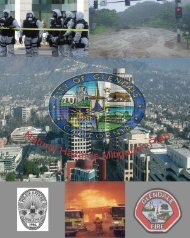
<strong>Butte</strong> <strong>County</strong>Multi-Jurisdictional All HazardPre-Disaster Mitigation PlanMarch 2007City <strong>of</strong> OrovilleThe City <strong>of</strong> Oroville is located in southeastern <strong>Butte</strong> <strong>County</strong> along the Feather River, onthe southwestern side <strong>of</strong> Lake Oroville. The city is bisected by <strong>State</strong> Route 70, whichruns in a north-south direction, and by <strong>State</strong> Route 162, which runs in an east-westdirection. <strong>State</strong> Route 99 extends north-south four miles west <strong>of</strong> the city limits.Oroville is the seat <strong>of</strong> <strong>County</strong> government in <strong>Butte</strong> <strong>County</strong>. Diverse economic activitieshave historically shaped the city and include: gold mining, agriculture, railroads, lumberprocessing, and dam construction and operation. Oroville Dam, completed in 1968, is thecenterpiece <strong>of</strong> the <strong>California</strong> Water Project.Oroville grew rapidly during the Gold Rush, but lost population as mining activitydeclined. A second population boom coincided with construction <strong>of</strong> the Oroville Dam,which was completed in 1968. More recent growth in the area has been largely due tourban-to-rural migration, rather than major economic activity in the area.Major sources <strong>of</strong> economic growth and employment in the Oroville area are woodproducts and agriculture. The seasonal nature <strong>of</strong> employment in these industries hascontributed to cyclical variations in the community’s economy. The tourist-relatedeconomy, also seasonal, has added to this problem, although the impact <strong>of</strong> Indian casinoshas somewhat stabilized the seasonal nature <strong>of</strong> the tourism industry. Other localindustries, such as banking and services, have lent some stability to the city’s businessclimate. Residents <strong>of</strong> the area generally also work and shop there, except when makingmajor purchases.The Oroville area is characterized by low-density, scattered development with manyvacant parcels. The highest density residential development in the Oroville area islocated within the Oroville city limits, although this development is primarily singlefamilyin character with a scattering <strong>of</strong> apartments, mobile homes, and mobile homeparks. The city also contains principal centers <strong>of</strong> commercial development, located in thedowntown area. Industrial development is mainly limited to a band extending fromdowntown Oroville to Ophir Road between <strong>State</strong> Route 70 and Lincoln Boulevard.Town <strong>of</strong> ParadiseThe Town <strong>of</strong> Paradise is located at the juncture <strong>of</strong> the western slopes <strong>of</strong> the Cascade andSierra Nevada systems in north central <strong>Butte</strong> <strong>County</strong>. Topography and drainage patternshave had a major influence on development patterns in the area. This area is defined bysteep canyons - to the east by the West Branch <strong>of</strong> the Feather River drainage, and to thenorthwest by the <strong>Butte</strong> Creek-Little <strong>Butte</strong> Creek drainage. The Town <strong>of</strong> Paradiseoccupies an area identified as the Lower Ridge, which ranges from 2,200 feet in the northto 1,500 feet at the town’s southern boundary.19