Butte County MHMP - State of California
Butte County MHMP - State of California
Butte County MHMP - State of California

You also want an ePaper? Increase the reach of your titles
YUMPU automatically turns print PDFs into web optimized ePapers that Google loves.
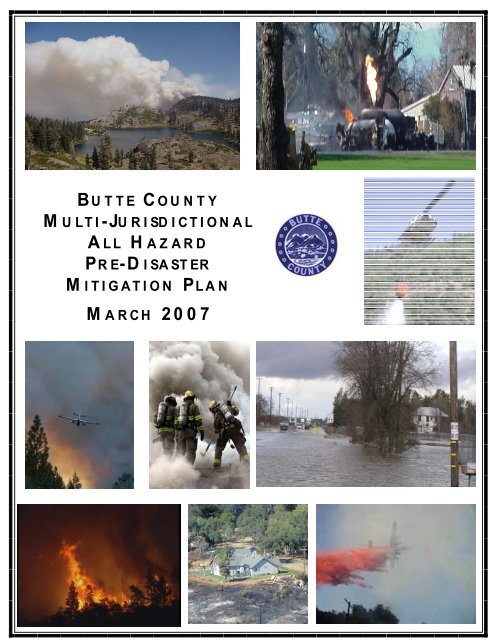
<strong>Butte</strong> <strong>County</strong>Multi-Jurisdictional All HazardPre-Disaster Mitigation PlanMarch 2007Adoption by Local Governing Body: §201.6(c)(5)<strong>County</strong> <strong>of</strong> <strong>Butte</strong>i
<strong>Butte</strong> <strong>County</strong>Multi-Jurisdictional All HazardPre-Disaster Mitigation PlanMarch 2007Adoption by Local Governing Body: §201.6(c)(5)City <strong>of</strong> Chicoiii
<strong>Butte</strong> <strong>County</strong>Multi-Jurisdictional All HazardPre-Disaster Mitigation PlanMarch 2007Adoption by Local Governing Body: §201.6(c)(5)City <strong>of</strong> Gridleyiv
<strong>Butte</strong> <strong>County</strong>Multi-Jurisdictional All HazardPre-Disaster Mitigation PlanMarch 2007Adoption by Local Governing Body: §201.6(c)(5)City <strong>of</strong> Orovillev
<strong>Butte</strong> <strong>County</strong>Multi-Jurisdictional All HazardPre-Disaster Mitigation PlanMarch 2007Adoption by Local Governing Body: §201.6(c)(5)Town <strong>of</strong> Paradisevi
<strong>Butte</strong> <strong>County</strong>Multi-Jurisdictional All HazardPre-Disaster Mitigation PlanMarch 2007Table <strong>of</strong> Contents1. Purpose / Vision / Values .............................................................................................12. The Planning Process....................................................................................................33. <strong>County</strong> Community Pr<strong>of</strong>iles.......................................................................................174. Hazards Facing <strong>Butte</strong> <strong>County</strong> and the Participating Jurisdictions .............................515. Multi-Jurisdiction Goals, Objectives, and Mitigation Strategies .............................1786. Multi-Jurisdiction Action Plan .................................................................................187a. <strong>Butte</strong> <strong>County</strong> .................................................................................................189b. City <strong>of</strong> Biggs.................................................................................................193c. City <strong>of</strong> Chico.................................................................................................197d. City <strong>of</strong> Gridley ..............................................................................................201e. City <strong>of</strong> Oroville .............................................................................................205f. Town <strong>of</strong> Paradise...........................................................................................2097. <strong>County</strong> Assets at Risk...............................................................................................2138. Plan Maintenance .....................................................................................................226vii
<strong>Butte</strong> <strong>County</strong>Multi-Jurisdictional All HazardPre-Disaster Mitigation PlanMarch 20071. Purpose / Vision / ValuesPurpose <strong>of</strong> <strong>MHMP</strong><strong>Butte</strong> <strong>County</strong> and the participating <strong>Butte</strong> <strong>County</strong> jurisdictions <strong>of</strong> the City <strong>of</strong> Biggs, theCity <strong>of</strong> Chico, the City <strong>of</strong> Gridley, the City <strong>of</strong> Oroville and the Town <strong>of</strong> Paradise havedeveloped this Multi-Jurisdictional All Hazard Pre-Disaster Mitigation Plan (<strong>MHMP</strong>) tocreate a safer community. This <strong>MHMP</strong> is the representation <strong>of</strong> the commitment <strong>of</strong> the<strong>County</strong> and participating jurisdictions to reduce risks from natural and other hazards, andserves as a guide for decision-makers as they commit resources to reducing the effects <strong>of</strong>natural and other hazards. This <strong>MHMP</strong> serves as a basis for the <strong>State</strong> Office <strong>of</strong>Emergency Services (OES) to provide technical assistance and to prioritize projectfunding. (See IFR §201.6).While the Disaster Mitigation Act <strong>of</strong> 2000 (“DMA 2000”) requires that localcommunities address only natural hazards, the Federal Emergency Management Agency(FEMA) recommends that local comprehensive mitigation plans address man-made andtechnological hazards to the extent possible. Towards that goal, <strong>Butte</strong> <strong>County</strong> and theparticipating jurisdictions have addressed an expansive set <strong>of</strong> hazards.Unless otherwise specified, reference throughout this Plan to the <strong>MHMP</strong> or <strong>Butte</strong> <strong>County</strong>includes <strong>Butte</strong> <strong>County</strong> and the cities <strong>of</strong> Biggs, Chico, Gridley, Oroville and the Town <strong>of</strong>Paradise.The <strong>County</strong> <strong>of</strong> <strong>Butte</strong> is required to adopt a federally-approved Hazard Mitigation Plan tobe eligible for certain disaster assistance and mitigation funding. The overall intent <strong>of</strong>this Plan is to reduce or prevent injury and damage from hazards in the <strong>County</strong>. Itidentifies past and present mitigation activities, current policies and programs, andmitigation strategies for the future. This Plan also guides hazard mitigation activities byestablishing hazard mitigation goals and objectives.The Plan is a “living document” that will be reviewed and updated annually to reflectchanging conditions and improvements by new information, especially information onlocal planning activities. The Multi-Jurisdictional Hazard Mitigation Plan is written tomeet the statutory requirements <strong>of</strong> DMA 2000 (P.L. 106-390), enacted October 30, 2000and 44 CFR Part 201 – Mitigation Planning, Interim Final Rule, published February 26,2002.1
<strong>Butte</strong> <strong>County</strong>Multi-Jurisdictional All HazardPre-Disaster Mitigation PlanMarch 2007Goals Shared with <strong>State</strong> Multi-Hazard Mitigation Plan<strong>Butte</strong> <strong>County</strong>’s <strong>MHMP</strong> supports the goals that it shares with the <strong>State</strong> <strong>of</strong> <strong>California</strong>Multi-Hazard Mitigation Plan, namely:• Goal 1: Save Lives and Reduce Injuries• Goal 2: Avoid Damages to Property• Goal 3: Protect the Environment• Goal 4: Promote Hazard Mitigation as an Integrated PolicySupport <strong>of</strong> Broader <strong>County</strong> VisionThe Multi-Jurisdictional Hazard Mitigation Plan supports the broader vision and values<strong>of</strong> <strong>Butte</strong> <strong>County</strong> as stated in the <strong>County</strong>’s Mission, Vision and Values <strong>State</strong>ments:MissionProvide quality service with dignity, integrity and respect.Vision• To ensure basic health, safety, and protection <strong>of</strong> people.• To facilitate commerce and trade in order to promote a high quality <strong>of</strong> life.• To promptly resolve issues in an honest and consistent manner.• To provide useful and effective service utilizing both public and private means.Values• Fiscal ResponsibilityWe respect our obligation to the taxpayer and shall act in a fiscally responsiblemanner.• Pride In ServiceWe take price in our mission, our organization, and the unique abilities <strong>of</strong> eachindividual employee to deliver quality service.• Integrity/EthicsWe shall conduct our business through honest and direct communication withintegrity, trust, and a high standard <strong>of</strong> ethics and respect.• Decisive Leadership and AccountabilityWe value initiative and leadership, and are accountable for our performance.• InnovationWe encourage innovative programs to increase efficiency and streamlineoperations.• Working TogetherWe encourage partnerships and cooperative agreements which enhance our abilityto accomplish our mission.2
<strong>Butte</strong> <strong>County</strong>Multi-Jurisdictional All HazardPre-Disaster Mitigation PlanMarch 20072. The Planning Process<strong>Butte</strong> <strong>County</strong> Office <strong>of</strong> Emergency Services (OES) is responsible for the development <strong>of</strong>the <strong>MHMP</strong>. The <strong>County</strong> OES hired a consultant, Bluecrane, Inc., (bluecrane) to assist inthe preparation <strong>of</strong> the Plan.<strong>Butte</strong> <strong>County</strong> OES formed a Planning Team with representatives from all participatingjurisdictions:• <strong>County</strong> Office <strong>of</strong> Emergency Services• <strong>County</strong> Department <strong>of</strong> Development Services• <strong>County</strong> Department <strong>of</strong> Public Works, Land Development• <strong>County</strong> GIS Division• <strong>County</strong> Administrative Office• <strong>County</strong> Sheriff’s Department• CDF/<strong>Butte</strong> <strong>County</strong> Fire Department (also serving City <strong>of</strong> Biggs and City <strong>of</strong>Gridley)• City <strong>of</strong> Chico Fire Department – Fire Chief• City <strong>of</strong> Oroville Fire Department – Fire Chief• City <strong>of</strong> Oroville Administrator• City <strong>of</strong> Biggs Administrator - Finance Director• City <strong>of</strong> Gridley Administrator• Town <strong>of</strong> Paradise Fire Department – Fire Chief• Mooretown RancheriaThe planning process utilized by <strong>Butte</strong> <strong>County</strong> is depicted in the following figure.3
<strong>Butte</strong> <strong>County</strong>Multi-Jurisdictional All HazardPre-Disaster Mitigation PlanMarch 2007LaunchtheProjectSet the<strong>County</strong>’sVisionAssessthe <strong>State</strong><strong>of</strong> the<strong>County</strong>Assessthe<strong>County</strong>’sHazardsAssess theHazardswithin EachJurisdiction• Establishstructure <strong>of</strong> Plan• Commitresources• Develop plan forpublicparticipation• Coordinategovernmentresources• Create anddocument thevision• Set goals• Develop policies• Create a <strong>County</strong>pr<strong>of</strong>ile• Develop backgroundinformation andanalysis• Identify <strong>County</strong>challenges, assets,and capabilities• Identify all hazards thatcould impact the <strong>County</strong>• Develop hazard pr<strong>of</strong>iles,including historical dataand hazard maps• Assess risk <strong>of</strong> hazards• Estimate losses• Discuss current activitiesto address hazards• Identify gaps (i.e., wherecurrent activities may fallshort)• Identify all hazards thatcould impact eachparticipating jurisdiction• Develop hazard pr<strong>of</strong>ileswithin each jurisdiction• Assess risk <strong>of</strong> hazards• Estimate losses• Discuss current activitiesto address hazards• Identify gaps (i.e., wherecurrent activities may fallshort)DevelopRange <strong>of</strong>MitigationStrategiesDevelopActionPlanSupportBoard <strong>of</strong>SupervisorsPresentationMonitorPlanProgressUpdatethe PlanasNeeded• Identify alternativestrategies• Evaluatealternatives• Select preferredstrategies• Set priorities• Develop five-year actionplan• By year, for each actiondescribe:– Hazard– Goal to be achieved– Strategy/project– Estimated cost– Timeframe– Responsible partyFollowing the <strong>County</strong> Board <strong>of</strong> Supervisors’ approval <strong>of</strong> the project, bluecrane wasretained to assist in the development <strong>of</strong> the <strong>MHMP</strong>. The effort was launched in March2006 in a meeting <strong>of</strong> the Planning Team including bluecrane. The Planning Team hasparticipated actively in the <strong>MHMP</strong>’s development, conferring every two to three weeksthroughout the process to review draft documents and assess progress on the plan.In addition to numerous meetings <strong>of</strong> the stakeholders group and the general steps shownin the diagram above, throughout the process <strong>of</strong> developing the <strong>MHMP</strong>, numerousactivities were continuously untaken in the <strong>County</strong> and within each city to solicit publicinput. This was done through website postings, newspaper announcements, <strong>County</strong> Fair,Fire Safe Council meetings and general community meetings. Public comments andinput included neighboring communities, agencies, businesses, academia, non-pr<strong>of</strong>its andother interested parties. The typical agenda for this interactive information sharing andinput gathering sessions with the public included:.• An overview <strong>of</strong> the <strong>MHMP</strong> purpose and process,• A broad overview <strong>of</strong> the Draft Plan as it stood at that time,• A detailed interactive discussion <strong>of</strong> each hazard,• Solicitation <strong>of</strong> all comments• An interactive discussion <strong>of</strong> the next steps4
<strong>Butte</strong> <strong>County</strong>Multi-Jurisdictional All HazardPre-Disaster Mitigation PlanMarch 2007Following is a list <strong>of</strong> the various public outreach forums conducted in <strong>Butte</strong> <strong>County</strong>.DateApril 22, 2006July 7, 2006July 26, 2006August 22 – 26, 2006September 6, 2006Event/LocationThermalito Grange Community Open House – Informational Table DisplayUpper Ridge Coordinating Council Meeting – OES Presentation<strong>Butte</strong> <strong>County</strong> Board <strong>of</strong> Supervisor’s Chambers Public Meeting<strong>Butte</strong> <strong>County</strong> Fair – Shared informational booth with CDF/<strong>Butte</strong> <strong>County</strong>Fire Department<strong>Butte</strong> <strong>County</strong> Fire Safe Council – OES PresentationPhotos from public review at the <strong>Butte</strong> <strong>County</strong> Fair and the Thermalito GrangeEarly on in the planning process <strong>Butte</strong> <strong>County</strong> OES determined that mitigation strategydevelopment would be enhanced by inviting other stakeholders to participate in theplanning process. Representatives from the following key agencies were <strong>of</strong>fered theopportunity to provide comments and/or participate in the planning process and theirappropriate responses were integrated into the final draft <strong>of</strong> the plan.• <strong>State</strong> DWR – Northern District• Watershed Groupso Cherokee Watershed Groupo Big Chico Creek Watershed Allianceo Little Chico Creek Watershed Groupo Big Chico Creek Ecological Reserveo <strong>Butte</strong> Creek Ecological Reserveo Feather River/Lower Honcut Creeko <strong>Butte</strong> Creek Watershed Conservancy5
<strong>Butte</strong> <strong>County</strong>Multi-Jurisdictional All HazardPre-Disaster Mitigation PlanMarch 2007o Upper Ridge Wilderness, Inc.o Friends <strong>of</strong> <strong>Butte</strong> Creeko Concow Watershedo Sacramento River Preservation Trust• <strong>Butte</strong> <strong>County</strong> Resource Conservation District• <strong>Butte</strong> <strong>County</strong> Fire Safe Council• Water Districtso Biggs West Gridley Water Districto <strong>Butte</strong> Water Districto <strong>California</strong> Water Service Companyo Del Oro Water Companyo Durham Irrigation Districto Durham Mutual Water Companyo Paradise Irrigation Districto South Feather Water and Powero Thermalito Irrigation District• Pacific Gas & Electric• <strong>Butte</strong> <strong>County</strong> Agricultural Commissioner’s Office• <strong>Butte</strong> <strong>County</strong> Association <strong>of</strong> Governments (BCAG)• Bureau <strong>of</strong> Land Management• Department <strong>of</strong> Agriculture-United <strong>State</strong>s Forest Service, Plumas National Forest,Feather River Ranger DistrictThe <strong>Butte</strong> <strong>County</strong> General Plan consists <strong>of</strong> a collection <strong>of</strong> 11 elements that were adoptedbetween 1971 and 2004. Since its adoption, the existing <strong>Butte</strong> <strong>County</strong> General Plan hasbeen supplemented and portions <strong>of</strong> it superseded by the adoption <strong>of</strong> area plans, updates toexisting elements, and additions <strong>of</strong> new elements. Some <strong>of</strong> the elements have beenamended, while most have not. The Land Use Element designates the generaldistribution <strong>of</strong> land uses, density and intensity standards for the unincorporated areas <strong>of</strong>the <strong>County</strong>. The Safety Element and the Seismic and Safety Element were both adoptedin 1977 with no subsequent updates. These two elements provide a general evaluation <strong>of</strong>potential public safety hazards.The <strong>County</strong> has begun a comprehensive update to the General Plan. This will includeupdating all <strong>of</strong> the elements, preparation <strong>of</strong> an environmental impact report and zoningordinance. The <strong>MHMP</strong> will serve as an important resource in the General Plan updateprocess. The <strong>County</strong> anticipates a three-year time frame for updating its general plan.The CDF/<strong>Butte</strong> <strong>County</strong> Fire Department annually updates the Fire Management Plan(Community Wildfire Protection Plan – CWPP, as defined by the Healthy ForestsRestoration Act – HFRA). The Plan identifies wildfire hazard areas based on GIS dataand provides an action plan for reducing the damaging effects <strong>of</strong> wildfire in <strong>Butte</strong>6
<strong>Butte</strong> <strong>County</strong>Multi-Jurisdictional All HazardPre-Disaster Mitigation PlanMarch 2007<strong>County</strong>. It does this by identifying the high value high-risk areas using GIS in the<strong>County</strong> that can be destroyed by fire. It determines a comprehensive course <strong>of</strong> actionincluding public information pertaining to fire safety, evacuation planning and fuelreduction to mitigate the threat and loss potential. The plan then identifies the necessaryresources to implement improvements.<strong>Butte</strong> <strong>County</strong> has also completed a Flood Mitigation Plan to provide guidance to agenciesand the public responsible for and interested in protecting life, property, and livestock;involved in land use planning; responsible for administering the FEMA National FloodInsurance Program and responsible for responding to flood emergencies within <strong>Butte</strong><strong>County</strong>.The <strong>Butte</strong> <strong>County</strong> Department <strong>of</strong> Water and Resource Conservation has developed the<strong>Butte</strong> <strong>County</strong> Drought Preparedness and Mitigation Plan (Drought Plan) to protect the<strong>County</strong> from the effects <strong>of</strong> a drought. The Drought Plan includes, an institutionalframework to approach drought; a monitoring plan; a response and mitigation plan; and adiscussion <strong>of</strong> water transfers during a drought.<strong>Butte</strong> <strong>County</strong> includes five incorporated Cities: Biggs, Chico, Gridley, Oroville and theTown <strong>of</strong> Paradise. Each city has a General Plan to guide development within the citylimits and within the city’s larger planning area. The plans for <strong>Butte</strong> <strong>County</strong> and theGeneral Plans <strong>of</strong> the participating cities form the foundation for this integrated multihazardmitigation plan.7
<strong>Butte</strong> <strong>County</strong>Multi-Jurisdictional All HazardPre-Disaster Mitigation PlanMarch 2007Local Capabilities AssessmentThis section list the <strong>County</strong>’s and participating jurisdiction’s strategy to utilized resourcesto achieve goals <strong>of</strong> reducing losses from future hazard events.Administrative and Technical CapabilityHuman ResourcesEmergency ManagersPlanner(s) or Engineer(s) withknowledge <strong>of</strong> land development, landmanagement practices, constructionpractices related to buildings and/orinfrastructureFloodplain ManagersGIS expertiseGrant writersDepartment/AgencyOffice <strong>of</strong> Emergency Services<strong>County</strong> ManagersCity ManagersFire Departments CDF/<strong>Butte</strong> <strong>County</strong> Fire DepartmentPolice DepartmentsDepartment HeadsDevelopment Services DepartmentsPublic Works, Land Development<strong>Butte</strong> <strong>County</strong> Watershed Groups<strong>County</strong> GIS DivisionOffice <strong>of</strong> Emergency Services, City Manager’s Office,Fire DepartmentsAsset /CapabilityRolling Stock /EquipmentFire DepartmentsInventoryCDF/<strong>Butte</strong> <strong>County</strong> Fire Department(Also serving the Cities <strong>of</strong> Biggs and Gridley)• 48 - Fire Engines• 1 - Ladder Truck• 2 - Heavy Rescues• 16 - Squads• 1 - Rescue Support• 18 - Water Tenders• 2 - Dozers• 1 - Air Attack Unit• 1 - Air Tanker• 1 - Hazardous Materials Units• 2 - Breathing Support Units• Level A, Level B and Proximity Suits• Hazardous Materials Special Equipment8
<strong>Butte</strong> <strong>County</strong>Multi-Jurisdictional All HazardPre-Disaster Mitigation PlanMarch 2007Asset /CapabilityFire Departments• 12 - Fire Engines• 3 - Aerial Ladder Trucks• 1 - Technical Rescue Unit• 1 - Aircraft Crash Rescue Unit• 1 - Brush Patrol• 1 – Hazardous Materials Unit• 1 - Foam Trailer• 1 - Rescue Support Trailer• 1 - Breathing Support Trailer• 1 - FireSafe House Trailer• 3 - Command Vehicles• 6 - Support VehiclesInventoryCity <strong>of</strong> Chico Fire ProtectionCity <strong>of</strong> Oroville Fire Protection• 4 - Fire Engines• 2 - Ladder Trucks• 1 - Aircraft Rescue Unit• 1 - Water Rescue Unit• 1 - Waverunner with Trailer and Support Equipment• 1 - Confined Space Rescue Unit• 1 - Trailer with Confined Space Equipment and Portable Air SupplyTown <strong>of</strong> Paradise Fire Protection• 5 - Type I/II Fire Engines• 1 - Type II Truck• 3 – 4WD Utility Vehicles• 1 – 4WD Water/Rescue Vehicle• 1 – 8 Passenger Van• 1 – Type III Fire Engine (Wildland)• 1 – Type II Air Trailer (Hazardous Materials Support Unit)• 1 – 2WD Mini PickupResourcesCDF/<strong>Butte</strong> <strong>County</strong> Fire Department(Also serving the Cities <strong>of</strong> Biggs and Gridley)• 225 - Full Time Fire Fighters and additional Fire Fighters during thesummer season• 130 to 160 (authorized strength <strong>of</strong> 400) – Volunteer Fire Fighters• 19 – Chief Officers• 3 – Training Officers9
<strong>Butte</strong> <strong>County</strong>Multi-Jurisdictional All HazardPre-Disaster Mitigation PlanMarch 2007Asset /CapabilityFire DepartmentsInventory• 5 – Prevention Officers• 4 Heavy Equipment Mechanics• 15 – Support Staff• Emergency Command Center (Dispatch)° 5 – Fire Captains° 1 – Battalion Chief° 6 – Dispatchers° 1- Telecommunications System Analyst• 33 - Specialist/Technicians Interagency Hazardous Materials Team• 40 - Technical Rescue Team (TRT)• 35 - Drowning Accident Rescue Team (DART)• Retired Fire personnelCity <strong>of</strong> Chico• 66 - Full Time Uniformed Personnel• 3 – Support Staff• 36 - Volunteer Fire FightersCity <strong>of</strong> Oroville• 22 - Full Time Personnel• 12 - Paid Call Fire FightersTown <strong>of</strong> Paradise• 22 - Full Time Paid Fire Fighters• 28 - Volunteer Fire Fighters• 2 - Full Time Support Staff• 4 - Part Time Support Staff• 5 - HazMat Specialist• 2 - Type 1 (Level A) HazMat Units• 7 - Technical Rescue Technicians• 4 - Rescue Drivers• 3 - Emergency Medical Technicians-Paramedics• 22 - Emergency Medical Technician• 22 - Emergency First RespondersFacilitiesCDF/<strong>Butte</strong> <strong>County</strong> Fire Department(Also serving the Cities <strong>of</strong> Biggs and Gridley)• 42 - Fire Stations (12 <strong>Butte</strong> <strong>County</strong> Fire Career Staffed Stations, 10 CDFCareer Staffed Stations and 20 <strong>Butte</strong> <strong>County</strong> Fire Volunteer Stations)• 1 – Air Attack Base• 1 – Training Center10
<strong>Butte</strong> <strong>County</strong>Multi-Jurisdictional All HazardPre-Disaster Mitigation PlanMarch 2007Asset /CapabilityFire DepartmentsInventory• 6 - Fire Stations• 1 - Fire Training CenterCity <strong>of</strong> Chico• 1 – Fire StationCity <strong>of</strong> Oroville• 3 – Fire StationsTown <strong>of</strong> Paradise11
<strong>Butte</strong> <strong>County</strong>Multi-Jurisdictional All HazardPre-Disaster Mitigation PlanMarch 2007Local Ordinances and Regulations<strong>Butte</strong> <strong>County</strong> Code,Chapter 8<strong>Butte</strong> <strong>County</strong> Code,Chapter 20<strong>Butte</strong> <strong>County</strong> Code,Chapter 24<strong>Butte</strong> <strong>County</strong> Code,Chapter 38APublic Resource Code(PRC) 4290Public Resource Code4291Public Resources Code2694The declared purposes <strong>of</strong> this chapter are to provide for the preparation andexecution <strong>of</strong> plans for the protection <strong>of</strong> persons, the environment, andproperty within the <strong>County</strong> <strong>of</strong> <strong>Butte</strong> in the event <strong>of</strong> an emergency, thedirection <strong>of</strong> the emergency services organization and the coordination <strong>of</strong> theemergency functions <strong>of</strong> the <strong>County</strong> <strong>of</strong> <strong>Butte</strong> with the Cities <strong>of</strong> Chico,Oroville, Gridley, Biggs and the Town <strong>of</strong> Paradise and all other affectedpublic agencies, corporations, organizations and private persons within the<strong>County</strong> <strong>of</strong> <strong>Butte</strong>. (Ord. No. 3296, § 1, 12-10-96)Improvement Standards for Subdivisions, Parcel Maps and SiteImprovements.Airport Air Zoning Ordinance. Under and pursuant to law and particularlythe provisions <strong>of</strong> article 6.5 <strong>of</strong> chapter 2, division 1, Title 5, <strong>of</strong> theGovernment Code <strong>of</strong> the state known as the “Airport Approaches ZoningLaw,” for the purpose <strong>of</strong> promoting the health, safety and general welfare <strong>of</strong>the inhabitants <strong>of</strong> the <strong>County</strong> <strong>of</strong> <strong>Butte</strong> by preventing the creation orestablishment <strong>of</strong> airport hazards, thereby protecting the lives and property<strong>of</strong> the users <strong>of</strong> the Chico Municipal Airport and <strong>of</strong> the occupants <strong>of</strong> the landin its vicinity, and preventing destruction or impairment <strong>of</strong> the utility <strong>of</strong> theairport and the public investment therein in accordance with and as part <strong>of</strong>any future comprehensive master plan <strong>of</strong> the airports within <strong>Butte</strong> <strong>County</strong>.(Ord. No. 591, § 1)Fire Prevention and Protection. This chapter shall supplement and be inaddition to the other fire prevention and protection statutes, regulations, andordinances enacted by the state, the county or any other governmentalagency having jurisdiction, including but not limited to Public ResourcesCode sections 4290 and 4291. (Ord. No. 3201, § 1, 4-25-95)Fire Safe Regulations. These regulations have been prepared and adoptedfor the purpose <strong>of</strong> establishing minimum wildfire protection standards inconjunction with building, construction and development in <strong>State</strong>Responsibility Areas (SRA). The future design and construction <strong>of</strong>structures, subdivisions and developments in SRAs shall provide for basicemergency access and perimeter wildfire protection measures as specifiedin PRC 4290.PRC 4291 is the law requiring annual defensible space be provided for adistance <strong>of</strong> 100 feet around all structures in, upon, or adjoining anymountainous area, forest-covered lands, brush-covered lands, grass-coveredlands, or any land that is covered with flammable material.PRC2694 states that a person who is acting as an agent for a transferor <strong>of</strong>real property that is located within a seismic hazard zone, shall disclose toany prospective transferee the fact that the property is located within aseismic hazard zone.12
<strong>Butte</strong> <strong>County</strong>Multi-Jurisdictional All HazardPre-Disaster Mitigation PlanMarch 2007Local Ordinances and RegulationsTitle 14 PublicResources CodeUniform Fire Code<strong>California</strong> Fire Code<strong>California</strong> Health andSafety Code and theUniform Building CodeTitle 19 <strong>California</strong> Code<strong>of</strong> RegulationsTitle 14, Article 10<strong>California</strong> Code <strong>of</strong>RegulationsEarthquake Safety andPublic BuildingsRehabilitation Bond Act(Proposition 122)Assembly Bill 337(Bates Bill)<strong>California</strong> Civil Code1103These regulations provided additional fire prevention and suppressionstandards.This Code may be adopted by local jurisdictions, with amendments, andprovides minimum standards for many aspects <strong>of</strong> fire prevention andsuppression activities. These standards include provisions for access, watersupply, fire protection systems, and the use <strong>of</strong> fire resistant buildingmaterials.The <strong>California</strong> Fire Code is the Uniform Fire Code with <strong>State</strong> <strong>of</strong> <strong>California</strong>amendments (this is the <strong>of</strong>ficial Code for the <strong>State</strong> and all politicalsubdivisions). It is located in Part 9 <strong>of</strong> Title 24 <strong>of</strong> the <strong>California</strong> Code <strong>of</strong>Regulations (Title 24 is commonly referred to as the <strong>California</strong> BuildingStandards Code). The <strong>California</strong> Fire Code is revised and published everythree years by the <strong>California</strong> Building Standards Commission. Localjurisdictions have 180 days to make more restrictive amendments to theCode after it is released.The Health and Safety Code provides regulation pertaining to the abatement<strong>of</strong> fire related hazards. It also requires that local jurisdictions enforce theUniform Building Code, which provides standards for fire resistive buildingand ro<strong>of</strong>ing materials, and other fire-related construction methods.These regulations pertain to fire prevention and engineering measures fornew construction.Seismic Hazards Mapping. These regulations shall govern the exercise <strong>of</strong>city, county and state agency responsibilities to identify and map seismichazard zones and to mitigate seismic hazards to protect public health andsafety in accordance with the provisions <strong>of</strong> Public Resources Code, Section2690 et seq. (Seismic Hazards Mapping Act).In 1990, the <strong>State</strong> <strong>of</strong> <strong>California</strong> passed the Earthquake Safety and PublicBuildings Rehabilitation Bond Act (Proposition 122). Up to $50 millionwas allocated for the seismic retr<strong>of</strong>it <strong>of</strong> essential services facilities. Manylocal governments and special districts have retr<strong>of</strong>itted their essentialservices buildings with local funds.In response to the Oakland Hills, <strong>California</strong> fire <strong>of</strong> 1991, this bill waspassed in 1992. It requires brush clearance and fire resistant ro<strong>of</strong> material(Class A or B) to be used on all new construction that is located in areasdesignated as being a “Very High Fire Severity Zone.”This article mandates three natural hazard disclosures and consolidatesthese and previously required disclosures onto a statutory form called theNatural Hazard Disclosure <strong>State</strong>ment (NHDS). This form is now a legallyrequired part <strong>of</strong> most residential property transactions.13
<strong>Butte</strong> <strong>County</strong>Multi-Jurisdictional All HazardPre-Disaster Mitigation PlanMarch 2007Local Ordinances and RegulationsAlquist-PrioloEarthquake FaultZoning ActThe Alquist-Priolo Earthquake Fault Zoning Act requires the stateGeologist to identify earthquake fault zones along traces <strong>of</strong> both recentlyand potentially active major faults. The Alquist-Priolo Zones are usuallyone-quarter mile or less in width and proposed development plans withinthese fault zones must be accompanied by a geotechnical report prepared bya geologist describing the likelihood <strong>of</strong> surface rupture and otherseismically induced hazards.Fiscal CapabilityFinancial Resources for Hazard Mitigation ProjectsGeneral FundEnterprise Fund (These funds are restricted to specific use, i.e. solid waste enterprise fund)Development fees (Restricted to expansion costs for new development)Building Permit feesWeed Abatement penalty feesFees for water, sewer, gas, or electric serviceHR-2389 Secure Rural Schools and Community Self-Determination Act <strong>of</strong> 2000, Title III <strong>County</strong>ProjectsImpact fees for homebuyers or developers for new developments/homes<strong>State</strong> Funding Sources:CaltransCommerce and Economic Development ProgramInfrastructure <strong>State</strong> Revolving Fund (ISRF) ProgramRural Economic Development Infrastructure Program (REDIP)Proposition 13Proposition 50<strong>California</strong> Water Resources Control Board (WRCB)Clean Water <strong>State</strong> Revolving Fund (SRF) ProgramWatershed Protection Program<strong>California</strong> Department <strong>of</strong> Forestry and Fire Protection – Proposition 40 Watershed Protection GrantProgram<strong>California</strong> Fire Safe Council (Grants Clearinghouse-distributes some Federal National Fire PlanMonies in <strong>California</strong>)14
<strong>Butte</strong> <strong>County</strong>Multi-Jurisdictional All HazardPre-Disaster Mitigation PlanMarch 2007Fiscal CapabilityFinancial Resources for Hazard Mitigation ProjectsFederal Funding Sources:FEMAHousing and Urban Development (HUD) Community Development Block Grant ProgramU.S. Army Corps <strong>of</strong> Engineers (USACE)Small Business Administration (SBA) FundingU.S. Department <strong>of</strong> Agriculture (USDA) ProgramsNatural Resources Conservation Service (NRCS) - Environmental Quality Incentives Program (EQIP)Small Watershed ProgramFlood Prevention ProgramEmergency Watershed Protection (EWP) ProgramHomeland Security Grants (terrorism)Bureau <strong>of</strong> Land Management (BLM) Programs (National Fire Plan)United <strong>State</strong>s Forest Service (National Fire Plan)United <strong>State</strong>s Fish and Wildlife Service (National Fire Plan)Bureau <strong>of</strong> Indian Affairs (National Fire Plan)In-progress/On-going/Completed Mitigation Projects and ProgramsProgram or Project Status DescriptionMulti-Jurisdictional HazardMitigation PlanIn-Progress Preparation <strong>of</strong> a Multi-Jurisdictional Pre-DisasterHazard Mitigation Plan for <strong>Butte</strong> <strong>County</strong> and thefollowing participating jurisdictions: Biggs, Chico,Gridley, Oroville, Town <strong>of</strong> Paradise.Floodplain Management Plan Completed <strong>County</strong>wide Flood Mitigation Plan.Fire Management Plan<strong>Butte</strong> <strong>County</strong> Community Wildfire Protection PlanHazardous MaterialsEmergency Response PlanHousehold Hazardous Wasteand Used Oil Grant ProgramCompletedOngoingaddressing fire risk and mitigation strategies.<strong>County</strong>wide Hazardous Materials EmergencyResponse Plan was developed to fulfill legislativerequirements to assume responsibility <strong>of</strong> a PermanentHousehold Hazardous Waste Collection Facility.This program funded by grants from the <strong>California</strong>Integrated Waste Management Board, allows growersand ranchers to drop <strong>of</strong>f up to 55 gallons <strong>of</strong> used oil atpre-selected locations.15
<strong>Butte</strong> <strong>County</strong>Multi-Jurisdictional All HazardPre-Disaster Mitigation PlanMarch 2007In-progress/On-going/Completed Mitigation Projects and ProgramsProgram or Project Status DescriptionDrought Preparedness andMitigation Plan (Drought Plan)Annual <strong>County</strong>wide DisasterDrillsCompletedOngoingThis plan has been developed to provide an efficientand systematic process for the <strong>County</strong> that result in ashort- and long-term reduction in drought impacts tothe citizens, economy and environment in <strong>Butte</strong><strong>County</strong>.Members <strong>of</strong> the participating jurisdictions’ Police andFire Departments, Office <strong>of</strong> Emergency Servicespersonnel, and Emergency Managers participate inannual disaster tabletop and/or field exercises.ICS / SEM Training Ongoing Incident Command System / Standardized EmergencyManagement System training for appropriatepersonnel.Fire Department Equipment Completed Purchase <strong>of</strong> 100 self-contained breathing apparatusunits, fitness equipment, hand-held radios, protectiveequipment (helmets, gloves, masks, etc.).<strong>Butte</strong> <strong>County</strong>’s Protection,Mitigation and EnhancementReport<strong>Butte</strong> <strong>County</strong> Radio SystemStudyCompletedCompletedReport on reducing toxic air pollution from naturallyoccurring asbestos on existing gravel roads.Study <strong>of</strong> the <strong>County</strong>’s radio and microwave systemswhich are the backbone for emergencycommunications.Pest Exclusion Program Ongoing This program provides protection to the <strong>County</strong> byregulatory control through the use <strong>of</strong> quarantines toprevent the introduction <strong>of</strong> pests, which are not knownto exist or are <strong>of</strong> very limited distribution within the<strong>County</strong>.16
<strong>Butte</strong> <strong>County</strong>Multi-Jurisdictional All HazardPre-Disaster Mitigation PlanMarch 20073. <strong>County</strong> Community Pr<strong>of</strong>iles<strong>Butte</strong> <strong>County</strong><strong>Butte</strong> <strong>County</strong> lies in north central <strong>California</strong> at the northern end <strong>of</strong> the SacramentoValley, approximately 150 miles northeast <strong>of</strong> San Francisco and 70 miles north <strong>of</strong>Sacramento. <strong>State</strong> Highways 70 and 99, which extend in a north-south direction throughthe <strong>County</strong>, define the principal transportation corridors connecting the <strong>County</strong> to theregion. <strong>State</strong> Routes 32 and 162 provide sub-regional connections to areas to the west <strong>of</strong>the <strong>County</strong> and to Interstate 5.The <strong>County</strong> contains five incorporated cities: Chico, Oroville, Gridley, Biggs, and theTown <strong>of</strong> Paradise, and several small unincorporated rural communities. The U.S. ForestService is a major landowner in <strong>Butte</strong> <strong>County</strong> with holdings in Plumas National Forest(81,972 acres) and Lassen National Forest (49,240 acres). The U.S. Bureau <strong>of</strong> LandManagement owns 18,960 acres, consisting <strong>of</strong> scattered foothill lands. Combined, thesetwo Federal agencies own and control 12.3 percent <strong>of</strong> the land area in <strong>Butte</strong> <strong>County</strong>.<strong>Butte</strong> <strong>County</strong> covers an area <strong>of</strong> approximately 1,670 square miles and can be divided intothree general topographical areas: a valley area, a foothill region east <strong>of</strong> the valley area,and a mountain region east <strong>of</strong> the foothills. These topographic areas compriseapproximately 46 percent, 23 percent and 31 percent, respectively, <strong>of</strong> the <strong>County</strong>’s land.<strong>Butte</strong> <strong>County</strong> is watered by the Feather River and the Sacramento River. The <strong>County</strong> ingeneral is drained by the Feather River, <strong>Butte</strong> Creek and Chico Creek Watersheds. Part<strong>of</strong> the <strong>County</strong>'s western border is formed by the Sacramento River.<strong>Butte</strong> <strong>County</strong> has rich fertile valley soil, rolling hills, volcanic peaks and mesas and some<strong>of</strong> the most dramatic canyons carved by beautiful streams and rivers. <strong>Butte</strong> <strong>County</strong> is adiverse 1,068,000 acres. Its highest point is Humboldt Peak at 7,870 feet, while thelowest point is about 90 feet above sea level. Large areas <strong>of</strong> this rural area are preservedunaltered in the nearly 60,000 acres <strong>of</strong> parkland and wildlife preserves within the county.The valley remains a vital wintering site for 60% <strong>of</strong> the waterfowl that migrate throughthe Pacific Flyway. Ducks, geese, swans and many other graceful birds literally coverthe sky from November through March. From mid-February to mid-March, <strong>Butte</strong><strong>County</strong>'s countryside <strong>of</strong> almond, prune, kiwi, pear and apple orchards blossom into color.The orchard show is followed by an encore <strong>of</strong> spectacular wildflowers that bloomthroughout the area from March to June.City <strong>of</strong> BiggsThe City <strong>of</strong> Biggs is located in the southwest portion <strong>of</strong> <strong>Butte</strong> <strong>County</strong>, approximately fivemiles north <strong>of</strong> the City <strong>of</strong> Gridley. <strong>State</strong> Route 99 runs in a north-south direction east <strong>of</strong>the city, and the Union Pacific Railroad extends through the center <strong>of</strong> the city.17
<strong>Butte</strong> <strong>County</strong>Multi-Jurisdictional All HazardPre-Disaster Mitigation PlanMarch 2007The City <strong>of</strong> Biggs was founded in 1903 with the development <strong>of</strong> the area’s agricultureand the construction <strong>of</strong> the <strong>California</strong> and Oregon Railway, now known as the UnionPacific Railroad. The growth <strong>of</strong> the city has hinged on agricultural development. Smallfruit and field-crop farms and large rice-growing ranches presently occupy a majorportion <strong>of</strong> the immediately surrounding area. The rice industry is a major influence on thecommunity’s economy. Local economic growth is tied to agricultural productivity andthe demand for local goods and services, as prospects for non-agricultural developmentappear limited. Biggs <strong>of</strong>fers a small commercial core area that serves most daily needs <strong>of</strong>its residents, but most shopping for major items occurs in other population centers.City <strong>of</strong> ChicoThe City <strong>of</strong> Chico is located in the northwest quadrant <strong>of</strong> <strong>Butte</strong> <strong>County</strong>, about 100 milesnorth <strong>of</strong> Sacramento and 70 miles south <strong>of</strong> Redding. The City <strong>of</strong> Chico is bisected by<strong>State</strong> Route 99, which runs in a north-south direction. <strong>State</strong> Route 32, which runs east-towest,intersects <strong>State</strong> Route 99 near the center <strong>of</strong> the city.Founded in 1860 by John Bidwell, the City <strong>of</strong> Chico has grown from an individualrancho to the center <strong>of</strong> economic activity <strong>of</strong> the Tri-county area, which includes <strong>Butte</strong>,Glenn, and Tehama counties. Chico is home to two regional malls and major discountretailers. Also, Chico is a major medical and education center servicing much <strong>of</strong> theentire northeastern part <strong>of</strong> <strong>California</strong>.City <strong>of</strong> GridleyThe City <strong>of</strong> Gridley is located in the southwest corner <strong>of</strong> <strong>Butte</strong> <strong>County</strong>, approximatelyfive miles south <strong>of</strong> the City <strong>of</strong> Biggs. <strong>State</strong> Route 99 runs in a north-south directionthrough the eastern portion <strong>of</strong> the city, and the Union Pacific Railroad extends throughthe center <strong>of</strong> the city.The City <strong>of</strong> Gridley was founded in 1905 as an agricultural service center built upon andsurrounded by prime agricultural soils. The City has a small commercial area that servesmost daily needs <strong>of</strong> its residents, but most shopping for major items occurs in the otherpopulation centers (e.g., Chico or the Marysville-Yuba City area).Development in Gridley since the mid-1970s has been primarily single-family residentialin character. Developments around the city’s periphery has begun to depart from thetraditional grid street system by incorporating curved street patterns and non-continuousstreets. Some <strong>of</strong> the internal street patterns do not include adequate provisions for canalcrossingsor other connections with the surrounding street systems. Consequently, somerecent developments have obstructed orderly expansion <strong>of</strong> the community.18
<strong>Butte</strong> <strong>County</strong>Multi-Jurisdictional All HazardPre-Disaster Mitigation PlanMarch 2007City <strong>of</strong> OrovilleThe City <strong>of</strong> Oroville is located in southeastern <strong>Butte</strong> <strong>County</strong> along the Feather River, onthe southwestern side <strong>of</strong> Lake Oroville. The city is bisected by <strong>State</strong> Route 70, whichruns in a north-south direction, and by <strong>State</strong> Route 162, which runs in an east-westdirection. <strong>State</strong> Route 99 extends north-south four miles west <strong>of</strong> the city limits.Oroville is the seat <strong>of</strong> <strong>County</strong> government in <strong>Butte</strong> <strong>County</strong>. Diverse economic activitieshave historically shaped the city and include: gold mining, agriculture, railroads, lumberprocessing, and dam construction and operation. Oroville Dam, completed in 1968, is thecenterpiece <strong>of</strong> the <strong>California</strong> Water Project.Oroville grew rapidly during the Gold Rush, but lost population as mining activitydeclined. A second population boom coincided with construction <strong>of</strong> the Oroville Dam,which was completed in 1968. More recent growth in the area has been largely due tourban-to-rural migration, rather than major economic activity in the area.Major sources <strong>of</strong> economic growth and employment in the Oroville area are woodproducts and agriculture. The seasonal nature <strong>of</strong> employment in these industries hascontributed to cyclical variations in the community’s economy. The tourist-relatedeconomy, also seasonal, has added to this problem, although the impact <strong>of</strong> Indian casinoshas somewhat stabilized the seasonal nature <strong>of</strong> the tourism industry. Other localindustries, such as banking and services, have lent some stability to the city’s businessclimate. Residents <strong>of</strong> the area generally also work and shop there, except when makingmajor purchases.The Oroville area is characterized by low-density, scattered development with manyvacant parcels. The highest density residential development in the Oroville area islocated within the Oroville city limits, although this development is primarily singlefamilyin character with a scattering <strong>of</strong> apartments, mobile homes, and mobile homeparks. The city also contains principal centers <strong>of</strong> commercial development, located in thedowntown area. Industrial development is mainly limited to a band extending fromdowntown Oroville to Ophir Road between <strong>State</strong> Route 70 and Lincoln Boulevard.Town <strong>of</strong> ParadiseThe Town <strong>of</strong> Paradise is located at the juncture <strong>of</strong> the western slopes <strong>of</strong> the Cascade andSierra Nevada systems in north central <strong>Butte</strong> <strong>County</strong>. Topography and drainage patternshave had a major influence on development patterns in the area. This area is defined bysteep canyons - to the east by the West Branch <strong>of</strong> the Feather River drainage, and to thenorthwest by the <strong>Butte</strong> Creek-Little <strong>Butte</strong> Creek drainage. The Town <strong>of</strong> Paradiseoccupies an area identified as the Lower Ridge, which ranges from 2,200 feet in the northto 1,500 feet at the town’s southern boundary.19
<strong>Butte</strong> <strong>County</strong>Multi-Jurisdictional All HazardPre-Disaster Mitigation PlanMarch 2007Originally settled during the Gold Rush era, the Town <strong>of</strong> Paradise and surrounding areagrew very slowly during the first half <strong>of</strong> this century. The Town <strong>of</strong> Paradise ispredominately residential in character, and most <strong>of</strong> its dwelling units are single-familyunits. Multi-family units, at densities ranging from 8 to 12 units per acre, are foundprimarily in central Paradise, near commercial uses and along major arterial streets.The town’s central business district consists <strong>of</strong> a narrow band <strong>of</strong> commercial uses alongboth sides <strong>of</strong> the Skyway generally between Black Olive Drive and Maxwell Drive. Thetown contains relatively little industrial development. Agricultural uses, includingvineyards, orchards, and grazing land, are located primarily in the southern third <strong>of</strong> thetown.Population<strong>Butte</strong> <strong>County</strong> currently has a population <strong>of</strong> just over 210,000 and has increased at a rate<strong>of</strong> 3 percent per year since 1970 (<strong>Butte</strong> <strong>County</strong> General Plan, 2000). Approximately 54percent <strong>of</strong> <strong>Butte</strong> <strong>County</strong>’s population resides in the cities <strong>of</strong> Biggs, Chico, Gridley,Oroville, and the Town <strong>of</strong> Paradise and 45 percent reside in the unincorporated areas <strong>of</strong>the <strong>County</strong>.ClimateArea 2000 2003*<strong>Butte</strong> <strong>County</strong> 203,171 210,400City <strong>of</strong> Biggs 1,793 1,810City <strong>of</strong> Chico 59,954 68,600City <strong>of</strong> Gridley 5,382 5,750City <strong>of</strong> Oroville 13,004 13,250Town <strong>of</strong> Paradise 26,408 26,700Source: U.S. Census Bureau, Census 2000* <strong>State</strong> <strong>of</strong> <strong>California</strong>, Department <strong>of</strong> Finance Projection<strong>Butte</strong> <strong>County</strong> has a Mediterranean climate with cool, wet winters and hot, dry summers.Precipitation is normally in the form <strong>of</strong> rain, with snow in the higher elevations, andranges from approximately 20 to 80 inches per year.Quarterly reports for <strong>Butte</strong> <strong>County</strong> weather over a 30-year average show January's hightemperature at 54 degrees, while the low is typically 36 degrees. Rainfall is at 5.32inches, with humidity at 59%.20
<strong>Butte</strong> <strong>County</strong>Multi-Jurisdictional All HazardPre-Disaster Mitigation PlanMarch 2007DescriptionMeasurementJuly average daytime high 96°FJanuary average daytime high 55°FAnnual average rainfall (in.)29 in.Annual average snowfall (in.)0 in.Source: Western Regional Climate CenterGeography<strong>Butte</strong> <strong>County</strong> encompasses just over one million acres <strong>of</strong> land and is divided almost inhalf by two topographical features: the foothills and mountainous region <strong>of</strong> the northernSierra Nevada and the Southern Cascade Mountains in the northeast and the valleysection in the southwest. According to the <strong>Butte</strong> <strong>County</strong> General Plan, elevations rangefrom over 7,000 feet in the mountainous region to 60 feet in the valley section.Area: Approximately 1,677 square milesLand Area Acres: 1,073,280Elevation: 230 feet above sea levelHighest point: Humboldt Peak at 7,870 feetLowest point: 90 feet above sea levelEconomyYear Time Period Industry Title No. <strong>of</strong> Employed2006 Jan Total Wage and Salary 75,4002006 Jan Total Non-Farm 73,3002006 Jan Service Providing 65,4002006 Jan Total Private 56,8002006 Jan Residual-Private Services Providing 48,900Source: <strong>State</strong> <strong>of</strong> <strong>California</strong>, Employment Development DepartmentTransportation Systems<strong>Butte</strong> <strong>County</strong>'s location allows products to be trucked to any U.S. West Coast city withina single day. <strong>State</strong> Highway 99 provides north/south access through the county, whileHighway 70 <strong>of</strong>fers additional access south to Sacramento or points east to Reno. NearbyInterstate 80, the nation's east-west artery, and two Union Pacific Railroad lines provideready access for national distribution. <strong>Butte</strong> <strong>County</strong>'s proximity to the deep-water ports<strong>of</strong> Sacramento, Stockton, and Oakland ensure access to international markets within a21
<strong>Butte</strong> <strong>County</strong>Multi-Jurisdictional All HazardPre-Disaster Mitigation PlanMarch 2007matter <strong>of</strong> hours. Daily commuter flights shuttle passengers to large metropolitan areas,while overnight couriers <strong>of</strong>fer immediate worldwide transport <strong>of</strong> merchandise.Two Union Pacific rail lines serve <strong>Butte</strong> <strong>County</strong>. The first connects Chico, Biggs, andGridley north to Oregon and south to Sacramento. The second runs through Oroville, upthe Feather River Canyon toward Idaho, and south to Sacramento.<strong>Butte</strong> <strong>County</strong> has two major state highways, the first <strong>of</strong> which is <strong>State</strong> Highway 99. <strong>State</strong>Highway 99 connects <strong>Butte</strong> <strong>County</strong> with Interstate 5 traveling north, and continues southto Yuba City and Sacramento. Highway 99 is fast and straight its entire length in <strong>Butte</strong><strong>County</strong>, with fifteen miles <strong>of</strong> four-lane freeway through Chico.The second major highway in <strong>Butte</strong> <strong>County</strong> is <strong>State</strong> Highway 70. Highway 70 connectsthe county to areas east, including Reno and Interstate 80 traveling east, and continuessouth to Marysville and Sacramento. The southern three-quarters <strong>of</strong> Highway 70 is fastwith eight miles <strong>of</strong> four-lane freeway through Oroville and six miles <strong>of</strong> four-lane roadnorth <strong>of</strong> its Lake Oroville crossing. Then it winds up the North Fork <strong>of</strong> the Feather Rivercanyon on its way east through the mountains.Other highways in <strong>Butte</strong> <strong>County</strong> include <strong>State</strong> Highway 149, a short, well-traveledconnector between Highway 99 and Highway 70. It helps connect the <strong>County</strong> Seat <strong>of</strong>Oroville with <strong>Butte</strong> <strong>County</strong>’s largest city, Chico. <strong>State</strong> Highway 32 connects Chico toOrland and Interstate 5 to the west, and Lake Almanor, Lassen National Park, andSusanville to the northeast. The highway is fast east and west <strong>of</strong> Chico, but becomes acity street as it travels through Chico.<strong>State</strong> Highway 162 is a lightly traveled, straight, and fast highway connecting Oroville toWillows and Interstate 5 to the west, then becomes a winding road as it connects Orovilleto Quincy to the east. As it travels through Oroville, Highway 162 becomes a city street.Major Recreation AreasBidwell Park is the third largest municipal recreation area in the nation and <strong>of</strong>fers 35miles <strong>of</strong> trails for hiking, bicycling, skating, horseback riding, and jogging. Swimmingholes, picnic areas, baseball diamonds, a golf course, and playgrounds dot the elevenmilepark. Big Chico Creek runs the length <strong>of</strong> the park, winding its way throughspectacular bluffs and later through the valley floor, where towering broad-leafed treesprovide shade during hot summers.The drive along the Olive Highway, near Oroville, will take you to Feather Falls the sixthlargest waterfall in the nation, which reaches a magnificent 640 feet. You can view22
<strong>Butte</strong> <strong>County</strong>Multi-Jurisdictional All HazardPre-Disaster Mitigation PlanMarch 2007breathtaking scenery from the uphill hiking trail.Houseboats, patio boats, power boats, sail boats, and water-skiing enthusiasts all enjoyLake Oroville—with its 15,810 surface acres <strong>of</strong> warm water and its 167 miles <strong>of</strong>shoreline. The recreation facilities are operated by the <strong>State</strong> Department <strong>of</strong> Parks andRecreation. Two marinas serve vacationers’ needs, from fishing boats to 16-sleeperhouseboats, to floating campsites.Fishing opportunities are so numerous in the county that it would be impossible to listthem all. In addition to the salmon, trout, catfish, and shad to be found in the Feather andSacramento rivers, Lake Oroville is one <strong>of</strong> the best bass fishing locations in the state.<strong>Butte</strong> <strong>County</strong> is a well-known destination for hunting deer, bear, game birds orwaterfowl. Popular spots for deer are near Feather Falls and Inskip. The major gamebirds in this area are quail, dove, turkey, pheasant, pigeon, and migratory waterfowl.Top AttractionsOroville is most famous now because it is the site <strong>of</strong> the Oroville Dam, one <strong>of</strong> the 20largest dams in the world and the tallest dam in the US. Standing 770 feet high and 6,920feet across the top. This is one <strong>of</strong> the most important parts <strong>of</strong> the <strong>California</strong> <strong>State</strong> WaterProject or Central Valley Project, which moves water from water-rich Northern<strong>California</strong> to water-poor Southern <strong>California</strong>. This facility is operated by the Department<strong>of</strong> Water Resources which is undergoing license renewal with the Federal EnergyRegulator Agency; negotiations have included the City <strong>of</strong> Oroville and <strong>Butte</strong> <strong>County</strong>.The Oroville Dam is responsible for the creation <strong>of</strong> Lake Oroville, which has a 24-squaremile surface area and 167 miles <strong>of</strong> shoreline. Below the dam is a cavern that houses sixpower generation units capable <strong>of</strong> generating 2.8 billion kilowatt hours <strong>of</strong> powerannually.Chico is the site <strong>of</strong> Bidwell Park, the seventh-largest municipal park in the United <strong>State</strong>s,Bidwell Mansion <strong>State</strong> Historic Park, the Chico University Arboretum, and home to thetallest building between Sacramento, CA and Portland, OR. Chico is also the home <strong>of</strong><strong>California</strong> <strong>State</strong> University, Chico which ranks among the nation's top colleges.Sierra Nevada Brewing Company is based in Chico. <strong>Butte</strong> Creek Brewing Company,maker <strong>of</strong> hand-crafted organic ales, is also located in Chico.<strong>Butte</strong> <strong>County</strong> Pioneer Memorial Museum is a replica <strong>of</strong> a 49er cabin enlarged to hold6,000 sq. feet <strong>of</strong> historic treasures. <strong>County</strong> artifacts and Native American arrowhead andbasket collections are one <strong>of</strong> the most extensive in the area.23
<strong>Butte</strong> <strong>County</strong>Multi-Jurisdictional All HazardPre-Disaster Mitigation PlanMarch 2007Chico Museum features changing exhibits focusing on the rich and diverse history andculture <strong>of</strong> Chico and <strong>Butte</strong> <strong>County</strong>. Permanent exhibits include altars and artifacts fromChico's Chinese Taoist Temple and a historical timeline <strong>of</strong> history from 1830-present.The Oroville Chinese Temple and Garden stands as a reminder <strong>of</strong> the influence theChinese culture had in Oroville. The Temple was built in 1863 to support the Chinesecommunity <strong>of</strong> 10,000. Three chapels and a main chapel served as a place <strong>of</strong> worship forTaoism, Confucianism and Buddhism.Clay Pit <strong>State</strong> Vehicular Recreation Area provides good beginner terrain for <strong>of</strong>f-roadenthusiasts. The clay used to build Lake Oroville was taken from this 220-acre site, threemiles west <strong>of</strong> Oroville. The resulting depression is a large shallow pit ringed with lowhills. It is also a motorcycle, all-terrain vehicle, and dune buggy use area. Call inadvance to determine riding conditions.Feather Falls is the sixth highest waterfall in the nation, which reaches a magnificent 640feet. The Feather River Fish Hatchery accommodates 9,000 adult salmon and 2,000 adultsteelhead as well as incubators containing up to 20 million eggs and 9.6 millionfingerlings. June and September are the best months to visit as the fish can be viewedjumping the ladders in the hatchery for their Fall and Spring spawning season.The 9,100 acre Gray Lodge Wildlife Area in Gridley is one <strong>of</strong> the most intensivelymanaged waterfowl marshlands in the United <strong>State</strong>s which <strong>of</strong>fers excellent opportunitiesfor hunting, fishing, photographing, and nature viewingOroville <strong>State</strong> Wildlife Area is an 11,000 acre wildlife area. Bird watching is popular inthis beautifully preserved natural area and camping, fishing and hunting opportunities areavailable. Egrets, beaver, and river otter are among the many animals found here.Oroville's most famous resident, Ishi, last <strong>of</strong> the Yahi Indians, was considered to be thelast "Stone Age" Indian to come out <strong>of</strong> the wilderness and into western civilization.When he appeared in Oroville around 1911, he was immediately thrust into the nationalspotlight. The Visitor's Center at Lake Oroville has a thorough exhibit and documentaryfilm on Ishi and his life in society.Several movies have been filmed in <strong>Butte</strong> <strong>County</strong>, including ''Gone with the Wind,Friendly Persuasion, Magic Town, The Klansman, Ruby Ridge: An American Tragedyand The Adventures <strong>of</strong> Robin Hood.The following maps depict the location <strong>of</strong> <strong>Butte</strong> <strong>County</strong> and the Cities <strong>of</strong> Biggs, Chico,Gridley, Oroville and the Town <strong>of</strong> Paradise.24
<strong>Butte</strong> <strong>County</strong>Multi-Jurisdictional All HazardPre-Disaster Mitigation PlanMarch 200725
<strong>Butte</strong> <strong>County</strong>Multi-Jurisdictional All HazardPre-Disaster Mitigation PlanMarch 200726
<strong>Butte</strong> <strong>County</strong>Multi-Jurisdictional All HazardPre-Disaster Mitigation PlanMarch 2007Historical Setting<strong>Butte</strong> <strong>County</strong>, the “Land <strong>of</strong> Natural Wealth and Beauty” was one <strong>of</strong> the original<strong>California</strong> counties, created in 1850 at time <strong>of</strong> statehood. Part <strong>of</strong> the <strong>County</strong>'s territorywas given to Plumas <strong>County</strong> in 1854 and to Tehama <strong>County</strong> in 1856. Originalinhabitants included the Mechoopda and Concow bands <strong>of</strong> the Maidu Indians. Fourrecognized tribes still survive today in the <strong>County</strong>.<strong>Butte</strong> <strong>County</strong> was named for the Sutter <strong>Butte</strong>s, the very prominent small range <strong>of</strong> hills onthe valley floor, west <strong>of</strong> Gridley. The word butte is derived from the Teutonic wordmeaning "a blunt extension or elevation." In the French language, it signifies "a smallhill or mound <strong>of</strong> earth detached from any mountain range."The <strong>Butte</strong>s have had many names over the years. The Maidu Indians called them"Histum Yani" which translates as, "Middle Mountains <strong>of</strong> the Valley" or "SpiritMountain". According to Maidu legend, after death, the spirits <strong>of</strong> their people rest in the<strong>Butte</strong>s. Other names for the <strong>Butte</strong>s were "Marysville <strong>Butte</strong>s", "Sacramento <strong>Butte</strong>s", and"Los Tres Picos." They were finally named the "Sutter <strong>Butte</strong>s" in 1949.Gabriel Moraga, a Spaniard trying to locate possible mission sites, was the first Europeanto see the Sutter <strong>Butte</strong>s in 1806. Another Spaniard, Luis Arguello, led an expedition in1817 to explore Northern <strong>California</strong> by water. He called the <strong>Butte</strong>s "Los Picachos" or thepeaks. He also named the Feather River "El Rio de la Plumas", because he saw manyfeathers <strong>of</strong> wild fowl floating on the water.The first <strong>County</strong> seat was Hamilton. In 1853 it was moved to Bidwell's Bar, then in 1856to Oroville which is the <strong>County</strong> seat today.Governing BodiesThe <strong>County</strong> seat is Oroville. The <strong>County</strong> <strong>of</strong> <strong>Butte</strong> is divided into five supervisorialdistricts. The districts vary in size to provide for an equal distribution <strong>of</strong> the <strong>County</strong>'spopulation, not geographical size. District division based on population is designed togive all citizens <strong>of</strong> the <strong>County</strong> equal representation on the <strong>County</strong> Board. <strong>Butte</strong> <strong>County</strong>Charter Article II, Section 6 reads “Whenever the United <strong>State</strong>s Census shows that thepopulation <strong>of</strong> any supervisorial district exceeds or lacks more than 23 percent ascompared with the population in another district or districts, the Board shall change theboundaries <strong>of</strong> such district or districts so that the population <strong>of</strong> each district shall be sonearly equal as possible." District lines can change, and consideration <strong>of</strong> this processtakes place following Census years.27
<strong>Butte</strong> <strong>County</strong>Multi-Jurisdictional All HazardPre-Disaster Mitigation PlanMarch 2007Each district elects a Supervisor to represent that district on the <strong>County</strong> Board <strong>of</strong>Supervisors. The term <strong>of</strong> <strong>of</strong>fice for a Supervisor is four years, and there is no limit on thenumber <strong>of</strong> terms a member may serve. Supervisors must be a resident <strong>of</strong> the district theyrepresent at the time they are elected, and they must remain a resident <strong>of</strong> that districtwhile in <strong>of</strong>fice. At the beginning <strong>of</strong> each year the Board elects a new Chair and ViceChair.The following map outlines the supervisorial districts.28
<strong>Butte</strong> <strong>County</strong>Multi-Jurisdictional All HazardPre-Disaster Mitigation PlanMarch 200729
<strong>Butte</strong> <strong>County</strong>Multi-Jurisdictional All HazardPre-Disaster Mitigation PlanMarch 2007Land Use and Development Trends<strong>Butte</strong> <strong>County</strong>The total land area <strong>of</strong> <strong>Butte</strong> <strong>County</strong> is approximately 1,670 square miles or 1,068,000acres. The two most important factors affecting land use patterns in the <strong>County</strong> aregeographic conditions and political jurisdictions. Geographic conditions, particularlyclimate, topography, and vegetation, create three recognizable and distinct landscapeunits within <strong>Butte</strong> <strong>County</strong>: Valley, Foothills, and Mountains. These landscape unitscomprise approximately 46, 23, and 31 percent, respectively, <strong>of</strong> the <strong>County</strong>’s land.Historically, land use patterns in <strong>Butte</strong> <strong>County</strong> have been closely related to the naturalcharacteristics <strong>of</strong> the <strong>County</strong>’s main geographic areas. Each <strong>of</strong> the three geographic areas(Valley, Foothills, and Mountains) has provided a context for the development <strong>of</strong> its ownset <strong>of</strong> industries and land use patterns. The industries associated with each area arefrequently nontransferable economic activities; that is, they are highly dependent uponthe preservation <strong>of</strong> local geographic and land use conditions. For example, thecultivation <strong>of</strong> almonds and other orchard crops, a major industry in <strong>Butte</strong> <strong>County</strong>, isdependent on the deep rich soils <strong>of</strong> the valley in order to thrive, and the timber industry isdependent on the forests in the higher altitudes <strong>of</strong> the east <strong>County</strong>.<strong>Butte</strong> <strong>County</strong> possesses fertile soils, abundant water resources, and a relatively longgrowing season. Agriculture continues to be one <strong>of</strong> the major elements <strong>of</strong> the <strong>County</strong>’seconomic base despite greater diversification over the past decade. Because the soils andoperating systems are different for cultivated agriculture and livestock ranching,particularly for cattle and sheep, agriculture in <strong>Butte</strong> <strong>County</strong> is divided into two subareas: 1) orchard and field crops, which includes field crops, seed crops, vegetable crops,fruit and nut crops, nursery stock, and apiary products; and 2) grazing and open land,which involves animal husbandry forms <strong>of</strong> agriculture.Urban land constitutes a proportionally small share <strong>of</strong> total land area in <strong>Butte</strong> <strong>County</strong>. In2000, the most recent year that the Division <strong>of</strong> Land Resource Protection in the<strong>California</strong> Department <strong>of</strong> Conservation has data for <strong>Butte</strong> <strong>County</strong>, urban land usesoccupied 62.7 square miles or 4 percent <strong>of</strong> all <strong>County</strong> land in 2000 (Farmland Mappingand Monitoring Program (FMMP). In 2000, incorporated areas <strong>of</strong> the <strong>County</strong> accountedfor 3.6 percent <strong>of</strong> all <strong>County</strong> land, according to U.S. Census data.The <strong>County</strong>’s urban areas are located in the valley, with the exception <strong>of</strong> the Paradise andMagalia/Upper Ridge areas located in the mountains. Their locations reflect theirhistory: located adjacent to the prime agricultural lands which were their economicbackbone and adjacent to the major transportation corridors (the Union Pacific Railroadand Highways 70, 32, and 99).30
<strong>Butte</strong> <strong>County</strong>Multi-Jurisdictional All HazardPre-Disaster Mitigation PlanMarch 2007The direction in which the communities have grown also reflect changes that haveoccurred over time, such as the shift from one transportation system (trains) to another(motor vehicles), the development <strong>of</strong> new infrastructure (such as Lake Oroville), and thedecline in natural resources (e.g., the establishment <strong>of</strong> the Greenline in Chico to protectprime agricultural land). Growth among major educational institutions such as CSUChico and <strong>Butte</strong> College also influences regional growth in <strong>Butte</strong> <strong>County</strong>.Traditionally, urban development in <strong>Butte</strong> <strong>County</strong> has been concentrated in the urbanareas formed by the <strong>County</strong>’s five incorporated communities. Up to the 1960s and 1970s,development in these areas occurred primarily within the communities’ corporateboundaries. More recently, however, much <strong>of</strong> the development activity has taken placeon the periphery <strong>of</strong> established communities. Some <strong>of</strong> this development has taken placeunder the jurisdiction <strong>of</strong> cities, but much <strong>of</strong> it has not.In addition to the development in the established urban areas, the 1970s saw a sharpincrease in the amount <strong>of</strong> development that occurred throughout the foothill areas <strong>of</strong> the<strong>County</strong>, beyond the existing urban areas. This development was associated with theinflux <strong>of</strong> retirement age residents who moved to <strong>Butte</strong> <strong>County</strong> specifically to live in amore rural setting, away from the urban centers. This development is dispersedthroughout foothill areas (generally below the snow line), but with varying concentrationsnear pre-existing unincorporated rural communities.Currently a small percentage <strong>of</strong> land in <strong>Butte</strong> <strong>County</strong> is devoted to urban uses, while themajority <strong>of</strong> <strong>Butte</strong> <strong>County</strong>’s land uses include agriculture, timber, and grazing. Existingland use within <strong>Butte</strong> <strong>County</strong> is a mosaic <strong>of</strong> varying types <strong>of</strong> uses, ownership, character,and intensity. The existing Land Use Element sets forth 14 land use categories that applyto incorporated and unincorporated areas <strong>of</strong> the <strong>County</strong>.The following table lists the 14 land use categories along with the primary allowable landuses for each designation.Summary <strong>of</strong> Existing Land Use Designations<strong>Butte</strong> <strong>County</strong> General Plan Land Use ElementLand Use DesignationOrchard and Field CropsGrazing and Open LandTimber-MountainAgricultural ResidentialPrimary Land UsesCultivation, harvest, storage, processing, sale and distribution <strong>of</strong> allplant crops, especially annual food crops.Livestock grazing, animal husbandry, intense animal uses andanimal matter processing.Forest management and the harvesting and processing <strong>of</strong> forestproducts.Agricultural uses and single-family dwellings at rural densities.31
<strong>Butte</strong> <strong>County</strong>Multi-Jurisdictional All HazardPre-Disaster Mitigation PlanMarch 2007Land Use DesignationFoothill Area ResidentialLow Density ResidentialMedium DensityResidentialHigh Density ResidentialCommercialIndustrialResearch and BusinessParkPublicSports and EntertainmentSolid Waste ManagementFacility CombiningDesignationPrimary Land UsesSingle family dwellings at rural densities.Detached single-family dwellings at urban densities.A mixture <strong>of</strong> urban residential uses, including, detached singlefamilyhomes, condominiums, multiple-dwelling structures, mobilehome parks, group quarters and care homes.Higher-density urban residential uses, including condominiums,multiple-dwelling structures, mobile home parks, group quarters andcare homes.Structures and activities providing a full range <strong>of</strong> merchandise andservices to the general public.Processing, manufacturing, packaging, storage and distribution <strong>of</strong>goods and commodities.Allowable uses are narrowly defined to assure compatibility betweenuses. Industrial uses are limited to those manufacturers engaged inthe production <strong>of</strong> low volume, high value products, and particularlyadvanced technology products. Businesses requiring outdoorproduction and storage are prohibited. Following is a partial,representative listing <strong>of</strong> the primary permitted uses:1. High and advanced technology, research and development uses,laboratories, including university-based research and facilitiesused for testing and analysis <strong>of</strong> products or uses.2. Business and pr<strong>of</strong>essional corporate headquarters, regional<strong>of</strong>fices, and data processing facilities.3. Uses that emphasize product development over high volumeproduction in order to minimize traffic associated with thetransportation <strong>of</strong> raw materials and products, and other nuisancefactors.Large facilities owned and operated by government agencies,including schools, colleges, airports, dams and reservoirs, disposalsites, recreation facilities, conservation areas, fire stations and othergovernment buildings and property.Examples <strong>of</strong> uses that are considered appropriate under thisclassification include, but are not limited to a golf course; anamphitheater for use as an open air entertainment facility;eating and drinking establishments; food and beverage sales; vehiclerepair services; gasoline service stations; public buildings; hotels andmotels; <strong>of</strong>fices; RV Park.Uses that are accessory and/or related to solid waste and/or septagedisposal.32
<strong>Butte</strong> <strong>County</strong>Multi-Jurisdictional All HazardPre-Disaster Mitigation PlanMarch 2007<strong>Butte</strong> <strong>County</strong>’s boundaries became fixed in 1856. Recent population growth continues toincrease and was at approximately 11.6 percent from 1990 to 2000, compared 13.6percent for <strong>California</strong> (U.S. Census Bureau, 2003). According to the <strong>Butte</strong> <strong>County</strong>General Plan, migration from <strong>California</strong>’s metropolitan areas is expected to continue andwould represent the largest part <strong>of</strong> the <strong>County</strong> population growth in coming years. TheCity <strong>of</strong> Chico anticipates that growth in the urban area would move toward the northeastand southeast, as infill opportunities become limited and as Greenline policies restrictgrowth to the west (<strong>Butte</strong> <strong>County</strong> Master Environmental Assessment, 1996).A small percentage <strong>of</strong> land in <strong>Butte</strong> <strong>County</strong> is devoted to urban uses, while the majority<strong>of</strong> <strong>Butte</strong> <strong>County</strong>’s land uses include agriculture, timber, and grazing. According to the<strong>Butte</strong> <strong>County</strong> 2005 land use zoning data, all <strong>of</strong> the watersheds in <strong>Butte</strong> <strong>County</strong>, except forthe Lake Oroville/Upper Feather River watershed, have the greatest land use inagriculture (See the following figure from <strong>Butte</strong> <strong>County</strong>’s Flood Mitigation Plan, January2006).The relatively minimal reported damages and loss <strong>of</strong> life attributed to flooding over thepast 25 years in <strong>Butte</strong> <strong>County</strong> indicates that the current land use management practices in<strong>Butte</strong> <strong>County</strong> have proven effective. However, increasing development and populationgrowth will require disciplined land use management practices to ensure that urbanization<strong>of</strong> land protected by levees does not occur and is not allowed to exacerbate the affects <strong>of</strong>flooding in other areas.33
<strong>Butte</strong> <strong>County</strong>Multi-Jurisdictional All HazardPre-Disaster Mitigation PlanMarch 2007FIGURE 3-1 LAND USE ZONE PERCENTAGESLand Use Zone Percentages, %UnclassifiedResource ConservationResidentialBig Chico Creek<strong>Butte</strong> CreekCherokeeFeather River/Lower Honcut CreekLake Oroville/Upper Feather RiverLittle Chico CreekPine CreekRecreationalLand Use ZonePublic/GovernmentIndustrialForestCommercialAgricultural-ResidentialAgricultural0 10 20 30 40 50 60 70 80 90 100Percentage <strong>of</strong> Land Use in the 100-Year Floodplain34
<strong>Butte</strong> <strong>County</strong>Multi-Jurisdictional All HazardPre-Disaster Mitigation PlanMarch 2007The following map shows that most <strong>of</strong> the eastern third <strong>of</strong> the <strong>County</strong> is designated bythe existing General Plan for Timber-Mountain uses, and most <strong>of</strong> the unincorporatedareas in the central part <strong>of</strong> the <strong>County</strong> is designated a Grazing and Open Land. Thewestern part <strong>of</strong> the <strong>County</strong> is designated as Orchard and Field Crops.35
<strong>Butte</strong> <strong>County</strong>Multi-Jurisdictional All HazardPre-Disaster Mitigation PlanMarch 200736
<strong>Butte</strong> <strong>County</strong>Multi-Jurisdictional All HazardPre-Disaster Mitigation PlanMarch 2007Each City within <strong>Butte</strong> <strong>County</strong> has adopted a land use and circulation plan for theirincorporated lands and for their planning area. Development and land use changes areminimal throughout the <strong>County</strong> and within the cities <strong>of</strong> the <strong>County</strong>. However, asdevelopment and land use changes may be presented to the governing body <strong>of</strong> eachjurisdiction, careful and thorough consideration is given to the potential impact by eachhazard to the proposed development and or land use change. Approvals, as necessary andappropriate, may be conditioned with actions which mitigate the potential exposure tohazards. Following are the participating jurisdictions land use plans and maps.City <strong>of</strong> Biggs Area Land Use PlanThe City <strong>of</strong> Biggs has developed a General Plan 1997 – 2015 which includes Land UseGoals, Policies, Programs, Plans and Designations. The City limit <strong>of</strong> Biggs encompassesan area <strong>of</strong> about 338 acres that is predominantly residential. By comparison, employmentgenerating uses and vacant land available for development within the City are limited.The largest land use in Biggs is residential. Most <strong>of</strong> the housing consists <strong>of</strong> single-familydwellings. There are no mobile home parks in the City.Commercial and industrial land uses in Biggs have experiencing a decline for a number<strong>of</strong> years due to larger retail stores in the surrounding cities drawing shoppers from Biggs.The industrial base in Biggs for many years has been rice processing and handling. Thetemporary closing <strong>of</strong> the only rice mill and storage facility within the City limits caused aserious loss <strong>of</strong> jobs and decline in electric utility revenues. The mill is now operated as asecondary mill when demands exceed the capacity <strong>of</strong> the mills leasers’ primary location.The City is presently searching for ways to revitalize it commercial district and to rebuildor replace its lost industrial uses.37
<strong>Butte</strong> <strong>County</strong>Multi-Jurisdictional All HazardPre-Disaster Mitigation PlanMarch 200738
<strong>Butte</strong> <strong>County</strong>Multi-Jurisdictional All HazardPre-Disaster Mitigation PlanMarch 2007City <strong>of</strong> Chico Area Land Use PlanThe Chico Planning Area consists <strong>of</strong> approximately 150 square miles <strong>of</strong> land located inthe west central portion <strong>of</strong> <strong>Butte</strong> <strong>County</strong>. The existing Chico Area Land Use Planestablishes a “greenline,” generally around the western portion <strong>of</strong> Chico. The greenlineconstitutes the boundary between urban and agricultural uses on the western side <strong>of</strong> theChico urban area. The <strong>County</strong>’s area plan states that all land use on the “agriculturalside” <strong>of</strong> the greenline “shall consist solely <strong>of</strong> agricultural land uses as provided by theOrchard and Field Crops designation.” Agricultural Residential land uses are alsopermitted on the agricultural side <strong>of</strong> the greenline, where designated by the Chico AreaLand Use Plan. The Plan further states that land uses on the urban side <strong>of</strong> the greenline“shall be guided by the policies <strong>of</strong> the Land Use Element and the applicable urban landuse designation contained in the Land Use Element.”<strong>Butte</strong> <strong>County</strong>’s largest urban community, Chico, experienced a moderately slow andsteady growth rate until 1960. The city grew rapidly during the 1960s and through thefirst half <strong>of</strong> the 1970s, largely due to increased student enrollment at <strong>California</strong> <strong>State</strong>University, Chico (CSUC). Additional growth during the period from 1970 to 1990established the city as the retail, service, and medical center for the region. Chico ishome to two regional malls and major discount retailers. Also, Chico is a major medicaland education center servicing much <strong>of</strong> the entire northeastern part <strong>of</strong> <strong>California</strong>. ThePlanning Area includes all <strong>of</strong> the incorporated City <strong>of</strong> Chico and any land outside itsboundaries which in the planning agency’s judgment bears relation to its planning.The city also provides the most fully developed retail commercial area in the county. Inthe non-urban part <strong>of</strong> the area surrounding Chico, the predominant land use on the valleyfloor is agriculture, including a variety <strong>of</strong> crops. Prime agricultural soils are found on thevalley floor on the west side <strong>of</strong> the city. Generally, soils to the east <strong>of</strong> the city aresuitable only for seasonal grazing. In the foothill areas, the predominant uses are lowdensityhousing, marginal agricultural activity, and recreation/open space.Urban land uses with significant public and regional retail uses predominate the area.Existing policies seek to preserve agricultural land, centralize development, and steernew urban growth to the north, east, and southeast. Development constraints includeagricultural lands and poor soils in the foothills area.39
<strong>Butte</strong> <strong>County</strong>Multi-Jurisdictional All HazardPre-Disaster Mitigation PlanMarch 200740
<strong>Butte</strong> <strong>County</strong>Multi-Jurisdictional All HazardPre-Disaster Mitigation PlanMarch 2007City <strong>of</strong> Gridley Area Land Use PlanThe City <strong>of</strong> Gridley encompasses an area <strong>of</strong> about 1,360 acres and is located in thesouthwest corner <strong>of</strong> <strong>Butte</strong> <strong>County</strong>, approximately five miles south <strong>of</strong> the City <strong>of</strong> Biggs.The City <strong>of</strong> Gridley General Plan consists <strong>of</strong> eight elements: Land Use, Circulation,Public Facilities, Open Space, Conservation, Housing, Noise, and Safety/Seismic Safety.Substantial differences exist between the land use designations <strong>of</strong> the City and the<strong>County</strong> General Plans for the area within the City’s primary sphere <strong>of</strong> influence. Themain differences occur in the areas <strong>of</strong> land immediately south, east, and west <strong>of</strong> thecurrent city limits. In general, the <strong>County</strong> land use designations would allow lowerdensity residential development than would the City designations. Besides limitations bythe <strong>County</strong> Agricultural Element, the Gridley Urban Reserve limits parcel sizes to five(5) acre minimum.An Area <strong>of</strong> Concern (AOC) was adopted by the <strong>Butte</strong> <strong>County</strong> Local Agency FormationCommission between the City <strong>of</strong> Biggs and the City <strong>of</strong> Gridley. This is a designated areawithin the unincorporated land between the cities where LAFCO is required to notifyboth the Cities <strong>of</strong> Biggs and Gridley <strong>of</strong> <strong>County</strong> development projects. This area is to helpcoordinate growth and facilitate communications concerning development proposals inthe area.41
<strong>Butte</strong> <strong>County</strong>Multi-Jurisdictional All HazardPre-Disaster Mitigation PlanMarch 200742
<strong>Butte</strong> <strong>County</strong>Multi-Jurisdictional All HazardPre-Disaster Mitigation PlanMarch 2007City <strong>of</strong> Oroville Area Land Use PlanThe existing Oroville Area Plan uses a 20-year time horizon and covers both theincorporated and unincorporated areas within the Oroville-Thermalito area. The Plangenerally reflects the land use patterns and zoning in areas <strong>of</strong> existing development.Recognizing the sprawling and scattered growth patterns in the area, the Planconsolidates urban development in two general areas: the area in and around the City <strong>of</strong>Oroville and a smaller area in the eastern portion <strong>of</strong> the planning area along Kelly Ridge.The Plan also establishes an Urban Reserve policy within the approximately 2,000 acres<strong>of</strong> the area south and east <strong>of</strong> the Wyman Ravine.The Oroville planning area occupies 38,700 acres. Land use ranges from rural residentialin the foothills to intense commercial and industrial uses in and adjacent to Oroville.Public infrastructure available through several agencies has capacity to support futureurban development.43
<strong>Butte</strong> <strong>County</strong>Multi-Jurisdictional All HazardPre-Disaster Mitigation PlanMarch 200744
<strong>Butte</strong> <strong>County</strong>Multi-Jurisdictional All HazardPre-Disaster Mitigation PlanMarch 200745
<strong>Butte</strong> <strong>County</strong>Multi-Jurisdictional All HazardPre-Disaster Mitigation PlanMarch 2007Town <strong>of</strong> Paradise Urban Reserve Area Land Use PlanThe Town <strong>of</strong> Paradise Urban Reserve Area Land Use Plan prescribes land use for thelarge unincorporated area called the Upper Ridge, and smaller unincorporated areasadjacent to the Town <strong>of</strong> Paradise on the Lower Ridge. The area plan designatesapproximately 1/3 <strong>of</strong> the Upper Ridge area Agricultural Residential; 1/3 Grazing andOpen Lands; and the remainder Timber Mountain, Public, and Commercial.The planning area occupies 14,700 acres. Paradise is the third largest incorporatedcommunity in the <strong>County</strong>. Land use is dominated by residential and commercial useswith a limited number <strong>of</strong> industrial activities. Constraints include a shortage <strong>of</strong> flat,developable land, poor soils for septic tank use, and potential water supply limitations.46
<strong>Butte</strong> <strong>County</strong>Multi-Jurisdictional All HazardPre-Disaster Mitigation PlanMarch 200747
<strong>Butte</strong> <strong>County</strong>Multi-Jurisdictional All HazardPre-Disaster Mitigation PlanMarch 2007<strong>Butte</strong> <strong>County</strong> Development TrendsWhile the population <strong>of</strong> <strong>Butte</strong> <strong>County</strong> is expected to continue growing, there are LandUse policies and elements within the <strong>County</strong> General Plan to help assure orderlydevelopment. The <strong>County</strong> has begun a comprehensive update to it General Plan andzoning ordinance. The update process will evaluate future trends and establish updatedpolicies relating to development. Part <strong>of</strong> the General Plan update process is to considerfuture growth rates. The <strong>Butte</strong> <strong>County</strong> Association <strong>of</strong> Governments (BCAG) serves asthe regional transportation body in the <strong>County</strong>. BCAG has generated a preliminarygrowth projection analysis to be available for the <strong>County</strong> in its General Plan updateprocess. These projections have not yet been adopted by the BCAG Board. Adjustmentsto these preliminary projections may also take place during the General Plan updateprocess.In addition, the Local Agency Formation Commission (LAFCO) <strong>of</strong> <strong>Butte</strong> <strong>County</strong> istasked with the mission to provide an orderly pattern <strong>of</strong> growth that reconciles the variedneeds <strong>of</strong> the <strong>County</strong>. Approval is required by LAFCO for properties that wish to beincorporated within City limits. One <strong>of</strong> the fundamental principles <strong>of</strong> LAFCO is toensure the establishment <strong>of</strong> an appropriate and logical municipal government structurefor the distribution <strong>of</strong> efficient and appropriate public services.LAFCO Land Use Objectives include:• the discouragement <strong>of</strong> urban sprawl;• the preservation <strong>of</strong> the physical and economic integrity <strong>of</strong> agricultural lands;• the preservation <strong>of</strong> open space within urban development patterns;• the orderly formation and development <strong>of</strong> agencies by shaping local agencyboundaries;• the minimization <strong>of</strong> agencies providing services to a given area; and• the utilization <strong>of</strong> Spheres <strong>of</strong> Influence to guide future development <strong>of</strong> agencyboundaries.Agribusiness in <strong>Butte</strong> <strong>County</strong><strong>Butte</strong> <strong>County</strong> has been, and continues to be, a predominantly rural, agricultural county.Two kinds <strong>of</strong> agricultural activity occur in the county: 1) cultivation <strong>of</strong> row and fieldcrops (field, seed, vegetables), orchard and tree products (fruit and nut), nursery stock,and apiary (bee and honey); and 2) grazing/animal husbandry, a category which includeslivestock ranching and all aspects <strong>of</strong> animal husbandry.The Valley area, which consists <strong>of</strong> rich alluvial bottom lands <strong>of</strong> the Sacramento RiverValley, is predominantly agricultural in character. Most <strong>of</strong> the intensive agriculture in the48
<strong>Butte</strong> <strong>County</strong>Multi-Jurisdictional All HazardPre-Disaster Mitigation PlanMarch 2007county occurs here, due to the availability <strong>of</strong> level topography, prime cultivable soils, andexcellent drainage. In 2000, approximately 249,000 acres <strong>of</strong> county land were used forintensive agriculture, mainly to grow rice, almonds, prunes, and walnuts. An additional265,000 acres were devoted to grazing lands. Numerous agricultural processing facilitiesare found throughout the Valley area.<strong>Butte</strong> <strong>County</strong> welcomes and encourages the growth <strong>of</strong> agribusiness. Its commitment toworking with the health and vitality <strong>of</strong> this industry strengthens <strong>California</strong>'s number onestatus in agriculture in the United <strong>State</strong>s.<strong>Butte</strong> <strong>County</strong>'s rich soil, temperate climate and abundant water supply help produce avariety <strong>of</strong> crops, valued at nearly $360 million. The number <strong>of</strong> full-time farms increasedby three percent between 1992 and 1997, while the market value <strong>of</strong> crop sales increasedby 57 percent. Top crops include: rice, almonds, walnuts, prunes, peaches and kiwi fruit.Almonds are a major crop in the Chico area and the city is bordered on the west bythousands <strong>of</strong> acres <strong>of</strong> almond trees. The trees bloom with a pink/white flower in lateFebruary or early March. Millions <strong>of</strong> bees are brought in for the pollination. The nutsare harvested in late August.In the southern end <strong>of</strong> <strong>Butte</strong> <strong>County</strong> is the farm community <strong>of</strong> Gridley. Gridley is knownas the kiwi fruit capital <strong>of</strong> the United <strong>State</strong>s and is also home <strong>of</strong> the <strong>Butte</strong> <strong>County</strong>fairgrounds.<strong>Butte</strong> <strong>County</strong> Agribusiness is diverse in its growth, attracting a range <strong>of</strong> companies fromfood processing and packaging to research and development. These companies havediscovered the unbeatable mix <strong>of</strong> resources and incentives that enable them to delivermore variety and higher-quality products at lower operating costs.Following is a five year (2000 to 2004) summary <strong>of</strong> crop values in <strong>Butte</strong> <strong>County</strong>.49
<strong>Butte</strong> <strong>County</strong>Multi-Jurisdictional All HazardPre-Disaster Mitigation PlanMarch 2007Five-Year SummaryOf Crop ValuesCrops 2000 2001 2002 2003 2004Field $127,540,000 $106,642,000 $112,987,000 $124,279,000 $112,402,000Seed 7,552,000 5,755,000 $6,877,000 $7,459,000 $8,080,000Vegetable 570,000 505,000 $490,000 $510,000 $550,000Fruit and Nuts 138,634,000 121,991,000 $149,687,000 $175,611,000 $196,487,000Nursery Stock 5,961,000 8,555,000 $7,178,000 $11,985,000 $10,786,000Apiary Products 2,515,000 2,377,000 $2,260,000 $2,624,000 $2,578,000Livestock, all 8,573,000 8,800,000 $8,018,000 $9,678,000 $12,359,000Subtotal $291,345,000 $254,625,000 $287,497,000 $332,146 ,000 $343,242,000Timber 33,484,000 32,878,000 $18,056,000 $13,264,000 $15,032,000Grand Total $324,829,000 $287,503,000 $305,553,000 $345,410,000 $358,274,00050
<strong>Butte</strong> <strong>County</strong>Multi-Jurisdictional All HazardPre-Disaster Mitigation PlanMarch 20074. Hazards Facing <strong>Butte</strong> <strong>County</strong> and the Participating JurisdictionsIdentification <strong>of</strong> HazardsWith its varying topography; mix <strong>of</strong> urban and rural areas; rapidly growing permanent,transient, and recreational populations, <strong>Butte</strong> <strong>County</strong> and the participating jurisdictions issubject to potential negative impacts from a broad range <strong>of</strong> hazards and threats. Thereare three broad categories <strong>of</strong> hazards that threaten the <strong>County</strong>, namely:Natural hazards include:• Natural hazards• Technological hazards• Domestic security threats• Wildfires• Floods• Earthquake• Landslide• Extreme Weather (drought/heavy rain/hailstorm/windstorm/tornado)• Volcano• Insect Infestation• Naturally Occurring Biological ThreatsTechnological hazards include:• Dam Failure• Hazardous Materials (Hazmat) IncidentsDomestic security threats include:• Terrorism (CBRNE)o Chemicalo Biologicalo Radiologicalo Nuclearo Explosive51
<strong>Butte</strong> <strong>County</strong>Multi-Jurisdictional All HazardPre-Disaster Mitigation PlanMarch 2007The following table describes how and why the hazards listed above were identified by<strong>Butte</strong> <strong>County</strong> in preparing its <strong>MHMP</strong>.HazardHow and Why IdentifiedWildfireHistory <strong>of</strong> eventsFloodingHistory <strong>of</strong> eventsEarthquakeHistory <strong>of</strong> events; presence <strong>of</strong> fault lines and geologic activityLandslideHistory <strong>of</strong> eventsExtreme Weather History <strong>of</strong> eventsDam FailureHistory <strong>of</strong> events; presence <strong>of</strong> damsVolcanoHistory <strong>of</strong> eventsHazardous Materials(Hazmat) IncidentsHistory <strong>of</strong> eventsInsect Infestation History <strong>of</strong> eventsNaturally OccurringBiological ThreatsHistory <strong>of</strong> eventsTerrorism Heightened sense <strong>of</strong> awareness since September 2001For the rating <strong>of</strong> “probability” <strong>of</strong> occurrence, for each <strong>of</strong> the following hazards, theparticipants in the workshop for the <strong>Butte</strong> <strong>County</strong> <strong>MHMP</strong> were asked to provide ratings <strong>of</strong>the likelihood that an event would occur in the future. The ratings that were used were:• High Probability (highly likely to occur)• Medium Probability (likely to occur)• Low Probability (not very likely to occur)These were subjective, order-<strong>of</strong>-magnitude ratings that participants could relate to whetherthey were highly skilled in a hazards area (e.g., members <strong>of</strong> a fire department) or not. Thisapproach facilitated utilizing a consensus approach with the participating group.For the rating <strong>of</strong> “severity”, the participants in the workshop for the <strong>Butte</strong> <strong>County</strong> <strong>MHMP</strong>were asked to provide ratings <strong>of</strong> the likely severity <strong>of</strong> an event, assuming one occurred inthe future. The ratings that were used were:• High Severity (extensive loss <strong>of</strong> life and/or property)• Medium Probability (moderate loss <strong>of</strong> life and/or property)• Low Probability (relatively modest loss <strong>of</strong> life and/or property)These were subjective, order-<strong>of</strong>-magnitude ratings that participants could relate to whetherthey were highly skilled in a hazards area (e.g., members <strong>of</strong> a fire department) or not. Thisapproach facilitated utilizing a consensus approach with the participating group.52
<strong>Butte</strong> <strong>County</strong>Multi-Jurisdictional All HazardPre-Disaster Mitigation PlanMarch 2007Hazard: WildfireJurisdictions Affected by Wildfire<strong>Butte</strong> <strong>County</strong> Probability: VeryHighBiggs Probability: LowChico Probability: MediumGridley Probability: LowOroville Probability: Very HighParadise Probability: Very High<strong>Butte</strong> <strong>County</strong> Severity: HighBiggs Severity: LowChico Severity: MediumGridley Severity: LowOroville Severity: HighParadise Severity: Very HighHazard DefinitionA wildfire is an uncontrolled fire spreading through vegetative fuels, posing danger anddestruction to life and property. Wildfires can occur in undeveloped areas and spread tourban areas where structures and other human development are more concentrated.To describe an area where urban development has been located in proximity to openspace, or “wildland” areas, the term “urban-wildland interface” is commonly used. Themost common type <strong>of</strong> urban wildland interface results when development occursimmediately adjacent to wildland vegetation. Other interface conditions can be createdwhen urban development is intermixed with wildland vegetation, or when pockets <strong>of</strong>wildland vegetation occur inside developed areas.The foothill communities <strong>of</strong> Kelly Ridge, Bangor, Cohasset, Forest Ranch, ParadisePines, Concow, Yankee Hill, Berry Creek, and Forbestown are examples <strong>of</strong> intermixedurban-wildland interface areas. The communities <strong>of</strong> Paradise and Paradise Pines(Magalia) are more characteristic <strong>of</strong> interface communities where urban or suburbandevelopment immediately abuts the wildland. Fires that occur within the urban-wildlandinterface areas affect natural resources as well as life and property. This type <strong>of</strong> fire is53
<strong>Butte</strong> <strong>County</strong>Multi-Jurisdictional All HazardPre-Disaster Mitigation PlanMarch 2007described as “a fire moving from a wildland environment, consuming vegetation for fuel,to an environment where structures and buildings are fueling the fire”.Wildfire HistoryWildland fire hazards (open space, rangeland, chaparral, and forested areas) exist invarying degrees over approximately 70% <strong>of</strong> <strong>Butte</strong> <strong>County</strong>. <strong>Butte</strong> <strong>County</strong> has anextensive history <strong>of</strong> large damaging fires, most <strong>of</strong> which have burned within the urbaninterface area resulting in not only the loss <strong>of</strong> property but life. During the past decade,<strong>Butte</strong> <strong>County</strong> has experienced several large and damaging wildfires in and around thewildland urban interface areas. In 2000 and 2001, three fires in the Yankee Hill areaburned close to 12,000 acres, destroyed 65 residences, numerous outbuildings andvehicles, and resulted in two civilian fatalities.A summary <strong>of</strong> notable wildfires that have occurred in <strong>Butte</strong> <strong>County</strong> since 1992 isprovided in the table below. This table does not list the numerous smaller fires that haveoccurred throughout the <strong>County</strong>.LARGE FIRES IN BUTTE COUNTY SINCE 1992Year Fire Name/ AcreageResidences/Structures Destroyed/FatalitiesCommunity Burned1992 Dry/Pentz 700 No1992 Cox/Palermo 700 No1992 Maidu/Centerville 675 Yes1992 Burton/Lower6,000 NoParadise1992 Villa/Palermo 6,700 Yes1993 Campbell/West693 NoOroville1994 Raulson/Yankee Hill 900 Yes1994 Table/Oroville 960 No1995 Hwy 149/Central 2,000 No<strong>Butte</strong>1996 Palermo/Palermo 1,200 No1997 Hwy 149/Central 594 No<strong>Butte</strong>1999 <strong>Butte</strong> Complex/<strong>County</strong>wide33,924 3 residences/11 outbuildings/1 civilian fatality. Dry lightning wasresponsible for nine separate large fires with the largest fire burningover 16,000 acres. Strong southwest winds ranging between 20 to 40mph as well as hot temperatures, steep terrain and narrow access roadshampered the control process. Fire fighting cost exceeded $11 million.1999 Oregon Incident/Oroville200 The Oregon Incident was a civilian caused fire, but was aided bystrong and gusty winds, low humidity, and inaccessibility. The firewas responsible for burning over 200 acres as well as destroying54
<strong>Butte</strong> <strong>County</strong>Multi-Jurisdictional All HazardPre-Disaster Mitigation PlanMarch 2007LARGE FIRES IN BUTTE COUNTY SINCE 1992several homes and outbuildings. Fire suppression costs totaled$20,000. Property damage over $480,000. Five injuries were reported.2000 Concow/Yankee Hill 1,835 A wildfire ignited east <strong>of</strong> Chico and was pushed by strong winds. Hightemperatures and low humidity assisted the rapid spread which led tosome evacuations and structures lost. Damages to 14 residences, 1civilian fatality, and firefighters burned over.2001 Honey Run Fire 3.5 This fire started in the early morning hours. While only 3.5 acres insize, it posed an immediate threat to residents in lower Paradise andresulted in evacuations.2001 Poe/Yankee Hill 8,333 This fire burned through the community <strong>of</strong> Yankee Hill and posed apotential threat to the Town <strong>of</strong> Paradise. Damages to 51 residences,120 outbuilding , and 155 vehicles.2001 Hwy 70/Yankee Hill 1,710 Fire threatened areas in the community <strong>of</strong> Yankee Hill that hadescaped the Poe Fire less than two months earlier. Damage tocommercial timber loss.2002 Skyway 2,010 Structures threatened2004 Oregon 2,030 1 residence destroyed/additional structures threatenedSource: <strong>California</strong> Department <strong>of</strong> Forestry and Fire Protection <strong>Butte</strong> <strong>County</strong> Community Wildfire Protection Plan; NOAA NationalClimatic Data Center; U.S. Department <strong>of</strong> CommerceThe following communities in <strong>Butte</strong> <strong>County</strong> are listed on the National Registry as firethreatened communities. An F in the Federal Threat column indicates some or all <strong>of</strong> thewildland fire threat to that community comes from federal (e.g., US Forest Service, BLM,Dept. <strong>of</strong> Defense, etc.) lands.The Hazard Level code indicates the fire threat level, where 2 denotes moderate threat,and 3 denotes high threat.Fire Threatened Communities In <strong>Butte</strong> <strong>County</strong>Community Name Federal Threat Hazard LevelBangor 3Berry Creek F 3<strong>Butte</strong> Creek F 3<strong>Butte</strong> Meadows F 3Centerville F 3Cherokee F 3Chico F 3Cohasset F 3Concow F 355
<strong>Butte</strong> <strong>County</strong>Multi-Jurisdictional All HazardPre-Disaster Mitigation PlanMarch 2007Fire Threatened Communities In <strong>Butte</strong> <strong>County</strong>Community Name Federal Threat Hazard LevelFeather Falls F 3Forest Ranch F 3Inskip F 2Jonesville F 3Magalia F 3Oroville F 3Oroville East F 3Palermo F 3Paradise F 3Pentz F 3Robinson Mills F 3South Oroville F 3Stirling City F 3Thermalito 3Source: <strong>California</strong> Department <strong>of</strong> Forestry and Fire Protection; <strong>Butte</strong> <strong>County</strong> Community Wildfire Protection PlanThere are an additional 29 communities in <strong>Butte</strong> <strong>County</strong> recommended to be placed onthe National Registry. The following table lists the <strong>Butte</strong> <strong>County</strong> communitiesrecommended but not currently listed.Community EstimatedPopulationEstimated Area(sq. mi.)Density(Population/sq. mi.)Sunnyslope 20 .50 40Brush Creek 30 2.00 15Helltown 20 1.00 20Oregon City 50 3.00 20Doe Mill 100 3.00 30DeSabla 750 3.00 225Toadtown 20 0.50 40Love Lock 20 0.50 40Wyandotte 500 2.00 250Kelly Ridge 3000 3.00 1000Nelson Bar 20 0.50 40Hurleton 200 1.00 20Clipper Mills 100 2.00 50Forbestown 100 2.00 50Old Forbestown 30 0.50 60Swedes Flat 50 0.50 100Dunstone 50 0.50 10056
<strong>Butte</strong> <strong>County</strong>Multi-Jurisdictional All HazardPre-Disaster Mitigation PlanMarch 2007Community EstimatedPopulationEstimated Area(sq. mi.)Density(Population/sq. mi.)Robinson Corner 30 0.50 60Honcut 50 1.00 50Craig 20 0.50 40Yankee Hill 2000 3.00 650Big Bend 300 0.50 600Deadwood 200 0.50 400Philbrook 20 2.00 10<strong>Butte</strong> Creek House 5 .25 20Lomo 5 .25 20Richardson Springs 100 .50 200Woodleaf 10 .50 20The following map depicts <strong>Butte</strong> <strong>County</strong> Fire Hazard Severity levels.57
<strong>Butte</strong> <strong>County</strong>Multi-Jurisdictional All HazardPre-Disaster Mitigation PlanMarch 200758
<strong>Butte</strong> <strong>County</strong>Multi-Jurisdictional All HazardPre-Disaster Mitigation PlanMarch 2007Risk AssessmentFire is a continuous threat in <strong>Butte</strong> <strong>County</strong>. The public is exposed to fire-related hazardsfrom two potential sources: structural fires and wildland fires affecting urban and ruralresidential interface areas. Structures in the urban and rural interface areas are at risk <strong>of</strong>fires from wildland areas as well as those starting from inside the structures. Such firescan, in turn, spread to wildlands or other structures, causing additional needs for firefighting resources. <strong>Butte</strong> <strong>County</strong> has an extensive history <strong>of</strong> large and damaging fires,most <strong>of</strong> which have burned within the urban interface area resulting in not only the loss<strong>of</strong> property but life.The most likely fire threat within Biggs would be a structural fire within a residence orsmall business. Additionally, four other types <strong>of</strong> fires have the potential for resulting inmajor losses in and around the City. These include: fire or explosion at one <strong>of</strong> the localagricultural processing plants; major operational failure <strong>of</strong> the rail service which passesthrough Biggs; urban conflagration (multiple simultaneous structural fires); and, wildlandand vegetation fire on the perimeter <strong>of</strong> the City <strong>of</strong> Biggs affecting agricultural crops.Within the City <strong>of</strong> Chico Bidwell Park and the surrounding land along with the foothillsin the eastern Planning Area are the areas most prone to wildland fires.The Town <strong>of</strong> Paradise has experienced numerous wildland fires over the years. Whilenone have resulted in the devastation <strong>of</strong> major fires such as the Oakland Hills Fire in1991, the threat and possibility <strong>of</strong> such a fire is very real. The impact <strong>of</strong> a wildland fire onthe watersheds surrounding the Town could also be significant.The fire hazard severity assigned to state responsibility lands (SRA) under the protection<strong>of</strong> the <strong>California</strong> Department <strong>of</strong> Forestry and Fire Protection are measures <strong>of</strong> expectedfire behavior given the topography and vegetative fuels. Based on these parameters, thefire hazard severity is determined to be very high, high, or moderate. Population densityand the number <strong>of</strong> structures in a given area are not determinants <strong>of</strong> an area’s fire hazardseverity. The actions <strong>of</strong> humans also influence the risk <strong>of</strong> wildfires. These four factors in<strong>Butte</strong> <strong>County</strong>: weather, fuel, topography and human actions, are described below.Weather. The climate in <strong>Butte</strong> <strong>County</strong> is generally referred to as “Mediterranean” withhot dry summers and relatively cool, moderately wet winters. Rainfall throughout the<strong>County</strong> occurs primarily between October and April, and ranges between 75+ inches peryear in the foothill/mountain areas, to less than 18 inches per year in the valley areas.Because the summer months are generally hot and dry, the risk <strong>of</strong> wildfires is greatest inlate summer and early fall. Compounding the severity <strong>of</strong> fire conditions are north tonortheast winds, as well as low relative humidity in the summer and fall. The community59
<strong>Butte</strong> <strong>County</strong>Multi-Jurisdictional All HazardPre-Disaster Mitigation PlanMarch 2007<strong>of</strong> Yankee Hill/Concow is especially affected by northeast winds, because the north forkdrainage <strong>of</strong> the Feather River enhances those winds.Similar weather-related elements have complex important effects on wildfire intensityand behavior. Wind is a primary weather factor that influences fire behavior – as windvelocity increases, the rate <strong>of</strong> fire spread, intensity and spotting potential also increase.Gusty and erratic wind conditions can cause a fire to spread irregularly, making itdifficult to predict its path and effectively deploy fire suppression forces. Relativehumidity is also an important fire-related weather factor. As humidity levels drop, thedry air causes vegetation moisture levels to decrease, thereby increasing the likelihoodthat plant material will readily ignite and burn and increasing spot fire potential.Fuel. A large portion <strong>of</strong> <strong>Butte</strong> <strong>County</strong> is covered by natural vegetation. Fuels have beenclassified as grasses, brush and timber. This vegetation can be further defined into 13fuel model types, each <strong>of</strong> whose characteristics contributes to varying degrees to firebehavior. The likely fire behavior can be influenced by many factors, including the age <strong>of</strong>vegetation, the amount <strong>of</strong> accumulated dead plant material, and the period <strong>of</strong> time since astand <strong>of</strong> vegetation was last burned. The most significant fire hazard severity is posed bycommunities <strong>of</strong> mature chaparral and overstocked stands <strong>of</strong> mixed conifer with a heavycomponent <strong>of</strong> ground and ladder fuels. This type <strong>of</strong> vegetation burns with intense heatand high flame, because the amount <strong>of</strong> fuel readily available to burn can be very high ifthe area has not been properly managed or has not recently burned. Controlled burning isone method that can greatly reduce the fuel loading and hence fire behavior potential fora given area. Other fuel conditions in addition to fuel loading that can significantly affectfire behavior include an abundance <strong>of</strong> dead fuel, live and dead fuel moistures, fuelarrangement, and in developed areas the addition <strong>of</strong> some types <strong>of</strong> ornamental vegetation.Topography. Steep terrain or slope plays a key role in the rate and direction in whichwildfires spread; as fires will normally burn much faster uphill. Generally, when thegradient <strong>of</strong> a slope doubles, the rate <strong>of</strong> spread <strong>of</strong> a fire will also double. Steep, ruggedtopography also channels air-flow, thereby creating erratic wind patterns. Firesuppression in steep areas is complicated by limited accessibility, and the effectiveness <strong>of</strong>firefighters and equipment are hampered by terrain and the lack <strong>of</strong> access roads.Equipment may be unable to work at all on steep terrainHuman Actions. Most wildfires are ignited by human action, the result <strong>of</strong> direct acts <strong>of</strong>arson, carelessness, or accidents. Many fires originate in populated areas along roads andaround homes, and are <strong>of</strong>ten the result <strong>of</strong> arson or careless acts such as the disposal <strong>of</strong>cigarettes, use <strong>of</strong> equipment or debris burning. Recreation areas that are located in highfire hazard areas also result in increased human activity that can increase the potential forwildfires to occur.60
<strong>Butte</strong> <strong>County</strong>Multi-Jurisdictional All HazardPre-Disaster Mitigation PlanMarch 2007• Effects on people and structures. As the previous table <strong>of</strong> selected historicwildfire incidents shows, the effects on people and housing can be significant. Inaddition to damaging natural environments, wildfires injure and kill residents andfirefighters, as well as damage or destroy structures and personal property. Many<strong>of</strong> the fires shown in the table resulted in the evacuation <strong>of</strong> homes. In 2000 and2001, three fires in the Yankee Hill area burned close to 12,000 acres, destroyed65 residences, 131 outbuildings, 155 vehicles, and resulted in civilian fatalities.• Effects on infrastructure. In addition to damaging residences and structuresand injuring and killing residents and firefighters, wildfires also deplete waterreserves, down power lines, disrupt telephone service, and block roads. They canalso indirectly cause floods, if flood control facilities are inadequate to handle anincrease in storm run<strong>of</strong>f, sediment, and debris that is likely to be generated frombarren, burned-over hillsides.Risk assessment conclusion. Wildfire will continue to be a high risk hazard for <strong>Butte</strong><strong>County</strong>. The potential for loss <strong>of</strong> life and property from urban structure fires is greatestin places where large groups <strong>of</strong> people gather, such as <strong>of</strong>fices, stores, hotels, and theaters.Uses which may suffer large monetary losses due to a major fire include businesses,factories, and shopping areas.The following maps depict <strong>Butte</strong> <strong>County</strong> Communities at Risk. The <strong>Butte</strong> <strong>County</strong> FireSafe Council Community Wildfire Protection Plan committee developed the mapsdesignating <strong>Butte</strong> Counties Communities at Risk and surrounding Wildland UrbanInterface (WUI) areas. The Communities at Risk were mapped with GIS technologyusing parcel, site address, population density (2000 census), aerial photography, and roaddata along with local knowledge. The communities were designated because theycontained residential structures, varying from a cluster <strong>of</strong> homes to thousands <strong>of</strong>structures with infrastructure.The second map designates the Communities at Risk with surrounding WUI areas. TheWUI areas were broken down in two parts, the Adjacent WUI which is the areaimmediately surrounding the community at risk extending out ½ mile, and the ExtendedWUI consisting <strong>of</strong> the area surrounding the Adjacent WUI extending out an additional 1mile; the total WUI area is 1 ½ miles around the Community at Risk.61
<strong>Butte</strong> <strong>County</strong>Multi-Jurisdictional All HazardPre-Disaster Mitigation PlanMarch 200762
<strong>Butte</strong> <strong>County</strong>Multi-Jurisdictional All HazardPre-Disaster Mitigation PlanMarch 200763
<strong>Butte</strong> <strong>County</strong>Multi-Jurisdictional All HazardPre-Disaster Mitigation PlanMarch 2007Relationship to Other Hazards – Cascading EffectsFlooding and erosion. Major wildfires can completely destroy ground cover. If heavyrains follow a major fire, flash floods, heavy erosion, landslides and mudflows can occur.These cascading effects can have ruinous impacts on people, structures, infrastructure,and agriculture.Plans and ProgramsThe responsibility for the prevention and suppression <strong>of</strong> wildfires in <strong>Butte</strong> <strong>County</strong>belongs to the <strong>California</strong> Department <strong>of</strong> Forestry and Fire Protection (CDF), the <strong>Butte</strong><strong>County</strong> Fire Department (BCFD) and to individual cities within their incorporated areas.As the major fire fighting force in the <strong>County</strong>, CDF/BCFD maintains 48 fire stations andsupport facilities either fully or cooperatively. The CDF/BCFD also maintain a fleet <strong>of</strong>fire fighting equipment in <strong>Butte</strong> <strong>County</strong>, including engines, aircraft, squads/rescues,bulldozers, water tenders, hazardous materials units and heavy rescue vehicles.The CDF and the United <strong>State</strong>s Forest Service have entered into automatic aidagreements for the purpose <strong>of</strong> wildfire protection in <strong>Butte</strong> <strong>County</strong>. The Bureau <strong>of</strong> LandManagement contracts with CDF to protect its lands within <strong>Butte</strong> <strong>County</strong>. Automatic aidagreements are reciprocal arrangements in which fire protection agencies share personneland equipment during emergency situations. The cities <strong>of</strong> Biggs, Chico, Gridley,Oroville and the Town <strong>of</strong> Paradise are all signatories to automatic aid agreements withboth CDF and BCFD. CDF/<strong>Butte</strong> <strong>County</strong> Fire Department provides fire protection undercontract to the cities <strong>of</strong> Biggs and Gridley.To minimize potential fire risks, a variety <strong>of</strong> legislative and advisory programs have beendeveloped. Local ordinances direct fire prevention activities within <strong>Butte</strong> <strong>County</strong>. Theseinclude, 1) Improvement Standards for Subdivisions, Parcel Maps and Site ImprovementsPursuant to Chapter 20 <strong>of</strong> the <strong>Butte</strong> <strong>County</strong> Code; 2) Chapter 38 and 38A <strong>of</strong> the <strong>Butte</strong><strong>County</strong> Code covering Fireworks and Weed Abatement, 3) The Fire Safe Regulations <strong>of</strong>Public Resources Code 4290 and Public Resource Code 4291.Mitigation Goals and Strategies<strong>Butte</strong> <strong>County</strong><strong>Butte</strong> <strong>County</strong> Mitigation strategies are prioritized by zone, with the highest priority beingthe home ignition zone and working outward to the Extended Wildland Urban Interface(WUI). There are numerous factors which contribute to homes and communities being atrisk to loss from wildfires, including building construction features and hazardous fuel64
<strong>Butte</strong> <strong>County</strong>Multi-Jurisdictional All HazardPre-Disaster Mitigation PlanMarch 2007conditions. Many factors are under the control <strong>of</strong> the resident, property owner,community, or <strong>County</strong>.The <strong>Butte</strong> <strong>County</strong> Community Wildfire Protection Plan <strong>of</strong> 2005 includes the followingmitigation Goals and Strategies.Fire Risk and Mitigation Strategies Areas <strong>of</strong> Focus:A. Information, Education and PlanningB. Reducing Structure IgnitabilityC. Enhancing Suppression Capabilities and Public Safety1. Fire Protection2. Access and Signage3. Water SystemsD. Hazardous Fuel Reduction Planning & ImplementationMitigation Strategies Prioritization by Zone:1. Home Ignition Zone – The home and landscaping out 100 feet.2. Community at Risk Zone3. Adjacent Wildland Urban Interface (WUI) Zone – 1/2 mile around Community4. Extended Wildland Urban Interface (WUI) Zone- 1 mile around adjacent WUI.A. Information, Education and Planning:The <strong>Butte</strong> <strong>County</strong> residents and communities have benefited from the fire safe activities<strong>of</strong> fire safe councils within <strong>Butte</strong> <strong>County</strong>, local fire departments, state and federalagencies, and private organizations. Some examples are:• <strong>County</strong>wide chipper program• Evacuation planning• Education information• School and Adult Education Programs• Hazardous fuel reduction projects• Homeowner consultations• Special needs assistance program• Fire Safe Council website• Homeowner Guides to Firewise Landscaping• Wildfire safety information and community meetingsB. Reducing Structure IgnitabilityStructures and Attachments. Strengthen building standards and compliance for newconstruction and building remodel activities, and provide incentives for existing65
<strong>Butte</strong> <strong>County</strong>Multi-Jurisdictional All HazardPre-Disaster Mitigation PlanMarch 2007residences and properties to make them less prone to loss from a wildfire due to embers,radiated heat, or surface fire spread.• Ro<strong>of</strong>ing (Shake ro<strong>of</strong>s are a leading cause <strong>of</strong> home loss in wildfires)o Educate residents on importance <strong>of</strong> replacing wood shake ro<strong>of</strong>so Modify <strong>County</strong> and City Codes to 1) limit the amount (%) <strong>of</strong> a home’sunrated ro<strong>of</strong> that can be replaced; 2) reduced or no fee permits forreplacement <strong>of</strong> shake ro<strong>of</strong>s; 3) replacement <strong>of</strong> shake ro<strong>of</strong>s upon sale <strong>of</strong> ahome; 4) establish a sunset clause on unrated ro<strong>of</strong>ing material; 5) developa financial incentive program within the <strong>County</strong> to assist qualifyingresidents with the replacement <strong>of</strong> their Class C and unrated ro<strong>of</strong>s.• Siding (untreated wood siding significantly adds to the radian heat andfirebrand exposure risk from wildfire)o Educate residents on importance <strong>of</strong> replacing wood sidingo Modify <strong>County</strong> and City Codes to 1) limit the amount (%) <strong>of</strong> a homesunrated siding that can be replaced; 2) reduced or no fee permits forreplacement <strong>of</strong> wood siding; 3) replacement <strong>of</strong> wood siding upon sale <strong>of</strong> ahome; 4) establish a sunset clause on unrated siding; 5) new constructionstandards for siding – consider standards for fire resistive siding on newconstructions required to be permitted.• Vent Openingso Educate residents and the building industry on the importance <strong>of</strong> steel ventscreening:• Explore incentives for screening• Modify <strong>County</strong> and City Code Measures which may include, butnot be limited to, requiring steel screening <strong>of</strong> vent openings uponhome sale or remodel• Eaves (eaves <strong>of</strong>ten add to the homes exposure from wildfire by trapping directflames and embers).o Educate residents and contractors <strong>of</strong> the importance <strong>of</strong> fire restive eaveconstructiono Explore incentives for improvements to eave constructiono Modify <strong>County</strong> and City Code measures which may include, but not belimited to, boxed-in eaves upon home sale• Deckso Educate residents n the importance <strong>of</strong> fire safe deckingo Modify <strong>County</strong> and City Code Measures which may include, but not belimited to, prohibiting unsafe synthetic deckingo In the interim period, modify <strong>County</strong> and City Codes to meet the newWildland-Urban Interface Fire Areas Building Standards for newconstruction66
<strong>Butte</strong> <strong>County</strong>Multi-Jurisdictional All HazardPre-Disaster Mitigation PlanMarch 2007• Detached Structureso Educate residents on need for separation <strong>of</strong> detached structure andflammable heat sourceso Enforce clearance requirements on detached structures• Woodpileso Educate residents on the need to separate wood piles from their residenceo Modify <strong>County</strong> and City Codes to require fire resistive wood sheds• Propane tankso Educate residents on the need for separation between their home andpropane tanksC. Enhancing Suppression Capacities and Public Safety• Fire Protectiono Automatic Aid Agreementso Cooperative <strong>County</strong>wide emergency service planningo Support the implementation <strong>of</strong> the <strong>Butte</strong> <strong>County</strong> Fire Rescue Master Plandeveloped by the <strong>County</strong> Fire Chiefs Association• Road and Address Signageo Explore incentives for fire safe house signingo Consider modifying <strong>County</strong> and City Codes Measures which may include,but not be limited to, requiring proper signage upon saleo Enforce road and address signage requirements for all new construction• Driveways and Private Roadso During the General Plan revision process evaluate and develop <strong>County</strong>standards for private road construction and maintenanceo Educate residents on the need to build and maintain private roads suitablefor emergency accesso Develop and enforce standards for private roadso Explore incentives for homeowners to bring existing driveways up tocompliance with state and local standards for emergency accesso Enforce state and local driveway standards for emergency access duringnew construction• Gateso Modify <strong>County</strong> and City Codes to require all gates comply with state andlocal standards for emergency accesso Explore incentives for fire safe gateso Enforce state and local gate standards for emergency access during newconstruction• Vegetative Clearanceso Enforce vegetative clearance standards67
<strong>Butte</strong> <strong>County</strong>Multi-Jurisdictional All HazardPre-Disaster Mitigation PlanMarch 2007o Modify <strong>County</strong> and City Codes to require existing, non compliantroadways and driveways to conform to current vegetation clearancesstandards when receiving any new building permit• Slopes, turnouts and turnarounds, bridges (driveway and private roads)o Require that driveways and roadways meet the fire safe standards forslopes, turnouts and turnarounds, and bridges need to have the capacity toaccommodate emergency vehicles in terms <strong>of</strong> width, height and weight• Access for evacuations in and out <strong>of</strong> the community in the wildland urbaninterface.o Agencies working with <strong>County</strong> OES will identify communities withinadequate escape routes. This process shall be included in the <strong>County</strong>General Plan processo Develop alternate community escape routeso Support efforts to improve local and state road systems for emergencyaccess• Water Systems.o Individual structures and property• Identify, sign and map, using GIS, existing water sources• Explore incentives for property owners to enhance water storageand delivery for fire protectiono Existing Communities and Subdivisions• Identify, sign and map, using GIS, existing water sourceso Enhance storage and delivery <strong>of</strong> watero Explore incentives for enhancing water storage anddeliveryo Explore options to increase community storage anddeliveryo Proposed Residential and Commercial Developments• Ensure that proposed residential and commercial developmentscomply with the state and local standards for emergency watersystemso Enhance storage <strong>of</strong> water within the Wildland Urban Interface Area• Communities and local agencies should work collaboratively at thelocal, state, and federal level to identify opportunities to improvewater storage, access and development for firefighting on publicand private landsD. Hazardous Fuel Reduction• Defensible space and fuel treatment on developed lotso Educate residents on the need for creating and maintaining defensiblespaceo Explore incentives to increase compliance with state and local laws68
<strong>Butte</strong> <strong>County</strong>Multi-Jurisdictional All HazardPre-Disaster Mitigation PlanMarch 2007o Developing a process to aid state and local agencies in enforcingdefensible space laws• Fuel treatment on adjacent vacant lotso Educate residents on need for reducing hazardous fuelso Modify <strong>County</strong> and City Codes to require vacant lots conform to a firesafe standardo Explore options to increase fuel reduction on vacant lots• Post Forest Practice activity (slash) fuel treatmento Educate non-industrial and industrial forest landowners about the addedfire hazard created by remaining activity fuelso Work with non-industrial and industrial forest landowners to treatactivities fuels within the designated Wildland Urban Interface Areabeyond the requirements <strong>of</strong> the forest practice acto Explore incentives to ease the cost to non-industrial and industrial forestlandowners to make it easier and more cost effective for them to treatactivity fuelso Work with the Board <strong>of</strong> Forestry and Fire Protection to modify the forestpractice standards for the treatment <strong>of</strong> activity fuels• Fuel treatment and maintenance <strong>of</strong> hazardous fuels in planned subdivisionso Consider modification <strong>of</strong> <strong>County</strong> Codes to require hazardous fueltreatment on proposed developments prior to recordation <strong>of</strong> final mapo Modify <strong>County</strong> Codes to require a plan for the maintenance <strong>of</strong> treatedwildland fuels on proposed developments prior to recordation <strong>of</strong> final map• Fuel treatment <strong>of</strong> private lands within communities-at-risko Encourage collaborative community based hazardous fuel reductionprojectso Implement recommended hazardous fuel reduction projectso Continue to pursue hazardous fuel reduction funding for communitieso Explore incentives for landowners to reduce hazardous fuels• Fuel treatment on public lands within communities-at-risko Treat all public lands within community at risk boundary• Fuel reduction in the adjacent and extended Wildland Urban Interface zoneo Complete <strong>Butte</strong> Counties Strategy for Fuel Reduction including private,local, state and federal hazardous fuel reduction projectso Explore incentives for landowners to reduce hazardous fuelso Continue mitigation measures into extended Wildland Urban Interface• Fuel reduction maintenanceo Educate homeowners, citizen groups, organizations, agencies and otherinvolved in fuel reductiono Develop methods and best practices based on fuel type for initial fuelreduction and fuel reduction maintenance69
<strong>Butte</strong> <strong>County</strong>Multi-Jurisdictional All HazardPre-Disaster Mitigation PlanMarch 2007o Require that fuel reduction project within developments, communities-atrisk,and the adjacent and extended Wildland Urban Interface areaso Work with governing boards, agencies and lawmakers to develop, approveand regulate alternative methods for fuel reduction maintenanceo Explore incentives (e.g. tax breaks, reduction in insurance premiums,wave yield taxes, and exemptions) for existing landowners to maintainhazardous fuel reduction standards on their propertiesCity <strong>of</strong> BiggsThe City <strong>of</strong> Biggs Fire Protection Plan includes the following Goals, Policies andPrograms:Goal 6.3Protect people and property within the City <strong>of</strong> Biggs against fire relatedloss and damage.Policy 6.3.A At a minimum, maintain current levels <strong>of</strong> service for fire protection bycontinuing to require development to provide and/or fund fire protectionfacilities, personnel, and operations and maintenance.Policy 6.3.B Require all new development to design public facility improvements toensure that water volume and hydrant spacing are adequate to supportefficient and effective fire suppression.Policy 6.3.C Biggs shall strive to maintain, at a minimum, the City's current InsuranceService Office (ISO) rating <strong>of</strong> four (4).Program 6.3.1 Continue to enforce the requirements <strong>of</strong> Public Resources Code Sections4290 and 4291 on all development projects. This includes, but is notlimited to the following:• Maintain ro<strong>of</strong>s <strong>of</strong> structures free <strong>of</strong> vegetative growth and debris• Remove any portion <strong>of</strong> trees growing within ten (10) feet <strong>of</strong>chimney/stovepipe outlets• Maintain screens over chimney/stovepipe outlets or other devicesthat burn any solid or liquid fuelProgram 6.3.2 In conjunction with Program 4.2.2, develop and adopt standards for firesuppression facilities, including water supply and distribution systemstandards, and fire hydrant spacing.70
<strong>Butte</strong> <strong>County</strong>Multi-Jurisdictional All HazardPre-Disaster Mitigation PlanMarch 2007Program 6.3.3 Review the desirability <strong>of</strong> requiring automatic fire protection sprinklerswithin new residential development. If determined desirable, incorporatesuch requirements within the City Building Code.Program 6.3.4 Consider opportunities for augmenting the fire protection services whichare provided through <strong>Butte</strong> <strong>County</strong> Fire Department, including increasedfirefighter staffing and acquisition <strong>of</strong> new equipment.Program 6.3.5 The City shall consider amending existing ordinances or adopting a newordinance which requires clear and recognizable addresses for allstructures within the City <strong>of</strong> Biggs.Program 6.3.6 Adopt the Uniform Fire Code to enhance <strong>Butte</strong> <strong>County</strong> Fire Department'soperations in Biggs.Program 6.3.7 Consider opportunities to improve the City ISO rating for the safety andeconomic benefits that an improved rating would net the City and itsresidents.City <strong>of</strong> ChicoThe Guiding Policies <strong>of</strong> the City <strong>of</strong> Chico Fire Protection Plan includes:S-G-3 Continue to provide high quality, effective and efficient fire protection servicesfor Chico area residents.S-G-4 Minimize the loss <strong>of</strong> life and property resulting from the hazards <strong>of</strong> fire, medicaland rescue emergencies, hazardous materials incidents, and disaster response andrecovery within the City and surrounding Planning Area.S-I-7 Maintain an average response time <strong>of</strong> four minutes or less for all proposed forurban development.S-I-8 Maintain automatic aid agreements with other agencies in <strong>Butte</strong> <strong>County</strong>, with thelong-term objective <strong>of</strong> having a single emergency response agency for the ChicoUrban Area.S-I-9 Work with the <strong>California</strong> Department <strong>of</strong> Forestry and <strong>Butte</strong> <strong>County</strong> FireDepartment on the feasibility <strong>of</strong> a watershed protection contract for the BidwellPark area and other areas that are prone to wildland fires to enhance citycapabilities with tools such as air tankers and helicopters.71
<strong>Butte</strong> <strong>County</strong>Multi-Jurisdictional All HazardPre-Disaster Mitigation PlanMarch 2007S-I-10 Explore the possibilities <strong>of</strong> requiring automatic fire sprinklers for all newdevelopment that is not within 1½ miles <strong>of</strong> an existing or planned fire station andfire-resistive construction and compliance with <strong>California</strong>'s high rise buildingrequirements for buildings over three stories in height.S-I-11 Encourage the <strong>County</strong> to adopt and implement a weed abatement program in theunincorporated areas <strong>of</strong> the Chico Urban Area and to require mitigation to reducewildland fire hazards.S-I-12 Encourage the <strong>County</strong> to require development in unincorporated and within theCity's Sphere <strong>of</strong> Influence to conform to development standards within the City,including but not limited to Uniform Building Code, Uniform Fire Code, waterand street improvement standards.S-I-13 Develop standards to protect structures in wildland fire areas for inclusion in theBest Practices Manual or similar implementing program. These standards willinclude, for example, use <strong>of</strong> fire-resistant building and ro<strong>of</strong>ing materials,installation <strong>of</strong> fire-resistant landscaping, maximum road gradients, and clearance<strong>of</strong> vegetation proximate to structures.City <strong>of</strong> GridleyFollowing are the City <strong>of</strong> Gridley’s General Plan Safety Goals and Fire Safety standards:Goals:1. Minimize the impact <strong>of</strong> hazards upon people and property by incorporation <strong>of</strong> safetyconsiderations into the community development process.2. Minimize the expansion or intensification <strong>of</strong> disasters once an event has occurred byinsuring adequate community preparedness for rapid and efficient response.3. Provide a reasonable safe habitat in which people may live, work or play.4. Minimize loss <strong>of</strong> life and damage to property in the event <strong>of</strong> disaster.5. Make existing structures as safe as possible.6. Achieve the lowest possible community fire rating as fiscally possible for the City andits citizens.7. Coordinate and augment area emergency response and mutual assistance agreementswith neighboring cities, <strong>Butte</strong> <strong>County</strong> and the <strong>State</strong> <strong>of</strong> <strong>California</strong>.72
<strong>Butte</strong> <strong>County</strong>Multi-Jurisdictional All HazardPre-Disaster Mitigation PlanMarch 20078. Support reasonable <strong>County</strong>, <strong>State</strong> and Federal efforts, plans and programs for disasterprevention and response.Standards1. Require that the community fire protection grade level as determined by a certifiedrating agency shall not exceed a grade <strong>of</strong> 4 by insuring that the following operationalcharacteristics are fully adequate and reliable in meeting the City’s fire protectionneeds:• Fire department manning to be based on the amount <strong>of</strong> area to be protected, thekind <strong>of</strong> fires to be encountered, the City’s population, the inter-jurisdictionalagreements the City enters into and the City’s fiscal capability.• Fire fighting equipment and location to be determined by the variety <strong>of</strong> structuresin the area, the available water supply, outside aid, the amount <strong>of</strong> areas to beprotected, and the kind <strong>of</strong> fires to be encountered. Furthermore, facilities for themaintenance and repair <strong>of</strong> equipment should be sufficient to minimize equipmentdowntown. Equipment should be maintained in a ready and usable state inlocations determined by necessary response time and any physical barriersslowing response.• Communication equipment capable <strong>of</strong> 24 hour alarm notification, equipmentdispatching, unit coordination and coordination with other jurisdictions. Backupsystems to be provided in case <strong>of</strong> failure.• Water supply in such quantity that maximum daily consumption and required fireflow requirements can be met at the same time. The supply system should besuch that in case <strong>of</strong> pump failure, water can be shunted to critical areas from otherwells.• A distribution system <strong>of</strong> sufficient capacity so required fire flows can be deliveredto all built up areas with consumption at the maximum daily rate. Wheneverpossible, a gridiron network should be used with cross connections for loppingand mutual reinforcement. Mains should be valved so that sections can bebypassed in case <strong>of</strong> failure. Main sizes under eight inches should not be deadended.• A fire hydrant system whose design and spacing is based on the available fireflow and the type <strong>of</strong> land uses being protected. Hydrants in commercial areasshould be at smaller intervals than those in residential areas. The maximum firehydrant interval should not exceed five hundred feet.• Fire zones delineated for the protection <strong>of</strong> closely built commercial or industrialdistricts to keep fires from spreading from building to building. Restrictionswould include minimum fire wall requirements and restricted constructionmaterials.• Enforcement <strong>of</strong> Title 19 <strong>of</strong> the <strong>California</strong> Administrative Code, a Uniform FireCode or Fire Prevention Code, and a Uniform Housing Code for abatement <strong>of</strong>unsafe residences.73
<strong>Butte</strong> <strong>County</strong>Multi-Jurisdictional All HazardPre-Disaster Mitigation PlanMarch 2007City <strong>of</strong> OrovilleFollowing are the City <strong>of</strong> Oroville’s Fire Hazard Objectives and Implementing Policies:Objective: Fire Hazards8.30a Work to prevent wildland and urban fire, and protect live s, property, andwatershed from fire dangers.Implementing Policies: Fire Hazards8.30b Within the built areas <strong>of</strong> the City, strive to comply with ISO recommendations forfire engine response.8.30c Within developed portions <strong>of</strong> the Planning Area, enforce fire protection standardsas adopted by the Oroville City Council.8.30d Within rural and undeveloped portions <strong>of</strong> the Planning Area and in the u rbanwildlandinterface, enforce fire protection standards as specified by the <strong>California</strong>Department <strong>of</strong> Forestry and Fire Protection and the <strong>Butte</strong> <strong>County</strong> Draft Energy,Natural Resources, and Recreation Element.8.30e Monitor fire-flow capability <strong>of</strong> the water systems throughout the Planning Area,and support all efforts to improve water availability at all locations that haveflows considered inadequate for fire protection.8.30f Consider revision <strong>of</strong> the Fire Sprinkler Ordinance, if necessary, to provideprotection in remote areas that cannot achieve adequate fire flows in the watersystems.8.30g Pursue the most effective and cost conservative methods <strong>of</strong> providing fireprotection including the exploration <strong>of</strong> contract services with adjoiningdepartments.Town <strong>of</strong> ParadiseTown <strong>of</strong> Paradise’s Fire Management Goals, Objectives, Policies, ImplementationMeasures and Fuel Reduction Plan including the Fuel Modification Concepts:GoalsSG-1SG-2Assure that law enforcement and fire protection services are enhancedsufficiently to meet the demands <strong>of</strong> new and existing land use development.Provide adequate access, including emergency vehicle access and evacuation, toall new parcels and existing parcels where feasible.74
<strong>Butte</strong> <strong>County</strong>Multi-Jurisdictional All HazardPre-Disaster Mitigation PlanMarch 2007SG-6Improve the communication system(s) used during townwide emergencies, suchas wildland fires, earthquakes or volcanic occurrences.ObjectivesSO-2 Maintain an overall fire insurance (ISO) rating <strong>of</strong> three or better, and anemergency fire response within five minutes for 90% <strong>of</strong> all emergency incidentswithin the Town Limits.SO-4Designate an emergency aircraft landing area within three years.PoliciesSP-2Through the development review process, adequate roads shall be required to beconstructed and/or improved for emergency vehicle access, particularly in highwildland fire hazard areas.SP-3SP-4SP-5SP-6SP-7SP-8Future development should be designed and constructed to take maximumadvantage <strong>of</strong> known fire and crime prevention siting, orientation and buildingtechniques.The town shall work with the Del Oro Water Company, the Paradise IrrigationDistrict and the Lime Saddle Community Services District to assure theadequacy <strong>of</strong> fire flow and peakload water supplies.The town should promote fire prevention by continuing to require brushremoval and fuel load clearing as ongoing conditions <strong>of</strong> development approvaland property maintenance.The town should maintain adoption <strong>of</strong> a current Uniform Fire Code amended toreflect the unique needs <strong>of</strong> Paradise, and require compliance with its provisions.New fire stations(s) shall be located so that all areas within Town Limits arewithin a five-minute emergency response time for 90% <strong>of</strong> all emergencyincidents. New fire station locations should be within a one-half mile radius <strong>of</strong>the symbols indicated on the Land Use Diagram.The town shall encourage <strong>Butte</strong> <strong>County</strong> to enforce standards conforming to thefire safety standards established by the state Board <strong>of</strong> Forestry for stateresponsibility areas within the Paradise secondary and tertiary planning areas,including:• Road standards for fire equipment access• Standards for signs identifying streets, roads and buildings• Minimum private water supply reserves for emergency fire use75
<strong>Butte</strong> <strong>County</strong>Multi-Jurisdictional All HazardPre-Disaster Mitigation PlanMarch 2007• Fuel breaks and greenbelts• Land use policies and safety standards that take into account the recurrentnature <strong>of</strong> wildland fires• Design standards establishing minimum road widths and clearances aroundstructures• Emergency preparedness protocol and procedures• Maximum length <strong>of</strong> cul-de-sac roadwaysImplementation MeasuresSI-1 Establish standards for adequate fire flows for new land use development andexpansion <strong>of</strong> existing development.SI-2SI-3SI-4SI-5SI-6SI-7Review existing standards for roadway widths, emergency access and road andstructural identification and amend as necessary.Establish law enforcement and fire protection impact fees for new land usedevelopment sufficient to assure that established levels <strong>of</strong> protection aremaintained.If feasible, establish law enforcement and fire protection service fees forexisting land uses sufficient to assure that established levels <strong>of</strong> protection aremaintained.Educate residents regarding the dangers <strong>of</strong> seismic activity and wildland fires,and the Town <strong>of</strong> Paradise Multihazard Disaster Plan and adopt the Town <strong>of</strong>Paradise Multihazard Disaster Plan by reference in the General Plan.Enforce and comply with the provisions <strong>of</strong> the Uniform Building Code and theUniform Fire Code.Require adequate dry brush clearance around structures.Fuel ReductionRoadside Fuel Reduction Zone (RSFRZ). Areas along roadways, approximately 10 to50', where fuels are thinned or removed. The primary purpose is to create safe access forfire equipment and egress for residents. This zone also provides potential control lineswhich can be easily improved during fire fighting operation or can be used for "firingout" operations.Fuel Reduction Projects (FRP) Fire Breaks. Complete, or nearly complete, removal <strong>of</strong>fuel in strategic locations which serve a control line that can be easily improved in a fire76
<strong>Butte</strong> <strong>County</strong>Multi-Jurisdictional All HazardPre-Disaster Mitigation PlanMarch 2007situation. Fuel breaks are usually located along power line right-<strong>of</strong>-ways or on otherprivate lands.Shaded Fuel Reduction Projects (SFR). Removal or reduction <strong>of</strong> vegetation in areasadjacent to structures in the interface between wildland and structures. In fire fightingterminology, this is known as the "I-Zone". This area is included in the Town <strong>of</strong> ParadiseHazard Abatement Ordinance and is normally considered to be the first 30' to 150' feetfrom the structure. However, the Shaded Fuel Reduction actually includes up to 300'from the structures depending on the type and size <strong>of</strong> the vegetation in a specific area andthe slope or topography <strong>of</strong> the area. The goal in this zone is to remove, reduce or replacethe highly flammable surface vegetation, limb up trees and thin out small flammable treesto make the structures defensible in a wildland fire. Shading reduces the surface fueltemperature, increases humidity, and discourages re-growth <strong>of</strong> sun tolerant shrub species.These projects would be achieved by the following methods:1. Hand Crews: Including Private Contractors, <strong>California</strong> Conservation Corp.(CCC), <strong>California</strong> Department <strong>of</strong> Corrections Inmate Crews, Sheriff WorkAssistance Program (SWAP), Private Industry Council (PIC), Youth Groups, andother organized groups.2. Mechanical Deloading: This would include:• Dozer pile and burn operations• Mechanical mastication• Dozer/excavator clearing, combined with biomass fuel removal3. Livestock Grazing:• Goats used in spot applications• Commercial grazing used in light fuels where practicalCurrent Fuel Reduction Projects:Top <strong>of</strong> Paradise Fuel Reduction Project (TOPFRP). This six mile long project is currentlybeing completed. The TOPFRP runs north from the completed West Branch FRP to thetop <strong>of</strong> Paradise, then runs southwest along the rim <strong>of</strong> Little <strong>Butte</strong> Creek Canyon to BillePark.Dry Creek Fuel Reduction Project East Phase and West Phase. These are two parallelprojects that form a “U” shape in the Dry Creek drainage as just south <strong>of</strong> Pearson Road.These shaded fuel breaks will total a combined two miles and will tie into fuel reductionwork completed in adjoining subdivisions as conditions <strong>of</strong> approval. These projects havebeen funded and are slated for completion in 2005/2006.Additional Projects• Clear Creek Fuel Reduction Project• Morgan Ridge Roadside Fuel Reduction Project77
<strong>Butte</strong> <strong>County</strong>Multi-Jurisdictional All HazardPre-Disaster Mitigation PlanMarch 2007• South Paradise Fuel Reduction Project• Old Clark Road Fuel Reduction Project• Eden Road Fuel reduction Project• Wayland Roadside Fuel Reduction Project• Paradise Vegetative Management Project• West Paradise Fuel Reduction ProjectGoals for 2005/2006• Complete the six mile “Top <strong>of</strong> Paradise” Fuel Reduction Project.• Complete Dry Creek Fuel Reduction Project West and East Phase• Develop severity zones for the Town <strong>of</strong> Paradise to be used to increaserequirements for defensible space and fire resistive building construction.• Complete 500 defensible space inspections• Acquire a grant for 2006 to continue fuel reduction projects around Paradise.• Conduct a major Wildland Urban Interface training exercise.78
<strong>Butte</strong> <strong>County</strong>Multi-Jurisdictional All HazardPre-Disaster Mitigation PlanMarch 2007Hazard: FloodingJurisdictions Affected by Flooding<strong>Butte</strong> <strong>County</strong> Probability: VeryHighBiggs Probability: HighChico Probability: HighGridley Probability: HighOroville Probability: Very HighParadise Probability: Medium<strong>Butte</strong> <strong>County</strong> Severity: HighBiggs Severity: HighChico Severity: Medium to HighGridley Severity: HighOroville Severity: HighParadise Severity: LowHazard DefinitionA flood is defined as an overflowing <strong>of</strong> water onto an area <strong>of</strong> land that is normally dry.Floods generally occur from natural causes, usually weather-related, such as a suddensnow melt, <strong>of</strong>ten in conjunction with a wet or rainy spring or with sudden and very heavyrainfalls. Floods can, however, result from human causes as a dam impoundmentbursting. Dam break floods are usually associated with intense rainfall or prolongedflood conditions.Dam failure may be caused by faulty design, construction, and operational inadequacies.The cause can also be due to a flood event or earthquake larger than the dam wasdesigned to accommodate. The degree and extent <strong>of</strong> damage depend on the size <strong>of</strong> thedam and circumstances <strong>of</strong> failure. A small dam retaining water in a stock pond maybreak resulting in little more damage that the loss <strong>of</strong> the structure itself. In contrast, adam break could result in the loss <strong>of</strong> irrigation water for a season causing extremefinancial hardship to many farmers. An even larger dam failure might bring aboutconsiderable loss <strong>of</strong> property; destruction <strong>of</strong> cropland, roads, and utilities; and loss <strong>of</strong> life.Other consequences can include loss <strong>of</strong> income, disruption <strong>of</strong> services, andenvironmental devastation.79
<strong>Butte</strong> <strong>County</strong>Multi-Jurisdictional All HazardPre-Disaster Mitigation PlanMarch 2007Floods are generally classed as either slow-rise or flash floods. Slow-rise floods may bepreceded by a warning time lasting from hours to days, or possibly weeks. Evacuationand sandbagging for a slow rise flood may lessen flood-related damage. Conversely,flash floods are the most difficult for which to prepare due to the extremely short warningtime, if there is any at all. Flash flood warnings usually require immediate evacuation.For floodplain management purposes, the following discussion describes the FederalEmergency Management Agency (FEMA) definition <strong>of</strong> “100-year flood.” The term"100-year flood" is misleading. It is not a flood that will occur once every 100 years.Rather, it is the flood elevation that has a 1 percent chance <strong>of</strong> being equaled or exceededeach year. Thus, a 100-year flood could occur more than once in a relatively short period<strong>of</strong> time. The 100-year flood, which is the standard used by most federal and stateagencies, is used by the National Flood Insurance Program (NFIP) as the standard forfloodplain management and to determine the need for flood insurance. A structurelocated within a special flood hazard area shown on a map has a 26 percent chance <strong>of</strong>suffering flood damage during the term <strong>of</strong> a 30-year mortgage.History<strong>Butte</strong> <strong>County</strong> has proclaimed nine states <strong>of</strong> emergencies due to flooding since 1950 andresidents have submitted over $3 million in flood insurance claims since 1978. <strong>Butte</strong><strong>County</strong> has a Mediterranean climate with cool, wet winters and hot, dry summers. Awide range <strong>of</strong> precipitation has been recorded through <strong>Butte</strong> <strong>County</strong>. Precipitation isnormally in the form <strong>of</strong> rain, with snow in the higher elevations, and ranges fromapproximately 20 to 80 inches per year. Flooding problems in <strong>Butte</strong> <strong>County</strong> occur in themountains as well as the poorly drained valley floor. <strong>Butte</strong> <strong>County</strong>’s foothill and uplandareas generally do not have flooding. However, drainage problems in the Paradise and<strong>Butte</strong> Meadows areas do exist. The run<strong>of</strong>f from impervious surfaces is also a concern,particularly because the surface area <strong>of</strong> impervious cover is increasing.The entire City <strong>of</strong> Biggs is located outside <strong>of</strong> the 100 year flood zone as defined by theFederal Emergency Management Agency (FEMA), due to protection provided by theOroville Dam. However, localized flooding occurs in and around Biggs during storms <strong>of</strong>less than 100 year proportions. Two primary types <strong>of</strong> regional flooding have thepotential to threaten the City <strong>of</strong> Biggs. These are the failure <strong>of</strong> a dam located “upstream”from the City and the failure or overtopping <strong>of</strong> the Feather River levees. Several Damslocated above Biggs are also located above Oroville Dam and, in the event <strong>of</strong> failure <strong>of</strong>these dams, floodwater would be contained in Lake Oroville. Four dams are located suchthat failure might create flooding within Biggs. These are the Oroville Dam itself andthree structures which create the Thermalito complex: the Thermalito Diversion Dam, theThermalito Forebay Dam, and the Thermalito Afterbay Dam.80
<strong>Butte</strong> <strong>County</strong>Multi-Jurisdictional All HazardPre-Disaster Mitigation PlanMarch 2007Magalia Dam, located along Little Chico Creek, has been identified as at risk to failure inthe event <strong>of</strong> significant seismic activity. However, in the event <strong>of</strong> such failure floodwaterwould be slowed by the Little Chico Creek canyon and would be conveyed to theSacramento River. No flooding in the vicinity <strong>of</strong> Biggs would be anticipated from failure<strong>of</strong> Magalia Dam. A primary cause <strong>of</strong> dam failure is exposure to seismic activity. The<strong>California</strong> Department <strong>of</strong> Water Resources has identified dams which are consideredsafety hazards due to potential damage resulting from earthquakes. Oroville Dam and theThermalito complex are not considered at risk to seismic activity.An area <strong>of</strong> local flooding is located on the north ends <strong>of</strong> Third Street and Second Street.This area <strong>of</strong> flooding encompasses some ten residential lots. The high water levelreaches an elevation <strong>of</strong> about eight or ten inches above the street curb. Protection againstlocal flooding is addressed specifically within the Public Facilities section under the topic<strong>of</strong> Storm Drainage Facilities. Overtopping <strong>of</strong> Sacramento River levees is not asignificant concern due to the general topography <strong>of</strong> the region. Levee failure orovertopping <strong>of</strong> the Sacramento River in areas above Biggs would be directed to the <strong>Butte</strong>Sinks area and would not directly affect the City.Storm water run<strong>of</strong>f has, at times, created localized flooding problems in the City <strong>of</strong> Chicoand the agricultural area west <strong>of</strong> the City. High Sacramento River flood stage creates abackwater in the creek and tributaries, which pass through the Planning Area, and maydelay run<strong>of</strong>f from entering the river. The Flood Insurance Rate Map (FIRM) forunincorporated <strong>Butte</strong> <strong>County</strong> shows Sacramento River overflow inundating an area abouttwo miles east <strong>of</strong> the river boundaries. The volume <strong>of</strong> water within this two-milebackwater area would be expected to increase over time with additional urban run<strong>of</strong>fassociated with growth as well as from natural drainage.Capacities <strong>of</strong> channels in the western portion <strong>of</strong> the City <strong>of</strong> Chico Planning Area are alsolimited, and potential floodflows are believed to be higher than recorded historicaloccurrences. The FIRM shows floodwater flowing out <strong>of</strong> the Big Chico Creek Channelnear the western edge <strong>of</strong> the Planning Area. Inadequate channel capacity exacerbates theflooding potential near the Sacramento River. Flood control projects on Little Chico, BigChico, and Lindo Channel have helped reduce the amount <strong>of</strong> run<strong>of</strong>f that flows throughthe City <strong>of</strong> Chico, reducing potential flooding problems.Floods <strong>of</strong> record occurred in December 1937, December 1955, December 1964, February1986, January 1995, and January 1997, ranging between 20-year to more than a 100-yearstorms, and caused hundreds <strong>of</strong> thousands <strong>of</strong> dollars <strong>of</strong> damage.The following table depicts the most recent flood events in <strong>Butte</strong> <strong>County</strong>.81
<strong>Butte</strong> <strong>County</strong>Multi-Jurisdictional All HazardPre-Disaster Mitigation PlanMarch 2007Location Date Type Death/InjuriesReported Property DamageLittle Chico Creek 12/1964 Flooding 0 Unknown.Ruddy Creek/RuddyCreek Tributary 02/1986Flooding 0 Some flood damage.South Portion 02/08/19930 $50,000. Water flowed into ten homes and fourFlashFloodbusinesses in Palermo and three homes inGridley.Rock Creek KeeferSlough Areas01/1995 Flooding 0 Homes flooded, <strong>State</strong> Highway 99 covered withflood water for several hours.Palermo 01/22/1997 FlashFlood0 Heavy rains brought two small creeks in thetown above their banks, damaging 10 homes.<strong>Butte</strong> Creek Canyon 01/22/1997 FlashFlood0 Flooding from <strong>Butte</strong> Creek damaged 20 homesand buildings.Chico 01/22/1997 FlashFlood0 Flooding damaged 20 homes as heavy rainsoverflowed in more urbanized areas and alongthe City’s creeks.Little Chico Creek 02/03/1998Flooding 0 Flood surge which resulted in the flooding <strong>of</strong>Palermo 01/31/2005 FlashFloodRock Creek/Keefer Winter <strong>of</strong>Slough Areas2005 Flooding<strong>Butte</strong> <strong>County</strong>Winter <strong>of</strong>2005Alberton Avenue Bridge0 5+ homes flooded, Post Office, Market,downtown intersection flooded with six to eightinches <strong>of</strong> water.0 <strong>State</strong> Highway 99 covered with flood water forseveral hours. Multiple occurrences. Extensivebank erosion in several areas. One propertyowner lost an acre <strong>of</strong> land due to erosion.Flooding 0 Extensive road damage through the <strong>County</strong>totaling over $774,000.00Source: NOAA National Climatic Data Center, U.S. Department <strong>of</strong> Commerce; <strong>State</strong> <strong>of</strong> <strong>California</strong> Office <strong>of</strong> Emergency Services;<strong>Butte</strong> <strong>County</strong> Office <strong>of</strong> Emergency ServicesThe following map depicts the flood hazards in <strong>Butte</strong> <strong>County</strong>.82
<strong>Butte</strong> <strong>County</strong>Multi-Jurisdictional All HazardPre-Disaster Mitigation PlanMarch 200783
<strong>Butte</strong> <strong>County</strong>Multi-Jurisdictional All HazardPre-Disaster Mitigation PlanMarch 2007Summarized below are the principal flood problems in <strong>Butte</strong> <strong>County</strong>:Big Chico Creek: Flooding hazards within the Big Chico Creek watershed is attributedto potential high flows from Lindo Channel, Sycamore Creek, Rock Creek, KeeferSlough, and Big Chico Creek.<strong>Butte</strong> Creek: There have been seven high discharge events on <strong>Butte</strong> Creek, as recordedby a gauge maintained by the U.S. Geological Survey (USGS). According to the FEMAFIS and FIRMs, the water surface elevations under a 100-year and 500-year storm eventwould encroach on the levee freeboard and overtop part <strong>of</strong> the levees along <strong>Butte</strong> Creek.The <strong>Butte</strong> Creek levees were constructed in the 1950’s and the condition <strong>of</strong> the levees atthis time, with respect to structural integrity or seepage, is not known.Cherokee Canal: Cherokee Canal experiences flooding due to heavy rains and valleyflooding. The primary flooding hazards within the Cherokee Watershed is caused bysedimentation and structures located within the FEMA Special Flood Hazard Area(SFHA).Dead Horse Slough: The Dead Horse Slough crossing at El Monte Avenue experiencesperiodic inundation and nearby structures have inundated as recently as 1997. In thelower reaches <strong>of</strong> Little Chico Creek, the Little Chico Creek crossing at Alberton Avenueand at Taffee Avenue has experienced levee overtopping, sheet flow flooding, and leveeseepage.Feather River/Lower Honcut Creek:Flooding in the Feather River/LowerHoncut Creek watershed has beenattributed to several sources: DryCreek and its tributaries, stormwaterdrainage in the City <strong>of</strong> Oroville, theFeather River, and Wyman Ravine.The three major forks <strong>of</strong> Dry Creekoriginate and join within the City <strong>of</strong>Oroville’s urban area. The floodhazards witnessed in this watershedinclude:FeatherNorthFork <strong>of</strong>MiddleFork <strong>of</strong>SouthFork <strong>of</strong>• Dry Creek: During high flowevents, the northernmost fork <strong>of</strong>Dry Creek (Zone A SFHA, no BFE designated. FEMA FIRM dated June 8, 1998)exceeds channel capacity and inundates the Oroville urban area. There are sevendetention basins on the three forks. One <strong>of</strong> these detention basins is the Argonaut84
<strong>Butte</strong> <strong>County</strong>Multi-Jurisdictional All HazardPre-Disaster Mitigation PlanMarch 2007basin, located on the middle fork <strong>of</strong> Dry Creek, which fills up before all others inthe system. Channel erosion in the tributaries <strong>of</strong> Dry Creek was evident through thedeveloped areas in the City <strong>of</strong> Oroville.• Dry Creek Tributaries Confluence: Heavy development and excessive erosionnear the confluence <strong>of</strong> the three main forks <strong>of</strong> Dry Creek (Zone A SFHA, no BFEdesignated. FEMA FIRM dated June 8, 1998), in the City <strong>of</strong> Oroville urban area,exposes nearby residents to potential flooding.• City <strong>of</strong> Oroville Stormwater Drainage: The limited capacity <strong>of</strong> the urbanstormwater drainage pipes in the downtown area restrict the volume <strong>of</strong> water thatcan be conveyed to the Feather River, leading to local flooding at different locationsin the City.• Feather River: During high flows in the Feather River water rises through thegravel deposits in the industrial area near the Feather River Boulevard on the westside <strong>of</strong> the City <strong>of</strong> Oroville(Zone A SFHA, no BFE designated. FEMA FIRM datedJune 8, 1998). The severity <strong>of</strong> this problem is proportional to the water surfaceelevation in the Feather River, which is contained by levees above the adjacentground, through the industrial area. A boil in the Feather River concrete levee near4 th Street and Safford Street creates a leak during high flow events. This levee ismaintained and operated by the City <strong>of</strong> Oroville.• Wyman Ravine and Tributaries: Wyman Ravine, which is located south <strong>of</strong> theCity <strong>of</strong> Oroville and runs northeast to southwest in that reach, floods nearby houses,Palermo, Highway 70 and many <strong>County</strong> Roads including Alice Avenue, Lone TreeRoad, Cox Lane, Stimpson Road, Central House Road, Middle Honcut Road,Lower Honcut Road and Railroad Avenue in the lower reach. (BFE = 149 ft.,FEMA FIRM dated June 8, 1998).Hazelbrush Levee: The Hazelbrush Levee is the western levee <strong>of</strong> the Feather Riverbelow the Thermalito Afterbay spillway. This levee is located where the Feather turnsfrom southwest to the south and immediately downstream from this area the FeatherRiver channel is constrained by rock piles from gold rush days. The combination <strong>of</strong> thechannel turn and channel blockage, along with the location above Biggs, represents asignificant threat to Biggs. A proposal that has been discussed within the City is thereopening <strong>of</strong> passages beneath the Union Pacific Railroad tracks to allow water to flow tothe west in the event <strong>of</strong> a levee failure above Biggs. Originally built on trestles, the base<strong>of</strong> the rail has been filled and now serves as a levee. Unfortunately, in the event <strong>of</strong> alevee breach northeast Biggs, flood water would flow in a generally southwest directionand upon meeting the rail tracks would be forced toward Biggs.85
<strong>Butte</strong> <strong>County</strong>Multi-Jurisdictional All HazardPre-Disaster Mitigation PlanMarch 2007Keefer Slough: Flooding along Keefer Slough is due to water naturally diverging fromRock Creek. The frequency <strong>of</strong> flooding has historically been dependent on the debris andvegetation in Rock Creek between <strong>State</strong> Highway 99 and its upstream divergence fromKeefer Slough. Notable recent flooding events occurred in March 1983, January 1995,March 1995, January 1997 and February 1998, February 2004, March and April 2006when Keefer Slough flooded homes in the vicinity <strong>of</strong> Keefer Road, Keefer Slough, andthe area southwest <strong>of</strong> <strong>State</strong> Highway 99. <strong>State</strong> Highway 99 was covered withfloodwaters for several hours during each <strong>of</strong> these events. The floodwaters continuedsouthwest, affecting much <strong>of</strong> the area between <strong>State</strong> Highway 99 and the SouthernPacific Railroad, including the community <strong>of</strong> Nord.Lake Oroville/Upper Feather River: Although there are no FEMA repetitive lossproperties nor FEMA-designated SFHAs within the Lake Oroville/Upper Feather Riverwatershed, flooding hazards occur primarily upstream <strong>of</strong> the Concow Reservoir at severalroad crossings at Concow Creek and at Cirby Creek.• Concow Creek: The region near theConcow Reservoir, north <strong>of</strong> Lake Oroville,has experienced periodic inundation andseveral crossings are severely deteriorated.In particular, the H<strong>of</strong>fman Road Bridge atConcow Creek has limited capacity and isinundated during annual storms. Thebridge has severely deteriorated andcannot handle heavy traffic that would beexpected during rescue and evacuation.The culverts underneath the bridge areseverely damaged and large sections <strong>of</strong>concrete have fallen into the creek andshow signs <strong>of</strong> continuing erosion. TheH<strong>of</strong>fman Road Bridge serves as the onlyroute out <strong>of</strong> the area for the close to thirtyresidents who live on the right bank <strong>of</strong>Concow Creek.• Cirby Creek: The Camelot Subdivision,just upstream <strong>of</strong> the H<strong>of</strong>fman RoadBridge, contains many privately owned bridges, such as the Cirby Creek Roadcrossing at Cirby Creek that have limited capacity to convey heavy flows and sufferdebris blockage in high flow events. Many <strong>of</strong> the bridges cannot handle the heavytraffic that would be needed for rescue and evacuation purposes.ConcowReservoirCrossings near the Concow Reservoir that have flooded onseveral occasions.86
<strong>Butte</strong> <strong>County</strong>Multi-Jurisdictional All HazardPre-Disaster Mitigation PlanMarch 2007Little Chico Creek: Flooding in Little Chico Creek has largely affected residents withinthe City <strong>of</strong> Chico urban area; however during high flow events the lower section <strong>of</strong> thewatershed has experienced substantial damage. Flooding hazards are primarily excessivevegetation in the Little Chico Creek channel, flooding from Dead Horse Slough, floodingin the lower reaches <strong>of</strong> Little Chico Creek, and the levees along the Little Chico Creek-<strong>Butte</strong> Creek Diversion channel. DWR is responsible for maintenance <strong>of</strong> the levees andchannel, funding is provided by <strong>County</strong> property owners through Maintenance Area 5.Magalia Dam: Magalia Dam, located along Little <strong>Butte</strong> Creek, has been identified as atrisk to failure in the event <strong>of</strong> significant seismic activity. In the event <strong>of</strong> such failurefloodwater would cause significant damages in the Little <strong>Butte</strong> Creek and <strong>Butte</strong> CreekCanyons and would exceed the capacity <strong>of</strong> the downstream <strong>Butte</strong> Creek levees.Pine Creek: Pine Creek is a significant watershed in Tehama <strong>County</strong>; the downstreamportion is the smallest watershed in <strong>Butte</strong> <strong>County</strong>. Additionally, the Pine CreekWatershed has a very low population density. Flooding in the Pine Creek watershed hasbeen attributed to limited channel capacities due to excessive vegetation and sedimentdeposits, which occur in both Pine Creek and its main tributary, Singer Creek.Ruddy Creek and Ruddy Creek Tributary: Areas <strong>of</strong> flooding along Ruddy Creek havebeen noted throughout the basin. Flood damage was reported after the February 1986,January 1995, January 1997 and February 1998 storms. Since the 1989 FIS, widespreadflooding was observed in the 1995, 1997, and 1998 winter seasons.Lake Oroville Operations. Immediately prior to the January 1, 1997 storm, DWRbegan releasing water and created an additional 200,000 acre feet storage capacity inLake Oroville. These releases likely averted a catastrophe <strong>of</strong> much greater proportions for<strong>Butte</strong> <strong>County</strong>.Levee Failure / Overtopping. Both the Sacramento and the Feather Rivers pass throughthe southwestern portion <strong>of</strong> <strong>Butte</strong> <strong>County</strong>. Failure or overtopping <strong>of</strong> the levees along theFeather River could result in minor to severe flooding depending on the type <strong>of</strong> leveefailure and/or the volume <strong>of</strong> flow present at the time <strong>of</strong> failure. The segment <strong>of</strong> theFeather River from which overflows would affect the <strong>County</strong> falls within Department <strong>of</strong>Water Resources (DWR) Management Area 7. DWR levees are inspected twice annuallyand receive regular maintenance. To date, no significant deficiencies have beenidentified within Management Area 7. DWR has estimated the channel capacity inManagement Area 7 to be 210,000 CFS. Due to channel limitations <strong>of</strong> the Feather Rivernear the Yuba River and below Bear Creek, the maximum allowed release criteria forOroville Dam is 160,000 CFS. Structurally, the release gates can allow controlledreleases <strong>of</strong> up to 250,000 CFS.87
<strong>Butte</strong> <strong>County</strong>Multi-Jurisdictional All HazardPre-Disaster Mitigation PlanMarch 2007Emergency spillway design capacity <strong>of</strong> Oroville Dam would allow up to an additional629,000 CFS <strong>of</strong> uncontrolled release. The Corps has estimated the capacity <strong>of</strong> theFeather River in Management Area 7 to be 210,000 CFS. DWR has estimated that a 200year storm event would require releases <strong>of</strong> 170,000 CFS from Oroville Dam and that a500 year storm event would require releases <strong>of</strong> 250,000 CFS. In the event that conditionsrequire unusually high release rates (in excess <strong>of</strong> 150,000 CFS) DWR would notify localjurisdictions and emergency response agencies. Additionally, flows would be increasedincrementally to allow for evacuation if determined necessary. In February <strong>of</strong> 1986,exceptional run<strong>of</strong>f conditions required unusually large releases <strong>of</strong> water into the FeatherRiver. Following the 1986 floods, the U.S. Army Corps <strong>of</strong> Engineers (Corps) conductedan evaluation <strong>of</strong> Feather River levees. In early January <strong>of</strong> 1997 an unusually warm stormseries resulted in exceptional rainfall/run<strong>of</strong>f in the Sierra Nevada immediately after aseries <strong>of</strong> heavy snow storms. During the six day period <strong>of</strong> the storm as much as 40inches <strong>of</strong> rain fell within the Sierra Nevada.The greatest threat <strong>of</strong> the 1997 storm was the potential for overtopping Oroville Dam. Atthe peak <strong>of</strong> the storm inflows to Lake Oroville were 358,000 CFS and the lake level wasrising 1.5 feet in elevation per hour. The maximum lake level was 13 feet below theemergency spillway elevation. If heavy rainfall had continued an additional six to eighthours, release rates from Oroville Dam would have been much greater than theapproximately 160,000 CFS which DWR released during the 1977 event and FeatherRiver levees might have been overtopped, resulting in flooding.Other Flood-Related Hazards: BridgesBridge damage and collapse due to high velocity flow and excess debris pose a risk to lifeand can cause damage to property and structures. According to Flood Damage SurveyReports (DSR) conducted by Natural Resource and Conservation Service (NRCS) and<strong>Butte</strong> <strong>County</strong> for FEMA, the flood event in 1997 caused:• Embankment failure to the Oroville-Chico Highway, 1.1 miles east <strong>of</strong> MidwayRoad. The eroded material was replaced with rock fill to the original pr<strong>of</strong>ile,resulting in $21,000 in repairs.• The <strong>Butte</strong> Creek Bridge on Nelson Road, eight miles west <strong>of</strong> Highway 99, hadextensive damage to the support columns and embankment, resulting in $68,000 inrepairs.• Erosion <strong>of</strong> the piers and the bank on the north side <strong>of</strong> the Honey Run CoveredBridge had to be repaired to its original condition, costing $16,000.88
<strong>Butte</strong> <strong>County</strong>Multi-Jurisdictional All HazardPre-Disaster Mitigation PlanMarch 2007• Damage to the <strong>Butte</strong> Creek Bridge at Humboldt road due to excessive rock, trees,and debris carried by floodwaters resulted in over $25,000 in repairs.• The bridge at Humboldt Road and Colby Creek sustained damage to the bridgeabutment and guardrail and cost over $12,000 in repairs.• The Sycamore Valley Road junction with Cohasset Road at Cohasset Bridgesustained damages behind the bridge wingwall, where floodwaters overtopped theroadway, washing out behind the bridge wingwall and cost over $6,000 in repairs.• The Meridian Road Bridge was overtopped causing pavement deterioration andwashout <strong>of</strong> the riprap, resulting in a portion <strong>of</strong> a $7,000 repair.• The Pine Creek Bridge on Nord Gianella Road sustained debris damage resulting inalmost $6,000 in repairs.• The Skyway Bridge at <strong>Butte</strong> Creek sustained damages that cost almost $4,000 inrepairs.Risk AssessmentThe larger streams in <strong>Butte</strong> <strong>County</strong> are subject to heavy run<strong>of</strong>f, and a number <strong>of</strong> smallerstreams have caused considerable flood damage in the past. While significant steps havebeen taken to control the most serious flood hazards, many areas <strong>of</strong> <strong>Butte</strong> <strong>County</strong> remainvulnerable to flooding. The seriousness <strong>of</strong> flooding in these areas has grown in the last20 years because development continued in areas that were previously thought to be out<strong>of</strong> the exposed floodplains. Now many <strong>of</strong> these areas are known to be prone to flooding.As the Sacramento Rivers meanders within the floodplain, its channel in the <strong>Butte</strong> Basinarea, upstream from the project levees, is largely uncontrolled.The river’s action plays a key role in shaping the topography and determining land useswithin the area. Within the Sacramento River floodplain the lands are low and flat,characterized by meandering channels, natural levee terraces, swales, and associatedwetlands, swamps, and ponds. Private levees have been erected along the banks <strong>of</strong> a largeportion <strong>of</strong> Wyman Ravine. However, levees along the lower portions do not contain 10year storm events and their effectiveness during 100 year floods are negligible. A leveeextending approximately 3,500 feet north <strong>of</strong> Palermo Road to 2,000 feet upstream <strong>of</strong>Lincoln Boulevard is more significant.Several levee systems have been constructed along <strong>Butte</strong> Creek, Cherokee Canal, BigChico Creek, Hamlin Slough, Little Chico Creek-<strong>Butte</strong> Creek Diversion Channel,89
<strong>Butte</strong> <strong>County</strong>Multi-Jurisdictional All HazardPre-Disaster Mitigation PlanMarch 2007Comanche Creek, and Little Chico Creek. An evaluation <strong>of</strong> these levees found that theydo not provide protection from 100 year flood events. Inadequate levees and/or channelcapacities were found on portions <strong>of</strong> the following streams: <strong>Butte</strong> Creek downstream <strong>of</strong>the Skyway, Hamlin Slough, and the Little Chico-Creek downstream <strong>of</strong> the <strong>Butte</strong> CreekDiversion Channel, Comanche Creek, and Cherokee Canal. During intense storms, waterwould typically over-top these levees and break out <strong>of</strong> the channel, usually not returningfor several thousand feet, if at all.The Sycamore-Mud Creek and Sandy Gulch Corps project levees provide a 100-yearlevel <strong>of</strong> protection for the Chico Area.• Effects on people and housing. Direct impacts <strong>of</strong> flooding can include injuriesand loss <strong>of</strong> life, damage to property and health hazards from ruptured sewagelines and damaged septic systems. Secondary impacts include the cost andcommitment <strong>of</strong> resources for flood fighting services, clean-up operations, and therepair or replacement <strong>of</strong> damaged structures.• Effects on commercial and industrial structures. Depending on the geographicarea involved and the economic and demographic characteristics <strong>of</strong> the area, theeffects on industry and commerce may be significant. Flooding can causedamage to commercial and industrial structures, damage to vegetation, crops andlivestock. Flooding also has long term impacts on agriculture, preventing theplanting <strong>of</strong> crops and reducing the productivity/life <strong>of</strong> orchards.• Effects on infrastructure. A slow-rising flood situation will progress through aseries <strong>of</strong> stages, beginning with minor rainfall and evolving to a major event suchas substantial flooding. Once flooding begins, personnel will be needed to assistin rescuing persons trapped by flood waters, securing utilities, cordoning <strong>of</strong>f floodareas, and controlling traffic. These actions may overtax local agencies, andadditional personnel and resources may be required. Flooding can cause damageto roads, communication facilities and other infrastructure. Road inundation canseverely impair interstate commerce, impacting commercial and industrialventures.Risk assessment conclusion. Flooding due to heavy precipitation is a potential hazard in<strong>Butte</strong> <strong>County</strong> with the resultant possibilities for damage to property and loss <strong>of</strong> life.Severe flooding can be particularly costly and have long term effects.90
<strong>Butte</strong> <strong>County</strong>Multi-Jurisdictional All HazardPre-Disaster Mitigation PlanMarch 2007Relationship to Other Hazards – Cascading EffectsFloods can cause many cascading effects. Fire can break out as a result <strong>of</strong> dysfunctionalelectrical equipment. Hazardous materials can also get into floodways, causing healthconcerns and polluted water supplies. In many instances during a flood, the drinkingwater supply will be contaminated.Plans and ProgramsThe delineation <strong>of</strong> flood boundaries and adoption <strong>of</strong> <strong>County</strong> Ordinances regulatingdevelopment within identified flood plains/floodways are the basic flood managementtools that the <strong>County</strong> uses to identify flood hazards and implement its own floodmanagement programs. Flood hazards in the <strong>County</strong> have been evaluated in an effort todevelop effective flood policies and implementation measures to aid in reducing adverseimpacts resulting from flood events.Corrective flood control projects have alleviated most <strong>of</strong> the dangerous and lifethreatening flooding problems in the <strong>County</strong>. The most notable <strong>of</strong> these projects was theconstruction <strong>of</strong> the Oroville Dam and related flood control projects. Also, the streamsdesignated for flood control projects by the Flood Control Act <strong>of</strong> 1944 corrected manyserious flood problems along the Sacramento River and its tributaries, including MudCreek, Sandy Gulch, Big and Little Chico Creeks, <strong>Butte</strong> Creek, and Cherokee Canal.The most frequently used flood control technique in the <strong>County</strong> is retention or detention<strong>of</strong> peak run<strong>of</strong>f to, at, or below predevelopment levels. Another approach to flood controlinvolves comprehensive watershed management. Comprehensive watershed managementdoes not solely focus on flood control – it focuses on management <strong>of</strong> the floodplain byproviding wider areas for flooding using a combination <strong>of</strong> setback levies, floodwalls, andother structural and non-structural designs. The comprehensive watershed managementdesign concept allows for the natural development <strong>of</strong> riparian habitat within the floodplain, reduction in flood management has been gaining national and statewideconsideration, and significant grant funding has been provided to foster the development<strong>of</strong> a comprehensive Floodplain Management Plans approved by the Board <strong>of</strong> Supervisors,which the <strong>Butte</strong> <strong>County</strong> Office <strong>of</strong> Emergency Services administers. A <strong>County</strong> Ordinanceadopted in March 1983 enforced flood hazard prevention establishing Article IV inChapter 26 <strong>of</strong> the <strong>Butte</strong> <strong>County</strong> Code. Through this Code, the floodplain administratorhas the authority to enforce <strong>County</strong> flood hazard prevention policy. Within areas subjectto flooding that are proposed for subdivision, the <strong>County</strong> is required to ensure thefollowing:91
<strong>Butte</strong> <strong>County</strong>Multi-Jurisdictional All HazardPre-Disaster Mitigation PlanMarch 20071. All such proposed developments are consistent with the need to minimize flooddamage.2. Subdivisions and parcel maps shall, as a condition <strong>of</strong> approval, establishregulatory flood elevations and note same on final maps prior to recordation <strong>of</strong>the final map.3. Adequate drainage is provided to reduce exposure to flood hazards.4. All public utilities and facilities are located so as to minimize or eliminate flooddamage.The relatively minimal reported damages and loss <strong>of</strong> life attributed to flooding over thepast 25 years in <strong>Butte</strong> <strong>County</strong> indicates that the current land use management practices in<strong>Butte</strong> <strong>County</strong> have proven effective. However, increasing development and populationgrowth will require disciplined land use management practices to ensure that urbanization<strong>of</strong> land protected by levees does not occur and is not allowed to exacerbate the affects <strong>of</strong>flooding in other areas.The following table identifies flooding problems in <strong>Butte</strong> <strong>County</strong> and the suggestedimprovements as noted in the <strong>Butte</strong> <strong>County</strong> General Plan <strong>of</strong> 2005.StudyLocationThermalitoNorth ChicoSpecific PlanAreaSouth-EastChico,Chapman AreaNorthern <strong>Butte</strong><strong>County</strong>,Northwest <strong>of</strong>ChicoProblems IdentifiedMany existing conduits found to beinadequate to accommodateexisting and rear future flows.Many areas undrained due to lack<strong>of</strong> facilities.Few existing drainage facilities to<strong>of</strong>f-set increasing developmentresulting in increasing landdivisions creating many smallparcels.Little existing street improvementssuch as curbs, gutters, andsidewalks. No existing storm drainfacilities in many areas.Area plagued by recurrent floodingdue to contributing upstreamdrainage area, a broad naturalfloodplain and poor channelalignment.Suggested ImprovementsUtilize natural drainage courses in conjunctionwith additional well placed drainageimprovements. Such improvements includenew trunk lines, and several additional culvertschannels.Improvements <strong>of</strong> existing storm drain facilities,and addition <strong>of</strong> new facilities to serve ultimateurban development. New improvementsinclude on-site detention to reduce peak run<strong>of</strong>f,a trunk facility with collector lines to existingwater courses such as Rock Creek orSycamore-Mud Creek.Construction <strong>of</strong> storm drain facilities such ascurbs and gutters and conduit. Adoption <strong>of</strong>drainage plan for area.Install diversion/detention facilities toreduce/rechannel excess floodwaters toimprovements constructed by the Army Corp<strong>of</strong> Engineers south <strong>of</strong> the tributary area.South East <strong>of</strong> Existing facilities are inadequate to Replace a series <strong>of</strong> undersized culverts and92
<strong>Butte</strong> <strong>County</strong>Multi-Jurisdictional All HazardPre-Disaster Mitigation PlanMarch 2007StudyLocationCity <strong>of</strong>Oroville area(WymanRavine)City <strong>of</strong> ChicoandSurroundingAreaTown <strong>of</strong>ParadiseNorth <strong>of</strong> Chico,Rock Creek-Keefer SloughAreaEast ChicoArea: 1978Rolls,Anderson andRolls StudyArea.Problems Identifiedhandle existing and future flows.A need to evaluate current facilitiesand plan for future development, byway <strong>of</strong> outlining planning criteria.Environmental impact reportaddressing the adoption <strong>of</strong> theChico Urban Area Draft StormDrainage Master Plan relating to a5000 ac. Annexation.Field inventory <strong>of</strong> existing drainagefacilities shows that past adoptedpolicies were many times ignoredeither through lack <strong>of</strong> knowledge orindifference.Location experiences floodingproblems during periods <strong>of</strong> highintensity storms. Overland flowfrom approx. 50 sq. mile upstreamtributary area causing significantflooding problems coupled with oldchannels within district boundariesand undersized culverts.Only two areas were identifiedwithin the study area as havingexisting underground drainagefacilities. Run<strong>of</strong>f calculationsindicated the storm drains for bothareas are undersized compared tothe area being drained.Suggested Improvementsother drainage structures. Adoption <strong>of</strong> adrainage plan for the tributary area.Follow adopted City Master Plan for planning /design criteria which designates new facilitiesto meet future needs across jurisdictionalboundaries.EIR references prior City Master Plan in 1997for future improvements <strong>of</strong> areas lacking instorm drain systems and strategies forimproving areas with existing storm drainsystems.Create planning criteria designating more strictand controlled regulation <strong>of</strong> development.Master plan provides developmental guidelinesand a schedule <strong>of</strong> improvements for theplanned area.A U.S. Army Corps <strong>of</strong> Engineers FeasibilityStudy will provide cost-<strong>of</strong>-solution data for theproposed improvements, such as setbacklevees, floodwalls, channels and drainagestructures. Study will enable local propertyowners to make a determination on fundingprojects. Complete the Rock Creek KeeferSlough Flood Plain Study and implementappropriate actions to reduce flooding.Study <strong>of</strong> drainage patterns shows the size andlocation for eight additional storm drains todrain the study area for both existing and futuredevelopment. Adoption <strong>of</strong> a drainage plan forthe tributary area.93
<strong>Butte</strong> <strong>County</strong>Multi-Jurisdictional All HazardPre-Disaster Mitigation PlanMarch 2007Mitigation Goals and Strategies<strong>Butte</strong> <strong>County</strong><strong>Butte</strong> <strong>County</strong>’s mitigation measures include:• Flood Hazard - Lindo Channel Diversion: Levee erosion, debris accumulation,and lack <strong>of</strong> freeboard at, and downstream <strong>of</strong>, the Lindo Channel Diversion at Five-Mile Park.Mitigation - Gravel Management Program: A long-term gravel managementprogram should be developed and implemented, to include habitat rehabilitation(i.e. gravel re-introduction downstream <strong>of</strong> the diversion), protecting the levee fromerosion while maintaining capacity <strong>of</strong> the channel, and allow for safe and relativelyeasy debris removal and temporary storage on the right bank during high flowevents. The gravel management program should also include the installation <strong>of</strong>debris deflectors on the bridge located downstream on Sycamore Creek. Thedevelopment <strong>of</strong> the long-term gravel management program should include the input<strong>of</strong> local residents, watershed groups, and agencies.• Flood Hazard - Sycamore Creek: Channel bank erosion, sedimentation, headcutting,and debris accumulation at the Sycamore Creek Diversion near MarigoldRoad and debris and sediment accumulation at the Sycamore Creek Diversioncrossing at the Cohasset Road Bridge.Mitigation - Detailed Study, Energy Dissipation Mitigation, Erosion ControlMitigation; Sediment and Debris Removal: The erosion sites throughout thechannel should be inventoried and surveyed and followed by hydraulic modeling toevaluate channel capacity and rate <strong>of</strong> erosion and sediment transport. Oncecomplete, specific energy dissipation and erosion control measures should berecommended in the <strong>Butte</strong> <strong>County</strong> General Plan and implemented through FEMAfunding, <strong>Butte</strong> <strong>County</strong>’s current channel maintenance programs and DWR’s locallevee maintenance program. Sediment loads from upstream sources, such asSycamore Canyon, should be addressed to minimize need for sediment removal andwetland disturbance. The removal <strong>of</strong> sediment from upstream sources should beincorporated into <strong>Butte</strong> <strong>County</strong>’s channel maintenance programs. Regular debrisremoval is needed at this crossing; however, bridge modification or replacement toaccommodate high flows and debris load would reduce the need for this practice.Adjacent open areas should be utilized for water storage during high flow events.To allow water to flow back to the main channel, a bypass under Cohasset Roadshould be established. Such improvements could be integrated into the CohassetRoad widening project.94
<strong>Butte</strong> <strong>County</strong>Multi-Jurisdictional All HazardPre-Disaster Mitigation PlanMarch 2007• Flood Hazard - Rock Creek-Keefer Slough Split: Gravel deposition at the Rock-Creek Keefer Slough Split.Mitigation - Flow Regulation and Channel Maintenance: Flow regulatingstructures, as well as a channel maintenance program is needed to prevent largeflows from being distributed to one channel, which damages the urban andagricultural downstream areas.• Flood Hazard - Rock Creek: The lower reaches <strong>of</strong> Rock Creek and overflowsfrom Rock Creek into Keefer Slough periodically inundate agricultural areas andthe Town <strong>of</strong> Nord.Mitigation: Flow regulating structures, as well as a channel maintenance program,is needed to prevent large flows from being distributed to one channel, whichdamages the urban and agricultural downstream areas.• Flood Hazard - Sacramento River: Erosion <strong>of</strong> River Road in the stretch betweenWest Sacramento Avenue and Big Chico Creek.Mitigation: Upstream <strong>of</strong> the eroded spot in River Road, erosion in the SacramentoRiver is stabilized by riprap. The erosion begins at the end <strong>of</strong> the riprap. As atemporary solution, a concrete barrier has been constructed to prevent shoulderparking. Riprap upstream on the Sacramento River should continue downstream. Toextend the riprap, permits and involvement from the Bureau <strong>of</strong> Land Management,USACOE, CDFG, and the Regional Water Quality Control Board would berequired.• Flood Hazard - <strong>Butte</strong> Creek Levees: According to the FEMA FIS and FIRMs,the water surface elevations under a 100-year and 500-year storm event wouldencroach on the levee freeboard and overtop part <strong>of</strong> the levees along <strong>Butte</strong> Creek.The <strong>Butte</strong> Creek levees were constructed in the 1950’s and the condition <strong>of</strong> thelevees at this time, with respect to structural integrity or seepage, is not known.<strong>Butte</strong> Creek contained a flow greater than the 100-year event, as published in theFEMA FIS, in 1997, confirming that the floodplain provided in the FEMA FIRMsfrom <strong>Butte</strong> Creek is largely due to theoretical levee failure. This method <strong>of</strong>floodplain determination near levees is adopted by FEMA for levees that are notcertified. DWR is responsible for maintenance <strong>of</strong> the levees, funding is provided by<strong>County</strong> property owners through Maintenance Area 5. DWR is also responsible forchannel maintenance, funding is provided by the <strong>State</strong> <strong>of</strong> <strong>California</strong>.95
<strong>Butte</strong> <strong>County</strong>Multi-Jurisdictional All HazardPre-Disaster Mitigation PlanMarch 2007Mitigation - Conduct a Geotechnical Investigation and Update Hydrologic andHydraulic Analyses: To ensure the continuation <strong>of</strong> public safety and to determinethe feasibility <strong>of</strong> certifying the <strong>Butte</strong> Creek levees, it is essential to determine thecondition <strong>of</strong> the existing levees and foundations in the <strong>Butte</strong> Creek system. Thecondition <strong>of</strong> the levees can influence the method by which certification is ultimatelyachieved. Conduct a geotechnical study on the <strong>Butte</strong> Creek levee system todetermine the extent to which reconstruction or modification would be made toobtain certification for the levees. Hydrologic and hydraulic analysis should beconducted on the <strong>Butte</strong> Creek levee system with new hydrographic surveys. Thiswould be equivalent to an updated FEMA FIS. Provide continued and adequate<strong>State</strong> funding for channel maintenance.• Flood Hazard - Cherokee Canal: Excessive sedimentation and debrisaccumulation in the Cherokee Canal clogs the channel and results in channel bankovertopping in high flow events. DWR is responsible for maintenance <strong>of</strong> thelevees, funding is provided by <strong>County</strong> property owners through Maintenance Area13. DWR is also responsible for channel maintenance, funding is provided by the<strong>State</strong> <strong>of</strong> <strong>California</strong>.Mitigation: A regular channel maintenance and sedimentation removal programshould be established. Provide continued and adequate <strong>State</strong> funding for channelmaintenance.• Flood Hazard - Storage in the FEMA SFHA: <strong>Butte</strong> <strong>County</strong> Rice Grower’sAssociation Chemical Warehouse and the <strong>California</strong> Rice Experiment Station in theFEMA SFHA.Mitigation: Floodwalls or ring levees could be constructed around thebuildings/sites, to prevent inundation during high flows. The structures could alsobe elevated or flood pro<strong>of</strong>ed to prevent water seepage. These alternatives need tobe properly reviewed and addressed in the Corps Feasibility Study.• Flood Hazard - Dry Creek: High flows on the North and Middle Forks <strong>of</strong> DryCreek exceed the channel capacity in the Oroville urban area. The ArgonautDetention Basin on the Middle Fork <strong>of</strong> Dry Creek fills up before the others in thesystem. Channel erosion in the tributaries <strong>of</strong> Dry Creek was evident through thedeveloped areas in the City <strong>of</strong> Oroville.Mitigation - Detention Basin and Channel Inspection and Repair: Increase thestorage capacity <strong>of</strong> the Argonaut detention basin on the middle fork <strong>of</strong> Dry Creekand incorporate multi-objective management, such as converting the area to arecreational area.96
<strong>Butte</strong> <strong>County</strong>Multi-Jurisdictional All HazardPre-Disaster Mitigation PlanMarch 2007• Flood Hazard -Dry Creek Tributaries Confluence: Heavy development andexcessive erosion near the confluence <strong>of</strong> the three main forks <strong>of</strong> Dry Creek, in theCity <strong>of</strong> Oroville urban area.Mitigation - Detention Basin Installation and Expansion: Install a detentionbasin near the intersection <strong>of</strong> Foothill Boulevard and Oro-Quincy Highway tocontrol high flow and reduce the water volume and velocity.• Flood Hazard - Feather River: Water rises through the gravel deposits in theFeather River Boulevard area, from Oro-Dam Boulevard to Georgia Pacific, tocreate equilibrium with the water surface elevation in the Feather River. Seepageoccurs from the Feather River concrete channel adjacent to 4th Street and SaffordStreet.Mitigation - Floodwall: Install a floodwall along the Feather River in the sectionadjacent to Feather River Blvd. The Feather River concrete channel, maintainedand operated by the City <strong>of</strong> Oroville, should be inspected and repaired to preventdeterioration <strong>of</strong> the channel and potential losses due to significant seepage andflooding <strong>of</strong> the surrounding areas.• Flood Hazard - City <strong>of</strong> Oroville Stormwater Drainage: Flooding in the urbanarea between the Feather River and the North Fork <strong>of</strong> the Dry Creek.Mitigation - Adjust Capacity and Operation <strong>of</strong> Pump Station, IncreaseExisting Storm Drain Lines, Increase Capacity <strong>of</strong> Outflow Lines, Install Pipe,and Adopt Regulations: Increase the capacity and adjust the operation <strong>of</strong> theHuntoon Street pump station; increase the size <strong>of</strong> the existing storm drain lines inthe Downtown area and increase capacity <strong>of</strong> outflow lines at the levee; install pipeunder Highway 70 to the Feather River from the area west <strong>of</strong> Feather RiverBoulevard between Mitchell Avenue and Oro Dam Boulevard; and the City <strong>of</strong>Oroville should adopt regulations that requires no net increase and onsite storage bynew development for storm events including and up to a 100-year event.• Flood Hazard - Wyman Ravine: Houses flood near Wyman Ravine. Floodingoccurs along Railroad Avenue due to overflow from the lower reach <strong>of</strong> WymanRavine.Mitigation - Detention Basin: Add a detention basin on the Middle Fork <strong>of</strong>Wyman Ravine. Add detention basin on Wyman Ravine near Palermo.• Flood Hazard - Concow Creek and Cirby Creek: Several private road crossingsin the watershed do not have enough capacity to convey the flows, have signs <strong>of</strong>97
<strong>Butte</strong> <strong>County</strong>Multi-Jurisdictional All HazardPre-Disaster Mitigation PlanMarch 2007severe deterioration, and cannot handle heavy traffic, which would be expectedduring rescue and evacuation. The property owners are responsible for themaintenance <strong>of</strong> the roads and crossings.Mitigation - Re-Build Road Crossings: Increase conveyance capacity <strong>of</strong> existingstructures or rebuild severely deteriorated flow structures to convey flow, deflectdebris, and have the capacity for potential heavy traffic. Structures <strong>of</strong> concern are:Concow Creek at H<strong>of</strong>fman Road Bridge; Cirby Creek crossing at Cirby CreekRoad; and the bridges in the Camelot subdivision, after Cirby Creek and ConcowCreek join.• Flood Hazard - Vegetation in Little Chico Creek: Reduced Little Chico Creekchannel capacity due to excessive vegetation.Mitigation - Channel Maintenance Program: The current channel capacity <strong>of</strong>Little Chico Creek is estimated at 1,800 cfs with the current vegetation levels,compared to 2,350 cfs in the FEMA FIS. Reducing the density <strong>of</strong> the vegetationwould result in an increase in channel conveyance capacity. Channel maintenanceresponsibilities for the <strong>Butte</strong> Creek levee system and the Little Chico Creekchannels are currently distributed between DWR’s Maintenance Area No. 5 and theCity <strong>of</strong> Chico. A vegetation clearing and channel maintenance program wouldincrease the channel capacity <strong>of</strong> Little Chico Creek, facilitate interagencycoordination, and initiate active participation from the public. The maintenanceprogram could be developed with continued involvement from other local agencies,organizations, watershed groups, and the public.• Flood Hazard -Dead Horse Slough: Inundation occurs at the Dead Horse Sloughcrossing at El Monte Avenue. The lower reach <strong>of</strong> Little Chico Creek hasexperienced levee seepage and overflow.Mitigation - Floodwall and Geotechnical Investigations: A floodwall could bebuilt on the left channel bank to protect the structures at the Music Camp, Bed andBreakfast, provided the project did not reduce the capacity <strong>of</strong> the system or elevatethe flood plain on any other properties. Geotechnical, hydrologic and hydraulicinvestigations should be conducted to determine the extent <strong>of</strong> damage, neededrepairs, and cost for raising the levees in the sections near the Little Chico Creekcrossings at Taffee Avenue and at Alberton Avenue.• Flood Hazard - Drainage in Little Chico Creek: Inadequate Storm DrainageSystem in the City <strong>of</strong> Chico results in excessive drainage and pollution into LittleChico Creek.98
<strong>Butte</strong> <strong>County</strong>Multi-Jurisdictional All HazardPre-Disaster Mitigation PlanMarch 2007Mitigation - Revised Drainage Criteria: The City <strong>of</strong> Chico Storm DrainageMaster Plan should be revised with drainage criteria that accounts for new andfuture development and to detain/retain flows greater than the storm drain capacityin locations other than Little Chico Creek.• Flood Hazard - Uncertified Levee: The levee along the Little Chico Creek-<strong>Butte</strong>Creek Diversion channel was constructed in 1957. The condition <strong>of</strong> the levee andits foundation are not known and it is not certified by the USACOE, thus thefloodplain shown on the FEMA FIRM reflects an inadequate levee in relation to theout-<strong>of</strong>-bank flooding that can occur from <strong>Butte</strong> Creek.Mitigation - Conduct a Geotechnical Investigation/Levee Certification: Thismitigation measure is similar to that identified for the <strong>Butte</strong> Creek levees. The cost<strong>of</strong> levee certification depends upon the findings <strong>of</strong> the initial geotechnicalinvestigations. The proposed mitigation is to conduct a preliminary geotechnicalinvestigation <strong>of</strong> the levee for close to one mile <strong>of</strong> one bank. A prerequisite topursuing this mitigation measure is the completion <strong>of</strong> an updated hydrologic andhydraulic analysis identified for <strong>Butte</strong> Creek, which includes the entire system(<strong>Butte</strong> Creek, Little Chico Creek-<strong>Butte</strong> Creek Diversion channel, and Little ChicoCreek). Pending the results <strong>of</strong> this analysis and the above-mentioned structuralintegrity analysis <strong>of</strong> the levees, reconstruction or raising the existing levees could beconsidered.• Flood Hazard - Pine Creek and Singer Creek: Excessive vegetation andsedimentation reduces channel capacity in Pine Creek and Singer Creek.Mitigation - Channel Maintenance and Sediment Removal Program: Achannel maintenance and sediment removal program should be developed andimplemented to reduce the density <strong>of</strong> vegetation in the Pine Creek and Singer Creekchannels. Channel maintenance responsibilities for the Pine Creek and Singer Creekchannels are distributed among private landowners. A vegetation clearing andchannel maintenance program should be implemented to increase the channelcapacity <strong>of</strong> Pine Creek and Singer Creek. A state or local agency, such as DWR,NRCS, or <strong>Butte</strong> <strong>County</strong>, could sponsor the establishment and implementation <strong>of</strong> achannel maintenance program for Pine Creek and Singer Creek, which wouldinclude sediment removal. The maintenance and removal program should bedeveloped with continued involvement from other local agencies, organizations,watershed groups, and the public.99
<strong>Butte</strong> <strong>County</strong>Multi-Jurisdictional All HazardPre-Disaster Mitigation PlanMarch 2007City <strong>of</strong> BiggsBiggs does not have any FEMA identified flood hazard areas. The elevation <strong>of</strong> the cityfrom 96+ feet above sea level in the northeast to 86+ feet above sea level near thewesterly boundary <strong>of</strong> the City generally prevents water accumulation in depths that createdangerous flooding. However, the City <strong>of</strong> Biggs is subject to inundation if theThermalito Afterbay levee or the Oroville Dam fails.Flood Mitigation Goals, Policies and Programs <strong>of</strong> the City <strong>of</strong> Biggs include:Goal 6.2Minimize the risk <strong>of</strong> personal injury and property damage resulting fromflooding.Policy 6.2.A Develop flood control strategies and improvement plans for the City <strong>of</strong>Biggs in coordination with RD 833.Policy 6.2.B New development shall not be approved in areas which are subject t<strong>of</strong>looding without prior review and approval <strong>of</strong> plans for improvementswhich provide a minimum flood protection level equal to the 100 yearoccurrence storm event.Policy 6.2.C Development <strong>of</strong> structures must be in compliance with FEMA standards.All 100 year flood hazards must be completely mitigated through properdesign.Policy 6.2.D All new residential development shall be constructed on pads which are atleast six inches above the top <strong>of</strong> curb <strong>of</strong> the street on which thedevelopment fronts.Policy 6.2.E New development projects shall be designed to avoid increases in peakstorm run<strong>of</strong>f levels entering RD 833 channels.Program 6.2.1 Encourage the <strong>California</strong> Department <strong>of</strong> Water Resources to determine themaximum flow capacity for the Feather River and to identify portions <strong>of</strong> theFeather River levees, particularly in the vicinity <strong>of</strong> Hazelbush Levee, whichare subject to failure or overtopping during periods <strong>of</strong> high water flow.City <strong>of</strong> ChicoFlood Mitigation Policies <strong>of</strong> the City <strong>of</strong> Chico include:S-G-1 Minimize threat to life and property from flooding and dam inundation.100
<strong>Butte</strong> <strong>County</strong>Multi-Jurisdictional All HazardPre-Disaster Mitigation PlanMarch 2007S-I-1 As part <strong>of</strong> project review, ensure that structures subject to the 100-year floodprovide adequate protection from flood hazards.S-I-2 When considering areas for future urban expansion ensure that impacts <strong>of</strong>flooding are adequately analyzed.S-I-3 In designing flood control facilities, consider the need to protect anadromousfisheries and allow for adequate water passage to ensure the survival <strong>of</strong>downstream riparian ecosystems.City <strong>of</strong> GridleyFollowing are the City <strong>of</strong> Gridley’s General Plan Safety Goals, and Flood Safety Standards:Goals:1. Minimize the impact <strong>of</strong> hazards upon people and property by incorporation <strong>of</strong> safetyconsiderations into the community development process.2. Minimize the expansion or intensification <strong>of</strong> disasters once an event has occurred byinsuring adequate community preparedness for rapid and efficient response.3. Provide a reasonable safe habitat in which people may live, work or play.4. Minimize loss <strong>of</strong> life and damage to property in the event <strong>of</strong> disaster.5. Make existing structures as safe as possible.6. Achieve the lowest possible community fire rating as fiscally possible for the City andits citizens.7. Coordinate and augment area emergency response and mutual assistance agreementswith neighboring cities, <strong>Butte</strong> <strong>County</strong> and the <strong>State</strong> <strong>of</strong> <strong>California</strong>.8. Support reasonable <strong>County</strong>, <strong>State</strong> and Federal efforts, plans and programs for disasterprevention and response.Standards:1. Require that all habitable structures that would lie within the 100 year floodplain <strong>of</strong>the Feather River to be constructed so that any inhabitants would be protected to alevel above the 100 year flood elevation; and any utilities serving such structures willbe able to withstand inundation.101
<strong>Butte</strong> <strong>County</strong>Multi-Jurisdictional All HazardPre-Disaster Mitigation PlanMarch 2007City <strong>of</strong> OrovilleFollowing are the City <strong>of</strong> Oroville’s Flooding Objectives and Implementing Policies:Objectives: Drainage and Flooding8.20a Continue to protect lives and property and ensure that structures existing andproposed, for sites located within flood plains are provided adequate protectionfrom flood damage and hazards.8.20b Preserve as open space those areas that cannot be protected from flood hazard.8.20c Support a multi-use concept <strong>of</strong> flood pains, flood-related facilities, andwaterways, including, where appropriate, the following uses:• Flood control• Groundwater recharge• Water quality preservation• Mineral extraction• Open space• Agriculture• Nature study• Habitat preservation• Pedestrian, equestrian, and bicycle circulation• Outdoor sports and recreation8.20d Where feasible given flood control requirements, maintain the natural condition<strong>of</strong> waterways and flood plains to ensure ad3equate groundwater recharge andwater quality, preservation <strong>of</strong> habitat, and access to mineral resources.8.20e Support the intent <strong>of</strong> <strong>Butte</strong> <strong>County</strong>’s flood control policies as specified in theDraft Energy, Natural Resources, and Recreation Element.8.20f Cooperate with all affected or interested public and private agencies involved toensure that flood control improvements do not result in unacceptable degradation<strong>of</strong> environmentally sensitive areas.Implementing Policies: Drainage and Flooding8.20g Coordinate and maintain the existing Master Drainage Plan(s), organized bydrainage basin, rather than by project or jurisdiction, for the entire Planning Areabased on build-out <strong>of</strong> the General Plan.8.20h For drainage basins not subject to prior study, prepare a drainage study forincorporation into the City’s Master Drainage Plan. Master drainage plans shallbe <strong>of</strong>fered for peer review prior to review and approval by the City Council.102
<strong>Butte</strong> <strong>County</strong>Multi-Jurisdictional All HazardPre-Disaster Mitigation PlanMarch 20078.20i Use the appropriate City drainage plan to determine whether to require stormdrainage analysis for projects within the Planning Area, and, if necessary, makestorm drainage improvements a condition <strong>of</strong> development approval.8.20j Require that developers pay their fair share for construction <strong>of</strong> <strong>of</strong>f-site drainageimprovements, where necessary as determined by the appropriate City drainageplan.8.20k Reduce the effects <strong>of</strong> surface run<strong>of</strong>f in developing areas by the use <strong>of</strong> extensivelandscaping with an emphasis on native and drought-resistant species, minimizingimpervious surfaces, and providing for recharge.8.20l Prior to project approval in the vicinity <strong>of</strong> a waterway or drainage course, consultFlood Insurance Rate Maps on file with the Planning Department to identify areasthat have not been subject to detailed study; if the project falls within an area thathas not been studied, require studies and, if necessary, require mitigation orrestrictions on development.8.20m Identify critical facilities in flood hazard areas and within the Oroville Daminundation area, and seek ways to improve their level <strong>of</strong> protection, if possible.8.20n Encourage timely FEMA map changes and annually incorporate mappedrevisions to the 100-year flood zone into City hazards maps.8.20o In the event <strong>of</strong> dam failure on the Oroville Dam, implement emergency measuresconsistent with the City’s Multi-Hazard Functional Disaster Plan.Town <strong>of</strong> ParadiseFlood Mitigation Policies and Implementation measures <strong>of</strong> the Town <strong>of</strong> Paradise include:SP-9The town should assure that increased run<strong>of</strong>f resulting from additional coverage<strong>of</strong> surface area on developing properties does not adversely affect surroundingproperties, roads or stream courses.SP-10 The town shall attempt to assure that no new structures are located withinpotential floodways.SP-11Development should not be permitted if identified or potential flooding anddrainage impacts cannot be overcome by sound engineering practices.103
<strong>Butte</strong> <strong>County</strong>Multi-Jurisdictional All HazardPre-Disaster Mitigation PlanMarch 2007SP-12SI-9All new development should comply with the procedures and regulations <strong>of</strong> theMaster Storm Drain Study and Facilities Plan.Constantly re-evaluate and continue to implement the Master Storm Drain Studyand Facilities Plan.104
<strong>Butte</strong> <strong>County</strong>Multi-Jurisdictional All HazardPre-Disaster Mitigation PlanMarch 2007Hazard: EarthquakeJurisdictions Affected by Earthquake<strong>Butte</strong> <strong>County</strong> Probability: LowBiggs Probability: LowChico Probability: LowGridley Probability: LowOroville Probability: LowParadise Probability: Low<strong>Butte</strong> <strong>County</strong> Severity: Low toMediumBiggs Severity: LowChico Severity: LowGridley Severity: Low to HighOroville Severity: LowParadise Severity: LowHazard DefinitionAn earthquake is a sudden, rapid shaking <strong>of</strong> the ground caused by the breaking andshifting <strong>of</strong> rock beneath the Earth's surface. For hundreds <strong>of</strong> millions <strong>of</strong> years, the forces<strong>of</strong> plate tectonics have shaped the Earth as the huge plates that form the Earth's surfacemove slowly over, under, and past each other. Sometimes the movement is gradual. Atother times, the plates are locked together, unable to release the accumulating energy.When the accumulated energy grows strong enough, the plates break free causing theground to shake. Most earthquakes occur at the boundaries where the plates meet;however, some earthquakes occur in the middle <strong>of</strong> plates.The major form <strong>of</strong> direct damage from most earthquakes is damage to construction.Bridges are particularly vulnerable to collapse, and dam failure may generate majordownstream flooding. Buildings vary in susceptibility, dependent upon construction andthe types <strong>of</strong> soils on which they are built. Earthquakes destroy power and telephonelines; gas, sewer, or water mains; which, in turn, may set <strong>of</strong>f fires and/or hinderfirefighting or rescue efforts. The hazard <strong>of</strong> earthquakes varies from place to place,dependent upon the regional and local geology. Ground shaking may occur in areas 65miles or more from the epicenter (the point on the ground surface above the focus).105
<strong>Butte</strong> <strong>County</strong>Multi-Jurisdictional All HazardPre-Disaster Mitigation PlanMarch 2007Ground shaking can change the mechanical properties <strong>of</strong> some fine grained, saturatedsoils, whereupon they liquefy and act as a fluid (liquefaction).Where earthquakes have struck before, they will strike again. Earthquakes strikesuddenly, without warning. Earthquakes can occur at any time <strong>of</strong> the year and at anytime <strong>of</strong> the day or night.Ground movement during an earthquake is seldom the direct cause <strong>of</strong> death or injury.Most earthquake-related injuries result from collapsing walls, flying glass, and fallingobjects as a result <strong>of</strong> the ground shaking, or people trying to move more than a few feetduring the shaking. Much <strong>of</strong> the damage in earthquakes is predictable and preventable.With increasing magnitude (i.e., larger earthquakes) ground motions are stronger, lastlonger, and are felt over larger areas. Earthquake “intensity” refers to the effects <strong>of</strong>earthquake ground motions on people and buildings. Earthquake intensity is <strong>of</strong>ten moreuseful than magnitude when discussing the damaging effects <strong>of</strong> earthquakes. The mostcommon intensity scale is the Modified Mercalli Intensity (MMI) scale, which rangesfrom I to XII.HistoryThe Seismic Hazards Mapping Program <strong>of</strong> the <strong>California</strong> Geological Survey categorizesall <strong>of</strong> <strong>Butte</strong> <strong>County</strong> as a “seismic hazard zone” since the entire <strong>County</strong> is subject toearthquakes <strong>of</strong> Modified Mercalli Intensity scale VIII. The Oroville earthquake <strong>of</strong> 1975 isthe only earthquake <strong>of</strong> this intensity recorded in <strong>Butte</strong> <strong>County</strong>. The earthquake resultedin structural damage, partial destruction <strong>of</strong> some buildings, fires and numerous injuries.Seismic risk in <strong>Butte</strong> <strong>County</strong> results from earthquake faults within the <strong>County</strong>, as well asfrom faults outside the <strong>County</strong> whose seismic activity would cause potentially damagingground motion in the <strong>County</strong>. The Sierra foothills contain literally hundreds <strong>of</strong> mappedfaults, dozens <strong>of</strong> which are located within <strong>Butte</strong> <strong>County</strong>. Most <strong>of</strong> these faults are not nowconsidered active. Furthermore, most <strong>of</strong> these faults are very short and thus are probablynot capable <strong>of</strong> producing severely damaging earthquakes.The <strong>California</strong> Mining and Geology Board has defined active faults as those for whichthere is evidence <strong>of</strong> surface displacement within the Quaternary period (within about thelast 1.6 million years). Faults classified as potentially active faults show no evidence <strong>of</strong>surface displacements within the past 11,000 years, but this period <strong>of</strong> time is shortgeologically and thus such faults are considered potentially active. It is important to keepin mind that faults that do not meet the <strong>California</strong> Mining and Geology Board’s criteriaare not necessarily permanently inactive. Many damaging <strong>California</strong> earthquakes,106
<strong>Butte</strong> <strong>County</strong>Multi-Jurisdictional All HazardPre-Disaster Mitigation PlanMarch 2007including the 1975 Oroville earthquake, the 1983 Coalinga earthquake, and the 1987Whittier Narrows earthquake occurred on faults not previously recognized as active.After the 1975 Oroville earthquake, geologists reevaluated the earthquake hazard in theSierra foothills region, including <strong>Butte</strong> <strong>County</strong>. It is now generally accepted thatearthquakes <strong>of</strong> magnitude 6.0 or 6.5 are possible anywhere in the foothills and near themargins <strong>of</strong> the Sacramento Valley, including <strong>Butte</strong> <strong>County</strong>. The possibility <strong>of</strong> suchearthquakes along the Chico Monocline fault, in the Coast Ranges thrust zone, and alongseveral faults in the Sierra foothills cannot be excluded from consideration. Earthquakesas large as magnitude 7.0 in these areas would produce major damage in <strong>Butte</strong> <strong>County</strong>.Such events would probably result in MMI <strong>of</strong> IX or X in <strong>Butte</strong> <strong>County</strong> and could result incollapses <strong>of</strong> unreinforced masonry buildings, with substantial numbers <strong>of</strong> casualties.The only known active fault in <strong>Butte</strong> <strong>County</strong> is the Cleveland Hills Fault south <strong>of</strong>Oroville, the site <strong>of</strong> the August 1975 Oroville earthquake. This earthquake had a Richtermagnitude <strong>of</strong> 5.7. Prior to the 1975 earthquake this fault had not been considered active.Reports by the <strong>California</strong> Division <strong>of</strong> Mines and Geology indicate that the ground motionat Gridley was approximately 0.1 times acceleration <strong>of</strong> gravity. Similar motion wasexperienced in Oroville and resulted in considerable structural damage in Oroville. Thisearthquake was also felt in Chico, but there was no recorded damage. Studies indicatethat this fault could have a maximum credible earthquake <strong>of</strong> 6.5 to 6.7 Richter.Potentially Active Faults in <strong>Butte</strong> <strong>County</strong>There are a number <strong>of</strong> faults within <strong>Butte</strong> <strong>County</strong> and a large number <strong>of</strong> relatively nearbyfaults that could be considered potentially active, based either on the fairly restrictivecriteria developed by the <strong>California</strong> Mining and Geology Board. Following is adescription <strong>of</strong> the active faults in or near <strong>Butte</strong> <strong>County</strong> and the potential affect they haveon the <strong>County</strong>.Cleveland Hills Fault. As <strong>of</strong> 2003 there is only one identified active fault located within<strong>Butte</strong> <strong>County</strong> - the Cleveland Hills fault. The <strong>State</strong> Geologist has mapped and studied itsince 1977. It is subject to the Alquist-Priolo Act and is identified pursuant to AB6x asan “earthquake fault zone.” This fault was responsible for the 1975 Oroville earthquake<strong>of</strong> Richter magnitude 5.7, an event that produced surface displacement along about 2.2miles <strong>of</strong> the fault. Ground motions corresponding to MMI VIII were experienced atGridley and Oroville. Significant structural damage occurred to unreinforced masonrybuildings in Oroville. Geologic studies indicate that the total length <strong>of</strong> the ClevelandHills fault is probably 11 to 15 miles. The maximum credible earthquake on this fault isprobably about magnitude 6.5 to 6.7. An event <strong>of</strong> this magnitude would causesubstantially more damage than the 1975 event.107
<strong>Butte</strong> <strong>County</strong>Multi-Jurisdictional All HazardPre-Disaster Mitigation PlanMarch 2007Big Bend Fault. Some geologists consider the Big Bend fault zone potentially active.This fault could produce a magnitude 7.0 earthquake with MMI <strong>of</strong> IX or X in <strong>Butte</strong><strong>County</strong>. Intensities this high would result in major damage.Foothills Shear Zone. The Foothills shear zone extends into southern <strong>Butte</strong> <strong>County</strong>. Apossible magnitude 7.0 earthquake in this zone would result in intensities as high as IX in<strong>Butte</strong> <strong>County</strong>.Chico Monocline Fault. The Chico Monocline fault which extends northwesterly fromChico was considered potentially active in an unpublished 1988 report by the <strong>California</strong>Geological Survey. Based on its length, this fault could produce at least a magnitude 7.0earthquake which would cause major damage in Chico and elsewhere in <strong>Butte</strong> <strong>County</strong>.Willows Fault. West <strong>of</strong> <strong>Butte</strong> <strong>County</strong> is the 40-mile long Willows fault which couldproduce a Magnitude 7 earthquake and could yield a MMI as high as VIII in <strong>Butte</strong><strong>County</strong> (comparable to the intensity experienced during the 1975 Oroville earthquake).Coast Ranges Thrust Zone. The Coast Ranges Thrust Zone is approximately 35 mileswest <strong>of</strong> <strong>Butte</strong> <strong>County</strong>. This fault zone could potentially produce a magnitude 8.0earthquake which could be experienced in <strong>Butte</strong> <strong>County</strong> as MMI IX or X. An event <strong>of</strong>this magnitude would cause major damage to <strong>Butte</strong> <strong>County</strong>.San Andreas Fault System. The San Andreas fault, along with related faults such as theHayward and Calaveras faults, is one <strong>of</strong> the most active faults in <strong>California</strong>. Totaldisplacement along this fault has been at least 450 miles and could possibly be as muchas 750 miles. This fault system was responsible for the magnitude 8.0 San Franciscoearthquake <strong>of</strong> 1906 as well as numerous other damaging earthquakes, including the 1989Loma Prieta earthquake. At its nearest point, the San Andreas fault is about 95 mileswest <strong>of</strong> <strong>Butte</strong> <strong>County</strong>. The 1906 earthquake was strongly felt in <strong>Butte</strong> <strong>County</strong>, atapproximately MMI V and VI in western <strong>Butte</strong> <strong>County</strong> and IV to V in eastern <strong>Butte</strong><strong>County</strong>, but there was little damage.Hayward-Calaveras Fault. The Hayward-Calaveras fault complex is considered to be abranch <strong>of</strong> the San Andreas fault. An 1868 earthquake is reported to have caused strongfluctuations in the water level in the Sacramento River near Sacramento and in a sloughnear Stockton.Midland-Sweitzer Fault. The 80-long Midland-Sweitzer fault lies approximately 40miles southwest <strong>of</strong> <strong>Butte</strong> <strong>County</strong>. Historically, earthquakes <strong>of</strong> Richter magnitudesbetween 6.0 and 6.9 have occurred on or near this fault, including two strong earthquakesin 1892. Based on the fault length and the historic activity, this fault is capable <strong>of</strong>108
<strong>Butte</strong> <strong>County</strong>Multi-Jurisdictional All HazardPre-Disaster Mitigation PlanMarch 2007producing a magnitude 7.0 earthquake which would be experienced in <strong>Butte</strong> <strong>County</strong> withMMI as high as VIII or IX.Eastern Sierra Faults/ Russell Valley Fault. The Eastern Sierra contain a number <strong>of</strong>active faults including the Russell Valley fault, which produced the 1966 Truckeeearthquake <strong>of</strong> magnitude approximately 6.0, and several faults in the Last Chance andHoney Lake fault zones, which have produced several magnitude 5.0 to 5.9 earthquakes.These fault zones are approximately 50 miles east <strong>of</strong> <strong>Butte</strong> <strong>County</strong>. Earthquakes on thesefaults could be experienced in <strong>Butte</strong> <strong>County</strong> with MMI as high as VII or VIII.Last Chance-Honey Lake Fault Zones. The Last Chance-Honey Lake fault zones areapproximately 100 miles long and trend north-northwest along the <strong>California</strong>-Nevadaborder. These faults are active and have resulted in earthquakes ranging between 5 and5.9 Richter.Other Potentially Active FaultsOther potentially active faults which could result in significant ground motion in <strong>Butte</strong><strong>County</strong> include the Sutter <strong>Butte</strong> faults, Dunnigan fault, Camel's Peak fault, Melones-Dogwood Peak faults and the Hawkins Valley fault. All <strong>of</strong> these faults should beconsidered potentially active due to geologic, historic, or seismic data. Other potentiallyactive faults may also exist within the <strong>County</strong>.The following map depicts known faults in or near <strong>Butte</strong> <strong>County</strong>.109
<strong>Butte</strong> <strong>County</strong>Multi-Jurisdictional All HazardPre-Disaster Mitigation PlanMarch 2007110
<strong>Butte</strong> <strong>County</strong>Multi-Jurisdictional All HazardPre-Disaster Mitigation PlanMarch 2007Risk AssessmentThe Seismic Hazards Mapping Program <strong>of</strong> the <strong>California</strong> Geological Survey categorizes<strong>Butte</strong> <strong>County</strong> as a seismic hazard zone. Seismic risk in <strong>Butte</strong> <strong>County</strong> results fromearthquake faults within the <strong>County</strong> as well as from faults outside the <strong>County</strong> whoseseismic activity would cause potentially damaging ground motion in the <strong>County</strong>. In theevent <strong>of</strong> an earthquake, the location <strong>of</strong> the epicenter as well as the time <strong>of</strong> day and season<strong>of</strong> the year would have a pr<strong>of</strong>ound effect on the number <strong>of</strong> death, casualties, propertydamage, agricultural and environmental damage, and disruption <strong>of</strong> normal governmentand community services and activities. The effects could be aggravated by collateralemergencies such as fires, flooding, hazardous material spills, utility disruptions,landslides and transportation emergencies.• Effects on people and housing. In any earthquake, the primary consideration issaving lives. Time and effort must also be dedicated to providing for mentalhealth by reuniting families, providing shelter to displaced persons, and restoringbasic needs and services. Major efforts will be required to remove debris andclear roadways, demolish unsafe structures, assist in reestablishing public servicesand utilities, and provide continuing care and temporary housing for affectedcitizens.Unreinforced masonry structures perform poorly under almost all earthquakeconditions, and especially if located on poor ground areas. Nearby relativelysmall earthquakes can be very damaging because <strong>of</strong> the sharp motions theygenerate. Distant events, while more damaging to taller buildings, can alsodamage unreinforced masonry buildings because <strong>of</strong> the stresses caused by longperiodmotions.Evidence from past earthquakes shows that wood frame structures properly tied totheir foundations perform very well, or if badly damaged cause few injuries andlife loss even if located in poor ground areas. Older wood frame structures thathave stone, brick, or cripple wall foundations, or that are not bolted to theirfoundations, do not perform well. Mobile homes generally perform very wellbecause <strong>of</strong> their lightness, but failures <strong>of</strong> their weak foundation supports (usuallyflimsy metal stands or concrete blocks) can produce serious damage andeconomic losses. Older mobile homes are also considered serious fire hazardsbecause <strong>of</strong> the non-fire resistant wall paneling and other materials.• Effects on commercial and industrial structures. After any earthquake,individuals are likely to lose wages due to the inability <strong>of</strong> businesses to functionbecause <strong>of</strong> damaged goods and/or facilities. With business losses, the <strong>County</strong> <strong>of</strong>111
<strong>Butte</strong> <strong>County</strong>Multi-Jurisdictional All HazardPre-Disaster Mitigation PlanMarch 2007<strong>Butte</strong> and the cities in <strong>Butte</strong> <strong>County</strong> will lose revenue. Economic recovery fromeven a minor earthquake will be critical to the communities involved.• Effects on infrastructure. The damage caused by both ground breaking andground shaking can lead to the paralysis <strong>of</strong> the local infrastructure: police, fire,medical and governmental services.Risk assessment conclusion. <strong>Butte</strong> <strong>County</strong> is located in a seismic hazard zone asidentified by the Seismic Hazards Mapping Program <strong>of</strong> the <strong>California</strong> Geological Survey,since the entire <strong>County</strong> is subject to earthquakes <strong>of</strong> Modified Mercalli Intensity scaleVIII. A significant fraction <strong>of</strong> small to moderately large earthquakes occurs on faults thatwere not previously recognized. Such earthquakes are characterized as “backgroundseismicity” or “floating earthquakes”, terms that indicate that the expected sources andlocations <strong>of</strong> such earthquakes are <strong>of</strong>ten unknown. Based on this concept, the generalgeologic setting <strong>of</strong> <strong>Butte</strong> <strong>County</strong>, and earthquake experience elsewhere in the SierraFoothills and Central Valley, it appears reasonable to assume that background seismicitycould produce earthquakes as large as Richter magnitude 6.0 or 6.5 virtually anywhere in<strong>Butte</strong> <strong>County</strong>.Relationship to Other Hazards – Cascading EffectsEarthquakes can cause many cascading effects such as fires, flooding, hazardous materialspills, utility disruptions, landslides, transportation emergencies, and the possible failure<strong>of</strong> several dams in <strong>Butte</strong> <strong>County</strong>.Based on the known active faults and on the large number <strong>of</strong> potentially active faults, allparts <strong>of</strong> <strong>Butte</strong> <strong>County</strong> are potentially subject to moderately strong ground shaking.Conservatively, ground motions as strong as those observed in Oroville during the 1975earthquake (MMI VIII) can be expected anywhere in <strong>Butte</strong> <strong>County</strong>. More conservatively,ground motions with intensities as high as X could occur from magnitude 7.0 earthquakeson the Chico Monocline Fault, the Big Bend Fault, or the Foothills Shear zone. Similarintensities could be experienced in <strong>Butte</strong> <strong>County</strong> from larger earthquakes on more distantfaults such as the Coast Ranges thrust zone or Melones fault zone.Liquefaction, which may occur under strong ground shaking during earthquakes, is thetransformation <strong>of</strong> granular sediment or fill material from a solid state to a temporarilyliquid state. Areas paralleling the Sacramento River that contain clean sand layers withlow relative densities are estimated to have generally high liquefaction potential.Granular layers underlying most <strong>of</strong> the remaining Sacramento Valley area <strong>of</strong> <strong>Butte</strong><strong>County</strong> have higher relative densities and thus have moderate liquefaction potential.Clean layers <strong>of</strong> granular materials older than Holocene are <strong>of</strong> higher relative densities andare thus <strong>of</strong> low liquefaction potential. Areas <strong>of</strong> bedrock, including most <strong>of</strong> eastern <strong>Butte</strong>112
<strong>Butte</strong> <strong>County</strong>Multi-Jurisdictional All HazardPre-Disaster Mitigation PlanMarch 2007<strong>County</strong> have no liquefaction potential, although localized areas <strong>of</strong> valley fill alluvium canhave moderate to high liquefaction potential.A seiche is a periodic oscillation <strong>of</strong> a body <strong>of</strong> water such as a reservoir, river, lake, harboror bay resulting from seismic shaking or other causes such as landslides into a body <strong>of</strong>water. Seiches have not been recorded in any <strong>of</strong> the reservoirs in <strong>Butte</strong> <strong>County</strong> that arewithin the jurisdiction <strong>of</strong> the <strong>California</strong> Division <strong>of</strong> Dam Safety. However, the potentialfor seiches does exist in <strong>Butte</strong> <strong>County</strong>, either from landslides or from strongerearthquakes than have been experienced in historical times.HAZUS AnalysisAs part <strong>of</strong> the development <strong>of</strong> this <strong>MHMP</strong>, an earthquake scenario was created inHAZUS-MH, the FEMA-approved s<strong>of</strong>tware program for estimating potential losses fromdisasters.For the HAZUS Analysis scenario, a magnitude 5.7 earthquake on the Cleveland Fault(Foothills Fault System) with an epicenter at 39.43 Latitude, -121.55 Longitudes and 8.42miles below the surface was simulated replicating the historical 8:20 p.m. 1975earthquake.113
<strong>Butte</strong> <strong>County</strong>Multi-Jurisdictional All HazardPre-Disaster Mitigation PlanMarch 2007The following Map indicates the HAZUS analysis earthquake epicenter.114
<strong>Butte</strong> <strong>County</strong>Multi-Jurisdictional All HazardPre-Disaster Mitigation PlanMarch 2007The results produced by HAZUS are reported by census tract. The Loss Estimates arestated in $thousands. The summarized results for <strong>Butte</strong> <strong>County</strong> are presented on thepages immediately following.115
<strong>Butte</strong> <strong>County</strong>Multi-Jurisdictional All HazardPre-Disaster Mitigation PlanMarch 2007SUMMARIZED HAZUS RESULTS: HAZUS AnalysisJurisdiction: <strong>Butte</strong> <strong>County</strong>Scenario: Cleveland Fault (Foothills Fault System) Earthquake 5.7Direct Economic Loss Estimates (thousands <strong>of</strong> $)Structural Damage $ 433.77Non-Structural Damage $ 1,333.73Total Loss $ 1,767.50Bridge FunctionalityDay 1 99.9Day 3 99.9Day 7 99.9Day 14 99.9Bridge DamageNone 1.000Slight 0.000Moderate 0.000Extensive 0.000Completely Destroyed 0.000Fire Station FunctionalityDay 1 99.5Day 3 99.5Day 7 99.9Day 14 99.9Fire Station Structural DamageNone 0.995Slight 0.004Moderate 0.001Extensive 0.000Completely Destroyed 0.000Police Station FunctionalityDay 1 99.5Day 3 99.5Day 7 99.9Day 14 99.9Police Station Structural DamageNone 0.995Slight 0.004Moderate 0.001Extensive 0.000Completely Destroyed 0.000116
<strong>Butte</strong> <strong>County</strong>Multi-Jurisdictional All HazardPre-Disaster Mitigation PlanMarch 2007Commercial Casualties for Evening EventMedical Aid 0.713Hospital Treatment 0.067Life-Threatening Severity 0.000Death 0.000Commuting Casualties for Evening EventMedical Aid 0.000Hospital Treatment 0.000Life-Threatening Severity 0.000Death 0.000Educational Casualties for Evening EventMedical Aid 0.039Hospital Treatment 0.001Life-Threatening Severity 0.000Death 0.000Hotels Casualties for Evening EventMedical Aid 0.000Hospital Treatment 0.000Life-Threatening Severity 0.000Death 0.000Industrial Casualties for Evening EventMedical Aid 0.039Hospital Treatment 0.001Life-Threatening Severity 0.000Death 0.000Other Residential Casualties for Evening EventMedical Aid 0.339Hospital Treatment 0.024Life-Threatening Severity 0.000Death 0.000Single Family Casualties for Evening EventMedical Aid 0.097Hospital Treatment 0.001Life-Threatening Severity 0.000Death 0.000Total Casualties for Evening EventMedical Aid 1.227Hospital Treatment 0.094Life-Threatening Severity 0.000Death 0.000117
<strong>Butte</strong> <strong>County</strong>Multi-Jurisdictional All HazardPre-Disaster Mitigation PlanMarch 2007SUMMARIZED HAZUS RESULTS: HAZUS AnalysisJurisdiction: City <strong>of</strong> BiggsScenario: Cleveland Fault (Foothills Fault System) Earthquake 5.7Direct Economic Loss Estimates (thousands <strong>of</strong> $)Structural Damage $ 15.04Non-Structural Damage $ 59.43Total Loss $ 74.47Bridge FunctionalityDay 1 99.9Day 3 99.9Day 7 99.9Day 14 99.9Bridge DamageNone 1.000Slight 0.000Moderate 0.000Extensive 0.000Completely Destroyed 0.000Fire Station FunctionalityDay 1 99.2Day 3 99.3Day 7 99.9Day 14 99.9Fire Station Structural DamageNone 0.993Slight 0.006Moderate 0.001Extensive 0.000Completely Destroyed 0.000Police Station FunctionalityDay 1 99.2Day 3 99.3Day 7 99.9Day 14 99.9Police Station Structural DamageNone 0.993Slight 0.007Moderate 0.001Extensive 0.000Completely Destroyed 0.000118
<strong>Butte</strong> <strong>County</strong>Multi-Jurisdictional All HazardPre-Disaster Mitigation PlanMarch 2007Commercial Casualties for Evening EventMedical Aid 0.012Hospital Treatment 0.001Life-Threatening Severity 0.000Death 0.000Commuting Casualties for Evening EventMedical Aid 0.000Hospital Treatment 0.000Life-Threatening Severity 0.000Death 0.000Educational Casualties for Evening EventMedical Aid 0.001Hospital Treatment 0.000Life-Threatening Severity 0.000Death 0.000Hotels Casualties for Evening EventMedical Aid 0.000Hospital Treatment 0.000Life-Threatening Severity 0.000Death 0.000Industrial Casualties for Evening EventMedical Aid 0.000Hospital Treatment 0.000Life-Threatening Severity 0.000Death 0.000Other Residential Casualties for Evening EventMedical Aid 0.006Hospital Treatment 0.001Life-Threatening Severity 0.000Death 0.000Single Family Casualties for Evening EventMedical Aid 0.004Hospital Treatment 0.000Life-Threatening Severity 0.000Death 0.000Total Casualties for Evening EventMedical Aid 0.023Hospital Treatment 0.002Life-Threatening Severity 0.000Death 0.000119
<strong>Butte</strong> <strong>County</strong>Multi-Jurisdictional All HazardPre-Disaster Mitigation PlanMarch 2007SUMMARIZED HAZUS RESULTS: HAZUS AnalysisJurisdiction: City <strong>of</strong> ChicoScenario: Cleveland Fault (Foothills Fault System) Earthquake 5.7Direct Economic Loss Estimates (thousands <strong>of</strong> $)Structural Damage $ 497.25Non-Structural Damage $ 1,274.50Total Loss $ 1,771.75Bridge FunctionalityDay 1 99.9Day 3 99.9Day 7 99.9Day 14 99.9Bridge DamageNone 1.000Slight 0.000Moderate 0.000Extensive 0.000Completely Destroyed 0.000Fire Station FunctionalityDay 1 99.3Day 3 99.3Day 7 99.9Day 14 99.9Fire Station Structural DamageNone 0.993Slight 0.006Moderate 0.001Extensive 0.000Completely Destroyed 0.000Police Station FunctionalityDay 1 99.3Day 3 99.3Day 7 99.9Day 14 99.9Police Station Structural DamageNone 0.993Slight 0.006Moderate 0.001Extensive 0.000Completely Destroyed 0.000120
<strong>Butte</strong> <strong>County</strong>Multi-Jurisdictional All HazardPre-Disaster Mitigation PlanMarch 2007Commercial Casualties for Evening EventMedical Aid 0.489Hospital Treatment 0.047Life-Threatening Severity 0.000Death 0.000Commuting Casualties for Evening EventMedical Aid 0.000Hospital Treatment 0.000Life-Threatening Severity 0.000Death 0.000Educational Casualties for Evening EventMedical Aid 0.035Hospital Treatment 0.001Life-Threatening Severity 0.000Death 0.000Hotels Casualties for Evening EventMedical Aid 0.000Hospital Treatment 0.000Life-Threatening Severity 0.000Death 0.000Industrial Casualties for Evening EventMedical Aid 0.028Hospital Treatment 0.001Life-Threatening Severity 0.000Death 0.000Other Residential Casualties for Evening EventMedical Aid 0.186Hospital Treatment 0.013Life-Threatening Severity 0.000Death 0.000Single Family Casualties for Evening EventMedical Aid 0.054Hospital Treatment 0.000Life-Threatening Severity 0.000Death 0.000Total Casualties for Evening EventMedical Aid 0.792Hospital Treatment 0.062Life-Threatening Severity 0.000Death 0.000121
<strong>Butte</strong> <strong>County</strong>Multi-Jurisdictional All HazardPre-Disaster Mitigation PlanMarch 2007SUMMARIZED HAZUS RESULTS: HAZUS AnalysisJurisdiction: City <strong>of</strong> GridleyScenario: Cleveland Fault (Foothills Fault System) Earthquake 5.7Direct Economic Loss Estimates (thousands <strong>of</strong> $)Structural Damage $ 57.53Non-Structural Damage $ 193.62Total Loss $ 251.15Bridge FunctionalityDay 1 99.9Day 3 99.9Day 7 99.9Day 14 99.9Bridge DamageNone 1.000Slight 0.000Moderate 0.000Extensive 0.000Completely Destroyed 0.000Fire Station FunctionalityDay 1 99.3Day 3 99.3Day 7 99.9Day 14 99.9Fire Station Structural DamageNone 0.993Slight 0.006Moderate 0.001Extensive 0.000Completely Destroyed 0.000Police Station FunctionalityDay 1 99.2Day 3 99.2Day 7 99.9Day 14 99.9Police Station Structural DamageNone 0.993Slight 0.007Moderate 0.001Extensive 0.000Completely Destroyed 0.000122
<strong>Butte</strong> <strong>County</strong>Multi-Jurisdictional All HazardPre-Disaster Mitigation PlanMarch 2007Commercial Casualties for Evening EventMedical Aid 0.048Hospital Treatment 0.005Life-Threatening Severity 0.000Death 0.000Commuting Casualties for Evening EventMedical Aid 0.000Hospital Treatment 0.000Life-Threatening Severity 0.000Death 0.000Educational Casualties for Evening EventMedical Aid 0.001Hospital Treatment 0.000Life-Threatening Severity 0.000Death 0.000Hotels Casualties for Evening EventMedical Aid 0.000Hospital Treatment 0.000Life-Threatening Severity 0.000Death 0.000Industrial Casualties for Evening EventMedical Aid 0.002Hospital Treatment 0.000Life-Threatening Severity 0.000Death 0.000Other Residential Casualties for Evening EventMedical Aid 0.019Hospital Treatment 0.001Life-Threatening Severity 0.000Death 0.000Single Family Casualties for Evening EventMedical Aid 0.012Hospital Treatment 0.001Life-Threatening Severity 0.000Death 0.000Total Casualties for Evening EventMedical Aid 0.082Hospital Treatment 0.007Life-Threatening Severity 0.000Death 0.000123
<strong>Butte</strong> <strong>County</strong>Multi-Jurisdictional All HazardPre-Disaster Mitigation PlanMarch 2007SUMMARIZED HAZUS RESULTS: HAZUS AnalysisJurisdiction: City <strong>of</strong> OrovilleScenario: Cleveland Fault (Foothills Fault System) Earthquake 5.7Direct Economic Loss Estimates (thousands <strong>of</strong> $)Structural Damage $ 71.08Non-Structural Damage $ 182.05Total Loss $ 253.13Bridge FunctionalityDay 1 99.9Day 3 99.9Day 7 99.9Day 14 99.9Bridge DamageNone 1.000Slight 0.000Moderate 0.000Extensive 0.000Completely Destroyed 0.000Fire Station FunctionalityDay 1 99.7Day 3 99.7Day 7 99.9Day 14 99.9Fire Station Structural DamageNone 0.998Slight 0.002Moderate 0.000Extensive 0.000Completely Destroyed 0.000Police Station FunctionalityDay 1 99.7Day 3 99.7Day 7 99.9Day 14 99.9Police Station Structural DamageNone 0.998Slight 0.002Moderate 0.000Extensive 0.000Completely Destroyed 0.000124
<strong>Butte</strong> <strong>County</strong>Multi-Jurisdictional All HazardPre-Disaster Mitigation PlanMarch 2007Commercial Casualties for Evening EventMedical Aid 0.085Hospital Treatment 0.006Life-Threatening Severity 0.000Death 0.000Commuting Casualties for Evening EventMedical Aid 0.000Hospital Treatment 0.000Life-Threatening Severity 0.000Death 0.000Educational Casualties for Evening EventMedical Aid 0.000Hospital Treatment 0.000Life-Threatening Severity 0.000Death 0.000Hotels Casualties for Evening EventMedical Aid 0.000Hospital Treatment 0.000Life-Threatening Severity 0.000Death 0.000Industrial Casualties for Evening EventMedical Aid 0.003Hospital Treatment 0.000Life-Threatening Severity 0.000Death 0.000Other Residential Casualties for Evening EventMedical Aid 0.072Hospital Treatment 0.005Life-Threatening Severity 0.000Death 0.000Single Family Casualties for Evening EventMedical Aid 0.015Hospital Treatment 0.000Life-Threatening Severity 0.000Death 0.000Total Casualties for Evening EventMedical Aid 0.175Hospital Treatment 0.011Life-Threatening Severity 0.000Death 0.000125
<strong>Butte</strong> <strong>County</strong>Multi-Jurisdictional All HazardPre-Disaster Mitigation PlanMarch 2007SUMMARIZED HAZUS RESULTS: HAZUS AnalysisJurisdiction: Town <strong>of</strong> ParadiseScenario: Cleveland Fault (Foothills Fault System) Earthquake 5.7Direct Economic Loss Estimates (thousands <strong>of</strong> $)Structural Damage $ 48.22Non-Structural Damage $ 125.75Total Loss $ 173.97Bridge FunctionalityDay 1 99.9Day 3 99.9Day 7 99.9Day 14 99.9Bridge DamageNone 1.000Slight 0.000Moderate 0.000Extensive 0.000Completely Destroyed 0.000Fire Station FunctionalityDay 1 99.8Day 3 99.8Day 7 99.9Day 14 99.9Fire Station Structural DamageNone 0.998Slight 0.002Moderate 0.000Extensive 0.000Completely Destroyed 0.000Police Station FunctionalityDay 1 99.8Day 3 99.8Day 7 99.9Day 14 99.9Police Station Structural DamageNone 0.998Slight 0.002Moderate 0.000Extensive 0.000Completely Destroyed 0.000126
<strong>Butte</strong> <strong>County</strong>Multi-Jurisdictional All HazardPre-Disaster Mitigation PlanMarch 2007Commercial Casualties for Evening EventMedical Aid 0.042Hospital Treatment 0.005Life-Threatening Severity 0.000Death 0.000Commuting Casualties for Evening EventMedical Aid 0.000Hospital Treatment 0.000Life-Threatening Severity 0.000Death 0.000Educational Casualties for Evening EventMedical Aid 0.000Hospital Treatment 0.000Life-Threatening Severity 0.000Death 0.000Hotels Casualties for Evening EventMedical Aid 0.000Hospital Treatment 0.000Life-Threatening Severity 0.000Death 0.000Industrial Casualties for Evening EventMedical Aid 0.003Hospital Treatment 0.000Life-Threatening Severity 0.000Death 0.000Other Residential Casualties for Evening EventMedical Aid 0.036Hospital Treatment 0.002Life-Threatening Severity 0.000Death 0.000Single Family Casualties for Evening EventMedical Aid 0.006Hospital Treatment 0.000Life-Threatening Severity 0.000Death 0.000Total Casualties for Evening EventMedical Aid 0.087Hospital Treatment 0.007Life-Threatening Severity 0.000Death 0.000127
<strong>Butte</strong> <strong>County</strong>Multi-Jurisdictional All HazardPre-Disaster Mitigation PlanMarch 2007Structural HazardsUnreinforced Masonry BuildingsThe performance <strong>of</strong> a structure during an earthquake varies considerably, depending onthe proximity <strong>of</strong> the building to an active fault or some other ground hazard, such aserosion or liquefaction. It also depends on the materials it is built from, the magnitude,intensity, and duration <strong>of</strong> the quake, and similar factors. <strong>Butte</strong> <strong>County</strong> has experiencedtwo damaging earthquakes (1940 and 1975). Unreinforced masonry buildings in theolder sections <strong>of</strong> Chico (1940) and Oroville (1975) suffered moderate to severe damagein these earthquakes.The majority <strong>of</strong> buildings in the unincorporated areas <strong>of</strong> <strong>Butte</strong> <strong>County</strong> are one- and twostorywood frame structures, most <strong>of</strong> which are single family dwellings. Concentrations<strong>of</strong> larger buildings are found on the campuses <strong>of</strong> <strong>Butte</strong> Community College and<strong>California</strong> <strong>State</strong> University, Chico. Adjacent to or in Oroville and Chico are severalshopping malls that have several major structures with large open areas. Concentrations<strong>of</strong> one to three story unreinforced masonry structures (primarily brick) are located in theolder downtown areas <strong>of</strong> Chico and Oroville.In general, evidence from past earthquakes shows that wood frame structures properlytied to their foundations perform very well, or if badly damaged, cause few injuries andlife loss even if located in poor ground areas. Older wood frame structures that havestone, brick, or cripple wall foundations, or that are not bolted to their foundations, do notperform well. Unreinforced masonry structures, on the other hand, perform poorly underalmost all earthquake conditions, and especially if located on poor ground areas. Nearbyrelatively small earthquakes can be very damaging because <strong>of</strong> the sharp motions theygenerate. Distant events, while more damaging to taller buildings, can also damageunreinforced masonry buildings because <strong>of</strong> the stresses caused by long-period motions.Mobile homes generally perform very well because <strong>of</strong> their lightness, but failures <strong>of</strong> theirweak foundation supports (usually flimsy metal stands or concrete blocks) can produceserious damage and economic losses. Older mobile homes are also considered seriousfire hazards because <strong>of</strong> the non-fire resistant wall paneling and other materials. Theperformance <strong>of</strong> other structures depends on their specific characteristics, quality <strong>of</strong>construction, and other factors discussed above.There is one Earthquake Fault Zone in the <strong>County</strong> - the Cleveland Hills Fault - south <strong>of</strong>Oroville. This Zone was established by the <strong>California</strong> Division <strong>of</strong> Mines and Geology(now the <strong>California</strong> Geological Survey), pursuant to Public Resources Code Sections2621-2630. This law requires that a geologic report be filed as a precondition for buildingpermit, in order to allow the local building <strong>of</strong>ficial to judge the damage to the proposedbuilding in case <strong>of</strong> a fault rupture.128
<strong>Butte</strong> <strong>County</strong>Multi-Jurisdictional All HazardPre-Disaster Mitigation PlanMarch 2007The Board <strong>of</strong> Supervisors is responsible for adopting codes and standards for theconstruction, repair, or alteration <strong>of</strong> structures. <strong>Butte</strong> <strong>County</strong>’s Development ServicesDepartment-Building Inspection Division is the agency responsible for enforcingbuilding regulations in the unincorporated areas. The Cities <strong>of</strong> Chico, Gridley, Oroville,and Paradise have their own building inspection departments.Mitigation Goals and Strategies<strong>Butte</strong> <strong>County</strong><strong>Butte</strong> <strong>County</strong>’s Findings, Policies and Implementation Measures include:• Finding 1<strong>Butte</strong> <strong>County</strong> is in an area <strong>of</strong> known faults and recent seismic activity.Policy 1Inform the public <strong>of</strong> current estimates <strong>of</strong> seismic hazard in all parts <strong>of</strong> the <strong>County</strong>.Implementation 1Approve and publish this plan element. Keep the information up-to-date.• Finding 2The only know active fault in <strong>Butte</strong> <strong>County</strong> is the Cleveland Hill fault nearOroville. A number <strong>of</strong> faults in or near the <strong>County</strong> should be consideredpotentially active. The proximity <strong>of</strong> the San Andreas fault system is generallysignificant in evaluating seismic risk in the <strong>County</strong>.Policy 2Take into account all known seismic information in making land use decisions.Avoid location schools, hospitals, public buildings, and similar uses in knownactive fault areas.Implementation 2a. Consider the most recent information on seismic hazard in all zoning andsubdivision decisions.b. Require appropriate detailed seismic investigations for all public and privateprojects in locations <strong>of</strong> known active fault areas.• Finding 3The area around the Cleveland Hill fault has been designated as a Special StudiesZone under the Alquist-Priolo act, effective January 1, 1977 (Chapter 7.5,Division 2, <strong>California</strong> Code).129
<strong>Butte</strong> <strong>County</strong>Multi-Jurisdictional All HazardPre-Disaster Mitigation PlanMarch 2007Policy 3Follow the policies and criteria established by the <strong>State</strong> Mining and GeologyBoard within the Special Studies Zone.Implementation 3Exercise approval authority with respect to all real estate development andstructures for human occupancy within the Special Studies Zone, as provided by<strong>State</strong> Law.• Finding 4Portions <strong>of</strong> the Sacramento Valley have a generally high potential for liquefactionduring a major earthquake.Policy 4Consider liquefaction potential in making land use decisionsImplementation 4Require appropriate design <strong>of</strong> structures susceptible to the effects <strong>of</strong> liquefaction.City <strong>of</strong> BiggsGoals, Policies and Programs <strong>of</strong> the City <strong>of</strong> Biggs include:Goal 6.5Minimize the threat <strong>of</strong> personal injury and property damage due to seismicand geologic hazards.Policy 6.5.A Consider the potential for expansive soils and earthquake related hazardswhen reviewing applications for developments.Policy 6.5.B A soils report, prepared by a licensed soils engineer, shall be required forall residential subdivisions and development projects. Soils reports shallevaluate shrink/swell and liquefaction potential <strong>of</strong> sites and recommendmeasures to minimize unstable soil hazards.Policy 6.5.C Applications for projects which extract groundwater, oil, or gas shallinclude a report evaluating the potential for resulting subsidence. Reportsshall discuss appropriate mitigation measures to reduce the potential forsubsidence.Policy 6.5.D The City encourages owners <strong>of</strong> buildings which are subject to seismichazards to pursue structural improvements to remedy seismic relatedhazards.130
<strong>Butte</strong> <strong>County</strong>Multi-Jurisdictional All HazardPre-Disaster Mitigation PlanMarch 2007Program 6.5.E The City shall pursue funding options to assist property owners with costsrelated to seismic safety structural improvements.Program 6.5.1 The City shall work with the <strong>Butte</strong> <strong>County</strong> Building Department toestablish and implement programs to identify buildings which presentseismic safety concerns and explore opportunities to assist owners <strong>of</strong> suchstructures with accomplishing necessary improvements.Program 6.5.3 The City shall monitor the elevation <strong>of</strong> groundwater at City wells.Fluctuations in groundwater levels shall be recorded to determine longterm trends in groundwater elevation.City <strong>of</strong> ChicoGoals and Policies <strong>of</strong> the City <strong>of</strong> Chico include:S-G-2 Protect lives and property from seismic and geologic hazards.S-I-4 Continue requiring projects in areas that have highly expansive soils to undertakenecessary studies and structural precautions as part <strong>of</strong> the project approvalprocess. These areas are identified in Figure 8-2. Where prior soil studies onsimilarly-situated property, have been conducted, the City may waive therequirement for field work in order to avoid imposing unnecessary applicationcosts.S-I-6 Undertake a program to assess the risk posed by unreinforced masonry buildingsin the City, including retr<strong>of</strong>itting costs and funding alternatives as part <strong>of</strong> theCity's building inspection program; require retr<strong>of</strong>itting such buildings whensignificant risk is established by the assessment.Because <strong>of</strong> the potential ground shaking associated with quakes along faults close to thePlanning Area it is prudent that the risk posed by unreinforced masonry buildings in theCity be assessed. Retr<strong>of</strong>itting would be required when occupancy changes were madethat resulted in increased hazards to life and/or safety, such as conversion from retail to anightclub or a restaurant use.The City also could use zoning as an incentive to encourage retr<strong>of</strong>itting, and a SeismicRetr<strong>of</strong>it Ordinance could be adopted.The City requires a structural analysis for any proposed change in the type <strong>of</strong> occupancy<strong>of</strong> an unreinforced masonry building which results in an increased hazard to life and/orpublic safety. Under the authority <strong>of</strong> the Building Code, the City may requirereinforcement <strong>of</strong> the building as a condition <strong>of</strong> approving a certificate for the new131
<strong>Butte</strong> <strong>County</strong>Multi-Jurisdictional All HazardPre-Disaster Mitigation PlanMarch 2007occupancy. The objective <strong>of</strong> this policy is to ensure that there will be no increased risk tooccupants <strong>of</strong> these buildings. However, no inventory <strong>of</strong> the number <strong>of</strong> URM buildings ortheir condition has been compiled, so the degree <strong>of</strong> risk posed by URM buildings in theCity is unknown.City <strong>of</strong> GridleyThe City <strong>of</strong> Gridley’s General Plan Safety Goals, Seismic Safety Standards:Goals:1. Minimize the impact <strong>of</strong> hazards upon people and property by incorporation <strong>of</strong> safetyconsiderations into the community development process.2. Minimize the expansion or intensification <strong>of</strong> disasters once an event has occurred byinsuring adequate community preparedness for rapid and efficient response.3. Provide a reasonable safe habitat in which people may live, work or play.4. Minimize loss <strong>of</strong> life and damage to property in the event <strong>of</strong> disaster.5. Make existing structures as safe as possible.6. Achieve the lowest possible community fire rating as fiscally possible for the City andits citizens.7. Coordinate and augment area emergency response and mutual assistance agreementswith neighboring cities, <strong>Butte</strong> <strong>County</strong> and the <strong>State</strong> <strong>of</strong> <strong>California</strong>.8. Support reasonable <strong>County</strong>, <strong>State</strong> and Federal efforts, plans and programs for disasterprevention and response.Standards:1. Require all new construction within the community to be constructed according to thestandards <strong>of</strong> the Uniform Building Code. The City should also require that allessential, critical or high occupancy facilities be able to withstand an earthquakeintensity <strong>of</strong> VIII on the Modified Mercalli Scale.132
<strong>Butte</strong> <strong>County</strong>Multi-Jurisdictional All HazardPre-Disaster Mitigation PlanMarch 2007City <strong>of</strong> OrovilleFollowing are the Objectives and Implementing Policies <strong>of</strong> the City <strong>of</strong> Oroville:Objectives: Seismicity, Geology, and Soils8.10a Continue to protect lives and property by investigating and minimizing geologicand seismic hazards or by locating development away from such hazards andendorse public awareness programs provided by other public agencies.8.10b Support implementation <strong>of</strong> <strong>Butte</strong> <strong>County</strong> General Plan policies relating togeologic and seismic hazards, and consult a pr<strong>of</strong>essional geologist whereconflicting information exists or where no published information is available.8.10c Continue to restrict development within Alquist-Priolo Special Studies Zones.8.10d Require areas identified as having significant liquefaction potential to besubjected to a geotechnical study prior to development approval and to mitigatethe potential hazard to a level <strong>of</strong> insignificance; if mitigation is not possible,preserve these areas as Environmental Conservation Safety or in agriculture.8.10e Monitor studies related to induced seismicity; if further studies establish aconclusive relationship between reservoir drawdown, refilling, and seismicactivity, encourage the Department <strong>of</strong> Water Resources to manage the OrovilleDam water regime to reduce risk.8.10f Use the building inspection program to inventory and evaluate earthquake hazardsin existing buildings, and work towards the systematic upgrading <strong>of</strong> seismicallyunsafe buildings.8.10g Develop a City-based public awareness and preparedness program to educate thepublic <strong>of</strong> the potential for earthquakes and other natural disasters (such astornadoes) within the Planning Area, and what to do in the event <strong>of</strong> an earthquakeor other disaster.8.10h Regulate development on unstable slopes to minimize hazards.8.10i For sites where a preliminary soils report indicates the presence <strong>of</strong> criticallyexpansive soils, surface groundwater, or other soil problems, require geologicsoils investigations prepared by a registered civil engineer to determine the extend<strong>of</strong> and mitigation for geologic hazards.133
<strong>Butte</strong> <strong>County</strong>Multi-Jurisdictional All HazardPre-Disaster Mitigation PlanMarch 20078.10j Encourage project design which minimizes the potential for wind and watererosion to occur. Where necessary, require the preparation and implementation <strong>of</strong>a soil erosion plan, including soil erosion mitigation during construction.8.10k Request and encourage the Division <strong>of</strong> Mines and Geology to comprehensivelymap landslide susceptibility throughout the Planning Area.8.10l Continue to monitor ongoing studies identifying potentially active faults or faultsegments.Town <strong>of</strong> ParadiseGoals and Policies <strong>of</strong> the Town <strong>of</strong> Paradise include:SG-6SP-15SP-16Improve the communication system(s) used during town wide emergencies, suchas wildland fires, earthquakes or volcanic occurrences.Development projects should be designed to minimize soil erosion, and shall berequired to comply with all Town <strong>of</strong> Paradise-adopted soil erosion standardsmaintained by the Paradise Community Development Department.The town should require all development proposals on sites which contain slopesexceeding twenty percent, and/or which border or include significant andsensitive stream courses or natural drainageways, to include programs forreplanting and slope stabilization, erosion control plans, and to incorporatedesigns which minimize grading and cut-and-fill.SP-17 Building on slopes in excess <strong>of</strong> thirty percent should not be permitted.SI-5SI-6SI-8Educate residents regarding the dangers <strong>of</strong> seismic activity and wildland fires,and the Town <strong>of</strong> Paradise Multihazard Disaster Plan and adopt the Town <strong>of</strong>Paradise Multihazard Disaster Plan by reference in the General Plan.Enforce and comply with the provisions <strong>of</strong> the Uniform Building Code and theUniform Fire Code.Amend the town ordinances as necessary to require erosion control plans, sitedesign which minimizes grading and cut-and-fill, and programs for replantingand slope stabilization.134
<strong>Butte</strong> <strong>County</strong>Multi-Jurisdictional All HazardPre-Disaster Mitigation PlanMarch 2007Hazard: LandslideJurisdictions Affected by Landslide<strong>Butte</strong> <strong>County</strong> Probability: MediumBiggs Probability: LowChico Probability: LowGridley Probability: LowOroville Probability: MediumParadise Probability: Low<strong>Butte</strong> <strong>County</strong> Severity: MediumBiggs Severity: LowChico Severity: LowGridley Severity: LowOroville Severity: LowParadise Severity: LowHazard DefinitionA landslide is a geologic hazard where the forces <strong>of</strong> gravity combine with other factors tocause earth material to move or slide down an incline. Landslides occur in all U.S. statesand territories. In a landslide, masses <strong>of</strong> rock, earth, or debris move down a slope.Landslides may be small or large, slow or rapid. They are activated by:• storms• earthquakes• volcanic eruptions• fires• alternate freezing or thawing• steepening <strong>of</strong> slopes by erosion or human modificationDebris and mud flows are rivers <strong>of</strong> rock, earth, and other debris saturated with water.They develop when water rapidly accumulates in the ground, during heavy rainfall orrapid snowmelt, changing the earth into a flowing river <strong>of</strong> mud or “slurry.” They canflow rapidly, striking with little or no warning at avalanche speeds. They also can travelseveral miles from their source, growing in size as they pick up trees, boulders, cars, andother materials.135
<strong>Butte</strong> <strong>County</strong>Multi-Jurisdictional All HazardPre-Disaster Mitigation PlanMarch 2007Although steep slopes are commonly present where landslides occur, it is not necessaryfor the slopes to be long. Landslides, rock falls, and debris flows occur continuously onall slopes; some processes act very slowly, while others occur very suddenly, <strong>of</strong>ten withdisastrous results. As human populations expand over more <strong>of</strong> the land surface, theseprocesses become an increasing concern. There are predictable relationships betweenlocal geology and landslides, rock falls and debris flows. Knowledge <strong>of</strong> theserelationships can improve planning and reduce vulnerability. Slope stability is dependenton many factors and their interrelationships, including rock type, slope steepness, andnatural or man-made undercutting.History<strong>Butte</strong> <strong>County</strong> has a history <strong>of</strong> landslides and has experienced numerous landslides thisyear totaling to more than $152,000 in estimated damages to property and cost for debrisremoval. Most landslides in <strong>Butte</strong> <strong>County</strong> occur on slopes greater than 15 percent, andmost new landslides occur in areas that have experienced previous landslides. The areas<strong>of</strong> highest landslide potential are in the mountainous central area <strong>of</strong> the <strong>County</strong> wherewell-developed soils overly impervious bedrock on steep slopes which at times undergoheavy rainfall. The slopes around flat uplands, such as Table Mountain, are also highlysusceptible to landslides.Most <strong>of</strong> the rest <strong>of</strong> <strong>Butte</strong> <strong>County</strong> has moderate to low landslide potential. The areas <strong>of</strong>lowest landslide potential are the flat lands <strong>of</strong> the Sacramento Valley. There may,however, be some landslide hazard due to possible liquefaction <strong>of</strong> soils bordering theSacramento River and its tributaries.Areas <strong>of</strong> potential landslides are shown in the following map.136
<strong>Butte</strong> <strong>County</strong>Multi-Jurisdictional All HazardPre-Disaster Mitigation PlanMarch 2007137
<strong>Butte</strong> <strong>County</strong>Multi-Jurisdictional All HazardPre-Disaster Mitigation PlanMarch 2007Risk AssessmentThere is a continuing risk <strong>of</strong> landslides during seasons <strong>of</strong> high precipitation. In addition,earthquakes could also cause significant landslides. The <strong>County</strong> has a great deal <strong>of</strong> hillyand mountainous terrain increasing the likelihood <strong>of</strong> a landslide incident.• Effects on people and housing. Landslides constitute a threat to property, roadsafety, and life. Small landslides would not pose a serious risk. However, there isa possibility that a severe landslide in a populated area could cause significantdamage and risk to life.• Effects on commercial and industrial structures. Landslides can result indamage to property and cause buildings to become unsafe either due to distress orcollapse during sudden or gradual slope movement. Structures constructed insteep terrain, possibly on stable ground, may also experience landslide hazards ifthey are sited in the path <strong>of</strong> potential mud flows or rockslide hazards.• Effects on infrastructure. Landslides can result in the destruction <strong>of</strong>infrastructure such as roadways, water and sewer lines, electrical andtelecommunications utilities and drainage.Risk assessment conclusion. Most <strong>of</strong> <strong>Butte</strong> <strong>County</strong> has moderate to low landslidepotential but are a continuing risk especially during seasons <strong>of</strong> high precipitation.Relationship to Other Hazards – Cascading EffectsAs noted, landslides can be the result <strong>of</strong> an earthquake or severe wet weather.138
<strong>Butte</strong> <strong>County</strong>Multi-Jurisdictional All HazardPre-Disaster Mitigation PlanMarch 2007Hazard: Extreme WeatherJurisdictions Affected by Extreme Weather<strong>Butte</strong> <strong>County</strong> Probability: LowBiggs Probability: LowChico Probability: LowGridley Probability: LowOroville Probability: MediumParadise Probability: Medium<strong>Butte</strong> <strong>County</strong> Severity: MediumBiggs Severity: LowChico Severity: MediumGridley Severity: MediumOroville Severity: MediumParadise Severity: MediumHazard DefinitionExtreme weather hazards in <strong>Butte</strong> <strong>County</strong> are:• Drought• Extreme winter weather (heavy rain/hailstorm/windstorm)• TornadosDrought must be defined not only in terms <strong>of</strong> below normal precipitation, but also interms <strong>of</strong> duration. Occasional periods <strong>of</strong> below average precipitation will not seriouslydeplete moisture reserves. Droughts become severe if “wet seasons” pass withoutsignificant precipitation. Drought and extreme heat can cause shortages <strong>of</strong> water andfood crops. Prolonged shortages <strong>of</strong> moisture can be enough <strong>of</strong> a drain on moisturereserves to seriously affect crops, livestock, forest and range lands, as well as hydroelectric,irrigation, and urban water supplies. Parched lands are more susceptible towildfires during periods <strong>of</strong> drought. Droughts can actually result in later flooding. Thevegetation dies without water, and as a result, even average rain can cause flooding.Extreme winter weather in the context <strong>of</strong> <strong>Butte</strong> <strong>County</strong>, extreme winter weather refersto heavy rain, hailstorms, and windstorms.139
<strong>Butte</strong> <strong>County</strong>Multi-Jurisdictional All HazardPre-Disaster Mitigation PlanMarch 2007Tornados are violent storms with whirling winds <strong>of</strong> up to 300 miles per hour. It appearsas a funnel shaped cloud, from gray to black in color, which extends to the ground fromthe base <strong>of</strong> the thunderstorm. Tornados move at an average speed <strong>of</strong> 30 mph andgenerally move from the southwest to northeast. Their direction <strong>of</strong> travel can be erraticand may change suddenly. These short-lived storms are the most violent <strong>of</strong> allatmospheric phenomena and the most destructive, over a small area. U.S. tornados areclassified into six intensity categories, named F0 – F5. These categories are based uponthe estimated maximum winds occurring within the funnel. Following is the TornadoScale.MaximumWind SpeedsF-040-72 mphF-173-112 mphF-2113-157 mphF-3158-206 mphF-4207-260 mphF-5261-318 mphF-6Greater than319 mphTypical EffectsGale Tornado. Light Damage: Some damage to chimneys; breaks twigs andbranches <strong>of</strong>f tress; pushes over shallow-rooted trees; damages signboards; somewindows broken; hurricane wind speed begins at 73 mph.Moderate Tornado. Moderate damage: Peels surfaces <strong>of</strong>f ro<strong>of</strong>s; mobile homespushed <strong>of</strong>f foundations or overturned; outbuildings demolished; moving autospushed <strong>of</strong>f the roads; trees snapped or broken.Significant Tornado. Considerable damage: Ro<strong>of</strong>s torn <strong>of</strong>f frame houses; mobilehomes demolished; frame houses with weak foundations lifted and moved;boxcars pushed over; large trees snapped or uprooted; light-object missilesgenerated.Severe Tornado. Severe damage: Ro<strong>of</strong>s and some walls torn <strong>of</strong>f well-constructedhouses; trains overturned; most trees in forests uprooted; heavy cars lifted <strong>of</strong>f theground and thrown; weak pavement blown <strong>of</strong>f roads.Devastating Tornado. Devastating damage: Well constructed homes leveled;structures with weak foundations blown <strong>of</strong>f some distance; cars thrown anddisintegrated; large missiles generated; trees in forest uprooted and carried somedistance away.Incredible Tornado. Incredible damage: Strong frame houses lifted <strong>of</strong>ffoundations and carried considerable distance to disintegrate; automobile-sizedmissiles fly through the air in excess <strong>of</strong> 300 ft (100 m); trees debarked;incredible phenomena will occur.The maximum wind speeds <strong>of</strong> tornadoes are not expected to reach the F6 windspeeds.140
<strong>Butte</strong> <strong>County</strong>Multi-Jurisdictional All HazardPre-Disaster Mitigation PlanMarch 2007HistoryDrought. <strong>Butte</strong> <strong>County</strong> chronically experiences drought. The 1987 to 1992 and 1994drought was notable for its six-year duration and the statewide nature <strong>of</strong> its impactsthroughout <strong>California</strong>. Groundwater extraction increased substantially during the droughtwhich caused excessive drawdown <strong>of</strong> the groundwater table. Numerous private domesticwells went dry, as did wells supplying small systems in rural areas. In addition, thedrought conditions have caused extensive weakening <strong>of</strong> trees in forested areas causingthem to become highly vulnerable to disease and insect infestation. Many trees haveweakened and died, creating a severe fire hazard. Furthermore, wildland brush areas aredry, presenting wildfire risk.The following table summarizes the time and duration <strong>of</strong> droughts in <strong>Butte</strong> <strong>County</strong>during the twentieth century.Northern <strong>California</strong> Recent Drought YearsDrought YearsDuration (Years)1912-1913 11918-1920 21923-1924 11929-1934 51947-1950 31959-1961 31976-1977 11987-1992 51993-1994 1Source: <strong>Butte</strong> <strong>County</strong> Drought Preparedness PlanExtreme Winter Weather. A wide range <strong>of</strong> precipitation has been recorded throughoutthe <strong>County</strong>. Precipitation ranges from less than 20 inches <strong>of</strong> rainfall annually in thewestern valley area to over 80 inches <strong>of</strong> snow and rain in the eastern Cascades and SierraNevada mountains. There is a strong meteorological dynamic between the low elevationvalley areas and the eastern mountains that causes more precipitation higher in themountains. The majority <strong>of</strong> the precipitation falls as rain below the 4,000 foot elevation.Above 4,000 feet, a considerable portion <strong>of</strong> winter precipitation occurs as snow.The following table depicts extreme winter weather incidents occurring in <strong>Butte</strong> <strong>County</strong>.141
<strong>Butte</strong> <strong>County</strong>Multi-Jurisdictional All HazardPre-Disaster Mitigation PlanMarch 2007Location Date Type Death/Injuries Reported PropertyDamage/Description<strong>Butte</strong> 06/15/1978 Thunderstorm Winds 0 None Reported<strong>Butte</strong> 09/25/1986 Hail, Magnitude .750 None Reportedinches<strong>Butte</strong> 02/28/1988 Thunderstorm Winds, 0 None ReportedMagnitude 52 kts.<strong>Butte</strong> 04/23/1989 Thunderstorm Winds, 0 None ReportedHail, Magnitude .75inches<strong>Butte</strong> 09/26/1991 Thunderstorm Winds 0 None Reported<strong>Butte</strong> 02/19/1993 High Winds 0 Strong winds ahead <strong>of</strong> anintensifying Pacific storm.Heavy rains with the windscaused road flooding in <strong>Butte</strong><strong>County</strong>.<strong>Butte</strong> 11/11/1993 Lightning 0 $5 Million. Lightening strucka department store during anevening thunderstorm. Thefire smoldered for severalhours before it was reported.Substantial damage was doneto the store.Oroville 02/10/1994 Funnel Clouds 0 A Fire Chief heading to thesite <strong>of</strong> a tornado observedBiggs 01/1995 Heavy Rain, HighWindsthree funnel clouds.Rainfall totaling 3 - 4 inchesaccumulated in just 24 hours.Flooding was generallylimited to public streets.Many trees were damaged ordestroyed by high winds,numerous power outages bothwithin the City and with theelectric company’stransmission lines.Palermo 03/04/1996 Thunderstorm Winds, 0 None ReportedMagnitude 50 kts.<strong>County</strong>wide 01/12/1998 Heavy Rain 0 Heavy rains from a strongPacific storm causedwidespread but minorflooding.<strong>County</strong>wide 01/18/1998 Heavy Rain 0 Heavy rains from a Pacificstorm brought brief but heavyrain to the area. Poweroutages and numerous trafficaccidents occurred.Bush Creek 01/22/2000 Heavy Rain 0 Rainfall totaling 4.91 inchesaccumulated in just over 48hours.142
<strong>Butte</strong> <strong>County</strong>Multi-Jurisdictional All HazardPre-Disaster Mitigation PlanMarch 2007Location Date Type Death/Injuries Reported PropertyDamage/DescriptionOroville 02/22/2001 Hail, Magnitude 1.00inches0 One inch <strong>of</strong> hail was reportedin Oroville.Chico 02/22/2001 Hail, Magnitude 1.00inches0 One inch <strong>of</strong> hail was reportedin Chico.Town <strong>of</strong>Paradise02/22/2001 Hail, Magnitude 1.00inches0 One inch <strong>of</strong> hail was reportedin Magalia, 10 miles north <strong>of</strong>the Town <strong>of</strong> Paradise.Brush Creek 02/22/2001 Hail, Magnitude 1.00inches0 One inch <strong>of</strong> hail was reportedin Brush Creek.Oroville 01/07/2005 Heavy Rain 0 None ReportedDurham 06/10/2005 Hail, Magnitude .750 None Reportedinches<strong>County</strong>wide 12/22/2005 Heavy Rain 0 A series <strong>of</strong> powerful butwarm winter storms broughtheavy rainfall to Northern<strong>California</strong> during a five dayperiod. It brought 13.02inches <strong>of</strong> rain to Brush Creekand 4.65 inches <strong>of</strong> rain toOroville.Source: NOAA National Climatic Data Center, FEMA Region IXTornados. <strong>Butte</strong> <strong>County</strong> has a history <strong>of</strong> chronic tornados. The following table describesevents dating back to 1970, which resulted in six injuries and over $8 million in damages.Location Date Type Death/ Reported Property DamageInjuries<strong>Butte</strong> 06/28/1970 Tornado0 None ReportedLength - 2 milesWidth - 33 yardsMagnitude F1<strong>Butte</strong> 03/04/1978 Tornado0 $3,000Length – 2 milesWidth – 53 yardsMagnitude F0<strong>Butte</strong> 03/23/1978 Tornado0 $25,000Magnitude F0<strong>Butte</strong> 01/22/1981 Tornado0 $3,000Magnitude F0<strong>Butte</strong> 12/17/1992 Tornado4 Injured $2.5 MLength – 1 mileWidth – 100 yardsMagnitude F1Biggs 01/07/1993 TornadoLength – 0 miles0 $50,000. A barn ro<strong>of</strong> was tossed 75 feetand 2 vehicles were damaged by the143
<strong>Butte</strong> <strong>County</strong>Multi-Jurisdictional All HazardPre-Disaster Mitigation PlanMarch 2007Location Date Type Death/ Reported Property DamageInjuriesWidth – 10 yardstornado.Magnitude F1Chico 04/17/1003 TornadoLength – 0 milesWidth – 25 yardsMagnitude F00 $1,000 in property damage, $100 in cropdamage. A tornado touched down in thecenter <strong>of</strong> Chico near Chico <strong>State</strong>University. The brief touchdown resultedOroville 02/10/1994 TornadoLength – 0 milesWidth – 20 yardsMagnitude F2Oroville 03/10/1994 TornadoLength – 0 milesWidth – 30 yardsMagnitude F0Honcut 04/25/1994 TornadoLength – 0 milesWidth – 20 yardsMagnitude F0Richvale 05/16/1998 TornadoLength – 0 milesWidth – 10 yardsMagnitude F0Oroville 01/08/2005 TornadoLength-UnknownWidth – UnknownMagnitude F1Durham 04/08/2005 TornadoLength-UnknownWidth – UnknownMagnitude F0Source: NOAA National Climatic Data Center, FEMA Region IXin damage to a number <strong>of</strong> trees.2 Injured $5 M. A tornado formed behind a coldfront and traveled through a housing subdivisionin Oroville. A total <strong>of</strong> 47 homeswere damaged. One home was destroyedwhile 25 other suffered major damage. Afull sized motor home was toppled andpushed forward several feet.0 $500,000. Falling trees damaged housesand knocked out power lines.0 Fire department <strong>of</strong>ficials spotted thetornado as it briefly touched down insouthern <strong>Butte</strong> <strong>County</strong>.0 None Reported0 $20,000. Brief touchdown reported south<strong>of</strong> Oroville damaging two structures.0 $10,000. Minor damage to a residenceand nearby trees.Risk Assessment• Effects on people and housing, commercial and industrial structures andinfrastructure. Extreme weather incidents as noted above can cause extensiveand costly damage to housing, commercial and industrial structures, infrastructureand even injury or loss <strong>of</strong> life. The danger is multiplied by the risks <strong>of</strong> wildfireignitions, power line downing, floods, and landslides/mudslides. It is highlyunlikely that a hailstorm constituting significant property damage or loss <strong>of</strong> lifewill occur in the <strong>County</strong>.144
<strong>Butte</strong> <strong>County</strong>Multi-Jurisdictional All HazardPre-Disaster Mitigation PlanMarch 2007Risk assessment conclusion. <strong>Butte</strong> <strong>County</strong> is at some risk for drought. Thunderstorms,heavy winds, heavy rainfall and tornados have all caused damage to the <strong>County</strong> in thepast and will no doubt occur again in the future. Hailstorms constitute minimal risk.Relationship to Other Hazards – Cascading EffectsDrought leads to the weakening and ultimately death <strong>of</strong> trees which constitute increasedfire hazard. Thunderstorms, heavy winds, heavy rainfall and tornados carry the risks <strong>of</strong>floods, power and communications outages, landslides and mudslides.Plans and ProgramsThe <strong>Butte</strong> <strong>County</strong> Department <strong>of</strong> Water and Resource Conservation has developed the<strong>Butte</strong> <strong>County</strong> Drought Preparedness and Mitigation Plan (Drought Plan) to provide anefficient and systematic process for the <strong>County</strong> that results in a short- and long-termreduction in drought impacts to the citizens, economy, and environment in <strong>Butte</strong> <strong>County</strong>.The Drought Plan includes:• An institutional framework to approach drought• A monitoring plan• A response and mitigation planMitigation Goals and StrategiesFollowing are <strong>Butte</strong> <strong>County</strong>’s Drought Planning Mitigation Measures:ManagementCategoryWaterLandMitigation MeasureEvaluate appropriate irrigation system types that will help reduce evaporation,percolation, and run<strong>of</strong>fExamine ways to make the existing irrigation system more efficient and easy tomaintainBuild an emergency water storage systemBuild a tail-water return systemStore water in water supply and drainage ditchesInstall water measurement devices to track water useDrill wells or deepen existing ones to tap deeper groundwater aquifersUse conservation tillage to increase soil moisture and reduce evaporationUse conservation practices that reduce run<strong>of</strong>f and increase infiltrationClosely monitor soil moisture using the “feel” method at a minimumContract early for supplemental feed and examine alternate feed sourcesExamine and revise schedules for culling herds145
<strong>Butte</strong> <strong>County</strong>Multi-Jurisdictional All HazardPre-Disaster Mitigation PlanMarch 2007ManagementCategoryCropMitigation MeasureConsider more drought tolerant crops if feasibleConsider new crop rotations if feasibleEvaluate other cropping systems that require less water if feasiblePractice stress management <strong>of</strong> orchards or remove older, less productive trees ifpossible146
<strong>Butte</strong> <strong>County</strong>Multi-Jurisdictional All HazardPre-Disaster Mitigation PlanMarch 2007Hazard: Dam FailureJurisdictions Affected by Dam Failure<strong>Butte</strong> <strong>County</strong> Probability: LowBiggs Probability: LowChico Probability: LowGridley Probability: LowOroville Probability: LowParadise Probability: Low<strong>Butte</strong> <strong>County</strong> Severity: Very HighBiggs Severity: HighChico Severity: LowGridley Severity: Low to Very HighOroville Severity: Very HighParadise Severity: LowHazard DefinitionA dam failure is the partial or complete collapse <strong>of</strong> an impoundment, with the associateddownstream flooding. Flooding <strong>of</strong> the area below the dam may occur as the result <strong>of</strong>structural failure <strong>of</strong> the dam, overtopping, or a seiche. Dam failures are caused by naturaland manmade conditions. The list <strong>of</strong> causes includes earthquake, erosion <strong>of</strong> the face orfoundation, improper siting, structural/design flaws, and prolonged rainfall and flooding.The primary danger associated with a dam failure is the swift, unpredictable flooding <strong>of</strong>those areas immediately downstream <strong>of</strong> the dam..There are three general types <strong>of</strong> dams: earth and rock fill, concrete arch or hydraulic fill,and concrete gravity. Each <strong>of</strong> these types <strong>of</strong> dams has different failure characteristics.The earth and rock fill dam will fail gradually due to erosion <strong>of</strong> the breach; a flood wavewill build gradually to a peak and then decline until the reservoir is empty. A concretearch or hydraulic fill dam will fail almost instantaneously; with a very rapid build-up to apeak and then a gradual decline. A concrete gravity dam will fail somewhere in betweeninstantaneous and gradual, with corresponding build-up <strong>of</strong> flood wave.147
<strong>Butte</strong> <strong>County</strong>Multi-Jurisdictional All HazardPre-Disaster Mitigation PlanMarch 2007HistoryAs <strong>of</strong> 2003, there are 24 dams in <strong>Butte</strong> <strong>County</strong> under the jurisdiction <strong>of</strong> the <strong>California</strong>Department <strong>of</strong> Water Resources Division <strong>of</strong> Safety <strong>of</strong> Dams (DSD) as shown on thefollowing table.A majority <strong>of</strong> these dams (15) are earth fill embankments. The remaining dams can becategorized as follows: three gravity concrete dams, three variable radius concrete archdams, two rock embankment dams, and one hydraulic fill dam. These dams function in avariety <strong>of</strong> service capacities for the <strong>County</strong>, including irrigation, recreation, stockwatering, power production, and municipal water supply. The reservoirs contained bythese dams range in size from 85 acre feet to 3,537,377 acre feet. The following tabledepicts the dams under <strong>State</strong> jurisdiction in <strong>Butte</strong> <strong>County</strong>.Dams Under <strong>State</strong> Jurisdiction in <strong>Butte</strong> <strong>County</strong>Dam NameOwnerConstructionTypeStorageCapacity(acre-feet)YearCompletedA L Chaffin George Chaffin Earth 450 1957<strong>California</strong> Park E M West Earth 446 1966Cannon Ranch Spring Valley Minerals Earth 217 1870ConcowNevada IrrigationDistrictVariable RadiusArch8,600 1925Desabla Forebay Pacific Gas & Electric Earth 280 1903Feather River HatchForbestown DiversCA Department <strong>of</strong>Water ResourcesOroville-WyandotteIrrigation DistrictGravity 580 1964Variable RadiusArch358 1962Grizzly Creek Ronald T. Dreisbach Earth 76 1964Kunkle Pacific Gas & Electric Earth 253 1907Lake MadroneLost CreekLake Madrone WaterDistrictOroville-WyandotteIrrigation DistrictEarth 200 1931Variable RadiusArch5,680 1924148
<strong>Butte</strong> <strong>County</strong>Multi-Jurisdictional All HazardPre-Disaster Mitigation PlanMarch 2007Dam NameMagaliaMiners RanchOrovilleParadiseOwnerParadise IrrigationDistrictOroville-WyandotteIrrigation DistrictCA <strong>State</strong> Department <strong>of</strong>Water ResourcesParadise IrrigationDistrictConstructionTypeVariable RadiusArchStorageCapacity(acre-feet)YearCompleted5,680 1924Earth and Rock 912 1962Earth 3,537,377 1965Earth 11,500 1957Philbrook Pacific Gas & Electric Earth 5,180 1926Poe Pacific Gas & Electric Gravity 1,150 1959Ponderosa DiversionOroville-WyandotteIrrigation DistrictEarth 4,750 1962Round Valley Pacific Gas & Electric Earth and Rock 85 1895Sly CreekThermalito DiversionDam, Afterbay andForebayOroville-WyandotteIrrigation DistrictCA <strong>State</strong> Department <strong>of</strong>Water ResourcesEarth 65,050 1961Earth 57,041 1967Source: Department <strong>of</strong> Water Resources, <strong>State</strong> <strong>of</strong> <strong>California</strong>, Dams within the Jurisdiction <strong>of</strong> the <strong>State</strong> <strong>of</strong> <strong>California</strong>Division personnel inspect the Department <strong>of</strong> Water Resources Division <strong>of</strong> Safety Dams(DSD) each year. The DSD has also evaluated the seismic safety <strong>of</strong> the dams at LakeWyandotte, Lost Creek, and Round Valley. As a result <strong>of</strong> the study done for LakeWyandotte, the spillway has been lowered to contain the reservoir in the event <strong>of</strong> damlowering in an earthquake. Lost Creek dam personnel submitted their study and are inthe process <strong>of</strong> studying several faults <strong>of</strong> special concern. Round Valley has alsosubmitted a study which found the dam in compliance with earthquake standards. Themain focus <strong>of</strong> this study was correcting seepage. According to the area engineer for theDivision <strong>of</strong> Dam Safety, this problem has been corrected.In a 1992 study <strong>of</strong> Magalia Dam it was concluded that the upstream slope <strong>of</strong> the dam wasfound to have inadequate stability under seismic loading conditions. As <strong>of</strong> 2003 the waterlevel in the reservoir was lowered, due to seismic stability concerns. The <strong>County</strong> is doingpreliminary engineering on a project to widen the Skyway across Magalia Dam. TheParadise Irrigation District’s preferred alternative for the widening project involves149
<strong>Butte</strong> <strong>County</strong>Multi-Jurisdictional All HazardPre-Disaster Mitigation PlanMarch 2007stabilizing the dam and would permit the restoration <strong>of</strong> the design water level behindMagalia Dam.The DSD also identified an additional safety hazard at the Lake Madrone dam. Thespillway is below the minimum design standard. It has been certified as safe for a 1:500year flood, whereas the normal minimum level is 1:1,000 years. However, minimumlevels differ in various locations and depends on construction type, terrain, seismicfeatures in the area, and habitat (human and otherwise) in the downstream flood zone.This facility is under court order to increase dam spillway capacity. Of the remainingdams, Kunkle is typical <strong>of</strong> several dams whose use has been restricted to a particularstorage level. The DSD believes these dams are safe at a particular fill level and hasrestricted their use to that level or lower.Risk AssessmentThe <strong>County</strong> <strong>of</strong> <strong>Butte</strong> is subject to potential flooding from several local dams, reservoirs,streams, rivers, and washes. Seasonal flooding with failure <strong>of</strong> run-<strong>of</strong>f storage reservoirs,canals, and levees could seriously compound the situation, particularly in or near urbanpopulation centers. From the time <strong>of</strong> complete failure to inundation could be as little as5-to-10 minutes.With major disruptions in power and communications systems, warning may not bereceived from dam or reservoir sites in time to initiate an organized evacuation orbroadcast warnings via emergency radio stations. If a credible prediction is initiated,then preparation for a damaging earthquake could begin and residents and businessowners within dam inundation areas could be directed to assembly areas to wait for<strong>of</strong>ficial word regarding safe re-entry. This method <strong>of</strong> direction and control couldsubstantially reduce potential loss <strong>of</strong> life, if enough warning were available.• Effects on people and housing. The effects on people and housing can besignificant. Loss <strong>of</strong> life and loss <strong>of</strong> property are very real risks. The shelterrequirements for displaced persons can be enormous.• Effects on commercial and industrial structures. Similarly, commercial andindustrial structures face risks running the gamut from significant damage to totalloss.• Effects on infrastructure. Dam failure may be a direct or indirect cause <strong>of</strong>power outages. These outages can be extensive in geographic area and numbers<strong>of</strong> persons affected.150
<strong>Butte</strong> <strong>County</strong>Multi-Jurisdictional All HazardPre-Disaster Mitigation PlanMarch 2007Risk assessment conclusion. Dam failure incidents have not historically been a problemin <strong>Butte</strong> <strong>County</strong>. As noted above, seasonal flooding with failure <strong>of</strong> run-<strong>of</strong>f storagereservoirs, canals, and levees could seriously compound the risks <strong>of</strong> dam failure andadditional flooding. A primary cause <strong>of</strong> dam failure is exposure to seismic activity. The<strong>California</strong> Department <strong>of</strong> Water Resources has identified dams which are consideredsafety hazards due to potential damage resulting from earthquakes. Oroville Dam and theThermalito complex are not considered at risk to seismic activity.Relationship to Other Hazards – Cascading EffectsDam failure obviously causes downstream flooding. It may also lead to power failuresand downed power lines. The secondary effects <strong>of</strong> dam failure can include the disruption<strong>of</strong> the local and state economies by damage to buildings and roads, the severance <strong>of</strong>communications, the disruption <strong>of</strong> supply and delivery mechanisms, additional welfare,and emergency aid to the recovering economy. Earthquakes can endanger dams inseveral ways, including failure <strong>of</strong> the foundations or dams themselves due to groundfailures, or through secondary effects such as seiches and landslides in the reservoir.Plans and ProgramsSeveral methods have been used to improve the seismic stability <strong>of</strong> dams in <strong>California</strong>.Multiple arch dams are being stiffened, and embankment dams are being buttressed.Reservoir storage restrictions are being used to improve dam safety.Records maintained at the <strong>California</strong> Office <strong>of</strong> Emergency Services provided potentialfailure inundation maps for 11 dams affecting <strong>Butte</strong> <strong>County</strong>. These maps were compiledinto the GIS digital coverage <strong>of</strong> potential dam inundation zones for <strong>Butte</strong> <strong>County</strong>. Thesemaps are intended to be used by state and local <strong>of</strong>ficials for the development andapproval <strong>of</strong> dam failure emergency procedures as described in the <strong>California</strong> GovernmentCode. The maps are also used to provide information needed to make natural hazarddisclosure statements required by legislation.Inundation maps have been required since 1972, following the 1971 San FernandoEarthquake and near failure <strong>of</strong> the Lower Van Norman Dam. Eleven maps for <strong>Butte</strong><strong>County</strong> are on file with the <strong>State</strong> Office <strong>of</strong> Emergency Services. Eight dams do not havemaps on file, and they have been requested. Four are regulated by the Federal EnergyRegulatory Commission (FERC), and maps are assumed to exist for these. Only one dam(Hatchery) is not required to have an inundation map.151
<strong>Butte</strong> <strong>County</strong>Multi-Jurisdictional All HazardPre-Disaster Mitigation PlanMarch 2007Hazard: VolcanoJurisdictions Affected by Volcano<strong>Butte</strong> <strong>County</strong> Probability: VeryLowBiggs Probability: Very LowChico Probability: Very LowGridley Probability: Very LowOroville Probability: Very LowParadise Probability: Very Low<strong>Butte</strong> <strong>County</strong> Severity: LowBiggs Severity: LowChico Severity: LowGridley Severity: LowOroville Severity: LowParadise Severity: LowHazard DefinitionA volcano is a vent in the surface <strong>of</strong> the Earth through which magma erupts and also thelandform that is constructed by the erupted material.The Earth's surface is made up <strong>of</strong> a patchwork <strong>of</strong> about a dozen large plates that moverelative to one another at speeds from less than one centimeter to about ten centimetersper year (about the speed at which fingernails grow). These rigid plates, whose averagethickness is about 80 kilometers, are spreading apart, sliding past each other, or collidingwith each other in slow motion on top <strong>of</strong> the Earth's hot, pliable interior. Volcanoes tendto form where plates collide or spread apart, but they can also grow in the middle <strong>of</strong> aplate.HistorySome <strong>of</strong> the most striking topographic features <strong>of</strong> <strong>Butte</strong> <strong>County</strong>, including TableMountain north <strong>of</strong> Oroville, are volcanic in origin. The lava flows which now cap TableMountain and most <strong>of</strong> the other volcanic features in the <strong>County</strong> are, however, tens <strong>of</strong>millions <strong>of</strong> years old. The geologic activity producing this volcanism has long sinceceased. However, extreme northern <strong>Butte</strong> <strong>County</strong> is an exception to this generalization152
<strong>Butte</strong> <strong>County</strong>Multi-Jurisdictional All HazardPre-Disaster Mitigation PlanMarch 2007because Mount Lassen, an active volcano, is only about 25 miles north <strong>of</strong> the <strong>Butte</strong><strong>County</strong> line.Mount Lassen is the southernmost volcano in the Cascade Range. There are numerousactive volcanoes in the Cascades, including Mount Shasta in <strong>California</strong> and several othersin Oregon and Washington. Mount Lassen last erupted in the period between 1914 and1921; this period <strong>of</strong> volcanic activity included steam and ash eruptions as well as a smalllava flow. Like the other volcanoes in the Cascades, Mount Lassen is considereddormant, which means that it is not currently erupting but is expected to erupt again inthe future. Mount Lassen has erupted at least seven times within the past 1,200 years.Risk AssessmentThere are four main hazards that may accompany volcanic eruptions: 1) ash and cinderfalls, 2) explosive blasts, 3) lava flows, and 4) mud flows.• Effects on people and housing. Populations living near volcanoes are mostvulnerable to volcanic eruptions and lava flows, although volcanic ash can traveland affect populations many miles away. Houses, buildings, roads, and fields canget covered with ash and ro<strong>of</strong>s could collapse upon extreme ash buildup(especially if wet). If the ash fall is really heavy it can make it impossible tobreathe.• Effects on commercial and industrial structures and infrastructure. Houses,buildings, roads, and fields can get covered with ash and ro<strong>of</strong>s could collapseupon extreme ash buildup (especially if wet). Lava flows can run over structures.Risk assessment conclusion. Despite the general severity <strong>of</strong> volcanic hazards, potentialvolcanic hazards for <strong>Butte</strong> <strong>County</strong> are limited to the northernmost portions <strong>of</strong> the <strong>County</strong>.Even here, the hazards are relatively modest because <strong>of</strong> the distance between <strong>Butte</strong><strong>County</strong> and Mount Lassen. In historic times, there are no records <strong>of</strong> significant ash falls,explosive effects, lava flows or mud flows reaching <strong>Butte</strong> <strong>County</strong>. Furthermore,impending volcanic eruptions generally give numerous advance warning signs and thus itis usually possible to evacuate residents in areas subject to volcanic hazards.Relationship to Other Hazards – Cascading EffectsVolcano eruption can cause landslides, mud and debris flows, affect power lines andcause illness or possibly death from exposure to ash.153
<strong>Butte</strong> <strong>County</strong>Multi-Jurisdictional All HazardPre-Disaster Mitigation PlanMarch 2007Hazard: Hazardous Materials IncidentsJurisdictions Affected by Hazardous Material Incidents<strong>Butte</strong> <strong>County</strong> Probability: Low toMediumBiggs Probability: LowChico Probability: MediumGridley Probability: MediumOroville Probability: MediumParadise Probability: Medium<strong>Butte</strong> <strong>County</strong> Severity: High to VeryHighBiggs Severity: HighChico Severity: HighGridley Severity: HighOroville Severity: Very HighParadise Severity: MediumHazard DefinitionHazardous materials (Hazmat) consist <strong>of</strong> substances that by their nature, lack <strong>of</strong>containment, and reactivity, have the capability for inflicting harm. Hazmat poses athreat to health and the environment when improperly managed. Hazmat can be toxic,corrosive, flammable, explosive, reactive, an irritant, or a strong sensitizer. Hazmatsubstances also include certain infectious agents, radiological materials, oxiders, oil, usedoil, petroleum products, and industrial solid waste substances.Hazardous materials can pose a threat where they are manufactured, stored, transportedor used. They are used in almost every manufacturing operation and by retailers, serviceindustries, and homeowners.Hazardous material incidents are one <strong>of</strong> the most common technological threats to publichealth and the environment. Incidents may occur as the result <strong>of</strong> natural disasters, humanerror, and/or accident.Hazmat incidents typically take three forms:154
<strong>Butte</strong> <strong>County</strong>Multi-Jurisdictional All HazardPre-Disaster Mitigation PlanMarch 2007• Fixed facility incidentso It is reasonably possible to identify and prepare for a fixed site incident,because laws require those facilities to notify state and local authoritiesabout what is being used or produced there.• Transportation incidentso Transportation incidents are more difficult to prepare for because it isimpossible to know what material(s) could be involved until an accidentactually happens.• Pipeline incidentsHistoryo Pipelines carry natural gas and petroleum. Breakages in pipelines carrydiffering amounts <strong>of</strong> danger, depending on where and how the breakoccurs, and what is in the pipe.According to <strong>Butte</strong> <strong>County</strong>’s Hazardous Waste Management Plan, the <strong>County</strong>’shazardous waste production is about 6,500 tons per year. This amount does not includehazardous wastes treated on-site. The most recent inventory <strong>of</strong> <strong>Butte</strong> <strong>County</strong> hazardouswaste generators, provided by the <strong>California</strong> Department <strong>of</strong> Toxic Substances Control,shows a total <strong>of</strong> 22,036 tons produced in 2001. The largest percentage is composed <strong>of</strong>waste oil, with small quantity generators producing the majority <strong>of</strong> the amount. Waste oilis the predominant hazardous waste produced by large and small quantity generatorscounting for over 84 percent <strong>of</strong> the <strong>County</strong>’s waste production in 2001 (the most recentyear for which data is available).The major generators <strong>of</strong> this waste in the <strong>County</strong> are haulers that are licensed to pick upused oil from locations in other counties. Therefore, the largest sources <strong>of</strong> hazardouswaste important to <strong>Butte</strong> <strong>County</strong> are outside <strong>of</strong> the <strong>County</strong>. It is brought in by a licensedhauler and then shipped out for recycling, treatment, or disposal. Medical wastes areanother growing source <strong>of</strong> hazardous wastes in the <strong>County</strong>.Household hazardous waste facilities are operated by Norcal Waste Systems inOroville, A.C. Industrial Services in Chico, and Waste Management, Inc. in Gridley, forthe benefit <strong>of</strong> their customers.Investigations by the Federal Environmental Protection Agency (EPA) have foundsurface and ground water contamination at the Oroville site.155
<strong>Butte</strong> <strong>County</strong>Multi-Jurisdictional All HazardPre-Disaster Mitigation PlanMarch 2007The <strong>Butte</strong> <strong>County</strong> Hazardous Materials Response Team is the agency which responds tolarge scale, emergency hazardous material incidents within the <strong>County</strong>. This team wasorganized by the <strong>Butte</strong> <strong>County</strong> Fire Chiefs Association brought in through the use <strong>of</strong> aJoint Powers Agreement (JPA). Team members are provided through variousdepartments from the cities <strong>of</strong> Chico, Oroville, Paradise, Biggs, and Gridley; and the<strong>County</strong> <strong>of</strong> <strong>Butte</strong>/CDF Fire. Funding is provided through the JPA at $.10 per capita(serving 210,000 people <strong>of</strong> <strong>Butte</strong> <strong>County</strong>), Cal EPA grants, and reimbursements.Annual responses number about 120, with drug labs and waste being the main cause <strong>of</strong>incidents. Other significant incidents include train derailments, tanker overturns,agricultural incidents, and a U-2 which crashed into Oroville.The Humboldt Road Burn Dump in Chico has been the subject <strong>of</strong> extensive investigation.This site involves large amounts <strong>of</strong> burn dump waste, including the primary city disposalarea, several smaller areas historically operated by private companies, and substantialareas <strong>of</strong> scattered waste. While the site has been extensively characterized, no finalcorrective action alternative has yet been selected. The Regional Water Quality ControlBoard is the lead agency for this voluntary cleanup action. The Regional Water QualityControl Board ordered the site be remediated by removing contaminated soils.Remaining soils were consolidated and capped. At this time the majority <strong>of</strong> theremediation has been completed. One area remains to have corrective action initiated andthe Regional Board has issued a Cleanup and Abatement Order to the responsible parties.The Neal Road Landfill, a Class III facility, is not permitted to accept hazardous waste.Class I landfills are permitted to accept these materials. The <strong>County</strong> does not have anyClass I landfill disposal or treatment facilities. The <strong>Butte</strong> <strong>County</strong> Hazardous WasteManagement Plan identified that the amount <strong>of</strong> hazardous wastes produced or broughtinto the <strong>County</strong> cannot economically support the development <strong>of</strong> a Class I facility within<strong>Butte</strong> <strong>County</strong>.Hazardous materials transported through <strong>Butte</strong> <strong>County</strong> are carried by truck on the <strong>State</strong>Highway system or via the rail line. <strong>County</strong> roads and city streets are used to transportlocally generated wastes from the source to the regional highway system.Hazardous materials are regularly shipped via the rail line and, while unlikely, anincident involving a rail accident within the <strong>County</strong> could have devastating effects.Unfortunately, the <strong>County</strong> has little control over the types <strong>of</strong> materials that are shippedvia the rail line. With regard to government activities, the content <strong>of</strong> shipments may beconfidential for reasons <strong>of</strong> security. While the <strong>County</strong> has little influence over the types<strong>of</strong> material transported via the rail line, the potential for rail incidents can be reduced byensuring that at-grade crossings within the <strong>County</strong> are operating in a safe and effectivemanner.156
<strong>Butte</strong> <strong>County</strong>Multi-Jurisdictional All HazardPre-Disaster Mitigation PlanMarch 2007Risk Assessment• Effects on people and housing. People may be evacuated when a Hazmatincident occurs. Relative to some <strong>of</strong> the other natural hazards assessed earlier inthis <strong>MHMP</strong>, the numbers <strong>of</strong> people affected by Hazmat incidents are usually less.• Effects on commercial and industrial structures. There may be economicconsequences due to Hazmat incidents, but the damage is generally limited toclean-up <strong>of</strong> facilities and grounds, or simply interruption <strong>of</strong> business due toevacuation.• Effects on infrastructure. Hazmat incidents involving transportation mayresult in downed power lines. Also, Hazmat materials may impact waterways anddrainage systems, and incidents can lead to the evacuation <strong>of</strong> schools, businessdistricts, and residential areas. Hazmat materials may also impact agriculturalirrigation supply (canals, rivers, lakes) or drinking/environmental water for the<strong>State</strong> Water Project.Risk assessment conclusion. Although the point <strong>of</strong> hazard in a Hazmat incident canhave serious property damage and even loss <strong>of</strong> life, Hazmat accidents do not generallyaffect extremely large areas. Hazmat incidents present a real danger and are highlyunpredictable in terms determining when or where they will occur, but they generally donot pose a serious threat to the ability <strong>of</strong> <strong>Butte</strong> <strong>County</strong> to respond. Reasonablepreparation by the <strong>Butte</strong> <strong>County</strong> Hazardous Materials Response Team which is made up<strong>of</strong> specially trained representatives <strong>of</strong> the <strong>Butte</strong> <strong>County</strong> Fire Department, <strong>California</strong>Department <strong>of</strong> Forestry and members <strong>of</strong> the City <strong>of</strong> Chico, Paradise, Oroville, Gridleyand Biggs Fire Departments enables the <strong>County</strong> to deal with the majority <strong>of</strong> likely events.Relationship to Other Hazards – Cascading EffectsBesides the immediate effect <strong>of</strong> a hazardous materials incident at the scene <strong>of</strong> theemergency, there are ancillary effects as well. For instance, there may be impacts onwaterways and drainage systems, and the evacuation <strong>of</strong> schools, business districts, andresidential areas.Plans and ProgramsIn April 2002, <strong>Butte</strong> <strong>County</strong> assumed responsibility <strong>of</strong> a Permanent HouseholdHazardous Waste Collection Facility (PHHWCF). The PHHWCF is located adjacent tothe Chico Airport and is operated under contract by A/C Industrial Services, Inc. ThePHHWCF provides a controlled environment for receiving and processing householdhazardous waste that originates within <strong>Butte</strong> <strong>County</strong>. The PHHWCF is open to all157
<strong>Butte</strong> <strong>County</strong>Multi-Jurisdictional All HazardPre-Disaster Mitigation PlanMarch 2007residents <strong>of</strong> <strong>Butte</strong> <strong>County</strong>. Conditionally exempt small quantity generators can also usethe facility. In addition, Household Hazardous Waste Collector Events are servingoutlying areas <strong>of</strong> the <strong>County</strong>.The <strong>Butte</strong> <strong>County</strong> Division <strong>of</strong> Environmental Health has submitted an application to the<strong>California</strong> Environmental Protection Agency for certification as a Certified UnifiedProgram Agency (CUPA). Upon resolution <strong>of</strong> program funding issues, the Divisionhopes to obtain CUPA certification. Additional CUPA program elements includeinspection <strong>of</strong> hazardous waste generators, “Tiered Permitting” hazardous waste treatmentfacilities (conditionally exempt, conditionally authorized, and permit by rule tiers only),and limited oversight <strong>of</strong> above ground hazardous material storage tank facilities.Administered by the Environmental Health Division, the <strong>County</strong> collects inventory formsfrom facilities that store hazardous materials. In order to fulfill legislative requirements,the <strong>County</strong> has developed a Hazardous Materials Emergency Response Plan.In the event <strong>of</strong> a hazardous material emergency, several agencies are responsible fortimely response, depending on the extent and type <strong>of</strong> the incident. The <strong>Butte</strong> <strong>County</strong>Hazardous Materials Response Team is the agency which responds to large scale,emergency hazardous material incidents within the county. This team is made up <strong>of</strong>specially trained representatives <strong>of</strong> the <strong>Butte</strong> <strong>County</strong> Fire Department, <strong>California</strong>Department <strong>of</strong> Forestry, and members <strong>of</strong> the City <strong>of</strong> Chico, Paradise, Oroville, Gridley,and Biggs Fire Departments. The team is composed <strong>of</strong> 33 specialists/technicians and anadditional 10 technicians who provide support. The team trains together monthly, and,with the <strong>State</strong>-approved hazardous materials (“haz-mat”) training grounds at <strong>Butte</strong>College, training includes a variety <strong>of</strong> hands-on experiences.The team is Type 1 and staffs two units. The newer unit, Haz Mat 64, is stationed at theKelly Ridge CDF Fire/<strong>Butte</strong> <strong>County</strong> Station, and Haz Mat 1 (an older unit) is stationed atChico Station 1. Each unit carries level A and level B suits, allowing them to enter mosttoxic atmospheres. They also carry proximity suits. The units carry chemical analysiskits, air monitoring and gas detection tools, printed and computer chemical databases,decontamination equipment, and a variety <strong>of</strong> hand tools. Special equipment includes:chlorine kits, stinger and air drill for fuel tankers, underflow and overflow pipes andvalves, and a large amount <strong>of</strong> absorbents.158
<strong>Butte</strong> <strong>County</strong>Multi-Jurisdictional All HazardPre-Disaster Mitigation PlanMarch 2007Hazard: Insect Infestation / Non Vectors <strong>of</strong> Human DiseasesJurisdictions Affected by Insect Infestation / Non Vectors <strong>of</strong> Human Diseases<strong>Butte</strong> <strong>County</strong> Probability: MediumBiggs Probability: LowChico Probability: MediumGridley Probability: LowOroville Probability: MediumParadise Probability: Low<strong>Butte</strong> <strong>County</strong> Severity: HighBiggs Severity: LowChico Severity: HighGridley Severity: MediumOroville Severity: Very HighParadise Severity: HighHazard DefinitionInsect infestation occurs when an undesirable type <strong>of</strong> insect inhabits an area in a mannerthat causes serious harm to agriculture crops, livestock, or poultry; wild land trees, plants,or animals, or humans. Countless insects live on, in, and around plants, animals, andhumans in all environments. Many are harmless, while others can cause fatal damage.Under some conditions, insects that have been present and relatively harmless canbecome hazardous. For example, severe drought conditions can weaken trees and makethem more susceptible to destruction from insect attacks. The major forms <strong>of</strong> insects are:Chewing insects are defoliating insects. They generally strip plants <strong>of</strong> green matter suchas leaves. Caterpillars and beetles make up the largest proportion <strong>of</strong> chewing insects.Under normal conditions, trees can usually bounce back from an attack <strong>of</strong> thesedefoliators, though repeat infestation will weaken a tree and can eventually kill it bystarving it <strong>of</strong> energy.Boring, or tunneling, insects cause damage by boring into the stem, roots, or twigs <strong>of</strong> atree. Some lay eggs which then hatch and the larvae burrow more deeply into the wood,blocking <strong>of</strong>f the water-conducting tissues <strong>of</strong> the tree. Boring insects generally feed onthe vascular tissues <strong>of</strong> the tree. If the infestation is serious, the upper leaves are starved159
<strong>Butte</strong> <strong>County</strong>Multi-Jurisdictional All HazardPre-Disaster Mitigation PlanMarch 2007<strong>of</strong> nutrients and moisture, and the tree can die. Signs <strong>of</strong> borer infestation includeentry/exit holes in the bark, small mounds <strong>of</strong> sawdust at the base, and sections <strong>of</strong> thecrown wilting and dying.Sucking insects do their damage by sucking out the liquid from leaves and twigs. Manysucking insects are relatively immobile, living on the outside <strong>of</strong> a plant and forming ahard protective outer coating while they feed on the plant’s juices. Quite <strong>of</strong>ten they willexcrete a sweet, sticky substance known as honeydew which contains unprocessed plantmaterial. Honeydew can cause sooty mold to form on leaves and can become a nuisance.Signs <strong>of</strong> infestation include scaly formations on branches, dieback <strong>of</strong> leaves, andhoneydew production.Also, while not technically an “insect,” it is worth noting that pathogens such as fungican kill large stands <strong>of</strong> trees. For example, Phytopthora ramorum, the cause <strong>of</strong> SuddenOak Death, which is devastating not only for oaks, but for many other species <strong>of</strong> trees aswell, is spreading rapidly.In conjunction with the above outlined problems, insects can carry and spread disease toplants, animals, and people.HistoryThe number one industry in <strong>Butte</strong> <strong>County</strong> is agriculture, which provides a verysignificant base to the <strong>County</strong>’s economy. <strong>Butte</strong> <strong>County</strong>’s gross value <strong>of</strong> agriculturalproduction for 2004 totaled $358,274,000. This is a 12.8 million dollar increase over the2003 gross value total.Throughout <strong>Butte</strong> <strong>County</strong>, 1,216 traps were placed to detect the presence <strong>of</strong> the pest:Gypsy Moth, Mediterranean Fly, Japanese and Khapra Beetle, Oriental, Melon and OliveFruit Flies and Glassy-winged Sharpshooter. 1,873 Olive Fruit Flies were trapped.Pest eradication for the Spotted Kanpweed, Diffuse Knapweed, Hoary Cress, PerennialPeppergrass, White Horsenettle, Skeleton Weed and Dyer’s Woad is controlled by acombination <strong>of</strong> mechanical and chemical methods at 52 sites throughout the <strong>County</strong>.Risk AssessmentThe climate in <strong>Butte</strong> <strong>County</strong> makes it possible for insects to reproduce with little naturalhindrance to their proliferation.• Effects on people and housing. In the case <strong>of</strong> Sudden Oak Death the fire hazardit creates can cost loss <strong>of</strong> homes and life.160
<strong>Butte</strong> <strong>County</strong>Multi-Jurisdictional All HazardPre-Disaster Mitigation PlanMarch 2007• Effects <strong>of</strong> agriculture and commercial and industrial structures. If a giveninsect is particularly hazardous to crops, livestock, forest, or property, it can costthe <strong>County</strong> millions <strong>of</strong> dollars in lost revenue in eradication and replacement.Relationship to Other Hazards – Cascading EffectsInsect infestation to wild land trees not only leaves dead stands <strong>of</strong> trees but, as a result,also increases the fuel available to wildfires, thereby exacerbating the negative effect onecotourism.Risk assessment conclusion. Insect infestation is an ongoing threat to agriculture andpublic health in <strong>Butte</strong> <strong>County</strong>. The effects on people and property can be disastrous andcostly.Plans and ProgramsPesticide use in <strong>California</strong> is monitored ensuring the continued availability and use <strong>of</strong>these vital tools for agriculture. Restricted materials permits are issued for pesticide useand site inspections are performed prior to use. A vital function <strong>of</strong> this program is therecording <strong>of</strong> all agricultural pesticide applications from the Use Reports submitted bygrowers and/or commercial applicators. Departmental personnel provide out-reach to thegeneral community and to growers. As a final measure, commodities are sometimessampled prior to harvest and analyzed for pesticide residues. All this provides protectionfor the consumer, the worker, the environment, and the grower, making <strong>Butte</strong> <strong>County</strong> and<strong>California</strong> agriculture products some <strong>of</strong> the safest in the world.Pest ManagementThe Agricultural Commissioner’s department works with CDFA and USDA to developthe use <strong>of</strong> effective biological controls for use on troublesome pests <strong>of</strong> agriculture. Seven(7) different biological control organisms have been released throughout the <strong>County</strong> tohelp in the control <strong>of</strong> such bothersome pests as: Puncture Vine, Yellow Starthistle, AshWhitefly, Purple Loosestrife, Klamath Weed and Italian Thistle.Pest Detection<strong>Butte</strong> <strong>County</strong> is involved with a proactive program to primarily detect insect pests beforethey become established. Traps are monitored throughout the entire county for thepresence <strong>of</strong> any exotic pests <strong>of</strong> agriculture, such as the Mediterranean, Oriental andMelon Fruit Fly, Gypsy Moth, Japanese Beetle, Khapra Beetle, etc. These insect pestshave an enormous host range and are difficult and costly to eradicate once they becomeestablished. Through early detection this program is protecting more than agriculture.The environment is protected by limiting the need for more pesticide applications. The161
<strong>Butte</strong> <strong>County</strong>Multi-Jurisdictional All HazardPre-Disaster Mitigation PlanMarch 2007quality <strong>of</strong> produce is higher when exotic pests are detected early and prevented frombecoming established as common pests. Consumers are protected from rising food costsas production expenses are less.Pest ExclusionThe Pest Exclusion program provides protection to the <strong>County</strong> by regulatory controlthrough the use <strong>of</strong> quarantines to prevent the introduction <strong>of</strong> pests, which are not knownto exist or are <strong>of</strong> very limited distribution within the <strong>County</strong>. Last year over 9,800inspections were conducted at various locations in the <strong>County</strong> checking incoming plantmaterial for cleanliness. Many harvested crops are exported to foreign countries.Phytosanitary certificates are issued declaring the commodity shipments meet the pestfreerequirements <strong>of</strong> these other countries. Seed fields are inspected during the growingseason to maintain a high standard <strong>of</strong> cleanliness for export.Phytophthora ramorum is the causal agent for Sudden Oak Death. This pathogen isresponsible for the loss <strong>of</strong> thousands <strong>of</strong> tanoaks and native oak along the U.S. WestCoast. To prevent the spread into <strong>Butte</strong> <strong>County</strong>, suspect host and associated host plantsare inspected and tested for the pathogen.<strong>Butte</strong> <strong>County</strong> is a non-infested but, regulated <strong>County</strong>. The Compliance Agreement in<strong>Butte</strong> <strong>County</strong> allows host and associated host plants intrastate and interstate shipments.Each shipment must include a federal certificate or a stamp. This certificate is issued onan annual basis and an annual survey is required.The promotion and protection <strong>of</strong> <strong>Butte</strong> <strong>County</strong> agriculture is accomplished througheducational outreach and enforcement <strong>of</strong> the law. The local expertise is utilized touniformly administer the following statewide programs here in <strong>Butte</strong> <strong>County</strong>.As required by the <strong>California</strong> Food and Agricultural Code, the <strong>Butte</strong> <strong>County</strong> AgriculturalCommissioner compiles and records information in the annual crop and livestock reportregarding the gross production and value <strong>of</strong> the county’s commodities. Various researchinstitutions, schools, banks, government agencies, and businesses use this valuableinformation to the benefit <strong>of</strong> the local economy. Also, disasters to agriculture aresurveyed and the information collected is used by other agencies <strong>of</strong>fering disaster relief.Statistics promote and protect the continued production and prosperity <strong>of</strong> agriculture in<strong>Butte</strong> <strong>County</strong>.The following table summarizes the varied activities conducted and the methods used toprevent and control the spread <strong>of</strong> exotic pests in <strong>Butte</strong> <strong>County</strong>. The pest detection, pestexclusion, and pest eradication programs serve to protect the county from infestation <strong>of</strong>introduced pests. Through monitoring and quick response to small infestations, damagingpest populations can be controlled before they require a large-scale response. Biological162
<strong>Butte</strong> <strong>County</strong>Multi-Jurisdictional All HazardPre-Disaster Mitigation PlanMarch 2007control provides a method <strong>of</strong> sustainable pest control with a minimum impact to theenvironment.Pest ExclusionExotic PestsPest Agent/Mechanism Scope <strong>of</strong> ProgramPest DetectionGypsy Moth, Med. Fly,Japanese & Khapra Beetle,Oriental, Melon & OliveFruit Flies and GlassywingedsharpshooterPest EradicationSpotted Knapweed, DiffuseKnapweed, Hoary Cress,Perennial Peppergrass,White Horsenettle, SkeletonWeed, Dyer’s WoadPest ManagementGlassy Winged SharpshooterHomalodisca coaqulataInspections1,216 Traps placed throughoutthe <strong>County</strong> to detect the presence<strong>of</strong> these pests.Controlled by a combination <strong>of</strong>mechanical and chemicalmethods.Controlled by chemical method.9,882 Shipments inspectedfor live pests, includingGlassy-winged SharpShooter and Sudden OakDeath.1,873 Olive Fruit Fliestrapped.52 Sites spread throughoutthe <strong>County</strong>.2 TreatmentsPest Management andYellowstar ThistleCentaurea solstitialisKlamath WeedHypericum perforatumPuncture VineTribulus terrestrisItalian ThistleCarduus tenuiflorus/carduuspycnocephalusAsh WhiteflySiphoninus PhillyreaeBiological ControlSeed Weevils/Gall Fly/Seed FlyBangasternus/Chaetoriella/Eustenpus/Larinus/UrophoraKlamath BeetleChrysoline gemellataStem and Seed WeevilsMicrolarinus lypriformisSeed head weevilsRhinocyllus conicusParasitic waspEncarsia partenopeaGenerally distributedGenerally distributedGenerally distributedGenerally distributedGenerally distributed163
<strong>Butte</strong> <strong>County</strong>Multi-Jurisdictional All HazardPre-Disaster Mitigation PlanMarch 2007Pest Agent/Mechanism Scope <strong>of</strong> ProgramPurple loosestrifeLythrum salicariaEucalyptus Red Gum LerpPsyllidGlycaspis brimblecombeiRoot and seed weevils/leafbeetlesHylobius/nanophyes/galerucellaParasitic waspPsyllaephagus bliteusNursery sitesNursery sites164
<strong>Butte</strong> <strong>County</strong>Multi-Jurisdictional All HazardPre-Disaster Mitigation PlanMarch 2007Hazard: Naturally Occurring Biological ThreatsJurisdictions Affected by Naturally Occurring Biological Threats<strong>Butte</strong> <strong>County</strong> Probability: MediumBiggs Probability: LowChico Probability: MediumGridley Probability: LowOroville Probability: MediumParadise Probability: Medium<strong>Butte</strong> <strong>County</strong> Severity: HighBiggs Severity: MediumChico Severity: HighGridley Severity: MediumOroville Severity: MediumParadise Probability: MediumHazard DefinitionPublic health-related hazards may be the result <strong>of</strong> a naturally occurring event orterrorism. Key hazards <strong>of</strong> concern to <strong>Butte</strong> <strong>County</strong> today are described below.West Nile Virus (WNV) is a mosquito-borne virus that has been found in parts <strong>of</strong> Asia,Eastern Europe, Africa, and the Middle East. The virus arrived in the WesternHemisphere in 1999 in New York City. The more severe forms <strong>of</strong> West Nile virus areWest Nile encephalitis, West Nile meningitis, and West Nile meningoencephalitis.Encephalitis refers to an inflammation <strong>of</strong> the brain, meningitis is an inflammation <strong>of</strong> themembrane around the brain and the spinal cord, and meningoencephalitis refers toinflammation <strong>of</strong> the brain and the membrane surrounding it.Avian Influenza (Bird Flu) and Avian Influenza A (H5N1) Virus is an infection byavian (bird) influenza (flu) viruses. These influenza viruses occur naturally among birds.Wild birds worldwide carry the viruses in their intestines, but usually do not get sick fromthem. However, avian influenza is very contagious among birds and can make somedomesticated birds, including chickens, ducks, and turkeys, very sick and kill them.165
<strong>Butte</strong> <strong>County</strong>Multi-Jurisdictional All HazardPre-Disaster Mitigation PlanMarch 2007Infected birds shed influenza virus in their saliva, nasal secretions, and feces. Susceptiblebirds become infected when they have contact with contaminated secretions or excretionsor with surfaces that are contaminated with secretions or excretions from infected birds.Domesticated birds may become infected with avian influenza virus through directcontact with infected waterfowl or other infected poultry, or through contact withsurfaces (such as dirt or cages) or materials (such as water or feed) that have beencontaminated with the virus.Infection with avian influenza viruses in domestic poultry causes two main forms <strong>of</strong>disease that are distinguished by low and high extremes <strong>of</strong> virulence. The “lowpathogenic” form may go undetected and usually causes only mild symptoms (such asruffled feathers and a drop in egg production). However, the highly pathogenic formspreads more rapidly through flocks <strong>of</strong> poultry. This form may cause disease that affectsmultiple internal organs and has a mortality rate that can reach 90-100% <strong>of</strong>ten within 48hours.Usually, avian influenza virus refers to influenza A viruses found chiefly in birds, butinfections with these viruses can occur in humans. The risk from avian influenza isgenerally low to most people, because the viruses do not usually infect humans.However, confirmed cases <strong>of</strong> human infection from several subtypes <strong>of</strong> avian influenzainfection have been reported since 1997. Most cases <strong>of</strong> avian influenza infection inhumans have resulted from contact with infected poultry or surfaces contaminated withsecretion/excretions from infected birds. The spread <strong>of</strong> avian influenza viruses from oneill person to another has been reported very rarely, and transmission has not beenobserved to continue beyond one person.Bovine Spongiform Encephalopathy (BSE) is widely referred to as "mad cow disease."It is a chronic degenerative disease that affects the central nervous system <strong>of</strong> cattle. BSEis named because <strong>of</strong> the spongy appearance <strong>of</strong> the brain tissue <strong>of</strong> infected cattle examinedunder a microscope. BSE belongs to a family <strong>of</strong> diseases known as the transmissiblespongiform encephalopathies (TSEs). TSE animal diseases found in the United <strong>State</strong>sinclude scrapie in sheep and goats, chronic wasting disease in deer and elk, transmissiblespongiform encephalopathy in mink, feline spongiform encephalopathy in cats, and inhumans: kuru, both classic and variant Creutzfeldt-Jakob disease, Gerstmann-Straussler-Scheinker syndrome, and fatal familial insomnia.The agent that is responsible for BSE and other TSEs has not been fully characterized.Although other types <strong>of</strong> agents have been implicated, the theory that is most accepted inthe scientific community is that the agent is a prion, which is an abnormal form <strong>of</strong> anormal protein known as a cellular prion protein. The TSE agents are extremely resistantto heat, ultraviolet light, ionizing radiation, normal sterilization processes, and common166
<strong>Butte</strong> <strong>County</strong>Multi-Jurisdictional All HazardPre-Disaster Mitigation PlanMarch 2007disinfectants that normally inactivate viruses and bacteria.There is no evidence to date that BSE emanated from TSEs in other animals. Regardingfeeding practices, it is known that cattle can become infected with BSE by eating feedcontaminated with the infectious BSE agent.Current scientific research confirms that BSE infectivity occurs in the brain, trigeminalganglia, tonsils, spinal cord, dorsal root ganglion, and distal ileum <strong>of</strong> the small intestine<strong>of</strong> cattle experimentally infected with the BSE agent. Research also confirms that BSEinfectivity is in the brain, spinal cord, and retina <strong>of</strong> the eyes <strong>of</strong> cattle infected with theagent under field conditions.BSE is not a contagious disease. There is no evidence that the disease is transmittedthrough direct contact or animal-to-animal spread. The primary means by which animalsbecome infected is through consumption <strong>of</strong> feed contaminated with the infectious BSEagent.Botulism is a serious paralytic illness caused by a nerve toxin that is produced by thebacterium Clostridium botulinum. There are three main kinds <strong>of</strong> botulism. Food bornebotulism is caused by eating foods that contain the botulism toxin. Wound botulism iscaused by toxin produced from a wound infected with Clostridium botulinum. Infantbotulism is caused by consuming the spores <strong>of</strong> the botulinum bacteria, which then growin the intestines and release toxin. All forms <strong>of</strong> botulism can be fatal and are consideredmedical emergencies. Food borne botulism can be especially dangerous because manypeople can be poisoned by eating a contaminated food.Campylobacter jejuni (Pronounced "camp-e-low-back-ter j-june-eye") was notrecognized as a cause <strong>of</strong> human food borne illness prior to 1975. Now, the bacterialorganism is known to be the most common cause <strong>of</strong> food borne illness in the U.S.(Salmonella is the second most common cause). Food is the most common vehicle forthe spread <strong>of</strong> Campylobacter and poultry is the most common food implicated. Somecase-control studies indicate that up to 70% <strong>of</strong> sporadic cases <strong>of</strong> campylobacteriosis areassociated with eating chicken. Surveys by the USDA demonstrated that up to 88% <strong>of</strong>the broiler chicken carcasses in the U.S. are contaminated with Campylobacter while arecent Consumer Reports study identified Campylobacter in 63% <strong>of</strong> more then 1000chickens obtained in grocery stores. Other identified food vehicles include unpasteurizedmilk, undercooked meats, mushrooms, hamburger, cheese, pork, shellfish, and eggs.Canine Distemper is a viral disease <strong>of</strong> young dogs characterized by high fever andrespiratory inflammation. It can affect wild animals and <strong>County</strong> pets. Other animaldiseases which can affect humans include rabies and toxoplasmosis (an opportunisticinfection caused by the microscopic parasite Toxoplasma gondii, found in raw or167
<strong>Butte</strong> <strong>County</strong>Multi-Jurisdictional All HazardPre-Disaster Mitigation PlanMarch 2007undercooked meat and cat feces), as well as parasites such as roundworms, whipworms,hookworms, ringworms, and mange.E. coli is found in the family <strong>of</strong> bacteria named Enterobacteriaceae, which is informallyreferred to as the enteric bacteria. Most forms <strong>of</strong> E. coli are harmless; however, there arestrains that cause serious illness. Other enteric bacteria are the Salmonella bacteria (alsoa very large family, with many different members), Klebsiella pneumoniae, and Shigella,which many people consider to be part <strong>of</strong> the E. coli family.Exotic Newcastle Disease (END) is a contagious viral disease affecting many species <strong>of</strong>birds including poultry and wild birds. This is probably one <strong>of</strong> the most infectiousdiseases <strong>of</strong> poultry in the world with a death rate <strong>of</strong> almost 100 percent in unvaccinatedpoultry flocks and so virulent that many birds die without showing any clinical signs.The disease can even infect and cause death in vaccinated poultry.END is extremely contagious. The spread is primarily through direct contact betweenhealthy birds and the bodily fluids <strong>of</strong> infected birds. It can be transmitted throughinfected bird droppings as well as secretions from the nose, mouth and eyes. It spreadsrapidly among confined birds…. like commercially raised chickens. The disease is alsoeasily spread by virus-bearing material picked up on shoes and clothing and carried froman infected flock to a healthy one. END can also spread from poultry flocks to wildlife aswild birds come into contact with infected poultry, possibly when wild birds enter a pento feed on spilled grain. Although experiments have documented that several wildspecies including ducks and pheasants can develop the disease, widespread illness anddeath has only been documented in double-crested cormorants in the United <strong>State</strong>s andCanada. This disease affects the respiratory, nervous and digestive systems, with anincubation period ranging from two to 15 days.The available information suggests that Newcastle disease can affect people; however, itdoes not pose a significant health risk. In humans, the disease is usually limited toconjunctivitis, which is a mild inflammation <strong>of</strong> the tissues around the eyes and is seen inpersons associated with infected birds or facilities where infected birds are housed. Itshould be noted that poultry products in the Arizona marketplace, including eggs andmeat, continue to be safe to consume.Hantavirus infection is caused by a group <strong>of</strong> viruses that can infect humans with twoserious illnesses: hemorrhagic fever with renal syndrome (HFRS) and Hantaviruspulmonary syndrome (HPS). Hantaviruses are found without causing symptoms withinvarious species <strong>of</strong> rodents and are passed to humans by exposure to the urine, feces, orsaliva <strong>of</strong> those infected rodents. Ten different Hantaviruses have been identified asimportant in humans.168
<strong>Butte</strong> <strong>County</strong>Multi-Jurisdictional All HazardPre-Disaster Mitigation PlanMarch 2007Hepatitis A is one <strong>of</strong> five human hepatitis viruses that primarily infect the human liverand cause human illness. The other known human hepatitis viruses are hepatitis B, C, D,and E. Hepatitis A is relatively unusual in nations with developed sanitation systemssuch as the U.S. Nevertheless, it continues to occur here. Each year, an estimated 100persons die as a result <strong>of</strong> acute liver failure in the U.S. due to hepatitis A. Approximately30 - 50,000 cases occur yearly in the U.S. and the direct and indirect costs <strong>of</strong> these casesexceed $300 million. Hepatitis A is totally preventable, and need not occur.Listeria monocytogenes is a pathogenic (disease-causing) bacterium that is food-borneand causes an illness called listeriosis. It is frequently overlooked as a possible cause <strong>of</strong>illness due to its unique growth capabilities. First, it is somewhat difficult forlaboratories to grow, and when they do so, Listeria can be confused with commonharmless contaminants and disregarded. Second, most bacteria grow poorly whentemperatures fall below 40°F, while Listeria survives at in temperatures from belowfreezing (20°F) to body temperature and it grows best at O°F to 50°F, including thetemperature range that we use for refrigeration. As a result, Listeria may be transmittedin ready-to-eat foods that have been kept properly refrigerated.Lyme Disease (Borrelia burgdorferi) is a systemic, tick borne disease with proteanmanifestations, including dermatologic, rheumatologic, neurologic, and cardiacabnormalities. The best clinical marker for the disease is an initial skin lesion that occursin 60%-80% <strong>of</strong> patients.Monkeypox is a rare viral disease that occurs mostly in central and western Africa. It iscalled “monkeypox” because it was first found in 1958 in laboratory monkeys.Monkeypox was reported in humans for the first time in 1970. In early June 2003,monkeypox was reported among several people in the U.S. Most <strong>of</strong> these people got sickafter having contact with pet prairie dogs that were sick with monkeypox. This was thefirst time that there had been an outbreak <strong>of</strong> monkeypox in the U.S. The disease iscaused by Monkeypox virus. It belongs to a group <strong>of</strong> viruses that includes the smallpoxvirus (variola), the virus used in the smallpox vaccine (vaccinia), and the cowpox virus.In humans, the signs and symptoms <strong>of</strong> monkeypox are like those <strong>of</strong> smallpox, but usuallythey are milder. Another difference is that monkeypox causes the lymph nodes to swell.Norwalk virus is a virus that attaches to the outside <strong>of</strong> cells lining the intestine. Onceattached, it transfers its genetic material into that cell. There it reproduces, finally killingthe human cell to release new copies <strong>of</strong> it that attach to more cells <strong>of</strong> the intestine's lining.Common names <strong>of</strong> the illness caused by the Norwalk and other small round structured orcaliciviruses are viral gastroenteritis, acute nonbacterial gastroenteritis, food poisoning,and food borne infection. This illness occurs worldwide. Humans are the only knownhosts. The viruses are passed in the stool <strong>of</strong> infected persons. Of viruses, only thecommon cold is reported more <strong>of</strong>ten than viral gastroenteritis. Norwalk and Norwalk-169
<strong>Butte</strong> <strong>County</strong>Multi-Jurisdictional All HazardPre-Disaster Mitigation PlanMarch 2007like viruses are increasingly being recognized as leading causes <strong>of</strong> food-borne disease inthe United <strong>State</strong>s. People most <strong>of</strong>ten get Norwalk virus infection by swallowing infectedfood or water. Outbreaks in the U.S. are <strong>of</strong>ten linked to eating raw shellfish, especiallyoysters and clams. Steaming does not kill the virus or prevent its transmission.Plague is a disease caused by Yersinia pestis (Y. pestis), a bacterium found in rodentsand their fleas in many areas around the world. Pneumonic plague is different from thebubonic plague. Both are caused by Yersinia pestis, but they are transmitted differentlyand their symptoms differ. Pneumonic plague can be transmitted from person to person;bubonic plague cannot. Pneumonic plague affects the lungs and is transmitted when aperson breathes in Y. pestis particles in the air. Bubonic plague is transmitted throughthe bite <strong>of</strong> an infected flea or exposure to infected material through a break in the skin.Symptoms include swollen, tender lymph glands called buboes. Buboes are not presentin pneumonic plague. If bubonic plague is not treated, however, the bacteria can spreadthrough the bloodstream and infect the lungs, causing a secondary case <strong>of</strong> pneumonicplague. Patients usually have fever, weakness, and rapidly developing pneumonia withshortness <strong>of</strong> breath, chest pain, cough, and sometimes bloody or watery sputum. Nausea,vomiting, and abdominal pain may also occur. Without early treatment, pneumonicplague usually leads to respiratory failure, shock, and rapid death.Salmonella is a type <strong>of</strong> bacteria that causes typhoid fever and many other infections <strong>of</strong>intestinal origin. Typhoid fever, rare in the U.S., is caused by a particular straindesignated Salmonella typhi. But illness due to due to other Salmonella strains, justcalled "salmonellosis," is common in the U.S. Today, the number <strong>of</strong> known strains <strong>of</strong>this bacteria total over 2300.SARS is a respiratory illness <strong>of</strong> unknown cause that has recently been reported in anumber <strong>of</strong> countries. According to the World Health Organization (WHO), the mainsymptoms and signs <strong>of</strong> SARS include a fever greater than 100.5° F (38° C), and cough,shortness <strong>of</strong> breath, or difficulty breathing. The cause <strong>of</strong> SARS is not known at this time.Researchers at CDC and around the world are working to find the cause <strong>of</strong> SARS. Atthis early stage <strong>of</strong> the investigation, it seems more likely that SARS is caused by anorganism that we have less experience with rather than a commonly occurring, knownorganism.The Shigella germ is a bacterium that can cause sudden and severe diarrhea(gastroenteritis) in humans. Shigella lives in the human intestine and is commonly spreadboth through food and by person-to-person contact. The illness is also known as"bacillary dysentery." About 25,000 or so laboratory confirmed cases <strong>of</strong> shigellosis arereported each year in the U.S. However, many cases go undiagnosed and/or unreported,and the best estimates are that 450,000 cases <strong>of</strong> Shigella infection actually occur annuallyin the U.S.170
<strong>Butte</strong> <strong>County</strong>Multi-Jurisdictional All HazardPre-Disaster Mitigation PlanMarch 2007Tularemia is a potentially serious illness that occurs naturally in the U.S. It is caused bythe bacterium Francisella tularensis found in animals (especially rodents, rabbits, andhares). Tularemia is also known as “rabbit fever.” Tularemia is usually a rural diseaseand has been reported in all U.S. states except Hawaii. Tularemia is a widespread diseasein animals. About 200 human cases <strong>of</strong> tularemia are reported each year in the U.S. Mostcases occur in the south-central and western states.HistoryThe first <strong>California</strong> recorded death from West Nile Virus in 2006 occurred in <strong>Butte</strong><strong>County</strong>. In 2005 there was the presence <strong>of</strong> West Nile Virus infecting 25 humans, 79birds, 53 sentinel chickens and 7 horses. Outbreaks had been localized and controlled.From 1995 to 2003 there have been reported 98 cases <strong>of</strong> Lyme disease in the <strong>County</strong>.Risk AssessmentGiven the existence <strong>of</strong> naturally occurring biological agents in <strong>Butte</strong> <strong>County</strong>, withoutenhanced public outreach, monitoring and control the potential exists for one or more <strong>of</strong>these virulent diseases to dramatically affect the life, health and safety <strong>of</strong> <strong>County</strong> citizens.• Effects on people and housing. Humans are susceptible to the effects <strong>of</strong> mostNaturally-Occurring Biological Threats.Risk assessment conclusion. Because the risk for a pandemic outbreak <strong>of</strong> a lethaldisease does exist, preparedness should be maintained at a high level.Plans and ProgramsPublic HealthAccording to the <strong>California</strong> Code <strong>of</strong> Regulations, the <strong>County</strong> Health Officer (CHO) willtake whatever measures are necessary to investigate and control reported or suspecteddiseases and conditions. Such measures include, but are not limited to, confirmation <strong>of</strong> aclinical or laboratory diagnosis, determination that an unusual disease or disease outbreakexists, determination and investigation <strong>of</strong> the source, and the prevention and control <strong>of</strong>the disease. Various functions within <strong>County</strong> Public Health assist the CHO, dependingon the issues being addressed.The Public Health Laboratory System in <strong>California</strong> is a unique and diverse system <strong>of</strong> 39autonomous <strong>County</strong> and City facilities, working in close cooperation with the <strong>California</strong>Department <strong>of</strong> Health Services state laboratories. The <strong>Butte</strong> <strong>County</strong> Public HealthLaboratory provides extensive laboratory services to the people <strong>of</strong> <strong>California</strong> for171
<strong>Butte</strong> <strong>County</strong>Multi-Jurisdictional All HazardPre-Disaster Mitigation PlanMarch 2007diagnostic and epidemiological investigations. The Health Department Laboratories arestaffed by Public Health Microbiologists. These pr<strong>of</strong>essionals are certified by the <strong>State</strong><strong>of</strong> <strong>California</strong>, hold baccalaureate degrees and have been trained in approved public healthlaboratories. Laboratories vary in size from one certified Public Health Microbiologist to50, depending on population and level <strong>of</strong> service provided. An approved LaboratoryDirector supervises each laboratory.Immediate Disease Control MeasuresAmong other responsibilities, the CHO is authorized under the <strong>California</strong> Health andSafety Code to take measures as may be necessary to prevent the spread <strong>of</strong>communicable disease. Generally, actions may include obtaining information pertainingto the incident, assess the health risk to the community, notify appropriate agencies, andcoordinate disease prevention and control with community, local, regional, state andfederal agencies. Should it be necessary, the CHO will also initiate Quarantine measureswithin the <strong>County</strong>.Notification <strong>of</strong> First Responders, Medical Community and Public SectorIf, after consultation with appropriate local, regional, state or federal agencies, the CHOdetermines that an imminent or actual health threat exists, local response will be initiatedin accordance with emergency response and notification protocols. Depending on thenature <strong>of</strong> the event, potential responders may include local, state and/or federalemergency/disaster, law enforcement and health agencies.172
<strong>Butte</strong> <strong>County</strong>Multi-Jurisdictional All HazardPre-Disaster Mitigation PlanMarch 2007Hazard: TerrorismJurisdictions Affected by Terrorism<strong>Butte</strong> <strong>County</strong> Probability: LowBiggs Probability: LowChico Probability: LowGridley Probability: LowOroville Probability: LowParadise Probability: Low<strong>Butte</strong> <strong>County</strong> Severity: HighBiggs Severity: LowChico Severity: HighGridley Severity: LowOroville Severity: HighParadise Severity: LowHazard DefinitionTerrorism is defined in 28 CFR Section 0.85) as “…the unlawful use <strong>of</strong> force andviolence against persons or property to intimidate or coerce a government, the civilianpopulation, or any segment there<strong>of</strong>, in furtherance <strong>of</strong> political or social objectives.” SinceSeptember 11, 2001, terrorism has become a fact <strong>of</strong> life for all Americans. Planning forresponse to potential terrorist incidents has long been part <strong>of</strong> <strong>California</strong>’s EmergencyPreparedness Planning effort. <strong>California</strong> provides a target-rich environment for terrorists,with many facilities and venues and an easy place to hide in <strong>California</strong>’s diversepopulation. Effective hazard mitigation that reduces risk to terrorism must be based upontechnical expert information and analysis <strong>of</strong> actual terrorist events.Terrorists <strong>of</strong>ten use threats to create fear among the public, to try to convince citizens thattheir government is powerless to prevent terrorism, and to get immediate publicity fortheir causes. Terrorist acts or and acts <strong>of</strong> war may cause casualties, extensive propertydamage, fires, flooding, and other ensuing hazards.Terrorism takes many forms, including:• Chemical• Biological173
<strong>Butte</strong> <strong>County</strong>Multi-Jurisdictional All HazardPre-Disaster Mitigation PlanMarch 2007• Radiological• Nuclear• Explosive• Cyber-terrorismChemical. Chemical weapons have been used primarily to terrorize an unprotectedcivilian population and not as a weapon <strong>of</strong> war. This is because <strong>of</strong> fear <strong>of</strong> retaliation andthe likelihood that the agent would contaminate the battlefield for a long period <strong>of</strong> time.Some analysts suggest that the possibility <strong>of</strong> a chemical attack would appear far morelikely than either the use <strong>of</strong> nuclear or biological materials, largely due to the easyavailability <strong>of</strong> many <strong>of</strong> the necessary precursor substances needed to construct chemicalweapons. Additionally, the rudimentary technical knowledge needed to build a workingchemical device is taught in every college level chemistry course in the world.Some chemical agents are odorless and tasteless and are difficult to detect. They canhave an immediate effect (a few seconds to a few minutes) or a delayed effect (severalhours to several days).Biological. Biological weapons are defined as any infectious agent such as a bacteria orvirus used to produce illness or death in people, animals, or plants. This definition is<strong>of</strong>ten expanded to include biologically-derived toxins and poisons. Biological agents canbe dispersed as aerosols or airborne particles. Terrorists may use biological agents tocontaminate food or water because the agents are extremely difficult to detect.Radiological. A radioactive material is a material made up <strong>of</strong> unstable atoms which give<strong>of</strong>f excess energy in the form <strong>of</strong> radiation through the process <strong>of</strong> radioactive decay.Radiation cannot be detected by human senses. Wherever radioactive materials are used,transported, or stored there is a potential for a radiological accident to occur. Some <strong>of</strong>their most common uses include use:• By doctors to detect and treat serious diseases.• By educational institutions and companies for research.• By the military to power large ships and submarines.• By companies in the manufacture <strong>of</strong> products.• As a critical base material to help produce the commercial electrical power that isgenerated by a nuclear power plant.• As one <strong>of</strong> the critical components in nuclear weapons, which are relied upon tohelp deter the threat <strong>of</strong> war.174
<strong>Butte</strong> <strong>County</strong>Multi-Jurisdictional All HazardPre-Disaster Mitigation PlanMarch 2007Nuclear. The possibility exists that a terrorist organization might acquire the capability<strong>of</strong> creating a small nuclear detonation. A single nuclear detonation in the United <strong>State</strong>swould likely produce fallout affecting an area many times greater than that <strong>of</strong> the blastitself. There is also the possibility that a terrorist will construct a “dirty bomb”, a bombthat is used to distribute nuclear contaminated materials. It would have less <strong>of</strong> an effectthan a “traditional” nuclear bomb, but the terror effect on the population would be great.Explosive. The possibility exists that a terrorist may attack with conventional explosives,particular in a public setting. Innumerable incidents have occurred around the worldinvolving car bombs, truck bombs, and bombs attached directly to terrorist individuals.Cyber-terrorism. Cyber-terrorism is the use <strong>of</strong> computer network tools to shut downcritical government infrastructures such as energy, transportation, and governmentoperations, or to coerce or intimidate a government or civilian population. The premise<strong>of</strong> cyber terrorism is that as nations and critical infrastructure became more dependent oncomputer networks for their operation, new vulnerabilities are created. A hostile nationor group could exploit these vulnerabilities to penetrate a poorly secured computernetwork and disrupt or even shut down critical public or business operations.The goal <strong>of</strong> cyber terrorism is believed to be aimed at hurting the economy <strong>of</strong> a region orcountry, and to amplify the effects <strong>of</strong> a traditional physical terrorist attack by causingadditional confusion and panic.HistoryFortunately, <strong>Butte</strong> <strong>County</strong> has no history <strong>of</strong> incidents <strong>of</strong> chemical, biological, nuclear,radiological, or explosive terrorism. The <strong>County</strong> has been impacted – as has the rest <strong>of</strong>the world – by recent computer viruses and worms.Risk AssessmentMany terrorist events have occurred in <strong>California</strong>, most recently the attempted attack onthe Suburban Propane tanks in Elk Grove in 1999. Worldwide there were 457 incidentsor planned acts during the period from 1980 to 1999. Of these, 135 were internationaland 322 domestic terrorism. The majority <strong>of</strong> these incidents (321) have been bombings.However, there is also a concern for the potential <strong>of</strong> Weapons <strong>of</strong> Mass Destruction(WMD) use in future terrorist events. The use <strong>of</strong> WMDs increases the potential for masscasualties and damage.One <strong>of</strong> the special considerations in dealing with the terrorist threat is that it is difficult topredict. One must know the minds and capabilities <strong>of</strong> various terrorists and terroristgroups. These are characteristics terrorist organizations strive to conceal. Because all175
<strong>Butte</strong> <strong>County</strong>Multi-Jurisdictional All HazardPre-Disaster Mitigation PlanMarch 2007terrorists are not the same, the calculation is even more difficult. Two things are clearfrom the perspective <strong>of</strong> hazard mitigation. The most <strong>of</strong>ten used weapon <strong>of</strong> terrorists isbombs and the greatest potential for loss is from WMDs.Because <strong>of</strong> the dynamic nature <strong>of</strong> the terrorist threat and the open nature <strong>of</strong> <strong>California</strong>society, all jurisdictions within <strong>California</strong> are vulnerable to terrorist attack.Chemical. A terrorist would not have to build a complicated chemical release device.During favorable weather conditions an already existing chemical plant could besabotaged or bombed releasing a toxic cloud to drift into a populated area. The resultcould be just as dangerous as having placed a smaller chemical device in a more confinedspace. This type <strong>of</strong> incident would cause the maximum amount <strong>of</strong> fear, trepidation, andpotential panic among the civilian population, and thus achieve a major terroristobjective.Biological. The agents are cheap, easy to make, and simple to conceal. Even smallamounts, if effectively deployed, could cause massive injuries and overwhelm emergencyrooms. The production <strong>of</strong> biological weapons can be carried out virtually anywhere — insimple laboratories, on a farm, or even in a home.However, experts say it remains very difficult to transform a deadly virus or bacteriuminto a weapon that can be effectively dispersed. A bomb carrying a biological agentwould likely destroy the germ as it explodes. Dispersing the agents with aerosols ischallenging because biomaterials are <strong>of</strong>ten wet and can clog sprayers. Most agree that,while a biological attack could be devastating in theory, in reality, the logisticalchallenges <strong>of</strong> developing effective agents and then dispersing them make it less likely aterrorist could carry out a successful widespread assault.Radiological/Nuclear. Under extreme circumstances an accident or intentionalexplosion involving radiological materials can cause very serious problems.Consequences may include death, severe health risks to the public, damage to theenvironment, and extraordinary loss <strong>of</strong>, or damage to, property.Explosive. Explosive terrorist attacks may have consequences including death anddamage to property.Cyber-terrorism. Recent incidents illustrate the <strong>County</strong>’s vulnerability to cyberterrorism.• Effects on people and housing. Depending on levels <strong>of</strong> contamination andexposure, effects could range from minimal to devastating.176
<strong>Butte</strong> <strong>County</strong>Multi-Jurisdictional All HazardPre-Disaster Mitigation PlanMarch 2007• Effects on commercial and industrial structures. Depending on levels <strong>of</strong>contamination and exposure, effects could range from minimal to devastating.• Effects on infrastructure. Nuclear, radiological, and cyber-terrorism can havepr<strong>of</strong>ound effects on infrastructure.• Effects on agriculture. Depending on levels <strong>of</strong> contamination and exposure,effects could range from minimal to devastating.Risk assessment conclusion. Due to events such as the 9/11 Twin Towers attack and thedeclared war against terrorism, national and local governments have assigned highpriority to terrorist attack preparedness.177
<strong>Butte</strong> <strong>County</strong>Multi-Jurisdictional All HazardPre-Disaster Mitigation PlanMarch 20075. Multi-Jurisdiction Goals, Objectives, and Mitigation Strategies<strong>Butte</strong> <strong>County</strong> <strong>MHMP</strong> Planning Team held a workshop to review and analyze the riskassessment. The Planning Team developed goals and objectives based on the riskassessment studies and selected those that were determined to be <strong>of</strong> greatest benefit inhazard reduction to the <strong>County</strong> and participating cities.Mitigation workshop photosThe goals, objectives and strategies developed during the mitigation workshop are asfollows:178
<strong>Butte</strong> <strong>County</strong>Multi-Jurisdictional All HazardPre-Disaster Mitigation PlanMarch 2007Wildfire <strong>Butte</strong> Co Biggs Chico Gridley Oroville ParadiseGoal:Reduce impact <strong>of</strong> wildlandfire to infrastructureReduce impact <strong>of</strong>wildland fire toinfrastructureReduce impact <strong>of</strong>wildland fire toinfrastructureReduce impact <strong>of</strong>wildland fire toinfrastructureReduce impact <strong>of</strong>wildland fire toinfrastructureReduce impact <strong>of</strong>wildland fire toinfrastructurePlan 1Continued fuel reductionprogramRoad / bridgeconstruction for accessRoad / bridgeconstruction for accessFire LookoutsPlan 2Road / bridge construction foraccessWater service to areasbeing annexedWater service to areasbeing annexedFuel ReductionPlan 3Uniform weed abatementacross the <strong>County</strong> (uniformenforcement and fees forservices)Fire Lookouts Fire LookoutsHazard AbatementProgramsPlan 4Adoption <strong>of</strong> constructioncodes for the use <strong>of</strong> more fireresistant building materialsWeed Abatementextensioninto new areasPlan 5Uniform evacuation process(road construction /improvement)Plan 6Expansion / improvement <strong>of</strong>water supply, hydrants, etc.Plan 7Tankers, lookouts, handcrews179
<strong>Butte</strong> <strong>County</strong>Multi-Jurisdictional All HazardPre-Disaster Mitigation PlanMarch 2007Flooding <strong>Butte</strong> Co Biggs Chico Gridley Oroville ParadiseGoal:Protect infrastructure andagriculture from longtermrisks <strong>of</strong> floodProtect infrastructureand agriculture fromlong-term risks <strong>of</strong> floodProtect downtown Chicoand UniversityProtect infrastructureand residents from longtermrisks <strong>of</strong> floodProtect infrastructurefrom long-term risks <strong>of</strong>floodProtect Roadway SystemPlan 1Increase the <strong>Butte</strong> Creek,Cherokee Levee levels for100 year flood planprotectionIncrease the <strong>Butte</strong>Creek, Cherokee Leveelevels for 100 year floodplan protectionLittle Chico Creek study;protection for 100 yearfloodFeather River LeveeReinforcementProtect commercialinfrastructure byimproving storm run<strong>of</strong>fsystemCompletion <strong>of</strong> Dry CreekDrainage Project (inprogress)Plan 2Rock Creek and KeeferSlough flood controlproject (started andstalled)Feather River floodcontrol project - basedon current assessmentProvide additionalstormwater retentionReinforce CityInfrastructure adjacentto Feather River (SewerPlant / Facilities)Improvement <strong>of</strong> retentionbasinsCompletion <strong>of</strong> BerryCreek Drainage Project(in progress)Plan 3Plan 43B's overflow facilityconstructionPalermo-technicalassessmentFlood mitigation planfor Afterbay andForebayProtect critical <strong>County</strong>infrastructure (i.e.relocate EOC) andrecordsRestore capacity <strong>of</strong>existing flood controlfeaturesProtect critical <strong>County</strong>infrastructure (i.e.relocate EOC) andrecordsImprove drainagesystemProtect critical <strong>County</strong>infrastructure (i.e.relocate EOC) andrecordsProtect critical <strong>County</strong>infrastructure (i.e.relocate EOC) andrecordsProtect critical <strong>County</strong>infrastructure (i.e.relocate EOC) andrecordsPlan 5DWR maintenance <strong>of</strong>flood control channelsPlan 6Protect critical <strong>County</strong>infrastructure (i.e.relocate EOC) andrecords180
<strong>Butte</strong> <strong>County</strong>Multi-Jurisdictional All HazardPre-Disaster Mitigation PlanMarch 2007Earthquake <strong>Butte</strong> Co Biggs Chico Gridley Oroville ParadiseGoal:Plan 1To mitigate access issuesand improve survivabilityEncourage water districtsto improve allinfrastructureTo mitigate accessissues and improvesurvivabilityTo mitigate access issuesand improve survivabilityAdditional funding forretro fitting / URMreplacementTo mitigate access issuesand improve survivabilityAdditional funding forretro fitting / URMreplacementTo mitigate access issuesand improve survivabilityAdditional funding forretro fitting / URMreplacementTo mitigate access issuesand improve survivabilityCritical facilities broughtup to current buildingstandardsPlan 2Increase publicpreparedness awarenessCritical facilities broughtup to current buildingstandardsCritical facilities broughtup to current buildingstandardsCritical facilities broughtup to current buildingstandardsPlan 3Critical facilities broughtup to current buildingstandardsLandslide <strong>Butte</strong> Co Biggs Chico Gridley Oroville ParadiseGoal:Plan 1Identify and inventoryareas prone to the riskDevelop aerialphotography and mappinglibrary that can allowidentification <strong>of</strong>vulnerable areas prior tobuilding permitsIdentify and inventoryareas prone to the riskDevelop aerialphotography andmapping library thatcan allow identification<strong>of</strong> vulnerable areasprior to buildingpermitsIdentify and inventoryareas prone to the riskDevelop aerialphotography and mappinglibrary that can allowidentification <strong>of</strong>vulnerable areas prior tobuilding permitsIdentify and inventoryareas prone to the riskDevelop aerialphotography and mappinglibrary that can allowidentification <strong>of</strong>vulnerable areas prior tobuilding permits.Identify and inventoryareas prone to the riskDevelop aerialphotography andmapping library thatcan allow identification<strong>of</strong> vulnerable areasprior to buildingpermitsIdentify and inventoryareas prone to the riskDevelop aerialphotography and mappinglibrary that can allowidentification <strong>of</strong>vulnerable areas prior tobuilding permitsPlan 2 Build elevation models Build elevation models Build elevation models Build elevation models Build elevation models Build elevation modelsPlan 3Evaluate road run-<strong>of</strong>f andcorrect where necessaryPlan 4Evaluate water deliverysystem vulnerability (openditches) and mitigate181
<strong>Butte</strong> <strong>County</strong>Multi-Jurisdictional All HazardPre-Disaster Mitigation PlanMarch 2007ExtremeWeatherGoal:Plan 1Plan 2<strong>Butte</strong> Co Biggs Chico Gridley Oroville ParadiseImprove publicnotification process /system and mitigate risksCommon <strong>County</strong> earlywarning systemImprove publicnotification process /system and mitigate risksCommon <strong>County</strong> earlywarning systemImprove publicnotification process /system and mitigate risksCommon <strong>County</strong> earlywarning systemImprove publicnotification process /system and mitigate risksCommon <strong>County</strong> earlywarning systemImprove publicnotification process /system and mitigate risksCommon <strong>County</strong> earlywarning systemImprove publicnotification process /system and mitigate risksEnsure that criticalinfrastructure canwithstand severe snowCommon <strong>County</strong> earlywarning systemDamFailureGoal:Plan 1Plan 2<strong>Butte</strong> Co Biggs Chico Gridley Oroville ParadiseImprove publicnotification andevacuation programsCommon <strong>County</strong>notification systemDevelop integrated,county-wide evacuationand sheltering planImprove publicnotification andevacuation programsCommon <strong>County</strong>notification systemDevelop integrated,county-wide evacuationand sheltering planImprove publicnotification andevacuation programsCommon <strong>County</strong>notification systemDevelop integrated,county-wide evacuationand sheltering planImprove publicnotification andevacuation programsCommon <strong>County</strong>notification systemDevelop integrated,county-wide evacuationand sheltering planImprove publicnotification andevacuation programsCommon <strong>County</strong>notification systemDevelop integrated,county-wide evacuationand sheltering planImprove publicnotification andevacuation programsCommon <strong>County</strong>notification systemDevelop integrated,county-wide evacuationand sheltering plan182
<strong>Butte</strong> <strong>County</strong>Multi-Jurisdictional All HazardPre-Disaster Mitigation PlanMarch 2007Volcano <strong>Butte</strong> Co Biggs Chico Gridley Oroville ParadiseGoal:Plan 1Increase theresponsiveness to avolcanic eventExpand integratedevacuation plan toaddress the uniquesituation <strong>of</strong> volcaniceruptionIncrease theresponsiveness to avolcanic eventIncrease theresponsiveness to avolcanic eventIncrease theresponsiveness to avolcanic eventIncrease theresponsiveness to avolcanic eventIncrease theresponsiveness to avolcanic eventHazardousMaterialsIncidentsGoal:Plan 1<strong>Butte</strong> Co Biggs Chico Gridley Oroville ParadiseMinimize the impact <strong>of</strong>a Haz Mat incidentDevelop an updatedevacuation /notification planMinimize the impact <strong>of</strong> aHaz Mat incidentMinimize the impact <strong>of</strong> aHaz Mat incidentBuild a below-graderailroad crossing indowntownMinimize the impact <strong>of</strong> aHaz Mat incidentMinimize the impact <strong>of</strong>a Haz Mat incidentMinimize the impact <strong>of</strong> aHaz Mat incident183
<strong>Butte</strong> <strong>County</strong>Multi-Jurisdictional All HazardPre-Disaster Mitigation PlanMarch 2007InsectInfestation<strong>Butte</strong> Co Biggs Chico Gridley Oroville ParadiseGoal:Increase detection andprevention <strong>of</strong> insectinfestationIncrease detection andprevention <strong>of</strong> insectinfestationIncrease detection andprevention <strong>of</strong> insectinfestationIncrease detection andprevention <strong>of</strong> insectinfestationIncrease detection andprevention <strong>of</strong> insectinfestationIncrease detection andprevention <strong>of</strong> insectinfestationPlan 1Enhance the educationprogram for nurseryowners, orchards andthe publicEnhance the educationprogram for nurseryowners, orchards andthe publicEnhance the educationprogram for nursery owners,orchards and the publicEnhance the educationprogram for nurseryowners, orchards andthe publicEnhance the educationprogram for nurseryowners, orchards andthe publicEnhance the educationprogram for nurseryowners, orchards and thepublicPlan 2Augment detectionprograms to include fleamarkets, pet stores,exotic markets, parcelservices and otherpathwaysPlan 3Augment weedmanagement programincluding increasingweed-free forage anderadication <strong>of</strong> weeds bybiological, cultural,chemical and othermeans184
<strong>Butte</strong> <strong>County</strong>Multi-Jurisdictional All HazardPre-Disaster Mitigation PlanMarch 2007NaturallyOccurringBiologicalThreatsGoal:Plan 1Plan 2Plan 3Plan 4<strong>Butte</strong> Co Biggs Chico Gridley Oroville ParadiseIncrease detection,preparedness andresponsiveness topotential biologicalthreatsExpand program <strong>of</strong>food and food servicebusiness inspectionsConduct more frequentbiological incidentresponse drills andexercisesEnhance the screeningprogram for pets,plants, and produceentering the <strong>County</strong> toprotect the <strong>County</strong>’secosystem and highlyvulnerable agriculturalindustryAugment detectionprograms to include fleamarkets, pet stores,exotic markets, parcelservices and otherpathwaysIncrease detection,preparedness andresponsiveness topotential biologicalthreatsIncrease detection,preparedness andresponsiveness to potentialbiological threatsIncrease detection,preparedness andresponsiveness topotential biologicalthreatsIncrease detection,preparedness andresponsiveness topotential biologicalthreatsIncrease detection,preparedness andresponsiveness to potentialbiological threats185
<strong>Butte</strong> <strong>County</strong>Multi-Jurisdictional All HazardPre-Disaster Mitigation PlanMarch 2007Terrorism <strong>Butte</strong> Co Biggs Chico Gridley Oroville ParadiseGoal:Increase deterrence andprevention measuresIncrease deterrence andprevention measuresIncrease deterrence andprevention measuresIncrease deterrence andprevention measuresIncrease deterrence andprevention measuresIncrease deterrence andprevention measuresPlan 1Plan 2Educate citizenry forprotection / preventionHarden criticalinfrastructure(e.g. EOC)Educate citizenry forprotection / preventionHarden criticalinfrastructure(e.g. EOC)Educate citizenry forprotection / preventionHarden critical infrastructure(e.g. EOC)Educate citizenry forprotection / preventionHarden criticalinfrastructure(e.g. EOC)Educate citizenry forprotection / preventionHarden criticalinfrastructure(e.g. EOC)Educate citizenry forprotection / preventionHarden criticalinfrastructure (e.g. EOC)186
<strong>Butte</strong> <strong>County</strong>Multi-Jurisdictional All HazardPre-Disaster Mitigation PlanMarch 20076. Multi-Jurisdiction Action PlanThe process used to prioritize mitigation strategies involved lengthy discussions withvarious jurisdictional stakeholders, followed by citizen and community review. The endresult is a hazard mitigation action plan with a prioritized list <strong>of</strong> strategies that <strong>Butte</strong><strong>County</strong> and the participating jurisdictions expect to carryout during the next five years.Prioritizing StrategiesThe process used was to first prioritized goals and their respective objectives based onpriority maps created during the risk assessments. Available resources and public inputwere also considered. The <strong>County</strong> and participating jurisdictions next assessed eachstrategy listed under the prioritized list <strong>of</strong> goals. <strong>Butte</strong> <strong>County</strong> then prepared a draftaction plan that listed goals followed by a prioritized list <strong>of</strong> strategies.In assessing and evaluating each strategy, <strong>Butte</strong> <strong>County</strong> and the participating jurisdictionsconsidered the following factors:1. The cost was justified2. Financial resources will be available; local or outside resources3. Staff resources will be adequate4. Minimal impact on <strong>County</strong>/jurisdiction’s department functions5. Strategies mitigate risks for the riskiest hazard events6. Strategies reflect the goals and objectivesImplementation/AdministrationThe final action plan will include the principal contact and cooperating parties, cost, andthe time involved in carrying out the strategy. The use <strong>of</strong> FEMA’s Benefit-Cost Analysis(BCA) s<strong>of</strong>tware (FEMA Mitigation BCA Toolkit Version 3.0) will be used to identify thecost-effectiveness <strong>of</strong> each activity/project undertaken.Each year the action plan will be revisited and the first year will be dropped as thoseactivities are completed and another year will be added so that the action plan alwaysreflects a five-year time frame and remains current. Strategies undertaken and completedwill be evaluated as to their effectiveness.For the planning areas subject to flood hazards, the mitigation actions and projects thatreduce flood risk and deal with repetitive loss structures will be in compliance with theNFIP. Those activities not completed during the first year will be re-evaluated andincluded in the first year <strong>of</strong> the new action plan if still appropriate.187
<strong>Butte</strong> <strong>County</strong>Multi-Jurisdictional All HazardPre-Disaster Mitigation PlanMarch 2007Even though individual strategies will be assigned a principal contact to ensureimplementation, overall responsibility, and oversight, the general monitoring <strong>of</strong> theaction plan has been assigned to <strong>County</strong> OES. <strong>County</strong> OES will provide periodic updatesto the <strong>County</strong> Board <strong>of</strong> Supervisors.This action plan serves as a guide to spending priorities but will be adjusted annually toreflect current needs and financial resources. Some strategies will require outsidefunding to implement. If outside funding is not available, then the strategy will be setaside until new sources <strong>of</strong> funding can be identified.188
<strong>Butte</strong> <strong>County</strong>Multi-Jurisdictional All HazardPre-Disaster Mitigation PlanMarch 2007a. <strong>Butte</strong> <strong>County</strong>Hazard Goal / Strategy Action PriorityFloodingDamFailureWildfireProtectinfrastructureand agriculturefrom long-termrisks <strong>of</strong> floodImprove publicnotification andevacuationprogramsReduce impact<strong>of</strong> wildland fireto infrastructureProtect critical<strong>County</strong>infrastructure(i.e. relocateEOC) andrecordsCommon <strong>County</strong>notificationsystemTankers,lookouts, handcrews123ResponsibleParty Timeframe CostTo BeDevelopedTo BeDevelopedTo BeDevelopedTo BeDevelopedTo BeDevelopedTo BeDevelopedTo BeDevelopedTo BeDevelopedTo BeDevelopedWildfireReduce impact<strong>of</strong> wildland fireto infrastructureContinued fuelreductionprogram4To BeDevelopedTo BeDevelopedTo BeDevelopedWildfireWildfireReduce impact<strong>of</strong> wildland fireto infrastructureReduce impact<strong>of</strong> wildland fireto infrastructureAdoption <strong>of</strong>constructioncodes for the use<strong>of</strong> more fireresistant buildingmaterialsUniformevacuationprocess (roadconstruction/improvement)56To BeDevelopedTo BeDevelopedTo BeDevelopedTo BeDevelopedTo BeDevelopedTo BeDevelopedHow the Mitigation Actions Identified Address Existing and New Buildings andInfrastructureThe matrices on the following pages cross reference the proposed mitigation actionsenumerated above to the specific hazards, buildings, and infrastructure that are addressedby the actions. Development and land use changes are minimal throughout the <strong>County</strong>and within the cities <strong>of</strong> the <strong>County</strong>.The cities <strong>of</strong> Chico and Oroville are the only two jurisdictions that have planned or futureNew Building Infrastructure identified within the <strong>County</strong>.189
<strong>Butte</strong> <strong>County</strong>Multi-Jurisdictional All HazardPre-Disaster Mitigation PlanMarch 2007How the Mitigation Actions Identified Address Existing and New Buildings and Infrastructure<strong>Butte</strong> <strong>County</strong>Existing InfrastructureElectrical and PowerInfrastructureDams andWater ManagementCommunicationFacilitiesCritical RoadsBridges and DamsAgriculturalInfrastructurePublic StructuresWildfire Goal 1: Reduce impact <strong>of</strong> wildland fire to infrastructureWildfire Mitigation Action Plana. Continued fuel reduction programb. Road / bridge construction for accessc. Uniform weed abatement across the <strong>County</strong> (uniform enforcement andfees for services)d. Adoption <strong>of</strong> construction codes for the use <strong>of</strong> more fire resistantbuilding materialse. Uniform evacuation process (road construction / improvement)f. Expansion / improvement <strong>of</strong> water supply, hydrants, etc.g. Tankers, lookkouts, hand crewsX X X X X X XFlooding Goal 1: Protect infrastructure and agriculture from long-termrisks <strong>of</strong> floodFlooding Mitigation Action Plana. Increase the <strong>Butte</strong> Creek, Cherokee Levee levels for 100 year floodplan protectionb. Rock Creek and Keifer Slough flood control project (started andstalled)c. 3B's overfow facility constructiond. Palermo-technical assessmente. DWR maintenance <strong>of</strong> flood control channelsf. Protect critical <strong>County</strong> infrastructure (i.e. relocate EOC) and recordsX X X X X X XEarthquake Goal 1: To mitigate access issues and improve survivabilityEarthquake Mitigation Action Plan:a. Encourage water districts to improve all infrastructureb. Increase public preparedness awarenessc. Critical facilities brought up to current building standardsX X X X X X X190
<strong>Butte</strong> <strong>County</strong>Multi-Jurisdictional All HazardPre-Disaster Mitigation PlanMarch 2007<strong>Butte</strong> <strong>County</strong>Existing InfrastructureElectrical and PowerInfrastructureDams andWater ManagementCommunicationFacilitiesCritical RoadsBridges and DamsAgriculturalInfrastructurePublic StructuresLandslide Goal 1: Identify and inventory areas prone to the riskLandslide Mitigation Action Plan:a. Develop aerial photography and mapping library that can allowidentification <strong>of</strong> vulnerable areas prior to building permitsb. Build elevation modelsc. Evaluate road run-<strong>of</strong>f and correct where necessaryd. Evaluate water delivery system vulnerability (open ditches) andmitigateX X X X X X XExtreme Weather Goal 1: Improve public notification process / systemand mitigate risksExtreme Weather Mitigation Action Plan:a. Common <strong>County</strong> early warning systemX X X X X X XDam Failure Goal 1: Improve public notification and evacuationprogramsDam Failure Mitigation Action Plan:a. Common <strong>County</strong> notification systemb. Develop integrated, county-wide evacuation and sheltering planX X X X X X XVolcano Goal 1: Increase the responsiveness to a volcanic eventVolcano Mitigation Action Plan:a. Expand integrated evacuation plan to address the unique situation <strong>of</strong>volcanic eruptionX X X X X X X191
<strong>Butte</strong> <strong>County</strong>Multi-Jurisdictional All HazardPre-Disaster Mitigation PlanMarch 2007<strong>Butte</strong> <strong>County</strong>Existing InfrastructureElectrical and PowerInfrastructureDams andWater ManagementCommunicationFacilitiesCritical RoadsBridges and DamsAgriculturalInfrastructurePublic StructuresHazardous Materials Incidents Goal 1: Minimize the impact <strong>of</strong> a HazMat incidentHazardous Materials Incidents Action Plan:a. Develop an updated evacuation / notification planInsect Infestation Goal 1: Increase detection and prevention <strong>of</strong> insectinfestationInsect Infestation Mitigation Action Plan:a. Implement an education program for nursery owners, orchards andthe publicb. Augment detection programs to include flea markets, pet stores, exoticmarkets, parcel services and other pathwaysc. Augment weed management program including increasing weed-freeforage and eradication <strong>of</strong> weeds by biological, cultural, chemical andother meansNaturally-Occurring Biological Threats Goal 1: Increase detection,preparedness and responsiveness to potential biological threatsX X X X X X XXNaturally Occuring Biological Threats Mitigation Action Plan:a. Expand program <strong>of</strong> food and food service business inspectionsb. Conduct more frequent biological incident response drills andexercisesc. Enhance the screening program for pets, plants, and produce enteringthe <strong>County</strong> to protect the <strong>County</strong>’s ecosystem and highly vulnerableagricultural industryd. Augment detection programs to include flea markets, pet stores, exoticmarkets, parcel services and other pathwaysXXTerrorism Goal 1: Increase deterrence and prevention measuresTerrorism Action Plan:a. Educate citizenry for protection / preventionb. Harden critical infrastructure (e.g. EOC)X X X X X X X192
<strong>Butte</strong> <strong>County</strong>Multi-Jurisdictional All HazardPre-Disaster Mitigation PlanMarch 2007b. City <strong>of</strong> BiggsHazard Goal / Strategy Action Priority ResponsibleParty Timeframe CostFloodingProtectinfrastructureand agriculturefrom long-termrisks <strong>of</strong> floodIncrease the<strong>Butte</strong> Creek,Cherokee Leveelevels for 100year flood planprotection1To BeDevelopedTo BeDevelopedTo BeDevelopedFloodingProtectinfrastructureand agriculturefrom long-termrisks <strong>of</strong> floodFeather Riverflood controlproject - based oncurrentassessment2To BeDevelopedTo BeDevelopedTo BeDevelopedFloodingProtectinfrastructureand agriculturefrom long-termrisks <strong>of</strong> floodFlood mitigationplan for Afterbayand Forebay3To BeDevelopedTo BeDevelopedTo BeDevelopedHow the Mitigation Actions Identified Address Existing and New Buildings andInfrastructureThe matrices on the following pages cross references the proposed mitigation actionsenumerated above to the specific hazards, buildings, and infrastructure that are addressedby the actions. Development and land use changes are minimal throughout the <strong>County</strong>and within the cities <strong>of</strong> the <strong>County</strong>.The cities <strong>of</strong> Chico and Oroville are the only two jurisdictions that have planned or futureNew Building Infrastructure identified within the <strong>County</strong>.193
<strong>Butte</strong> <strong>County</strong>Multi-Jurisdictional All HazardPre-Disaster Mitigation PlanMarch 2007How the Mitigation Actions Identified Address Existing Infrastructure (No New Buildings and Infrastructure to Report)BiggsExisting InfrastructureElectrical and PowerInfrastructureDams andWater ManagementCommunicationFacilitiesCritical RoadsBridges and DamsAgriculturalInfrastructurePublic StructuresWildfire Goal 1: Reduce impact <strong>of</strong> wildland fire to infrastructureWildfire Mitigation Action Plana. NoneFlooding Goal 1: Protect infrastructure and agriculture from long-termrisks <strong>of</strong> floodFlooding Mitigation Action Plana. Increase the <strong>Butte</strong> Creek, Cherokee Levee levels for 100 year floodplan protectionb. Feather River flood control project - based on current assessmentc. Flood mitigation plan for Afterbay and Forebayd. Protect critical <strong>County</strong> infrastructure (i.e. relocate EOC) and recordsX X X X X X XEarthquake Goal 1: To mitigate access issues and improve survivabilityEarthquake Mitigation Action Plan:a. None194
<strong>Butte</strong> <strong>County</strong>Multi-Jurisdictional All HazardPre-Disaster Mitigation PlanMarch 2007BiggsExisting InfrastructureElectrical and PowerInfrastructureDams andWater ManagementCommunicationFacilitiesCritical RoadsBridges and DamsAgriculturalInfrastructurePublic StructuresLandslide Goal 1: Identify and inventory areas prone to the riskLandslide Mitigation Action Plan:a . Develop aerial photography and mapping library that can allowidentification <strong>of</strong> vulnerable areas prior to building permitsb. Build elevation modelsX X X X X X XExtreme Weather Goal 1: Improve public notification process / systemand mitigate risksExtreme Weather Mitigation Action Plan:a. Common <strong>County</strong> early warning systemX X X X X X XDam Failure Goal 1: Improve public notification and evacuationprogramsDam Failure Mitigation Action Plan:a. Common <strong>County</strong> notification systemb. Develop integrated, county-wide evacuation and sheltering planX X X X X X XVolcano Goal 1: Increase the responsiveness to a volcanic eventVolcano Mitigation Action Plan:a. None195
<strong>Butte</strong> <strong>County</strong>Multi-Jurisdictional All HazardPre-Disaster Mitigation PlanMarch 2007BiggsExisting InfrastructureElectrical and PowerInfrastructureDams andWater ManagementCommunicationFacilitiesCritical RoadsBridges and DamsAgriculturalInfrastructurePublic StructuresHazardous Materials Incidents Goal 1: Minimize the impact <strong>of</strong> a HazMat incidentHazardous Materials Incidents Action Plan:a. NoneInsect Infestation Goal 1: Increase detection and prevention <strong>of</strong> insectinfestationInsect Infestation Mitigation Action Plan:a. NoneNaturally-Occurring Biological Threats Goal 1: Increase detection,preparedness and responsiveness to potential biological threatsNaturally Occuring Biological Threats Mitigation Action Plan:a. Expand program <strong>of</strong> food and food service business inspectionsb. Conduct more frequent biological incident response drills andexercisesc. Enhance the screening program for pets, plants, and produce enteringthe <strong>County</strong> to protect the <strong>County</strong>’s ecosystem and highly vulnerableagricultural industryd. Augment detection programs to include flea markets, pet stores, exoticmarkets, parcel services and other pathwaysXXTerrorism Goal 1: Increase deterrence and prevention measuresTerrorism Action Plan:a. Educate citizenry for protection / preventionb. Harden critical infrastructure (e.g. EOC)X X X X X X X196
<strong>Butte</strong> <strong>County</strong>Multi-Jurisdictional All HazardPre-Disaster Mitigation PlanMarch 2007c. City <strong>of</strong> ChicoHazard Goal / Strategy Action PriorityResponsiblePartyTimeframeCostExtremeWeatherImprove publicnotification process /system and mitigaterisksCommon <strong>County</strong>early warningsystem1To BeDevelopedTo BeDevelopedTo BeDevelopedFloodingFloodingProtect downtownChico and UniversityProtect downtownChico and UniversityLittle ChicoCreek study;protection for100 year floodProvideadditionalstormwaterretention23To BeDevelopedTo BeDevelopedTo BeDevelopedTo BeDevelopedTo BeDevelopedTo BeDevelopedFloodingProtect downtownChico and UniversityRestore capacity<strong>of</strong> existing floodcontrol features4To BeDevelopedTo BeDevelopedTo BeDevelopedWildfireReduce impact <strong>of</strong>wildland fire toinfrastructureWater service toareas beingannexed5To BeDevelopedTo BeDevelopedTo BeDevelopedHow the Mitigation Actions Identified Address Existing and New Buildings andInfrastructureThe matrices on the following pages cross references the proposed mitigation actionsenumerated above to the specific hazards, buildings, and infrastructure that are addressedby the actions. Development and land use changes are minimal throughout the <strong>County</strong>and within the cities <strong>of</strong> the <strong>County</strong>.The cities <strong>of</strong> Chico and Oroville are the only two jurisdictions that have planned or futureNew Building Infrastructure identified within the <strong>County</strong>.197
<strong>Butte</strong> <strong>County</strong>Multi-Jurisdictional All HazardPre-Disaster Mitigation PlanMarch 2007How the Mitigation Actions Identified Address Existing and New Buildings and InfrastructureChicoExisting InfrastructureNew InfrastructureElectrical and PowerInfrastructureDams andWater ManagementCommunicationFacilitiesCritical RoadsBridges and DamsAgriculturalInfrastructurePublic StructuresWater TreamentPlantCommercial RetailFire StationsWildfire Goal 1: Reduce impact <strong>of</strong> wildland fire to infrastructureWildfire Mitigation Action Plana. Road / bridge construction for accessb. Water service to areas being annexedc. Fire LookoutsX X X X X X X X X XFlooding Goal 1: Protect downtown Chico and UniversityFlooding Mitigation Action Plana. Little Chico Creek study; protection for 100 year floodb. Provide additional stormwater retentionc. Restore capacity <strong>of</strong> existing flood control featuresd. Protect critical <strong>County</strong> infrastructure (i.e. relocate EOC) and recordsX X X X X X X X X XEarthquake Goal 1: To mitigate access issues and improve survivabilityEarthquake Mitigation Action Plan:a. Additional funding for retro fitting / URM replacementb. Critical facilities brought up to current building standardsX X X X X X X X X198
<strong>Butte</strong> <strong>County</strong>Multi-Jurisdictional All HazardPre-Disaster Mitigation PlanMarch 2007ChicoExisting InfrastructureNew InfrastructureElectrical and PowerInfrastructureDams andWater ManagementCommunicationFacilitiesCritical RoadsBridges and DamsAgriculturalInfrastructurePublic StructuresWater TreamentPlantCommercial RetailFire StationsLandslide Goal 1: Identify and inventory areas prone to the riskLandslide Mitigation Action Plan:a . Develop aerial photography and mapping library that can allowidentification <strong>of</strong> vulnerable areas prior to building permitsb. Build elevation modelsX X X X X X X X X XExtreme Weather Goal 1: Improve public notification process / systemand mitigate risksExtreme Weather Mitigation Action Plan:a. Common <strong>County</strong> early warning systemX X X X X X X X X XDam Failure Goal 1: Improve public notification and evacuationprogramsDam Failure Mitigation Action Plan:a. Common <strong>County</strong> notification systemb. Develop integrated, county-wide evacuation and sheltering planX X X X X X X X X XVolcano Goal 1: Increase the responsiveness to a volcanic eventVolcano Mitigation Action Plan:a. None199
<strong>Butte</strong> <strong>County</strong>Multi-Jurisdictional All HazardPre-Disaster Mitigation PlanMarch 2007ChicoExisting InfrastructureNew InfrastructureElectrical and PowerInfrastructureDams andWater ManagementCommunicationFacilitiesCritical RoadsBridges and DamsAgriculturalInfrastructurePublic StructuresWater TreamentPlantCommercial RetailFire StationsHazardous Materials Incidents Goal 1: Minimize the impact <strong>of</strong> a HazMat incidentHazardous Materials Incidents Action Plan:a. Build a below-grade railroad crossing in downtownX X X X X X XInsect Infestation Goal 1: Increase detection and prevention <strong>of</strong> insectinfestationInsect Infestation Mitigation Action Plan:a. NoneNaturally-Occurring Biological Threats Goal 1: Increase detection,preparedness and responsiveness to potential biological threatsNaturally Occuring Biological Threats Mitigation Action Plan:a. Expand program <strong>of</strong> food and food service business inspectionsb. Conduct more frequent biological incident response drills andexercisesc. Enhance the screening program for pets, plants, and produce enteringthe <strong>County</strong> to protect the <strong>County</strong>’s ecosystem and highly vulnerableagricultural industryd. Augment detection programs to include flea markets, pet stores, exoticmarkets, parcel services and other pathwaysX X XTerrorism Goal 1: Increase deterrence and prevention measuresTerrorism Action Plan:a. Educate citizenry for protection / preventionb. Harden critical infrastructure (e.g. EOC)X X X X X X X X X X200
<strong>Butte</strong> <strong>County</strong>Multi-Jurisdictional All HazardPre-Disaster Mitigation PlanMarch 2007d. City <strong>of</strong> GridleyHazard Goal / Strategy Action Priority ResponsiblePartyDamFailureDamFailureFloodingFloodingImprove publicnotification andevacuationprogramsImprove publicnotification andevacuationprogramsProtectinfrastructureand agriculturefrom long-termrisks <strong>of</strong> floodProtectinfrastructureand agriculturefrom long-termrisks <strong>of</strong> floodCommon <strong>County</strong>notificationsystemDevelopintegrated,county-wideevacuation andsheltering planFeather RiverLeveeReinforcementReinforce CityInfrastructureadjacent toFeather River(Sewer Plant /Facilities)1234To BeDevelopedTo BeDevelopedTo BeDevelopedTo BeDevelopedTimeframeTo BeDevelopedTo BeDevelopedTo BeDevelopedTo BeDevelopedCostTo BeDevelopedTo BeDevelopedTo BeDevelopedTo BeDevelopedFloodingProtectinfrastructureand agriculturefrom long-termrisks <strong>of</strong> floodImprove drainagesystem5To BeDevelopedTo BeDevelopedTo BeDevelopedHow the Mitigation Actions Identified Address Existing and New Buildings andInfrastructureThe matrices on the following pages cross references the proposed mitigation actionsenumerated above to the specific hazards, buildings, and infrastructure that are addressedby the actions. Development and land use changes are minimal throughout the <strong>County</strong>and within the cities <strong>of</strong> the <strong>County</strong>.The cities <strong>of</strong> Chico and Oroville are the only two jurisdictions that have planned or futureNew Building Infrastructure identified within the <strong>County</strong>.201
<strong>Butte</strong> <strong>County</strong>Multi-Jurisdictional All HazardPre-Disaster Mitigation PlanMarch 2007How the Mitigation Actions Identified Address Existing Infrastructure (No New Buildings and Infrastructure to Report)GridleyExisting InfrastructureElectrical and PowerInfrastructureDams andWater ManagementCommunicationFacilitiesCritical RoadsBridges and DamsAgriculturalInfrastructurePublic StructuresWildfire Goal 1: Reduce impact <strong>of</strong> wildland fire to infrastructureWildfire Mitigation Action Plana. NoneFlooding Goal 1: Protect infrastructure and residents from long-termrisks <strong>of</strong> floodFlooding Mitigation Action Plana. Feather River Levee Reinforcementb. Reinforce City Infrastructure adjacent to Feather River (Sewer Plant /Facilities)c. Improve drainage systemd. Protect critical <strong>County</strong> infrastructure (i.e. relocate EOC) and recordsX X X X X X XEarthquake Goal 1: To mitigate access issues and improve survivabilityEarthquake Mitigation Action Plan:a. Additional funding for retro fitting / URM replacementb. Critical facilities brought up to current building standardsX X X X X X X202
<strong>Butte</strong> <strong>County</strong>Multi-Jurisdictional All HazardPre-Disaster Mitigation PlanMarch 2007GridleyExisting InfrastructureElectrical and PowerInfrastructureDams andWater ManagementCommunicationFacilitiesCritical RoadsBridges and DamsAgriculturalInfrastructurePublic StructuresLandslide Goal 1: Identify and inventory areas prone to the riskLandslide Mitigation Action Plan:a . Develop aerial photography and mapping library that can allowidentification <strong>of</strong> vulnerable areas prior to building permitsb. Build elevation modelsX X X X X X XExtreme Weather Goal 1: Improve public notification process / systemand mitigate risksExtreme Weather Mitigation Action Plan:a. Common <strong>County</strong> early warning systemX X X X X X XDam Failure Goal 1: Improve public notification and evacuationprogramsDam Failure Mitigation Action Plan:a. Common <strong>County</strong> notification systemb. Develop integrated, county-wide evacuation and sheltering planX X X X X X XVolcano Goal 1: Increase the responsiveness to a volcanic eventVolcano Mitigation Action Plan:a. None203
<strong>Butte</strong> <strong>County</strong>Multi-Jurisdictional All HazardPre-Disaster Mitigation PlanMarch 2007GridleyExisting InfrastructureElectrical and PowerInfrastructureDams andWater ManagementCommunicationFacilitiesCritical RoadsBridges and DamsAgriculturalInfrastructurePublic StructuresHazardous Materials Incidents Goal 1: Minimize the impact <strong>of</strong> a HazMat incidentHazardous Materials Incidents Action Plan:a. NoneInsect Infestation Goal 1: Increase detection and prevention <strong>of</strong> insectinfestationInsect Infestation Mitigation Action Plan:a. NoneNaturally-Occurring Biological Threats Goal 1: Increase detection,preparedness and responsiveness to potential biological threatsNaturally Occuring Biological Threats Mitigation Action Plan:a. Expand program <strong>of</strong> food and food service business inspectionsb. Conduct more frequent biological incident response drills andexercisesc. Enhance the screening program for pets, plants, and produce enteringthe <strong>County</strong> to protect the <strong>County</strong>’s ecosystem and highly vulnerableagricultural industryd. Augment detection programs to include flea markets, pet stores, exoticmarkets, parcel services and other pathwaysXXTerrorism Goal 1: Increase deterrence and prevention measuresTerrorism Action Plan:a. Educate citizenry for protection / preventionb. Harden critical infrastructure (e.g. EOC)X X X X X X X204
<strong>Butte</strong> <strong>County</strong>Multi-Jurisdictional All HazardPre-Disaster Mitigation PlanMarch 2007e. City <strong>of</strong> OrovilleHazard Goal / Strategy Action PriorityResponsiblePartyTimeframeCostsDamFailureImprove publicnotification andevacuationprogramsCommon<strong>County</strong>notificationsystem1To BeDevelopedTo BeDevelopedTo BeDevelopedFloodingProtectinfrastructure fromlong-term risks <strong>of</strong>floodImprovement<strong>of</strong> retentionbasins2To BeDevelopedTo BeDevelopedTo BeDevelopedFloodingProtectinfrastructure fromlong-term risks <strong>of</strong>floodProtectcommercialinfrastructureby improvingstorm run<strong>of</strong>fsystem3To BeDevelopedTo BeDevelopedTo BeDevelopedWildfireReduce impact <strong>of</strong>wildland fire toinfrastructureWater serviceto areas beingannexed4To BeDevelopedTo BeDevelopedTo BeDevelopedWildfireReduce impact <strong>of</strong>wildland fire toinfrastructureWeedAbatementextensionintonew areas5To BeDevelopedTo BeDevelopedTo BeDevelopedHow the Mitigation Actions Identified Address Existing and New Buildings andInfrastructureThe matrices on the following pages cross references the proposed mitigation actionsenumerated above to the specific hazards, buildings, and infrastructure that are addressedby the actions. Development and land use changes are minimal throughout the <strong>County</strong>and within the cities <strong>of</strong> the <strong>County</strong>.The cities <strong>of</strong> Chico and Oroville are the only two jurisdictions that have planned or futureNew Building Infrastructure identified within the <strong>County</strong>.205
<strong>Butte</strong> <strong>County</strong>Multi-Jurisdictional All HazardPre-Disaster Mitigation PlanMarch 2007How the Mitigation Actions Identified Address Existing and New Buildings and InfrastructureOrovilleExisting InfrastructureNew InfrastructureElectrical and PowerInfrastructureDams andWater ManagementCommunicationFacilitiesCritical RoadsBridges and DamsAgriculturalInfrastructurePublic StructuresResidentailDevelopmentCommercial RetailWildfire Goal 1: Reduce impact <strong>of</strong> wildland fire to infrastructureWildfire Mitigation Action Plana. Road / bridge construction for accessb. Water service to areas being annexedc. Fire Lookoutsd. Weed Abatement-extension into new areasX X X X X X X X XFlooding Goal 1: Protect infrastructure from long-term risks <strong>of</strong> floodFlooding Mitigation Action Plana. Protect commercial infrastructure by improving storm run<strong>of</strong>f systemb. Improvement <strong>of</strong> retention basinsc. Protect critical <strong>County</strong> infrastructure (i.e. relocate EOC) and recordsX X X X X X X X XEarthquake Goal 1: To mitigate access issues and improve survivabilityEarthquake Mitigation Action Plan:a. Additional funding for retro fitting / URM replacementb. Critical facilities brought up to current building standardsX X X X X X X X206
<strong>Butte</strong> <strong>County</strong>Multi-Jurisdictional All HazardPre-Disaster Mitigation PlanMarch 2007OrovilleExisting InfrastructureNew InfrastructureElectrical and PowerInfrastructureDams andWater ManagementCommunicationFacilitiesCritical RoadsBridges and DamsAgriculturalInfrastructurePublic StructuresResidentailDevelopmentCommercial RetailLandslide Goal 1: Identify and inventory areas prone to the riskLandslide Mitigation Action Plan:a. Develop aerial photography and mapping library that can allowidentification <strong>of</strong> vulnerable areas prior to building permitsb. Build elevation modelsX X X X X X X X XExtreme Weather Goal 1: Improve public notification process / systemand mitigate risksExtreme Weather Mitigation Action Plan:a. Common <strong>County</strong> early warning systemX X X X X X X X XDam Failure Goal 1: Improve public notification and evacuationprogramsDam Failure Mitigation Action Plan:a. Common <strong>County</strong> notification systemb. Develop integrated, county-wide evacuation and sheltering planX X X X X X X X XVolcano Goal 1: Increase the responsiveness to a volcanic eventVolcano Mitigation Action Plan:a. None207
<strong>Butte</strong> <strong>County</strong>Multi-Jurisdictional All HazardPre-Disaster Mitigation PlanMarch 2007OrovilleExisting InfrastructureNew InfrastructureElectrical and PowerInfrastructureDams andWater ManagementCommunicationFacilitiesCritical RoadsBridges and DamsAgriculturalInfrastructurePublic StructuresResidentailDevelopmentCommercial RetailHazardous Materials Incidents Goal 1: Minimize the impact <strong>of</strong> a HazMat incidentHazardous Materials Incidents Action Plan:a. NoneInsect Infestation Goal 1: Increase detection and prevention <strong>of</strong> insectinfestationInsect Infestation Mitigation Action Plan:a. NoneNaturally-Occurring Biological Threats Goal 1: Increase detection,preparedness and responsiveness to potential biological threatsNaturally Occuring Biological Threats Mitigation Action Plan:a. Expand program <strong>of</strong> food and food service business inspectionsb. Conduct more frequent biological incident response drills andexercisesc. Enhance the screening program for pets, plants, and produce enteringthe <strong>County</strong> to protect the <strong>County</strong>’s ecosystem and highly vulnerableagricultural industryd. Augment detection programs to include flea markets, pet stores, exoticmarkets, parcel services and other pathwaysXXTerrorism Goal 1: Increase deterrence and prevention measuresTerrorism Action Plan:a. Educate citizenry for protection / preventionb. Harden critical infrastructure (e.g. EOC)X X X X X X X X X208
<strong>Butte</strong> <strong>County</strong>Multi-Jurisdictional All HazardPre-Disaster Mitigation PlanMarch 2007f. Town <strong>of</strong> ParadiseHazardFloodingFloodingWildfireWildfireExtremeWeatherGoal /StrategyProtectRoadwaySystemProtectRoadwaySystemReduceimpact <strong>of</strong>wildland firetoinfrastructureReduceimpact <strong>of</strong>wildland firetoinfrastructureImprovepublicnotificationprocess /system andmitigate risksActionCompletion <strong>of</strong>Dry CreekDrainageProject (inprogress)Completion <strong>of</strong>Berry CreekDrainageProject (inprogress)Priority12Fire Lookouts 3Fuel Reduction 4Ensure thatcriticalinfrastructurecan withstandsevere snow5ResponsiblePartyTo BeDevelopedTo BeDevelopedTo BeDevelopedTo BeDevelopedTo BeDevelopedTimeframeTo BeDevelopedTo BeDevelopedTo BeDevelopedTo BeDevelopedTo BeDevelopedCostTo BeDevelopedTo BeDevelopedTo BeDevelopedTo BeDevelopedTo BeDevelopedHow the Mitigation Actions Identified Address Existing and New Buildings andInfrastructureThe matrices on the following pages cross references the proposed mitigation actionsenumerated above to the specific hazards, buildings, and infrastructure that are addressedby the actions. Development and land use changes are minimal throughout the <strong>County</strong>and within the cities <strong>of</strong> the <strong>County</strong>.The cities <strong>of</strong> Chico and Oroville are the only two jurisdictions that have planned or futureNew Building Infrastructure identified within the <strong>County</strong>.209
<strong>Butte</strong> <strong>County</strong>Multi-Jurisdictional All HazardPre-Disaster Mitigation PlanMarch 2007How the Mitigation Actions Identified Address Existing Infrastructure (No New Buildings and Infrastructure to Report)ParadiseExisting InfrastructureElectrical and PowerInfrastructureDams andWater ManagementCommunicationFacilitiesCritical RoadsBridges and DamsAgriculturalInfrastructurePublic StructuresWildfire Goal 1: Reduce impact <strong>of</strong> wildland fire to infrastructureWildfire Mitigation Action Plana. Fire Lookoutsb. Fuel Reductionc. Hazard Abatement ProgramsX X X X X X XFlooding Goal 1: Protect Roadway SystemFlooding Mitigation Action Plana. Completion <strong>of</strong> Dry Creek Drainage Project (in progress)b. Completion <strong>of</strong> Berry Creek Drainage Project (in progress)c. Protect critical <strong>County</strong> infrastructure (i.e. relocate EOC) and recordsX X X X X X XEarthquake Goal 1: To mitigate access issues and improve survivabilityEarthquake Mitigation Action Plan:a. Critical facilities brought up to current building standards X X X X X X X210
<strong>Butte</strong> <strong>County</strong>Multi-Jurisdictional All HazardPre-Disaster Mitigation PlanMarch 2007ParadiseExisting InfrastructureElectrical and PowerInfrastructureDams andWater ManagementCommunicationFacilitiesCritical RoadsBridges and DamsAgriculturalInfrastructurePublic StructuresLandslide Goal 1: Identify and inventory areas prone to the riskLandslide Mitigation Action Plan:a . Develop aerial photography and mapping library that can allowidentification <strong>of</strong> vulnerable areas prior to building permitsb. Build elevation modelsX X X X X X XExtreme Weather Goal 1: Improve public notification process / systemand mitigate risksExtreme Weather Mitigation Action Plan:a. Ensure that critical infrastructure can withstand severe snowb. Common <strong>County</strong> early warning systemX X X X X X XDam Failure Goal 1: Improve public notification and evacuationprogramsDam Failure Mitigation Action Plan:a. Common <strong>County</strong> notification systemb. Develop integrated, county-wide evacuation and sheltering planX X X X X X XVolcano Goal 1: Increase the responsiveness to a volcanic eventVolcano Mitigation Action Plan:a. None211
<strong>Butte</strong> <strong>County</strong>Multi-Jurisdictional All HazardPre-Disaster Mitigation PlanMarch 2007ParadiseExisting InfrastructureElectrical and PowerInfrastructureDams andWater ManagementCommunicationFacilitiesCritical RoadsBridges and DamsAgriculturalInfrastructurePublic StructuresHazardous Materials Incidents Goal 1: Minimize the impact <strong>of</strong> a HazMat incidentHazardous Materials Incidents Action Plan:a. NoneInsect Infestation Goal 1: Increase detection and prevention <strong>of</strong> insectinfestationInsect Infestation Mitigation Action Plan:a. NoneNaturally-Occurring Biological Threats Goal 1: Increase detection,preparedness and responsiveness to potential biological threatsNaturally Occuring Biological Threats Mitigation Action Plan:a. NoneTerrorism Goal 1: Increase deterrence and prevention measuresTerrorism Action Plan:a. Educate citizenry for protection / preventionb. Harden critical infrastructure (e.g. EOC)X X X X X X X212
<strong>Butte</strong> <strong>County</strong>Multi-Jurisdictional All HazardPre-Disaster Mitigation PlanMarch 20077. <strong>County</strong> Assets at RiskList <strong>of</strong> Jurisdiction's Assets at Risk for All Applicable Hazards(Including Location and Potential Dollar Losses)(Methodology used to prepare estimates: Assessor’s values, replacement costs, insurance coverage, estimated costs based on recent construction procurements and/or localstandard construction costs per square foot. *Road damage estimates are based on a per site cost figure, with each site covering an estimate road length <strong>of</strong> 2 to 300 feet. Each roadmay experience multiple damaged sites from one hazard event, or multiple roads may experience one event each. There is no way to make an accurate estimate <strong>of</strong> the potentiallimits one hazard may cause.) % denotes the approximate damage / loss to the identified asset as a result <strong>of</strong> each relevant hazard. The method used to establish each % was tologically assess the practical extent <strong>of</strong> loss or damage to each asset as balanced by the vulnerability <strong>of</strong> the asset to each hazard.<strong>Butte</strong> <strong>County</strong>Type Name Latitude LongitudeEstimated PotentialLossWildfireFloodingEarthquakeLandslideExtreme WeatherDam FailureVolcanoHaz Mat IncidentsInsect InfestationsNatural Bio ThreatsTerrorismAirport Richvale Airport 39.493837 -121.780586 Various 50% 50% 15% 10% 25% 50% 50% 25% 25% 25%Bridge Pulga Road at Flea Valley 39.8041667 -121.451111 $ 730,000 20% 20% 1% 20% 10% 20% 20% 50% 50%Bridge <strong>Butte</strong> Creek Bridge at Midway 39.604444 -121.7841667 $ 12,500,000 20% 20% 1% 20% 10% 20% 20% 50% 50%Bridge Bridge at Humbert Road & Colby Creek 40.1113889 -121.4855556 $ 650,000 20% 20% 1% 20% 10% 20% 20% 50% 50%Bridge Cherokee Bridge at Nelson Shippee Rd 39.5377778 -121.7069444 $ 1,700,000 20% 20% 1% 20% 10% 20% 20% 50% 50%Bridge Honey Run Covered Bridge 39.7291667 -121.703333 $ 2,100,000 20% 20% 1% 20% 10% 20% 20% 50% 50%Bridge Rock Creek Dr. at Rock Creek 39.8438889 -121.8363889 $ 1,400,000 20% 20% 1% 20% 10% 20% 20% 50% 50%Bridge Meridian Bridge at Mud Creek 39.4757 -121.9186111 $ 2,100,000 20% 20% 1% 20% 10% 20% 20% 50% 50%Bridge Pine Creek Bridge at Wilson Landing Rd 39.79369444 -121.9941667 $ 2,100,000 20% 20% 1% 20% 10% 20% 20% 50% 50%Bridge Skyway Bridge at <strong>Butte</strong> Creek 39.70444 -121.7880556 $ 4,800,000 20% 20% 1% 20% 10% 20% 20% 50% 50%Commercial Blue Diamond Growers 39.71506 -121.853649 $ 365,000 50% 15% 10% 25% 50% 15% 25% 25% 25% 15%Commercial Feather Falls Casino 39.2756 -121.317 $ 25,000,000 (est) 50% 50% 15% 10% 25% 50% 15% 25% 25% 25%Commercial Various Small Businesses Various Various Various 50% 50% 15% 10% 25% 50% 15% 25% 25% 25%Comm Ctr Charles Lynds Community Center 39.49566 -121.2786 $ 251,484 50% 50% 15% 10% 25% 50% 15% 25% 25% 25%Comm Ctr Forest Ranch Community Center 39.883583 -121.673243 $ 230,000 50% 50% 15% 10% 25% 50% 15% 25% 25% 25%Emergency CDF - <strong>Butte</strong> Fire Center 39.853686 -121.588313 $ 500,000 (est) 50% 50% 15% 10% 25% 50% 15% 25% 25% 25%Emergency CDF - Stirling City Volunteer Fire 39.903842 -121.52725 $ 150,000 50% 50% 15% 10% 25% 50% 15% 25% 25% 25%Emergency <strong>County</strong> Station #10 <strong>Butte</strong> Meadows 40.0486 -121.3201 $ 185,993 50% 50% 15% 10% 25% 50% 15% 25% 25% 25%213
<strong>Butte</strong> <strong>County</strong>Multi-Jurisdictional All HazardPre-Disaster Mitigation PlanMarch 2007Type Name Latitude LongitudeEstimated PotentialLossWildfireFloodingEarthquakeLandslideExtreme WeatherDam FailureVolcanoHaz Mat IncidentsInsect InfestationsNatural Bio ThreatsTerrorismEmergency Fire Station #26 <strong>Butte</strong> Creek Canyon 39.4377 -121.4211 $ 620,683 50% 50% 15% 10% 25% 50% 15% 25% 25% 25%Emergency Fire Station #27 <strong>Butte</strong> Creek Canyon 39.4684 -121.3969 $ 110,365 50% 50% 15% 10% 25% 50% 15% 25% 25% 25%Emergency Fire Station #33 Upper Ridge 39.4919 -121.3547 $ 480,905 50% 50% 15% 10% 25% 50% 15% 25% 25% 25%Emergency Fire Station #37 Golden Feather 39.4328 -121.3137 $ 228,516 50% 50% 15% 10% 25% 50% 15% 25% 25% 25%Emergency Fire Station #38 Concow Lake 39.4644 -121.3031 $ 200,281 50% 50% 15% 10% 25% 50% 15% 25% 25% 25%Emergency Fire Station #41 Nord 39.4827 -121.5451 $ 463,324 50% 50% 15% 10% 25% 50% 15% 25% 25% 25%Emergency Fire Station #45 Durham 39.386 -121.4795 $ 518,653 50% 50% 15% 10% 25% 50% 15% 25% 25% 25%Emergency Fire Station #53 Clipper Mills 39.32 -121.096 $ 118,478 50% 50% 15% 10% 25% 50% 15% 25% 25% 25%Emergency Fire Station #55 Bangor 39.2341 -121.2447 $ 315,901 50% 50% 15% 10% 25% 50% 15% 25% 25% 25%Emergency Fire Station #60 Brush Creek 39.41.46 -121.2013 $ 62,636 50% 50% 15% 10% 25% 50% 15% 25% 25% 25%Emergency Fire Station #61 Pioneer 39.3747 -121.223 $ 175,112 50% 50% 15% 10% 25% 50% 15% 25% 25% 25%Emergency Fire Station #64 Kelly Ridge 39.3083 -121.2911 $ 483,215 50% 50% 15% 10% 25% 50% 15% 25% 25% 25%Emergency Fire Station #66 Wyandotte 39.2735 -121.2755 $ 354,624 50% 50% 15% 10% 25% 50% 15% 25% 25% 25%Emergency Fire Station #71 Richvale 39.2972 -121.4477 $ 487,254 50% 50% 15% 10% 25% 50% 15% 25% 25% 25%Emergency Fire Station #72 Palermo 39.2616 -121.3267 $ 93,248 50% 50% 15% 10% 25% 50% 15% 25% 25% 25%Emergency Sheriff - <strong>County</strong> Jail 39.314602 -121.342594 $ 18,642,702 50% 50% 15% 10% 25% 50% 15% 25% 25% 25%Emergency Sheriff - Multi-Use Building 39.31467 -121.342038 $ 4,254,284 50% 50% 15% 10% 25% 50% 15% 25% 25% 25%Emergency Sheriff - Paradise Sub-Station 39.491074 -121.353176 $ 156,261 50% 50% 15% 10% 25% 50% 15% 25% 25% 25%Emergency Sheriff - Search & Rescue Building 39.4246 -121.474 $ 335,649 50% 50% 15% 10% 25% 50% 15% 25% 25% 25%Government <strong>Butte</strong> <strong>County</strong> Ag Commissioner 39.524237 -121.571059 $ 532,471 50% 50% 15% 10% 25% 50% 15% 25% 25% 25%Government <strong>Butte</strong> <strong>County</strong> Mosquito Abatement 39.494937 -121.609377 $ 3,560,000 50% 50% 15% 10% 25% 50% 15% 25% 25% 25%Government <strong>Butte</strong> <strong>County</strong> Public Works (Chico) 39.5117 -121.6092 $ 208,570 50% 50% 15% 10% 25% 50% 15% 25% 25% 25%Government <strong>Butte</strong> <strong>County</strong> Public Works (Paradise) 39.53292 -121.5283 $ 219,481 50% 50% 15% 10% 25% 50% 15% 25% 25% 25%Government <strong>Butte</strong> <strong>County</strong> Public Works (Oroville) 39.525008 -121.570868 $ 3,557,225 50% 50% 15% 10% 25% 50% 15% 25% 25% 25%Government <strong>Butte</strong> <strong>County</strong> Behavioral Health 39.303055 121.33 $ 415,113 50% 50% 15% 10% 25% 50% 15% 25% 25% 25%Government <strong>Butte</strong> <strong>County</strong> Behavioral Health 39.313621 121.341251 $ 1,994,453 50% 50% 15% 10% 25% 50% 15% 25% 25% 25%Government Behavioral Health - In-Patient 39.4516 -121.515 $ 1,954,492 50% 50% 15% 10% 25% 50% 15% 25% 25% 25%Government <strong>County</strong> Government Building 39.44125 -121.502859 $ 611,793 50% 50% 15% 10% 25% 50% 15% 25% 25% 25%Government <strong>County</strong> Government Building 39.215257 -121.412124 $ 496,338 50% 50% 15% 10% 25% 50% 15% 25% 25% 25%214
<strong>Butte</strong> <strong>County</strong>Multi-Jurisdictional All HazardPre-Disaster Mitigation PlanMarch 2007Type Name Latitude LongitudeEstimated PotentialLossWildfireFloodingEarthquakeLandslideExtreme WeatherDam FailureVolcanoHaz Mat IncidentsInsect InfestationsNatural Bio ThreatsTerrorismGovernment <strong>County</strong> Government Building 39.314001 -121.342081 $ 12,079,711 50% 50% 15% 10% 25% 50% 15% 25% 25% 25%Government Facilities Services (old hospital) 39.313261 -121.3484 $ 3,367,648 50% 50% 15% 10% 25% 50% 15% 25% 25% 25%Government <strong>Butte</strong> <strong>County</strong> Fair Grounds 39.365863 -121.685675 $ 8,830,145 50% 50% 15% 10% 25% 50% 15% 25% 25% 25%Government General Services / IS 39.312952 -121.342017 $ 2,484,332 50% 50% 15% 10% 25% 50% 15% 25% 25% 25%Government Library - Durham 39.563 -121.4835 $ 1,368,921 50% 50% 15% 10% 25% 50% 15% 25% 25% 25%Government Mailroom 39.313272 -121.341354 $ 306,619 50% 50% 15% 10% 25% 50% 15% 25% 25% 25%Government Juvenile Hall 39.3148 -121.3411 $ 2,774,525 50% 50% 15% 10% 25% 50% 15% 25% 25% 25%Government Juvenile Hall 39.3147 -121.342 $ 9,522,935 50% 50% 15% 10% 25% 50% 15% 25% 25% 25%Government Probation Department 39.3145 -121.348 $ 2,358,523 50% 50% 15% 10% 25% 50% 15% 25% 25% 25%Government Housing Authority <strong>of</strong> <strong>Butte</strong> <strong>County</strong> 39.2148 -121.3848 $ 2,516,993 50% 50% 15% 10% 25% 50% 15% 25% 25% 25%Industrial Plant PG&E - Electrical & related facilities Various Various Various 50% 50% 15% 10% 25% 50% 15% 25% 25% 25%Industrial Plant Western Petroleum Marketers 39.4238 -121.4838 $ 68,000 50% 50% 15% 10% 25% 50% 15% 25% 25% 25%Industrial Plant South-Feather Water Treatment Plant 39.3041 -121.2741 $ 85,781,697 50% 50% 15% 10% 25% 50% 15% 25% 25% 25%Road - <strong>County</strong> 12th St 39.51108059420 -121.591534012 $300K per site * X X X X X XRoad - <strong>County</strong> 7 Mile Ln 39.58186609960 -121.909182456 $300K per site * X X X X X X X X XRoad - <strong>County</strong> 7 Mile Ln 39.58186609960 -121.909182456 $300K per site * X X X X X X X X XRoad - <strong>County</strong> Afton Rd 39.42088697890 -121.798814784 $300K per site * X X X X X XRoad - <strong>County</strong> Aguas Frias Rd 39.53654385620 -121.856375078 $300K per site * X X X X X XRoad - <strong>County</strong> Biggs East Hwy 39.41517757660 -121.665773197 $300K per site * X X X X X XRoad - <strong>County</strong> Carnegie Rd 39.83718970760 -121.615447127 $300K per site * X X X X X X X X XRoad - <strong>County</strong> Challenge Cut-<strong>of</strong>f Rd 39.51368946060 -121.262015500 $300K per site * X X X X X X X X XRoad - <strong>County</strong> Cohasset Rd 39.86322810690 -121.780172997 $300K per site * X X X X X X X X XRoad - <strong>County</strong> Colter Way 39.83989836680 -121.604713933 $300K per site * X X X X X X X X XRoad - <strong>County</strong> Colusa Hwy 39.36236899780 -121.805139966 $300K per site * X X X X X X X X XRoad - <strong>County</strong> Creston Rd 39.82000670850 -121.601830437 $300K per site * X X X X XRoad - <strong>County</strong> Dayton Rd 39.68653592320 -121.854954081 $300K per site * X X X X X X X X XRoad - <strong>County</strong> Dos Rios Rd 39.42165050520 -121.656955363 $300K per site * X X X X X X X X XRoad - <strong>County</strong> Durham-Dayton Hwy 39.64600509990 -121.789936308 $300K per site * X X X X X X X X XRoad - <strong>County</strong> Durham-Pentz Rd 39.64558694000 -121.638909950 $300K per site * X X X X X X X X X215
<strong>Butte</strong> <strong>County</strong>Multi-Jurisdictional All HazardPre-Disaster Mitigation PlanMarch 2007Type Name Latitude LongitudeEstimated PotentialLossWildfireFloodingEarthquakeLandslideExtreme WeatherDam FailureVolcanoHaz Mat IncidentsInsect InfestationsNatural Bio ThreatsTerrorismRoad - <strong>County</strong> E Eaton Rd 39.77574948660 -121.861052059 $300K per site * X X X X X X X X XRoad - <strong>County</strong> E Gridley Rd 39.36503552240 -121.647665107 $300K per site * X X X X X X X X XRoad - <strong>County</strong> E Hamilton Rd 39.45103656620 -121.671935999 $300K per site * X X X X X XRoad - <strong>County</strong> Folsom St 39.78117118450 -121.957122127 $300K per site * X X X X X X X X XRoad - <strong>County</strong> Forbestown Rd 39.50733199650 -121.358711389 $300K per site * X X X X X X X X XRoad - <strong>County</strong> Glenwood Ave 39.73610781910 -121.881824994 $300K per site * X X X X X X X X XRoad - <strong>County</strong> Gypsum St 39.91066489400 -121.532316662 $300K per site * X X X X X X X X XRoad - <strong>County</strong> Hamilton-Nord-Cana Hwy 39.83279470360 -121.956889370 $300K per site * X X X X X X X X XRoad - <strong>County</strong> Humboldt Rd 40.07960883290 -121.556359387 $300K per site * X X X X X X X X XRoad - <strong>County</strong> Keefer Rd 39.81869444550 -121.877637768 $300K per site * X X X X X X X X XRoad - <strong>County</strong> Kelly Ridge Rd 39.51769052440 -121.464531724 $300K per site * X X X X X X X X XRoad - <strong>County</strong> Kelly Ridge Rd 39.51769052440 -121.464531724 $300K per site * X X X X X X X X XRoad - <strong>County</strong> La Porte Rd 39.36034129970 -121.427410247 $300K per site * X X X X X X X X XRoad - <strong>County</strong> Larkin Rd 39.41553606240 -121.643418786 $300K per site * X X X X X X X X XRoad - <strong>County</strong> Lincoln Blvd 39.46986013680 -121.549337666 $300K per site * X X X X X X X X XRoad - <strong>County</strong> Los Verjeles Rd 39.37944738790 -121.38633413 $300K per site * X X X X X X XRoad - <strong>County</strong> Lumpkin La Porte Rd 39.62474992840 -121.192996207 $300K per site * X X X X X X XRoad - <strong>County</strong> Lumpkin Rd 39.55903411130 -121.330870932 $300K per site * X X X X X X XRoad - <strong>County</strong> Lwr Honcut Rd 39.32529222400 -121.551172347 $300K per site * X X X X X X XRoad - <strong>County</strong> Lwr Wyandotte Rd 39.46694108000 -121.525063766 $300K per site * X X X X X X XRoad - <strong>County</strong> Manzanita St 39.90675783740 -121.529472641 $300K per site * X X X X X X XRoad - <strong>County</strong> Market St 39.77855240750 -121.958002296 $300K per site * X X X X X X XRoad - <strong>County</strong> Midway 39.59171523830 -121.779500270 $300K per site * X X X X X X XRoad - <strong>County</strong> Miners Ranch Rd 39.48583804230 -121.456494707 $300K per site * X X X X X X XRoad - <strong>County</strong> Mt. Ida Rd 39.48749968570 -121.484817460 $300K per site * X X X X X X XRoad - <strong>County</strong> Myers St 39.50303454780 -121.548797321 $300K per site * X X X X X X XRoad - <strong>County</strong> Naranja Ave 39.48233879400 -121.482247502 $300K per site * X X X X X X XRoad - <strong>County</strong> Neal Rd 39.70208363470 -121.686078096 $300K per site * X X X X X X XRoad - <strong>County</strong> Nelson Ave 39.52571131290 -121.623645149 $300K per site * X X X X X X X216
<strong>Butte</strong> <strong>County</strong>Multi-Jurisdictional All HazardPre-Disaster Mitigation PlanMarch 2007Type Name Latitude LongitudeEstimated PotentialLossWildfireFloodingEarthquakeLandslideExtreme WeatherDam FailureVolcanoHaz Mat IncidentsInsect InfestationsNatural Bio ThreatsTerrorismRoad - <strong>County</strong> Nelson Rd 39.55149089730 -121.839266694 $300K per site * X X X X X X XRoad - <strong>County</strong> Nimshew Rd 39.84991335580 -121.608323791 $300K per site * X X X X X X XRoad - <strong>County</strong> Nord Hwy 39.77513227450 -121.920066874 $300K per site * X X X X X X XRoad - <strong>County</strong> Oakvale Ave 39.49718281200 -121.491827240 $300K per site * X X X X X X XRoad - <strong>County</strong> Old Skyway 39.80725926420 -121.579446626 $300K per site * X X X X X X XRoad - <strong>County</strong> Ophir Rd 39.46568481390 -121.552633940 $300K per site * X X X X X X XRoad - <strong>County</strong> Ord Ferry Rd 39.63214407280 -121.926950531 $300K per site * X X X X X X XRoad - <strong>County</strong> Oro Bangor Hwy 39.44341045440 -121.433352280 $300K per site * X X X X X X XRoad - <strong>County</strong> Oro Quincy Hwy 39.65153238450 -121.412527379 $300K per site * X X X X X X XRoad - <strong>County</strong> Palermo Honcut Hwy 39.38091213230 -121.539753881 $300K per site * X X X X X X XRoad - <strong>County</strong> Palermo Rd 39.43423513300 -121.571265844 $300K per site * X X X X X X XRoad - <strong>County</strong> Ponderosa Way 39.81586583470 -121.599233522 $300K per site * X X X X X X XRoad - <strong>County</strong> Riceton Hwy 39.44309736620 -121.725919386 $300K per site * X X X X X X X XRoad - <strong>County</strong> Richvale Hwy 39.49371868950 -121.773057265 $300K per site * X X X X X X X XRoad - <strong>County</strong> Robinson Mill Rd 39.49330713830 -121.320488807 $300K per site * X X X X X X X XRoad - <strong>County</strong> Royal Oaks Dr 39.53054891060 -121.474854654 $300K per site * X X X X X X X XRoad - <strong>County</strong> S Park Dr 39.80612714580 -121.596281933 $300K per site * X X X X X X X XRoad - <strong>County</strong> Skyway 40.06397586240 -121.547963762 $300K per site * X X X X X X X XRoad - <strong>County</strong> Slate St 39.90809199460 -121.531382760 $300K per site * X X X X X X X XRoad - <strong>County</strong> Taylor St 39.77768978130 -121.956159097 $300K per site * X X X X X X X XRoad - <strong>County</strong> Upper Palermo Rd 39.45321715930 -121.536996353 $300K per site * X X X X X XRoad - <strong>County</strong> W Biggs Gridley Rd 39.38847256120 -121.710059714 $300K per site * X X X X X X X XRoad - <strong>County</strong> W Commercial St 39.77921010800 -121.956969393 $300K per site * X X X X X X X XRoad - <strong>County</strong> W East Ave 39.74986812520 -121.872974985 $300K per site * X X X X X X X XRoad - <strong>County</strong> W Hamilton Rd 39.45046869070 -121.707079344 $300K per site * X X X X X X X XRoad - <strong>County</strong> W Park Dr 39.80852188080 -121.602747882 $300K per site * X X X X X X X XRoad - <strong>County</strong> Wheelock Rd 39.63867687400 -121.593459682 $300K per site * X X X X X X X XRoad - <strong>County</strong> Wycliff Way 39.82854190110 -121.605294673 $300K per site * X X X X X X X XRoad - Private Oro Dam Blvd E 39.51682612270 -121.517219217 $300K per site * X X X X X X X217
<strong>Butte</strong> <strong>County</strong>Multi-Jurisdictional All HazardPre-Disaster Mitigation PlanMarch 2007City <strong>of</strong> BiggsType Name Latitude LongitudeEstimated PotentialLossWildfireFloodingEarthquakeLandslideExtreme WeatherDam FailureVolcanoHaz Mat IncidentsInsect InfestationsNatural Bio ThreatsTerrorismCommercial Various Small Businesses Various Various Various 75% 5% 10% 75% 10% 25%Emergency Biggs Police Dept 39.412876 -121.713018 Various 75% 5% 10% 75% 10% 25%Emergency Fire Station #73 Biggs 39.2485 -121.4248 $ 728,091 75% 5% 10% 75% 10% 25%Government Memorial Hall - Biggs 39.2456 -121.426 $ 514,204 75% 5% 10% 75% 10% 25%Road - Biggs 2nd St 39.41643905640 -121.707374891 $300K per site * X X X X X XRoad - Biggs 4th St 39.41633725650 -121.709549143 $300K per site * X X X X X XRoad - Biggs 7th St 39.41527387910 -121.713314701 $300K per site * X X X X X XRoad - Biggs 8th St 39.41600651300 -121.714357249 $300K per site * X X X X X XRoad - Biggs B St 39.41340365650 -121.709978552 $300K per site * X X X X X XRoad - Biggs Bannock St 39.41044797890 -121.71438686 $300K per site * X X X X X XRoad - Biggs E St 39.41598969890 -121.710793592 $300K per site * X X X X X XRoad - Biggs H St 39.41828115930 -121.712401649 $300K per site * X X X X X X218
<strong>Butte</strong> <strong>County</strong>Multi-Jurisdictional All HazardPre-Disaster Mitigation PlanMarch 2007City <strong>of</strong> ChicoType Name Latitude LongitudeEstimated PotentialLossWildfireFloodingEarthquakeLandslideExtreme WeatherDam FailureVolcanoHaz Mat IncidentsInsect InfestationsNatural Bio ThreatsTerrorismAirport Aircraft Hanger-Aero Union Corp. 39.794942 -121.851441 $ 1,429,233 50% 50% 15% 10% 10% 50% 25% 25% 25% 50%Airport Aircraft Hanger-Aero Union Corp. 39.804022 -121.857788 $ 954,270 50% 50% 15% 10% 10% 50% 25% 25% 25% 50%Airport Airport Maintenance Building 39.794968 -121.850734 $ 114,048 50% 50% 15% 10% 10% 50% 25% 25% 25% 50%Airport Airport Restaurant & Offices 39.797947 -121.852576 $ 61,479 50% 50% 15% 10% 10% 50% 25% 25% 25% 50%AirportAirport-Terminal & Runway39.798593 -121.854913Lighting$ 922,500 50% 50% 15% 10% 10% 50% 25% 25% 25% 50%Airport Electrical Vault 39.801876 -121.851129 $ 90,000 50% 50% 15% 10% 10% 50% 25% 25% 25% 50%Airport Ranchero Airport 39.722298 -121.872484 $ 3,500,000 50% 50% 15% 10% 10% 50% 25% 25% 25% 50%Commercial Chico Molding Company 39.795182 -121.850021 $ 266,409 50% 50% 15% 10% 10% 50% 25% 25% 25% 50%Commercial Chico Travel Services 39.798832 -121.855085 $ 55,424 50% 50% 15% 10% 10% 50% 25% 25% 25% 50%Commercial Various Small Businesses Various Various Various 50% 50% 15% 10% 10% 50% 25% 25% 25% 50%Commercial Retail 39.738655 -121.804878 Various 50% 50% 15% 10% 10% 50% 25% 25% 25% 50%Commercial Retail 39.734176 -121.807519 Various 50% 50% 15% 10% 10% 50% 25% 25% 25% 50%Commercial Retail 39.722931 -121.801777 Various 50% 50% 15% 10% 10% 50% 25% 25% 25% 50%Commercial Retail 39.725736 -121.812477 Various 50% 50% 15% 10% 10% 50% 25% 25% 25% 50%Commercial Retail 39.7612 -121.8152 Various 50% 50% 15% 10% 10% 50% 25% 25% 25% 50%Commercial Retail 39.7855 -121.891 Various 50% 50% 15% 10% 10% 50% 25% 25% 25% 50%Commercial Retail 39.7235 -121.8016 Various 50% 50% 15% 10% 10% 50% 25% 25% 25% 50%Emergency <strong>Butte</strong> <strong>County</strong> Fire-Station 42 Chico 39.803028 -121.907003 $ 278,350 50% 50% 15% 10% 10% 50% 25% 25% 25% 50%Emergency Chico Fire Station # 1 39.724539 -121.837317 $ 1,325,613 50% 50% 15% 10% 10% 50% 25% 25% 25% 50%Emergency Chico Fire Station # 2 39.742778 -121.847544 $ 726,923 50% 50% 15% 10% 10% 50% 25% 25% 25% 50%Emergency Chico Fire Station # 3 39.794955 -121.850761 $ 405,470 50% 50% 15% 10% 10% 50% 25% 25% 25% 50%Emergency Chico Fire Station # 4 39.716887 -121.795121 $ 600,250 50% 50% 15% 10% 10% 50% 25% 25% 25% 50%Emergency Chico Fire Station # 5 39.760764 -121.803207 $ 1,437,673 50% 50% 15% 10% 10% 50% 25% 25% 25% 50%Emergency Chico Fire Station # 6 (Budgeted) 39.74284 -121.884874 $ 4,000,000 50% 50% 15% 10% 10% 50% 25% 25% 25% 50%Emergency Chico Fire Station # 7 (Planned) 39.7753 -121.872 $ 5,500,000 50% 50% 15% 10% 10% 50% 25% 25% 25%Emergency Chico Police Department 39.735639 -121.815232 $ 1,035,330 50% 50% 15% 10% 10% 50% 25% 25% 25% 50%219
<strong>Butte</strong> <strong>County</strong>Multi-Jurisdictional All HazardPre-Disaster Mitigation PlanMarch 2007Type Name Latitude LongitudeEstimated PotentialLossWildfireFloodingEarthquakeLandslideExtreme WeatherDam FailureVolcanoHaz Mat IncidentsInsect InfestationsNatural Bio ThreatsTerrorismEmergency Fire Station #42 North Chico 39.463 -121.5059 $ 3,764,132 50% 50% 15% 10% 10% 50% 25% 25% 25% 50%EmergencyFire Training Center - Bldg &39.735677 -121.815119Tower$ 500,000 50% 50% 15% 10% 10% 50% 25% 25% 25% 50%Emergency Fuel Tanks / Pumping Equipment 39.79956 -121.85342 $ 320,000 50% 50% 15% 10% 10% 50% 25% 25% 25% 50%Emergency Fuel Tanks / Pumping Equipment 39.80202 -121.85774 $ 820,000 50% 50% 15% 10% 10% 50% 25% 25% 25% 50%Emergency Sheriff - Chico Sub-Station 39.425152 -121.482131 $ 305,148 50% 50% 15% 10% 10% 50% 25% 25% 25% 50%Government Boys & Girls Club Office Building 39.728051 -121.835042 $ 609,400 50% 50% 15% 10% 10% 50% 25% 25% 25% 50%Government <strong>Butte</strong> <strong>County</strong> Assn. <strong>of</strong> Govts. 39.735336 -121.817007 $ 306,132 50% 50% 15% 10% 10% 50% 25% 25% 25% 50%Government Chico Creek Nature Center 39.745503 -121.807319 $ 289,985 50% 50% 15% 10% 10% 50% 25% 25% 25% 25% 50%Government Chico Museum 39.729403 -121.842781 $ 1,178,254 50% 50% 15% 10% 10% 50% 25% 25% 25% 50%Government City Offices 39.73589 -121.814479 $ 890,784 50% 50% 15% 10% 10% 50% 25% 25% 25% 50%Government Council Chamber Building 39.728884 -121.838428 $ 2,129,087 50% 50% 15% 10% 10% 50% 25% 25% 25% 50%Government Five Mile Dam Swimming Area 3944479 -121504494 $ 248,985 50% 50% 15% 10% 10% 50% 25% 25% 25% 25% 50%Government Horseshoe Lake Fishing Deck 3944479 -121504494 $ 150,000 50% 50% 15% 10% 10% 50% 25% 25% 25% 25% 50%Government Library - Chico 39.443777 -121.50303 $ 8,071,187 50% 50% 15% 10% 10% 50% 25% 25% 25% 50%Government Lower Bidwell Park 3944479 -121504494 $ 542,076 50% 50% 15% 10% 10% 50% 25% 25% 25% 50%Government Memorial Hall - Chico 39.441213 -121.503911 $ 2,283,874 50% 50% 15% 10% 10% 50% 25% 25% 25% 50%Government Memorial Hall - Chico (NEW) 39.75356 -121.85618 $ 660,000 50% 50% 15% 10% 10% 50% 25% 25% 25% 50%Government Municipal Building 39.728933 -121.838485 $ 8,317,231 50% 50% 15% 10% 10% 50% 25% 25% 25% 50%Government Municipal Services Center 39.735909 -121.817559 $ 4,333,753 50% 50% 15% 10% 10% 50% 25% 25% 25% 50%Government Old Municipal Building 39.728784 -121.838314 $ 2,319,593 50% 50% 15% 10% 10% 50% 25% 25% 25% 50%Government Parking Structure / Solar System 39.7284 -121.8414 $ 4,597,619 50% 50% 15% 10% 10% 50% 25% 25% 25% 50%Government Public Health Building - Chico 39.4457 -121.503061 $ 1,093,497 50% 50% 15% 10% 10% 50% 25% 25% 25% 50%Government Restroom 39.7311 -121.8412 $ 95,000 50% 50% 15% 10% 10% 50% 25% 25% 25% 50%Government Restroom / Concrete Bowl / Fence 39.726304 -121.831498 $ 323,815 50% 50% 15% 10% 10% 50% 25% 25% 25% 50%Government Restroom / Sum Pump / Fence 3944479 -121504494 $ 41,446 50% 50% 15% 10% 10% 50% 25% 25% 25% 50%GovernmentRestroom / Well / Playground /Lighting 3944479 -121504494 $ 317,703 50% 50% 15% 10% 10% 50% 25% 25% 25% 50%Government Stansbury Home Museum 39.726778 -121.839962 $ 1,001,037 50% 50% 15% 10% 10% 50% 25% 25% 25% 50%Government Superior Court - Chico 39.444 -121.5029 $ 1,361,998 50% 50% 15% 10% 10% 50% 25% 25% 25% 50%220
<strong>Butte</strong> <strong>County</strong>Multi-Jurisdictional All HazardPre-Disaster Mitigation PlanMarch 2007Type Name Latitude LongitudeEstimated PotentialLossWildfireFloodingEarthquakeLandslideExtreme WeatherDam FailureVolcanoHaz Mat IncidentsInsect InfestationsNatural Bio ThreatsTerrorismGovernment Sycamore Bath / Concession Bldg. 3944479 -121504494 $ 122,030 50% 50% 15% 10% 10% 50% 25% 25% 25% 50%Government Train Depot Building 39.7233 -121.8454 $ 1,039,426 50% 50% 15% 10% 10% 50% 25% 25% 25% 50%Hospital Enloe Homecare/Hospice 39.773139 -121.839099 $ 2,393,000 50% 50% 15% 10% 10% 50% 25% 25% 25% 50%Hospital Enloe Hospital 39.742318 -121.849434 $ 35,137,000 50% 50% 15% 10% 10% 50% 25% 25% 25% 50%Hospital Enloe Medical Center -Cohasset 39.752274 -121.847232 $ 19,505,000 50% 50% 15% 10% 10% 50% 25% 25% 25% 50%Hospital Enloe Outpatient Center 39.748862 -121.793197 $ 9,048,000 50% 50% 15% 10% 10% 50% 25% 25% 25% 50%Hospital Mangrove Medical Lab & X-Ray 39.740202 -121.83699 $ 13,933,000 50% 50% 15% 10% 10% 50% 25% 25% 25% 50%HospitalMed Mart/Pacific Pulmonary39.746686 -121.894494Services$ 4,000,000 50% 50% 15% 10% 10% 50% 25% 25% 25% 50%Industrial Plant Helena Chemical 39.697013 -121.780543 $ 1,500,000 50% 50% 15% 10% 10% 50% 25% 25% 25% 50%Industrial Plant Kinder Morgan 39.4228 -121.4845 $ 575,000 50% 50% 15% 10% 10% 50% 25% 25% 25% 50%Utility Water Pollution Control Plant 39.697549 -121.917624 $ 366,616,157 50% 50% 15% 10% 10% 50% 25% 25% 25% 25% 50%Road - Chico 1st Ave 39.74248613410 -121.83516941 $300K per site * X X X X X XRoad - Chico Broadway 39.72802366340 -121.839368270 $300K per site * X X X X X XRoad - Chico Bruce Rd 39.73348787070 -121.787493583 $300K per site * X X X X X XRoad - Chico Chico Canyon Rd 39.75311965920 -121.793029432 $300K per site * X X X X X X X X XRoad - Chico Cypress St 39.72920056110 -121.829285404 $300K per site * X X X X XRoad - Chico E 1st Ave 39.74982412820 -121.825808073 $300K per site * X X X X X XRoad - Chico E 20th St 39.72700202860 -121.807134535 $300K per site * X X X X X XRoad - Chico E Lassen Ave 39.77100644270 -121.848885740 $300K per site * X X X X X XRoad - Chico E Park Ave 39.71474948840 -121.807607493 $300K per site * X X X X X XRoad - Chico East Ave 39.76095456970 -121.835201316 $300K per site * X X X X X XRoad - Chico Esplanade 39.76383374740 -121.868474664 $300K per site * X X X X X XRoad - Chico Fair St 39.71800443040 -121.816947724 $300K per site * X X X X X XRoad - Chico Floral Ave 39.76873771680 -121.829466238 $300K per site * X X X X X XRoad - Chico Holly Ave 39.75043392500 -121.869123564 $300K per site * X X X X X XRoad - Chico Longfellow Ave 39.75186892380 -121.824982682 $300K per site * X X X X X XRoad - Chico Main St 39.72808349170 -121.837761278 $300K per site * X X X X X XRoad - Chico Mangrove Ave 39.74337507470 -121.839337410 $300K per site * X X X X X XRoad - Chico Manzanita Ave 39.76131333650 -121.804540327 $300K per site * X X X X X X221
<strong>Butte</strong> <strong>County</strong>Multi-Jurisdictional All HazardPre-Disaster Mitigation PlanMarch 2007Type Name Latitude LongitudeEstimated PotentialLossWildfireFloodingEarthquakeLandslideExtreme WeatherDam FailureVolcanoHaz Mat IncidentsInsect InfestationsNatural Bio ThreatsTerrorismRoad - Chico Marigold Ave 39.76009334780 -121.815181701 $300K per site * X X X X X XRoad - Chico Mariposa Ave 39.76116171270 -121.824615547 $300K per site * X X X X X XRoad - Chico Memorial Way 39.73341721640 -121.838975766 $300K per site * X X X X X XRoad - Chico Mulberry St 39.72361274570 -121.824585299 $300K per site * X X X X X XRoad - Chico Oroville Ave 39.72528174700 -121.834945528 $300K per site * X X X X X XRoad - Chico Park Ave 39.71946209730 -121.823529839 $300K per site * X X X X X XRoad - Chico Pine St 39.72983063790 -121.831657484 $300K per site * X X X X X XRoad - Chico Shasta Way 39.73103791180 -121.841832074 $300K per site * X X X X X XRoad - Chico Vallombrosa Ave 39.74582601740 -121.815083968 $300K per site * X X X X X XRoad - Chico W Eaton Rd 39.77018200650 -121.882929730 $300K per site * X X X X X XRoad - Chico W Sacramento Ave 39.73101005000 -121.878535666 $300K per site * X X X X X XRoad - Chico Woodland Ave 39.73293883470 -121.834778948 $300K per site * X X X X X X222
<strong>Butte</strong> <strong>County</strong>Multi-Jurisdictional All HazardPre-Disaster Mitigation PlanMarch 2007City <strong>of</strong> GridleyType Name Latitude LongitudeEstimated PotentialLossWildfireFloodingEarthquakeLandslideExtreme WeatherDam FailureVolcanoHaz Mat IncidentsInsect InfestationsNatural Bio ThreatsTerrorismCommercial Various Small Businesses Various Various Various 10% 75% 10% 5% 15% 75% 5% 20% 25% 20% 25%Emergency Fire Station #74 Gridley 39.2183 -121.4109 $ 594,420 10% 75% 10% 5% 15% 75% 5% 20% 20% 25%Emergency Gridley Police Dept 39.365424 -121.697374 $ 1,300,000 10% 75% 10% 5% 15% 75% 5% 20% 20% 25%Government Gridley City Hall 39.365424 -121.697374 $ 1,148,000 10% 75% 10% 5% 15% 75% 5% 20% 20% 25%Government Public Works - Gridley 39.213858 -121.414225 $ 293,150 10% 75% 10% 5% 15% 75% 5% 20% 20% 25%Government Library - Gridley 39.215984 -121.412726 $ 1,508,104 10% 75% 10% 5% 15% 75% 5% 20% 20% 25%Government Memorial Hall - Gridley 39.215202 -121.412424 $ 1,190,855 10% 75% 10% 5% 15% 75% 5% 20% 20% 25%Government <strong>County</strong> Public Works Gridley Yard 39.360719 -121.694869 $ 175,844 10% 75% 10% 5% 15% 75% 5% 20% 20% 25%Hospital Biggs-Gridley Memorial Hospital 39.367137 -121.690359 $ 3,500,000 10% 75% 10% 5% 15% 75% 5% 20% 20% 25%Hospital La Paloma Health Center 39.363204 -121.650621 $ 40,000 10% 75% 10% 5% 15% 75% 5% 20% 20% 25%Road - Gridley Hazel St 39.36458546030 -121.697216451 $300K per site * X X X X X XRoad - Gridley Magnolia St 39.36320542370 -121.690854777 $300K per site * X X X X X XRoad - Gridley Spruce St 39.36535237680 -121.698842744 $300K per site * X X X X X XRoad - Gridley Sycamore St 39.36305649270 -121.704051234 $300K per site * X X X X X XRoad - Gridley Washington St 39.36666747760 -121.694958636 $300K per site * X X X X X XUti-Swer Plant 39.3632 -121.6879 $ 1,800,000 10% 75% 10% 5% 15% 75% 5% 20% 20% 25%Util-Elec Sub 39.2183 -121.4109 $ 1,300,000 10% 75% 10% 5% 15% 75% 5% 20% 20% 25%Util-Wtr Wells Various Various $ 600,000 10% 75% 10% 5% 15% 75% 5% 20% 20% 25%Util-Sw Pumps Various Various $ 1,250,000 10% 75% 10% 5% 15% 75% 5% 20% 20% 25%223
<strong>Butte</strong> <strong>County</strong>Multi-Jurisdictional All HazardPre-Disaster Mitigation PlanMarch 2007City <strong>of</strong> OrovilleType Name Latitude LongitudeEstimated PotentialLossWildfireFloodingEarthquakeLandslideExtreme WeatherDam FailureVolcanoHaz Mat IncidentsInsect InfestationsNatural Bio ThreatsTerrorismAirport Oroville <strong>County</strong> Airport 39.49665 -121.613394 Various 50% 75% 25% 25% 20% 75% 15% 25% 25% 50%Commercial Various Small Businesses Various Various Various 50% 75% 25% 25% 20% 75% 15% 25% 5% 25% 50%Comm Ctr South Oroville Community Center 39.2957 -121.3214 $ 3,555,065 50% 75% 25% 25% 20% 75% 15% 25% 25% 50%Emergency El Medio Fire Dept 39.496968 -121.548521 $ 1,253,000 50% 75% 25% 25% 20% 75% 15% 25% 25% 50%Emergency Oroville Police and Fire Dept 39.507345 -121.554124 $ 526,398 50% 75% 25% 25% 20% 75% 15% 25% 25% 50%Government Superior Court - Oroville 39.314 -121.3425 $ 12,157,576 50% 75% 25% 25% 20% 75% 15% 25% 25% 50%Government Public Works - Oroville 39.313 -121.3417 $ 3,096,075 50% 75% 25% 25% 20% 75% 15% 25% 25% 50%Government Memorial Hall - Oroville 39.3057 -121.335 $ 1,859,330 50% 75% 25% 25% 20% 75% 15% 25% 25% 50%Government Library - Oroville 39.3023 -121.331 $ 4,599,802 50% 75% 25% 25% 20% 75% 15% 25% 25% 50%Hospital Berry Creek Health Center 39.642007 -121.424117 $ 149,768 50% 75% 25% 25% 20% 75% 15% 25% 25% 50%Hospital Community Comp/Urgent Care 39.505962 -121.569967 $ 2,300,000 50% 75% 25% 25% 20% 75% 15% 25% 25% 50%Hospital Oroville Hospital 39.504708 -121.542073 $ 32,151,079 50% 75% 25% 25% 20% 75% 15% 25% 25% 50%Utility Oroville Sewerage Commission 39.488135 -121.563618 $ 100,000,000 50% 75% 25% 25% 20% 75% 15% 25% 25% 50%Road-Oroville Bridge St 39.51312275810 -121.545027674 $300K per site * X X X X X XRoad Foothill Blvd 39.47869896810 -121.498302263 $300K per site * X X X X X X X X XRoad Lincoln St 39.50855373320 -121.555046400 $300K per site * X X X X X XRoad Montgomery St 39.51329619870 -121.557767999 $300K per site * X X X X X XRoad Orange Ave 39.51719300760 -121.538790567 $300K per site * X X X X X XRoad Table Mountain Blvd 39.52039855030 -121.553158859 $300K per site * X X X X X X X XRoad-Oroville Washington Ave 39.51160483530 -121.547152663 $300K per site * X X X X X X224
<strong>Butte</strong> <strong>County</strong>Multi-Jurisdictional All HazardPre-Disaster Mitigation PlanMarch 2007Town <strong>of</strong> ParadiseType Name Latitude LongitudeEstimated PotentialLossWildfireFloodingEarthquakeLandslideExtreme WeatherDam FailureVolcanoHaz Mat IncidentsInsect InfestationsNatural Bio ThreatsTerrorismAirport Paradise Skypark 39.70292 -121.618177 $ 1,500,000 75% 75% 25% 75% 75% 25% 25% 25% 50%Commercial Various Small Businesses Various Various Various 75% 75% 25% 75% 75% 25% 25% 5% 25% 50%Emergency Paradise Fire Dept. Station 1 39.753849 -121.624955 $ 772,936 75% 75% 25% 75% 75% 25% 25% 25% 50%Emergency Paradise Fire Dept. Station 2 39.4456 -121.3538 $ 297,880 75% 75% 25% 75% 75% 25% 25% 25% 50%Emergency Paradise Fire Dept. Station 3 39.4639 -121.362 $ 389,973 75% 75% 25% 75% 75% 25% 25% 25% 50%Emergency Paradise Police Dept. 39.753189 -121.624337 $ 1,841,606 75% 75% 25% 75% 75% 25% 25% 25% 50%Government Town Hall 39.4457 -121.383 $ 2,163,313Government Library - Paradise 39.452886 -121.362235 $ 2,761,958 75% 75% 25% 75% 75% 25% 25% 25% 50%Government Memorial Hall - Paradise 39.453569 -121.372211 $ 1,129,337 75% 75% 25% 75% 75% 25% 25% 25% 50%Government Public Works – Paradise 39.452724 -121.372149 $ 374,354Government Superior Court - Paradise 39.453569 -121.371955 $ 817,729 75% 75% 25% 75% 75% 25% 25% 25% 50%Hospital Feather River Hospital 39.75648 -121.57212 $ 45,910,739 75% 75% 25% 75% 75% 25% 25% 25% 50%Utility Paradise Irrigation District 39.759499 -121.620361 $ 20,300,000 75% 75% 25% 75% 75% 25% 25% 25% 50%Utility Paradise Irrigation District - Yard 39.753858 -121.623629 $ 1,300,000 75% 75% 25% 75% 75% 25% 25% 25% 50%225
<strong>Butte</strong> <strong>County</strong>Multi-Jurisdictional All HazardPre-Disaster Mitigation PlanMarch 20078. Plan MaintenanceBecause the Plan is a living document that reflects the <strong>County</strong>’s ongoing hazardmitigation activities, the process <strong>of</strong> monitoring, evaluating, and updating it will be criticalto the effectiveness <strong>of</strong> hazard mitigation in the <strong>County</strong>.<strong>Butte</strong> <strong>County</strong> OES has the responsibility for maintaining, evaluating, and updating thePlan. <strong>County</strong> OES has developed a method to ensure that regular review and update <strong>of</strong> itsMulti-Jurisdictional All Hazard Pre-Disaster Mitigation Plan (<strong>MHMP</strong>) occurs. FEMAregulations require an update every five years. <strong>Butte</strong> <strong>County</strong> OES will utilize thePlanning Committee to poll agencies to see if they want to continue to participate and iftheir elements <strong>of</strong> the plan are up-to-date.Factors that will be considered in evaluating whether a Plan update or revisions arerequired are:• Relevance <strong>of</strong> <strong>MHMP</strong> goals and objectives to the evolving situation in <strong>Butte</strong> <strong>County</strong>(i.e. significant changes in the landscape due to implementation <strong>of</strong> hazardmitigation projects).• Consistency <strong>of</strong> <strong>MHMP</strong> goals and objectives with changes in state and federal laws,regulations or policies.• Relevance <strong>of</strong> <strong>MHMP</strong> goals and objectives to current and expected conditions.• New technologies• New informationThe risk assessment portion <strong>of</strong> the plan will be reviewed to determine if the informationshould be updated or modified. The parties responsible for the various implementationactions will report on:• Status <strong>of</strong> their projects• Implementation processes that worked well• Any difficulties encountered• How coordination efforts are proceeding• Which strategies should be revised.<strong>Butte</strong> <strong>County</strong> is committed to involving the public in the continual reshaping andupdating <strong>of</strong> the <strong>MHMP</strong>. The Hazard Mitigation Plan Evaluation Committee members areresponsible for the annual review and update <strong>of</strong> the plan. Although they represent thepublic to some extent, the public will be able to directly comment on and providefeedback about the plan.226
<strong>Butte</strong> <strong>County</strong>Multi-Jurisdictional All HazardPre-Disaster Mitigation PlanMarch 2007<strong>Butte</strong> <strong>County</strong> currently uses comprehensive land use planning, capital improvementsplanning, and building codes to guide and control development within the <strong>County</strong>. Thehazard mitigation strategies <strong>of</strong> the <strong>Butte</strong> <strong>County</strong> General Plan, Fire Management Plan,Flood Mitigation Plan, Drought Mitigation Plan, and Safety Elements have beenintegrated into this <strong>MHMP</strong>. This <strong>MHMP</strong> will be provided to those responsible for the<strong>County</strong> and its participating jurisdiction’s General Plan development mechanisms toinsure that consistency is maintained.The <strong>County</strong> has initiated a comprehensive update to its General Plan and ZoningOrdinance. This update is expected to take approximately three years. The five citieswithin the <strong>County</strong> are also in early stages <strong>of</strong> updating their General Plans. This <strong>MHMP</strong>will serve as an important document in the General Plan update processes particularly asit relates to the Seismic, Safety and related elements.Copies <strong>of</strong> the plan will be kept on hand at <strong>County</strong> OES and the <strong>County</strong> Library. Thesecopies <strong>of</strong> the plan will include the address and phone number <strong>of</strong> the <strong>County</strong> OES staffmember responsible for tracking public comment.227