Butte County MHMP - State of California
Butte County MHMP - State of California
Butte County MHMP - State of California

Create successful ePaper yourself
Turn your PDF publications into a flip-book with our unique Google optimized e-Paper software.
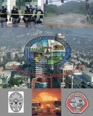
<strong>Butte</strong> <strong>County</strong>Multi-Jurisdictional All HazardPre-Disaster Mitigation PlanMarch 2007City <strong>of</strong> Chico Area Land Use PlanThe Chico Planning Area consists <strong>of</strong> approximately 150 square miles <strong>of</strong> land located inthe west central portion <strong>of</strong> <strong>Butte</strong> <strong>County</strong>. The existing Chico Area Land Use Planestablishes a “greenline,” generally around the western portion <strong>of</strong> Chico. The greenlineconstitutes the boundary between urban and agricultural uses on the western side <strong>of</strong> theChico urban area. The <strong>County</strong>’s area plan states that all land use on the “agriculturalside” <strong>of</strong> the greenline “shall consist solely <strong>of</strong> agricultural land uses as provided by theOrchard and Field Crops designation.” Agricultural Residential land uses are alsopermitted on the agricultural side <strong>of</strong> the greenline, where designated by the Chico AreaLand Use Plan. The Plan further states that land uses on the urban side <strong>of</strong> the greenline“shall be guided by the policies <strong>of</strong> the Land Use Element and the applicable urban landuse designation contained in the Land Use Element.”<strong>Butte</strong> <strong>County</strong>’s largest urban community, Chico, experienced a moderately slow andsteady growth rate until 1960. The city grew rapidly during the 1960s and through thefirst half <strong>of</strong> the 1970s, largely due to increased student enrollment at <strong>California</strong> <strong>State</strong>University, Chico (CSUC). Additional growth during the period from 1970 to 1990established the city as the retail, service, and medical center for the region. Chico ishome to two regional malls and major discount retailers. Also, Chico is a major medicaland education center servicing much <strong>of</strong> the entire northeastern part <strong>of</strong> <strong>California</strong>. ThePlanning Area includes all <strong>of</strong> the incorporated City <strong>of</strong> Chico and any land outside itsboundaries which in the planning agency’s judgment bears relation to its planning.The city also provides the most fully developed retail commercial area in the county. Inthe non-urban part <strong>of</strong> the area surrounding Chico, the predominant land use on the valleyfloor is agriculture, including a variety <strong>of</strong> crops. Prime agricultural soils are found on thevalley floor on the west side <strong>of</strong> the city. Generally, soils to the east <strong>of</strong> the city aresuitable only for seasonal grazing. In the foothill areas, the predominant uses are lowdensityhousing, marginal agricultural activity, and recreation/open space.Urban land uses with significant public and regional retail uses predominate the area.Existing policies seek to preserve agricultural land, centralize development, and steernew urban growth to the north, east, and southeast. Development constraints includeagricultural lands and poor soils in the foothills area.39