Lough Mahon - Inland Fisheries Ireland
Lough Mahon - Inland Fisheries Ireland
Lough Mahon - Inland Fisheries Ireland
- No tags were found...

You also want an ePaper? Increase the reach of your titles
YUMPU automatically turns print PDFs into web optimized ePapers that Google loves.
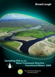
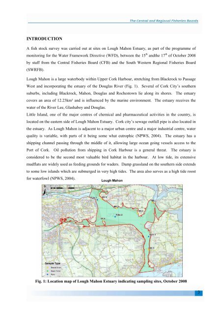
INTRODUCTIONA fish stock survey was carried out at sites on <strong>Lough</strong> <strong>Mahon</strong> Estuary, as part of the programme ofmonitoring for the Water Framework Directive (WFD), between the 15 th andthe 17 th of October 2008by staff from the Central <strong>Fisheries</strong> Board (CFB) and the South Western Regional <strong>Fisheries</strong> Board(SWRFB).<strong>Lough</strong> <strong>Mahon</strong> is a large waterbody within Upper Cork Harbour, stretching from Blackrock to PassageWest and incorporating the estuary of the Douglas River (Fig. 1). Several of Cork City’s southernsuburbs, including Blackrock, <strong>Mahon</strong>, Douglas and Rochestown lie along its shores. The estuarycovers an area of 12.23km² and is influenced by the marine environment. The estuary receives thewater of the River Lee, Glashaboy and Douglas.Little Island, one of the major centres of chemical and pharmaceutical activities in the country, islocated on the eastern side of <strong>Lough</strong> <strong>Mahon</strong> Estuary. Cork city’s sewage outfall pipe is also located inthe estuary. As <strong>Lough</strong> <strong>Mahon</strong> is adjacent to a major urban centre and a major industrial centre, waterquality is variable, with parts of it being some what eutrophic (NPWS, 2004). The estuary has ashipping channel passing through the middle of it, allowing large ocean going vessels access to thePort of Cork. Oil pollution from shipping in Cork Harbour is a general threat. The estuary isconsidered to be the second most valuable bird habitat in the harbour. At low tide, its extensivemudflats are widely used as feeding grounds for waders. Damp grassland on the southern side extendsto some low islands which are submerged in very high tides. The area also serves as a high tide roostfor waterfowl (NPWS, 2004).Fig. 1: Location map of <strong>Lough</strong> <strong>Mahon</strong> Estuary indicating sampling sites, October 20083