Lough Mahon - Inland Fisheries Ireland
Lough Mahon - Inland Fisheries Ireland
Lough Mahon - Inland Fisheries Ireland
- No tags were found...
You also want an ePaper? Increase the reach of your titles
YUMPU automatically turns print PDFs into web optimized ePapers that Google loves.
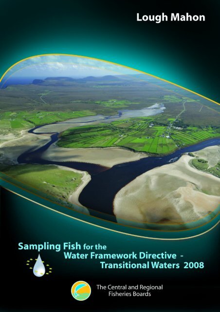
INTRODUCTIONA fish stock survey was carried out at sites on <strong>Lough</strong> <strong>Mahon</strong> Estuary, as part of the programme ofmonitoring for the Water Framework Directive (WFD), between the 15 th andthe 17 th of October 2008by staff from the Central <strong>Fisheries</strong> Board (CFB) and the South Western Regional <strong>Fisheries</strong> Board(SWRFB).<strong>Lough</strong> <strong>Mahon</strong> is a large waterbody within Upper Cork Harbour, stretching from Blackrock to PassageWest and incorporating the estuary of the Douglas River (Fig. 1). Several of Cork City’s southernsuburbs, including Blackrock, <strong>Mahon</strong>, Douglas and Rochestown lie along its shores. The estuarycovers an area of 12.23km² and is influenced by the marine environment. The estuary receives thewater of the River Lee, Glashaboy and Douglas.Little Island, one of the major centres of chemical and pharmaceutical activities in the country, islocated on the eastern side of <strong>Lough</strong> <strong>Mahon</strong> Estuary. Cork city’s sewage outfall pipe is also located inthe estuary. As <strong>Lough</strong> <strong>Mahon</strong> is adjacent to a major urban centre and a major industrial centre, waterquality is variable, with parts of it being some what eutrophic (NPWS, 2004). The estuary has ashipping channel passing through the middle of it, allowing large ocean going vessels access to thePort of Cork. Oil pollution from shipping in Cork Harbour is a general threat. The estuary isconsidered to be the second most valuable bird habitat in the harbour. At low tide, its extensivemudflats are widely used as feeding grounds for waders. Damp grassland on the southern side extendsto some low islands which are submerged in very high tides. The area also serves as a high tide roostfor waterfowl (NPWS, 2004).Fig. 1: Location map of <strong>Lough</strong> <strong>Mahon</strong> Estuary indicating sampling sites, October 20083
METHODSCurrent work in the UK indicates the need for a multi-method netting approach (seine nets, fyke netsand beam trawls) to sampling for fish in estuaries and these procedures are now the standard CFBmethodology for fish stock surveys in transitional waters for the WFD monitoring programme. Twosampling methods were used during the <strong>Lough</strong> <strong>Mahon</strong> survey (i.e. beach seines and fyke nets). Beamtrawling was not attempted due to the soft mud substrate and constant boat traffic in the shippingchannel. Portable GPS instruments were used to mark the precise location of each sampling site (Fig.1).Six beach seine and three fyke nets sites were surveyed in 2008. All sites were chosen to encompassthe majority of geographical and, where possible, habitat ranges of the estuary.RESULTSFish species diversity was low at the seine net sites with nine species being captured. The mostfrequently occurring and abundant fish species was sprat and thick-lipped grey mullet which werecaptured in five out of six seine net hauls (Table 1). Species diversity was also low at the fyke netssites, with five fish species captured (Table 1).Salinity values taken at beach seine sites ranged from 7.00ppt to 25.80ppt.Table 1: List of fish species and abundances of each species by net type in <strong>Lough</strong> <strong>Mahon</strong>Estuary, October 2008<strong>Lough</strong> <strong>Mahon</strong>Scientific name Common Name Beach seine (6) Fyke net (3)Chelon labrosus Thick Lipped Grey Mullet 263 -Platichthys flesus Flounder 4 4Sprattus sprattus Sprat 547 -Pomatoschistus microps Common Goby 224 -Pleuronectes platessa Plaice 1 -Gobius niger Black Goby 1 -Atherina prebyter Sand Smelt 17 -Ciliata mustela 5-Bearded Rockling - 2Gasterosteus aculeatus 3-Spined Stickleback 2 -Merlangus merlangus Whiting - 2Gadus morhua Cod - 1Pollachius pollachius Pollock - 3Syngnathus acus Greater Pipefish 4 -DISCUSSIONAn essential step in the WFD monitoring process is the classification of the status of transitionalwaters, which in turn will assist in identifying the objectives that must be set in the individual RiverBasin Management Plans.4
The EPA have assigned <strong>Lough</strong> <strong>Mahon</strong> an interim draft classification of “Good” status, i.e. mustprevent deterioration below “Good” status, based on general physico-chemical elements,phytoplankton and macroalgal growths (SWRBD, 2008).A new WFD fish classification tool, Transitional Fish Classification Index or TFCI, has beendeveloped for the island of <strong>Ireland</strong> (Ecoregion 1) using NIEA and CFB data. This is a multi-metrictool based on similar tools developed in South Africa and the UK (Harrison and Whitfield, 2004;Coates et al., 2007). <strong>Lough</strong> <strong>Mahon</strong> has been assigned a draft classification of “Good” (EQR=0.625)using the fish classification tool which agrees with the classification assigned to the estuary by theEPA.A final overall classification will be assigned to the estuary in December 2009 after the consultationand review period has been completed.REFERENCESCoates, S., Waugh, A., Anwar, A. and Robson, N. (2007) Efficacy of a multi-metric fish index as ananalysis tool for the transitional fish component of the Water Framework Directive. MarinePollution Bulletin, 55, 225-240 (www.sciencedirect.com)Harrison, T.D. and Whitfield, A.K. (2004) A multi-metric index to assess the environmental conditionof estuaries. Journal of Fish Biology, 65, 683-710 (www.blackwell-synergy.com)NPWS (2004) Site Synopsis: Cork Harbour SPA (http://www.npws.ie/en/media/ Media,4444,en.pdf)(accessed 24.4.2009)SWRBD (2008) Water matters, “Help us plan”. Draft River Basin Management Plan for the SouthWestern River Basin District.5


