Muckanagh_mini_report_2009 - Inland Fisheries Ireland
Muckanagh_mini_report_2009 - Inland Fisheries Ireland
Muckanagh_mini_report_2009 - Inland Fisheries Ireland
- No tags were found...

Create successful ePaper yourself
Turn your PDF publications into a flip-book with our unique Google optimized e-Paper software.
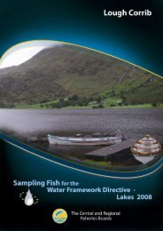
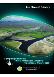
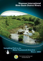
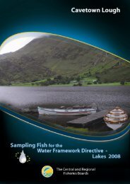
The Central and Regional <strong>Fisheries</strong> Boards1
The Central and Regional <strong>Fisheries</strong> BoardsACKNOWLEDGEMENTSThe authors wish to gratefully acknowledge the help and co-operation of the CEO Mr. EamonCusack, Assistant CEO Mr. Sean Ryan and their staff from the Shannon Regional <strong>Fisheries</strong> Board.The authors would also like to gratefully acknowledge the help and cooperation of all their colleaguesin the Central <strong>Fisheries</strong> Board (CFB).The authors would also like to acknowledge the funding provided for the project from the Departmentof Communications, Energy and Natural Resources for <strong>2009</strong>.The <strong>report</strong> includes Ordnance Survey <strong>Ireland</strong> data reproduced under OSi Copyright Permit No. MP007508.Unauthorised reproduction infringes Ordnance Survey <strong>Ireland</strong> and Government of <strong>Ireland</strong> copyright.© Ordnance Survey <strong>Ireland</strong>, <strong>2009</strong>1
The Central and Regional <strong>Fisheries</strong> Boards1.1 Introduction<strong>Muckanagh</strong> Lough (Plate 1.1, Fig. 1.1) is located within the Fergus catchment, approximately 10kmeast of the village of Corrofin, Co. Clare. It is a shallow lake, with a mean depth of 3m, a maximumdepth of 19m and a surface area of 95ha. The lake is categorised as typology class 10 (as designatedby the EPA for the purposes of the Water Framework Directive), i.e. shallow (100mg/l CaCO3). The lake is located in the “East Burren Complex” SpecialArea of Conservation. The East Burren Complex SAC is a large area that encompasses all the highground in the east Burren. A total of 12 different habitats listed on Annex I of the EU HabitatsDirective are included within the site, including areas of limestone pavement, calcareous grasslands,heath scrub, woodlands and calcareous lakes and turloughs (NPWS, 2001). The site exhibits some ofthe best and most extensive areas of oligotrophic limestone wetlands to be found in the Burren and inEurope. Some of the most extensive calcareous swamp fen communities in the country also occurwithin this complex (NPWS, 2001).<strong>Muckanagh</strong> Lough has historically held a good stock of brown trout (O’Reilly, 1998). A surveycarried out by the <strong>Inland</strong> <strong>Fisheries</strong> Trust during 1970 recorded stocks of brown trout and pike in thelake. Although perch, rudd and tench were present in the inlet canal in 1970, none of these specieswere recorded during this previous survey (<strong>Inland</strong> <strong>Fisheries</strong> Trust, unpublished data). The lake waspreviously stocked with brown trout during 1977; however test netting of the lake revealed that noneof these fish survived (<strong>Inland</strong> <strong>Fisheries</strong> Trust, unpublished data).Plate 1.1. <strong>Muckanagh</strong> Lough2
The Central and Regional <strong>Fisheries</strong> BoardsFig. 1.1. Location map of <strong>Muckanagh</strong> Lough showing locations and depths of each net1.2 Methods<strong>Muckanagh</strong> Lough was surveyed over two nights between the 9 th and the 11 th of September <strong>2009</strong>. Atotal of three sets of Dutch fyke nets, 12 benthic monofilament multi-mesh (12 panel, 5-55mm meshsize) CEN standard survey gill nets (4 @ 0-2.9m, 4 @ 3-5.9m, 2 @ 6-11.9m and 2 @ 12-19.9 and twosurface monofilament multi-mesh (12 panel, 5-55mm mesh size) CEN standard survey gill nets weredeployed randomly in the lake (17 sites). The netting effort was supplemented using three benthicbraided survey gill nets (62.5mm mesh knot to knot) at three additional sites. Survey locations wererandomly selected within each depth zone using a grid placed over a map of the lake. A handheldGPS was used to mark the precise location of each net. The angle of each gill net in relation to theshoreline was randomised.All fish apart from perch were measured and weighed on site and scales were removed from all browntrout, rudd and pike. Live fish were returned to the water whenever possible (i.e. when the likelihoodof their survival was considered to be good). Samples of fish were returned to the laboratory forfurther analysis.3
The Central and Regional <strong>Fisheries</strong> Boards1.3 Results1.3.1 Species RichnessA total of seven fish species were recorded in <strong>Muckanagh</strong> Lough during the survey, with 91 fishbeing captured (Table 1.1). Perch was the most abundant fish species recorded. Eels were recordedin good numbers in fyke nets only.Table 1.1. List of fish species recorded (including numbers captured) during the survey on<strong>Muckanagh</strong> Lough, September <strong>2009</strong>Scientific name Common name Number of fish capturedBenthicSurfaceBenthicmonomonobraidedmultimeshmultimeshgill netsgill netsgill netsPerca fluviatilis Perch 38 0 0 0 38ScardiniuserythropthalmusRudd 13 0 3 0 16Esox lucius Pike 7 1 0 0 8Salmo trutta Brown trout 2 0 0 0 2Gasterosteus aculeatus Three-spined stickleback 1 0 0 0 1Tinca tinca Tench 0 0 0 1 1Anguilla anguilla European eel 0 0 0 25 25FykenetsTotal1.3.2 Fish abundanceFish abundance (mean CPUE) and biomass (mean BPUE) were calculated as the mean number/weightof fish caught per metre of net. For all fish species except eel, CPUE/BPUE is based on all nets,whereas eel CPUE/BPUE is based on fyke nets only. Mean CPUE and BPUE for all fish species aresummarised in Table 1.2.The differences in the mean perch CPUE between <strong>Muckanagh</strong> Lough and four other similar lakeswere assessed and found to be statistically significant (Kruskal-Wallis, P
The Central and Regional <strong>Fisheries</strong> BoardsTable 1.2. Mean (S.E.) CPUE and BPUE for all fish species captured on <strong>Muckanagh</strong> Lough,September <strong>2009</strong>Scientific nameCommon nameMean CPUEPerca fluviatilis Perch 0.063 (0.034)Scardinius erythropthalmus Rudd 0.027 (0.010)Esox lucius Pike 0.014(0.005)Salmo trutta Brown trout 0.003 (0.002)Gasterosteus aculeatus Three-spined stickleback 0.002 (0.002)Tinca tinca Tench 0.001 (0.001)Anguilla anguilla European eel 0.139 (0.098)Mean BPUEEsox lucius Pike 8.123 (5.645)Scardinius erythropthalmus Rudd 2.837 (1.208)Salmo trutta Brown trout 0.335 (0.236)Perca fluviatilis Perch 0.332 (0.160)Tinca tinca Tench 0.250 (0.250)Gasterosteus aculeatus Three-spined stickleback 0.003 (0.003)Anguilla anguilla European eel 35.506 (26.673)* On the rare occasion where biomass data was unavailable for an individual fish, this was determined from a length/weight regression forthat species. Standard error is displayed in brackets.0.8Mean CPUE (Mean no. fish / m of net)0.70.60.50.40.30.20.10.0Cullaun Dromore Inchicronan Bunny <strong>Muckanagh</strong>LakeFig. 1.2. Mean (±S.E.) perch CPUE in five lakes surveyed during <strong>2009</strong>1.3.3 Length frequency distributionsThe two brown trout recorded measured 18.4cm and 21.8cm in length (mean = 20.1cm). Perchranged in length from 5.8cm to 13.8cm (mean = 7.2cm) (Fig. 1.3). Rudd ranged in length from12.2cm to 22.8cm (mean = 17.8cm) (Fig.1.4). Pike ranged in length from 18.4cm to 71.5cm. Eels5
The Central and Regional <strong>Fisheries</strong> Boardsranged in length from 42.0cm to 62.0cm. One three-spined stickleback and one tench were alsorecorded, measuring 5.0cm and 25.5cm in length respectively.Number of fish1614121086420Benthic monoSurface mono0 1 2 3 4 5 6 7 8 9 10 11 12 13 14 15Length (cm)Fig. 1.3. Length frequency of perch (n=33) captured on <strong>Muckanagh</strong> Lough, September <strong>2009</strong>Number of fish4.543.532.521.510.50Benthic monoSurface mono0 1 2 3 4 5 6 7 8 9 10 11 12 13 14 15 16 17 18 19 20 21 22 23 24Length (cm)Fig. 1.4. Length frequency of rudd (n=15) captured on <strong>Muckanagh</strong> Lough, September <strong>2009</strong>1.3.4 Fish age and growthTwo age classes of perch were present, ranging from 0+ to 1+, with a mean L1 of 6.0cm (Table 1.3).The dominant age class was 0+, corresponding to the 5cm to 8cm length class (Fig. 1.3). Three ageclasses of rudd were present, ranging from 2+ to 4+, with a mean L1 of 2.9cm (Table 1.4). Four ageclasses of pike were present, ranging from 1+ to 6+ and the two brown trout captured were aged 2+.6
The Central and Regional <strong>Fisheries</strong> BoardsTable 1.3. Mean (±SE) perch length at age for <strong>Muckanagh</strong> Lough, September <strong>2009</strong>L 1Mean 6.0 (0.3)N 3Range 5.7-6.6Table 1.4. Mean (±SE) rudd length at age for <strong>Muckanagh</strong> Lough, September <strong>2009</strong>L 1 L 2 L 3 L 4Mean 2.9 (0.2) 6.8 (0.4) 11.7 (0.5) 16.0 (0.7)N 14 14 13 7Range 2.0-4.6 4.9-10.3 9.0-16.0 12.8-19.01.4 SummaryPerch was the dominant species in terms of abundance (CPUE) and pike was the dominant species interms of biomass (BPUE) captured in the survey gill nets.The mean perch CPUE in <strong>Muckanagh</strong> Lough was significantly lower than Dromore Lough andInchicronan Lough; however, there were no other statistically significant differences between theother lakes included in the statistical comparison. Two age classes were present, 0+ and 1+,indicating reproductive success in each of the previous two years.Classification and assigning lakes with an ecological status is a critical part of the WFD monitoringprogramme. It allows River Basin District managers to identify and prioritise lakes that currently fallshort of the <strong>mini</strong>mum “Good Ecological Status” that is required by 2015 if <strong>Ireland</strong> is not to incurpenalties.A WFD multimetric fish classification tool has been developed for the island of <strong>Ireland</strong> (Ecoregion17) using CFB and Agri-Food and Biosciences Northern <strong>Ireland</strong> (AFBINI) data generated during theNSSHARE Fish in Lakes project (Kelly et al., 2008). Using this tool, <strong>Muckanagh</strong> Lough has beenassigned an ecological status classification of Moderate based on the fish populations present.The EPA has assigned an overall status of Moderate to <strong>Muckanagh</strong> Lough in an interim draftclassification. This is based on physico-chemical parameters and biotic elements such asmacroinvertebrates, macrophytes and fish.1.5 ReferencesKelly, F.L., Harrison, A., Connor, L., Allen, M., Rosell, R. and Champ, T. (2008) FISH IN LAKESTask 6.9: Classification tool for Fish in Lakes. FINAL REPORT. Central <strong>Fisheries</strong> Board,NSSHARE project.7
The Central and Regional <strong>Fisheries</strong> BoardsNPWS (2001) Site Synopsis: East Burren Complex, Site code 001926. Site Synopsis <strong>report</strong>, NationalParks and Wildlife Service.O’Reilly, P. (1998) Loughs of <strong>Ireland</strong> - A Flyfisher’s Guide. 3 rd Edition. Merlin Unwin Books.O’Reilly, P. (2007) Loughs of <strong>Ireland</strong> - A Flyfisher’s Guide. 4 th Edition. Merlin Unwin Books.8
The Central and Regional <strong>Fisheries</strong> Boards9