HYDROLOGICAL MODEL â HEC - HMS (Hydrologic ... - Uwi.edu
HYDROLOGICAL MODEL â HEC - HMS (Hydrologic ... - Uwi.edu
HYDROLOGICAL MODEL â HEC - HMS (Hydrologic ... - Uwi.edu
SHOW LESS
- No tags were found...

You also want an ePaper? Increase the reach of your titles
YUMPU automatically turns print PDFs into web optimized ePapers that Google loves.
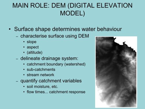
MAIN ROLE: DEM (DIGITAL ELEVATION<strong>MODEL</strong>)• Surface shape determines water behaviour– characterise surface using DEM• slope• aspect• (altitude)– delineate drainage system:• catchment boundary (watershed)• sub-catchments• stream network– quantify catchment variables• soil moisture, etc.• flow times... catchment response