HYDROLOGICAL MODEL â HEC - HMS (Hydrologic ... - Uwi.edu
HYDROLOGICAL MODEL â HEC - HMS (Hydrologic ... - Uwi.edu
HYDROLOGICAL MODEL â HEC - HMS (Hydrologic ... - Uwi.edu
- No tags were found...
You also want an ePaper? Increase the reach of your titles
YUMPU automatically turns print PDFs into web optimized ePapers that Google loves.
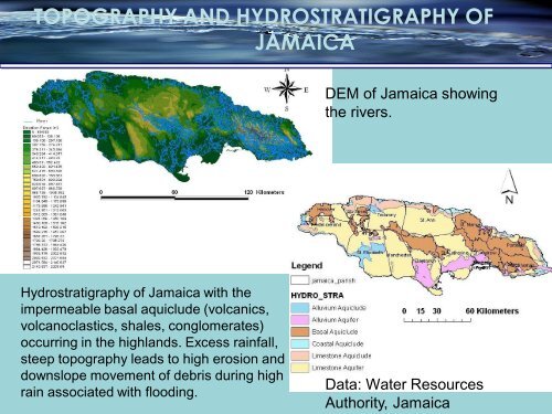
TOPOGRAPHY AND HYDROSTRATIGRAPHY OFJAMAICADEM of Jamaica showingthe rivers.Hydrostratigraphy of Jamaica with theimpermeable basal aquiclude (volcanics,volcanoclastics, shales, conglomerates)occurring in the highlands. Excess rainfall,steep topography leads to high erosion anddownslope movement of debris during highrain associated with flooding.Data: Water ResourcesAuthority, Jamaica


